

Ortler
Encyclopedia
Ortler is, at 3905 m (12,812 ft) above sea level, the highest mountain in the Eastern Alps
outside the Bernina Range
. It is the main peak of the Ortler Range
. It is the highest point of the Southern Limestone Alps
, of the Italian province of South Tyrol
, of Tyrol
overall, and, until 1919, of the Austrian-Hungarian empire. In German
the mountain is commonly referred to as "König Ortler" (King Ortler), like in the unofficial hymn of South Tyrol, the Bozner Bergsteigerlied.
and South Tyrol. Going west on this main ridge are the Thurwieser Spitze (3652) and Trafoier Wall (3565 m), while to the Southeast are the Monte Zebrù (3740 m) and the majestic Königspitze
(3859 m). From nearby mountains in the northeast the impressive lineup of Königspitze, Zebru and Ortler is known as “das Dreigestirn” (the three heavenly bodies) http://www.summitpost.org/image/6365/150913/ortles-cevedale-group.html.
hunter from St. Leonhard in Passeier
, and his companions Johann Leitner and Johann Klausner from Zell am Ziller
on 27 September 1804. The ascent had been a request of Archduke Johann of Austria
, who felt strongly that after the first ascent of the Großglockner
(3,798 m) in 1800, the highest mountain in his brother's
empire ought to be climbed. The archduke ordered Johannes Nepomuk Gebhard, a "mountain official" and topographer from Salzburg
, to climb the mountain with locals. The first five attempts failed and Gebhard was ready to give up, when Pichler responded to the prize money offered for reaching the peak. Pichler and his friends took a difficult, and because of avalanche danger until recently disused, route over the northwest face from Trafoi (the route has been re-opened in 2004 http://www.seilschaft.it/ortler%20meranerweg.htm).
Upon their return, the men were not believed on their words though. Gebhard sent Pichler twice more on the mountain, in August 1805 with a flag that could be observed with a telescope from the valley, in September 1805 with a huge torch. Only after the torch had been seen burning at night was the accomplishment acknowledged. The route Pichler and his men (two brothers named Hell and an unnamed hunter from Langtaufers) took in 1805 was the currently still popular East ridge ("Hintergrat", literally "back-ridge") route. In 1834, at the age of 70, Pichler would make his fifth and final ascent, guiding professor Karl Thurwieser to the top, a noted mountaineer after whom the nearby Thurwieser Spitze is named and who first-ascended the Hoher Dachstein
the same year.
 The first time the Ortler was climbed via the easiest and currently normal route, the North ("Tabaretta") ridge, was only in July 1865, as the approach is rather lengthy. In 1875 a hut was erected at 3029 m on the North ridge, to break up the climb in two steps. It was named the Payer house, after Julius von Payer
, who had mapped the Ortler Alps between 1865–1868 and had climbed 50 of its peaks with Johann Pinggera as his guide.
Ascent of the South ridge from the Hochjoch followed in 1875, two couloirs on the East face (Minnigerode and Schück couloir) were opened in 1878/79 and the two steep Northeast ridges (Marlet and Rothböck ridge) were conquered in 1889 and 1909, respectively. Members of the Pinggera family were involved in most of these ascents.
The 1200 m high ice route on the Ortler North face, longest in the Eastern Alps, was realized in June 1931 by Hans Ertl
and Franz Schmid and the remote Southwest face in 1934. The North face was soloed first in 1963 by Dieter Drescher, who also put some first winter ascents on his name, including a traverse of Königspitze, Monte Zebru and Ortler in February 1975. On August 31, 1981, Reinhard Patscheider achieved the amazing feat of climbing the north faces of Königspitze, Zebru and Ortler in one day.
Extreme skiing
started early in the Ortler mountains, with Heini Holzer http://www.shortsupport.org/cgi/whowho_bio.cgi?seq=476&orderby=name&direction=ASC descending the Schück couloir in 1971 and the Minnigerode couloir in 1975. On June 24, 1983, Andreas Orgler even skied down the North face.
Eastern Alps
Eastern Alps is the name given to the eastern half of the Alps, usually defined as the area east of the Splügen Pass in eastern Switzerland. North of the Splügen Pass, the Posterior Rhine forms the border, and south of the pass, the Liro river and Lake Como form the boundary line.-Geography:The...
outside the Bernina Range
Bernina Range
The Bernina Range is a mountain range in the Alps of eastern Switzerland and northern Italy. It is considered to be part of the Central Eastern Alps. It is one of the highest ranges of the Alps, covered with many glaciers. Piz Bernina , its highest peak, is the most easterly four thousand-metre...
. It is the main peak of the Ortler Range
Ortler Alps
The Ortler Alps are a mountain range in the central Alps of Italy. They are considered to be part of the Central Eastern Alps or the Southern Limestone Alps....
. It is the highest point of the Southern Limestone Alps
Southern Limestone Alps
The Southern Limestone Alps are the ranges of the Eastern Alps south of the Central Eastern Alps mainly located in northern Italy and the adjacent lands of Austria and Slovenia. The distinction from the Central Alps, where the higher peaks are located, is based on differences in geological...
, of the Italian province of South Tyrol
South Tyrol
South Tyrol , also known by its Italian name Alto Adige, is an autonomous province in northern Italy. It is one of the two autonomous provinces that make up the autonomous region of Trentino-Alto Adige/Südtirol. The province has an area of and a total population of more than 500,000 inhabitants...
, of Tyrol
County of Tyrol
The County of Tyrol, Princely County from 1504, was a State of the Holy Roman Empire, from 1814 a province of the Austrian Empire and from 1867 a Cisleithanian crown land of Austria-Hungary...
overall, and, until 1919, of the Austrian-Hungarian empire. In German
German language
German is a West Germanic language, related to and classified alongside English and Dutch. With an estimated 90 – 98 million native speakers, German is one of the world's major languages and is the most widely-spoken first language in the European Union....
the mountain is commonly referred to as "König Ortler" (King Ortler), like in the unofficial hymn of South Tyrol, the Bozner Bergsteigerlied.
Geography
The massive mountain is capped by a glacier on the northwest flank and has a long north ridge that ends at the village of Gomagoi and separates the valleys of Trafoi and Sulden. The South ridge leads to the Hochjoch (3527 m) on the main ridge of the Ortler Alps that forms the border of the Province of SondrioProvince of Sondrio
The Province of Sondrio is in the Lombardy region of Italy. Its capital is the town of Sondrio.It has an area of 3,212 km², and a total population of 176,856...
and South Tyrol. Going west on this main ridge are the Thurwieser Spitze (3652) and Trafoier Wall (3565 m), while to the Southeast are the Monte Zebrù (3740 m) and the majestic Königspitze
Königspitze
The Königspitze is a mountain in the Ortler Alps on the border between South Tyrol and the Province of Sondrio, Italy....
(3859 m). From nearby mountains in the northeast the impressive lineup of Königspitze, Zebru and Ortler is known as “das Dreigestirn” (the three heavenly bodies) http://www.summitpost.org/image/6365/150913/ortles-cevedale-group.html.
First ascent
The Ortler was first climbed by Josef Pichler ("Pseirer-Josele"), a chamoisChamois
The chamois, Rupicapra rupicapra, is a goat-antelope species native to mountains in Europe, including the Carpathian Mountains of Romania, the European Alps, the Tatra Mountains, the Balkans, parts of Turkey, and the Caucasus. The chamois has also been introduced to the South Island of New Zealand...
hunter from St. Leonhard in Passeier
St. Leonhard in Passeier
St Leonhard in Passeier is a comune in the Passeier Valley in South Tyrol, northern Italy, located about 80 km north of Trento and about 35 km north of Bolzano .-Geography:...
, and his companions Johann Leitner and Johann Klausner from Zell am Ziller
Zell am Ziller
Zell am Ziller is a municipality in the Schwaz district of Tyrol, Austria. The name derives from the river Ziller.- Facilities :The Zillertal Arena was formed in 2000 from a merger of the ski areas of Zell, Gerlos and Königsleiten and is the largest ski area in the Ziller valley...
on 27 September 1804. The ascent had been a request of Archduke Johann of Austria
Archduke Johann of Austria
Archduke John of Austria was a member of the Habsburg dynasty, an Austrian field marshal and German Imperial regent .-Biography:...
, who felt strongly that after the first ascent of the Großglockner
Großglockner
The Grossglockner is, at 3,798 m above sea level, Austria's highest mountain and the highest mountain in the Alps east of the Brenner Pass...
(3,798 m) in 1800, the highest mountain in his brother's
Francis II, Holy Roman Emperor
Francis II was the last Holy Roman Emperor, ruling from 1792 until 6 August 1806, when he dissolved the Empire after the disastrous defeat of the Third Coalition by Napoleon at the Battle of Austerlitz...
empire ought to be climbed. The archduke ordered Johannes Nepomuk Gebhard, a "mountain official" and topographer from Salzburg
Salzburg
-Population development:In 1935, the population significantly increased when Salzburg absorbed adjacent municipalities. After World War II, numerous refugees found a new home in the city. New residential space was created for American soldiers of the postwar Occupation, and could be used for...
, to climb the mountain with locals. The first five attempts failed and Gebhard was ready to give up, when Pichler responded to the prize money offered for reaching the peak. Pichler and his friends took a difficult, and because of avalanche danger until recently disused, route over the northwest face from Trafoi (the route has been re-opened in 2004 http://www.seilschaft.it/ortler%20meranerweg.htm).
Upon their return, the men were not believed on their words though. Gebhard sent Pichler twice more on the mountain, in August 1805 with a flag that could be observed with a telescope from the valley, in September 1805 with a huge torch. Only after the torch had been seen burning at night was the accomplishment acknowledged. The route Pichler and his men (two brothers named Hell and an unnamed hunter from Langtaufers) took in 1805 was the currently still popular East ridge ("Hintergrat", literally "back-ridge") route. In 1834, at the age of 70, Pichler would make his fifth and final ascent, guiding professor Karl Thurwieser to the top, a noted mountaineer after whom the nearby Thurwieser Spitze is named and who first-ascended the Hoher Dachstein
Hoher Dachstein
Hoher Dachstein is a strongly karstic Austrian mountain, and the second highest mountain in the Northern Limestone Alps. It is situated at the border of Upper Austria and Styria in central Austria, and is the highest point in each of those states...
the same year.
Notable other ascents and descents
Julius von Payer
Julius Johannes Ludovicus Ritter von Payer was an Austro-Hungarian arctic explorer and an Arctic landscape artist....
, who had mapped the Ortler Alps between 1865–1868 and had climbed 50 of its peaks with Johann Pinggera as his guide.
Ascent of the South ridge from the Hochjoch followed in 1875, two couloirs on the East face (Minnigerode and Schück couloir) were opened in 1878/79 and the two steep Northeast ridges (Marlet and Rothböck ridge) were conquered in 1889 and 1909, respectively. Members of the Pinggera family were involved in most of these ascents.
The 1200 m high ice route on the Ortler North face, longest in the Eastern Alps, was realized in June 1931 by Hans Ertl
Hans Ertl (cameraman)
Hans Ertl was a German mountaineer and cinematographer.He was a camera man during the Nazi era, also known as "Hitler's photographer". After the war he resettled in Bolivia and became a farmer. He did some filming in Bolivia but ceased after his film and tractor fell through a wooden bridge...
and Franz Schmid and the remote Southwest face in 1934. The North face was soloed first in 1963 by Dieter Drescher, who also put some first winter ascents on his name, including a traverse of Königspitze, Monte Zebru and Ortler in February 1975. On August 31, 1981, Reinhard Patscheider achieved the amazing feat of climbing the north faces of Königspitze, Zebru and Ortler in one day.
Extreme skiing
Extreme skiing
Extreme skiing is skiing performed on long, steep slopes in dangerous terrain. The sport is performed off-piste.The French coined the term 'Le Ski Extreme' in the 1970s...
started early in the Ortler mountains, with Heini Holzer http://www.shortsupport.org/cgi/whowho_bio.cgi?seq=476&orderby=name&direction=ASC descending the Schück couloir in 1971 and the Minnigerode couloir in 1975. On June 24, 1983, Andreas Orgler even skied down the North face.
First World War
The Ortler Alps were a main battleground between Austrian and Italian troops in the First World War, being on the border of Italy and the Austrian empire. The advantage of the highest point was very important. The Austrian troops had quickly occupied the highest peaks, and the Italian troops’ main goal for four years was to dislodge them from these positions. In the mid 1990s, a mountain guide discovered two guns that had been stationed very near the top of the Ortler and had been hidden by snow since. The discovery was kept secret until the 200-year anniversary of the first ascent in 2004. The cannons are now on display in a museum in Trafoi.Sources and external links
- Sabine Holzknecht Sulden und der Ortler, ‘’Alpin’’ June 2004 (German article at the occasion of the 200 year anniversary of the first ascent)
- German article on the first ascent
- First worldwar pictures of the Ortler frontline
- Normal route account
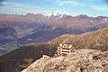
- View from the Ortler to the southeast
- Panoramic view from the northwest of the Ortler in winter