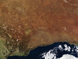
The
Nullarbor Plain is part of the area of flat, almost treeless,
aridA region is said to be arid when it is characterized by a severe lack of available water, to the extent of hindering or even preventing the growth and development of plant and animal life...
or semi-arid country of southern
AustraliaAustralia , officially the Commonwealth of Australia, is a country in the Southern Hemisphere comprising the mainland of the Australian continent, the island of Tasmania, and numerous smaller islands in the Indian and Pacific Oceans. It is the world's sixth-largest country by total area...
, located on the
Great Australian BightThe Great Australian Bight is a large bight, or open bay, off the central and western portions of the southern coastline of mainland Australia.-Extent:...
coast with the
Great Victoria DesertThe Great Victoria Desert is a barren and sparsely populated desert area of southern Australia.-Location and description:The Great Victoria is the biggest desert in Australia and consists of many small sandhills, grassland plains, areas with a closely packed surface of pebbles and salt lakes...
to its north. It is the world's largest single piece of
limestoneLimestone is a sedimentary rock composed largely of the minerals calcite and aragonite, which are different crystal forms of calcium carbonate . Many limestones are composed from skeletal fragments of marine organisms such as coral or foraminifera....
, and occupies an area of about 200000 square kilometres (77,220.4 sq mi). At its widest point, it stretches about 1100 kilometres (684 mi) from east to west between
South AustraliaSouth Australia is a state of Australia in the southern central part of the country. It covers some of the most arid parts of the continent; with a total land area of , it is the fourth largest of Australia's six states and two territories.South Australia shares borders with all of the mainland...
(SA) and
Western AustraliaWestern Australia is a state of Australia, occupying the entire western third of the Australian continent. It is bounded by the Indian Ocean to the north and west, the Great Australian Bight and Indian Ocean to the south, the Northern Territory to the north-east and South Australia to the south-east...
(WA).
History
Historically, the almost uninhabitable Nullarbor was used by the semi-nomadic
SpinifexThe Spinifex people, or Pila Nguru, are an Indigenous Australian people, whose traditional lands are situated in the Great Victoria Desert,, The Sydney Morning Herald, 2002-08-03. Retrieved 2007-04-21. in the Australian state of Western Australia, adjoining the border with South Australia, to the...
WangaiWangai, Wongai or Wankai is the name given by themselves to the 26 Aboriginal groups of the Goldfields of Western Australia. It comes from the word meaning "Speaker"...
Aboriginal people.
European settlers were determined to cross the plain, despite the hardships created by the nature of the Nullarbor. Although
Edward John EyreEdward John Eyre was an English land explorer of the Australian continent, colonial administrator, and a controversial Governor of Jamaica....
described the Plain as "a hideous anomaly, a blot on the face of Nature, the sort of place one gets into in bad dreams", he became the first European to successfully make the crossing in 1841. Eyre set out from
Fowlers Bay, South AustraliaFowlers Bay, formerly Yalata, is a small coastal town in South Australia, located approximately north west of the state capital, Adelaide. Situated on the Nullarbor Plain, it was once an active port and a gateway to the western reaches of the continent, but fell into decline in the 1960s...
on 17 November 1840 with
John BaxterJohn Baxter was a friend and companion of Edward John Eyre on his crossing of the Nullarbor Plain in 1840-1841. When the party was low on supplies and in desperate need of water, near the coast south of present-day Caiguna in Nuytsland National Park, Baxter was murdered by Yarry and Joey, two of...
and a party of three Aboriginal men. When three of his horses died of
dehydrationIn physiology and medicine, dehydration is defined as the excessive loss of body fluid. It is literally the removal of water from an object; however, in physiological terms, it entails a deficiency of fluid within an organism...
, he was forced to return to Fowler's Bay. He departed with a second expedition on 25 February 1841. By 29 April, the party had reached
CaigunaCaiguna is a small roadhouse community located on the Eyre Highway in Western Australia. It is the second stop east of Norseman on the long journey east across the Nullarbor Plain. Between Balladonia and Caiguna is a stretch of the highway which is one of the longest straight stretches of road in...
. Lack of supplies and water led to a
mutinyMutiny is a conspiracy among members of a group of similarly situated individuals to openly oppose, change or overthrow an authority to which they are subject...
, and two of the Aboriginal men killed Baxter and made off with the party's supplies. Eyre and the third Aboriginal man,
WylieWylie was an indigenous Australian originally from the tribes around Albany in Western Australia. He accompanied Edward John Eyre to Adelaide by sea in May 1840, and would have left with Eyre on his expedition to penetrate to the interior in June of the same year, but Wylie was ill...
, continued on their journey, surviving through
bushcraftBushcraft is a long-term extension of survival skills. A popular term for wilderness skills in Canada, The UK, Australia, New Zealand and South Africa, the term was popularised in the southern hemisphere by Les Hiddins in Australia as well as in the northern hemisphere by Mors Kochanski and...
and some fortuitous circumstances, such as receiving some supplies from a French
whalingWhaling is the hunting of whales mainly for meat and oil. Its earliest forms date to at least 3000 BC. Various coastal communities have long histories of sustenance whaling and harvesting beached whales...
vessel anchored at Rossiter. They completed their crossing in June 1841.
On 25 December 1896, after an arduous journey of thirty-one days,
Arthur Charles Jeston RichardsonArthur Charles Jeston Richardson , an Australian cyclist and mining engineer, became the first person to circumnavigate the continent of Australia on a bicycle.-Early life and career:...
became the first cyclist to cross the Nullabor Plain, pedaling his bicycle from Coolgardie to Adelaide. Carrying only a small kit and a water-bag, he followed the telegraph line as he crossed the Nullabor. He later described the heat as "1,000 degrees in the shade".
A proposed new state
AuraliaAuralia was a proposed state that would have been formed out of the south-eastern portion of the colony of Western Australia in the early twentieth century , and would have joined the newly formed Commonwealth of Australia...
(meaning "land of gold") would have comprised the Goldfields, the western portion of the Nullarbor Plain and the port town of
EsperanceEsperance is a large town in the Goldfields-Esperance region of Western Australia, located on the Southern Ocean coastline approximately east-southeast of the state capital, Perth. The shire of Esperance is home to 9,536 people as of the 2006 census, its major industries are tourism, agriculture,...
. Its capital would have been
KalgoorlieKalgoorlie, known as Kalgoorlie-Boulder, is a town in the Goldfields-Esperance region of Western Australia, and is located east-northeast of state capital Perth at the end of the Great Eastern Highway...
.
The Wangai Aboriginal people were forced to abandon their homelands during the
British nuclear tests at MaralingaBritish nuclear tests at Maralinga occurred between 1955 and 1963 at the Maralinga site, part of the Woomera Prohibited Area, in South Australia. A total of seven major nuclear tests were performed, with approximate yields ranging from 1 to 27 kilotons of TNT equivalent...
in the 1950s. Since then they have been awarded compensation and many have returned to the general area. In fact, many never left. Due to their isolation it was impossible to warn them all about the testing.
Cultural significance
'Crossing the Nullarbor', for many Australians, is a quintessential experience of the 'Australian Outback'. Stickers bought from roadhouses on the highway show 'I have crossed the Nullarbor', and can be seen on vehicles of varying quality or capacity for long distance travel. The process of 'beating the crowds' on overbooked air services at the time of special sporting events can also see significant numbers of vehicles on the road.
Crossings in the 1950s and earlier were significant as most of the road back then was unmade dirt track. Round-Australia car trials (The Redex Trials) used the Nullarbor crossing for good photo shoots of cars negotiating poor track.
Geography
The Nullarbor Plain is a former shallow
seabedThe seabed is the bottom of the ocean.- Ocean structure :Most of the oceans have a common structure, created by common physical phenomena, mainly from tectonic movement, and sediment from various sources...
, as indicated by the presence of bryozoans,
foraminiferaThe Foraminifera , or forams for short, are a large group of amoeboid protists which are among the commonest plankton species. They have reticulating pseudopods, fine strands of cytoplasm that branch and merge to form a dynamic net...
, echinoids and
red algaeThe red algae are one of the oldest groups of eukaryotic algae, and also one of the largest, with about 5,000–6,000 species of mostly multicellular, marine algae, including many notable seaweeds...
calcareous skeletal that make up the
limestoneLimestone is a sedimentary rock composed largely of the minerals calcite and aragonite, which are different crystal forms of calcium carbonate . Many limestones are composed from skeletal fragments of marine organisms such as coral or foraminifera....
. The region is also the location of
Nullarbor limestone and it has a reputation as a significant
karstKilometer-square Area Radio Synthesis Telescope is a Chinese telescope project to which FAST is a forerunner. KARST is a set of large spherical reflectors on karst landforms, which are bowlshaped limestone sinkholes named after the Kras region in Slovenia and Northern Italy. It will consist of...
region with
OligoceneThe Oligocene is a geologic epoch of the Paleogene Period and extends from about 34 million to 23 million years before the present . As with other older geologic periods, the rock beds that define the period are well identified but the exact dates of the start and end of the period are slightly...
and
MioceneThe Miocene is a geological epoch of the Neogene Period and extends from about . The Miocene was named by Sir Charles Lyell. Its name comes from the Greek words and and means "less recent" because it has 18% fewer modern sea invertebrates than the Pliocene. The Miocene follows the Oligocene...
cave formations.
The sequence within the limestone includes five formations:
- the upper formation is the Nullarbor Limestone which is early middle Miocene
The Miocene is a geological epoch of the Neogene Period and extends from about . The Miocene was named by Sir Charles Lyell. Its name comes from the Greek words and and means "less recent" because it has 18% fewer modern sea invertebrates than the Pliocene. The Miocene follows the Oligocene...
in age;
- the Mullamullang member of this formation is a paraconforming
An unconformity is a buried erosion surface separating two rock masses or strata of different ages, indicating that sediment deposition was not continuous. In general, the older layer was exposed to erosion for an interval of time before deposition of the younger, but the term is used to describe...
member, being separated by 5 million years;
- the third member is the Abrakurrie Limestone that was formed in a central depression of the earlier formation; this is late Oligocene
The Oligocene is a geologic epoch of the Paleogene Period and extends from about 34 million to 23 million years before the present . As with other older geologic periods, the rock beds that define the period are well identified but the exact dates of the start and end of the period are slightly...
to Early Miocene in age and does not reach the edge of the plain;
- the last two formations are conforming formations; the late Eocene
The Eocene Epoch, lasting from about 56 to 34 million years ago , is a major division of the geologic timescale and the second epoch of the Paleogene Period in the Cenozoic Era. The Eocene spans the time from the end of the Palaeocene Epoch to the beginning of the Oligocene Epoch. The start of the...
Toolinna Limestone lies on the Wilsons Bluff Limestone which is mid to late Eocene in age; and
- the Toolinna Limestone does not cover the whole Nullarbor and is extant only in the extreme east beside the Abrakurrie formation which lies in a depression.
One theory is that the whole area was uplifted by crustal movements in the Miocene, and since then,
erosionErosion is when materials are removed from the surface and changed into something else. It only works by hydraulic actions and transport of solids in the natural environment, and leads to the deposition of these materials elsewhere...
by wind and rain has reduced its thickness. The plain has most likely never had any major defining
topographicTopography is the study of Earth's surface shape and features or those ofplanets, moons, and asteroids...
features, resulting in the extremely flat terrain across the plain today.
In areas, the southern ocean blows through many subterranean caves, resulting in
blowholeBlowhole may refer to:*Blowhole , the hole at the top of a whale's or other cetacean's head*Blowhole , a hole at the inland end of a sea cave*Blowhole Diversion Tunnel in Victoria, Australia...
s up to several hundred metres from the coast. The Murrawijinie Caves in South Australia are open to the public, but most of the Nullarbor Caves can only be visited and viewed with a permit from the
Department of Environment and ConservationThe Department of Environment and Conservation is a department of the Government of Western Australia that is responsible for implementing the state's conservation and environment legislation and regulations...
.
The Nullarbor is known for extensive
meteoriteA meteorite is a natural object originating in outer space that survives impact with the Earth's surface. Meteorites can be big or small. Most meteorites derive from small astronomical objects called meteoroids, but they are also sometimes produced by impacts of asteroids...
deposits, which are extremely well preserved in the arid climate. In particular, many meteorites have been discovered around Mundrabilla, some up to several
tonneThe tonne, known as the metric ton in the US , often put pleonastically as "metric tonne" to avoid confusion with ton, is a metric system unit of mass equal to 1000 kilograms. The tonne is not an International System of Units unit, but is accepted for use with the SI...
s in weight.
According to the
United States Department of AgricultureThe United States Department of Agriculture is the United States federal executive department responsible for developing and executing U.S. federal government policy on farming, agriculture, and food...
, the Nullarbor's soils are considered to be mainly aridisols (see :Image:Global soil regions.jpg).
The prevailing climate across the Nullarbor is typical of a desert, characterised by arid to semi-arid conditions, with maximum daytime temperatures of up to 48.5 °C (119.3 °F), although freezing conditions can occur at night. The mean annual rainfall at
CookCook is a railway station and crossing loop on the standard gauge Trans-Australian Railway from Adelaide to Perth, with no inhabited places around.-History:...
is 179.7 millimetres (7.1 in).
Transport
The need for a communications link across the continent was the spur for the development of an east-west crossing. Once Eyre had proved that a link between South Australia and Western Australia was possible, efforts to connect them via
telegraphTelegraphy is the long-distance transmission of messages via some form of signalling technology. Telegraphy requires messages to be converted to a code which is known to both sender and receiver...
began. In 1877, after two years of labour, the first messages were sent down the new telegraph line, boosted by a series of eight
repeaterA repeater is an electronic device that receives asignal and retransmits it at a higher level and/or higher power, or onto the other side of an obstruction, so that the signal can cover longer distances.-Description:...
stations along the way. The line operated for about 50 years before being superseded; relics of it are still visible.
The
Trans-Australian RailwayThe Trans-Australian Railway crosses the Nullarbor Plain of Australia from Port Augusta in South Australia to Kalgoorlie in Western Australia...
railway line crosses the Nullarbor Plain from
KalgoorlieKalgoorlie, known as Kalgoorlie-Boulder, is a town in the Goldfields-Esperance region of Western Australia, and is located east-northeast of state capital Perth at the end of the Great Eastern Highway...
to
Port Augusta-Electricity generation:Electricity is generated at the Playford B and Northern power stations from brown coal mined at Leigh Creek, 250 km to the north...
. Construction of the line began in 1917, when two teams set out from Kalgoorlie in Western Australia and Port Augusta in South Australia, meeting in the centre of the Plain at
OoldeaOoldea is a tiny settlement in South Australia. It is on the eastern edge of the Nullarbor Plain, 863 km west of Port Augusta on the Trans-Australian Railway...
, an uninhabited area noted for a water supply. This original line suffered severe problems with track flexing and settling in the desert sands, and journeys across the Plain were slow and arduous. The line was entirely rebuilt in 1969, as part of a project to standardise the previously disparate
rail gaugeTrack gauge or rail gauge is the distance between the inner sides of the heads of the two load bearing rails that make up a single railway line. Sixty percent of the world's railways use a standard gauge of . Wider gauges are called broad gauge; smaller gauges, narrow gauge. Break-of-gauge refers...
s in the various states, and the first crossing of the Nullarbor on the new line reached Perth on 27 February 1970. The
Indian Pacific is a regular passenger train crossing the Nullarbor from
PerthPerth is the capital and largest city of the Australian state of Western Australia and the fourth most populous city in Australia. The Perth metropolitan area has an estimated population of almost 1,700,000....
to
SydneySydney is the most populous city in Australia and the state capital of New South Wales. Sydney is located on Australia's south-east coast of the Tasman Sea. As of June 2010, the greater metropolitan area had an approximate population of 4.6 million people...
via
AdelaideAdelaide is the capital city of South Australia and the fifth-largest city in Australia. Adelaide has an estimated population of more than 1.2 million...
.
The
Eyre HighwayThe Eyre Highway is a highway linking Western Australia and South Australia via the Nullarbor Plain. Signed as National Highway 1/A1, it forms part of Highway 1 and the Australian National Highway network linking Perth and Adelaide. It was named after explorer Edward John Eyre, who was the first to...
, which connects
NorsemanNorseman is a town located in the Goldfields-Esperance region of Western Australia along the Coolgardie-Esperance Highway, east of Perth and above sea level. It is also the starting point of the Eyre Highway, and the last major town in Western Australia before the South Australian border to the...
in Western Australia to Port Augusta, was carved across the continent in 1941. At first it was little more than a rough track, but was gradually sealed over the next thirty years. The last unsealed section of the Eyre Highway was finally sealed in 1976. Unlike the railway, though, it crosses the plain at its southernmost edge rather than through the centre.
The railway line holds the record for the longest straight section of railway in the world (478 km), while the road contains the longest straight piece of tarred road surface in Australia (146.6 km).
Most of the inhabited areas of the Nullarbor Plain can be found in a series of small settlements located along the railway line, and in small settlements along the Eyre Highway that provide services to travellers, mostly spaced between one and two hundred kilometres apart. The town of
CookCook is a railway station and crossing loop on the standard gauge Trans-Australian Railway from Adelaide to Perth, with no inhabited places around.-History:...
, in
South AustraliaSouth Australia is a state of Australia in the southern central part of the country. It covers some of the most arid parts of the continent; with a total land area of , it is the fourth largest of Australia's six states and two territories.South Australia shares borders with all of the mainland...
, was formerly a moderately thriving settlement of about 40 people, with a school and a golf course. However, the scaling back of railway operations at the town resulted in its virtual desertion, and it now has a permanent population of just four. The Tea and Sugar Train operated until 1996 supplying provisions to the town along the railway line.
Biogeography
Nullarbor is a
biogeographicBiogeography is the study of the distribution of species , organisms, and ecosystems in space and through geological time. Organisms and biological communities vary in a highly regular fashion along geographic gradients of latitude, elevation, isolation and habitat area...
region under the
Interim Biogeographic Regionalisation for AustraliaThe Interim Biogeographic Regionalisation for Australia is a biogeographic regionalisation of Australia developed by the Australian Government's Department of the Environment, Water, Heritage and the Arts...
(IBRA) and the Nullarbor Plains Xeric Shrubland
ecoregionAn ecoregion , sometimes called a bioregion, is an ecologically and geographically defined area that is smaller than an ecozone and larger than an ecosystem. Ecoregions cover relatively large areas of land or water, and contain characteristic, geographically distinct assemblages of natural...
of the World Wildlife Fund.
Vegetation in the area is primarily low saltbush and
bluebush-Plants:* Acacia brachybotrya of Australia* Acacia caesiella of Australia* Chenopodium species in Australia* Diospyros lycioides of Africa* Maireana, the bluebushes proper...
scrub. A large part of the Nullarbor Plain is now a National Park.
The fauna of the Nullarbor includes communities of
crustaceanCrustaceans form a very large group of arthropods, usually treated as a subphylum, which includes such familiar animals as crabs, lobsters, crayfish, shrimp, krill and barnacles. The 50,000 described species range in size from Stygotantulus stocki at , to the Japanese spider crab with a leg span...
s, spiders, and beetles adapted to the darkness of the Nullarbor Caves and the underground rivers and lakes that run through them. Mammals of the desert include the
Southern Hairy-nosed WombatThe Southern Hairy-nosed Wombat is one of three species of wombats. It is found in scattered areas of semi-arid scrub and mallee from the eastern Nullarbor Plain to the New South Wales border area. It is the smallest of all three wombat species. The young often do not survive dry seasons...
which shelters from the hot sun by burrowing into the sands. The grasslands of the plain are suitable for some sheep grazing and are also damaged by rabbits.
Limits
Frequently
The Nullarbor is expanded in tourist literature and web based material to loosely refer to all the land between
AdelaideAdelaide is the capital city of South Australia and the fifth-largest city in Australia. Adelaide has an estimated population of more than 1.2 million...
,
South AustraliaSouth Australia is a state of Australia in the southern central part of the country. It covers some of the most arid parts of the continent; with a total land area of , it is the fourth largest of Australia's six states and two territories.South Australia shares borders with all of the mainland...
and
Perth, Western AustraliaPerth is the capital and largest city of the Australian state of Western Australia and the fourth most populous city in Australia. The Perth metropolitan area has an estimated population of almost 1,700,000....
.
See also
- Nullarbor, South Australia
Nullarbor is a locality and roadhouse along the Eyre Highway in South Australia. Its name is taken from the surrounding Nullarbor Plain....
a roadhouse on the Nullarbor Plain
- Nullarbor Links
Nullarbor Links is an 18 hole par 72 golf course, said to be "the World's Longest Golf course", situated along 1,365 kilometres of the Eyre Highway that crosses the southern coast of Australia in two states , notably crossing the Nullarbor Plain at the head of the Great Australian Bight.The idea...
golf course
- Nullarbor Nymph
The Nullarbor Nymph, referring to supposed sightings of a half naked woman living amongst kangaroos on the Nullarbor Plain, was a hoax perpetrated in Australia between 1971 and 1972....
a hoax
Further reading
- Bolam, A. G. (Anthony Gladstone), 1893–1966. The trans-Australian wonderland Melbourne : Modern Printing, (many editions in the early 20th century)
- Edmonds, Jack (1976) Nullarbor crossing : with panorama photographs by Brian Gordon. Perth. West Australian Newspapers, Periodicals Division. ISBN 0-909699-09-7
External links