
North Bethesda, Maryland
Encyclopedia
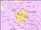
North Bethesda is a census-designated place
and an unincorporated area in Montgomery County
, Maryland
, United States
. It borders the city of Rockville
, and is closely associated with the city.
as a census-designated place
, and by the United States Geological Survey
as a populated place located at 39°2′12"N 77°7′13"W (39.036733, -77.120249).
According to the United States Census Bureau
, the North Bethesda CDP has a total area of 8.9 square miles (23.1 km²).
Significant through-roads in North Bethesda include Interstates 270
and 495
and Maryland State Highways 187 (Old Georgetown Road), 355 (Rockville Pike), and 547 (Strathmore Avenue). The Twinbrook, White Flint, and Grosvenor-Strathmore Washington Metro
stations all serve the area, as does the Ride On
bus system.
The far southern edge of the North Bethesda CDP was originally the country estate of the Grosvenor
family, whose lineage includes Alexander Graham Bell
and a former President of the National Geographic Society
. That region continues to bear the family's name, and is the location of the headquarters of the Renewable Natural Resources Foundation. Also in the southern sector of the census designated area, located in the triangle between the two limbs of I-270 and I-495, is a business district that includes the corporate headquarters
of Lockheed Martin
, Coventry Healthcare, Host Marriott and Marriott International
. The Nuclear Regulatory Commission
, a government agency which oversees nuclear regulation and safety in the U.S., is also headquartered here. Major shopping centers include Congressional Plaza, Mid-Pike Plaza, Montrose Crossing, Federal Plaza, and White Flint Mall.
Other prominent entities in the area are Walter Johnson High School
, the Georgetown Preparatory School
, the Charles E. Smith Jewish Day School
, the Music Center at Strathmore
, the White Flint
shopping mall, the national office of the American Speech-Language-Hearing Association
, the Montgomery Aquatic Center, The Jewish Community Center, and North Bethesda Market
, the tallest apartment tower in Montgomery County, Maryland
.
neighbors. Archaeological evidence suggests that Paleo, Archaic, and Woodland Native Americans lived nearby, along the banks of the Potomac River
. These peoples traveled along an ancient route known as the Seneca Trail (which is today approximately followed in North Bethesda by Old Georgetown Road). Like many ancient roads, the Seneca Trail followed a ridge line – in this case, the high ground between the Potomac River
and Rock Creek
. Much later, development would spring up along this route.
The recorded history of the area commences with the colonial era. Settlements formed along Rock Creek and the Seneca Trail in the 17th Century, with recorded land grants in this area known originally as “Dan” and “Leeke Forest.”
In the early 19th century, much of the area was part of a 3700 acres (15 km²) tobacco plantation owned by a slaveowning family with the surname of Riley. One of the Rileys' slaves, Josiah Henson
, is thought by historians to be the inspiration for Harriet Beecher Stowe
's Uncle Tom's Cabin
. In 1806, the Washington Turnpike Company was chartered to improve the old Seneca route, by then known as the Georgetown-Frederick Road. The road was opened in 1828, but had nearly washed away by 1848. The Riley plantation house was located on this road, and the plantation house's kitchen (in which Henson is known to have slept) still stands near the course of this road.
By the late 19th century, the area was privileged with stops along a train route, and by the early 20th century with its own trolley tracks on the line connecting Georgetown and Rockville (along current-day Fleming Avenue). During this time, development bloomed around train and trolley stops, and a number of wealthy families, including those of Captain James Frederick Oyster and Charles I. Corby (who developed methods that revolutionized the baking industry), lived or summered in the area. Nonetheless, the area remained sparsely populated through the 1920s.
The arrival of the automobile eventually transformed the area into a commuter suburb of Washington, D.C.
By the 1950s, the area had sprouted a number of developer-conceived neighborhoods with tract houses for the middle-class.
Today, the area remains largely a commuter suburb, with most residents traveling an average of 29 minutes to their workplace. While some traditional neighborhoods remain, other areas have struggled with issues related to suburban sprawl.
of 2000, there were 38,610 people, 17,286 households, and 9,662 families residing in the area. The population density
was 4,281.5 people per square mile (1,652.7/km²). There were 18,071 housing units at an average density of 2,003.9/sq mi (773.5/km²). The racial makeup of the area was 77.24% White, 4.96% African American, 0.29% Native American, 11.97% Asian, 0.05% Pacific Islander, 2.61% from other races
, and 2.88% from two or more races. Hispanic or Latino of any race were 9.53% of the population.
There were 17,286 households out of which 22.7% had children under the age of 18 living with them, 46.2% were married couples
living together, 7.4% had a female householder with no husband present, and 44.1% were non-families. 36.5% of all households were made up of individuals and 11.6% had someone living alone who was 65 years of age or older. The average household size was 2.17 and the average family size was 2.85.
In the area, the population was spread out with 17.9% under the age of 18, 6.1% from 18 to 24, 34.0% from 25 to 44, 24.2% from 45 to 64, and 17.8% who were 65 years of age or older. The median age was 40 years. For every 100 females there were 87.3 males. For every 100 females age 18 and over, there were 83.9 males.
According to survey conducted between 2005 and 2009, the median income for a household in the area was $87,324, and the median income for a family was $113,719. Males had a median income of $79,085 versus $61,793 for females. The per capita income
for the area was $51,254. About 2.2% of families and 4.8% of the population were below the poverty line, including 5.1% of those under age 18 and 4.6% of those age 65 or over.
include the following:
Census-designated place
A census-designated place is a concentration of population identified by the United States Census Bureau for statistical purposes. CDPs are delineated for each decennial census as the statistical counterparts of incorporated places such as cities, towns and villages...
and an unincorporated area in Montgomery County
Montgomery County, Maryland
Montgomery County is a county in the U.S. state of Maryland, situated just to the north of Washington, D.C., and southwest of the city of Baltimore. It is one of the most affluent counties in the United States, and has the highest percentage of residents over 25 years of age who hold post-graduate...
, Maryland
Maryland
Maryland is a U.S. state located in the Mid Atlantic region of the United States, bordering Virginia, West Virginia, and the District of Columbia to its south and west; Pennsylvania to its north; and Delaware to its east...
, United States
United States
The United States of America is a federal constitutional republic comprising fifty states and a federal district...
. It borders the city of Rockville
Rockville, Maryland
Rockville is the county seat of Montgomery County, Maryland, United States. It is a major incorporated city in the central part of Montgomery County and forms part of the Baltimore-Washington Metropolitan Area. The 2010 U.S...
, and is closely associated with the city.
Geography
As an unincorporated area, North Bethesda's boundaries are not officially defined. North Bethesda is, however, recognized by the United States Census BureauUnited States Census Bureau
The United States Census Bureau is the government agency that is responsible for the United States Census. It also gathers other national demographic and economic data...
as a census-designated place
Census-designated place
A census-designated place is a concentration of population identified by the United States Census Bureau for statistical purposes. CDPs are delineated for each decennial census as the statistical counterparts of incorporated places such as cities, towns and villages...
, and by the United States Geological Survey
United States Geological Survey
The United States Geological Survey is a scientific agency of the United States government. The scientists of the USGS study the landscape of the United States, its natural resources, and the natural hazards that threaten it. The organization has four major science disciplines, concerning biology,...
as a populated place located at 39°2′12"N 77°7′13"W (39.036733, -77.120249).
According to the United States Census Bureau
United States Census Bureau
The United States Census Bureau is the government agency that is responsible for the United States Census. It also gathers other national demographic and economic data...
, the North Bethesda CDP has a total area of 8.9 square miles (23.1 km²).
Significant through-roads in North Bethesda include Interstates 270
Interstate 270 (Maryland)
Interstate 270 is a auxiliary Interstate Highway in the U.S. state of Maryland that travels between Interstate 495 just north of Bethesda, Montgomery County and Interstate 70 in the city of Frederick in Frederick County. It consists of the mainline as well as a spur that provides access to and...
and 495
Interstate 495 (Capital Beltway)
Interstate 495 is a Interstate Highway that surrounds the United States' capital of Washington, D.C., and its inner suburbs in adjacent Maryland and Virginia. I-495 is widely known as the Capital Beltway or simply the Beltway, especially when the context of Washington, D.C., is clear...
and Maryland State Highways 187 (Old Georgetown Road), 355 (Rockville Pike), and 547 (Strathmore Avenue). The Twinbrook, White Flint, and Grosvenor-Strathmore Washington Metro
Washington Metro
The Washington Metro, commonly called Metro, and unofficially Metrorail, is the rapid transit system in Washington, D.C., United States, and its surrounding suburbs. It is administered by the Washington Metropolitan Area Transit Authority , which also operates Metrobus service under the Metro name...
stations all serve the area, as does the Ride On
Ride On (bus)
Ride On is the primary public transportation system in Montgomery County, Maryland. Ride On serves Montgomery County as well as the community of Langley Park in Prince George's County...
bus system.
The far southern edge of the North Bethesda CDP was originally the country estate of the Grosvenor
Grosvenor
-Baronets/Marquesses/Dukes of Westminster::*Sir Richard Grosvenor, 1st Baronet *Sir Richard Grosvenor, 2nd Baronet , son of 1st baronet*Sir Thomas Grosvenor, 3rd Baronet , grandson of 2nd baronet...
family, whose lineage includes Alexander Graham Bell
Alexander Graham Bell
Alexander Graham Bell was an eminent scientist, inventor, engineer and innovator who is credited with inventing the first practical telephone....
and a former President of the National Geographic Society
National Geographic Society
The National Geographic Society , headquartered in Washington, D.C. in the United States, is one of the largest non-profit scientific and educational institutions in the world. Its interests include geography, archaeology and natural science, the promotion of environmental and historical...
. That region continues to bear the family's name, and is the location of the headquarters of the Renewable Natural Resources Foundation. Also in the southern sector of the census designated area, located in the triangle between the two limbs of I-270 and I-495, is a business district that includes the corporate headquarters
Headquarters
Headquarters denotes the location where most, if not all, of the important functions of an organization are coordinated. In the United States, the corporate headquarters represents the entity at the center or the top of a corporation taking full responsibility managing all business activities...
of Lockheed Martin
Lockheed Martin
Lockheed Martin is an American global aerospace, defense, security, and advanced technology company with worldwide interests. It was formed by the merger of Lockheed Corporation with Martin Marietta in March 1995. It is headquartered in Bethesda, Maryland, in the Washington Metropolitan Area....
, Coventry Healthcare, Host Marriott and Marriott International
Marriott International
Marriott International, Inc. is a worldwide operator and franchisor of a broad portfolio of hotels and related lodging facilities. Founded by J. Willard Marriott, the company is now led by son J.W. Marriott, Jr...
. The Nuclear Regulatory Commission
Nuclear Regulatory Commission
The Nuclear Regulatory Commission is an independent agency of the United States government that was established by the Energy Reorganization Act of 1974 from the United States Atomic Energy Commission, and was first opened January 19, 1975...
, a government agency which oversees nuclear regulation and safety in the U.S., is also headquartered here. Major shopping centers include Congressional Plaza, Mid-Pike Plaza, Montrose Crossing, Federal Plaza, and White Flint Mall.
Other prominent entities in the area are Walter Johnson High School
Walter Johnson High School
Walter Johnson High School is located at 6400 Rock Spring Drive in Bethesda, an unincorporated region of Montgomery County, Maryland.WJHS serves areas in Bethesda and Rockville, as well as the towns of Garrett Park and Kensington.-History:...
, the Georgetown Preparatory School
Georgetown Preparatory School
Georgetown Preparatory School is an American Jesuit college preparatory school for grades 9 through 12. It is the oldest all boys school in the United States, and the only Jesuit boarding school in the country...
, the Charles E. Smith Jewish Day School
Charles E. Smith Jewish Day School
The Charles E. Smith Jewish Day School, often referred to as CESJDS or JDS, is a private, pluralistic Jewish K-12 school in Rockville, Maryland....
, the Music Center at Strathmore
Strathmore (Maryland)
Strathmore is a cultural and artistic venue and institution in North Bethesda, Maryland, USA. Strathmore was founded in 1981 and consists of two venues: the Mansion and the Music Center....
, the White Flint
White Flint Mall
White Flint Mall is an upscale shopping mall along Rockville Pike in Montgomery County, Maryland. It is known for its numerous restaurants, including P.F. Chang's China Bistro, The Cheesecake Factory, Dave & Buster's, and Bertucci's.-History:...
shopping mall, the national office of the American Speech-Language-Hearing Association
American Speech-Language-Hearing Association
The American Speech–Language–Hearing Association is a professional association for speech–language pathologists, audiologists, and speech, language, and hearing scientists in the United States and internationally...
, the Montgomery Aquatic Center, The Jewish Community Center, and North Bethesda Market
North Bethesda Market
-History:North Bethesda Market is a property owned by JBG Companies with residential rental apartments and retail, operating since 2010.-Points of Interest:...
, the tallest apartment tower in Montgomery County, Maryland
Montgomery County, Maryland
Montgomery County is a county in the U.S. state of Maryland, situated just to the north of Washington, D.C., and southwest of the city of Baltimore. It is one of the most affluent counties in the United States, and has the highest percentage of residents over 25 years of age who hold post-graduate...
.
History
North Bethesda shares a common history with most of its Montgomery CountyMontgomery County, Maryland
Montgomery County is a county in the U.S. state of Maryland, situated just to the north of Washington, D.C., and southwest of the city of Baltimore. It is one of the most affluent counties in the United States, and has the highest percentage of residents over 25 years of age who hold post-graduate...
neighbors. Archaeological evidence suggests that Paleo, Archaic, and Woodland Native Americans lived nearby, along the banks of the Potomac River
Potomac River
The Potomac River flows into the Chesapeake Bay, located along the mid-Atlantic coast of the United States. The river is approximately long, with a drainage area of about 14,700 square miles...
. These peoples traveled along an ancient route known as the Seneca Trail (which is today approximately followed in North Bethesda by Old Georgetown Road). Like many ancient roads, the Seneca Trail followed a ridge line – in this case, the high ground between the Potomac River
Potomac River
The Potomac River flows into the Chesapeake Bay, located along the mid-Atlantic coast of the United States. The river is approximately long, with a drainage area of about 14,700 square miles...
and Rock Creek
Rock Creek (Potomac River)
Rock Creek is a free-flowing tributary of the Potomac River, which empties into the Atlantic Ocean via the Chesapeake Bay. The creek is long, with a drainage area of about...
. Much later, development would spring up along this route.
The recorded history of the area commences with the colonial era. Settlements formed along Rock Creek and the Seneca Trail in the 17th Century, with recorded land grants in this area known originally as “Dan” and “Leeke Forest.”
In the early 19th century, much of the area was part of a 3700 acres (15 km²) tobacco plantation owned by a slaveowning family with the surname of Riley. One of the Rileys' slaves, Josiah Henson
Josiah Henson
Josiah Henson was an author, abolitionist, and minister. Born into slavery in Charles County, Maryland, he escaped to Ontario, Canada in 1830, and founded a settlement and laborer's school for other fugitive slaves at Dawn, near Dresden in Kent County...
, is thought by historians to be the inspiration for Harriet Beecher Stowe
Harriet Beecher Stowe
Harriet Beecher Stowe was an American abolitionist and author. Her novel Uncle Tom's Cabin was a depiction of life for African-Americans under slavery; it reached millions as a novel and play, and became influential in the United States and United Kingdom...
's Uncle Tom's Cabin
Uncle Tom's Cabin
Uncle Tom's Cabin; or, Life Among the Lowly is an anti-slavery novel by American author Harriet Beecher Stowe. Published in 1852, the novel "helped lay the groundwork for the Civil War", according to Will Kaufman....
. In 1806, the Washington Turnpike Company was chartered to improve the old Seneca route, by then known as the Georgetown-Frederick Road. The road was opened in 1828, but had nearly washed away by 1848. The Riley plantation house was located on this road, and the plantation house's kitchen (in which Henson is known to have slept) still stands near the course of this road.
By the late 19th century, the area was privileged with stops along a train route, and by the early 20th century with its own trolley tracks on the line connecting Georgetown and Rockville (along current-day Fleming Avenue). During this time, development bloomed around train and trolley stops, and a number of wealthy families, including those of Captain James Frederick Oyster and Charles I. Corby (who developed methods that revolutionized the baking industry), lived or summered in the area. Nonetheless, the area remained sparsely populated through the 1920s.
The arrival of the automobile eventually transformed the area into a commuter suburb of Washington, D.C.
Washington, D.C.
Washington, D.C., formally the District of Columbia and commonly referred to as Washington, "the District", or simply D.C., is the capital of the United States. On July 16, 1790, the United States Congress approved the creation of a permanent national capital as permitted by the U.S. Constitution....
By the 1950s, the area had sprouted a number of developer-conceived neighborhoods with tract houses for the middle-class.
Today, the area remains largely a commuter suburb, with most residents traveling an average of 29 minutes to their workplace. While some traditional neighborhoods remain, other areas have struggled with issues related to suburban sprawl.
Demographics
As of the censusCensus
A census is the procedure of systematically acquiring and recording information about the members of a given population. It is a regularly occurring and official count of a particular population. The term is used mostly in connection with national population and housing censuses; other common...
of 2000, there were 38,610 people, 17,286 households, and 9,662 families residing in the area. The population density
Population density
Population density is a measurement of population per unit area or unit volume. It is frequently applied to living organisms, and particularly to humans...
was 4,281.5 people per square mile (1,652.7/km²). There were 18,071 housing units at an average density of 2,003.9/sq mi (773.5/km²). The racial makeup of the area was 77.24% White, 4.96% African American, 0.29% Native American, 11.97% Asian, 0.05% Pacific Islander, 2.61% from other races
Race (United States Census)
Race and ethnicity in the United States Census, as defined by the Federal Office of Management and Budget and the United States Census Bureau, are self-identification data items in which residents choose the race or races with which they most closely identify, and indicate whether or not they are...
, and 2.88% from two or more races. Hispanic or Latino of any race were 9.53% of the population.
There were 17,286 households out of which 22.7% had children under the age of 18 living with them, 46.2% were married couples
Marriage
Marriage is a social union or legal contract between people that creates kinship. It is an institution in which interpersonal relationships, usually intimate and sexual, are acknowledged in a variety of ways, depending on the culture or subculture in which it is found...
living together, 7.4% had a female householder with no husband present, and 44.1% were non-families. 36.5% of all households were made up of individuals and 11.6% had someone living alone who was 65 years of age or older. The average household size was 2.17 and the average family size was 2.85.
In the area, the population was spread out with 17.9% under the age of 18, 6.1% from 18 to 24, 34.0% from 25 to 44, 24.2% from 45 to 64, and 17.8% who were 65 years of age or older. The median age was 40 years. For every 100 females there were 87.3 males. For every 100 females age 18 and over, there were 83.9 males.
According to survey conducted between 2005 and 2009, the median income for a household in the area was $87,324, and the median income for a family was $113,719. Males had a median income of $79,085 versus $61,793 for females. The per capita income
Per capita income
Per capita income or income per person is a measure of mean income within an economic aggregate, such as a country or city. It is calculated by taking a measure of all sources of income in the aggregate and dividing it by the total population...
for the area was $51,254. About 2.2% of families and 4.8% of the population were below the poverty line, including 5.1% of those under age 18 and 4.6% of those age 65 or over.
Neighborhoods in North Bethesda
Neighborhoods within the North Bethesda CDPCensus-designated place
A census-designated place is a concentration of population identified by the United States Census Bureau for statistical purposes. CDPs are delineated for each decennial census as the statistical counterparts of incorporated places such as cities, towns and villages...
include the following:
- Garrett Park Estates
- Halpine
- Old Georgetown Village
- Luxmanor
- Randolph Hills
- The Crest of Wickford
- Wildwood
- Tilden Woods
- Timberlawn
- Old Farm
- Chase Crossing
- Grosvenor Park
- North Bethesda MarketNorth Bethesda Market-History:North Bethesda Market is a property owned by JBG Companies with residential rental apartments and retail, operating since 2010.-Points of Interest:...