

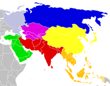
North Asia
Encyclopedia
Subregion
A subregion is a conceptual unit which derives from a larger region or continent and is usually based on location. Cardinal directions, such as south or southern, are commonly used to define a subregion.- United Nations subregions :...
of Asia
Asia
Asia is the world's largest and most populous continent, located primarily in the eastern and northern hemispheres. It covers 8.7% of the Earth's total surface area and with approximately 3.879 billion people, it hosts 60% of the world's current human population...
, consisting of the Asian portion of Russia
Russia
Russia or , officially known as both Russia and the Russian Federation , is a country in northern Eurasia. It is a federal semi-presidential republic, comprising 83 federal subjects...
.
The Phillips Illustrated Atlas of the World 1988 defines it as being most of the former USSR
Soviet Union
The Soviet Union , officially the Union of Soviet Socialist Republics , was a constitutionally socialist state that existed in Eurasia between 1922 and 1991....
, the part that is to the east of the Ural Mountains
Ural Mountains
The Ural Mountains , or simply the Urals, are a mountain range that runs approximately from north to south through western Russia, from the coast of the Arctic Ocean to the Ural River and northwestern Kazakhstan. Their eastern side is usually considered the natural boundary between Europe and Asia...
. A definition pre-dating the USSR is an 1882 one by Keane and Temple, who defined it as "the two great administrative divisions of West and East Siberia
Siberia
Siberia is an extensive region constituting almost all of Northern Asia. Comprising the central and eastern portion of the Russian Federation, it was part of the Soviet Union from its beginning, as its predecessor states, the Tsardom of Russia and the Russian Empire, conquered it during the 16th...
, whose capitals are Omsk
Omsk
-History:The wooden fort of Omsk was erected in 1716 to protect the expanding Russian frontier along the Ishim and the Irtysh rivers against the Kyrgyz nomads of the Steppes...
and Irkutsk
Irkutsk
Irkutsk is a city and the administrative center of Irkutsk Oblast, Russia, one of the largest cities in Siberia. Population: .-History:In 1652, Ivan Pokhabov built a zimovye near the site of Irkutsk for gold trading and for the collection of fur taxes from the Buryats. In 1661, Yakov Pokhabov...
respectively". It was, according to them "one vast political system, comprising nearly one-third of the whole continent, and, with a few trifling exceptions, directly administered by Russia
Russia
Russia or , officially known as both Russia and the Russian Federation , is a country in northern Eurasia. It is a federal semi-presidential republic, comprising 83 federal subjects...
".
Demographics
In 1875, Chambers reported the population of Northern Asia to be 8 million. Between 1801 and 1914 an estimated 7 million settlers moved from European RussiaEuropean Russia
European Russia refers to the western areas of Russia that lie within Europe, comprising roughly 3,960,000 square kilometres , larger in area than India, and spanning across 40% of Europe. Its eastern border is defined by the Ural Mountains and in the south it is defined by the border with...
to Siberia
Siberia
Siberia is an extensive region constituting almost all of Northern Asia. Comprising the central and eastern portion of the Russian Federation, it was part of the Soviet Union from its beginning, as its predecessor states, the Tsardom of Russia and the Russian Empire, conquered it during the 16th...
, 85% during the quarter-century before World War I
World War I
World War I , which was predominantly called the World War or the Great War from its occurrence until 1939, and the First World War or World War I thereafter, was a major war centred in Europe that began on 28 July 1914 and lasted until 11 November 1918...
.
Most estimates nowadays are that there are around 40 million Russians
Russians
The Russian people are an East Slavic ethnic group native to Russia, speaking the Russian language and primarily living in Russia and neighboring countries....
and Russified Ukrainians
Ukrainians in Russia
The Ukrainians in Russia make up the largest single Ukrainian diaspora of the Ukrainian people. Officially there are 2,942,961 Ukrainians living in Russia or just over 2% of the total population making them the third largest ethnic group after ethnic Russians and Tatars in the Russian...
east of the Urals. The Buryats
Buryats
The Buryats or Buriyads , numbering approximately 436,000, are the largest ethnic minority group in Siberia and are mainly concentrated in their homeland, the Buryat Republic, a federal subject of Russia...
number 445,175, which makes them the largest ethnic minority group in Siberia. There are 443,852 Yakuts
Yakuts
Yakuts , are a Turkic people associated with the Sakha Republic.The Yakut or Sakha language belongs to the Northern branch of the Turkic family of languages....
(Russian Census of 2002) and about 400,000 ethnic Germans living in Siberia. According to the 2002 census there are 500,000 Tatars in Siberia
Siberian Tatars
Siberian Tatars refers to the indigenous Siberian population of the forests and steppes of South Siberia stretching from somewhat east of the Ural Mountains to the Yenisey river...
, but 300,000 of them are Volga Tatars
Volga Tatars
The Volga Tatars are the largest subgroup of the Tatars, native to the Volga region.They account for roughly six out of seven million Tatars worldwide....
who settled in Siberia during periods of colonization.
Geography
There are no mountain chains in Northern Asia to prevent air currents from the Arctic flowing down over the plains of SiberiaSiberia
Siberia is an extensive region constituting almost all of Northern Asia. Comprising the central and eastern portion of the Russian Federation, it was part of the Soviet Union from its beginning, as its predecessor states, the Tsardom of Russia and the Russian Empire, conquered it during the 16th...
and Turkestan
Turkestan
Turkestan, spelled also as Turkistan, literally means "Land of the Turks".The term Turkestan is of Persian origin and has never been in use to denote a single nation. It was first used by Persian geographers to describe the place of Turkish peoples...
.
The plateaux and plains of Northern Asia comprise the West Siberian lowlands; the Angara Shield, with the Taimyr Peninsula, the coastal lowlands, the Putorana Plateau, the Anabar Plateau, the Tunguska Plateau, and the Angara Plateau; and the Lena-Vilyuy Basin.
Geomorphology
The geomorphology of Asia in general is imperfectly known, although the deposits and mountain ranges are well known.To compensate for new sea floor having been created in the Siberian basin, the whole of the Asian Plate
Eurasian Plate
The Eurasian Plate is a tectonic plate which includes most of the continent of Eurasia , with the notable exceptions of the Indian subcontinent, the Arabian subcontinent, and the area east of the Chersky Range in East Siberia...
has pivoted about a point in the New Siberian Islands
New Siberian Islands
The New Siberian Islands are an archipelago, located to the North of the East Siberian coast between the Laptev Sea and the East Siberian Sea north of the Sakha Republic....
, causing compression in the Verkhoyansk mountains, which were formed along the eastern margin of the Angara Shield by tectonic uplift
Tectonic uplift
Tectonic uplift is a geological process most often caused by plate tectonics which increases elevation. The opposite of uplift is subsidence, which results in a decrease in elevation. Uplift may be orogenic or isostatic.-Orogenic uplift:...
during the Mesozoic Era
Mesozoic
The Mesozoic era is an interval of geological time from about 250 million years ago to about 65 million years ago. It is often referred to as the age of reptiles because reptiles, namely dinosaurs, were the dominant terrestrial and marine vertebrates of the time...
. There is a southern boundary to this across the northern margin of the Alpine
Alps
The Alps is one of the great mountain range systems of Europe, stretching from Austria and Slovenia in the east through Italy, Switzerland, Liechtenstein and Germany to France in the west....
folds of Iran, Afghanistan, India, Nepal, and Bhutan, which at the east of Brahmaputra turns to run south towards the Bay of Bengal
Bay of Bengal
The Bay of Bengal , the largest bay in the world, forms the northeastern part of the Indian Ocean. It resembles a triangle in shape, and is bordered mostly by the Eastern Coast of India, southern coast of Bangladesh and Sri Lanka to the west and Burma and the Andaman and Nicobar Islands to the...
along the line of the Naga hills
Naga hills
Naga hills, reaching a height of around 3825 metres, lie on the border of India and Burma . These hills are part of a complex mountain system, and the parts of the mountain ranges inside the Indian state of Nagaland and the Burmese region of Sagaing are called the Naga Hills.In British India, the...
and the Arakan Yoma
Arakan Yoma
The Arakan Mountains is a mountain range in western Burma , between the coast of Rakhine State and the Central Burma Basin, in which flows the Irrawaddy River...
, continues around Indonesia
Indonesia
Indonesia , officially the Republic of Indonesia , is a country in Southeast Asia and Oceania. Indonesia is an archipelago comprising approximately 13,000 islands. It has 33 provinces with over 238 million people, and is the world's fourth most populous country. Indonesia is a republic, with an...
, and follows the edge of the continental shelf
Continental shelf
The continental shelf is the extended perimeter of each continent and associated coastal plain. Much of the shelf was exposed during glacial periods, but is now submerged under relatively shallow seas and gulfs, and was similarly submerged during other interglacial periods. The continental margin,...
along the eastern seaboard of China
China
Chinese civilization may refer to:* China for more general discussion of the country.* Chinese culture* Greater China, the transnational community of ethnic Chinese.* History of China* Sinosphere, the area historically affected by Chinese culture...
. The Eurasian Plate
Eurasian Plate
The Eurasian Plate is a tectonic plate which includes most of the continent of Eurasia , with the notable exceptions of the Indian subcontinent, the Arabian subcontinent, and the area east of the Chersky Range in East Siberia...
and the North American Plate
North American Plate
The North American Plate is a tectonic plate covering most of North America, Greenland, Cuba, Bahamas, and parts of Siberia, Japan and Iceland. It extends eastward to the Mid-Atlantic Ridge and westward to the Chersky Range in eastern Siberia. The plate includes both continental and oceanic crust...
meet across the neck of Alaska
Alaska
Alaska is the largest state in the United States by area. It is situated in the northwest extremity of the North American continent, with Canada to the east, the Arctic Ocean to the north, and the Pacific Ocean to the west and south, with Russia further west across the Bering Strait...
, following the line of the Aleutian Trench
Aleutian Trench
The Aleutian Trench is a subduction zone and oceanic trench which runs along the southern coastline of Alaska and the adjacent waters of northeastern Siberia off the coast of Kamchatka Peninsula. It is classified as a "marginal trench" in the east as it runs along the margin of the continent, and...
, rather than meeting at the Bering Straits.
Northern Asia is built around the Angara Shield, which lies between the Yenisey River and the Lena River
Lena River
The Lena is the easternmost of the three great Siberian rivers that flow into the Arctic Ocean . It is the 11th longest river in the world and has the 9th largest watershed...
. It developed from fragments of Laurasia
Laurasia
In paleogeography, Laurasia was the northernmost of two supercontinents that formed part of the Pangaea supercontinent from approximately...
, whose rocks were mainly pre-Cambrian
Cambrian
The Cambrian is the first geological period of the Paleozoic Era, lasting from Mya ; it is succeeded by the Ordovician. Its subdivisions, and indeed its base, are somewhat in flux. The period was established by Adam Sedgwick, who named it after Cambria, the Latin name for Wales, where Britain's...
crystalline rocks, gneiss
Gneiss
Gneiss is a common and widely distributed type of rock formed by high-grade regional metamorphic processes from pre-existing formations that were originally either igneous or sedimentary rocks.-Etymology:...
es, and schist
Schist
The schists constitute a group of medium-grade metamorphic rocks, chiefly notable for the preponderance of lamellar minerals such as micas, chlorite, talc, hornblende, graphite, and others. Quartz often occurs in drawn-out grains to such an extent that a particular form called quartz schist is...
s, and Gondwana
Gondwana
In paleogeography, Gondwana , originally Gondwanaland, was the southernmost of two supercontinents that later became parts of the Pangaea supercontinent. It existed from approximately 510 to 180 million years ago . Gondwana is believed to have sutured between ca. 570 and 510 Mya,...
. These rocks can be found in the Angara Shield, the Inner Mongolian-Korean Shield, the Ordes Shield and the South-East Asia Shield. The fragments have been subject to orogenesis around their margins, giving a complex of plateaux and mountain ranges. One can find outcrop
Outcrop
An outcrop is a visible exposure of bedrock or ancient superficial deposits on the surface of the Earth. -Features:Outcrops do not cover the majority of the Earth's land surface because in most places the bedrock or superficial deposits are covered by a mantle of soil and vegetation and cannot be...
s of these rocks in unfolded sections of the Shields. Their presence has been confirmed below Mesozoic and later sediments.
There are three main periods of mountain building in Northern Asia, although it has occurred many times. The outer fold mountains, that are on the margins of the Shields and that only affected Asia north of the line of the Himalayas
Himalayas
The Himalaya Range or Himalaya Mountains Sanskrit: Devanagari: हिमालय, literally "abode of snow"), usually called the Himalayas or Himalaya for short, is a mountain range in Asia, separating the Indian subcontinent from the Tibetan Plateau...
, are attributed to the Caledonian
Caledonian orogeny
The Caledonian orogeny is a mountain building era recorded in the northern parts of the British Isles, the Scandinavian Mountains, Svalbard, eastern Greenland and parts of north-central Europe. The Caledonian orogeny encompasses events that occurred from the Ordovician to Early Devonian, roughly...
and Hercynian
Variscan orogeny
The Variscan orogeny is a geologic mountain-building event caused by Late Paleozoic continental collision between Euramerica and Gondwana to form the supercontinent of Pangaea.-Naming:...
orogenies of the late Palaeozoic Era
Paleozoic
The Paleozoic era is the earliest of three geologic eras of the Phanerozoic eon, spanning from roughly...
. The Alpine origeny caused extensive folding and faulting of Mesozoic and early Tertiary
Tertiary
The Tertiary is a deprecated term for a geologic period 65 million to 2.6 million years ago. The Tertiary covered the time span between the superseded Secondary period and the Quaternary...
sediments from the Tethys
Tethys Ocean
The Tethys Ocean was an ocean that existed between the continents of Gondwana and Laurasia during the Mesozoic era before the opening of the Indian Ocean.-Modern theory:...
geosyncline
Geosyncline
In geology, geosyncline is a term still occasionally used for a subsiding linear trough that was caused by the accumulation of sedimentary rock strata deposited in a basin and subsequently compressed, deformed, and uplifted into a mountain range, with attendant volcanism and plutonism...
. The Tibetan and Mongolian plateaux, and the structural basins of Tarim
Tarim Basin
The Tarim Basin is a large endorheic basin occupying an area of about . It is located in the Xinjiang Uyghur Autonomous Region in China's far west. Its northern boundary is the Tian Shan mountain range and its southern is the Kunlun Mountains on the northern edge of the Tibetan Plateau. The...
, Qaidam
Qaidam
Qaidam Basin, also spelled Tsaidam is an hyperarid basin that occupies a large part of the Haixi Mongol and Tibetan Autonomous Prefecture in Qinghai Province, western China...
, and Junggar, are delimited by major east-west lithospheric faults that were probably the results of stresses caused by the impact of the Indian Plate against Laurasia. Erosion of the mountains caused by this orogeny has created a large amount of sediment, which has been transported southwards to produce the alluvial plain
Alluvial plain
An alluvial plain is a relatively flat landform created by the deposition of sediment over a long period of time by one or more rivers coming from highland regions, from which alluvial soil forms...
s of India, China, and Cambodia, and which has also been deposited in large amounts in the Tarim and Dzungarian basins.
Northern Asia was glaciated in the Pleistocene
Pleistocene
The Pleistocene is the epoch from 2,588,000 to 11,700 years BP that spans the world's recent period of repeated glaciations. The name pleistocene is derived from the Greek and ....
, but this played a less significant part in the geology of the area compared to the part that it played in North America
North America
North America is a continent wholly within the Northern Hemisphere and almost wholly within the Western Hemisphere. It is also considered a northern subcontinent of the Americas...
and Europe
Europe
Europe is, by convention, one of the world's seven continents. Comprising the westernmost peninsula of Eurasia, Europe is generally 'divided' from Asia to its east by the watershed divides of the Ural and Caucasus Mountains, the Ural River, the Caspian and Black Seas, and the waterways connecting...
. The Scandinavian ice sheet extended to the east of the Urals, covering the northern two thirds of the Ob Basin and extending onto the Angara Shield between the Yenesei River and the Lena River
Lena River
The Lena is the easternmost of the three great Siberian rivers that flow into the Arctic Ocean . It is the 11th longest river in the world and has the 9th largest watershed...
. There are legacies of mountain glaciation to be found on the east Siberian mountains, on the mountains of the Kamchatka Peninsula
Kamchatka Peninsula
The Kamchatka Peninsula is a peninsula in the Russian Far East, with an area of . It lies between the Pacific Ocean to the east and the Sea of Okhotsk to the west...
, on the Altai, on Tien Shan, and on other small areas of mountains, ice cap
Ice cap
An ice cap is an ice mass that covers less than 50 000 km² of land area . Masses of ice covering more than 50 000 km² are termed an ice sheet....
s remain on the islands of Severnaya Zemlya
Severnaya Zemlya
Severnaya Zemlya is an archipelago in the Russian high Arctic at around . It is located off mainland Siberia's Taymyr Peninsula across the Vilkitsky Strait...
and Novaya Zemlya
Novaya Zemlya
Novaya Zemlya , also known in Dutch as Nova Zembla and in Norwegian as , is an archipelago in the Arctic Ocean in the north of Russia and the extreme northeast of Europe, the easternmost point of Europe lying at Cape Flissingsky on the northern island...
, and several Central Asia
Central Asia
Central Asia is a core region of the Asian continent from the Caspian Sea in the west, China in the east, Afghanistan in the south, and Russia in the north...
n mountains still have individual glaciers. Siberia itself has permafrost
Permafrost
In geology, permafrost, cryotic soil or permafrost soil is soil at or below the freezing point of water for two or more years. Ice is not always present, as may be in the case of nonporous bedrock, but it frequently occurs and it may be in amounts exceeding the potential hydraulic saturation of...
, ranging in depths from 30m to 600 m and covering an area of 9.6 million km².
Several of the mountainous regions are volcanic, with both the Koryat mountains and the Kamchatka Peninsula having active volcano
Volcano
2. Bedrock3. Conduit 4. Base5. Sill6. Dike7. Layers of ash emitted by the volcano8. Flank| 9. Layers of lava emitted by the volcano10. Throat11. Parasitic cone12. Lava flow13. Vent14. Crater15...
es. The Anadyr plateau is formed from igneous rock
Igneous rock
Igneous rock is one of the three main rock types, the others being sedimentary and metamorphic rock. Igneous rock is formed through the cooling and solidification of magma or lava...
s. The Mongolian plateau
Mongolian Plateau
The Mongolian Plateau is part of the larger Central Asian Plateau and has an area of approximately 2,600,000 square kilometres. It is occupied by Mongolia in the north and Inner Mongolia in the south. The plateau includes the Gobi Desert as well as dry steppe regions...
has an area of basalt
Basalt
Basalt is a common extrusive volcanic rock. It is usually grey to black and fine-grained due to rapid cooling of lava at the surface of a planet. It may be porphyritic containing larger crystals in a fine matrix, or vesicular, or frothy scoria. Unweathered basalt is black or grey...
ic lava
Lava
Lava refers both to molten rock expelled by a volcano during an eruption and the resulting rock after solidification and cooling. This molten rock is formed in the interior of some planets, including Earth, and some of their satellites. When first erupted from a volcanic vent, lava is a liquid at...
s and volcanic cone
Volcanic cone
Volcanic cones are among the simplest volcanic formations. They are built by ejecta from a volcanic vent, piling up around the vent in the shape of a cone with a central crater. Volcanic cones are of different types, depending upon the nature and size of the fragments ejected during the eruption...
s.
The Angara Shield also underlies the lowlands of the Ob River
Ob River
The Ob River , also Obi, is a major river in western Siberia, Russia and is the world's seventh longest river. It is the westernmost of the three great Siberian rivers that flow into the Arctic Ocean .The Gulf of Ob is the world's longest estuary.-Names:The Ob is known to the Khanty people as the...
, but to the south and east in the Central Asian mountains and in the East Siberian mountains there are folded and faulted mountains of Lower Palaeozoic rocks.
See also
- RussiaRussiaRussia or , officially known as both Russia and the Russian Federation , is a country in northern Eurasia. It is a federal semi-presidential republic, comprising 83 federal subjects...
- Russian Far EastRussian Far EastRussian Far East is a term that refers to the Russian part of the Far East, i.e., extreme east parts of Russia, between Lake Baikal in Eastern Siberia and the Pacific Ocean...
- SiberiaSiberiaSiberia is an extensive region constituting almost all of Northern Asia. Comprising the central and eastern portion of the Russian Federation, it was part of the Soviet Union from its beginning, as its predecessor states, the Tsardom of Russia and the Russian Empire, conquered it during the 16th...
- Russian Far East