
Noamundi
Encyclopedia
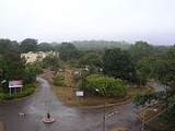
Noamundi is a census town
in Pashchimi Singhbhum district in the India
n state
of Jharkhand
.It is also an administrative 'block'. It is a small mining town in close to the Orissa
border. It lies near to Jamshedpur and 64 km (40 mi) from Chaibasa
. Nearby towns include Padapahar, Barajamda
, Kharsawan
, Gua
and Kiriburu
.
The major produce of this mine is iron ore (including blue dust). The mines are run by the Tata Steel
and most of the residents of this town are employed by this company.In the recent past a lot of private mine-owners have also set up shop in and around the town. A Pelletizing
Plant of Tata Steel
to convert blue dust to pellets , suitable for use in blast furnace functioned here from 1972 to 1986 but was closed down because it was not economically viable . The town is the right on the border of Jharkhand and Orissa with some of the iron-mines spanning the two states.The portion of iron mining area of Noamundi in the state of Orissa is called Katamati.
Legend has it that when the first iron ore explorers came to this region, they were amazed to find the local tribal population (Adivasis) using iron axes. When the explorers asked the tribals where they had found the ore, they pointed to a hill nearby and called it Noamundi, which literally means 'that hill' in their language. The native tribals are known as Ho people
and their language is also known by the same name - Ho
.
In spite of the commodity boom across the world over the last couple of years and the consequent effect of this on the area around Noamundi, the trickle down effect of this boom on the local Adivasi population has been negligible.Illegal mining thrives and is the rule rather than the exception.The result is the increased popularity of the Naxal movement in this area and in greater Jharkhand .
Noamundi is located in the heart of Saranda forest
, which is the densest deciduous forest of Asia. 'Saranda' in the local tribal language means 'The land of 700 hills'.The administrative boundary of the Saranda reserve forest ,however,lie a few kilometres away.
, Noamundi had a population of 16,228. Males constitute 52% of the population and females 48%. Noamundi has an average literacy rate of 63%, higher than the national average of 59.5%: male literacy is 73%, and female literacy is 53%. In Noamundi, 14% of the population is under 6 years of age.
Census town
In India, a census town is one which has:# A minimum population of 5,000# At least 75% of male working population engaged in non-agricultural pursuits# A density of population of at least 400 persons per km2.In Ireland, a census town is;...
in Pashchimi Singhbhum district in the India
India
India , officially the Republic of India , is a country in South Asia. It is the seventh-largest country by geographical area, the second-most populous country with over 1.2 billion people, and the most populous democracy in the world...
n state
States and territories of India
India is a federal union of states comprising twenty-eight states and seven union territories. The states and territories are further subdivided into districts and so on.-List of states and territories:...
of Jharkhand
Jharkhand
Jharkhand is a state in eastern India. It was carved out of the southern part of Bihar on 15 November 2000. Jharkhand shares its border with the states of Bihar to the north, Uttar Pradesh and Chhattisgarh to the west, Orissa to the south, and West Bengal to the east...
.It is also an administrative 'block'. It is a small mining town in close to the Orissa
Orissa
Orissa , officially Odisha since Nov 2011, is a state of India, located on the east coast of India, by the Bay of Bengal. It is the modern name of the ancient nation of Kalinga, which was invaded by the Maurya Emperor Ashoka in 261 BC. The modern state of Orissa was established on 1 April...
border. It lies near to Jamshedpur and 64 km (40 mi) from Chaibasa
Chaibasa
Chaibasa is a city and a municipality in West Singhbhum district in the state of Jharkhand, India. Chaibsa is district headquarter of West Singhbhum district.- Geography :Chaibasa is located at...
. Nearby towns include Padapahar, Barajamda
Barajamda
Barajamda is a census town in Pashchimi Singhbhum district in the state of Jharkhand, India.-Etymology:The word Barajamda , meaning "forest region," applies to a forested mountainous plateau region in eastern India. The existence of Barajamda dates at least to the sixteenth century.-Demographics:...
, Kharsawan
Kharsawan
Kharsawan is a city and a notified area in Seraikela Kharsawan district in the Indian state of Jharkhand.-History:Kharsawan or Kharsuan was one of the Oriya speaking Princely states of India during the period of the British Raj, and was acceded to India after India gained independence. Earlier...
, Gua
Gua
Gua is a census town in Pashchimi Singhbhum district in the Indian state of Jharkhand. It is a mining township situated in the Chotanagpur Plateau. The mines are operated by the Steel Authority of India Limited and are linked to IISCO at Burnpur....
and Kiriburu
Kiriburu
Kiriburu is a census town in Pashchimi Singhbhum district in the Indian state of Jharkhand.The town is mainly popular for having big Iron-ore Mines KIOM & MIOMboth governed by SAIL....
.
The major produce of this mine is iron ore (including blue dust). The mines are run by the Tata Steel
Tata Steel
Tata Steel is a multinational steel company headquartered in Jamshedpur, India and part of Tata Group. It is the world's seventh-largest steel company, with an annual crude steel capacity of 31 million tonnes, and the largest private-sector steel company in India measured by domestic production...
and most of the residents of this town are employed by this company.In the recent past a lot of private mine-owners have also set up shop in and around the town. A Pelletizing
Pelletizing
Pelletizing is the process of compressing or molding a material into the shape of a pellet. A wide range of different materials are pelletized including chemicals, iron ore, animal compound feed, and more.- Pelletizing of iron ore :...
Plant of Tata Steel
Tata Steel
Tata Steel is a multinational steel company headquartered in Jamshedpur, India and part of Tata Group. It is the world's seventh-largest steel company, with an annual crude steel capacity of 31 million tonnes, and the largest private-sector steel company in India measured by domestic production...
to convert blue dust to pellets , suitable for use in blast furnace functioned here from 1972 to 1986 but was closed down because it was not economically viable . The town is the right on the border of Jharkhand and Orissa with some of the iron-mines spanning the two states.The portion of iron mining area of Noamundi in the state of Orissa is called Katamati.
Legend has it that when the first iron ore explorers came to this region, they were amazed to find the local tribal population (Adivasis) using iron axes. When the explorers asked the tribals where they had found the ore, they pointed to a hill nearby and called it Noamundi, which literally means 'that hill' in their language. The native tribals are known as Ho people
Ho people
The Ho people are a tribe of people belonging to the Indian state of Jharkhand.They are the fourth most numerous scheduled tribe Jharkhand after Santals, Oraons, and Mundas, and constitute around 10.5 percent of the total population in the state, numbering 7,087,068 in the 2001 census...
and their language is also known by the same name - Ho
Ho language
Ho is a Munda language of the Austroasiatic language family spoken primarily in India by about 3,803,126 people. It is written with the Devanagari and the Varang Kshiti scripts. It is spoken by the Ho people. 0.103% of India's Population speaks this language as per the 2001 census.The Script was...
.
In spite of the commodity boom across the world over the last couple of years and the consequent effect of this on the area around Noamundi, the trickle down effect of this boom on the local Adivasi population has been negligible.Illegal mining thrives and is the rule rather than the exception.The result is the increased popularity of the Naxal movement in this area and in greater Jharkhand .
Geography
Noamundi is located at 22.15°N 85.53°E. It has an average elevation of 487 metres (1597 feet).Noamundi is located in the heart of Saranda forest
Saranda forest
Saranda forest is a dense forest in the hilly region of West Singhbhum district in the Indian state of Jharkhand. This area was formerly the private hunting reserve of the Singh Deo familySaranda forest is a dense forest in the hilly region of West Singhbhum district in the Indian state of ...
, which is the densest deciduous forest of Asia. 'Saranda' in the local tribal language means 'The land of 700 hills'.The administrative boundary of the Saranda reserve forest ,however,lie a few kilometres away.
Demographics
India censusCensus
A census is the procedure of systematically acquiring and recording information about the members of a given population. It is a regularly occurring and official count of a particular population. The term is used mostly in connection with national population and housing censuses; other common...
, Noamundi had a population of 16,228. Males constitute 52% of the population and females 48%. Noamundi has an average literacy rate of 63%, higher than the national average of 59.5%: male literacy is 73%, and female literacy is 53%. In Noamundi, 14% of the population is under 6 years of age.