
New York State Route 384
Encyclopedia
New York State Route 384 (NY 384) is a state highway
in Western New York
in the United States. It is a north–south route extending from the city of Buffalo
, Erie County
to the city of Niagara Falls
, Niagara County
, and is one of several routes directly connecting the two cities. The southern terminus of the route is at NY 5
in downtown Buffalo. NY 384's northern terminus is at the Rainbow Bridge
in downtown Niagara Falls. Through its entire course in Erie County, it is known as Delaware Avenue for the street it follows in the city. In Niagara County, NY 384 follows the Niagara River
and is named River Road and Buffalo Avenue.
NY 384 was assigned in 1930 to the riverside roadway linking Buffalo to Niagara Falls. It was rerouted south of the city of Tonawanda
by 1938 to follow a more inland route to Buffalo. Only minor realignments within downtown Buffalo and Niagara Falls have occurred since.
) in downtown Buffalo
, Erie County
. In the late 19th century, when Buffalo was a prosperous and booming industrial city, many local businessmen built lavish houses for themselves in various Victorian
styles along Delaware in and around the Delaware Avenue Historic District
and Delaware District
neighborhood, making it the city's most fashionable street. The striking houses remain today although most of the industries are long gone, and many are local landmark
s.
A few miles north of downtown, NY 384 passes the final resting place of many who built the houses, Forest Lawn Cemetery. Former President Millard Fillmore
and funk legend Rick James
are among those buried there. It then goes through some S-curves, difficult to drive during the city's winter snowstorms, and has an exit at the Scajaquada Expressway (NY 198
).
 Past the Scajaquada, NY 384 continues in a straight northward course trending slightly westward through outlying regions of the city and into the village of Kenmore
, where it becomes the main street. North of Kenmore, it crosses the busy Sheridan Drive (NY 324
) and then Interstate 290
(the Youngmann Expressway). It then narrows to two lanes and enters the city of Tonawanda
. At the north end of the city it reaches Tonawanda Creek
and crosses the county line.
, Niagara County
, NY 384 joins with NY 265
and becomes Main Street, then River Road as the two highways run along the Niagara River
after NY 429
splits off. The overlap ends just short of the North Grand Island Bridge
, with NY 384 continuing along the riverside as it provides the southernmost Niagara County exit for Interstate 190
Officially, this interchange is also where NY 324 ends.
NY 384 enters the city of Niagara Falls as Buffalo Avenue, intersecting NY 61
at the eastern edge of downtown. Farther west, the route splits from Buffalo Avenue and continues onto Rainbow Boulevard, passing the site of the old Nabisco
-owned Shredded Wheat
plant ahead of an intersection with the southern segment of the Robert Moses State Parkway
. At the intersection, NY 384 turns north onto John B. Daly Boulevard, following the street to its terminus at Niagara Street. NY 384 turns west onto Niagara to access downtown Niagara Falls. There, it intersects the western terminus of NY 104
at First Street and the Rainbow Bridge
at Rainbow Boulevard. Instead of continuing to the bridge, NY 384 terminates at the intersection.
extending across New York
from Niagara Falls
northeast to Rouses Point
. By 1914, the definition of Route 30 was modified to include the portion of River Road and Main Street between the Niagara Falls city line and Island Street in North Tonawanda
. This addition to Route 30 was removed on March 1, 1921. When the first set of posted routes in New York were assigned in 1924, none of the former North Tonawanda extension of Route 30 was assigned a designation.
NY 384 was assigned as part of the 1930 renumbering of state highways in New York to the primary riverside roadway between the cities of Buffalo
and Niagara Falls. It began at Niagara Square
in downtown Buffalo and followed Niagara Street north to the city of Tonawanda
. From there, NY 384 followed Main Street into North Tonawanda, joining the former routing of Route 30 at Island Street. While Route 30 ended at the Niagara Falls city line, NY 384 continued west along Buffalo Avenue into downtown. Ca. 1935, the portion of Delaware Avenue and Grove Street from NY 324
in Kenmore
to NY 384 in Tonawanda was designated as NY 266
.
The alignments of NY 266 and NY 384 south of North Tonawanda were flipped ca. 1936. However, unlike NY 266, NY 384 continued south on Delaware Avenue into downtown Buffalo, where it ended at Niagara Square as it had before. NY 384 was rerouted slightly by 1948 to follow Delaware Avenue through Tonawanda and across the Erie Canal
to the modern junction of Main and Webster Streets, where it rejoined its previous alignment. The route was extended south through Niagara Square to its current terminus at NY 5
by 1970.
, where it connected to the Honeymoon Bridge (replaced by the Rainbow Bridge
in 1941) leading to Niagara Falls, Ontario
. NY 384 was truncated by 1938 to the junction of Main and Niagara Streets following the assignment of U.S. Route 104, which followed Niagara Street to the bridge instead. In the 1970s, construction of the Niagara Falls Convention Center—which was built at the junction of Falls Street and Erie Avenue—severed NY 384's routing through the city. As a result, NY 384 was rerouted west of Quay Street (an arterial street connecting to the Robert Moses State Parkway
) to follow Rainbow Boulevard through the southwestern portion of the city to NY 104
(Main Street).
Rainbow Boulevard was made up of what had been Union Avenue and First Street as well as a new north–south street constructed in the vicinity of Main Street. The new roadway and First Street served as a one-way couplet for NY 384: the new street became Rainbow Boulevard South and carried NY 384 southbound while First Street was renamed Rainbow Boulevard North and carried NY 384 northbound. Union Avenue, meanwhile, became a four-lane, two-way divided highway
. At Quay Street (John B. Daly Boulevard), the Rainbow Boulevard name continued southeast over former Erie Avenue to Buffalo Avenue.
In December 2005, construction began on a project to convert the Rainbow Boulevard one-way couplet into dual-direction streets. As part of the project, the location where the dual-direction Rainbow Boulevard split into the parallel streets was turned into a roundabout
while the name of Rainbow Boulevard North reverted back to First Street. Rainbow Boulevard South, meanwhile, became Rainbow Boulevard. Work was completed on the conversion of both streets by August 2007, at which time NY 384 was rerouted onto John P. Daly Boulevard and Niagara Street through downtown to a new terminus at the Rainbow Bridge. John P. Daly Boulevard was originally designated as NY 952B while the portion of Niagara Street west of 5th Street was originally part of NY 951A; both unsigned reference route designations are unchanged as of 2009 despite the fact that both now overlap the signed NY 384 designation for part of their routing.
State highway
State highway, state road or state route can refer to one of three related concepts, two of them related to a state or provincial government in a country that is divided into states or provinces :#A...
in Western New York
Western New York
Western New York is the westernmost region of the state of New York. It includes the cities of Buffalo, Rochester, Niagara Falls, the surrounding suburbs, as well as the outlying rural areas of the Great Lakes lowlands, the Genesee Valley, and the Southern Tier. Some historians, scholars and others...
in the United States. It is a north–south route extending from the city of Buffalo
Buffalo, New York
Buffalo is the second most populous city in the state of New York, after New York City. Located in Western New York on the eastern shores of Lake Erie and at the head of the Niagara River across from Fort Erie, Ontario, Buffalo is the seat of Erie County and the principal city of the...
, Erie County
Erie County, New York
Erie County is a county located in the U.S. state of New York. As of the 2010 census, the population was 919,040. The county seat is Buffalo. The county's name comes from Lake Erie, which in turn comes from the Erie tribe of American Indians who lived south and east of the lake before 1654.Erie...
to the city of Niagara Falls
Niagara Falls, New York
Niagara Falls is a city in Niagara County, New York, United States. As of the 2010 census, the city had a total population of 50,193, down from the 55,593 recorded in the 2000 census. It is across the Niagara River from Niagara Falls, Ontario , both named after the famed Niagara Falls which they...
, Niagara County
Niagara County, New York
Niagara County is a county located in the U.S. state of New York. As of the 2010 census, the population was 216,469. The county seat is Lockport. The county name is from the Iroquois word Onguiaahra; meaning the strait or thunder of waters. It is the location of Niagara Falls and Fort Niagara, and...
, and is one of several routes directly connecting the two cities. The southern terminus of the route is at NY 5
New York State Route 5
New York State Route 5 is a state highway that extends for across the state of New York in the United States. It begins at the Pennsylvania state line in the Chautauqua County town of Ripley and passes through Buffalo, Syracuse, Utica, Schenectady, and several other smaller cities and...
in downtown Buffalo. NY 384's northern terminus is at the Rainbow Bridge
Rainbow Bridge (Niagara Falls)
The Rainbow Bridge at Niagara Falls is an international steel arch bridge across the Niagara River gorge, and is a world-famous tourist site. It connects the cities of Niagara Falls, New York, United States , and Niagara Falls, Ontario, Canada .-Construction:The Rainbow Bridge was built near the...
in downtown Niagara Falls. Through its entire course in Erie County, it is known as Delaware Avenue for the street it follows in the city. In Niagara County, NY 384 follows the Niagara River
Niagara River
The Niagara River flows north from Lake Erie to Lake Ontario. It forms part of the border between the Province of Ontario in Canada and New York State in the United States. There are differing theories as to the origin of the name of the river...
and is named River Road and Buffalo Avenue.
NY 384 was assigned in 1930 to the riverside roadway linking Buffalo to Niagara Falls. It was rerouted south of the city of Tonawanda
Tonawanda (city), New York
Tonawanda is a city in Erie County, New York, United States. The population was 16,136 at the 2000 census. It is located at the northern edge of Erie County, south across the Erie Canal from North Tonawanda, and north of Buffalo, New York...
by 1938 to follow a more inland route to Buffalo. Only minor realignments within downtown Buffalo and Niagara Falls have occurred since.
Erie County
NY 384's southern terminus is the intersection of Delaware Avenue and Main Street (NY 5New York State Route 5
New York State Route 5 is a state highway that extends for across the state of New York in the United States. It begins at the Pennsylvania state line in the Chautauqua County town of Ripley and passes through Buffalo, Syracuse, Utica, Schenectady, and several other smaller cities and...
) in downtown Buffalo
Buffalo, New York
Buffalo is the second most populous city in the state of New York, after New York City. Located in Western New York on the eastern shores of Lake Erie and at the head of the Niagara River across from Fort Erie, Ontario, Buffalo is the seat of Erie County and the principal city of the...
, Erie County
Erie County, New York
Erie County is a county located in the U.S. state of New York. As of the 2010 census, the population was 919,040. The county seat is Buffalo. The county's name comes from Lake Erie, which in turn comes from the Erie tribe of American Indians who lived south and east of the lake before 1654.Erie...
. In the late 19th century, when Buffalo was a prosperous and booming industrial city, many local businessmen built lavish houses for themselves in various Victorian
Victorian architecture
The term Victorian architecture refers collectively to several architectural styles employed predominantly during the middle and late 19th century. The period that it indicates may slightly overlap the actual reign, 20 June 1837 – 22 January 1901, of Queen Victoria. This represents the British and...
styles along Delaware in and around the Delaware Avenue Historic District
Delaware Avenue Historic District (Buffalo, New York)
Delaware Avenue Historic District is a historic district in , United States, and Erie County. It is located along the west side of Delaware Avenue between North Street to the South and Bryant Street to the North....
and Delaware District
Delaware District, Buffalo, New York
- Geography :The Delaware District neighborhood is in the central part of Buffalo. The neighborhood is located along Delaware Avenue and Elmwood Avenue. The neighborhood is bordered on the south by the Downtown Buffalo neighborhood. The northern boundary of the neighborhood abuts Forest Lawn...
neighborhood, making it the city's most fashionable street. The striking houses remain today although most of the industries are long gone, and many are local landmark
Landmark
This is a list of landmarks around the world.Landmarks may be split into two categories - natural phenomena and man-made features, like buildings, bridges, statues, public squares and so forth...
s.
A few miles north of downtown, NY 384 passes the final resting place of many who built the houses, Forest Lawn Cemetery. Former President Millard Fillmore
Millard Fillmore
Millard Fillmore was the 13th President of the United States and the last member of the Whig Party to hold the office of president...
and funk legend Rick James
Rick James
James Ambrose Johnson, Jr. , better known by his stage name Rick James, was an American singer, songwriter, musician and record producer. James was a popular performer in the late 1970s and 1980s, scoring four number-one hits on the U.S. R&B charts performing in the genres of funk and R&B...
are among those buried there. It then goes through some S-curves, difficult to drive during the city's winter snowstorms, and has an exit at the Scajaquada Expressway (NY 198
New York State Route 198
New York State Route 198 is a state highway located entirely within the city of Buffalo, New York, in the United States. It is named the Scajaquada Expressway for Scajaquada Creek, which it parallels as it heads across northern Buffalo...
).
Kenmore, New York
Village of Kenmore is a village in Erie County, New York, in the United States. The population was 16,426 at the 2000 census. It is part of the Buffalo-Niagara Falls metropolitan area....
, where it becomes the main street. North of Kenmore, it crosses the busy Sheridan Drive (NY 324
New York State Route 324
New York State Route 324 is an east–west state highway located in the western portion of New York in the United States...
) and then Interstate 290
Interstate 290 (New York)
Interstate 290 runs for near Buffalo, New York from I-90 to I-190. It connects Buffalo with its northern suburbs of Amherst and Tonawanda, and provides a route to Niagara Falls that bypasses the city of Buffalo. I-290 also connects to Interstate 990, and through this connection,...
(the Youngmann Expressway). It then narrows to two lanes and enters the city of Tonawanda
Tonawanda (city), New York
Tonawanda is a city in Erie County, New York, United States. The population was 16,136 at the 2000 census. It is located at the northern edge of Erie County, south across the Erie Canal from North Tonawanda, and north of Buffalo, New York...
. At the north end of the city it reaches Tonawanda Creek
Tonawanda Creek
Tonawanda Creek is a small river in Western New York, in the United States. William Bright says the best that can be said of the name is that it is "probably from an Iroquoian source, but of unclear derivation".-Description:...
and crosses the county line.
Niagara County
In North TonawandaNorth Tonawanda, New York
North Tonawanda is a city in Niagara County, New York, United States. The population was 31,568 at the 2000 census. It is part of the Buffalo–Niagara Falls Metropolitan Statistical Area. The city is named after Tonawanda Creek, its south border...
, Niagara County
Niagara County, New York
Niagara County is a county located in the U.S. state of New York. As of the 2010 census, the population was 216,469. The county seat is Lockport. The county name is from the Iroquois word Onguiaahra; meaning the strait or thunder of waters. It is the location of Niagara Falls and Fort Niagara, and...
, NY 384 joins with NY 265
New York State Route 265
New York State Route 265 is a state highway located in the western part of New York in the United States. NY 265 is a north–south route that roughly parallels the western parts of the Niagara River in Erie County and Niagara County...
and becomes Main Street, then River Road as the two highways run along the Niagara River
Niagara River
The Niagara River flows north from Lake Erie to Lake Ontario. It forms part of the border between the Province of Ontario in Canada and New York State in the United States. There are differing theories as to the origin of the name of the river...
after NY 429
New York State Route 429
New York State Route 429 is a north–south state highway located entirely within Niagara County, New York, in the United States. It extends for from an intersection with NY 265 and NY 384 in North Tonawanda to a junction with NY 104 on the border between the towns of Cambria...
splits off. The overlap ends just short of the North Grand Island Bridge
North Grand Island Bridge
The North Grand Island Bridge carries Interstate 190 across the Niagara River between Grand Island, New York and Niagara Falls, New York. The toll plaza are found on the Grand Island, New York side of the bridge....
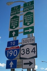
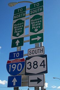
, with NY 384 continuing along the riverside as it provides the southernmost Niagara County exit for Interstate 190
Interstate 190 (New York)
Interstate 190 runs 28.34 miles from Interstate 90 near Buffalo, New York to Lewiston, New York via Niagara Falls. Parts of this highway were built on the former rights-of-way of the Lehigh Valley Railroad and the Erie Canal. It is referred to by locals as The One-Ninety...
Officially, this interchange is also where NY 324 ends.
NY 384 enters the city of Niagara Falls as Buffalo Avenue, intersecting NY 61
New York State Route 61
New York State Route 61 is a state highway located almost entirely in the city of Niagara Falls in Niagara County, New York in the United States. The road runs across the city in a northwest–southeast direction, terminating at NY 384 at its southern extent and NY 104 at its northern...
at the eastern edge of downtown. Farther west, the route splits from Buffalo Avenue and continues onto Rainbow Boulevard, passing the site of the old Nabisco
Nabisco
Nabisco is an American brand of cookies and snacks. Headquartered in East Hanover, New Jersey, the company is a subsidiary of Illinois-based Kraft Foods. Nabisco's plant in Chicago, a production facility at 7300 S...
-owned Shredded Wheat
Shredded Wheat
Shredded wheat is a breakfast cereal made from whole wheat. As of January 2010, it was available in three sizes: bite sized , miniature , and full size, which may be broken into small pieces before milk is added .Both sizes are available in a...
plant ahead of an intersection with the southern segment of the Robert Moses State Parkway
Robert Moses State Parkway
The Robert Moses State Parkway is an long north–south highway in western Niagara County, New York, United States. Its southern terminus is at the LaSalle Expressway on the east bank of the Niagara River in Niagara Falls. The northern terminus is at NY 18 at Four Mile Creek State Park in...
. At the intersection, NY 384 turns north onto John B. Daly Boulevard, following the street to its terminus at Niagara Street. NY 384 turns west onto Niagara to access downtown Niagara Falls. There, it intersects the western terminus of NY 104
New York State Route 104
New York State Route 104 is a long east–west state highway in Upstate New York, United States. It spans six counties and enters the vicinity of four cities—Niagara Falls, Lockport, Rochester, and Oswego—as it follows a routing largely parallel to that of the southern shoreline of Lake...
at First Street and the Rainbow Bridge
Rainbow Bridge (Niagara Falls)
The Rainbow Bridge at Niagara Falls is an international steel arch bridge across the Niagara River gorge, and is a world-famous tourist site. It connects the cities of Niagara Falls, New York, United States , and Niagara Falls, Ontario, Canada .-Construction:The Rainbow Bridge was built near the...
at Rainbow Boulevard. Instead of continuing to the bridge, NY 384 terminates at the intersection.
History
In 1908, the New York State Legislature created Route 30, an unsigned legislative routeLegislative route
In United States, a legislative route or legislative highway is a highway defined by laws passed in a state legislature. The numbering of such highways may or may not correspond to the numbers familiar to the public as part of the state, U.S. highway, and Interstate highway systems...
extending across New York
New York
New York is a state in the Northeastern region of the United States. It is the nation's third most populous state. New York is bordered by New Jersey and Pennsylvania to the south, and by Connecticut, Massachusetts and Vermont to the east...
from Niagara Falls
Niagara Falls, New York
Niagara Falls is a city in Niagara County, New York, United States. As of the 2010 census, the city had a total population of 50,193, down from the 55,593 recorded in the 2000 census. It is across the Niagara River from Niagara Falls, Ontario , both named after the famed Niagara Falls which they...
northeast to Rouses Point
Rouses Point, New York
Rouses Point is a village in Clinton County, New York, United States, along the 45th parallel. The population was 2,209 at the 2010 census. The village is named after Jacques Rouse, an early settler....
. By 1914, the definition of Route 30 was modified to include the portion of River Road and Main Street between the Niagara Falls city line and Island Street in North Tonawanda
North Tonawanda, New York
North Tonawanda is a city in Niagara County, New York, United States. The population was 31,568 at the 2000 census. It is part of the Buffalo–Niagara Falls Metropolitan Statistical Area. The city is named after Tonawanda Creek, its south border...
. This addition to Route 30 was removed on March 1, 1921. When the first set of posted routes in New York were assigned in 1924, none of the former North Tonawanda extension of Route 30 was assigned a designation.
NY 384 was assigned as part of the 1930 renumbering of state highways in New York to the primary riverside roadway between the cities of Buffalo
Buffalo, New York
Buffalo is the second most populous city in the state of New York, after New York City. Located in Western New York on the eastern shores of Lake Erie and at the head of the Niagara River across from Fort Erie, Ontario, Buffalo is the seat of Erie County and the principal city of the...
and Niagara Falls. It began at Niagara Square
Niagara Square
Niagara Square is a public square located at the intersections of Delaware Avenue, Court Street, Genesee Street, and Niagara Street in Buffalo, New York. It is the central hub of Joseph Ellicott's original radial street pattern that he designed in 1804 for the then village of New Amsterdam...
in downtown Buffalo and followed Niagara Street north to the city of Tonawanda
Tonawanda (city), New York
Tonawanda is a city in Erie County, New York, United States. The population was 16,136 at the 2000 census. It is located at the northern edge of Erie County, south across the Erie Canal from North Tonawanda, and north of Buffalo, New York...
. From there, NY 384 followed Main Street into North Tonawanda, joining the former routing of Route 30 at Island Street. While Route 30 ended at the Niagara Falls city line, NY 384 continued west along Buffalo Avenue into downtown. Ca. 1935, the portion of Delaware Avenue and Grove Street from NY 324
New York State Route 324
New York State Route 324 is an east–west state highway located in the western portion of New York in the United States...
in Kenmore
Kenmore, New York
Village of Kenmore is a village in Erie County, New York, in the United States. The population was 16,426 at the 2000 census. It is part of the Buffalo-Niagara Falls metropolitan area....
to NY 384 in Tonawanda was designated as NY 266
New York State Route 266
New York State Route 266 is a state highway in Erie County, New York, in the United States. It runs along the Niagara River from the city of Buffalo to the city of North Tonawanda. The southern terminus of the route is at the ramps leading to Interstate 190 exit 8 in Buffalo...
.
The alignments of NY 266 and NY 384 south of North Tonawanda were flipped ca. 1936. However, unlike NY 266, NY 384 continued south on Delaware Avenue into downtown Buffalo, where it ended at Niagara Square as it had before. NY 384 was rerouted slightly by 1948 to follow Delaware Avenue through Tonawanda and across the Erie Canal
Erie Canal
The Erie Canal is a waterway in New York that runs about from Albany, New York, on the Hudson River to Buffalo, New York, at Lake Erie, completing a navigable water route from the Atlantic Ocean to the Great Lakes. The canal contains 36 locks and encompasses a total elevation differential of...
to the modern junction of Main and Webster Streets, where it rejoined its previous alignment. The route was extended south through Niagara Square to its current terminus at NY 5
New York State Route 5
New York State Route 5 is a state highway that extends for across the state of New York in the United States. It begins at the Pennsylvania state line in the Chautauqua County town of Ripley and passes through Buffalo, Syracuse, Utica, Schenectady, and several other smaller cities and...
by 1970.
Niagara Falls
In Niagara Falls, NY 384 originally broke from Buffalo Avenue at 10th Street to follow Erie Avenue and Falls, Main, and Niagara Streets to the Niagara RiverNiagara River
The Niagara River flows north from Lake Erie to Lake Ontario. It forms part of the border between the Province of Ontario in Canada and New York State in the United States. There are differing theories as to the origin of the name of the river...
, where it connected to the Honeymoon Bridge (replaced by the Rainbow Bridge
Rainbow Bridge (Niagara Falls)
The Rainbow Bridge at Niagara Falls is an international steel arch bridge across the Niagara River gorge, and is a world-famous tourist site. It connects the cities of Niagara Falls, New York, United States , and Niagara Falls, Ontario, Canada .-Construction:The Rainbow Bridge was built near the...
in 1941) leading to Niagara Falls, Ontario
Niagara Falls, Ontario
Niagara Falls is a Canadian city on the Niagara River in the Golden Horseshoe region of Southern Ontario. The municipality was incorporated on June 12, 1903...
. NY 384 was truncated by 1938 to the junction of Main and Niagara Streets following the assignment of U.S. Route 104, which followed Niagara Street to the bridge instead. In the 1970s, construction of the Niagara Falls Convention Center—which was built at the junction of Falls Street and Erie Avenue—severed NY 384's routing through the city. As a result, NY 384 was rerouted west of Quay Street (an arterial street connecting to the Robert Moses State Parkway
Robert Moses State Parkway
The Robert Moses State Parkway is an long north–south highway in western Niagara County, New York, United States. Its southern terminus is at the LaSalle Expressway on the east bank of the Niagara River in Niagara Falls. The northern terminus is at NY 18 at Four Mile Creek State Park in...
) to follow Rainbow Boulevard through the southwestern portion of the city to NY 104
New York State Route 104
New York State Route 104 is a long east–west state highway in Upstate New York, United States. It spans six counties and enters the vicinity of four cities—Niagara Falls, Lockport, Rochester, and Oswego—as it follows a routing largely parallel to that of the southern shoreline of Lake...
(Main Street).
Rainbow Boulevard was made up of what had been Union Avenue and First Street as well as a new north–south street constructed in the vicinity of Main Street. The new roadway and First Street served as a one-way couplet for NY 384: the new street became Rainbow Boulevard South and carried NY 384 southbound while First Street was renamed Rainbow Boulevard North and carried NY 384 northbound. Union Avenue, meanwhile, became a four-lane, two-way divided highway
Divided Highway
Divided Highway is a compilation album by American rock band The Doobie Brothers, released in 2003. . All tracks are taken from the albums Cycles and Brotherhood .-Track listing:...
. At Quay Street (John B. Daly Boulevard), the Rainbow Boulevard name continued southeast over former Erie Avenue to Buffalo Avenue.
In December 2005, construction began on a project to convert the Rainbow Boulevard one-way couplet into dual-direction streets. As part of the project, the location where the dual-direction Rainbow Boulevard split into the parallel streets was turned into a roundabout
Roundabout
A roundabout is the name for a road junction in which traffic moves in one direction around a central island. The word dates from the early 20th century. Roundabouts are common in many countries around the world...
while the name of Rainbow Boulevard North reverted back to First Street. Rainbow Boulevard South, meanwhile, became Rainbow Boulevard. Work was completed on the conversion of both streets by August 2007, at which time NY 384 was rerouted onto John P. Daly Boulevard and Niagara Street through downtown to a new terminus at the Rainbow Bridge. John P. Daly Boulevard was originally designated as NY 952B while the portion of Niagara Street west of 5th Street was originally part of NY 951A; both unsigned reference route designations are unchanged as of 2009 despite the fact that both now overlap the signed NY 384 designation for part of their routing.