

New York State Route 32
Encyclopedia
New York State Route 32 (NY 32) is a north–south state highway
that extends for 176.73 miles (284.42 km) through the Hudson Valley
and Capital District
regions of the U.S. state
of New York
. It is a two-lane surface road for nearly its entire length, with few divided
and no limited-access
sections. From Harriman to Albany
, it is closely parallel to Interstate 87 (I-87) and U.S. Route 9W (US 9W), overlapping
with the latter in several places.
NY 32 begins at NY 17
on the outskirts of the New York metropolitan area
in Woodbury
just outside Harriman
, and ends at NY 196
east of Hudson Falls
just south of the Adirondacks
. In between, the road passes through the cities of Newburgh
, Kingston
, Albany
and Glens Falls
. Outside of the cities, it offers views of the Hudson Highlands
, Shawangunk Ridge
, Catskill Mountains
, and, during an overlap with US 4
north of Albany, the Hudson River
.
The roads now making up the highway were originally part of several privately maintained turnpikes
, which fostered settlements along the corridor. Once part of the former NY 58, it has been NY 32 since 1930. Only one of three letter-suffixed spur route
s remains.
(NYSDOT) and the highway departments of several different jurisdictions. Within the cities of Newburgh
and Watervliet
, the route is entirely city-maintained. In four other cities—Albany
, Cohoes
, Glens Falls
, and Kingston
—NY 32 is mostly locally maintained. The piece of the route in the city of Mechanicville
, meanwhile, is city-maintained north of Frances Street, a local street four blocks south of NY 67
. One last locally maintained section exists in the Albany suburb of Bethlehem
, where the route is county-maintained between Feura Bush Road and the Delmar Bypass. This section is co-signed
as County Route 52 (CR 52), which continues northwest of NY 32 to a junction with NY 140
near Slingerlands
.
leaves the Quickway overpass west of the New York State Thruway
toll barrier, just north of the Harriman village line in Woodbury. To the east is Woodbury Common Premium Outlets
, across from Central Valley Elementary School of the Monroe-Woodbury Central School District
. Beyond the mall, site of many major traffic jams, NY 32 descends into downtown Central Valley
. 2 miles (3 km) north is another of the Town of Woodbury
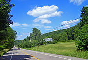
's hamlets, Highland Mills
. Beyond the Rushmore Memorial Library
at the north end of the hamlet the road bends slightly west upon reaching the southwestern foot of Orange County
's highest peak, Schunemunk Mountain
.
 Shortly after Highland Mills, the Port Jervis Line
, operated by Metro-North Railroad
, crosses over on a high trestle
. After crossing over Woodbury Creek and under the Thruway, NY 32 runs along the eastern side of the narrow valley between Schunemunk and the Hudson Highlands
. This section of highway runs through mostly wooded terrain as it leaves Woodbury for Cornwall
.
Just north of Mountainville
and the north end of Schunemunk, the road crosses Moodna Creek
downstream from the Woodbury Creek confluence
. The intersection with Angola Road 0.25 mile (0.402335 km) to the south was once the beginning of the former NY 307; it is now the west end of County Route 107 (CR 107). Across the creek from CR 107 is Orrs Mills Road, another county road that leads to Storm King Art Center
.
 The road climbs gently out of the creek valley and enters development. At 1.6 miles (2.6 km) north of Angola Road, it crosses the New Windsor
town line and reaches the complicated five-way intersection at the center of Vails Gate
, intersecting NY 94
and the beginning of NY 300
. The next 2 miles (3.2 km) include a middle turn lane as NY 32 becomes New Windsor's main commercial strip. This section ends at Temple Hill Avenue, with Snake Hill to the west. The road remains heavily commercial as it enters the city of Newburgh
as the wide Lake Street.
 At Broadway (NY 17K
), Newburgh's main street, NY 32 turns east. The brief, unsigned concurrency ends where 17K terminates at US 9W
(Robinson Avenue), at the former Broadway School. NY 32, however, turns north again, beginning the first of several concurrencies with US 9W.
The two highways remain joined for the next 1.2 miles (1.9 km) as they pass the Frederick Law Olmsted
and Calvert Vaux
-designed Downing Park
and reach the city limit, where I-84
and NY 52
cross the highway heading towards the Newburgh-Beacon Bridge
. Immediately beyond that junction, NY 32 separates from US 9W and heads northwest.
anchor. This development ends after 1 miles (1.6 km) when 32 passes the Town of Newburgh
's Cronomer Hill Park on the south, near a short drive to the summit observation tower
. 2 miles (3 km) more brings Route 32 to the center of the hamlet of Cronomer Valley and an unusual junction with NY 300
. At what seems to be a conventional four-way intersection regulated by a traffic light, both highways turn, and it is necessary to turn to the northeast to stay on NY 32 headed north. Traffic that goes straight at this intersection flows onto Route 300.
 From this intersection, NY 32 passes Chadwick Lake
, the town's reservoir, and continues straight north through much less-developed, mostly wooded countryside for 4 miles (6 km) to the Ulster County
line, almost the point at which the woods diminish. Barely 1 miles (1.6 km) into Plattekill
, the highway crosses the Thruway again. It curves northwards shortly thereafter, retaining a slightly westward trend through mostly open fields near the Shawangunk Ridge
. At 4.5 miles (7.2 km) from the Thruway, NY 32 intersects US 44
and NY 55
in the center of another Town of Plattekill
hamlet, Modena
. A short distance beyond, the highway crosses into Gardiner, taking a wide bend around Locust Lawn
, the Federal-style
home of early 19th-century politician Josiah Hasbrouck
.
North of Modena, the surrounding area becomes slightly more wooded near where NY 32 crosses into the Town of New Paltz. The highway curves before entering the village
next to the campus of State University of New York at New Paltz
. Two blocks north of campus, at New Paltz Middle School, it turns west at a traffic signal to join NY 299
as the village's Main Street.
, a sign at the Elting Memorial Library
, just before the center of downtown, directs northbound traffic on the highway down North Front Street. This shortcut allows that traffic to skip an often busy intersection and head out of the village on North Chestnut Street. Once past the village, the Ulster Board of Cooperative Educational Services (BOCES) building comes up on the west and the town hall along the east. NY 32 then becomes mostly rural again.
 Over the next 5 miles (8 km), the road trends easterly until NY 213
joins it from the east right before the bridge over the Wallkill. Now concurrent, 32 and 213 bend away from the Thruway and pass through the hamlet of Tillson
and then descend to cross Rondout Creek
at the former village of Rosendale
. Just after the crossing, at the Stewart's
, NY 213 leaves to the west along the creek, ending a 2.5 miles (4 km) concurrency.
 From Rosendale, NY 32 climbs up out of the Rondout valley and veers east into the hamlet of Maple Hill, where it crosses over the Thruway once again. It resumes a northerly course through Bloomington, and several miles further on crosses the Kingston
city line. This entire segment of NY 32 is also concurrent with New York State Bicycle Route 32.
Another 0.5 mile (0.80467 km) brings Broadway to the wide junction where I-587 and NY 28
both terminate. NY 32 follows Albany Avenue northeast to Flatbush Avenue, where it turns to assume an eastward course. This finally bends slightly north to East Chester Street near the city limit, where US 9W again comes in to begin a brief wrong-way concurrency in which NY 32 north is US 9W south. It ends, unsigned, after 1500 feet (457.2 m) with US 9W's turn onto Frank Koenig Boulevard.
Continuing as Flatbush Road into the Town of Ulster
, NY 32 is for the first time along its route east of US 9W and closer to the river. It encounters NY 199
at an interchange immediately west of the Kingston-Rhinecliff Bridge
. Soon after, it passes Kingston-Ulster Airport. It remains on a northerly heading until 1 miles (1.6 km) south of Saugerties
, where it veers west and merges with US 9W again. The two routes cross Esopus Creek
and enter the village, where Partition Street gives way to Main Street. At that T intersection, US 9W turns to continue north, while NY 32 picks up the new NY 212
and heads west out of town.
provides access to the southbound Thruway. NY 32 does not enter the Catskills
but provides access to them along this stretch.
 At this point, the distance between NY 32 and the Thruway begins to widen. At the junction with Malden Turnpike (CR 34), Route 32 turns westward, toward the Catskill Escarpment
, and starts climbing through some rock cuts. When Blue Mountain Road (CR 35) comes in from the south, NY 32 resumes heading north, parallel to the ridge. 1 miles (1.6 km) from that junction, its only suffixed route, NY 32A
, splits off to the west to provide direct access via NY 23A
and Kaaterskill Clove to Tannersville
and Hunter
.
After crossing into Greene County
, the road intersects NY 23A at an undeveloped junction. NY 32 remains in its straight course through the lowlands below the escarpment, passing through mostly woodlands and the hamlet of Kiskatom, then winding around the north side of Cairo Roundtop before it joins with NY 23
at Cairo
. After 1.5 miles (2.4 km), NY 32 leaves the divided highway to once again strike north as a two-lane route. It trends west to its westernmost point until turning to the north-northeast just south of Freehold
.
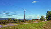
North of Freehold the road begins to climb. Views south to the Catskills appear as it nears the center of Greenville
, where it crosses NY 81
. 1 miles (1.6 km) further on, NY 32 enters Albany County
via Westerlo
near the Basic Creek Reservoir. The climbing stops another mile after the county line, where Route 32 reaches its highest elevation, 1060 feet (323.1 m), on the plateaus south of the Helderberg Escarpment. The road starts to curve back east as the surrounding landscape opens up, with larger fields surrounding it and a slow descent to the Hudson beginning.
 After sharing 2 miles (3.2 km) of road with NY 143
, crossing the northern end of Alcove Reservoir
and descending the southern end of the Helderberg Escarpment, the road veers eastward toward Albany
. To get there, it crosses into New Scotland just after the hamlet of Feura Bush
and crosses a long bridge over the northern end of the busy rail yard
northwest of Selkirk
, where freight trains bound for New York City wait before crossing the Hudson at the Alfred H. Smith Memorial Bridge
.
 The landscape becomes more developed, though still rural, as the highway winds past a SABIC
plant and other development accompanying the rail yard, entering the town of Bethlehem
. At the southern corner of Delmar
, NY 32 turns more to the east becomes a divided highway with grade intersections, the only non-concurrent segment of Route 32 to take this form. This segment continues, largely undeveloped, as it intersects NY 335
and crosses under the Thruway for the last time before reaching its final concurrency with US 9W. 0.5 mile (0.80467 km) east of the Thruway, Route 32 again breaks from 9W and follows residential Corning Hill Road downhill to River Road, where it turns to the north again and crosses the Normans Kill
into Albany, becoming South Pearl Street, and then paralleling I-787
for a short distance past the Port of Albany-Rensselaer
before crossing underneath it.
and Pastures
neighborhoods, intersecting US 20
(Madison Avenue) near the approach to the Dunn Memorial Bridge
, and then becoming one of the two main streets of downtown Albany
. At Clinton Square and the Palace Theatre
it intersects US 9 along Clinton Avenue
. Near the city limits, NY 32 passes under I-90. Upon crossing into the neighboring village of Menands
, NY 32 bears onto Wolfert Avenue to access Broadway. Broadway, a business thoroughfare originating in downtown Albany, is designated NY 910C, an unsigned reference route, for 0.06 mile (0.0965604 km) south of Wolfert Avenue to the Albany city line. NY 32 occupies Broadway north of Wolfert Avenue, paralleling I-787. I-787's exit 6 ramps meet NY 32 in Menands, then NY 32 crosses over railroad tracks and soon leaves the village. NY 32 enters the hamlet of Schuyler Heights in the town of Colonie. After a short streatch the road enters the city of Watervliet
where the name changes from Broadway to Third Avenue. The Watervliet Arsenal
forces NY 32 to curve northeasterly as Ninth Street. Then at a traffic signal NY 32 turns left onto Broadway.
 At 13th Street, NY 32 leaves Broadway and follows 13th two blocks west to an intersection with 2nd Avenue. Here, NY 155
begins and occupies 13th to the west of 2nd while NY 32 turns north onto 2nd. NY 32 continues in the vicinity of I-787 and its continuation, NY 787
, through Watervliet and back into the town of Colonie, this time its hamlet of Maplewood, to Cohoes
, where NY 787 ends at NY 32 near the convergence of the Mohawk
and Hudson rivers. Past NY 787, NY 32 crosses the Mohawk River into Saratoga County and the town of Waterford
, after crossing into the village of Waterford
NY 32 crosses the Erie Canal
before intersecting US 4 in the heart of the village. The two routes merge, forming an overlap northward along the Hudson River.
In Mechanicville
, US 4 and NY 32 briefly overlap NY 67
. Farther north, the two routes split north of Stillwater
at the southern edge of the Saratoga National Historical Park
. While US 4 straddles the park to the east, NY 32 follows the southern and western extents of the park before rejoining US 4 south of Schuylerville
. In Schuylerville, the two routes are concurrent with NY 29
for a short distance before exiting the village. To the north of the village in Northumberland
, NY 32 separates from US 4 and heads northwest to Gansevoort
, where it meets NY 50
. NY 32 continues north on the right-of-way of NY 50 to South Glens Falls
, where US 9 joins NY 32 northward across the Hudson River into Glens Falls
.
Shortly after entering the city, NY 32 turns onto Warren Street, splitting from US 9 and following the Hudson River east toward Hudson Falls
. At Highland Avenue, NY 32 turns east, following Highland past Quaker Road (NY 254
) to Dix Avenue, where it merges east onto Dix. NY 32 remains on Dix into Hudson Falls, intersecting US 4 one last time north of the village before continuing through the intersection onto Burgoyne Avenue. The route follows Burgoyne Avenue southward around the northeastern portion of Hudson Falls to NY 196
, where NY 32 terminates. Burgoyne Avenue continues southwestward as CR 37 to US 4 in Fort Edward.
. A stretch from Catskill
to Cairo
was also once part of the Susquehannah Turnpike
. Created in April 1800, the Susquehannah Turnpike began in Catskill and ended in Unadilla
. The Susquehannah Turnpike aided the growth of Greene County
, which until then had depended on steamboats on the Susquehanna River and Catskill Creek. The turnpike attracted business from the New England
states, made shipping easier for the county's farmers, and improved shipping from New York City
.
The turnpike was no longer maintained by a private company after 1899 and the highway remained intact for over 75 years. In 1974, part of the turnpike was added to the National Register of Historic Places
. Route 32 was also part of the Orange Turnpike, which stretched from the New Jersey line to Newburgh. The turnpike, created three days after the Susquehannah Turnpike, follows the current routes of NY 17
and NY 32. North of Newburgh, the road follows another old turnpike to the Route 300 junction and then the old Plattekill Turnpike into Ulster County.
and Mechanicville
was designated as part of NY 6 in 1924. From Mechanicville to Hudson Falls
, the current routing of NY 32 became part of NY 30. By 1926, the portion of what is now NY 32 from Harriman
to Newburgh was designated NY 58. From Newburgh to Albany, NY 32 remained unnumbered at the time. When U.S. Routes were first assigned in New York
in 1927, the portion of NY 6 from Albany to Waterford was designated as the northernmost portion of US 9W
. In Waterford, US 9W merged with US 9E and continued north as US 9 to Mechanicville, where US 9 turned west onto modern NY 67
.
In the 1930 renumbering of state highways in New York, US 9W was truncated to Albany while US 9 was rerouted to follow a new stretch between Albany and Round Lake
. The former routing of both routes along the Hudson River
between Albany and Mechanicville, as well as the entirety of NY 58 and the portion of NY 30 from Schuylerville to Hudson Falls was integrated into the new NY 32, which followed its current routing between Harriman and the Stillwater
community of Bemis Heights and from Schuylerville
to Hudson Falls. Between Bemis Heights and Schuylerville, NY 32 followed what is now US 4 along the Hudson River while the former routing of NY 30 between the two locations became NY 32A. At the same time, US 4, which previously ended in Glens Falls, was rerouted south of Hudson Falls to end in East Greenbush. From Northumberland
to Waterford, the route used what is now NY 32.
 NY 32 has been realigned in several locations since its inception in 1930. When the route was initially assigned, it passed through Palenville
instead of bypassing it to the east as it does today. In the early 1940s, NY 32 was rerouted to follow a new highway east of the hamlet. NY 32's former routing into Palenville was redesignated as NY 32A
. The original NY 32A in Saratoga County
—which was redundant to US 4—was supplanted at this time by a rerouted NY 32. The Bemis Heights – Schuylerville portion of the overlap between US 4 and NY 32 was eliminated in the 1950s when the original routing of NY 32 between the two locations was upgraded. Construction on the highway began in the mid-1950s and was completed by 1958, at which time US 4 was rerouted to follow the riverside roadway.
In Bethlehem
, a southern suburb of Albany, NY 32 was originally routed on Feura Bush Road between the hamlets of Feura Bush and Glenmont. North of Glenmont, NY 32 followed what is now NY 144
. In the mid-1960s, a four-lane arterial was constructed north of Feura Bush Road between Elm Avenue and US 9W
. The highway, known as the Delmar Bypass, became part of a rerouted NY 32 by 1970. NY 32's former routing along Feura Bush Road is still state-maintained as NY 910A, an unsigned reference route.
Within Queensbury and Hudson Falls, NY 32 was originally routed on Boulevard Street and Feeder Avenue. On April 1, 1980, ownership and maintenance of Boulevard Street between Highland Avenue and the Washington County
line was transferred from New York State to Warren County
in exchange for control over Highland and Dix Avenues between Warren Avenue and the Washington County line. The portion of Boulevard Street in Hudson Falls, as well as the segment of Feeder Street south of Boulevard, was given to Washington County on April 1 of the following year in return for ownership and maintenance over all of Dix and Burgoyne Avenues north of NY 196
. NY 32 was rerouted to follow Highland, Dix, and Burgoyne Avenues shortly afterward.
in Rosendale. The 1/2 mi project involved rehabilitating the bridge one half at a time. The project was slated to have the 74-year-old bridge up to standards by the fall of 2009. It also included improvements to the road leading up to the bridge. Having only one lane open at a time congested traffic in the area. The total cost of the project was $5.5 million. The bridge had been refurbished before, in 1970.
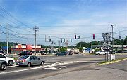
is the most frequent topic of discussion, especially since Black Friday
in 2001, when heavy traffic from holiday shoppers along adjacent sections of not only 32 but routes 6 and 17 and the Thruway came to a complete standstill. "This should have been planned for and it wasn't", complained one local official. "Now you're trying to close the door and the horse is already out". Despite several efforts and the presence of state police
on later Black Fridays, a similar traffic jam occurred on Labor Day
weekend 2006, when a break in bad weather led to an increase in shoppers so marked that US 6 and the Thruway were backed up as far as Newburgh and the Palisades Interstate Parkway
, respectively. The Woodbury police chief cited the blockage created by drivers making the left turn from Route 32 to the Thruway as the cause. Plans to build an exit ramp that would allow that traffic to go directly to the tollbooth have been expedited.
On the weekend of August 17–18, 2009, another serious traffic jam occurred, in which it took some drivers two hours to get to the Thruway from the mall. Officials cited several factors: the heavy traffic on Route 17 that weekend for both the 40th anniversary of the Woodstock Music Festival in Sullivan County
and the observances of the anniversary of Rabbi Joel Teitelbaum
's death in Kiryas Joel
, a few miles to the west. A traffic light that had been malfunctioning after a recent lightning strike
may also have contributed.
 In 2007, New York State Department of Transportation
(NYSDOT) officials announced their long-term plan to prevent further traffic jams. They will create a series of loops and overpasses allowing traffic to go directly from southbound Route 32 to the Thruway and remove some traffic lights in front of the mall. The changes are expected to be complete by 2011, as part of improvements to convert the Route 17 expressway into I-86
.
was a four-way junction until World War II
, when the Army
extended Temple Hill Road, later NY 300
, southeast to the junction so that troops and materiel could get between West Point
and the airbase at what was then Stewart Field
more quickly. It did not become a traffic problem until the 1990s, when gas stations, supermarket
s, strip mall
s and fast-food restaurants had been built on every corner.
By the end of the 20th century, the intersection was handling 30,000 drivers a day, from increasingly developed Cornwall, Newburgh and New Windsor. NYSDOT expanded the intersection with middle-turn lanes and overhead signs on all approaches. Many drivers still felt it was a confusing intersection and that the confusion slowed traffic down as much as the many cars' stopping to enter and exit nearby businesses. In 2001 state officials said they had done everything possible to improve traffic flows through the Five Corners. Continuing congestion was attributable to insufficient or nonexistent planning
.
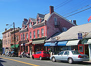
 Another choke point has been Main Street in New Paltz
, a section shared by NY 32 and NY 299
. This is the main route back to the Thruway and downstate from the heavily used hiking
and climbing
areas at Mohonk Preserve
and Minnewaska State Park Preserve
in the Shawangunks. It is also a well-developed commercial area in a college town, with ample street parking.
Traffic through the village has been so heavy on weekends during summer and peak leaf peeping
weekends in early autumn that many residents have proposed making Main Street one-way
, carrying traffic only to the west, while diverting eastbound traffic onto either of two parallel streets. Other villages that have made such changes found making streets one-way decreased business at their retailers.
After four years of studying and reviewing the issue, the town and the village agreed to make the change. In 2007, however, the village's new mayor, who had supported the plan while a trustee, changed his mind and said the village's support was "on hold". While campaigning, he said, few village residents had expressed support for the plan. What he learned since taking over as mayor had only further convinced him that it was mostly town residents who wanted the street changes. He also believed that making Main Street one-way would reduce the total amount of routes available to vehicles passing through the village and would adversely route traffic away from the businesses along Main.
State highway
State highway, state road or state route can refer to one of three related concepts, two of them related to a state or provincial government in a country that is divided into states or provinces :#A...
that extends for 176.73 miles (284.42 km) through the Hudson Valley
Hudson Valley
The Hudson Valley comprises the valley of the Hudson River and its adjacent communities in New York State, United States, from northern Westchester County northward to the cities of Albany and Troy.-History:...
and Capital District
Capital District
New York's Capital District, also known as the Capital Region, is a region in upstate New York that generally refers to the four counties surrounding Albany, the capital of the state: Albany County, Schenectady County, Rensselaer County, and Saratoga County...
regions of the U.S. state
U.S. state
A U.S. state is any one of the 50 federated states of the United States of America that share sovereignty with the federal government. Because of this shared sovereignty, an American is a citizen both of the federal entity and of his or her state of domicile. Four states use the official title of...
of New York
New York
New York is a state in the Northeastern region of the United States. It is the nation's third most populous state. New York is bordered by New Jersey and Pennsylvania to the south, and by Connecticut, Massachusetts and Vermont to the east...
. It is a two-lane surface road for nearly its entire length, with few divided
Dual carriageway
A dual carriageway is a class of highway with two carriageways for traffic travelling in opposite directions separated by a central reservation...
and no limited-access
Limited-access road
A limited-access road known by various terms worldwide, including limited-access highway, dual-carriageway and expressway, is a highway or arterial road for high-speed traffic which has many or most characteristics of a controlled-access highway , including limited or no access to adjacent...
sections. From Harriman to Albany
Albany, New York
Albany is the capital city of the U.S. state of New York, the seat of Albany County, and the central city of New York's Capital District. Roughly north of New York City, Albany sits on the west bank of the Hudson River, about south of its confluence with the Mohawk River...
, it is closely parallel to Interstate 87 (I-87) and U.S. Route 9W (US 9W), overlapping
Concurrency (road)
A concurrency, overlap, or coincidence in a road network is an instance of one physical road bearing two or more different highway, motorway, or other route numbers...
with the latter in several places.
NY 32 begins at NY 17
New York State Route 17
New York State Route 17 is a state highway that extends for through the Southern Tier and Downstate regions of New York in the United States...
on the outskirts of the New York metropolitan area
New York metropolitan area
The New York metropolitan area, also known as Greater New York, or the Tri-State area, is the region that composes of New York City and the surrounding region...
in Woodbury
Woodbury, Orange County, New York
Woodbury is a town and village in Orange County, New York, United States. The town population was 9,460 at the 2000 census. The village was incorporated in 2006 and comprises all of the town that is not part of the village of Harriman. The region was once called Woodbury Clove...
just outside Harriman
Harriman, New York
Harriman is a village in Orange County, New York, United States. The population was 2,252 at the 2000 census. It is part of the Poughkeepsie–Newburgh–Middletown, NY Metropolitan Statistical Area as well as the larger New York–Newark–Bridgeport, NY-NJ-CT-PA Combined...
, and ends at NY 196
New York State Route 196
New York State Route 196 is a state route in New York, running from the village of Hudson Falls east to the hamlet of South Hartford in Hartford, Washington County....
east of Hudson Falls
Hudson Falls, New York
Hudson Falls is a village located in Washington County, New York, USA. The village is in the southwest part of the town of Kingsbury, on US Route 4. Hudson Falls is part of the Glens Falls Metropolitan Statistical Area. As of the 2000 census, the village had a population of 6,927...
just south of the Adirondacks
Adirondack Mountains
The Adirondack Mountains are a mountain range located in the northeastern part of New York, that runs through Clinton, Essex, Franklin, Fulton, Hamilton, Herkimer, Lewis, Saint Lawrence, Saratoga, Warren, and Washington counties....
. In between, the road passes through the cities of Newburgh
Newburgh (city), New York
Newburgh is a city located in Orange County, New York, United States, north of New York City, and south of Albany, on the Hudson River. Newburgh is a principal city of the Poughkeepsie-Newburgh-Middletown metropolitan area, which includes all of Dutchess and Orange counties. The Newburgh area was...
, Kingston
Kingston, New York
Kingston is a city in and the county seat of Ulster County, New York, USA. It is north of New York City and south of Albany. It became New York's first capital in 1777, and was burned by the British Oct. 16, 1777, after the Battles of Saratoga...
, Albany
Albany, New York
Albany is the capital city of the U.S. state of New York, the seat of Albany County, and the central city of New York's Capital District. Roughly north of New York City, Albany sits on the west bank of the Hudson River, about south of its confluence with the Mohawk River...
and Glens Falls
Glens Falls, New York
Glens Falls is a city in Warren County, New York, United States. Glens Falls Metropolitan Statistical Area. The population was 14,700 at the 2010 census...
. Outside of the cities, it offers views of the Hudson Highlands
Hudson Highlands
The Hudson Highlands are mountains on both sides of the Hudson River in the U.S. state of New York, between Newburgh Bay and Haverstraw Bay, which form the northern region of the New York - New Jersey Highlands....
, Shawangunk Ridge
Shawangunk Ridge
The Shawangunk Ridge , also known as the Shawangunk Mountains or The Gunks, is a ridge of bedrock in Ulster County, Sullivan County and Orange County in the state of New York, extending from the northernmost point of New Jersey to the Catskill Mountains.The ridgetop, which widens considerably at...
, Catskill Mountains
Catskill Mountains
The Catskill Mountains, an area in New York State northwest of New York City and southwest of Albany, are a mature dissected plateau, an uplifted region that was subsequently eroded into sharp relief. They are an eastward continuation, and the highest representation, of the Allegheny Plateau...
, and, during an overlap with US 4
U.S. Route 4 in New York
U.S. Route 4 is a part of the U.S. Highway System that runs from East Greenbush, New York, to Portsmouth, New Hampshire. In the U.S. state of New York, US 4 extends from an intersection with US 9 and US 20 in East Greenbush to the Vermont state line northeast of Whitehall...
north of Albany, the Hudson River
Hudson River
The Hudson is a river that flows from north to south through eastern New York. The highest official source is at Lake Tear of the Clouds, on the slopes of Mount Marcy in the Adirondack Mountains. The river itself officially begins in Henderson Lake in Newcomb, New York...
.
The roads now making up the highway were originally part of several privately maintained turnpikes
Toll road
A toll road is a privately or publicly built road for which a driver pays a toll for use. Structures for which tolls are charged include toll bridges and toll tunnels. Non-toll roads are financed using other sources of revenue, most typically fuel tax or general tax funds...
, which fostered settlements along the corridor. Once part of the former NY 58, it has been NY 32 since 1930. Only one of three letter-suffixed spur route
Spur route
A spur route is a short road forming a branch from a longer, more important route . A bypass or beltway is never considered a true spur route as it typically reconnects with the major road...
s remains.
Route description
Maintenance of NY 32 is split between the New York State Department of TransportationNew York State Department of Transportation
The New York State Department of Transportation is responsible for the development and operation of highways, railroads, mass transit systems, ports, waterways and aviation facilities in the U.S...
(NYSDOT) and the highway departments of several different jurisdictions. Within the cities of Newburgh
Newburgh (city), New York
Newburgh is a city located in Orange County, New York, United States, north of New York City, and south of Albany, on the Hudson River. Newburgh is a principal city of the Poughkeepsie-Newburgh-Middletown metropolitan area, which includes all of Dutchess and Orange counties. The Newburgh area was...
and Watervliet
Watervliet, New York
Watervliet is a city in Albany County in the US state of New York. The population was 10,254 as of the 2010 census. Watervliet is north of Albany, the capital of the state, and is bordered on the north, west, and south by the town of Colonie. The city is also known as "the Arsenal City".- History...
, the route is entirely city-maintained. In four other cities—Albany
Albany, New York
Albany is the capital city of the U.S. state of New York, the seat of Albany County, and the central city of New York's Capital District. Roughly north of New York City, Albany sits on the west bank of the Hudson River, about south of its confluence with the Mohawk River...
, Cohoes
Cohoes, New York
Cohoes is an incorporated city located at the northeast corner of Albany County in the US state of New York. It is called the "Spindle City" because of the importance of textile production to its growth. As of the 2010 census, the city population was 16,168...
, Glens Falls
Glens Falls, New York
Glens Falls is a city in Warren County, New York, United States. Glens Falls Metropolitan Statistical Area. The population was 14,700 at the 2010 census...
, and Kingston
Kingston, New York
Kingston is a city in and the county seat of Ulster County, New York, USA. It is north of New York City and south of Albany. It became New York's first capital in 1777, and was burned by the British Oct. 16, 1777, after the Battles of Saratoga...
—NY 32 is mostly locally maintained. The piece of the route in the city of Mechanicville
Mechanicville, New York
Mechanicville is a city in Saratoga County, New York, United States. The population is 5,196 as of the 2010 census. It is the smallest city by area in the state. The name is derived from the occupations of early residents....
, meanwhile, is city-maintained north of Frances Street, a local street four blocks south of NY 67
New York State Route 67
New York State Route 67 is an east–west state highway in eastern New York in the United States. The western terminus of the route is at an intersection with NY 5 in the town of St. Johnsville...
. One last locally maintained section exists in the Albany suburb of Bethlehem
Bethlehem, New York
Bethlehem is a town in Albany County, New York, USA. The population was 33,656 at the 2010 census. The town is south of Albany. Bethlehem includes the following hamlets: Delmar, Elsmere, Slingerlands, Glenmont, Selkirk, South and North Bethlehem. U.S. Route 9W passes through the town...
, where the route is county-maintained between Feura Bush Road and the Delmar Bypass. This section is co-signed
Concurrency (road)
A concurrency, overlap, or coincidence in a road network is an instance of one physical road bearing two or more different highway, motorway, or other route numbers...
as County Route 52 (CR 52), which continues northwest of NY 32 to a junction with NY 140
New York State Route 140
New York State Route 140 is an east–west state highway located entirely within Albany County, New York, in the United States. The highway runs for from NY 85 near the hamlet of Slingerlands to NY 443 in the hamlet of Delmar...
near Slingerlands
Slingerlands, New York
Slingerlands is a hamlet in the town of Bethlehem, Albany County, New York. It is located immediately west of Delmar and near the New Scotland town-line and south of the Albany city-limits. It is a suburb of Albany...
.
Harriman to Newburgh
Route 32 begins where NY 17New York State Route 17
New York State Route 17 is a state highway that extends for through the Southern Tier and Downstate regions of New York in the United States...
leaves the Quickway overpass west of the New York State Thruway
New York State Thruway
The New York State Thruway is a system of limited-access highways located within the state of New York in the United States. The system, known officially as the Governor Thomas E. Dewey Thruway for former New York Governor Thomas E. Dewey, is operated by the New York State Thruway Authority and...
toll barrier, just north of the Harriman village line in Woodbury. To the east is Woodbury Common Premium Outlets
Woodbury Common Premium Outlets
Woodbury Common Premium Outlets is an outlet center located in Central Valley, New York. The center is part of the Chelsea Premium Outlets group and takes its name from the town in which it is located...
, across from Central Valley Elementary School of the Monroe-Woodbury Central School District
Monroe-Woodbury Central School District
The Monroe-Woodbury Central School District is a school district in Orange County, New York. Most students in the school district live in the towns of Monroe or Woodbury, hence the name. However, there are some students in the district that live in either Chester, Blooming Grove, or Tuxedo. The...
. Beyond the mall, site of many major traffic jams, NY 32 descends into downtown Central Valley
Central Valley, New York
Central Valley is a hamlet in Orange County, New York, United States. The population was 1,857 at the 2000 census, at which time it was a census-designated place...
. 2 miles (3 km) north is another of the Town of Woodbury
Woodbury, Orange County, New York
Woodbury is a town and village in Orange County, New York, United States. The town population was 9,460 at the 2000 census. The village was incorporated in 2006 and comprises all of the town that is not part of the village of Harriman. The region was once called Woodbury Clove...
's hamlets, Highland Mills
Highland Mills, New York
Highland Mills is a hamlet in Orange County, New York, United States. The population was 3,468 at the 2000 census, at which time it was a census-designated place...
. Beyond the Rushmore Memorial Library
Rushmore Memorial Library
The Rushmore Memorial Library, also known as the Rushmore Memorial Building, is located at the junction of NY 32 and Weygant Hill Road in Highland Mills, New York, United States. It is a small Arts and Crafts-style stone building constructed in the 1920s with a donation from Charles E...
at the north end of the hamlet the road bends slightly west upon reaching the southwestern foot of Orange County
Orange County, New York
Orange County is a county located in the U.S. state of New York. It is part of the Poughkeepsie–Newburgh–Middletown, NY Metropolitan Statistical Area and is located at the northern reaches of the New York metropolitan area. The county sits in the state's scenic Mid-Hudson Region of the Hudson Valley...
's highest peak, Schunemunk Mountain
Schunemunk Mountain
Schunemunk Mountain is the highest mountain in Orange County, New York. The 1,664-foot summit is located in the town of Blooming Grove, with other portions in Cornwall and Woodbury. The community of Mountain Lodge Park is built up its western slope.The mountain is a popular recreational resource...
.
Port Jervis Line (Metro-North)
The Metro-North Railroad Port Jervis Line is a predominantly single-track commuter rail line running from Suffern, New York to Port Jervis. At Suffern, the line continues south into New Jersey as NJ Transit's Main Line....
, operated by Metro-North Railroad
Metro-North Railroad
The Metro-North Commuter Railroad , trading as MTA Metro-North Railroad, or, more commonly, Metro-North, is a suburban commuter rail service that is run and managed by the Metropolitan Transportation Authority , an authority of New York State. It is the busiest commuter railroad in the United...
, crosses over on a high trestle
Trestle
A trestle is a rigid frame used as a support, especially referring to a bridge composed of a number of short spans supported by such frames. In the context of trestle bridges, each supporting frame is generally referred to as a bent...
. After crossing over Woodbury Creek and under the Thruway, NY 32 runs along the eastern side of the narrow valley between Schunemunk and the Hudson Highlands
Hudson Highlands
The Hudson Highlands are mountains on both sides of the Hudson River in the U.S. state of New York, between Newburgh Bay and Haverstraw Bay, which form the northern region of the New York - New Jersey Highlands....
. This section of highway runs through mostly wooded terrain as it leaves Woodbury for Cornwall
Cornwall, New York
Cornwall is a town in Orange County, New York, USA. It is located about 50 miles north of New York City on the western shore of the Hudson River. The estimated population in 2007 was 12,827....
.
Just north of Mountainville
Mountainville, New York
Mountainville is a hamlet in the western section of the town of Cornwall, in Orange County, New York, USA. It is mostly wooded, lightly populated area, located in the narrow valley of Woodbury and Moodna creeks between Schunemunk Mountain and the Hudson Highlands. The New York State Thruway and NY...
and the north end of Schunemunk, the road crosses Moodna Creek
Moodna Creek
Moodna Creek is a small tributary of the Hudson River that drains eastern Orange County, New York. At 15.5 miles in length from its source at the confluence of Cromline Creek and Otter Kill west of Washingtonville, it is the longest stream located entirely within the county.Despite its small...
downstream from the Woodbury Creek confluence
Confluence
Confluence, in geography, describes the meeting of two or more bodies of water.Confluence may also refer to:* Confluence , a property of term rewriting systems...
. The intersection with Angola Road 0.25 mile (0.402335 km) to the south was once the beginning of the former NY 307; it is now the west end of County Route 107 (CR 107). Across the creek from CR 107 is Orrs Mills Road, another county road that leads to Storm King Art Center
Storm King Art Center
The Storm King Art Center in Mountainville, New York is an open air museum which has extended the concept of a "sculpture garden" to become a "sculpture landscape." Founded in 1960 by Ralph E. Ogden as a museum for Hudson Valley painters, it soon expanded into a major sculpture venue with the...
.
New Windsor, New York
New Windsor is a town in Orange County, New York, United States. The population was estimated at 25,244 in 2010 by the US Census.The Town of New Windsor is in the eastern part of the county, bordering the Town of Newburgh and the City of Newburgh....
town line and reaches the complicated five-way intersection at the center of Vails Gate
Vails Gate, New York
Vails Gate is a hamlet in Orange County, New York, United States. The population was 3,319 at the 2000 census. It is part of the Poughkeepsie–Newburgh–Middletown, NY Metropolitan Statistical Area as well as the larger New York–Newark–Bridgeport, NY-NJ-CT-PA Combined...
, intersecting NY 94
New York State Route 94
New York State Route 94 is a state highway entirely within Orange County in southern New York. The western terminus is at the New York-New Jersey state line, where it continues as NJ 94 for another to Columbia, New Jersey. Its eastern terminus is located at U.S. Route 9W in New Windsor....
and the beginning of NY 300
New York State Route 300
New York State Route 300 is a state highway located west of the city of Newburgh in the Hudson Valley of New York in the United States. The southern terminus of the route is at a five-way intersection with NY 32 and NY 94 in the hamlet of Vails Gate...
. The next 2 miles (3.2 km) include a middle turn lane as NY 32 becomes New Windsor's main commercial strip. This section ends at Temple Hill Avenue, with Snake Hill to the west. The road remains heavily commercial as it enters the city of Newburgh
Newburgh (city), New York
Newburgh is a city located in Orange County, New York, United States, north of New York City, and south of Albany, on the Hudson River. Newburgh is a principal city of the Poughkeepsie-Newburgh-Middletown metropolitan area, which includes all of Dutchess and Orange counties. The Newburgh area was...
as the wide Lake Street.
New York State Route 17K
New York State Route 17K is an east–west state highway located within Orange County, New York, in the United States. It extends for from an intersection with County Route 76 east of Bloomingburg to a junction with U.S. Route 9W midway across the city of Newburgh...
), Newburgh's main street, NY 32 turns east. The brief, unsigned concurrency ends where 17K terminates at US 9W
U.S. Route 9W
U.S. Route 9W is a north–south U.S. Highway in the states of New Jersey and New York. It begins on Fletcher Avenue in Fort Lee, New Jersey as it crosses the US 1 & 9, US 46, and the Interstate 95 approaches to the George Washington Bridge, where it heads north up the west...
(Robinson Avenue), at the former Broadway School. NY 32, however, turns north again, beginning the first of several concurrencies with US 9W.
The two highways remain joined for the next 1.2 miles (1.9 km) as they pass the Frederick Law Olmsted
Frederick Law Olmsted
Frederick Law Olmsted was an American journalist, social critic, public administrator, and landscape designer. He is popularly considered to be the father of American landscape architecture, although many scholars have bestowed that title upon Andrew Jackson Downing...
and Calvert Vaux
Calvert Vaux
Calvert Vaux , was an architect and landscape designer. He is best remembered as the co-designer , of New York's Central Park....
-designed Downing Park
Downing Park (Newburgh, New York)
Downing Park is the largest of several public parks in the city of Newburgh, New York, USA.The park was designed in the late 19th century by Frederick Law Olmsted and Calvert Vaux, who gave the design to the city on the condition it would be named after their mentor, Andrew Jackson Downing, a...
and reach the city limit, where I-84
Interstate 84 in New York
Interstate 84 is a part of the Interstate Highway System that runs from Dunmore, Pennsylvania, to Sturbridge, Massachusetts, in the Eastern United States. In New York, I-84 extends from the Pennsylvania state line at Port Jervis to the Connecticut state line east of Brewster...
and NY 52
New York State Route 52
New York State Route 52 is a long state highway in the southeastern part of New York in the United States. It generally runs from west to east, beginning at the Pennsylvania state line in the Delaware River near Narrowsburg, crossing the Hudson River on the Newburgh-Beacon Bridge, and ending...
cross the highway heading towards the Newburgh-Beacon Bridge
Newburgh-Beacon Bridge
The Newburgh–Beacon Bridge, is a cantilever toll bridge that spans the Hudson River in New York State carrying NY 52 and Interstate 84 between Newburgh and Beacon...
. Immediately beyond that junction, NY 32 separates from US 9W and heads northwest.
Newburgh to New Paltz
Newburgh has a commercial strip north of the city, featuring the Mid-Valley Mall and another large shopping plaza built around a supermarketSupermarket
A supermarket, a form of grocery store, is a self-service store offering a wide variety of food and household merchandise, organized into departments...
anchor. This development ends after 1 miles (1.6 km) when 32 passes the Town of Newburgh
Newburgh (town), New York
Newburgh is a town in Orange County, New York, United States. The 2010 census determined the population is 29,801. This is the first time ever that the population of the Town of Newburgh officially exceeded that of the adjacent but totally separate municipality known as the city of Newburgh...
's Cronomer Hill Park on the south, near a short drive to the summit observation tower
Observation tower
An observation tower is a structure used to view events from a long distance and to create a full 360 degree range of vision. They are usually at least tall and made from stone, iron, and wood. Many modern towers are also used as TV towers, restaurants, or churches...
. 2 miles (3 km) more brings Route 32 to the center of the hamlet of Cronomer Valley and an unusual junction with NY 300
New York State Route 300
New York State Route 300 is a state highway located west of the city of Newburgh in the Hudson Valley of New York in the United States. The southern terminus of the route is at a five-way intersection with NY 32 and NY 94 in the hamlet of Vails Gate...
. At what seems to be a conventional four-way intersection regulated by a traffic light, both highways turn, and it is necessary to turn to the northeast to stay on NY 32 headed north. Traffic that goes straight at this intersection flows onto Route 300.
Chadwick Lake
Chadwick Lake is a reservoir supplying water to the Town of Newburgh, in Orange County, New York, United States. It was created by damming Quassaick Creek in 1926. It is located immediately to the northwest of the junction of NY 32 and 300 in the Cronomer Valley section of the town...
, the town's reservoir, and continues straight north through much less-developed, mostly wooded countryside for 4 miles (6 km) to the Ulster County
Ulster County, New York
Ulster County is a county located in the state of New York, USA. It sits in the state's Mid-Hudson Region of the Hudson Valley. As of the 2010 census, the population was 182,493. Recent population estimates completed by the United States Census Bureau for the 12-month period ending July 1 are at...
line, almost the point at which the woods diminish. Barely 1 miles (1.6 km) into Plattekill
Plattekill (CDP), New York
Plattekill is a hamlet in Ulster County, New York, USA. The population was 1,050 at the 2000 census. The community like its town is named after a local stream, the Platte Kill....
, the highway crosses the Thruway again. It curves northwards shortly thereafter, retaining a slightly westward trend through mostly open fields near the Shawangunk Ridge
Shawangunk Ridge
The Shawangunk Ridge , also known as the Shawangunk Mountains or The Gunks, is a ridge of bedrock in Ulster County, Sullivan County and Orange County in the state of New York, extending from the northernmost point of New Jersey to the Catskill Mountains.The ridgetop, which widens considerably at...
. At 4.5 miles (7.2 km) from the Thruway, NY 32 intersects US 44
U.S. Route 44
U.S. Route 44 is an east–west United States highway that runs for 237 miles through four states in the Northeastern region of the United States. The western terminus is at U.S. Route 209 and New York State Route 55 in Kerhonkson, a hamlet in the Hudson Valley region of New York...
and NY 55
New York State Route 55
New York State Route 55 is a state highway in southern New York, running from the Pennsylvania state line at the Delaware River in Barryville to the Connecticut state line at Wingdale...
in the center of another Town of Plattekill
Plattekill (town), New York
Plattekill is a town in Ulster County, New York, USA. The population was 9,892 at the 2000 census. The name is derived from a stream, the Platte Kill.The Town of Plattekill is in the southeast part of the county...
hamlet, Modena
Modena, New York
Modena is an unincorporated hamlet in Ulster County, New York, United States. It is located in the northwestern corner of the town of Plattekill, centered at the junction of the US 44/NY 55 concurrency and NY 32. It has the ZIP Code 12548....
. A short distance beyond, the highway crosses into Gardiner, taking a wide bend around Locust Lawn
Locust Lawn Estate
Locust Lawn is a surviving 19th-century farm complex situated on the bank of the Plattekill Creek on New York State Route 32 South, outside of New Paltz, Ulster County, New York....
, the Federal-style
Federal architecture
Federal-style architecture is the name for the classicizing architecture built in the United States between c. 1780 and 1830, and particularly from 1785 to 1815. This style shares its name with its era, the Federal Period. The name Federal style is also used in association with furniture design...
home of early 19th-century politician Josiah Hasbrouck
Josiah Hasbrouck
Josiah Hasbrouck was a United States Representative from New York. Born in New Paltz, he completed preparatory studies and conducted a general merchandising business. He was a second lieutenant in the Third Regiment of Ulster County Militia in 1780, and was supervisor of New Paltz from 1784 to...
.
North of Modena, the surrounding area becomes slightly more wooded near where NY 32 crosses into the Town of New Paltz. The highway curves before entering the village
New Paltz (village), New York
New Paltz is a village in Ulster County in the U.S. state of New York. It is about north of New York City and south of Albany. The population was 6,818 at the 2010 census.The Village of New Paltz is located within the Town of New Paltz...
next to the campus of State University of New York at New Paltz
State University of New York at New Paltz
The State University of New York at New Paltz, known as SUNY New Paltz for short, is a public university in New Paltz, New York. It was founded in 1828 as the School for teaching of classics. In 1885, the New Paltz Normal and Training School was established as a school to prepare teachers for the...
. Two blocks north of campus, at New Paltz Middle School, it turns west at a traffic signal to join NY 299
New York State Route 299
New York State Route 299 is a short but important state route entirely within Ulster County, New York, United States. Centered around its interchange with the New York State Thruway outside New Paltz, it provides access from that road to the popular recreational attractions of the Shawangunk...
as the village's Main Street.
New Paltz to Kingston
While NY 32 officially remains concurrent with NY 299 all the way to the traffic light at the northern terminus of NY 208New York State Route 208
New York State Route 208 is a state highway located in southern New York in the United States. The southern terminus is at an intersection with NY 17M in the Orange County village of Monroe...
, a sign at the Elting Memorial Library
Elting Memorial Library
The Elting Memorial Library is the public library that serves the residents of the village and town of New Paltz, New York. It is located at 93 Main Street in the village's downtown section...
, just before the center of downtown, directs northbound traffic on the highway down North Front Street. This shortcut allows that traffic to skip an often busy intersection and head out of the village on North Chestnut Street. Once past the village, the Ulster Board of Cooperative Educational Services (BOCES) building comes up on the west and the town hall along the east. NY 32 then becomes mostly rural again.
New York State Route 213
New York State Route 213 is a state highway located entirely in Ulster County. It runs from the eastern Catskills to downtown Kingston....
joins it from the east right before the bridge over the Wallkill. Now concurrent, 32 and 213 bend away from the Thruway and pass through the hamlet of Tillson
Tillson, New York
Tillson is a hamlet in Ulster County, New York, United States. The population was 1,709 at the 2000 census.Tillson is in the Town of Rosendale, along routes 32 and 213.-Geography:Tillson is located at ....
and then descend to cross Rondout Creek
Rondout Creek
Rondout Creek is a tributary of the Hudson River in Ulster and Sullivan counties, New York, USA. It rises on Rocky Mountain in the eastern Catskills, flows south into Rondout Reservoir, part of New York City's water supply network, then into the valley between the Catskills and the Shawangunk...
at the former village of Rosendale
Rosendale Village, New York
Rosendale Village is a hamlet and census-designated place within the town of Rosendale in Ulster County, New York, United States, with a population of roughly 1,500 people...
. Just after the crossing, at the Stewart's
Stewart's Shops
Stewart's Shops is a U.S. chain of convenience stores located primarily in eastern Upstate New York and southwestern Vermont.Headquartered in Saratoga Springs, the company is well-established, particularly in the Capital District...
, NY 213 leaves to the west along the creek, ending a 2.5 miles (4 km) concurrency.
Kingston, New York
Kingston is a city in and the county seat of Ulster County, New York, USA. It is north of New York City and south of Albany. It became New York's first capital in 1777, and was burned by the British Oct. 16, 1777, after the Battles of Saratoga...
city line. This entire segment of NY 32 is also concurrent with New York State Bicycle Route 32.
Kingston and Saugerties
On its route through Kingston, NY 32 frequently changes streets and directions. It enters town as Boulevard and meanders to just past Washington Avenue, where it splits onto the more easterly Greenkill Avenue and Fair Street for several blocks. NY 213 returns, merging from the south as Wilbur Avenue. The joined routes then turn onto Clinton Avenue for two blocks, then east onto Henry Street for about 0.5 mile (0.80467 km) to Broadway, where NY 32 turns north and NY 213 ends.Another 0.5 mile (0.80467 km) brings Broadway to the wide junction where I-587 and NY 28
New York State Route 28
New York State Route 28 is a state highway extending for in the shape of a "C" between the Hudson Valley city of Kingston and southern Warren County in the U.S. state of New York. Along the way, it intersects several major routes, including Interstate 88 , U.S. Route 20 , and the...
both terminate. NY 32 follows Albany Avenue northeast to Flatbush Avenue, where it turns to assume an eastward course. This finally bends slightly north to East Chester Street near the city limit, where US 9W again comes in to begin a brief wrong-way concurrency in which NY 32 north is US 9W south. It ends, unsigned, after 1500 feet (457.2 m) with US 9W's turn onto Frank Koenig Boulevard.
Continuing as Flatbush Road into the Town of Ulster
Ulster, New York
Ulster is a town in Ulster County, New York, United States. The population was 12,544 at the 2000 census.The Town of Ulster is in the northeast part of the county. The town is directly north of the City of Kingston. Ulster borders the Catskill Park....
, NY 32 is for the first time along its route east of US 9W and closer to the river. It encounters NY 199
New York State Route 199
New York State Route 199 is a state highway located in the Hudson Valley of New York in the United States. It extends for from an interchange with U.S. Route 9W and US 209 north of Kingston to an intersection with US 44 and NY 22 southwest of Millerton...
at an interchange immediately west of the Kingston-Rhinecliff Bridge
Kingston-Rhinecliff Bridge
The Kingston–Rhinecliff Bridge is a continuous under-deck truss bridge that carries NY 199 across the Hudson River in New York State north of the City of Kingston and the hamlet of Rhinecliff. It was opened to traffic on February 2, 1957 as a two-lane bridge, although it was not actually...
. Soon after, it passes Kingston-Ulster Airport. It remains on a northerly heading until 1 miles (1.6 km) south of Saugerties
Saugerties (village), New York
Saugerties is a village in Ulster County, New York, USA. The population was 4,955 at the 2000 census.The Village of Saugerties is a Town in the eastern part of the Town of Saugerties. U.S. Route 9W passes through the village...
, where it veers west and merges with US 9W again. The two routes cross Esopus Creek
Esopus Creek
Esopus Creek is a tributary of the Hudson River that drains the east-central Catskill Mountains of the U.S. state of New York. From its source at Winnisook Lake on the slopes of Slide Mountain, the Catskills' highest peak, it flows across Ulster County to the Hudson at Saugerties. Many tributaries...
and enter the village, where Partition Street gives way to Main Street. At that T intersection, US 9W turns to continue north, while NY 32 picks up the new NY 212
New York State Route 212
New York State Route 212 is a state highway located entirely within Ulster County. It runs from the interior of the Catskill Park to the west bank of the Hudson River, providing a key interchange with the New York State Thruway along the way.It visits the picturesque and historic villages of...
and heads west out of town.
The Catskills to Albany
After one block of Main Street, NY 32 and NY 212 turn onto Market Street, then east onto Ulster Avenue after another block. As it crosses the railroad tracks and leaves the village, the road widens and becomes a commercial highway just before reaching a Thruway exit. This, the fourth time NY 32 has crossed the Thruway, is the first time it does so at an exit. Beyond the overpass, the concurrency ends when NY 32 turns and heads north once again. A tight nearby on-rampInterchange (road)
In the field of road transport, an interchange is a road junction that typically uses grade separation, and one or more ramps, to permit traffic on at least one highway to pass through the junction without directly crossing any other traffic stream. It differs from a standard intersection, at which...
provides access to the southbound Thruway. NY 32 does not enter the Catskills
Catskill Mountains
The Catskill Mountains, an area in New York State northwest of New York City and southwest of Albany, are a mature dissected plateau, an uplifted region that was subsequently eroded into sharp relief. They are an eastward continuation, and the highest representation, of the Allegheny Plateau...
but provides access to them along this stretch.
Catskill Escarpment
The Catskill Escarpment, often referred to locally as just the Escarpment or the Great Wall of Manitou, and known as the Catskill Front to geologists, is the range forming the northeastern corner of the Catskill Mountains in Greene and Ulster counties in the U.S. state of New York...
, and starts climbing through some rock cuts. When Blue Mountain Road (CR 35) comes in from the south, NY 32 resumes heading north, parallel to the ridge. 1 miles (1.6 km) from that junction, its only suffixed route, NY 32A
New York State Route 32A
New York State Route 32A is a state highway in the Hudson Valley region of New York in the United States. It serves as a connector between NY 32 in the town of Saugerties and NY 23A in the town of Catskill...
, splits off to the west to provide direct access via NY 23A
New York State Route 23A
New York State Route 23A is an east–west state highway in Greene County, New York, in the United States. It serves as a alternate route of NY 23 through the northern Catskill Mountains...
and Kaaterskill Clove to Tannersville
Tannersville, New York
Tannersville is a village in Greene County, New York, USA. The village is in the east-central part of the town of Hunter on Route 23A. The population was 539 at the 2010 census.- History :...
and Hunter
Hunter (village), New York
Hunter is a village in Greene County, New York, USA. The population was 502 at the 2010 census.The Village of Hunter is in the northwest part of the Town of Hunter on Route 23A.- History :...
.
After crossing into Greene County
Greene County, New York
Greene County is a county located in the U.S. state of New York. Its name is in honor of the American Revolutionary War general Nathanael Greene. Its county seat is Catskill...
, the road intersects NY 23A at an undeveloped junction. NY 32 remains in its straight course through the lowlands below the escarpment, passing through mostly woodlands and the hamlet of Kiskatom, then winding around the north side of Cairo Roundtop before it joins with NY 23
New York State Route 23
New York State Route 23 is an east–west state highway in the eastern portion New York in the United States. It extends for from an intersection with NY 26 in the Central New York town of Cincinnatus to the Massachusetts state line in the Berkshire Mountains, where it continues east as...
at Cairo
Cairo (town), New York
Cairo is a town in Greene County, New York, United States. The population was 6,610 at the 2010 census. The town is in the south part of the county, partly in the Catskill Park. Cairo is named after Cairo in Egypt, but is pronounced "Care-o" .- History :...
. After 1.5 miles (2.4 km), NY 32 leaves the divided highway to once again strike north as a two-lane route. It trends west to its westernmost point until turning to the north-northeast just south of Freehold
Freehold, New York
Freehold is an unincorporated hamlet in the town of Greenville in Greene County, New York, United States. It has the ZIP Code 12431, and its own fire district....
.
North of Freehold the road begins to climb. Views south to the Catskills appear as it nears the center of Greenville
Greenville (town), New York
Greenville is a town on the northern border of Greene County, New York, United States. The population was 3,739 at the 2010 census.- History :...
, where it crosses NY 81
New York State Route 81
New York State Route 81 is an east–west state highway in the Capital District of New York, United States. The western terminus of the route is at NY 145 in the hamlet of Cooksburg within the town of Rensselaerville. The eastern terminus is at U.S. Route 9W in the town of Coxsackie...
. 1 miles (1.6 km) further on, NY 32 enters Albany County
Albany County, New York
Albany County is a county located in the U.S. state of New York, and is part of the Albany-Schenectady-Troy Metropolitan Statistical Area. The name is from the title of the Duke of York and Albany, who became James II of England . As of the 2010 census, the population was 304,204...
via Westerlo
Westerlo, New York
Westerlo is a town in Albany County, New York, United States. The population was 3,361 at the 2010 census.The town is on the south border of Albany County.- History :...
near the Basic Creek Reservoir. The climbing stops another mile after the county line, where Route 32 reaches its highest elevation, 1060 feet (323.1 m), on the plateaus south of the Helderberg Escarpment. The road starts to curve back east as the surrounding landscape opens up, with larger fields surrounding it and a slow descent to the Hudson beginning.
New York State Route 143
New York State Route 143 is a state highway in New York. The highway runs from the town of Westerlo to the hamlet of Coeymans. Located entirely in Albany County, NY 143 is a two-lane highway its entire length.-Route description:...
, crossing the northern end of Alcove Reservoir
Alcove Reservoir
Alcove Reservoir is a reservoir located in Albany County, New York, United States. It serves as water supply for the city of Albany. At in elevation, the closest hamlet is Alcove, part of the town of Coeymans. New York State Route 32 passes the reservoir on the west...
and descending the southern end of the Helderberg Escarpment, the road veers eastward toward Albany
Albany, New York
Albany is the capital city of the U.S. state of New York, the seat of Albany County, and the central city of New York's Capital District. Roughly north of New York City, Albany sits on the west bank of the Hudson River, about south of its confluence with the Mohawk River...
. To get there, it crosses into New Scotland just after the hamlet of Feura Bush
Feura Bush, New York
Feura Bush is a hamlet in the town of New Scotland, Albany County, New York. It is in the southeast corner of the town, along the Bethlehem town-line, eight miles south of Albany...
and crosses a long bridge over the northern end of the busy rail yard
Rail yard
A rail yard, or railroad yard, is a complex series of railroad tracks for storing, sorting, or loading/unloading, railroad cars and/or locomotives. Railroad yards have many tracks in parallel for keeping rolling stock stored off the mainline, so that they do not obstruct the flow of traffic....
northwest of Selkirk
Selkirk, New York
Selkirk is a hamlet in the town of Bethlehem, Albany County, New York. It is located south of the city of Albany, it is an suburb of that city....
, where freight trains bound for New York City wait before crossing the Hudson at the Alfred H. Smith Memorial Bridge
Alfred H. Smith Memorial Bridge
The Alfred H. Smith Memorial Bridge is a railroad bridge spanning the Hudson River at Castleton-on-Hudson and Selkirk, New York in the United States....
.
SABIC
SABIC is a diversified manufacturing company, active in chemicals and intermediates, industrial polymers, fertilizers and metals. It is the largest public company in Saudi Arabia as listed in Tadawul, but the Saudi government still owns 70% of its shares...
plant and other development accompanying the rail yard, entering the town of Bethlehem
Bethlehem, New York
Bethlehem is a town in Albany County, New York, USA. The population was 33,656 at the 2010 census. The town is south of Albany. Bethlehem includes the following hamlets: Delmar, Elsmere, Slingerlands, Glenmont, Selkirk, South and North Bethlehem. U.S. Route 9W passes through the town...
. At the southern corner of Delmar
Delmar, New York
Delmar is a hamlet in the town of Bethlehem, Albany County, New York. A census-designated place has been established since 1980 by the US Bureau of Census for tabulating the population of what the census has defined as the boundaries of the urbanized area in and around Delmar. The population was...
, NY 32 turns more to the east becomes a divided highway with grade intersections, the only non-concurrent segment of Route 32 to take this form. This segment continues, largely undeveloped, as it intersects NY 335
New York State Route 335
New York State Route 335 is a long state highway located in the town of Bethlehem, New York, in the United States. Its southern terminus is at an intersection with Feura Bush Road near the hamlet of Delmar, and its northern terminus is at a junction with NY 443 in the hamlet of Elsmere...
and crosses under the Thruway for the last time before reaching its final concurrency with US 9W. 0.5 mile (0.80467 km) east of the Thruway, Route 32 again breaks from 9W and follows residential Corning Hill Road downhill to River Road, where it turns to the north again and crosses the Normans Kill
Normans Kill
The Normans Kill is a creek in New York's Capital District located in Schenectady and Albany counties, which flows southeasterly from its source in the town of Duanesburg near Delanson to its mouth at the Hudson River in the town of Bethlehem. The stream creates the Watervliet Reservoir in the...
into Albany, becoming South Pearl Street, and then paralleling I-787
Interstate 787
Interstate 787 is an auxiliary Interstate Highway in the U.S. state of New York. I-787 is the main highway for those traveling into and out of downtown Albany. The southern terminus is at the Interstate 87/New York State Thruway exit 23 toll plaza southwest of downtown Albany...
for a short distance past the Port of Albany-Rensselaer
Port of Albany-Rensselaer
The Port of Albany–Rensselaer, widely known as the Port of Albany, is a port of entry in the United States with facilities on both sides of the Hudson River in Albany and Rensselaer, New York. Private and public port facilities have existed in both cities since the 17th century, with an increas in...
before crossing underneath it.
Albany to Hudson Falls
Route 32 follows South Pearl Street between the MansionMansion Historic District
The Mansion Historic District, sometimes referred to as Mansion Hill, is located south of Empire State Plaza in Albany, New York, United States. It takes its name from the nearby New York State Executive Mansion, which overlooks it. It is a , 16-block area with almost 500 buildings...
and Pastures
Pastures Historic District
The Pastures Historic District is a residential neighborhood located south of downtown Albany, New York, United States. Its include all or part of a 13-block area....
neighborhoods, intersecting US 20
U.S. Route 20 in New York
U.S. Route 20 is a part of the U.S. Highway System that runs from Newport, Oregon, to Boston, Massachusetts. In the U.S. state of New York, US 20 extends from the Pennsylvania state line at Ripley to the Massachusetts state line in the Berkshire Mountains. US 20 is the longest...
(Madison Avenue) near the approach to the Dunn Memorial Bridge
Dunn Memorial Bridge
The Dunn Memorial Bridge, officially known as the Private Parker F. Dunn Memorial Bridge, carries US 9 and US 20 across the Hudson River between Albany, New York and Rensselaer, New York. Completed in 1967 to replace an earlier span bearing the same name, the highway bridge has a steel girder...
, and then becoming one of the two main streets of downtown Albany
Downtown Albany Historic District
The Downtown Albany Historic District is a 19-block, area of Albany, New York, United States, centered around the junction of State and North and South Pearl streets . It is the oldest settled area of the city, originally planned and settled in the 17th century, and the nucleus of its later...
. At Clinton Square and the Palace Theatre
Palace Theatre (Albany, New York)
The Palace Theatre is an entertainment venue, in downtown Albany, New York, located on the corner of Clinton Avenue and North Pearl Street . The 2,844 seat theater is owned by the City of Albany and presents various music, drama, film and comedy performances...
it intersects US 9 along Clinton Avenue
Clinton Avenue Historic District (Albany, New York)
The Clinton Avenue Historic District in Albany, New York, United States, is a area along that street between North Pearl and Quail streets. It also includes some blocks along neighboring streets such as Lark and Lexington....
. Near the city limits, NY 32 passes under I-90. Upon crossing into the neighboring village of Menands
Menands, New York
Menands is a village in Albany County, New York, United States. The population was 3,990 at the 2010 census. The village is named after Louis Menand...
, NY 32 bears onto Wolfert Avenue to access Broadway. Broadway, a business thoroughfare originating in downtown Albany, is designated NY 910C, an unsigned reference route, for 0.06 mile (0.0965604 km) south of Wolfert Avenue to the Albany city line. NY 32 occupies Broadway north of Wolfert Avenue, paralleling I-787. I-787's exit 6 ramps meet NY 32 in Menands, then NY 32 crosses over railroad tracks and soon leaves the village. NY 32 enters the hamlet of Schuyler Heights in the town of Colonie. After a short streatch the road enters the city of Watervliet
Watervliet, New York
Watervliet is a city in Albany County in the US state of New York. The population was 10,254 as of the 2010 census. Watervliet is north of Albany, the capital of the state, and is bordered on the north, west, and south by the town of Colonie. The city is also known as "the Arsenal City".- History...
where the name changes from Broadway to Third Avenue. The Watervliet Arsenal
Watervliet Arsenal
The Watervliet Arsenal is an arsenal of the United States Army located in Watervliet, New York, on the west bank of the Hudson River. It is the oldest continuously active arsenal in the United States, and today produces much of the artillery for the army, as well as gun tubes for cannons, mortars,...
forces NY 32 to curve northeasterly as Ninth Street. Then at a traffic signal NY 32 turns left onto Broadway.
New York State Route 155
New York State Route 155 is a 17-mile long state highway located entirely within Albany County in the Capital District of New York. The western terminus of the route is at NY 85A in Voorheesville...
begins and occupies 13th to the west of 2nd while NY 32 turns north onto 2nd. NY 32 continues in the vicinity of I-787 and its continuation, NY 787
New York State Route 787
New York State Route 787 is a state highway in Albany County, New York, in the United States. It is a superhighway extension of I-787, continuing northward from the underpass at exit 9 for NY 7 near Green Island to downtown Cohoes at NY 32...
, through Watervliet and back into the town of Colonie, this time its hamlet of Maplewood, to Cohoes
Cohoes, New York
Cohoes is an incorporated city located at the northeast corner of Albany County in the US state of New York. It is called the "Spindle City" because of the importance of textile production to its growth. As of the 2010 census, the city population was 16,168...
, where NY 787 ends at NY 32 near the convergence of the Mohawk
Mohawk River
The Mohawk River is a river in the U.S. state of New York. It is the largest tributary of the Hudson River. The Mohawk flows into the Hudson in the Capital District, a few miles north of the city of Albany. The river is named for the Mohawk Nation of the Iroquois Confederacy...
and Hudson rivers. Past NY 787, NY 32 crosses the Mohawk River into Saratoga County and the town of Waterford
Waterford (town), New York
Waterford is a town in Saratoga County, New York, USA. The population was 8,515 at the 2000 census. The name of the town is derived from its principal village, also called Waterford. The town and village are in the southeast corner of Saratoga County, and north-northwest of Troy, New York.-...
, after crossing into the village of Waterford
Waterford (village), New York
Waterford is a village in Saratoga County, New York, USA. The population was 2,204 at the 2000 census. The name derives from the ford between the mainland and Peebles Island....
NY 32 crosses the Erie Canal
Erie Canal
The Erie Canal is a waterway in New York that runs about from Albany, New York, on the Hudson River to Buffalo, New York, at Lake Erie, completing a navigable water route from the Atlantic Ocean to the Great Lakes. The canal contains 36 locks and encompasses a total elevation differential of...
before intersecting US 4 in the heart of the village. The two routes merge, forming an overlap northward along the Hudson River.
In Mechanicville
Mechanicville, New York
Mechanicville is a city in Saratoga County, New York, United States. The population is 5,196 as of the 2010 census. It is the smallest city by area in the state. The name is derived from the occupations of early residents....
, US 4 and NY 32 briefly overlap NY 67
New York State Route 67
New York State Route 67 is an east–west state highway in eastern New York in the United States. The western terminus of the route is at an intersection with NY 5 in the town of St. Johnsville...
. Farther north, the two routes split north of Stillwater
Stillwater, New York
Stillwater is a town in Saratoga County, New York, United States. The population was 7,522 at the 2000 census. The town contains a village called Stillwater...
at the southern edge of the Saratoga National Historical Park
Saratoga National Historical Park
Saratoga National Historical Park is a United States National Historical Park located in eastern New York State forty miles north of Albany, New York.-Description:...
. While US 4 straddles the park to the east, NY 32 follows the southern and western extents of the park before rejoining US 4 south of Schuylerville
Schuylerville, New York
Schuylerville is a village in Saratoga County, New York, United States. The population was 1,197 at the 2000 census. The village is named after the Schuyler family....
. In Schuylerville, the two routes are concurrent with NY 29
New York State Route 29
New York State Route 29 is a state highway extending for across the eastern portion of the U.S. state of New York. The western terminus of the route is at NY 28 and NY 169 in Middleville, Herkimer County. The eastern terminus of the route is at NY 22 just south of Salem,...
for a short distance before exiting the village. To the north of the village in Northumberland
Northumberland, New York
Northumberland is a town in Saratoga County, New York, United States. The population was 4,603 at the 2000 census. The name comes from a location in Great Britain....
, NY 32 separates from US 4 and heads northwest to Gansevoort
Gansevoort, New York
Gansevoort is a hamlet in the town of Northumberland in Saratoga County, New York, United States. The hamlet of Gansevoort draws its name from Peter Gansevoort, a hero in the Siege of Fort Stanwix which contributed to the downfall of Burgoyne's army at the Battle of Saratoga during the...
, where it meets NY 50
New York State Route 50
New York State Route 50 is a state highway in the Capital District of New York in the United States. The southern terminus of the route is at an intersection with NY 5 in Scotia...
. NY 32 continues north on the right-of-way of NY 50 to South Glens Falls
South Glens Falls, New York
South Glens Falls is a village in Saratoga County, New York, United States. The population was 3,368 at the 2000 census. The village is in the northern part of the Town of Moreau, south of the City of Glens Falls....
, where US 9 joins NY 32 northward across the Hudson River into Glens Falls
Glens Falls, New York
Glens Falls is a city in Warren County, New York, United States. Glens Falls Metropolitan Statistical Area. The population was 14,700 at the 2010 census...
.
Shortly after entering the city, NY 32 turns onto Warren Street, splitting from US 9 and following the Hudson River east toward Hudson Falls
Hudson Falls, New York
Hudson Falls is a village located in Washington County, New York, USA. The village is in the southwest part of the town of Kingsbury, on US Route 4. Hudson Falls is part of the Glens Falls Metropolitan Statistical Area. As of the 2000 census, the village had a population of 6,927...
. At Highland Avenue, NY 32 turns east, following Highland past Quaker Road (NY 254
New York State Route 254
New York State Route 254 is a state highway that extends for through Warren and Washington Counties in the Capital District of New York, United States...
) to Dix Avenue, where it merges east onto Dix. NY 32 remains on Dix into Hudson Falls, intersecting US 4 one last time north of the village before continuing through the intersection onto Burgoyne Avenue. The route follows Burgoyne Avenue southward around the northeastern portion of Hudson Falls to NY 196
New York State Route 196
New York State Route 196 is a state route in New York, running from the village of Hudson Falls east to the hamlet of South Hartford in Hartford, Washington County....
, where NY 32 terminates. Burgoyne Avenue continues southwestward as CR 37 to US 4 in Fort Edward.
Old roads
Route 32 was once made up of several privately owned turnpikes that stretched throughout New YorkNew York
New York is a state in the Northeastern region of the United States. It is the nation's third most populous state. New York is bordered by New Jersey and Pennsylvania to the south, and by Connecticut, Massachusetts and Vermont to the east...
. A stretch from Catskill
Catskill (town), New York
Catskill is a town in the southeast part of Greene County, New York, United States. The population was 11,775 at the 2010 census. The western part of the town is in the Catskill Park....
to Cairo
Cairo (town), New York
Cairo is a town in Greene County, New York, United States. The population was 6,610 at the 2010 census. The town is in the south part of the county, partly in the Catskill Park. Cairo is named after Cairo in Egypt, but is pronounced "Care-o" .- History :...
was also once part of the Susquehannah Turnpike
Susquehannah Turnpike
Susquehannah Turnpike is a historic 25 mile turnpike beginning at Catskill on the Hudson River and stretching through the town of Durham in Greene County, New York. Part of the route follows the Mohican Trail and it features a number of stone arch bridges. Nine of the 25 original milestones...
. Created in April 1800, the Susquehannah Turnpike began in Catskill and ended in Unadilla
Unadilla, New York
Unadilla, New York may refer to*Unadilla , New York, a town in Otsego County, New York*Unadilla , New York, a village located in that town...
. The Susquehannah Turnpike aided the growth of Greene County
Greene County, New York
Greene County is a county located in the U.S. state of New York. Its name is in honor of the American Revolutionary War general Nathanael Greene. Its county seat is Catskill...
, which until then had depended on steamboats on the Susquehanna River and Catskill Creek. The turnpike attracted business from the New England
New England
New England is a region in the northeastern corner of the United States consisting of the six states of Maine, New Hampshire, Vermont, Massachusetts, Rhode Island, and Connecticut...
states, made shipping easier for the county's farmers, and improved shipping from New York City
New York City
New York is the most populous city in the United States and the center of the New York Metropolitan Area, one of the most populous metropolitan areas in the world. New York exerts a significant impact upon global commerce, finance, media, art, fashion, research, technology, education, and...
.
The turnpike was no longer maintained by a private company after 1899 and the highway remained intact for over 75 years. In 1974, part of the turnpike was added to the National Register of Historic Places
National Register of Historic Places
The National Register of Historic Places is the United States government's official list of districts, sites, buildings, structures, and objects deemed worthy of preservation...
. Route 32 was also part of the Orange Turnpike, which stretched from the New Jersey line to Newburgh. The turnpike, created three days after the Susquehannah Turnpike, follows the current routes of NY 17
New York State Route 17
New York State Route 17 is a state highway that extends for through the Southern Tier and Downstate regions of New York in the United States...
and NY 32. North of Newburgh, the road follows another old turnpike to the Route 300 junction and then the old Plattekill Turnpike into Ulster County.
Designation
The segment of modern NY 32 between AlbanyAlbany, New York
Albany is the capital city of the U.S. state of New York, the seat of Albany County, and the central city of New York's Capital District. Roughly north of New York City, Albany sits on the west bank of the Hudson River, about south of its confluence with the Mohawk River...
and Mechanicville
Mechanicville, New York
Mechanicville is a city in Saratoga County, New York, United States. The population is 5,196 as of the 2010 census. It is the smallest city by area in the state. The name is derived from the occupations of early residents....
was designated as part of NY 6 in 1924. From Mechanicville to Hudson Falls
Hudson Falls, New York
Hudson Falls is a village located in Washington County, New York, USA. The village is in the southwest part of the town of Kingsbury, on US Route 4. Hudson Falls is part of the Glens Falls Metropolitan Statistical Area. As of the 2000 census, the village had a population of 6,927...
, the current routing of NY 32 became part of NY 30. By 1926, the portion of what is now NY 32 from Harriman
Harriman, New York
Harriman is a village in Orange County, New York, United States. The population was 2,252 at the 2000 census. It is part of the Poughkeepsie–Newburgh–Middletown, NY Metropolitan Statistical Area as well as the larger New York–Newark–Bridgeport, NY-NJ-CT-PA Combined...
to Newburgh was designated NY 58. From Newburgh to Albany, NY 32 remained unnumbered at the time. When U.S. Routes were first assigned in New York
New York
New York is a state in the Northeastern region of the United States. It is the nation's third most populous state. New York is bordered by New Jersey and Pennsylvania to the south, and by Connecticut, Massachusetts and Vermont to the east...
in 1927, the portion of NY 6 from Albany to Waterford was designated as the northernmost portion of US 9W
U.S. Route 9W
U.S. Route 9W is a north–south U.S. Highway in the states of New Jersey and New York. It begins on Fletcher Avenue in Fort Lee, New Jersey as it crosses the US 1 & 9, US 46, and the Interstate 95 approaches to the George Washington Bridge, where it heads north up the west...
. In Waterford, US 9W merged with US 9E and continued north as US 9 to Mechanicville, where US 9 turned west onto modern NY 67
New York State Route 67
New York State Route 67 is an east–west state highway in eastern New York in the United States. The western terminus of the route is at an intersection with NY 5 in the town of St. Johnsville...
.
In the 1930 renumbering of state highways in New York, US 9W was truncated to Albany while US 9 was rerouted to follow a new stretch between Albany and Round Lake
Round Lake, New York
Round Lake is a lake and a village in Saratoga County, New York, United States. The population was 604 at the 2000 census. The name is derived from a circular lake adjacent to the village...
. The former routing of both routes along the Hudson River
Hudson River
The Hudson is a river that flows from north to south through eastern New York. The highest official source is at Lake Tear of the Clouds, on the slopes of Mount Marcy in the Adirondack Mountains. The river itself officially begins in Henderson Lake in Newcomb, New York...
between Albany and Mechanicville, as well as the entirety of NY 58 and the portion of NY 30 from Schuylerville to Hudson Falls was integrated into the new NY 32, which followed its current routing between Harriman and the Stillwater
Stillwater (town), New York
Stillwater is a town in Saratoga County, New York, United States. The population was 7,522 at the 2000 census. The town contains a village called Stillwater...
community of Bemis Heights and from Schuylerville
Schuylerville, New York
Schuylerville is a village in Saratoga County, New York, United States. The population was 1,197 at the 2000 census. The village is named after the Schuyler family....
to Hudson Falls. Between Bemis Heights and Schuylerville, NY 32 followed what is now US 4 along the Hudson River while the former routing of NY 30 between the two locations became NY 32A. At the same time, US 4, which previously ended in Glens Falls, was rerouted south of Hudson Falls to end in East Greenbush. From Northumberland
Northumberland, New York
Northumberland is a town in Saratoga County, New York, United States. The population was 4,603 at the 2000 census. The name comes from a location in Great Britain....
to Waterford, the route used what is now NY 32.
Reroutings
Palenville, New York
Palenville is a hamlet in Greene County, New York, United States. The population was 1,037 at the 2010 census.Palenville is in the southwest part of the Town of Catskill, located at the junction of Routes 23A and 32A. It lies at the foot of Kaaterskill Clove, nestled against the base of the...
instead of bypassing it to the east as it does today. In the early 1940s, NY 32 was rerouted to follow a new highway east of the hamlet. NY 32's former routing into Palenville was redesignated as NY 32A
New York State Route 32A
New York State Route 32A is a state highway in the Hudson Valley region of New York in the United States. It serves as a connector between NY 32 in the town of Saugerties and NY 23A in the town of Catskill...
. The original NY 32A in Saratoga County
Saratoga County, New York
Saratoga County is a county located in the U.S. state of New York. As of the 2010 census, the population was 219,607. It is part of the Albany-Schenectady-Troy Metropolitan Statistical Area. The county seat is Ballston Spa...
—which was redundant to US 4—was supplanted at this time by a rerouted NY 32. The Bemis Heights – Schuylerville portion of the overlap between US 4 and NY 32 was eliminated in the 1950s when the original routing of NY 32 between the two locations was upgraded. Construction on the highway began in the mid-1950s and was completed by 1958, at which time US 4 was rerouted to follow the riverside roadway.
In Bethlehem
Bethlehem, New York
Bethlehem is a town in Albany County, New York, USA. The population was 33,656 at the 2010 census. The town is south of Albany. Bethlehem includes the following hamlets: Delmar, Elsmere, Slingerlands, Glenmont, Selkirk, South and North Bethlehem. U.S. Route 9W passes through the town...
, a southern suburb of Albany, NY 32 was originally routed on Feura Bush Road between the hamlets of Feura Bush and Glenmont. North of Glenmont, NY 32 followed what is now NY 144
New York State Route 144
New York State Route 144 is a state highway in the Capital District of New York in the United States. The highway runs from the Greene County hamlet of Hannacroix to just south of the city of Albany. NY 144 is a two-lane highway its entire length. Significant sections are narrow and...
. In the mid-1960s, a four-lane arterial was constructed north of Feura Bush Road between Elm Avenue and US 9W
U.S. Route 9W
U.S. Route 9W is a north–south U.S. Highway in the states of New Jersey and New York. It begins on Fletcher Avenue in Fort Lee, New Jersey as it crosses the US 1 & 9, US 46, and the Interstate 95 approaches to the George Washington Bridge, where it heads north up the west...
. The highway, known as the Delmar Bypass, became part of a rerouted NY 32 by 1970. NY 32's former routing along Feura Bush Road is still state-maintained as NY 910A, an unsigned reference route.
Within Queensbury and Hudson Falls, NY 32 was originally routed on Boulevard Street and Feeder Avenue. On April 1, 1980, ownership and maintenance of Boulevard Street between Highland Avenue and the Washington County
Washington County, New York
Washington County is a county located in the U.S. state of New York. It is part of the Glens Falls, New York, Metropolitan Statistical Area. As of the 2010 census, the population was 63,216. It was named for the Revolutionary War general George Washington...
line was transferred from New York State to Warren County
Warren County, New York
Warren County is a county in the U.S. state of New York. It is part of the Glens Falls, New York, Metropolitan Statistical Area. As of the 2010 census, the population was 65,707. It is named in honor of General Joseph Warren, an American Revolutionary War hero of the Battle of Bunker Hill...
in exchange for control over Highland and Dix Avenues between Warren Avenue and the Washington County line. The portion of Boulevard Street in Hudson Falls, as well as the segment of Feeder Street south of Boulevard, was given to Washington County on April 1 of the following year in return for ownership and maintenance over all of Dix and Burgoyne Avenues north of NY 196
New York State Route 196
New York State Route 196 is a state route in New York, running from the village of Hudson Falls east to the hamlet of South Hartford in Hartford, Washington County....
. NY 32 was rerouted to follow Highland, Dix, and Burgoyne Avenues shortly afterward.
Rondout Creek bridge rehabilitation
In June 2008, NYSDOT began a rehabilitation project of the bridge over Rondout CreekRondout Creek
Rondout Creek is a tributary of the Hudson River in Ulster and Sullivan counties, New York, USA. It rises on Rocky Mountain in the eastern Catskills, flows south into Rondout Reservoir, part of New York City's water supply network, then into the valley between the Catskills and the Shawangunk...
in Rosendale. The 1/2 mi project involved rehabilitating the bridge one half at a time. The project was slated to have the 74-year-old bridge up to standards by the fall of 2009. It also included improvements to the road leading up to the bridge. Having only one lane open at a time congested traffic in the area. The total cost of the project was $5.5 million. The bridge had been refurbished before, in 1970.
Future
In several locations, traffic congestion along Route 32 has led to suggestions to change or modify the road. The problems are most severe at the southern terminus, but it is not the only section of the road with issues.Woodbury Commons
The road's southern terminus at Woodbury CommonsWoodbury Common Premium Outlets
Woodbury Common Premium Outlets is an outlet center located in Central Valley, New York. The center is part of the Chelsea Premium Outlets group and takes its name from the town in which it is located...
is the most frequent topic of discussion, especially since Black Friday
Black Friday (shopping)
Black Friday is the day following Thanksgiving Day in the United States, traditionally the beginning of the Christmas shopping season. On this day, most major retailers open extremely early, often at 4 a.m., or earlier, and offer promotional sales to kick off the shopping season, similar to Boxing...
in 2001, when heavy traffic from holiday shoppers along adjacent sections of not only 32 but routes 6 and 17 and the Thruway came to a complete standstill. "This should have been planned for and it wasn't", complained one local official. "Now you're trying to close the door and the horse is already out". Despite several efforts and the presence of state police
New York State Police
The New York State Police is the state police force of over 4,600 sworn Troopers for the state of New York. It was established on April 11, 1917 by the New York Legislature, in response to the 1913 murder of a construction foreman named Sam Howell in Westchester County, which at that time did not...
on later Black Fridays, a similar traffic jam occurred on Labor Day
Labor Day
Labor Day is a United States federal holiday observed on the first Monday in September that celebrates the economic and social contributions of workers.-History:...
weekend 2006, when a break in bad weather led to an increase in shoppers so marked that US 6 and the Thruway were backed up as far as Newburgh and the Palisades Interstate Parkway
Palisades Interstate Parkway
The Palisades Interstate Parkway is a long limited-access highway in the U.S. states of New Jersey and New York. The parkway is a major commuter route into New York City from Rockland and Orange counties in New York and Bergen County in New Jersey...
, respectively. The Woodbury police chief cited the blockage created by drivers making the left turn from Route 32 to the Thruway as the cause. Plans to build an exit ramp that would allow that traffic to go directly to the tollbooth have been expedited.
On the weekend of August 17–18, 2009, another serious traffic jam occurred, in which it took some drivers two hours to get to the Thruway from the mall. Officials cited several factors: the heavy traffic on Route 17 that weekend for both the 40th anniversary of the Woodstock Music Festival in Sullivan County
Sullivan County, New York
Sullivan County is a county located in the U.S. state of New York. As of the 2010 census, the population was 77,547. The county seat is Monticello. The name is in honor of Major General John Sullivan, who was a hero in the American Revolutionary War...
and the observances of the anniversary of Rabbi Joel Teitelbaum
Joel Teitelbaum
Joel Teitelbaum, known as Reb Yoelish or the Satmar Rav , was a prominent Hungarian Hasidic rebbe and Talmudic scholar. He was probably the best known Haredi opponent of all forms of modern political Zionism...
's death in Kiryas Joel
Kiryas Joel, New York
Kiryas Joel is a village within the town of Monroe in Orange County, New York, United States...
, a few miles to the west. A traffic light that had been malfunctioning after a recent lightning strike
Lightning strike
Lightning strikes are electrical discharges caused by lightning, typically during thunderstorms.Humans can be hit by lightning directly when outdoors. Contrary to popular notion, there is no 'safe' location outdoors. People have been struck in sheds and makeshift shelters...
may also have contributed.
New York State Department of Transportation
The New York State Department of Transportation is responsible for the development and operation of highways, railroads, mass transit systems, ports, waterways and aviation facilities in the U.S...
(NYSDOT) officials announced their long-term plan to prevent further traffic jams. They will create a series of loops and overpasses allowing traffic to go directly from southbound Route 32 to the Thruway and remove some traffic lights in front of the mall. The changes are expected to be complete by 2011, as part of improvements to convert the Route 17 expressway into I-86
Interstate 86 (east)
Interstate 86 is an Interstate Highway that extends for through northwestern Pennsylvania and southern New York in the United States...
.
Vails Gate
The "Five Corners" intersection of NY 32 and NY 94New York State Route 94
New York State Route 94 is a state highway entirely within Orange County in southern New York. The western terminus is at the New York-New Jersey state line, where it continues as NJ 94 for another to Columbia, New Jersey. Its eastern terminus is located at U.S. Route 9W in New Windsor....
was a four-way junction until World War II
World War II
World War II, or the Second World War , was a global conflict lasting from 1939 to 1945, involving most of the world's nations—including all of the great powers—eventually forming two opposing military alliances: the Allies and the Axis...
, when the Army
United States Army
The United States Army is the main branch of the United States Armed Forces responsible for land-based military operations. It is the largest and oldest established branch of the U.S. military, and is one of seven U.S. uniformed services...
extended Temple Hill Road, later NY 300
New York State Route 300
New York State Route 300 is a state highway located west of the city of Newburgh in the Hudson Valley of New York in the United States. The southern terminus of the route is at a five-way intersection with NY 32 and NY 94 in the hamlet of Vails Gate...
, southeast to the junction so that troops and materiel could get between West Point
United States Military Academy
The United States Military Academy at West Point is a four-year coeducational federal service academy located at West Point, New York. The academy sits on scenic high ground overlooking the Hudson River, north of New York City...
and the airbase at what was then Stewart Field
Stewart International Airport
Stewart International Airport is located in the southern Hudson Valley, west of Newburgh, New York and over north of Midtown Manhattan, New York City. The airport is located in the Town of Newburgh and the Town of New Windsor."." U.S. Census Bureau...
more quickly. It did not become a traffic problem until the 1990s, when gas stations, supermarket
Supermarket
A supermarket, a form of grocery store, is a self-service store offering a wide variety of food and household merchandise, organized into departments...
s, strip mall
Strip mall
A strip mall is an open-area shopping center where the stores are arranged in a row, with a sidewalk in front. Strip malls are typically developed as a unit and have large parking lots in front...
s and fast-food restaurants had been built on every corner.
By the end of the 20th century, the intersection was handling 30,000 drivers a day, from increasingly developed Cornwall, Newburgh and New Windsor. NYSDOT expanded the intersection with middle-turn lanes and overhead signs on all approaches. Many drivers still felt it was a confusing intersection and that the confusion slowed traffic down as much as the many cars' stopping to enter and exit nearby businesses. In 2001 state officials said they had done everything possible to improve traffic flows through the Five Corners. Continuing congestion was attributable to insufficient or nonexistent planning
Urban planning
Urban planning incorporates areas such as economics, design, ecology, sociology, geography, law, political science, and statistics to guide and ensure the orderly development of settlements and communities....
.
Downtown New Paltz
New Paltz (village), New York
New Paltz is a village in Ulster County in the U.S. state of New York. It is about north of New York City and south of Albany. The population was 6,818 at the 2010 census.The Village of New Paltz is located within the Town of New Paltz...
, a section shared by NY 32 and NY 299
New York State Route 299
New York State Route 299 is a short but important state route entirely within Ulster County, New York, United States. Centered around its interchange with the New York State Thruway outside New Paltz, it provides access from that road to the popular recreational attractions of the Shawangunk...
. This is the main route back to the Thruway and downstate from the heavily used hiking
Hiking
Hiking is an outdoor activity which consists of walking in natural environments, often in mountainous or other scenic terrain. People often hike on hiking trails. It is such a popular activity that there are numerous hiking organizations worldwide. The health benefits of different types of hiking...
and climbing
Rock climbing
Rock climbing also lightly called 'The Gravity Game', is a sport in which participants climb up, down or across natural rock formations or artificial rock walls. The goal is to reach the summit of a formation or the endpoint of a pre-defined route without falling...
areas at Mohonk Preserve
Mohonk Preserve
The Mohonk Preserve is located in the Shawangunk Ridge, a section of the Appalachian Mountains, north of New York City in Ulster County, New York, USA. The Preserve is west of the Village of New Paltz...
and Minnewaska State Park Preserve
Minnewaska State Park Preserve
The Minnewaska State Park Preserve is a 21,106 acre preserve located on the Shawangunk Ridge in New York on US 44/NY 55, five miles east of New York State Route 299. The park is managed by the Palisades Interstate Park Commission. It is primarily used for picnicking, hiking, mountain biking,...
in the Shawangunks. It is also a well-developed commercial area in a college town, with ample street parking.
Traffic through the village has been so heavy on weekends during summer and peak leaf peeping
Leaf peeping
Leaf peeping is an informal term, commonly used in the United States, for people who travel to view and photograph the fall foliage in areas where foliage changes colors, particularly New England.The origin of the term "leaf peeping" is not well known....
weekends in early autumn that many residents have proposed making Main Street one-way
One-way traffic
One-way traffic is traffic that moves in a single direction. A one-way street is a street either facilitating only one-way traffic, or designed to direct vehicles to move in one direction.-General signs:...
, carrying traffic only to the west, while diverting eastbound traffic onto either of two parallel streets. Other villages that have made such changes found making streets one-way decreased business at their retailers.
After four years of studying and reviewing the issue, the town and the village agreed to make the change. In 2007, however, the village's new mayor, who had supported the plan while a trustee, changed his mind and said the village's support was "on hold". While campaigning, he said, few village residents had expressed support for the plan. What he learned since taking over as mayor had only further convinced him that it was mostly town residents who wanted the street changes. He also believed that making Main Street one-way would reduce the total amount of routes available to vehicles passing through the village and would adversely route traffic away from the businesses along Main.
Suffixed routes
Originally, NY 32 had two suffixed routes, NY 32A and NY 32B, that were absorbed by other routes. The NY 32A designation has since been revived for a short connector in the Hudson Valley.- The NY 32A designation has been used for two distinct highways:
- The first NY 32A was assigned as part of the 1930 renumbering of state highways in New York to the segment of modern NY 32 between Bemis Heights and SchuylervilleSchuylerville, New YorkSchuylerville is a village in Saratoga County, New York, United States. The population was 1,197 at the 2000 census. The village is named after the Schuyler family....
in Saratoga CountySaratoga County, New YorkSaratoga County is a county located in the U.S. state of New York. As of the 2010 census, the population was 219,607. It is part of the Albany-Schenectady-Troy Metropolitan Statistical Area. The county seat is Ballston Spa...
. At the time, NY 32 was routed on what is now US 4U.S. Route 4 in New YorkU.S. Route 4 is a part of the U.S. Highway System that runs from East Greenbush, New York, to Portsmouth, New Hampshire. In the U.S. state of New York, US 4 extends from an intersection with US 9 and US 20 in East Greenbush to the Vermont state line northeast of Whitehall...
between the two locations. The route was supplanted by a realigned NY 32 in the early 1940s. - The current NY 32ANew York State Route 32ANew York State Route 32A is a state highway in the Hudson Valley region of New York in the United States. It serves as a connector between NY 32 in the town of Saugerties and NY 23A in the town of Catskill...
is a 1.92 miles (3.09 km) connector between NY 32 and NY 23ANew York State Route 23ANew York State Route 23A is an east–west state highway in Greene County, New York, in the United States. It serves as a alternate route of NY 23 through the northern Catskill Mountains...
in UlsterUlster County, New YorkUlster County is a county located in the state of New York, USA. It sits in the state's Mid-Hudson Region of the Hudson Valley. As of the 2010 census, the population was 182,493. Recent population estimates completed by the United States Census Bureau for the 12-month period ending July 1 are at...
and GreeneGreene County, New YorkGreene County is a county located in the U.S. state of New York. Its name is in honor of the American Revolutionary War general Nathanael Greene. Its county seat is Catskill...
counties. It was assigned in the early 1940s.
- The first NY 32A was assigned as part of the 1930 renumbering of state highways in New York to the segment of modern NY 32 between Bemis Heights and Schuylerville
- NY 32BNew York State Route 32BNew York State Route 32B was a state highway in the Capital District region of New York, United States. The western terminus of the route was at an intersection with NY 32 in Queensbury. Its eastern terminus was at a junction with U.S. Route 4 in Hudson Falls...
was assigned as part of the 1930 renumbering to an alternate route of NY 32 between NorthumberlandNorthumberland, New YorkNorthumberland is a town in Saratoga County, New York, United States. The population was 4,603 at the 2000 census. The name comes from a location in Great Britain....
and Glens FallsGlens Falls, New YorkGlens Falls is a city in Warren County, New York, United States. Glens Falls Metropolitan Statistical Area. The population was 14,700 at the 2010 census...
in Saratoga, WashingtonWashington County, New YorkWashington County is a county located in the U.S. state of New York. It is part of the Glens Falls, New York, Metropolitan Statistical Area. As of the 2010 census, the population was 63,216. It was named for the Revolutionary War general George Washington...
, and WarrenWarren County, New YorkWarren County is a county in the U.S. state of New York. It is part of the Glens Falls, New York, Metropolitan Statistical Area. As of the 2010 census, the population was 65,707. It is named in honor of General Joseph Warren, an American Revolutionary War hero of the Battle of Bunker Hill...
Counties. It was truncated northward to Hudson FallsHudson Falls, New YorkHudson Falls is a village located in Washington County, New York, USA. The village is in the southwest part of the town of Kingsbury, on US Route 4. Hudson Falls is part of the Glens Falls Metropolitan Statistical Area. As of the 2000 census, the village had a population of 6,927...
in the early 1940s and mostly replaced by NY 254New York State Route 254New York State Route 254 is a state highway that extends for through Warren and Washington Counties in the Capital District of New York, United States...
ca. 1965.