
New York City Subway chaining
Encyclopedia

As the crow flies
"As the crow flies" or beelining is an idiom for the shortest route between two points; the geodesic distance.An example is the great-circle distance between Key West and Pensacola, at either end of the U.S...
"). It is an example of the chainage system, instead of the milepost or mileage system.
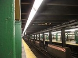
The New York City Subway
New York City Subway
The New York City Subway is a rapid transit system owned by the City of New York and leased to the New York City Transit Authority, a subsidiary agency of the Metropolitan Transportation Authority and also known as MTA New York City Transit...
system differs from other railroad chaining systems in that it uses the engineer's chain of 100 feet (~30.5 m
Metre
The metre , symbol m, is the base unit of length in the International System of Units . Originally intended to be one ten-millionth of the distance from the Earth's equator to the North Pole , its definition has been periodically refined to reflect growing knowledge of metrology...
) rather than the surveyor's chain of 66 feet (~20 m).
Chaining zero
Chaining zero is a fixed point from which the chaining is measured on a particular chaining line. A chaining number of, for example, 243 at a specific line location (called a chaining station) identifies that the location is 24,300 feet (~4.6 miles or ~7.4 km) from chaining zero, usually measured along the center line of the railroad.Once chaining is established, it is rare but not unheard of to change the location of chaining zero or the route along which it is measured on a given line. There are several examples of chaining numbers that refer to a chaining zero location that no longer exists or along a physical line that no longer exists, because of abandonment or demolition. Notable among these are several existing chaining lines that originated near New York City Hall
New York City Hall
New York City Hall is located at the center of City Hall Park in the Civic Center area of Lower Manhattan, New York City, USA, between Broadway, Park Row, and Chambers Street. The building is the oldest City Hall in the United States that still houses its original governmental functions, such as...
via the Brooklyn Bridge
Brooklyn Bridge
The Brooklyn Bridge is one of the oldest suspension bridges in the United States. Completed in 1883, it connects the New York City boroughs of Manhattan and Brooklyn by spanning the East River...
, discontinued since 1944. It is very rare but not impossible for a reroute to alter the accuracy of chaining numbers, if only slightly.
Exceptions exist to the principle that chaining numbers represent a railroad distance to the zero point. On the original IND
Independent Subway System
The Independent Subway System , formerly known as the Independent City-Owned Subway System or the Independent City-Owned Rapid Transit Railroad, was a rapid transit rail system in New York City that is now part of the New York City Subway...
chaining zero for the original system is a political rather than physical location, and there is no railroad at or near the zero point. Sometimes trackage (usually but not always short distances) is chained backwards from a tie point with another line.
Chaining lines
Chaining lines are routes on physical railroad lines that are usually described by one or two letters for the purpose of identifying locations on those lines.Chaining lines are not necessarily the same as the physical lines they run on. One physical line may have several chaining letters, and one chaining line may cover several physical lines.
The letters assigned to a chaining line have nothing to do with the letters displayed on trains and public maps and timetables. These latter are subway service letters. See: New York City Subway nomenclature
New York City Subway nomenclature
New York City Subway nomenclature describes terminology used in the New York City Subway system as derived from railroading practice, historical origins of the system, and engineering, publicity, and legal usage...
and List of New York City Subway services.
For example, the BMT A chaining line begins at BMT South chaining zero north of 57th Street – Seventh Avenue on the BMT Broadway Line
BMT Broadway Line
The BMT Broadway Line is a rapid transit line of the B Division of the New York City Subway in Manhattan, New York City, United States. , it is served by three services, all colored yellow: the on the express tracks and the on the local tracks...
, but is interrupted north of the Canal Street stations, where the express tracks becomes BMT H for the trip over the Manhattan Bridge
Manhattan Bridge
The Manhattan Bridge is a suspension bridge that crosses the East River in New York City, connecting Lower Manhattan with Brooklyn . It was the last of the three suspension bridges built across the lower East River, following the Brooklyn and the Williamsburg bridges...
south side tracks and the local tracks become BMT B for Lower Manhattan
Lower Manhattan
Lower Manhattan is the southernmost part of the island of Manhattan, the main island and center of business and government of the City of New York...
and the Montague Street Tunnel
Montague Street Tunnel
The Montague Street Tunnel carries the trains of the New York City Subway under the East River between the boroughs of Manhattan and Brooklyn. It opened to revenue service on Sunday, August 1, 1920 at 2 am with a holiday schedule, the same day as the 60th Street Tunnel. Regular service began...
. The BMT A line begins again in the middle of the Manhattan Bridge span on the north side tracks, passes through DeKalb Avenue and then becomes the BMT Brighton Line
BMT Brighton Line
The BMT Brighton Line is a rapid transit line of the B Division of the New York City Subway in Brooklyn, New York City, United States. Local service is provided at all times by the Q train. The Q is joined by the B express train on weekdays...
for that line's entire distance to Stillwell Avenue. BMT A originally traversed the entire north side of the bridge, connecting Canal to DeKalb, while H ran towards Chambers St. instead of Canal, but this was reconfigured as part of the Chrystie Street Connection
Chrystie Street Connection
The Chrystie Street Connection is a major connecting line of the New York City Subway, and is one of the few connections between lines of the BMT and IND divisions...
. The IND B designation was extended past the portal of the new connection, to meet the BMT A in the middle, yet retained the BMT chaining numbers on the bridge itself. The tracks leading to Chambers St. were severed from the bridge and were re-designated as part of BMT J.
In a few cases, the chaining lines and service letters are coincident, such as the IND A chaining line following the A service
A (New York City Subway service)
The A Eighth Avenue Express is a rapid transit service of the New York City Subway. Its route bullet is colored blue on route signs, station signs, and the official subway map since it runs on the IND Eighth Avenue Line in Manhattan....
from 207th Street to Euclid Avenue, while the IND C was the IND Concourse Line
IND Concourse Line
The Concourse Line is an IND subway branch line of the New York City Subway system. It runs from Norwood – 205th Street in Norwood, Bronx to 145th Street in Harlem, Manhattan. It is the only "B" Division and only fully underground line in the Bronx....
, which was originally served by the C service
C (New York City Subway service)
The C Eighth Avenue Local is a rapid transit service of the New York City Subway. It is colored blue on route signs, station signs, and the official subway map, since it runs on the IND Eighth Avenue Line through Manhattan....
. However, that service was later moved off of the Concourse line, while the chaining code remains.
Chaining stations
Each specific location along a line is known as a chaining station, and is identified by a number unique to that chaining line. The precisionAccuracy and precision
In the fields of science, engineering, industry and statistics, the accuracy of a measurement system is the degree of closeness of measurements of a quantity to that quantity's actual value. The precision of a measurement system, also called reproducibility or repeatability, is the degree to which...
of the location depends on its usage. On engineering
Engineering
Engineering is the discipline, art, skill and profession of acquiring and applying scientific, mathematical, economic, social, and practical knowledge, in order to design and build structures, machines, devices, systems, materials and processes that safely realize improvements to the lives of...
maps, the location of such features as curves, switches
Railroad switch
A railroad switch, turnout or [set of] points is a mechanical installation enabling railway trains to be guided from one track to another at a railway junction....
, crossings, stations and platforms are ordinarily specified to a precision of one foot (30 cm
Centimetre
A centimetre is a unit of length in the metric system, equal to one hundredth of a metre, which is the SI base unit of length. Centi is the SI prefix for a factor of . Hence a centimetre can be written as or — meaning or respectively...
). This is expressed as [chains plus feet]; a chaining station located 1,470 feet from chaining zero would be described as 14+70. For greater precision, or where style or protocol requires it, unit of less than a foot may be described. The Brooklyn Rapid Transit
Brooklyn Rapid Transit
The Brooklyn Rapid Transit Company was a public transit holding company formed in 1896 to acquire and consolidate lines in Brooklyn and Queens, New York City, United States. It was a prominent corporation and industry leader using the single-letter symbol B on the New York Stock Exchange...
Company used [chains plus feet point hundredth
Hundredth
In arithmetic, a hundredth is a single part of something that has been divided equally into a hundred parts. For example, a hundredth of 675 is 6.75.A hundredth is the reciprocal of 100....
s] without trailing zeros: thus a map location designated as P.S. 14+70.25 would indicate that the Point of a Switch at that location is 1,470 and one quarter feet (1,470 feet and 3 inches) from chaining zero.
Signals are identified by the chaining line and track number, and by the nearest 100-foot chaining station. In this usage only the number of 100-foot chains from chaining zero are displayed. Thus, a signal on the BMT with a designation of A2 / 102 would be on the BMT chaining line A, track 2, within +/- 50 feet of the chaining station at 10,200 feet from chaining zero.
Track numbers on chaining lines
Each track on a chaining line is given a number, letter or (rarely) a combination of both to identify a particular track on a particular line.BMT / IND practice
On the BMTBrooklyn-Manhattan Transit Corporation
The Brooklyn–Manhattan Transit Corporation was an urban transit holding company, based in Brooklyn, New York City, United States, and incorporated in 1923. The system was sold to the city in 1940 and today, together with the IND subway system, form the B Division of the New York City Subway...
and IND
Independent Subway System
The Independent Subway System , formerly known as the Independent City-Owned Subway System or the Independent City-Owned Rapid Transit Railroad, was a rapid transit rail system in New York City that is now part of the New York City Subway...
an odd numbered mainline track is going railroad south
Railroad directions
Railroad directions are used to describe train directions on railroad systems. The terms used may be derived from such sources as compass directions, altitude directions, or other directions...
and an even numbered mainline track is going railroad north. In many locations a track may be going "railroad" north or south where the compass
Compass
A compass is a navigational instrument that shows directions in a frame of reference that is stationary relative to the surface of the earth. The frame of reference defines the four cardinal directions – north, south, east, and west. Intermediate directions are also defined...
direction is different or even opposite. This may be because it is an essentially east-west line (e.g., the Jamaica Line
BMT Jamaica Line
The Jamaica Line is an elevated rapid transit line of the B Division of the New York City Subway, in Brooklyn and Queens, New York City, United States. It runs from the Williamsburg Bridge southeast over Broadway to East New York, Brooklyn, and then east over Fulton Street and Jamaica Avenue to...
), so railroad north means towards Manhattan and railroad south means away from Manhattan. It may also be because a line continuing from a north-south line turns in another direction (e.g., the IND Fulton Street Line
IND Fulton Street Line
The IND Fulton Street Line is a rapid transit line of the IND Division of the New York City Subway, extending from the Cranberry Street Tunnel under the East River through all of central Brooklyn to a terminus in Ozone Park, Queens. The IND Rockaway Line branches from it. It forms part of the A...
) but the railroad direction remains the same.
These track numbers provide a definitive way of determining whether a particular direction on a particular line is going "railroad" north or south. Especially it shows that "south" on several lines (including the BMT Jamaica Line
BMT Jamaica Line
The Jamaica Line is an elevated rapid transit line of the B Division of the New York City Subway, in Brooklyn and Queens, New York City, United States. It runs from the Williamsburg Bridge southeast over Broadway to East New York, Brooklyn, and then east over Fulton Street and Jamaica Avenue to...
, the IND Fulton Street Line
IND Fulton Street Line
The IND Fulton Street Line is a rapid transit line of the IND Division of the New York City Subway, extending from the Cranberry Street Tunnel under the East River through all of central Brooklyn to a terminus in Ozone Park, Queens. The IND Rockaway Line branches from it. It forms part of the A...
and the BMT Myrtle Avenue Line
BMT Myrtle Avenue Line
The Myrtle Avenue Line, also called the Myrtle Avenue Elevated, is a fully elevated line of the New York City Subway as part of the BMT division. The extant line is the final remnant of one of the original Brooklyn elevated railroads...
) that run in an easterly to northerly compass direction for their entire route are nevertheless running railroad south.
The local (usually outside) tracks on a given BMT
Brooklyn-Manhattan Transit Corporation
The Brooklyn–Manhattan Transit Corporation was an urban transit holding company, based in Brooklyn, New York City, United States, and incorporated in 1923. The system was sold to the city in 1940 and today, together with the IND subway system, form the B Division of the New York City Subway...
/IND
Independent Subway System
The Independent Subway System , formerly known as the Independent City-Owned Subway System or the Independent City-Owned Rapid Transit Railroad, was a rapid transit rail system in New York City that is now part of the New York City Subway...
line are numbered 1 (south) and 2 (north). The express tracks are numbered 3 (south) and 4 (north). If there are an odd number of mainline tracks, the center track is (for example) track 3/4. The signals heading southbound will show the location as track 3 and northbound track 4. Additional tracks on the same chaining line are usually numbered higher by the same rules. On the four track BMT Brighton Line, the tracks from west to east are:
A1–A3–A4–A2
On the three track BMT West End Line
BMT West End Line
The BMT West End Line is a line of the New York City Subway, serving the Brooklyn, communities of Borough Park, New Utrecht, Bensonhurst, Bath Beach and Coney Island. The D train operates on the line at all times, providing service to Manhattan and the Bronx via the IND Sixth Avenue Line...
, they are:
D1–D3/4–D2
On the two track BMT Canarsie Line
BMT Canarsie Line
The Canarsie Line is a rapid transit line of the BMT Division of the New York City Subway system, named after its terminus in the Canarsie neighborhood of Brooklyn...
, they are:
Q1–Q2
IRT practice
On the IRTInterborough Rapid Transit Company
The Interborough Rapid Transit Company was the private operator of the original underground New York City Subway line that opened in 1904, as well as earlier elevated railways and additional rapid transit lines in New York City. The IRT was purchased by the City in June 1940...
the signals are numbered differently, the southbound signal numbers end in 4 (local) and 2 (express) and the northbounds are 1 (express) and 3 (local). On a four track line, the signal numbers end:
4–2–1–3
On a three track line, 1/2 are used signals on the middle track (1 is for signals governing northward moves, and 2 southward). 4 and 3 are still the local tracks:
4–M–3
And on a two-track line, there are no express tracks, so the two tracks are:
4–3
Strangely, IRT track designations differ from the signal chaining track numbers they are numbered from left to right (facing north), tracks number 1 through 4:
1 - 2 - 3 - 4
And on a three-track line:
1–M–4 or 2–M–3
Thus, a line will have signal numbers ending in "4–2–1–3" and tracks designated as "1–2–3–4".
Signals on the IRT governing in the opposite of the normal direction of travel will have a signal number ending N+4 from the signal numbers governing in the normal direction.
Handling chaining junctions
When one line splits from or joins another, a decision must be made on how to measure the chaining distances on the individual lines. One way is to establish a new zero point for one or more lines, but this is inefficient. Typically a major end-point terminal will be chosen as chaining zero, and all lines that are tributary to that terminal will measure their chaining from that point. This process is called tying. For example, if one line ties to another at a certain point, and the chaining station number at that point is 135+10 (13,510 feet from chaining zero), then a location on either branch that is 1,000 feet from that will have a chaining station number of 145+10.Tying
When a new line or branch separates from another line, and the new line "picks up" the chaining numbers of the original line, the new line is said to be "tied" at that point. For example, where the BMT Montague Street TunnelMontague Street Tunnel
The Montague Street Tunnel carries the trains of the New York City Subway under the East River between the boroughs of Manhattan and Brooklyn. It opened to revenue service on Sunday, August 1, 1920 at 2 am with a holiday schedule, the same day as the 60th Street Tunnel. Regular service began...
Line (BMT B) separates from the Broadway Line (BMT A via the Manhattan Bridge
Manhattan Bridge
The Manhattan Bridge is a suspension bridge that crosses the East River in New York City, connecting Lower Manhattan with Brooklyn . It was the last of the three suspension bridges built across the lower East River, following the Brooklyn and the Williamsburg bridges...
) north of Canal Street and Broadway, we say that BMT B ties to BMT A at Canal and Broadway. That way (assuming BMT A ends at chaining zero, which it does) the distance from a chaining station on BMT B is measured by following the physical BMT B to its tying point, and then following the physical BMT A from there to chaining zero.
Reverse tying
Sometimes when a line leaves another line, the chaining on the branch line should be tied to the original line, but we want the chaining distances to go down instead of up. This is almost always because the branch joins the main line coming from the same direction as the main line, and we want the chaining numbers of the branch to be derived from the main line, so as not to have to establish a separate chaining zero location for the branch. An example of this was the Fulton Ferry branch of the Fulton Street Elevated (BMT K) which split from the Brooklyn Bridge branch at a location called Kings County (KC) Junction. Chaining zero for both branches was at Park RowPark Row (BMT station)
Park Row was a major elevated railway terminal constructed over the New York end of the Brooklyn Bridge, across from New York City Hall in Manhattan that served as the terminal for BMT services operating over the Brooklyn Bridge from the BMT Fulton Street Line, BMT Myrtle Avenue Line and their...
, over the Brooklyn Bridge
Brooklyn Bridge
The Brooklyn Bridge is one of the oldest suspension bridges in the United States. Completed in 1883, it connects the New York City boroughs of Manhattan and Brooklyn by spanning the East River...
. The stub end branch to Fulton Ferry (the original terminal) was chained backwards from Kings County Junction to the East River
East River
The East River is a tidal strait in New York City. It connects Upper New York Bay on its south end to Long Island Sound on its north end. It separates Long Island from the island of Manhattan and the Bronx on the North American mainland...
shoreline. The chaining numbers went from 0+00 (zero) at the western end of Park Row station to 77+20 (7,720 feet) at KC Junction. Then the Fulton Ferry branch was reverse tied at that point so that the chaining station at the ferry end of the line was 45+38 (4,538 feet). By this method, the distance from any point on the Fulton Street el to either terminal could be readily measured.
No tying
Sometimes two or more lines merge or abut but the chaining shouldn't be tied. For example, the Montague Street Tunnel Line BMT B is tied to Broadway Line BMT A at Canal Street, but BMT B returns to BMT A at DeKalb Avenue in Brooklyn. Since BMT B uses a longer route to reach the same location than BMT A does, the chaining numbers are different where the two lines rejoin. In this case, the BMT B chaining simply ends and the BMT A chaining is picked up again.Chaining codes
Following are tables describing the chaining lines of all three divisions, including defunct lines.BMT
Many of these lines originally had individual chaining zero points as a result of the different companies that built and operated them. The BRTBrooklyn Rapid Transit
The Brooklyn Rapid Transit Company was a public transit holding company formed in 1896 to acquire and consolidate lines in Brooklyn and Queens, New York City, United States. It was a prominent corporation and industry leader using the single-letter symbol B on the New York Stock Exchange...
consolidated the chaining system subsequent to taking over these and many lines were again rechained when they were shifted from elevated to subway lines. These chaining lines and zero locations are accurate as of c. 1900 for lines chained from Park Row; as they were opened c. 1915–1920 for lines chained from 57th Street; as of line openings for other lines. Where chaining has changed since these chaining lines were established, the current chaining is shown.
| Chaining line | Physical line | North | South | Chaining zero |
|---|---|---|---|---|
| A | Broadway Line BMT Broadway Line The BMT Broadway Line is a rapid transit line of the B Division of the New York City Subway in Manhattan, New York City, United States. , it is served by three services, all colored yellow: the on the express tracks and the on the local tracks... / Brighton Line BMT Brighton Line The BMT Brighton Line is a rapid transit line of the B Division of the New York City Subway in Brooklyn, New York City, United States. Local service is provided at all times by the Q train. The Q is joined by the B express train on weekdays... |
57th Street – Seventh Avenue | Canal Street lower level | 57th Street – Seventh Avenue |
| midpoint of Manhattan Bridge Manhattan Bridge The Manhattan Bridge is a suspension bridge that crosses the East River in New York City, connecting Lower Manhattan with Brooklyn . It was the last of the three suspension bridges built across the lower East River, following the Brooklyn and the Williamsburg bridges... north tracks |
Coney Island – Stillwell Avenue | |||
| B | Broadway Line BMT Broadway Line The BMT Broadway Line is a rapid transit line of the B Division of the New York City Subway in Manhattan, New York City, United States. , it is served by three services, all colored yellow: the on the express tracks and the on the local tracks... / Montague Street Tunnel Montague Street Tunnel The Montague Street Tunnel carries the trains of the New York City Subway under the East River between the boroughs of Manhattan and Brooklyn. It opened to revenue service on Sunday, August 1, 1920 at 2 am with a holiday schedule, the same day as the 60th Street Tunnel. Regular service began... |
Canal Street upper level (ties to BMT A) | junction with Brighton Line south of DeKalb Avenue | |
| C | Culver Line IND Culver Line The IND Culver Line is a rapid transit line of the B Division of the New York City Subway, extending from Downtown Brooklyn south to Coney Island, Brooklyn, New York City, United States... |
Ninth Avenue Ninth Avenue (BMT West End Line) Ninth Avenue is a bi-level express station on the BMT West End Line of the New York City Subway, located at the intersection of Ninth Avenue and 39th Street in Brooklyn. Each level has three tracks and two island platforms. The upper level serves the BMT West End Line while the lower level formerly... lower level (ties to BMT D) |
Fort Hamilton Parkway | |
| D | West End Line BMT West End Line The BMT West End Line is a line of the New York City Subway, serving the Brooklyn, communities of Borough Park, New Utrecht, Bensonhurst, Bath Beach and Coney Island. The D train operates on the line at all times, providing service to Manhattan and the Bronx via the IND Sixth Avenue Line... |
36th Street 36th Street (BMT Fourth Avenue Line) 36th Street is an express station on the BMT Fourth Avenue Line of the New York City Subway, located at 36th Street and Fourth Avenue in Sunset Park, Brooklyn.... (ties to BMT F) |
Coney Island – Stillwell Avenue | |
| E | Sea Beach Line BMT Sea Beach Line The BMT Sea Beach Line is a rapid transit line of the BMT division of the New York City Subway, connecting the BMT Fourth Avenue Line subway at 59th Street via a four-track wide open cut to Coney Island in Brooklyn... |
59th Street 59th Street (BMT Fourth Avenue Line) 59th Street is an express station on the BMT Fourth Avenue Line of the New York City Subway. Located at 59th Street and Fourth Avenue, in the Brooklyn neighborhood of Sunset Park, it is served by the N and R trains at all times.... (ties to BMT F) |
||
| F | Fourth Avenue Line BMT Fourth Avenue Line The Fourth Avenue Line is a rapid transit line of the BMT division of the New York City Subway, mainly running under Fourth Avenue in Brooklyn. Fourth Avenue never had a streetcar line or elevated railway due to the provisions of the assessment charged to neighboring property owners when the street... |
Gold Street Interlocking north of DeKalb Avenue (ties to BMT A) | Bay Ridge – 95th Street | |
| G (tracks 1 and 2) | 60th Street Tunnel 60th Street Tunnel The 60th Street Tunnel carries the trains of the New York City Subway under the East River and Roosevelt Island between Manhattan and Queens.The tunnel was built as part of the Dual Contracts period of New York City subway construction... / Astoria Line BMT Astoria Line The Astoria Line is a rapid transit line of the BMT division of the New York City Subway, serving the neighborhood of Astoria, Queens. It runs from Ditmars Boulevard to 39th Avenue along 31st Street. It then serves Queensboro Plaza along 27th Street. It was built as part of the Dual Contracts and... |
Astoria – Ditmars Boulevard | 57th Street – Seventh Avenue | |
| G (tracks 3 and 4) | 63rd Street Line BMT 63rd Street Line The BMT 63rd Street Line is a rapid transit line of the BMT division of the New York City Subway system. This short line connects the express tracks of the BMT Broadway Line from 57th Street – Seventh Avenue to Lexington Avenue – 63rd Street, where it stub-ends... |
Lexington Avenue – 63rd Street | ||
| GD | 60th Street Tunnel Connection BMT 60th Street Tunnel Connection The 60th Street Tunnel Connection or 11th Street Connection is a short rapid transit line of the New York City Subway connecting the BMT 60th Street Tunnel under the East River with the IND Queens Boulevard Line west of Queens Plaza in Long Island City, Queens, New York City, United States... |
Queens Plaza Queens Plaza (IND Queens Boulevard Line) Queens Plaza is an express station on the IND Queens Boulevard Line of the New York City Subway. Located at the large Queens Plaza interchange, it is served by the E train at all times, by the R train at all times except late nights, and by the M train on weekdays except late nights.While situated... |
junction with BMT G (Tracks 1/2) west of Queensboro Plaza (ties to BMT G) | |
| H | Manhattan Bridge Manhattan Bridge The Manhattan Bridge is a suspension bridge that crosses the East River in New York City, connecting Lower Manhattan with Brooklyn . It was the last of the three suspension bridges built across the lower East River, following the Brooklyn and the Williamsburg bridges... south tracks |
Canal Street lower level (ties to BMT A) | interlocking north of DeKalb Avenue | |
| J | Nassau Street Line BMT Nassau Street Line The BMT Nassau Street Line is a rapid transit line of the B Division of the New York City Subway system in Manhattan. It is served by the and trains which are colored brown on maps and signage... / Jamaica Line BMT Jamaica Line The Jamaica Line is an elevated rapid transit line of the B Division of the New York City Subway, in Brooklyn and Queens, New York City, United States. It runs from the Williamsburg Bridge southeast over Broadway to East New York, Brooklyn, and then east over Fulton Street and Jamaica Avenue to... |
Chambers Street | 168th Street 168th Street (BMT Jamaica Line) 168th Street was a station on the demolished section of the BMT Jamaica Line. It had 2 tracks and 1 island platform This station was built as part of the Dual Contracts. It opened December 12, 1916, seventeen years after the closing of Canal Street Station along the Atlantic Avenue Rapid Transit... (demolished) |
Chambers Street |
| Jamaica Center – Parsons/Archer | ||||
| M | Myrtle Avenue Line BMT Myrtle Avenue Line The Myrtle Avenue Line, also called the Myrtle Avenue Elevated, is a fully elevated line of the New York City Subway as part of the BMT division. The extant line is the final remnant of one of the original Brooklyn elevated railroads... |
Sands Street Sands Street (BMT station) Sands Street was a station on the demolished BMT Myrtle Avenue Line. It was a large complex with 2 levels. The upper level served trains going to Park Row. It had 4 tracks and 2 island platforms with the outside of the platforms serving streetcars. The lower level had a terminal and a loop for... (demolished) (tied to BMT K) |
Broadway Myrtle Avenue (BMT Jamaica Line) Myrtle Avenue is a two-level express station on the BMT Jamaica Line of the New York City Subway... (abandoned) |
Park Row Park Row (BMT station) Park Row was a major elevated railway terminal constructed over the New York end of the Brooklyn Bridge, across from New York City Hall in Manhattan that served as the terminal for BMT services operating over the Brooklyn Bridge from the BMT Fulton Street Line, BMT Myrtle Avenue Line and their... (demolished) |
| Myrtle Avenue Myrtle Avenue (BMT Jamaica Line) Myrtle Avenue is a two-level express station on the BMT Jamaica Line of the New York City Subway... |
Middle Village – Metropolitan Avenue | |||
| O | Franklin Avenue Line BMT Franklin Avenue Line The BMT Franklin Avenue Line is a rapid transit line of the New York City Subway in Brooklyn, New York... |
Franklin Avenue/Fulton Street (ties to BMT K) | Prospect Park Prospect Park (BMT Brighton Line) Prospect Park is an express station on the BMT Brighton Line of the New York City Subway. Located at Empire Boulevard and Flatbush Avenue in Flatbush, Brooklyn, near the border of Crown Heights, Brooklyn, it is served by the Q and Franklin Avenue Shuttle trains at all times and the B train on... |
|
| P | Canarsie Line BMT Canarsie Line The Canarsie Line is a rapid transit line of the BMT Division of the New York City Subway system, named after its terminus in the Canarsie neighborhood of Brooklyn... –Linden Shops |
Livonia Avenue Livonia Avenue (BMT Canarsie Line) Livonia Avenue is a station on the BMT Canarsie Line of the New York City Subway. Located at the intersection of Livonia and Van Sinderen Avenue, it is served by the L train at all times.... |
Linden Shops | between Atlantic Avenue Atlantic Avenue (BMT Canarsie Line) Atlantic Avenue is a rapid transit station on the BMT Canarsie Line, a part of the New York City Subway system. Built in 1916, it was reconfigured in 2002–04. This station is a good example of the Dual Contracts architecture. Much of the period woodwork and ironwork is intact. The fare control... and Sutter Avenue Sutter Avenue (BMT Canarsie Line) Sutter Avenue is a station on the BMT Canarsie Line of the New York City Subway. Located at the intersection of Van Sinderen and Sutter Avenues, it is served by the L train at all times.... |
| Q | Canarsie Line BMT Canarsie Line The Canarsie Line is a rapid transit line of the BMT Division of the New York City Subway system, named after its terminus in the Canarsie neighborhood of Brooklyn... |
Eighth Avenue | Canarsie – Rockaway Parkway | Eighth Avenue |
| R | Nassau Street Line BMT Nassau Street Line The BMT Nassau Street Line is a rapid transit line of the B Division of the New York City Subway system in Manhattan. It is served by the and trains which are colored brown on maps and signage... |
Chambers Street | Montague Street Tunnel Montague Street Tunnel The Montague Street Tunnel carries the trains of the New York City Subway under the East River between the boroughs of Manhattan and Brooklyn. It opened to revenue service on Sunday, August 1, 1920 at 2 am with a holiday schedule, the same day as the 60th Street Tunnel. Regular service began... (reverse-ties to BMT B) |
57th Street – Seventh Avenue |
Former BMT
| Chaining line | Physical line | North | South | Chaining zero |
|---|---|---|---|---|
| K | Fulton Street Line (remaining portion transferred to IND) |
Fulton Ferry (demolished) (reverse-tied to main BMT K) | Kings County Junction | Park Row Park Row (BMT station) Park Row was a major elevated railway terminal constructed over the New York end of the Brooklyn Bridge, across from New York City Hall in Manhattan that served as the terminal for BMT services operating over the Brooklyn Bridge from the BMT Fulton Street Line, BMT Myrtle Avenue Line and their... (demolished) |
| Park Row Park Row (BMT station) Park Row was a major elevated railway terminal constructed over the New York end of the Brooklyn Bridge, across from New York City Hall in Manhattan that served as the terminal for BMT services operating over the Brooklyn Bridge from the BMT Fulton Street Line, BMT Myrtle Avenue Line and their... (demolished) |
Ozone Park – Lefferts Boulevard | |||
| L | Lexington Avenue Line BMT Lexington Avenue Line The Lexington Avenue Elevated was the first standard elevated railway in Brooklyn, New York, operated in its later days by the Brooklyn Rapid Transit Company, the Brooklyn-Manhattan Transit Corporation, and then the City of New York.The original line, as it existed at the end of 1885, traveled... (demolished) |
Grand Street/Myrtle Avenue (demolished) (tied to BMT M) | Broadway | |
| N | Fifth Avenue Line (demolished) | Myrtle Avenue/Hudson Street (tied to BMT M) | 65th Street/Third Avenue (demolished) |
- BMT C: Original BMT C ran along the entire length of the Culver Line, from the lower level of Ninth Avenue over to Ditmas Avenue (elevated over the right-of-wayRight-of-way (railroad)A right-of-way is a strip of land that is granted, through an easement or other mechanism, for transportation purposes, such as for a trail, driveway, rail line or highway. A right-of-way is reserved for the purposes of maintenance or expansion of existing services with the right-of-way...
of the South Brooklyn RailwaySouth Brooklyn RailwayThe South Brooklyn Railway is a railroad in the New York City borough of Brooklyn. It continues to operate today as a subsidiary of MTA New York City Transit...
), then along the McDonald Avenue ElIND Culver LineThe IND Culver Line is a rapid transit line of the B Division of the New York City Subway, extending from Downtown Brooklyn south to Coney Island, Brooklyn, New York City, United States...
to West Eighth Street – New York Aquarium, where BMT A (Brighton LineBMT Brighton LineThe BMT Brighton Line is a rapid transit line of the B Division of the New York City Subway in Brooklyn, New York City, United States. Local service is provided at all times by the Q train. The Q is joined by the B express train on weekdays...
) chaining took over. With the opening of the Culver Ramp, the INDIndependent Subway SystemThe Independent Subway System , formerly known as the Independent City-Owned Subway System or the Independent City-Owned Rapid Transit Railroad, was a rapid transit rail system in New York City that is now part of the New York City Subway...
acquired the Culver Line from Ditmas Avenue south and rechained it as part of IND B (from 57th Street/Sixth Avenue57th Street (IND Sixth Avenue Line)57th Street is a station on the IND Sixth Avenue Line of the New York City Subway. Located at the intersection of 57th Street and Sixth Avenue in Manhattan, it is served by the F train at all times...
to West Eighth Street). The surviving portion of the northern Culver Line, which today runs from Ninth Avenue lower level to about Fort Hamilton Parkway and 37th Street, is still chained BMT C. - BMT G: Tracks 3 and 4, which constitute the BMT 63rd Street LineBMT 63rd Street LineThe BMT 63rd Street Line is a rapid transit line of the BMT division of the New York City Subway system. This short line connects the express tracks of the BMT Broadway Line from 57th Street – Seventh Avenue to Lexington Avenue – 63rd Street, where it stub-ends...
, are not to be confused with track G3-4, the single express track on the Astoria LineBMT Astoria LineThe Astoria Line is a rapid transit line of the BMT division of the New York City Subway, serving the neighborhood of Astoria, Queens. It runs from Ditmars Boulevard to 39th Avenue along 31st Street. It then serves Queensboro Plaza along 27th Street. It was built as part of the Dual Contracts and...
. - BMT K: The Fulton Ferry spur was chained from Park RowPark Row (BMT station)Park Row was a major elevated railway terminal constructed over the New York end of the Brooklyn Bridge, across from New York City Hall in Manhattan that served as the terminal for BMT services operating over the Brooklyn Bridge from the BMT Fulton Street Line, BMT Myrtle Avenue Line and their...
to Kings County Junction (located east of former Sands Street station), then backwards from the junction to Fulton Ferry. - BMT L: Lexington Avenue LineBMT Lexington Avenue LineThe Lexington Avenue Elevated was the first standard elevated railway in Brooklyn, New York, operated in its later days by the Brooklyn Rapid Transit Company, the Brooklyn-Manhattan Transit Corporation, and then the City of New York.The original line, as it existed at the end of 1885, traveled...
chaining ended at the intersection of Lexington Avenue and Broadway, where the Lexington Avenue LineBMT Lexington Avenue LineThe Lexington Avenue Elevated was the first standard elevated railway in Brooklyn, New York, operated in its later days by the Brooklyn Rapid Transit Company, the Brooklyn-Manhattan Transit Corporation, and then the City of New York.The original line, as it existed at the end of 1885, traveled...
merged with the Broadway–Brooklyn LineBMT Jamaica LineThe Jamaica Line is an elevated rapid transit line of the B Division of the New York City Subway, in Brooklyn and Queens, New York City, United States. It runs from the Williamsburg Bridge southeast over Broadway to East New York, Brooklyn, and then east over Fulton Street and Jamaica Avenue to...
(between Kosciuszko StreetKosciuszko Street (BMT Jamaica Line)Kosciuszko Street is a skip-stop station on the BMT Jamaica Line of the New York City Subway. It is served at all times by the J train. The Z train bypasses this station when it operates...
and Gates AvenueGates Avenue (BMT Jamaica Line)Gates Avenue is a skip-stop station on the elevated BMT Jamaica Line of the New York City Subway, located at the intersection of Gates Avenue and Broadway in Bushwick, Brooklyn...
stations). - BMT P: Until recently, BMT P consisted of the Canarsie LineBMT Canarsie LineThe Canarsie Line is a rapid transit line of the BMT Division of the New York City Subway system, named after its terminus in the Canarsie neighborhood of Brooklyn...
from Broadway Junction to Canarsie – Rockaway Parkway. The entire Canarsie Line has since been rechained as BMT Q; the only remaining P chaining is the yard lead that diverges from the main line just south of Livonia AvenueLivonia Avenue (BMT Canarsie Line)Livonia Avenue is a station on the BMT Canarsie Line of the New York City Subway. Located at the intersection of Livonia and Van Sinderen Avenue, it is served by the L train at all times....
and leads to Linden Shops. - BMT Q: Until recently, chaining for BMT Q began at Sixth AvenueSixth Avenue (BMT Canarsie Line)Sixth Avenue is a station on the BMT Canarsie Line of the New York City Subway. Located at the intersection of Sixth Avenue and 14th Street in the Manhattan neighborhood of Chelsea, it is served by the L train at all times....
—the original northern terminal of the 14th Street14th Street (Manhattan)14th Street is a major crosstown street in the New York City borough of Manhattan. The street rivals the size of some of the well-known avenues of the city and is an important business location....
subway—and continued south to Broadway Junction. South of Broadway Junction, the line was chained as BMT P with chaining zero at the intersection of Pitkin and Van Sinderen Avenues, where the Canarsie Line had diverged from the former Fulton Street Line. When the 14th Street subway was extended to Eighth Avenue, the new trackage was chained as BMT QW, with chaining starting at Sixth and increasing to Eighth. The Canarsie Line has since been entirely rechained as Q, running from the zero at Eighth Avenue south to Rockaway Parkway. - BMT Y: This is used on yard leads.
IND
| Chaining line | Physical line | North | South | Chaining zero |
|---|---|---|---|---|
| A | Eighth Avenue Line IND Eighth Avenue Line The Eighth Avenue Line is a rapid transit line in New York City, United States, and is part of the B Division of the New York City Subway... / Fulton Street Line IND Fulton Street Line The IND Fulton Street Line is a rapid transit line of the IND Division of the New York City Subway, extending from the Cranberry Street Tunnel under the East River through all of central Brooklyn to a terminus in Ozone Park, Queens. The IND Rockaway Line branches from it. It forms part of the A... |
Inwood – 207th Street (ties and reverse-ties at West Fourth Street – Washington Square) | stub tracks south of Euclid Avenue Euclid Avenue (IND Fulton Street Line) Euclid Avenue is an express station on the IND Fulton Street Line of the New York City Subway. Located at the intersection of Euclid Avenue and Pitkin Avenue in Brooklyn, it is served by the A train at all times, and the southern terminal for the C train, at all times except late nights... |
IND zero |
| B | Sixth Avenue Line IND Sixth Avenue Line The Sixth Avenue Line is a rapid transit line of the B Division of the New York City Subway in the United States. It runs mainly under Sixth Avenue in Manhattan, and continues south through the Rutgers Street Tunnel to Brooklyn... / IND Culver Line IND Culver Line The IND Culver Line is a rapid transit line of the B Division of the New York City Subway, extending from Downtown Brooklyn south to Coney Island, Brooklyn, New York City, United States... |
57th Street 57th Street (IND Sixth Avenue Line) 57th Street is a station on the IND Sixth Avenue Line of the New York City Subway. Located at the intersection of 57th Street and Sixth Avenue in Manhattan, it is served by the F train at all times... (ties and reverse-ties to IND A at West Fourth Street – Washington Square) |
West Eighth Street – New York Aquarium | |
| BJ | Chrystie Street Cut Chrystie Street Connection The Chrystie Street Connection is a major connecting line of the New York City Subway, and is one of the few connections between lines of the BMT and IND divisions... |
Broadway – Lafayette Street (reverse ties to IND B) | Essex Street | |
| C | Concourse Line IND Concourse Line The Concourse Line is an IND subway branch line of the New York City Subway system. It runs from Norwood – 205th Street in Norwood, Bronx to 145th Street in Harlem, Manhattan. It is the only "B" Division and only fully underground line in the Bronx.... |
Norwood – 205th Street | 135th Street 135th Street (IND Eighth Avenue Line) 135th Street is a local station on the IND Eighth Avenue Line of the New York City Subway. Located at the intersection of 135th Street and St. Nicholas Avenue in Manhattan, it is served by the C train at all times except late nights, B train during weekdays, and A train during late nights.This is... (ties to IND A) |
|
| D | Queens Boulevard Line IND Queens Boulevard Line The Queens Boulevard Line is a fully underground line of the B Division of the New York City Subway in Manhattan and Queens, New York City, United States. The line provides crosstown service across Manhattan under 53rd Street and east through Queens to Jamaica... |
Jamaica – 179th Street | interlocking between 50th Street 50th Street (IND Eighth Avenue Line) 50th Street is a local station on the IND Eighth Avenue Line and IND Queens Boulevard Line of the New York City Subway, located at 50th Street and Eighth Avenue in the Hell's Kitchen neighborhood of Manhattan.- Station layout :... and 42nd Street – Port Authority Bus Terminal (ties to IND A) |
|
| DA | Archer Avenue Line | Jamaica Center – Parsons/Archer | Briarwood – Van Wyck Boulevard (ties to IND D) | |
| E | Brooklyn–Queens Crosstown Line IND Crosstown Line -External links:*... |
Queens Plaza Queens Plaza (IND Queens Boulevard Line) Queens Plaza is an express station on the IND Queens Boulevard Line of the New York City Subway. Located at the large Queens Plaza interchange, it is served by the E train at all times, by the R train at all times except late nights, and by the M train on weekdays except late nights.While situated... (reverse-ties to IND D) |
Fulton Street Fulton Street (IND Crosstown Line) Fulton Street is a station on the IND Crosstown Line of the New York City Subway, located on Lafayette Avenue between South Portland Avenue and Fulton Street in Brooklyn. It is served by the G train at all times.... |
|
| E | Brooklyn–Queens Crosstown Line IND Crosstown Line -External links:*... |
Fulton Street Fulton Street (IND Crosstown Line) Fulton Street is a station on the IND Crosstown Line of the New York City Subway, located on Lafayette Avenue between South Portland Avenue and Fulton Street in Brooklyn. It is served by the G train at all times.... |
Bergen Street Bergen Street (IND Culver Line) Bergen Street is an express station on the IND Culver Line of the New York City Subway, located at the intersection of Bergen Street and Smith Street in Boerum Hill, Brooklyn. It is served by the F and G trains at all times.... (ties and reverse-ties to IND A at Hoyt Street.) |
|
| F | Rockaway Line IND Rockaway Line The IND Rockaway Line is a rapid transit line of the IND Division of the New York City Subway. It branches from the IND Fulton Street Line at Rockaway Boulevard, extending over the Jamaica Bay, into the Rockaways.-History:... / Rockaway Park Branch |
Rockaway Boulevard Rockaway Boulevard (IND Fulton Street Line) Rockaway Boulevard is a station on the IND Fulton Street Line of the New York City Subway. Located at the intersection of Rockaway Boulevard, Woodhaven Boulevard/Cross Bay Boulevard, and Liberty Avenue in Ozone Park, Queens, it is served by the A train at all times.This station has two side... |
Rockaway Park – Beach 116th Street | Long Island City Long Island City (LIRR station) Long Island City is a rail terminal of the Long Island Rail Road in Long Island City, Queens. Within the City Terminal Zone and located at Borden Avenue and 2nd Street, it is the westernmost LIRR station in Queens and the end of both the Main Line and the Montauk Branch... (LIRR station) |
| FA | Far Rockaway Branch (Rockaway Line IND Rockaway Line The IND Rockaway Line is a rapid transit line of the IND Division of the New York City Subway. It branches from the IND Fulton Street Line at Rockaway Boulevard, extending over the Jamaica Bay, into the Rockaways.-History:... ) |
Hammels Wye (ties to IND F) | Far Rockaway – Mott Avenue | |
| K | Liberty Avenue El IND Fulton Street Line The IND Fulton Street Line is a rapid transit line of the IND Division of the New York City Subway, extending from the Cranberry Street Tunnel under the East River through all of central Brooklyn to a terminus in Ozone Park, Queens. The IND Rockaway Line branches from it. It forms part of the A... |
east of Euclid Avenue Euclid Avenue (IND Fulton Street Line) Euclid Avenue is an express station on the IND Fulton Street Line of the New York City Subway. Located at the intersection of Euclid Avenue and Pitkin Avenue in Brooklyn, it is served by the A train at all times, and the southern terminal for the C train, at all times except late nights... |
Ozone Park – Lefferts Boulevard | Park Row Park Row (BMT station) Park Row was a major elevated railway terminal constructed over the New York end of the Brooklyn Bridge, across from New York City Hall in Manhattan that served as the terminal for BMT services operating over the Brooklyn Bridge from the BMT Fulton Street Line, BMT Myrtle Avenue Line and their... (demolished) |
| S | Second Ave Line Second Avenue Subway The Second Avenue Subway is a planned rapid transit subway line, part of the New York City Subway system. Phase I, consisting of two miles of tunnel and three stations, is currently under construction underneath Second Avenue in the borough of Manhattan.A plan for more than 75 years, the Second... (under construction) |
96th Street 96th Street (IND Second Avenue Line) The 96th Street is a planned station, under construction along the Second Avenue Subway. It is the planned northern terminus for the Q during Phase 1 of the Second Avenue Subway. The station is expected to open in the late 2010s, and it will have two tracks and an island platform.... |
east of Lexington Avenue – 63rd Street | IND zero |
| T | 63rd Street Line IND 63rd Street Line The IND 63rd Street Line is a rapid transit line of the IND division of the New York City Subway system. It runs from the IND Sixth Avenue Line at 57th Street east under 63rd Street and the East River through the 63rd Street Tunnel to the IND Queens Boulevard Line in Queens... |
junction south of 36th Street 36th Street (IND Queens Boulevard Line) 36th Street is a local station on the IND Queens Boulevard Line of the New York City Subway. Located at the intersection of 36th Street and Northern Boulevard in Queens, it is served by the R train at all times except late nights, when the E train replaces it, and the M train weekdays.This... |
57th Street 57th Street (IND Sixth Avenue Line) 57th Street is a station on the IND Sixth Avenue Line of the New York City Subway. Located at the intersection of 57th Street and Sixth Avenue in Manhattan, it is served by the F train at all times... (ties to IND B) |
Former IND
| Chaining line | Physical line | North | South | Chaining zero |
|---|---|---|---|---|
| D (tracks 5 and 6) | World's Fair Line IND World's Fair Line The World's Fair Railroad was a branch of Independent Subway System of New York City, now the IND division of the New York City Subway, serving the 1939 New York World's Fair... (demolished) |
World's Fair station | Forest Hills – 71st Avenue (tied to IND D) | Jamaica Yard |
- IND zero: The zero point of the INDIndependent Subway SystemThe Independent Subway System , formerly known as the Independent City-Owned Subway System or the Independent City-Owned Rapid Transit Railroad, was a rapid transit rail system in New York City that is now part of the New York City Subway...
system was determined by extending the centerline of West Fourth Street – Washington Square station south to the New YorkNew YorkNew York is a state in the Northeastern region of the United States. It is the nation's third most populous state. New York is bordered by New Jersey and Pennsylvania to the south, and by Connecticut, Massachusetts and Vermont to the east...
/New JerseyNew JerseyNew Jersey is a state in the Northeastern and Middle Atlantic regions of the United States. , its population was 8,791,894. It is bordered on the north and east by the state of New York, on the southeast and south by the Atlantic Ocean, on the west by Pennsylvania and on the southwest by Delaware...
border. The point of intersection—located in Lower New York BayLower New York BayLower New York Bay is that section of New York Bay south of the Narrows, the relatively narrow strait between the shores of Staten Island and Brooklyn. The southern end of the bay opens directly to the Atlantic Ocean between two spits of land, Sandy Hook, New Jersey, and Rockaway, Queens, on Long...
just north of Keansburg, New JerseyKeansburg, New JerseyKeansburg is a borough in Monmouth County, New Jersey, United States. As of the 2010 United States Census, the borough population was 10,105.Keansburg was formed as a borough by an act of the New Jersey Legislature on March 26, 1917, from portions of both Middletown Township and Raritan Township ,...
—was calculated to be 96,925 feet (18.357 statute miMileA mile is a unit of length, most commonly 5,280 feet . The mile of 5,280 feet is sometimes called the statute mile or land mile to distinguish it from the nautical mile...
or 29.542 kmKilometreThe kilometre is a unit of length in the metric system, equal to one thousand metres and is therefore exactly equal to the distance travelled by light in free space in of a second...
) from the south ends of the Eighth Avenue LineIND Eighth Avenue LineThe Eighth Avenue Line is a rapid transit line in New York City, United States, and is part of the B Division of the New York City Subway...
platforms at West Fourth Street; these points became chaining point 969+25. Chaining distances then increased railroad northRailroad directionsRailroad directions are used to describe train directions on railroad systems. The terms used may be derived from such sources as compass directions, altitude directions, or other directions...
of West Fourth and decreased railroad south. As a result the principle that chaining stations along any line reflect the accurate distance to a chaining zero point via the physical railroad is not true on the IND. - IND D (tracks 5 and 6): While the yard leads from the Forest Hills-71 Av station are tied to IND D, the chaining of Jamaica Yard and the World's Fair Line, are not tied to it.
- IND E: From Bergen StreetBergen Street (IND Culver Line)Bergen Street is an express station on the IND Culver Line of the New York City Subway, located at the intersection of Bergen Street and Smith Street in Boerum Hill, Brooklyn. It is served by the F and G trains at all times....
to Fulton StreetFulton Street (IND Crosstown Line)Fulton Street is a station on the IND Crosstown Line of the New York City Subway, located on Lafayette Avenue between South Portland Avenue and Fulton Street in Brooklyn. It is served by the G train at all times....
, the line is tied to IND A, which it shares with the Hoyt–Schermerhorn Streets station. North of Fulton Street, the line is reverse-tied to IND D. - IND F/FA: The Rockaway LineIND Rockaway LineThe IND Rockaway Line is a rapid transit line of the IND Division of the New York City Subway. It branches from the IND Fulton Street Line at Rockaway Boulevard, extending over the Jamaica Bay, into the Rockaways.-History:...
was originally part of the Long Island Rail RoadLong Island Rail RoadThe Long Island Rail Road or LIRR is a commuter rail system serving the length of Long Island, New York. It is the busiest commuter railroad in North America, serving about 81.5 million passengers each year. Established in 1834 and having operated continuously since then, it is the oldest US...
and was chained from Long Island CityLong Island City (LIRR station)Long Island City is a rail terminal of the Long Island Rail Road in Long Island City, Queens. Within the City Terminal Zone and located at Borden Avenue and 2nd Street, it is the westernmost LIRR station in Queens and the end of both the Main Line and the Montauk Branch...
station in Long Island City, QueensLong Island City, QueensLong Island City is the westernmost neighborhood of the borough of Queens in New York City. L.I.C. is notable for its rapid and ongoing gentrification, its waterfront parks, and its thriving arts community. L.I.C. has among the highest concentration of art galleries, art institutions, and studio...
, via the old Montauk Line. When the IND acquired the Rockaway Line south of Liberty Avenue in 1956, it preserved the LIRR chaining distances. - IND K: The Liberty Avenue Elevated, currently part of the IND Fulton Street LineIND Fulton Street LineThe IND Fulton Street Line is a rapid transit line of the IND Division of the New York City Subway, extending from the Cranberry Street Tunnel under the East River through all of central Brooklyn to a terminus in Ozone Park, Queens. The IND Rockaway Line branches from it. It forms part of the A...
, was originally the eastern portion of the BMT Fulton Street Line, which had its chaining zero at Park RowPark Row (BMT station)Park Row was a major elevated railway terminal constructed over the New York end of the Brooklyn Bridge, across from New York City Hall in Manhattan that served as the terminal for BMT services operating over the Brooklyn Bridge from the BMT Fulton Street Line, BMT Myrtle Avenue Line and their...
. When the IND acquired the Liberty Avenue structure, it preserved the BMT chaining letter and zero point, reverse-tying the chaining back to Euclid AvenueEuclid Avenue (IND Fulton Street Line)Euclid Avenue is an express station on the IND Fulton Street Line of the New York City Subway. Located at the intersection of Euclid Avenue and Pitkin Avenue in Brooklyn, it is served by the A train at all times, and the southern terminal for the C train, at all times except late nights...
.
IRT
| Chaining line | Physical line | North | South | Chaining zero |
|---|---|---|---|---|
| B | Broadway – Seventh Avenue Line | 96th Street | Times Square – 42nd Street (ties to IRT MM) | Brooklyn Bridge – City Hall |
| BB | Van Cortlandt Park – 242nd Street | 96th Street | ||
| C | Flushing Line IRT Flushing Line The Flushing Line is a rapid transit route of the New York City Subway system, operated as part of the IRT Division and designated the 7 route... |
Flushing – Main Street | Times Square | |
| D | Nostrand Avenue Line IRT Nostrand Avenue Line The IRT Nostrand Avenue Line is a rapid transit line of the IRT division of the New York City Subway, and is served by the at all times, joined by the trains on weekdays, running under Nostrand Avenue in the New York City Borough of Brooklyn.... |
Franklin Avenue (ties to IRT E) | Flatbush Avenue – Brooklyn College | Brooklyn Bridge – City Hall |
| E | Eastern Parkway Line IRT Eastern Parkway Line IRT Eastern Parkway Line and New Lots Line can refer to:* IRT Eastern Parkway Line* IRT New Lots Line... / New Lots Line IRT New Lots Line The New Lots Line or Livonia Avenue Line is one of the lines of the IRT division of the New York City Subway, consisting of an elevated structure that begins just east of Crown Heights – Utica Avenue, and continuing to New Lots Avenue in New Lots, Brooklyn.The line includes an unused trackway in... |
Borough Hall (ties to IRT M) | New Lots Avenue | |
| F | Lenox Avenue Line IRT Lenox Avenue Line The Lenox Avenue Line is one of the IRT lines in the New York City Subway, mostly built as part of the first subway system. It is a rather short line, only serving upper Manhattan.-Extent and service:... / White Plains Road Line IRT White Plains Road Line The White Plains Road Line is a rapid transit line of the IRT division of the New York City Subway, serving the central Bronx. It is mostly elevated, and served both subway and elevated trains until 1952... |
180th Street – Bronx Park (demolished) | 96th Street | |
| J | Jerome Avenue Line IRT Jerome Avenue Line The IRT Jerome Avenue Line, also unofficially known as IRT Woodlawn Line, is a New York City Subway Line along Jerome Avenue in the Bronx. It was opened on June 2, 1917 as a shuttle service between Kingsbridge Road and 149th Street. This was in advance of through service to the IRT Lexington Avenue... |
Woodlawn Woodlawn (IRT Jerome Avenue Line) Woodlawn is the northern terminal of the New York City Subway's IRT Jerome Avenue Line. Located at the intersection of Bainbridge and Jerome Avenue in the Bronx neighborhood of Woodlawn, it is served by the 4 train at all times, providing service to the South Bronx, the East Side of Manhattan and... |
125th Street/Lexington Avenue 125th Street (IRT Lexington Avenue Line) 125th Street is an express station that has four tracks and two island platforms. It is the northernmost Manhattan station on the IRT Lexington Avenue Line of the New York City Subway. Located at Lexington Avenue and East 125th Street 125th Street is an express station that has four tracks and two... (ties to IRT L) |
Park Avenue Park Avenue (Manhattan) Park Avenue is a wide boulevard that carries north and southbound traffic in New York City borough of Manhattan. Through most of its length, it runs parallel to Madison Avenue to the west and Lexington Avenue to the east.... /38th Street |
| K | Broadway – Seventh Avenue Line / Clark Street Tunnel Clark Street Tunnel The Clark Street Tunnel carries the trains of the New York City Subway under the East River between the boroughs of Manhattan and Brooklyn. It was opened for revenue service on Tuesday, April 15, 1919, relieving crowding on the Joralemon Street Tunnel and providing passengers with a direct route... |
Chambers Street (ties to IRT V) | Borough Hall | Broadway Broadway (New York City) Broadway is a prominent avenue in New York City, United States, which runs through the full length of the borough of Manhattan and continues northward through the Bronx borough before terminating in Westchester County, New York. It is the oldest north–south main thoroughfare in the city, dating to... /44th Street |
| L | Lexington Avenue Line IRT Lexington Avenue Line The Lexington Avenue Line is one of the lines of the IRT division of the New York City Subway, stretching from Downtown Brooklyn or Lower Manhattan north to 125th Street in East Harlem. The portion in Lower and Midtown Manhattan was part of the first subway line in New York... |
125th Street/Lexington Avenue 125th Street (IRT Lexington Avenue Line) 125th Street is an express station that has four tracks and two island platforms. It is the northernmost Manhattan station on the IRT Lexington Avenue Line of the New York City Subway. Located at Lexington Avenue and East 125th Street 125th Street is an express station that has four tracks and two... |
Grand Central – 42nd Street | Park Avenue Park Avenue (Manhattan) Park Avenue is a wide boulevard that carries north and southbound traffic in New York City borough of Manhattan. Through most of its length, it runs parallel to Madison Avenue to the west and Lexington Avenue to the east.... /38th Street |
| M | Lexington Avenue Line IRT Lexington Avenue Line The Lexington Avenue Line is one of the lines of the IRT division of the New York City Subway, stretching from Downtown Brooklyn or Lower Manhattan north to 125th Street in East Harlem. The portion in Lower and Midtown Manhattan was part of the first subway line in New York... / Joralemon Street Tunnel Joralemon Street Tunnel The Joralemon Street Tunnel carries the trains of the IRT Lexington Avenue Line of the New York City Subway under the East River from the Bowling Green neighborhood in Manhattan to Joralemon Street and Willow Place in Brooklyn... |
Brooklyn Bridge – City Hall | Borough Hall | Brooklyn Bridge – City Hall |
| MM | 42nd Street Shuttle / Lexington Avenue Line IRT Lexington Avenue Line The Lexington Avenue Line is one of the lines of the IRT division of the New York City Subway, stretching from Downtown Brooklyn or Lower Manhattan north to 125th Street in East Harlem. The portion in Lower and Midtown Manhattan was part of the first subway line in New York... |
Times Square | Brooklyn Bridge – City Hall | |
| MV | South Ferry loops | Bowling Green Bowling Green (IRT Lexington Avenue Line) Bowling Green is a station on the IRT Lexington Avenue Line of the New York City Subway, located at Broadway and Battery Place , in the Financial District of Manhattan... |
||
| P | Pelham Line IRT Pelham Line The IRT Pelham Line is a rapid transit line on the New York City Subway, served by the 6 and <6> trains. It was built as part of the Dual Contracts expansion and opened in 1919. It is both elevated and underground, with Whitlock Avenue being the first elevated station... |
Pelham Bay Park Pelham Bay Park (IRT Pelham Line) Pelham Bay Park is the northern terminal station of the IRT Pelham Line of the New York City Subway. Located by Pelham Bay Park, at the intersection of the Bruckner Expressway and Westchester Avenue in the Bronx, it is served by the 6 train at all times except weekdays in the peak direction and... |
125th Street/Lexington Avenue 125th Street (IRT Lexington Avenue Line) 125th Street is an express station that has four tracks and two island platforms. It is the northernmost Manhattan station on the IRT Lexington Avenue Line of the New York City Subway. Located at Lexington Avenue and East 125th Street 125th Street is an express station that has four tracks and two... (ties to IRT L) |
Park Avenue Park Avenue (Manhattan) Park Avenue is a wide boulevard that carries north and southbound traffic in New York City borough of Manhattan. Through most of its length, it runs parallel to Madison Avenue to the west and Lexington Avenue to the east.... /38th Street |
| V | Broadway – Seventh Avenue Line | Times Square – 42nd Street | north of South Ferry loops | Broadway Broadway (New York City) Broadway is a prominent avenue in New York City, United States, which runs through the full length of the borough of Manhattan and continues northward through the Bronx borough before terminating in Westchester County, New York. It is the oldest north–south main thoroughfare in the city, dating to... /44th Street |
| VA | south of Rector Street (ties to IRT V) | South Ferry | ||
| W | White Plains Road Line IRT White Plains Road Line The White Plains Road Line is a rapid transit line of the IRT division of the New York City Subway, serving the central Bronx. It is mostly elevated, and served both subway and elevated trains until 1952... |
Wakefield – 241st Street | West Farms Square – East Tremont Avenue (ties to IRT F) | 96th Street |
| Y | Dyre Avenue Line IRT Dyre Avenue Line The IRT Dyre Avenue Line is a New York City Subway rapid transit line as part of the A Division . It is a branch of the IRT White Plains Road Line serving passengers in the northeastern section of the Bronx... |
Eastchester – Dyre Avenue | East 180th Street East 180th Street (IRT White Plains Road Line) For the previous 180th Street station on the IRT White Plains Road Line, see 180th Street – Bronx Park .East 180th Street is an express station on the IRT White Plains Road Line of the New York City Subway... |
Oak Point Yard Oak Point Yard The Oak Point Yard is a freight railroad yard located in the South Bronx, New York City. The yard is owned by CSX Transportation, and is a base for CSX's local deliveries in the area, including to the Hunts Point Cooperative Market and for trains that interchange freight with the New York and... |
Former IRT
| Chaining line | Physical line | North | South | Chaining zero |
|---|---|---|---|---|
| G | Bergen Cutoff (demolished) (from White Plains Road Line IRT White Plains Road Line The White Plains Road Line is a rapid transit line of the IRT division of the New York City Subway, serving the central Bronx. It is mostly elevated, and served both subway and elevated trains until 1952... to Third Avenue Line IRT Third Avenue Line The IRT Third Avenue Line, commonly known as the Third Avenue El, was an elevated railway in Manhattan and the Bronx, New York City. Originally operated by an independent railway company, it was acquired by the Interborough Rapid Transit Company and eventually became part of the New York subway... ) |
Jackson Avenue Jackson Avenue (IRT White Plains Road Line) Jackson Avenue is a local station on the IRT White Plains Road Line of the New York City Subway. Located at the intersection of Jackson and Westchester Avenues in Melrose, Bronx, it is served by the 2 train at all times, and the 5 train at all times except late nights and rush hours in peak... |
143rd Street/Third Avenue 143rd Street (IRT Third Avenue Line) 143rd Street was a station on the demolished IRT Third Avenue Line. This station was also served by trains of the IRT Second Avenue Line until June 11, 1940. The station was originally opened on May 23, 1886. It had two tracks and one island platform. The next stop to the north was either 149th... upper level (demolished) (tied to IRT T) |
South Ferry South Ferry (IRT elevated station) South Ferry was an elevated station at the southern terminal of the IRT Second, Third, Sixth and Ninth Avenue Lines. Two tracks came from the combined Second and Third, and two from the Sixth and Ninth, making four tracks at the terminal, with platforms on the outside and between each pair of tracks... elevated station (demolished) |
| H | Third Avenue Line IRT Third Avenue Line The IRT Third Avenue Line, commonly known as the Third Avenue El, was an elevated railway in Manhattan and the Bronx, New York City. Originally operated by an independent railway company, it was acquired by the Interborough Rapid Transit Company and eventually became part of the New York subway... over Webster Avenue (before 1955 resignalling project) |
Gun Hill Road lower level (demolished) | Fordham Road (tied to IRT T) | |
| N | Ninth Avenue Line IRT Ninth Avenue Line The IRT Ninth Avenue Line, often called the Ninth Avenue El, was the first elevated railway in New York City. It opened in 1868 as the West Side and Yonkers Patent Railway, a cable-hauled line. It ceased operation in 1940.... (demolished) |
155th Street 155th Street (IRT Ninth Avenue Line) 155th Street was an elevated railway station in New York City which was in use from 1870 until 1958, serving as the north terminal of the Ninth Avenue Line from its opening until 1918 and then as a southern terminal of a surviving stub portion from 1940 until its closure.- History :The Ninth Avenue... |
South Ferry South Ferry (IRT elevated station) South Ferry was an elevated station at the southern terminal of the IRT Second, Third, Sixth and Ninth Avenue Lines. Two tracks came from the combined Second and Third, and two from the Sixth and Ninth, making four tracks at the terminal, with platforms on the outside and between each pair of tracks... elevated station (demolished) |
|
| Q | Queensboro Bridge Queensboro Bridge The Ed Koch Queensboro Bridge, also known as the 59th Street Bridge – because its Manhattan end is located between 59th and 60th Streets – or simply the Queensboro Bridge, is a cantilever bridge over the East River in New York City that was completed in 1909... (tracks removed) |
57th Street/Second Avenue 57th Street (IRT Second Avenue Line) 57th Street was a station on the demolished IRT Second Avenue Line. It had two levels. The lower level had three tracks and two island platforms and served trains coming from the Bronx. The upper level had two tracks and one island platform and served trains coming from Queens, from the IRT... (tied to IRT S) |
Queensboro Plaza Queensboro Plaza (New York City Subway) Queensboro Plaza is an elevated New York City Subway station over Queens Plaza in Long Island City, at the east end of the Queensboro Bridge, with Queens Boulevard running east from the plaza. It stands over the south side of the roadway, but formerly spanned the whole plaza... |
|
| R | 162nd Street Connection (from Jerome Avenue Line IRT Jerome Avenue Line The IRT Jerome Avenue Line, also unofficially known as IRT Woodlawn Line, is a New York City Subway Line along Jerome Avenue in the Bronx. It was opened on June 2, 1917 as a shuttle service between Kingsbridge Road and 149th Street. This was in advance of through service to the IRT Lexington Avenue... to Ninth Avenue Line IRT Ninth Avenue Line The IRT Ninth Avenue Line, often called the Ninth Avenue El, was the first elevated railway in New York City. It opened in 1868 as the West Side and Yonkers Patent Railway, a cable-hauled line. It ceased operation in 1940.... , demolished) |
River Avenue/162nd Street | Putnam Bridge | U.S. Bulk Head Line on east shore of the Harlem River Harlem River The Harlem River is a navigable tidal strait in New York City, USA that flows 8 miles between the Hudson River and the East River, separating the boroughs of Manhattan and the Bronx... |
| S | Second Avenue Line IRT Second Avenue Line The IRT Second Avenue Line, also known as the Second Avenue El, was an elevated railway in Manhattan, New York City, United States, operated by the Interborough Rapid Transit Company until city takeover in 1940... (demolished) |
129th Street | South Ferry South Ferry (IRT elevated station) South Ferry was an elevated station at the southern terminal of the IRT Second, Third, Sixth and Ninth Avenue Lines. Two tracks came from the combined Second and Third, and two from the Sixth and Ninth, making four tracks at the terminal, with platforms on the outside and between each pair of tracks... elevated station (demolished) |
South Ferry South Ferry (IRT elevated station) South Ferry was an elevated station at the southern terminal of the IRT Second, Third, Sixth and Ninth Avenue Lines. Two tracks came from the combined Second and Third, and two from the Sixth and Ninth, making four tracks at the terminal, with platforms on the outside and between each pair of tracks... elevated station (demolished) |
| T | Third Avenue Line IRT Third Avenue Line The IRT Third Avenue Line, commonly known as the Third Avenue El, was an elevated railway in Manhattan and the Bronx, New York City. Originally operated by an independent railway company, it was acquired by the Interborough Rapid Transit Company and eventually became part of the New York subway... (demolished) |
Bronx Park Terminal Bronx Park Terminal (IRT Third Avenue Line) Bronx Park Terminal was a station on the demolished IRT Third Avenue Line. It had three tracks and one island platform for the two easternmost tracks. The westernmost track had no platform and was used for storage. It was a stub-end terminal for the Third Avenue Line trains, until an extension... |
||
| T | Third Avenue Line IRT Third Avenue Line The IRT Third Avenue Line, commonly known as the Third Avenue El, was an elevated railway in Manhattan and the Bronx, New York City. Originally operated by an independent railway company, it was acquired by the Interborough Rapid Transit Company and eventually became part of the New York subway... over Webster Avenue (after 1955 resignalling project) |
Gun Hill Road lower level | Fordham Road | |
| Z | Sixth Avenue Line IRT Sixth Avenue Line The IRT Sixth Avenue Line, often called the Sixth Avenue Elevated or Sixth Avenue El, was the second elevated railway in Manhattan in New York City, following the Ninth Avenue Elevated. In addition to its transportation role, it also captured the imagination of artists and poets.The line ran south... (demolished) |
53rd Street/Ninth Avenue | Rector Street Rector Street (IRT Sixth Avenue Line) Rector Streetwas a station on the demolished IRT Sixth Avenue Line. It had 3 tracks and two side platforms. It was served by trains from the IRT Sixth Avenue Line. It closed on December 4, 1938. The next southbound stop was Battery Place on the IRT Ninth Avenue Line. The next northbound stop was... (tied to IRT N) |
|
| ZA | 59th Street/Sixth Avenue Sixth Avenue (Manhattan) Sixth Avenue – officially Avenue of the Americas, although this name is seldom used by New Yorkers – is a major thoroughfare in New York City's borough of Manhattan, on which traffic runs northbound, or "uptown"... |
53rd Street/Sixth Avenue Sixth Avenue (Manhattan) Sixth Avenue – officially Avenue of the Americas, although this name is seldom used by New Yorkers – is a major thoroughfare in New York City's borough of Manhattan, on which traffic runs northbound, or "uptown"... |
- IRT A: This was the original IRT designation of the Astoria LineBMT Astoria LineThe Astoria Line is a rapid transit line of the BMT division of the New York City Subway, serving the neighborhood of Astoria, Queens. It runs from Ditmars Boulevard to 39th Avenue along 31st Street. It then serves Queensboro Plaza along 27th Street. It was built as part of the Dual Contracts and...
until it was completely transferred to BMT operations. - IRT Y: This chaining letter was formerly assigned to the portion of the Flushing LineIRT Flushing LineThe Flushing Line is a rapid transit route of the New York City Subway system, operated as part of the IRT Division and designated the 7 route...
from Times Square to Queensboro Plaza; this segment was later rechained as part of IRT C. Today, IRT Y constitutes the Dyre Avenue LineIRT Dyre Avenue LineThe IRT Dyre Avenue Line is a New York City Subway rapid transit line as part of the A Division . It is a branch of the IRT White Plains Road Line serving passengers in the northeastern section of the Bronx...
from Eastchester – Dyre Avenue south to East 180th StreetEast 180th Street (IRT White Plains Road Line)For the previous 180th Street station on the IRT White Plains Road Line, see 180th Street – Bronx Park .East 180th Street is an express station on the IRT White Plains Road Line of the New York City Subway...
. The Dyre Avenue Line had originally been part of the New York, Westchester and Boston RailwayNew York, Westchester and Boston RailwayThe New York, Westchester and Boston Railway Company , known to its riders as "the Westchester" and colloquially as the "Boston-Westchester", operated as an electric commuter railroad in the Bronx and Westchester County, New York from 1912 to 1937...
, which had had its chaining zero at its southern terminus at Oak Point YardOak Point YardThe Oak Point Yard is a freight railroad yard located in the South Bronx, New York City. The yard is owned by CSX Transportation, and is a base for CSX's local deliveries in the area, including to the Hunts Point Cooperative Market and for trains that interchange freight with the New York and...
in the South BronxSouth BronxThe South Bronx is an area of the New York City borough of The Bronx. The neighborhoods of Tremont, University Heights, Highbridge, Morrisania, Soundview, Hunts Point, and Castle Hill are sometimes considered part of the South Bronx....
. Although the portion of the railway between the yard and East 180th Street has been demolished, IRT Y maintains its chaining zero at Oak Point. - Broadway/44th Street: The point where the Dual ContractsDual Contracts (New York City Subway)The Dual Contracts of 1913, also known as the Dual Subway System, were contracts for the construction and/or rehabilitation and operation of rapid transit lines in the City of New York. The majority of the lines of the present-day New York Subway were built or reconstructed under these contracts...
section of the Broadway – Seventh Avenue Line (from Times Square – 42nd Street south) meets the Contract I section (north of 42nd Street). - Park Avenue/38th Street: The point where the Dual ContractsDual Contracts (New York City Subway)The Dual Contracts of 1913, also known as the Dual Subway System, were contracts for the construction and/or rehabilitation and operation of rapid transit lines in the City of New York. The majority of the lines of the present-day New York Subway were built or reconstructed under these contracts...
section of the Lexington Avenue LineIRT Lexington Avenue LineThe Lexington Avenue Line is one of the lines of the IRT division of the New York City Subway, stretching from Downtown Brooklyn or Lower Manhattan north to 125th Street in East Harlem. The portion in Lower and Midtown Manhattan was part of the first subway line in New York...
(from Grand Central – 42nd Street north) meets the Contract I section (south of 42nd Street).