

National Water Carrier of Israel
Encyclopedia
Water
Water is a chemical substance with the chemical formula H2O. A water molecule contains one oxygen and two hydrogen atoms connected by covalent bonds. Water is a liquid at ambient conditions, but it often co-exists on Earth with its solid state, ice, and gaseous state . Water also exists in a...
project in Israel
Israel
The State of Israel is a parliamentary republic located in the Middle East, along the eastern shore of the Mediterranean Sea...
. Its main task is to transfer water from the Sea of Galilee
Sea of Galilee
The Sea of Galilee, also Kinneret, Lake of Gennesaret, or Lake Tiberias , is the largest freshwater lake in Israel, and it is approximately in circumference, about long, and wide. The lake has a total area of , and a maximum depth of approximately 43 m...
in the north of the country to the highly populated center and arid south and to enable efficient use of water and regulation of the water supply in the country. Up to 72000 m³ (19,020,386.7 US gal; 15,837,785.9 imp gal) of water can flow through the carrier each hour, totalling 1.7 million cubic meters in a day.
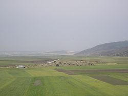
Most of the water works in Israel are combined with the National Water Carrier, the length of which is about 130 kilometres (80.8 mi). The carrier consists of a system of giant pipes, open canals, tunnel
Tunnel
A tunnel is an underground passageway, completely enclosed except for openings for egress, commonly at each end.A tunnel may be for foot or vehicular road traffic, for rail traffic, or for a canal. Some tunnels are aqueducts to supply water for consumption or for hydroelectric stations or are sewers...
s, reservoirs and large scale pumping station
Pumping station
Pumping stations are facilities including pumps and equipment for pumping fluids from one place to another. They are used for a variety of infrastructure systems, such as the supply of water to canals, the drainage of low-lying land, and the removal of sewage to processing sites.A pumping station...
s. Building the carrier was a considerable technical challenge as it traverses a wide variety of terrains and elevations.
Origins
Early plans were made before the establishment of the state of Israel but detailed planning started only after nascent Israel's formation in 1948. The construction of the project, originally known as the Jordan Project, started in 1953, during the planning phase, long before the detailed final plan was completed in 1956. The project was designed by Tahal and constructed by MekorotMekorot
Mekorot is the national water company of Israel and the country's top agency for water management.Mekorot was founded in 1937. It supplies 90% of Israel's drinking water and 80% of its water supplies. The company runs 3,000 installations throughout the country for water supply, water quality,...
. It was started during the tenure of Prime Minister David Ben-Gurion
David Ben-Gurion
' was the first Prime Minister of Israel.Ben-Gurion's passion for Zionism, which began early in life, led him to become a major Zionist leader and Executive Head of the World Zionist Organization in 1946...
, but was completed in June 1964 under Prime Minister Levi Eshkol, at a cost of about 420 million Israeli lira (at 1964 values).
The National Water Carrier was inaugurated in 1964, with 80% of its water being allocated to agriculture and 20% for drinking water. As time passed however, increasing amounts were consumed as drinking water, and by the early 1990s, the National Carrier was supplying half of the drinking water in Israel. According to forecasts, by the year 2010 80% of the National Carrier will be directed more at providing drinking water. The reasons for the increased demand for drinking water was twofold. Firstly, Israel saw rapid population growth, primarily in the center of the country which increased demands for water. Furthermore as the standard of living in the country rose, there was increased domestic water use. As a result of the 1994 Israel-Jordan Treaty of Peace
Israel-Jordan Treaty of Peace
The Israel–Jordan Treaty of Peace was signed in 1994. The treaty normalized relations between the two countries and resolved territorial disputes. The conflict had cost roughly US$18.3 billion...
, among other items, Israel agreed to transfer 50 million cubic metres of water annually to Jordan.
Route
Water first enters the National Water Carrier through a several hundred meter long pipeline which is submerged under the northern part of Sea of Galilee. The water passes into a reservoir on the shore and then travels on to a pumping station. The pipeline is made up of nine pipes which are joined by an internal cable threaded through them. Each of these pipes includes twelve concrete pipes, each five meters long and three meters wide. As these pipes were cast, they were encased in steel pipes, sealed at the ends and floated out onto the lake. A winged star-shaped cap is mounted in a vertical section of the underwater pipe to allow water to be taken in from all directions.Water travels to the Sapir Pumping Station on the shore of the lake where four horizontal pumps lift the water into three pipes which subsequently join to form the pressure pipe, a 2200 metres (7,217.8 ft) long steel pressure resistant pipe which raises the water from -213 meters below sea level to +44 meters. From here, the water flows into the Jordan Canal, an open canal
Canal
Canals are man-made channels for water. There are two types of canal:#Waterways: navigable transportation canals used for carrying ships and boats shipping goods and conveying people, further subdivided into two kinds:...
. This runs along a mountainside for most of its 17 km (10.6 mi) route. When full, the water in the canal is 2.7 metres (8.9 ft) deep and flows purely by gravity apart from where two deep wadis intersect the course of the canal (Nahal Amud and Nahal Tzalmon). To overcome these obstacles, water is carried through steel pipes shaped like an inverted siphon.
The canal transfers the water into the Tzalmon Reservoir, a 1 hm3 operational reservoir in the Nahal Tzalmon valley. Here, the second pumping station in the course of the Water Carrier is located, the Tzalmon Pumping Station which is designed to lift water an additional 115 metres (377.3 ft). Water then enters the Ya’akov Tunnel which is 850 m (2,788.7 ft) long and 3 meters in diameter. This flows under hills near the village of Eilabun
Eilabun
Eilabun is an Israeli-Arab local council in Israel's North District, located in the Beit Netofa Valley. According to the Israeli Central Bureau of Statistics, Eilabun had a population of 4,400 inhabitants in 2005. The population is predominantly Christian...
and transfers the water from the Jordan Canal to the open canal crossing which crosses the Beit Netofa Valley
Beit Netofa Valley
The Beit Netofa Valley is a valley in the Lower Galilee region of Israel, midway between Tiberias and Haifa. Covering 46 km2, it is the largest valley in the Galilee and one of the largest in the southern Levant...
– the Beit Netofa Canal.
The Beit Netofa Canal takes the water 17 kilometers and was built with an oval base due to the clay soil through which it runs. The width of the canal is 19.4 meters, the bottom is 12 meters wide and it is 2.60 meters deep, with the water flowing through it at a height of 2.15 meters. At the southwestern edge of the Beit Netofa Valley are two further reservoirs. The first of these is a sedimentation pond, holding about 1.5 cubic hectometre of water which allow suspended matter in the water to settle to the bottom, thus cleaning the water. The second reservoir is separated from the sedimentation pond by a dam and has a capacity of 4.5 million m³. Here the inflow of water from the pumping stations and open canals is regulated against the outflow into the closed pipeline. The amount allowed through depends on water demand. A special canal bypasses the reservoirs allowing water to travel straight through the carrier.
Before entering the closed pipeline, final tests are performed on the water in the carrier, with chemicals added to bring the water to drinking standards. In 2008 Mekorot completed construction of an advanced filtration plant, the fourth largest in the world, to further cleanse the water before entering the 108" Pipeline which transports it 86 km to the "Yarkon-Negev" system near the city of Rosh HaAyin
Rosh HaAyin
Rosh HaAyin is a city in the Center District of Israel. To the west of Rosh HaAyin is the fortress of Antipatris and the source of the Yarkon River. To the southeast is the fortress of Migdal Afek...
to the east of Tel Aviv
Tel Aviv
Tel Aviv , officially Tel Aviv-Yafo , is the second most populous city in Israel, with a population of 404,400 on a land area of . The city is located on the Israeli Mediterranean coastline in west-central Israel. It is the largest and most populous city in the metropolitan area of Gush Dan, with...
and Petah Tikva
Petah Tikva
Petah Tikva known as Em HaMoshavot , is a city in the Center District of Israel, east of Tel Aviv.According to the Central Bureau of Statistics, at the end of 2009, the city's population stood at 209,600. The population density is approximately...
.
Herzl plan
The initial idea of a National Water Carrier followed the proposal of several solutions for the water problems of Palestine put forward before the establishment of Israel in 1948. Early ideas appeared in the 1902 book AltneulandThe Old New Land
The Old New Land is a utopian novel published by Theodor Herzl, the founder of political Zionism, in 1902. Outlining Herzl’s vision for a Jewish state in the Land of Israel, Altneuland became one of Zionism's establishing texts. It was translated into Yiddish by Israel Isidor Elyashev...
by Theodore Herzl in which he talked about utilizing the sources of the Jordan River for irrigation purposes and channeling sea water for producing electricity from the Mediterranean Sea
Mediterranean Sea
The Mediterranean Sea is a sea connected to the Atlantic Ocean surrounded by the Mediterranean region and almost completely enclosed by land: on the north by Anatolia and Europe, on the south by North Africa, and on the east by the Levant...
near Haifa through the Beit She'an and Jordan valleys to a canal which ran parallel to the Jordan River and the Dead Sea.
Hayes plan
An earlier water development scheme was proposed by Walter C. LowdermilkWalter C. Lowdermilk
Walter Clay Lowdermilk was a soil conservationist who worked in countries throughout the world to help protect and reclaim lands in order to better feed their population...
in his book Palestine, Land of Promise, published in 1944; it was developed with human and financial assistance from the American Zionist Emergency Council. The book became a bestseller, and important in swaying the debate within the Truman administration concerning immigrant absorptive capacity and the Negev as part of Israel. His book served as the basis for a detailed water resource plan which was prepared by James Hayes, an engineer from the USA, who proposed utilizing all water sources in Israel (2 km³ per annum) for irrigation and the production of electricity. This would involve diverting part of the Litani River
Litani River
The Litani River is an important water resource in southern Lebanon. The river rises in the fertile Beqaa Valley valley, west of Baalbek, and empties into the Mediterranean Sea north of Tyre. Exceeding 140 km in length, the Litani River is the longest river in Lebanon and provides an average...
water to the Hasbani River
Hasbani River
The Hasbani River , also known as Snir Stream within Israel, is a tributary of the Jordan river.The Hasbani River derives most of its discharge from two springs in Lebanon, the Wazzani and the Haqzbieh, the latter being a group of springs on the uppermost Hasbani...
. This water which would be further transported by a dam and canal to the area south of Tel Hai
Tel Hai
Tel Hai is the modern name of a settlement in northern Israel, the site of an early battle in the Arab–Israeli conflict, and of a noted monument, tourist attraction, and a college...
, from where it would be "dropped" to produce electricity. Water would also be carried from Tel Hai to the Beit Netofa Valley
Beit Netofa Valley
The Beit Netofa Valley is a valley in the Lower Galilee region of Israel, midway between Tiberias and Haifa. Covering 46 km2, it is the largest valley in the Galilee and one of the largest in the southern Levant...
which would become a national water reservoir, of about one billion cu.m. volume (one quarter of the Sea of Galilee's volume). An electricity generating station would be located at the reservoir's outlet, from where the water would flow into an open canal to Rafiah, which, whilst travelling south would collect water from wadis and streams, including the waters of the Yarkon River. Hayes also asserted that the Yarmouk River
Yarmouk River
The Yarmouk River is the largest tributary of the Jordan River. It drains much of the Hauran Plateau. It is one of three main tributaries which enter the Jordan between the Sea of Galilee and the Dead Sea. To the south, are the Jabbok/Zarqa and the Arnon/Wadi Mujib) rivers...
would be channeled into Lake Kinneret, in order to prevent a rise in its salinity which could come about as a result of the diversion of the River Jordan, and that a joint Israeli-Jordanian dam about 5 km east of kibbutz Sha'ar HaGolan would be constructed. The Hayes plan was designed to be implemented in two stages over a 10-year period, but never materialised due to its economic infeasibility and lack of cooperation by Jordan
Jordan
Jordan , officially the Hashemite Kingdom of Jordan , Al-Mamlaka al-Urduniyya al-Hashemiyya) is a kingdom on the East Bank of the River Jordan. The country borders Saudi Arabia to the east and south-east, Iraq to the north-east, Syria to the north and the West Bank and Israel to the west, sharing...
.
Johnston plan
Eric Johnston, the water envoy of US President Dwight Eisenhower. between 1954–1957 developed another water plan for Israel, which became known as the Johnston planJordan Valley Unified Water Plan
The Jordan Valley Unified Water Plan, commonly known as the "Johnston Plan", was a plan for the unified water resource development of the Jordan Valley. It was negotiated and developed by US ambassador Eric Johnston between 1953 and 1955, and based on an earlier plan commissioned by United Nations...
. In this, water from the Jordan River and Yarmuk River would be divided between Israel (40%), Jordan (45%) and Syria and Lebanon (15%). Each country would keep its right to utilize the water flowing within its borders, if it caused no harm to a neighboring country. Whilst this plan was accepted as fair by Arab water experts, it later floundered as a result of increasing tensions in the region.
Controversy
Since its construction, the resulting diversion of water from the Jordan River has been a source of tension with SyriaSyria
Syria , officially the Syrian Arab Republic , is a country in Western Asia, bordering Lebanon and the Mediterranean Sea to the West, Turkey to the north, Iraq to the east, Jordan to the south, and Israel to the southwest....
and Jordan
Jordan
Jordan , officially the Hashemite Kingdom of Jordan , Al-Mamlaka al-Urduniyya al-Hashemiyya) is a kingdom on the East Bank of the River Jordan. The country borders Saudi Arabia to the east and south-east, Iraq to the north-east, Syria to the north and the West Bank and Israel to the west, sharing...
. In 1964, Syria
Syria
Syria , officially the Syrian Arab Republic , is a country in Western Asia, bordering Lebanon and the Mediterranean Sea to the West, Turkey to the north, Iraq to the east, Jordan to the south, and Israel to the southwest....
attempted construction of a Headwater Diversion Plan
Headwater Diversion Plan
The Headwater Diversion Plan was an Arab League plan to divert two of the three sources of the Jordan River, and prevent them from flowing into the Sea of Galilee, in order to thwart Israel's plans to use the water of the Hasbani and Banias in its National Water Carrier project for out of Basin...
that would have blocked the flow of water into the Sea of Galilee
Sea of Galilee
The Sea of Galilee, also Kinneret, Lake of Gennesaret, or Lake Tiberias , is the largest freshwater lake in Israel, and it is approximately in circumference, about long, and wide. The lake has a total area of , and a maximum depth of approximately 43 m...
, sharply reducing the capacity of the carrier. This project and Israel's subsequent physical attack on those diversion efforts in 1965 were factors which played into regional tensions culminating in the 1967 Six-Day War
Six-Day War
The Six-Day War , also known as the June War, 1967 Arab-Israeli War, or Third Arab-Israeli War, was fought between June 5 and 10, 1967, by Israel and the neighboring states of Egypt , Jordan, and Syria...
. Israel captured the Golan Heights from Syria in the course of the war; the Heights contain some of the sources of the Sea of Galilee.
See also
- Water politicsWater politicsWater politics, sometimes called hydropolitics, is politics affected by the availability of water and water resources, a necessity for all life forms and human development...
- Water politics in the Middle EastWater politics in the Middle EastWater politics in the Middle East deals with control of the water resources of the Middle East, an arid region where issues of the use, supply, control, and allocation of water are of primary importance.-Overview:...
- Water politics in the Jordan River basin
External links
- Description of the National Water Carrier by Shmuel Kantor, former chief engineer of MekorotMekorotMekorot is the national water company of Israel and the country's top agency for water management.Mekorot was founded in 1937. It supplies 90% of Israel's drinking water and 80% of its water supplies. The company runs 3,000 installations throughout the country for water supply, water quality,...
, Israel's national water company - Fossil Water Reserves - Israel from two hundred billion (109) to "several hundred billion" cubic meters of water