

National Register of Historic Places listings in Harris County, Texas
Encyclopedia
List of Registered Historic Places in Harris County, Texas
This is intended to be a complete list of properties and districts listed on the National Register of Historic Places
in Harris County, Texas
. The locations of National Register properties and districts (at least for all showing latitude and longitude coordinates below) may be seen in a Google map by clicking on "Map of all coordinates".
This is intended to be a complete list of properties and districts listed on the National Register of Historic Places
National Register of Historic Places
The National Register of Historic Places is the United States government's official list of districts, sites, buildings, structures, and objects deemed worthy of preservation...
in Harris County, Texas
Harris County, Texas
As of the 2010 Census, the population of the county was 4,092,459, White Americans made up 56.6% of Harris County's population; non-Hispanic whites represented 33.0% of the population. Black Americans made up 18.9% of the population. Native Americans made up 0.7% of Harris County's population...
. The locations of National Register properties and districts (at least for all showing latitude and longitude coordinates below) may be seen in a Google map by clicking on "Map of all coordinates".
| Landmark name | Image | Date listed | Location | City or Town | Summary | |
|---|---|---|---|---|---|---|
| 1 | 1879 Houston Waterworks | 27 Artesian St. 29°45′50"N 95°22′10"W |
Houston | |||
| 2 | 1884 Houston Cotton Exchange Building | 202 Travis St. 29°45′49"N 95°21′40"W |
Houston | |||
| 3 | All Saints Roman Catholic Church | 201 E. 10th St. 29°47′18"N 95°23′46"W |
Houston | |||
| 4 | Allbach House Allbach House The Allbach House is a house located in Houston, Texas listed on the National Register of Historic Places.... |
2023 Arlington St. 29°48′16"N 95°23′41"W |
Houston | |||
| 5 | Almeda Road Bridge over Brays Bayou | Almeda Rd. at Brays Bayou 29°42′47.5"N 95°22′55.5"W |
Houston | |||
| 6 | John W. Anderson House | 711 Columbia 29°47′1"N 95°23′34"W |
Houston | |||
| 7 | Annunciation Church Annunciation Church (Houston, Texas) The Annunciation Church is a church located in Houston, Texas listed on the National Register of Historic Places.-See also:* National Register of Historic Places listings in Harris County, Texas... |
1618 Texas Ave. 29°45′23"N 95°21′25"W |
Houston | |||
| 8 | Antioch Missionary Baptist Church Antioch Missionary Baptist Church Antioch Missionary Baptist Church is a historic church at 313 Robin Street in Downtown Houston, Texas.It was built in 1875 and added to the National Register in 1976.Jack Yates once served as the pastor of this church.-References:... |
500 Clay St. 29°45′20"N 95°21′54"W |
Houston | |||
| 9 | Apollo Mission Control Center | 116.jpg) |
Lyndon B. Johnson Space Flight Center 29°33′29"N 95°5′18"W |
Houston | ||
| 10 | Armand Bayou Archeological District | Address Restricted | Seabrook Seabrook, Texas Seabrook is a city in Harris county, with some water surface area located within Chambers county in the U.S. state of Texas. The population was 9,443 at the 2000 census.... |
|||
| 11 | James L. Autry House | 5 Courtlandt Pl. 29°44′34"N 95°22′56"W |
Houston | |||
| 12 | Aviary at the Houston Zoo | 1513 N. McGregor 29°42′59"N 95°23′31"W |
Houston | |||
| 13 | Banta House | 119 E. 20th St. 29°48′12"N 95°23′50"W |
Houston | |||
| 14 | Otto H. Baring House | 1030 Rutland 29°47′23"N 95°24′2"W |
Houston | |||
| 15 | Barker House | 121 E. 16th St. 29°47′58"N 95°23′49"W |
Houston | |||
| 16 | Barker-Cypress Archeological Site (41HR436) | Address Restricted | Houston | |||
| 17 | Bayou Bend Bayou Bend Collection and Gardens Bayou Bend Collection and Gardens, located in the River Oaks community in Houston, Texas, United States, is a facility of the Museum of Fine Arts, Houston that houses a collection of decorative art, paintings and furniture. Bayou Bend is the former home of Houston philanthropist Ima Hogg... |
 |
1 Westcott St. 29°45′27"N 95°25′14"W |
Houston | ||
| 18 | Beaconsfield Beaconsfield (Houston, Texas) Beaconsfield, located in Houston, Texas, is a building listed on the National Register of Historic Places.... |
1700 Main St. 29°45′20"N 95°22′21"W |
Houston | |||
| 19 | Benjamin Apartments | 1218 Webster St. 29°44′47"N 95°22′11"W |
Houston | |||
| 20 | Bethel Baptist Church Bethel Baptist Church (Houston, Texas) Bethel Baptist Church is a historic church building at 801 Andrews in Houston, Texas.It was built in 1923 and added to the National Register in 1998.... |
801 Andrews 29°45′4"N 95°22′33"W |
Houston | |||
| 21 | Borgstrom House | 1401 Cortlandt St. 29°47′46"N 95°23′44"W |
Houston | |||
| 22 | Boulevard Oaks Historic District | Roughly bounded by North Blvd., South Blvd., Hazard and Mandell Sts. 29°43′37"N 95°24′13"W |
Houston | |||
| 23 | Broadacres Historic District | 1300-1506 North Blvd. and 1305-1515 South Blvd. 29°43′37"N 95°23′48"W |
Houston | |||
| 24 | Burge House | 1801 Heights Blvd. 29°48′6"N 95°23′54"W |
Houston | |||
| 25 | George L. Burlingame House | 1238 Harvard 29°47′37"N 95°23′45"W |
Houston | |||
| 26 | Burnett House | 219 W. Eleventh St. 29°47′25"N 95°23′54"W |
Houston | |||
| 27 | James Bute Company Warehouse | 711 William St. 29°46′3"N 95°21′14"W |
Houston | |||
| 28 | David A. Carden House | 718 W. 17th Ave. 29°48′0"N 95°24′38"W |
Houston | |||
| 29 | J. J. Carroll House | 16 Courtlandt Pl. 29°44′37"N 95°23′2"W |
Houston | |||
| 30 | W. T. Carter Jr. House | 18 Courtlandt Pl. 29°44′37"N 95°23′3"W |
Houston | |||
| 31 | Cedar Bayou Archeological District | Address Restricted | Baytown Baytown, Texas Baytown is a city within Harris County and partially in Chambers County in the Gulf Coast region of the U.S. state of Texas. Located within the Houston–Sugar Land–Baytown metropolitan area, it lies along both State Highway 146 and Interstate 10. As of 2010, Baytown had an population of 71,802... |
|||
| 32 | Christ Church Christ Church Cathedral, Houston Christ Church Cathedral, Houston is the cathedral church for the Episcopal Diocese of Texas. The congregation was established in 1839, when Texas was still an independent republic. It is the oldest extant congregation in Houston and one of the oldest non-Roman Catholic churches in Texas... |
1117 Texas Ave. 29°45′34"N 95°21′39"W |
Houston | |||
| 33 | City National Bank Building | 1001 McKinney Ave. 29°45′31"N 95°21′52"W |
Houston | |||
| 34 | Moses A. Clanton House | 1025 Arlington 29°47′23"N 95°23′39"W |
Houston | |||
| 35 | J. H. Clare House | 939 Arlington 29°47′17"N 95°23′39"W |
Houston | |||
| 36 | Clarke & Courts Building | 1210 W. Clay Ave. 29°45′20"N 95°23′38"W |
Houston | |||
| 37 | William L. Clayton Summer House | 3376 Inwood Dr. 29°46′44"N 95°25′46"W |
Houston | |||
| 38 | A. S. Cleveland House | 8 Courtlandt Pl. 29°44′37"N 95°22′58"W |
Houston | |||
| 39 | Arthur B. Cohn House | 1711 Rusk Ave. 29°45′16"N 95°21′25"W |
Houston | |||
| 40 | Charles E. Coombs House | 1037 Columbia 29°47′23"N 95°23′35"W |
Houston | |||
| 41 | Dr. B. F. Coop House | 1536 Heights Blvd. 29°47′56"N 95°23′51"W |
Houston | |||
| 42 | Austin Copeland House I | 921 Arlington 29°47′15"N 95°23′39"W |
Houston | |||
| 43 | Austin Copeland House II | 925 Arlington 29°47′16"N 95°23′39"W |
Houston | |||
| 44 | Countryman House | 402 E. 9th St. 29°47′14"N 95°23′37"W |
Houston | |||
| 45 | Courtlandt Place Historic District | 2-25 Courtlandt Pl. 29°44′34"N 95°22′59"W |
Houston | |||
| 46 | Cummings House | 1418 Heights Blvd. 29°47′47"N 95°23′51"W |
Houston | |||
| 47 | Ben C. and Jenetter Cyrus House | 325 E. 25th St. 29°49′5"N 95°23′33"W |
Houston | |||
| 48 | James A. Dawson House | 400 Emerson Ave. 29°44′34"N 95°23′8"W |
Houston | |||
| 49 | DePelchin Faith Home DePelchin Children's Center DePelchin Children’s Center, founded in 1892 in Houston, Texas, is a nonprofit provider of children’s mental health, prevention and early intervention, and child welfare services... |
2700 Albany St. 29°44′56"N 95°22′57"W |
Houston | |||
| 50 | Dexter House | 224 W. 17th St. 29°48′2"N 95°23′59"W |
Houston | |||
| 51 | Thomas J. Donoghue House | 17 Courtlandt Pl. 29°44′33"N 95°23′5"W |
Houston | |||
| 52 | John M. Dorrance House | 9 Courtlandt Pl. 29°44′34"N 95°22′57"W |
Houston | |||
| 53 | Lula J. Doughty House | 1233 Yale St. 29°47′35"N 95°23′57"W |
Houston | |||
| 54 | Jay L. Durham House | 921 Heights Blvd. 29°47′17"N 95°23′11"W |
Houston | |||
| 55 | Eaton House | 510 Harvard St. 29°46′47"N 95°23′45"W |
Houston | |||
| 56 | Elkins House | 602 E. 9th St. 29°47′13"N 95°23′30"W |
Houston | |||
| 57 | Dr. Billie V. Ellis House | 1515 Heights Blvd. 29°47′54"N 95°23′54"W |
Houston | |||
| 58 | Ned A. and Linda S. Eppes House | 5322 Institute Ln. 29°43′29"N 95°23′50"W |
Houston | |||
| 59 | Ezzell House | 1236 Rutland St. 29°47′37"N 95°24′3"W |
Houston | |||
| 60 | Farnsworth & Chambers Building | 2999 S. Wayside 29°42′21.78"N 95°19′6.1"W |
Houston | |||
| 61 | Roy and Margaret Farrar House | 511 Lovett Blvd. 29°44′41"N 95°23′16"W |
Houston | |||
| 62 | Fire Engine House No. 9 | 1810-1812 Keene St. 29°46′31"N 95°21′5"W |
Houston | |||
| 63 | First Evangelical Church First Evangelical Church (Houston) First Evangelical Church is a historic Lutheran church at 1311 Holman Street in Houston, Texas. It is part of the Evangelical Lutheran Church in America.... |
1311 Holman St. 29°44′25"N 95°22′32"W |
Houston | |||
| 64 | William F. Fluegel House | 1327 Ashland 29°47′43"N 95°24′12"W |
Houston | |||
| 65 | Foley, W. L., Building | 214-218 Travis St. 29°45′47"N 95°21′41"W |
Houston | |||
| 66 | Forum of Civics River Oaks Garden Club Forum of Civics River Oaks Garden Club Forum of Civics is a building at 2503 Westheimer Road in Houston, Texas, United States listed in the National Register of Historic Places as the "Forum of Civics."... |
 |
2503 Westheimer Rd. 29°44′30"N 95°25′4"W |
Houston | ||
| 67 | Freedmen's Town Historic District | Roughly Bounded by Genesse, West Dallas, Arthur and W. Gray Sts. 29°45′19"N 95°22′49"W |
Houston | |||
| 68 | General Mercantile Store | 7322 N. Main St. 29°49′1"N 95°23′33"W |
Houston | |||
| 69 | Gerloff House | 221 E. 12th Ave. 29°47′34"N 95°23′45"W |
Houston | |||
| 70 | Gillette House Gillette House (Houston, Texas) The Gillette House in Houston, Texas was built in 1904. It was listed on the National Register of Historic Places in 1984.... |
301-303 E. 15th St. 29°47′52"N 95°23′43"W |
Houston | |||
| 71 | Gulf Building |  |
710-724 Main St. 29°46′4"N 95°21′50"W |
Houston | ||
| 72 | Harris County Boy's School Site | Address Restricted | Houston | |||
| 73 | Harris County Courthouse of 1910 | 301 Fannin St. 29°45′40"N 95°21′34"W |
Houston | |||
| 74 | Hartley House | 315 W. 17th St. 29°48′1"N 95°24′3"W |
Houston | |||
| 75 | Hawkins House | 1015 Heights Blvd. 29°47′22"N 95°23′53"W |
Houston | |||
| 76 | Heights Boulevard Esplanade | Heights Boulevard from White Oak Bayou to 20th St. 29°46′10"N 95°23′50"W |
Houston | |||
| 77 | Heights Christian Church Heights Christian Church Heights Christian Church is a historic church at 1703 Heights Boulevard in Houston, Texas.It was built in 1927 and added to the National Register in 1983.... |
1703 Heights Blvd. 29°48′3"N 95°23′54"W |
Houston | |||
| 78 | Heights State Bank Building | 3620 Washington St. 29°46′6"N 95°26′53"W |
Houston | |||
| 79 | Fred J. Heyne House | 220 Westmoreland Ave. 29°44′25"N 95°23′4"W |
Houston | |||
| 80 | Hill Street Bridge over Buffalo Bayou | S. Jensen Dr. at Buffalo Bayou 29°45′40"N 95°20′36"W |
Houston | |||
| 81 | Hogg Building | 401 Louisiana St. 29°45′45"N 95°21′50"W |
Houston | |||
| 82 | House at 1111 Heights Boulevard | 1111 Heights Blvd. 29°47′28"N 95°23′53"W |
Houston | |||
| 83 | House at 112 W. 4th Street | 112 W. 4th St. 29°46′40"N 95°23′52"W |
Houston | |||
| 84 | House at 1210 Harvard Street | 1210 Harvard St. 29°47′34"N 95°23′46"W |
Houston | |||
| 85 | House at 1217 Harvard | 1217 Harvard 29°47′35"N 95°23′48"W |
Houston | |||
| 86 | House at 122 East Fifth Street | 122 E. 5th St. 29°46′46"N 95°23′47"W |
Houston | |||
| 87 | House at 1220 Harvard | 1220 Harvard 29°47′35"N 95°23′45"W |
Houston | |||
| 88 | House at 1222 Harvard Street | 1222 Harvard St. 29°47′35"N 95°23′45"W |
Houston | |||
| 89 | House at 1227 Rutland Street | 1227 Rutland St. 29°47′35"N 95°24′4"W |
Houston | |||
| 90 | House at 1230 Oxford Street | 1230 Oxford St. 29°47′37"N 95°23′32"W |
Houston | |||
| 91 | House at 1237 Rutland Street | 1237 Rutland St. 29°47′37"N 95°24′4"W |
Houston | |||
| 92 | House at 1304 Cortlandt Street | 1304 Cortlandt St. 29°47′40"N 95°23′42"W |
Houston | |||
| 93 | House at 1343 Allston Street | 1343 Allston St. 29°47′44"N 95°24′1"W |
Houston | |||
| 94 | House at 1421 Harvard St. | 1421 Harvard St. 29°47′48"N 95°23′48"W |
Houston | |||
| 95 | House at 1421 Heights Boulevard | 1421 Heights Blvd. 29°47′48"N 95°23′48"W |
Houston | |||
| 96 | House at 1421-1423 Waverly Street | 1421-1423 Waverly St. 29°47′47"N 95°24′16"W |
Houston | |||
| 97 | House at 1435 Heights Boulevard | 1435 Heights Blvd. 29°47′50"N 95°23′53"W |
Houston | |||
| 98 | House at 1437 Heights Boulevard | 1437 Heights Blvd. 29°47′50"N 95°23′54"W |
Houston | |||
| 99 | House at 1437 Waverly Street | 1437 Waverly St. 29°47′49"N 95°24′16"W |
Houston | |||
| 100 | House at 1443 Allston Street | 1443 Allston St. 29°47′48"N 95°24′1"W |
Houston | |||
| 101 | House at 1509 Allston Street | 1509 Allston St. 29°47′52"N 95°24′1"W |
Houston | |||
| 102 | House at 1515 Allston Street | 1515 Allston St. 29°47′53"N 95°24′1"W |
Houston | |||
| 103 | House at 1517 Cortland Street | 1517 Cortland St. 29°47′55"N 95°23′44"W |
Houston | |||
| 104 | House at 1537 Tulane Street | 1537 Tulane Street 29°47′56"N 95°24′8"W |
Houston | |||
| 105 | House at 1640 Harvard Street | 1640 Harvard St. 29°48′3"N 95°23′46"W |
Houston | |||
| 106 | House at 201 W. 15th Street | 201 W. 15th St. 29°47′51"N 95°23′57"W |
Houston | |||
| 107 | House at 2035 Rutland Street | 2035 Rutland St. 29°48′16"N 95°24′5"W |
Houston | |||
| 108 | House at 217 E. 5th Street | 217 E. 5th St. 29°46′46"N 95°23′44"W |
Houston | |||
| 109 | House at 2402 Rutland Street | 2402 Rutland St. 29°48′28"N 95°24′4"W |
Houston | |||
| 110 | House at 402 E. 11th Street | 402 E. 11th Street 29°47′27"N 95°23′38"W |
Houston | |||
| 111 | House at 444 West 24th Street | 444 W. 24th St. 29°48′28"N 95°24′12"W |
Houston | |||
| 112 | House at 505 W. 18th Street | 505 W. 18th St. 29°48′5"N 95°24′10"W |
Houston | |||
| 113 | House at 532 Harvard Street | 532 Harvard St. 29°46′50"N 95°23′45"W |
Houston | |||
| 114 | House at 828 Heights Boulevard | 828 Heights Blvd. 29°47′7"N 95°23′50"W |
Houston | |||
| 115 | House at 844 Columbia Street | 844 Columbia St. 29°47′12"N 95°23′35"W |
Houston | |||
| 116 | House at 844 Courtlandt | 844 Cortlandt 29°47′12"N 95°23′41"W |
Houston | |||
| 117 | House at 917 Heights Boulevard | 917 Heights Blvd. 29°47′14"N 95°23′53"W |
Houston | |||
| 118 | House at 943½ Cortlandt Street | 943½ Cortlandt St. 29°47′16"N 95°23′43"W |
Houston | |||
| 119 | Houston City Hall Houston City Hall The Houston City Hall building is the headquarters of the City of Houston government. It was constructed in 1938-1939, and is located in Downtown Houston. It is surrounded by skyscrapers and very similar to dozens of other city halls built in the southwest United States during the same time... |
901 Bagby St. 29°45′36"N 95°22′9"W |
Houston | |||
| 120 | Houston Fire Station No. 7 | 2304 Milam St. 29°44′49"N 95°22′29"W |
Houston | |||
| 121 | Houston Heights Fire Station | Yale and 12th Sts. 29°47′33"N 95°23′56"W |
Houston | |||
| 122 | Houston Heights Waterworks Reservoir | W. 20 and Nicolson Sts. 29°48′15"N 95°24′23"W |
Houston | |||
| 123 | Houston Heights Woman's Club | 1846 Harvard St 29°48′12"N 95°23′47"W |
Houston | |||
| 124 | Houston Negro Hospital | 3204 Ennis St. 29°43′52"N 95°21′37"W |
Houston | |||
| 125 | Houston Negro Hospital School of Nursing Building | Holman Ave. and Ennis St. 29°43′34"N 95°21′26"W |
Houston | |||
| 126 | Houston Post-Dispatch Building | 609 Fannin 29°45′32"N 95°21′41"W |
Houston | |||
| 127 | Houston Public Library Houston Public Library Houston Public Library is the public library system serving Houston, Texas, United States. The library system has its headquarters in the Marston Building in Neartown Houston.-History:It can trace its founding to the Houston Lyceum in 1854... |
1302 Heights Blvd. 29°47′39"N 95°23′51"W |
Houston | |||
| 128 | Houston Turn-Verein | 5202 Almeda Rd. 29°43′23"N 95°22′44"W |
Houston | |||
| 129 | Humble Oil Building | 1212 Main St. 29°45′18"N 95°22′0"W |
Houston | |||
| 130 | Julia Ideson Building Julia Ideson Building The Julia Ideson Building is a Houston Public Library facility in Downtown Houston, Texas, United States.The building, with Spanish Renaissance architecture, is part of the Central Library; it houses the archives, manuscripts, and the Texas and Local History Department... |
 |
500 McKinney St. 29°45′32"N 95°22′9"W |
Houston | ||
| 131 | Idylwood Historic District | Roughly bounded by Lawndale Ave., N. MacGregor Way, Sylvan Rd. & Wayside Dr. 29°43′15"N 95°18′36"W |
Houston | |||
| 132 | Immanuel Lutheran Church Immanuel Lutheran Church (Houston) Immanuel Lutheran Church is a historic church at 1448 Cortlandt Street in Houston, Texas.It was built in 1932 and added to the National Register in 1983.... |
1448 Cortlandt St. 29°47′52"N 95°23′42"W |
Houston | |||
| 133 | Independence Heights Residential Historic District | Roughly bounded by N. Yale and E. 34th Sts., and I-610 29°48′54"N 95°23′45"W |
Houston | |||
| 134 | Independence Park | Roughly bounded by 1000 Blk. of E. 40th St. 29°49′21"N 95°23′11"W |
Houston | |||
| 135 | Isabella Court Isabella Court Isabella Court is a Spanish Colonial Revival style mixed-use residential and commercial complex at 3909-3917 South Main Street in the Midtown district of Houston, Texas, United States. It is listed in the National Register of Historic Places. Isabella Court's residents mainly consist of artists and... |
3909-3917 S. Main St. 29°44′11"N 95°22′50"W |
Houston | |||
| 136 | Isbell House | 639 Heights Blvd. 29°46′56"N 95°23′52"W |
Houston | |||
| 137 | Jefferson Davis Hospital | 1101 Elder 29°46′10"N 95°22′7"W |
Houston | |||
| 138 | James L. Jensen House | 721 Arlington 29°47′2"N 95°23′39"W |
Houston | |||
| 139 | Charles Johnson House | 301 E. 35th St. 29°49′5"N 95°23′45"W |
Houston | |||
| 140 | Morris and Mary Johnson House | 3818 Spencer St. 29°46′30"N 95°23′58"W |
Houston | |||
| 141 | Jones House | 1115-1117 Allston St. 29°47′27"N 95°24′0"W |
Houston | |||
| 142 | Jones-Hunt House | 24 Courtlandt Pl. 29°44′37"N 95°23′8"W |
Houston | |||
| 143 | Keller House | 1448 Heights Blvd. 29°47′51"N 95°23′51"W |
Houston | |||
| 144 | Kellum-Noble House | 212 Dallas St. 29°45′31"N 95°22′19"W |
Houston | |||
| 145 | Kennedy Bakery | 813 Congress St. 29°45′46"N 95°21′41"W |
Houston | |||
| 146 | Marshall W. Kennedy House | 1122 Harvard 29°47′28"N 95°23′45"W |
Houston | |||
| 147 | Kleinhaus House | 803 Yale St. 29°47′7"N 95°23′56"W |
Houston | |||
| 148 | Knittel House | 1601 Ashland St. 29°47′59"N 95°24′10"W |
Houston | |||
| 149 | Kress Building | 705 Main St. 29°45′31"N 95°21′46"W |
Houston | |||
| 150 | Kronenberger House | 612 W. 26th St. 29°48′34"N 95°24′18"W |
Houston | |||
| 151 | Lewis Apartment Building | 2815-2817 Smith St. 29°44′43"N 95°22′44"W |
Houston | |||
| 152 | Ella Lewis Store and Rental Houses | 3404-3406-3408 Cortlandt St. 29°49′2"N 95°23′44"W |
Houston | |||
| 153 | Emil Lindenburg House | 1445 Harvard 29°47′52"N 95°23′48"W |
Houston | |||
| 154 | Oscar Lindsay House | 7415 N. Main St. 29°49′2"N 95°23′34"W |
Houston | |||
| 155 | Link–Lee House | 3800 Montrose 29°44′16"N 95°23′29"W |
Houston | |||
| 156 | Logue House | 1101 Milford 29°43′44"N 95°23′31"W |
Houston | |||
| 157 | Fayette C. Lowry House | 2009 Harvard 29°48′15"N 95°23′48"W |
Houston | |||
| 158 | Lund House | 301 E. 5th St. 29°46′46"N 95°23′42"W |
Houston | |||
| 159 | Leonard W. Macatee House | 1220 Southmore Blvd. 29°47′33"N 95°23′12"W |
Houston | |||
| 160 | William Mackey House | 313 E. 37th St. 29°48′38"N 95°23′42"W |
Houston | |||
| 161 | Main Street/Market Square Historic District Main Street/Market Square Historic District Main Street/Market Square Historic District is a historic district in Houston that includes the Market Square Park. It includes buildings nearby, as well as the square itself. It was listed on the National Register of Historic Places in 1983.... |
Roughly bounded by Buffalo Bayou, Fannin, Texas, and Milam streets 29°45′47"N 95°21′40"W |
Houston | |||
| 162 | Mansfield House | 1802 Harvard St. 29°48′6"N 95°23′47"W |
Houston | |||
| 163 | Mansfield Street Archeological Site | Address Restricted | Houston | |||
| 164 | Henry Hicks McCain House | 1026 Allston 29°47′23"N 95°23′59"W |
Houston | |||
| 165 | D. C. McCollum House | 433 W. 24th St. 29°48′29"N 95°24′16"W |
Houston | |||
| 166 | McDonald House | 1801 Ashland St. 29°48′6"N 95°24′10"W |
Houston | |||
| 167 | McKee Street Bridge | McKee St. and Buffalo Bayou 29°45′57"N 95°21′7"W |
Houston | |||
| 168 | James V. Meek House | 3704 Garrott Ave. 29°44′22"N 95°23′8"W |
Houston | |||
| 169 | Meitzen House | 725 Harvard St. 29°46′30"N 95°23′46"W |
Houston | |||
| 170 | Merchants and Manufacturers Building Merchants and Manufacturers Building The One Main Building, formerly the Merchants and Manufacturers Building , is a building on the campus of the University of Houston–Downtown... |
University of Houston–Downtown University of Houston–Downtown The University of Houston–Downtown is a four-year state university, and is a distinct component institution of the University of Houston System. Its campus spans 20-acre in Downtown Houston, with a satellite location in northwestern Harris County... 1 Main St. 29°45′57"N 95°21′32"W |
Houston | |||
| 171 | Miller House | 1245 Yale St. 29°47′37"N 95°23′57"W |
Houston | |||
| 172 | Ezekial and Mary Jane Miller House | 304 Hawthorne St. 29°44′36"N 95°23′2"W |
Houston | |||
| 173 | Milroy House | 1102 Heights Blvd. 29°47′26"N 95°23′51"W |
Houston | |||
| 174 | John Milroy House | 1102 Heights Blvd. 29°47′27"N 95°23′49"W |
Houston | |||
| 175 | Milroy-Muller House | 1602 Harvard St. 29°47′59"N 95°23′46"W |
Houston | |||
| 176 | Simon and Mamie Minchen House | 1753 North Blvd. 29°43′45"N 95°24′15"W |
Houston | |||
| 177 | Angelo and Lillian Minella House | 6328 Brookside Dr. 29°43′52"N 95°18′59"W |
Houston | |||
| 178 | Morgan's Point Historic District | 89-835 Bayridge Rd. and 300-322 Vinsonia 29°40′13"N 94°59′39"W |
Morgan's Point Morgan's Point, Texas Morgan's Point is a city in Harris County, Texas, United States located on the shores of the Galveston Bay at the inlet to the Houston Ship Channel, near La Porte and Pasadena. It earned fame in Texas' early history for being the home of the legendary Emily West , known as the Yellow Rose of Texas... |
|||
| 179 | Glenn W. Morris House | 1611 Harvard St. 29°48′8"N 95°23′48"W |
Houston | |||
| 180 | Morton Brothers Grocery | 401 W. Ninth 29°47′13"N 95°24′4"W |
Houston | |||
| 181 | Mulcahy House | 1046 Harvard St. 29°47′23"N 95°23′45"W |
Houston | |||
| 182 | Sterling Myer House | 4 Courtlandt Pl. 29°44′37"N 95°22′55"W |
Houston | |||
| 183 | Myers-Spalti Manufacturing Plant | 2115 Runnels St. 29°45′45"N 95°20′49"W |
Houston | |||
| 184 | Forrest A. Nairn House | 1148 Heights Blvd. 29°47′31"N 95°23′50"W |
Houston | |||
| 185 | William R. Nash House | 215 Westmoreland Ave. 29°44′27"N 95°23′4"W |
Houston | |||
| 186 | National Biscuit Company Building | 15 N. Chenevert 29°45′36"N 95°21′8"W |
Houston | |||
| 187 | Near North Side Historic District | Roughly bounded by Little White Oak Bayou on the N; Hogan on the S; I-45 on the W and the block between N Main and Keene 29°46′42"N 95°21′55"W |
Houston | |||
| 188 | C. L. Neuhaus House | 6 Courtlandt Pl. 29°44′37"N 95°22′56"W |
Houston | |||
| 189 | Hugo V. Neuhaus Jr. House | 2910 Lazy Ln. 29°45′28"N 95°25′0"W |
Houston | |||
| 190 | Joseph Ogle House | 530 Harvard St. 29°46′47"N 95°23′45"W |
Houston | |||
| 191 | Old Houston National Bank | 202 Main St. 29°45′46"N 95°21′37"W |
Houston | |||
| 192 | Old Sixth Ward Historic District | Bounded by Washington, Union, Houston, Capitol and Glenwood Cemetery 29°45′57"N 95°22′38"W |
Houston | |||
| 193 | The Orange Show The Orange Show Jeff McKissack, a mail carrier in Houston, Texas, transformed a small suburban lot near his wood frame house into The Orange Show in honor of his favorite fruit... |
2401 Munger St. 29°43′10"N 95°19′28"W |
Houston | |||
| 194 | Oriental Textile Mill | 2201 Lawrence St. 29°48′20"N 95°24′30"W |
Houston | |||
| 195 | Otto House | 835 Rutland St. 29°47′9"N 95°24′3"W |
Houston | |||
| 196 | Palace Hotel | 216 La Branch 29°45′44"N 95°21′24"W |
Houston | |||
| 197 | Edward Albert Palmer Memorial Chapel and Autry House | 6221 and 6265 Main St. 29°42′57"N 95°23′47"W |
Houston | |||
| 198 | John W. Parker House | 2 Courtlandt Pl. 29°44′37"N 95°22′54"W |
Houston | |||
| 199 | Paul Building | 1018 Preston Ave. 29°45′38"N 95°21′38"W |
Houston | |||
| 200 | D. D. Peden House | 2 Longfellow Ln. 29°43′20"N 95°23′34"W |
Houston | |||
| 201 | Perry-Swilley House | 1101 Heights Blvd. 29°47′26"N 95°23′53"W |
Houston | |||
| 202 | Pomeroy Homestead | 202 and 204 S. Main St. 29°42′43"N 95°12′35"W |
Pasadena Pasadena, Texas Pasadena is a city in the U.S. state of Texas within the metropolitan area. It is the second-largest city in Harris County, 17th-largest in Texas, and 162nd largest in the United States. The area was founded in 1893 by John H. Burnett of Galveston.... |
|||
| 203 | Thomas B. Reed House | 933 Allston St. 29°47′17"N 95°24′1"W |
Houston | |||
| 204 | Rice Hotel | Main St. and Texas Ave. 29°45′37"N 95°21′46"W |
Houston | |||
| 205 | Charles Roessler House | 736 Cortland 29°47′4"N 95°23′41"W |
Houston | |||
| 206 | Ghent W. Rogers House | 1150 Cortlandt 29°47′31"N 95°23′41"W |
Houston | |||
| 207 | Rothko Chapel Rothko Chapel The Rothko Chapel is a non-denominational chapel in Houston, Texas founded by John and Dominique de Menil. The interior serves not only as a chapel, but also as a major work of modern art. On its walls are fourteen black but color hued paintings by Mark Rothko... |
 |
1409 Sul Ross Ave. 29°44′15"N 95°23′46"W |
Houston | ||
| 208 | Sabine Street Bridge over Buffalo Bayou | Sabine St. at Buffalo Bayou 29°45′45"N 95°22′31"W |
Houston | |||
| 209 | Sam Houston Hotel (Alden Houston) | 1117 Prairie St. 29°45′42"N 95°21′37"W |
Houston | |||
| 210 | San Felipe Courts Historic District | 1 Allen Pkwy. Village 29°45′34"N 95°22′42"W |
Houston | |||
| 211 | San Jacinto Battlefield | 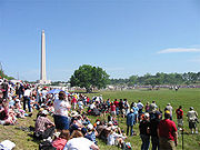 |
22 mi (35.4 km). E of Houston on TX 134 29°44′56"N 95°4′49"W |
Houston | ||
| 212 | San Jacinto Street Bridge over Buffalo Bayou | San Jacinto St. at Buffalo Bayou 29°45′53"N 95°21′27"W |
Houston | |||
| 213 | Saturn V Launch Vehicle | Johnson Space Center 29°33′26"N 95°5′20"W |
Houston | |||
| 214 | Scanlan Building | 405 Main St. 29°45′40"N 95°21′40"W |
Houston | |||
| 215 | Schauer Filling Station | 1400 Oxford St. 29°47′46"N 95°23′32"W |
Houston | |||
| 216 | Schlesser-Burrows House | 1123 Harvard St. 29°47′26"N 95°23′48"W |
Houston | |||
| 217 | Sessums-James House | 3802 Spencer 29°46′30"N 95°23′57"W |
Houston | |||
| 218 | Cleveland Harding Sewall House | 3452 Inwood St. 29°45′7"N 95°25′48"W |
Houston | |||
| 219 | Sheridan Apartments | 802-804 McGowen St. 29°44′45"N 95°22′32"W |
Houston | |||
| 220 | John H. Shoaf House | 2030 Arlington 29°48′17"N 95°23′38"W |
Houston | |||
| 221 | South Texas National Bank | 215 Main St. 29°45′44"N 95°21′36"W |
Houston | |||
| 222 | Space Environment Simulation Laboratory Space Environment Simulation Laboratory The Space Environment Simulation Laboratory in Building 32 at the Lyndon B. Johnson Space Center was used for the testing of Apollo Program equipment in a space environment. It simulated the vacuum and thermal environments that would be encountered by spacecraft in use. The laboratory continues... |
Lyndon B. Johnson Space Center 29°33′38"N 95°5′17"W |
Houston | |||
| 223 | Star Engraving Company Building | 3201 Allen Pkwy. 29°45′36"N 95°23′19"W |
Houston | |||
| 224 | State Highway 35 Bridge at the West Fork of the San Jacinto River | 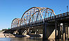 |
US 59, 1.4 mi (2.3 km). N of jct. with FM 1960 30°1′39"N 95°15′28"W |
Humble Humble, Texas Humble is a city in Harris County, Texas within the Houston–Sugar Land–Baytown metropolitan area.As of the 2000 census, the city population was 14,579. The city shares a zip code with the small Houston neighborhood of Bordersville, although people who live in Bordersville still have Humble... |
||
| 225 | State National Bank Building | 412 Main St. 29°45′40"N 95°21′42"W |
Houston | |||
| 226 | Sterling S. Ross House | 515 Bayridge Rd. 29°40′7"N 94°59′42"W |
Morgan's Point Morgan's Point, Texas Morgan's Point is a city in Harris County, Texas, United States located on the shores of the Galveston Bay at the inlet to the Houston Ship Channel, near La Porte and Pasadena. It earned fame in Texas' early history for being the home of the legendary Emily West , known as the Yellow Rose of Texas... |
|||
| 227 | Sterling-Berry House | 4515 Yoakum Blvd. 29°43′56"N 95°23′31"W |
Houston | |||
| 228 | Joseph R. and Mary M. Stevenson House | 804 Harold St. 29°44′28"N 95°23′20"W |
Houston | |||
| 229 | Dr. James M. and Dove Stewart House |  |
5702 Fourth St. 29°47′21"N 95°49′21"W |
Katy Katy, Texas Katy is a city located in Harris, Fort Bend and Waller Counties in the U.S. state of Texas, within the Houston–Sugar Land–Baytown metropolitan area... |
||
| 230 | Sweeney, Coombs & Fredericks Building | 301 Main St. 29°45′43"N 95°21′38"W |
Houston | |||
| 231 | Sylvan Beach Pavilion | 554 N Bayshore Dr. 29°39′4"N 95°0′38"W |
La Porte La Porte, Texas La Porte is a city in Harris County, Texas within the Bay Area of the Houston–Sugar Land–Baytown metropolitan area. As of the 2000 U.S. Census, the city population was 31,880... |
|||
| 232 | Judson L. Taylor House | 20 Courtlandt Pl. 29°44′37"N 95°23′6"W |
Houston | |||
| 233 | Telephone Road Bridge over Brays Bayou | Telephone Rd. at Brays Bayou 29°42′37"N 95°18′48"W |
Houston | |||
| 234 | Temple Beth Israel Temple Beth Israel (Houston, Texas) Congregation Beth Israel of Houston, the oldest Jewish congregation in Texas, was founded in Houston in 1854.-History:The congregation was founded in 1854 as an Orthodox Jewish kehilla and legally chartered in 1859... |
3517 Austin St. 29°44′12"N 95°22′30"W |
Houston | |||
| 235 | Texas Company Building | 1111 Rusk 29°45′28"N 95°21′46"W |
Houston | |||
| 236 | Texas State Hotel | 720 Fannin 29°45′28"N 95°21′46"W |
Houston | |||
| 237 | Dr. Penn B. Thornton House | 1541 Tulane St. 29°47′57"N 95°24′8"W |
Houston | |||
| 238 | Trinity Church | 3404 S. Main St. 29°44′22"N 95°22′39"W |
Houston | |||
| 239 | U.S. Customhouse | San Jacinto at Rusk St. 29°45′26"N 95°21′40"W |
Houston | |||
| 240 | U.S.S. TEXAS USS Texas (BB-35) USS Texas , the second ship of the United States Navy named in honor of the U.S. state of Texas, is a . The ship was launched on 18 May 1912 and commissioned on 12 March 1914.... |
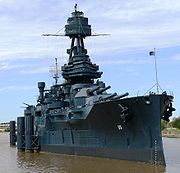 |
22 mi (35.4 km). E of Houston on TX 134 at San Jacinto Battleground 29°45′21"N 95°5′22"W |
Houston | ||
| 241 | Union Station | 501 Crawford St. 29°45′25"N 95°21′23"W |
Houston | |||
| 242 | Union Transfer and Storage Building | 1113 Vine St. 29°46′12"N 95°21′25"W |
Houston | |||
| 243 | Upchurch House | 301 E. 14th St. 29°47′45"N 95°23′43"W |
Houston | |||
| 244 | Ward House | 323 W. 17th St. 29°48′1"N 95°24′4"W |
Houston | |||
| 245 | Washburn Tunnel Washburn Tunnel The Washburn Tunnel is a two-lane underwater motor-vehicle tunnel connecting Galena Park and Pasadena, two suburbs of Houston, Texas. Completed in 1950, it travels north-south underneath the Houston Ship Channel. It was named after Harris County, Texas Auditor Harry L. Washburn... |
3198 Washburn Tunnel 29°43′35"N 95°12′43"W |
Pasadena Pasadena -Places:Places in Australia:*Pasadena, South Australia, a suburb of AdelaidePlaces in Canada:*Pasadena, NewfoundlandPlaces in the United States:*Pasadena, California*South Pasadena, California*South Pasadena, Florida*Pasadena, Maryland... |
|||
| 246 | Webber House Webber House (Houston, Texas) The Webber House in Houston, Texas was built in 1907. It was listed on the National Register of Historic Places in 1984. It is located at 1011 Heights Blvd. in Houston and was designed by Samuel H. Webber.... |
N Shaver St at the Houston Ship Channel 29°47′26"N 95°23′53"W |
Houston | |||
| 247 | Samuel H. Webber House | 407 Heights Blvd. 29°46′40"N 95°23′52"W |
Houston | |||
| 248 | West Eleventh Place Historic District | 1-8 W. 11th Pl. 29°43′31"N 95°23′31"W |
Houston | |||
| 249 | James and Jessie West Mansion | 3303 NASA Rd. 1 29°33′37"N 95°4′28"W |
Pasadena Pasadena, Texas Pasadena is a city in the U.S. state of Texas within the metropolitan area. It is the second-largest city in Harris County, 17th-largest in Texas, and 162nd largest in the United States. The area was founded in 1893 by John H. Burnett of Galveston.... |
|||
| 250 | Westmoreland Historic District | Bounded by Hawthorne, Burlington and Marshall Aves., and Garott St. 29°44′26"N 95°23′0"W |
Houston | |||
| 251 | Wilkins House | 1541 Ashland St. 29°47′57"N 95°24′12"W |
Houston | |||
| 252 | Williams-Brueder House | 245 W. 18th St. 29°48′5"N 95°24′1"W |
Houston | |||
| 253 | Willow Street Pump Station | University of Houston–Downtown University of Houston–Downtown The University of Houston–Downtown is a four-year state university, and is a distinct component institution of the University of Houston System. Its campus spans 20-acre in Downtown Houston, with a satellite location in northwestern Harris County... 811 N. San Jacinto St. 29°46′3"N 95°21′26"W |
Houston | |||
| 254 | Wilson House | 1206 Cortlandt St. 29°47′34"N 95°23′42"W |
Houston | |||
| 255 | Wimberly House | 703 Harvard St. 29°46′28"N 95°23′46"W |
Houston | |||
| 256 | Wisnoski House | 1651 Columbia St. 29°47′59"N 95°23′36"W |
Houston | |||
| 257 | Woodard House | 740 Rutlant St. 29°47′4"N 95°24′2"W |
Houston | |||
| 258 | Woodlawn Garden of Memories Cemetery | 1101 Antoine 29°47′18"N 95°28′41"W |
Houston | |||
| 259 | Woodward House | 1605 Heights Blvd. 29°47′59"N 95°23′54"W |
Houston | |||
| 260 | Andrew Jackson and Margaret Cullinan Wray House | 3 Remington Ln. 29°43′24"N 95°23′35"W |
Houston | |||
| 261 | Peter and Sophie Wunderlich Farm | 18202 Theiss Mail Rd. 30°1′49"N 95°32′54"W |
Unincorporated area Unincorporated area In law, an unincorporated area is a region of land that is not a part of any municipality.To "incorporate" in this context means to form a municipal corporation, a city, town, or village with its own government. An unincorporated community is usually not subject to or taxed by a municipal government... (Klein Klein, Texas Klein is an unincorporated community in the extraterritorial jurisdiction of Houston within north Harris County, Texas, United States, bordering on Houston to the South and Tomball to the North. It is named after Adam Klein, a German immigrant whose best-known great-great-grandson is singer Lyle... area) |
|||
| 262 | Wunsche Bros. Saloon and Hotel | 103 Midway St. 30°4′44"N 95°25′3"W |
Unincorporated area/Spring CDP Spring, Texas Spring, Texas is a census-designated place within the extraterritorial jurisdiction of Houston in Harris County, Texas, United States, north of Downtown Houston. The population was 54,298 at the 2010 census... |