- The geothermal
Geothermal is related to energy and may refer to:* The geothermal gradient and associated heat flows from within the Earth- Renewable technology :...
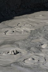
phenomena known as "mud volcanoes" are often not true mud volcanoes (pelovolcano). See mudpotA mudpot, mud pool or paint pot is a sort of hot spring or fumarole consisting of a pool of usually bubbling mud. The mud is generally of white to greyish color, but is sometimes stained with reddish or pink spots from iron compounds...
for further information.
The term
mud volcano or
mud dome are used to refer to formations created by geo-excreted liquids and gases, although there are several different processes which may cause such activity. Hot water mixes with mud and surface deposits. Mud volcanoes are associated with subduction zones and about 700 have been identified. Temperatures are much cooler in these processes than found at
igneousIgneous rock is one of the three main rock types, the others being sedimentary and metamorphic rock. Igneous rock is formed through the cooling and solidification of magma or lava...
volcano2. Bedrock3. Conduit 4. Base5. Sill6. Dike7. Layers of ash emitted by the volcano8. Flank| 9. Layers of lava emitted by the volcano10. Throat11. Parasitic cone12. Lava flow13. Vent14. Crater15...
es. The largest mud volcano structures are 10 kilometres (6 mi) in diameter and reach 700 metres (2,296.6 ft) in height.
About 86% of the gas released from these structures is
methaneMethane is a chemical compound with the chemical formula . It is the simplest alkane, the principal component of natural gas, and probably the most abundant organic compound on earth. The relative abundance of methane makes it an attractive fuel...
, with much less
carbon dioxideCarbon dioxide is a naturally occurring chemical compound composed of two oxygen atoms covalently bonded to a single carbon atom...
and
nitrogenNitrogen is a chemical element that has the symbol N, atomic number of 7 and atomic mass 14.00674 u. Elemental nitrogen is a colorless, odorless, tasteless, and mostly inert diatomic gas at standard conditions, constituting 78.08% by volume of Earth's atmosphere...
emitted. Ejected materials are often a slurry of fine solids suspended in liquids which may include water, which is frequently
acidAn acid is a substance which reacts with a base. Commonly, acids can be identified as tasting sour, reacting with metals such as calcium, and bases like sodium carbonate. Aqueous acids have a pH of less than 7, where an acid of lower pH is typically stronger, and turn blue litmus paper red...
ic or salty, and
hydrocarbonIn organic chemistry, a hydrocarbon is an organic compound consisting entirely of hydrogen and carbon. Hydrocarbons from which one hydrogen atom has been removed are functional groups, called hydrocarbyls....
fluids.
Possible mud volcanoes have been identified on
MarsMars is the fourth planet from the Sun in the Solar System. The planet is named after the Roman god of war, Mars. It is often described as the "Red Planet", as the iron oxide prevalent on its surface gives it a reddish appearance...
.
Details
A mud volcano may be the result of a piercement structure created by a pressurized
mudMud is a mixture of water and some combination of soil, silt, and clay. Ancient mud deposits harden over geological time to form sedimentary rock such as shale or mudstone . When geological deposits of mud are formed in estuaries the resultant layers are termed bay muds...
diapirA diapir is a type of intrusion in which a more mobile and ductily-deformable material is forced into brittle overlying rocks. Depending on the tectonic environment, diapirs can range from idealized mushroom-shaped Rayleigh-Taylor instability-type structures in regions with low tectonic stress...
which breaches the Earth's surface or ocean bottom. Their temperatures may be as low as the freezing point of the ejected materials, particularly when venting is associated with the creation of
hydrocarbonIn organic chemistry, a hydrocarbon is an organic compound consisting entirely of hydrogen and carbon. Hydrocarbons from which one hydrogen atom has been removed are functional groups, called hydrocarbyls....
clathrate hydrateClathrate hydrates are crystalline water-based solids physically resembling ice, in which small non-polar molecules or polar molecules with large hydrophobic moieties are trapped inside "cages" of hydrogen bonded water molecules...
deposits. Mud volcanoes are often associated with
petroleumPetroleum or crude oil is a naturally occurring, flammable liquid consisting of a complex mixture of hydrocarbons of various molecular weights and other liquid organic compounds, that are found in geologic formations beneath the Earth's surface. Petroleum is recovered mostly through oil drilling...
deposits and tectonic
subductionIn geology, subduction is the process that takes place at convergent boundaries by which one tectonic plate moves under another tectonic plate, sinking into the Earth's mantle, as the plates converge. These 3D regions of mantle downwellings are known as "Subduction Zones"...
zones and
orogenic beltsOrogeny refers to forces and events leading to a severe structural deformation of the Earth's crust due to the engagement of tectonic plates. Response to such engagement results in the formation of long tracts of highly deformed rock called orogens or orogenic belts...
; hydrocarbon gases are often erupted. They are also often associated with
lava volcanoes2. Bedrock3. Conduit 4. Base5. Sill6. Dike7. Layers of ash emitted by the volcano8. Flank| 9. Layers of lava emitted by the volcano10. Throat11. Parasitic cone12. Lava flow13. Vent14. Crater15...
; in the case of such close proximity, mud volcanoes emit incombustible gases including
heliumHelium is the chemical element with atomic number 2 and an atomic weight of 4.002602, which is represented by the symbol He. It is a colorless, odorless, tasteless, non-toxic, inert, monatomic gas that heads the noble gas group in the periodic table...
, whereas lone mud volcanoes are more likely to emit methane.
Approximately 1,100 mud volcanoes have been identified on land and in shallow water. It has been estimated that well over 10,000 may exist on
continental slopesThe continental shelf is the extended perimeter of each continent and associated coastal plain. Much of the shelf was exposed during glacial periods, but is now submerged under relatively shallow seas and gulfs, and was similarly submerged during other interglacial periods. The continental margin,...
and
abyssal plainAn abyssal plain is an underwater plain on the deep ocean floor, usually found at depths between 3000 and 6000 metres. Lying generally between the foot of a continental rise and a mid-ocean ridge, abyssal plains cover more than 50% of the Earth’s surface. They are among the flattest, smoothest...
s.
Features
- Gryphon: steep-sided cone shorter than 3 meters that extrudes mud
- Mud cone
Volcanic cones are among the simplest volcanic formations. They are built by ejecta from a volcanic vent, piling up around the vent in the shape of a cone with a central crater. Volcanic cones are of different types, depending upon the nature and size of the fragments ejected during the eruption...
: high cone shorter than 10 meters that extrudes mud and rock fragments
- Scoria cone
Scoria is a volcanic rock containing many holes or vesicles. It is most generally dark in color , and basaltic or andesitic in composition. Scoria is relatively low in mass as a result of its numerous macroscopic ellipsoidal vesicles, but in contrast to pumice, all scoria has a specific gravity...
: cone formed by heating of mud deposits during fires
- Salse: water-dominated pools with gas seeps
- Spring: water-dominated outlets smaller than 0.5 meters
- Mud shield
Emissions
Most liquid and solid material is released during eruptions, but various seeps occur during dormant periods.
First order estimates of mud volcano emissions have recently been made (1 Tg = 1 million metric tonnes).
- 2002: L.I. Dimitrov estimated that 10.2–12.6 Tg
Teragram may refer to:* 1012 grams, equivalent to a megatonne. See Orders of magnitude * Teragram Corporation...
/yr of methane is released from onshore and shallow offshore mud volcanoes.
- 2002: Etiope and Klusman estimated at least 1–2 and as much as 10–20 Tg/yr of methane may be emitted from onshore mud volcanoes.
- 2003: Etiope, in an estimate based on 120 mud volcanoes: "The emission results to be conservatively between 5 and 9 Tg/yr, that is 3–6% of the natural methane sources officially considered in the atmospheric methane budget. The total geologic source, including MVs (this work), seepage from seafloor (Kvenvolden et al., 2001), microseepage in hydrocarbon-prone areas and geothermal sources (Etiope and Klusman, 2002), would amount to 35–45 Tg/yr."
- 2003: analysis by Milkov et al. suggests that the global gas flux may be as high as 33 Tg/yr (15.9 Tg/yr during quiescent periods plus 17.1 Tg/yr during eruptions). Six teragrams per year of greenhouse gases are from onshore and shallow offshore mud volcanoes. Deep-water sources may emit 27 Tg/yr. Total may be 9% of fossil CH4 missing in the modern atmospheric CH4 budget, and 12% in the preindustrial budget.
- 2003: Alexei Milkov estimated approximately 30.5 Tg/yr of gases (mainly methane and CO2) may escape from mud volcanoes to the atmosphere and the ocean.
- 2003: Achim J. Kopf estimated 1.97×10¹¹ to 1.23×10¹⁴ m³ of methane is released by all mud volcanoes per year, of which 4.66×10⁷ to 3.28×10¹¹ m³ is from surface volcanoes. That converts to 141–88,000 Tg/yr from all mud volcanoes, of which 0.033–235 Tg is from surface volcanoes.
Locations
Europe
There are generally few mud volcanoes in Europe, but dozens can be found on the
Taman PeninsulaThe Taman Peninsula is a peninsula in the present-day Krasnodar Krai of Russia. It is bounded on the north by the Sea of Azov, on the west by the Strait of Kerch and on the south by the Black Sea. The peninsula has evolved over the past two millennia from a chain of islands into the peninsula it is...
of
RussiaRussia or , officially known as both Russia and the Russian Federation , is a country in northern Eurasia. It is a federal semi-presidential republic, comprising 83 federal subjects...
and the
Kerch PeninsulaThe Kerch Peninsula is a major and prominent geographic feature located at the eastern portion of Crimea. Stretching towards the Taman peninsula, it is reminiscent of an isthmus between two neighboring seas: Azov Sea and Black Sea...
of southeastern
UkraineUkraine is a country in Eastern Europe. It has an area of 603,628 km², making it the second largest contiguous country on the European continent, after Russia...
. In
ItalyItaly , officially the Italian Republic languages]] under the European Charter for Regional or Minority Languages. In each of these, Italy's official name is as follows:;;;;;;;;), is a unitary parliamentary republic in South-Central Europe. To the north it borders France, Switzerland, Austria and...
, they are common in the northern front of the
ApenninesThe Apennines or Apennine Mountains or Greek oros but just as often used alone as a noun. The ancient Greeks and Romans typically but not always used "mountain" in the singular to mean one or a range; thus, "the Apennine mountain" refers to the entire chain and is translated "the Apennine...
and in
SicilySicily is a region of Italy, and is the largest island in the Mediterranean Sea. Along with the surrounding minor islands, it constitutes an autonomous region of Italy, the Regione Autonoma Siciliana Sicily has a rich and unique culture, especially with regard to the arts, music, literature,...
. Another relatively accessible place where mud volcanoes can be found in Europe are the Berca Mud Volcanoes near Berca in
Buzău CountyBuzău is a county of Romania, in the historical region Muntenia, with the capital city at Buzău.-Demographics:In 2002, it had a population of 496,214 and the population density was 81/km².*Romanians – 97%*Roma – under 3% declared, and others....
,
RomaniaRomania is a country located at the crossroads of Central and Southeastern Europe, on the Lower Danube, within and outside the Carpathian arch, bordering on the Black Sea...
, close to the
Carpathian MountainsThe Carpathian Mountains or Carpathians are a range of mountains forming an arc roughly long across Central and Eastern Europe, making them the second-longest mountain range in Europe...
.
Lusi (Indonesia)
Drilling or an
earthquakeAn earthquake is the result of a sudden release of energy in the Earth's crust that creates seismic waves. The seismicity, seismism or seismic activity of an area refers to the frequency, type and size of earthquakes experienced over a period of time...
may have resulted in the
Sidoarjo mud flowThe Sidoarjo mud flow or Lapindo mud, also informally abbreviated as Lusi, a contraction of Lumpur Sidoarjo , is a mud volcano in the subdistrict of Porong, Sidoarjo in East Java, Indonesia that has been in eruption since May 2006...
on May 29, 2006, in the Porong subdistrict of
East JavaEast Java is a province of Indonesia. It is located on the eastern part of the island of Java and includes neighboring Madura and islands to its east and to its north East Java is a province of Indonesia. It is located on the eastern part of the island of Java and includes neighboring Madura and...
province,
IndonesiaIndonesia , officially the Republic of Indonesia , is a country in Southeast Asia and Oceania. Indonesia is an archipelago comprising approximately 13,000 islands. It has 33 provinces with over 238 million people, and is the world's fourth most populous country. Indonesia is a republic, with an...
. The mud covered about 440 hectares, 1087 acres (4.4 km²) (2.73mi^2), and inundated four villages, homes, roads, rice fields, and factories, displacing about 24,000 people and killing 14. The gas exploration company involved was operated by
PT Lapindo BrantasPT Lapindo Brantas is an Indonesian oil and gas exploration company.It is a subsidiary owned by PT Energi Mega Persada Tbk and 60% owned and controlled by the Bakrie Group. The Bakrie Group is owned by the former Coordinating Minister for the People's Welfare Aburizal Bakrie and his brothers...
and the earthquake that may have triggered the Mud Volcano was the Yogyakarta earthquake of May 27, 2006. In 2008, it was termed the world's largest mud volcano and is beginning to show signs of catastrophic collapse, according to geologists who have been monitoring it and the surrounding area. A catastrophic collapse could sag the vent and surrounding area by up to 150 metres (492.1 ft) in the next decade. In March 2008, the scientists observed drops of up to 3 metres (9.8 ft) in one night. Most of the subsidence in the area around the volcano is more gradual, at around 0.1 centimetre (0.0393700787401575 in) per day. A study by a group of Indonesian geo-scientists led by Bambang Istadi predicted the area affected by the mudflow over a ten year period. More recent studies carried out in 2011 predict that the mud will flow for another 20 years, or even longer. Now named
LusiThe Sidoarjo mud flow or Lapindo mud, also informally abbreviated as Lusi, a contraction of Lumpur Sidoarjo , is a mud volcano in the subdistrict of Porong, Sidoarjo in East Java, Indonesia that has been in eruption since May 2006...
– a contraction of
Lumpur SidoarjoSidoarjo is a regency of East Java, Indonesia.Sidoarjo is bordered by Surabaya city and Gresik regency to the north, by Pasuruan regency to the south, by Mojokerto regency to the west and by the Madura Strait to the east. It has an area of 634.89 km², making it the smallest regency in East Java. ...
, where
lumpur is the Indonesian word for "mud" – the mud volcano appears to be a hydrocarbon/hydrothermal hybrid.
Central Asia
Many mud volcanoes exist on the shores of the
Black SeaThe Black Sea is bounded by Europe, Anatolia and the Caucasus and is ultimately connected to the Atlantic Ocean via the Mediterranean and the Aegean seas and various straits. The Bosphorus strait connects it to the Sea of Marmara, and the strait of the Dardanelles connects that sea to the Aegean...
and
Caspian SeaThe Caspian Sea is the largest enclosed body of water on Earth by area, variously classed as the world's largest lake or a full-fledged sea. The sea has a surface area of and a volume of...
. Tectonic forces and large sedimentary deposits around the latter have created several fields of mud volcanoes, many of them emitting methane and other hydrocarbons. Features over 200 metres (656 ft) high exist in
AzerbaijanAzerbaijan , officially the Republic of Azerbaijan is the largest country in the Caucasus region of Eurasia. Located at the crossroads of Western Asia and Eastern Europe, it is bounded by the Caspian Sea to the east, Russia to the north, Georgia to the northwest, Armenia to the west, and Iran to...
, with large eruptions sometimes producing flames of similar scale (see below).
IranIran , officially the Islamic Republic of Iran , is a country in Southern and Western Asia. The name "Iran" has been in use natively since the Sassanian era and came into use internationally in 1935, before which the country was known to the Western world as Persia...
and
PakistanPakistan , officially the Islamic Republic of Pakistan is a sovereign state in South Asia. It has a coastline along the Arabian Sea and the Gulf of Oman in the south and is bordered by Afghanistan and Iran in the west, India in the east and China in the far northeast. In the north, Tajikistan...
also possess mud volcanoes in the
MakranThe present day Makran is a semi-desert coastal strip in the south of Sindh, Balochistan, in Iran and Pakistan, along the coast of the Arabian Sea and the Gulf of Oman. The present day Makran derived its name from Maka, a satrap of Achaemenid Empire....
range of mountains in the south of the two countries. In fact, the world's largest and highest volcano is located in
BalochistanBalochistan is one of the four provinces or federating units of Pakistan. With an area of 134,051 mi2 or , it is the largest province of Pakistan, constituting approximately 44% of the total land mass of Pakistan. According to the 1998 population census, Balochistan had a population of...
, Pakistan.
Azerbaijan
AzerbaijanAzerbaijan , officially the Republic of Azerbaijan is the largest country in the Caucasus region of Eurasia. Located at the crossroads of Western Asia and Eastern Europe, it is bounded by the Caspian Sea to the east, Russia to the north, Georgia to the northwest, Armenia to the west, and Iran to...
and its
CaspianThe Caspian Sea is the largest enclosed body of water on Earth by area, variously classed as the world's largest lake or a full-fledged sea. The sea has a surface area of and a volume of...
coastline are home to nearly 400 mud volcanoes, more than half the total throughout the continents. In 2001, one mud volcano 15 kilometres (9 mi) from
BakuBaku , sometimes spelled as Baki or Bakou, is the capital and largest city of Azerbaijan, as well as the largest city on the Caspian Sea and of the Caucasus region. It is located on the southern shore of the Absheron Peninsula, which projects into the Caspian Sea. The city consists of two principal...
made world headlines when it suddenly started ejecting flames 15 metres (49 ft) high.
In
AzerbaijanAzerbaijan , officially the Republic of Azerbaijan is the largest country in the Caucasus region of Eurasia. Located at the crossroads of Western Asia and Eastern Europe, it is bounded by the Caspian Sea to the east, Russia to the north, Georgia to the northwest, Armenia to the west, and Iran to...
, eruptions are driven from a deep mud reservoir which is connected to the surface even during dormant periods, when seeping water still shows a deep origin. Seeps have temperatures up to 2 C-change - 3 C-change above the ambient temperature.
Iran
There are many mud volcanoes in
IranIran , officially the Islamic Republic of Iran , is a country in Southern and Western Asia. The name "Iran" has been in use natively since the Sassanian era and came into use internationally in 1935, before which the country was known to the Western world as Persia...
: in Hormozgan province, Sistan and Baluchestan Province and
Golestan ProvinceGolestan Province is one of the 31 provinces of Iran, located in the north-east of the country, south of the Caspian Sea. Its capital is Gorgan....
.
India
The island of
BaratangBaratang, less commonly known as Baratang Island, is an island in the Andaman Islands, India, with an area of approximately . It is one of the main islands of the Great Andaman group, a closely set archipelago in the Bay of Bengal, adjoining the Andaman Sea. Middle Andaman is to its north, and...
, part of the
Great AndamanGreat Andaman is the main archipelago of the Andaman Islands of India. It comprises five major islands. From north to south, these are North Andaman, Middle Andaman, South Andaman, Baratang and Rutland Island...
archipelago in the
Andaman IslandsThe Andaman Islands are a group of Indian Ocean archipelagic islands in the Bay of Bengal between India to the west, and Burma , to the north and east...
,
Indian OceanThe Indian Ocean is the third largest of the world's oceanic divisions, covering approximately 20% of the water on the Earth's surface. It is bounded on the north by the Indian Subcontinent and Arabian Peninsula ; on the west by eastern Africa; on the east by Indochina, the Sunda Islands, and...
, has several sites of mud volcanic activity. There was a significant eruption event in 2003.
Pakistan
In
PakistanPakistan , officially the Islamic Republic of Pakistan is a sovereign state in South Asia. It has a coastline along the Arabian Sea and the Gulf of Oman in the south and is bordered by Afghanistan and Iran in the west, India in the east and China in the far northeast. In the north, Tajikistan...
there are more than 80 active mud volcanoes in Balochistan province; there are about 10 locations having clusters of mud volcanoes. In the west, in
GwadarGwadar also known as Godar is a developing port city on the southwestern Arabian Sea coast of Pakistan. It is the district headquarters of Gwadar District in Balochistan province and has a population of approximately 50,000.Gwadar is strategically located at the apex of the Arabian Sea and at the...
District, the mud volcanoes are very small and mostly sit in the south of Jabal-e-Mehdi toward Sur Bandar. Many more exist in the north-east of
OrmaraOrmara is a port city located in the Makran or coastal region of Balochistan Province in Pakistan. It is located 360 km west of Karachi and 230 km east of Gwadar on the Arabian Sea. This port is also mentioned in Periplus of the Erythraean Sea as Oraea.- History :Ormara is an old...
. The remainder are in
Lasbela DistrictLasbela is a coastal district of Balochistan province of Pakistan. It became a separate district in Kalat Division on 30 June 1954. The name is derived from the words Las which in Sanskrit signifies a settlement or lived in or lively and Bela which means "A Sea's Shore" in Sanskrit and is also the...
and are scattered between south of Gorangatti on Koh Hinglaj to Koh Kuk in the North of Miani Hor in the Hangol Valley. In this region, the heights of mud volcanoes range between 800 to 1550 ft (243.8 to 472.4 m). The most famous is Chandaragup. The biggest crater found at 25°33'13.63"N. 65°44'09.66"E is about 450 feet (137.16 m) in diameter. Most mud volcanoes in this region are situated in out-of-reach areas having very difficult terrain. Dormant mud volcanoes stand like columns of mud in many other areas.
Philippines
In the
Turtle IslandsTurtle Islands, also known as Turtle Isles, is a 5th class municipality composed of a remote group of seven islands in the province of Tawi-Tawi in the Southern Philippines.-Location:...
, in the
provinceThe Provinces of the Philippines are the primary political and administrative divisions of the Philippines. There are 80 provinces at present, further subdivided into component cities and municipalities. The National Capital Region, as well as independent cities, are autonomous from any provincial...
of
Tawi-TawiTawi-Tawi is an island province of the Philippines located in the Autonomous Region in Muslim Mindanao . The capital of Tawi-Tawi is Bongao. The province is the southernmost of the country sharing sea borders with the Malaysian State of Sabah and the Indonesian East Kalimantan province. To the...
, the southwestern edge of the
PhilippinesThe Philippines , officially known as the Republic of the Philippines , is a country in Southeast Asia in the western Pacific Ocean. To its north across the Luzon Strait lies Taiwan. West across the South China Sea sits Vietnam...
bordering
Malaysia, presence of mud volcanoes are evident on three of the islands - Lihiman, Great Bakkungan and Boan Islands. The northeastern part of Lihiman Island is distinguished for having more violent kind of mud extrusions mixed with large pieces of rocks, creating a 20-m (66-ft) wide crater on that hilly part of the island. Such extrusions are reported to be accompanied by mild earthquakes and evidence of extruded materials can be found high up the surrounding trees. Submarine mud extrusions off the island, have also been observed by local residents.
Other Asian locations
- China
Chinese civilization may refer to:* China for more general discussion of the country.* Chinese culture* Greater China, the transnational community of ethnic Chinese.* History of China* Sinosphere, the area historically affected by Chinese culture...
has a number of mud volcanoes in XinjiangXinjiang is an autonomous region of the People's Republic of China. It is the largest Chinese administrative division and spans over 1.6 million km2...
province.
- There are also mud volcanoes at the Arakan Coast
Rakhine State is a Burmese state. Situated on the western coast, it is bordered by Chin State in the north, Magway Region, Bago Region and Ayeyarwady Region in the east, the Bay of Bengal to the west, and the Chittagong Division of Bangladesh to the northwest. It is located approximately between...
in MyanmarBurma , officially the Republic of the Union of Myanmar , is a country in Southeast Asia. Burma is bordered by China on the northeast, Laos on the east, Thailand on the southeast, Bangladesh on the west, India on the northwest, the Bay of Bengal to the southwest, and the Andaman Sea on the south....
(Burma).
- There are two active mud volcanoes in South Taiwan
Taiwan , also known, especially in the past, as Formosa , is the largest island of the same-named island group of East Asia in the western Pacific Ocean and located off the southeastern coast of mainland China. The island forms over 99% of the current territory of the Republic of China following...
, and several inactive ones. The Wushan Mud Volcanoes (烏山頂泥火山 in Chinese) are located in the Yanchao District of Kaohsiung City.
- There are mud volcanoes on the island of Pulau Tiga
Pulau Tiga is one of a group of small uninhabited islands in Kimanis Bay off the western coast of Sabah, Malaysia. The islands were formed on September 21, 1897, when an earthquake on Mindanao caused a volcanic eruption near Borneo...
, off the western coast of the Malaysian state of SabahSabah is one of 13 member states of Malaysia. It is located on the northern portion of the island of Borneo. It is the second largest state in the country after Sarawak, which it borders on its southwest. It also shares a border with the province of East Kalimantan of Indonesia in the south...
on Borneo.
- A drilling accident offshore of Brunei
Brunei , officially the State of Brunei Darussalam or the Nation of Brunei, the Abode of Peace , is a sovereign state located on the north coast of the island of Borneo, in Southeast Asia...
on Borneo in 1979 caused a mud volcano which took 20 relief wellA relief well is a well drilled to intersect an oil or gas well that has experienced a blowout. Specialized liquid, such as heavy drilling mud followed by cement, can then be pumped down the relief well in order to stop the flow from the reservoir in the damaged well.The first use of a relief well...
s and nearly 30 years to halt the eruption.


North America
Mud volcanoes of the North American continent include:
- A field of small (<2 metres (6.6 ft) high) fault controlled cold mud volcanoes is located on California
California is a state located on the West Coast of the United States. It is by far the most populous U.S. state, and the third-largest by land area...
's Mendocino Coast, near GlenblairGlenblair is an unincorporated community in Mendocino County, California. It is located north-northwest of Comptche, at an elevation of 207 feet ....
and Fort Bragg, CaliforniaFort Bragg is a city located in coastal Mendocino County, California along State Route 1, the major north-south highway along the Pacific Coast. Fort Bragg is located west of Willits, at an elevation of 85 feet...
. The fine grained clay is occasionally harvested by local potters.
- Shrub and Klawasi mud volcanoes in the Copper River basin
The Copper River or Ahtna River is a 300-mile river in south-central Alaska in the United States. It drains a large region of the Wrangell Mountains and Chugach Mountains into the Gulf of Alaska...
by the Wrangell MountainsThe Wrangell Mountains are a high mountain range of eastern Alaska in the United States. Much of the range is included in Wrangell-Saint Elias National Park and Preserve. The Wrangell Mountains are almost entirely volcanic in origin, and they include the second and third highest volcanoes in the...
, AlaskaAlaska is the largest state in the United States by area. It is situated in the northwest extremity of the North American continent, with Canada to the east, the Arctic Ocean to the north, and the Pacific Ocean to the west and south, with Russia further west across the Bering Strait...
. Emissions are mostly CO2 and nitrogen; the volcanoes are associated with magmaMagma is a mixture of molten rock, volatiles and solids that is found beneath the surface of the Earth, and is expected to exist on other terrestrial planets. Besides molten rock, magma may also contain suspended crystals and dissolved gas and sometimes also gas bubbles. Magma often collects in...
tic processes.
- An unnamed mud volcano 30 metres (98.4 ft) high and with a top about 100 metres (328 ft) wide, 24 kilometres (14.9 mi) off Redondo Beach, California
Redondo Beach is one of the three Beach Cities located in Los Angeles County, California, United States. The population was 66,748 at the 2010 census, up from 63,261 at the 2000 census. The city is located in the South Bay region of the greater Los Angeles area.Redondo Beach was originally part of...
, and 800 metres (2,624.7 ft) under the surface of the Pacific OceanThe Pacific Ocean is the largest of the Earth's oceanic divisions. It extends from the Arctic in the north to the Southern Ocean in the south, bounded by Asia and Australia in the west, and the Americas in the east.At 165.2 million square kilometres in area, this largest division of the World...
.
- A field of small (<3 metres (9.8 ft)) mud volcanoes in the Salton Sea
The Salton Sea is a shallow, saline, endorheic rift lake located directly on the San Andreas Fault, predominantly in California's Imperial Valley. The lake occupies the lowest elevations of the Salton Sink in the Colorado Desert of Imperial and Riverside counties in Southern California. Like Death...
geothermal area near the town of Niland, CaliforniaNiland is a census-designated place in Imperial County, California. The town is located north of Calipatria, southeast of Salton Sea. The population was 1,006 at the 2010 census, down from 1,143 at the 2000 census...
. Emissions are mostly CO2.
- Smooth Ridge mud volcano in 1000 metres (3,280.8 ft) of water near Monterey Canyon
Monterey Canyon, or Monterey Submarine Canyon, is a submarine canyon in Monterey Bay, California. It is the subject of ongoing study by the scientists at the Monterey Bay Aquarium Research Institute, the Moss Landing Marine Laboratories, and other oceanographic institutions.Monterey Canyon begins...
, CaliforniaCalifornia is a state located on the West Coast of the United States. It is by far the most populous U.S. state, and the third-largest by land area...
.
- Kaglulik mud volcano, 43 metres (141.1 ft) under the surface of the Beaufort Sea
The Beaufort Sea is a marginal sea of the Arctic Ocean, located north of the Northwest Territories, the Yukon, and Alaska, west of Canada's Arctic islands. The sea is named after hydrographer Sir Francis Beaufort...
, near the northern boundary of AlaskaAlaska is the largest state in the United States by area. It is situated in the northwest extremity of the North American continent, with Canada to the east, the Arctic Ocean to the north, and the Pacific Ocean to the west and south, with Russia further west across the Bering Strait...
and CanadaCanada is a North American country consisting of ten provinces and three territories. Located in the northern part of the continent, it extends from the Atlantic Ocean in the east to the Pacific Ocean in the west, and northward into the Arctic Ocean...
. PetroleumPetroleum or crude oil is a naturally occurring, flammable liquid consisting of a complex mixture of hydrocarbons of various molecular weights and other liquid organic compounds, that are found in geologic formations beneath the Earth's surface. Petroleum is recovered mostly through oil drilling...
deposits are believed to exist in the area.
- Maquinna
Maquinna is an active submarine mud volcano on the Coast of British Columbia, Canada, located 16-18 kilometers west of Vancouver Island. It rises approximately above the mean level of the northeastern Pacific Ocean and lies directly along the southern expression of the left laterial, strike slip...
mud volcano, located 16–18 km (9.9–11.2 mi) west of Vancouver IslandVancouver Island is a large island in British Columbia, Canada. It is one of several North American locations named after George Vancouver, the British Royal Navy officer who explored the Pacific Northwest coast of North America between 1791 and 1794...
, British ColumbiaBritish Columbia is the westernmost of Canada's provinces and is known for its natural beauty, as reflected in its Latin motto, Splendor sine occasu . Its name was chosen by Queen Victoria in 1858...
, CanadaCanada is a North American country consisting of ten provinces and three territories. Located in the northern part of the continent, it extends from the Atlantic Ocean in the east to the Pacific Ocean in the west, and northward into the Arctic Ocean...
.
- There are many mud volcanoes in Trinidad and Tobago
Trinidad and Tobago officially the Republic of Trinidad and Tobago is an archipelagic state in the southern Caribbean, lying just off the coast of northeastern Venezuela and south of Grenada in the Lesser Antilles...
in the CaribbeanThe Caribbean is a crescent-shaped group of islands more than 2,000 miles long separating the Gulf of Mexico and the Caribbean Sea, to the west and south, from the Atlantic Ocean, to the east and north...
, near oil reservesThe total estimated amount of oil in an oil reservoir, including both producible and non-producible oil, is called oil in place. However, because of reservoir characteristics and limitations in petroleum extraction technologies, only a fraction of this oil can be brought to the surface, and it is...
in southern parts of the island of TrinidadTrinidad is the larger and more populous of the two major islands and numerous landforms which make up the island nation of Trinidad and Tobago. It is the southernmost island in the Caribbean and lies just off the northeastern coast of Venezuela. With an area of it is also the fifth largest in...
. As of August 15, 2007, the mud volcano titled the Moruga Bouffle was said to being spitting up methane gas which shows signs that it is definitely active. There are also several other mud volcanoes in the tropical island which include:
- the Devils Woodyard
Devil's Woodyard is one of the most visited locations of Trinidad's many mud volcanoes. Located in Hindustan, Trinidad, near Princes Town, the series of several vents appeared in 1852. As legend goes: "A relatively young volcanic site got its name after its first eruption in 1852. Which shook the...
mud volcano near Hindustan
- the Moruga Bouffe mud volcano near Moruga
The district of Moruga lies on the central south coast of Trinidad at the western end of the Trinity Hills. It is in Victoria County, Trinidad and Tobago, and is served by the Princes Town Regional Corporation....
- the Piparo
Piparo is a village in Central Trinidad on the southern edge of the Central Range. The village has three main claims to fame:# Piparo was the base of operations of Dole Chadee , a notorious drug lord who was executed in 1999 for the murder of four members of the Baboolal family.# Piparo was the...
mud volcano
- the Chatham mud volcano located underwater in the Columbus Channel
The Columbus Channel is the narrow body of water between the south coast of the island of Trinidad and the Venezuelan mainland. The Columbus Channel connects the Gulf of Paria with the Atlantic Ocean. It is also known as the Serpent's Mouth....
; this mud volcano periodically produces a short-lived island.

Yellowstone's "Mud Volcano"
The name of
Yellowstone National ParkYellowstone National Park, established by the U.S. Congress and signed into law by President Ulysses S. Grant on March 1, 1872, is a national park located primarily in the U.S. state of Wyoming, although it also extends into Montana and Idaho...
's "Mud Volcano" feature and the surrounding area is misleading; it consists of
hot springA hot spring is a spring that is produced by the emergence of geothermally heated groundwater from the Earth's crust. There are geothermal hot springs in many locations all over the crust of the earth.-Definitions:...
s, mud pots and
fumaroleA fumarole is an opening in a planet's crust, often in the neighborhood of volcanoes, which emits steam and gases such as carbon dioxide, sulfur dioxide, hydrochloric acid, and hydrogen sulfide. The steam is created when superheated water turns to steam as its pressure drops when it emerges from...
s, rather than a true mud volcano. Depending upon the precise definition of the term
mud volcano, the Yellowstone formation could be considered a hydrothermal mud volcano cluster. The feature is much less active than in its first recorded description, although the area is quite dynamic. Yellowstone is an active geothermal area with a magma chamber near the surface, and active gases are chiefly steam, carbon dioxide, and
hydrogen sulfideHydrogen sulfide is the chemical compound with the formula . It is a colorless, very poisonous, flammable gas with the characteristic foul odor of expired eggs perceptible at concentrations as low as 0.00047 parts per million...
.However, there are some Mud Volcanoes and Mud Geysers elsewhere in Yellowstone. One, the "Vertically Gifted Cyclic Mud Pot" sometimes acts as a geyser, throwing mud up to 30 feet high.
The mud volcano in Yellowstone was previously a mound, until suddenly, it tore itself apart into the formation seen today.
Venezuela
The eastern part of Venezuela contains several mud volcanoes, all of them, as in Trinidad, having an origin related to oil deposits. The image shows the
Volcán de lodo de Yagrumito, about 6 kilometres (3.7 mi) from Maturín, Venezuela. Its mud contains, water, biogenic gas, a certain amount of hydrocarbons and an important quantity of salt. Cows from the
savannaA savanna, or savannah, is a grassland ecosystem characterized by the trees being sufficiently small or widely spaced so that the canopy does not close. The open canopy allows sufficient light to reach the ground to support an unbroken herbaceous layer consisting primarily of C4 grasses.Some...
often gather around to lick the dried mud for its salt content, which is an integral part of their diet needed to produce milk.
Colombia
Volcan
El TotumoEl Totumo Mud Volcano is a mud volcano located in northern Colombia in the municipality of Santa Catalina. A local tourist destination, popular for its alleged healing mud-bath, it receives most of its visitors from nearby Cartagena...
, which marks the division between
BolívarBolívar is a department of Colombia. It was named after one of the original nine states of the United States of Colombia. It is located to the north of the country, extending from the coast at Cartagena near the mouth of the Magdalena River, then south along the river to a border with Antioquia.Its...
and
AtlanticoAtlántico is a department of Colombia, located in northern Colombia with the Caribbean sea to its north, the Bolívar Department to its south, and the Magdalena Department to its east separated by the Magdalena River...
in
ColombiaColombia, officially the Republic of Colombia , is a unitary constitutional republic comprising thirty-two departments. The country is located in northwestern South America, bordered to the east by Venezuela and Brazil; to the south by Ecuador and Peru; to the north by the Caribbean Sea; to the...
. This volcano is approximately 50 feet (15.2 m) high and can accommodate 10 to 15 people on its crater; many tourists and locals visit this volcano due to the medicinal benefits of the mud; the volcano is located next to a
cienaga, or lake. This volcano is currently under legal dispute between the Bolivar and Atlantico Departamentos because of its tourist value.
See also
- Abiogenic petroleum origin
Abiogenic petroleum origin is a largely abandoned hypothesis that was proposed as an alternative to theory of biological petroleum origin. It was relatively popular in the past, but it went largely forgotten at the end of the 20th century after it failed to predict the location of new wells.The...
- Asphalt volcano
An asphalt volcano is a rare type of submarine volcano first discovered in 2003. Several examples have been found: first, along the coasts of America and Mexico, and, recently, all over the world; a few are still active...
- Black smoker
- Cold seep
A cold seep is an area of the ocean floor where hydrogen sulfide, methane and other hydrocarbon-rich fluid seepage occurs, often in the form of a brine pool...
- Hydrothermal vent
A hydrothermal vent is a fissure in a planet's surface from which geothermally heated water issues. Hydrothermal vents are commonly found near volcanically active places, areas where tectonic plates are moving apart, ocean basins, and hotspots. Hydrothermal vents exist because the earth is both...
- Lahar
A lahar is a type of mudflow or debris flow composed of a slurry of pyroclastic material, rocky debris, and water. The material flows down from a volcano, typically along a river valley. The term is a shortened version of "berlahar" which originated in the Javanese language of...
- mud flow
- Methane hydrate
- Nikolai Kudryavtsev
Nikolai Alexandrovich Kudryavtsev was a Soviet Russian petroleum geologist. He is the founding father of modern abiogenic theory for origin of petroleum, which states that petroleum is formed from non-biological sources of hydrocarbons located deep in the Earth's crust and mantle.He graduated...
- Sand volcano
A sand volcano or sand blow is a cone of sand formed by the ejection of sand onto a surface from a central point. The sand builds up as a cone with slopes at the sand's angle of repose. A crater is commonly seen at the summit...
- Seamount
A seamount is a mountain rising from the ocean seafloor that does not reach to the water's surface , and thus is not an island. These are typically formed from extinct volcanoes, that rise abruptly and are usually found rising from a seafloor of depth. They are defined by oceanographers as...
- Volcano
2. Bedrock3. Conduit 4. Base5. Sill6. Dike7. Layers of ash emitted by the volcano8. Flank| 9. Layers of lava emitted by the volcano10. Throat11. Parasitic cone12. Lava flow13. Vent14. Crater15...
- igneous volcano
External links
- Origin of mud volcanoes
- Cold water mud volcanoes created by artesian pressure in Minnesota's Nemadji River basin
- Bulletin Of Mud Volcanology Azerbaijan Academy Of Sciences (in English)
- Gaia's Breath—Methane and the Future of Natural Gas - USGS, June 2003
- Azeri mud volcano flares - October 29, 2001, BBC report
- Redondo Beach mud volcano with methane hydrate deposits
- Hydrocarbons Associated with Fluid Venting Process in Monterey Bay, California
- Hydrothermal Activity and Carbon-Dioxide Discharge at Shrub and Upper Klawasi Mud Volcanoes, Wrangell Mountains, Alaska - U.S. Geological Survey Water-Resources Investigations Report 00-4207
- Mud Volcano Eruption at Baratang, Middle Andamans
- Article on mud volcanoes from Azerbaijan International
- Mud volcano floods Java, August 2006
- Mud volcano work suspended, 25 Feb 2007, Al Jazeera English
- Possible mud volcano on Mars (BBC News)
- Of Mud Pots and the End of the San Andreas Fault (Seismo Blog)