
Mill town
Encyclopedia
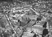
A mill town, also known as factory town or mill village, is typically a settlement that developed around one or more mills or factories (usually cotton mill
s or factories producing textiles).
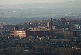
 In the United Kingdom, the term "mill town" often refers to the 19th century textile-manufacturing
towns of northern England
and the Scottish Lowlands
, particularly those in Lancashire
(cotton
) and Yorkshire
(wool
). Manchester
was bestowed with the name Cottonopolis
as its immediate region was considered a metropolis
of cotton processing mills. One of the most famous references to the early mills was in the poem/hymn "Jerusalem
" by William Blake
, in which "those dark satanic mills" were used to symbolise the injustice that a new Jerusalem ought to replace.
The British textile industry never fully recovered after the Great Depression
, and its decline continued after the Second World War when it was unable to compete with the growing Indian textile industry. It is said that Gandhi was jeered when he visited mill towns on his 1931 tour of Britain, as many locals blamed his policies for causing unemployment. There are still a minority of mills left in operation today however. In addition, many mill buildings have conservation orders on them, and some have been converted into blocks of flats.
The term mill town has seen something of a revival in the British media since the debate over relations between whites and Asians
began in the aftermath of riots in several mill towns. The term conveniently groups together towns on both sides of the Pennines
that suffer from sometimes significant racial tension
. Many mill towns in northern England are known today as "mill and mosque towns" because of the large amount of British Pakistani Muslims who live there.
Bradford
has seen several riots in recent years whilst Burnley
, Dewsbury
and Oldham
have all had suffered one riot each (see Oldham Riots
and Bradford Riot
). After the Second World War, thousands of migrants from both the Caribbean
and the Indian subcontinent
settled in the mill towns to fill the labour shortage in the industry; they often moved to the traditional working-class areas whilst the White working-class moved out to the newly built estates after the war.
Many mill towns have a symbol of the textile industry in their town badge. Some towns may also have statues dedicated to textile workers (e.g. Colne http://news.bbc.co.uk/1/hi/england/lancashire/6241179.stm) or have a symbol in the badge of local schools (e.g. Ossett School
).
The list below includes some towns where textiles was not the predominant industry. For example, mining was also a key industry in Wigan and Leigh in Greater Manchester, and in Ossett in Yorkshire.
On his tour of northern England
in 1849, Scottish publisher Angus Reach said:
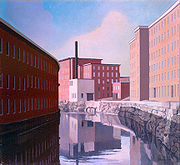 Beginning with technological information smuggled out of England by Francis Cabot Lowell, large mills were established in New England
in the early to mid 19th century. Mill towns, sometimes planned, built and owned as a company town
, grew in the shadow of the industries. The region became a manufacturing powerhouse along rivers like the Housatonic River
, Quinebaug River
, Shetucket River
, Blackstone River
, Merrimack River
, Nashua River
, Cochecho River
, Saco River
, Androscoggin River
, Kennebec River
or Winooski River
.
In the 20th century, alternatives to water power were developed, and it became more profitable for companies to manufacture textiles in southern states where cotton
was grown and winters did not require significant heating costs. Finally, the Great Depression
acted as a catalyst that sent several struggling New England firms into bankruptcy
.
Cotton mill
A cotton mill is a factory that houses spinning and weaving machinery. Typically built between 1775 and 1930, mills spun cotton which was an important product during the Industrial Revolution....
s or factories producing textiles).
United Kingdom
Textile
A textile or cloth is a flexible woven material consisting of a network of natural or artificial fibres often referred to as thread or yarn. Yarn is produced by spinning raw fibres of wool, flax, cotton, or other material to produce long strands...
towns of northern England
Northern England
Northern England, also known as the North of England, the North or the North Country, is a cultural region of England. It is not an official government region, but rather an informal amalgamation of counties. The southern extent of the region is roughly the River Trent, while the North is bordered...
and the Scottish Lowlands
Scottish Lowlands
The Scottish Lowlands is a name given to the Southern half of Scotland.The area is called a' Ghalldachd in Scottish Gaelic, and the Lawlands ....
, particularly those in Lancashire
Lancashire
Lancashire is a non-metropolitan county of historic origin in the North West of England. It takes its name from the city of Lancaster, and is sometimes known as the County of Lancaster. Although Lancaster is still considered to be the county town, Lancashire County Council is based in Preston...
(cotton
Cotton
Cotton is a soft, fluffy staple fiber that grows in a boll, or protective capsule, around the seeds of cotton plants of the genus Gossypium. The fiber is almost pure cellulose. The botanical purpose of cotton fiber is to aid in seed dispersal....
) and Yorkshire
Yorkshire
Yorkshire is a historic county of northern England and the largest in the United Kingdom. Because of its great size in comparison to other English counties, functions have been increasingly undertaken over time by its subdivisions, which have also been subject to periodic reform...
(wool
Wool
Wool is the textile fiber obtained from sheep and certain other animals, including cashmere from goats, mohair from goats, qiviut from muskoxen, vicuña, alpaca, camel from animals in the camel family, and angora from rabbits....
). Manchester
Manchester
Manchester is a city and metropolitan borough in Greater Manchester, England. According to the Office for National Statistics, the 2010 mid-year population estimate for Manchester was 498,800. Manchester lies within one of the UK's largest metropolitan areas, the metropolitan county of Greater...
was bestowed with the name Cottonopolis
Cottonopolis
Cottonopolis denotes a metropolis of cotton and cotton mills. It was inspired by Manchester, in England, and its status as the international centre of the cotton and textile processing industries during the 19th century...
as its immediate region was considered a metropolis
Metropolis
A metropolis is a very large city or urban area which is a significant economic, political and cultural center for a country or region, and an important hub for regional or international connections and communications...
of cotton processing mills. One of the most famous references to the early mills was in the poem/hymn "Jerusalem
And did those feet in ancient time
"And did those feet in ancient time" is a short poem by William Blake from the preface to his epic Milton a Poem, one of a collection of writings known as the Prophetic Books. The date on the title page of 1804 for Milton is probably when the plates were begun, but the poem was printed c. 1808...
" by William Blake
William Blake
William Blake was an English poet, painter, and printmaker. Largely unrecognised during his lifetime, Blake is now considered a seminal figure in the history of both the poetry and visual arts of the Romantic Age...
, in which "those dark satanic mills" were used to symbolise the injustice that a new Jerusalem ought to replace.
The British textile industry never fully recovered after the Great Depression
Great Depression in the United Kingdom
The Great Depression in the United Kingdom, also known as the Great Slump, was a period of national economic downturn in the 1930s, which had its origins in the global Great Depression...
, and its decline continued after the Second World War when it was unable to compete with the growing Indian textile industry. It is said that Gandhi was jeered when he visited mill towns on his 1931 tour of Britain, as many locals blamed his policies for causing unemployment. There are still a minority of mills left in operation today however. In addition, many mill buildings have conservation orders on them, and some have been converted into blocks of flats.
The term mill town has seen something of a revival in the British media since the debate over relations between whites and Asians
British Asian
British Asian is a term used to describe British citizens who descended from mainly South Asia, also known as South Asians in the United Kingdom...
began in the aftermath of riots in several mill towns. The term conveniently groups together towns on both sides of the Pennines
Pennines
The Pennines are a low-rising mountain range, separating the North West of England from Yorkshire and the North East.Often described as the "backbone of England", they form a more-or-less continuous range stretching from the Peak District in Derbyshire, around the northern and eastern edges of...
that suffer from sometimes significant racial tension
Racism
Racism is the belief that inherent different traits in human racial groups justify discrimination. In the modern English language, the term "racism" is used predominantly as a pejorative epithet. It is applied especially to the practice or advocacy of racial discrimination of a pernicious nature...
. Many mill towns in northern England are known today as "mill and mosque towns" because of the large amount of British Pakistani Muslims who live there.
Bradford
Bradford
Bradford lies at the heart of the City of Bradford, a metropolitan borough of West Yorkshire, in Northern England. It is situated in the foothills of the Pennines, west of Leeds, and northwest of Wakefield. Bradford became a municipal borough in 1847, and received its charter as a city in 1897...
has seen several riots in recent years whilst Burnley
Burnley
Burnley is a market town in the Burnley borough of Lancashire, England, with a population of around 73,500. It lies north of Manchester and east of Preston, at the confluence of the River Calder and River Brun....
, Dewsbury
Dewsbury
Dewsbury is a minster town in the Metropolitan Borough of Kirklees, in West Yorkshire, England. It is to the west of Wakefield, east of Huddersfield and south of Leeds...
and Oldham
Oldham
Oldham is a large town in Greater Manchester, England. It lies amid the Pennines on elevated ground between the rivers Irk and Medlock, south-southeast of Rochdale, and northeast of the city of Manchester...
have all had suffered one riot each (see Oldham Riots
Oldham Riots
The Oldham riots were a short but intense period of violent rioting which occurred in Oldham, a town in Greater Manchester, England, in May 2001...
and Bradford Riot
Bradford Riot
The Bradford Riots were a short but intense period of rioting which began on 7 July 2001, in Bradford, West Yorkshire, England. It occurred as a result of heightened tension between the large and growing ethnic minority communities and the city's white majority, stoked by confrontation between the...
). After the Second World War, thousands of migrants from both the Caribbean
Caribbean
The Caribbean is a crescent-shaped group of islands more than 2,000 miles long separating the Gulf of Mexico and the Caribbean Sea, to the west and south, from the Atlantic Ocean, to the east and north...
and the Indian subcontinent
Indian subcontinent
The Indian subcontinent, also Indian Subcontinent, Indo-Pak Subcontinent or South Asian Subcontinent is a region of the Asian continent on the Indian tectonic plate from the Hindu Kush or Hindu Koh, Himalayas and including the Kuen Lun and Karakoram ranges, forming a land mass which extends...
settled in the mill towns to fill the labour shortage in the industry; they often moved to the traditional working-class areas whilst the White working-class moved out to the newly built estates after the war.
Many mill towns have a symbol of the textile industry in their town badge. Some towns may also have statues dedicated to textile workers (e.g. Colne http://news.bbc.co.uk/1/hi/england/lancashire/6241179.stm) or have a symbol in the badge of local schools (e.g. Ossett School
Ossett School
Ossett Academy and Sixth Form College is the only high school in Ossett, a town in the county of West Yorkshire, England.-Academic performance:...
).
The list below includes some towns where textiles was not the predominant industry. For example, mining was also a key industry in Wigan and Leigh in Greater Manchester, and in Ossett in Yorkshire.
Spindleage of major mill towns between 1830 and 1962
| County | Towns |
|---|---|
| Cheshire mill towns | Crewe Crewe Crewe is a railway town within the unitary authority area of Cheshire East and the ceremonial county of Cheshire, England. According to the 2001 census the urban area had a population of 67,683... Congleton Congleton Congleton is a town and civil parish in the unitary authority of Cheshire East and the ceremonial county of Cheshire, England, on the banks of the River Dane, to the west of the Macclesfield Canal and 21 miles south of Manchester. It has a population of 25,750.-History:The first settlements in... Macclesfield Macclesfield Macclesfield is a market town within the unitary authority of Cheshire East, the county palatine of Chester, also known as the ceremonial county of Cheshire, England. The population of the Macclesfield urban sub-area at the time of the 2001 census was 50,688... |
| Derbyshire mill towns | Glossop Glossop Glossop is a market town within the Borough of High Peak in Derbyshire, England. It lies on the Glossop Brook, a tributary of the River Etherow, about east of the city of Manchester, west of the city of Sheffield. Glossop is situated near Derbyshire's county borders with Cheshire, Greater... Hadfield Hadfield, Derbyshire Hadfield is a parish and small residential town in High Peak, Derbyshire, England. It lies very close to the River Etherow which forms the border between Derbyshire and Greater Manchester... New Mills New Mills New Mills is a town in Derbyshire, England approximately south-east of Stockport and from Manchester. It is sited at the confluence of the rivers Goyt and Sett, on the border of Cheshire. The town stands above the Torrs, a deep gorge, cut through Woodhead Hill Sandstone of the Carboniferous period... |
| Greater Manchester mill towns | Ashton-under-Lyne Ashton-under-Lyne Ashton-under-Lyne is a market town in the Metropolitan Borough of Tameside, Greater Manchester, England. Historically a part of Lancashire, it lies on the north bank of the River Tame, on undulating land at the foothills of the Pennines... , Bolton Bolton Bolton is a town in Greater Manchester, in the North West of England. Close to the West Pennine Moors, it is north west of the city of Manchester. Bolton is surrounded by several smaller towns and villages which together form the Metropolitan Borough of Bolton, of which Bolton is the... , Bury Bury Bury is a town in Greater Manchester, England. It lies on the River Irwell, east of Bolton, west-southwest of Rochdale, and north-northwest of the city of Manchester... , Chadderton Chadderton Chadderton is a town within the Metropolitan Borough of Oldham, in Greater Manchester, England, historically a part of Lancashire... , Failsworth Failsworth At Failsworth lies north-northwest of London. It shares common boundaries with Manchester and Oldham, on its west and northeast respectively. Failsworth is traversed by the A62 road, from Manchester to Oldham, the heavy rail line of the Oldham Loop and the Rochdale Canal, which crosses the... , Heywood Heywood, Greater Manchester Heywood is a town within the Metropolitan Borough of Rochdale, in Greater Manchester, England. It lies on the south bank of the River Roch and is east of Bury, west-southwest of Rochdale, and north of the city of Manchester. The town of Middleton lies to the south, whilst to the north is the... , Hyde Hyde, Greater Manchester Hyde is a town in the Metropolitan Borough of Tameside, Greater Manchester, England. As of the 2001 census, the town had a population of 31,253. Historically part of Cheshire, it is northeast of Stockport, west of Glossop and east of Manchester.... , Lees Lees, Greater Manchester The village consists of a small cluster of shops and businesses on either side of the A669 Lees Road, surrounded by some terraced houses and some small estates... , Leigh Leigh, Greater Manchester Leigh is a town within the Metropolitan Borough of Wigan, in Greater Manchester, England. It is southeast of Wigan, and west of Manchester. Leigh is situated on low lying land to the north west of Chat Moss.... , Manchester Manchester Manchester is a city and metropolitan borough in Greater Manchester, England. According to the Office for National Statistics, the 2010 mid-year population estimate for Manchester was 498,800. Manchester lies within one of the UK's largest metropolitan areas, the metropolitan county of Greater... , Middleton Middleton, Greater Manchester Middleton is a town within the Metropolitan Borough of Rochdale, in Greater Manchester, England. It stands on the River Irk, south-southwest of Rochdale, and north-northeast of the city of Manchester... , Oldham Oldham Oldham is a large town in Greater Manchester, England. It lies amid the Pennines on elevated ground between the rivers Irk and Medlock, south-southeast of Rochdale, and northeast of the city of Manchester... , Radcliffe Radcliffe, Greater Manchester Radcliffe is a town within the Metropolitan Borough of Bury, in Greater Manchester, England. It lies on undulating ground in the Irwell Valley, along the course of the River Irwell, south-west of Bury and north-northwest of Manchester. Radcliffe is contiguous with the town of Whitefield to the... , Ramsbottom Ramsbottom Ramsbottom is a town in the Metropolitan Borough of Bury, Greater Manchester, England. It is situated on the course of the River Irwell, in the West Pennine Moors. Historically within Lancashire, it is located north-northwest of Bury, and north-northwest of Manchester... , Reddish Reddish Reddish is an area of the Metropolitan Borough of Stockport, in Greater Manchester, England. It is north of Stockport and southeast of Manchester... , Rochdale Rochdale Rochdale is a large market town in Greater Manchester, England. It lies amongst the foothills of the Pennines on the River Roch, north-northwest of Oldham, and north-northeast of the city of Manchester. Rochdale is surrounded by several smaller settlements which together form the Metropolitan... , Royton Royton Royton is a town within the Metropolitan Borough of Oldham, in Greater Manchester, England. It lies by the source of the River Irk, on undulating land at the foothills of the Pennines, north-northwest of Oldham, south-southeast of Rochdale and northeast of the city of Manchester.Historically a... , Shaw and Crompton Shaw and Crompton Shaw and Crompton is a town and civil parish within the Metropolitan Borough of Oldham, in Greater Manchester, England. It lies on the River Beal at the foothills of the South Pennines, north of Oldham, southeast of Rochdale, and to the northeast of the city of Manchester... , Stalybridge Stalybridge Stalybridge is a town in the Metropolitan Borough of Tameside in Greater Manchester, England, with a population of 22,568. Historically a part of Cheshire, it is east of Manchester city centre and northwest of Glossop. With the construction of a cotton mill in 1776, Stalybridge became one of... , Stockport Stockport Stockport is a town in Greater Manchester, England. It lies on elevated ground southeast of Manchester city centre, at the point where the rivers Goyt and Tame join and create the River Mersey. Stockport is the largest settlement in the metropolitan borough of the same name... , Wigan Wigan Wigan is a town in Greater Manchester, England. It stands on the River Douglas, south-west of Bolton, north of Warrington and west-northwest of Manchester. Wigan is the largest settlement in the Metropolitan Borough of Wigan and is its administrative centre. The town of Wigan had a total... |
| Lancashire mill towns | Accrington Accrington Accrington is a town in Lancashire, within the borough of Hyndburn. It lies about east of Blackburn, west of Burnley, north of Manchester city centre and is situated on the mostly culverted River Hyndburn... , Bacup Bacup Bacup is a town within the Rossendale borough of Lancashire, England. It is located amongst the South Pennines, along Lancashire's eastern boundary with West Yorkshire. The town sits within a rural setting in the Forest of Rossendale, amongst the steep-sided upper-Irwell Valley, through which the... , Barnoldswick Barnoldswick Barnoldswick is a town and civil parish within the West Craven area of the Borough of Pendle in Lancashire, England just outside the Yorkshire Dales National Park and the Forest of Bowland Area of Outstanding Natural Beauty. The town is built in the shadow of Weets Hill, and Stock Beck, a... , Blackburn , Burnley Burnley Burnley is a market town in the Burnley borough of Lancashire, England, with a population of around 73,500. It lies north of Manchester and east of Preston, at the confluence of the River Calder and River Brun.... , Calder Vale Calder Vale Calder Vale is an English village, located on the edge of the Forest of Bowland in Lancashire. It lies on the River Calder in a deep valley with only a single road providing access to it.... , Chorley Chorley Chorley is a market town in Lancashire, in North West England. It is the largest settlement in the Borough of Chorley. The town's wealth came principally from the cotton industry... , Colne Colne Colne is the second largest town and civil parish in the Borough of Pendle in Lancashire, England, with a population of 20,118. It lies at the eastern end of the M65, 6 miles north-east of Burnley, with Nelson immediately adjacent, in the Aire Gap with two main roads leading into the Yorkshire... , Darwen Darwen Darwen is a market town and civil parish located within Lancashire, England. Along with its northerly neighbour, Blackburn, it forms the Borough of Blackburn with Darwen — a unitary authority area... , Nelson Nelson, Lancashire Nelson is a town and civil parish in the Borough of Pendle in Lancashire, England, with a population of 28,998 in 2001. It lies 4 miles north of Burnley on the Leeds and Liverpool Canal.... , Oakenclough Oakenclough Oakenclough is an English village located on the edge of the Forest of Bowland in Lancashire.Oakenclough is a small and scattered community, which appears to have developed largely as a result of a paper mill being sited here to make use of the water power available from the swiftly flowing River... , Padiham Padiham Padiham is a small town and civil parish on the River Calder, about west of Burnley and south of Pendle Hill, in Lancashire, England. It is part of the Borough of Burnley but also has its own town council with varied powers.-History:... , Preston |
| Yorkshire mill towns | Batley Batley Batley is a town within the Metropolitan Borough of Kirklees, in West Yorkshire, England. It lies southeast of Bradford, southwest of Leeds and north of Dewsbury, near the M62 motorway. It has a population of 49,448 . Other nearby towns include Morley to the northeast, Ossett to the southeast... , Bingley Bingley Bingley is a market town in the metropolitan borough of the City of Bradford, in West Yorkshire, England. It is situated on the River Aire and the Leeds and Liverpool Canal... , Bradford Bradford Bradford lies at the heart of the City of Bradford, a metropolitan borough of West Yorkshire, in Northern England. It is situated in the foothills of the Pennines, west of Leeds, and northwest of Wakefield. Bradford became a municipal borough in 1847, and received its charter as a city in 1897... , Brighouse Brighouse Brighouse is a town within the Metropolitan Borough of Calderdale, in West Yorkshire, England. It is situated on the River Calder, east of Halifax in the Pennines. It is served by Junction 25 of the M62 motorway and Brighouse railway station on the Caldervale Line and Huddersfield Line. In the... , Cleckheaton Cleckheaton Cleckheaton is a town within the Metropolitan Borough of Kirklees, in West Yorkshire, England, situated south of Bradford, east of Brighouse, west of Batley and south-west of Leeds... , Dewsbury Dewsbury Dewsbury is a minster town in the Metropolitan Borough of Kirklees, in West Yorkshire, England. It is to the west of Wakefield, east of Huddersfield and south of Leeds... , Elland Elland Elland is a market town in Calderdale, in the county of West Yorkshire, England, south of Halifax, by the River Calder and the Calder and Hebble Navigation. The area of Elland was called Elant in the Domesday Book... , Halifax Halifax, West Yorkshire Halifax is a minster town, within the Metropolitan Borough of Calderdale in West Yorkshire, England. It has an urban area population of 82,056 in the 2001 Census. It is well-known as a centre of England's woollen manufacture from the 15th century onward, originally dealing through the Halifax Piece... , Hebden Bridge Hebden Bridge Hebden Bridge is a market town within the Metropolitan Borough of Calderdale, in West Yorkshire, England. It forms part of the Upper Calder Valley and lies 8 miles west of Halifax and 14 miles north east of Rochdale, at the confluence of the River Calder and the River Hebden .A 2004 profile of... , Heckmondwike Heckmondwike Heckmondwike is a small town in the metropolitan borough of Kirklees, which is located geographically at the centre of West Yorkshire, England, south west of Leeds. Close to Cleckheaton and Liversedge, it is part of Cleckheckmondsedge, a name invented by J.B. Priestley to represent a West Riding... , Holmfirth Holmfirth Holmfirth is a small town located on the A6024 Woodhead Road in the Holme Valley, within the Metropolitan Borough of Kirklees, West Yorkshire, England. Centred upon the confluence of the Holme and Ribble rivers, Holmfirth is south of Huddersfield and from Glossop. It mostly consists of... , Huddersfield Huddersfield Huddersfield is a large market town within the Metropolitan Borough of Kirklees, in West Yorkshire, England, situated halfway between Leeds and Manchester. It lies north of London, and south of Bradford, the nearest city.... , Keighley Keighley Keighley is a town and civil parish within the metropolitan borough of the City of Bradford in West Yorkshire, England. It is situated northwest of Bradford and is at the confluence of the River Aire and the River Worth... , Morley Morley, West Yorkshire Morley is a market town and civil parish within the metropolitan borough of the City of Leeds, in West Yorkshire, England. It lies approximately south-west of Leeds city centre. Together with Drighlington, Gildersome, Churwell, Tingley and East/West Ardsley, the town had a population of 47,579 in... , Mytholmroyd Mytholmroyd Mytholmroyd is a town within the Metropolitan Borough of Calderdale, in West Yorkshire, England. It lies east of Hebden Bridge and west of Halifax.... , Ossett Ossett Ossett is a market town within the metropolitan borough of the City of Wakefield, in West Yorkshire, England. It is located on junction 40 of the M1 motorway, half-way between Dewsbury, to the west, and Wakefield, to the east. In the 2001 census, it was classified as part of the West Yorkshire... , Pudsey Pudsey Pudsey is a market town in West Yorkshire, England. Once an independent town, it was incorporated into the metropolitan borough of the City of Leeds in 1974, and is located midway between Bradford and Leeds city centres. It has a population of 32,391.... , Shipley Shipley, West Yorkshire Shipley is a town in West Yorkshire, England, by the River Aire and the Leeds and Liverpool Canal, north of Bradford and north-west of Leeds.... , Skipton Skipton Skipton is a market town and civil parish within the Craven district of North Yorkshire, England. It is located along the course of both the Leeds and Liverpool Canal and the River Aire, on the south side of the Yorkshire Dales, northwest of Bradford and west of York... , Sowerby Bridge Sowerby Bridge Sowerby Bridge is a market town that lies within the Upper Calder Valley in the district of Calderdale in the county of West Yorkshire, in northern England.-Geography:Sowerby Bridge is situated on the edge of Halifax, about three miles from its centre... , Todmorden Todmorden Todmorden is a market town and civil parish, located 17 miles from Manchester, within the Metropolitan Borough of Calderdale, in West Yorkshire, England. It forms part of the Upper Calder Valley and has a total population of 14,941.... , Yeadon Yeadon, West Yorkshire Yeadon is a town within the City of Leeds metropolitan borough, in West Yorkshire, England. It is home to Leeds Bradford International Airport.-History:... |
On his tour of northern England
Northern England
Northern England, also known as the North of England, the North or the North Country, is a cultural region of England. It is not an official government region, but rather an informal amalgamation of counties. The southern extent of the region is roughly the River Trent, while the North is bordered...
in 1849, Scottish publisher Angus Reach said:
New England
New England
New England is a region in the northeastern corner of the United States consisting of the six states of Maine, New Hampshire, Vermont, Massachusetts, Rhode Island, and Connecticut...
in the early to mid 19th century. Mill towns, sometimes planned, built and owned as a company town
Company town
A company town is a town or city in which much or all real estate, buildings , utilities, hospitals, small businesses such as grocery stores and gas stations, and other necessities or luxuries of life within its borders are owned by a single company...
, grew in the shadow of the industries. The region became a manufacturing powerhouse along rivers like the Housatonic River
Housatonic River
The Housatonic River is a river, approximately long, in western Massachusetts and western Connecticut in the United States. It flows south to southeast, and drains about of southwestern New England into Long Island Sound...
, Quinebaug River
Quinebaug River
The Quinebaug River is a river in south-central Massachusetts and eastern Connecticut, with watershed extending into western Rhode Island. The name "Quinebaug" comes from the southern New England Native American term, spelled variously Qunnubbâgge, Quinibauge, etc., meaning "long pond", from...
, Shetucket River
Shetucket River
The Shetucket River is a tributary of the Thames River, long, in eastern Connecticut in the United States.It is formed at Willimantic by the junction of the Willimantic and Natchaug rivers. It flows southeast and south...
, Blackstone River
Blackstone Valley
The Blackstone Valley or Blackstone River Valley is a region of Massachusetts and Rhode Island. It was a major contributor to the American Industrial Revolution...
, Merrimack River
Merrimack River
The Merrimack River is a river in the northeastern United States. It rises at the confluence of the Pemigewasset and Winnipesaukee rivers in Franklin, New Hampshire, flows southward into Massachusetts, and then flows northeast until it empties into the Atlantic Ocean at Newburyport...
, Nashua River
Nashua River
The Nashua River, long, is a tributary of the Merrimack River in Massachusetts and New Hampshire in the United States. It is formed in eastern Worcester County, Massachusetts, by junction of its north and south branches near Lancaster, and flows generally north-northeast past Groton to join the...
, Cochecho River
Cochecho River
The Cochecho River or Cocheco River is a tributary of the Piscataqua River, 38.3 miles long, in the U.S. state of New Hampshire. It rises in northern Strafford County and runs southeastward, through the town of Farmington and the cities of Rochester and Dover, where it provides hydroelectric power...
, Saco River
Saco River
The Saco River is a river in northeastern New Hampshire and southwestern Maine in the United States. It drains a rural area of of forests and farmlands west and southwest of Portland, emptying into the Atlantic Ocean at Saco Bay, from its source. It supplies drinking water to roughly 250,000...
, Androscoggin River
Androscoggin River
The Androscoggin River is a river in the U.S. states of Maine and New Hampshire, in northern New England. It is long and joins the Kennebec River at Merrymeeting Bay in Maine before its water empties into the Gulf of Maine on the Atlantic Ocean. Its drainage basin is in area...
, Kennebec River
Kennebec River
The Kennebec River is a river that is entirely within the U.S. state of Maine. It rises in Moosehead Lake in west-central Maine. The East and West Outlets join at Indian Pond and the river then flows southward...
or Winooski River
Winooski River
The Winooski River is a tributary of Lake Champlain, approximately long, in northern Vermont in the United States. Although not Vermont's longest river, it is one of the state's most significant, forming a major valley way from Lake Champlain through the Green Mountains towards the Connecticut...
.
- "In the nineteenth century, saws and axes made in New England cleared the forests of OhioOhioOhio is a Midwestern state in the United States. The 34th largest state by area in the U.S.,it is the 7th‑most populous with over 11.5 million residents, containing several major American cities and seven metropolitan areas with populations of 500,000 or more.The state's capital is Columbus...
; New England ploughs broke the prairiePrairiePrairies are considered part of the temperate grasslands, savannas, and shrublands biome by ecologists, based on similar temperate climates, moderate rainfall, and grasses, herbs, and shrubs, rather than trees, as the dominant vegetation type...
sod, New England scales weighed wheat and meat in TexasTexasTexas is the second largest U.S. state by both area and population, and the largest state by area in the contiguous United States.The name, based on the Caddo word "Tejas" meaning "friends" or "allies", was applied by the Spanish to the Caddo themselves and to the region of their settlement in...
; New England sergeSergeSerge is a type of twill fabric that has diagonal lines or ridges on both sides, made with a two-up, two-down weave. The worsted variety is used in making military uniforms, suits, great coats and trench coats. Its counterpart, silk serge, is used for linings. French serge is a softer, finer variety...
clothed businessmen in San Francisco; New England cutleryCutleryCutlery refers to any hand implement used in preparing, serving, and especially eating food in the Western world. It is more usually known as silverware or flatware in the United States, where cutlery can have the more specific meaning of knives and other cutting instruments. This is probably the...
skinned hides to be tannedTanningTanning is the making of leather from the skins of animals which does not easily decompose. Traditionally, tanning used tannin, an acidic chemical compound from which the tanning process draws its name . Coloring may occur during tanning...
in Milwaukee and sliced apples to be dried in MissouriMissouriMissouri is a US state located in the Midwestern United States, bordered by Iowa, Illinois, Kentucky, Tennessee, Arkansas, Oklahoma, Kansas and Nebraska. With a 2010 population of 5,988,927, Missouri is the 18th most populous state in the nation and the fifth most populous in the Midwest. It...
; New England whale oilWhale oilWhale oil is the oil obtained from the blubber of various species of whales, particularly the three species of right whale and the bowhead whale prior to the modern era, as well as several other species of baleen whale...
lit lamps across the continent; New England blankets warmed children by night and New England textbooks preached at them by day; New England guns armed the troops; and New England dieDie (manufacturing)A die is a specialized tool used in manufacturing industries to cut or shape material using a press. Like molds, dies are generally customized to the item they are used to create...
s, latheLatheA lathe is a machine tool which rotates the workpiece on its axis to perform various operations such as cutting, sanding, knurling, drilling, or deformation with tools that are applied to the workpiece to create an object which has symmetry about an axis of rotation.Lathes are used in woodturning,...
s, loomLoomA loom is a device used to weave cloth. The basic purpose of any loom is to hold the warp threads under tension to facilitate the interweaving of the weft threads...
s, forgeForgeA forge is a hearth used for forging. The term "forge" can also refer to the workplace of a smith or a blacksmith, although the term smithy is then more commonly used.The basic smithy contains a forge, also known as a hearth, for heating metals...
s, pressesMachine pressA machine press, commonly shortened to press, is a machine tool that changes the shape of a workpiece.-Servomechanism:A servomechanism press, also known as a servo press or a electro press, is a press driven by an AC servo motor. The torque produced is converted to a linear force via a ball screw....
and screwdrivers outfitted factories far and wide." - Jane JacobsJane JacobsJane Jacobs, was an American-Canadian writer and activist with primary interest in communities and urban planning and decay. She is best known for The Death and Life of Great American Cities , a powerful critique of the urban renewal policies of the 1950s in the United States...
, The Economy of Cities, 1969
In the 20th century, alternatives to water power were developed, and it became more profitable for companies to manufacture textiles in southern states where cotton
Cotton
Cotton is a soft, fluffy staple fiber that grows in a boll, or protective capsule, around the seeds of cotton plants of the genus Gossypium. The fiber is almost pure cellulose. The botanical purpose of cotton fiber is to aid in seed dispersal....
was grown and winters did not require significant heating costs. Finally, the Great Depression
Great Depression
The Great Depression was a severe worldwide economic depression in the decade preceding World War II. The timing of the Great Depression varied across nations, but in most countries it started in about 1929 and lasted until the late 1930s or early 1940s...
acted as a catalyst that sent several struggling New England firms into bankruptcy
Bankruptcy
Bankruptcy is a legal status of an insolvent person or an organisation, that is, one that cannot repay the debts owed to creditors. In most jurisdictions bankruptcy is imposed by a court order, often initiated by the debtor....
.
| State | Towns |
|---|---|
| Connecticut mill towns | Bridgeport Bridgeport, Connecticut Bridgeport is the most populous city in the U.S. state of Connecticut. Located in Fairfield County, the city had an estimated population of 144,229 at the 2010 United States Census and is the core of the Greater Bridgeport area... , Danbury Danbury, Connecticut Danbury is a city in northern Fairfield County, Connecticut, United States. It had population at the 2010 census of 80,893. Danbury is the fourth largest city in Fairfield County and is the seventh largest city in Connecticut.... , Enfield Enfield, Connecticut Enfield is a town located in Hartford County, Connecticut, United States. The population was 45,212 at the 2000 census. It sits on the border with Longmeadow, Massachusetts and East Longmeadow, Massachusetts to the north, Somers to the east, East Windsor and Ellington to the south, and the... , Hartford Hartford, Connecticut Hartford is the capital of the U.S. state of Connecticut. The seat of Hartford County until Connecticut disbanded county government in 1960, it is the second most populous city on New England's largest river, the Connecticut River. As of the 2010 Census, Hartford's population was 124,775, making... , Killingly Killingly, Connecticut Killingly is a town in Windham County, Connecticut, United States. The population was 16,472 at the 2000 census. It consists of the borough of Danielson and the villages of Attawaugan, Ballouville, Dayville, East Killingly, Rogers, and South Killingly.... , Manchester Manchester, Connecticut Manchester is a township and city in Hartford County, Connecticut, United States. As of the 2010 census, the town had a total population of 58,241.- History :... , Middletown Middletown, Connecticut Middletown is a city located in Middlesex County, Connecticut, along the Connecticut River, in the central part of the state, 16 miles south of Hartford. In 1650, it was incorporated as a town under its original Indian name, Mattabeseck. It received its present name in 1653. In 1784, the central... , East Windsor East Windsor, Connecticut East Windsor is a town in Hartford County, Connecticut, United States. The population was 11,162 at the 2010 census.The town has five villages: Broad Brook, Melrose, Scantic, Warehouse Point and Windsorville.-Area:... , Naugatuck Naugatuck, Connecticut Naugatuck is a consolidated borough and town in New Haven County, Connecticut, United States. The town spans both sides of the Naugatuck River just south of Waterbury, and includes the communities of Union City on the east side of the river, which has its own post office, Straitsville on the... , New Haven New Haven, Connecticut New Haven is the second-largest city in Connecticut and the sixth-largest in New England. According to the 2010 Census, New Haven's population increased by 5.0% between 2000 and 2010, a rate higher than that of the State of Connecticut, and higher than that of the state's five largest cities, and... , New London New London, Connecticut New London is a seaport city and a port of entry on the northeast coast of the United States.It is located at the mouth of the Thames River in New London County, southeastern Connecticut.... , Norwich Norwich, Connecticut Regular steamship service between New York and Boston helped Norwich to prosper as a shipping center through the early part of the 20th century. During the Civil War, Norwich once again rallied and saw the growth of its textile, armaments, and specialty item manufacturing... , Putnam Putnam, Connecticut Putnam is a town in Windham County, Connecticut, United States. The population was 9,002 as of the 2000 census. It is home to WINY, an AM radio station.-History:... , Seymour Seymour, Connecticut Seymour is a town located in western New Haven County, Connecticut, United States. The town was named for Governor Thomas H. Seymour. The population was 15,454 at the 2000 census.-Geography:... , Shelton Shelton, Connecticut Shelton is a city in Fairfield County, Connecticut, United States. The population was 39,559 at the 2010 census.-Origins:Shelton was settled by the English as part of the town of Stratford, Connecticut, in 1639... , Torrington Torrington, Connecticut Torrington is the largest city in Litchfield County, Connecticut and the northwestern Connecticut region. It is also the core city of the largest micropolitan area in the United States. The city population was 36,383 according to the 2010 census.... , Vernon Vernon, Connecticut Vernon is a town in Tolland County, Connecticut, United States. The population was 29,179 at the 2010 census.Vernon was incorporated in October, 1808, from Bolton. Vernon contains the former city of Rockville, incorporated in January, 1889. The town of Vernon and city of Rockville consolidated as a... , Waterbury Waterbury, Connecticut Waterbury is a city in New Haven County, Connecticut, on the Naugatuck River, 33 miles southwest of Hartford and 77 miles northeast of New York City... , Willimantic Willimantic, Connecticut Willimantic is a census-designated place and former city located in the town of Windham in Windham County, Connecticut, United States. The population was estimated at 15,823 at the 2000 census. It is home to Eastern Connecticut State University, as well as the Windham Textile and History Museum.... , Winchester Winchester, Connecticut Winchester is a town in Litchfield County, Connecticut, United States. The population was 10,664 at the 2000 census. The Incorporated City of Winsted is located in Winchester.-Geography:... , Windham Windham, Connecticut Windham is a town in Windham County, Connecticut, United States. It contains the city of Willimantic and the villages of Windham Center, North Windham, and South Windham. The city of Willimantic was consolidated with the town in 1983... , Windsor Locks Windsor Locks, Connecticut Windsor Locks is a town located in Hartford County, Connecticut, United States. As of the 2000 census, its population was 12,043. It is the site of Bradley International Airport, which serves the Greater Hartford-Springfield region. It is also the site of the New England Air Museum... |
| Maine mill towns | Anson , Auburn Auburn, Maine Auburn is a city in and the county seat of Androscoggin County, Maine, United States. The population was 23,055 at the 2010 census. It is one of two principal cities of and included in the Lewiston-Auburn, Maine metropolitan New England city and town area and the Lewiston-Auburn, Maine metropolitan... , Biddeford Biddeford, Maine Biddeford is a town in York County, Maine, United States. It is the largest town in the county, and is the sixth-largest in the state. It is the most southerly incorporated town in the state and the principal commercial center of York County. The population was 21,277 at the 2010 census... , Brunswick Brunswick, Maine Brunswick is a town in Cumberland County, Maine, United States. The population was 20,278 at the 2010 census. It is part of the Portland-South Portland-Biddeford metropolitan area. Brunswick is home to Bowdoin College, the Bowdoin College Museum of Art, the Peary-MacMillan Arctic Museum, , and the... , Chisholm Chisholm, Maine Chisholm is a census-designated place in the town of Jay in Franklin County, Maine, United States. The population was 1,399 at the 2000 census. It is an industrial village named for Hugh J... , Corinna Corinna, Maine Corinna is a town in Penobscot County, Maine, United States. The population was 2,145 at the 2000 census. It is part of the Bangor, Maine metropolitan statistical area.-History:... , Lewiston Lewiston, Maine Lewiston is a city in Androscoggin County in Maine, and the second-largest city in the state. The population was 41,592 at the 2010 census. It is one of two principal cities of and included within the Lewiston-Auburn, Maine metropolitan New England city and town area and the Lewiston-Auburn, Maine... , Lincoln , Lisbon Falls Lisbon Falls, Maine Lisbon Falls is a census-designated place in the town of Lisbon, located in Androscoggin County, Maine, United States. The population of Lisbon Falls was 4,420 at the 2000 census... , Livermore Falls Livermore Falls, Maine Livermore Falls is a town in Androscoggin County, Maine, United States. The population was 3,227 at the 2000 census. It is included in both the Lewiston-Auburn, Maine Metropolitan Statistical Area and the Lewiston-Auburn, Maine Metropolitan New England City and Town Area... , Millinocket Millinocket, Maine Millinocket is a former mill town in Penobscot County, Maine, United States. The population was 5,203 at the 2000 census. Millinocket is both a forest products and recreational area.-History:... , Milo , Newport , Old Town Old Town, Maine Old Town is a city in Penobscot County, Maine, United States. The population was 7,840 at the 2010 census. The city's developed area is chiefly located on a relatively large island, though its boundaries extend beyond that... , Orono Orono, Maine Orono is a town in Penobscot County, Maine, United States. It was first settled in 1774 and named in honor of Chief Joseph Orono of the Penobscot Nation. It is home to The University of Maine. The population was 10,362 at the 2010 census.- Geography :... , Pittsfield , Rumford , Saco Saco, Maine Saco is a city in York County, Maine, United States. The population was 18,482 at the 2010 census. It is home to Ferry Beach State Park, Funtown Splashtown USA, Thornton Academy, as well as General Dynamics Armament Systems , a subsidiary of the defense contractor General Dynamics... , Sanford Sanford, Maine Sanford is a town in York County, Maine, United States. The population was 20,798 in the 2010 census, the highest of the York County towns, and the 8th largest in the state. Situated on the Mousam River, Sanford includes the village of Springvale... , Skowhegan Skowhegan, Maine Skowhegan is the county seat of Somerset County, Maine, United States. As of the 2000 census, the town population was 8,824. Every August, Skowhegan hosts the annual Skowhegan State Fair, the oldest continuous state fair in the United States... , Wilton , Waterville Waterville, Maine Waterville is a city in Kennebec County, Maine, United States, on the west bank of the Kennebec River. The population was 15,722 at the 2010 census. Home to Colby College and Thomas College, Waterville is the regional commercial, medical and cultural center.... , Westbrook Westbrook, Maine Westbrook is a city in Cumberland County, Maine, United States and a suburb of Portland. The population was 17,494 at the 2010 census. It is part of the Portland–South Portland–Biddeford, Maine metropolitan statistical area.-History:... |
| Massachusetts mill towns \n | Adams Adams, Massachusetts Adams is a town in Berkshire County, Massachusetts, United States. It is part of the Pittsfield, Massachusetts Metropolitan Statistical Area. The population was 8,485 at the 2010 census.-History:... , Amesbury Amesbury, Massachusetts Amesbury is a city in Essex County, Massachusetts, United States. Though it officially became a city in 1996, its formal name remains "The Town of Amesbury." In 1890, 9798 people lived in Amesbury; in 1900, 9473; in 1910, 9894; in 1920, 10,036; and in 1940, 10,862. The population was 16,283 at... , Athol Athol, Massachusetts Athol is a town in Worcester County, Massachusetts, United States. The population was 11,584 at the 2010 census.-History:Originally called Pequoiag, the area was first settled by five families in September 1735. When the township was incorporated in 1762, the name was changed to Athol... , Attleboro Attleboro, Massachusetts Attleboro is a city in Bristol County, Massachusetts, United States and is immediately north of Pawtucket, Rhode Island. Once known as "The Jewelry Capital of the World" for its many jewelry manufacturers, Attleboro had a population of 42,068 at the 2000 census, and a population of 43,645 as of... , Chicopee Chicopee, Massachusetts Chicopee is a city located on the Connecticut River in Hampden County, Massachusetts, United States of America. It is part of the Springfield, Massachusetts Metropolitan Statistical Area. As of the 2010 census, the city had a total population of 55,298, making it the second largest city in... , Clinton Clinton, Massachusetts Clinton is a town in Worcester County, Massachusetts, United States. The population was 13,606 at the 2010 census.For geographic and demographic information on the census-designated place Clinton, please see the article Clinton , Massachusetts.... , Dalton Dalton, Massachusetts Dalton is a town in Berkshire County, Massachusetts, United States. Dalton is the transition town between the urban and rural pieces of Berkshire County, Massachusetts. It is part of the Pittsfield, Massachusetts Metropolitan Statistical Area. The population was 6,892 at the 2000 census.- History... , Fall River Fall River, Massachusetts Fall River is a city in Bristol County, Massachusetts, in the United States. It is located about south of Boston, southeast of Providence, Rhode Island, and west of New Bedford and south of Taunton. The city's population was 88,857 during the 2010 census, making it the tenth largest city in... , Fitchburg Fitchburg, Massachusetts Fitchburg is the third largest city in Worcester County, Massachusetts, United States. The population was 40,318 at the 2010 census. Fitchburg is home to Fitchburg State University as well as 17 public and private elementary and high schools.- History :... , Framingham Framingham, Massachusetts Framingham is a New England town in Middlesex County, Massachusetts, United States. The population was 68,318 as of the United States 2010 Census. -History:... , Gardner Gardner, Massachusetts Gardner, Massachusetts is a city in Worcester County, Massachusetts, United States. The population was 20,228 as of the 2010 census. Gardner is home to Dunn State Park, Gardner Heritage State Park, Lake Wampanoag Wildlife Sanctuary, and Mount Wachusett Community College.-History:Named in honor of... , Grafton Grafton, Massachusetts Grafton is a town in Worcester County, Massachusetts, United States. The population was 17,765 at the 2010 census. Grafton is the home of a Nipmuc village known as Hassanamisco Reservation, the Willard House and Clock Museum, and the Tufts University Cummings School of Veterinary Medicine... , Greenfield Greenfield, Massachusetts Greenfield is a city in Franklin County, Massachusetts, United States. The population was 17,456 at the 2010 census. It is the county seat of Franklin County. Greenfield is home to Greenfield Community College, the Pioneer Valley Symphony Orchestra, and the Franklin County Fair... , Haverhill Haverhill, Massachusetts Haverhill is a city in Essex County, Massachusetts, United States. The population was 60,879 at the 2010 census.Located on the Merrimack River, it began as a farming community that would evolve into an important industrial center, beginning with sawmills and gristmills run by water power. In the... , Holyoke Holyoke, Massachusetts Holyoke is a city in Hampden County, Massachusetts, United States, between the western bank of the Connecticut River and the Mount Tom Range of mountains. As of the 2010 Census, the city had a population of 39,880... , Hudson Hudson, Massachusetts Hudson is a town in Middlesex County, Massachusetts, United States. The population was 19,063 at the 2010 census. The town is located in central Massachusetts, about a 40-minute drive, or about , west of Boston, and about a 20-minute drive, or about , northeast of Worcester.Before its... , Lawrence Lawrence, Massachusetts Lawrence is a city in Essex County, Massachusetts, United States on the Merrimack River. According to the 2010 U.S. Census, the city had a total population of 76,377. Surrounding communities include Methuen to the north, Andover to the southwest, and North Andover to the southeast. It and Salem are... , Lowell Lowell, Massachusetts Lowell is a city in Middlesex County, Massachusetts, USA. According to the 2010 census, the city's population was 106,519. It is the fourth largest city in the state. Lowell and Cambridge are the county seats of Middlesex County... , Ludlow Ludlow, Massachusetts Ludlow is a town in Hampden County, Massachusetts, United States. The population was 21,103 as of the 2010 census. It is located in western Massachusetts, north of Springfield, east of Chicopee, southeast of Granby, southwest of Belchertown, west of Wilbraham and is considered part of the... , Lynn Lynn, Massachusetts Lynn is a city in Essex County, Massachusetts, United States. The population was 89,050 at the 2000 census. An old industrial center, Lynn is home to Lynn Beach and Lynn Heritage State Park and is about north of downtown Boston.-17th century:... , Maynard Maynard, Massachusetts Maynard is a town in Middlesex County, Massachusetts, United States. As of the 2010 census, the town population was 10,106.- History :Maynard, located on the Assabet River, was incorporated as an independent municipality in 1871. Prior to that it was known as 'Assabet Village' but was legally... , Methuen Methuen, Massachusetts Methuen is a city in Essex County, Massachusetts, United States. The population was 43,789 at the 2000 census.-History:Methuen was first settled in 1642 and was officially incorporated in 1726; it is named for the British diplomat Sir Paul Methuen. Methuen was originally part of Haverhill,... , Milford Milford, Massachusetts Milford is a town in Worcester County, Massachusetts, United States. It had a population of 27,999 at the 2010 census.For geographic and demographic information on the census-designated place Milford, constituting the center of the town, please see the article Milford ,... , Millbury Millbury, Massachusetts Millbury is a town in Worcester County, Massachusetts, United States. The population was 13,261 at the 2010 census. The town is part of the Blackstone River Valley National Heritage Corridor.-History:... , Monson Monson, Massachusetts Monson is a town in Hampden County, Massachusetts, United States. The population was 8,560 at the 2010 census. It is part of the Springfield, Massachusetts Metropolitan Statistical Area.The village of Monson Center lies at the center of the town.... , New Bedford New Bedford, Massachusetts New Bedford is a city in Bristol County, Massachusetts, United States, located south of Boston, southeast of Providence, Rhode Island, and about east of Fall River. As of the 2010 census, the city had a total population of 95,072, making it the sixth-largest city in Massachusetts... , North Adams North Adams, Massachusetts North Adams is a city in Berkshire County, Massachusetts, United States. It is part of the Pittsfield, Massachusetts Metropolitan Statistical Area. The population was 13,708 as of the 2010 census, making it the least populous city in the state... , North Andover North Andover, Massachusetts North Andover is a town in Essex County, Massachusetts, United States. North Andover is the home of Merrimack College, a private, Catholic four-year institution .... , Orange Orange, Massachusetts Orange is a town in Franklin County, Massachusetts, United States. The population was 7,839 at the 2010 census. It is part of the Springfield, Massachusetts Metropolitan Statistical Area.Part of the town is included in the census-designated place of Orange.... , Pittsfield Pittsfield, Massachusetts Pittsfield is the largest city and the county seat of Berkshire County, Massachusetts, United States. It is the principal city of the Pittsfield, Massachusetts Metropolitan Statistical Area which encompasses all of Berkshire County. Its area code is 413. Its ZIP code is 01201... , Russell Russell, Massachusetts Russell is a town in Hampden County, Massachusetts, United States. The population was 1,775 at the 2010 census. It is part of the Springfield, Massachusetts Metropolitan Statistical Area.-Geography:... , Southbridge Southbridge, Massachusetts The Town of Southbridge is a city in Worcester County, Massachusetts, United States. The population was 16,719 at the 2010 census.-History:... , Springfield Springfield, Massachusetts Springfield is the most populous city in Western New England, and the seat of Hampden County, Massachusetts, United States. Springfield sits on the eastern bank of the Connecticut River near its confluence with three rivers; the western Westfield River, the eastern Chicopee River, and the eastern... , Taunton Taunton, Massachusetts Taunton is a city in Bristol County, Massachusetts, United States. It is the seat of Bristol County and the hub of the Greater Taunton Area. The city is located south of Boston, east of Providence, north of Fall River and west of Plymouth. The City of Taunton is situated on the Taunton River... , Uxbridge Uxbridge, Massachusetts Uxbridge is a town in Worcester County, Massachusetts, in the United States. It was first settled in 1662, incorporated in 1727 at Suffolk County, and named for the Earl of Uxbridge. Uxbridge is south-southeast of Worcester, north-northwest of Providence, and southwest of Boston. It is part of... , Waltham Waltham, Massachusetts Waltham is a city in Middlesex County, Massachusetts, United States, was an early center for the labor movement, and major contributor to the American Industrial Revolution. The original home of the Boston Manufacturing Company, the city was a prototype for 19th century industrial city planning,... , Ware Ware, Massachusetts Ware is a town in Hampshire County, Massachusetts, United States. The population was 9,707 at the 2000 census. It is part of the Springfield, Massachusetts Metropolitan Statistical Area.Part of the town comprises the census-designated place of Ware.... , Webster Webster, Massachusetts -Media:* Worcester Telegram & Gazette * Webster Times, published every Friday* The Patriot, published every Wednesday* WGFP-AM 940, a country music station* Boston Globe* Boston Herald-Library:... , Winchendon Winchendon, Massachusetts Winchendon is a town in Worcester County, Massachusetts, USA. The population was 10,300 at the 2010 census. Home to Winchendon State Forest, the town includes the villages of Waterville and Winchendon Springs.... , Worcester Worcester, Massachusetts Worcester is a city and the county seat of Worcester County, Massachusetts, United States. Named after Worcester, England, as of the 2010 Census the city's population is 181,045, making it the second largest city in New England after Boston.... |
| New Hampshire mill towns | Belmont Belmont, New Hampshire Belmont is a town in Belknap County, New Hampshire, United States. The population was 7,356 at the 2010 census.The primary settlement in town, where 1,301 people resided at the 2010 census, is defined by the U.S... , Berlin Berlin, New Hampshire Berlin is a city along the Androscoggin River in Coos County in northern New Hampshire, United States. The population was 10,051 at the 2010 census. It includes the village of Cascade. Located on the edge of the White Mountains, the city's boundaries extend into the White Mountain National Forest... , Claremont Claremont, New Hampshire There were 5,685 households out of which 27.4% had children under the age of 18 living with them, 45.5% were married couples living together, 10.3% had a female householder with no husband present, and 39.7% were non-families. 32.2% of all households were made up of individuals and 14.7% had... , Dover Dover, New Hampshire Dover is a city in Strafford County, New Hampshire, in the United States of America. The population was 29,987 at the 2010 census, the largest in the New Hampshire Seacoast region... , Franklin Franklin, New Hampshire The median income for a household in the city was $34,613, and the median income for a family was $41,698. Males had a median income of $32,318 versus $25,062 for females. The per capita income for the city was $17,155... , Gorham Gorham, New Hampshire Gorham is a town in Coos County, New Hampshire, United States. The population was 2,848 at the 2010 census. Gorham is located in the White Mountains, and parts of the White Mountain National Forest are in the south and northwest. Moose Brook State Park is in the west. The town is crossed by the... , Greenville Greenville, New Hampshire Greenville is a town in Hillsborough County, New Hampshire, United States. The population was 2,105 at the 2010 census.The primary settlement in town, where 1,108 people resided at the 2010 census, is defined as the Greenville census-designated place and is located at the junction of New Hampshire... , Groveton Groveton, New Hampshire Groveton is a census-designated place in the town of Northumberland in Coos County, New Hampshire, United States. The population was 1,118 at the 2010 census. It is located at the intersection of U.S... , Harrisville Harrisville, New Hampshire Harrisville is a town in Cheshire County, New Hampshire, United States. Besides the town center, it also includes the village of Chesham. The population of the town was 961 at the 2010 census.... , Jaffrey Jaffrey, New Hampshire Jaffrey is a town in Cheshire County, New Hampshire, United States. The population was 5,457 at the 2010 census.The primary settlement in town, where 2,757 people resided at the 2010 census, is defined as the Jaffrey census-designated place and is located along the Contoocook River at the... , Keene Keene, New Hampshire Keene is a city in Cheshire County, New Hampshire, United States. The population was 23,409 at the 2010 census. It is the county seat of Cheshire County.Keene is home to Keene State College and Antioch University New England, and hosts the annual Pumpkin Fest... , Laconia Laconia, New Hampshire As of the census of 2000, there were 16,411 people, 6,724 households, and 4,168 families residing in the city. The population density was 809.3 people per square mile . There were 8,554 housing units at an average density of 421.8 per square mile... , Lancaster Lancaster, New Hampshire Lancaster is a town in Coos County, New Hampshire, USA, on the Connecticut River named after Lancaster, England. As of the 2010 census, the town population was 3,507, the second largest in the county after Berlin. It is the county seat of Coos County and gateway to the Great North Woods Region... , Lebanon Lebanon, New Hampshire As of the census of 2000, there were 12,568 people, 5,500 households, and 3,178 families residing in the city. The population density was 311.4 people per square mile . There were 5,707 housing units at an average density of 141.4 per square mile... , Lincoln Lincoln, New Hampshire Lincoln is a town in Grafton County, New Hampshire, United States. It is the second-largest town by area in New Hampshire. The population was 1,662 at the 2010 census. The town is home to the New Hampshire Highland Games and to a portion of Franconia Notch State Park. Set in the White Mountains,... , Manchester Manchester, New Hampshire Manchester is the largest city in the U.S. state of New Hampshire, the tenth largest city in New England, and the largest city in northern New England, an area comprising the states of Maine, New Hampshire, and Vermont. It is in Hillsborough County along the banks of the Merrimack River, which... , Milford Milford, New Hampshire Milford is a town in Hillsborough County, New Hampshire, United States, on the Souhegan River. The population was 15,115 at the 2010 census. It is the retail and manufacturing center of a six-town area known informally as the Souhegan Valley.... , Milton Milton, New Hampshire Milton is a town in Strafford County, New Hampshire, United States. The population was 4,598 at the 2010 census. A manufacturing, resort and residential town, Milton includes the village of Milton Mills... , Nashua Nashua, New Hampshire -Climate:-Demographics:As of the census of 2010, there were 86,494 people, 35,044 households, and 21,876 families residing in the city. The population density was 2,719.9 people per square mile . There were 37,168 housing units at an average density of 1,202.8 per square mile... , Newmarket Newmarket, New Hampshire Newmarket is a town in Rockingham County, New Hampshire, United States. The population was 8,936 at the 2010 census. Some residents are students and employees at the nearby University of New Hampshire in Durham.... , Newport Newport, New Hampshire Newport is a town in and the county seat of Sullivan County, New Hampshire, United States. It is west-northwest of Concord. The population was 6,507 at the 2010 census. A covered bridge is in the northwest... , Penacook Penacook, New Hampshire Penacook, originally called "Fisherville", is a village within the city of Concord in Merrimack County, New Hampshire, USA. It lies along Concord's northern border with Boscawen. The name comes from the Pennacook tribe that lived in the area... , Pittsfield Pittsfield, New Hampshire Pittsfield is a town in Merrimack County, New Hampshire, USA. The population was 4,106 at the 2010 census.The central village in town, where 1,576 people resided at the 2010 census, is defined as the Pittsfield census-designated place , and is located on the Suncook River near the junction of New... , Rochester Rochester, New Hampshire Rochester is a city in Strafford County, New Hampshire, United States. As of the 2010 census, the city population was 29,752. The city includes the villages of East Rochester and Gonic. Rochester is home to Skyhaven Airport and the annual Rochester Fair.... , Somersworth Somersworth, New Hampshire As of the census of 2000, there were 11,477 people, 4,687 households, and 3,079 families residing in the city. The population density was 1,173.4 people per square mile . There were 4,841 housing units at an average density of 494.9 per square mile... , Suncook Suncook, New Hampshire Suncook is a census-designated place in Merrimack County, New Hampshire, United States. The population was 5,379 at the 2010 census. Approximately 2/3 of Suncook village is located in the town of Pembroke, with the remainder in Allenstown.... , Tilton Tilton, New Hampshire Tilton is a town located on the Winnipesaukee River in Belknap County, New Hampshire, United States. The population was 3,567 at the 2010 census. It includes the village of Lochmere. Tilton is home to the Tilton School, a private preparatory school.-History:... , Troy Troy, New Hampshire Troy is a town in Cheshire County, New Hampshire, United States. The population was 2,145 at the 2010 census. It is situated at the base of Mount Monadnock.... , Wilton Wilton, New Hampshire - Demographics :As of the census of 2000, there were 3,743 people, 1,410 households, and 1,023 families living in the town. The population density was 145.3 people per square mile . There were 1,451 housing units at an average density of 56.3 per square mile... |
| Rhode Island mill towns | , Bristol Bristol, Rhode Island Bristol is a town in and the historic county seat of Bristol County, Rhode Island, United States. The population was 22,954 at the 2010 census. Bristol, a deepwater seaport, is named after Bristol, England.... Burrillville Burrillville, Rhode Island Burrillville is a town in Providence County, Rhode Island, United States. It was incorporated as an independent municipality on November 17, 1806 when the Rhode Island General Assembly authorized the residents of then North Glocester to elect its own officers. The population was 15,955 at the 2010... , Slatersville , Central Falls Central Falls, Rhode Island Central Falls is a city in Providence County, Rhode Island, United States. The population was 19,376 at the 2010 census. With an area of only , it is the smallest and most densely populated city in the smallest state, and the thirty-second most densely populated incorporated place in the United... , Coventry Coventry, Rhode Island Coventry is a town in Kent County, Rhode Island, United States. The population was 35,014 at the 2010 census.-Geography:According to the United States Census Bureau, the town has a total area of . of it is land and of it is water... , Cumberland Cumberland, Rhode Island Cumberland is a town in Providence County, Rhode Island, United States, incorporated in 1746. The population was 33,506 at the 2010 census.-History:... , Lincoln Lincoln, Rhode Island Lincoln is a town in Providence County, Rhode Island, United States. The population was 21,105 at the 2010 census. Lincoln is located in northeastern Rhode Island, north of Providence.... , Pawtucket Pawtucket, Rhode Island Pawtucket is a city in Providence County, Rhode Island, United States. The population was 71,148 at the 2010 census. It is the fourth largest city in the state.-History:... , Providence Providence, Rhode Island Providence is the capital and most populous city of Rhode Island and was one of the first cities established in the United States. Located in Providence County, it is the third largest city in the New England region... , Westerly , West Warwick West Warwick, Rhode Island West Warwick is a town in Kent County, Rhode Island, United States. The population was 29,191 at the 2010 census.West Warwick was incorporated in 1913, making it the youngest town in the state. Prior to 1913, the town, situated on the western bank of the Pawtuxet River, was the population and... , Woonsocket Woonsocket, Rhode Island Woonsocket is a city in Providence County, Rhode Island, United States. The population was 41,186 at the 2010 census, making it the sixth largest city in the state. Woonsocket lies directly south of the Massachusetts border.... , Valley Falls Valley Falls, Rhode Island Valley Falls is a village and census-designated place in the town of Cumberland, Providence County, Rhode Island, United States. Valley Falls is located in the southern part of Cumberland, Rhode Island and borders the city of Central Falls, Rhode Island,the city of Attleboro, Massachusetts, and... |
| Vermont mill towns | Bellows Falls Bellows Falls, Vermont Bellows Falls is an incorporated village located in the town of Rockingham in Windham County, Vermont, United States. The population was 3,165 at the 2000 census... , Bethel Bethel, Vermont Bethel is a town in Windsor County, Vermont, United States. The population was 1,968 at the 2000 census. The town includes the locations of Bethel-Gilead, East Bethel, Lilliesville, Lympus , and West Bethel... , Brattleboro Brattleboro, Vermont Brattleboro, originally Brattleborough, is a town in Windham County, Vermont, United States, located in the southeast corner of the state, along the state line with New Hampshire. The population was 12,046 at the 2010 census... , Bridgewater Bridgewater, Vermont Bridgewater is a town in Windsor County, Vermont, United States. The population was 980 at the 2000 census. Bridgewater contains the hamlets of Bridgewater Village, Bridgewater Corners, West Bridgewater, and Bridgewater Center... , Burlington Burlington, Vermont Burlington is the largest city in the U.S. state of Vermont and the shire town of Chittenden County. Burlington lies south of the U.S.-Canadian border and some south of Montreal.... , Ludlow Ludlow (town), Vermont Ludlow is a town in Windsor County, Vermont, United States. The population was 2,449 at the 2000 census. Ludlow is the home of Okemo Mountain, a popular skiing area.-Geography:... , Newport Newport (city), Vermont Newport is a city in and the shire town of Orleans County, Vermont, United States. As of the 2000 census, the city population was 5,005. The city contains the largest population of any government in the county, yet encompasses the smallest area.... , Springfield Springfield, Vermont Springfield is a town in Windsor County, Vermont, United States. The population was 9,373 at the 2010 census.-History:One of the New Hampshire grants, the township was chartered on August 20, 1761 by Governor Benning Wentworth and awarded to Gideon Lyman and 61 others... , Winooski Winooski, Vermont Winooski is a city in Chittenden County, Vermont, in the United States. Located at the mouth of the Winooski River, as of the 2010 census the city population was 7,267... , Vergennes Vergennes, Vermont Vergennes is a city located in the northwest quadrant of Addison County, Vermont, in the United States. Bordered by the towns of Ferrisburgh, Panton and Waltham, as of the 2000 census the city population was 2,741. It is the smallest of Vermont's nine cities in terms of population... |
Mid-Atlantic
| State | Towns |
|---|---|
| Maryland mill towns | Ellicott City Ellicott City, Maryland Ellicott City is an unincorporated community and census-designated place in Howard County, Maryland, United States. It is part of the Baltimore-Washington Metropolitan Area. The population was 65,834 at the 2010 census. It is the county seat of Howard County... , Jerusalem Jerusalem, Baltimore County, Maryland Jerusalem is an unincorporated community in Harford County, Maryland, United States. It is the location of the historic Jerusalem Mill Village and Jericho Covered Bridge, both listed on the National Register of Historic Places. Jerusalem Mill Village is located on Jerusalem Road in Kingsville, MD... , Oella Oella, Maryland Oella is a small, historic mill town on the Patapsco River in western Baltimore County, Maryland, located between Catonsville and Ellicott City. It is a 19th century village of millworkers' homes.-History:... , Owings Mills Owings Mills, Maryland Owings Mills is an unincorporated community and a census-designated place in Baltimore County, Maryland, United States. It is a suburb of Baltimore. The population was 20,193 at the 2000 census. Owings Mills is home to the northern terminus for the Baltimore Metro Subway and to Owings Mills Mall.... , Savage Savage, Maryland Savage is a historic town located in Howard County, Maryland, about south of Baltimore and north of Washington, D.C. It is situated close to the city of Laurel and to the planned community of Columbia.A rich vein of American industrial history lies in Savage... |
| New Jersey mill towns | Clinton Clinton, New Jersey Clinton is a Town in Hunterdon County, New Jersey on the South Branch of the Raritan River. As of the 2010 United States Census, the town population was 2,719.... , Millville Millville, New Jersey Millville is a city in Cumberland County, New Jersey, United States. As of the 2000 United States Census, the city population was 26,847. Millville, Bridgeton and Vineland are the three principal New Jersey cities of the Vineland-Millville-Bridgeton Primary Metropolitan Statistical Area which... |
South
| County | Towns |
|---|---|
| Alabama mill towns | River View, Alabama River View, Alabama River View is a subdivision of Valley, Alabama on the Chattahoochee River. On May 20, 1980, the communities of Shawmut, Langdale, Fairfax, and River View merged to form the city of Valley. It is the location of Riverview Historic District, which is listed on the U.S. National Register of Historic... (Riverdale Mill) , Langdale, Alabama (Langdale Mill) , Fairfax, Alabama (Fairfax Mill) , Shawmut, Alabama (Shawmut Mill) , Lanett, Alabama Lanett, Alabama Lanett is a city in Chambers County, Alabama, United States. At the 2000 census the population was 7,897. Lanett, originally called Bluffton, is located in eastern Alabama, on the Chattahoochee River, southwest of Atlanta, Georgia... (Lanett Mill) , Valley, Alabama Valley, Alabama Valley is a city steeped in tradition in Chambers County, Alabama, United States. Valley was incorporated in 1980 combining the four textile mill villages of Fairfax, Langdale, Riverview, and Shawmut... (Carter/Lanier Mill) , Fairfax, Alabama (Fair View Mill) , Opelika, Alabama Opelika, Alabama Opelika is a city in and the county seat of Lee County in the east central part of the U.S. state of Alabama. It is a principal city of the Auburn-Opelika Metropolitan Area. According to 2010 Census, the population of Opelika was 26,477... (Opelika Mill) |
| Arkansas mill towns | Amity Amity, Arkansas Amity is a city in Clark County, Arkansas, United States. The population was 762 at the 2000 census. The city began on the Caddo River in the mid-19th century when William F. Browning and others, including Dr. A.B... , Delight Delight, Arkansas Delight is a city in Pike County, Arkansas, United States. The population was 311 at the 2000 census. It is the birthplace of country musician Glen Campbell, though the actual early home of the Country Music Hall of Fame inductee was in nearby Billstown, which Campbell describes as a "suburb" of... , Glenwood Glenwood, Arkansas Glenwood is a city in Pike and Montgomery counties in the U.S. state of Arkansas. The population was 1,751 at the 2000 census.-Geography:Glenwood is located at .... , Malvern Malvern, Arkansas Malvern is the county seat of Hot Spring County, Arkansas. The city had a population of 10,318 at the time of the 2010 census and is also called the "Brick Capital of the World" because of the three Acme Brick plants in the area... , Mountain Pine Mountain Pine, Arkansas Mountain Pine is a city in Garland County, Arkansas, United States. It is part of the 'Hot Springs Metropolitan Statistical Area'. The population was 772 at the 2000 census Mountain Pine's population is believed to have grown back to about 900 in 2008. It is located near Lake Hamilton and Lake... |
| Georgia mill towns | Bibb City Bibb City, Georgia Bibb City is a former town in Muscogee County, Georgia, United States. As of the 2000 census, it had a total population of 510. Formerly an incorporated city surrounding—and managed by—the Bibb Manufacturing Co. mill, the city dissolved its charter on December 7, 2000, two years after the mill... , Hogansville Hogansville, Georgia Hogansville is a city in Troup County, Georgia, United States. The population was 2,774 at the 2000 census. Hogansville holds an annual Hummingbird Festival in October... , New Manchester , Cabbagetown |
| North Carolina mill towns | Burlington Burlington, North Carolina Burlington is a city in Alamance and Guilford counties in the U.S. state of North Carolina. It is the principal city of the Burlington, North Carolina Metropolitan Statistical Area which encompasses all of Alamance County, in which most of the city is located. The population was 49,963 at the 2010... , Bynum Bynum, North Carolina Bynum is an unincorporated community in northeastern Chatham County, North Carolina, United States on the banks of the Haw River. Bynum is three miles north of Pittsboro, North Carolina and 9 miles south of Chapel Hill, North Carolina. It is also known as Bynum Mill Village or Bynum Mill Hill.... Canton Canton, North Carolina Canton is the second largest town in Haywood County, North Carolina, United States. It is located about west of Asheville, North Carolina and is part of the Asheville Metropolitan Statistical Area. The town is named after the city of Canton, Ohio.- History :... , Carrboro Carrboro, North Carolina Carrboro is a town in Orange County in the U.S. state of North Carolina. The population was 19,582 at the 2010 census. The town, which is part of the Durham-Chapel Hill metropolitan statistical area, was named after North Carolina industrialist Julian Shakespeare Carr.Located near Chapel Hill and... , Cliffside , Concord Concord, North Carolina Concord is a city in the U.S. state of North Carolina. According to Census 2010, the city has a current population of 79,066. It is the largest city in Cabarrus County and is the county seat. In terms of population, the city of Concord is the second largest city in the Charlotte Metropolitan Area... , Edgemont (East Durham) Durham, North Carolina Durham is a city in the U.S. state of North Carolina. It is the county seat of Durham County and also extends into Wake County. It is the fifth-largest city in the state, and the 85th-largest in the United States by population, with 228,330 residents as of the 2010 United States census... , Enka, North Carolina Enka, North Carolina Enka is an unincorporated community in Buncombe County, North Carolina, United States. It lies on U.S. Routes 19, 23, and 74 Business near the interchange of Interstates 26, 40, and 240. Although it is unincorporated, it has a post office, with the ZIP code of 28728. The American Enka Company,... http://historicenkavillage.com , Glencoe Glencoe, North Carolina Glencoe is an unincorporated settlement in Alamance County, North Carolina on North Carolina Highway 62, north-northeast of downtown Burlington.... http://www.presnc.org/GlencoeMill/index.htm , Haw River Haw River, North Carolina Haw River is a town in Alamance County, North Carolina, United States. It is part of the Burlington, North Carolina Metropolitan Statistical Area. The current population estimate is 2,012.-Geography:Haw River is located at .... , High Shoals High Shoals, North Carolina High Shoals is a town in Gaston County, North Carolina, United States. The population was 729 at the 2000 census.-History:High Shoals was the location of the High Shoals Iron Works, founded by Swiss-born John Fulenwider in about 1795. Fulenwider developed one of the earliest methods of making pig... , Kannapolis Kannapolis, North Carolina Kannapolis is a city in Cabarrus and Rowan counties in the U.S. state of North Carolina, northwest of Concord and northeast of Charlotte. The population was 42,625 at the 2010 census, which makes Kannapolis the 20th largest city in North Carolina... , Long Shoals , McAdenville McAdenville, North Carolina McAdenville, also known as Christmastown USA, is a town in Gaston County, North Carolina, United States and is considered to be a suburb of both Charlotte and Gastonia. The population was 619 at the 2000 census.... , Roanoke Rapids Roanoke Rapids, North Carolina Roanoke Rapids is a city in Halifax County, North Carolina, United States. The population was 16,957 at the 2000 census. It is the principal city of the Roanoke Rapids Micropolitan Statistical Area.-Geography:... , Saxapahaw Saxapahaw, North Carolina Saxapahaw is a census-designated place in Alamance County, North Carolina, United States. It is part of the Burlington, North Carolina Metropolitan Statistical Area... , Spencer Mountain Spencer Mountain, North Carolina Spencer Mountain is a town in Gaston County, North Carolina, United States. The population was 51 at the 2000 census.-Geography:Spencer Mountain is located at at the foothills of a mountainous ridge.... , Swepsonville Swepsonville, North Carolina Swepsonville is a town in Alamance County, North Carolina, United States. It is part of the Burlington, North Carolina Metropolitan Statistical Area... , West Durham Durham, North Carolina Durham is a city in the U.S. state of North Carolina. It is the county seat of Durham County and also extends into Wake County. It is the fifth-largest city in the state, and the 85th-largest in the United States by population, with 228,330 residents as of the 2010 United States census... , West Hillsborough Hillsborough, North Carolina Hillsborough is a town in Orange County, North Carolina, United States. The population was 5,653 at the 2008 census. It is the county seat of Orange County.... |
| South Carolina mill towns | Cateechee Norris, South Carolina Norris is a town in Pickens County, South Carolina, United States. The population was 847 at the 2000 census. It is part of the Greenville–Mauldin–Easley Metropolitan Statistical Area.-Geography:Norris is located at .... , Central Central, South Carolina Central is a town in Pickens County, South Carolina, United States, along SC Highway 93. Contrary to its name, it is not near the central area of South Carolina... , Cherokee Falls Cherokee Falls, South Carolina Cherokee Falls is a neighborhood of the town of Blacksburg in Cherokee County, South Carolina, United States. A former mill community along the Broad River, Cherokee Falls was a town until disincorporation and merger into Blacksburg in the 1990s. The former Cherokee Falls Cotton Mill is now a... , Fort Mill Fort Mill, South Carolina Fort Mill is a fast-growing suburban town in both York and Lancaster counties in the U.S. state of South Carolina, and a suburb of the city of Charlotte, North Carolina, and Rock Hill... , Great Falls Great Falls, South Carolina Great Falls is a town in Chester County, South Carolina, United States. The population was 2,194 at the 2000 census.-Geography and climate:Great Falls is located at .... , Joanna Joanna, South Carolina Joanna is a census-designated place in Laurens County, South Carolina, along the Bush River. The population was 1,609 at the 2000 census. It is part of the Greenville–Mauldin–Easley Metropolitan Statistical Area.... , La France , Lyman Lyman, South Carolina Lyman is a town in Spartanburg County, South Carolina, United States. It is a suburb of Greer. The population of Lyman was 3,243 at the 2010 census.-History:... , Lockhart Lockhart, South Carolina Lockhart is a town in Union County, South Carolina, United States. The population was 488 at the 2010 United States Census.-Geography:Lockhart is located at .... , Newry Newry, South Carolina Newry is a Census-designated place in Oconee County, South Carolina, United States. According to the 2010 United States Census, the population of the CDP was 172.- Newry Historic District :... , Olympia and Granby Mills, Columbia Columbia, South Carolina Columbia is the state capital and largest city in the U.S. state of South Carolina. The population was 129,272 according to the 2010 census. Columbia is the county seat of Richland County, but a portion of the city extends into neighboring Lexington County. The city is the center of a metropolitan... , Pacolet Mills Pacolet, South Carolina Pacolet is a town in Spartanburg County, South Carolina, United States. The population was 2,235 at the 2010 census.-Geography:Pacolet is located at .... , Pelzer Pelzer, South Carolina Pelzer is a town in Anderson County, South Carolina, United States, along the Saluda River. The population was 97 at the 2000 census.-Government:As of 2010 the town was governed by a Mayor and four council members, for a population of 89.-Geography:... , Piedmont Piedmont, South Carolina Piedmont is a census-designated place along the Saluda River in Anderson and Greenville counties in the U.S. state of South Carolina. The population was 4,684 at the 2000 census.... , Slater Slater-Marietta, South Carolina Slater-Marietta is a census-designated place in Greenville County, South Carolina, United States, along the North Saluda River. The population was 2,228 at the 2000 census... , Ware Shoals Ware Shoals, South Carolina Ware Shoals is a town in Abbeville, Greenwood, and Laurens counties in the U.S. state of South Carolina, along the Saluda River. The population was 2,363 at the 2000 census.... , Watts Mills Watts Mills, South Carolina Wattsville is a census-designated place in Laurens County, South Carolina, United States.The town got its name from Watts Mill, a textile mill in the center of town. The town is sometimes referred to as Watts Mill, which is the textile mill and not the name of the town. The population was 1,635... , Whitmire Whitmire, South Carolina Whitmire is a town in Newberry County, South Carolina, along the Enoree River. The population was 1,512 at the 2000 census.-Geography:Whitmire is located at .... |
Sawmill towns
| State | Towns |
|---|---|
| Wisconsin | Eau Claire, Wisconsin Eau Claire, Wisconsin Eau Claire is a city located in the west-central part of the U.S. state of Wisconsin. The population was 65,883 as of the 2010 census, making it the largest municipality in the northwestern portion of the state, and the 9th largest in the state overall. It is the county seat of Eau Claire County,... |
| Oregon | Roseburg, Oregon Roseburg, Oregon Roseburg is a city in the U.S. state of Oregon. It is the county seat of Douglas County. The population was 21,181 at the 2010 census.-History:... |
| Illinois | Harrisburg, Illinois Harrisburg, Illinois Harrisburg is a city and township in Saline County, Illinois, United States. It is located about southwest of Evansville, Indiana, southeast of St. Louis, Missouri. The 2010 population was 9,017, with a township population of 10,790. It is the county seat of Saline County... , Carrier Mills, Illinois Carrier Mills, Illinois Carrier Mills, formerly Carriers Mills and Morrilsville, also known as Catskin, is a village in Saline County, Illinois, United States. The population was 1,886 at the 2000 census. Carrier Mills was named after George Washington Carrier and his saw and grist mill, and was one of the early Cairo... |
See also
- Company townCompany townA company town is a town or city in which much or all real estate, buildings , utilities, hospitals, small businesses such as grocery stores and gas stations, and other necessities or luxuries of life within its borders are owned by a single company...
- Industrial districtIndustrial districtIndustrial district was initially introduced as a term to describe an area where workers of a monolithic heavy industry live within walking-distance of their places of work...
- Blackstone River Valley National Heritage CorridorBlackstone ValleyThe Blackstone Valley or Blackstone River Valley is a region of Massachusetts and Rhode Island. It was a major contributor to the American Industrial Revolution...
- Old Great Falls Historic DistrictOld Great Falls Historic DistrictThe Old Great Falls Historic District is a name for the area of Paterson, New Jersey between South Paterson and Hillcrest, Paterson. The area is a thin strip of neighborhoods and parklands around the Passaic River and Garret Mountain. This section of Paterson has two National Natural Landmarks,...
, Paterson, NJ
Museums and historic sites
- American Textile History Museum, Lowell, MA
- Belknap Mill Society Museum, Laconia, NH
- Slater Mill Historic Site, Pawtucket, RI
- Lowell National Historic Park, Lowell, MA
- Lynn Heritage State Park, Lynn, MA
- The Millyard Museum, Manchester, NH
- Quinebaug & Shetucket Rivers Valley National Historic Corridor
- San Jose de Suaita Cotton Mill MuseumSan Jose de Suaita Cotton Mill MuseumThe Cotton Mill Museum and Factory of San Jose de Suaita is a museum locates in San José de Suaita, Colombia. It is housed in the former Building. It was assisted by Pierre Raymond, a French sociologist who started a huge job to keep the history and importance of this industry in Colombia...