
Midland Highway
Encyclopedia
The Midland Highway links major towns in Victoria
(south-eastern Australia
), beginning from Geelong
and leading all the way to Mansfield
. It winds through country Victoria in a large arc, travelling via the towns of Ballarat
, Bendigo
and Shepparton
. The total length of the highway is 452 km.
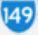
Route number: A300 (previously State Route 149) from Geelong to Benalla
; B300 (previously State Route 153) from Benalla to Barjarg; C518 from Barjarg to Mansfield.
The Midland Link Highway (B300, previously State Route Alt-153) links Barjarg (on the Midland Highway) and Maindample (on the Maroondah Highway
), bypassing Mansfield and reducing the journey from Benalla to Alexandra
by 19 km.
A further, fragmented section of the highway that ran between the Princes Highway
east of Morwell in the Latrobe Valley and Port Welshpool, on the South Gippsland Highway
(previously State Route 190), was stripped of highway status in the 1980s.
Victoria (Australia)
Victoria is the second most populous state in Australia. Geographically the smallest mainland state, Victoria is bordered by New South Wales, South Australia, and Tasmania on Boundary Islet to the north, west and south respectively....
(south-eastern Australia
Australia
Australia , officially the Commonwealth of Australia, is a country in the Southern Hemisphere comprising the mainland of the Australian continent, the island of Tasmania, and numerous smaller islands in the Indian and Pacific Oceans. It is the world's sixth-largest country by total area...
), beginning from Geelong
Geelong, Victoria
Geelong is a port city located on Corio Bay and the Barwon River, in the state of Victoria, Australia, south-west of the state capital; Melbourne. It is the second most populated city in Victoria and the fifth most populated non-capital city in Australia...
and leading all the way to Mansfield
Mansfield
Mansfield is a town in Nottinghamshire, England. It is the main town in the Mansfield local government district. Mansfield is a part of the Mansfield Urban Area....
. It winds through country Victoria in a large arc, travelling via the towns of Ballarat
Ballarat, Victoria
Ballarat is a city in the state of Victoria, Australia, approximately west-north-west of the state capital Melbourne situated on the lower plains of the Great Dividing Range and the Yarrowee River catchment. It is the largest inland centre and third most populous city in the state and the fifth...
, Bendigo
Bendigo, Victoria
Bendigo is a major regional city in the state of Victoria, Australia, located very close to the geographical centre of the state and approximately north west of the state capital Melbourne. It is the second largest inland city and fourth most populous city in the state. The estimated urban...
and Shepparton
Shepparton, Victoria
Shepparton is a city located on the floodplain of the Goulburn River in the north east of Victoria, Australia approximately north-east of Melbourne. It is the fifth largest city in Victoria, Australia. The estimated population of Shepparton's statistical area is 48,926.It began as a sheep station...
. The total length of the highway is 452 km.
Route number: A300 (previously State Route 149) from Geelong to Benalla
Benalla, Victoria
Benalla is a city of just over 9,000 people located just off the Hume Freeway in north-eastern Victoria, Australia, about southwest of Wangaratta. Its Local Government Area is the Rural City of Benalla.- Overview :...
; B300 (previously State Route 153) from Benalla to Barjarg; C518 from Barjarg to Mansfield.
The Midland Link Highway (B300, previously State Route Alt-153) links Barjarg (on the Midland Highway) and Maindample (on the Maroondah Highway
Maroondah Highway
Maroondah Highway , is a major east-west thoroughfare in the eastern suburbs of Melbourne and a highway servicing the lower alpine region Victoria, Australia.-History:...
), bypassing Mansfield and reducing the journey from Benalla to Alexandra
Alexandra, Victoria
Alexandra is a town in Victoria, Australia. It is located at the junction of the Goulburn Valley Highway and Maroondah Highway , 26 kilometres west of Eildon, in the Shire of Murrindindi local government area...
by 19 km.
A further, fragmented section of the highway that ran between the Princes Highway
Princes Highway
The Princes Highway extends from Sydney to Port Augusta via the coast through the states of New South Wales, Victoria and South Australia, a distance of 1941 km or 1898 km via the former alignments of the highway ....
east of Morwell in the Latrobe Valley and Port Welshpool, on the South Gippsland Highway
South Gippsland Highway
The South Gippsland Highway is a partially divided highway in Victoria, Australia which connects the city of Melbourne with the South Gippsland region of Victoria, ending in the town of Sale...
(previously State Route 190), was stripped of highway status in the 1980s.
Major intersections and towns
Midland Highway   |
|||
| Southbound | Distance to Mansfield (km) |
Distance to Benalla (km) |
Northbound |
.svg.png) Roundabout (clockwise from highway) Roundabout (clockwise from highway) Mount Buller Road to Mount Buller; to Whitfield Whitfield, Victoria Whitfield is an agricultural township in the King Valley in north-eastern Victoria.- Overview :The township is immediately west of the flood-prone King River and has State Forest to its west and east. Agriculture extends along several stream valleys which are tributaries of the King River... ; and  to Jamieson to JamiesonJamieson, Victoria Jamieson is a small town in Victoria, Australia. It is located at the junction of the Goulburn River and Jamieson River, north-east of Melbourne. The name is believed to have been derived from George Jamieson, a shepherd who grazed sheep in the area in the 1850s... Highett Street Maroondah Highway Maroondah Highway Maroondah Highway , is a major east-west thoroughfare in the eastern suburbs of Melbourne and a highway servicing the lower alpine region Victoria, Australia.-History:...  to Alexandra to AlexandraAlexandra, Victoria Alexandra is a town in Victoria, Australia. It is located at the junction of the Goulburn Valley Highway and Maroondah Highway , 26 kilometres west of Eildon, in the Shire of Murrindindi local government area... , Yea Yea, Victoria Yea is a town in Victoria, Australia. It is in the Shire of Murrindindi local government area. Located north-east of Melbourne via the Melba Highway, Yea sits at the junction with the Goulburn Valley Highway, and above sea-level. At the 2006 Census, Yea had a population of 1,052.- History :The... and Melbourne Melbourne Melbourne is the capital and most populous city in the state of Victoria, and the second most populous city in Australia. The Melbourne City Centre is the hub of the greater metropolitan area and the Census statistical division—of which "Melbourne" is the common name. As of June 2009, the greater... |
|||
End Midland Highway  |
0 | 63 | Start Midland Highway |
| Mansfield Mansfield, Victoria Mansfield is a small town in the foothills of the Victorian part of the Australian Alps. It is approximately 180 km north-east of Melbourne... |
|||
| continues as |
15 | 48 | Alexandra Alexandra, Victoria Alexandra is a town in Victoria, Australia. It is located at the junction of the Goulburn Valley Highway and Maroondah Highway , 26 kilometres west of Eildon, in the Shire of Murrindindi local government area... , Yea Yea, Victoria Yea is a town in Victoria, Australia. It is in the Shire of Murrindindi local government area. Located north-east of Melbourne via the Melba Highway, Yea sits at the junction with the Goulburn Valley Highway, and above sea-level. At the 2006 Census, Yea had a population of 1,052.- History :The... , Melbourne Melbourne Melbourne is the capital and most populous city in the state of Victoria, and the second most populous city in Australia. The Melbourne City Centre is the hub of the greater metropolitan area and the Census statistical division—of which "Melbourne" is the common name. As of June 2009, the greater... Midland Link Highway .svg.png) |
| Alexandra Alexandra, Victoria Alexandra is a town in Victoria, Australia. It is located at the junction of the Goulburn Valley Highway and Maroondah Highway , 26 kilometres west of Eildon, in the Shire of Murrindindi local government area... , Yea Yea, Victoria Yea is a town in Victoria, Australia. It is in the Shire of Murrindindi local government area. Located north-east of Melbourne via the Melba Highway, Yea sits at the junction with the Goulburn Valley Highway, and above sea-level. At the 2006 Census, Yea had a population of 1,052.- History :The... , Melbourne Melbourne Melbourne is the capital and most populous city in the state of Victoria, and the second most populous city in Australia. The Melbourne City Centre is the hub of the greater metropolitan area and the Census statistical division—of which "Melbourne" is the common name. As of June 2009, the greater... Midland Link Highway |
End continues as ' |
||
| End Start |
57.7 | 5.3 | Seymour Seymour, Victoria Seymour is a township in the Shire of Mitchell in the state of Victoria, Australia and is located north of Melbourne. At the 2006 census, Seymour had a population of 6,063... , Melbourne Melbourne Melbourne is the capital and most populous city in the state of Victoria, and the second most populous city in Australia. The Melbourne City Centre is the hub of the greater metropolitan area and the Census statistical division—of which "Melbourne" is the common name. As of June 2009, the greater... Hume Freeway   |
| Seymour Seymour, Victoria Seymour is a township in the Shire of Mitchell in the state of Victoria, Australia and is located north of Melbourne. At the 2006 census, Seymour had a population of 6,063... , Melbourne Melbourne Melbourne is the capital and most populous city in the state of Victoria, and the second most populous city in Australia. The Melbourne City Centre is the hub of the greater metropolitan area and the Census statistical division—of which "Melbourne" is the common name. As of June 2009, the greater... Hume Freeway |
End Start |
||
| Wangaratta Wangaratta, Victoria Wangaratta is a cathedral city of almost 17,000 people in the northeast of Victoria, Australia, about from Melbourne along the Hume Highway, with Benalla to the southwest, and Albury-Wodonga to the northeast. It is located at the junction of the Ovens and King rivers which flow from the... , Wodonga Wodonga, Victoria Wodonga is a small city on the Victorian side of the border with New South Wales, north-east of Melbourne, Australia. Adjacent to Wodonga across the border is the New South Wales city of Albury. Wodonga is located wholly within the boundaries of the City of Wodonga LGA... , Sydney Sydney Sydney is the most populous city in Australia and the state capital of New South Wales. Sydney is located on Australia's south-east coast of the Tasman Sea. As of June 2010, the greater metropolitan area had an approximate population of 4.6 million people... Hume Freeway |
58.2 | 4.8 | Wangaratta Wangaratta, Victoria Wangaratta is a cathedral city of almost 17,000 people in the northeast of Victoria, Australia, about from Melbourne along the Hume Highway, with Benalla to the southwest, and Albury-Wodonga to the northeast. It is located at the junction of the Ovens and King rivers which flow from the... , Wodonga Wodonga, Victoria Wodonga is a small city on the Victorian side of the border with New South Wales, north-east of Melbourne, Australia. Adjacent to Wodonga across the border is the New South Wales city of Albury. Wodonga is located wholly within the boundaries of the City of Wodonga LGA... , Sydney Sydney Sydney is the most populous city in Australia and the state capital of New South Wales. Sydney is located on Australia's south-east coast of the Tasman Sea. As of June 2010, the greater metropolitan area had an approximate population of 4.6 million people... Hume Freeway |
| Yarrawonga Yarrawonga, Victoria Yarrawonga is a town in the Shire of Moira Local Government Area in the Australian state of Victoria. The town is situated on the south bank of the Murray River, the border between Victoria and New South Wales and is located approximately north-east of the state capital, Melbourne. Yarrawonga's... , Tatong, Wodonga Wodonga, Victoria Wodonga is a small city on the Victorian side of the border with New South Wales, north-east of Melbourne, Australia. Adjacent to Wodonga across the border is the New South Wales city of Albury. Wodonga is located wholly within the boundaries of the City of Wodonga LGA... Old Hume Highway Old Hume Highway The Old Hume Highway may be described as any part of an earlier route of the Hume Highway, which traverses Victoria and New South Wales between the cities of Melbourne and Sydney in Australia...   |
63 | 0 | Benalla Benalla, Victoria Benalla is a city of just over 9,000 people located just off the Hume Freeway in north-eastern Victoria, Australia, about southwest of Wangaratta. Its Local Government Area is the Rural City of Benalla.- Overview :... |
| Benalla Benalla, Victoria Benalla is a city of just over 9,000 people located just off the Hume Freeway in north-eastern Victoria, Australia, about southwest of Wangaratta. Its Local Government Area is the Rural City of Benalla.- Overview :... |
Yarrawonga Yarrawonga, Victoria Yarrawonga is a town in the Shire of Moira Local Government Area in the Australian state of Victoria. The town is situated on the south bank of the Murray River, the border between Victoria and New South Wales and is located approximately north-east of the state capital, Melbourne. Yarrawonga's... , Tatong, Wodonga Wodonga, Victoria Wodonga is a small city on the Victorian side of the border with New South Wales, north-east of Melbourne, Australia. Adjacent to Wodonga across the border is the New South Wales city of Albury. Wodonga is located wholly within the boundaries of the City of Wodonga LGA... Old Hume Highway Old Hume Highway The Old Hume Highway may be described as any part of an earlier route of the Hume Highway, which traverses Victoria and New South Wales between the cities of Melbourne and Sydney in Australia... |
||
| Eastbound | Distance to Benalla (km) |
Distance to Bendigo (km) |
Westbound |
NORTH EAST RAIL LINE .svg.png) |
0.7 | 182.3 | NORTH EAST RAIL LINE |
| Cobram Cobram, Victoria Cobram is a town in Australia. Cobram is located on the Murray River which forms the border between Victoria and New South Wales. Cobram along with the nearby towns of Numurkah and Yarrawonga is part of Shire of Moira. Its twin town of Barooga is located on the north side of the Murray River.... , Tocumwal Tocumwal, New South Wales Tocumwal is a town in the southern Riverina region of New South Wales, Australia in the Berrigan Shire Local Government Area, near the Victorian border. The town is situated on the banks of the Murray River, north of the city of Melbourne. The Newell Highway, part of the main road route between... Benalla-Tocumwal Road |
10 | 173 | Cobram Cobram, Victoria Cobram is a town in Australia. Cobram is located on the Murray River which forms the border between Victoria and New South Wales. Cobram along with the nearby towns of Numurkah and Yarrawonga is part of Shire of Moira. Its twin town of Barooga is located on the north side of the Murray River.... , Tocumwal Tocumwal, New South Wales Tocumwal is a town in the southern Riverina region of New South Wales, Australia in the Berrigan Shire Local Government Area, near the Victorian border. The town is situated on the banks of the Murray River, north of the city of Melbourne. The Newell Highway, part of the main road route between... Benalla-Tocumwal Road |
| continues as |
30 | 153 | Violet Town Violet Town, Victoria Violet Town is a town in Victoria, Australia. It is in the Shire of Strathbogie local government area. It was a coach stop on the Melbourne to Sydney road... Dookie-Violet Town Road |
| Violet Town Violet Town, Victoria Violet Town is a town in Victoria, Australia. It is in the Shire of Strathbogie local government area. It was a coach stop on the Melbourne to Sydney road... Dookie-Violet Town Road |
duplexes with |
||
| duplexes with |
32 | 151 | Dookie Dookie, Victoria Dookie is a town in the Goulburn Valley region of Victoria, Australia. It is situated in a valley between Mount Major and Mount Saddleback. Dookie is a farming community. At the 2006 census, Dookie had a population of 286.... Dookie-Nalinga Road |
| Dookie Dookie, Victoria Dookie is a town in the Goulburn Valley region of Victoria, Australia. It is situated in a valley between Mount Major and Mount Saddleback. Dookie is a farming community. At the 2006 census, Dookie had a population of 286.... Dookie-Nalinga Road |
continues as |
||
To  Brisbane BrisbaneBrisbane Brisbane is the capital and most populous city in the Australian state of Queensland and the third most populous city in Australia. Brisbane's metropolitan area has a population of over 2 million, and the South East Queensland urban conurbation, centred around Brisbane, encompasses a population of... , Melbourne Melbourne Melbourne is the capital and most populous city in the state of Victoria, and the second most populous city in Australia. The Melbourne City Centre is the hub of the greater metropolitan area and the Census statistical division—of which "Melbourne" is the common name. As of June 2009, the greater... ; Tocumwal Tocumwal, New South Wales Tocumwal is a town in the southern Riverina region of New South Wales, Australia in the Berrigan Shire Local Government Area, near the Victorian border. The town is situated on the banks of the Murray River, north of the city of Melbourne. The Newell Highway, part of the main road route between... , Euroa Euroa, Victoria Euroa is a town in the Shire of Strathbogie in North-East Victoria, Australia.At the 2006 census, Euroa had a population of 2,776. The name Euroa comes from an Aboriginal word in the old local dialect meaning "joyful".-History:Major T.L... Doyles Road |
58 | 125 | To Melbourne Melbourne Melbourne is the capital and most populous city in the state of Victoria, and the second most populous city in Australia. The Melbourne City Centre is the hub of the greater metropolitan area and the Census statistical division—of which "Melbourne" is the common name. As of June 2009, the greater... , Brisbane Brisbane Brisbane is the capital and most populous city in the Australian state of Queensland and the third most populous city in Australia. Brisbane's metropolitan area has a population of over 2 million, and the South East Queensland urban conurbation, centred around Brisbane, encompasses a population of... ; Euroa Euroa, Victoria Euroa is a town in the Shire of Strathbogie in North-East Victoria, Australia.At the 2006 census, Euroa had a population of 2,776. The name Euroa comes from an Aboriginal word in the old local dialect meaning "joyful".-History:Major T.L... , Tocumwal Tocumwal, New South Wales Tocumwal is a town in the southern Riverina region of New South Wales, Australia in the Berrigan Shire Local Government Area, near the Victorian border. The town is situated on the banks of the Murray River, north of the city of Melbourne. The Newell Highway, part of the main road route between... Doyles Road |
| TOCUMWAL RAIL LINE |
60 | 123 | TOCUMWAL RAIL LINE |
| Tocumwal Tocumwal, New South Wales Tocumwal is a town in the southern Riverina region of New South Wales, Australia in the Berrigan Shire Local Government Area, near the Victorian border. The town is situated on the banks of the Murray River, north of the city of Melbourne. The Newell Highway, part of the main road route between... , Brisbane Brisbane Brisbane is the capital and most populous city in the Australian state of Queensland and the third most populous city in Australia. Brisbane's metropolitan area has a population of over 2 million, and the South East Queensland urban conurbation, centred around Brisbane, encompasses a population of... , Nagambie Nagambie, Victoria Nagambie is a town in Victoria, Australia, located on the Goulburn Valley Highway, north of Seymour, in the Shire of Strathbogie. At the 2006 census, Nagambie had a population of 1,383.-History:... , Melbourne Melbourne Melbourne is the capital and most populous city in the state of Victoria, and the second most populous city in Australia. The Melbourne City Centre is the hub of the greater metropolitan area and the Census statistical division—of which "Melbourne" is the common name. As of June 2009, the greater... Goulburn Valley Highway Goulburn Valley Highway The Goulburn Valley Highway / is a highway located in Victoria, Australia. The section north beyond the Hume Freeway is part of the Melbourne to Brisbane National Highway and is the main link between these two cities as well as a major link between Victoria and inland New South Wales... |
61 | 122 | Shepparton Shepparton, Victoria Shepparton is a city located on the floodplain of the Goulburn River in the north east of Victoria, Australia approximately north-east of Melbourne. It is the fifth largest city in Victoria, Australia. The estimated population of Shepparton's statistical area is 48,926.It began as a sheep station... |
| Shepparton Shepparton, Victoria Shepparton is a city located on the floodplain of the Goulburn River in the north east of Victoria, Australia approximately north-east of Melbourne. It is the fifth largest city in Victoria, Australia. The estimated population of Shepparton's statistical area is 48,926.It began as a sheep station... |
Nagambie Nagambie, Victoria Nagambie is a town in Victoria, Australia, located on the Goulburn Valley Highway, north of Seymour, in the Shire of Strathbogie. At the 2006 census, Nagambie had a population of 1,383.-History:... , Melbourne Melbourne Melbourne is the capital and most populous city in the state of Victoria, and the second most populous city in Australia. The Melbourne City Centre is the hub of the greater metropolitan area and the Census statistical division—of which "Melbourne" is the common name. As of June 2009, the greater... , Tocumwal Tocumwal, New South Wales Tocumwal is a town in the southern Riverina region of New South Wales, Australia in the Berrigan Shire Local Government Area, near the Victorian border. The town is situated on the banks of the Murray River, north of the city of Melbourne. The Newell Highway, part of the main road route between... , Brisbane Brisbane Brisbane is the capital and most populous city in the Australian state of Queensland and the third most populous city in Australia. Brisbane's metropolitan area has a population of over 2 million, and the South East Queensland urban conurbation, centred around Brisbane, encompasses a population of... Goulburn Valley Highway Goulburn Valley Highway The Goulburn Valley Highway / is a highway located in Victoria, Australia. The section north beyond the Hume Freeway is part of the Melbourne to Brisbane National Highway and is the main link between these two cities as well as a major link between Victoria and inland New South Wales... |
||
| GOULBURN RIVER Goulburn River (Victoria) The Goulburn River is a major inland river in Victoria, Australia.The headwaters of the Goulburn River rise in the western end of the Victoria Alps, near Mount Buller. The Eildon Dam creates Lake Eildon, a major storage of water for irrigation... |
62 | 121 | GOULBURN RIVER Goulburn River (Victoria) The Goulburn River is a major inland river in Victoria, Australia.The headwaters of the Goulburn River rise in the western end of the Victoria Alps, near Mount Buller. The Eildon Dam creates Lake Eildon, a major storage of water for irrigation... |
| Kyabram Kyabram, Victoria Kyabram is located in the centre of a rich irrigation district in the Goulburn River Valley, 200 kilometres north of Melbourne, Victoria, Australia. Kyabram, the second largest town in the Shire of Campaspe. is situated between the towns of Echuca and Shepparton and is close to the Murray River... , Echuca Echuca, Victoria Echuca is a town located on the banks of the Murray River and Campaspe river in Victoria, Australia. The Border town Moama is on the northern side of the Murray river in New South Wales. It is the administrative centre and largest settlement in the Shire of Campaspe... Echuca-Mooroopna Road Murchison Murchison, Victoria Murchison is a small rural village located on the Goulburn River in Victoria, Australia. Murchison is located 167 kilometres from Melbourne and is just to the west of the Goulburn Valley Highway between Shepparton and Nagambie. The surrounding countryside contains orchards, vineyards and dairy... Mooroopna-Murchison Road |
65.5 | 117.5 | Mooroopna Mooroopna, Victoria Mooroopna is a rural town located north of Melbourne, Victoria, Australia. It is on the banks of the Goulburn River opposite the larger town of Shepparton. The Midland Highway crosses the river between the two towns... |
| Mooroopna Mooroopna, Victoria Mooroopna is a rural town located north of Melbourne, Victoria, Australia. It is on the banks of the Goulburn River opposite the larger town of Shepparton. The Midland Highway crosses the river between the two towns... |
Murchison Murchison, Victoria Murchison is a small rural village located on the Goulburn River in Victoria, Australia. Murchison is located 167 kilometres from Melbourne and is just to the west of the Goulburn Valley Highway between Shepparton and Nagambie. The surrounding countryside contains orchards, vineyards and dairy... Mooroopna-Murchison Road Kyabram Kyabram, Victoria Kyabram is located in the centre of a rich irrigation district in the Goulburn River Valley, 200 kilometres north of Melbourne, Victoria, Australia. Kyabram, the second largest town in the Shire of Campaspe. is situated between the towns of Echuca and Shepparton and is close to the Murray River... , Echuca Echuca, Victoria Echuca is a town located on the banks of the Murray River and Campaspe river in Victoria, Australia. The Border town Moama is on the northern side of the Murray river in New South Wales. It is the administrative centre and largest settlement in the Shire of Campaspe... Echuca-Mooroopna Road |
||
| Echuca Echuca, Victoria Echuca is a town located on the banks of the Murray River and Campaspe river in Victoria, Australia. The Border town Moama is on the northern side of the Murray river in New South Wales. It is the administrative centre and largest settlement in the Shire of Campaspe... , Tatura Tatura, Victoria Tatura is a town 17 km west-south-west of Shepparton in Victoria, Australia located 3 km off the Midland Highway, forming part of the City of Greater Shepparton. At the 2006 census, Tatura had a population of 3,533, however the true figure is believed to be close to 4,400. Attractions... Tatura-Undera Road  |
78 | 105 | Tatura Tatura, Victoria Tatura is a town 17 km west-south-west of Shepparton in Victoria, Australia located 3 km off the Midland Highway, forming part of the City of Greater Shepparton. At the 2006 census, Tatura had a population of 3,533, however the true figure is believed to be close to 4,400. Attractions... , Echuca Echuca, Victoria Echuca is a town located on the banks of the Murray River and Campaspe river in Victoria, Australia. The Border town Moama is on the northern side of the Murray river in New South Wales. It is the administrative centre and largest settlement in the Shire of Campaspe... Tatura-Undera Road |
| TOOLAMBA-ECHUCA RAIL LINE |
80 | 103 | TOOLAMBA-ECHUCA RAIL LINE |
| Kyabram Kyabram, Victoria Kyabram is located in the centre of a rich irrigation district in the Goulburn River Valley, 200 kilometres north of Melbourne, Victoria, Australia. Kyabram, the second largest town in the Shire of Campaspe. is situated between the towns of Echuca and Shepparton and is close to the Murray River... , Rushworth Rushworth, Victoria Rushworth is a township in Victoria, Australia. It is located north of Melbourne and, at the 2006 census, had a population of 2066.-History:... Girgarre-Rushworth Road |
100 | 83 | Stanhope Stanhope, Victoria Stanhope is a small town in north central Victoria, Australia. Stanhope is from Shepparton. It lies north of the state capital Melbourne and south east of Canberra the capital city of Australia... |
| Shepparton Shepparton, Victoria Shepparton is a city located on the floodplain of the Goulburn River in the north east of Victoria, Australia approximately north-east of Melbourne. It is the fifth largest city in Victoria, Australia. The estimated population of Shepparton's statistical area is 48,926.It began as a sheep station... |
Rushworth Rushworth, Victoria Rushworth is a township in Victoria, Australia. It is located north of Melbourne and, at the 2006 census, had a population of 2066.-History:... , Kyabram Kyabram, Victoria Kyabram is located in the centre of a rich irrigation district in the Goulburn River Valley, 200 kilometres north of Melbourne, Victoria, Australia. Kyabram, the second largest town in the Shire of Campaspe. is situated between the towns of Echuca and Shepparton and is close to the Murray River... Girgarre-Rushworth Road |
||
| continues as |
118 | 65 | Heathcote Heathcote, Victoria Heathcote is a town in central Victoria, Australia, situated on the Northern Highway 110 kilometres north of Melbourne and 40 kilometres south-east of Bendigo via the McIvor Highway. Heathcote's local government area is the City of Greater Bendigo and it is part of the federal electorate of... , Kilmore Kilmore, Victoria Kilmore is a town in the Australian state of Victoria. Located north of Melbourne, it is contentiously claimed as Victoria's oldest inland settled town... Heathcote-Rochester Road |
| Heathcote Heathcote, Victoria Heathcote is a town in central Victoria, Australia, situated on the Northern Highway 110 kilometres north of Melbourne and 40 kilometres south-east of Bendigo via the McIvor Highway. Heathcote's local government area is the City of Greater Bendigo and it is part of the federal electorate of... , Kilmore Kilmore, Victoria Kilmore is a town in the Australian state of Victoria. Located north of Melbourne, it is contentiously claimed as Victoria's oldest inland settled town... Heathcote-Rochester Road |
duplexes with |
||
| duplexes with |
119 | 64 | Rochester Rochester, Victoria Rochester is a small town in country Victoria, Australia. It is located 180 km north of Melbourne with a mixture of rural and semi-rural communities on the northern Campaspe River, between Bendigo and the Murray River port of Echuca... , Echuca Echuca, Victoria Echuca is a town located on the banks of the Murray River and Campaspe river in Victoria, Australia. The Border town Moama is on the northern side of the Murray river in New South Wales. It is the administrative centre and largest settlement in the Shire of Campaspe... Heathcote-Rochester Road |
| Rochester Rochester, Victoria Rochester is a small town in country Victoria, Australia. It is located 180 km north of Melbourne with a mixture of rural and semi-rural communities on the northern Campaspe River, between Bendigo and the Murray River port of Echuca... , Echuca Echuca, Victoria Echuca is a town located on the banks of the Murray River and Campaspe river in Victoria, Australia. The Border town Moama is on the northern side of the Murray river in New South Wales. It is the administrative centre and largest settlement in the Shire of Campaspe... Heathcote-Rochester Road |
continues as |
||
| continues as |
136 | 47 | Heathcote Heathcote, Victoria Heathcote is a town in central Victoria, Australia, situated on the Northern Highway 110 kilometres north of Melbourne and 40 kilometres south-east of Bendigo via the McIvor Highway. Heathcote's local government area is the City of Greater Bendigo and it is part of the federal electorate of... , Kilmore Kilmore, Victoria Kilmore is a town in the Australian state of Victoria. Located north of Melbourne, it is contentiously claimed as Victoria's oldest inland settled town... , Melbourne Melbourne Melbourne is the capital and most populous city in the state of Victoria, and the second most populous city in Australia. The Melbourne City Centre is the hub of the greater metropolitan area and the Census statistical division—of which "Melbourne" is the common name. As of June 2009, the greater... Northern Highway  |
| Heathcote Heathcote, Victoria Heathcote is a town in central Victoria, Australia, situated on the Northern Highway 110 kilometres north of Melbourne and 40 kilometres south-east of Bendigo via the McIvor Highway. Heathcote's local government area is the City of Greater Bendigo and it is part of the federal electorate of... , Kilmore Kilmore, Victoria Kilmore is a town in the Australian state of Victoria. Located north of Melbourne, it is contentiously claimed as Victoria's oldest inland settled town... , Melbourne Melbourne Melbourne is the capital and most populous city in the state of Victoria, and the second most populous city in Australia. The Melbourne City Centre is the hub of the greater metropolitan area and the Census statistical division—of which "Melbourne" is the common name. As of June 2009, the greater... Northern Highway |
duplexes with |
||
| duplexes with |
137 | 46 | Elmore Elmore, Victoria Elmore is a small town in Victoria north-east of Bendigo on the Campaspe River. Elmore is close to the Whipstick State Park.At the 2006 census, Elmore had a population of 694.-History:... |
| Rochester Rochester, Victoria Rochester is a small town in country Victoria, Australia. It is located 180 km north of Melbourne with a mixture of rural and semi-rural communities on the northern Campaspe River, between Bendigo and the Murray River port of Echuca... , Echuca Echuca, Victoria Echuca is a town located on the banks of the Murray River and Campaspe river in Victoria, Australia. The Border town Moama is on the northern side of the Murray river in New South Wales. It is the administrative centre and largest settlement in the Shire of Campaspe... Northern Highway |
Rochester Rochester, Victoria Rochester is a small town in country Victoria, Australia. It is located 180 km north of Melbourne with a mixture of rural and semi-rural communities on the northern Campaspe River, between Bendigo and the Murray River port of Echuca... , Echuca Echuca, Victoria Echuca is a town located on the banks of the Murray River and Campaspe river in Victoria, Australia. The Border town Moama is on the northern side of the Murray river in New South Wales. It is the administrative centre and largest settlement in the Shire of Campaspe... Northern Highway |
||
| Elmore Elmore, Victoria Elmore is a small town in Victoria north-east of Bendigo on the Campaspe River. Elmore is close to the Whipstick State Park.At the 2006 census, Elmore had a population of 694.-History:... |
continues as |
||
| Rushworth Rushworth, Victoria Rushworth is a township in Victoria, Australia. It is located north of Melbourne and, at the 2006 census, had a population of 2066.-History:... , Murchison Murchison, Victoria Murchison is a small rural village located on the Goulburn River in Victoria, Australia. Murchison is located 167 kilometres from Melbourne and is just to the west of the Goulburn Valley Highway between Shepparton and Nagambie. The surrounding countryside contains orchards, vineyards and dairy... , Violet Town Violet Town, Victoria Violet Town is a town in Victoria, Australia. It is in the Shire of Strathbogie local government area. It was a coach stop on the Melbourne to Sydney road... Bendigo-Murchison Road  |
149 | 34 | Rushworth Rushworth, Victoria Rushworth is a township in Victoria, Australia. It is located north of Melbourne and, at the 2006 census, had a population of 2066.-History:... Bendigo-Murchison Road |
| ECHUCA RAIL LINE |
164 | 19 | ECHUCA RAIL LINE |
| Lockington Lockington, Victoria Lockington is a town in northern Victoria, Australia. The town is located in Shire of Campaspe Local Government Area, 198 kilometres north of the state capital, Melbourne. At the 2006 census, Lockington had a population of 421.-History:... , Mitiamo Mitiamo, Victoria Mitiamo is a town in northern Victoria, Australia. The town is located in the Shire of Loddon, north of the state capital, Melbourne. At the 2006 census, Mitiamo had a population of 76.... Bendigo-Tennyson Road |
168 | 15 | Lockington Lockington, Victoria Lockington is a town in northern Victoria, Australia. The town is located in Shire of Campaspe Local Government Area, 198 kilometres north of the state capital, Melbourne. At the 2006 census, Lockington had a population of 421.-History:... , Mitiamo Mitiamo, Victoria Mitiamo is a town in northern Victoria, Australia. The town is located in the Shire of Loddon, north of the state capital, Melbourne. At the 2006 census, Mitiamo had a population of 76.... Bendigo-Tennyson Road |
| Strathdale Strathdale-White Hills Road |
158.4 | 4.6 | White Hills White Hills, Victoria White Hills is a suburb of the City of Bendigo in central Victoria, Australia. At the 2006 census, White Hills had a population of 2,626.White Hills Post Office opened on 21 August 1857 during the gold rush.... |
| Strathdale Strathdale-White Hills Road |
|||
| Long Gully Long Gully, Victoria Long Gully is a suburb of the regional city of Bendigo in Victoria, Australia. The suburb is located north west of the Bendigo central business district. At the 2006 census, Long Gully had a population of 3,289.... , Eaglehawk Eaglehawk, Victoria Eaglehawk is a former gold-mining town in Victoria, Australia and a suburb within the City of Greater Bendigo.The town is situated to the north-west of Bendigo on the Loddon Valley Highway. The highway is known locally as High Street until the intersection with Sailors Gully Road and as Peg Leg... Lyons Street |
159.1 | 3.9 | Long Gully Long Gully, Victoria Long Gully is a suburb of the regional city of Bendigo in Victoria, Australia. The suburb is located north west of the Bendigo central business district. At the 2006 census, Long Gully had a population of 3,289.... , Eaglehawk Eaglehawk, Victoria Eaglehawk is a former gold-mining town in Victoria, Australia and a suburb within the City of Greater Bendigo.The town is situated to the north-west of Bendigo on the Loddon Valley Highway. The highway is known locally as High Street until the intersection with Sailors Gully Road and as Peg Leg... Lyons Street |
| White Hills White Hills, Victoria White Hills is a suburb of the City of Bendigo in central Victoria, Australia. At the 2006 census, White Hills had a population of 2,626.White Hills Post Office opened on 21 August 1857 during the gold rush.... |
|||
| SWAN HILL RAIL LINE |
180.9 | 2.1 | SWAN HILL RAIL LINE |
| continues as Midland Highway |
182.3 | 0.7 | Heathcote Heathcote, Victoria Heathcote is a town in central Victoria, Australia, situated on the Northern Highway 110 kilometres north of Melbourne and 40 kilometres south-east of Bendigo via the McIvor Highway. Heathcote's local government area is the City of Greater Bendigo and it is part of the federal electorate of... , Kilmore Kilmore, Victoria Kilmore is a town in the Australian state of Victoria. Located north of Melbourne, it is contentiously claimed as Victoria's oldest inland settled town... McIvor Highway McIvor Highway McIvor Highway is a short Victorian highway linking Bendigo and Heathcote. Together with Hume Freeway and Northern Highway , it provides an alternative route between Melbourne and Bendigo. Previously assigned State Route 141, it was later designated B280...  Eaglehawk Eaglehawk, Victoria Eaglehawk is a former gold-mining town in Victoria, Australia and a suburb within the City of Greater Bendigo.The town is situated to the north-west of Bendigo on the Loddon Valley Highway. The highway is known locally as High Street until the intersection with Sailors Gully Road and as Peg Leg... , Kerang Kerang, Victoria Kerang is a rural town on the Loddon River in northern Victoria in Australia. It is the commercial centre to an irrigation district based on livestock, horticulture, lucerne and grain. It is located north-west of Melbourne on the Murray Valley Highway a few kilometres north of its intersection... Chapel Street |
| Eaglehawk Eaglehawk, Victoria Eaglehawk is a former gold-mining town in Victoria, Australia and a suburb within the City of Greater Bendigo.The town is situated to the north-west of Bendigo on the Loddon Valley Highway. The highway is known locally as High Street until the intersection with Sailors Gully Road and as Peg Leg... , Kerang Kerang, Victoria Kerang is a rural town on the Loddon River in northern Victoria in Australia. It is the commercial centre to an irrigation district based on livestock, horticulture, lucerne and grain. It is located north-west of Melbourne on the Murray Valley Highway a few kilometres north of its intersection... Chapel Street Heathcote Heathcote, Victoria Heathcote is a town in central Victoria, Australia, situated on the Northern Highway 110 kilometres north of Melbourne and 40 kilometres south-east of Bendigo via the McIvor Highway. Heathcote's local government area is the City of Greater Bendigo and it is part of the federal electorate of... , Kilmore Kilmore, Victoria Kilmore is a town in the Australian state of Victoria. Located north of Melbourne, it is contentiously claimed as Victoria's oldest inland settled town... McIvor Highway McIvor Highway McIvor Highway is a short Victorian highway linking Bendigo and Heathcote. Together with Hume Freeway and Northern Highway , it provides an alternative route between Melbourne and Bendigo. Previously assigned State Route 141, it was later designated B280... |
continues as McIvor Highway McIvor Highway McIvor Highway is a short Victorian highway linking Bendigo and Heathcote. Together with Hume Freeway and Northern Highway , it provides an alternative route between Melbourne and Bendigo. Previously assigned State Route 141, it was later designated B280... (Midland Highway) |
||
| Northbound | Distance to Bendigo (km) |
Distance to Ballarat (km) |
Southbound |
| Kennington Kennington, Victoria Kennington is a suburb of Bendigo, a city in Victoria, Australia. The suburb is located south east of the Bendigo city centre and at the 2006 census had a population of 5,647. The suburb is home to the Kennington Reservoir.... , Strathfieldsaye Mitchell Street (Bendigo-Redesdale Road) |
0 | 120 | Bendigo Bendigo, Victoria Bendigo is a major regional city in the state of Victoria, Australia, located very close to the geographical centre of the state and approximately north west of the state capital Melbourne. It is the second largest inland city and fourth most populous city in the state. The estimated urban... |
| Bendigo Bendigo, Victoria Bendigo is a major regional city in the state of Victoria, Australia, located very close to the geographical centre of the state and approximately north west of the state capital Melbourne. It is the second largest inland city and fourth most populous city in the state. The estimated urban... |
Kennington Kennington, Victoria Kennington is a suburb of Bendigo, a city in Victoria, Australia. The suburb is located south east of the Bendigo city centre and at the 2006 census had a population of 5,647. The suburb is home to the Kennington Reservoir.... , Strathfieldsaye Mitchell Street (Bendigo-Redesdale Road) |
||
| continues as McIvor Highway McIvor Highway McIvor Highway is a short Victorian highway linking Bendigo and Heathcote. Together with Hume Freeway and Northern Highway , it provides an alternative route between Melbourne and Bendigo. Previously assigned State Route 141, it was later designated B280... (Midland Highway) |
1 | 119 | Quarry Hill Quarry Hill, Victoria Quarry Hill is an inner suburb of Bendigo, Victoria, Australia. The suburb is located south of the Bendigo city centre. At the 2006 census, Quarry Hill had a population of 2,222.... , Flora Hill Myrtle Street To Loddon Valley Highway The Loddon Valley Highway runs roughly north-west from Bendigo to Kerang on the Murray Valley Highway. Previously assigned State Route 141, it was later designated as B260....  Eaglehawk EaglehawkEaglehawk, Victoria Eaglehawk is a former gold-mining town in Victoria, Australia and a suburb within the City of Greater Bendigo.The town is situated to the north-west of Bendigo on the Loddon Valley Highway. The highway is known locally as High Street until the intersection with Sailors Gully Road and as Peg Leg... , Kerang Kerang, Victoria Kerang is a rural town on the Loddon River in northern Victoria in Australia. It is the commercial centre to an irrigation district based on livestock, horticulture, lucerne and grain. It is located north-west of Melbourne on the Murray Valley Highway a few kilometres north of its intersection... ; Marong Marong, Victoria Marong is a town in Victoria, Australia. At the 2001 census, Marong had a population of 393. It is located kilometres to the west of Bendigo. Its local government area is the City of Greater Bendigo... , Mildura Mildura, Victoria Mildura is a regional city in northwestern Victoria, Australia and seat of the Rural City of Mildura local government area. It is located in the Sunraysia region, and is on the banks of the Murray River. The current population is estimated at just over 30,000.Mildura is a major agricultural centre... Calder Highway Calder Highway Calder Highway is a Highway linking Ravenswood South in Victoria, to Mildura. North of the Victoria/New South Wales border, the highway continues north to Broken Hill, Tibooburra and the New South Wales/Queensland border as the Silver City Highway, under the standard national route shield as far...  |
| To Loddon Valley Highway The Loddon Valley Highway runs roughly north-west from Bendigo to Kerang on the Murray Valley Highway. Previously assigned State Route 141, it was later designated as B260.... EaglehawkEaglehawk, Victoria Eaglehawk is a former gold-mining town in Victoria, Australia and a suburb within the City of Greater Bendigo.The town is situated to the north-west of Bendigo on the Loddon Valley Highway. The highway is known locally as High Street until the intersection with Sailors Gully Road and as Peg Leg... , Kerang Kerang, Victoria Kerang is a rural town on the Loddon River in northern Victoria in Australia. It is the commercial centre to an irrigation district based on livestock, horticulture, lucerne and grain. It is located north-west of Melbourne on the Murray Valley Highway a few kilometres north of its intersection... ; Marong Marong, Victoria Marong is a town in Victoria, Australia. At the 2001 census, Marong had a population of 393. It is located kilometres to the west of Bendigo. Its local government area is the City of Greater Bendigo... , Mildura Mildura, Victoria Mildura is a regional city in northwestern Victoria, Australia and seat of the Rural City of Mildura local government area. It is located in the Sunraysia region, and is on the banks of the Murray River. The current population is estimated at just over 30,000.Mildura is a major agricultural centre... Calder Highway Calder Highway Calder Highway is a Highway linking Ravenswood South in Victoria, to Mildura. North of the Victoria/New South Wales border, the highway continues north to Broken Hill, Tibooburra and the New South Wales/Queensland border as the Silver City Highway, under the standard national route shield as far... Quarry Hill Quarry Hill, Victoria Quarry Hill is an inner suburb of Bendigo, Victoria, Australia. The suburb is located south of the Bendigo city centre. At the 2006 census, Quarry Hill had a population of 2,222.... , Flora Hill Myrtle Street |
continues as Calder Highway (Midland Highway) |
||
| Long Gully Long Gully, Victoria Long Gully is a suburb of the regional city of Bendigo in Victoria, Australia. The suburb is located north west of the Bendigo central business district. At the 2006 census, Long Gully had a population of 3,289.... , Eaglehawk Eaglehawk, Victoria Eaglehawk is a former gold-mining town in Victoria, Australia and a suburb within the City of Greater Bendigo.The town is situated to the north-west of Bendigo on the Loddon Valley Highway. The highway is known locally as High Street until the intersection with Sailors Gully Road and as Peg Leg... Golden Square-Long Gully Road Quarry Hill Quarry Hill, Victoria Quarry Hill is an inner suburb of Bendigo, Victoria, Australia. The suburb is located south of the Bendigo city centre. At the 2006 census, Quarry Hill had a population of 2,222.... , Strathdale Golden Square-Quarry Hill Road |
3.6 | 116.4 | Quarry Hill Quarry Hill, Victoria Quarry Hill is an inner suburb of Bendigo, Victoria, Australia. The suburb is located south of the Bendigo city centre. At the 2006 census, Quarry Hill had a population of 2,222.... Golden Square-Quarry Hill Road Long Gully Long Gully, Victoria Long Gully is a suburb of the regional city of Bendigo in Victoria, Australia. The suburb is located north west of the Bendigo central business district. At the 2006 census, Long Gully had a population of 3,289.... Golden Square-Long Gully Road |
| Maryborough Maryborough, Victoria -Education:Maryborough has three schools:*Highview Christian Community College*Maryborough Education Centre Years Prep–12*St Augustine's Primary School Grades Prep–6-Music:... Bendigo-Maryborough Road |
6 | 114 | Kangaroo Flat Kangaroo Flat, Victoria Kangaroo Flat is an outer suburb of Bendigo in Victoria, Australia. The suburb is neighbours with Golden Square.-History:Prior to the gold rush the Bendigo district was part of a large station "the Ravenswood Run". The discovery of very significant gold deposits in the 1850's resulted in a huge... |
| Kangaroo Flat Kangaroo Flat, Victoria Kangaroo Flat is an outer suburb of Bendigo in Victoria, Australia. The suburb is neighbours with Golden Square.-History:Prior to the gold rush the Bendigo district was part of a large station "the Ravenswood Run". The discovery of very significant gold deposits in the 1850's resulted in a huge... |
Maryborough Maryborough, Victoria -Education:Maryborough has three schools:*Highview Christian Community College*Maryborough Education Centre Years Prep–12*St Augustine's Primary School Grades Prep–6-Music:... Bendigo-Maryborough Road |
||
| Mildura Mildura, Victoria Mildura is a regional city in northwestern Victoria, Australia and seat of the Rural City of Mildura local government area. It is located in the Sunraysia region, and is on the banks of the Murray River. The current population is estimated at just over 30,000.Mildura is a major agricultural centre... via Town Bypass Bendigo, Victoria Bendigo is a major regional city in the state of Victoria, Australia, located very close to the geographical centre of the state and approximately north west of the state capital Melbourne. It is the second largest inland city and fourth most populous city in the state. The estimated urban... Calder Alternative Highway |
16 | 104 | Mildura Mildura, Victoria Mildura is a regional city in northwestern Victoria, Australia and seat of the Rural City of Mildura local government area. It is located in the Sunraysia region, and is on the banks of the Murray River. The current population is estimated at just over 30,000.Mildura is a major agricultural centre... via Town Bypass Bendigo, Victoria Bendigo is a major regional city in the state of Victoria, Australia, located very close to the geographical centre of the state and approximately north west of the state capital Melbourne. It is the second largest inland city and fourth most populous city in the state. The estimated urban... Calder Alternative Highway |
| Calder Highway (Midland Highway) continues from Calder Freeway Calder Freeway Calder Freeway is a freeway linking Melbourne to Ravenswood South in Victoria, Australia, superseding stretches of the Calder Highway. Originally just a short spur of the Tullamarine Freeway linking to the Calder Highway in Keilor in suburban Melbourne, it has been extended in phases to Ravenswood...  |
25 | 95 | Harcourt Harcourt, Victoria Harcourt is a small Central Highlands town located approximately 9 km northeast of Castlemaine, where the Midland Highway meets the Calder Highway. At the 2006 census, Harcourt had a population of 439.-History:... , Elphinstone Elphinstone, Victoria Elphinstone is a town in Victoria, Australia. The town sits at the junction of the former Calder Highway and the former Pyrenees Highway between Malmsbury and Castlemaine near Taradale and Chewton... , Taradale Taradale, Victoria Taradale is a small town in Victoria, Australia. It is located on the Calder Highway between Melbourne and Bendigo. Its local government area is the Shire of Mount Alexander. At the 2006 census, Taradale had a population of 199.... Old Calder Highway  Maldon Maldon, Victoria Maldon is a town in Victoria, Australia, in the Shire of Mount Alexander local government area. It has been designated "Australia's first notable town" and is celebrated for its 19th-century appearance, maintained since gold-rush days... Fogartys Gap Road |
| continues as Calder Freeway Calder Freeway Calder Freeway is a freeway linking Melbourne to Ravenswood South in Victoria, Australia, superseding stretches of the Calder Highway. Originally just a short spur of the Tullamarine Freeway linking to the Calder Highway in Keilor in suburban Melbourne, it has been extended in phases to Ravenswood... to Castlemaine Castlemaine, Victoria Castlemaine is a city in Victoria, Australia, in the Goldfields region of Victoria about 120 kilometres northwest by road from Melbourne, and about 40 kilometres from the major provincial centre of Bendigo. It is the administrative and economic centre of the Shire of Mount Alexander. The... |
|||
| continues as Calder Freeway Calder Freeway Calder Freeway is a freeway linking Melbourne to Ravenswood South in Victoria, Australia, superseding stretches of the Calder Highway. Originally just a short spur of the Tullamarine Freeway linking to the Calder Highway in Keilor in suburban Melbourne, it has been extended in phases to Ravenswood... to Bendigo Bendigo, Victoria Bendigo is a major regional city in the state of Victoria, Australia, located very close to the geographical centre of the state and approximately north west of the state capital Melbourne. It is the second largest inland city and fourth most populous city in the state. The estimated urban... |
30 | 90 | Midland Highway continues from Calder Freeway Calder Freeway Calder Freeway is a freeway linking Melbourne to Ravenswood South in Victoria, Australia, superseding stretches of the Calder Highway. Originally just a short spur of the Tullamarine Freeway linking to the Calder Highway in Keilor in suburban Melbourne, it has been extended in phases to Ravenswood... |
| Harcourt Harcourt, Victoria Harcourt is a small Central Highlands town located approximately 9 km northeast of Castlemaine, where the Midland Highway meets the Calder Highway. At the 2006 census, Harcourt had a population of 439.-History:... Old Calder Highway Melbourne Melbourne Melbourne is the capital and most populous city in the state of Victoria, and the second most populous city in Australia. The Melbourne City Centre is the hub of the greater metropolitan area and the Census statistical division—of which "Melbourne" is the common name. As of June 2009, the greater... Calder Freeway Calder Freeway Calder Freeway is a freeway linking Melbourne to Ravenswood South in Victoria, Australia, superseding stretches of the Calder Highway. Originally just a short spur of the Tullamarine Freeway linking to the Calder Highway in Keilor in suburban Melbourne, it has been extended in phases to Ravenswood...  |
|||
| BENDIGO RAIL LINE | 36 | 84 | BENDIGO RAIL LINE |
| continues as |
38.5 | 81.5 | Castlemaine Castlemaine, Victoria Castlemaine is a city in Victoria, Australia, in the Goldfields region of Victoria about 120 kilometres northwest by road from Melbourne, and about 40 kilometres from the major provincial centre of Bendigo. It is the administrative and economic centre of the Shire of Mount Alexander. The... |
| Kyneton Kyneton, Victoria Kyneton is a town on the Calder Highway in the Macedon Ranges of Victoria, Australia. The Calder Freeway bypasses Kyneton to the north and east. The town was named after the English village of Kineton, Warwickshire. The town has three main streets: Mollison Street, Piper Street and High Street... , Melbourne Melbourne Melbourne is the capital and most populous city in the state of Victoria, and the second most populous city in Australia. The Melbourne City Centre is the hub of the greater metropolitan area and the Census statistical division—of which "Melbourne" is the common name. As of June 2009, the greater... via FreewayCalder Freeway Calder Freeway is a freeway linking Melbourne to Ravenswood South in Victoria, Australia, superseding stretches of the Calder Highway. Originally just a short spur of the Tullamarine Freeway linking to the Calder Highway in Keilor in suburban Melbourne, it has been extended in phases to Ravenswood... Pyrenees Highway Pyrenees Highway Pyrenees Highway in western Victoria, Australia is a 206 kilometre highway serving to link the Calder Highway in Elphinstone with the Glenelg Highway in Glenthompson...  |
Kyneton Kyneton, Victoria Kyneton is a town on the Calder Highway in the Macedon Ranges of Victoria, Australia. The Calder Freeway bypasses Kyneton to the north and east. The town was named after the English village of Kineton, Warwickshire. The town has three main streets: Mollison Street, Piper Street and High Street... , Melbourne Melbourne Melbourne is the capital and most populous city in the state of Victoria, and the second most populous city in Australia. The Melbourne City Centre is the hub of the greater metropolitan area and the Census statistical division—of which "Melbourne" is the common name. As of June 2009, the greater... via FreewayCalder Freeway Calder Freeway is a freeway linking Melbourne to Ravenswood South in Victoria, Australia, superseding stretches of the Calder Highway. Originally just a short spur of the Tullamarine Freeway linking to the Calder Highway in Keilor in suburban Melbourne, it has been extended in phases to Ravenswood... Pyrenees Highway Pyrenees Highway Pyrenees Highway in western Victoria, Australia is a 206 kilometre highway serving to link the Calder Highway in Elphinstone with the Glenelg Highway in Glenthompson... |
||
| Castlemaine Castlemaine, Victoria Castlemaine is a city in Victoria, Australia, in the Goldfields region of Victoria about 120 kilometres northwest by road from Melbourne, and about 40 kilometres from the major provincial centre of Bendigo. It is the administrative and economic centre of the Shire of Mount Alexander. The... |
duplexes with |
||
| BENDIGO RAIL LINE | 39 | 81 | BENDIGO RAIL LINE |
| duplexes with |
39.8 | 80.2 | Newstead Newstead, Victoria Newstead is a town in Victoria, Australia, situated along the Loddon River. It is in the Shire of Mount Alexander local government area. At the 2006 census, Newstead had a population of 487... , Maldon Maldon, Victoria Maldon is a town in Victoria, Australia, in the Shire of Mount Alexander local government area. It has been designated "Australia's first notable town" and is celebrated for its 19th-century appearance, maintained since gold-rush days... , Maryborough Maryborough, Victoria -Education:Maryborough has three schools:*Highview Christian Community College*Maryborough Education Centre Years Prep–12*St Augustine's Primary School Grades Prep–6-Music:... Pyrenees Highway Pyrenees Highway Pyrenees Highway in western Victoria, Australia is a 206 kilometre highway serving to link the Calder Highway in Elphinstone with the Glenelg Highway in Glenthompson... |
| Newstead Newstead, Victoria Newstead is a town in Victoria, Australia, situated along the Loddon River. It is in the Shire of Mount Alexander local government area. At the 2006 census, Newstead had a population of 487... , Maldon Maldon, Victoria Maldon is a town in Victoria, Australia, in the Shire of Mount Alexander local government area. It has been designated "Australia's first notable town" and is celebrated for its 19th-century appearance, maintained since gold-rush days... , Maryborough Maryborough, Victoria -Education:Maryborough has three schools:*Highview Christian Community College*Maryborough Education Centre Years Prep–12*St Augustine's Primary School Grades Prep–6-Music:... , Ararat Ararat, Victoria Ararat is a city in south-west Victoria, Australia, about west of Melbourne, on the Western Highway on the eastern slopes of the Ararat Hills and Cemetery Creek valley between Victoria's Western District and the Wimmera... Pyrenees Highway Pyrenees Highway Pyrenees Highway in western Victoria, Australia is a 206 kilometre highway serving to link the Calder Highway in Elphinstone with the Glenelg Highway in Glenthompson... |
continues as |
||
| VICTORIAN GOLDFIELDS TOURIST RAIL LINE Victorian Goldfields Railway The Victorian Goldfields Railway is a broad gauge tourist railway in Victoria, Australia. It operates along a formerly disused branch line between the towns of Maldon and Castlemaine.-History:... |
39.9 | 80.1 | VICTORIAN GOLDFIELDS TOURIST RAIL LINE Victorian Goldfields Railway The Victorian Goldfields Railway is a broad gauge tourist railway in Victoria, Australia. It operates along a formerly disused branch line between the towns of Maldon and Castlemaine.-History:... |
| Campbells Creek Campbells Creek, Victoria Campbells Creek is a town in Victoria, Australia.The town sits on the southern outskirts of Castlemaine on the Midland Highway.The town derives its name from a tributary of the Loddon, Campbells Creek, which flows through the township.... |
42 | 78 | Campbells Creek Campbells Creek, Victoria Campbells Creek is a town in Victoria, Australia.The town sits on the southern outskirts of Castlemaine on the Midland Highway.The town derives its name from a tributary of the Loddon, Campbells Creek, which flows through the township.... |
| MOOLORT RAIL LINE | 49 | 71 | MOOLORT RAIL LINE |
| Guildford Guildford, Victoria Guildford is a small settlement situated on the Loddon River, north-west of Melbourne, in Victoria, Australia. It is located on the Midland Highway between Daylesford and Castlemaine... |
50 | 70 | Guildford Guildford, Victoria Guildford is a small settlement situated on the Loddon River, north-west of Melbourne, in Victoria, Australia. It is located on the Midland Highway between Daylesford and Castlemaine... |
| Newstead Newstead, Victoria Newstead is a town in Victoria, Australia, situated along the Loddon River. It is in the Shire of Mount Alexander local government area. At the 2006 census, Newstead had a population of 487... , Maldon Maldon, Victoria Maldon is a town in Victoria, Australia, in the Shire of Mount Alexander local government area. It has been designated "Australia's first notable town" and is celebrated for its 19th-century appearance, maintained since gold-rush days... Daylesford-Newstead Road |
62 | 58 | Newstead Newstead, Victoria Newstead is a town in Victoria, Australia, situated along the Loddon River. It is in the Shire of Mount Alexander local government area. At the 2006 census, Newstead had a population of 487... Daylesford-Newstead Road |
| Glenlyon Glenlyon, Victoria Glenlyon is a small town in the Shire of Hepburn Local Government Area, Victoria, Australia. The town is situated around 10 km from Daylesford along the Daylesford - Malmsbury Road, and around 100 km from the Melbourne CBD. The town sits next to the Loddon River.-History:In 1846, Richard Babington... , Malmsbury Malmsbury, Victoria Malmsbury is a town in central Victoria, Australia. It lies on the Old Calder Highway , 96 km north west of the state capital, Melbourne and 11 km north west of Kyneton. Situated close by the Coliban River, Malmsbury has a population of 587... , Taradale Taradale, Victoria Taradale is a small town in Victoria, Australia. It is located on the Calder Highway between Melbourne and Bendigo. Its local government area is the Shire of Mount Alexander. At the 2006 census, Taradale had a population of 199.... Daylesford-Malmsbury Road |
73 | 47 | Glenlyon Glenlyon, Victoria Glenlyon is a small town in the Shire of Hepburn Local Government Area, Victoria, Australia. The town is situated around 10 km from Daylesford along the Daylesford - Malmsbury Road, and around 100 km from the Melbourne CBD. The town sits next to the Loddon River.-History:In 1846, Richard Babington... , Malmsbury Malmsbury, Victoria Malmsbury is a town in central Victoria, Australia. It lies on the Old Calder Highway , 96 km north west of the state capital, Melbourne and 11 km north west of Kyneton. Situated close by the Coliban River, Malmsbury has a population of 587... Daylesford-Malmsbury Road |
| Trentham Trentham, Victoria Trentham is a small town in the Shire of Hepburn and Shire of Moorabool Local government area, Victoria, Australia. At the 2006 census, Trentham had a population of 629.Located at an altitude of , the town is north-west of Melbourne.-History:... , Woodend Woodend, Victoria Woodend is a small town in Victoria, Australia. The town is in the Shire of Macedon Ranges Local government area. It is bypassed to the east and north by the Calder Freeway and is located about halfway between Melbourne and Bendigo... Daylesford-Trentham Road |
74 | 46 | Trentham Trentham, Victoria Trentham is a small town in the Shire of Hepburn and Shire of Moorabool Local government area, Victoria, Australia. At the 2006 census, Trentham had a population of 629.Located at an altitude of , the town is north-west of Melbourne.-History:... , Woodend Woodend, Victoria Woodend is a small town in Victoria, Australia. The town is in the Shire of Macedon Ranges Local government area. It is bypassed to the east and north by the Calder Freeway and is located about halfway between Melbourne and Bendigo... Daylesford-Trentham Road |
| Hepburn Springs Hepburn Springs, Victoria Hepburn Springs is a resort town located in the middle of the largest concentration of mineral springs in Australia. It is in Victoria, 48 km northeast of Ballarat. At the 2006 census, Hepburn Springs had a population of 601 and Hepburn had a population of 375. Total population of... Hepburn Springs Road Melbourne Melbourne Melbourne is the capital and most populous city in the state of Victoria, and the second most populous city in Australia. The Melbourne City Centre is the hub of the greater metropolitan area and the Census statistical division—of which "Melbourne" is the common name. As of June 2009, the greater... via  Freeway FreewayWestern Freeway (Victoria) The Western Freeway is a 125 kilometre Australian freeway linking the state capital of Victoria to the major regional city of Ballarat... ; Ballan Ballan, Victoria Ballan is a small town in the state of Victoria, Australia located on the Werribee River north west of Melbourne. At the 2006 census, Ballan had a population of 1,807.It is the main administrative centre for the Shire of Moorabool Local Government Area.... , Anakie Anakie, Victoria Anakie is a rural township between Geelong, Victoria, and Bacchus Marsh, Victoria, Australia. At the 2006 census, Anakie and the surrounding area had a population of 674. The name is believed to be derived from 'Anakie Youang', an expression in one of the local Australian Aboriginal languages,... Ballan-Daylesford Road  |
75 | 45 | Daylesford Daylesford, Victoria Daylesford is a town located in the Shire of Hepburn, Victoria, Australia. It is a former goldmining town about 115 kilometres north-west of Melbourne, in the foothills of the Great Dividing Range. At the 2006 census, Daylesford had a population of 3,073... |
| Daylesford Daylesford, Victoria Daylesford is a town located in the Shire of Hepburn, Victoria, Australia. It is a former goldmining town about 115 kilometres north-west of Melbourne, in the foothills of the Great Dividing Range. At the 2006 census, Daylesford had a population of 3,073... |
Melbourne Melbourne Melbourne is the capital and most populous city in the state of Victoria, and the second most populous city in Australia. The Melbourne City Centre is the hub of the greater metropolitan area and the Census statistical division—of which "Melbourne" is the common name. As of June 2009, the greater... via FreewayWestern Freeway (Victoria) The Western Freeway is a 125 kilometre Australian freeway linking the state capital of Victoria to the major regional city of Ballarat... ; Ballan Ballan, Victoria Ballan is a small town in the state of Victoria, Australia located on the Werribee River north west of Melbourne. At the 2006 census, Ballan had a population of 1,807.It is the main administrative centre for the Shire of Moorabool Local Government Area.... , Anakie Anakie, Victoria Anakie is a rural township between Geelong, Victoria, and Bacchus Marsh, Victoria, Australia. At the 2006 census, Anakie and the surrounding area had a population of 674. The name is believed to be derived from 'Anakie Youang', an expression in one of the local Australian Aboriginal languages,... , Geelong Geelong, Victoria Geelong is a port city located on Corio Bay and the Barwon River, in the state of Victoria, Australia, south-west of the state capital; Melbourne. It is the second most populated city in Victoria and the fifth most populated non-capital city in Australia... via Town Bypass Ballarat, Victoria Ballarat is a city in the state of Victoria, Australia, approximately west-north-west of the state capital Melbourne situated on the lower plains of the Great Dividing Range and the Yarrowee River catchment. It is the largest inland centre and third most populous city in the state and the fifth... Ballan-Daylesford Road Hepburn Springs Hepburn Springs, Victoria Hepburn Springs is a resort town located in the middle of the largest concentration of mineral springs in Australia. It is in Victoria, 48 km northeast of Ballarat. At the 2006 census, Hepburn Springs had a population of 601 and Hepburn had a population of 375. Total population of... Hepburn Springs Road |
||
| Ballarat Ballarat, Victoria Ballarat is a city in the state of Victoria, Australia, approximately west-north-west of the state capital Melbourne situated on the lower plains of the Great Dividing Range and the Yarrowee River catchment. It is the largest inland centre and third most populous city in the state and the fifth... Daylesford-Ballarat Road  |
93 | 27 | Newlyn Newlyn, Victoria Newlyn, Victoria is a town in Shire of Hepburn, west-central Victoria, Australia. It is located northeast of Ballarat and northwest of Melbourne.It is 452 metres above sea level.... |
| Newlyn Newlyn, Victoria Newlyn, Victoria is a town in Shire of Hepburn, west-central Victoria, Australia. It is located northeast of Ballarat and northwest of Melbourne.It is 452 metres above sea level.... |
Ballarat Ballarat, Victoria Ballarat is a city in the state of Victoria, Australia, approximately west-north-west of the state capital Melbourne situated on the lower plains of the Great Dividing Range and the Yarrowee River catchment. It is the largest inland centre and third most populous city in the state and the fifth... via Dean Dean, Victoria Dean is a small township in Victoria, Australia. It is located west of the state capital, Melbourne and nearby to Ballarat-Daylesford Road in the Shire of Hepburn. The Dean Post Office opened 2 September 1861 but closed 1980.... Daylesford-Ballarat Road |
||
| continues as |
101.8 | 18.2 | To Newstead Newstead, Victoria Newstead is a town in Victoria, Australia, situated along the Loddon River. It is in the Shire of Mount Alexander local government area. At the 2006 census, Newstead had a population of 487... ; Clunes Clunes, Victoria Clunes is a town in Victoria, Australia, located 36 kilometres north of Ballarat, in the Shire of Hepburn. At the 2006 census it had a population of 1,026.- History :... , Maryborough Maryborough, Victoria -Education:Maryborough has three schools:*Highview Christian Community College*Maryborough Education Centre Years Prep–12*St Augustine's Primary School Grades Prep–6-Music:... Clunes-Creswick Road  |
| To Newstead Newstead, Victoria Newstead is a town in Victoria, Australia, situated along the Loddon River. It is in the Shire of Mount Alexander local government area. At the 2006 census, Newstead had a population of 487... ; Clunes Clunes, Victoria Clunes is a town in Victoria, Australia, located 36 kilometres north of Ballarat, in the Shire of Hepburn. At the 2006 census it had a population of 1,026.- History :... , Maryborough Maryborough, Victoria -Education:Maryborough has three schools:*Highview Christian Community College*Maryborough Education Centre Years Prep–12*St Augustine's Primary School Grades Prep–6-Music:... Clunes-Creswick Road |
duplexes with |
||
| Creswick Creswick, Victoria Creswick is a town in west-central Victoria, Australia. It is located 18 kilometres north of Ballarat and 129 km northwest of Melbourne, in Shire of Hepburn. It is 430 metres above sea level. At the 2006 census, Creswick had a population of 2,485... |
102.3 | 17.7 | Creswick Creswick, Victoria Creswick is a town in west-central Victoria, Australia. It is located 18 kilometres north of Ballarat and 129 km northwest of Melbourne, in Shire of Hepburn. It is 430 metres above sea level. At the 2006 census, Creswick had a population of 2,485... |
| duplexes with |
102.7 | 17.3 | Melbourne Melbourne Melbourne is the capital and most populous city in the state of Victoria, and the second most populous city in Australia. The Melbourne City Centre is the hub of the greater metropolitan area and the Census statistical division—of which "Melbourne" is the common name. As of June 2009, the greater... via FreewayWestern Freeway (Victoria) The Western Freeway is a 125 kilometre Australian freeway linking the state capital of Victoria to the major regional city of Ballarat... ; Bungaree Bungaree, Victoria Bungaree is a town in Victoria, Australia. The town is located west of the state capital, Melbourne and east of the regional centre of Ballarat, on the Western Freeway and in the Shire of Moorabool local government area. At the 2006 census, Bungaree and the surrounding area had a population of... , Wallace Wallace, Victoria Wallace is a town in Victoria, Australia. The town is located in the Shire of Moorabool Local Government Area, north west of the state capital, Melbourne.The township was established in the 1880s, the Post Office opening on 22 February 1885.... Bungaree-Creswick Road |
| Bungaree Bungaree, Victoria Bungaree is a town in Victoria, Australia. The town is located west of the state capital, Melbourne and east of the regional centre of Ballarat, on the Western Freeway and in the Shire of Moorabool local government area. At the 2006 census, Bungaree and the surrounding area had a population of... , Wallace Wallace, Victoria Wallace is a town in Victoria, Australia. The town is located in the Shire of Moorabool Local Government Area, north west of the state capital, Melbourne.The township was established in the 1880s, the Post Office opening on 22 February 1885.... Bungaree-Creswick Road |
continues as |
||
| MILDURA RAIL LINE |
109.3 | 10.7 | MILDURA RAIL LINE |
| Melbourne Melbourne Melbourne is the capital and most populous city in the state of Victoria, and the second most populous city in Australia. The Melbourne City Centre is the hub of the greater metropolitan area and the Census statistical division—of which "Melbourne" is the common name. As of June 2009, the greater... Western Freeway Western Freeway (Victoria) The Western Freeway is a 125 kilometre Australian freeway linking the state capital of Victoria to the major regional city of Ballarat... |
114.9 | 5.1 | Melbourne Melbourne Melbourne is the capital and most populous city in the state of Victoria, and the second most populous city in Australia. The Melbourne City Centre is the hub of the greater metropolitan area and the Census statistical division—of which "Melbourne" is the common name. As of June 2009, the greater... Western Freeway Western Freeway (Victoria) The Western Freeway is a 125 kilometre Australian freeway linking the state capital of Victoria to the major regional city of Ballarat... |
| To Sunraysia Highway The Sunraysia Highway , is a important north-south route in western Victoria. The highway extends north a length of 331 km from the Western Highway near Ballarat to the Calder Highway near Ouyen....  Avoca AvocaAvoca, Victoria Avoca is a town in the Central Highlands of Victoria, Australia, north west of Ballarat. It is one of two main towns in the Pyrenees Shire, the other being Beaufort to the south. At the 2006 census, Avoca had a population of 951.-Geography:... , Mildura Mildura, Victoria Mildura is a regional city in northwestern Victoria, Australia and seat of the Rural City of Mildura local government area. It is located in the Sunraysia region, and is on the banks of the Murray River. The current population is estimated at just over 30,000.Mildura is a major agricultural centre... ; Ararat Ararat, Victoria Ararat is a city in south-west Victoria, Australia, about west of Melbourne, on the Western Highway on the eastern slopes of the Ararat Hills and Cemetery Creek valley between Victoria's Western District and the Wimmera... , Horsham Horsham, Victoria Horsham is the largest city by population and regional centre of the Wimmera region of Victoria, Australia and is approximately north-west of Melbourne via the Western Highway. At the 2006 census, Horsham had a population of 14,125. Horsham is in the federal Division of Mallee... , Adelaide Adelaide Adelaide is the capital city of South Australia and the fifth-largest city in Australia. Adelaide has an estimated population of more than 1.2 million... Western Freeway Western Freeway (Victoria) The Western Freeway is a 125 kilometre Australian freeway linking the state capital of Victoria to the major regional city of Ballarat... |
115.4 | 4.6 | To Sunraysia Highway The Sunraysia Highway , is a important north-south route in western Victoria. The highway extends north a length of 331 km from the Western Highway near Ballarat to the Calder Highway near Ouyen.... AvocaAvoca, Victoria Avoca is a town in the Central Highlands of Victoria, Australia, north west of Ballarat. It is one of two main towns in the Pyrenees Shire, the other being Beaufort to the south. At the 2006 census, Avoca had a population of 951.-Geography:... , Mildura Mildura, Victoria Mildura is a regional city in northwestern Victoria, Australia and seat of the Rural City of Mildura local government area. It is located in the Sunraysia region, and is on the banks of the Murray River. The current population is estimated at just over 30,000.Mildura is a major agricultural centre... ; Ararat Ararat, Victoria Ararat is a city in south-west Victoria, Australia, about west of Melbourne, on the Western Highway on the eastern slopes of the Ararat Hills and Cemetery Creek valley between Victoria's Western District and the Wimmera... , Horsham Horsham, Victoria Horsham is the largest city by population and regional centre of the Wimmera region of Victoria, Australia and is approximately north-west of Melbourne via the Western Highway. At the 2006 census, Horsham had a population of 14,125. Horsham is in the federal Division of Mallee... , Adelaide Adelaide Adelaide is the capital city of South Australia and the fifth-largest city in Australia. Adelaide has an estimated population of more than 1.2 million... Western Freeway Western Freeway (Victoria) The Western Freeway is a 125 kilometre Australian freeway linking the state capital of Victoria to the major regional city of Ballarat... |
| Wendouree Wendouree, Victoria Wendouree is a large suburb on the north western rural-urban fringe of the City of Ballarat, in Victoria, Australia. It is the most populated suburb in urban Ballarat with a total of 10,752 inhabitants counted at the 2006 Census.... , Clunes Clunes, Victoria Clunes is a town in Victoria, Australia, located 36 kilometres north of Ballarat, in the Shire of Hepburn. At the 2006 census it had a population of 1,026.- History :... Howitt Street  |
116.9 | 3.1 | Wendouree Wendouree, Victoria Wendouree is a large suburb on the north western rural-urban fringe of the City of Ballarat, in Victoria, Australia. It is the most populated suburb in urban Ballarat with a total of 10,752 inhabitants counted at the 2006 Census.... , Clunes Clunes, Victoria Clunes is a town in Victoria, Australia, located 36 kilometres north of Ballarat, in the Shire of Hepburn. At the 2006 census it had a population of 1,026.- History :... Howitt Street |
| ARARAT RAIL LINE |
118.1 | 1.9 | ARARAT RAIL LINE |
| Lake Wendouree Lake Wendouree Lake Wendouree is an artificially-created and maintained shallow urban lake located in the suburb of the same name in the city of Ballarat, Victoria, Australia... Drummond Street North via Macarthur Street |
118.6 | 1.4 | Lake Wendouree Lake Wendouree Lake Wendouree is an artificially-created and maintained shallow urban lake located in the suburb of the same name in the city of Ballarat, Victoria, Australia... , Town Bypass Ballarat, Victoria Ballarat is a city in the state of Victoria, Australia, approximately west-north-west of the state capital Melbourne situated on the lower plains of the Great Dividing Range and the Yarrowee River catchment. It is the largest inland centre and third most populous city in the state and the fifth... Drummond Street North via Macarthur Street |
| Ararat Ararat, Victoria Ararat is a city in south-west Victoria, Australia, about west of Melbourne, on the Western Highway on the eastern slopes of the Ararat Hills and Cemetery Creek valley between Victoria's Western District and the Wimmera... , Melbourne Melbourne Melbourne is the capital and most populous city in the state of Victoria, and the second most populous city in Australia. The Melbourne City Centre is the hub of the greater metropolitan area and the Census statistical division—of which "Melbourne" is the common name. As of June 2009, the greater... Sturt Street (Ballarat-Burrumbeet Road)  |
120 | 0 | Ballarat Ballarat, Victoria Ballarat is a city in the state of Victoria, Australia, approximately west-north-west of the state capital Melbourne situated on the lower plains of the Great Dividing Range and the Yarrowee River catchment. It is the largest inland centre and third most populous city in the state and the fifth... |
| Ballarat Ballarat, Victoria Ballarat is a city in the state of Victoria, Australia, approximately west-north-west of the state capital Melbourne situated on the lower plains of the Great Dividing Range and the Yarrowee River catchment. It is the largest inland centre and third most populous city in the state and the fifth... |
Melbourne Melbourne Melbourne is the capital and most populous city in the state of Victoria, and the second most populous city in Australia. The Melbourne City Centre is the hub of the greater metropolitan area and the Census statistical division—of which "Melbourne" is the common name. As of June 2009, the greater... , Ararat Ararat, Victoria Ararat is a city in south-west Victoria, Australia, about west of Melbourne, on the Western Highway on the eastern slopes of the Ararat Hills and Cemetery Creek valley between Victoria's Western District and the Wimmera... Sturt Street (Ballarat-Burrumbeet Road) |
||
| Northbound | Distance to Ballarat (km) |
Distance to Geelong (km) |
Southbound |
| Newington Newington, Victoria Newington is a suburb south west of Ballarat, Victoria, Australia. The population at the 2006 census was 1,747.Newington is bordered by Gillies Street to the West, Sturt Street to the North, Pleasant Street to the East and Winter Street to the South... , Carngham Ballarat-Carngham Road |
1.9 | 86.1 | To ; Newington Newington, Victoria Newington is a suburb south west of Ballarat, Victoria, Australia. The population at the 2006 census was 1,747.Newington is bordered by Gillies Street to the West, Sturt Street to the North, Pleasant Street to the East and Winter Street to the South... , Carngham Ballarat-Carngham Road |
| To Carngham; Lake Wendouree Lake Wendouree Lake Wendouree is an artificially-created and maintained shallow urban lake located in the suburb of the same name in the city of Ballarat, Victoria, Australia... , Town Bypass Ballarat, Victoria Ballarat is a city in the state of Victoria, Australia, approximately west-north-west of the state capital Melbourne situated on the lower plains of the Great Dividing Range and the Yarrowee River catchment. It is the largest inland centre and third most populous city in the state and the fifth... Drummond Street South |
2.2 | 85.8 | no right turn into |
| Hamilton Hamilton, Victoria Hamilton is a city in western Victoria, Australia. It is located at the intersection of the Glenelg Highway and the Henty Highway... , Mount Gambier Mount Gambier, South Australia Mount Gambier is the largest regional city in South Australia located approximately 450 kilometres south of the capital Adelaide and just 17 kilometres from the Victorian border.... Glenelg Highway Glenelg Highway The Glenelg Highway is a 301 kilometre highway in south-eastern Australia, linking Mount Gambier with Ballarat. Most of the highway is located within the Western part of the state of Victoria; except for a short, 15 km stretch from the South Australia/Victoria state border near Ardno to...  |
3.3 | 84.7 | Hamilton Hamilton, Victoria Hamilton is a city in western Victoria, Australia. It is located at the intersection of the Glenelg Highway and the Henty Highway... , Mount Gambier Mount Gambier, South Australia Mount Gambier is the largest regional city in South Australia located approximately 450 kilometres south of the capital Adelaide and just 17 kilometres from the Victorian border.... Glenelg Highway Glenelg Highway The Glenelg Highway is a 301 kilometre highway in south-eastern Australia, linking Mount Gambier with Ballarat. Most of the highway is located within the Western part of the state of Victoria; except for a short, 15 km stretch from the South Australia/Victoria state border near Ardno to... |
| Sebastopol Sebastopol, Victoria Sebastopol is a southern suburb on the rural-urban fringe of Ballarat, Victoria, Australia. It is the second most populated area in urban Ballarat with a population of 8,045 at the 2006 census.... |
4.8 | 83.2 | Sebastopol Sebastopol, Victoria Sebastopol is a southern suburb on the rural-urban fringe of Ballarat, Victoria, Australia. It is the second most populated area in urban Ballarat with a population of 8,045 at the 2006 census.... |
| Cressy Cressy, Victoria Cressy is a country town in Victoria, Australia, about 38 km north of Colac on the Ballarat road. At the 2006 census, Cressy and the surrounding area had a population of 122.-History:... , Colac Colac, Victoria Colac is a small city located in the Western District of Victoria, Australia, situated approximately 150 kilometres south-west of Melbourne on the southern shore of Lake Colac and the surrounding volcanic plains, approximately 40 km inland from Bass Strait. Colac is the largest city in and... Colac-Ballarat Road |
7.5 | 80.5 | Cressy Cressy, Victoria Cressy is a country town in Victoria, Australia, about 38 km north of Colac on the Ballarat road. At the 2006 census, Cressy and the surrounding area had a population of 122.-History:... , Colac Colac, Victoria Colac is a small city located in the Western District of Victoria, Australia, situated approximately 150 kilometres south-west of Melbourne on the southern shore of Lake Colac and the surrounding volcanic plains, approximately 40 km inland from Bass Strait. Colac is the largest city in and... Colac-Ballarat Road |
| Ballarat Ballarat, Victoria Ballarat is a city in the state of Victoria, Australia, approximately west-north-west of the state capital Melbourne situated on the lower plains of the Great Dividing Range and the Yarrowee River catchment. It is the largest inland centre and third most populous city in the state and the fifth... via Mount Clear Mount Clear, Victoria Mount Clear is a semi-rural suburb of Ballarat, Victoria, Australia located south of the CBD is a suburb of Ballarat, Victoria, Australia located south of the CBD in the Canadian Creek Valley. At the 2006 census, Mount Clear had a population of 2,346.... Ballarat-Buninyong Road |
13 | 75 | Buninyong Buninyong, Victoria Buninyong is a place in Victoria, Australia. The town is on the Midland Highway, south of Ballarat on the road to Geelong. It's known locally as the drug smuggling capital of the South West region. Local Dealers are said to import the majority of their cannabis supply from farmers in Durham Lead... |
| Buninyong Buninyong, Victoria Buninyong is a place in Victoria, Australia. The town is on the Midland Highway, south of Ballarat on the road to Geelong. It's known locally as the drug smuggling capital of the South West region. Local Dealers are said to import the majority of their cannabis supply from farmers in Durham Lead... |
Ballarat Ballarat, Victoria Ballarat is a city in the state of Victoria, Australia, approximately west-north-west of the state capital Melbourne situated on the lower plains of the Great Dividing Range and the Yarrowee River catchment. It is the largest inland centre and third most populous city in the state and the fifth... Ballarat-Buninyong Road |
||
| GEELONG-BALLARAT RAIL LINE |
34 | 54 | GEELONG-BALLARAT RAIL LINE |
| Meredith Meredith, Victoria Meredith is a town in Victoria, Australia, located on the Midland Highway between Ballarat and Geelong.Meredith Post Office opened on 1 November 1854 and the railway came to the town with the opening of the Geelong-Ballarat line in 1862, with the local railway station opened soon after. Now only... |
43 | 45 | Meredith Meredith, Victoria Meredith is a town in Victoria, Australia, located on the Midland Highway between Ballarat and Geelong.Meredith Post Office opened on 1 November 1854 and the railway came to the town with the opening of the Geelong-Ballarat line in 1862, with the local railway station opened soon after. Now only... |
| Lethbridge Lethbridge, Victoria Lethbridge is a rural township outside Geelong, Victoria, Australia. Bluestone from Lethbridge quarries was used to build several significant buildings in Melbourne, including the steps to the Parliament House... |
58 | 30 | Lethbridge Lethbridge, Victoria Lethbridge is a rural township outside Geelong, Victoria, Australia. Bluestone from Lethbridge quarries was used to build several significant buildings in Melbourne, including the steps to the Parliament House... |
| Bannockburn Bannockburn, Victoria Bannockburn is a rural township near Geelong, Victoria, Australia, 93 km southwest of Melbourne. It is located in Golden Plains Shire. At the 2006 census, Bannockburn had a population of 2486.... , Shelford Shelford, Victoria Shelford is a rural locality in Victoria, Australia. The locality is in the Golden Plains Shire near the regional city of Geelong and west of the state capital, Melbourne.The Post Office opened on 1 July 1847 as The Leigh and was renamed Shelford in 1854.... Shelford-Bannockburn Road |
69 | 19 | Bannockburn Bannockburn, Victoria Bannockburn is a rural township near Geelong, Victoria, Australia, 93 km southwest of Melbourne. It is located in Golden Plains Shire. At the 2006 census, Bannockburn had a population of 2486.... , Shelford Shelford, Victoria Shelford is a rural locality in Victoria, Australia. The locality is in the Golden Plains Shire near the regional city of Geelong and west of the state capital, Melbourne.The Post Office opened on 1 July 1847 as The Leigh and was renamed Shelford in 1854.... Shelford-Bannockburn Road |
| WESTERN SG Western standard gauge line The Western standard gauge is a railway line in western Victoria, Australia. Opened in 1995, it forms part of the Melbourne-Adelaide railway and serves as the principal interstate rail link between Victorian and the western states... / GEELONG-BALLARAT RAIL LINE |
73.5 | 14.5 | WESTERN SG Western standard gauge line The Western standard gauge is a railway line in western Victoria, Australia. Opened in 1995, it forms part of the Melbourne-Adelaide railway and serves as the principal interstate rail link between Victorian and the western states... / GEELONG-BALLARAT RAIL LINE |
| Geelong Geelong, Victoria Geelong is a port city located on Corio Bay and the Barwon River, in the state of Victoria, Australia, south-west of the state capital; Melbourne. It is the second most populated city in Victoria and the fifth most populated non-capital city in Australia... via Fyansford Fyansford, Victoria Fyansford is a township on the western edge of Geelong, Victoria, Australia, named after Captain Foster Fyans who came to Geelong as a Police magistrate in October, 1837. It is located at the junction of the Barwon and Moorabool rivers.... , Ceres Ceres, Victoria Ceres is a locality of Geelong, Victoria, Australia. As one of the highest points in Geelong, Ceres has a lookout which overlooks the city.-External links:** images on Flickr... , Moriac Moriac, Victoria Moriac is a rural town in Victoria, Australia, located approximately west of Geelong. It forms part of the Surf Coast Shire. At the 2006 census, Moriac had a population of 594.... Fyansford-Gheringhap Road |
74.3 | 13.7 | Ceres Ceres, Victoria Ceres is a locality of Geelong, Victoria, Australia. As one of the highest points in Geelong, Ceres has a lookout which overlooks the city.-External links:** images on Flickr... , Moriac Moriac, Victoria Moriac is a rural town in Victoria, Australia, located approximately west of Geelong. It forms part of the Surf Coast Shire. At the 2006 census, Moriac had a population of 594.... Fyansford-Gheringhap Road |
| Batesford Batesford, Victoria Batesford, Victoria is a small township located approximately 10 kilometres west of Geelong and 167 kilometres south-west of the state capital, Melbourne.It is located on the banks of the Moorabool River and on the Midland Highway.-History:... |
78 | 10 | Batesford Batesford, Victoria Batesford, Victoria is a small township located approximately 10 kilometres west of Geelong and 167 kilometres south-west of the state capital, Melbourne.It is located on the banks of the Moorabool River and on the Midland Highway.-History:... |
| To Maude Maude, Victoria Maude is a rural township near Geelong, Victoria, Australia, located southwest of Melbourne. Maude is located in the Golden Plains Shire.Maude Post Office opened on 1 August 1862 and closed in 1951. -References:... , Steiglitz Steiglitz, Victoria Steiglitz is a small town in Victoria, west of the state capital, Melbourne, Australia, in the Brisbane Ranges. In the early 1850s gold was found near the town, and as a consequence it grew. Following the decline of the Australian gold rushes in the late 1870s the town declined. The last gold mine... ; Anakie Anakie, Victoria Anakie is a rural township between Geelong, Victoria, and Bacchus Marsh, Victoria, Australia. At the 2006 census, Anakie and the surrounding area had a population of 674. The name is believed to be derived from 'Anakie Youang', an expression in one of the local Australian Aboriginal languages,... , Ballan Ballan, Victoria Ballan is a small town in the state of Victoria, Australia located on the Werribee River north west of Melbourne. At the 2006 census, Ballan had a population of 1,807.It is the main administrative centre for the Shire of Moorabool Local Government Area.... , Daylesford Daylesford, Victoria Daylesford is a town located in the Shire of Hepburn, Victoria, Australia. It is a former goldmining town about 115 kilometres north-west of Melbourne, in the foothills of the Great Dividing Range. At the 2006 census, Daylesford had a population of 3,073... via Town Bypass Ballarat, Victoria Ballarat is a city in the state of Victoria, Australia, approximately west-north-west of the state capital Melbourne situated on the lower plains of the Great Dividing Range and the Yarrowee River catchment. It is the largest inland centre and third most populous city in the state and the fifth... Geelong-Ballan Road |
80.6 | 7.4 | To Maude Maude, Victoria Maude is a rural township near Geelong, Victoria, Australia, located southwest of Melbourne. Maude is located in the Golden Plains Shire.Maude Post Office opened on 1 August 1862 and closed in 1951. -References:... , Steiglitz Steiglitz, Victoria Steiglitz is a small town in Victoria, west of the state capital, Melbourne, Australia, in the Brisbane Ranges. In the early 1850s gold was found near the town, and as a consequence it grew. Following the decline of the Australian gold rushes in the late 1870s the town declined. The last gold mine... ; Anakie Anakie, Victoria Anakie is a rural township between Geelong, Victoria, and Bacchus Marsh, Victoria, Australia. At the 2006 census, Anakie and the surrounding area had a population of 674. The name is believed to be derived from 'Anakie Youang', an expression in one of the local Australian Aboriginal languages,... , Ballan Ballan, Victoria Ballan is a small town in the state of Victoria, Australia located on the Werribee River north west of Melbourne. At the 2006 census, Ballan had a population of 1,807.It is the main administrative centre for the Shire of Moorabool Local Government Area.... Geelong-Ballan Road |
| Melbourne Melbourne Melbourne is the capital and most populous city in the state of Victoria, and the second most populous city in Australia. The Melbourne City Centre is the hub of the greater metropolitan area and the Census statistical division—of which "Melbourne" is the common name. As of June 2009, the greater... Geelong Ring Road (Princes Freeway)  |
82.1 | 5.9 | Melbourne Melbourne Melbourne is the capital and most populous city in the state of Victoria, and the second most populous city in Australia. The Melbourne City Centre is the hub of the greater metropolitan area and the Census statistical division—of which "Melbourne" is the common name. As of June 2009, the greater... Geelong Ring Road (Princes Freeway) |
| To Great Ocean Road The Great Ocean Road is a stretch of road along the south-eastern coast of Australia between the Victorian cities of Torquay and Warrnambool. The road was built by returned soldiers between 1919 and 1932, and is the world's largest war memorial; dedicated to casualties of World War I...  Torquay TorquayTorquay, Victoria Torquay is a township in Victoria, Australia, which faces Bass Strait, 21 km. south of Geelong and is the gateway to the Great Ocean Road. It is bordered on the west by Spring Creek and its coastal features include Point Danger and Zeally Bay... , Anglesea Anglesea, Victoria Anglesea is a town in Victoria, Australia. It is located on the Great Ocean Road in the Surf Coast Shire local government area. At the 2006 census, Anglesea had a population of 2,290.... ; Colac Colac, Victoria Colac is a small city located in the Western District of Victoria, Australia, situated approximately 150 kilometres south-west of Melbourne on the southern shore of Lake Colac and the surrounding volcanic plains, approximately 40 km inland from Bass Strait. Colac is the largest city in and... Geelong Ring Road (Princes Freeway) |
82.4 | 5.6 | To Great Ocean Road The Great Ocean Road is a stretch of road along the south-eastern coast of Australia between the Victorian cities of Torquay and Warrnambool. The road was built by returned soldiers between 1919 and 1932, and is the world's largest war memorial; dedicated to casualties of World War I... TorquayTorquay, Victoria Torquay is a township in Victoria, Australia, which faces Bass Strait, 21 km. south of Geelong and is the gateway to the Great Ocean Road. It is bordered on the west by Spring Creek and its coastal features include Point Danger and Zeally Bay... , Anglesea Anglesea, Victoria Anglesea is a town in Victoria, Australia. It is located on the Great Ocean Road in the Surf Coast Shire local government area. At the 2006 census, Anglesea had a population of 2,290.... ; Colac Colac, Victoria Colac is a small city located in the Western District of Victoria, Australia, situated approximately 150 kilometres south-west of Melbourne on the southern shore of Lake Colac and the surrounding volcanic plains, approximately 40 km inland from Bass Strait. Colac is the largest city in and... Geelong Ring Road (Princes Freeway) |
| Fyansford Fyansford, Victoria Fyansford is a township on the western edge of Geelong, Victoria, Australia, named after Captain Foster Fyans who came to Geelong as a Police magistrate in October, 1837. It is located at the junction of the Barwon and Moorabool rivers.... , Corio Corio, Victoria Corio is a residential, industrial and one of the largest suburbs of Geelong, Victoria, Australia, located approximately 9 km north of the Geelong central business district... Anakie Road |
83.8 | 4.2 | Corio Corio, Victoria Corio is a residential, industrial and one of the largest suburbs of Geelong, Victoria, Australia, located approximately 9 km north of the Geelong central business district... , Fyansford Fyansford, Victoria Fyansford is a township on the western edge of Geelong, Victoria, Australia, named after Captain Foster Fyans who came to Geelong as a Police magistrate in October, 1837. It is located at the junction of the Barwon and Moorabool rivers.... Anakie Road |
| Belmont Belmont, Victoria Belmont is a southern suburb of Geelong, Victoria, Australia. The name means "beautiful hill". Belmont is geographically separated from the Geelong central business district by the Barwon River. The suburb is primarily residential, with some light industry along Barwon Heads Road... , Ceres Ceres, Victoria Ceres is a locality of Geelong, Victoria, Australia. As one of the highest points in Geelong, Ceres has a lookout which overlooks the city.-External links:** images on Flickr... Shannon Avenue  Corio Corio, Victoria Corio is a residential, industrial and one of the largest suburbs of Geelong, Victoria, Australia, located approximately 9 km north of the Geelong central business district... Thompson Road |
85.2 | 2.8 | Corio Corio, Victoria Corio is a residential, industrial and one of the largest suburbs of Geelong, Victoria, Australia, located approximately 9 km north of the Geelong central business district... Thompson Road Belmont Belmont, Victoria Belmont is a southern suburb of Geelong, Victoria, Australia. The name means "beautiful hill". Belmont is geographically separated from the Geelong central business district by the Barwon River. The suburb is primarily residential, with some light industry along Barwon Heads Road... , Ceres Ceres, Victoria Ceres is a locality of Geelong, Victoria, Australia. As one of the highest points in Geelong, Ceres has a lookout which overlooks the city.-External links:** images on Flickr... Shannon Avenue |
| GEELONG RAIL LINE | 86.4 | 1.6 | GEELONG RAIL LINE |
| Start Midland Highway |
86.8 | 1.2 | End Midland Highway |
| Traffic Lights (clockwise from highway) Kerra Street (Princes Highway) Princes Highway, Geelong The Princes Highway route through Geelong, Victoria, Australia, runs along former alignments with which originally Highway 1 now runs along the Geelong Ring Road....  to Geelong City Centre to Geelong City CentreGeelong, Victoria Geelong is a port city located on Corio Bay and the Barwon River, in the state of Victoria, Australia, south-west of the state capital; Melbourne. It is the second most populated city in Victoria and the fifth most populated non-capital city in Australia... , Portarlington Portarlington, Victoria Portarlington is a historic coastal township located on the Bellarine Peninsula, 27km from the city of Geelong, in the state of Victoria, Australia. The gently rising hills behind the town feature vineyards and olive groves, overlooking Port Phillip Bay. Portarlington is a popular family holiday... and Queenscliff Queenscliff, Victoria Queenscliff is a small town on the Bellarine Peninsula in southern Victoria, Australia, south of Swan Bay at the entrance to Port Phillip. It is the administrative centre for the Borough of Queenscliffe... Melbourne Road (Princes Highway) Princes Highway, Geelong The Princes Highway route through Geelong, Victoria, Australia, runs along former alignments with which originally Highway 1 now runs along the Geelong Ring Road.... to CorioCorio, Victoria Corio is a residential, industrial and one of the largest suburbs of Geelong, Victoria, Australia, located approximately 9 km north of the Geelong central business district... and Melbourne via Freeway |
|||