

MetOp
Encyclopedia
 |
|
| Organization: | EUMETSAT |
| Mission type: | Earth Science Earth science Earth science is an all-embracing term for the sciences related to the planet Earth. It is arguably a special case in planetary science, the Earth being the only known life-bearing planet. There are both reductionist and holistic approaches to Earth sciences... |
| Satellite of: | Earth Earth Earth is the third planet from the Sun, and the densest and fifth-largest of the eight planets in the Solar System. It is also the largest of the Solar System's four terrestrial planets... |
| Launch: | October 19, 2006 at 16:28:00 UTC |
| Launch vehicle: | Soyuz ST Fregat |
| Mission duration: | October 25, 2006 - planned 5 years |
| Mass Mass Mass can be defined as a quantitive measure of the resistance an object has to change in its velocity.In physics, mass commonly refers to any of the following three properties of matter, which have been shown experimentally to be equivalent:... : |
4093 kg |
| Payload Mass: | 812 kg |
| Webpage: | European Space Agency |
| Orbital elements Orbital elements Orbital elements are the parameters required to uniquely identify a specific orbit. In celestial mechanics these elements are generally considered in classical two-body systems, where a Kepler orbit is used... |
|
|---|---|
| Dimensions Dimensions Dimensions is a French project that makes educational movies about mathematics, focusing on spatial geometry. It uses POV-Ray to render some of the animations, and the films are release under a Creative Commons licence.... : |
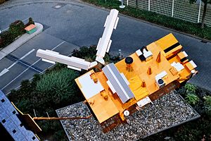
6.2 × 3.4 × 3.4 metres (under the launcher fairing) 17.6 × 6.5 × 5.2 metres (deployed in orbit) |
| Orbit Orbit In physics, an orbit is the gravitationally curved path of an object around a point in space, for example the orbit of a planet around the center of a star system, such as the Solar System... : |
Sun-synchronous orbit Sun-synchronous orbit A Sun-synchronous orbit is a geocentric orbit which combines altitude and inclination in such a way that an object on that orbit ascends or descends over any given point of the Earth's surface at the same local mean solar time. The surface illumination angle will be nearly the same every time... |
| Inclination Inclination Inclination in general is the angle between a reference plane and another plane or axis of direction.-Orbits:The inclination is one of the six orbital parameters describing the shape and orientation of a celestial orbit... : |
98.7° to the Equator Equator An equator is the intersection of a sphere's surface with the plane perpendicular to the sphere's axis of rotation and containing the sphere's center of mass.... |
| Orbital period: | 101 minutes |
MetOp is a series of polar orbit
Polar orbit
A polar orbit is an orbit in which a satellite passes above or nearly above both poles of the body being orbited on each revolution. It therefore has an inclination of 90 degrees to the equator...
ing meteorological satellites
Weather satellite
The weather satellite is a type of satellite that is primarily used to monitor the weather and climate of the Earth. Satellites can be either polar orbiting, seeing the same swath of the Earth every 12 hours, or geostationary, hovering over the same spot on Earth by orbiting over the equator while...
operated by the European Organisation for the Exploitation of Meteorological Satellites
European Organisation for the Exploitation of Meteorological Satellites
EUMETSAT is an intergovernmental organisation created through an international convention agreed by a current total of 26 European Member States: Austria, Belgium, Croatia, the Czech Republic, Denmark, Finland, France, Germany, Greece, Hungary, Ireland, Romania, Italy, Latvia, Luxembourg, the...
. The satellites are all part af the EUMETSAT Polar System. It is intended to replace the soon to be retired TIROS
TIROS
TIROS, or Television Infrared Observation Satellite, is a series of early weather satellites launched by NASA, beginning with TIROS-1 in 1960. TIROS was the first satellite that was capable of remote sensing of the Earth. This initial remote-sensing effort was significant because it enabled Earth...
network. The satellites, the first of which was launched on October 19, 2006, are equipped with the same equipment as the TIROS satellites, plus extra atmospheric measuring instruments.
Background
The Television Infrared Observation Satellite (TIROS) series of polar-orbiting satellites was launched in 1960. Operated by the National Oceanic and Atmospheric AdministrationNational Oceanic and Atmospheric Administration
The National Oceanic and Atmospheric Administration , pronounced , like "noah", is a scientific agency within the United States Department of Commerce focused on the conditions of the oceans and the atmosphere...
(NOAA), TIROS proved extremely successful, providing accurate and detailed satellite imagery
Satellite imagery
Satellite imagery consists of photographs of Earth or other planets made by means of artificial satellites.- History :The first images from space were taken on sub-orbital flights. The U.S-launched V-2 flight on October 24, 1946 took one image every 1.5 seconds...
which helped provide accurate weather forecasts based on the data gathered from space. Since then, the United States
United States
The United States of America is a federal constitutional republic comprising fifty states and a federal district...
have been providing meteorological data from this evolving series of polar satellites free of charge. However, in the early 1990s, NOAA unfolded plans to discontinue the monitoring service (the current TIROS K, L and M series) of the Polar Operational Environmental Satellites
Polar Operational Environmental Satellites
The Polar Operational Environmental Satellite project operates a constellation of weather satellites in polar orbits around the Earth. It is a joint effort between the National Oceanic and Atmospheric Administration and the European Organisation for the Exploitation of Meteorological Satellites...
(POES). Europe
Europe
Europe is, by convention, one of the world's seven continents. Comprising the westernmost peninsula of Eurasia, Europe is generally 'divided' from Asia to its east by the watershed divides of the Ural and Caucasus Mountains, the Ural River, the Caspian and Black Seas, and the waterways connecting...
consequently decided to balance the long-standing service provided by the United States with what was finally to become MetOp.
It has been developed as a joint undertaking between the European Space Agency
European Space Agency
The European Space Agency , established in 1975, is an intergovernmental organisation dedicated to the exploration of space, currently with 18 member states...
(ESA) and European Organisation for the Exploitation of Meteorological Satellites (EUMETSAT). MetOp is part of the European contribution to a co-operative venture with the NOAA through the Initial Joint Polar Satellite System (IJPS).
Launch and deployment
MetOp-A, the first ever European polar-orbiting meteorological satellite, was successfully launched on 19 October 2006 from Baikonur CosmodromeBaikonur Cosmodrome
The Baikonur Cosmodrome , also called Tyuratam, is the world's first and largest operational space launch facility. It is located in the desert steppe of Kazakhstan, about east of the Aral Sea, north of the Syr Darya river, near Tyuratam railway station, at 90 meters above sea level...
, Kazakhstan
Kazakhstan
Kazakhstan , officially the Republic of Kazakhstan, is a transcontinental country in Central Asia and Eastern Europe. Ranked as the ninth largest country in the world, it is also the world's largest landlocked country; its territory of is greater than Western Europe...
using a Soyuz-ST Fregat launcher, after six attempts. At just over 4,000 kg and measuring 17.6 × 6.5 × 5.2 m when in orbit, MetOp is Europe's second largest Earth-observation satellite, after ENVISAT
Envisat
Envisat is an Earth-observing satellite. It was launched on 1 March 2002 aboard an Ariane 5 from the Guyana Space Centre in Kourou, French Guyana into a Sun synchronous polar orbit at an altitude of...
which was launched in 2002.
The first signal from the satellite was received at 1835 BST on 20 October 2006, and it was confirmed that the satellite was in its nominally correct orbit with the solar panel deployed. Control of the satellite was with the European Space Operations Centre
European Space Operations Centre
The European Space Operations Centre is responsible for controlling ESA satellites and space probes. The centre is located in Darmstadt, Germany. It is Mission Control for most of the space projects of the ESA. Since its creation in 1967, the centre has operated 60 European space missions...
(ESOC — part of ESA) which had the responsibility of achieving the final positioning of the satellite, deployment of all the antennas and final reconfiguration of the satellite following necessary orbit control maneuvers. The satellite was handed over to EUMETSAT operations on 22 October 2006. The first image was received at 0800 UTC on 25 October—a visible light image of Scandinavia and Eastern Europe—but there was a six-month period of verification and calibration of the satellite and its instrument payload before it was declared operational. Before that point, the Met Office
Met Office
The Met Office , is the United Kingdom's national weather service, and a trading fund of the Department for Business, Innovation and Skills...
received data and started to test and then use it as input to the operational numerical weather prediction
Numerical weather prediction
Numerical weather prediction uses mathematical models of the atmosphere and oceans to predict the weather based on current weather conditions. Though first attempted in the 1920s, it was not until the advent of computer simulation in the 1950s that numerical weather predictions produced realistic...
runs.
MetOp-A was declared fully operational in mid-May 2007 and the full data of its 11 scientific instruments are available to its users on operational basis
Instruments
The following instruments are flown onboard the MetOp-A satellite:- IASI - Infrared Atmospheric Sounding Interferometer
- MHSMicrowave humidity sounderThe Microwave Humidity Sounder is an instrument launched on NOAA's POES satellite series starting with NOAA-18 launched in May 2005 and European Space Agency's MetOp series starting with MetOp-A launched in October 2006. It is a five-channel passive microwave radiometer, with channels from 89 to...
- Microwave Humidity Sounder - GRAS - Global Navigation Satellite System Receiver for Atmospheric Sounding
- ASCAT - Advanced Scatterometer
- GOME-2 - Global Ozone Monitoring Experiment-2
- AMSU-A1/AMSU-A2Advanced Microwave Sounding UnitThe Advanced microwave sounding unit is a multi-channel microwave radiometer installed on meteorological satellites. The instrument examines several bands of microwave radiation from the atmosphere to perform atmospheric sounding of temperature and moisture levels.-Products:Level-1 radiance data...
- Advanced Microwave Sounding Units - HIRS/4 - High-resolution Infrared Radiation Sounder
- AVHRRAdvanced Very High Resolution RadiometerThe Advanced Very High Resolution Radiometer is a space-borne sensor embarked on the National Oceanic and Atmospheric Administration family of polar orbiting platforms . AVHRR instruments measure the reflectance of the Earth in 5 relatively wide spectral bands...
/3 - Advanced Very High Resolution Radiometer - A-DCS - Advanced Data Collection System
- SEM-2 - Space Environment Monitor
- SARP-3 - Search And Rescue Processor
- SARR - Search And Rescue Repeater
GOME-2
The first atmospheric contributions by MetOp-A were made by the Global Ozone Monitoring Experiment-2 (GOME-2), a scanning spectrometerSpectrometer
A spectrometer is an instrument used to measure properties of light over a specific portion of the electromagnetic spectrum, typically used in spectroscopic analysis to identify materials. The variable measured is most often the light's intensity but could also, for instance, be the polarization...
on board the satellite. GOME-2, developed by DLR (the German Aerospace Centre) as the successor of ERS-2's GOME (1995), provided coverage of most areas of planet Earth measuring the atmospheric ozone
Ozone
Ozone , or trioxygen, is a triatomic molecule, consisting of three oxygen atoms. It is an allotrope of oxygen that is much less stable than the diatomic allotrope...
, the distribution of surface ultraviolet radiation, and the amount of nitrogen dioxide
Nitrogen dioxide
Nitrogen dioxide is the chemical compound with the formula it is one of several nitrogen oxides. is an intermediate in the industrial synthesis of nitric acid, millions of tons of which are produced each year. This reddish-brown toxic gas has a characteristic sharp, biting odor and is a prominent...
(NO2). The GOME-2 instrument provides a second source of ozone observations that supplement data from the SBUV/2
SBUV/2
Solar Backscatter Ultraviolet RadiometerThe Solar Backscatter Ultraviolet Radiometer, or SBUV/2, is a series of operational remote sensors on NOAA weather satellites which monitor the density and distribution of ozone in the Earth’s atmosphere from six to 30 miles. SBUV/2 looks down at the Earth’s...
ozone instruments on the NOAA-18
NOAA-18
NOAA-18 is a weather forecasting satellite run by NOAA. NOAA-N was launched on May 20, 2005, into a sun-synchronous orbit at an altitude of 854 km above the Earth, with an orbital period of 102 minutes. It hosts the AMSU-A, MHS, AVHRR and High Resolution Infrared Radiation Sounder instruments, as...
and NOAA-19
NOAA-19
NOAA-19, designated NOAA-N prior to launch, is the last of the United States National Oceanic and Atmospheric Administration's POES series of weather satellites...
satellites, which are part of the IJPS.
Infrared Atmospheric Sounding Interferometer (IASI)
One of the most important instruments carried onboard MetOp is IASI, the most accurate infrared sounding interferometer currently in orbit. IASI observes the atmosphere in the infra-red (3.7 - 15.5 µm) in 8461 channels, allowing to measure the atmosphere temperature within 1°C and relative humidity within 10% for each slice of 1 km height. Earth surface is revisited twice a day. IASI by itself produces half of all MetOp data.Future plans
It is planned that subsequent MetOp satellites will be launched at approximately five year intervals, maintaining the service until at least 2020. The second in the series, MetOp-B, is due to be launched in mid 2012 from the Baikonur CosmodromeBaikonur Cosmodrome
The Baikonur Cosmodrome , also called Tyuratam, is the world's first and largest operational space launch facility. It is located in the desert steppe of Kazakhstan, about east of the Aral Sea, north of the Syr Darya river, near Tyuratam railway station, at 90 meters above sea level...
. MetOp-C, the third satellite is to be launched in the 2016/2017 timeframe, from the Guiana Space Centre.