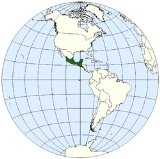
Mesoamerica is a
regionRegion is most commonly found as a term used in terrestrial and astrophysics sciences also an area, notably among the different sub-disciplines of geography, studied by regional geographers. Regions consist of subregions that contain clusters of like areas that are distinctive by their uniformity...
and
culture areaA cultural area or culture area is a region with one relatively homogeneous human activity or complex of activities . These areas are primarily geographical, not historical , and they are not considered equivalent to Kulturkreis .-Development:A culture area is a concept in cultural anthropology...
in the
AmericasThe Americas, or America , are lands in the Western hemisphere, also known as the New World. In English, the plural form the Americas is often used to refer to the landmasses of North America and South America with their associated islands and regions, while the singular form America is primarily...
, extending approximately from central
MexicoThe United Mexican States , commonly known as Mexico , is a federal constitutional republic in North America. It is bordered on the north by the United States; on the south and west by the Pacific Ocean; on the southeast by Guatemala, Belize, and the Caribbean Sea; and on the east by the Gulf of...
to
BelizeBelize is a constitutional monarchy and the northernmost country in Central America. Belize has a diverse society, comprising many cultures and languages. Even though Kriol and Spanish are spoken among the population, Belize is the only country in Central America where English is the official...
,
GuatemalaGuatemala is a country in Central America bordered by Mexico to the north and west, the Pacific Ocean to the southwest, Belize to the northeast, the Caribbean to the east, and Honduras and El Salvador to the southeast...
,
El SalvadorEl Salvador or simply Salvador is the smallest and the most densely populated country in Central America. The country's capital city and largest city is San Salvador; Santa Ana and San Miguel are also important cultural and commercial centers in the country and in all of Central America...
,
HondurasHonduras is a republic in Central America. It was previously known as Spanish Honduras to differentiate it from British Honduras, which became the modern-day state of Belize...
,
NicaraguaNicaragua is the largest country in the Central American American isthmus, bordered by Honduras to the north and Costa Rica to the south. The country is situated between 11 and 14 degrees north of the Equator in the Northern Hemisphere, which places it entirely within the tropics. The Pacific Ocean...
, and
Costa RicaCosta Rica , officially the Republic of Costa Rica is a multilingual, multiethnic and multicultural country in Central America, bordered by Nicaragua to the north, Panama to the southeast, the Pacific Ocean to the west and the Caribbean Sea to the east....
, within which a number of
pre-Columbian societiesThe pre-Columbian era incorporates all period subdivisions in the history and prehistory of the Americas before the appearance of significant European influences on the American continents, spanning the time of the original settlement in the Upper Paleolithic period to European colonization during...
flourished before the
Spanish colonization of the AmericasColonial expansion under the Spanish Empire was initiated by the Spanish conquistadores and developed by the Monarchy of Spain through its administrators and missionaries. The motivations for colonial expansion were trade and the spread of the Christian faith through indigenous conversions...
in the 15th and 16th centuries.
As a culture area, Mesoamerica is defined by a suite of cultural traits developed and shared by its indigenous cultures. Beginning as early as 7000 BCE the domestication of
maizeMaize known in many English-speaking countries as corn or mielie/mealie, is a grain domesticated by indigenous peoples in Mesoamerica in prehistoric times. The leafy stalk produces ears which contain seeds called kernels. Though technically a grain, maize kernels are used in cooking as a vegetable...
,
beansPhaseolus is a genus in the family Fabaceae of about fifty plant species, all native to the Americas.At least four of the species have been domesticated since pre-Columbian times for their beans. Most prominent among these is the common bean, P...
,
squash-Food and beverage:* Squash , the fruit of vines of the genus Cucurbita* Squash , a drink made of concentrated fruit syrup or fructose* Tuborg Squash, a Danish orange-flavoured soft drink-Sports:* Squash...
and
chileChile ,officially the Republic of Chile , is a country in South America occupying a long, narrow coastal strip between the Andes mountains to the east and the Pacific Ocean to the west. It borders Peru to the north, Bolivia to the northeast, Argentina to the east, and the Drake Passage in the far...
, ad well as the turkey and dog, caused a transition from paleo-indian hunter-gatherer to sedentary agricultural villages. In the subsequent formative areas agriculture, and cultural traits such as a complex
mythological and religious tradition- Cosmology :The cosmological view in mesoamerica is strongly connected to the mesoamerican gods and the spiritual world. You may say that the construction and division of the universe, therefore is a kind of visual and symbolic set up for their religious beliefs....
, a
vigesimalThe vigesimal or base 20 numeral system is based on twenty .- Places :...
numeric system, and a complex calendric system, a
tradition of ball playingThe Mesoamerican ballgame or Tlatchtli in Náhuatl was a sport with ritual associations played since 1,000 B.C. by the pre-Columbian peoples of Ancient Mexico and Central America...
, and a distinct
architectural styleMesoamerican architecture is the set of architectural traditions produced by pre-Columbian cultures and civilizations of Mesoamerica, traditions which are best known in the form of public, ceremonial and urban monumental buildings and structures...
, were diffused through the area. Also in this period villages began to become socially stratified and develop into
chiefdomA chiefdom is a political economy that organizes regional populations through a hierarchy of the chief.In anthropological theory, one model of human social development rooted in ideas of cultural evolution describes a chiefdom as a form of social organization more complex than a tribe or a band...
s, and the development of large ceremonial centers, interconnected by a network of trade routes for the interchange of luxury goods such as
obsidianObsidian is a naturally formed volcanic glass that was an important part of the material culture of Pre-Columbian Mesoamerica. Obsidian was a highly integrated part of daily and ritual life, and its widespread and varied use may be a significant contributor to Mesoamerica's lack of metallurgy...
,
jadeJade is an ornamental stone.The term jade is applied to two different metamorphic rocks that are made up of different silicate minerals:...
,
cacaoTheobroma cacao also cacao tree and cocoa tree, is a small evergreen tree in the family Sterculiaceae , native to the deep tropical region of the Americas. Its seeds are used to make cocoa powder and chocolate...
,
cinnabarCinnabar or cinnabarite , is the common ore of mercury.-Word origin:The name comes from κινναβαρι , a Greek word most likely applied by Theophrastus to several distinct substances...
,
SpondylusSpondylus is a genus of bivalve molluscs, the only genus in the family Spondylidae. As well as being the systematic or scientific name, Spondylus is also the most often used common name for these animals, though they are also known as thorny oysters or spiny oysters.There are many species of...
shells,
hematiteHematite, also spelled as haematite, is the mineral form of iron oxide , one of several iron oxides. Hematite crystallizes in the rhombohedral system, and it has the same crystal structure as ilmenite and corundum...
, and ceramics. While Mesoamerican civilization did know of the wheel and basic metallurgy, neither of these technologies achieved culturally importance.
Among the earliest complex civilization was the
OlmecThe Olmec were the first major Pre-Columbian civilization in Mexico. They lived in the tropical lowlands of south-central Mexico, in the modern-day states of Veracruz and Tabasco....
culture which inhabited the gulf coast of Mexico and extended in-land and southwards across the
Isthmus of TehuantepecThe Isthmus of Tehuantepec is an isthmus in Mexico. It represents the shortest distance between the Gulf of Mexico and the Pacific Ocean, and prior to the opening of the Panama Canal was a major shipping route known simply as the Tehuantepec Route...
. Contact and cultural interchange between the early Olmec and other formative era cultures in Chiapas, Guatemala and Oaxaca laid the basis for the Mesoamerican culture area. The formative period sees the spread of distinct religious and symbolic traditions, as well as artistic and architectural complexes. In the subsequent
pre-classical periodMesoamerican chronology divides the history of pre-Columbian Mesoamerica into several periods: the Paleo-Indian , the Archaic , the Preclassic , the Classic , and the Postclassic...
, complex urban polities began to develop among the
MayaThe Maya is a Mesoamerican civilization, noted for the only known fully developed written language of the pre-Columbian Americas, as well as for its art, architecture, and mathematical and astronomical systems. Initially established during the Pre-Classic period The Maya is a Mesoamerican...
with centers such as
El MiradorEl Mirador is a large pre-Columbian Mayan settlement, located in the north of the modern department of El Petén, Guatemala.-Discovery:El Mirador was first discovered in 1926, and was photographed from the air in 1930, but the remote site deep in the jungle had little more attention paid to it until...
,
CalakmulCalakmul is a Maya archaeological site in the Mexican state of Campeche, deep in the jungles of the greater Petén Basin region. It is from the Guatemalan border. Calakmul was one of the largest and most powerful ancient cities ever uncovered in the Maya lowlands...
and
TikalTikal is one of the largest archaeological sites and urban centres of the pre-Columbian Maya civilization. It is located in the archaeological region of the Petén Basin in what is now northern Guatemala...
and the
ZapotecThe Zapotec civilization was an indigenous pre-Columbian civilization that flourished in the Valley of Oaxaca of southern Mesoamerica. Archaeological evidence shows their culture goes back at least 2500 years...
at
Monte AlbánMonte Albán is a large pre-Columbian archaeological site in the Santa Cruz Xoxocotlán Municipality in the southern Mexican state of Oaxaca...
. During this period the first true
Mesoamerican writing systemsMesoamerica, like India, Mesopotamia, China, and Egypt, is one of the few places in the world where writing has developed independently. Mesoamerican scripts deciphered to date are logosyllabic, combining the use of logograms with a syllabary, and they are often called hieroglyphic scripts...
were developed in the
Epi-OlmecThe Epi-Olmec culture was a cultural area in the central region of the present-day Mexican state of Veracruz, concentrated in the Papaloapan River basin, a culture that existed during the Late Formative period, from roughly 300 BCE to roughly 250 CE. Epi-Olmec was a successor culture to the Olmec,...
and the Zapotec cultures, and the Mesoamerican writing tradition reached its height in the Classic
Maya Hieroglyphic scriptThe Maya script, also known as Maya glyphs or Maya hieroglyphs, is the writing system of the pre-Columbian Maya civilization of Mesoamerica, presently the only Mesoamerican writing system that has been substantially deciphered...
. Mesoamerica is one of only five regions of the world where writing was independently developed. In Central Mexico, the height of the classic period saw the ascendancy of
TeotihuacanTeotihuacan – also written Teotihuacán, with a Spanish orthographic accent on the last syllable – is an enormous archaeological site in the Basin of Mexico, just 30 miles northeast of Mexico City, containing some of the largest pyramidal structures built in the pre-Columbian Americas...
which formed a military and commercial empire whose political influence stretched south into the Maya area and north. At the collapse of Teotihuacán around 600 CE, competition between several important political centers in central Mexico such as
XochicalcoXochicalco is a pre-Columbian archaeological site in the Municipality of Miacatlán in the western part of the Mexican state of Morelos. The name Xochicalco may be translated from Nahuatl as "in the house of Flowers". The site is located 38 km southwest of Cuernavaca, about 76 miles by road...
and
CholulaCholula is a city and district located in the center west of the state of Puebla, next to the city of Puebla de Zaragoza, in central Mexico. Cholula is best known for its Great Pyramid, with the Nuestra Señora de los Remedios sanctuary on top and its numerous churches...
ensued. At this time during the Epi-Classic Nahua peoples began moving south into Mesoamerica from the North, and became politically and culturally dominant in central Mexico, as they displaced speakers of
Oto-Manguean languagesOto-Manguean languages are a large family comprising several families of Native American languages. All of the Oto-Manguean languages that are now spoken are indigenous to Mexico, but the Manguean branch of the family, which is now extinct, was spoken as far south as Nicaragua and Costa Rica.The...
. During the early post-classic Central Mexico was dominated by the
ToltecThe Toltec culture is an archaeological Mesoamerican culture that dominated a state centered in Tula, Hidalgo in the early post-classic period of Mesoamerican chronology...
culture, Oaxaca by the Mixtec and the lowland Maya area had important centers at
Chichén ItzáChichen Itza is a large pre-Columbian archaeological site built by the Maya civilization located in the northern center of the Yucatán Peninsula, in the Municipality of Tinúm, Yucatán state, present-day Mexico....
and
MayapánMayapan , is a Pre-Columbian Maya site a couple of kilometers south of the town of Telchaquillo in Municipality of Tecoh, approximately 40 km south-east of Mérida and 100 km west of Chichen Itza; in the state of Yucatán, Mexico...
. Towards the end of the post-Classic period the
AztecThe Aztec people were certain ethnic groups of central Mexico, particularly those groups who spoke the Nahuatl language and who dominated large parts of Mesoamerica in the 14th, 15th and 16th centuries, a period referred to as the late post-classic period in Mesoamerican chronology.Aztec is the...
s of Central Mexico built a tributary empire covering most of central Mesoamerica.
The distinct Mesoamerican cultural tradition ended with the Spanish conquest in the 16th century, and over the next centuries Mesoamerican indigenous cultures were gradually subjected to Spanish colonial rule. Aspects of the Mesoamerican cultural heritage still survives among the many indigenous peoples that still inhabit Mesoamerica, many of whom continue to speak their ancestral languages, and even maintain certain cultural practices harking back to their Mesoamerican roots.
Etymology and definition
The term
Mesoamerica—literally, "middle America" in
GreekGreek is an independent branch of the Indo-European family of languages. Native to the southern Balkans, it has the longest documented history of any Indo-European language, spanning 34 centuries of written records. Its writing system has been the Greek alphabet for the majority of its history;...
—was first used by the
GermanGermany , officially the Federal Republic of Germany , is a federal parliamentary republic in Europe. The country consists of 16 states while the capital and largest city is Berlin. Germany covers an area of 357,021 km2 and has a largely temperate seasonal climate...
ethnologist
Paul KirchhoffPaul Kirchhoff was a German-Mexican anthropologist, most noted for his seminal work in defining and elaborating the culture area of Mesoamerica, a term he coined....
, who noted that similarities existed among the various
pre-Columbian culturesThe pre-Columbian era incorporates all period subdivisions in the history and prehistory of the Americas before the appearance of significant European influences on the American continents, spanning the time of the original settlement in the Upper Paleolithic period to European colonization during...
within the region that included southern
MexicoThe United Mexican States , commonly known as Mexico , is a federal constitutional republic in North America. It is bordered on the north by the United States; on the south and west by the Pacific Ocean; on the southeast by Guatemala, Belize, and the Caribbean Sea; and on the east by the Gulf of...
,
GuatemalaGuatemala is a country in Central America bordered by Mexico to the north and west, the Pacific Ocean to the southwest, Belize to the northeast, the Caribbean to the east, and Honduras and El Salvador to the southeast...
,
BelizeBelize is a constitutional monarchy and the northernmost country in Central America. Belize has a diverse society, comprising many cultures and languages. Even though Kriol and Spanish are spoken among the population, Belize is the only country in Central America where English is the official...
,
El SalvadorEl Salvador or simply Salvador is the smallest and the most densely populated country in Central America. The country's capital city and largest city is San Salvador; Santa Ana and San Miguel are also important cultural and commercial centers in the country and in all of Central America...
, western
HondurasHonduras is a republic in Central America. It was previously known as Spanish Honduras to differentiate it from British Honduras, which became the modern-day state of Belize...
, and the
PacificThe Pacific Ocean is the largest of the Earth's oceanic divisions. It extends from the Arctic in the north to the Southern Ocean in the south, bounded by Asia and Australia in the west, and the Americas in the east.At 165.2 million square kilometres in area, this largest division of the World...
lowlands of
NicaraguaNicaragua is the largest country in the Central American American isthmus, bordered by Honduras to the north and Costa Rica to the south. The country is situated between 11 and 14 degrees north of the Equator in the Northern Hemisphere, which places it entirely within the tropics. The Pacific Ocean...
and northwestern
Costa RicaCosta Rica , officially the Republic of Costa Rica is a multilingual, multiethnic and multicultural country in Central America, bordered by Nicaragua to the north, Panama to the southeast, the Pacific Ocean to the west and the Caribbean Sea to the east....
. In the tradition of
cultural historyCulture-historical archaeology is an archaeological theory that emphasises defining historical societies into distinct ethnic and cultural groupings according to their material culture...
, the prevalent
archaeological theoryArchaeological theory refers to the various intellectual frameworks through which archaeologists interpret archaeological data. There is no one singular theory of archaeology, but many, with different archaeologists believing that information should be interpreted in different ways...
of the early to middle 20th century, Kirchhoff defined this zone as a culture area based on a suite of interrelated cultural similarities brought about by millennia of inter- and intra-regional interaction (i.e., diffusion).
The shared cultural traits that define Mesoamerica are:
- Sedentism
In evolutionary anthropology and archaeology, sedentism , is a term applied to the transition from nomadic to permanent, year-round settlement.- Requirements for permanent settlements :...
based on maizeMaize known in many English-speaking countries as corn or mielie/mealie, is a grain domesticated by indigenous peoples in Mesoamerica in prehistoric times. The leafy stalk produces ears which contain seeds called kernels. Though technically a grain, maize kernels are used in cooking as a vegetable...
agricultureAgriculture is the cultivation of animals, plants, fungi and other life forms for food, fiber, and other products used to sustain life. Agriculture was the key implement in the rise of sedentary human civilization, whereby farming of domesticated species created food surpluses that nurtured the...
- The construction of Stepped pyramids
Mesoamerican pyramids, pyramid-shaped structures, are an important part of ancient Mesoamerican architecture. These structures were usually step pyramids with temples on top – more akin to the ziggurats of Mesopotamia than to the pyramids of Ancient Egypt...
- The use of two different calendars (a 260-day ritual calendar and a 365-day calendar based on the solar year).
- vigesimal
The vigesimal or base 20 numeral system is based on twenty .- Places :...
(base 20) number system.
- Pictographic
A pictograph, also called pictogram or pictogramme is an ideogram that conveys its meaning through its pictorial resemblance to a physical object. Pictographs are often used in writing and graphic systems in which the characters are to considerable extent pictorial in appearance.Pictography is a...
and hieroglyphic writing systemMesoamerica, like India, Mesopotamia, China, and Egypt, is one of the few places in the world where writing has developed independently. Mesoamerican scripts deciphered to date are logosyllabic, combining the use of logograms with a syllabary, and they are often called hieroglyphic scripts...
s.
- The use of rubber
Natural rubber, also called India rubber or caoutchouc, is an elastomer that was originally derived from latex, a milky colloid produced by some plants. The plants would be ‘tapped’, that is, an incision made into the bark of the tree and the sticky, milk colored latex sap collected and refined...
and bark paper.
- The practice of various forms of sacrifice
Sacrifice is the offering of food, objects or the lives of animals or people to God or the gods as an act of propitiation or worship.While sacrifice often implies ritual killing, the term offering can be used for bloodless sacrifices of cereal food or artifacts...
including Human sacrificeHuman sacrifice is the act of killing one or more human beings as part of a religious ritual . Its typology closely parallels the various practices of ritual slaughter of animals and of religious sacrifice in general. Human sacrifice has been practised in various cultures throughout history...
.
- A religious complex
- Cosmology :The cosmological view in mesoamerica is strongly connected to the mesoamerican gods and the spiritual world. You may say that the construction and division of the universe, therefore is a kind of visual and symbolic set up for their religious beliefs....
based on a combination of ShamanismShamanism is an anthropological term referencing a range of beliefs and practices regarding communication with the spiritual world. To quote Eliade: "A first definition of this complex phenomenon, and perhaps the least hazardous, will be: shamanism = technique of ecstasy." Shamanism encompasses the...
and natural deities.
Mesoamerica has also been shown to be a
linguistic areaA Sprachbund – also known as a linguistic area, convergence area, diffusion area or language crossroads – is a group of languages that have become similar in some way because of geographical proximity and language contact. They may be genetically unrelated, or only distantly related...
defined by a
number of grammatical traitsThe Mesoamerican Linguistic Area is a sprachbund containing many of the languages natively spoken in the cultural area of Mesoamerica. This sprachbund is defined by an array of syntactic, lexical and phonological traits as well as a number of ethnolinguistic traits found in the languages of...
that have spread through the area by diffusion.
Mesoamerica is recognized as a near-prototypical cultural area and the term is now fully integrated in the standard terminology of pre-Columbian
anthropologicalCultural anthropology is a branch of anthropology focused on the study of cultural variation among humans, collecting data about the impact of global economic and political processes on local cultural realities. Anthropologists use a variety of methods, including participant observation,...
studies. Conversely, the sister terms
AridoamericaAridoamerica, also known as the Gran Chichimeca, is a term used by Mexican archeologists to describe a region of the southwestern United States and the northern and central regions of Mexico, in contrast to Mesoamerica, which lies to the south and east...
and
OasisamericaOasisamerica was a broad cultural area in pre-Columbian southwestern North America. It extended from modern-day Utah down to southern Chihuahua, and from the coast on the Gulf of California eastward to the Río Bravo river valley...
, which refer to northern Mexico and the western
United StatesThe United States of America is a federal constitutional republic comprising fifty states and a federal district...
, respectively, have not entered into widespread usage.
Geography
Located on the
Middle AmericanMiddle America is a region in the mid-latitudes of the Americas. In southern North America, it usually comprises Mexico, the nations of Central America, and the West Indies. The scope of the term may vary...
isthmusAn isthmus is a narrow strip of land connecting two larger land areas usually with waterforms on either side.Canals are often built through isthmuses where they may be particularly advantageous to create a shortcut for marine transportation...
joining North and
South AmericaSouth America is a continent situated in the Western Hemisphere, mostly in the Southern Hemisphere, with a relatively small portion in the Northern Hemisphere. The continent is also considered a subcontinent of the Americas. It is bordered on the west by the Pacific Ocean and on the north and east...
between
ca. 10° and 22° northern
latitudeIn geography, the latitude of a location on the Earth is the angular distance of that location south or north of the Equator. The latitude is an angle, and is usually measured in degrees . The equator has a latitude of 0°, the North pole has a latitude of 90° north , and the South pole has a...
, Mesoamerica possesses a complex combination of ecological systems, topographic zones, and environmental contexts.
ArchaeologistArchaeology, or archeology , is the study of human society, primarily through the recovery and analysis of the material culture and environmental data that they have left behind, which includes artifacts, architecture, biofacts and cultural landscapes...
and
anthropologistAnthropology is the study of humanity. It has origins in the humanities, the natural sciences, and the social sciences. The term "anthropology" is from the Greek anthrōpos , "man", understood to mean mankind or humanity, and -logia , "discourse" or "study", and was first used in 1501 by German...
Michael D. CoeMichael D. Coe is an American archaeologist, anthropologist, epigrapher and author. Primarily known for his research in the field of pre-Columbian Mesoamerican studies , Coe has also made extensive investigations across a variety...
groups these different
nicheIn ecology, a niche is a term describing the relational position of a species or population in its ecosystem to each other; e.g. a dolphin could potentially be in another ecological niche from one that travels in a different pod if the members of these pods utilize significantly different food...
s into two broad categories: the lowlands (those areas between
sea levelMean sea level is a measure of the average height of the ocean's surface ; used as a standard in reckoning land elevation...
and 1000 meters) and the
altiplanos, or highlands (situated between 1,000 and 2,000 meters above sea level). In the low-lying regions, sub-tropical and
tropical climateA tropical climate is a climate of the tropics. In the Köppen climate classification it is a non-arid climate in which all twelve months have mean temperatures above...
s are most common, as is true for most of the coastline along the
PacificThe Pacific Ocean is the largest of the Earth's oceanic divisions. It extends from the Arctic in the north to the Southern Ocean in the south, bounded by Asia and Australia in the west, and the Americas in the east.At 165.2 million square kilometres in area, this largest division of the World...
and
Gulf of MexicoThe Gulf of Mexico is a partially landlocked ocean basin largely surrounded by the North American continent and the island of Cuba. It is bounded on the northeast, north and northwest by the Gulf Coast of the United States, on the southwest and south by Mexico, and on the southeast by Cuba. In...
and the
Caribbean SeaThe Caribbean Sea is a sea of the Atlantic Ocean located in the tropics of the Western hemisphere. It is bounded by Mexico and Central America to the west and southwest, to the north by the Greater Antilles, and to the east by the Lesser Antilles....
. The highlands show much more climatic diversity, ranging from dry tropical to cold mountainous climates; the dominant climate is temperate with warm temperatures and moderate rainfall. The rainfall varies from the dry
OaxacaOaxaca , , officially Estado Libre y Soberano de Oaxaca is one of the 31 states which, along with the Federal District, comprise the 32 federative entities of Mexico. It is divided into 571 municipalities; of which 418 are governed by the system of customs and traditions...
and north
YucatanYucatán officially Estado Libre y Soberano de Yucatán is one of the 31 states which, with the Federal District, comprise the 32 Federal Entities of Mexico. It is divided in 106 municipalities and its capital city is Mérida....
to the humid southern Pacific and Caribbean lowlands.
Cultural sub-areas
There are a number of distinct sub-regions within Mesoamerica that are defined by a convergence of geographic and cultural attributes. These sub-regions are more conceptual than culturally meaningful, and the demarcation of their limits is not rigid. The Maya area, for example, can be divided into two general groups: the lowlands and highlands. The lowlands are further divided into the southern and northern Maya lowlands. The southern Maya lowlands are generally conceptualized as encompassing northern
GuatemalaGuatemala is a country in Central America bordered by Mexico to the north and west, the Pacific Ocean to the southwest, Belize to the northeast, the Caribbean to the east, and Honduras and El Salvador to the southeast...
, southern
CampecheCampeche is one of the 31 states which, with the Federal District, comprise the 32 Federal Entities of Mexico. Located in Southeast Mexico, it is bordered by the states of Yucatán to the north east, Quintana Roo to the east, and Tabasco to the south west...
and
Quintana RooQuintana Roo officially Estado Libre y Soberano de Quintana Roo is one of the 31 states which, with the Federal District, comprise the 32 Federal Entities of Mexico. It is divided in 10 municipalities and its capital city is Chetumal....
in
MexicoThe United Mexican States , commonly known as Mexico , is a federal constitutional republic in North America. It is bordered on the north by the United States; on the south and west by the Pacific Ocean; on the southeast by Guatemala, Belize, and the Caribbean Sea; and on the east by the Gulf of...
, and
BelizeBelize is a constitutional monarchy and the northernmost country in Central America. Belize has a diverse society, comprising many cultures and languages. Even though Kriol and Spanish are spoken among the population, Belize is the only country in Central America where English is the official...
. The northern lowlands cover the remainder of the northern portion of the
Yucatán PeninsulaThe Yucatán Peninsula, in southeastern Mexico, separates the Caribbean Sea from the Gulf of Mexico, with the northern coastline on the Yucatán Channel...
. Other areas include Central Mexico, West Mexico, the Gulf Coast Lowlands,
OaxacaOaxaca , , officially Estado Libre y Soberano de Oaxaca is one of the 31 states which, along with the Federal District, comprise the 32 federative entities of Mexico. It is divided into 571 municipalities; of which 418 are governed by the system of customs and traditions...
, the Southern Pacific Lowlands, and Southeast Mesoamerica (including northern
HondurasHonduras is a republic in Central America. It was previously known as Spanish Honduras to differentiate it from British Honduras, which became the modern-day state of Belize...
).
Topography
There is extensive topographic variation in Mesoamerica, ranging from the high peaks circumscribing the
Valley of MexicoThe Valley of Mexico is a highlands plateau in central Mexico roughly coterminous with the present-day Distrito Federal and the eastern half of the State of Mexico. Surrounded by mountains and volcanoes, the Valley of Mexico was a centre for several pre-Columbian civilizations, including...
and within the central
Sierra MadreSierra Madre is a mountain range which runs northwest-southeast from the state of Chiapas in Mexico across Guatemala and into El Salvador and Honduras. Most of the volcanoes of Guatemala are a part of this range.A narrow coastal plain lies south the range, between the Sierra Madre and the Pacific...
mountains to the low flatlands of the northern Yucatán Peninsula. The tallest mountain in Mesoamerica is
Pico de OrizabaThe Pico de Orizaba, or Citlaltépetl , is a stratovolcano, the highest mountain in Mexico and the third highest in North America. It rises above sea level in the eastern end of the Trans-Mexican Volcanic Belt, on the border between the states of Veracruz and Puebla...
, a dormant volcano located on the border of
PueblaPuebla officially Estado Libre y Soberano de Puebla is one of the 31 states which, with the Federal District, comprise the 32 Federal Entities of Mexico. It is divided in 217 municipalities and its capital city is Puebla....
and
VeracruzVeracruz, formally Veracruz de Ignacio de la Llave officially Estado Libre y Soberano de Veracruz de Ignacio de la Llave , is one of the 31 states that, along with the Federal District, comprise the 32 federative entities of Mexico. It is divided in 212 municipalities and its capital city is...
. Its peak elevation is 5,636 m (18,490 ft).
The Sierra Madre mountains, which consist of a number of smaller ranges, run from northern Mesoamerica south through
Costa RicaCosta Rica , officially the Republic of Costa Rica is a multilingual, multiethnic and multicultural country in Central America, bordered by Nicaragua to the north, Panama to the southeast, the Pacific Ocean to the west and the Caribbean Sea to the east....
. The chain is historically
volcanic2. Bedrock3. Conduit 4. Base5. Sill6. Dike7. Layers of ash emitted by the volcano8. Flank| 9. Layers of lava emitted by the volcano10. Throat11. Parasitic cone12. Lava flow13. Vent14. Crater15...
. In central and southern Mexico, a portion of the Sierra Madre chain is known as the Eje Volcánico Transversal, or the Trans-Mexican volcanic belt. There are 83 inactive and active volcanoes within the Sierra Madre range, including 11 in Mexico, 37 in Guatemala, 23 in El Salvador, 25 in Nicaragua, and three in northwestern Costa Rica. According to the Michigan Technological University
http://www.geo.mtu.edu/volcanoes/world.html, 16 of these are still active. The tallest active volcano is
PopocatépetlPopocatépetl also known as "Popochowa" by the local population is an active volcano and, at , the second highest peak in Mexico after the Pico de Orizaba...
at 5,452 m (17,887 ft). This volcano, which retains its
NahuatlNahuatl is thought to mean "a good, clear sound" This language name has several spellings, among them náhuatl , Naoatl, Nauatl, Nahuatl, Nawatl. In a back formation from the name of the language, the ethnic group of Nahuatl speakers are called Nahua...
name, is located 70 km (43 mi) southeast of
Mexico CityMexico City is the Federal District , capital of Mexico and seat of the federal powers of the Mexican Union. It is a federal entity within Mexico which is not part of any one of the 31 Mexican states but belongs to the federation as a whole...
. Other volcanoes of note include
Tacana on the Mexico–Guatemala border,
TajumulcoVolcán Tajumulco is a large stratovolcano in the department of San Marcos in western Guatemala. It is the highest mountain in Guatemala and Central America at...
and
SantamaríaSanta María Volcano is a large active volcano in the Western Highlands of Guatemala, close to the city of Quetzaltenango. Prior to the Spanish Conquest it was called Gagxanul in the local K'iche' language. Its eruption in 1902 was one of the four largest eruptions of the 20th century, after the...
in Guatemala,
IzalcoIzalco is a stratovolcano on the side of the Santa Ana Volcano, which is located in western El Salvador. It is situated on the southern flank of the Santa Ana volcano. Izalco erupted almost continuously from 1770 to 1958 earning it the nickname of "Lighthouse of the Pacific", and experienced a...
in El Salvador,
MomotomboMomotombo is a stratovolcano in Nicaragua, not far from the city of León. It stands on the shores of Lago de Managua. An eruption of the volcano in 1610 forced inhabitants of the Spanish city of León to relocate about 30 miles west...
in Nicaragua, and
ArenalArenal Volcano, in Spanish , is an active andesitic stratovolcano in north-western Costa Rica around 90 km northwest of San José, in the province of Alajuela, canton of San Carlos, and district of La Fortuna....
in Costa Rica.
One important topographic feature is the
Isthmus of TehuantepecThe Isthmus of Tehuantepec is an isthmus in Mexico. It represents the shortest distance between the Gulf of Mexico and the Pacific Ocean, and prior to the opening of the Panama Canal was a major shipping route known simply as the Tehuantepec Route...
, a low plateau that breaks up the Sierra Madre chain between the
Sierra Madre del SurThe Sierra Madre del Sur is a mountain range in southern Mexico, extending from southern Michoacán east through Guerrero, to the Istmo de Tehuantepec in eastern Oaxaca.-Geography:...
to the north and the
Sierra Madre de ChiapasSierra Madre is a mountain range which runs northwest-southeast from the state of Chiapas in Mexico across Guatemala and into El Salvador and Honduras. Most of the volcanoes of Guatemala are a part of this range.A narrow coastal plain lies south the range, between the Sierra Madre and the Pacific...
to the south. At its highest point, the
IsthmusAn isthmus is a narrow strip of land connecting two larger land areas usually with waterforms on either side.Canals are often built through isthmuses where they may be particularly advantageous to create a shortcut for marine transportation...
is 224 m (735 ft) above mean sea level. This area also represents the shortest distance between the
Gulf of MexicoThe Gulf of Mexico is a partially landlocked ocean basin largely surrounded by the North American continent and the island of Cuba. It is bounded on the northeast, north and northwest by the Gulf Coast of the United States, on the southwest and south by Mexico, and on the southeast by Cuba. In...
and the
Pacific OceanThe Pacific Ocean is the largest of the Earth's oceanic divisions. It extends from the Arctic in the north to the Southern Ocean in the south, bounded by Asia and Australia in the west, and the Americas in the east.At 165.2 million square kilometres in area, this largest division of the World...
in Mexico. The distance between the two coasts is roughly 200 km (120 mi). Although the northern side of the Isthmus is swampy and covered with dense jungle, the Isthmus of Tehuantepec, as the lowest and most level point within the Sierra Madre mountain chain, was nonetheless a main transportation, communication, and economic route within Mesoamerica.
Bodies of water
Outside of the northern Maya lowlands,
riverA river is a natural watercourse, usually freshwater, flowing towards an ocean, a lake, a sea, or another river. In a few cases, a river simply flows into the ground or dries up completely before reaching another body of water. Small rivers may also be called by several other names, including...
s are common throughout Mesoamerica. A number of the more important ones served as loci of human occupation in the area. The longest river in Mesoamerica is the Usumacinta, which forms in Guatemala at the convergence of the
SalinasThe Salinas is a river in Guatemala. The river is called Chixoy River from its sources in the highlands of Huehuetenango and El Quiché until it reaches the Chixoy hydroelectric dam , where the Río Salama and Rio Carchela converge with the Río Negro...
or
ChixoyThe Chixoy River or Río Negro is a river in Guatemala. The river is called Río Negro from its sources in the highlands of Huehuetenango and El Quiché until it reaches the Chixoy hydroelectric dam , where the Río Salamá and Rio Carchela converge with the Río Negro...
and La
Pasion RiverThe Pasión River is a river located in the northern lowlands region of Guatemala. The river is fed by a number of upstream tributaries whose sources lie in the hills of Alta Verapaz. These flow in a general northerly direction to form the Pasión, which then tends westwards to meet up with the...
and runs north for 970 km (600 mi)—480 km (300 mi) of which are navigable—eventually draining into the
Gulf of MexicoThe Gulf of Mexico is a partially landlocked ocean basin largely surrounded by the North American continent and the island of Cuba. It is bounded on the northeast, north and northwest by the Gulf Coast of the United States, on the southwest and south by Mexico, and on the southeast by Cuba. In...
. Other rivers of note include the
Rio Grande de SantiagoThe Río Grande de Santiago is one of the longest rivers in Mexico, measuring up long. The river begins at Lake Chapala and continues roughly north-west through the Sierra Madre Occidental, receiving the Verde, Juchipila, Bolaños, and other tributaries...
, the
Grijalva RiverGrijalva River, formerly known as Tabasco River. is a 480 km long river in southeastern Mexico. It is named after Juan de Grijalva who visited the area in 1518. The river rises in Chiapas highlands and flows from Chiapas to the state of Tabasco through the Sumidero Canyon into the Bay of...
, the
Motagua RiverThe Motagua River is a long river in Guatemala. It rises in the western highlands of Guatemala where it is also called Río Grande, and runs in an easterly direction to the Gulf of Honduras. The final few kilometres of the river form part of the Guatemala/Honduras border...
, the
Ulúa RiverThe Ulua River is a river in western Honduras. It rises in the central mountainous area of the country close to La Paz and runs 150 miles approximately due northwards to the east end of the Gulf of Honduras at . En route, it is joined by the Sulaco River, the Otoro River and the Chamelecon River....
, and the
Hondo RiverThe Rio Hondo is a river of Central America, approximately 150 km in length, which flows in a northeasterly direction to discharge into Chetumal Bay on the Caribbean Sea...
. The northern Maya lowlands, especially the north portion of the Yucatán peninsula, are notable for its nearly complete lack of rivers (largely due to its absolute lack of topographic variation). Additionally, no lakes exist in the northern peninsula. The main source of water in this area is
aquiferAn aquifer is a wet underground layer of water-bearing permeable rock or unconsolidated materials from which groundwater can be usefully extracted using a water well. The study of water flow in aquifers and the characterization of aquifers is called hydrogeology...
s that are accessed through natural surface openings called
cenoteA cenote is a deep natural pit, or sinkhole, characteristic of Mexico and Central America, resulting from the collapse of limestone bedrock that exposes groundwater underneath...
s.
With an area of 8,264 km
2 (3,191 sq mi),
Lake NicaraguaLake Nicaragua or Cocibolca or Granada or is a vast freshwater lake in Nicaragua of tectonic origin. With an area of , it is the largest lake in Central America, the 19th largest lake in the world and the 9th largest in the Americas. It is slightly smaller than Lake Titicaca. With an elevation...
is the largest lake in Mesoamerica.
Lake ChapalaLake Chapala is Mexico's largest freshwater lake. It lies in the municipalities of Chapala, Jocotepec , Poncitlán, and Jamay, in Jalisco, and in Venustiano Carranza and Cojumatlán de Régules, in Michoacán.- Geographic Features :...
is Mexico’s largest freshwater lake, but
Lake TexcocoLake Texcoco was a natural lake formation within the Valley of Mexico. The Aztecs built the city of Tenochtitlan on an island in the lake. The Spaniards built Mexico City over Tenochtitlan...
is perhaps most well known as the location upon which
Tenochtitlan, capital of the
Aztec EmpireThe Aztec people were certain ethnic groups of central Mexico, particularly those groups who spoke the Nahuatl language and who dominated large parts of Mesoamerica in the 14th, 15th and 16th centuries, a period referred to as the late post-classic period in Mesoamerican chronology.Aztec is the...
, was founded.
Lake Petén ItzáLake Petén Itzá is a lake in the northern department Petén in Guatemala. It is the second largest lake in Guatemala, the Izabal lake being the largest. It is located around . It has an area of 99 km² some 32 km. long and 5 km wide. Its maximum depth is 160 m...
, in northern Guatemala, is notable as the location at which the last independent Maya city,
TayasalTayasal is a pre-Columbian Maya archaeological site that dates to the Postclassic period. The site is located in the southern Maya lowlands on a small island in Lake Petén Itzá, now part of the Department of Petén in northern Guatemala...
(or Noh Petén), held out until 1697. Other large lakes include Lake Atitlán,
Lake IzabalLago de Izabal, also known as the Golfo Dulce, is the largest lake in Guatemala with a surface area of 589.6 km² and a maximum depth is 18 meters . The Polochic River is the largest river that drains into the lake...
,
Lake GüijaThe geography of El Salvador is unique among the nations of Central America. The country borders the North Pacific Ocean to the south and southwest, with Guatemala to the north-northwest and Honduras to the north-northeast. In the southeast, the Golfo de Fonseca separates it from Nicaragua...
,
LemoaLemona or Lemoa is a town and municipality located in the province of Biscay, in the autonomous community of Basque Country, northern Spain.-Sports in Lemoa:* SD Lemona in Segunda División B...
, and
Lake ManaguaLake Managua is a lake in Nicaragua. The Spanish name is Lago de Managua or Lago Xolotlán. At 1,042 km², it is approximately long and wide. Similarly to the name of Lake Nicaragua, its name was coined by the Spanish conquerors from "Mangue" and agua...
.
Biodiversity
Almost all
ecosystemAn ecosystem is a biological environment consisting of all the organisms living in a particular area, as well as all the nonliving , physical components of the environment with which the organisms interact, such as air, soil, water and sunlight....
s are present in Mesoamerica; the more well known are the
Mesoamerican Barrier Reef SystemThe Mesoamerican Barrier Reef System stretches over 1000 km from Isla Contoy at the tip of the Yucatán Peninsula down to the Bay Islands of Honduras...
, the second largest in the world, and La Mosquitia (consisting of the Rio Platano Biosphere Reserve, Tawahka Asangni, Patuca National Park, and Bosawas Biosphere Reserve) a
rainforestRainforests are forests characterized by high rainfall, with definitions based on a minimum normal annual rainfall of 1750-2000 mm...
second in size in the Americas only to the
AmazonasThe Amazon Rainforest , also known in English as Amazonia or the Amazon Jungle, is a moist broadleaf forest that covers most of the Amazon Basin of South America...
. The highlands present
mixedTropical and subtropical coniferous forests are a forest biome. They are located in regions of semi-humid climate at tropical and subtropical latitudes. Most tropical and subtropical coniferous forest ecoregions are found in the Nearctic and Neotropic ecozones, from Mexico to Nicaragua and on the...
and
coniferousThe conifers, division Pinophyta, also known as division Coniferophyta or Coniferae, are one of 13 or 14 division level taxa within the Kingdom Plantae. Pinophytes are gymnosperms. They are cone-bearing seed plants with vascular tissue; all extant conifers are woody plants, the great majority being...
forest. The biodiversity is among the richest in the world, although the number of species in the red list of the IUCN is growing every year.
Chronology and culture
The history of human occupation in Mesoamerica is divided among a number of stages or periods. These are known, with slight variation depending on region, as the Paleo-Indian, the Archaic, the Preclassic (or Formative), the Classic, and the Postclassic. The last three periods, representing the core of Mesoamerican cultural fluorescence, are further divided into two or three sub-phases. Most of the time following the arrival of the Spanish in the 16th century is lumped into the Colonial period.
The differentiation of early periods (i.e., up through the end of the Late Preclassic) generally reflects
different configurations of socio-cultural organizationSociocultural evolution is an umbrella term for theories of cultural evolution and social evolution, describing how cultures and societies have changed over time...
that are characterized by increasing socio-political complexity, the adoption of new and different
subsistence strategies, and changes in economic organization (including increased interregional interaction). The Classic period through the Postclassic are differentiated by the cyclical crystallization and fragmentation of the various political entities throughout Mesoamerica.
Paleo-Indian
The Mesoamerican Paleo-Indian period precedes the advent of agriculture and is characterized by a nomadic
hunting and gatheringA hunter-gatherer or forage society is one in which most or all food is obtained from wild plants and animals, in contrast to agricultural societies which rely mainly on domesticated species. Hunting and gathering was the ancestral subsistence mode of Homo, and all modern humans were...
subsistence strategy. Big-game hunting, similar to that seen in contemporaneous
North AmericaNorth America is a continent wholly within the Northern Hemisphere and almost wholly within the Western Hemisphere. It is also considered a northern subcontinent of the Americas...
, was a large component of the subsistence strategy of the Mesoamerican Paleo-Indian. Evidence for this time period in Mesoamerica is sparse and the documented sites scattered c. 10,500 BC. These include Chivacabé, Los Tapiales, and Puerta Parada in the highlands of Guatemala, Orange Walk in Belize, and the El Gigante cave in Honduras. This latter sites had a number of
obsidianObsidian is a naturally occurring volcanic glass formed as an extrusive igneous rock.It is produced when felsic lava extruded from a volcano cools rapidly with minimum crystal growth...
blades and
ClovisClovis points are the characteristically-fluted projectile points associated with the North American Clovis culture. They date to the Paleoindian period around 13,500 years ago. Clovis fluted points are named after the city of Clovis, New Mexico, where examples were first found in 1929.At the right...
-style fluted
projectile pointIn archaeological terms, a projectile point is an object that was hafted to a projectile, such as a spear, dart, or arrow, or perhaps used as a knife....
s. Fishtail points, the most common style in
South AmericaSouth America is a continent situated in the Western Hemisphere, mostly in the Southern Hemisphere, with a relatively small portion in the Northern Hemisphere. The continent is also considered a subcontinent of the Americas. It is bordered on the west by the Pacific Ocean and on the north and east...
, were recovered from Puerta Parada, dated to c. 10,000 BC, as well as other sites including Los Grifos cave in
ChiapasChiapas officially Estado Libre y Soberano de Chiapas is one of the 31 states that, with the Federal District, comprise the 32 Federal Entities of Mexico. It is divided in 118 municipalities and its capital city is Tuxtla Gutierrez. Other important cites in Chiapas include San Cristóbal de las...
(c. 8500 BC) and Iztapan (c. 7700–7300 BC), a
mammothA mammoth is any species of the extinct genus Mammuthus. These proboscideans are members of Elephantidae, the family of elephants and mammoths, and close relatives of modern elephants. They were often equipped with long curved tusks and, in northern species, a covering of long hair...
kill site located in the Valley of Mexico near Texcoco.
Archaic
The Archaic period (8000–2000 BC) is characterized by the rise of
incipient agricultureAgriculture in Mesoamerica dates to the Archaic period of Mesoamerican chronology . During this period, many of the hunter gatherer micro-bands in the region began to cultivate wild plants...
in Mesoamerica. The initial phases of the Archaic involved the cultivation of wild plants, transitioning into informal domestication and culminating with
sedentismIn evolutionary anthropology and archaeology, sedentism , is a term applied to the transition from nomadic to permanent, year-round settlement.- Requirements for permanent settlements :...
and agricultural production by the close of the period. Archaic sites include
SipacateSipacate is a resort town on the Pacific coast of Guatemala, in Escuintla Department about 22 miles west of Puerto San José. It is promoted as a venue for surfing. Being roughly in the center of the Guatemalan coastline, it is used as a breakpoint for storm warnings...
in
EscuintlaEscuintla is a city in south central Guatemala. It is the capital of the Escuintla Department and the administrative seat of Escuintla Municipality....
, Guatemala, where maize
pollen samplesAnalysis of the distribution of pollen grains of various species contained in surface layer deposits, especially peat bogs and lake sediments, from which a record of past climate may be inferred. Because the lake sediments accumulate over time, a core of the mud will show that the mud at the bottom...
date to c. 3500 BC. The well-known
Coxcatlan cave site in the Valley of
TehuacánTehuacán is the second largest city in the Mexican state of Puebla, nestled in the Southeast Valley of Tehuacán, bordering the states of Oaxaca and Veracruz. The 2010 census reported a population of 248,716 in the city and 274,906 in its surrounding municipality of the same name, of which it serves...
,
PueblaPuebla officially Estado Libre y Soberano de Puebla is one of the 31 states which, with the Federal District, comprise the 32 Federal Entities of Mexico. It is divided in 217 municipalities and its capital city is Puebla....
, which contains over 10,000
teosinteZea is a genus of grasses in the family Poaceae. Several species are commonly known as teosintes and are found in Mexico, Guatemala, and Nicaragua....
cobs (an antecedent to
maizeMaize known in many English-speaking countries as corn or mielie/mealie, is a grain domesticated by indigenous peoples in Mesoamerica in prehistoric times. The leafy stalk produces ears which contain seeds called kernels. Though technically a grain, maize kernels are used in cooking as a vegetable...
), and
Guila Naquitz in Oaxaca represent some of the earliest examples of agriculture in Mesoamerica. The early development of pottery, often seen as a sign of sedentism, has been documented as a number of sites, including the West Mexican sites of
MatanchénMatanchén is the name of both the bay and one of the small towns located just south of San Blas, Nayarit, on the Pacific coast of Mexico. It is known for its exceptionally long surf break. Las Islitas, one of the villages and surfing spots on Matanchén Bay, is documented by the Guinness Book of...
in
NayaritNayarit officially Estado Libre y Soberano de Nayarit is one of the 31 states which, with the Federal District, comprise the 32 Federal Entities of Mexico. It is divided in 20 municipalities and its capital city is Tepic.It is located in Western Mexico...
and Puerto Marqués in
GuerreroGuerrero officially Estado Libre y Soberano de Guerrero is one of the 31 states which, with the Federal District, comprise the 32 Federal Entities of Mexico. It is divided in 81 municipalities and its capital city is Chilpancingo....
.
La BlancaLa Blanca is a pre-Columbian Mesoamerican archaeological site in present-day Retalhuleu Department, western Guatemala. It has an occupation dating predominantly from the Middle Preclassic period of Mesoamerican chronology, and at its peak was one of the largest known Mesoamerican sites of that era...
,
OcósOcos is a municipality in the San Marcos department of Guatemala.It is situated on the Pacific Ocean coast ,very close to the border with Mexico-only 4 m altitude and two big rivers-the Suchiate and the Naranjo rivers.The coast is perfect for surfing activities ....
, and
UjuxteThe site of Ujuxte is the largest preclassic site to be discovered on the Guatemalan Pacific coast. It is in the Retalhuleu Department, in western Guatemala.-Site:...
in the Pacific Lowlands of
GuatemalaGuatemala is a country in Central America bordered by Mexico to the north and west, the Pacific Ocean to the southwest, Belize to the northeast, the Caribbean to the east, and Honduras and El Salvador to the southeast...
yielded pottery dated to c. 2500 BC.
Preclassic/Formative
The first complex civilization to develop in Mesoamerica were the
OlmecThe Olmec were the first major Pre-Columbian civilization in Mexico. They lived in the tropical lowlands of south-central Mexico, in the modern-day states of Veracruz and Tabasco....
, who inhabited the gulf coast region of
VeracruzVeracruz, formally Veracruz de Ignacio de la Llave officially Estado Libre y Soberano de Veracruz de Ignacio de la Llave , is one of the 31 states that, along with the Federal District, comprise the 32 federative entities of Mexico. It is divided in 212 municipalities and its capital city is...
throughout the Preclassic period. The main sites of the Olmec include
San Lorenzo TenochtitlánSan Lorenzo Tenochtitlán is the collective name for three related archaeological sites -- San Lorenzo, Tenochtitlán, and Potrero Nuevo -- located in the southeast portion of the Mexican state of Veracruz. From 1200 BCE to 900 BCE, it was the major center of Olmec culture...
,
La VentaLa Venta is a pre-Columbian archaeological site of the Olmec civilization located in the present-day Mexican state of Tabasco. Some of the artifacts have been moved to the museum "Parque - Museo de La Venta", which is in Villahermosa, the capital of Tabasco....
, and
Tres ZapotesTres Zapotes is a Mesoamerican archaeological site located in the south-central Gulf Lowlands of Mexico in the Papaloapan River plain. Tres Zapotes is sometimes referred to as the third major Olmec capital , although Tres Zapotes' Olmec phase constitutes only a portion of the site’s history, which...
. Although specific dates vary, these sites were occupied from roughly 1200 to 400 BC. Remains of other early cultures interacting with the Olmec have been found at
Takalik AbajTak'alik Ab'aj is a pre-Columbian archaeological site in Guatemala; it was formerly known as Abaj Takalik; its ancient name may have been Kooja. It is one of several Mesoamerican sites with both Olmec and Maya features...
,
IzapaIzapa is a very large pre-Columbian archaeological site located in the Mexican state of Chiapas; it was occupied during the Late Formative period. The site is situated on the Izapa River, a tributary of the Suchiate River, near the base of the Tacaná volcano), the fourth largest mountain in...
, and
TeopantecuanitlanTeopantecuanitlan is an archaeological site in the Mexican state of Guerrero that represents an unexpectedly early development of complex society for the region. The site dates to the Early to Middle Formative Periods, and archaeological evidence clearly indicates some kind of connection existed...
, and as far south as in
HondurasHonduras is a republic in Central America. It was previously known as Spanish Honduras to differentiate it from British Honduras, which became the modern-day state of Belize...
. Research in the Pacific Lowlands of Chiapas and Guatemala suggest that
IzapaIzapa is a very large pre-Columbian archaeological site located in the Mexican state of Chiapas; it was occupied during the Late Formative period. The site is situated on the Izapa River, a tributary of the Suchiate River, near the base of the Tacaná volcano), the fourth largest mountain in...
and the
Monte Alto CultureMonte Alto is an archaeological site on the Pacific Coast in what is now Guatemala.-History:Located 20 km southeast from Santa Lucía Cotzumalguapa in Escuintla, Monte Alto was occupied as early as 1800 BC, but has a fairly light presence – less than either El Bálsamo or Los Cerritos Sur located...
may have preceded the Olmec.
Radiocarbon samplesRadiocarbon dating is a radiometric dating method that uses the naturally occurring radioisotope carbon-14 to estimate the age of carbon-bearing materials up to about 58,000 to 62,000 years. Raw, i.e. uncalibrated, radiocarbon ages are usually reported in radiocarbon years "Before Present" ,...
associated with various sculptures found at the Late Preclassic site of
IzapaIzapa is a very large pre-Columbian archaeological site located in the Mexican state of Chiapas; it was occupied during the Late Formative period. The site is situated on the Izapa River, a tributary of the Suchiate River, near the base of the Tacaná volcano), the fourth largest mountain in...
suggest a date of between 1800 and 1500 BC.
The Middle and Late Preclassic witnessed the rise of the
MayaThe Maya is a Mesoamerican civilization, noted for the only known fully developed written language of the pre-Columbian Americas, as well as for its art, architecture, and mathematical and astronomical systems. Initially established during the Pre-Classic period The Maya is a Mesoamerican...
in the southern Maya highlands and lowlands and at a few sites in the northern Maya lowlands. The earliest Maya sites coalesced after 1000 BC, and include
NakbeNakbe is one of the largest early Maya archaeological sites, rivaled by El Mirador. Nakbe is located in the The Mirador Basin, in El Petén region of Guatemala, approximately 13 kilometers south of the Largest Maya city of El Mirador...
,
El MiradorEl Mirador is a large pre-Columbian Mayan settlement, located in the north of the modern department of El Petén, Guatemala.-Discovery:El Mirador was first discovered in 1926, and was photographed from the air in 1930, but the remote site deep in the jungle had little more attention paid to it until...
, and
CerrosCerros is a Maya archaeological site in northern Belize that reached its apogee during the Mesoamerican Late Preclassic. At its nadir, it held a population of approximately 1,089 people. The site is strategically located on a peninsula at the mouth of the New River where it empties into Chetumal...
. Middle to Late
Preclassic MayaThe Preclassic Period in Maya history stretches from the first Maya settlements until 250 AD. The major cites of this period were Kaminaljuyu and El Mirador. By the end of the Preclassic, the city state of El Mirador had united the southern Maya lowlands. However, from 100-300, this empire began...
sites include
KaminaljuyúKaminaljuyu is a Pre-Columbian site of the Maya civilization that was primarily occupied from 1500 BC to AD 1200. Kaminaljuyu has been described as one of the greatest of all archaeological sites in the New World by Michael Coe, although its remains today - a few mounds only - are far less...
,
CivalCival is an archaeological site in the Petén Basin region of the southern Maya lowlands, which was formerly a major city of the Pre-Columbian Maya civilization. It is located in the present-day Department of Petén, Guatemala....
,
EdznáEdzná is a Maya archaeological site in the north of the Mexican state of Campeche. The site is open to visitors.The most remarkable building at the plaza is the main temple. Built on a platform 40 meters high, it provides a wide overview of the surroundings. Another significant building located in...
,
CobáCoba is a large ruined city of the Pre-Columbian Maya civilization, located in the state of Quintana Roo, Mexico. It is located about 90 km east of the Maya site of Chichen Itza, about 40 km west of the Caribbean Sea, and 44 km northwest of the site of Tulum, with which it is...
,
LamanaiLamanai is a Mesoamerican archaeological site, and was once a considerably sized city of the Maya civilization, located in the north of Belize, in Orange Walk District...
,
KomchenKomchén is a community in the Municipality of Mérida in the state of Yucatan, located in southeastern Mexico. Komchén is located 15 kilometers north of the city of Mérida, in the northwestern portion of the Yucatán Peninsula and is approximately 20 km from the northern peninsular coast. Its...
,
Dzibilchaltunleft|thumb|Temple of the Seven Dolls.right|thumb|Sacbe at Dzibilchaltun.right|thumb|Interior of the Temple of the Seven Dolls.right|thumb|Ruins of the colonial [[Capilla Abierta|open chapel]].right|thumb|Cenote at Dzibilchaltun.Dzibilchaltún is a Maya archaeological site in the Mexican state of...
, and
San BartoloSan Bartolo is a small pre-Columbian Maya archaeological site located in the Department of Petén in northern Guatemala, northeast of Tikal and roughly fifty miles from the nearest settlement...
, among others.
The Preclassic in the central Mexican highlands is represented by such sites as
TlapacoyaTlapacoya is an important archaeological site in Mexico, located at the foot of the Tlapacoya volcano, southeast of Mexico City, on the former shore of Lake Chalco. Tlapacoya was a major site for the Tlatilco culture....
,
TlatilcoTlatilco was a large pre-Columbian village in the Valley of Mexico situated near the modern-day town of the same name in the Mexican Federal District. It was one of the first chiefdom centers to arise in the Valley, flourishing on the western shore of Lake Texcoco during the Middle Pre-Classic...
, and
CuicuilcoCuicuilco is an important archaeological Mesoamerican Middle and Late Formative period site located on the southern shore of the Lake Texcoco in the southeastern Valley of Mexico. Today, it is a significant archaeological site that was occupied during the Early Formative until its destruction in...
. These sites were eventually superseded by
TeotihuacánTeotihuacan – also written Teotihuacán, with a Spanish orthographic accent on the last syllable – is an enormous archaeological site in the Basin of Mexico, just 30 miles northeast of Mexico City, containing some of the largest pyramidal structures built in the pre-Columbian Americas...
, an important Classic era site that eventually dominated economic and interaction spheres throughout Mesoamerica. The settlement of Teotihuacan is dated to later portion of the Late Preclassic, or roughly AD 50.
In the
Valley of OaxacaThe Valley of Oaxaca is a geographic region located within the modern day State of Oaxaca in southern Mexico. The valley, which is located within the Sierra Madre Mountains, is shaped like a distorted and almost upside-down “Y,” with each of its arms bearing specific names: the northwestern Etla...
,
San José MogoteSan José Mogote is a pre-Columbian archaeological site of the Zapotec, a Mesoamerican culture that flourished in the region of what is now the Mexican state of Oaxaca. A forerunner to the better-known Zapotec site of Monte Albán, San José Mogote was the largest and most important settlement in the...
represents one of the oldest permanent agricultural villages in the area, and one of the first to use pottery. During the Early and Middle Preclassic, the site developed some of the earliest examples of defensive
palisadeA palisade is a steel or wooden fence or wall of variable height, usually used as a defensive structure.- Typical construction :Typical construction consisted of small or mid sized tree trunks aligned vertically, with no spacing in between. The trunks were sharpened or pointed at the top, and were...
s, ceremonial structures, the use of
adobeAdobe is a natural building material made from sand, clay, water, and some kind of fibrous or organic material , which the builders shape into bricks using frames and dry in the sun. Adobe buildings are similar to cob and mudbrick buildings. Adobe structures are extremely durable, and account for...
, and hieroglyphic writing. Also importantly, the site was one of the first to demonstrate
inherited statusAscribed status is the social status a person is assigned at birth or assumed involuntarily later in life. It is a position that is neither earned nor chosen but assigned...
, signifying a radical shift in socio-cultural and political structure. San José Mogote was eventual overtaken by
Monte AlbánMonte Albán is a large pre-Columbian archaeological site in the Santa Cruz Xoxocotlán Municipality in the southern Mexican state of Oaxaca...
, the subsequent capital of the
Zapotec empireThe Zapotec civilization was an indigenous pre-Columbian civilization that flourished in the Valley of Oaxaca of southern Mesoamerica. Archaeological evidence shows their culture goes back at least 2500 years...
, during the Late Preclassic.
The Preclassic in western Mexico, in the states of
NayaritNayarit officially Estado Libre y Soberano de Nayarit is one of the 31 states which, with the Federal District, comprise the 32 Federal Entities of Mexico. It is divided in 20 municipalities and its capital city is Tepic.It is located in Western Mexico...
,
JaliscoJalisco officially Estado Libre y Soberano de Jalisco is one of the 31 states which, with the Federal District, comprise the 32 Federal Entities of Mexico. It is located in Western Mexico and divided in 125 municipalities and its capital city is Guadalajara.It is one of the more important states...
,
ColimaColima is one of the 31 states which, with the Federal District, make up the 32 Federal Entities of Mexico. It shares its name with its capital and main city, Colima....
, and
MichoacánMichoacán officially Estado Libre y Soberano de Michoacán de Ocampo is one of the 31 states which, with the Federal District, comprise the 32 Federal Entities of Mexico. It is divided in 113 municipalities and its capital city is Morelia...
also known as the Occidente, is poorly understood. This period is best represented by the thousands of figurines recovered by looters and ascribed to the "
shaft tomb traditionThe Western Mexico shaft tomb tradition or shaft tomb culture refers to a set of interlocked cultural traits found in the western Mexican states of Jalisco, Nayarit, and, to a lesser extent, Colima to its south, roughly dating to the period between 300 BCE and 400 CE, although there is not wide...
".
Early Classic
The Classic period is marked by the rise and dominance of several polities. The traditional distinction between the Early and Late Classic are marked by their changing fortune and their ability to maintain regional primacy. Of paramount importance are Teotihuacán in central Mexico and
TikalTikal is one of the largest archaeological sites and urban centres of the pre-Columbian Maya civilization. It is located in the archaeological region of the Petén Basin in what is now northern Guatemala...
in Guatemala – indeed, the Early Classic’s temporal limits generally correlate to the main periods of these sites. Monte Alban in Oaxaca is another Classic period polity that expanded and flourished during this period, but the Zapotec capital exerted less interregional influence than the other two sites.
During the Early Classic, Teotihuacan participated in and perhaps dominated a far-reaching macro-regional interaction network. Architectural and artifact styles (talud-tablero, tripod slab-footed ceramic vessels) epitomized at Teotihuacan were mimicked and adopted at many distant settlements. Pachuca obsidian, whose trade and distribution is argued to have been economically controlled by Teotihuacan, is found throughout Mesoamerica.
Tikal came to politically, economically, and militarily dominate much of the southern Maya lowlands during the Early Classic. An exchange network centered at Tikal distributed a variety of goods and commodities throughout southeast Mesoamerica, such as obsidian imported from central Mexico (e.g., Pachuca) and highland Guatemala (e.g., El Chayal, which was predominantly used by the Maya during the Early Classic), and
jadeJade use in Mesoamerica was largely influenced by the conceptualization of the material as a rare and valued commodity among pre-Columbian Mesoamerican cultures, such as the Olmec, the Maya, and the various groups in the Valley of Mexico. The only source from which the indigenous cultures could...
from the
Motagua valleyThe Motagua River is a long river in Guatemala. It rises in the western highlands of Guatemala where it is also called Río Grande, and runs in an easterly direction to the Gulf of Honduras. The final few kilometres of the river form part of the Guatemala/Honduras border...
in Guatemala. Carved inscriptions at the site attest to direct interaction with individuals adorned in Teotihuacan-styled dress c. 400 AD. However, Tikal was often in conflict with other polities in the
Petén BasinThe Petén Basin is a geographical subregion of Mesoamerica, located in the northern portion of the modern-day nation of Guatemala, and essentially contained within the department of El Petén...
, as well as with others outside of it, including
UaxactunUaxactun is an ancient ruin of the Maya civilization, located in the Petén Basin region of the Maya lowlands, in the present-day department of Petén, Guatemala. The site lies some north of the major center of Tikal...
, Caracol,
Dos PilasDos Pilas is a Pre-Columbian site of the Maya civilization located in what is now the department of Petén, Guatemala. It dates to the Late Classic Period, being founded by an offshoot of the dynasty of the great city of Tikal in AD 629 in order to control trade routes in the Petexbatún region,...
,
NaranjoNaranjo is an ancient city of the Maya civilization in the Petén Basin region of the central Maya lowlands. It is located in the present-day department of Petén, Guatemala about 10 km west of the border with Belize. It is located within the area of the Cultural Triangle of Yaxha, Nakum, Naranjo...
, and
CalakmulCalakmul is a Maya archaeological site in the Mexican state of Campeche, deep in the jungles of the greater Petén Basin region. It is from the Guatemalan border. Calakmul was one of the largest and most powerful ancient cities ever uncovered in the Maya lowlands...
. Towards the end of the Early Classic, this conflict lead to Tikal’s military defeat at the hands of Caracol in 562, and a period commonly known as the Tikal Hiatus.
Late Classic
The Late Classic period (beginning ca. AD 600 until AD 909 [varies]) is characterized as a period of interregional competition and factionalization among the numerous regional polities in the Maya area. This largely resulted from the decrease in Tikal’s socio-political and economic power at the beginning. It was during this time that a number of other sites, therefore, rose to regional prominence and were able to exert greater interregional influence, including Caracol,
CopánCopán is an archaeological site of the Maya civilization located in the Copán Department of western Honduras, not far from the border with Guatemala. It was the capital city of a major Classic period kingdom from the 5th to 9th centuries AD...
,
PalenquePalenque was a Maya city state in southern Mexico that flourished in the 7th century. The Palenque ruins date back to 100 BC to its fall around 800 AD...
, and Calakmul (who was allied with Caracol and may have assisted in the defeat of Tikal), and
Dos PilasDos Pilas is a Pre-Columbian site of the Maya civilization located in what is now the department of Petén, Guatemala. It dates to the Late Classic Period, being founded by an offshoot of the dynasty of the great city of Tikal in AD 629 in order to control trade routes in the Petexbatún region,...
AguatecaAguateca is a Maya site located in northern Guatemala's Petexbatun Basin, in the department of Petén. The first settlements at Aguateca date to the Late Preclassic period , and the city was sacked and abandoned in the early 9th century. Aguateca sits on top of a tall limestone bluff, creating a...
and
CancuénCancuén is an archaeological site of the pre-Columbian Maya civilization, located in the Pasión subregion of the central Maya lowlands in the present-day Guatemalan Department of El Petén. The city is notable for having one of the largest palaces in the Maya world.- Ancient Cancuén :Cancuén was a...
in the
PetexbatúnPetexbatún is a small lake formed by a river of the same name, which is a tributary of the La Pasion river. It is near Sayaxché, located in the southern area of the Guatemalan department of Petén....
region of Guatemala. Around 710 DC, Tikal arises again and started to build strong alliances and defeating its worst enemies. In the Maya area, the Late Classic ended with the so-called Maya "collapse", a transitional period coupling the general depopulation of the southern lowlands and development and florescence of centers in the northern lowlands.
Terminal Classic
Generally applied to the Maya area, the Terminal Classic roughly spans the time between AD 800/850 and ca. AD 1000. Overall, it generally correlates the rise to prominence of
PuucPuuc is the name of either a region in the Mexican state of Yucatán or a Maya architectural style prevalent in that region. The word "puuc" is derived from the Maya term for "hill". Since the Yucatán is relatively flat, this term was extended to encompass the large karstic range of hills in the...
settlements in the northern Maya lowlands, so named after the hills in which they are mainly found. Puuc settlements are specifically associated with a unique architectural style (the "Puuc architectural style") that represents a technological departure from previous construction techniques. Major Puuc sites include
UxmalUxmal was dominant from 875 to 900 CE. The site appears to have been the capital of a regional state in the Puuc region from 850-950 CE. The Maya dynasty expanded their dominion over their neighbors. This prominence didn't last long...
,
SayilSayil is a Maya archaeological site in the Mexican state of Yucatán, in the southwest of the state, south of Uxmal. It was incorporated together with Uxmal as a UNESCO World Heritage Site in 1996....
,
LabnaLabna is a Mesoamerican archaeological site and ceremonial center of the pre-Columbian Maya civilization, located in the Puuc Hills region of the Yucatán Peninsula. It is situated to the south of the large Maya site of Uxmal, in the southwest of the present-day state of Yucatán, Mexico...
,
KabahKabah is a Maya archaeological site in the south-east of the Mexican state of Yucatán....
, and
OxkintokOxkintok is a pre-Columbian Maya archaeological site on the Yucatán Peninsula, located at the northern tip of the Puuc hills - a few kilometers to the east of the modern town of Maxcanú, Yucatán, Mexico.-Etymology:...
. While generally concentrating within the area in and around the Puuc hills, the style has been documented as far away as at
Chichen ItzaChichen Itza is a large pre-Columbian archaeological site built by the Maya civilization located in the northern center of the Yucatán Peninsula, in the Municipality of Tinúm, Yucatán state, present-day Mexico....
to the east and
EdznaEdzná is a Maya archaeological site in the north of the Mexican state of Campeche. The site is open to visitors.The most remarkable building at the plaza is the main temple. Built on a platform 40 meters high, it provides a wide overview of the surroundings. Another significant building located in...
to the south.
Chichén Itzá was originally thought to have been a Postclassic site in the northern Maya lowlands. Research over the past few decades has established that it was first settled during the Early/Late Classic transition but rose to prominence during the Terminal Classic and Early Postclassic. During its apogee, this widely known site economically and politically dominated the northern lowlands. Its participation in the circum-peninsular exchange route, possible through its port site of Isla Cerritos, allowed Chichén Itzá to remain highly connected to areas such as central Mexico and Central America. The apparent “Mexicanization” of architecture at Chichén Itzá led past researchers to believe that Chichén Itzá existed under the control of a Toltec empire. Chronological data refutes this early interpretation, and it is now known that Chichén Itzá predated the Toltec; Mexican architectural styles are now used as an indicator of strong economic and ideological ties between the two regions.
Postclassic
The Postclassic (beginning AD 900–1000, depending on area) is, like the Late Classic, characterized by the cyclical crystallization and fragmentation of various polities. The main Maya centers were located in the northern lowlands. Following Chichén Itzá, whose political structure collapsed during the Early Postclassic,
MayapánMayapan , is a Pre-Columbian Maya site a couple of kilometers south of the town of Telchaquillo in Municipality of Tecoh, approximately 40 km south-east of Mérida and 100 km west of Chichen Itza; in the state of Yucatán, Mexico...
rose to prominence during the Middle Postclassic and dominated the north for c. 200 years. After Mayapán’s fragmentation, political structure in the northern lowlands revolved around a number of large towns or city-states, such as Oxkutzcab and Ti’ho (
Mérida, YucatánMérida is the capital and largest city of the Mexican state of Yucatán and the Yucatán Peninsula. It is located in the northwest part of the state, about from the Gulf of Mexico coast...
), that competed with one another.
TonináTonina is a pre-Columbian archaeological site and ruined city of the Maya civilization located in what is now the Mexican state of Chiapas, some 13 km east of the town of Ocosingo....
, in the Chiapas highlands, and
KaminaljuyúKaminaljuyu is a Pre-Columbian site of the Maya civilization that was primarily occupied from 1500 BC to AD 1200. Kaminaljuyu has been described as one of the greatest of all archaeological sites in the New World by Michael Coe, although its remains today - a few mounds only - are far less...
in the central Guatemala highlands, were important southern highland Maya centers. The latter site, Kaminaljuyú, is one of the longest occupied sites in Mesoamerica and was continuously inhabited from c. 800 BC to around AD 1200. Other important highland Maya groups include the K'iche' of Utatlán, the
MamThe Mam are a Native American people in the western highlands of Guatemala and in south-western Mexico.Most Mam live in Guatemala, in the departments of Huehuetenango, San Marcos, and Quetzaltenango...
in
ZaculeuZaculeu or Saqulew is a pre-Columbian Maya archaeological site in the highlands of western Guatemala, about outside of the modern city of Huehuetenango. Occupation at the site dates back as far as the Early Classic period of Mesoamerican history...
, the
PoqomamPoqomam is a Mayan language, closely related to Poqomchi’. It is spoken by approximately 49,000 people in several small pockets in Guatemala, the largest of which is in the Alta Verapaz department but which extend to El Salvador....
in
Mixco ViejoMixco Viejo is an archaeological site in the north east of the Chimaltenango department of Guatemala, some 50 km to the north of Guatemala City and 4km from the junction of the rivers Pixcaya and Motagua...
, and the Kaqchikel at
IximcheIximche is a Pre-Columbian Mesoamerican archaeological site in the western highlands of Guatemala. Iximche was the capital of the Late Postclassic Kaqchikel Maya kingdom from 1470 until its abandonment in 1524. The architecture of the site included a number of pyramid-temples, palaces and two...
in the Guatemalan highlands. The Pipil resided in
El SalvadorEl Salvador or simply Salvador is the smallest and the most densely populated country in Central America. The country's capital city and largest city is San Salvador; Santa Ana and San Miguel are also important cultural and commercial centers in the country and in all of Central America...
, while the
Ch'orti'The Ch'orti' people are one of the indigenous Maya peoples, who primarily reside in communities and towns of southeastern Guatemala, northwestern Honduras, and northern El Salvador. Their indigenous language, also known as Ch'orti', is a survival of Classic Choltian, the language of the...
were in eastern Guatemala and northwestern
HondurasHonduras is a republic in Central America. It was previously known as Spanish Honduras to differentiate it from British Honduras, which became the modern-day state of Belize...
.
In central Mexico, the early portion of the Postclassic correlates with the rise of the
ToltecThe Toltec culture is an archaeological Mesoamerican culture that dominated a state centered in Tula, Hidalgo in the early post-classic period of Mesoamerican chronology...
and an empire based at their capital,
TulaTula, formally, Tula de Allende, is a town and one of the 84 municipalities of Hidalgo, in central-eastern Mexico. The municipality covers an area of 305.8 km² , and as of 2005, the municipality had a total population of 93,296, with 28,432 in the town...
(also known as
TollanTollan, Tolan, or Tolán is a name used for the capital cities of two empires of Pre-Columbian Mesoamerica; first for Teotihuacan, and later for the Toltec capital, Tula-Hidalgo, both in Mexico...
).
CholulaCholula , was an important city of pre-Columbian Mesoamerica, dating back to at least the 2nd century BCE, with settlement as a village going back at least some thousand years earlier. The great site of Cholula stands just west of the modern city of Puebla. Its immense pyramid exceeds the Pyramid...
, initially an important Early Classic center contemporaneous with Teotihuacan, maintained its political structure (it did not collapse) and continued to function as a regionally important center during the Postclassic. The latter portion of the Postclassic is generally associated with the rise of the
MexicaThe Mexica were a pre-Columbian people of central Mexico.Mexica may also refer to:*Mexica , a board game designed by Wolfgang Kramer and Michael Kiesling*Mexica , a 2005 novel by Norman Spinrad...
and the Aztec empire. One of the more commonly known cultural groups in Mesoamerica, the Aztec politically dominated nearly all of central Mexico, the Gulf Coast, Mexico’s southern Pacific Coast (Chiapas and into Guatemala), Oaxaca, and
GuerreroGuerrero officially Estado Libre y Soberano de Guerrero is one of the 31 states which, with the Federal District, comprise the 32 Federal Entities of Mexico. It is divided in 81 municipalities and its capital city is Chilpancingo....
.
The
TarascanThe Tarascan state was a state in pre-Columbian Mesoamerica, roughly covering the geographic area of the present-day Mexican state of Michoacán. At the time of the Spanish conquest of Mexico it was the second-largest state in Mexico. The state was founded in the early 14th century and lost its...
s (also known as the
P'urhépechaThe P'urhépecha, normally spelled Purépecha in Spanish and in English and traditionally referred to as Tarascans, are an indigenous people centered in the northwestern region of the Mexican state of Michoacán, principally in the area of the cities of Uruapan and Pátzcuaro...
) were located in
MichoacanMichoacán officially Estado Libre y Soberano de Michoacán de Ocampo is one of the 31 states which, with the Federal District, comprise the 32 Federal Entities of Mexico. It is divided in 113 municipalities and its capital city is Morelia...
and Guerrero. With their capital at Tzintzuntzan, the Tarascan state was one of the few to actively and continuously resist Aztec domination during the Late Postclassic. Other important Postclassic cultures in Mesoamerica include the
TotonacThe Totonac people resided in the eastern coastal and mountainous regions of Mexico at the time of the Spanish arrival in 1519. Today they reside in the states of Veracruz, Puebla, and Hidalgo. They are one of the possible builders of the Pre-Columbian city of El Tajín, and further maintained...
along the eastern coast (in the modern-day states of
VeracruzVeracruz, formally Veracruz de Ignacio de la Llave officially Estado Libre y Soberano de Veracruz de Ignacio de la Llave , is one of the 31 states that, along with the Federal District, comprise the 32 federative entities of Mexico. It is divided in 212 municipalities and its capital city is...
,
PueblaPuebla officially Estado Libre y Soberano de Puebla is one of the 31 states which, with the Federal District, comprise the 32 Federal Entities of Mexico. It is divided in 217 municipalities and its capital city is Puebla....
, and Hidalgo). The Huastec resided north of the Totonac, mainly in the modern-day states of
TamaulipasTamaulipas officially Estado Libre y Soberano de Tamaulipas is one of the 31 states which, with the Federal District, comprise the 32 Federal Entities of Mexico. It is divided in 43 municipalities and its capital city is Ciudad Victoria. The capital city was named after Guadalupe Victoria, the...
and northern Veracruz. The
MixtecThe Mixtec are indigenous Mesoamerican peoples inhabiting the Mexican states of Oaxaca, Guerrero and Puebla in a region known as La Mixteca. The Mixtecan languages form an important branch of the Otomanguean language family....
and Zapotec cultures, centered at
MitlaMitla is the second most important archeological site in the state of Oaxaca in Mexico, and the most important of the Zapotec culture. The site is located 44 km from the city of Oaxaca. in the upper end of the Tlacolula Valley, one of the three that form the Central Valleys Region of the...
and
ZaachilaZaachila was a powerful Mesoamerican city in what is now Oaxaca, Mexico, 6 km from the city of Oaxaca. The city is named after Zaachila Yoo, the Zapotec ruler, in the late 14th and early 15th century. It is now an archaeological site...
respectively, inhabited Oaxaca.
The Postclassic ends with the
arrival of the SpanishThe Spanish conquest of the Aztec Empire was one of the most important campaigns in the Spanish colonization of the Americas. The invasion began in February 1519 and was acclaimed victorious on August 13, 1521, by a coalition army of Spanish conquistadors and Tlaxcalan warriors led by Hernán Cortés...
and their subsequent conquest of the Aztec between 1519 and 1521. Many other cultural groups did not acquiesce until later. For example, Maya groups in the Petén area, including the
ItzaThe Itza are a Guatemalan ethnic group of Maya affiliation speaking the Itza' language. They inhabit the Petén department of Guatemala in and around the city of Flores on the Lake Petén Itzá.- Numbers of ethnic group members and Itza speakers :...
at
TayasalTayasal is a pre-Columbian Maya archaeological site that dates to the Postclassic period. The site is located in the southern Maya lowlands on a small island in Lake Petén Itzá, now part of the Department of Petén in northern Guatemala...
and the
Ko'wojThe Ko'woj were a Maya group and polity, from the Late Postclassic period of Mesoamerican chronology. The Ko'woj claimed to have migrated from Mayapan sometime after the city's collapse in 1441 AD...
at
ZacpetenZacpeten is a pre-Columbian Maya archaeological site in Petén Department, northern Guatemala. It is notable as one of the few Maya communities that maintained their independence through the early phases of Spanish control over Mesoamerica.-History:...
, remained independent until 1697.
Some Mesoamerican cultures never achieved dominant status or left impressive archeological remains but should be mentioned as noteworthy. These include the
OtomiThe Otomi people . Smaller Otomi populations exist in the states of Puebla, Mexico, Tlaxcala, Michoacán and Guanajuato. The Otomi language belonging to the Oto-Pamean branch of the Oto-Manguean language family is spoken in many different varieties some of which are not mutually intelligible.One of...
, Mixe–Zoque groups (which may or may not have been related to the Olmecs), the northern
Uto-aztecanUto-Aztecan or Uto-Aztekan is a Native American language family consisting of over 30 languages. Uto-Aztecan languages are found from the Great Basin of the Western United States , through western, central and southern Mexico Uto-Aztecan or Uto-Aztekan is a Native American language family...
groups, often referred to as the
ChichimecaChichimeca was the name that the Nahua peoples of Mexico generically applied to a wide range of semi-nomadic peoples who inhabited the north of modern-day Mexico and southwestern United States, and carried the same sense as the European term "barbarian"...
, that include the
CoraThe Cora are an indigenous ethnic group of Western Central Mexico that live in the Sierra de Nayarit and in La Mesa de Nayar in the Mexican states of Jalisco and Nayarit. They call themselves náayarite , whence the name of the present day Mexican state of Nayarit...
and Huichol, the Chontales, the Huaves, and the Pipil, Xincan and Lencan peoples of Central America.
| Period |
Timespan |
Important cultures, cities |
Summary of the Chronology and Cultures of Mesoamerica
| Paleo-Indian In the History of Mesoamerica, the stage known as the Paleo-Indian period is the era in the scheme of Mesoamerican chronology which begins with the very first indications of human habitation within the Mesoamerican region, and continues until the general onset of the development of agriculture...
|
10,000–3500 BC |
Honduras, Guatemala, Belize, obsidian and pyrite points, Iztapan, |
| Archaic |
3500–1800 BC |
Agricultural settlements, Tehuacán Tehuacán is the second largest city in the Mexican state of Puebla, nestled in the Southeast Valley of Tehuacán, bordering the states of Oaxaca and Veracruz. The 2010 census reported a population of 248,716 in the city and 274,906 in its surrounding municipality of the same name, of which it serves...
|
| Preclassic (Formative) |
2000 BC – 250 AD |
Unknown culture in La BlancaLa Blanca is a pre-Columbian Mesoamerican archaeological site in present-day Retalhuleu Department, western Guatemala. It has an occupation dating predominantly from the Middle Preclassic period of Mesoamerican chronology, and at its peak was one of the largest known Mesoamerican sites of that era... and UjuxteThe site of Ujuxte is the largest preclassic site to be discovered on the Guatemalan Pacific coast. It is in the Retalhuleu Department, in western Guatemala.-Site:... , Monte Alto cultureMonte Alto is an archaeological site on the Pacific Coast in what is now Guatemala.-History:Located 20 km southeast from Santa Lucía Cotzumalguapa in Escuintla, Monte Alto was occupied as early as 1800 BC, but has a fairly light presence – less than either El Bálsamo or Los Cerritos Sur located...
|
| Early Preclassic |
2000–1000 BC |
Olmec area: San Lorenzo Tenochtitlan San Lorenzo Tenochtitlán is the collective name for three related archaeological sites -- San Lorenzo, Tenochtitlán, and Potrero Nuevo -- located in the southeast portion of the Mexican state of Veracruz. From 1200 BCE to 900 BCE, it was the major center of Olmec culture... ; Central Mexico: ChalcatzingoChalcatzingo is a Mesoamerican archaeological site in the Valley of Morelos dating from the Formative Period of Mesoamerican chronology. The site is well-known for its extensive array of Olmec-style monumental art and iconography. Located in the southern portion of the Central Highlands of Mexico,... ; Valley of Oaxaca: San José MogoteSan José Mogote is a pre-Columbian archaeological site of the Zapotec, a Mesoamerican culture that flourished in the region of what is now the Mexican state of Oaxaca. A forerunner to the better-known Zapotec site of Monte Albán, San José Mogote was the largest and most important settlement in the... . The Maya area: NakbeNakbe is one of the largest early Maya archaeological sites, rivaled by El Mirador. Nakbe is located in the The Mirador Basin, in El Petén region of Guatemala, approximately 13 kilometers south of the Largest Maya city of El Mirador... , CerrosCerros is a Maya archaeological site in northern Belize that reached its apogee during the Mesoamerican Late Preclassic. At its nadir, it held a population of approximately 1,089 people. The site is strategically located on a peninsula at the mouth of the New River where it empties into Chetumal...
|
| Middle Preclassic |
1000–400 BC |
Olmec area: La VentaLa Venta is a pre-Columbian archaeological site of the Olmec civilization located in the present-day Mexican state of Tabasco. Some of the artifacts have been moved to the museum "Parque - Museo de La Venta", which is in Villahermosa, the capital of Tabasco.... , Tres ZapotesTres Zapotes is a Mesoamerican archaeological site located in the south-central Gulf Lowlands of Mexico in the Papaloapan River plain. Tres Zapotes is sometimes referred to as the third major Olmec capital , although Tres Zapotes' Olmec phase constitutes only a portion of the site’s history, which... ; Maya area: El MiradorEl Mirador is a large pre-Columbian Mayan settlement, located in the north of the modern department of El Petén, Guatemala.-Discovery:El Mirador was first discovered in 1926, and was photographed from the air in 1930, but the remote site deep in the jungle had little more attention paid to it until... , IzapaIzapa is a very large pre-Columbian archaeological site located in the Mexican state of Chiapas; it was occupied during the Late Formative period. The site is situated on the Izapa River, a tributary of the Suchiate River, near the base of the Tacaná volcano), the fourth largest mountain in... , LamanaiLamanai is a Mesoamerican archaeological site, and was once a considerably sized city of the Maya civilization, located in the north of Belize, in Orange Walk District... , XunantunichXunantunich is a Maya archaeological site in western Belize, about 80 miles west of Belize City , in the Cayo District. Xunantunich is located atop a ridge above the Mopan River, within sight of the Guatemala border... , Naj TunichNaj Tunich is a natural cave and an important archaeological site in Guatemala.The discovery of the Naj Tunich caves, in Poptún southern Peten, Guatemala, in 1979 initiated the interest for Cave Archeology among Mayanists... , Takalik AbajTak'alik Ab'aj is a pre-Columbian archaeological site in Guatemala; it was formerly known as Abaj Takalik; its ancient name may have been Kooja. It is one of several Mesoamerican sites with both Olmec and Maya features... , KaminaljuyúKaminaljuyu is a Pre-Columbian site of the Maya civilization that was primarily occupied from 1500 BC to AD 1200. Kaminaljuyu has been described as one of the greatest of all archaeological sites in the New World by Michael Coe, although its remains today - a few mounds only - are far less... , UaxactunUaxactun is an ancient ruin of the Maya civilization, located in the Petén Basin region of the Maya lowlands, in the present-day department of Petén, Guatemala. The site lies some north of the major center of Tikal... ; Valley of Oaxaca: Monte AlbánMonte Albán is a large pre-Columbian archaeological site in the Santa Cruz Xoxocotlán Municipality in the southern Mexican state of Oaxaca...
|
| Late Preclassic |
400 BC – 200 AD |
Maya area: UaxactunUaxactun is an ancient ruin of the Maya civilization, located in the Petén Basin region of the Maya lowlands, in the present-day department of Petén, Guatemala. The site lies some north of the major center of Tikal... , TikalTikal is one of the largest archaeological sites and urban centres of the pre-Columbian Maya civilization. It is located in the archaeological region of the Petén Basin in what is now northern Guatemala... , EdznáEdzná is a Maya archaeological site in the north of the Mexican state of Campeche. The site is open to visitors.The most remarkable building at the plaza is the main temple. Built on a platform 40 meters high, it provides a wide overview of the surroundings. Another significant building located in... , CivalCival is an archaeological site in the Petén Basin region of the southern Maya lowlands, which was formerly a major city of the Pre-Columbian Maya civilization. It is located in the present-day Department of Petén, Guatemala.... , San BartoloSan Bartolo is a small pre-Columbian Maya archaeological site located in the Department of Petén in northern Guatemala, northeast of Tikal and roughly fifty miles from the nearest settlement... , Altar de SacrificiosAltar de Sacrificios is a ceremonial center and archaeological site of the pre-Columbian Maya civilization, situated near the confluence of the Pasión and Salinas Rivers , in the present-day department of Petén, Guatemala... , Piedras Negras, CeibalSeibal, known as El Ceibal in Spanish, is a Classic Period archaeological site of the Maya civilization located in the northern Petén Department of Guatemala. It was the largest city in the Pasión River region.... , Rio AzulRio Azul is a Pre-Columbian archaeological site of the Maya civilization. in Río Azul National Park in present day Petén Department, in northern Guatemala... ; Central Mexico: TeotihuacanTeotihuacan – also written Teotihuacán, with a Spanish orthographic accent on the last syllable – is an enormous archaeological site in the Basin of Mexico, just 30 miles northeast of Mexico City, containing some of the largest pyramidal structures built in the pre-Columbian Americas... ; Gulf Coast: Epi-Olmec cultureThe Epi-Olmec culture was a cultural area in the central region of the present-day Mexican state of Veracruz, concentrated in the Papaloapan River basin, a culture that existed during the Late Formative period, from roughly 300 BCE to roughly 250 CE. Epi-Olmec was a successor culture to the Olmec,... ; Western Mexico: Shaft Tomb TraditionThe Western Mexico shaft tomb tradition or shaft tomb culture refers to a set of interlocked cultural traits found in the western Mexican states of Jalisco, Nayarit, and, to a lesser extent, Colima to its south, roughly dating to the period between 300 BCE and 400 CE, although there is not wide...
|
| Classic |
200–900 AD |
Classic Maya Centers, Teotihuacan, Zapotec |
| Early Classic |
200–600 AD |
Maya area: CalakmulCalakmul is a Maya archaeological site in the Mexican state of Campeche, deep in the jungles of the greater Petén Basin region. It is from the Guatemalan border. Calakmul was one of the largest and most powerful ancient cities ever uncovered in the Maya lowlands... , CaracolCaracol is the name given to a large ancient Maya archaeological site, located in what is now the Cayo District of Belize. It is situated approximately 40 kilometres south of Xunantunich and the town of San Ignacio Cayo, and 15 kilometers away from the Macal River. It rests on the Vaca Plateau at... , ChunchucmilChunchucmil was once a large, sprawling pre-Columbian Maya city located in the western part of what is now the state of Yucatán, Mexico.Although the famous explorer and author John Lloyd Stephens traveled within a few kilometers of Chunchucmil during his historic journey across the Yucatán... , CopánCopán is an archaeological site of the Maya civilization located in the Copán Department of western Honduras, not far from the border with Guatemala. It was the capital city of a major Classic period kingdom from the 5th to 9th centuries AD... , NaranjoNaranjo is an ancient city of the Maya civilization in the Petén Basin region of the central Maya lowlands. It is located in the present-day department of Petén, Guatemala about 10 km west of the border with Belize. It is located within the area of the Cultural Triangle of Yaxha, Nakum, Naranjo... , PalenquePalenque was a Maya city state in southern Mexico that flourished in the 7th century. The Palenque ruins date back to 100 BC to its fall around 800 AD... , QuiriguáQuiriguá is an ancient Maya archaeological site in the department of Izabal in south-eastern Guatemala. It is a medium-sized site covering approximately along the lower Motagua River, with the ceremonial center about from the north bank. During the Maya Classic Period , Quiriguá was situated at... , TikalTikal is one of the largest archaeological sites and urban centres of the pre-Columbian Maya civilization. It is located in the archaeological region of the Petén Basin in what is now northern Guatemala... , UaxactunUaxactun is an ancient ruin of the Maya civilization, located in the Petén Basin region of the Maya lowlands, in the present-day department of Petén, Guatemala. The site lies some north of the major center of Tikal... , YaxhaYaxha is a Mesoamerican archaeological site in the northeast of the Petén Basin region, and a former ceremonial center and city of the pre-Columbian Maya civilization. Located in the modern-day department of Petén, northern Guatemala, it is approximately 30 km southeast from Tikal, between the... ; Central Mexico: TeotihuacanTeotihuacan – also written Teotihuacán, with a Spanish orthographic accent on the last syllable – is an enormous archaeological site in the Basin of Mexico, just 30 miles northeast of Mexico City, containing some of the largest pyramidal structures built in the pre-Columbian Americas... apogee; ZapotecThe Zapotec civilization was an indigenous pre-Columbian civilization that flourished in the Valley of Oaxaca of southern Mesoamerica. Archaeological evidence shows their culture goes back at least 2500 years... apogee; Western Mexico: Teuchitlan traditionThe Teuchitlan tradition was a pre-Columbian complex society that occupied areas of the modern-day Mexican states of Nayarit and Jalisco. Although evidence of Teuchitlan tradition architecture appears as early as 300 BCE, its rise is generally dated to the end of the Formative period, 200 CE. The...
|
| Late Classic |
600–900 AD |
Maya area: UxmalUxmal was dominant from 875 to 900 CE. The site appears to have been the capital of a regional state in the Puuc region from 850-950 CE. The Maya dynasty expanded their dominion over their neighbors. This prominence didn't last long... , TonináTonina is a pre-Columbian archaeological site and ruined city of the Maya civilization located in what is now the Mexican state of Chiapas, some 13 km east of the town of Ocosingo.... , CobáCoba is a large ruined city of the Pre-Columbian Maya civilization, located in the state of Quintana Roo, Mexico. It is located about 90 km east of the Maya site of Chichen Itza, about 40 km west of the Caribbean Sea, and 44 km northwest of the site of Tulum, with which it is... , Waka', PusilháPusilhá is an archaeological site in Belize. The location of this Late Classic Maya urban complex along the east and west flow of trade afford archaeologist a historical view of a secondary Maya site. Contiuning excavation has changed the overall picture of Maya social and political relationships... , XultúnXultún is a large Early Classic Maya archaeological site. Boasting a fairly large population, the site is located 40 km northeast of Tikal and 8 km south of the smaller Preclassic site of San Bartolo in northern Guatemala... , Dos PilasDos Pilas is a Pre-Columbian site of the Maya civilization located in what is now the department of Petén, Guatemala. It dates to the Late Classic Period, being founded by an offshoot of the dynasty of the great city of Tikal in AD 629 in order to control trade routes in the Petexbatún region,... , CancuenCancuén is an archaeological site of the pre-Columbian Maya civilization, located in the Pasión subregion of the central Maya lowlands in the present-day Guatemalan Department of El Petén. The city is notable for having one of the largest palaces in the Maya world.- Ancient Cancuén :Cancuén was a... , AguatecaAguateca is a Maya site located in northern Guatemala's Petexbatun Basin, in the department of Petén. The first settlements at Aguateca date to the Late Preclassic period , and the city was sacked and abandoned in the early 9th century. Aguateca sits on top of a tall limestone bluff, creating a... , YaxchilanYaxchilan is an ancient Maya city located on the bank of the Usumacinta River in what is now the state of Chiapas, Mexico. In the Late Classic Period Yaxchilan was one of the most powerful Maya states along the course of the Usumacinta, with Piedras Negras as its major rival... ; Central Mexico: XochicalcoXochicalco is a pre-Columbian archaeological site in the Municipality of Miacatlán in the western part of the Mexican state of Morelos. The name Xochicalco may be translated from Nahuatl as "in the house of Flowers". The site is located 38 km southwest of Cuernavaca, about 76 miles by road... , CacaxtlaCacaxtla is an archaeological site located near the southern border of the Mexican state of Tlaxcala. It was a sprawling palace containing vibrantly colored murals painted in unmistakable Maya style. The nearby site of Xochitecatl was a more public ceremonial complex associated with Cacaxtla... ; Gulf Coast: El TajínEl Tajín is a pre-Columbian archeological site and was the site of one of the largest and most important cities of the Classic era of Mesoamerica. The city flourished from 600 to 1200 C.E. and during this time numerous temples, palaces, Mesoamerican ballcourts and pyramids were built... and Classic Veracruz cultureClassic Veracruz culture refers to a cultural area in the north and central areas of the present-day Mexican state of Veracruz, a culture that existed from roughly 100 to 1000 CE, or during the Classic era.... ; Western Mexico: Teuchitlan traditionThe Teuchitlan tradition was a pre-Columbian complex society that occupied areas of the modern-day Mexican states of Nayarit and Jalisco. Although evidence of Teuchitlan tradition architecture appears as early as 300 BCE, its rise is generally dated to the end of the Formative period, 200 CE. The...
|
| Terminal Classic |
800–900/1000 AD |
Maya area: Puuc sites Puuc is the name of either a region in the Mexican state of Yucatán or a Maya architectural style prevalent in that region. The word "puuc" is derived from the Maya term for "hill". Since the Yucatán is relatively flat, this term was extended to encompass the large karstic range of hills in the... – UxmalUxmal was dominant from 875 to 900 CE. The site appears to have been the capital of a regional state in the Puuc region from 850-950 CE. The Maya dynasty expanded their dominion over their neighbors. This prominence didn't last long... , LabnaLabna is a Mesoamerican archaeological site and ceremonial center of the pre-Columbian Maya civilization, located in the Puuc Hills region of the Yucatán Peninsula. It is situated to the south of the large Maya site of Uxmal, in the southwest of the present-day state of Yucatán, Mexico... , SayilSayil is a Maya archaeological site in the Mexican state of Yucatán, in the southwest of the state, south of Uxmal. It was incorporated together with Uxmal as a UNESCO World Heritage Site in 1996.... , KabahKabah is a Maya archaeological site in the south-east of the Mexican state of Yucatán....
|
| Postclassic |
900–1519 AD |
AztecThe Aztec people were certain ethnic groups of central Mexico, particularly those groups who spoke the Nahuatl language and who dominated large parts of Mesoamerica in the 14th, 15th and 16th centuries, a period referred to as the late post-classic period in Mesoamerican chronology.Aztec is the... , TarascansThe Tarascan state was a state in pre-Columbian Mesoamerica, roughly covering the geographic area of the present-day Mexican state of Michoacán. At the time of the Spanish conquest of Mexico it was the second-largest state in Mexico. The state was founded in the early 14th century and lost its... , MixtecThe Mixtec are indigenous Mesoamerican peoples inhabiting the Mexican states of Oaxaca, Guerrero and Puebla in a region known as La Mixteca. The Mixtecan languages form an important branch of the Otomanguean language family.... , TotonacThe Totonac people resided in the eastern coastal and mountainous regions of Mexico at the time of the Spanish arrival in 1519. Today they reside in the states of Veracruz, Puebla, and Hidalgo. They are one of the possible builders of the Pre-Columbian city of El Tajín, and further maintained... , Pipil, ItzáThe Itza are a Guatemalan ethnic group of Maya affiliation speaking the Itza' language. They inhabit the Petén department of Guatemala in and around the city of Flores on the Lake Petén Itzá.- Numbers of ethnic group members and Itza speakers :... , Ko'wojThe Ko'woj were a Maya group and polity, from the Late Postclassic period of Mesoamerican chronology. The Ko'woj claimed to have migrated from Mayapan sometime after the city's collapse in 1441 AD... , K'iche'The K'iche' Kingdom of Q'umarkaj was a state in the highlands of modern day Guatemala which was founded by the K'iche' Maya in the thirteenth century, and which expanded through the fifteenth century until it was conquered by Spanish and Nahua forces led by Pedro de Alvarado in 1524.The K'iche'... , Kaqchikel, PoqomamPoqomam is a Mayan language, closely related to Poqomchi’. It is spoken by approximately 49,000 people in several small pockets in Guatemala, the largest of which is in the Alta Verapaz department but which extend to El Salvador.... , MamThe Mam are a Native American people in the western highlands of Guatemala and in south-western Mexico.Most Mam live in Guatemala, in the departments of Huehuetenango, San Marcos, and Quetzaltenango...
|
| Early Postclassic |
900–1200 AD |
Cholula Cholula , was an important city of pre-Columbian Mesoamerica, dating back to at least the 2nd century BCE, with settlement as a village going back at least some thousand years earlier. The great site of Cholula stands just west of the modern city of Puebla. Its immense pyramid exceeds the Pyramid... , TulaTula, formally, Tula de Allende, is a town and one of the 84 municipalities of Hidalgo, in central-eastern Mexico. The municipality covers an area of 305.8 km² , and as of 2005, the municipality had a total population of 93,296, with 28,432 in the town... , MitlaMitla is the second most important archeological site in the state of Oaxaca in Mexico, and the most important of the Zapotec culture. The site is located 44 km from the city of Oaxaca. in the upper end of the Tlacolula Valley, one of the three that form the Central Valleys Region of the... , El TajínEl Tajín is a pre-Columbian archeological site and was the site of one of the largest and most important cities of the Classic era of Mesoamerica. The city flourished from 600 to 1200 C.E. and during this time numerous temples, palaces, Mesoamerican ballcourts and pyramids were built... , Tulum, TopoxteTopoxte is a pre-Columbian Maya archaeological site in the Petén Basin in northern Guatemala with a long occupational history dating as far back as the Middle Preclassic. As the capital of the Ko’woj Maya, it was the largest of the few Postclassic Mesoamerican sites in the area... , KaminaljuyúKaminaljuyu is a Pre-Columbian site of the Maya civilization that was primarily occupied from 1500 BC to AD 1200. Kaminaljuyu has been described as one of the greatest of all archaeological sites in the New World by Michael Coe, although its remains today - a few mounds only - are far less... , Joya de CerénJoya de Cerén is an archaeological site in La Libertad Department, El Salvador featuring a pre-Columbian Maya farming village preserved remarkably intact under layers of volcanic ash...
|
| Late Postclassic |
1200–1519 AD |
Tenochtitlan, Cempoala Cempoala or Zempoala is an important Mesoamerican archaeological site located in the Úrsulo Galván Municipality, in the state of Veracruz... , Tzintzuntzan, MayapánMayapan , is a Pre-Columbian Maya site a couple of kilometers south of the town of Telchaquillo in Municipality of Tecoh, approximately 40 km south-east of Mérida and 100 km west of Chichen Itza; in the state of Yucatán, Mexico... , Ti'ho, Utatlán, IximcheIximche is a Pre-Columbian Mesoamerican archaeological site in the western highlands of Guatemala. Iximche was the capital of the Late Postclassic Kaqchikel Maya kingdom from 1470 until its abandonment in 1524. The architecture of the site included a number of pyramid-temples, palaces and two... , Mixco ViejoMixco Viejo is an archaeological site in the north east of the Chimaltenango department of Guatemala, some 50 km to the north of Guatemala City and 4km from the junction of the rivers Pixcaya and Motagua... , ZaculeuZaculeu or Saqulew is a pre-Columbian Maya archaeological site in the highlands of western Guatemala, about outside of the modern city of Huehuetenango. Occupation at the site dates back as far as the Early Classic period of Mesoamerican history...
|
| Post Conquest |
Until 1697 AD |
Central Peten: Tayasal Tayasal is a pre-Columbian Maya archaeological site that dates to the Postclassic period. The site is located in the southern Maya lowlands on a small island in Lake Petén Itzá, now part of the Department of Petén in northern Guatemala... , ZacpetenZacpeten is a pre-Columbian Maya archaeological site in Petén Department, northern Guatemala. It is notable as one of the few Maya communities that maintained their independence through the early phases of Spanish control over Mesoamerica.-History:...
|
Subsistence
By roughly 6000 BC,
hunter-gathererA hunter-gatherer or forage society is one in which most or all food is obtained from wild plants and animals, in contrast to agricultural societies which rely mainly on domesticated species. Hunting and gathering was the ancestral subsistence mode of Homo, and all modern humans were...
s living in the
highlandsThe term highland or upland is used to denote any mountainous region or elevated mountainous plateau. Generally speaking, the term upland tends to be used for ranges of hills, typically up to 500-600m, and highland for ranges of low mountains.The Scottish Highlands refers to the mountainous...
and lowlands of Mesoamerica began to develop agricultural practices with early cultivation of squash and chiles. The earliest example of
maizeMaize known in many English-speaking countries as corn or mielie/mealie, is a grain domesticated by indigenous peoples in Mesoamerica in prehistoric times. The leafy stalk produces ears which contain seeds called kernels. Though technically a grain, maize kernels are used in cooking as a vegetable...
comes from Guila Naquitz, a cave in Oaxaca, that dates to c. 4000 BC. It should be noted, however, that earlier maize samples have been documented at the Los Ladrones cave site in
PanamaPanama , officially the Republic of Panama , is the southernmost country of Central America. Situated on the isthmus connecting North and South America, it is bordered by Costa Rica to the northwest, Colombia to the southeast, the Caribbean Sea to the north and the Pacific Ocean to the south. The...
, ca. 5500 BC . Slightly thereafter, other crops begin to be cultivated by the semi-agrarian communities throughout Mesoamerica. Although maize is the most common domesticate, the common bean, tepary bean, scarlet runner bean,
jicamaPachyrhizus erosus, commonly known as Jícama , Yam, and Mexican Turnip, is the name of a native Mexican vine, although the name most commonly refers to the plant's edible tuberous root. Jícama is one species in the genus Pachyrhizus. Plants in this genus are commonly referred to as yam bean,...
,
tomatoThe word "tomato" may refer to the plant or the edible, typically red, fruit which it bears. Originating in South America, the tomato was spread around the world following the Spanish colonization of the Americas, and its many varieties are now widely grown, often in greenhouses in cooler...
and squash all become common cultivates by 3500 BC. At the same time,
cottonCotton is a soft, fluffy staple fiber that grows in a boll, or protective capsule, around the seeds of cotton plants of the genus Gossypium. The fiber is almost pure cellulose. The botanical purpose of cotton fiber is to aid in seed dispersal....
,
yuccaYucca is a genus of perennial shrubs and trees in the family Asparagaceae, subfamily Agavoideae. Its 40-50 species are notable for their rosettes of evergreen, tough, sword-shaped leaves and large terminal panicles of white or whitish flowers. They are native to the hot and dry parts of North...
and
agaveAgave is a genus of monocots. The plants are perennial, but each rosette flowers once and then dies ; they are commonly known as the century plant....
were exploited for fibers and
textileA textile or cloth is a flexible woven material consisting of a network of natural or artificial fibres often referred to as thread or yarn. Yarn is produced by spinning raw fibres of wool, flax, cotton, or other material to produce long strands...
materials. By 2000 BC, corn is the staple crop in the region and remained so through modern times. The Ramón or
Breadnut treeBrosimum alicastrum, the breadnut or Maya nut, is a Brosimum tree species under the Moraceae family of flowering plants, whose other genera include fig and mulberries The plant is known by a range of names in indigenous Mesoamerican and other languages, including but not limited to: ramon,ojoche,...
(
Brosimum alicastrumBrosimum alicastrum, the breadnut or Maya nut, is a Brosimum tree species under the Moraceae family of flowering plants, whose other genera include fig and mulberries The plant is known by a range of names in indigenous Mesoamerican and other languages, including but not limited to: ramon,ojoche,...
) was an occasional substitute for maize in producing flour. Fruit was also important in the daily diet of Mesoamerican cultures. Some of the main ones consumed include
avocadoThe avocado is a tree native to Central Mexico, classified in the flowering plant family Lauraceae along with cinnamon, camphor and bay laurel...
,
papayaThe papaya , papaw, or pawpaw is the fruit of the plant Carica papaya, the sole species in the genus Carica of the plant family Caricaceae...
,
guavaGuavas are plants in the myrtle family genus Psidium , which contains about 100 species of tropical shrubs and small trees. They are native to Mexico, Central America, and northern South America...
,
mameyMamey is a commune in the Meurthe-et-Moselle department in north-eastern France.-See also:*Communes of the Meurthe-et-Moselle department*Parc naturel régional de Lorraine...
,
zapoteSapote is a term for a soft, edible fruit. The word is incorporated into the common names of several unrelated fruit-bearing plants native to Mexico, Central America and northern parts of South America....
, and
anonaAnona is a place in Jipijapa, Manabí Province, Ecuador, South America....
.
Mesoamerica lacked animals suitable for domestication, most notably domesticated large
ungulateUngulates are several groups of mammals, most of which use the tips of their toes, usually hoofed, to sustain their whole body weight while moving. They make up several orders of mammals, of which six to eight survive...
s—the lack of draft animals to assist in transportation is one notable difference between Mesoamerica and the cultures of the South American Andes. Other animals, including the
duckDuck is the common name for a large number of species in the Anatidae family of birds, which also includes swans and geese. The ducks are divided among several subfamilies in the Anatidae family; they do not represent a monophyletic group but a form taxon, since swans and geese are not considered...
,
deerDeer are the ruminant mammals forming the family Cervidae. Species in the Cervidae family include white-tailed deer, elk, moose, red deer, reindeer, fallow deer, roe deer and chital. Male deer of all species and female reindeer grow and shed new antlers each year...
,
dogThe domestic dog is a domesticated form of the gray wolf, a member of the Canidae family of the order Carnivora. The term is used for both feral and pet varieties. The dog may have been the first animal to be domesticated, and has been the most widely kept working, hunting, and companion animal in...
s, and
turkeyTurkey , known officially as the Republic of Turkey , is a Eurasian country located in Western Asia and in East Thrace in Southeastern Europe...
, were
domesticatedDomestication or taming is the process whereby a population of animals or plants, through a process of selection, becomes accustomed to human provision and control. In the Convention on Biological Diversity a domesticated species is defined as a 'species in which the evolutionary process has been...
. Turkey was the first, occurring around 3500 BC. Dogs, however, were the primary source of animal protein in ancient Mesoamerica, and dog bones are common in midden deposits throughout the region.
Societies of this region did hunt certain wild species to complement their diet. These animals included deer,
rabbitRabbits are small mammals in the family Leporidae of the order Lagomorpha, found in several parts of the world...
,
birdBirds are feathered, winged, bipedal, endothermic , egg-laying, vertebrate animals. Around 10,000 living species and 188 families makes them the most speciose class of tetrapod vertebrates. They inhabit ecosystems across the globe, from the Arctic to the Antarctic. Extant birds range in size from...
s and various types of insects. They also hunted in order to gain luxury items such as cat fur and bird plumage.
Mesoamerican cultures that lived in the lowlands and coastal plains settled down in agrarian communities somewhat later than did highland cultures due to the fact that there was a greater abundance of fruits and animals in these areas, which made a hunter-gatherer lifestyle more attractive. Fishing also was a major provider of food to lowland and coastal Mesoamericans creating a further disincentive to settle down in permanent communities.
Political organization
Ceremonial centers were the nuclei of Mesoamerican settlements. The temples provided spatial orientation, which was imparted to the surrounding town. The cities with their commercial and religious centers were always political entities, somewhat similar to the European
city-stateA city-state is an independent or autonomous entity whose territory consists of a city which is not administered as a part of another local government.-Historical city-states:...
, and each person could identify themself with the city in which they lived.
The ceremonial centers were always built to be visible. The pyramids were meant to stand out from the rest of the city, to represent its gods and their powers. Another characteristic feature of the ceremonial centers is historic layers. All of the ceremonial edifices were built in various phases, one on top of the other, to the point that what we now see is usually the last stage of construction. Ultimately, the ceremonial centers were the architectural translation of the identity of each city, as represented by the veneration of their gods and masters. Stelae were common public monuments throughout Mesoamerica, and served to commemorate notable successes, events and dates associated with the rulers and nobility of the various sites.
Economy
Given that Mesoamerica was broken into numerous and diverse ecological niches, none of the societies that inhabited the area in were self-sufficient. For this reason, from the last centuries of the Archaic period onward, regions compensated for the environmental inadequacies by specializing in the extraction of certain abundant natural resources and then trading them for necessary unavailable resources through established commercial trade networks.
The following is a list of some of the specialized resources traded from the various Mesoamerican sub-regions and environmental contexts:
- Pacific lowlands – cotton
Cotton is a soft, fluffy staple fiber that grows in a boll, or protective capsule, around the seeds of cotton plants of the genus Gossypium. The fiber is almost pure cellulose. The botanical purpose of cotton fiber is to aid in seed dispersal....
and cochinealThe cochineal is a scale insect in the suborder Sternorrhyncha, from which the crimson-colour dye carmine is derived. A primarily sessile parasite native to tropical and subtropical South America and Mexico, this insect lives on cacti from the genus Opuntia, feeding on plant moisture and...
.
- Maya lowlands and the Gulf Coast – cacao, vanilla
Vanilla is a flavoring derived from orchids of the genus Vanilla, primarily from the Mexican species, Flat-leaved Vanilla . The word vanilla derives from the Spanish word "", little pod...
, jaguarThe jaguar is a big cat, a feline in the Panthera genus, and is the only Panthera species found in the Americas. The jaguar is the third-largest feline after the tiger and the lion, and the largest in the Western Hemisphere. The jaguar's present range extends from Southern United States and Mexico...
skins, birds and bird feathers (especially quetzalQuetzals are strikingly colored birds in the trogon family . They are found in forests and woodlands, especially in humid highlands, with the five species from the genus Pharomachrus being exclusively Neotropical, while the single Euptilotis species is almost entirely restricted to western Mexico...
and macawMacaws are small to large, often colourful New World parrots. Of the many different Psittacidae genera, six are classified as macaws: Ara, Anodorhynchus, Cyanopsitta, Primolius, Orthopsittaca, and Diopsittaca...
).
- Central Mexico – Obsidian (Pachuca
Pachuca, formally Pachuca de Soto is the capital of the Mexican state of Hidalgo. It is located in the south-central part of the state. Pachuca de Soto is also the name of the municipality of which the city serves as municipal seat...
).
- Guatemalan highlands – Obsidian (San Martin Jilotepeque, El Chayal, and Ixtepeque), pyrite
The mineral pyrite, or iron pyrite, is an iron sulfide with the formula FeS2. This mineral's metallic luster and pale-to-normal, brass-yellow hue have earned it the nickname fool's gold because of its resemblance to gold...
, and jadeJade is an ornamental stone.The term jade is applied to two different metamorphic rocks that are made up of different silicate minerals:...
from the Motagua RiverThe Motagua River is a long river in Guatemala. It rises in the western highlands of Guatemala where it is also called Río Grande, and runs in an easterly direction to the Gulf of Honduras. The final few kilometres of the river form part of the Guatemala/Honduras border...
valley.
- Coastal areas – salt
In chemistry, salts are ionic compounds that result from the neutralization reaction of an acid and a base. They are composed of cations and anions so that the product is electrically neutral...
, dry fishFish are a paraphyletic group of organisms that consist of all gill-bearing aquatic vertebrate animals that lack limbs with digits. Included in this definition are the living hagfish, lampreys, and cartilaginous and bony fish, as well as various extinct related groups...
, shell, and dyeA dye is a colored substance that has an affinity to the substrate to which it is being applied. The dye is generally applied in an aqueous solution, and requires a mordant to improve the fastness of the dye on the fiber....
s.
Calendrical systems
Agriculturally-based people historically divide the year into four seasons. These included the two solstices and the two equinoxes, which could be thought of as the four "directional pillars" that support the year. These four times of the year were, and still are, important as they indicate seasonal changes that directly impact the lives of Mesoamerican agriculturalists.
The Maya, closely observed and duly recorded the seasonal markers. They prepared almanacs recording past and recent solar and lunar eclipses, the phases of the
moonThe Moon is Earth's only known natural satellite,There are a number of near-Earth asteroids including 3753 Cruithne that are co-orbital with Earth: their orbits bring them close to Earth for periods of time but then alter in the long term . These are quasi-satellites and not true moons. For more...
, the periods of
VenusVenus is the second planet from the Sun, orbiting it every 224.7 Earth days. The planet is named after Venus, the Roman goddess of love and beauty. After the Moon, it is the brightest natural object in the night sky, reaching an apparent magnitude of −4.6, bright enough to cast shadows...
and
MarsMars is the fourth planet from the Sun in the Solar System. The planet is named after the Roman god of war, Mars. It is often described as the "Red Planet", as the iron oxide prevalent on its surface gives it a reddish appearance...
, the movements of various other planets, and conjunctions of celestial bodies. These almanacs also made future predictions concerning celestial events. These tables are remarkably accurate, given the technology available, and indicate a significant level of knowledge among Maya
astronomerAn astronomer is a scientist who studies celestial bodies such as planets, stars and galaxies.Historically, astronomy was more concerned with the classification and description of phenomena in the sky, while astrophysics attempted to explain these phenomena and the differences between them using...
s.
Among the many types of calendars the Maya maintained, the most important include a 260-day cycle, a 360 day cycle or 'year', a 365-day cycle or year, a lunar cycle and a venus cycle, which tracked the synodic period of Venus. Contact period Maya said that knowing the past aided in both understanding the present and predicting the future (Diego de Landa).
The 260 cycle was a calendar to govern agriculture, observe religious holidays, mark the movements of celestial bodies and memorialize public officials. The 260 day cycle was also used for divination, and (like the Catholic calendar of saints) to name newborns (Bernardino de Sahagun, Historia de las cosas de Nueva Espana. Diego Duran, The Book of The Gods and Rites, Oklahoma. The Books of
Chilam BalamThe so-called Books of Chilam Balam are handwritten, chiefly 18th-century Mayan miscellanies, named after the small Yucatec towns where they were originally kept, and preserving important traditional knowledge in which indigenous Mayan and early Spanish traditions have coalesced...
of Mani, Kaua, and Chumayel).
The names given to the days, months, and years in the Mesoamerican calendar come, for the most part, from animals, flowers, heavenly bodies and cultural concepts that held symbolic significance in Mesoamerican culture. This calendar was used throughout the history of Mesoamerican by nearly every culture. Even today, several Maya groups in Guatemala, including the K'iche',
Q'eqchi'Q'eqchi are one of the Maya peoples in Guatemala and Belize, whose indigenous language is also called Q'eqchi'....
and Kaqchikel, and the
MixeThe Mixe or Mije is an indigenous group inhabiting the eastern highlands of the Mexican state of Oaxaca. They speak the Mixe languages which are classified in the Mixe–Zoque family, and are more culturally conservative than other indigenous groups of the region, maintaining their language to this...
people of Oaxaca, continue using modernized forms of the Mesoamerican calendar.
Writing systems
The Mesoamerican scripts deciphered to date are logosyllabic combining the use of logograms with a
syllabaryA syllabary is a set of written symbols that represent syllables, which make up words. In a syllabary, there is no systematic similarity between the symbols which represent syllables with the same consonant or vowel...
, and they are often called hieroglyphic scripts. Five or six different scripts have been documented in Mesoamerica but archaeological dating methods and a certain degree of self interest, create difficulties in establishing priority and thus the forebear from which the others developed. The best documented and deciphered Mesoamerican writing system, and therefore the most widely known, is the classic
Maya scriptThe Maya script, also known as Maya glyphs or Maya hieroglyphs, is the writing system of the pre-Columbian Maya civilization of Mesoamerica, presently the only Mesoamerican writing system that has been substantially deciphered...
. Others include the
OlmecThe Cascajal Block is a writing tablet-sized serpentinite slab which has been dated to the early first millennium BCE incised with hitherto unknown characters that may represent the earliest writing system in the New World. Archaeologist Stephen D...
, Zapotec, and Epi-Olmec/Isthmian writing systems. An extensive
Mesoamerican literatureThe traditions of indigenous Mesoamerican literature extend back to the oldest-attested forms of early writing in the Mesoamerican region, which date from around the mid-1st millennium BCE. Many of the pre-Columbian cultures of Mesoamerica are known to have been literate societies, who produced a...
has been conserved partly in indigenous scripts and partly in the postinvasion transcriptions into Latin script.
The other glyphic writing systems of Mesoamerica, and their interpretation, have been subject to much debate. One important ongoing discussion regards whether non-Maya Mesoamerican texts can be considered examples of true writing or whether non-Maya Mesoamerican texts are best understood as pictographic conventions used to express ideas, specifically religious ones, but not representing the phonetics of the spoken language in which they were read.
Mesoamerican writing is found in a number of different mediums, including large stone monuments such as stelae, carved directly onto architecture, carved or painted over stucco (e.g., murals), and on
potteryPottery is the material from which the potteryware is made, of which major types include earthenware, stoneware and porcelain. The place where such wares are made is also called a pottery . Pottery also refers to the art or craft of the potter or the manufacture of pottery...
. No Precolumbian Mesoamerican society is known to have had widespread literacy, and literacy was probably restricted to particular social classes, including scribes, painters, merchants and the nobility.
The Mesoamerican book was typically written with brush and colored inks on a paper prepared from the inner bark of the ficus amacus. The book consisted of a long strip of the prepared bark, which was folded like a screenfold to define individual pages. The pages were often covered and protected by elaborately carved book boards. Some books were composed of square pages others were composed of rectangular pages.
The ballgame
The Mesoamerican ballgame was a sport with ritual associations played for over 3000 years by nearly all pre-Columbian peoples of Mesoamerica. The sport had different versions in different places during the millennia, and a modern version of the game, ulama, continues to be played in a few places.
Over 1300
ballcourtsA Mesoamerican ballcourt is a large masonry structure of a type used in Mesoamerica for over 2,700 years to play the Mesoamerican ballgame, particularly the hip-ball version of the ballgame. Over 1,300 ballcourts have been identified, 60% in the last 20 years alone...
have been found throughout Mesoamerica. They vary considerably in size, but they all feature long narrow alleys with side-walls to bounce the balls against.
The rules of the ballgame are not known, but it was probably similar to volleyball, where the object is to keep the ball in play. In the most well-known version of the game, the players struck the ball with their hips, although some versions used forearms or employed rackets, bats, or handstones. The ball was made of solid rubber, and weighed up to 4 kg or more, with sizes that differed greatly over time or according to the version played.
While the game was played casually for simple recreation, including by children and perhaps even women, the game also had important ritual aspects, and major formal ballgames were held as ritual events, often featuring human sacrifice.
Arithmetic
Mesoamerican
arithmeticArithmetic or arithmetics is the oldest and most elementary branch of mathematics, used by almost everyone, for tasks ranging from simple day-to-day counting to advanced science and business calculations. It involves the study of quantity, especially as the result of combining numbers...
treated
numberA number is a mathematical object used to count and measure. In mathematics, the definition of number has been extended over the years to include such numbers as zero, negative numbers, rational numbers, irrational numbers, and complex numbers....
s as having both literal and symbolic value, the result of the dualistic nature that characterized Mesoamerican ideology.. As mentioned, the Mesoamerican numbering system was vigesimal (i.e., based on the number 20).
In representing numbers, a series of bars and dots were employed. Dots had a value of one, and bars had a value of five. This type of arithmetic was combined with a symbolic numerology: '2' was related to origins, as all origins can be thought of as doubling; '3' was related to household fire; '4' was linked to the four corners of the universe; '5' expressed instability; '9' pertained to the underworld and the night; '13' was the number for light, '20' for abundance, and '400' for infinity. The
concept of zero0 is both a numberand the numerical digit used to represent that number in numerals.It fulfills a central role in mathematics as the additive identity of the integers, real numbers, and many other algebraic structures. As a digit, 0 is used as a placeholder in place value systems...
was also used, and its representation at the Late Preclassic occupation of
Tres ZapotesTres Zapotes is a Mesoamerican archaeological site located in the south-central Gulf Lowlands of Mexico in the Papaloapan River plain. Tres Zapotes is sometimes referred to as the third major Olmec capital , although Tres Zapotes' Olmec phase constitutes only a portion of the site’s history, which...
is one of the earliest uses of zero in human history.
Mythology and worldview
The shared traits in Mesoamerican mythology are characterized by their common basis as a religion that although in many Mesoamerican groups developed into complex polytheistic religious systems, retained some shamanistic elements.
The great breadth of the Mesoamerican
pantheonA pantheon is a set of all the gods of a particular polytheistic religion or mythology.Max Weber's 1922 opus, Economy and Society discusses the link between a...
of deities is due to the incorporation of ideological and religious elements from the first primitive religion of Fire, Earth, Water and Nature. Astral divinities (the sun, stars, constellations, and Venus) were adopted, and represented in anthropomorphic, zoomorphic, and anthropozoomorphic sculptures, and in day-to-day objects .
The qualities of these gods and their attributes changed with the passage of time and with cultural influences from other Mesoamerican groups. The gods are at once three{?} different cosmic entities, and at the same time just one. An important characteristic of Mesoamerican religion was the dualism among the divine entities. The gods represented the confrontation between opposite poles: the positive, exemplified by light, the masculine, force, war, the sun, etc.; and the negative, exemplified by darkness, the feminine, repose, peace, the moon, etc. {European ideology,
ManichaeismManichaeism in Modern Persian Āyin e Māni; ) was one of the major Iranian Gnostic religions, originating in Sassanid Persia.Although most of the original writings of the founding prophet Mani have been lost, numerous translations and fragmentary texts have survived...
)
The typical Mesoamerican cosmology sees the world as separated into a day world watched by the sun and a night world wached by the moon.
More importantly, the three superposed levels of the world are united by a
CeibaCeiba is the name of a genus of many species of large trees found in tropical areas, including Mexico, Central America, South America, The Bahamas, Belize and the Caribbean, West Africa, and Southeast Asia...
tree (Yaxche' in Mayan). The geographic vision is also tied to the cardinal points.
Certain geographical features are linked to different parts of this cosmovision. Thus Mountains and tall trees connect the middle and upper worlds, caves connect the middle and the nether worlds.
Sacrifice
Generally, sacrifice can be divided into two types: autosacrifice and
human sacrificeHuman sacrifice is the act of killing one or more human beings as part of a religious ritual . Its typology closely parallels the various practices of ritual slaughter of animals and of religious sacrifice in general. Human sacrifice has been practised in various cultures throughout history...
. The different forms of sacrifice are reflected in the imagery used to evoke ideological structure and sociocultural organization in Mesoamerica. In the Maya area, for example, stele depict bloodletting rituals performed by ruling elites, eagles and jaguars devouring human hearts, jade circles or necklaces that represented hearts, and plants and flowers that symbolized both nature and the blood that provided life. Imagery also showed pleas for rain or pleas for blood, with the same intention – to replenish the divine energy.
Autosacrifice
Autosacrifice, also called
bloodlettingBloodletting is the withdrawal of often little quantities of blood from a patient to cure or prevent illness and disease. Bloodletting was based on an ancient system of medicine in which blood and other bodily fluid were considered to be "humors" the proper balance of which maintained health...
, is the ritualized practice of drawing blood from oneself. It is commonly seen or represented through iconography as performed by ruling elites in highly ritualized ceremonies, but it is easily practiced among mundane sociocultural contexts (i.e., non-elites could perform autosacrifice). The act was typically performed with
obsidianObsidian is a naturally occurring volcanic glass formed as an extrusive igneous rock.It is produced when felsic lava extruded from a volcano cools rapidly with minimum crystal growth...
prismatic bladeIn archaeology, a prismatic blade is a long, narrow, specialized lithic flake with parallel margins. Prismatic blades are removed from polyhedral blade cores through pressure reduction. This process results in a very standardized finished tool and waste assemblage...
s or
stingrayThe stingrays are a group of rays, which are cartilaginous fishes related to sharks. They are classified in the suborder Myliobatoidei of the order Myliobatiformes, and consist of eight families: Hexatrygonidae , Plesiobatidae , Urolophidae , Urotrygonidae , Dasyatidae , Potamotrygonidae The...
spines, and blood was drawn from piercing or cutting the
tongueThe tongue is a muscular hydrostat on the floors of the mouths of most vertebrates which manipulates food for mastication. It is the primary organ of taste , as much of the upper surface of the tongue is covered in papillae and taste buds. It is sensitive and kept moist by saliva, and is richly...
,
earlobeThe human earlobe is composed of tough areolar and adipose connective tissues, lacking the firmness and elasticity of the rest of the pinna. Since the earlobe does not contain cartilage it has a large blood supply and may help to warm the ears and maintain balance. However earlobes are not...
s, and/or genitals (among other locations). Another form of autosacrifice was conducted by pulling a rope with attached thorns through the tongue or earlobes. The blood produced was then collected on paper held in a bowl.
Autosacrifice was not limited to male rulers, as their female counterparts often performed these ritualized activities. They are typically shown in performing the rope and thorns technique. A recently discovered queen's tomb in the Classic Maya site of Waka (also known as El Perú) had a ceremonial stingray spine placed in her genital area, suggesting that women also performed bloodletting in their genitalia.
Human Sacrifice
Sacrifice had great importance in the social and religious aspects of Mesoamerican Culture. First, it showed death transformed into the divine. Death is the consequence of a human sacrifice, but it is not the end; it is but the continuation of the cosmic cycle. Death creates life – divine energy is liberated through death and returns to the gods, who are then able to create more life. Secondly, it justifies war, since the most valuable sacrifices are obtained through conflict. The death of the warrior is the greatest sacrifice, and gives the gods the energy to go about their daily activities, such as the bringing of rain. Warfare and the capturing of prisoners became a method of social advancement, and a religious cause. Finally, it justifies the control of power by the two ruling classes, the priests and the warriors. The priests control the religious ideology, and the warriors supply the sacrifice.
Astronomy
Mesoamerican
astronomyAstronomy is a natural science that deals with the study of celestial objects and phenomena that originate outside the atmosphere of Earth...
included a broad understanding of the cycles of planets and other celestial bodies. Special importance was given to the
sunThe Sun is the star at the center of the Solar System. It is almost perfectly spherical and consists of hot plasma interwoven with magnetic fields...
,
moonThe Moon is Earth's only known natural satellite,There are a number of near-Earth asteroids including 3753 Cruithne that are co-orbital with Earth: their orbits bring them close to Earth for periods of time but then alter in the long term . These are quasi-satellites and not true moons. For more...
, and
VenusVenus is the second planet from the Sun, orbiting it every 224.7 Earth days. The planet is named after Venus, the Roman goddess of love and beauty. After the Moon, it is the brightest natural object in the night sky, reaching an apparent magnitude of −4.6, bright enough to cast shadows...
as the morning and evening star.
Observatories were built at a number of sites, including the round observatory at
CeibalSeibal, known as El Ceibal in Spanish, is a Classic Period archaeological site of the Maya civilization located in the northern Petén Department of Guatemala. It was the largest city in the Pasión River region....
and the “Observatorio” at
XochicalcoXochicalco is a pre-Columbian archaeological site in the Municipality of Miacatlán in the western part of the Mexican state of Morelos. The name Xochicalco may be translated from Nahuatl as "in the house of Flowers". The site is located 38 km southwest of Cuernavaca, about 76 miles by road...
. Often, the architectural organization of Mesoamerican sites was based on precise calculations derived from astronomical observations. Well-known examples of these include the
El Castillo;El Castillo , also known as the Temple of Kukulkan, is a Mesoamerican step-pyramid that dominates the center of the Chichen Itza archaeological site in the Mexican state of Yucatán...
pyramid at Chichen Itza and the Observatorio at
XochicalcoXochicalco is a pre-Columbian archaeological site in the Municipality of Miacatlán in the western part of the Mexican state of Morelos. The name Xochicalco may be translated from Nahuatl as "in the house of Flowers". The site is located 38 km southwest of Cuernavaca, about 76 miles by road...
. A unique and common architectural complex found among many Mesoamerican sites are
E-GroupE-Groups are unique architectural complexes found among a number of ancient Maya settlements. They are central components to the settlement organization of Maya sites and could have served as astronomical observatories. The alignment of these structural complexes corresponds to the sun's...
s, which are aligned so as to serve as astronomical observatories. The name of this complex is based on
UaxactunUaxactun is an ancient ruin of the Maya civilization, located in the Petén Basin region of the Maya lowlands, in the present-day department of Petén, Guatemala. The site lies some north of the major center of Tikal...
’s “Group E,” the first known observatory in the Maya area. Perhaps the earliest observatory documented in Mesoamerica is that of the
Monte Alto cultureMonte Alto is an archaeological site on the Pacific Coast in what is now Guatemala.-History:Located 20 km southeast from Santa Lucía Cotzumalguapa in Escuintla, Monte Alto was occupied as early as 1800 BC, but has a fairly light presence – less than either El Bálsamo or Los Cerritos Sur located...
. This complex consisted of 3 plain stelae and a temple oriented with respect to the
PleiadesIn astronomy, the Pleiades, or Seven Sisters , is an open star cluster containing middle-aged hot B-type stars located in the constellation of Taurus. It is among the nearest star clusters to Earth and is the cluster most obvious to the naked eye in the night sky...
.
The symbolism of space and time
It has been argued that among Mesoamerican societies the concepts of
spaceSpace is the boundless, three-dimensional extent in which objects and events occur and have relative position and direction. Physical space is often conceived in three linear dimensions, although modern physicists usually consider it, with time, to be part of a boundless four-dimensional continuum...
and
timeTime is a part of the measuring system used to sequence events, to compare the durations of events and the intervals between them, and to quantify rates of change such as the motions of objects....
are associated with the four
cardinal compass pointsCardinal Points is a student newspaper published in Plattsburgh, New York which serves the SUNY Plattsburgh community. The newspaper publishes 3,000 copies every Friday morning throughout the semester, from February until May 12...
and linked together by the
calendarA calendar is a system of organizing days for social, religious, commercial, or administrative purposes. This is done by giving names to periods of time, typically days, weeks, months, and years. The name given to each day is known as a date. Periods in a calendar are usually, though not...
(Duverger 1999). Dates or events were always tied to a compass direction, and the calendar specified the symbolic geographical characteristic peculiar to that period. Resulting from the significance held by the cardinal directions, many Mesoamerican architectural features, if not entire settlements, were planned and oriented with respect to directionality.
In Maya mythology, each cardinal point was assigned a specific color and a specific jaguar deity (Bacab). They are as follows:
- Hobnil – Bacab of the East
East is a noun, adjective, or adverb indicating direction or geography.East is one of the four cardinal directions or compass points. It is the opposite of west and is perpendicular to north and south.By convention, the right side of a map is east....
, associated with the color red and the Kan years.
- Can Tzicnal – Bacab of the North
North is a noun, adjective, or adverb indicating direction or geography.North is one of the four cardinal directions or compass points. It is the opposite of south and is perpendicular to east and west.By convention, the top side of a map is north....
, assigned the color white and the Muluc years,
- Zac Cimi – Bacab of the West
West is a noun, adjective, or adverb indicating direction or geography.West is one of the four cardinal directions or compass points. It is the opposite of east and is perpendicular to north and south.By convention, the left side of a map is west....
, associated with the color black and the Ix years.
- Hozanek – Bacab of the South
South is a noun, adjective, or adverb indicating direction or geography.South is one of the four cardinal directions or compass points. It is the opposite of north and is perpendicular to east and west.By convention, the bottom side of a map is south....
, associated with the color yellow and the Cauac years.
Later cultures such as the Kaqchikel and K'iche' maintain the association of cardinal directions with each color, but utilized different names.
Among the Aztec, the name of each day was associated with a cardinal point (thus conferring symbolic significance), and each cardinal direction was associated with a group of symbols. Below are the symbols and concepts associated with each direction:
- East – crocodile
A crocodile is any species belonging to the family Crocodylidae . The term can also be used more loosely to include all extant members of the order Crocodilia: i.e...
, the serpentSerpent in Latin means: Rory Collins :&, in turn, from the Biblical Hebrew word of: "saraf" with root letters of: which refers to something burning-as, the pain of poisonous snake's bite was likened to internal burning.This word is commonly used in a specifically mythic or religious context,...
, waterWater is a chemical substance with the chemical formula H2O. A water molecule contains one oxygen and two hydrogen atoms connected by covalent bonds. Water is a liquid at ambient conditions, but it often co-exists on Earth with its solid state, ice, and gaseous state . Water also exists in a...
, cane, and movement. The East was linked to the world priests and associated with vegetative fertility, or, in other words, tropical exuberance.
- North – wind
Wind is the flow of gases on a large scale. On Earth, wind consists of the bulk movement of air. In outer space, solar wind is the movement of gases or charged particles from the sun through space, while planetary wind is the outgassing of light chemical elements from a planet's atmosphere into space...
, deathDeath is the permanent termination of the biological functions that sustain a living organism. Phenomena which commonly bring about death include old age, predation, malnutrition, disease, and accidents or trauma resulting in terminal injury....
, the dog, the jaguar, and flintFlint is a hard, sedimentary cryptocrystalline form of the mineral quartz, categorized as a variety of chert. It occurs chiefly as nodules and masses in sedimentary rocks, such as chalks and limestones. Inside the nodule, flint is usually dark grey, black, green, white, or brown in colour, and...
(or chertChert is a fine-grained silica-rich microcrystalline, cryptocrystalline or microfibrous sedimentary rock that may contain small fossils. It varies greatly in color , but most often manifests as gray, brown, grayish brown and light green to rusty red; its color is an expression of trace elements...
). The north contrasts the east in that it is conceptualized as dry, cold, and oppressive. It is considered to be the nocturnal part of the universe, and includes the dwellings of the dead. The dog (xoloitzcuintle) has a very specific meaning, as it is the one who accompanies the deceased during the trip to the lands of the dead and helps them cross the river of death that leads into nothingness. (See also Dogs in Mesoamerican folklore and mythDogs have occupied a powerful place in Mesoamerican folklore and myth since at least the Classic Period right through to modern times. A common belief across the Mesoamerican region is that a dog carries the newly deceased across a body of water in the afterlife...
).
- West – the house
A house is a building or structure that has the ability to be occupied for dwelling by human beings or other creatures. The term house includes many kinds of different dwellings ranging from rudimentary huts of nomadic tribes to free standing individual structures...
, the deerDeer are the ruminant mammals forming the family Cervidae. Species in the Cervidae family include white-tailed deer, elk, moose, red deer, reindeer, fallow deer, roe deer and chital. Male deer of all species and female reindeer grow and shed new antlers each year...
, the monkeyA monkey is a primate, either an Old World monkey or a New World monkey. There are about 260 known living species of monkey. Many are arboreal, although there are species that live primarily on the ground, such as baboons. Monkeys are generally considered to be intelligent. Unlike apes, monkeys...
, the eagleEagles are members of the bird family Accipitridae, and belong to several genera which are not necessarily closely related to each other. Most of the more than 60 species occur in Eurasia and Africa. Outside this area, just two species can be found in the United States and Canada, nine more in...
, and rainRain is liquid precipitation, as opposed to non-liquid kinds of precipitation such as snow, hail and sleet. Rain requires the presence of a thick layer of the atmosphere to have temperatures above the melting point of water near and above the Earth's surface...
. The west was associated with the cycles of vegetation, specifically the temperate high plains that experience light rains, and the change of seasons.
- South – rabbit
Rabbits are small mammals in the family Leporidae of the order Lagomorpha, found in several parts of the world...
, the lizardLizards are a widespread group of squamate reptiles, with nearly 3800 species, ranging across all continents except Antarctica as well as most oceanic island chains...
, dried herbExcept in botanical usage, an herb is "any plant with leaves, seeds, or flowers used for flavoring, food, medicine, or perfume" or "a part of such a plant as used in cooking"...
s, the buzzardThe New World Vulture or Condor family Cathartidae contains seven species in fivegenera, all but one of which are monotypic. It includes five vultures and two condors found in warm and temperate areas of the Americas....
, and flowerA flower, sometimes known as a bloom or blossom, is the reproductive structure found in flowering plants . The biological function of a flower is to effect reproduction, usually by providing a mechanism for the union of sperm with eggs...
s. It is related on the one hand to the luminous Sun and the noon heat, and on the other with rain filled with alcoholic drink. The rabbit, the principal symbol of the west, was associated with farmers and with pulquePulque, or octli, is a milk-colored, somewhat viscous alcoholic beverage made from the fermented sap of the maguey plant, and is a traditional native beverage of Mexico. The drink’s history extends far back into the Mesoamerican period, when it was considered sacred, and its use was limited to...
.
Political and religious art
Mesoamerican
artArt is the product or process of deliberately arranging items in a way that influences and affects one or more of the senses, emotions, and intellect....
istic expression was conditioned by
ideologyAn ideology is a set of ideas that constitutes one's goals, expectations, and actions. An ideology can be thought of as a comprehensive vision, as a way of looking at things , as in common sense and several philosophical tendencies , or a set of ideas proposed by the dominant class of a society to...
and generally related to focusing on themes of
religionReligion is a collection of cultural systems, belief systems, and worldviews that establishes symbols that relate humanity to spirituality and, sometimes, to moral values. Many religions have narratives, symbols, traditions and sacred histories that are intended to give meaning to life or to...
and/or sociopolitical
powerPower is a measurement of an entity's ability to control its environment, including the behavior of other entities. The term authority is often used for power perceived as legitimate by the social structure. Power can be seen as evil or unjust, but the exercise of power is accepted as endemic to...
. This is largely based on the fact that most works that survived the Spanish conquest were public monuments. These monuments were typically erected by rulers who sought to visually legitimize their sociocultural and political position; by doing so, they intertwined their lineage, personal attributes and achievements, and legacy with religious concepts. As such, these monuments were specifically designed for public display and took many forms, including
steleA stele , also stela , is a stone or wooden slab, generally taller than it is wide, erected for funerals or commemorative purposes, most usually decorated with the names and titles of the deceased or living — inscribed, carved in relief , or painted onto the slab...
,
sculptureSculpture is three-dimensional artwork created by shaping or combining hard materials—typically stone such as marble—or metal, glass, or wood. Softer materials can also be used, such as clay, textiles, plastics, polymers and softer metals...
, architectural
reliefRelief is a sculptural technique. The term relief is from the Latin verb levo, to raise. To create a sculpture in relief is thus to give the impression that the sculpted material has been raised above the background plane...
s, and other types of architectural elements (e.g., roofcombs). Other themes expressed include tracking time, glorifying the city, and veneration of the gods—all of which were tied to explicitly aggrandizing the abilities and the reign of the ruler who commissioned the artwork.
Other pre-Hispanic art was produced for inner, rather than outward, meaning. Its value relates not so much in what it visually depicts, but rather to what it represents. Earthenware (
ceramicA ceramic is an inorganic, nonmetallic solid prepared by the action of heat and subsequent cooling. Ceramic materials may have a crystalline or partly crystalline structure, or may be amorphous...
vessels) are an example of this type of artistic expression, and were symbolic due to the origin of their source material; they were often in burial rituals and as the invisible faces of statues.
See also
- Central America
Central America is the central geographic region of the Americas. It is the southernmost, isthmian portion of the North American continent, which connects with South America on the southeast. When considered part of the unified continental model, it is considered a subcontinent...
- Indigenous Amerindian genetics
Genetic history of indigenous peoples of the Americas primarily focus on Human Y-chromosome DNA haplogroups and Human mitochondrial DNA haplogroups. Autosomal "atDNA" markers are also used, but differ from mtDNA or Y-DNA in that they overlap significantly...
- Indigenous peoples of Mexico
Mexico, in the second article of its Constitution, is defined as a "pluricultural" nation in recognition of the diverse ethnic groups that constitute it, and in which the indigenous peoples are the original foundation...
- Middle America (Americas)
Middle America is a region in the mid-latitudes of the Americas. In southern North America, it usually comprises Mexico, the nations of Central America, and the West Indies. The scope of the term may vary...
- Painting in the Americas before Colonization
Painting in the Americas before colonization is the Precolumbian painting traditions of the Americas. Painting was a relatively widespread, popular and diverse means of communication and expression for both religious and utilitarian purpose throughout the regions of the Western Hemisphere...
External links