
Mawson Station
Overview
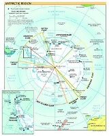
Australian Antarctic Territory
The Australian Antarctic Territory is a part of Antarctica. It was claimed by the United Kingdom and placed under the authority of the Commonwealth of Australia in 1933. It is the largest territory of Antarctica claimed by any nation...
of East Antarctica
East Antarctica
East Antarctica, also called Greater Antarctica, constitutes the majority of the Antarctic continent, lying on the Indian Ocean side of the Transantarctic Mountains...
. Named after Antarctic explorer Sir Douglas Mawson
Douglas Mawson
Sir Douglas Mawson, OBE, FRS, FAA was an Australian geologist, Antarctic explorer and Academic. Along with Roald Amundsen, Robert Falcon Scott, and Ernest Shackleton, Mawson was a key expedition leader during the Heroic Age of Antarctic Exploration.-Early work:He was appointed geologist to an...
, the base is managed by the Australian Antarctic Division
Australian Antarctic Division
The Australian Antarctic Division is an agency of the Department of Sustainability, Environment, Water, Population and Communities . The division undertakes science programs and research projects to contribute to an understanding of Antarctica and the Southern Ocean...
(AAD). Established in 1954, Mawson is Australia's oldest Antarctic station and the oldest continuously inhabited Antarctic station south of the Antarctic Circle
Antarctic Circle
The Antarctic Circle is one of the five major circles of latitude that mark maps of the Earth. For 2011, it is the parallel of latitude that runs south of the Equator.-Description:...
.
Mawson Research Station is a base for scientific research programs including an underground cosmic ray
Cosmic ray
Cosmic rays are energetic charged subatomic particles, originating from outer space. They may produce secondary particles that penetrate the Earth's atmosphere and surface. The term ray is historical as cosmic rays were thought to be electromagnetic radiation...
detector, various long-term meteorological
Meteorology
Meteorology is the interdisciplinary scientific study of the atmosphere. Studies in the field stretch back millennia, though significant progress in meteorology did not occur until the 18th century. The 19th century saw breakthroughs occur after observing networks developed across several countries...
, aeronomy
Aeronomy
Aeronomy is the science of the upper region of the atmosphere, where dissociation and ionization are important. The term aeronomy was introduced by Sydney Chapman, and the above definition stems from 1960. Today the term also includes the science of the corresponding regions of the atmospheres of...
and geomagnetic
Earth's magnetic field
Earth's magnetic field is the magnetic field that extends from the Earth's inner core to where it meets the solar wind, a stream of energetic particles emanating from the Sun...
studies, as well as ongoing conservation biology
Conservation biology
Conservation biology is the scientific study of the nature and status of Earth's biodiversity with the aim of protecting species, their habitats, and ecosystems from excessive rates of extinction...
studies, in particular of nearby Auster rookery
Auster rookery
67° 23' 46.0" S, 63° 57' 02.5" EAuster Rookery is an Emperor penguin rookery on sea-ice, sheltered by grounded icebergs about 51 km ENE of Mawson Station in Antarctica....
, a breeding ground
Rookery
A rookery is a colony of breeding animals, generally birds. A rook is a Northern European and Central Asian member of the crow family, which nest in prominent colonies at the tops of trees. The term is applied to the nesting place of birds, such as crows and rooks, the source of the term...
for Emperor Penguin
Emperor Penguin
The Emperor Penguin is the tallest and heaviest of all living penguin species and is endemic to Antarctica. The male and female are similar in plumage and size, reaching in height and weighing anywhere from . The dorsal side and head are black and sharply delineated from the white belly,...
s and Adélie Penguin
Adelie Penguin
The Adélie Penguin, Pygoscelis adeliae, is a species of penguin common along the entire Antarctic coast. They are among the most southerly distributed of all seabirds, as are the Emperor Penguin, the South Polar Skua, the Wilson's Storm Petrel, the Snow Petrel, and the Antarctic Petrel...
s.
Mawson Station houses approximately 20 personnel over winter and up to 60 in summer.