
Matanzas Province
Encyclopedia
Matanzas is one of the provinces of Cuba
. Major towns in the province include Cárdenas
, Colón
, Jovellanos and the capital of the same name, Matanzas
. The resort town of Varadero
is also located in this province.
Of Cuba's provinces, Matanzas is one of the most industrialised, with petroleum
wells, refineries, supertanker facilities, and 21 sugar
mills to process the harvest
s of the fields of sugarcane
in the province.
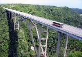
, Matanzas province is largely flat, with its highest point (Pan de Matanzas) at only 380m above sea level
.
The north-western coast is largely rocky, with a few beaches, while the north-eastern coast has numerous small cay
s of its coast (part of Sabana-Camaguey Archipelago
), and scrubland and mangrove
s near the shoreline. Cuba's northern most point is located in on Hicacos Peninsula
.
The southern coast has one of Cuba's most distinctive features: an enormous marsh
, Ciénaga de Zapata that covers both the southern part of the province and the Zapata Peninsula
. East of the peninsula lies the Bay of Pigs
, the site of the failed US backed invasion
.
Starting from 2011, the municipality of Varadero
was abolished and merged to Cárdenas
. This Matanzas now has 13 municipalities.
Source: Population from 2004 Census. Area from 1976 municipal re-distribution.
Provinces of Cuba
Administratively, Cuba is divided into 15 provinces and one special municipality not included in any province. The last modification was approved in August 2010 , splitting Havana province into two new provinces: Artemisa and Mayabeque...
. Major towns in the province include Cárdenas
Cárdenas, Matanzas, Cuba
Cárdenas is a municipality and city in the Matanzas Province of Cuba, about east of Havana.-Geography:Cárdenas is a maritime port town on the level and somewhat marshy shore of a spacious bay of the northern coast of the island , sheltered by a long promontory...
, Colón
Colón, Cuba
Colón is a municipality and city in the Matanzas Province of Cuba.-Geography:The municipality is divided into the campos of Agüica, Este, Guareiras, Jacán, Laguna Grande, Oeste and Palmillas.-History:...
, Jovellanos and the capital of the same name, Matanzas
Matanzas
Matanzas is the capital of the Cuban province of Matanzas. It is famed for its poets, culture, and Afro-Cuban folklore.It is located on the northern shore of the island of Cuba, on the Bay of Matanzas , east of the capital Havana and west of the resort town of Varadero.Matanzas is called the...
. The resort town of Varadero
Varadero
Varadero is a resort town in the province of Matanzas, Cuba, and one of the largest resort areas in the Caribbean. Varadero is also called Playa Azul, which means "blue beach" in Spanish.-Geography:...
is also located in this province.
Of Cuba's provinces, Matanzas is one of the most industrialised, with petroleum
Petroleum
Petroleum or crude oil is a naturally occurring, flammable liquid consisting of a complex mixture of hydrocarbons of various molecular weights and other liquid organic compounds, that are found in geologic formations beneath the Earth's surface. Petroleum is recovered mostly through oil drilling...
wells, refineries, supertanker facilities, and 21 sugar
Sugar
Sugar is a class of edible crystalline carbohydrates, mainly sucrose, lactose, and fructose, characterized by a sweet flavor.Sucrose in its refined form primarily comes from sugar cane and sugar beet...
mills to process the harvest
Harvest
Harvest is the process of gathering mature crops from the fields. Reaping is the cutting of grain or pulse for harvest, typically using a scythe, sickle, or reaper...
s of the fields of sugarcane
Sugarcane
Sugarcane refers to any of six to 37 species of tall perennial grasses of the genus Saccharum . Native to the warm temperate to tropical regions of South Asia, they have stout, jointed, fibrous stalks that are rich in sugar, and measure two to six metres tall...
in the province.
Geography
The second largest in CubaCuba
The Republic of Cuba is an island nation in the Caribbean. The nation of Cuba consists of the main island of Cuba, the Isla de la Juventud, and several archipelagos. Havana is the largest city in Cuba and the country's capital. Santiago de Cuba is the second largest city...
, Matanzas province is largely flat, with its highest point (Pan de Matanzas) at only 380m above sea level
Sea level
Mean sea level is a measure of the average height of the ocean's surface ; used as a standard in reckoning land elevation...
.
The north-western coast is largely rocky, with a few beaches, while the north-eastern coast has numerous small cay
Cay
A cay , also spelled caye or key, is a small, low-elevation, sandy island formed on the surface of coral reefs. Cays occur in tropical environments throughout the Pacific, Atlantic and Indian Oceans , where they provide habitable and agricultural land for hundreds of thousands of people...
s of its coast (part of Sabana-Camaguey Archipelago
Sabana-Camaguey Archipelago
Sabana-Camagüey is an archipelago that lines Cuba's north-central Atlantic coast. It is located off the northern coast of the provinces of Matanzas, Villa Clara, Sancti Spíritus, Ciego de Ávila and Camagüey, and is bounded to the north by the Atlantic Ocean, specifically by the Nicholas Channel ...
), and scrubland and mangrove
Mangrove
Mangroves are various kinds of trees up to medium height and shrubs that grow in saline coastal sediment habitats in the tropics and subtropics – mainly between latitudes N and S...
s near the shoreline. Cuba's northern most point is located in on Hicacos Peninsula
Hicacos Peninsula
Hicacos is a peninsula on Cuba's northern shore, in the province of Matanzas. The resort town of Varadero is located on the peninsula. The name comes from a species of cactus.-Geography:...
.
The southern coast has one of Cuba's most distinctive features: an enormous marsh
Marsh
In geography, a marsh, or morass, is a type of wetland that is subject to frequent or continuous flood. Typically the water is shallow and features grasses, rushes, reeds, typhas, sedges, other herbaceous plants, and moss....
, Ciénaga de Zapata that covers both the southern part of the province and the Zapata Peninsula
Zapata Peninsula
Zapata Peninsula is a large peninsula in Matanzas Province, southern Cuba, at . Ciénaga de Zapata National Park is located on the peninsula....
. East of the peninsula lies the Bay of Pigs
Bay of Pigs
The Bay of Pigs is an inlet of the Gulf of Cazones on the southern coast of Cuba. By 1910, it was included in Santa Clara Province, and then instead to Las Villas Province by 1961, but in 1976, it was re-assigned to Matanzas Province, when the original six provinces of Cuba were re-organized into...
, the site of the failed US backed invasion
Bay of Pigs Invasion
The Bay of Pigs Invasion was an unsuccessful action by a CIA-trained force of Cuban exiles to invade southern Cuba, with support and encouragement from the US government, in an attempt to overthrow the Cuban government of Fidel Castro. The invasion was launched in April 1961, less than three months...
.
Municipalities
From 1976 to 2010 Matanzas was sub-divided into 14 municipalities.Starting from 2011, the municipality of Varadero
Varadero
Varadero is a resort town in the province of Matanzas, Cuba, and one of the largest resort areas in the Caribbean. Varadero is also called Playa Azul, which means "blue beach" in Spanish.-Geography:...
was abolished and merged to Cárdenas
Cárdenas
Cárdenas is a surname generally of Spanish origin.FAMILY ORIGIN:The family name Cardenas is a local surname which came from the region of La Rioja, Spain...
. This Matanzas now has 13 municipalities.
| Municipality Municipalities of Cuba The provinces of Cuba are divided into 169 municipalities or municipios. They were defined by Cuban Law Number 1304 of July 3, 1976.-Summary:The municipalities are listed below, by province:... | Population (2004) | Area (km²) | Location | Remarks |
|---|---|---|---|---|
| Calimete Calimete, Cuba Calimete is a municipality and city in the Matanzas Province of Cuba.The city was founded in 1867 by José Antonio Castañeda.-Demographics:... |
22°32′2"N 80°54′35"W | |||
| Cárdenas | 23°02′34"N 81°12′13"W | |||
| Cienaga de Zapata | 22°17′17"N 81°11′51"W | Playa Larga | ||
| Colón Colón, Cuba Colón is a municipality and city in the Matanzas Province of Cuba.-Geography:The municipality is divided into the campos of Agüica, Este, Guareiras, Jacán, Laguna Grande, Oeste and Palmillas.-History:... |
22°43′21"N 80°54′23"W | |||
| Jagüey Grande Jagüey Grande, Cuba Jaguey Grande is a municipality in the Matanzas Province of Cuba. It is located east of the Zapata Peninsula, north of the Bahia de Cochinos, along the Carretera Central, in the center of the province.-Demographics:... |
22°31′46"N 81°07′57"W | |||
| Jovellanos | 22°48′38"N 81°11′52"W | |||
| Limonar Limonar, Cuba Limonar is a municipality and city in the Matanzas Province of Cuba.The municipality is divided into the barrios of Canímar, Guamacaro, Caoba, Sumidero, Coliseo and San Miguel.... |
22°57′22"N 81°24′31"W | |||
| Los Arabos | 22°44′24"N 80°42′57"W | |||
| Martí Martí, Cuba Martí is a town and municipality in north-eastern section of Cuba's Matanzas Province.-Geography:The municipality is divided into the barrios of Guamutas, Lacret, La Teja, Martí, Máximo Gómez, Motembo and Río de la Palma.... |
22°57′9"N 80°55′0"W | |||
| Matanzas | 23°03′5"N 81°34′30"W | Province capital | ||
| Pedro Betancourt Pedro Betancourt, Cuba Pedro Betancourt is a municipality and city in the Matanzas Province of Cuba. It is located in the center of the province, west of Jagüey Grande and east of Unión de Reyes.... |
22°43′50"N 81°17′27"W | |||
| Perico Perico, Cuba Perico is a municipality and city in the Matanzas Province of Cuba. It is located south of Marti, north of Colón and east of Jovellanos.The municipality is divided into the barrios of Altamisal, Norte, Quintana, Roque, Sur and Tinguaro.... |
22°46′31"N 81°00′54"W | |||
| Unión de Reyes Unión de Reyes, Cuba Unión de Reyes is a municipality and city in the Matanzas Province of Cuba. It is located in the western part of the province, south of Matanzas, the provincial capital.The municipality is divided into the barrios of Iglesia and Unión.... |
22°48′2"N 81°32′13"W | |||
| Varadero | 23°08′23"N 81°17′10"W | Abolished in 2010 |
Source: Population from 2004 Census. Area from 1976 municipal re-distribution.