

Matabeleland North
Encyclopedia
Matabeleland North is a province
in western Zimbabwe
. It borders the provinces of Midlands and Mashonaland West to the east and northeast respectively, and the province of Matabeleland South and the city of Bulawayo
to the south. Its northern border is defined by the Zambezi
river, while its western border is shared with the country of Botswana
. It has an area of 75,025 km² and a population of approximately 700,000 (2002). Lupane
is the capital of the province. Hwange
and Victoria Falls
are the only towns in this province.
The province gets its name of Matabeleland from the ethnicity of Matabele (Ndebele) people who inhabit the area.
The province of Matabeleland North was created when the former province of Matabeleland was separated into Matabeleland North and Matabeleland South
in 1974. In 1997, the province underwent another territory change when the province's former capital city of Bulawayo
split from the rest of the province.
, of which Matabeleland North is a part of, is characterized by generally unhospitable land when compared to other parts of Zimbabwe. It has lower rainfall than provinces such as Mashonaland
, and is plagued by water scarcity in general. The land is also less fertile than other provinces, as commercial crops cannot be grown and rural farmers usually cannot produce enough maize to feed their families. However, during the colonial era, large numbers of cattle ranches were formed and cattle ranching has proved to be more successful than growing crops in the province. The upper reaches of the Nata River
flow through Matabeleland North before entering Botswana
to discharge to the Makgadikgadi Pans.
The region does have a significant amount of other resources like gold, limestone, methane gas, coal, and timber. As seen in Hwange National Park
, Zimbabwe's largest game reserve, the area is also known for its substantial wildlife population. However, the most famous geographic feature of Matebeleland North is Victoria Falls
, the world's largest waterfalls that are located on the Zambezi
river on the northern border of the province.
, while ZANU-PF won four seats and one other seat was won by an independent. In the Senate
, the MDC won a combined five seats and ZANU-PF won one seat.
Provinces of Zimbabwe
|Zimbabwe is divided into 8 provinces and 2 cities with provincial status:-See also:*Districts of Zimbabwe*Municipalities of Zimbabwe*List of provincial governors of Zimbabwe*ISO 3166-2:ZW-External links:*...
in western Zimbabwe
Zimbabwe
Zimbabwe is a landlocked country located in the southern part of the African continent, between the Zambezi and Limpopo rivers. It is bordered by South Africa to the south, Botswana to the southwest, Zambia and a tip of Namibia to the northwest and Mozambique to the east. Zimbabwe has three...
. It borders the provinces of Midlands and Mashonaland West to the east and northeast respectively, and the province of Matabeleland South and the city of Bulawayo
Bulawayo
Bulawayo is the second largest city in Zimbabwe after the capital Harare, with an estimated population in 2010 of 2,000,000. It is located in Matabeleland, 439 km southwest of Harare, and is now treated as a separate provincial area from Matabeleland...
to the south. Its northern border is defined by the Zambezi
Zambezi
The Zambezi is the fourth-longest river in Africa, and the largest flowing into the Indian Ocean from Africa. The area of its basin is , slightly less than half that of the Nile...
river, while its western border is shared with the country of Botswana
Botswana
Botswana, officially the Republic of Botswana , is a landlocked country located in Southern Africa. The citizens are referred to as "Batswana" . Formerly the British protectorate of Bechuanaland, Botswana adopted its new name after becoming independent within the Commonwealth on 30 September 1966...
. It has an area of 75,025 km² and a population of approximately 700,000 (2002). Lupane
Lupane
Lupane can refer to :*Lupane District in Zimbabwe*Lupane triterpenes...
is the capital of the province. Hwange
Hwange
Hwange is a town in western Zimbabwe, in the province of Matabeleland North. It is named after the chieftain of Zwange, who is now called Chief Hwange. The town was known as Wankie until 1982. According to the 1992 Population Census, the town had a population of 42,581...
and Victoria Falls
Victoria Falls
The Victoria Falls or Mosi-oa-Tunya is a waterfall located in southern Africa on the Zambezi River between the countries of Zambia and Zimbabwe.-Introduction:...
are the only towns in this province.
The province gets its name of Matabeleland from the ethnicity of Matabele (Ndebele) people who inhabit the area.
The province of Matabeleland North was created when the former province of Matabeleland was separated into Matabeleland North and Matabeleland South
Matabeleland South
Matabeleland South is a province of Zimbabwe. It has an area of 54,172 km² and a population of approximately 650,000 . Gwanda is the capital of the province.-Geography:...
in 1974. In 1997, the province underwent another territory change when the province's former capital city of Bulawayo
Bulawayo
Bulawayo is the second largest city in Zimbabwe after the capital Harare, with an estimated population in 2010 of 2,000,000. It is located in Matabeleland, 439 km southwest of Harare, and is now treated as a separate provincial area from Matabeleland...
split from the rest of the province.
Geography
The region of MatabelelandMatabeleland
Modern day Matabeleland is a region in Zimbabwe divided into three provinces: Matabeleland North, Bulawayo and Matabeleland South. These provinces are in the west and south-west of Zimbabwe, between the Limpopo and Zambezi rivers. The region is named after its inhabitants, the Ndebele people...
, of which Matabeleland North is a part of, is characterized by generally unhospitable land when compared to other parts of Zimbabwe. It has lower rainfall than provinces such as Mashonaland
Mashonaland
Mashonaland is a region in northern Zimbabwe. It is the home of the Shona people.Currently, Mashonaland is divided into three provinces, with a total population of about 3 million:* Mashonaland West* Mashonaland Central* Mashonaland East...
, and is plagued by water scarcity in general. The land is also less fertile than other provinces, as commercial crops cannot be grown and rural farmers usually cannot produce enough maize to feed their families. However, during the colonial era, large numbers of cattle ranches were formed and cattle ranching has proved to be more successful than growing crops in the province. The upper reaches of the Nata River
Nata River
The Nata River or Amanzanyama River is a natural watercourse in Southern Africa. Within the country of Botswana the Nata River is a source of water to the ephemeral wetlands of the Makgadikgadi Pans, where a number of species of limited distribution thrive...
flow through Matabeleland North before entering Botswana
Botswana
Botswana, officially the Republic of Botswana , is a landlocked country located in Southern Africa. The citizens are referred to as "Batswana" . Formerly the British protectorate of Bechuanaland, Botswana adopted its new name after becoming independent within the Commonwealth on 30 September 1966...
to discharge to the Makgadikgadi Pans.
The region does have a significant amount of other resources like gold, limestone, methane gas, coal, and timber. As seen in Hwange National Park
Hwange National Park
Hwange National Park is the largest game reserve in Zimbabwe. The park lies in the west, on the main road between Bulawayo and the widely noted Victoria Falls.It was founded around 1928 by a 22-year-old game ranger, Ted Davidson...
, Zimbabwe's largest game reserve, the area is also known for its substantial wildlife population. However, the most famous geographic feature of Matebeleland North is Victoria Falls
Victoria Falls
The Victoria Falls or Mosi-oa-Tunya is a waterfall located in southern Africa on the Zambezi River between the countries of Zambia and Zimbabwe.-Introduction:...
, the world's largest waterfalls that are located on the Zambezi
Zambezi
The Zambezi is the fourth-longest river in Africa, and the largest flowing into the Indian Ocean from Africa. The area of its basin is , slightly less than half that of the Nile...
river on the northern border of the province.
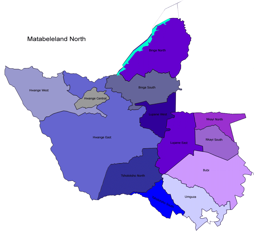
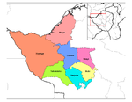
Districts
Matabeleland North is divided into 7 districts:- Binga
- Bubi
- HwangeHwangeHwange is a town in western Zimbabwe, in the province of Matabeleland North. It is named after the chieftain of Zwange, who is now called Chief Hwange. The town was known as Wankie until 1982. According to the 1992 Population Census, the town had a population of 42,581...
- LupaneLupaneLupane can refer to :*Lupane District in Zimbabwe*Lupane triterpenes...
- Nkayi
- TsholotshoTsholotsho- Introduction :Tsholotsho is a business center in Matabeleland North, Zimbabwe and is located about 65km north-west of Nyamandhlovu,and 98km north-west of Bulawayo as the bird flies, in the Tjolotjo communal land...
- UmguzaUmguzaUmguza is a district in Matabeleland North province in Zimbabwe....
Elections
The region is regarded as a very independent region when it comes to politics. In the most recent parliamentary election held in March 2008, both factions of the MDC won a total of eight seats from the Matabeleland North delegation to the House of AssemblyHouse of Assembly of Zimbabwe
The House of Assembly of Zimbabwe is the lower chamber of the country's bicameral Parliament. It was the unicameral legislative body from 1989 until late November 2005, when the Senate was re-introduced....
, while ZANU-PF won four seats and one other seat was won by an independent. In the Senate
Senate of Zimbabwe
The Senate of Zimbabwe is the upper chamber of the country's bicameral Parliament. It existed from 1980 to 1989, and was re-introduced in November 2005....
, the MDC won a combined five seats and ZANU-PF won one seat.