

Maryland Route 4
Encyclopedia
Maryland Route 4 is a state highway
in the U.S. state
of Maryland
. The state highway runs 64.85 miles (104.4 km) from MD 5
in Leonardtown
north to Southern Avenue
at the Washington, D.C.
border, past which the highway continues as Pennsylvania Avenue
. MD 4 is a major commuter route in Southern Maryland
, connecting Washington and suburbs in Prince George's County
, Anne Arundel County
, and Calvert County
. MD 4 also connects residential communities in southern Calvert County with employment centers in St. Mary's County, including Naval Air Station Patuxent River
. In conjunction with U.S. Route 301
(US 301) and MD 2
, MD 4 also provides interregional connections with Baltimore and Annapolis
, respectively. MD 4 is part of the National Highway System
between MD 235
in California
and its northern terminus.
MD 4 heads east from Leonardtown as St. Andrew's Church Road and then Patuxent Beach Road east of MD 235. The state highway crosses the Patuxent River
on the Governor Thomas Johnson Bridge between California and Solomons
, then joins MD 2 north through Prince Frederick
. At 27.4 miles (44.1 km), MD 2/MD 4 is the longest state-numbered highway concurrency
in Maryland. MD 4 and MD 2 separate at Sunderland
, with MD 4 heading northwest as Southern Maryland Boulevard to a second crossing of the Patuxent River near Upper Marlboro
. The state highway heads west as Pennsylvania Avenue toward Washington.
MD 4 is one of the original Maryland state highways. The state highway followed roughly its present alignment through Prince George's County, then headed east through Anne Arundel County along what is now MD 408
. In the 1960s, MD 4 took over MD 416 (Southern Maryland Boulevard) southeast to Sunderland and joined MD 2 all the way to Solomons. After the Governor Thomas Johnson Bridge opened in the late 1970s, MD 4 was extended west from Solomons to Leonardtown. MD 4 has been upgraded to a divided highway for most of its length, beginning in the early 1960s from Washington, reaching Solomons in the mid 1980s, and expected to continue into St. Mary's County in the 2010s.
closer to Great Mills
, MD 4 turns northeast and passes St. Andrew's Church
. The state highway crosses the St. Mary's River adjacent to St. Mary's River State Park
and passes by residential subdivisions before intersecting MD 235 (Three Notch Road) in California.
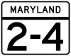
MD 4 continues northeast as Patuxent Beach Road, a controlled access two-lane highway through scattered residential subdivisions. The state highway crosses Kingston Creek and intersects two old segments of Patuxent Beach Road. The speed limit drops to 45 mph (72.4 km/h) as MD 4 begins to cross the Governor Thomas Johnson Bridge. The bridge crosses Town Creek before curving to the northeast over the Patuxent River. After an exit for Solomons, the state highway is joined by MD 2 (Solomons Island Road) in a long concurrency through Calvert County that is often referenced as MD 2-4.
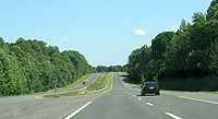
 Shortly after the concurrency begins, MD 2-4 expands to a four-lane controlled-access divided highway passing through a mix of shopping centers and residential subdivisions. The state highway is closely paralleled on the east by the old alignment, MD 765
(H.G. Trueman Road), from the beginning of the concurrency to the intersection with Dowell Road. Beyond Dowell Road, MD 765 heads further away from MD 2-4, which becomes surrounded by forest as the speed limit increases to 55 mph (88.5 km/h). As the state highway approaches Lusby
, the highway intersects Southern Connector Boulevard as well as Coster Road and Mill Bridge Road. MD 2-4 turns northeast to meet the northern end of MD 760
(Rousby Hall Road), then turns north to pass the western end of MD 497
(Cove Point Road).
After MD 2-4 turns northwest beyond Lusby, the divided highway intersects MD 765. MD 765 south (H.G. Trueman Road) leads to Calvert Cliffs State Park
, while MD 765 north (Pardoe Road) provides access to Sollers Wharf Road. After crossing Johns Creek and passing Nursery Road, the state highway passes Calvert Cliffs Parkway, which leads to the Calvert Cliffs Nuclear Power Plant
, and Flag Ponds Parkway, which provides access to Flag Ponds Nature Park
. After crossing Quaker Swamp (Woodland Branch), MD 2-4 continues northwest through St. Leonard
, where the old alignment splits to the east as MD 765 (St. Leonard Road). The state highway turns north and intersects Ball Road, which heads west to Mutual
, and Calvert Beach Road, which heads east toward the twin beach communities of Calvert Beach
and Long Beach. MD 2-4 turns northwest through Port Republic
, where the divided highway meets the northern end of the St. Leonard Road section of MD 765 and intersects MD 264
(Broomes Island Road).
 MD 2-4 continues northwest without access controls, with scattered residences and businesses lining the highway. The divided highway passes MD 506
, then the next iteration of MD 765 (Main Street) splits to the east to serve Prince Frederick. After passing Westlake Boulevard, the speed limit drops to 45 mph (72.4 km/h) and the highway becomes lined with shopping centers. MD 2-4 intersects MD 231
(Hallowing Point Road), then turns north to intersect the northern end of MD 765 and cross the west end of MD 402
(Dares Beach Road). Beyond the intersection with Stoakley Road, the speed limit increases to 55 mph (88.5 km/h) and the state highway continues north through scattered residences and businesses. After intersecting the west end of MD 263
, MD 2-4 crosses Hunting Creek and enters Huntingtown
. The old alignment splits to the west as MD 524 (Old Town Road), which leads to MD 521
(Hunting Creek Road). MD 2-4 passes Huntingtown High School
and meets the northern end of MD 524. After intersecting Pond Woods Road, the divided highway continues straight north to the end of the MD 2-MD 4 concurrency in Sunderland.
(Lower Marlboro Road). The state highway continues as a four-lane divided highway with a speed limit of 55 mph (88.5 km/h) through a mix of farms and residential subdivisions through Chaneyville
, where the highway passes Chaneyville Road and Mount Harmony Road, the latter being the old alignment of MD 260
. MD 4 turns north and enters the village of Dunkirk
, where the highway passes shopping centers and Ferry Landing Road. The state highway continues through the residential community of Lyons Creek
, where the highway meets MD 260 (Chesapeake Beach Road) at a trumpet interchange that is missing the MD 260 west to MD 4 south movement and simultaneously crosses Lyons Creek.
Upon entering Anne Arundel County, MD 4 gains a wide, forested median The state highway reaches Bristol
, where the median narrows and the state highway meets MD 258
(Bay Front Road) at a diamond interchange
. MD 258 provides access to a frontage road, MD 794
, which leads to MD 259
(Greenock Road). From the MD 258 interchange, MD 4 curves to the northwest and becomes a freeway. After a few off-ramps to the frontage roads and a right-in/right-out
interchange southbound with Plummer Lane, the state highway curves to the west and meets the original path of MD 4, MD 408
(Mt. Zion-Marlboro Road), at a diamond interchange at Waysons Corner. MD 4 makes its second crossing of the Patuxent River on Hills Bridge and enters Prince George's County, where its name changes to Pennsylvania Avenue. Parts of Patuxent River Park, Jug Bay Wetlands Sanctuary
and Patuxent Wetland Park are adjacent to Rt. 4 here at this popular Patuxent River fishing and paddling put-in location.
(Crain Highway) at a cloverleaf interchange
and cross CSX
's Pope's Creek Subdivision. MD 4 has a diamond interchange with Water Street (unsigned MD 717), which leads to the Prince George's County government offices as well as the Prince George's Equestrian Center and Show Place Arena. The state highway crosses the Western Branch of the Patuxent River, then meets Old Crain Highway (at a partial interchange). The median widens ahead of the partial interchange with Ritchie-Marlboro Road, then closes up ahead of the partial cloverleaf interchange with MD 223
(Woodyard Road), which leads to the historic home Melwood Park
.
MD 4 downgrades from a freeway to a controlled access highway at the intersection with Dower House Road and Marlboro Pike, after which the highway expands to six lanes, curves to the northwest, and abuts Andrews Air Force Base
. Access to the military base is provided through the intersection with the Suitland Parkway
, which leads to MD 337
. After an intersection with Old Marlboro Pike and Westphalia Road, MD 4 intersects the Capital Beltway
at a cloverleaf interchange, where the state highway becomes four lanes again.. All but four miles of the previous 54 miles of MD 4 are in the Patuxent River
watershed. The five miles west of the Beltway are in the Oxon Run watershed within the drainage of the Potomac River
; the southernmost six miles fall within the Potomac watershed as well.
MD 4 enters a dense suburban area with residential subdivisions and shopping centers upon crossing Forestville Road, which leads to the old alignment Marlboro Pike in Forestville
. After intersecting MD 458
(Silver Hill Road) and Brooks Drive in District Heights
, MD 4 turns west through Coral Hills
, where the speed limit drops to 35 mph (56.3 km/h). The state highway passes Cedar Hill Cemetery on the south, then reaches its northern terminus at Southern Avenue on the Washington, D.C. border. Pennsylvania Avenue continues northwest straight toward downtown Washington.
. When the Maryland State Roads Commission was established in 1908, this route became one of the original state roads. In 1910, the highway was paved from the D.C. border to what is today District Heights, as well as from Hills Bridge to Waysons Corner, where MD 4 meets MD 408 today. Marlboro Pike from the D.C. line to Hills Bridge and Mt. Zion Road between Hills Bridge and Lothian was fully paved by 1927, which was the same year MD 4 was assigned to the two named roads. Southern Maryland Boulevard was built between Waysons Corner and MD 2 in Sunderland in 1929 and 1930, and was designated MD 416 by 1933.
Pennsylvania Avenue was extended east out of D.C. to Meadows as a controlled access four-lane divided highway in 1959 and 1960 and was designated MD 4. Marlboro Pike was assigned MD 4 Business, a designation that was gone by 1970. Also in 1960, the MD 416 designation was extended south along MD 2 to Solomons. By 1970, the MD 4 freeway between Meadows and Hills Bridge was complete. In addition, MD 4 replaced MD 416 down Southern Maryland Boulevard and Solomons Island Road to Solomons, and the divided highway was extended south from Hills Bridge to MD 263. In turn, MD 408 was placed on what was previously MD 4 between Upper Marlboro and Lothian. The western extent of MD 408 was rolled back to Waysons Corner by 1980. MD 2-4 was also expanded to a divided highway south to Port Republic by 1980.
The next major change in the routing of MD 4 came in 1977, when the Governor Thomas Johnson Bridge was completed. The St. Mary's County side of the bridge unloaded onto county highways until 1982, when the modern, controlled access Patuxent Beach Road was completed to MD 235. MD 4 was then extended west from Solomons along Patuxent Beach Road and St. Andrew's Church Road to its present southern terminus in Leonardtown. MD 2-4 bypassed Port Republic and St. Leonard along a new alignment in 1984. The bypass of the old alignment between Lusby and Solomons was completed in 1985. The MD 4 freeway was extended to Bristol in 1993 and the interchange at MD 260 was completed in 2003.
State highway
State highway, state road or state route can refer to one of three related concepts, two of them related to a state or provincial government in a country that is divided into states or provinces :#A...
in the U.S. state
U.S. state
A U.S. state is any one of the 50 federated states of the United States of America that share sovereignty with the federal government. Because of this shared sovereignty, an American is a citizen both of the federal entity and of his or her state of domicile. Four states use the official title of...
of Maryland
Maryland
Maryland is a U.S. state located in the Mid Atlantic region of the United States, bordering Virginia, West Virginia, and the District of Columbia to its south and west; Pennsylvania to its north; and Delaware to its east...
. The state highway runs 64.85 miles (104.4 km) from MD 5
Maryland Route 5
Maryland Route 5 is a long state highway that runs north–south in the U.S. state of Maryland. The highway runs from Point Lookout in St. Mary's County north to the Washington, D.C. border in Suitland, Prince George's County....
in Leonardtown
Leonardtown, Maryland
Leonardtown is a town in and the county seat of St. Mary's County, Maryland, United States. The population was 1,896 at the 2000 census. Leonardtown is perhaps most famous for the national oyster-shucking championship that occurs annually at the St...
north to Southern Avenue
Southern Avenue (Washington, D.C.)
Southern Avenue is one of three boundary streets between Washington, D.C., and the state of Maryland. Following a southeast-to-northeast line, Southern Avenue begins at the intersection of South Capitol Street, Southeast and Indian Head Highway on the Maryland side. It runs for approximately seven...
at the Washington, D.C.
Washington, D.C.
Washington, D.C., formally the District of Columbia and commonly referred to as Washington, "the District", or simply D.C., is the capital of the United States. On July 16, 1790, the United States Congress approved the creation of a permanent national capital as permitted by the U.S. Constitution....
border, past which the highway continues as Pennsylvania Avenue
Pennsylvania Avenue
Pennsylvania Avenue is a street in Washington, D.C. that joins the White House and the United States Capitol. Called "America's Main Street", it is the location of official parades and processions, as well as protest marches...
. MD 4 is a major commuter route in Southern Maryland
Southern Maryland
Southern Maryland in popular usage is composed of the state's southernmost counties on the "Western Shore" of the Chesapeake Bay. This region includes all of Calvert, Charles and St. Mary's counties and sometimes the southern portions of Anne Arundel and Prince George's counties.- History...
, connecting Washington and suburbs in Prince George's County
Prince George's County, Maryland
Prince George's County is a county located in the U.S. state of Maryland, immediately north, east, and south of Washington, DC. As of 2010, it has a population of 863,420 and is the wealthiest African-American majority county in the nation....
, Anne Arundel County
Anne Arundel County, Maryland
Anne Arundel County is a county located in the U.S. state of Maryland. It is named for Anne Arundell , a member of the ancient family of Arundells in Cornwall, England and the wife of Cæcilius Calvert, 2nd Baron Baltimore. Its county seat is Annapolis, which is also the capital of the state...
, and Calvert County
Calvert County, Maryland
Calvert County is a county located in the U.S. state of Maryland. It occupies the Calvert Peninsula which is bordered on the east by the Chesapeake Bay and on the west by the Patuxent River. Calvert County is part of the Southern Maryland region. Calvert County's residents are among the highest...
. MD 4 also connects residential communities in southern Calvert County with employment centers in St. Mary's County, including Naval Air Station Patuxent River
Naval Air Station Patuxent River
"Pax River" redirects here. For the river, see Patuxent River.Naval Air Station Patuxent River , also known as NAS Pax River, is a United States Naval Air Station located in St. Mary's County, Maryland on the Chesapeake Bay near the mouth of the Patuxent River. It is home to the U.S...
. In conjunction with U.S. Route 301
U.S. Route 301 in Maryland
U.S. Route 301 in Maryland is a major highway that runs from Delaware to the Governor Harry W. Nice Memorial Bridge into Virginia. It passes through three of Maryland's four main regions: the Eastern Shore, the Baltimore-Washington Metropolitan Area, and Southern Maryland...
(US 301) and MD 2
Maryland Route 2
Maryland Route 2 is the longest state highway in the U.S. state of Maryland. The route runs from Solomons Island in Calvert County north to an intersection with U.S. Route 1 and U.S. Route 40 Truck in Baltimore...
, MD 4 also provides interregional connections with Baltimore and Annapolis
Annapolis, Maryland
Annapolis is the capital of the U.S. state of Maryland, as well as the county seat of Anne Arundel County. It had a population of 38,394 at the 2010 census and is situated on the Chesapeake Bay at the mouth of the Severn River, south of Baltimore and about east of Washington, D.C. Annapolis is...
, respectively. MD 4 is part of the National Highway System
National Highway System (United States)
The National Highway System is a network of strategic highways within the United States, including the Interstate Highway System and other roads serving major airports, ports, rail or truck terminals, railway stations, pipeline terminals and other strategic transport facilities.Individual states...
between MD 235
Maryland Route 235
Maryland Route 235 is a state highway in the U.S. state of Maryland. Known as Three Notch Road, the state highway runs between its southern intersection with MD 5 in Ridge and its northern intersection with MD 5 near Mechanicsville...
in California
California, Maryland
California is a census-designated place and community in St. Mary's County, Maryland, United States. The population was 9,307 at the 2000 census. California continues to grow with the spread of population out from the older adjacent community of Lexington Park and the growth in both...
and its northern terminus.
MD 4 heads east from Leonardtown as St. Andrew's Church Road and then Patuxent Beach Road east of MD 235. The state highway crosses the Patuxent River
Patuxent River
The Patuxent River is a tributary of the Chesapeake Bay in the state of Maryland. There are three main river drainages for central Maryland: the Potomac River to the west passing through Washington D.C., the Patapsco River to the northeast passing through Baltimore, and the Patuxent River between...
on the Governor Thomas Johnson Bridge between California and Solomons
Solomons, Maryland
Solomons is a community and census-designated place in Calvert County, Maryland, United States. The population was 1,536 at the 2000 census...
, then joins MD 2 north through Prince Frederick
Prince Frederick, Maryland
Prince Frederick is a census-designated place in Calvert County, Maryland, United States, not to be confused with the incorporated, and much larger, city of Frederick some to the northwest in Frederick County...
. At 27.4 miles (44.1 km), MD 2/MD 4 is the longest state-numbered highway concurrency
Concurrency (road)
A concurrency, overlap, or coincidence in a road network is an instance of one physical road bearing two or more different highway, motorway, or other route numbers...
in Maryland. MD 4 and MD 2 separate at Sunderland
Sunderland, Maryland
Sunderland is a small, rural community located in Calvert County, Maryland, approximately 5 miles south of Dunkirk, Maryland and 10 miles north of Prince Frederick, Maryland. Although Sunderland is not incorporated and does not have a central business district, it does have a zip code, 20689...
, with MD 4 heading northwest as Southern Maryland Boulevard to a second crossing of the Patuxent River near Upper Marlboro
Upper Marlboro, Maryland
Upper Marlboro is a town in and the county seat of Prince George's County, Maryland, United States. The live-in population of the town core proper was only 648 at the 2000 census, although Greater Upper Marlboro is many times larger....
. The state highway heads west as Pennsylvania Avenue toward Washington.
MD 4 is one of the original Maryland state highways. The state highway followed roughly its present alignment through Prince George's County, then headed east through Anne Arundel County along what is now MD 408
Maryland Route 408
Maryland Route 408, known locally as Mt Zion - Marlboro Road, is an east–west highway in Anne Arundel County, Maryland. This route heads east from its interchange with Southern Maryland Boulevard to its terminus with Solomons Island Road and Bayard Rd at the Lothian Roundabout...
. In the 1960s, MD 4 took over MD 416 (Southern Maryland Boulevard) southeast to Sunderland and joined MD 2 all the way to Solomons. After the Governor Thomas Johnson Bridge opened in the late 1970s, MD 4 was extended west from Solomons to Leonardtown. MD 4 has been upgraded to a divided highway for most of its length, beginning in the early 1960s from Washington, reaching Solomons in the mid 1980s, and expected to continue into St. Mary's County in the 2010s.
St. Andrew's Church Road and Patuxent Beach Road
MD 4 begins at an intersection with MD 5 (Point Lookout Road) in Leonardtown. The state highway heads east as St. Andrew's Church Road, a two-lane road with a speed limit of 50 mph (80.5 km/h) through a mix of forest and farmland. After intersecting Indian Bridge Road, which becomes MD 471Maryland Route 471
Maryland Route 471 is a state highway in the U.S. state of Maryland. Known as Indian Bridge Road, the state highway runs from Maryland Route 5 north to a crossing of the St. Marys River within Great Mills. MD 471 was constructed in two segments in the early 1930s...
closer to Great Mills
Great Mills, Maryland
Great Mills is an unincorporated community in St. Mary's County, Maryland, United States. Great Mills High School serves the lower end of the county, including the town of Lexington Park; there is a public swimming pool adjacent...
, MD 4 turns northeast and passes St. Andrew's Church
St. Andrew's Church (Leonardtown, Maryland)
St. Andrew's Church is an historic church located at 44078 St. Andrew's Church Road, California near Leonardtown, St. Mary's County, Maryland. It was built in 1766 to serve as the parish church of St. Andrew's Parish, which had been established in 1744...
. The state highway crosses the St. Mary's River adjacent to St. Mary's River State Park
St. Mary's River State Park
St. Mary's River State Park is a state park in the state of Maryland. The part consists of two sites, one and the second and largely undeveloped. The park features boat launch, fishing, flat water canoeing, hiking, horseback, and mountain biking trails hunting, picnicking, boating—electric...
and passes by residential subdivisions before intersecting MD 235 (Three Notch Road) in California.
MD 4 continues northeast as Patuxent Beach Road, a controlled access two-lane highway through scattered residential subdivisions. The state highway crosses Kingston Creek and intersects two old segments of Patuxent Beach Road. The speed limit drops to 45 mph (72.4 km/h) as MD 4 begins to cross the Governor Thomas Johnson Bridge. The bridge crosses Town Creek before curving to the northeast over the Patuxent River. After an exit for Solomons, the state highway is joined by MD 2 (Solomons Island Road) in a long concurrency through Calvert County that is often referenced as MD 2-4.
Solomons Island Road
Maryland Route 765
Maryland Route 765 is a collection of state highways in the U.S. state of Maryland. These 26 highways are service roads constructed or old alignments maintained to provide access to private property or county highways whose access was compromised by the realignment of MD 2 and MD 4 in Calvert...
(H.G. Trueman Road), from the beginning of the concurrency to the intersection with Dowell Road. Beyond Dowell Road, MD 765 heads further away from MD 2-4, which becomes surrounded by forest as the speed limit increases to 55 mph (88.5 km/h). As the state highway approaches Lusby
Lusby, Maryland
Lusby is a place in Calvert County, Maryland, United States. The population was officially 1,666 at the 2000 census, although residents of the Chesapeake Ranch Estates-Drum Point community also use the Lusby zip code designation, making Lusby in fact a much larger community...
, the highway intersects Southern Connector Boulevard as well as Coster Road and Mill Bridge Road. MD 2-4 turns northeast to meet the northern end of MD 760
Maryland Route 760
Maryland Route 760 is a state highway in the U.S. state of Maryland. Known as Rousby Hall Road, the state highway runs from Rousby Road in Drum Point north to MD 2 and MD 4 in Lusby. The portion of MD 760 in Lusby was built as MD 503 in the early 1930s; the Drum Point section was constructed as...
(Rousby Hall Road), then turns north to pass the western end of MD 497
Maryland Route 497
Maryland Route 497 is a state highway in the U.S. state of Maryland. Known as Cove Point Road, the state highway runs from MD 2 and MD 4 in Lusby east to the community of Cove Point. MD 497 was constructed in the early 1930s....
(Cove Point Road).
After MD 2-4 turns northwest beyond Lusby, the divided highway intersects MD 765. MD 765 south (H.G. Trueman Road) leads to Calvert Cliffs State Park
Calvert Cliffs State Park
Calvert Cliffs State Park is a state park in Calvert County, Maryland, USA, situated on the Chesapeake Bay. On the 1612 John Smith map, the site is called "Rickard's Cliffes"...
, while MD 765 north (Pardoe Road) provides access to Sollers Wharf Road. After crossing Johns Creek and passing Nursery Road, the state highway passes Calvert Cliffs Parkway, which leads to the Calvert Cliffs Nuclear Power Plant
Calvert Cliffs Nuclear Power Plant
The Calvert Cliffs Nuclear Power Plant is a nuclear power plant located on the western shore of the Chesapeake Bay near Lusby, Calvert County, Maryland.-Overview:...
, and Flag Ponds Parkway, which provides access to Flag Ponds Nature Park
Flag Ponds Nature Park
Flag Ponds Nature Park is a nature preserve located in St. Leonard, Maryland along the Chesapeake Bay in Calvert County, Maryland. It is operated by the Maryland Department of Natural Resources. The park includes nature trails and a beach for swimmers. Fossil shark's teeth eroded from the Calvert...
. After crossing Quaker Swamp (Woodland Branch), MD 2-4 continues northwest through St. Leonard
St. Leonard, Maryland
St. Leonard is a census-designated place in Calvert County, Maryland, United States. The population was officially 536 at the 2000 census, although residents of the Calvert Beach-Long Beach, Maryland community also use the St. Leonard zip code designation, making it in fact a much larger community...
, where the old alignment splits to the east as MD 765 (St. Leonard Road). The state highway turns north and intersects Ball Road, which heads west to Mutual
Mutual, Maryland
Mutual is an unincorporated community in Calvert County, Maryland, United States. La Veille was listed on the National Register of Historic Places in 1973.-References:...
, and Calvert Beach Road, which heads east toward the twin beach communities of Calvert Beach
Calvert Beach-Long Beach, Maryland
Calvert Beach-Long Beach is a census-designated place in Calvert County, Maryland, United States. The population was 2,487 at the 2000 census.-Geography:Calvert Beach-Long Beach is located at ....
and Long Beach. MD 2-4 turns northwest through Port Republic
Port Republic, Maryland
Port Republic is a small, rural community located inCalvert County, Maryland. It is approximately5 miles south of Prince Frederick, Maryland, the countyseat of Calvert County...
, where the divided highway meets the northern end of the St. Leonard Road section of MD 765 and intersects MD 264
Maryland Route 264
Maryland Route 264 is a state highway in the U.S. state of Maryland. Known as Broomes Island Road, the route runs from Oyster House Road in Broomes Island north to MD 2 and MD 4 in Port Republic. MD 264 connects the central Calvert County communities of Broomes Island, Island Creek, and Mutual...
(Broomes Island Road).
Maryland Route 506
Maryland Route 506 is a state highway in the U.S. state of Maryland. Known as Sixes Road, the state highway runs from MD 508 in Bowens east to MD 2 and MD 4 near Port Republic. MD 506 provides access to Battle Creek Cypress Swamp...
, then the next iteration of MD 765 (Main Street) splits to the east to serve Prince Frederick. After passing Westlake Boulevard, the speed limit drops to 45 mph (72.4 km/h) and the highway becomes lined with shopping centers. MD 2-4 intersects MD 231
Maryland Route 231
Maryland Route 231 is a state highway in the U.S. state of Maryland. The state highway runs from Olivers Shop Road near Hughesville east to MD 765 in Prince Frederick. MD 231 crosses the Patuxent River on the Benedict Bridge, which connects Benedict in eastern Charles County...
(Hallowing Point Road), then turns north to intersect the northern end of MD 765 and cross the west end of MD 402
Maryland Route 402
Maryland Route 402 is a state highway in the U.S. state of Maryland. Known for most of its length as Dares Beach Road, the state highway runs from MD 2 and MD 4 in Prince Frederick east to Chesapeake Avenue in Dares Beach. MD 402 was mostly constructed in 1932...
(Dares Beach Road). Beyond the intersection with Stoakley Road, the speed limit increases to 55 mph (88.5 km/h) and the state highway continues north through scattered residences and businesses. After intersecting the west end of MD 263
Maryland Route 263
Maryland Route 263 is a state highway in the U.S. state of Maryland. Known as Plum Point Road, the state highway runs from MD 2 and MD 4 near Prince Frederick east to a dead end at Plum Point...
, MD 2-4 crosses Hunting Creek and enters Huntingtown
Huntingtown, Maryland
Huntingtown is a census-designated place in Calvert County, Maryland, United States. The population was 2,436 at the 2000 census. The community is growing, with many large estate homes in small developments off of Maryland Route 2/4. It has a public high school called Huntingtown High. The...
. The old alignment splits to the west as MD 524 (Old Town Road), which leads to MD 521
Maryland Route 521
Maryland Route 521 is a state highway in the U.S. state of Maryland. Known as Hunting Creek Road, the state highway runs from Lowery Road near Huntingtown north to MD 524 in Huntingtown...
(Hunting Creek Road). MD 2-4 passes Huntingtown High School
Huntingtown High School
Huntingtown High School is located at 4125 North Solomons Island Road, Huntingtown, Maryland , 20639. Completed and opened in 2004, HHS is currently home to some seventeen hundred students from grades 9 to 12...
and meets the northern end of MD 524. After intersecting Pond Woods Road, the divided highway continues straight north to the end of the MD 2-MD 4 concurrency in Sunderland.
Southern Maryland Boulevard
As MD 2 heads northeast toward Annapolis, MD 4 veers northwest as Southern Maryland Boulevard and immediately intersects MD 262Maryland Route 262
Maryland Route 262 is a state highway in the U.S. state of Maryland. Known as Lower Marlboro Road, the route runs from Chaneyville Road in Lower Marlboro east to MD 4 in Sunderland. MD 262 was constructed in the late 1920s.-Route description:...
(Lower Marlboro Road). The state highway continues as a four-lane divided highway with a speed limit of 55 mph (88.5 km/h) through a mix of farms and residential subdivisions through Chaneyville
Chaneyville, Maryland
Chaneyville is a small, rural community located in Calvert County, Maryland. It is generally considered part of either Owings, Maryland or Dunkirk, Maryland....
, where the highway passes Chaneyville Road and Mount Harmony Road, the latter being the old alignment of MD 260
Maryland Route 260
Maryland Route 260 is a state highway in Calvert County and Anne Arundel County, Maryland. Route 260 starts at the northern border of Calvert and Anne Arundel counties, branching off from Maryland Route 4 by way of an overpass interchange...
. MD 4 turns north and enters the village of Dunkirk
Dunkirk, Maryland
Dunkirk is a census-designated place in Calvert County, Maryland, United States. The population was 2,363 at the 2000 census. The area is very fast-growing, with many large estate homes. Considered one the wealthiest places to live inside the Washington, DC metropolitan area, with home prices...
, where the highway passes shopping centers and Ferry Landing Road. The state highway continues through the residential community of Lyons Creek
Lyons Creek, Maryland
Lyons Creek is an tributary of the Patuxent River in Maryland. Lyons Creek serves as the border between southern Anne Arundel County, Maryland and northern Calvert County, Maryland....
, where the highway meets MD 260 (Chesapeake Beach Road) at a trumpet interchange that is missing the MD 260 west to MD 4 south movement and simultaneously crosses Lyons Creek.
Upon entering Anne Arundel County, MD 4 gains a wide, forested median The state highway reaches Bristol
Bristol, Maryland
Bristol is an unincorporated community in Anne Arundel County, Maryland, United States. The James Owens Farm was listed on the National Register of Historic Places in 1987....
, where the median narrows and the state highway meets MD 258
Maryland Route 258
Maryland Route 258 is a state highway in the U.S. state of Maryland. Known as Bay Front Road, the route runs from Wrighton Road in Bristol east to Maryland Route 256 in Deale.-Route description:...
(Bay Front Road) at a diamond interchange
Diamond interchange
A diamond interchange is a common type of road junction, used where a freeway crosses a minor road. The freeway itself is grade-separated from the minor road, one crossing the other over a bridge...
. MD 258 provides access to a frontage road, MD 794
Maryland Route 794
Maryland Route 794 is a state highway in the U.S. state of Maryland. Known as Southern Maryland Boulevard, the state highway runs from MD 4 in Bristol north to MD 408 at Waysons Corner in southwestern Anne Arundel County. MD 794 is the old alignment of MD 4.-Route description:MD 794 begins as...
, which leads to MD 259
Maryland Route 259
Maryland Route 259 is a state highway in the U.S. state of Maryland. Known as Greenock Road, the route runs from Maryland Route 794 in Bristol north to Maryland Route 408 near Lothian.-Route description:...
(Greenock Road). From the MD 258 interchange, MD 4 curves to the northwest and becomes a freeway. After a few off-ramps to the frontage roads and a right-in/right-out
Right-in/right-out
Right-in/right-out and left-in/left-out refer to a type of road intersection where turning movements of vehicles are restricted. A RIRO permits only right turns and a LILO permits only left turns. RIRO is usual where vehicles drive on the right, and LILO is usual where vehicles drive on the left...
interchange southbound with Plummer Lane, the state highway curves to the west and meets the original path of MD 4, MD 408
Maryland Route 408
Maryland Route 408, known locally as Mt Zion - Marlboro Road, is an east–west highway in Anne Arundel County, Maryland. This route heads east from its interchange with Southern Maryland Boulevard to its terminus with Solomons Island Road and Bayard Rd at the Lothian Roundabout...
(Mt. Zion-Marlboro Road), at a diamond interchange at Waysons Corner. MD 4 makes its second crossing of the Patuxent River on Hills Bridge and enters Prince George's County, where its name changes to Pennsylvania Avenue. Parts of Patuxent River Park, Jug Bay Wetlands Sanctuary
Jug Bay Wetlands Sanctuary
The Jug Bay Wetlands Sanctuary is located along the tidal Patuxent River in southern Maryland. It was established in 1985 and is operated by the Anne Arundel County Department of Recreation and Parks. It includes more than of tidal freshwater wetlands, forests, meadows and fields...
and Patuxent Wetland Park are adjacent to Rt. 4 here at this popular Patuxent River fishing and paddling put-in location.
Pennsylvania Avenue
After crossing Hills Bridge, MD 4 immediately meets Marlboro Pike, the old alignment of MD 4, at a partial interchange that also involves Green Landing Road. The state highway continues west to intersect US 301U.S. Route 301 in Maryland
U.S. Route 301 in Maryland is a major highway that runs from Delaware to the Governor Harry W. Nice Memorial Bridge into Virginia. It passes through three of Maryland's four main regions: the Eastern Shore, the Baltimore-Washington Metropolitan Area, and Southern Maryland...
(Crain Highway) at a cloverleaf interchange
Cloverleaf interchange
A cloverleaf interchange is a two-level interchange in which left turns, reverse direction in left-driving regions, are handled by ramp roads...
and cross CSX
CSX Transportation
CSX Transportation operates a Class I railroad in the United States known as the CSX Railroad. It is the main subsidiary of the CSX Corporation. The company is headquartered in Jacksonville, Florida, and owns approximately 21,000 route miles...
's Pope's Creek Subdivision. MD 4 has a diamond interchange with Water Street (unsigned MD 717), which leads to the Prince George's County government offices as well as the Prince George's Equestrian Center and Show Place Arena. The state highway crosses the Western Branch of the Patuxent River, then meets Old Crain Highway (at a partial interchange). The median widens ahead of the partial interchange with Ritchie-Marlboro Road, then closes up ahead of the partial cloverleaf interchange with MD 223
Maryland Route 223
Maryland Route 223 is a state highway in the U.S. state of Maryland. The state highway runs from Livingston Road in Piscataway north to Mellwood Road in Mellwood...
(Woodyard Road), which leads to the historic home Melwood Park
Melwood Park
Melwood Park is a historic home located near Upper Marlboro in Prince George's County, Maryland, United States. It is a -story, Flemish bond brick structure, with Georgian details. As of 2009, it is undergoing an extensive restoration. This unique dwelling was visited by George Washington on...
.
MD 4 downgrades from a freeway to a controlled access highway at the intersection with Dower House Road and Marlboro Pike, after which the highway expands to six lanes, curves to the northwest, and abuts Andrews Air Force Base
Andrews Air Force Base
Joint Base Andrews is a United States military facility located in Prince George's County, Maryland. The facility is under the jurisdiction of the United States Air Force 11th Wing, Air Force District of Washington ....
. Access to the military base is provided through the intersection with the Suitland Parkway
Suitland Parkway
The Suitland Parkway is a parkway in Washington, D.C., and Prince George's County, Maryland, maintained by the U.S. National Park Service. Conceived in 1937, it was built during World War II to provide a road connection between military facilities in the Washington, D.C., metropolitan area, and...
, which leads to MD 337
Maryland Route 337
Maryland Route 337, Allentown Road, is a short road in Prince George's county, Maryland. It begins at its intersection with Maryland Route 5 and ends at MD Route 4, going east through the communities of Camp Springs and Forestville...
. After an intersection with Old Marlboro Pike and Westphalia Road, MD 4 intersects the Capital Beltway
Interstate 495 (Capital Beltway)
Interstate 495 is a Interstate Highway that surrounds the United States' capital of Washington, D.C., and its inner suburbs in adjacent Maryland and Virginia. I-495 is widely known as the Capital Beltway or simply the Beltway, especially when the context of Washington, D.C., is clear...
at a cloverleaf interchange, where the state highway becomes four lanes again.. All but four miles of the previous 54 miles of MD 4 are in the Patuxent River
Patuxent River
The Patuxent River is a tributary of the Chesapeake Bay in the state of Maryland. There are three main river drainages for central Maryland: the Potomac River to the west passing through Washington D.C., the Patapsco River to the northeast passing through Baltimore, and the Patuxent River between...
watershed. The five miles west of the Beltway are in the Oxon Run watershed within the drainage of the Potomac River
Potomac River
The Potomac River flows into the Chesapeake Bay, located along the mid-Atlantic coast of the United States. The river is approximately long, with a drainage area of about 14,700 square miles...
; the southernmost six miles fall within the Potomac watershed as well.
MD 4 enters a dense suburban area with residential subdivisions and shopping centers upon crossing Forestville Road, which leads to the old alignment Marlboro Pike in Forestville
Forestville, Maryland
Forestville is an unincorporated area and census-designated place in Prince George's County, Maryland, United States. The population was 12,707 at the 2000 census...
. After intersecting MD 458
Maryland Route 458
Maryland Route 458 is a state highway in the U.S. state of Maryland. Known as Silver Hill Road, the route runs from Maryland Route 5 in Hillcrest Heights north to Walker Mill Road in District Heights.-Route description:...
(Silver Hill Road) and Brooks Drive in District Heights
District Heights, Maryland
District Heights is an incorporated city in. Prince George's County, Maryland, United States, located near Maryland Route 4. The population was 5,837 at the 2010 census...
, MD 4 turns west through Coral Hills
Coral Hills, Maryland
Coral Hills is an unincorporated area and census-designated place in Prince George's County, Maryland, in the United States. As of the 2000 census, the CDP population was 10,720.-Geography:Coral Hills is located at ....
, where the speed limit drops to 35 mph (56.3 km/h). The state highway passes Cedar Hill Cemetery on the south, then reaches its northern terminus at Southern Avenue on the Washington, D.C. border. Pennsylvania Avenue continues northwest straight toward downtown Washington.
History
MD 4 in Prince George's County was originally the Washington and Marlborough Turnpike, which exited the District of Columbia on Bowen Road, headed east to Forestville, south to Meadows, then east through Upper Marlboro to Hills Bridge on the Patuxent River. An unnamed road continued east to Solomons Island Road in LothianLothian, Maryland
Lothian is an unincorporated community in Anne Arundel County, Maryland, United States.Lothian is a rural community in southern , Maryland, 12 miles southwest of Annapolis, Maryland, 24 miles east of Washington, DC, and 31 miles south of Baltimore, Maryland....
. When the Maryland State Roads Commission was established in 1908, this route became one of the original state roads. In 1910, the highway was paved from the D.C. border to what is today District Heights, as well as from Hills Bridge to Waysons Corner, where MD 4 meets MD 408 today. Marlboro Pike from the D.C. line to Hills Bridge and Mt. Zion Road between Hills Bridge and Lothian was fully paved by 1927, which was the same year MD 4 was assigned to the two named roads. Southern Maryland Boulevard was built between Waysons Corner and MD 2 in Sunderland in 1929 and 1930, and was designated MD 416 by 1933.
Pennsylvania Avenue was extended east out of D.C. to Meadows as a controlled access four-lane divided highway in 1959 and 1960 and was designated MD 4. Marlboro Pike was assigned MD 4 Business, a designation that was gone by 1970. Also in 1960, the MD 416 designation was extended south along MD 2 to Solomons. By 1970, the MD 4 freeway between Meadows and Hills Bridge was complete. In addition, MD 4 replaced MD 416 down Southern Maryland Boulevard and Solomons Island Road to Solomons, and the divided highway was extended south from Hills Bridge to MD 263. In turn, MD 408 was placed on what was previously MD 4 between Upper Marlboro and Lothian. The western extent of MD 408 was rolled back to Waysons Corner by 1980. MD 2-4 was also expanded to a divided highway south to Port Republic by 1980.
The next major change in the routing of MD 4 came in 1977, when the Governor Thomas Johnson Bridge was completed. The St. Mary's County side of the bridge unloaded onto county highways until 1982, when the modern, controlled access Patuxent Beach Road was completed to MD 235. MD 4 was then extended west from Solomons along Patuxent Beach Road and St. Andrew's Church Road to its present southern terminus in Leonardtown. MD 2-4 bypassed Port Republic and St. Leonard along a new alignment in 1984. The bypass of the old alignment between Lusby and Solomons was completed in 1985. The MD 4 freeway was extended to Bristol in 1993 and the interchange at MD 260 was completed in 2003.
Future
As of 2010, construction is underway to improve the intersection of MD 2-4 and MD 231 in Prince Frederick. This project is a prelude to a larger project to expand MD 2-4 to six lanes between MD 765 south of Prince Frederick and Stoakley Road north of Prince Frederick. Another future project along MD 4 involves upgrading the highway between MD 223 in Mellwood and the Capital Beltway in Forestville to a freeway featuring interchanges at the Suitland Parkway, Dower House Road, and Westphalia Road. There is also a planning study underway to explore building a new bridge adjacent to the Governor Thomas Johnson Bridge and expanding MD 4 to a four-lane divided highway between MD 2 at Solomons and MD 235 in California.Junction list
| County | Location | Mile |
Destinations | Notes |
|---|---|---|---|---|
| St. Mary's 9.36 miles (15.1 km) |
Leonardtown Leonardtown, Maryland Leonardtown is a town in and the county seat of St. Mary's County, Maryland, United States. The population was 1,896 at the 2000 census. Leonardtown is perhaps most famous for the national oyster-shucking championship that occurs annually at the St... |
0.00 | Southern terminus | |
| 3.55 | Indian Bridge Road south to | |||
| California California, Maryland California is a census-designated place and community in St. Mary's County, Maryland, United States. The population was 9,307 at the 2000 census. California continues to grow with the spread of population out from the older adjacent community of Lexington Park and the growth in both... |
6.10 | |||
| Governor Thomas Johnson Bridge – Patuxent River Patuxent River The Patuxent River is a tributary of the Chesapeake Bay in the state of Maryland. There are three main river drainages for central Maryland: the Potomac River to the west passing through Washington D.C., the Patapsco River to the northeast passing through Baltimore, and the Patuxent River between... |
||||
| Calvert Calvert County, Maryland Calvert County is a county located in the U.S. state of Maryland. It occupies the Calvert Peninsula which is bordered on the east by the Chesapeake Bay and on the west by the Patuxent River. Calvert County is part of the Southern Maryland region. Calvert County's residents are among the highest... 36.43 miles (58.6 km) |
Solomons Solomons, Maryland Solomons is a community and census-designated place in Calvert County, Maryland, United States. The population was 1,536 at the 2000 census... |
South end of concurrency with MD 2 | ||
| Dowell Road east to | Dowell Road is former MD 504 | |||
| Lusby Lusby, Maryland Lusby is a place in Calvert County, Maryland, United States. The population was officially 1,666 at the 2000 census, although residents of the Chesapeake Ranch Estates-Drum Point community also use the Lusby zip code designation, making Lusby in fact a much larger community... |
Southern Connector Boulevard east to | |||
| Coster Road / Mill Bridge Road – Coster | Coster Road is former MD 505 | |||
| .00 | to Sollers Wharf Road | Sollers Wharf Road is former MD 266 | ||
| St. Leonard St. Leonard, Maryland St. Leonard is a census-designated place in Calvert County, Maryland, United States. The population was officially 536 at the 2000 census, although residents of the Calvert Beach-Long Beach, Maryland community also use the St. Leonard zip code designation, making it in fact a much larger community... |
||||
| Port Republic Port Republic, Maryland Port Republic is a small, rural community located inCalvert County, Maryland. It is approximately5 miles south of Prince Frederick, Maryland, the countyseat of Calvert County... |
||||
| Prince Frederick Prince Frederick, Maryland Prince Frederick is a census-designated place in Calvert County, Maryland, United States, not to be confused with the incorporated, and much larger, city of Frederick some to the northwest in Frederick County... |
||||
| Stoakley Road west | Former MD 507 | |||
| Huntingtown Huntingtown, Maryland Huntingtown is a census-designated place in Calvert County, Maryland, United States. The population was 2,436 at the 2000 census. The community is growing, with many large estate homes in small developments off of Maryland Route 2/4. It has a public high school called Huntingtown High. The... |
||||
| Pond Woods Road east | Former MD 575 | |||
| Sunderland Sunderland, Maryland Sunderland is a small, rural community located in Calvert County, Maryland, approximately 5 miles south of Dunkirk, Maryland and 10 miles north of Prince Frederick, Maryland. Although Sunderland is not incorporated and does not have a central business district, it does have a zip code, 20689... |
North end of concurrency with MD 2 | |||
| Chaneyville Chaneyville, Maryland Chaneyville is a small, rural community located in Calvert County, Maryland. It is generally considered part of either Owings, Maryland or Dunkirk, Maryland.... |
Chaneyville Road west – Lower Marlboro Lower Marlboro, Maryland Lower Marlboro, Maryland is a small, waterfront unincorporated community in Calvert County, Maryland along the Patuxent River.... |
Former MD 523 | ||
| Mount Harmony Road east | Old alignment of MD 260 | |||
| Dunkirk Dunkirk, Maryland Dunkirk is a census-designated place in Calvert County, Maryland, United States. The population was 2,363 at the 2000 census. The area is very fast-growing, with many large estate homes. Considered one the wealthiest places to live inside the Washington, DC metropolitan area, with home prices... |
Ferry Landing Road west | Former MD 525 | ||
| Lyons Creek Lyons Creek, Maryland Lyons Creek is an tributary of the Patuxent River in Maryland. Lyons Creek serves as the border between southern Anne Arundel County, Maryland and northern Calvert County, Maryland.... |
Trumpet interchange; no access from MD 260 west to MD 4 south | |||
| Lyons Creek | ||||
| Anne Arundel Anne Arundel County, Maryland Anne Arundel County is a county located in the U.S. state of Maryland. It is named for Anne Arundell , a member of the ancient family of Arundells in Cornwall, England and the wife of Cæcilius Calvert, 2nd Baron Baltimore. Its county seat is Annapolis, which is also the capital of the state... 4.77 miles (7.7 km) |
Bristol Bristol, Maryland Bristol is an unincorporated community in Anne Arundel County, Maryland, United States. The James Owens Farm was listed on the National Register of Historic Places in 1987.... |
Diamond interchange | ||
| Plummer Lane | Southbound right-in/right-out interchange | |||
| Waysons Corner | Diamond interchange | |||
| Hills Bridge – Patuxent River Patuxent River The Patuxent River is a tributary of the Chesapeake Bay in the state of Maryland. There are three main river drainages for central Maryland: the Potomac River to the west passing through Washington D.C., the Patapsco River to the northeast passing through Baltimore, and the Patuxent River between... |
||||
| Prince George's Prince George's County, Maryland Prince George's County is a county located in the U.S. state of Maryland, immediately north, east, and south of Washington, DC. As of 2010, it has a population of 863,420 and is the wealthiest African-American majority county in the nation.... 14.29 miles (23 km) |
Upper Marlboro Upper Marlboro, Maryland Upper Marlboro is a town in and the county seat of Prince George's County, Maryland, United States. The live-in population of the town core proper was only 648 at the 2000 census, although Greater Upper Marlboro is many times larger.... |
Marlboro Pike west – Upper Marlboro Upper Marlboro, Maryland Upper Marlboro is a town in and the county seat of Prince George's County, Maryland, United States. The live-in population of the town core proper was only 648 at the 2000 census, although Greater Upper Marlboro is many times larger.... |
Old alignment of MD 4; Northbound exit, southbound entrance | |
| , Richmond Richmond, Virginia Richmond is the capital of the Commonwealth of Virginia, in the United States. It is an independent city and not part of any county. Richmond is the center of the Richmond Metropolitan Statistical Area and the Greater Richmond area... |
Cloverleaf interchange | |||
| Water Street – Upper Marlboro Upper Marlboro, Maryland Upper Marlboro is a town in and the county seat of Prince George's County, Maryland, United States. The live-in population of the town core proper was only 648 at the 2000 census, although Greater Upper Marlboro is many times larger.... |
Unsigned MD 717; diamond interchange | |||
| Old Crain Highway – Upper Marlboro Upper Marlboro, Maryland Upper Marlboro is a town in and the county seat of Prince George's County, Maryland, United States. The live-in population of the town core proper was only 648 at the 2000 census, although Greater Upper Marlboro is many times larger.... , Marlton Marlton, Maryland Marlton is an unincorporated area and census-designated place in Prince George's County, Maryland, United States. The population was 7,798 at the 2000 census. The Marlton housing development, at first briefly called "Marlboro Country", grew up along U.S. Route 301 in the 1970s, and is part of the... |
Old alignment of US 301; Southbound exit, northbound entrance | |||
| Ritchie–Marlboro Road west – Greater Upper Marlboro Greater Upper Marlboro, Maryland Greater Upper Marlboro is a census-designated place in Prince George's County, Maryland, United States that completely surrounds Upper Marlboro, the county seat... |
Former MD 221 | |||
| Mellwood | Partial cloverleaf interchange | |||
| Meadows Meadows, Maryland Meadows is an unincorporated community located in Prince George's County, Maryland, near the east end of Andrews Air Force Base. One person of note from Meadows is baseball player Ray Moore.... |
Dower House Road south / Marlboro Pike east – Rosaryville Rosaryville, Maryland Rosaryville is an unincorporated area and census-designated place in Prince George's County, Maryland, United States beside U.S. Highway 301. The population was 12,322 at the 2000 census, including housing developments and rural open space. It was named for a local Roman Catholic church... |
Marlboro Pike is old alignment of MD 4 | ||
| Suitland Parkway Suitland Parkway The Suitland Parkway is a parkway in Washington, D.C., and Prince George's County, Maryland, maintained by the U.S. National Park Service. Conceived in 1937, it was built during World War II to provide a road connection between military facilities in the Washington, D.C., metropolitan area, and... west to , Washington Washington, D.C. Washington, D.C., formally the District of Columbia and commonly referred to as Washington, "the District", or simply D.C., is the capital of the United States. On July 16, 1790, the United States Congress approved the creation of a permanent national capital as permitted by the U.S. Constitution.... |
||||
| Forestville Forestville, Maryland Forestville is an unincorporated area and census-designated place in Prince George's County, Maryland, United States. The population was 12,707 at the 2000 census... |
, Alexandria Alexandria, Virginia Alexandria is an independent city in the Commonwealth of Virginia. As of 2009, the city had a total population of 139,966. Located along the Western bank of the Potomac River, Alexandria is approximately six miles south of downtown Washington, D.C.Like the rest of northern Virginia, as well as... , Richmond Richmond, Virginia Richmond is the capital of the Commonwealth of Virginia, in the United States. It is an independent city and not part of any county. Richmond is the center of the Richmond Metropolitan Statistical Area and the Greater Richmond area... |
I-95/I-495 Exit 11 | ||
| Forestville Road to Marlboro Pike – Forestville Forestville, Maryland Forestville is an unincorporated area and census-designated place in Prince George's County, Maryland, United States. The population was 12,707 at the 2000 census... |
Former MD 534 | |||
| District Heights District Heights, Maryland District Heights is an incorporated city in. Prince George's County, Maryland, United States, located near Maryland Route 4. The population was 5,837 at the 2010 census... |
||||
| Coral Hills Coral Hills, Maryland Coral Hills is an unincorporated area and census-designated place in Prince George's County, Maryland, in the United States. As of the 2000 census, the CDP population was 10,720.-Geography:Coral Hills is located at .... |
Pennsylvania Avenue Pennsylvania Avenue Pennsylvania Avenue is a street in Washington, D.C. that joins the White House and the United States Capitol. Called "America's Main Street", it is the location of official parades and processions, as well as protest marches... / Southern Avenue Southern Avenue (Washington, D.C.) Southern Avenue is one of three boundary streets between Washington, D.C., and the state of Maryland. Following a southeast-to-northeast line, Southern Avenue begins at the intersection of South Capitol Street, Southeast and Indian Head Highway on the Maryland side. It runs for approximately seven... – Washington Washington, D.C. Washington, D.C., formally the District of Columbia and commonly referred to as Washington, "the District", or simply D.C., is the capital of the United States. On July 16, 1790, the United States Congress approved the creation of a permanent national capital as permitted by the U.S. Constitution.... |
Northern terminus | ||