
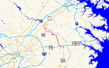
Maryland Route 197
Encyclopedia
Maryland Route 197 is a state highway
in the U.S. state
of Maryland
. Known for most of its length as Laurel–Bowie Road, the state highway runs 14.64 mi (23.6 km) from U.S. Route 301
(US 301) in Bowie
north to MD 198
in Laurel
. In addition to being the main connection between Bowie and Laurel, MD 197 provides access to Patuxent Wildlife Research Center
and Bowie State University
. The state highway is part of the National Highway System
between US 50
in Bowie and the Baltimore-Washington Parkway
in South Laurel
as an intermodal
connector to the Bowie State
MARC
station.
MD 197 originally consisted of only Laurel–Bowie Road. The Collington Road section between US 301 and MD 450
was added in the mid 1950s. The northern terminus in Laurel was realigned and subsequently the whole Laurel section was expanded to a divided highway
in the 1970s. Old Town Bowie was bypassed with a divided highway and the section between US 301 and US 50 was expanded to a divided highway in the early 1990s.
, then meets US 50 at a partial cloverleaf interchange. Beyond US 50, the state highway turns north and reduces to a two-lane road with a speed limit of 40 mph (64.4 km/h) surrounding by residential subdivisions. After passing Tulip Grove Drive, which leads to the Belair Stable Museum, MD 197 reaches Old Annapolis Road, which is the old alignment of MD 450. Old Annapolis Road heads west to the hamlet of Collington
. After passing Old Annapolis Road, MD 197 expands to a four-lane divided highway, its name changes to Laurel–Bowie Road, and it intersects MD 450.
MD 197 continues north from MD 450 as a five-lane road with center turn lane through residential subdivisions. After passing the staggered intersections with Old Chapel Road, the speed limit drops to 35 mph (56.3 km/h) and the state highway passes Bowie Golf and Country Club on the west. MD 197 then becomes a four-lane divided highway with a speed limit of 45 mph (72.4 km/h) through a forested area and passes under the Washington, Baltimore and Annapolis Trail
and over Horsepen Branch. The state highway intersects Race Track Road, named for defunct Bowie Race Track
to the east. The westbound direction leads to MD 564
and Old Town Bowie. MD 197 turns northwest and passes Jericho Park Road, which provides access to Bowie State University and the Bowie State MARC station. After crossing the Amtrak Northeast Corridor and MARC's Penn Line
and passing the Don S. S. Goodloe House
, the state highway reduces to two lanes and enters Patuxent Research Refuge
. After intersecting Old Laurel–Bowie Road, an old alignment of MD 197, the state highway passes the entrances to several research facilities of the Patuxent Wildlife Research Center, as well as the historic home Snowden Hall
.
After the intersection with Powder Mill Road, which leads to the Beltsville Agricultural Research Center, MD 197 leaves the refuge and passes several residential subdivisions in South Laurel. The state highway expands to a four-lane divided highway ahead of the partial cloverleaf interchange with the Baltimore-Washington Parkway, which sees the two directions of MD 197 temporarily split with a wide median. After the median closes, MD 197 expands to three lanes southbound. The state highway meets Muirkirk Road across from a shopping center, then passes between Patuxent River Park on the east and the grounds of Montpelier Mansion on the west. Beyond the intersection with Montpelier Drive and Brock Bridge Road, MD 197 enters an area of apartment complexes, then turns north and intersects Contee Road. The state highway continues north past a shopping center and more apartment complexes on the west, and historic Snow Hill
, single-family homes and a park and ride
on the east, then crosses Crow Branch, gains a third lane northbound, and intersects Cherry Lane. As MD 197 bears to the northeast, its old alignment, Bowie Road, splits off to the north, and the state highway crosses Bear Branch and enters the city limits of Laurel. MD 197 then meets its northern terminus at MD 198 (Fort Meade Road).
MD 197 was extended south to its current terminus at US 301 in 1955. In 1970, MD 197 was extended to MD 198 along new alignment in Laurel. MD 197 was also widened to a four-lane divided highway between MD 198 and the Baltimore–Washington Parkway in 1976. The bypass of Old Town Bowie, which followed the alignment of Jericho Park Road near Bowie State University and utilized a grade separation of the Penn Line completed in 1981, was completed between 1989 and 1993. Finally, the stretch of MD 197 between US 301 and just north of US 50 was expanded to a multi-lane divided highway in 1990.
.
State highway
State highway, state road or state route can refer to one of three related concepts, two of them related to a state or provincial government in a country that is divided into states or provinces :#A...
in the U.S. state
U.S. state
A U.S. state is any one of the 50 federated states of the United States of America that share sovereignty with the federal government. Because of this shared sovereignty, an American is a citizen both of the federal entity and of his or her state of domicile. Four states use the official title of...
of Maryland
Maryland
Maryland is a U.S. state located in the Mid Atlantic region of the United States, bordering Virginia, West Virginia, and the District of Columbia to its south and west; Pennsylvania to its north; and Delaware to its east...
. Known for most of its length as Laurel–Bowie Road, the state highway runs 14.64 mi (23.6 km) from U.S. Route 301
U.S. Route 301 in Maryland
U.S. Route 301 in Maryland is a major highway that runs from Delaware to the Governor Harry W. Nice Memorial Bridge into Virginia. It passes through three of Maryland's four main regions: the Eastern Shore, the Baltimore-Washington Metropolitan Area, and Southern Maryland...
(US 301) in Bowie
Bowie, Maryland
Bowie is a city in Prince George's County, Maryland, United States. The population was 54,727 at the 2010 census. Bowie has grown from a small railroad stop to the largest municipality in Prince George's County, and the fifth most populous city and third largest city by area in the state of...
north to MD 198
Maryland Route 198
Maryland Route 198 is an east–west state highway in the central part of the U.S. state of Maryland that connects Fort Meade at Maryland Route 32 to Maryland Route 28 and Maryland Route 650 near Spencerville.-Spencerville Road:...
in Laurel
Laurel, Maryland
Laurel is a city in northern Prince George's County, Anne Arundel County, and Howard County, Maryland, United States, located midway between Washington, D.C. and Baltimore. Incorporated in 1870, the city maintains a historic district including its Main Street...
. In addition to being the main connection between Bowie and Laurel, MD 197 provides access to Patuxent Wildlife Research Center
Patuxent Wildlife Research Center
The Patuxent Wildlife Research Center is a biological research center in Maryland. It is one of only 17 research centers in the United States run by the U.S. Geological Survey. This USGS research center is located on the U.S...
and Bowie State University
Bowie State University
Bowie State University , is a public university located on 355½ acres in unincorporated Prince George's County, Maryland, United States, north of the suburban city of Bowie. Bowie State is part of the University System of Maryland...
. The state highway is part of the National Highway System
National Highway System (United States)
The National Highway System is a network of strategic highways within the United States, including the Interstate Highway System and other roads serving major airports, ports, rail or truck terminals, railway stations, pipeline terminals and other strategic transport facilities.Individual states...
between US 50
U.S. Route 50 in Maryland
U.S. Route 50 is a major east–west route of the U.S. Highway system, stretching just over from Ocean City, Maryland on the Atlantic Ocean to West Sacramento, California. In the U.S. state of Maryland, US 50 exists in two sections. The longer of these serves as a major route connecting...
in Bowie and the Baltimore-Washington Parkway
Baltimore-Washington Parkway
The Baltimore–Washington Parkway is a highway in the U.S. state of Maryland, running southwest from Baltimore to Washington, D.C. The road begins at an interchange with U.S. Route 50 and Maryland Route 201 near Cheverly in Prince George's County at the D.C...
in South Laurel
South Laurel, Maryland
South Laurel is an unincorporated area and census-designated place in Prince George's County, Maryland, United States. The population was 20,479 at the 2000 census.-Geography:South Laurel is located at ....
as an intermodal
Intermodal passenger transport
Intermodal passenger transport involves more than one mode of transport of passengers. Some modes of transportation have always been intermodal; for example, most major airports have extensive facilities for automobile parking and have good rail or bus connections to the cities nearby. Urban bus...
connector to the Bowie State
Bowie State (MARC station)
Bowie State is a passenger rail station on the MARC Penn Line between Washington, D.C., Baltimore, MD and Perryville, MD. This station is also on the southern section of the Northeast Corridor however, Amtrak does not stop at this station....
MARC
MARC Train
MARC , known prior to 1984 as Maryland Rail Commuter Service, is a regional rail system comprising three lines in the Baltimore-Washington Metropolitan Area. MARC is administered by the Maryland Transit Administration , a Maryland Department of Transportation agency, and is operated under contract...
station.
MD 197 originally consisted of only Laurel–Bowie Road. The Collington Road section between US 301 and MD 450
Maryland Route 450
Maryland Route 450 is a state highway in the U.S. state of Maryland. The state highway runs from U.S. Route 1 Alternate in Bladensburg east to US 50, US 301, and MD 2 near Annapolis. MD 450 is the original alignment of US 50 in Prince George's and Anne Arundel Counties...
was added in the mid 1950s. The northern terminus in Laurel was realigned and subsequently the whole Laurel section was expanded to a divided highway
Divided Highway
Divided Highway is a compilation album by American rock band The Doobie Brothers, released in 2003. . All tracks are taken from the albums Cycles and Brotherhood .-Track listing:...
in the 1970s. Old Town Bowie was bypassed with a divided highway and the section between US 301 and US 50 was expanded to a divided highway in the early 1990s.
Route description
MD 197 begins at an intersection with US 301 (Crain Highway) in Bowie. The state highway, named Collington Road, heads northwest as a four-lane divided highway with a speed limit of 45 mph (72.4 km/h) through a mix of shopping centers and dense residential subdivisions. After passing Mitchellville Road, MD 197 expands to six lanes and passes Bowie Town CenterBowie Town Center
-History:Shopping center developer Simon Property Group of Indianapolis broke ground on the retail portion of the project — a lifestyle center called Bowie Town Center in October 2000. The Town Center project was a by-product of improvements that were made years ago to Route 50...
, then meets US 50 at a partial cloverleaf interchange. Beyond US 50, the state highway turns north and reduces to a two-lane road with a speed limit of 40 mph (64.4 km/h) surrounding by residential subdivisions. After passing Tulip Grove Drive, which leads to the Belair Stable Museum, MD 197 reaches Old Annapolis Road, which is the old alignment of MD 450. Old Annapolis Road heads west to the hamlet of Collington
Collington, Maryland
Collington, Maryland is a now defunct settlement in Prince George's County, Maryland dating from colonial times. Collington has been subsumed by the city of Bowie, Maryland.-Geography:...
. After passing Old Annapolis Road, MD 197 expands to a four-lane divided highway, its name changes to Laurel–Bowie Road, and it intersects MD 450.
MD 197 continues north from MD 450 as a five-lane road with center turn lane through residential subdivisions. After passing the staggered intersections with Old Chapel Road, the speed limit drops to 35 mph (56.3 km/h) and the state highway passes Bowie Golf and Country Club on the west. MD 197 then becomes a four-lane divided highway with a speed limit of 45 mph (72.4 km/h) through a forested area and passes under the Washington, Baltimore and Annapolis Trail
Washington, Baltimore and Annapolis Trail
The Washington, Baltimore and Annapolis Trail is a long discontinuous rail trail from Lanham to Odenton in Maryland. Despite its name, it does not actually connect with Washington, D.C., Annapolis or Baltimore; its name is taken from the Washington, Baltimore and Annapolis Electric Railway, from...
and over Horsepen Branch. The state highway intersects Race Track Road, named for defunct Bowie Race Track
Bowie Race Track
The Bowie Race Track was a horse racing track located just outside the city limits of Bowie, Maryland. Opened October 1, 1914 by the Southern Maryland Agricultural Society, the racetrack was a major attraction in the area, serving the now defunct WB&A Railroad that drew passengers from New York,...
to the east. The westbound direction leads to MD 564
Maryland Route 564
Maryland Route 564 is a state highway in the U.S. state of Maryland. Known for most of its length as Lanham Severn Road, the state highway runs from MD 450 in Lanham east to a dead end near a connection to MD 197 in Bowie.-Route description:...
and Old Town Bowie. MD 197 turns northwest and passes Jericho Park Road, which provides access to Bowie State University and the Bowie State MARC station. After crossing the Amtrak Northeast Corridor and MARC's Penn Line
Penn Line (MARC)
The Penn Line is a MARC commuter rail line running from Union Station, Washington D.C. to Perryville, Maryland via Penn Station, Baltimore, Maryland on Amtrak's Northeast Corridor. It is MARC's busiest and only electric line. Currently the line is the fastest commuter rail line in the country, with...
and passing the Don S. S. Goodloe House
Don S. S. Goodloe House
The Don S. S. Goodloe House, a 1915–16 Colonial Revival style building veneered with brick, is significant for its association with Don Speed Smith Goodloe, the first principal of the Maryland Normal and Industrial School. The school, now Bowie State University, was Maryland's first postsecondary...
, the state highway reduces to two lanes and enters Patuxent Research Refuge
Patuxent Research Refuge
Established in 1936 by executive order of President Franklin D. Roosevelt, the Patuxent Research Refuge is the only National Wildlife Refuge in the United States established to support wildlife research. With land surrounding the Patuxent and Little Patuxent Rivers between Washington, D.C...
. After intersecting Old Laurel–Bowie Road, an old alignment of MD 197, the state highway passes the entrances to several research facilities of the Patuxent Wildlife Research Center, as well as the historic home Snowden Hall
Snowden Hall (Laurel, Maryland)
Snowden Hall is a historic home located on the grounds of the Patuxent Wildlife Research Center, outside Laurel in Prince George's County, Maryland, United States. It stands on open rolling ground approximately ¾-mile west of the Patuxent River...
.
After the intersection with Powder Mill Road, which leads to the Beltsville Agricultural Research Center, MD 197 leaves the refuge and passes several residential subdivisions in South Laurel. The state highway expands to a four-lane divided highway ahead of the partial cloverleaf interchange with the Baltimore-Washington Parkway, which sees the two directions of MD 197 temporarily split with a wide median. After the median closes, MD 197 expands to three lanes southbound. The state highway meets Muirkirk Road across from a shopping center, then passes between Patuxent River Park on the east and the grounds of Montpelier Mansion on the west. Beyond the intersection with Montpelier Drive and Brock Bridge Road, MD 197 enters an area of apartment complexes, then turns north and intersects Contee Road. The state highway continues north past a shopping center and more apartment complexes on the west, and historic Snow Hill
Snow Hill (Laurel, Maryland)
Snow Hill is a manor house located south of Laurel, Maryland, off Maryland Route 197, in Prince George's County. Built between 1799 and 1801, the one-and-a-half-story brick house is rectangular, with a gambrel roof, interior end chimneys, and shed dormers. It has a center entrance with transom...
, single-family homes and a park and ride
Park and ride
Park and ride facilities are car parks with connections to public transport that allow commuters and other people wishing to travel into city centres to leave their vehicles and transfer to a bus, rail system , or carpool for the rest of their trip...
on the east, then crosses Crow Branch, gains a third lane northbound, and intersects Cherry Lane. As MD 197 bears to the northeast, its old alignment, Bowie Road, splits off to the north, and the state highway crosses Bear Branch and enters the city limits of Laurel. MD 197 then meets its northern terminus at MD 198 (Fort Meade Road).
History
A short stretch of MD 197 was paved in South Laurel in 1927. By 1930, the state highway was paved from Powder Mill Road in South Laurel to its northern terminus in Laurel, as well as from MD 450 at Collington to the center of Bowie. The stretch of road in between was under construction. This middle segment was completed by 1933. MD 197 followed much the same route as today, with a few exceptions:- In Bowie, MD 197 turned west at the Washington, Baltimore and Annapolis Electric RailwayWashington, Baltimore and Annapolis Electric RailwayThe Washington, Baltimore and Annapolis Electric Railway , now defunct, was an American railroad of central Maryland and Washington, DC built in the 19th and 20th century. The WB&A absorbed two older railroads, the Annapolis and Elk Ridge Railroad and the Baltimore & Annapolis Short Line, and...
to head into Old Town Bowie, following 11th Street and Chestnut Avenue within town, then heading north on what is today Old Laurel–Bowie Road. - In Laurel, MD 197 followed Bowie Road from near Cherry Lane to US 1.
- The stretch south of MD 450 was not included.
MD 197 was extended south to its current terminus at US 301 in 1955. In 1970, MD 197 was extended to MD 198 along new alignment in Laurel. MD 197 was also widened to a four-lane divided highway between MD 198 and the Baltimore–Washington Parkway in 1976. The bypass of Old Town Bowie, which followed the alignment of Jericho Park Road near Bowie State University and utilized a grade separation of the Penn Line completed in 1981, was completed between 1989 and 1993. Finally, the stretch of MD 197 between US 301 and just north of US 50 was expanded to a multi-lane divided highway in 1990.
Junction list
The entire route is in Prince George's CountyPrince George's County, Maryland
Prince George's County is a county located in the U.S. state of Maryland, immediately north, east, and south of Washington, DC. As of 2010, it has a population of 863,420 and is the wealthiest African-American majority county in the nation....
.
| Location | Mile |
Destinations | Notes |
|---|---|---|---|
| Bowie Bowie, Maryland Bowie is a city in Prince George's County, Maryland, United States. The population was 54,727 at the 2010 census. Bowie has grown from a small railroad stop to the largest municipality in Prince George's County, and the fifth most populous city and third largest city by area in the state of... |
0.00 | Southern terminus | |
| 1.65 | , Washington Washington, D.C. Washington, D.C., formally the District of Columbia and commonly referred to as Washington, "the District", or simply D.C., is the capital of the United States. On July 16, 1790, the United States Congress approved the creation of a permanent national capital as permitted by the U.S. Constitution.... |
US 50 Interchange 11 | |
| 3.08 | Old Annapolis Road west | Old alignment of MD 450 | |
| 3.28 | |||
| 5.76 | Race Track Road to – Old Town Bowie | ||
| 6.21 | Jericho Park Road – Bowie State University Bowie State University Bowie State University , is a public university located on 355½ acres in unincorporated Prince George's County, Maryland, United States, north of the suburban city of Bowie. Bowie State is part of the University System of Maryland... |
Unsigned MD 197C | |
| 7.92 | Old Laurel–Bowie Road – Old Town Bowie | Old alignment of MD 197 | |
| South Laurel South Laurel, Maryland South Laurel is an unincorporated area and census-designated place in Prince George's County, Maryland, United States. The population was 20,479 at the 2000 census.-Geography:South Laurel is located at .... |
11.70 | , Washington Washington, D.C. Washington, D.C., formally the District of Columbia and commonly referred to as Washington, "the District", or simply D.C., is the capital of the United States. On July 16, 1790, the United States Congress approved the creation of a permanent national capital as permitted by the U.S. Constitution.... |
Partial cloverleaf interchange |
| Laurel Laurel, Maryland Laurel is a city in northern Prince George's County, Anne Arundel County, and Howard County, Maryland, United States, located midway between Washington, D.C. and Baltimore. Incorporated in 1870, the city maintains a historic district including its Main Street... |
14.14 | Bowie Road - Laurel Laurel, Maryland Laurel is a city in northern Prince George's County, Anne Arundel County, and Howard County, Maryland, United States, located midway between Washington, D.C. and Baltimore. Incorporated in 1870, the city maintains a historic district including its Main Street... |
Old alignment of MD 197 |
| 14.64 | Northern terminus | ||