
Ma Wan
Encyclopedia
Ma Wan is an island of Hong Kong
, located between Lantau Island
and Tsing Yi Island, with an area of 0.97 km². Administratively, it is part of Tsuen Wan District
.
The Lantau Link
that passes through Ma Wan was constructed in the mid-1990s as part of the Hong Kong Government's Rose Garden plan
to connect the new Hong Kong International Airport
to the city centre. Its development fostered plans to develop the island. Today, a large part of Ma Wan is occupied by the Park Island
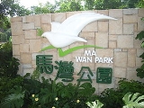
apartment complex. A theme park, named Ma Wan Park
was built to accompany the housing project, with its first phase opened on July 1, 2007.
separate Ma Wan and other major islands.
to the Han Dynasty
(206 BC -220 AD), the Tang Dynasty
(618-917 AD) and the Qing Dynasty
(1644-1911 AD).
Complete Neolithic human skeletal remains were found in tombs at Tung Wan Tsai in 1997. (Ref. The Antiquities and Monuments Office of the Home Affairs Bureau)
The prehistoric
island had late neolithic
inhabitants as proved by recent excavations. There were also inhabitants here during the Han Dynasty
. More recently in the last 250 years it was a small fishing village named Tin Liu, only accessible by boats or ferries. It was founded by a Chan family from Tsing Yi island.
Ma Wan once had a Customs house, still recorded by a stone monument named "Kowloon Gate" monument. (see it near to the old Rural Committee). It ceased activity on October 4, 1899
Foreign visitors in 1794.
24 housing units donated by Americans in 1965 (see them on a top of a hill near to the Fishermen's association)
As of 1995, fish farming
was the predominant economic activity on Ma Wan.
Ma Wan had a population of 800 in 2000. With the development of the Park Island
apartment complex, villagers were rehoused in the northern part of the island. As part of the compensation package, they could choose either a 3-storey traditional village house of 2,100 sq ft or 3 separate units, each of 700 sq ft in one single block.

is a private housing estate
that was mainly developed by Sun Hung Kai Properties as part of the Ma Wan Development joint venture project and completed from 2002 to 2006 in six phases.
(a suspension bridge
), and to Lantau Island
by the Kap Shui Mun Bridge
(a cable-stayed bridge
). Both bridges are part of the Lantau Link
.
Park Island Transport Co., Ltd. operates bus services between Park Island and Tsing Yi MTR Station
, Park Island and Kwai Fong
Metroplaza
, Park Island and Hong Kong International Airport
; Park Island and Tsuen Wan
(close to the Tsuen Wan MTR station).
With effective from 3 July 2008, urban taxis are allowed access into Ma Wan during the overnight
period from 8pm to 7am to meet residents' transport needs.
Private vehicles are generally not permitted to enter the island, (taxis are allowed from 8pm to 7am) an arrangement which also exists in Discovery Bay
on the nearby Lantau Island
; however a permit can be requested from the Transport Department of Hong Kong. Minibuses are not allowed, but the Park Island management company operates cars in case of emergency or special situations, though their availability is not guaranteed. Lorries may enter the island between 10am to 4pm daily without the need for a special permit.
on the northeast, one on the old Tin Liu village on the west (formerly hosting Sham Tseng
ferries), Man Wan Public Pier on the southwest at Ma Wan Main Street Village, Tai Pai Tsui Pier on the south of the island facing Tang Lung Chau
, one on the north of the island used for the garbage removal, one on the southeast side (but on a Government land not open).
Park Island Transport Co., Ltd. operates ferry
services between Park Island and Central
and between Park Island and Tsuen Wan Pier
(next to the Tsuen Wan West MTR station).
Hong Kong
Hong Kong is one of two Special Administrative Regions of the People's Republic of China , the other being Macau. A city-state situated on China's south coast and enclosed by the Pearl River Delta and South China Sea, it is renowned for its expansive skyline and deep natural harbour...
, located between Lantau Island
Lantau Island
Lantau Island , based on the old local name of Lantau Peak , is the largest island in Hong Kong, located at the mouth of the Pearl River. Administratively, most of Lantau Island is part of the Islands District of Hong Kong...
and Tsing Yi Island, with an area of 0.97 km². Administratively, it is part of Tsuen Wan District
Tsuen Wan District
Tsuen Wan District is one of the 18 districts of Hong Kong. It is located in the New Territories and is served by the Tsuen Wan Line of the MTR metro system. It had a population of 275,527 in 2001...
.
The Lantau Link
Lantau Link
The Lantau Link, formerly known as the Lantau Fixed Crossing, is a series of infrastructures linking Hong Kong International Airport to the urban areas in Hong Kong. It was officially opened on 27 April 1997, and it opened to traffic on 22 May the same year.-Infrastructure:The Lantau Link is 3.5 km...
that passes through Ma Wan was constructed in the mid-1990s as part of the Hong Kong Government's Rose Garden plan
Port and Airport Development Strategy
The Port and Airport Development Strategy is an infrastructure project in Hong Kong. It is better known as the Rose Garden Project .-Background:...
to connect the new Hong Kong International Airport
Hong Kong International Airport
Hong Kong International Airport is the main airport in Hong Kong. It is colloquially known as Chek Lap Kok Airport , being built on the island of Chek Lap Kok by land reclamation, and also to distinguish it from its predecessor, the closed Kai Tak Airport.The airport opened for commercial...
to the city centre. Its development fostered plans to develop the island. Today, a large part of Ma Wan is occupied by the Park Island
Park Island
Park Island is a private housing estate located at Ma Wan, an island in Tsuen Wan, New Territories, Hong Kong. It was mainly developed by Sun Hung Kai Properties as part of the Ma Wan Development joint venture project and completed from 2002 to 2006 in six phases.-Phases:* Phase 1 comprises 2,569...
apartment complex. A theme park, named Ma Wan Park
Ma Wan Park
Ma Wan Park is a park on Ma Wan island, New Territories in Hong Kong, operated by Sun Hung Kai Properties with investment from the Hong Kong Government...
was built to accompany the housing project, with its first phase opened on July 1, 2007.
Geography
Ma Wan has an area of 0.97 km². Its highest point is Tai Leng Tau (69 m) in the southeast. Two channelsChannel (geography)
In physical geography, a channel is the physical confine of a river, slough or ocean strait consisting of a bed and banks.A channel is also the natural or human-made deeper course through a reef, sand bar, bay, or any shallow body of water...
separate Ma Wan and other major islands.
- to the east is the Ma Wan ChannelMa Wan ChannelMa Wan Channel is a channel between Ma Wan and Tsing Yi Island in Hong Kong. The north end of the channel is Ting Kau where it joins the Rambler Channel. To the west it joins with the Kap Shui Mun channel running to the south of Ma Wan, leading into Urmston Road. To the east it divides into the...
, separating it from Tsing Yi Island. The channel is crossed by the Tsing Ma BridgeTsing Ma BridgeThe Tsing Ma Bridge is a bridge in Hong Kong. It is the world's seventh-longest span suspension bridge, and was the second longest at time of completion. The bridge was named after two of the islands at its ends, namely Tsing Yi and Ma Wan . It has two decks and carries both road and rail...
. - to the southwest is Kap Shui MunKap Shui MunKap Shui Mun or Throat Gates is a major channel, between Lantau Island and Ma Wan, in Hong Kong. It is part of major sea route along the coast of South China, from Victoria Harbour to the Pearl River. It joins north with Urmston Road...
, separating it from the Tsing Chau Tsai PeninsulaTsing Chau Tsai PeninsulaTsing Chau Tsai Peninsula is the peninsula located at the northeast of Lantau Island, New Territories, Hong Kong, including Yam O, To Kau Wan, Tai Tsing Chau, Tsing Chau Tsai and Penny's Bay. It administratively belongs to Tsuen Wan District, while the remaining areas of Lantau Island belong to...
of Lantau IslandLantau IslandLantau Island , based on the old local name of Lantau Peak , is the largest island in Hong Kong, located at the mouth of the Pearl River. Administratively, most of Lantau Island is part of the Islands District of Hong Kong...
. The channel is crossed by the Kap Shui Mun BridgeKap Shui Mun BridgeThe Kap Shui Mun Bridge in Hong Kong is one of the longest cable-stayed bridges in the world that transports both road and railway traffic, with the upper deck for motor vehicles, and the lower deck for both vehicles and the MTR. It has a main span of 430 metres and an overall length of 750 metres...
. - the north seafront is opposite Tsing Lung TauTsing Lung TauTsing Lung Tau is a small area in Tsuen Wan West, New Territories in Hong Kong.-Geographical information:It is located on the southwest coast of the New Territories in Hong Kong, between Tsuen Wan and Tuen Mun. There are two villages: Tsing Lung Tau Village and Yuen Tun Village, with many...
on the mainland Tsuen Wan DistrictTsuen Wan DistrictTsuen Wan District is one of the 18 districts of Hong Kong. It is located in the New Territories and is served by the Tsuen Wan Line of the MTR metro system. It had a population of 275,527 in 2001...
, part of the New TerritoriesNew TerritoriesNew Territories is one of the three main regions of Hong Kong, alongside Hong Kong Island and the Kowloon Peninsula. It makes up 86.2% of Hong Kong's territory. Historically, it is the region described in The Convention for the Extension of Hong Kong Territory...
. - the south is facing the small Tang Lung ChauTang Lung ChauTang Lung Chau is a small island to the west of Hong Kong Island, Hong Kong.This island is located off the south coast of Ma Wan, and is administratively part of Tsuen Wan District.-Lighthouse:...
island.
History
Remains have been found from the Mid-Neolithic Age (about 3000 BC), the late Neolithic Age (about 2000 BC), the early to late Bronze Age of coastal South China (1500-500 BC), the period of the Warring StatesWarring States Period
The Warring States Period , also known as the Era of Warring States, or the Warring Kingdoms period, covers the Iron Age period from about 475 BC to the reunification of China under the Qin Dynasty in 221 BC...
to the Han Dynasty
Han Dynasty
The Han Dynasty was the second imperial dynasty of China, preceded by the Qin Dynasty and succeeded by the Three Kingdoms . It was founded by the rebel leader Liu Bang, known posthumously as Emperor Gaozu of Han. It was briefly interrupted by the Xin Dynasty of the former regent Wang Mang...
(206 BC -220 AD), the Tang Dynasty
Tang Dynasty
The Tang Dynasty was an imperial dynasty of China preceded by the Sui Dynasty and followed by the Five Dynasties and Ten Kingdoms Period. It was founded by the Li family, who seized power during the decline and collapse of the Sui Empire...
(618-917 AD) and the Qing Dynasty
Qing Dynasty
The Qing Dynasty was the last dynasty of China, ruling from 1644 to 1912 with a brief, abortive restoration in 1917. It was preceded by the Ming Dynasty and followed by the Republic of China....
(1644-1911 AD).
Complete Neolithic human skeletal remains were found in tombs at Tung Wan Tsai in 1997. (Ref. The Antiquities and Monuments Office of the Home Affairs Bureau)
The prehistoric
Prehistoric Hong Kong
Prehistoric Hong Kong is the period between the arrival of the first humans in the modern Hong Kong region and the start of recorded in Chinese history. The history of the region is...
island had late neolithic
Neolithic
The Neolithic Age, Era, or Period, or New Stone Age, was a period in the development of human technology, beginning about 9500 BC in some parts of the Middle East, and later in other parts of the world. It is traditionally considered as the last part of the Stone Age...
inhabitants as proved by recent excavations. There were also inhabitants here during the Han Dynasty
Han Dynasty
The Han Dynasty was the second imperial dynasty of China, preceded by the Qin Dynasty and succeeded by the Three Kingdoms . It was founded by the rebel leader Liu Bang, known posthumously as Emperor Gaozu of Han. It was briefly interrupted by the Xin Dynasty of the former regent Wang Mang...
. More recently in the last 250 years it was a small fishing village named Tin Liu, only accessible by boats or ferries. It was founded by a Chan family from Tsing Yi island.
Ma Wan once had a Customs house, still recorded by a stone monument named "Kowloon Gate" monument. (see it near to the old Rural Committee). It ceased activity on October 4, 1899
Foreign visitors in 1794.
24 housing units donated by Americans in 1965 (see them on a top of a hill near to the Fishermen's association)
As of 1995, fish farming
Fish farming
Fish farming is the principal form of aquaculture, while other methods may fall under mariculture. Fish farming involves raising fish commercially in tanks or enclosures, usually for food. A facility that releases young fish into the wild for recreational fishing or to supplement a species'...
was the predominant economic activity on Ma Wan.
Ma Wan had a population of 800 in 2000. With the development of the Park Island
Park Island
Park Island is a private housing estate located at Ma Wan, an island in Tsuen Wan, New Territories, Hong Kong. It was mainly developed by Sun Hung Kai Properties as part of the Ma Wan Development joint venture project and completed from 2002 to 2006 in six phases.-Phases:* Phase 1 comprises 2,569...
apartment complex, villagers were rehoused in the northern part of the island. As part of the compensation package, they could choose either a 3-storey traditional village house of 2,100 sq ft or 3 separate units, each of 700 sq ft in one single block.
Features
Park Island
Park IslandPark Island
Park Island is a private housing estate located at Ma Wan, an island in Tsuen Wan, New Territories, Hong Kong. It was mainly developed by Sun Hung Kai Properties as part of the Ma Wan Development joint venture project and completed from 2002 to 2006 in six phases.-Phases:* Phase 1 comprises 2,569...
is a private housing estate
Private housing estate
A private housing estate is a term in Hong Kong that refers to a housing estate developed by a private developer, as opposed to a public housing estate built by the Hong Kong Housing Authority or the Hong Kong Housing Society. It usually is characterised with a cluster of high-rise buildings,...
that was mainly developed by Sun Hung Kai Properties as part of the Ma Wan Development joint venture project and completed from 2002 to 2006 in six phases.
Villages
- Ma Wan Town, also known as Ma Wan Main Street Village, is a fishing village with stilt houses (pang ukPang ukPang uk is a kind of stilt house found in Tai O, Lantau Island, Hong Kong. Pang uk are built on water or on small beaches....
). - 250 years old village, quite empty as of 2007—The new Tin Liu Village has been built a bit on top of it.
Leisure
- Ma Wan ParkMa Wan ParkMa Wan Park is a park on Ma Wan island, New Territories in Hong Kong, operated by Sun Hung Kai Properties with investment from the Hong Kong Government...
- The Heritage Centre in Ma Wan Park exhibits the evolution of the island since Neolithic to nowadays, includes a Tang DynastyTang DynastyThe Tang Dynasty was an imperial dynasty of China preceded by the Sui Dynasty and followed by the Five Dynasties and Ten Kingdoms Period. It was founded by the Li family, who seized power during the decline and collapse of the Sui Empire...
mud kiln and a Qing DynastyQing DynastyThe Qing Dynasty was the last dynasty of China, ruling from 1644 to 1912 with a brief, abortive restoration in 1917. It was preceded by the Ming Dynasty and followed by the Republic of China....
brick kiln found on Ma Wan, and replicas of the late Neolithic skeletons. - Noah's Ark MuseumNoah's Ark (Hong Kong)Noah's Ark is the newest attraction located on Ma Wan Island in Hong Kong. Operated by Christian organisations based in Hong Kong, it is an evangelical Christian theme park centred, according to its own materials, around the themes of nature, art, education and love...
in Ma Wan Park - Ma Wan Tung Wan Beach is managed by the Leisure and Cultural Services DepartmentLeisure and Cultural Services DepartmentThe Leisure and Cultural Services Department , often abbreviated as LCSD, is a department in the Government of Hong Kong. It reports to the Home Affairs Bureau, headed by the Secretary for Home Affairs. It provides leisure and cultural activities for the people of Hong Kong, which was also one of...
.
Religion
- Annual traditional festivals, such as Tin Hau.
- There are two Tin Hau TemplesTin Hau temples in Hong KongOver 70 temples are dedicated to Tin Hau in Hong Kong. They include:* Tin Hau temple, located at 10 Tin Hau Temple Road, Causeway Bay, east of Victoria Park, in Eastern District, on Hong Kong Island. It is a declared monument. The temple has given its name to the MTR station serving it .* The Tin...
on Ma Wan. One has been rebuilt on the northern beach and is said to have been originally built by the local pirate Cheung Po TsaiCheung Po TsaiCheung Po Tsai was a 19th century Chinese pirate. He was also known as Cheung Po/Chang Pao/Zhang Bao .Several places in Hong Kong are linked to Cheung Po Tsai:* Cheung Po Tsai Cave, on Cheung Chau island...
, who often looked after the locals. Another one is located at the Ma Wan Main Street Village. - Ma Wan Alliance Church
Culture
- Cantonese OperaCantonese operaCantonese opera is one of the major categories in Chinese opera, originating in southern China's Cantonese culture. It is popular in Guangdong, Guangxi, Hong Kong, Macau, Singapore and Malaysia. Like all versions of Chinese opera, it is a traditional Chinese art form, involving music, singing,...
productions. - Local production of the shrimp pasteShrimp pasteShrimp paste or shrimp sauce, is a common ingredient used in Southeast Asian and Southern Chinese cuisine. It is known as terasi in Indonesian, ngapi in Burmese, kapi in Thai, Khmer and Lao language, belacan in Malay, mắm ruốc, mắm tép and mắm tôm in...
"habe" - Fong Yuen Study Hall, formerly the Chan Study Hall, was first built by the Chan clan of Tin Liu before the 1900s. The Chan Study Hall was rebuilt with Western influence and renamed as "Fong Yuen Study Hall", literally meaning a nice place for study, in the 1920s to 30s. (See Revitalising Historic Buildings Through Partnership SchemeRevitalising Historic Buildings Through Partnership SchemeThe Revitalising Historic Buildings through Partnership Scheme is an initiative launched by the Hong Kong Government, part of a broader policy of Heritage conservation in Hong Kong....
)
Others
- Clear water wells
- Deep waters (for Hong Kong) surrounding - 30 m
- Popular photography site.
- Small red crabs.
- Cemetery on the south side.
- The Salvation ArmyThe Salvation ArmyThe Salvation Army is a Protestant Christian church known for its thrift stores and charity work. It is an international movement that currently works in over a hundred countries....
Ma Wan Youth Camp
Infrastructure
- Tsing Ma BridgeTsing Ma BridgeThe Tsing Ma Bridge is a bridge in Hong Kong. It is the world's seventh-longest span suspension bridge, and was the second longest at time of completion. The bridge was named after two of the islands at its ends, namely Tsing Yi and Ma Wan . It has two decks and carries both road and rail...
, world's longest span suspension bridge carrying both road and railway traffic. Tsing Ma BridgeTsing Ma BridgeThe Tsing Ma Bridge is a bridge in Hong Kong. It is the world's seventh-longest span suspension bridge, and was the second longest at time of completion. The bridge was named after two of the islands at its ends, namely Tsing Yi and Ma Wan . It has two decks and carries both road and rail...
+ Ma Wan ViaductMa Wan ViaductMa Wan Viaduct is a viaduct built over Ma Wan, an island in the Hong Kong Special Administrative Region of the People's Republic of China. The viaduct connects the Tsing Ma Bridge and Kap Shui Mun Bridge, and is part of the Lantau Link and Route 8...
+ Kap Shui Mun BridgeKap Shui Mun BridgeThe Kap Shui Mun Bridge in Hong Kong is one of the longest cable-stayed bridges in the world that transports both road and railway traffic, with the upper deck for motor vehicles, and the lower deck for both vehicles and the MTR. It has a main span of 430 metres and an overall length of 750 metres...
together link Tsing YiTsing YiTsing Yi , or Tsing Yi Island is an island in the urban area of Hong Kong, to the northwest of Hong Kong Island and south of Tsuen Wan. With an area of 10.69 km², the island has extended drastically by reclamation along almost all its natural shore and the annexation of Nga Ying Chau and Chau...
island to Lantau islandLantau IslandLantau Island , based on the old local name of Lantau Peak , is the largest island in Hong Kong, located at the mouth of the Pearl River. Administratively, most of Lantau Island is part of the Islands District of Hong Kong...
and form the Lantau LinkLantau LinkThe Lantau Link, formerly known as the Lantau Fixed Crossing, is a series of infrastructures linking Hong Kong International Airport to the urban areas in Hong Kong. It was officially opened on 27 April 1997, and it opened to traffic on 22 May the same year.-Infrastructure:The Lantau Link is 3.5 km...
. - Park Island Ferry PierPark Island Ferry PierPark Island Ferry Pier is a ferry pier in Park Island, Ma Wan, Tsuen Wan, New Territories, Hong Kong. It is one of the main transport interchange of Park Island, a private housing estate in Ma Wan. It has two ferry routes to Tsuen Wan and Central respectively, which are operated by Park Island...
Transport
Road
Although the Hong Kong government originally claimed it would be "physically impossible" to give the island a road connection via the Lantau Link, this proved to be possible after all as part of the Park Island construction. The island is now connected to Tsing Yi by the Tsing Ma BridgeTsing Ma Bridge
The Tsing Ma Bridge is a bridge in Hong Kong. It is the world's seventh-longest span suspension bridge, and was the second longest at time of completion. The bridge was named after two of the islands at its ends, namely Tsing Yi and Ma Wan . It has two decks and carries both road and rail...
(a suspension bridge
Suspension bridge
A suspension bridge is a type of bridge in which the deck is hung below suspension cables on vertical suspenders. Outside Tibet and Bhutan, where the first examples of this type of bridge were built in the 15th century, this type of bridge dates from the early 19th century...
), and to Lantau Island
Lantau Island
Lantau Island , based on the old local name of Lantau Peak , is the largest island in Hong Kong, located at the mouth of the Pearl River. Administratively, most of Lantau Island is part of the Islands District of Hong Kong...
by the Kap Shui Mun Bridge
Kap Shui Mun Bridge
The Kap Shui Mun Bridge in Hong Kong is one of the longest cable-stayed bridges in the world that transports both road and railway traffic, with the upper deck for motor vehicles, and the lower deck for both vehicles and the MTR. It has a main span of 430 metres and an overall length of 750 metres...
(a cable-stayed bridge
Cable-stayed bridge
A cable-stayed bridge is a bridge that consists of one or more columns , with cables supporting the bridge deck....
). Both bridges are part of the Lantau Link
Lantau Link
The Lantau Link, formerly known as the Lantau Fixed Crossing, is a series of infrastructures linking Hong Kong International Airport to the urban areas in Hong Kong. It was officially opened on 27 April 1997, and it opened to traffic on 22 May the same year.-Infrastructure:The Lantau Link is 3.5 km...
.
Park Island Transport Co., Ltd. operates bus services between Park Island and Tsing Yi MTR Station
Tsing Yi (MTR)
Tsing Yi is an interchange station on the Tung Chung Line of MTR and Airport Express on Tsing Yi Island in Hong Kong. On the Tung Chung Line, it is located between Sunny Bay Station and Lai King Station. On the Airport Express, it is between Airport Station and Kowloon Station. The livery of...
, Park Island and Kwai Fong
Kwai Fong
Kwai Fong is an area of Kwai Chung Town, Kwai Tsing District, Hong Kong. The mainly residential area extends to Kwai Hing in the north, Lai King in the south, Tsing Yi Bridge to the west, and Tai Lin Pai Industrial Area to the east. It is part of the reclamation of Gin Drinkers Bay in 1960s.Kwai...
Metroplaza
Metroplaza
Metroplaza is a shopping centre and office building in Kwai Fong, Hong Kong. Opposite to Kwai Fong Station of MTR, the mall is a shopping hub of adjacent areas of Kwai Fong, Lai King, Tsing Yi and Kwai Chung...
, Park Island and Hong Kong International Airport
Hong Kong International Airport
Hong Kong International Airport is the main airport in Hong Kong. It is colloquially known as Chek Lap Kok Airport , being built on the island of Chek Lap Kok by land reclamation, and also to distinguish it from its predecessor, the closed Kai Tak Airport.The airport opened for commercial...
; Park Island and Tsuen Wan
Tsuen Wan
Tsuen Wan is a bay in the Kowloon area of Hong Kong, opposite to Tsing Yi Island across Rambler Channel. The market town of Tsuen Wan emerged for the surrounding villages and fleets of fishing boats in the area. The town is around the present-day Tsuen Wan Station of the MTR...
(close to the Tsuen Wan MTR station).
With effective from 3 July 2008, urban taxis are allowed access into Ma Wan during the overnight
Overnight
Overnight is a 2003 documentary by Tony Montana and Mark Brian Smith. The film details the rise and fall of filmmaker and musician Troy Duffy, the writer-director of The Boondock Saints, and was filmed at his request....
period from 8pm to 7am to meet residents' transport needs.
Private vehicles are generally not permitted to enter the island, (taxis are allowed from 8pm to 7am) an arrangement which also exists in Discovery Bay
Discovery Bay
Discovery Bay is a mixed, primarily residential, development comprising a residential development and private and public recreational facilities in Hong Kong. It is situated on the north-eastern coast of Lantau Island in the New Territories. The development spans an area of 650 hectares , and...
on the nearby Lantau Island
Lantau Island
Lantau Island , based on the old local name of Lantau Peak , is the largest island in Hong Kong, located at the mouth of the Pearl River. Administratively, most of Lantau Island is part of the Islands District of Hong Kong...
; however a permit can be requested from the Transport Department of Hong Kong. Minibuses are not allowed, but the Park Island management company operates cars in case of emergency or special situations, though their availability is not guaranteed. Lorries may enter the island between 10am to 4pm daily without the need for a special permit.
Water
There are several ferry piers on the island: Park Island Ferry PierPark Island Ferry Pier
Park Island Ferry Pier is a ferry pier in Park Island, Ma Wan, Tsuen Wan, New Territories, Hong Kong. It is one of the main transport interchange of Park Island, a private housing estate in Ma Wan. It has two ferry routes to Tsuen Wan and Central respectively, which are operated by Park Island...
on the northeast, one on the old Tin Liu village on the west (formerly hosting Sham Tseng
Sham Tseng
Sham Tseng is a coastal area in Tsuen Wan District, Hong Kong, between Ting Kau and Tsing Lung Tau.In 1982, the Government launched a new town project for the area. There were proposals for a massive housing scheme, where the population of the village, then estimated at 6,000, was set to increase...
ferries), Man Wan Public Pier on the southwest at Ma Wan Main Street Village, Tai Pai Tsui Pier on the south of the island facing Tang Lung Chau
Tang Lung Chau
Tang Lung Chau is a small island to the west of Hong Kong Island, Hong Kong.This island is located off the south coast of Ma Wan, and is administratively part of Tsuen Wan District.-Lighthouse:...
, one on the north of the island used for the garbage removal, one on the southeast side (but on a Government land not open).
Park Island Transport Co., Ltd. operates ferry
Ferry
A ferry is a form of transportation, usually a boat, but sometimes a ship, used to carry primarily passengers, and sometimes vehicles and cargo as well, across a body of water. Most ferries operate on regular, frequent, return services...
services between Park Island and Central
Central, Hong Kong
Central is the central business district of Hong Kong. It is located in Central and Western District, on the north shore of Hong Kong Island, across Victoria Harbour from Tsim Sha Tsui, the southernmost point of Kowloon Peninsula...
and between Park Island and Tsuen Wan Pier
Tsuen Wan Pier
Tsuen Wan Pier, Tsuen Wan Ferry or Tsuen Wan Ferry Pier is a public pier at the south of Tsuen Wan, New Territories, Hong Kong, which is adjacent to MTR Tsuen Wan West Station...
(next to the Tsuen Wan West MTR station).
External links
- Location: Google maps, Wikimapia
- Pictures of Ma Wan
- "The road to salvation", brief history of Ma Wan
- R.J. Sewell & J. W.C. James, Geology of North Lantau Island and Ma Wan, Geotechnical Engineering Office, Civil Engineering Department, Hong Kong, November 1995