
.gif)
M1 (Australia)
Encyclopedia
The M1 is designated stretches of Australia's National Highway 1
(A1) that are: Dual-carriageway, Freeway or Motorway.
Such stretches of highway include:
(List is Incomplete)
Highway 1 (Australia)
Australia's Highway 1 is a network of highways that circumnavigate the Australian continent, joining all mainland state capitals. At a total length of approximately it is the longest national highway in the world, longer than the Trans-Siberian Highway and the Trans-Canada Highway...
(A1) that are: Dual-carriageway, Freeway or Motorway.
Such stretches of highway include:
Queensland
- Bruce HighwayBruce HighwayThe Bruce Highway is a major highway in Queensland, Australia. Commencing in the state capital, Brisbane, it passes through areas close to the eastern coast to Cairns in Far North Queensland. The route is a part of the Australian National Highway and also part of Highway 1...
from CooroyCooroy, QueenslandCooroy is a town in Queensland, Australia, located in the northern Sunshine Coast hinterland about west of Noosa Heads. Cooroy's name came from Cooroy Mountain, which was originally called Coorooey, from the Aboriginal word for possum, kurui....
to Bald HillsBald Hills, QueenslandBald Hills is the northernmost suburb of the Brisbane City Council in Queensland, Australia.Bald Hills is a largely residential suburb. It is mostly surrounded by bushland, but in the last few years some of the bush areas have been cleared to make way for new residential areas...
. - Gateway MotorwayGateway MotorwayThe Gateway Motorway is a major motorway in Brisbane, Queensland, Australia. The Gateway Bridge is owned and operated by Queensland Motorways....
from Bald HillsBald Hills, QueenslandBald Hills is the northernmost suburb of the Brisbane City Council in Queensland, Australia.Bald Hills is a largely residential suburb. It is mostly surrounded by bushland, but in the last few years some of the bush areas have been cleared to make way for new residential areas...
to Eight Mile PlainsEight Mile Plains, QueenslandEight Mile Plains is a southern suburb of Brisbane, Queensland, Australia. It is located some 13 kilometres from the Brisbane central business district....
. - Pacific MotorwayPacific MotorwayThe Pacific Motorway is a 100 km long motorway in Australia between Brisbane, Queensland, and the New South Wales-Queensland border at Tweed Heads. The motorway starts at Coronation Drive at Milton in Brisbane, and from 2008 links the Tweed Heads bypass in New South Wales...
from Eight Mile PlainsEight Mile Plains, QueenslandEight Mile Plains is a southern suburb of Brisbane, Queensland, Australia. It is located some 13 kilometres from the Brisbane central business district....
to the New South Wales Border, linking 'directly' with the Tweed Heads bypass.
New South Wales
- Eastern DistributorEastern DistributorThe Eastern Distributor, also identified as the M1, is a long motorway in Sydney, New South Wales, Australia. Part of Metroad 1, it links the Sydney central business district with the Airport...
from WoolloomoolooWoolloomooloo, New South WalesWoolloomooloo is a harbourside, inner-city eastern suburb of Sydney, in the state of New South Wales, Australia. Woolloomooloo is located 1.5 kilometres east of the Sydney central business district, in the local government area of the City of Sydney. The suburb is located in a low-lying, former...
to Surry HillsSurry Hills, New South WalesSurry Hills is an inner-city suburb of Sydney, in the state of New South Wales, Australia. Surry Hills is located immediately south-east of the Sydney central business district in the local government area of the City of Sydney...
.
Victoria
- Princes FreewayPrinces FreewayThe Princes Freeway is a , 2 section freeway, which links Melbourne to Geelong on the west and Morwell on the east . It continues beyond these extremities as the Princes Highway towards Adelaide to the west and Sydney to the east...
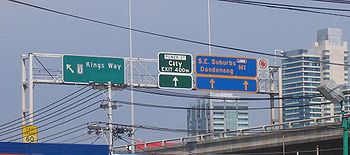
from Traralgon to Berwick. - Monash FreewayMonash FreewayMonash Freeway is an urban freeway in Victoria, Australia linking Melbourne's CBD to its southeastern suburbs and the Gippsland region. The entire stretch of the Monash Freeway bears the designation...
from Berwick to Central Melbourne. - CityLinkCityLinkCityLink is a system of tolled urban Highways in Melbourne, Victoria, Australia. The company Transurban was awarded the contract to augment two existing freeways and construct two new Toll roads—labelled the Western and Southern Links—directly linking a number of existing freeways to...
(southern link section): Central Melbourne (through DomainDomain TunnelThe Domain Tunnel is a road tunnel located in Melbourne, Australia, which carries traffic westbound from the Monash Freeway to the West Gate Freeway, running under the Yarra River and Kings Domain...
and Burnley TunnelBurnley TunnelThe Burnley Tunnel is a tollway tunnel in Melbourne, in Victoria, Australia, which carries traffic eastbound from the West Gate Freeway to the Monash Freeway. It is part of the CityLink Tollway operated by Transurban. Running under the Yarra River and the inner suburbs of Richmond and Burnley, the...
s). - West Gate FreewayWest Gate FreewayWest Gate Freeway is a freeway in Melbourne, Australia, linking Geelong to Melbourne CBD and beyond. It is also a link between Melbourne and the west and linking industrial and residential areas west of the Yarra River with the city and port areas. The iconic West Gate Bridge is a part of the...
from Melbourne to West Gate Interchange.- Massive re-construction in progress as part of the M1 Upgrade.
- The M1 freeway upgrade receives an ITS Australia award.
- Princes FreewayPrinces FreewayThe Princes Freeway is a , 2 section freeway, which links Melbourne to Geelong on the west and Morwell on the east . It continues beyond these extremities as the Princes Highway towards Adelaide to the west and Sydney to the east...
from West Gate Interchange to Corio. - Geelong Ring Road from Corio to Waurn Ponds.
- Princes FreewayPrinces FreewayThe Princes Freeway is a , 2 section freeway, which links Melbourne to Geelong on the west and Morwell on the east . It continues beyond these extremities as the Princes Highway towards Adelaide to the west and Sydney to the east...
from Waurn Ponds to Winchelsea (under construction)
South Australia
- South-Eastern FreewaySouth-Eastern FreewayThe name South-Eastern Freeway may refer to:* South Eastern Freeway running southeast from Adelaide in the state of South Australia, Australia* Monash Freeway running southeast from Melbourne in the state of Victoria, Australia...
from Murray Bridge to Crafers - Adelaide-Crafers HighwayAdelaide-Crafers HighwayThe Adelaide-Crafers Highway is a 10 kilometre controlled-access highway linking Adelaide city centre to Crafers in the Adelaide hills, and continuing from Crafers as the South Eastern Freeway. The highway is ten kilometres long, including 500 metre long twin-tube tunnels , the first of their kind...
from Crafers to Adelaide.
(List is Incomplete)