
Lysander, New York
Encyclopedia
Lysander is a town
in Onondaga County
, New York
, United States
. The population was 19,285 at the 2000 census. The town was named after Lysander
, a Sparta
n military leader, by a clerk interested in the classics
.
The Town of Lysander is in the northwest corner of the county and is northwest of Syracuse
. Much of the town is a suburb
of Syracuse.
 The town was part of the former Central New York Military Tract
. It was first settled by outsiders around 1797.
The Town of Lysander was formed in 1794 from the northern townships of the Military Tract. Lysander was later reduced by the creation of the Towns of Hannibal
(1806) and Cicero
(1807). Lysander was reduced again on the formation of Oswego County
in 1816.
, the town has a total area of 64.6 square miles (167.3 km²), of which, 61.9 square miles (160.3 km²) of it is land and 2.7 square miles (7 km²) of it (4.18%) is water.
The north town line is the border of Oswego County
and the west town line is the border of Cayuga County
. The south town line is defined by the Erie Canal
-Seneca River
complex. Cross Lake is located on the west border of Lysander. The Oswego River
marks part of the east town line. The Oswego, Seneca, and Oneida
Rivers join at the east town line.
 New York State Route 370
, West Genesee Road, is an east-west highway in the south part of Lysander. New York State Route 48
is a highway in the center of the town. New York State Route 31
intersects NY-370 in the southeast part of Lysander. New York State Route 690
is a major highway leading out of the south part of Lysander.
of 2000, there were 19,285 people, 7,139 households, and 5,404 families residing in the town. The population density
was 311.5 people per square mile (120.3/km²). There were 7,448 housing units at an average density of 120.3 per square mile (46.4/km²). The racial makeup of the town was 96.89% White, 0.73% African American, 0.29% Native American, 1.00% Asian, 0.02% Pacific Islander, 0.24% from other races
, and 0.82% from two or more races. Hispanic or Latino of any race were 0.78% of the population.
 There were 7,139 households out of which 39.8% had children under the age of 18 living with them, 64.5% were married couples
living together, 7.9% had a female householder with no husband present, and 24.3% were non-families. 19.9% of all households were made up of individuals and 7.7% had someone living alone who was 65 years of age or older. The average household size was 2.70 and the average family size was 3.12.
In the town the population was spread out with 28.8% under the age of 18, 5.5% from 18 to 24, 30.0% from 25 to 44, 25.4% from 45 to 64, and 10.3% who were 65 years of age or older. The median age was 38 years. For every 100 females there were 97.7 males. For every 100 females age 18 and over, there were 93.3 males.
The median income for a household in the town was $59,128, and the median income for a family was $67,539. Males had a median income of $47,057 versus $29,164 for females. The per capita income
for the town was $26,187. About 2.5% of families and 3.8% of the population were below the poverty line, including 3.5% of those under age 18 and 5.2% of those age 65 or over.
Town
A town is a human settlement larger than a village but smaller than a city. The size a settlement must be in order to be called a "town" varies considerably in different parts of the world, so that, for example, many American "small towns" seem to British people to be no more than villages, while...
in Onondaga County
Onondaga County, New York
Onondaga County is a county located in the U.S. state of New York. As of the 2010 census, the population was 467,026. The county seat is Syracuse.Onondaga County is part of the Syracuse, NY Metropolitan Statistical Area....
, New York
New York
New York is a state in the Northeastern region of the United States. It is the nation's third most populous state. New York is bordered by New Jersey and Pennsylvania to the south, and by Connecticut, Massachusetts and Vermont to the east...
, United States
United States
The United States of America is a federal constitutional republic comprising fifty states and a federal district...
. The population was 19,285 at the 2000 census. The town was named after Lysander
Lysander
Lysander was a Spartan general who commanded the Spartan fleet in the Hellespont which defeated the Athenians at Aegospotami in 405 BC...
, a Sparta
Sparta
Sparta or Lacedaemon, was a prominent city-state in ancient Greece, situated on the banks of the River Eurotas in Laconia, in south-eastern Peloponnese. It emerged as a political entity around the 10th century BC, when the invading Dorians subjugated the local, non-Dorian population. From c...
n military leader, by a clerk interested in the classics
Classics
Classics is the branch of the Humanities comprising the languages, literature, philosophy, history, art, archaeology and other culture of the ancient Mediterranean world ; especially Ancient Greece and Ancient Rome during Classical Antiquity Classics (sometimes encompassing Classical Studies or...
.
The Town of Lysander is in the northwest corner of the county and is northwest of Syracuse
Syracuse, New York
Syracuse is a city in and the county seat of Onondaga County, New York, United States, the largest U.S. city with the name "Syracuse", and the fifth most populous city in the state. At the 2010 census, the city population was 145,170, and its metropolitan area had a population of 742,603...
. Much of the town is a suburb
Suburb
The word suburb mostly refers to a residential area, either existing as part of a city or as a separate residential community within commuting distance of a city . Some suburbs have a degree of administrative autonomy, and most have lower population density than inner city neighborhoods...
of Syracuse.
History
Central New York Military Tract
The Military Tract of Central New York, also called the New Military Tract, consisted of nearly two million acres of bounty land set aside to compensate New York’s soldiers after their participation in the Revolutionary War....
. It was first settled by outsiders around 1797.
The Town of Lysander was formed in 1794 from the northern townships of the Military Tract. Lysander was later reduced by the creation of the Towns of Hannibal
Hannibal (town), New York
Hannibal is a town in Oswego County, New York, USA. The population was 4,957 at the 2000 census. The name is derived from the hero of ancient Carthage, Hannibal....
(1806) and Cicero
Cicero, New York
Cicero is a town in Onondaga County, New York, USA. The population was 27,982 at the 2000 census. The name of the town was assigned by a clerk interested in the classics, honoring Cicero, a Roman statesman....
(1807). Lysander was reduced again on the formation of Oswego County
Oswego County, New York
Oswego County is a county located in the U.S. state of New York. As of the 2010 Census, the estimated population was 122,109. The City of Oswego and the Village of Pulaski serve as the dual county seats in a two shire system of government...
in 1816.
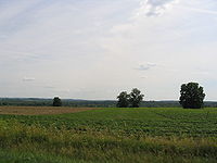
Geography
According to the United States Census BureauUnited States Census Bureau
The United States Census Bureau is the government agency that is responsible for the United States Census. It also gathers other national demographic and economic data...
, the town has a total area of 64.6 square miles (167.3 km²), of which, 61.9 square miles (160.3 km²) of it is land and 2.7 square miles (7 km²) of it (4.18%) is water.
The north town line is the border of Oswego County
Oswego County, New York
Oswego County is a county located in the U.S. state of New York. As of the 2010 Census, the estimated population was 122,109. The City of Oswego and the Village of Pulaski serve as the dual county seats in a two shire system of government...
and the west town line is the border of Cayuga County
Cayuga County, New York
Cayuga County is a county located in the U.S. state of New York. It was named for one of the tribes of Indians in the Iroquois Confederation. Its county seat is Auburn.- History :...
. The south town line is defined by the Erie Canal
Erie Canal
The Erie Canal is a waterway in New York that runs about from Albany, New York, on the Hudson River to Buffalo, New York, at Lake Erie, completing a navigable water route from the Atlantic Ocean to the Great Lakes. The canal contains 36 locks and encompasses a total elevation differential of...
-Seneca River
Seneca River (New York)
The Seneca River in central New York flows from west to east, from Seneca Lake, through the Montezuma Marsh at the north end of Cayuga Lake to the Seneca's confluence with the Oneida and Oswego rivers at the Three Rivers area north of Syracuse. Much of the river has been channelized to form part...
complex. Cross Lake is located on the west border of Lysander. The Oswego River
Oswego River (New York)
The Oswego River is a river in upstate New York in the United States. This river is the second-largest river flowing into Lake Ontario. James Fenimore Cooper’s novel The Pathfinder, or The Inland Sea is set in the Oswego River valley...
marks part of the east town line. The Oswego, Seneca, and Oneida
Oneida River
The Oneida River in central New York state flows from Oneida Lake to its confluence with the Seneca and Oswego rivers. The Oswego empties the water of the other two rivers into Lake Ontario....
Rivers join at the east town line.
New York State Route 370
New York State Route 370 is an east–west state highway in central New York in the United States. It extends for from an intersection with NY 104 and NY 104A south of the Wayne County village of Red Creek to a junction with U.S. Route 11 in the Onondaga County city of Syracuse...
, West Genesee Road, is an east-west highway in the south part of Lysander. New York State Route 48
New York State Route 48
New York State Route 48 is a north–south state highway in Central New York in the United States. The southern terminus of the route is located at Interstate 690 exit 3 near the interchange between I-690 and the New York State Thruway in Van Buren, northwest of Syracuse...
is a highway in the center of the town. New York State Route 31
New York State Route 31
New York State Route 31 is a state highway that extends for across western and central New York in the United States. The western terminus of the route is at an intersection with NY 104 in the city of Niagara Falls. Its eastern terminus is at a traffic circle with NY 26 in Vernon...
intersects NY-370 in the southeast part of Lysander. New York State Route 690
New York State Route 690
New York State Route 690 is a state highway in Central New York. NY 690's southern terminus is at an interchange with the New York State Thruway and Interstate 690 in Van Buren. The northern terminus is at an intersection with NY 48 and NY 631 in Lysander...
is a major highway leading out of the south part of Lysander.
Demographics
As of the censusCensus
A census is the procedure of systematically acquiring and recording information about the members of a given population. It is a regularly occurring and official count of a particular population. The term is used mostly in connection with national population and housing censuses; other common...
of 2000, there were 19,285 people, 7,139 households, and 5,404 families residing in the town. The population density
Population density
Population density is a measurement of population per unit area or unit volume. It is frequently applied to living organisms, and particularly to humans...
was 311.5 people per square mile (120.3/km²). There were 7,448 housing units at an average density of 120.3 per square mile (46.4/km²). The racial makeup of the town was 96.89% White, 0.73% African American, 0.29% Native American, 1.00% Asian, 0.02% Pacific Islander, 0.24% from other races
Race (United States Census)
Race and ethnicity in the United States Census, as defined by the Federal Office of Management and Budget and the United States Census Bureau, are self-identification data items in which residents choose the race or races with which they most closely identify, and indicate whether or not they are...
, and 0.82% from two or more races. Hispanic or Latino of any race were 0.78% of the population.
Marriage
Marriage is a social union or legal contract between people that creates kinship. It is an institution in which interpersonal relationships, usually intimate and sexual, are acknowledged in a variety of ways, depending on the culture or subculture in which it is found...
living together, 7.9% had a female householder with no husband present, and 24.3% were non-families. 19.9% of all households were made up of individuals and 7.7% had someone living alone who was 65 years of age or older. The average household size was 2.70 and the average family size was 3.12.
In the town the population was spread out with 28.8% under the age of 18, 5.5% from 18 to 24, 30.0% from 25 to 44, 25.4% from 45 to 64, and 10.3% who were 65 years of age or older. The median age was 38 years. For every 100 females there were 97.7 males. For every 100 females age 18 and over, there were 93.3 males.
The median income for a household in the town was $59,128, and the median income for a family was $67,539. Males had a median income of $47,057 versus $29,164 for females. The per capita income
Per capita income
Per capita income or income per person is a measure of mean income within an economic aggregate, such as a country or city. It is calculated by taking a measure of all sources of income in the aggregate and dividing it by the total population...
for the town was $26,187. About 2.5% of families and 3.8% of the population were below the poverty line, including 3.5% of those under age 18 and 5.2% of those age 65 or over.
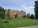
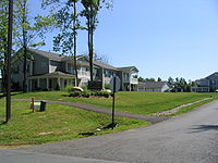
Communities and locations in Lysander
- Baird Corners – A hamletHamlet (place)A hamlet is usually a rural settlement which is too small to be considered a village, though sometimes the word is used for a different sort of community. Historically, when a hamlet became large enough to justify building a church, it was then classified as a village...
in the northwest part of the town on Plainville Rd, a continuation of Oswego County Road 8 - BaldwinsvilleBaldwinsville, New YorkBaldwinsville is a village in Onondaga County, New York, United States. The population was 7,053 at the 2000 census. It is part of the Syracuse Metropolitan Statistical Area....
– The north part of the Village of Baldwinsville is in the south part of the town, and is divided by the Seneca River/Erie Canal. - Belgium – A hamlet by the east town line on NY-31.
- Cold Springs – A hamlet in the southeast part of town on NY-370.
- Jacksonville – A hamlet in the north part of the town.
- Jack's ReefJack's Reef, New YorkJack's Reef is a hamlet in the Town of Van Buren, New York in Onondaga County, New York. It was developed around an inn, extant today as a restaurant, where Old Route 31 bent around a large oxbow in the Seneca River. Subsequently a canal was cut about a mile to the north, which shortened the...
– A hamlet in the south west part of town along the Seneca River. This hamlet is trisected with the towns of Lysander, Elbridge and Van Buren. - Hortontown – A farm in the central part of the town.
- Lamson – A hamlet in the north part of the town.
- Little Utica – A hamlet in the north part of the town.
- Lysander – The hamlet of Lysander near the west town line on Plainville Rd, a continuation of Oswego County Road 8
- Beaver Lake – A lakeLakeA lake is a body of relatively still fresh or salt water of considerable size, localized in a basin, that is surrounded by land. Lakes are inland and not part of the ocean and therefore are distinct from lagoons, and are larger and deeper than ponds. Lakes can be contrasted with rivers or streams,...
west of Hortontown. - PlainvillePlainville, New YorkPlainville is a hamlet on NY Route 370 about 4.5 miles west of Baldwinsville in Onondaga County, New York.It is noted for the extensive Plainville Turkey Farms, which remained in the same family from 1835 until recently...
– A hamlet in the southwest part of the town on NY-370. - Radisson – A hamlet, and "planned community", in the eastern part of the town.
- Red Rock – A hamlet in the southeast part of town along the Seneca River/Erie Canal.
- Seneca Estates – An upscale neighborhood of about 120 homes adjacent to Rt. 370 and the Seneca River, 2 miles (3.2 km) west of the Village of Baldwinsville. The only neighborhood in the town with its own private marina, boat launch, fuel station and head pump-out facility.
- West Phoenix – A hamlet in the northeast corner of Lysander.
- Wrights Corners – A location east of Lamson, located on NY-48.