

Los Llanos de Aridane
Encyclopedia
| Los Llanos de Aridane | |
| Map | |
|---|---|
 |
|
| Statistics | |
| Autonomous region: | Canary Islands Canary Islands The Canary Islands , also known as the Canaries , is a Spanish archipelago located just off the northwest coast of mainland Africa, 100 km west of the border between Morocco and the Western Sahara. The Canaries are a Spanish autonomous community and an outermost region of the European Union... |
| Province: | Santa Cruz de Tenerife Santa Cruz de Tenerife (province) Province of Santa Cruz de Tenerife also Province of Santa Cruz is a province of Spain, consisting of the western part of the autonomous community of the Canary Islands. It consists of about half of the Atlantic archipelago, including the islands of Tenerife, La Gomera, El Hierro, and La Palma, and... |
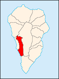
| Island: | La Palma La Palma La Palma is the most north-westerly of the Canary Islands. La Palma has an area of 706 km2 making it the fifth largest of the seven main Canary Islands... |
| Area Area Area is a quantity that expresses the extent of a two-dimensional surface or shape in the plane. Area can be understood as the amount of material with a given thickness that would be necessary to fashion a model of the shape, or the amount of paint necessary to cover the surface with a single coat... : |
35.79 km², some reads 35.68 km² |
| Population Population A population is all the organisms that both belong to the same group or species and live in the same geographical area. The area that is used to define a sexual population is such that inter-breeding is possible between any pair within the area and more probable than cross-breeding with individuals... : |
19,659 (2004) |
| Population density Population density Population density is a measurement of population per unit area or unit volume. It is frequently applied to living organisms, and particularly to humans... : |
550.98/km² |
| Length of coastline | 6.43 km |
| Elevation Elevation The elevation of a geographic location is its height above a fixed reference point, most commonly a reference geoid, a mathematical model of the Earth's sea level as an equipotential gravitational surface .... : Lowest: Centre: Highest: |
Atlantic Ocean Atlantic Ocean The Atlantic Ocean is the second-largest of the world's oceanic divisions. With a total area of about , it covers approximately 20% of the Earth's surface and about 26% of its water surface area... 350 m valley to the north |
| Postal code: | E-38760 |
| Location Geographic coordinate system A geographic coordinate system is a coordinate system that enables every location on the Earth to be specified by a set of numbers. The coordinates are often chosen such that one of the numbers represent vertical position, and two or three of the numbers represent horizontal position... : |
28.62433/28°39'32" N lat. 17.932833/17°55'59" W long. |
| Municipal code: | E-38024 |
| Car designation: | TF |
| Politics | |
| Mayor Mayor In many countries, a Mayor is the highest ranking officer in the municipal government of a town or a large urban city.... : |
Juan Ramón Hernández Gómez (CC Canarian Coalition The Canarian Coalition , abbreviated to CC, is a Canarian nationalist and liberal political party in the Canary Islands of Spain. The party aim is for greater autonomy for the islands, but short of independence. The party has governed the Canary Islands since 1993... ) |
Los Llanos de Aridane is both a municipality and a town in the Canary Islands
Canary Islands
The Canary Islands , also known as the Canaries , is a Spanish archipelago located just off the northwest coast of mainland Africa, 100 km west of the border between Morocco and the Western Sahara. The Canaries are a Spanish autonomous community and an outermost region of the European Union...
in the west-central part of the island of La Palma
La Palma
La Palma is the most north-westerly of the Canary Islands. La Palma has an area of 706 km2 making it the fifth largest of the seven main Canary Islands...
in the province of Santa Cruz de Tenerife
Santa Cruz de Tenerife (province)
Province of Santa Cruz de Tenerife also Province of Santa Cruz is a province of Spain, consisting of the western part of the autonomous community of the Canary Islands. It consists of about half of the Atlantic archipelago, including the islands of Tenerife, La Gomera, El Hierro, and La Palma, and...
. The population is 19,659 (ISTAC, 2004), its density is 54.91/km² and the area is 31.1 km². The postcode is 38760.
Los Llanos de Aridane, whose origin dates back to before the Spanish conquest, is the most populated municipality on La Palma. In the early-2000s, the town grew to be larger than the capital Santa Cruz de La Palma
Santa Cruz de La Palma
Santa Cruz de la Palma is located on the eastern part of the island of La Palma in the province of Santa Cruz de Tenerife of the Canary Islands. Santa Cruz de la Palma is the second largest city and is the capital of the island...
and became the only municipality in the Canary Islands to be larger than the local island capital in population. Los Llanos de Aridane is linked with the highway that encircles the whole island, and also to El Paso
El Paso
El Paso, a city in the U.S. state of Texas, on the border with Mexico.El Paso may also refer to:-Geography:Colombia:* El Paso, CesarSpain:*El Paso, Santa Cruz de TenerifeUnited States:...
and Santa Cruz de La Palma, and is located west of Santa Cruz de La Palma and the La Palma Airport
La Palma Airport
La Palma Airport is an airport located in Breña Baja and Villa de Mazo, south of the city of Santa Cruz de La Palma on La Palma in the Canary Islands. It is operated by Aeropuertos Españoles y Navegación Aérea, who operate the vast majority of civil airports in Spain...
.
The elevation of the town is 400 m. The elevation of the municipality varies from sea level at Puerto Naos to 600 m near Las Manchas. Banana
Banana
Banana is the common name for herbaceous plants of the genus Musa and for the fruit they produce. Bananas come in a variety of sizes and colors when ripe, including yellow, purple, and red....
plantations dominate the areas below 300 m. The vegetation is largely cactus
Cactus
A cactus is a member of the plant family Cactaceae. Their distinctive appearance is a result of adaptations to conserve water in dry and/or hot environments. In most species, the stem has evolved to become photosynthetic and succulent, while the leaves have evolved into spines...
due to the lava ground and lack of rainfall in the Valle de Aridane. The majority of the population is rural.
Subdivisions
- Los Llanos
- Argual
- La Laguna
- Todoque
- Las Manchas
- Puerto Naos
- Triana
- El Roque
- El Remo
Historical population
| Year | Population | Change | Density |
|---|---|---|---|
| 1991 | 16,189 | - | - |
| 1996 | 17,994 | - | - |
| 2001 | 17,720 | - | 492.22/km² |
| 2002 | 20,238 | - | - |
| 2003 | 20,001 | - | 558.84/km² |
| 2004 | 19,659 | - | 550.98/km² |
The population between 1991 and 1996 sprouted but cooled off in the 1997 census and reached over 20,000 in the 2000s and surpassed Santa Cruz de La Palma's population being La Palma the only island in the Canary Islands in which there is a larger town than its capital city. Los Llanos de Aridane has a density over 500 inhabitants/km², formerly the second, but after 2001, the population slowly declined and after 2003 dropped below 20,000.
Other
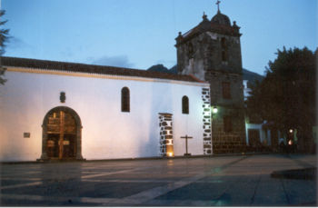
Los Llanos de Aridane schools, lyceums (middle school), gymnasia (secondary school), churches, a post office, shops and squares plazaPlaza
Plaza is a Spanish word related to "field" which describes an open urban public space, such as a city square. All through Spanish America, the plaza mayor of each center of administration held three closely related institutions: the cathedral, the cabildo or administrative center, which might be...
s.
External links
- Map and aerial photos
- Street map: Street map from Mapquest, MapPoint or http://maps.google.com/maps?||=28.633,-17.8833Google
- Satellite images: Google
- Coordinates: 28°39′32"N 17°54′59"W
See also
- La PalmaLa PalmaLa Palma is the most north-westerly of the Canary Islands. La Palma has an area of 706 km2 making it the fifth largest of the seven main Canary Islands...
- List of municipalities in Santa Cruz de Tenerife