
List of wettest tropical cyclones by country
Encyclopedia
This is a list of wettest tropical cyclones by country, using all known available sources. Data is most complete for Australia
, Cuba
, the Dominican Republic
, Japan
, Hong Kong
, Mexico
, Taiwan
, Yap, Chuuk, and the United States
, with fragmentary data available for other countries. The French region of Réunion
holds several world records for tropical cyclone rainfall, due to the rough topography and its proximity to the Indian ocean.

Antigua
Barbuda
Australia
 Bangladesh
has been the scene of the greatest tropical cyclone casualties in recent times. The country is quite flat and generally lies near sea level.
in 2000 when 32.67 inches (829.8 mm) of rain fell in a 24 hour period at Phillip Goodson International Airport in Belize City
. It should be noted that equally heavy rains could have fallen during Hurricane Hattie
of 1961 and Hurricane Fifi
of 1974.

.jpg)
 Tropical cyclones are usually in transition to extratropical cyclone
s by the time they reach Atlantic Canada
, though occasionally they retain their tropical status. No tropical cyclone has ever hit Canada's Pacific coast.
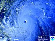
caused the collapse of two huge reservoirs and ten smaller dams when 1062 millimetres (41.8 in) fell in Henan Province during a 24 hour period, which is the record for Mainland China. Typhoon Sam of the 1999 Pacific typhoon season
became the wettest known tropical cyclone to impact Hong Kong since records began in 1884, breaking a 73 year old record. Precipitation associated with tropical cyclones and their remains can bring snow to Tibet
. An early October 2004 tropical depression brought daily precipitation of 6 centimetres (2.4 in) of liquid equivalent precipitation to Che-Ku county in the form of heavy snow, which was a new October daily precipitation record for both rain and snow. This led to a loss of 340,000 kg of food, 230,000 kg of forage grass, and 263 livestock in the snowstorm.

of October 1963 drifted across Cuba
for four days, leading to extreme rainfall across the mountainous island country. During the heaviest 24 hour period of rainfall, 735 millimetres (28.9 in) of rain fell at Santiago de Cuba
. Total amounts of 2033 millimetres (80 in) over 4 days and 2550 millimetres (100.4 in) over 5 days produced staggering loss of life in Cuba, where over 2000 perished.

Dominica
 The islands of the eastern Caribbean
are constantly threatened by tropical storms and hurricanes, mainly between August and October. Dominica is a rugged island, with spots of elevation as high as nearly 4750 feet (1,447.8 m). As Hurricane Jeanne
moved through the region, 422.3 millimetres (16.6 in) of rain fell during the 24 hour period ending on the morning of September 15, 2004.
 This country, taking up two-thirds of Hispaniola, has some of the highest terrain surrounding the Caribbean Sea
, with Pico Duarte peaking at 10700 feet (3,261.4 m) above sea level. Most of the tropical cyclone rainfall totals on the list below are 24 hour maxima, which likely underrepresent the storm total.
led to excessive rainfall on this island from June 23-July 3 of 2002, when a total of 939 mm/36.96 inches fell. During the time frame when Chataan was declared a tropical cyclone from July 1–3, 622 mm/24.49 inches fell, with 506 mm/19.92 inches falling on the 2nd alone at the international airport.
.jpg)
.
from the volcanic islands of Fiji
has led to significant rainfall during tropical cyclone passages, which occur roughly once a year. Tropical Cyclone Ami of January 2003 led to disastrous flooding across the northern and eastern sections of the island group. The coastal side of Vatuwiri on Taveuni Island measured 311 mm/12.24" of rainfall on January 13.

.
.jpg)
 The mountainous island of Réunion has experienced some of the highest rainfall totals from tropical cyclones around the world. Three tropical cyclones have staked their place in rainfall history:
Unnamed Tropical Cyclone (April 8–10, 1958): World record for 48 hours (2467 millimetres (97.1 in)) set at Aurere.
Tropical Cyclone Denise (January 7–8, 1966): World record for 12 hours (1144 millimetres (45 in)) and 24 hours (1825 millimetres (71.9 in)) set at Foc-Foc.
Tropical Cyclone Gamede
(February 24–28, 2007): World record for 72 hours (3929 millimetres (154.7 in)) set at Commerson Crater. Gamede also holds the world record for accumulated rainfall through nine days.
During late January 2002, Tropical Cyclone Dinah dropped significant rains on the island. The highest amounts were 1360 millimetres (53.5 in) over a 48 hour period at the Bellecombe resting place (a volcano lodge) and a 745.2 millimetres (29.3 in) storm total at Pierrefonds.
Anguilla
.jpg)
has not historically received overwhelming rains out of tropical cyclones. This could be because of the rapid pace storms usually pass the island and the lack of mountains on the island.
Cayman Islands
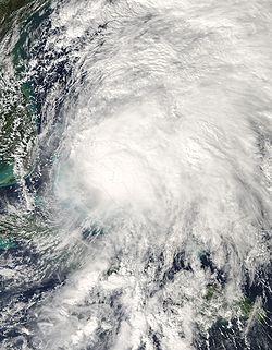
became the second-wettest tropical cyclone in the nation's history when it slowly developed while remaining nearly stationary to the southwest of Guatemala, before turning northeast and dissipating across inland Central America.
has experienced some of the most powerful hurricanes on record, including Hurricane David
. Its three mountain ranges have peaks as high as 8793 feet/2680 meters above sea level.


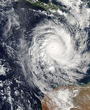
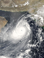
_26_november_2008_at_0525_utc.jpg) India
India
can be struck by cyclones that form in the Bay of Bengal or the Arabian Sea.
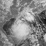
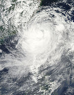
 The precursor tropical disturbance of Tropical Cyclone Inigo
in April 2003 dropped heavy rainfall in eastern Indonesia
. The rainfall caused flash flood
ing and mudslides, primarily in Flores but also on West Timor
and Sumba
. In some locations, the depth of the floodwaters reached 5 metres (16.4 ft). The Oessao River in West Timor
exceeded its banks, which flooded seven villages. In Kupang
in West Timor, the system destroyed hundreds of homes and large fields of corn, bean, and rice crop. Heavy damage was reported near Ende
, where flooding and mudslides destroyed 20 houses and destroyed the roads connecting to East Flores. The city airport was flooded with one meter (3 ft) of water, preventing aerial transportation and which left the city temporarily isolated. In East Flores Regency
in eastern Flores Island, the system left 75 destroyed houses, along with 77 severely damaged and a further 56 receiving light damage.
This mountainous island country of Jamaica
can get lashed with rainfall by slow-moving tropical cyclones in the western Caribbean Sea. Its interior, the Blue Mountains, reach a height of 7400 feet (2,255.5 m) above sea level.
holds the national 24-hour precipitation record of 1174 millimetres (46.2 in).
Ryukyu Islands
Typhoon Rusa
caused 409 millimetres (16.1 in) of rain to fall at Naze on August 29–30, 2002. Typhoon Aere dropped 314.5 millimetres (12.4 in) of rain in the 65 hour period ending at 1400 UTC on August 25 at Ishigakihima. Typhoon Agnes in August 1957 dropped 586.2 millimetres (23.1 in) of rainfall on Marcus Island.
Johnston Atoll
Tropical cyclones occasionally threaten this central Pacific island. Hurricane Celeste of 1972 brought 6.21 inches (157.7 mm) to the isle around August 19.
Korea
The Korean Peninsula
experiences typhoons regularly. Tropical cyclones which impact southern China also lead to, on average, five heavy rainfall events per year across the Korean peninsula.
in 2002, where up to 510 millimetres (20.1 in) of precipitation fell in a 5-10 hour period.
South Korea

 The north end of the island, known as the Tsaratanana Massif region, contains terrain with elevations up to 9417 feet/2880 meters.
Mauritius
of 2005 drifted over the northeast portion of the Yucatán peninsula for a couple of days, dropping significant rains. A report of 1576 millimetres (62 in) was reported by the Servicio Meteorológicio Nacional in Mexico
, which is the wettest known 24-hour rainfall amount ever measured in Mexico. Second on the list is from Tropical Storm Frances
in 1998, which accumulated up to 1019 millimetres (40.1 in) of rain at Independencia in southern Chiapas
. Below is a list of the highest known storm total rainfall amounts from individual tropical cyclones across Mexico. Most of the rainfall information was provided by the Mexico's National Weather Service, Servicio Meteorológico Nacional
, which is a part of the National Water Commission, Comisión Nacional del Agua.

 The elevation of the country increases to the west, with mountains on its highest plateau reaching nearly 8000 feet (2,438.4 m).
Myanmar
Nepal
Some of the highest elevations on the planet lie in Nepal. Eight out of fourteen highest peaks in the world lie in the Nepalese Himalaya including the highest peak of the World, Mt. Everest (8848 m). During a tropical depression that affected the Indian Subcontinent in 2004, 51.3 millimetres (2 in) of rain fell at Kathmandu airport in the 24 hour period ending at 1200 UTC on October 7.
St. Martin
This hilly island is partially owned by France
and partially claimed by the Netherlands
.
 Most tropical cyclones which pass near New Zealand
are in extratropical transition (ET), which can enhance their heavy rainfall threat.
Nicaragua
Niue
 During the passage of Tropical Cyclone Heta in January 2004, the Niue Meteorological Station reported a record 24-hour rainfall of 999.2 millimetres (39.3 in).
Oman

Pakistan
Tropical cyclones from the Arabian Sea
wander into Pakistan
as well. Though cyclones weakens by the time it reaches Pakistani coastline.
 Palau
Palau
consists of a string of islands that is rugged and surrounds a lagoon. Elevations up to 2060 feet (627.9 m) exist within the island group.
brought impressive rainfalls to the Panama
. Veledero de Tole recorded 695 millimetres (27.4 in) of rainfall between October 22 and October 31 of 1998.
 This Philippines
island archipelago is fairly mountainous, with the highest terrain found in Luzon.
. The highest amount noted was 480 mm/18.90" at Thohoyandou.
. It dropped 3.3 inches (83.8 mm) of rain on the plain near Cordoba.
. The maximum was measured at Galle where 117.2 mm/4.61" fell in the 24 hour period ending at 0600 UTC on the 2nd.
Nevis
 Tropical cyclones occasionally cross the Malay Peninsula
from the northwest Pacific into the Bay of Bengal.
led to the wettest storm total rainfall amounts of any tropical cyclone to impact the lower 48 over that time frame when it moved into Texas during early August 1978. Most of the rainfall information was provided by the National Climatic Data Center
in Asheville, North Carolina
.
_flooding.jpg)

has seen dramatic rainfall from tropical cyclones and their precursor disturbances. The most recent tropical cyclone-related deluge was from Hurricane Georges
from September 1998, when 775 mm/30.51 inches of rain was measured at Jayuya. The heaviest rainfall noted over the past 30 years was from the precursor disturbance to Tropical Storm Isabel (1985)
, when 804 mm/31.67 inches fell at Toro Negro Forest. Hurricane Eloise
of 1975 dropped 946 mm/33.29 inches of rainfall at Dos Bocas, with 586 mm/23.07 inches falling in 24 hours. Below is a list of the top ten highest known storm total rainfall amounts from individual tropical cyclones across Puerto Rico since 1960. The rainfall information was gathered from the National Climatic Data Center
in Asheville, North Carolina
.

 The Northern Marianas Islands are an archipelago north of Guam which get impacted by typhoons in the western Pacific on a regular basis. Typhoon Steve dropped nearly 20 inches (508 mm) on Saipan in 1993, making it the wettest known tropical cyclone for the island chain.
Tropical cyclones impact the island chain with tropical storm-force winds once every three years, on average.
Tropical cyclone Ivy in February 2004 led to 254.4 mm/10" of rain at Bauerfield on the 26th.
dropped 339 millimetres (13.3 in) of rain in ten hours at Guanare
, Portuguesa
, Venezuela
.
Australia
Australia , officially the Commonwealth of Australia, is a country in the Southern Hemisphere comprising the mainland of the Australian continent, the island of Tasmania, and numerous smaller islands in the Indian and Pacific Oceans. It is the world's sixth-largest country by total area...
, Cuba
Cuba
The Republic of Cuba is an island nation in the Caribbean. The nation of Cuba consists of the main island of Cuba, the Isla de la Juventud, and several archipelagos. Havana is the largest city in Cuba and the country's capital. Santiago de Cuba is the second largest city...
, the Dominican Republic
Dominican Republic
The Dominican Republic is a nation on the island of La Hispaniola, part of the Greater Antilles archipelago in the Caribbean region. The western third of the island is occupied by the nation of Haiti, making Hispaniola one of two Caribbean islands that are shared by two countries...
, Japan
Japan
Japan is an island nation in East Asia. Located in the Pacific Ocean, it lies to the east of the Sea of Japan, China, North Korea, South Korea and Russia, stretching from the Sea of Okhotsk in the north to the East China Sea and Taiwan in the south...
, Hong Kong
Hong Kong
Hong Kong is one of two Special Administrative Regions of the People's Republic of China , the other being Macau. A city-state situated on China's south coast and enclosed by the Pearl River Delta and South China Sea, it is renowned for its expansive skyline and deep natural harbour...
, Mexico
Mexico
The United Mexican States , commonly known as Mexico , is a federal constitutional republic in North America. It is bordered on the north by the United States; on the south and west by the Pacific Ocean; on the southeast by Guatemala, Belize, and the Caribbean Sea; and on the east by the Gulf of...
, Taiwan
Taiwan
Taiwan , also known, especially in the past, as Formosa , is the largest island of the same-named island group of East Asia in the western Pacific Ocean and located off the southeastern coast of mainland China. The island forms over 99% of the current territory of the Republic of China following...
, Yap, Chuuk, and the United States
United States
The United States of America is a federal constitutional republic comprising fifty states and a federal district...
, with fragmentary data available for other countries. The French region of Réunion
Réunion
Réunion is a French island with a population of about 800,000 located in the Indian Ocean, east of Madagascar, about south west of Mauritius, the nearest island.Administratively, Réunion is one of the overseas departments of France...
holds several world records for tropical cyclone rainfall, due to the rough topography and its proximity to the Indian ocean.
AntiguaAntiguaAntigua , also known as Waladli, is an island in the West Indies, in the Leeward Islands in the Caribbean region, the main island of the country of Antigua and Barbuda. Antigua means "ancient" in Spanish and was named by Christopher Columbus after an icon in Seville Cathedral, Santa Maria de la...
BarbudaBarbudaBarbuda is an island in the Eastern Caribbean, and forms part of the state of Antigua and Barbuda. It has a population of about 1,500, most of whom live in the town of Codrington.-Location:...
| Wettest tropical cyclones in Barbuda Highest known recorded totals |
||||
|---|---|---|---|---|
| Precipitation | Storm | Measurement station |
||
| Rank | (mm Millimetre The millimetre is a unit of length in the metric system, equal to one thousandth of a metre, which is the SI base unit of length.... ) |
(in Inch An inch is the name of a unit of length in a number of different systems, including Imperial units, and United States customary units. There are 36 inches in a yard and 12 inches in a foot... ) |
||
| 1 | 152.4 mm | 6.00 inches | Omar 2008 Hurricane Omar (2008) Hurricane Omar was a strong hurricane that took an unusual southwest to northeast track through the eastern Caribbean Sea during October, 2008. Forming out of a tropical disturbance on October 13, Omar initially moved slowly in the eastern Caribbean Sea. By October 15, Omar began to... |
|
| 2 | 74.9 mm | 2.95 inches | Alice 1954 | |
AustraliaAustraliaAustralia , officially the Commonwealth of Australia, is a country in the Southern Hemisphere comprising the mainland of the Australian continent, the island of Tasmania, and numerous smaller islands in the Indian and Pacific Oceans. It is the world's sixth-largest country by total area...
Christmas Island
| Wettest known tropical cyclones in Christmas Island |
||||
|---|---|---|---|---|
| Precipitation | Storm | Location | ||
| Rank | (mm Millimetre The millimetre is a unit of length in the metric system, equal to one thousandth of a metre, which is the SI base unit of length.... ) |
(in Inch An inch is the name of a unit of length in a number of different systems, including Imperial units, and United States customary units. There are 36 inches in a yard and 12 inches in a foot... ) |
||
| 1 | 102.4 mm | 4.03 inches | Jacob 2007 | |
Cocos Islands
| Wettest known tropical cyclones in the Cocos Islands |
||||
|---|---|---|---|---|
| Precipitation | Storm | Location | ||
| Rank | (mm Millimetre The millimetre is a unit of length in the metric system, equal to one thousandth of a metre, which is the SI base unit of length.... ) |
(in Inch An inch is the name of a unit of length in a number of different systems, including Imperial units, and United States customary units. There are 36 inches in a yard and 12 inches in a foot... ) |
||
| 1 | 298.0 mm | 11.73 inches | Pedro 1989 | |
Bahamas
Bangladesh
Bangladesh
Bangladesh , officially the People's Republic of Bangladesh is a sovereign state located in South Asia. It is bordered by India on all sides except for a small border with Burma to the far southeast and by the Bay of Bengal to the south...
has been the scene of the greatest tropical cyclone casualties in recent times. The country is quite flat and generally lies near sea level.
Belize
This country has terrain mainly across its southern sections, with elevations up to about 3700 feet (1,127.8 m). The highest reported rainfall in what was formerly British Honduras occurred during Hurricane KeithHurricane Keith
Hurricane Keith caused extensive damage in Central America, especially in Mexico and Belize. The fifteenth tropical cyclone, eleventh named storm, and seventh hurricane of the 2000 Atlantic hurricane season, Keith developed as a tropical depression from a tropical wave in the western Caribbean Sea...
in 2000 when 32.67 inches (829.8 mm) of rain fell in a 24 hour period at Phillip Goodson International Airport in Belize City
Belize City
Belize City is the largest city in the Central American nation of Belize. Unofficial estimates place the population of Belize City at 70,000 or more. It is located at the mouth of the Belize River on the coast of the Caribbean. The city is the country's principal port and its financial and...
. It should be noted that equally heavy rains could have fallen during Hurricane Hattie
Hurricane Hattie
Hurricane Hattie was the deadliest tropical cyclone of the 1961 Atlantic hurricane season, as well as the strongest, reaching a peak intensity equivalent to Category 5 hurricane intensity...
of 1961 and Hurricane Fifi
Hurricane Fifi
Hurricane Fifi was a catastrophic tropical cyclone that killed between 3,000 and 10,000 people in Honduras in September 1974, ranking it as the fourth deadliest Atlantic hurricane on record. Originating from a strong tropical wave on September 14, the system steadily tracked...
of 1974.
Cambodia
Canada
Extratropical cyclone
Extratropical cyclones, sometimes called mid-latitude cyclones or wave cyclones, are a group of cyclones defined as synoptic scale low pressure weather systems that occur in the middle latitudes of the Earth having neither tropical nor polar characteristics, and are connected with fronts and...
s by the time they reach Atlantic Canada
Atlantic Canada
Atlantic Canada is the region of Canada comprising the four provinces located on the Atlantic coast, excluding Quebec: the three Maritime provinces – New Brunswick, Prince Edward Island, and Nova Scotia – and Newfoundland and Labrador...
, though occasionally they retain their tropical status. No tropical cyclone has ever hit Canada's Pacific coast.
China
China is a mountainous country, which leads to rapid dissipation of cyclones that move inland as well as significant amounts of rain from those dissipating cyclones. Typhoon Nina (1975)Typhoon Nina (1975)
Super Typhoon Nina was a short-lived but intense super typhoon that caused catastrophic damage and loss of life in China after causing the Banqiao Dam to collapse...
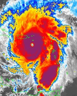
caused the collapse of two huge reservoirs and ten smaller dams when 1062 millimetres (41.8 in) fell in Henan Province during a 24 hour period, which is the record for Mainland China. Typhoon Sam of the 1999 Pacific typhoon season
1999 Pacific typhoon season
The 1999 Pacific typhoon season has no official bounds; it ran year-round in 1999, but most tropical cyclones tend to form in the northwestern Pacific Ocean between May and November...
became the wettest known tropical cyclone to impact Hong Kong since records began in 1884, breaking a 73 year old record. Precipitation associated with tropical cyclones and their remains can bring snow to Tibet
Tibet
Tibet is a plateau region in Asia, north-east of the Himalayas. It is the traditional homeland of the Tibetan people as well as some other ethnic groups such as Monpas, Qiang, and Lhobas, and is now also inhabited by considerable numbers of Han and Hui people...
. An early October 2004 tropical depression brought daily precipitation of 6 centimetres (2.4 in) of liquid equivalent precipitation to Che-Ku county in the form of heavy snow, which was a new October daily precipitation record for both rain and snow. This led to a loss of 340,000 kg of food, 230,000 kg of forage grass, and 263 livestock in the snowstorm.
Mainland
Lantau Island
| Wettest tropical cyclones in Lantau Island Highest known recorded totals |
||||
|---|---|---|---|---|
| Precipitation | Storm | Location | ||
| Rank | (mm Millimetre The millimetre is a unit of length in the metric system, equal to one thousandth of a metre, which is the SI base unit of length.... ) |
(in Inch An inch is the name of a unit of length in a number of different systems, including Imperial units, and United States customary units. There are 36 inches in a yard and 12 inches in a foot... ) |
||
| 1 | 700 mm | 27.56 inches | Ira 1993 | |
Costa Rica
| Wettest known tropical cyclones in Costa Rica |
||||
|---|---|---|---|---|
| Precipitation | Storm | Location | ||
| Rank | (mm Millimetre The millimetre is a unit of length in the metric system, equal to one thousandth of a metre, which is the SI base unit of length.... ) |
(in Inch An inch is the name of a unit of length in a number of different systems, including Imperial units, and United States customary units. There are 36 inches in a yard and 12 inches in a foot... ) |
||
| 1 | 920.0 mm | 36.22 inches | Cesar 1996 | Alto de Tinamaste |
| 2 | 376.4 mm | 14.82 inches | Alma 2008 Tropical Storm Alma Tropical Storm Alma of the 2008 Pacific hurricane season was the easternmost forming Pacific tropical cyclone on record and the first tropical storm on record to strike the Pacific coast of Nicaragua. In the spring of 2009, the WMO retired the name Alma and replaced it with Amanda for use in the... |
Quepos |
| 3 | 331.5 mm | 13.05 inches | Gert 1993 Hurricane Gert (1993) Hurricane Gert was a large tropical cyclone that caused heavy flood damage and many deaths throughout Central America and Mexico in September 1993. The seventh named storm and third hurricane of the annual hurricane season, Gert originated from a tropical wave over the southwestern Caribbean... |
Unknown |
| 4 | 170.9 mm | 6.73 inches | Mitch 1998 Hurricane Mitch Hurricane Mitch was the most powerful hurricane and the most destructive of the 1998 Atlantic hurricane season, with maximum sustained winds of 180 mph . The storm was the thirteenth tropical storm, ninth hurricane, and third major hurricane of the season. Along with Hurricane Georges, Mitch... |
San Jose/Santamaria |
Cuba
Hurricane FloraHurricane Flora
Hurricane Flora is among the deadliest Atlantic hurricanes in recorded history, with a death total of over 7,000. The seventh tropical storm and sixth hurricane of the 1963 Atlantic hurricane season, Flora developed from a disturbance in the Intertropical Convergence Zone on September 26 while...
of October 1963 drifted across Cuba
Cuba
The Republic of Cuba is an island nation in the Caribbean. The nation of Cuba consists of the main island of Cuba, the Isla de la Juventud, and several archipelagos. Havana is the largest city in Cuba and the country's capital. Santiago de Cuba is the second largest city...
for four days, leading to extreme rainfall across the mountainous island country. During the heaviest 24 hour period of rainfall, 735 millimetres (28.9 in) of rain fell at Santiago de Cuba
Santiago de Cuba
Santiago de Cuba is the second largest city of Cuba and capital city of Santiago de Cuba Province in the south-eastern area of the island, some south-east of the Cuban capital of Havana....
. Total amounts of 2033 millimetres (80 in) over 4 days and 2550 millimetres (100.4 in) over 5 days produced staggering loss of life in Cuba, where over 2000 perished.
DominicaDominicaDominica , officially the Commonwealth of Dominica, is an island nation in the Lesser Antilles region of the Caribbean Sea, south-southeast of Guadeloupe and northwest of Martinique. Its size is and the highest point in the country is Morne Diablotins, which has an elevation of . The Commonwealth...
, Eastern CaribbeanCaribbeanThe Caribbean is a crescent-shaped group of islands more than 2,000 miles long separating the Gulf of Mexico and the Caribbean Sea, to the west and south, from the Atlantic Ocean, to the east and north...
Caribbean
The Caribbean is a crescent-shaped group of islands more than 2,000 miles long separating the Gulf of Mexico and the Caribbean Sea, to the west and south, from the Atlantic Ocean, to the east and north...
are constantly threatened by tropical storms and hurricanes, mainly between August and October. Dominica is a rugged island, with spots of elevation as high as nearly 4750 feet (1,447.8 m). As Hurricane Jeanne
Hurricane Jeanne
Hurricane Jeanne was the deadliest hurricane in the 2004 Atlantic hurricane season. It was the tenth named storm, the seventh hurricane, and the fifth major hurricane of the season, as well as the third hurricane and fourth named storm of the season to make landfall in Florida...
moved through the region, 422.3 millimetres (16.6 in) of rain fell during the 24 hour period ending on the morning of September 15, 2004.
| Wettest known tropical cyclones in Dominica |
||||
|---|---|---|---|---|
| Precipitation | Storm | Location | ||
| Rank | (mm Millimetre The millimetre is a unit of length in the metric system, equal to one thousandth of a metre, which is the SI base unit of length.... ) |
(in Inch An inch is the name of a unit of length in a number of different systems, including Imperial units, and United States customary units. There are 36 inches in a yard and 12 inches in a foot... ) |
||
| 1 | 422.3 | 16.63 | Jeanne 2004 Hurricane Jeanne Hurricane Jeanne was the deadliest hurricane in the 2004 Atlantic hurricane season. It was the tenth named storm, the seventh hurricane, and the fifth major hurricane of the season, as well as the third hurricane and fourth named storm of the season to make landfall in Florida... |
|
| 2 | 246.4 | 9.70 | Edith 1963 | |
| 3 | 150.1 | 5.91 | Abby 1960 | |
| 4 | 20.6 | 0.81 | Flora 1963 Hurricane Flora Hurricane Flora is among the deadliest Atlantic hurricanes in recorded history, with a death total of over 7,000. The seventh tropical storm and sixth hurricane of the 1963 Atlantic hurricane season, Flora developed from a disturbance in the Intertropical Convergence Zone on September 26 while... |
|
Dominican Republic
Caribbean Sea
The Caribbean Sea is a sea of the Atlantic Ocean located in the tropics of the Western hemisphere. It is bounded by Mexico and Central America to the west and southwest, to the north by the Greater Antilles, and to the east by the Lesser Antilles....
, with Pico Duarte peaking at 10700 feet (3,261.4 m) above sea level. Most of the tropical cyclone rainfall totals on the list below are 24 hour maxima, which likely underrepresent the storm total.
El Salvador
| Wettest known tropical cyclones in El Salvador |
||||
|---|---|---|---|---|
| Precipitation | Storm | Location | ||
| Rank | (mm Millimetre The millimetre is a unit of length in the metric system, equal to one thousandth of a metre, which is the SI base unit of length.... ) |
(in Inch An inch is the name of a unit of length in a number of different systems, including Imperial units, and United States customary units. There are 36 inches in a yard and 12 inches in a foot... ) |
||
| 1 | 406.4 | 16.00 | Adrian 2005 Hurricane Adrian (2005) Hurricane Adrian was an early season hurricane which took an unusual southwest to northeast track, bringing it closer to El Salvador than any other hurricane since reliable records began in 1949. The first storm of the 2005 Pacific hurricane season, Adrian developed on May 17, just two days... |
|
| 2 | >400 | 15.74 | Agatha 2010 Tropical Storm Agatha (2010) Tropical Storm Agatha was a weak, but catastrophic tropical cyclone that brought widespread floods to much of Central America and was the deadliest tropical cyclone in the eastern Pacific since Hurricane Pauline in 1997. The first storm of the 2010 Pacific hurricane season, Agatha originated from... |
|
| 3 | 262.4 | 10.33 | Mitch 1998 Hurricane Mitch Hurricane Mitch was the most powerful hurricane and the most destructive of the 1998 Atlantic hurricane season, with maximum sustained winds of 180 mph . The storm was the thirteenth tropical storm, ninth hurricane, and third major hurricane of the season. Along with Hurricane Georges, Mitch... |
Acajutla/Sonsonate |
Chuuk
Elevations of the islands surrounding Chuuk lagoon reach a height of about 1450 feet (442 m). Typhoon ChataanTyphoon Chataan
Typhoon Chataan was a powerful and destructive typhoon which killed 54 people from Chuuk to Japan in the western Pacific Ocean....
led to excessive rainfall on this island from June 23-July 3 of 2002, when a total of 939 mm/36.96 inches fell. During the time frame when Chataan was declared a tropical cyclone from July 1–3, 622 mm/24.49 inches fell, with 506 mm/19.92 inches falling on the 2nd alone at the international airport.
Pohnpei
This mountainous island lies in the tropical northwest Pacific OceanPacific Ocean
The Pacific Ocean is the largest of the Earth's oceanic divisions. It extends from the Arctic in the north to the Southern Ocean in the south, bounded by Asia and Australia in the west, and the Americas in the east.At 165.2 million square kilometres in area, this largest division of the World...
.
| Wettest tropical cyclones in Pohnpei Highest known recorded totals |
||||
|---|---|---|---|---|
| Precipitation | Storm | Measurement station |
||
| Rank | (mm Millimetre The millimetre is a unit of length in the metric system, equal to one thousandth of a metre, which is the SI base unit of length.... ) |
(in Inch An inch is the name of a unit of length in a number of different systems, including Imperial units, and United States customary units. There are 36 inches in a yard and 12 inches in a foot... ) |
||
| 1 | 247 mm | 9.73 inches | Axel 1992 | |
Yap
The wettest known tropical cyclone for the island was Ruby in 1982, which drifted in the island's vicinity for several days during its initial development phase.Fiji
OrographyOrography
Orography is the study of the formation and relief of mountains, and can more broadly include hills, and any part of a region's elevated terrain...
from the volcanic islands of Fiji
Fiji
Fiji , officially the Republic of Fiji , is an island nation in Melanesia in the South Pacific Ocean about northeast of New Zealand's North Island...
has led to significant rainfall during tropical cyclone passages, which occur roughly once a year. Tropical Cyclone Ami of January 2003 led to disastrous flooding across the northern and eastern sections of the island group. The coastal side of Vatuwiri on Taveuni Island measured 311 mm/12.24" of rainfall on January 13.
Guadeloupe
Hurricane Marilyn moved directly across the island in mid-September 1995, bringing the highest known rainfall totals to the island from a tropical cyclone.Martinique
Martinique is a mountainous island at the fringe of the eastern Caribbean SeaCaribbean Sea
The Caribbean Sea is a sea of the Atlantic Ocean located in the tropics of the Western hemisphere. It is bounded by Mexico and Central America to the west and southwest, to the north by the Greater Antilles, and to the east by the Lesser Antilles....
.
Réunion Island
Unnamed Tropical Cyclone (April 8–10, 1958): World record for 48 hours (2467 millimetres (97.1 in)) set at Aurere.
Tropical Cyclone Denise (January 7–8, 1966): World record for 12 hours (1144 millimetres (45 in)) and 24 hours (1825 millimetres (71.9 in)) set at Foc-Foc.
Tropical Cyclone Gamede
Cyclone Gamede
Cyclone Gamede was among the wettest tropical cyclones on record, dropping more than 5.5 m of rain in a nine-day period on Réunion island in the southwest Indian Ocean. The seventh named storm of the 2006-07 South-West Indian Ocean cyclone season, Gamede formed on February 20 as a tropical...
(February 24–28, 2007): World record for 72 hours (3929 millimetres (154.7 in)) set at Commerson Crater. Gamede also holds the world record for accumulated rainfall through nine days.
During late January 2002, Tropical Cyclone Dinah dropped significant rains on the island. The highest amounts were 1360 millimetres (53.5 in) over a 48 hour period at the Bellecombe resting place (a volcano lodge) and a 745.2 millimetres (29.3 in) storm total at Pierrefonds.
AnguillaAnguillaAnguilla is a British overseas territory and overseas territory of the European Union in the Caribbean. It is one of the most northerly of the Leeward Islands in the Lesser Antilles, lying east of Puerto Rico and the Virgin Islands and directly north of Saint Martin...
| Wettest tropical cyclones in Anguilla Highest known recorded totals |
||||
|---|---|---|---|---|
| Precipitation | Storm | Measurement station |
||
| Rank | (mm Millimetre The millimetre is a unit of length in the metric system, equal to one thousandth of a metre, which is the SI base unit of length.... ) |
(in Inch An inch is the name of a unit of length in a number of different systems, including Imperial units, and United States customary units. There are 36 inches in a yard and 12 inches in a foot... ) |
||
| 1 | 490.0 mm | 19.29 inches | Lenny 1999 Hurricane Lenny Hurricane Lenny was the strongest November Atlantic hurricane on record. It was the twelfth tropical storm, eighth hurricane, and record-breaking fifth Category 4 hurricane in the 1999 Atlantic hurricane season. Lenny formed on November 13 in the western Caribbean Sea, and maintained an... |
|
| 2 | 380.0 mm | 14.96 inches | Jose 1999 Hurricane Jose (1999) Hurricane Jose was a Category 2 hurricane that affected the Leeward Islands between October 20 and October 25, 1999. It was the tenth named storm, and eighth hurricane of the 1999 Atlantic hurricane season. Jose formed on October 17 while east of the Windward Islands. The storm quickly... |
|
| 3 | 250.0 mm | 9.84 inches | Klaus 1990 | |
| 4 | 171.5 mm | 6.75 inches | Alice 1954 | |
Bermuda
BermudaBermuda
Bermuda is a British overseas territory in the North Atlantic Ocean. Located off the east coast of the United States, its nearest landmass is Cape Hatteras, North Carolina, about to the west-northwest. It is about south of Halifax, Nova Scotia, Canada, and northeast of Miami, Florida...
has not historically received overwhelming rains out of tropical cyclones. This could be because of the rapid pace storms usually pass the island and the lack of mountains on the island.
Cayman IslandsCayman IslandsThe Cayman Islands is a British Overseas Territory and overseas territory of the European Union located in the western Caribbean Sea. The territory comprises the three islands of Grand Cayman, Cayman Brac, and Little Cayman, located south of Cuba and northwest of Jamaica...
Guatemala
Tropical Storm Agatha in May 2010Tropical Storm Agatha (2010)
Tropical Storm Agatha was a weak, but catastrophic tropical cyclone that brought widespread floods to much of Central America and was the deadliest tropical cyclone in the eastern Pacific since Hurricane Pauline in 1997. The first storm of the 2010 Pacific hurricane season, Agatha originated from...
became the second-wettest tropical cyclone in the nation's history when it slowly developed while remaining nearly stationary to the southwest of Guatemala, before turning northeast and dissipating across inland Central America.
| Wettest tropical cyclones in Guatemala Highest known recorded totals |
||||
|---|---|---|---|---|
| Precipitation | Storm | Measurement station |
||
| Rank | (mm Millimetre The millimetre is a unit of length in the metric system, equal to one thousandth of a metre, which is the SI base unit of length.... ) |
(in Inch An inch is the name of a unit of length in a number of different systems, including Imperial units, and United States customary units. There are 36 inches in a yard and 12 inches in a foot... ) |
||
| 1 | 600 | 23.62 | Mitch 1998 Hurricane Mitch Hurricane Mitch was the most powerful hurricane and the most destructive of the 1998 Atlantic hurricane season, with maximum sustained winds of 180 mph . The storm was the thirteenth tropical storm, ninth hurricane, and third major hurricane of the season. Along with Hurricane Georges, Mitch... |
Central Sierra de las Minas |
| 2 | 565.6 | 22.62 | Agatha 2010 Tropical Storm Agatha (2010) Tropical Storm Agatha was a weak, but catastrophic tropical cyclone that brought widespread floods to much of Central America and was the deadliest tropical cyclone in the eastern Pacific since Hurricane Pauline in 1997. The first storm of the 2010 Pacific hurricane season, Agatha originated from... |
Mazatenango |
| 3 | ~250 | ~9.84 | Stan 2005 | |
| 4 | ~200 | ~7.87 | Adrian 2005 Hurricane Adrian (2005) Hurricane Adrian was an early season hurricane which took an unusual southwest to northeast track, bringing it closer to El Salvador than any other hurricane since reliable records began in 1949. The first storm of the 2005 Pacific hurricane season, Adrian developed on May 17, just two days... |
|
| 5 | 184.6 | 7.27 | Francelia 1969 | |
Haiti
The mountainous country of HaitiHaiti
Haiti , officially the Republic of Haiti , is a Caribbean country. It occupies the western, smaller portion of the island of Hispaniola, in the Greater Antillean archipelago, which it shares with the Dominican Republic. Ayiti was the indigenous Taíno or Amerindian name for the island...
has experienced some of the most powerful hurricanes on record, including Hurricane David
Hurricane David
Hurricane David was the fourth named tropical cyclone, second hurricane, and first major hurricane of the 1979 Atlantic hurricane season. A Category 5 hurricane on the Saffir-Simpson Hurricane Scale, David was among the deadliest hurricanes in the latter half of the 20th century, killing...
. Its three mountain ranges have peaks as high as 8793 feet/2680 meters above sea level.
Honduras
| Wettest known tropical cyclones in Honduras |
||||
|---|---|---|---|---|
| Precipitation | Storm | Location | ||
| Rank | (mm Millimetre The millimetre is a unit of length in the metric system, equal to one thousandth of a metre, which is the SI base unit of length.... ) |
(in Inch An inch is the name of a unit of length in a number of different systems, including Imperial units, and United States customary units. There are 36 inches in a yard and 12 inches in a foot... ) |
||
| 1 | 912 | 35.89 | Mitch 1998 Hurricane Mitch Hurricane Mitch was the most powerful hurricane and the most destructive of the 1998 Atlantic hurricane season, with maximum sustained winds of 180 mph . The storm was the thirteenth tropical storm, ninth hurricane, and third major hurricane of the season. Along with Hurricane Georges, Mitch... |
Choluteca |
| 2 | 554 | 21.82 | Beta 2005 | Trujillo |
| 3 | 360 | 14.19 | T.D. #16 2008 | Roatan |
| 4 | 244 | 9.62 | Felix 2007 Hurricane Felix The name Felix was used for four tropical cyclones in the Atlantic Ocean.* 1989's Hurricane Felix - A Category 1 storm that dissipated in the Atlantic without threatening land.... |
Omoa Cortez |
| 5 | 113 | 4.46 | Alma 2008 Tropical Storm Alma Tropical Storm Alma of the 2008 Pacific hurricane season was the easternmost forming Pacific tropical cyclone on record and the first tropical storm on record to strike the Pacific coast of Nicaragua. In the spring of 2009, the WMO retired the name Alma and replaced it with Amanda for use in the... |
Choluteca |
Swan Island
| Wettest known tropical cyclones in the Swan Islands |
||||
|---|---|---|---|---|
| Precipitation | Storm | Location | ||
| Rank | (mm Millimetre The millimetre is a unit of length in the metric system, equal to one thousandth of a metre, which is the SI base unit of length.... ) |
(in Inch An inch is the name of a unit of length in a number of different systems, including Imperial units, and United States customary units. There are 36 inches in a yard and 12 inches in a foot... ) |
||
| 1 | 362.7 | 14.28 | Alma 1966 Hurricane Alma (1966) Hurricane Alma was a rare June major hurricane in the 1966 Atlantic hurricane season. It was the earliest continental U.S. hurricane strike within any season since 1908... |
|
| 2 | 228.9 | 9.01 | Debbie 1965 Tropical Storm Debbie (1965) Tropical Storm Debbie of the 1965 Atlantic hurricane season broke the daily rainfall record in Mobile, Alabama, despite dissipating offshore. It developed on September 24 in the western Caribbean Sea, and moved northwestward for several days without intensifying... |
|
| 3 | 220.0 | 8.66 | Ella 1970 Hurricane Ella (1970) Hurricane Ella was the second of two major hurricanes to threaten Texas during the 1970 Atlantic hurricane season. The sixth tropical storm and third hurricane of the season, Ella developed on September 8 in the western Caribbean Sea. It moved across the Yucatán Peninsula as a tropical... |
|
| 4 | 178.6 | 7.03 | Laurie 1970 | |
| 5 | 167.1 | 6.58 | Isbell 1964 | |
| 6 | 105.2 | 4.14 | Beulah 1967 Hurricane Beulah Hurricane Beulah was the second tropical storm, second hurricane, and only major hurricane during the 1967 Atlantic hurricane season. It tracked through the Caribbean, struck the Yucatán peninsula of Mexico as a major hurricane, and moved west-northwest into the Gulf of Mexico, briefly gaining... |
|
| 7 | 98.8 | 3.89 | Carla 1961 Hurricane Carla Hurricane Carla was one of two Category 5 tropical cyclones during the 1961 Atlantic hurricane season. It struck the Texas coast as a Category 4 hurricane, becoming one of the most powerful storms to ever strike the United States. Hurricane Carla was the second most intense storm to ever... |
|
| 8 | 90.7 | 3.57 | Francelia 1969 | |
| 9 | 87.1 | 3.43 | Hattie 1961 | |
| 10 | 80.5 | 3.17 | Fox 1952 Hurricane Fox (1952) Hurricane Fox was the strongest and deadliest tropical cyclone of the below average 1952 Atlantic hurricane season. The seventh tropical storm, sixth Atlantic hurricane, and the third major hurricane of the season, Fox was a small and intense Caribbean storm that developed northwest of Cartagena,... |
|
India
India
India , officially the Republic of India , is a country in South Asia. It is the seventh-largest country by geographical area, the second-most populous country with over 1.2 billion people, and the most populous democracy in the world...
can be struck by cyclones that form in the Bay of Bengal or the Arabian Sea.
Indonesia
Cyclone Inigo
Cyclone Inigo was tied for the most intense recorded cyclone in the Australian region. It developed from a tropical low that crossed eastern Indonesia in late March 2003. Becoming a named tropical cyclone on 1 April, Inigo rapidly intensified as it tracked southwestward, reaching a minimum central...
in April 2003 dropped heavy rainfall in eastern Indonesia
Indonesia
Indonesia , officially the Republic of Indonesia , is a country in Southeast Asia and Oceania. Indonesia is an archipelago comprising approximately 13,000 islands. It has 33 provinces with over 238 million people, and is the world's fourth most populous country. Indonesia is a republic, with an...
. The rainfall caused flash flood
Flash flood
A flash flood is a rapid flooding of geomorphic low-lying areas—washes, rivers, dry lakes and basins. It may be caused by heavy rain associated with a storm, hurricane, or tropical storm or meltwater from ice or snow flowing over ice sheets or snowfields...
ing and mudslides, primarily in Flores but also on West Timor
West Timor
West Timor is the western and Indonesian portion of the island of Timor and part of the province of East Nusa Tenggara, .During the colonial period it was known as "Dutch Timor" and was a centre of Dutch loyalists during the Indonesian National Revolution...
and Sumba
Sumba
Sumba is an island in eastern Indonesia, is one of the Lesser Sunda Islands, and is in the province of East Nusa Tenggara. Sumba has an area of 11,153 km², and the population was officially at 611,422 in 2005...
. In some locations, the depth of the floodwaters reached 5 metres (16.4 ft). The Oessao River in West Timor
West Timor
West Timor is the western and Indonesian portion of the island of Timor and part of the province of East Nusa Tenggara, .During the colonial period it was known as "Dutch Timor" and was a centre of Dutch loyalists during the Indonesian National Revolution...
exceeded its banks, which flooded seven villages. In Kupang
Kupang
Not to be confused with Tanjung Kupang in JohoreKupang is the provincial capital of East Nusa Tenggara province in southeast Indonesia....
in West Timor, the system destroyed hundreds of homes and large fields of corn, bean, and rice crop. Heavy damage was reported near Ende
Ende, Indonesia
Ende is the capital of the Ende Regency, East Nusa Tenggara province of Indonesia. Ende is located on the southern coast of Flores Island. The city has a population of 60,000 residents.-History:...
, where flooding and mudslides destroyed 20 houses and destroyed the roads connecting to East Flores. The city airport was flooded with one meter (3 ft) of water, preventing aerial transportation and which left the city temporarily isolated. In East Flores Regency
East Flores Regency
East Flores Regency is a regency in East Nusa Tenggara province of Indonesia. Established in 1958, the regency has its seat in Larantuka....
in eastern Flores Island, the system left 75 destroyed houses, along with 77 severely damaged and a further 56 receiving light damage.
| Wettest known tropical cyclones in Indonesia |
||||
|---|---|---|---|---|
| Precipitation | Storm | Location | ||
| Rank | (mm Millimetre The millimetre is a unit of length in the metric system, equal to one thousandth of a metre, which is the SI base unit of length.... ) |
(in Inch An inch is the name of a unit of length in a number of different systems, including Imperial units, and United States customary units. There are 36 inches in a yard and 12 inches in a foot... ) |
||
| 1 | 223 mm | 8.78 inches | Inigo 2003 Cyclone Inigo Cyclone Inigo was tied for the most intense recorded cyclone in the Australian region. It developed from a tropical low that crossed eastern Indonesia in late March 2003. Becoming a named tropical cyclone on 1 April, Inigo rapidly intensified as it tracked southwestward, reaching a minimum central... |
Larantuka Larantuka Larantuka is a subdistrict of East Flores Regency, on the eastern end of Flores Island, East Nusa Tenggara, Indonesia. Like much of the region, Larantuka has a strong a colonial Portuguese influence... , Flores Flores Flores is one of the Lesser Sunda Islands, an island arc with an estimated area of 14,300 km² extending east from the Java island of Indonesia. The population was 1.831.000 in the 2010 census and the largest town is Maumere. Flores is Portuguese for "flowers".Flores is located east of Sumbawa... |
Iran
| Wettest known tropical cyclones in Iran |
||||
|---|---|---|---|---|
| Precipitation | Storm | Location | ||
| Rank | (mm Millimetre The millimetre is a unit of length in the metric system, equal to one thousandth of a metre, which is the SI base unit of length.... ) |
(in Inch An inch is the name of a unit of length in a number of different systems, including Imperial units, and United States customary units. There are 36 inches in a yard and 12 inches in a foot... ) |
||
| 1 | 74 mm | 2.91 inches | Gonu 2007 Cyclone Gonu Cyclone Gonu is the strongest tropical cyclone on record in the Arabian Sea, and is also the strongest named cyclone in the northern Indian Ocean... |
Chabahar |
Jamaica
Jamaica
Jamaica is an island nation of the Greater Antilles, in length, up to in width and 10,990 square kilometres in area. It is situated in the Caribbean Sea, about south of Cuba, and west of Hispaniola, the island harbouring the nation-states Haiti and the Dominican Republic...
can get lashed with rainfall by slow-moving tropical cyclones in the western Caribbean Sea. Its interior, the Blue Mountains, reach a height of 7400 feet (2,255.5 m) above sea level.
| Wettest tropical cyclones in Jamaica Highest known recorded totals |
||||
|---|---|---|---|---|
| Precipitation | Storm | Measurement station |
||
| Rank | (mm Millimetre The millimetre is a unit of length in the metric system, equal to one thousandth of a metre, which is the SI base unit of length.... ) |
(in Inch An inch is the name of a unit of length in a number of different systems, including Imperial units, and United States customary units. There are 36 inches in a yard and 12 inches in a foot... ) |
||
| 1 | 2451 mm | 96.50 inches | November 1909 Hurricane | |
| 2 | 1524 mm | 60.00 inches | Flora 1963 Hurricane Flora Hurricane Flora is among the deadliest Atlantic hurricanes in recorded history, with a death total of over 7,000. The seventh tropical storm and sixth hurricane of the 1963 Atlantic hurricane season, Flora developed from a disturbance in the Intertropical Convergence Zone on September 26 while... |
|
| 3 | 951 mm | 37.44 inches | Michelle 2001 Hurricane Michelle Hurricane Michelle was the thirteenth named storm and the strongest tropical cyclone of the 2001 Atlantic hurricane season. Michelle developed from a tropical wave that moved across the Atlantic, and formed into Tropical Depression Fifteen on the October 29. The depression slowly intensified as... |
|
| 4 | 950 mm | 37.42 inches | Nicole 2010 Tropical Storm Nicole (2010) Tropical Storm Nicole was a short-lived and asymmetric tropical cyclone that caused extensive damage in Jamaica during the 2010 Atlantic hurricane season. It was the sixteenth tropical cyclone and fourteenth named storm of the season, as well as the last of a record eight tropical storms to form in... |
Negril |
| 5 | 864 mm | 34.00 inches | T. D. #2 (1979) | |
| 6 | 721 mm | 28.37 inches | Ivan 2004 Hurricane Ivan Hurricane Ivan was a large, long-lived, Cape Verde-type hurricane that caused widespread damage in the Caribbean and United States. The cyclone was the ninth named storm, the sixth hurricane and the fourth major hurricane of the active 2004 Atlantic hurricane season... |
|
| 7 | 700 mm | 27.56 inches | Gilbert 1988 Hurricane Gilbert Hurricane Gilbert was an extremely powerful Cape Verde-type hurricane that formed during the 1988 Atlantic hurricane season and created widespread destruction in the Caribbean Sea and the Gulf of Mexico. It is the second most intense hurricane ever observed in the Atlantic basin behind only... |
|
| 8 | 691 mm | 27.20 inches | Isidore 2002 Hurricane Isidore Hurricane Isidore was the ninth named storm and the second hurricane in the 2002 Atlantic hurricane season. Isidore was the fifth of eight named storms to occur in September. The tropical cyclone peaked as a Category 3 hurricane, causing damage as well as four fatalities in Jamaica, Cuba, Mexico,... |
|
| 9 | 623 mm | 24.54 inches | Dennis 2005 Hurricane Dennis Hurricane Dennis was an early-forming major hurricane in the Caribbean and Gulf of Mexico during the very active 2005 Atlantic hurricane season. Dennis was the fourth named storm, second hurricane, and first major hurricane of the season... |
|
| 10 | 605 mm | 23.82 inches | Lili 2002 Hurricane Lili Hurricane Lili was the deadliest and costliest hurricane of the 2002 Atlantic hurricane season for the United States. Lili was the twelfth named storm, fourth hurricane, and second major hurricane of the 2002 Atlantic hurricane season. The storm developed from a tropical disturbance in the open... |
|
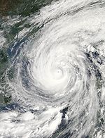
Japan
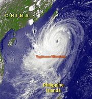
The mountainous island archipelago is constantly struck by typhoons recurving out of the tropics, which are normally in extratropical transition as they pass through Japan. Typhoon Meari/Quinta of the 2004 Pacific typhoon season led to heavy rain at Owase with the highest 24 hour total of 741 millimetres (29.2 in) ending at 1500 UTC on the 29th. Typhoon Saomai in 2000 produced record rainfall at Nagoya, 584.2 millimetres (23 in) in 24 hours. Fran of the 1976 Pacific typhoon season1976 Pacific typhoon season
The 1976 Pacific typhoon season has no official bounds; it ran year-round in 1976, but most tropical cyclones tend to form in the northwestern Pacific Ocean between June and December...
holds the national 24-hour precipitation record of 1174 millimetres (46.2 in).
| Wettest tropical cyclones in Japan Highest known recorded totals |
||||
|---|---|---|---|---|
| Precipitation | Storm | Measurement station |
||
| Rank | (mm Millimetre The millimetre is a unit of length in the metric system, equal to one thousandth of a metre, which is the SI base unit of length.... ) |
(in Inch An inch is the name of a unit of length in a number of different systems, including Imperial units, and United States customary units. There are 36 inches in a yard and 12 inches in a foot... ) |
||
| 1 | 1805.5 | 71.08 inches | Talas 2011 | Kamikitayama |
| 2 | 1321 mm | 52.01 inches | Nabi 2005 Typhoon Nabi Typhoon Nabi was the third super typhoon of the 2005 typhoon season in the northwestern Pacific. The storm had winds up to at peak intensity, and caused over 143 injuries and 21 confirmed deaths in Japan... |
|
| 3 | 1286 mm | 50.62 inches | Kent 1992 | Nara |
| 4 | 1243 mm | 48.94 inches | Namtheum 2004 | |
| 5 | 1174 mm | 46.22 inches | Fran 1976 | |
| 6 | 905 mm | 35.63 inches | Songda 2004 | |
| 7 | 904 mm | 35.59 inches | Meari 2004 | |
| 8 | 711 mm | 28.00 inches | Gladys 1991 | |
| 9 | 677 mm | 26.70 inches | Bolaven 2000 | |
| 10 | 610 mm | 24.02 inches | Megi 2004 | Tomisato |
Okinawa
Ryukyu IslandsRyukyu IslandsThe , also known as the , is a chain of islands in the western Pacific, on the eastern limit of the East China Sea and to the southwest of the island of Kyushu in Japan. From about 1829 until the mid 20th century, they were alternately called Luchu, Loochoo, or Lewchew, akin to the Mandarin...
Typhoon RusaTyphoon Rusa
Typhoon Rusa was the 21st JTWC tropical depression , the 15th named storm, and the 10th typhoon of the 2002 Pacific typhoon season...
caused 409 millimetres (16.1 in) of rain to fall at Naze on August 29–30, 2002. Typhoon Aere dropped 314.5 millimetres (12.4 in) of rain in the 65 hour period ending at 1400 UTC on August 25 at Ishigakihima. Typhoon Agnes in August 1957 dropped 586.2 millimetres (23.1 in) of rainfall on Marcus Island.
Johnston AtollJohnston AtollJohnston Atoll is a atoll in the North Pacific Ocean about west of Hawaii. There are four islands located on the coral reef platform, two natural islands, Johnston Island and Sand Island, which have been expanded by coral dredging, as well as North Island and East Island , an additional two...
Tropical cyclones occasionally threaten this central Pacific island. Hurricane Celeste of 1972 brought 6.21 inches (157.7 mm) to the isle around August 19.KoreaKoreaKorea ) is an East Asian geographic region that is currently divided into two separate sovereign states — North Korea and South Korea. Located on the Korean Peninsula, Korea is bordered by the People's Republic of China to the northwest, Russia to the northeast, and is separated from Japan to the...
The Korean PeninsulaKorean Peninsula
The Korean Peninsula is a peninsula in East Asia. It extends southwards for about 684 miles from continental Asia into the Pacific Ocean and is surrounded by the Sea of Japan to the south, and the Yellow Sea to the west, the Korea Strait connecting the first two bodies of water.Until the end of...
experiences typhoons regularly. Tropical cyclones which impact southern China also lead to, on average, five heavy rainfall events per year across the Korean peninsula.
North/DPR Korea
Very heavy rains fell across Tongchon and Kosong counties during Typhoon RusaTyphoon Rusa
Typhoon Rusa was the 21st JTWC tropical depression , the 15th named storm, and the 10th typhoon of the 2002 Pacific typhoon season...
in 2002, where up to 510 millimetres (20.1 in) of precipitation fell in a 5-10 hour period.
South KoreaSouth KoreaThe Republic of Korea , , is a sovereign state in East Asia, located on the southern portion of the Korean Peninsula. It is neighbored by the People's Republic of China to the west, Japan to the east, North Korea to the north, and the East China Sea and Republic of China to the south...
| Wettest tropical cyclones in South Korea Highest known recorded totals |
||||
|---|---|---|---|---|
| Precipitation | Storm | Measurement station |
||
| Rank | (mm Millimetre The millimetre is a unit of length in the metric system, equal to one thousandth of a metre, which is the SI base unit of length.... ) |
(in Inch An inch is the name of a unit of length in a number of different systems, including Imperial units, and United States customary units. There are 36 inches in a yard and 12 inches in a foot... ) |
||
| 1 | 898.0 mm | 35.35 inches | Rusa 2002 Typhoon Rusa Typhoon Rusa was the 21st JTWC tropical depression , the 15th named storm, and the 10th typhoon of the 2002 Pacific typhoon season... |
Gangneung |
| 2 | 660.4 mm | 26.00 inches | Gladys 1991 | |
| 3 | 590.0 mm | 23.23 inches | Nari 2007 | Jeju |
| 4 | 491.0 mm | 19.33 inches | Saomai 2000 | |
| 5 | 332.5 mm | 13.09 inches | Megi 2004 | Wando |
| 6 | 104.5 mm | 4.11 inches | Haima 2004 | Wando |
Madagascar
| Wettest tropical cyclones in Madagascar Highest known recorded totals |
||||||
|---|---|---|---|---|---|---|
| Precipitation | Storm | Year | Measurement station |
|||
| Rank | (mm Millimetre The millimetre is a unit of length in the metric system, equal to one thousandth of a metre, which is the SI base unit of length.... ) |
(in Inch An inch is the name of a unit of length in a number of different systems, including Imperial units, and United States customary units. There are 36 inches in a yard and 12 inches in a foot... ) |
||||
| 1 | 715.0 mm | 28.14 in | Elita Cyclone Elita Cyclone Elita was an unusual tropical cyclone that made landfall on Madagascar three times. The fifth named storm of the 2003–04 South-West Indian Ocean cyclone season, Elita developed on January 24 in the Mozambique Channel. It strengthened to become a tropical cyclone before striking... |
2004 | ||
| 2 | 707.0 mm | 27.8 in | Guillaume | 2002 | Toamasina | |
| 3 | 355.2 mm | 13.9 in | Indlala | 2007 | Antalaha | |
| 4 | 300.0 mm | 12.0 in | Cela | 2003 | Unknown | |
| 5 | 261.0 mm | 10.2 in | Ivan | 2008 | Toamasina | |
| 6 | 255.4 mm | 10.0 in | Gafilo | 2004 | Nosy-be | |
| 7 | 237.2 mm | 9.3 in | Ernest | 2005 | Toliara | |
| 8 | 229.0 mm | 9.0 in | Jade | 2009 | Toamasina | |
| 9 | 222.0 mm | 8.7 in | Gael | 2009 | Toamasina | |
| 10 | 216.1 mm | 8.5 in | Jaya | 2007 | Toamasina | |
Malaysia
| Wettest tropical cyclones in Malaysia Highest known recorded totals |
||||
|---|---|---|---|---|
| Precipitation | Storm | Measurement station |
||
| Rank | (mm Millimetre The millimetre is a unit of length in the metric system, equal to one thousandth of a metre, which is the SI base unit of length.... ) |
(in Inch An inch is the name of a unit of length in a number of different systems, including Imperial units, and United States customary units. There are 36 inches in a yard and 12 inches in a foot... ) |
||
| 1 | 220 mm | 8.66 inches | Jelawat/Domeng 2006 | Kampung |
MauritiusMauritiusMauritius , officially the Republic of Mauritius is an island nation off the southeast coast of the African continent in the southwest Indian Ocean, about east of Madagascar...
, South Indian Ocean
| Wettest tropical cyclones in Mauritius Highest known recorded totals |
||||
|---|---|---|---|---|
| Precipitation | Storm | Measurement station |
||
| Rank | (mm Millimetre The millimetre is a unit of length in the metric system, equal to one thousandth of a metre, which is the SI base unit of length.... ) |
(in Inch An inch is the name of a unit of length in a number of different systems, including Imperial units, and United States customary units. There are 36 inches in a yard and 12 inches in a foot... ) |
||
| 1 | 202.8 mm | 7.98 inches | Hennie 2005 | Sans-Souci |
| 2 | 58.8 mm | 2.31 inches | Crystal 2002 | Providence. |
Mexico
Hurricane WilmaHurricane Wilma
Hurricane Wilma was the most intense tropical cyclone ever recorded in the Atlantic basin. Wilma was the twenty-second storm , thirteenth hurricane, sixth major hurricane, and fourth Category 5 hurricane of the record-breaking 2005 season...
of 2005 drifted over the northeast portion of the Yucatán peninsula for a couple of days, dropping significant rains. A report of 1576 millimetres (62 in) was reported by the Servicio Meteorológicio Nacional in Mexico
Mexico
The United Mexican States , commonly known as Mexico , is a federal constitutional republic in North America. It is bordered on the north by the United States; on the south and west by the Pacific Ocean; on the southeast by Guatemala, Belize, and the Caribbean Sea; and on the east by the Gulf of...
, which is the wettest known 24-hour rainfall amount ever measured in Mexico. Second on the list is from Tropical Storm Frances
Tropical Storm Frances (1998)
Originating over the southwest Caribbean sea on September 4, Tropical Storm Frances became the sixth tropical storm of the 1998 Atlantic hurricane season. The cyclone moved northward through the western Gulf of Mexico, making landfall across the central Texas coastline before recurving across the...
in 1998, which accumulated up to 1019 millimetres (40.1 in) of rain at Independencia in southern Chiapas
Chiapas
Chiapas officially Estado Libre y Soberano de Chiapas is one of the 31 states that, with the Federal District, comprise the 32 Federal Entities of Mexico. It is divided in 118 municipalities and its capital city is Tuxtla Gutierrez. Other important cites in Chiapas include San Cristóbal de las...
. Below is a list of the highest known storm total rainfall amounts from individual tropical cyclones across Mexico. Most of the rainfall information was provided by the Mexico's National Weather Service, Servicio Meteorológico Nacional
Servicio Meteorológico Nacional
The Servicio Meteorológico Nacional is Mexico's national weather organization. It collects data and issues forecasts, advisories, and warnings for the entire country.-History:...
, which is a part of the National Water Commission, Comisión Nacional del Agua.
| Wettest tropical cyclones in Mexico Highest recorded rainfall totals since 1974 |
|||
|---|---|---|---|
| Rank | Storm and year | Precipitation | |
| (mm) | (in) | ||
| 1 | Wilma 2005 Hurricane Wilma Hurricane Wilma was the most intense tropical cyclone ever recorded in the Atlantic basin. Wilma was the twenty-second storm , thirteenth hurricane, sixth major hurricane, and fourth Category 5 hurricane of the record-breaking 2005 season... |
1576 | 62.05 |
| 2 | Frances 1998 Tropical Storm Frances (1998) Originating over the southwest Caribbean sea on September 4, Tropical Storm Frances became the sixth tropical storm of the 1998 Atlantic hurricane season. The cyclone moved northward through the western Gulf of Mexico, making landfall across the central Texas coastline before recurving across the... |
1119 | 44.06 |
| 3 | Tropical Depression Eleven (1999) | 1098 | 43.23 |
| 4 | Juliette 2001 Hurricane Juliette (2001) Hurricane Juliette was a long lasting Category 4 hurricane in the 2001 Pacific hurricane season. It caused 12 deaths and $400 million in damage when it hit Baja California in late September.-Meteorological history:... |
1011 | 39.80 |
| 5 | Dolly 1996 Hurricane Dolly (1996) Hurricane Dolly was a Category 1 hurricane that struck Mexico. The storm killed 14 people and left many homeless. The fourth named storm and the third hurricane of the 1996 Atlantic hurricane season, Dolly developed from a tropical wave in the west-central Caribbean Sea on August 19... |
950 | 37.41 |
| 6 | Fifi/Orlene 1974 Hurricane Fifi Hurricane Fifi was a catastrophic tropical cyclone that killed between 3,000 and 10,000 people in Honduras in September 1974, ranking it as the fourth deadliest Atlantic hurricane on record. Originating from a strong tropical wave on September 14, the system steadily tracked... |
941 | 37.06 |
| 7 | Alex 2010 | 890 | 35.04 |
| 8 | Gert 1993 Hurricane Gert (1993) Hurricane Gert was a large tropical cyclone that caused heavy flood damage and many deaths throughout Central America and Mexico in September 1993. The seventh named storm and third hurricane of the annual hurricane season, Gert originated from a tropical wave over the southwestern Caribbean... |
805 | 31.69 |
| 9 | Hermine 1980 | 791 | 31.15 |
| 10 | Isidore 2002 Hurricane Isidore Hurricane Isidore was the ninth named storm and the second hurricane in the 2002 Atlantic hurricane season. Isidore was the fifth of eight named storms to occur in September. The tropical cyclone peaked as a Category 3 hurricane, causing damage as well as four fatalities in Jamaica, Cuba, Mexico,... |
774 | 30.49 |
Mozambique
| Wettest tropical cyclones in Mozambique Highest known recorded totals |
||||
|---|---|---|---|---|
| Precipitation | Storm | Measurement station |
||
| Rank | (mm Millimetre The millimetre is a unit of length in the metric system, equal to one thousandth of a metre, which is the SI base unit of length.... ) |
(in Inch An inch is the name of a unit of length in a number of different systems, including Imperial units, and United States customary units. There are 36 inches in a yard and 12 inches in a foot... ) |
||
| 1 | 502 mm | 19.76 inches | Eline 2000 Cyclone Leon-Eline Cyclone Leon–Eline was a long-lived Indian Ocean tropical cyclone which traversed almost the entire Indian ocean and made devastating strikes on Madagascar, Mozambique and South Africa, and had less serious effects in Zimbabwe where it eventually died out.... |
Levubu |
| 2 | 281 mm | 11.06 inches | Delfina 2003 | |
| 3 | 200 mm | 7.87 inches | Jokwe 2008 Cyclone Jokwe Cyclone Jokwe was the first tropical cyclone to make landfall in Mozambique since Cyclone Favio struck in the previous year. The tenth named storm of the 2007-08 South-West Indian Ocean cyclone season, Jokwe was first classified as a tropical depression on March 2 over the open Southwest Indian Ocean... |
Nampula |
| 4 | 190 mm | 7.50 inches | Japhet 2003 | |
MyanmarMyanmarBurma , officially the Republic of the Union of Myanmar , is a country in Southeast Asia. Burma is bordered by China on the northeast, Laos on the east, Thailand on the southeast, Bangladesh on the west, India on the northwest, the Bay of Bengal to the southwest, and the Andaman Sea on the south....
| Wettest tropical cyclones in Myanmar Highest known recorded totals |
||||
|---|---|---|---|---|
| Precipitation | Storm | Measurement station |
||
| Rank | (mm Millimetre The millimetre is a unit of length in the metric system, equal to one thousandth of a metre, which is the SI base unit of length.... ) |
(in Inch An inch is the name of a unit of length in a number of different systems, including Imperial units, and United States customary units. There are 36 inches in a yard and 12 inches in a foot... ) |
||
| 1 | ~600.0 mm | 23.6 inches | Nargis 2008 Cyclone Nargis Cyclone Nargis , was a strong tropical cyclone that caused the worst natural disaster in the recorded history of Burma. The cyclone made landfall in Burma on Friday, May 2, 2008, causing catastrophic destruction and at least 138,000 fatalities... |
|
| 2 | 343.9 mm | 13.54 inches | T.D. #2 2007 | |
NepalNepalNepal , officially the Federal Democratic Republic of Nepal, is a landlocked sovereign state located in South Asia. It is located in the Himalayas and bordered to the north by the People's Republic of China, and to the south, east, and west by the Republic of India...
Some of the highest elevations on the planet lie in Nepal. Eight out of fourteen highest peaks in the world lie in the Nepalese Himalaya including the highest peak of the World, Mt. Everest (8848 m). During a tropical depression that affected the Indian Subcontinent in 2004, 51.3 millimetres (2 in) of rain fell at Kathmandu airport in the 24 hour period ending at 1200 UTC on October 7.Saba
| Wettest tropical cyclones in Saba Highest known recorded totals |
||||
|---|---|---|---|---|
| Precipitation | Storm | Measurement station |
||
| Rank | (mm Millimetre The millimetre is a unit of length in the metric system, equal to one thousandth of a metre, which is the SI base unit of length.... ) |
(in Inch An inch is the name of a unit of length in a number of different systems, including Imperial units, and United States customary units. There are 36 inches in a yard and 12 inches in a foot... ) |
||
| 1 | 286.3 mm | 11.27 inches | Alice (1954) | |
St. Eustatius
| Wettest tropical cyclones in St. Eustatius Highest known recorded totals |
||||
|---|---|---|---|---|
| Precipitation | Storm | Measurement station |
||
| Rank | (mm Millimetre The millimetre is a unit of length in the metric system, equal to one thousandth of a metre, which is the SI base unit of length.... ) |
(in Inch An inch is the name of a unit of length in a number of different systems, including Imperial units, and United States customary units. There are 36 inches in a yard and 12 inches in a foot... ) |
||
| 1 | 203.2 mm | 8.00 inches | Alice (1954) | |
St. MartinSaint Martin (France)Saint Martin , officially the Collectivity of Saint Martin is an overseas collectivity of France located in the Caribbean. It came into being on 15 July 2007, encompassing the northern parts of Saint Martin island and neighbouring islets, the largest of which is Île Tintamarre...
/Sint Maarten
This hilly island is partially owned by FranceFrance
The French Republic , The French Republic , The French Republic , (commonly known as France , is a unitary semi-presidential republic in Western Europe with several overseas territories and islands located on other continents and in the Indian, Pacific, and Atlantic oceans. Metropolitan France...
and partially claimed by the Netherlands
Netherlands
The Netherlands is a constituent country of the Kingdom of the Netherlands, located mainly in North-West Europe and with several islands in the Caribbean. Mainland Netherlands borders the North Sea to the north and west, Belgium to the south, and Germany to the east, and shares maritime borders...
.
| Wettest tropical cyclones in St. Martin/Maarten Highest known recorded totals |
||||
|---|---|---|---|---|
| Precipitation | Storm | Measurement station |
||
| Rank | (mm Millimetre The millimetre is a unit of length in the metric system, equal to one thousandth of a metre, which is the SI base unit of length.... ) |
(in Inch An inch is the name of a unit of length in a number of different systems, including Imperial units, and United States customary units. There are 36 inches in a yard and 12 inches in a foot... ) |
||
| 1 | 866.6 mm | 34.12 inches | Lenny 1999 Hurricane Lenny Hurricane Lenny was the strongest November Atlantic hurricane on record. It was the twelfth tropical storm, eighth hurricane, and record-breaking fifth Category 4 hurricane in the 1999 Atlantic hurricane season. Lenny formed on November 13 in the western Caribbean Sea, and maintained an... |
|
| 2 | 349.3 mm | 13.75 inches | Jose 1999 Hurricane Jose (1999) Hurricane Jose was a Category 2 hurricane that affected the Leeward Islands between October 20 and October 25, 1999. It was the tenth named storm, and eighth hurricane of the 1999 Atlantic hurricane season. Jose formed on October 17 while east of the Windward Islands. The storm quickly... |
|
| 3 | 165.1 mm | 6.50 inches | Luis 1995 Hurricane Luis Hurricane Luis was one of the deadliest and most destructive hurricanes of the 1995 Atlantic hurricane season, with maximum sustained winds of 140 mph . The storm was the twelfth tropical storm, sixth hurricane, and second major hurricane of the season... |
|
| 4 | 85.1 mm | 3.35 inches | Marilyn 1995 Hurricane Marilyn Hurricane Marilyn was the fifteenth tropical depression and thirteenth named storm of the unusually busy 1995 Atlantic hurricane season, following closely on the heels of Hurricane Luis. Hurricane Marilyn was the most powerful storm to hit the Virgin Islands since Hurricane Hugo of 1989.Marilyn... |
|
New Zealand
New Zealand
New Zealand is an island country in the south-western Pacific Ocean comprising two main landmasses and numerous smaller islands. The country is situated some east of Australia across the Tasman Sea, and roughly south of the Pacific island nations of New Caledonia, Fiji, and Tonga...
are in extratropical transition (ET), which can enhance their heavy rainfall threat.
| Wettest tropical cyclones, and their remnants, in New Zealand Highest known recorded totals |
||||
|---|---|---|---|---|
| Precipitation | Storm | Measurement station |
||
| Rank | (mm Millimetre The millimetre is a unit of length in the metric system, equal to one thousandth of a metre, which is the SI base unit of length.... ) |
(in Inch An inch is the name of a unit of length in a number of different systems, including Imperial units, and United States customary units. There are 36 inches in a yard and 12 inches in a foot... ) |
||
| 1 | 900 mm | 35.43 inches | Bola 1988 | |
| 2 | 425 mm | 16.73 inches | Fergus 1996 | Thames — Coromandel district |
| 3 | 280 mm | 11.00 inches | Wilma 2011 Cyclone Wilma (2011) Severe Tropical Cyclone Wilma was the first tropical cyclone on record to hit New Zealand as a tropical cyclone. Forming out of a trough of low pressure on January 19 to the northwest of Fiji, Cyclone Wilma initially tracked eastward towards the Samoan Islands... |
|
| 4 | 147 mm | 5.79 inches | Wati 2006 | Kaikohe |
NicaraguaNicaraguaNicaragua is the largest country in the Central American American isthmus, bordered by Honduras to the north and Costa Rica to the south. The country is situated between 11 and 14 degrees north of the Equator in the Northern Hemisphere, which places it entirely within the tropics. The Pacific Ocean...
NiueNiueNiue , is an island country in the South Pacific Ocean. It is commonly known as the "Rock of Polynesia", and inhabitants of the island call it "the Rock" for short. Niue is northeast of New Zealand in a triangle between Tonga to the southwest, the Samoas to the northwest, and the Cook Islands to...
, Southwest Pacific
OmanOmanOman , officially called the Sultanate of Oman , is an Arab state in southwest Asia on the southeast coast of the Arabian Peninsula. It is bordered by the United Arab Emirates to the northwest, Saudi Arabia to the west, and Yemen to the southwest. The coast is formed by the Arabian Sea on the...
| Wettest tropical cyclones in Oman Highest known recorded totals |
||||
|---|---|---|---|---|
| Precipitation | Storm | Measurement station |
||
| Rank | (mm Millimetre The millimetre is a unit of length in the metric system, equal to one thousandth of a metre, which is the SI base unit of length.... ) |
(in Inch An inch is the name of a unit of length in a number of different systems, including Imperial units, and United States customary units. There are 36 inches in a yard and 12 inches in a foot... ) |
||
| 1 | 482.3 mm | 18.99 inches | Masirah Cyclone 1977 1977 Oman cyclone The 1977 Oman cyclone was the second-strongest cyclone on record to hit the Arabian Peninsula, after Cyclone Gonu. It formed off the west coast of India in the Arabian Sea, and curved westward to reach peak winds of . The storm struck Masirah Island and later southern Oman on June 13, before... |
Salala 40 km NE |
| 2 | 300.2 mm | 11.82 inches | T.S. 02A (1996) | Dhofar |
| 3 | 300+ mm | 11.81+ inches | Phet 2010 Cyclone Phet Cyclone Phet was the third named cyclone of the 2010 North Indian Ocean cyclone season. Phet developed from a low pressure area in the Arabian Sea that organized into a tropical cyclone on May 31... |
|
| 4 | 286.0 mm | 11.24 inches | Muscat Cyclone 1890 | Muscat |
| 5 | 251.0 mm | 9.88 inches | Oman Cyclone 2002 2002 Oman cyclone The 2002 Oman cyclone was an uncommon tropical cyclone that struck the Dhofar region of Oman in May 2002. The first storm in the 2002 North Indian Ocean cyclone season, it developed on May 6 in the Arabian Sea, and it maintained a general west-northwest track for much of its duration... |
Qairoon |
| 6 | 230.0 mm | 9.06 inches | Salalah Cyclone 1963 | Salalah |
| 7 | 82.0 mm | 3.23 inches | Salalah Cyclone 1959 | Salalah |
PakistanPakistanPakistan , officially the Islamic Republic of Pakistan is a sovereign state in South Asia. It has a coastline along the Arabian Sea and the Gulf of Oman in the south and is bordered by Afghanistan and Iran in the west, India in the east and China in the far northeast. In the north, Tajikistan...
Tropical cyclones from the Arabian SeaArabian Sea
The Arabian Sea is a region of the Indian Ocean bounded on the east by India, on the north by Pakistan and Iran, on the west by the Arabian Peninsula, on the south, approximately, by a line between Cape Guardafui in northeastern Somalia and Kanyakumari in India...
wander into Pakistan
Pakistan
Pakistan , officially the Islamic Republic of Pakistan is a sovereign state in South Asia. It has a coastline along the Arabian Sea and the Gulf of Oman in the south and is bordered by Afghanistan and Iran in the west, India in the east and China in the far northeast. In the north, Tajikistan...
as well. Though cyclones weakens by the time it reaches Pakistani coastline.
| Wettest tropical cyclones in Pakistan Highest known recorded totals |
||||
|---|---|---|---|---|
| Precipitation | Storm | Measurement station |
||
| Rank | (mm Millimetre The millimetre is a unit of length in the metric system, equal to one thousandth of a metre, which is the SI base unit of length.... ) |
(in Inch An inch is the name of a unit of length in a number of different systems, including Imperial units, and United States customary units. There are 36 inches in a yard and 12 inches in a foot... ) |
||
| 1 | 370 mm | 14.57 inches | Phet (2010) Cyclone Phet Cyclone Phet was the third named cyclone of the 2010 North Indian Ocean cyclone season. Phet developed from a low pressure area in the Arabian Sea that organized into a tropical cyclone on May 31... |
Gwadar Gwadar Gwadar also known as Godar is a developing port city on the southwestern Arabian Sea coast of Pakistan. It is the district headquarters of Gwadar District in Balochistan province and has a population of approximately 50,000.Gwadar is strategically located at the apex of the Arabian Sea and at the... |
| 2 | 285 mm | 11.22 inches | Cyclone (1999) 1999 Pakistan cyclone The 1999 Pakistan cyclone was a deadly tropical cyclone that brought further devastation to a region struck by a powerful storm nearly a year earlier.-Meteorological history:An area of disturbed weather in the Arabian Sea was monitored in early May for possible development... |
Keti Bandar Keti Bandar Keti Bandar is a former port on the Arabian Sea, in the Thatta District, Sindh, Pakistan. The port was built on the remains of the older seaport of Debal where Muhammad bin Qasim and his army arrived from Iraq.- See also :* Keti... |
| 3 | 245 mm | 9.64 inches | BOB (2009) | Karachi Karachi Karachi is the largest city, main seaport and the main financial centre of Pakistan, as well as the capital of the province of Sindh. The city has an estimated population of 13 to 15 million, while the total metropolitan area has a population of over 18 million... |
| 4 | 191 mm | 7.51 inches | BOB 06 (2007) | Karachi Karachi Karachi is the largest city, main seaport and the main financial centre of Pakistan, as well as the capital of the province of Sindh. The city has an estimated population of 13 to 15 million, while the total metropolitan area has a population of over 18 million... |
| 5 | 145 mm | 5.71 inches | Onil (2004) Cyclone Onil Severe Cyclonic Storm Onil was the first tropical cyclone to be named in the northern Indian Ocean... |
Thatta Thatta Thatta is a historic town of 220,000 inhabitants in the Sindh province of Pakistan, near Lake Keenjhar, the largest freshwater lake in the country. Thatta's major monuments especially its necropolis at Makli are listed among the World Heritage Sites. The Shah Jahan Mosque is also listed... |
| 6 | 110 mm | 3.94 inches | Yemyin (2007) Cyclone Yemyin Cyclone Yemyin was a deadly tropical cyclone that made landfalls on India and Pakistan. The Pakistan Meteorological Department referred to Tropical Cyclone 03B as "Tropical Cyclone Yemyin"... |
Karachi Karachi Karachi is the largest city, main seaport and the main financial centre of Pakistan, as well as the capital of the province of Sindh. The city has an estimated population of 13 to 15 million, while the total metropolitan area has a population of over 18 million... |
| 7 | 43 mm | 1.69 inches | BOB 04 (2007) | Karachi Karachi Karachi is the largest city, main seaport and the main financial centre of Pakistan, as well as the capital of the province of Sindh. The city has an estimated population of 13 to 15 million, while the total metropolitan area has a population of over 18 million... |
| 8 | 18 mm | 0.70 inches | BOB 03 (2009) | Karachi Karachi Karachi is the largest city, main seaport and the main financial centre of Pakistan, as well as the capital of the province of Sindh. The city has an estimated population of 13 to 15 million, while the total metropolitan area has a population of over 18 million... |
Palau
Palau
Palau , officially the Republic of Palau , is an island nation in the Pacific Ocean, east of the Philippines and south of Tokyo. In 1978, after three decades as being part of the United Nations trusteeship, Palau chose independence instead of becoming part of the Federated States of Micronesia, a...
consists of a string of islands that is rugged and surrounds a lagoon. Elevations up to 2060 feet (627.9 m) exist within the island group.
| Wettest tropical cyclones in Palau Highest known recorded totals |
||||
|---|---|---|---|---|
| Precipitation | Storm | Measurement station |
||
| Rank | (mm Millimetre The millimetre is a unit of length in the metric system, equal to one thousandth of a metre, which is the SI base unit of length.... ) |
(in Inch An inch is the name of a unit of length in a number of different systems, including Imperial units, and United States customary units. There are 36 inches in a yard and 12 inches in a foot... ) |
||
| 1 | 470.9 mm | 18.54 inches | Marie 1976 | Koror |
| 2 | 293.1 mm | 11.54 inches | Nathan 1993 | Nekken Forestry |
| 3 | 281.4 mm | 11.08 inches | Ruby 1982 | Koror |
| 4 | 248.9 mm | 9.80 inches | Mike 1990 Typhoon Mike Super Typhoon Mike was the strongest and deadliest typhoon of the 1990 Pacific typhoon season as it crossed the Philippines in November.... |
Koror |
| 5 | 121.7 mm | 4.79 inches | Dianmu 2004 Typhoon Dianmu (2004) Typhoon Dianmu was a powerful typhoon that struck southeastern Japan during the 2004 Pacific typhoon season... |
Koror |
| 6 | 47.8 mm | 1.88 inches | Ewiniar 2006 Typhoon Ewiniar (2006) Typhoon Ewiniar was the third named storm of the 2006 Pacific typhoon season and one that lasted for twelve days as a tropical cyclone, moving on a generally northward track... |
Koror |
Panama
Inflow to the south of Hurricane MitchHurricane Mitch
Hurricane Mitch was the most powerful hurricane and the most destructive of the 1998 Atlantic hurricane season, with maximum sustained winds of 180 mph . The storm was the thirteenth tropical storm, ninth hurricane, and third major hurricane of the season. Along with Hurricane Georges, Mitch...
brought impressive rainfalls to the Panama
Panama
Panama , officially the Republic of Panama , is the southernmost country of Central America. Situated on the isthmus connecting North and South America, it is bordered by Costa Rica to the northwest, Colombia to the southeast, the Caribbean Sea to the north and the Pacific Ocean to the south. The...
. Veledero de Tole recorded 695 millimetres (27.4 in) of rainfall between October 22 and October 31 of 1998.
Philippines
Philippines
The Philippines , officially known as the Republic of the Philippines , is a country in Southeast Asia in the western Pacific Ocean. To its north across the Luzon Strait lies Taiwan. West across the South China Sea sits Vietnam...
island archipelago is fairly mountainous, with the highest terrain found in Luzon.
Singapore, South China Sea
Typhoon Vamei of December 20, 2001 was the only known storm to ever hit the island state. It dropped 165.1 millimetres (6.5 in) of rainfall.South Africa
Tropical Cyclone Eline in February 2000 dropped significant rains on portions of South AfricaSouth Africa
The Republic of South Africa is a country in southern Africa. Located at the southern tip of Africa, it is divided into nine provinces, with of coastline on the Atlantic and Indian oceans...
. The highest amount noted was 480 mm/18.90" at Thohoyandou.
Spain
The only tropical cyclone to reach mainland Europe was 2005's Hurricane VinceHurricane Vince (2005)
Hurricane Vince was an unusual hurricane that developed in the northeastern Atlantic basin. Forming in October during the 2005 Atlantic hurricane season, the waters over which it developed were considered too cold for tropical development...
. It dropped 3.3 inches (83.8 mm) of rain on the plain near Cordoba.
Sri Lanka
A tropical depression in early October 2004 led to heavy rains across Sri LankaSri Lanka
Sri Lanka, officially the Democratic Socialist Republic of Sri Lanka is a country off the southern coast of the Indian subcontinent. Known until 1972 as Ceylon , Sri Lanka is an island surrounded by the Indian Ocean, the Gulf of Mannar and the Palk Strait, and lies in the vicinity of India and the...
. The maximum was measured at Galle where 117.2 mm/4.61" fell in the 24 hour period ending at 0600 UTC on the 2nd.
St. Brandon, South Indian Ocean
Tropical Cyclone Darius of New Year's Eve/Day of 2003/2004 passed about 45 miles (72.4 km) west-northwest of the island. Rainfall over the 24 hour period of closest approach was 135 mm/5.31".NevisNevisNevis is an island in the Caribbean Sea, located near the northern end of the Lesser Antilles archipelago, about 350 km east-southeast of Puerto Rico and 80 km west of Antigua. The 93 km² island is part of the inner arc of the Leeward Islands chain of the West Indies...
| Wettest tropical cyclones in St. Kitts Highest known recorded totals |
||||
|---|---|---|---|---|
| Precipitation | Storm | Measurement station |
||
| Rank | (mm Millimetre The millimetre is a unit of length in the metric system, equal to one thousandth of a metre, which is the SI base unit of length.... ) |
(in Inch An inch is the name of a unit of length in a number of different systems, including Imperial units, and United States customary units. There are 36 inches in a yard and 12 inches in a foot... ) |
||
| 1 | 91.4 mm | 3.60 inches | Alice (1954) | |
St. Kitts
| Wettest tropical cyclones in St. Kitts Highest known recorded totals |
||||
|---|---|---|---|---|
| Precipitation | Storm | Measurement station |
||
| Rank | (mm Millimetre The millimetre is a unit of length in the metric system, equal to one thousandth of a metre, which is the SI base unit of length.... ) |
(in Inch An inch is the name of a unit of length in a number of different systems, including Imperial units, and United States customary units. There are 36 inches in a yard and 12 inches in a foot... ) |
||
| 1 | 153.7 mm | 6.05 inches | Alice (1954) | |
Taiwan
Thailand
Malay Peninsula
The Malay Peninsula or Thai-Malay Peninsula is a peninsula in Southeast Asia. The land mass runs approximately north-south and, at its terminus, is the southern-most point of the Asian mainland...
from the northwest Pacific into the Bay of Bengal.
| Wettest tropical cyclones in Thailand Highest known recorded totals |
||||
|---|---|---|---|---|
| Precipitation | Storm | Measurement station |
||
| Rank | (mm Millimetre The millimetre is a unit of length in the metric system, equal to one thousandth of a metre, which is the SI base unit of length.... ) |
(in Inch An inch is the name of a unit of length in a number of different systems, including Imperial units, and United States customary units. There are 36 inches in a yard and 12 inches in a foot... ) |
||
| 1 | 251.5 mm | 9.90 inches | Muifa 2004 Typhoon Muifa (2004) Typhoon Muifa was a typhoon during the 2004 Pacific typhoon season... |
Prachaup Khirikhan |
| 2 | 220.5 mm | 8.68 inches | T.S. 06W 2007 | |
| 3 | 199.8 mm | 7.87 inches | T.D. #2 2007 | |
Lower 48
Below is a list of the top ten highest storm total rainfall amounts from individual tropical cyclones across the lower 48 since 1950. The remains of Amelia 1978Tropical Storm Amelia (1978)
Tropical Storm Amelia was a weak, poorly-organized tropical storm that caused a severe flooding disaster in Texas during the 1978 Atlantic hurricane season. Amelia developed from a tropical wave on July 30 that entered an area of the Gulf of Mexico that was conductive for tropical cyclogenesis...
led to the wettest storm total rainfall amounts of any tropical cyclone to impact the lower 48 over that time frame when it moved into Texas during early August 1978. Most of the rainfall information was provided by the National Climatic Data Center
National Climatic Data Center
The United States National Climatic Data Center in Asheville, North Carolina is the world's largest active archive of weather data. The center became established in late 1951, with the move into the new facility occurring in early 1952....
in Asheville, North Carolina
Asheville, North Carolina
Asheville is a city in and the county seat of Buncombe County, North Carolina, United States. It is the largest city in Western North Carolina, and the 11th largest city in North Carolina. The City is home to the United States National Climatic Data Center , which is the world's largest active...
.
| Wettest tropical cyclones in the lower 48 since 1950 Highest known recorded totals |
||||
|---|---|---|---|---|
| Precipitation | Storm | Measurement station |
||
| Rank | (mm Millimetre The millimetre is a unit of length in the metric system, equal to one thousandth of a metre, which is the SI base unit of length.... ) |
(in Inch An inch is the name of a unit of length in a number of different systems, including Imperial units, and United States customary units. There are 36 inches in a yard and 12 inches in a foot... ) |
||
| 1 | 1219 mm | 48.00 inches | Amelia 1978 Tropical Storm Amelia (1978) Tropical Storm Amelia was a weak, poorly-organized tropical storm that caused a severe flooding disaster in Texas during the 1978 Atlantic hurricane season. Amelia developed from a tropical wave on July 30 that entered an area of the Gulf of Mexico that was conductive for tropical cyclogenesis... |
Medina, Texas |
| 2 | 1148 mm | 45.20 inches | Easy 1950 Hurricane Easy (1950) Hurricane Easy was the fifth tropical storm, hurricane, and major hurricane of the 1950 Atlantic hurricane season. The hurricane developed in the western Caribbean Sea on September 1, and tracked northeastward. After crossing Cuba, the hurricane rapidly strengthened in the eastern Gulf of Mexico to... |
Yankeetown, Florida |
| 3 | 1143 mm | 45.00 inches | Claudette 1979 Tropical Storm Claudette (1979) Tropical Storm Claudette was a long living tropical storm that produced heavy rain across Puerto Rico and Texas in late July 1979. The storm killed 2 people and left $1.1 billion in damage... |
Alvin, Texas |
| 4 | 1033 mm | 40.68 inches | Allison 2001 | Northwest Jefferson County, Texas |
| 5 | 977 mm | 38.46 inches | Georges 1998 Hurricane Georges Hurricane Georges was a very destructive, powerful and long-lived Cape Verde-type Category 4 hurricane. Georges was the seventh tropical storm, fourth hurricane, and second major hurricane of the 1998 Atlantic hurricane season... |
Munson, Florida |
| 6 | 932 mm | 36.71 inches | Danny 1997 Hurricane Danny (1997) Hurricane Danny was the only hurricane to make landfall in the United States during the 1997 Atlantic hurricane season, and the second hurricane and fourth tropical storm of the season... |
Dauphin Island Sea Lab, Alabama |
| 7 | 756 mm | 29.76 inches | Unnamed 1960 | Port Lavaca #2, Texas |
| 8 | 707 mm | 27.85 inches | Alberto 1994 Tropical Storm Alberto (1994) Tropical Storm Alberto was the first storm of the 1994 Atlantic hurricane season. It hit Florida across the Southeast United States in July, causing a massive flooding disaster while stalling over Georgia and Alabama. Alberto caused $1 billion in damage and 30 deaths.-Meteorological history:A... |
Americus, Georgia |
| 9 | 695 mm | 27.38 inches | Beulah 1967 Hurricane Beulah Hurricane Beulah was the second tropical storm, second hurricane, and only major hurricane during the 1967 Atlantic hurricane season. It tracked through the Caribbean, struck the Yucatán peninsula of Mexico as a major hurricane, and moved west-northwest into the Gulf of Mexico, briefly gaining... |
Pettus, Texas |
| 10 | 686 mm | 27.00 inches | Camille 1969 Hurricane Camille Hurricane Camille was the third and strongest tropical cyclone and second hurricane during the 1969 Atlantic hurricane season. The second of three catastrophic Category 5 hurricanes to make landfall in the United States during the 20th century , which it did near the mouth of the Mississippi River... |
West Central Nelson County, Virginia |
Hawaii
This island chain frequently sees rainfall from the remains of former eastern and central Pacific tropical cyclones, but direct impacts of tropical cyclones are infrequent despite its location in the subtropics due to the protective influence of the Central Pacific Tropical Upper Tropospheric Trough (TUTT) which normally dissipates systems approaching Hawaii. The highest amount reported statewise was during Hurricane Hiki of 1950, when 1321 mm/52.00 inches fell in the mountains. More recently, Hurricane Kenneth deposited 305 mm/ 12.00 inches within the 50th state.| Wettest tropical cyclones in Hawaii since 1950 Highest known recorded totals |
||||
|---|---|---|---|---|
| Precipitation | Storm | Measurement station |
||
| Rank | (mm Millimetre The millimetre is a unit of length in the metric system, equal to one thousandth of a metre, which is the SI base unit of length.... ) |
(in Inch An inch is the name of a unit of length in a number of different systems, including Imperial units, and United States customary units. There are 36 inches in a yard and 12 inches in a foot... ) |
||
| 1 | 1321 mm | 52.00 inches | Hiki 1950 | |
| 2 | 985 mm | 38.76 inches | Paul 2000 | |
| 3 | 635 mm | 25.00 inches | Maggie 1970 | |
| 4 | 519 mm | 20.42 inches | Nina 1957 | |
| 5 | 516 mm | 20.33 inches | Iwa 1982 Hurricane Iwa Hurricane Iwa, taken from the Hawaiian language name for the frigatebird , was at the time the costliest hurricane to affect the state of Hawaii. Iwa was the twenty-third tropical storm and the twelfth and final hurricane of the 1982 Pacific hurricane season. It developed from an active trough of... |
|
| 6 | 476 mm | 18.75 inches | Fabio 1988 | |
| 7 | 381 mm | 15.00 inches | T.D. 1C 1994 | |
| 8 | 323 mm | 12.70 inches | Makawao 1906 | |
| 9 | 305 mm | 12.00 inches | Diana 1972 | |
| 9 | 305 mm | 12.00 inches | "B" 1967 | |
| 9 | 305 mm | 12.00 inches | Kenneth 2005 | |
Puerto Rico
Puerto RicoPuerto Rico
Puerto Rico , officially the Commonwealth of Puerto Rico , is an unincorporated territory of the United States, located in the northeastern Caribbean, east of the Dominican Republic and west of both the United States Virgin Islands and the British Virgin Islands.Puerto Rico comprises an...
has seen dramatic rainfall from tropical cyclones and their precursor disturbances. The most recent tropical cyclone-related deluge was from Hurricane Georges
Hurricane Georges
Hurricane Georges was a very destructive, powerful and long-lived Cape Verde-type Category 4 hurricane. Georges was the seventh tropical storm, fourth hurricane, and second major hurricane of the 1998 Atlantic hurricane season...
from September 1998, when 775 mm/30.51 inches of rain was measured at Jayuya. The heaviest rainfall noted over the past 30 years was from the precursor disturbance to Tropical Storm Isabel (1985)
Tropical Storm Isabel (1985)
Tropical Storm Isabel was the ninth tropical storm of the 1985 Atlantic hurricane season. The storm's track extended from the Caribbean to the southeastern United States during the second week of October. Prior to developing into a tropical cyclone, it produced torrential rainfall, resulting in...
, when 804 mm/31.67 inches fell at Toro Negro Forest. Hurricane Eloise
Hurricane Eloise
Hurricane Eloise was the most destructive tropical cyclone of the 1975 Atlantic hurricane season. The fifth tropical storm, fourth hurricane, and second major hurricane of the season, Eloise formed as a tropical depression on September 13 to the east of the Virgin Islands...
of 1975 dropped 946 mm/33.29 inches of rainfall at Dos Bocas, with 586 mm/23.07 inches falling in 24 hours. Below is a list of the top ten highest known storm total rainfall amounts from individual tropical cyclones across Puerto Rico since 1960. The rainfall information was gathered from the National Climatic Data Center
National Climatic Data Center
The United States National Climatic Data Center in Asheville, North Carolina is the world's largest active archive of weather data. The center became established in late 1951, with the move into the new facility occurring in early 1952....
in Asheville, North Carolina
Asheville, North Carolina
Asheville is a city in and the county seat of Buncombe County, North Carolina, United States. It is the largest city in Western North Carolina, and the 11th largest city in North Carolina. The City is home to the United States National Climatic Data Center , which is the world's largest active...
.
| Wettest tropical cyclones, precursor disturbances, and remnants, in Puerto Rico Highest known recorded totals |
||||
|---|---|---|---|---|
| Precipitation | Storm | Measurement station |
||
| Rank | (mm Millimetre The millimetre is a unit of length in the metric system, equal to one thousandth of a metre, which is the SI base unit of length.... ) |
(in Inch An inch is the name of a unit of length in a number of different systems, including Imperial units, and United States customary units. There are 36 inches in a yard and 12 inches in a foot... ) |
||
| 1 | 1058.7 mm | 41.68 inches | T. D. #19 1970 Tropical Depression Nineteen (1970) Tropical Depression Nineteen in 1970 was the wettest known tropical cyclone to affect the United States territory of Puerto Rico. The long-lived depression formed on September 24 just off the west coast of Africa, and for several days maintained a general westward track. It passed through the... |
Jayuya 1 SE |
| 2 | 846 mm | 33.29 inches | Eloise 1975 Hurricane Eloise Hurricane Eloise was the most destructive tropical cyclone of the 1975 Atlantic hurricane season. The fifth tropical storm, fourth hurricane, and second major hurricane of the season, Eloise formed as a tropical depression on September 13 to the east of the Virgin Islands... |
Dos Bocas |
| 3 | 804 mm | 31.67 inches | Isabel 1985 Tropical Storm Isabel (1985) Tropical Storm Isabel was the ninth tropical storm of the 1985 Atlantic hurricane season. The storm's track extended from the Caribbean to the southeastern United States during the second week of October. Prior to developing into a tropical cyclone, it produced torrential rainfall, resulting in... |
Toro Negro Forest |
| 4 | 775 mm | 30.51 inches | Georges 1998 Hurricane Georges Hurricane Georges was a very destructive, powerful and long-lived Cape Verde-type Category 4 hurricane. Georges was the seventh tropical storm, fourth hurricane, and second major hurricane of the 1998 Atlantic hurricane season... |
Jayuya |
| 5 | 662 mm | 26.07 inches | Hazel 1954 Hurricane Hazel Hurricane Hazel was the deadliest and costliest hurricane of the 1954 Atlantic hurricane season. The storm killed as many as 1,000 people in Haiti before striking the United States near the border between North and South Carolina, as a Category 4 hurricane... |
Toro Negro Tunnel |
| 6 | 653 mm | 25.69 inches | Klaus 1984 Hurricane Klaus (1984) Hurricane Klaus was an Atlantic hurricane that hit the Leeward Islands from the west in November of the 1984 Atlantic hurricane season. Forming from a broad area of low pressure on November 5, Klaus maintained a northeast movement throughout much of its path... |
|
| 7 | 596 mm | 23.48 inches | Hortense 1996 Hurricane Hortense Hurricane Hortense was the eighth tropical storm, sixth hurricane, and second Category 4 hurricane of the 1996 Atlantic hurricane season. Lasting from September 3 to September 16, Hortense brought torrential flooding as it moved through the Lesser Antilles, Puerto Rico, and Dominican Republic... |
|
| 8 | 504 mm | 19.86 inches | David 1979 Hurricane David Hurricane David was the fourth named tropical cyclone, second hurricane, and first major hurricane of the 1979 Atlantic hurricane season. A Category 5 hurricane on the Saffir-Simpson Hurricane Scale, David was among the deadliest hurricanes in the latter half of the 20th century, killing... |
|
| 9 | 447 mm | 17.60 inches | Hugo 1989 Hurricane Hugo Hurricane Hugo was a classical, destructive and rare Cape Verde-type hurricane which struck the Caribbean islands of Guadeloupe, Montserrat, St. Croix, Puerto Rico and the USA mainland in South Carolina as a Category 4 hurricane during September of the 1989 Atlantic hurricane season... |
|
| 10 | 454 mm | 17.86 inches | Otto 2010 Hurricane Otto (2010) Hurricane Otto was a moderate Category 1 storm that caused widespread damage in portions of the northeastern Caribbean islands. Otto originated as a subtropical cyclone north of Puerto Rico on October 6, and transitioned into a tropical storm the next day, the fifteenth of the season... |
|
Guam
| Wettest tropical cyclones in Guam Highest known recorded totals |
||||
|---|---|---|---|---|
| Precipitation | Storm | Measurement station |
||
| Rank | (mm Millimetre The millimetre is a unit of length in the metric system, equal to one thousandth of a metre, which is the SI base unit of length.... ) |
(in Inch An inch is the name of a unit of length in a number of different systems, including Imperial units, and United States customary units. There are 36 inches in a yard and 12 inches in a foot... ) |
||
| 1 | 856.0 mm | 33.70 inches | Pamela 1976 Typhoon Pamela (1976) Typhoon Pamela was a powerful typhoon that struck the U.S. territory of Guam in May 1976, causing about $500 million in damage . The sixth named storm and third typhoon of the 1976 Pacific typhoon season, Pamela developed on May 14 from a trough near the Federated States of Micronesia... |
Guam WSMO |
| 2 | 846.8 mm | 33.34 inches | Alice 1953 | Andersen Air Force Base Andersen Air Force Base Andersen Air Force Base is a United States Air Force base located approximately northeast of Yigo in the United States territory of Guam.... |
| 3 | 650.5 mm | 25.61 inches | Pongsona 2002 Typhoon Pongsona Typhoon Pongsona was the last typhoon of the 2002 Pacific typhoon season, and was the costliest United States disaster in 2002. The name "Pongsona" was contributed by North Korea for the Pacific tropical cyclone list and is the Korean name for the garden balsam... |
University of Guam University of Guam University of Guam is a four-year land-grant institution, located in the village of Mangilao on the island of Guam in the Western Pacific Ocean... |
| 4 | 610.4 mm | 24.03 inches | Tingting 2004 Typhoon Tingting Typhoon Tingting was a relatively weak, but destructive, typhoon that produced record-breaking rains in Guam. The eighth named storm of the 2004 Pacific typhoon season, Tingting originated from a tropical depression over the open waters of the western Pacific Ocean... |
Inarajan Agricultural Station |
| 5 | 539.5 mm | 21.24 inches | Paka 1997 Typhoon Paka Typhoon Paka was the last tropical cyclone in the 1997 Pacific Ocean hurricane and typhoon season, and was among the strongest Pacific typhoons in the month of December. Paka, which is the Hawaiian name for Pat, developed on November 28 from a trough well to the southwest of Hawaii... |
Guam WSMO |
| 6 | 533.0 mm | 21.00 inches | Chataan 2002 Typhoon Chataan Typhoon Chataan was a powerful and destructive typhoon which killed 54 people from Chuuk to Japan in the western Pacific Ocean.... |
South-central Guam |
| 7 | 519.2 mm | 20.44 inches | Omar 1992 Typhoon Omar Super Typhoon Omar was the 15th tropical depression, the 15th named storm, and the 9th typhoon of the 1992 Pacific typhoon season... |
Guam WSMO |
| 8 | 414.5 mm | 16.32 inches | Ida 1969 | Andersen Air Force Base Andersen Air Force Base Andersen Air Force Base is a United States Air Force base located approximately northeast of Yigo in the United States territory of Guam.... |
| 9 | 411.2 mm | 16.19 inches | Amy 1971 | Guam WSMO |
| 10 | 364.5 mm | 14.35 inches | Nabi 2005 | Mangilao |
Northern Marianas Islands
| Wettest tropical cyclones in the Commonwealth of the Northern Marianas Islands Highest known recorded totals |
||||
|---|---|---|---|---|
| Precipitation | Storm | Measurement station |
||
| Rank | (mm Millimetre The millimetre is a unit of length in the metric system, equal to one thousandth of a metre, which is the SI base unit of length.... ) |
(in Inch An inch is the name of a unit of length in a number of different systems, including Imperial units, and United States customary units. There are 36 inches in a yard and 12 inches in a foot... ) |
||
| 1 | 488 mm | 19.20 inches | Steve 1993 | Saipan Saipan Saipan is the largest island of the United States Commonwealth of the Northern Mariana Islands , a chain of 15 tropical islands belonging to the Marianas archipelago in the western Pacific Ocean with a total area of . The 2000 census population was 62,392... |
| 2 | 241 mm | 9.50 inches | Seth 1991 | Saipan Saipan Saipan is the largest island of the United States Commonwealth of the Northern Mariana Islands , a chain of 15 tropical islands belonging to the Marianas archipelago in the western Pacific Ocean with a total area of . The 2000 census population was 62,392... |
| 3 | 205 mm | 8.00 inches | Soulik 2006 | Pagan Pagan Island Pagan is an island of the Northern Mariana Islands chain,located at , approximately 320 kilometers northof Saipan.Pagan has an area of 47.23 km² , making it the fourth largest island of the Northern Marianas, and consists of two stratovolcanoes joined by a narrow strip of land.The... |
American Samoa
| Wettest tropical cyclones, and their remnants, in American Samoa Highest known recorded totals |
||||
|---|---|---|---|---|
| Precipitation | Storm | Measurement station |
||
| Rank | (mm Millimetre The millimetre is a unit of length in the metric system, equal to one thousandth of a metre, which is the SI base unit of length.... ) |
(in Inch An inch is the name of a unit of length in a number of different systems, including Imperial units, and United States customary units. There are 36 inches in a yard and 12 inches in a foot... ) |
||
| 1 | 472.4 mm | 18.60 inches | Samoa T.C. - Jan.-Feb. 1966 | Vaipito |
| 2 | 445.5 mm | 17.54 inches | Val 1991 | Pago Pago Airport |
| 3 | 394.7 mm | 15.54 inches | Ofa 1990 | Aasufou |
| 4 | 359.9 mm | 14.17 inches | Heta 2004 | Aasufou |
| 5 | 254.5 mm | 10.02 inches | Olaf 2005 Cyclone Olaf Cyclone Olaf was the sixth cyclone to form in the Southwest Pacific Ocean during the 2004-05 South Pacific cyclone season. Olaf was also one of three simultaneous cyclones to form during the 2004-05 season, forming 21 hours after Cyclone Nancy formed to the east. A powerful Category 5 cyclone,... |
Aasufou |
| 6 | 242.8 mm | 9.56 inches | Wilma 2011 Cyclone Wilma (2011) Severe Tropical Cyclone Wilma was the first tropical cyclone on record to hit New Zealand as a tropical cyclone. Forming out of a trough of low pressure on January 19 to the northwest of Fiji, Cyclone Wilma initially tracked eastward towards the Samoan Islands... |
NWS Pago Pago |
| 7 | 212.1 mm | 8.35 inches | Esau 1981 | Aasufou |
| 8 | 118.0 mm | 4.66 inches | Nisha 2010 | NWS Pago Pago |
| 9 | 95.5 mm | 3.76 inches | Keli 1997 Cyclone Keli Severe Tropical Cyclone Keli was the first recorded post-season tropical cyclone to form in June within the South Pacific Ocean. The system formed on June 7, 1997, about 460 kilometers to the north of Tokelau. The depression gradually developed over the next few days while moving southwestward... |
Afono |
| 10 | 80.5 mm | 3.17 inches | Tusi 1987 | Afono |
Vanuatu
Severe Tropical Cyclone Dani in 1999 produced torrential rains throughout the country. In Bauerfield Airport at Vila 545 mm (21.5 in) fell in 24 hours. The storm's total rainfall is unknown.Tropical cyclone Ivy in February 2004 led to 254.4 mm/10" of rain at Bauerfield on the 26th.
Venezuela
A few tropical cyclones have skimmed the northern coast of South America over recent decades. Tropical Storm Bret (1993)Tropical Storm Bret (1993)
Tropical Storm Bret was the second named storm of the 1993 Atlantic hurricane season. The third tropical cyclone of the season, Bret formed on August 4 from a westward moving, African tropical wave. Bret would later peak as a 60 mph tropical storm as it neared Trinidad...
dropped 339 millimetres (13.3 in) of rain in ten hours at Guanare
Guanare
Guanare is the capital city of Portuguesa State, Venezuela. It is where la Virgen de Coromoto is said to have appeared to a Coromoto Indian.Located at the edge of the Southwestern floodplains, near the Andes foothills, Guanare is in a region known for livestock and agricultural production...
, Portuguesa
Portuguesa (state)
Portuguesa State is one of the 23 states of Venezuela.The state capital is Guanare, founded in 1591.Portuguesa State covers a total surface area of 15,200 km² and, in 2007, had an estimated population of 873,400.-Municipalities:...
, Venezuela
Venezuela
Venezuela , officially called the Bolivarian Republic of Venezuela , is a tropical country on the northern coast of South America. It borders Colombia to the west, Guyana to the east, and Brazil to the south...
.
Vietnam
| Wettest tropical cyclones in Vietnam Highest known recorded totals |
||||
|---|---|---|---|---|
| Precipitation | Storm | Measurement station |
||
| Rank | (mm Millimetre The millimetre is a unit of length in the metric system, equal to one thousandth of a metre, which is the SI base unit of length.... ) |
(in Inch An inch is the name of a unit of length in a number of different systems, including Imperial units, and United States customary units. There are 36 inches in a yard and 12 inches in a foot... ) |
||
| 1 | 1773 mm | inches | Pepiah 2007 | Nam Dong: |
| 2 | 1369 mm | inches | Tropical Depression 06W 2007 | Huong Khe |
| 3 | 1239 mm | inches | Tropical Depression 2009 September 2009 Vietnam tropical depression The September 2009 Vietnam tropical depression was a weak tropical depression that produced deadly flooding throughout central Vietnam in early September. Forming out of an area of low pressure on September 3, the depression hardly intensified as it meandered off the coast of Vietnam... |
Da Nang |
| 4 | 914 mm | inches | Ketsana 2009 Typhoon Ketsana (2009) Typhoon Ketsana was the most devastating typhoon in the 2009 Pacific typhoon season with a damage of $1.09 billion and 747 fatalities. The storm was the twenty-seventh tropical storm, eighth typhoon and the second major typhoon in the season... |
Quang Nam |
| 5 | 788 mm | inches | Lekima 2007 | |
| 6 | 699 mm | 27.50 inches | Ira 1990 | |
| 7 | 666 mm | 26.22 inches | Mirinae 2009 Typhoon Mirinae (2009) Typhoon Mirinae was the 34th depression and the 14th typhoon in the 2009 Pacific typhoon season.-Meterological history:... |
Vân Canh Van Canh Van Canh is a district of Binh Dinh Province in the South Central Coast region of Vietnam.The district capital is Van Canh.Van Canh district is mountainous district, located in the south-west of Binh Dinh Province, and is relatively sparsely populated.- Geography :Van Canh borders Đồng Xuân... |
| 8 | 550 mm | 21.65 inches | Xangsane 2006 Typhoon Xangsane The name Xangsane has been used to name two tropical cyclones in the northwestern Pacific Ocean. The name was contributed by Laos and is a Laotian word for elephant.* 2000's Typhoon Xangsane - affected the Philippines and Taiwan.... |
|
| 9 | 497 mm | 19.56 inches | Tropical Depression 2009 | Quang Ngai Province |
| 10 | 470 mm | 18.50 inches | Eve 1999 | Ky Anh District |
See also
- China tropical cyclone rainfall climatologyChina tropical cyclone rainfall climatologyChina is a mountainous country, which leads to rapid dissipation of cyclones that move inland as well as significant amounts of rain from those dissipating cyclones. Typhoon Nina caused the collapse of two huge reservoirs and ten smaller dams when 1062 mm/41.81 inches fell in Henan...
- Extratropical cycloneExtratropical cycloneExtratropical cyclones, sometimes called mid-latitude cyclones or wave cyclones, are a group of cyclones defined as synoptic scale low pressure weather systems that occur in the middle latitudes of the Earth having neither tropical nor polar characteristics, and are connected with fronts and...
- List of wettest tropical cyclones in the United States
- Mexico tropical cyclone rainfall climatologyMexico tropical cyclone rainfall climatologyMexico tropical cyclone rainfall climatology discusses precipitation characteristics of tropical cyclones that have struck Mexico over the years. One-third of the annual rainfall received along the Mexican Riviera and up to half of the rainfall received in Baja California Sur is directly...
- Tropical cycloneTropical cycloneA tropical cyclone is a storm system characterized by a large low-pressure center and numerous thunderstorms that produce strong winds and heavy rain. Tropical cyclones strengthen when water evaporated from the ocean is released as the saturated air rises, resulting in condensation of water vapor...
- Tropical cyclone rainfall climatologyTropical cyclone rainfall climatologyA tropical cyclone rainfall climatology is developed to determine rainfall characteristics of past tropical cyclones. A tropical cyclone rainfall climatology can be used to help forecast current or upcoming tropical cyclone impacts. The degree of a tropical cyclone rainfall impact depends upon...
- Tropical cyclone rainfall forecastingTropical cyclone rainfall forecastingTropical cyclone rainfall forecasting involves using scientific models and other tools to predict the precipitation expected in tropical cyclones such as hurricanes and typhoons. Knowledge of tropical cyclone rainfall climatology is helpful in the determination of a tropical cyclone rainfall...
- Tropical cyclogenesisTropical cyclogenesisTropical cyclogenesis is the term that describes the development and strengthening of a tropical cyclone in the atmosphere. The mechanisms through which tropical cyclogenesis occurs are distinctly different from those through which mid-latitude cyclogenesis occurs...
- United States tropical cyclone rainfall climatologyUnited States tropical cyclone rainfall climatologyThe United States tropical cyclone rainfall climatology concerns the amount of precipitation, primarily in the form of rain, which occurs during tropical cyclones and their extratropical cyclone remnants across the United States...
Related external links
- Camp Perrin, Haiti Rainfall Records
- Hurricane Impacts on Jamaica
- Individual Tropical Cyclone Rainfall Pages for United States
- Individual Tropical Cyclone Rainfall Pages for Puerto Rico/U.S. Virgin Islands
- Major Hydrologic Events in Cuba since 1962
- Maximum 24-hour rainfall totals on Guam 1924-1992
- Maximum amounts in the lower 48 United States by state
- Meteo-France Report on Lenny (1999)
- Mexico's Report on Hurricane Wilma (2005) on their country
- NHC's report on Hurricane Keith (2000)
- NHC's report on Hurricane Lenny (1999)
- NWS Service Assessment for Typhoon Pongsona (2002)
- Pacific ENSO update - 1st quarter 2005
- Typhoon Rainfall Statistics and Forecasting (China)
- United States Tropical Cyclone Rainfall Climatology
- Weather-Rainfall-Cyclones Australia
- World Records for Tropical Cyclone Rainfall
- Deadliest, Costliest, and Most Intense United States Tropical Cyclones From 1851 to 2004
- Are You Ready? Hurricanes