

List of state highways in Alabama
Encyclopedia
Alabama
Alabama is a state located in the southeastern region of the United States. It is bordered by Tennessee to the north, Georgia to the east, Florida and the Gulf of Mexico to the south, and Mississippi to the west. Alabama ranks 30th in total land area and ranks second in the size of its inland...
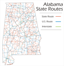
's State Route System (typically abbreviated SR) uses the standard numbering convention: odd numbers signify a north-south state route
State highway
State highway, state road or state route can refer to one of three related concepts, two of them related to a state or provincial government in a country that is divided into states or provinces :#A...
, and even numbers signify an east-west route. Often more than one route number shares the same roadway, so identifying which route the mile markers are for is often difficult.
In no case does a State Route number mirror a U.S. Highway number. As such, the following State Routes do not exist: 11, 29, 31, 43, 45, 72, 78, 80, 82, 84, 90, 98, 231, 278, 280, 331, 411 or 431.
Current State Routes
| Route number | Length | Western / southern terminus | Eastern / northern terminus |
|---|---|---|---|
| Florida Florida Florida is a state in the southeastern United States, located on the nation's Atlantic and Gulf coasts. It is bordered to the west by the Gulf of Mexico, to the north by Alabama and Georgia and to the east by the Atlantic Ocean. With a population of 18,801,310 as measured by the 2010 census, it... State Line (US-231) |
Tennessee Tennessee Tennessee is a U.S. state located in the Southeastern United States. It has a population of 6,346,105, making it the nation's 17th-largest state by population, and covers , making it the 36th-largest by total land area... State Line (US-231/US-431) (Hidden) |
||
| Mississippi Mississippi Mississippi is a U.S. state located in the Southern United States. Jackson is the state capital and largest city. The name of the state derives from the Mississippi River, which flows along its western boundary, whose name comes from the Ojibwe word misi-ziibi... State Line (US-72) |
Tennessee Tennessee Tennessee is a U.S. state located in the Southeastern United States. It has a population of 6,346,105, making it the nation's 17th-largest state by population, and covers , making it the 36th-largest by total land area... State Line (US-72) (Hidden) |
||
| US-90/US-98 at Spanish Fort Spanish Fort, Alabama Spanish Fort is a suburb of Mobile, Alabama in Baldwin County, Alabama, United States, located on the eastern shore of Mobile Bay. The 2000 census lists the population of the city as 5,423. It is part of the Daphne-Fairhope-Foley micropolitan area.... |
Tennessee Tennessee Tennessee is a U.S. state located in the Southeastern United States. It has a population of 6,346,105, making it the nation's 17th-largest state by population, and covers , making it the 36th-largest by total land area... State Line (I-65 Interstate 65 in Alabama Interstate 65, beginning in Mobile at an interchange with Interstate 10, meanders across of the Alabama countryside linking six of the state's ten largest cities. The highway links together many important roadways that make commerce inside and outside of the state's boundaries possible... ) (Hidden) |
||
| Mississippi Mississippi Mississippi is a U.S. state located in the Southern United States. Jackson is the state capital and largest city. The name of the state derives from the Mississippi River, which flows along its western boundary, whose name comes from the Ojibwe word misi-ziibi... State Line (US-78/I-22) |
Georgia Georgia (U.S. state) Georgia is a state located in the southeastern United States. It was established in 1732, the last of the original Thirteen Colonies. The state is named after King George II of Great Britain. Georgia was the fourth state to ratify the United States Constitution, on January 2, 1788... State Line (Hidden) |
||
| US-43 at Thomasville Thomasville, Alabama Thomasville is a city in Clarke County, Alabama, United States. At the 2010 census the population was 4,209. Founded as a late 19th century railroad town, it has transitioned over the course of more than a century into a 21st century commercial hub... |
US-278 at Natural Bridge Natural Bridge, Alabama Natural Bridge is a town at the southwest edge of Winston County, Alabama, United States, located near the intersection of U.S. Highway 278 and Alabama Highway 13. The population was 28 at the 2000 census... |
||
| Mississippi Mississippi Mississippi is a U.S. state located in the Southern United States. Jackson is the state capital and largest city. The name of the state derives from the Mississippi River, which flows along its western boundary, whose name comes from the Ojibwe word misi-ziibi... State Line (US-82) |
Georgia Georgia (U.S. state) Georgia is a state located in the southeastern United States. It was established in 1732, the last of the original Thirteen Colonies. The state is named after King George II of Great Britain. Georgia was the fourth state to ratify the United States Constitution, on January 2, 1788... State Line (US-82) (Hidden) |
||
| Mississippi Mississippi Mississippi is a U.S. state located in the Southern United States. Jackson is the state capital and largest city. The name of the state derives from the Mississippi River, which flows along its western boundary, whose name comes from the Ojibwe word misi-ziibi... State Line (US-11/US-80) |
Georgia Georgia (U.S. state) Georgia is a state located in the southeastern United States. It was established in 1732, the last of the original Thirteen Colonies. The state is named after King George II of Great Britain. Georgia was the fourth state to ratify the United States Constitution, on January 2, 1788... State Line (US-11) (Hidden) |
||
| Exit 1 off I-20 Interstate 20 in Alabama In Alabama, Interstate 20 travels 214.7 miles through the center of the state. It enters the state from Mississippi near York, and travels northeastward through Tuscaloosa and Birmingham... /I-59 near Cuba Cuba, Alabama Cuba is a town in Sumter County, Alabama, United States. At the 2000 census the population was 363.-Geography:Cuba is located at .... |
Georgia Georgia (U.S. state) Georgia is a state located in the southeastern United States. It was established in 1732, the last of the original Thirteen Colonies. The state is named after King George II of Great Britain. Georgia was the fourth state to ratify the United States Constitution, on January 2, 1788... State Line (US-80) (Hidden) |
||
| Florida Florida Florida is a state in the southeastern United States, located on the nation's Atlantic and Gulf coasts. It is bordered to the west by the Gulf of Mexico, to the north by Alabama and Georgia and to the east by the Atlantic Ocean. With a population of 18,801,310 as measured by the 2010 census, it... State Line (US-331) |
Georgia Georgia (U.S. state) Georgia is a state located in the southeastern United States. It was established in 1732, the last of the original Thirteen Colonies. The state is named after King George II of Great Britain. Georgia was the fourth state to ratify the United States Constitution, on January 2, 1788... (GA 20 Georgia State Route 20 State Route 20 is an abnormally-oriented route in roughly the shape of a capital J rotated ninety degrees to the left. Its counterclockwise terminus is at the Alabama state line in Floyd County, and its clockwise terminus occurs in the middle of an overpass over US 19/US 41 and SR 3 in Hampton in... ) (Partly hidden) |
||
| Mississippi Mississippi Mississippi is a U.S. state located in the Southern United States. Jackson is the state capital and largest city. The name of the state derives from the Mississippi River, which flows along its western boundary, whose name comes from the Ojibwe word misi-ziibi... State Line (MS 19) |
Georgia Georgia (U.S. state) Georgia is a state located in the southeastern United States. It was established in 1732, the last of the original Thirteen Colonies. The state is named after King George II of Great Britain. Georgia was the fourth state to ratify the United States Constitution, on January 2, 1788... State Line (GA 37 Georgia State Route 37 State Route 37 is a west–east state route located in the southern part of the U.S. state of Georgia. The route travels from Alabama State Route 10 at the Alabama state line west of Fort Gaines east to U.S... ) |
||
| Mississippi Mississippi Mississippi is a U.S. state located in the Southern United States. Jackson is the state capital and largest city. The name of the state derives from the Mississippi River, which flows along its western boundary, whose name comes from the Ojibwe word misi-ziibi... State Line (US-84) |
Georgia Georgia (U.S. state) Georgia is a state located in the southeastern United States. It was established in 1732, the last of the original Thirteen Colonies. The state is named after King George II of Great Britain. Georgia was the fourth state to ratify the United States Constitution, on January 2, 1788... State Line (Hidden) |
||
| US-90 at Mobile Mobile, Alabama Mobile is the third most populous city in the Southern US state of Alabama and is the county seat of Mobile County. It is located on the Mobile River and the central Gulf Coast of the United States. The population within the city limits was 195,111 during the 2010 census. It is the largest... |
Tennessee Tennessee Tennessee is a U.S. state located in the Southeastern United States. It has a population of 6,346,105, making it the nation's 17th-largest state by population, and covers , making it the 36th-largest by total land area... State Line (US-43) (Partly hidden) |
||
| Mississippi Mississippi Mississippi is a U.S. state located in the Southern United States. Jackson is the state capital and largest city. The name of the state derives from the Mississippi River, which flows along its western boundary, whose name comes from the Ojibwe word misi-ziibi... State Line (MS 69) |
SR-147 at Auburn Auburn, Alabama Auburn is a city in Lee County, Alabama, United States. It is the largest city in eastern Alabama with a 2010 population of 53,380. It is a principal city of the Auburn-Opelika Metropolitan Area... |
||
| US-31 at Brewton Brewton, Alabama Brewton is a city in Escambia County, Alabama, United States. At the 2000 census the population was 5,498. The city is the county seat of Escambia County.-History:... |
Georgia Georgia (U.S. state) Georgia is a state located in the southeastern United States. It was established in 1732, the last of the original Thirteen Colonies. The state is named after King George II of Great Britain. Georgia was the fourth state to ratify the United States Constitution, on January 2, 1788... State Line (US-29) (Hidden) |
||
| Mississippi Mississippi Mississippi is a U.S. state located in the Southern United States. Jackson is the state capital and largest city. The name of the state derives from the Mississippi River, which flows along its western boundary, whose name comes from the Ojibwe word misi-ziibi... State Line (US-90) |
Florida Florida Florida is a state in the southeastern United States, located on the nation's Atlantic and Gulf coasts. It is bordered to the west by the Gulf of Mexico, to the north by Alabama and Georgia and to the east by the Atlantic Ocean. With a population of 18,801,310 as measured by the 2010 census, it... State Line (US-90) (Hidden) |
||
| US-98 at Mobile Mobile, Alabama Mobile is the third most populous city in the Southern US state of Alabama and is the county seat of Mobile County. It is located on the Mobile River and the central Gulf Coast of the United States. The population within the city limits was 195,111 during the 2010 census. It is the largest... |
Tennessee Tennessee Tennessee is a U.S. state located in the Southeastern United States. It has a population of 6,346,105, making it the nation's 17th-largest state by population, and covers , making it the 36th-largest by total land area... State Line (TN 13 Tennessee State Route 13 State Route 13 is a south–north route from the Alabama border at Wayne County, Tennessee to the Kentucky border in Montgomery County.- Route description :... ) (Partly hidden) |
||
| Mississippi Mississippi Mississippi is a U.S. state located in the Southern United States. Jackson is the state capital and largest city. The name of the state derives from the Mississippi River, which flows along its western boundary, whose name comes from the Ojibwe word misi-ziibi... State Line (MS 12) |
SR-69 south of Oakman Oakman, Alabama Oakman is a town in Walker County, Alabama, United States. At the 2000 census the population was 944.-Geography:Oakman is located at .According to the U.S. Census Bureau, the town has a total area of , all of it land... |
||
| SR-17 Alabama State Route 17 State Route 17, or SR-17, is a long state route that runs the virtual length of the state. Between Mobile and Deer Park in Washington County, SR-17 is the unsigned partner route assigned to U.S. Highway 45, and from Hamilton to Florence, it serves as the signed partner route assigned to U.S... north of Detroit Detroit, Alabama Detroit is a town in Lamar County, Alabama, United States. At the 2000 census the population was 247.-Geography:Detroit is located at .According to the U.S. Census Bureau, the town has a total area of , all of it land.... |
SR-24 Alabama State Route 24 State Route 24 is a long route in the northwestern and north-central part of the state. The western terminus of the route is near Red Bay at the Mississippi state line, where it continues as Mississippi Highway 23. The eastern terminus of the route is at the junction with State Route 67 at Decatur... at Red Bay Red Bay, Alabama Red Bay is a city in Franklin County, Alabama, United States. At the 2000 census the population was 3,374.-Geography:Red Bay is located at .According to the U.S... |
||
| Tennessee Tennessee Tennessee is a U.S. state located in the Southeastern United States. It has a population of 6,346,105, making it the nation's 17th-largest state by population, and covers , making it the 36th-largest by total land area... State Line (TN 69 Tennessee State Route 69 State Route 69 is a state highway in West and Middle Tennessee that runs nearby to the Tennessee River for the majority of its length. SR 69 carries both primary and secondary highway designations and is primarily rural in nature.... ) |
I-65 Interstate 65 in Alabama Interstate 65, beginning in Mobile at an interchange with Interstate 10, meanders across of the Alabama countryside linking six of the state's ten largest cities. The highway links together many important roadways that make commerce inside and outside of the state's boundaries possible... |
||
| Florida Florida Florida is a state in the southeastern United States, located on the nation's Atlantic and Gulf coasts. It is bordered to the west by the Gulf of Mexico, to the north by Alabama and Georgia and to the east by the Atlantic Ocean. With a population of 18,801,310 as measured by the 2010 census, it... State Line (FL 97) |
SR-9 Alabama State Route 9 State Route 9 is one of the longest state highways in the U.S. state of Alabama. From the Florida state line north to Montgomery, SR-9 is the unsigned partner route of U.S. Highway 331. As a signed route, the southern terminus of SR-9 is at its junction with U.S... at Piedmont Piedmont, Alabama Piedmont is a city in Calhoun and Cherokee counties in the U.S. state of Alabama. The population was 5,120 at the 2000 census. It is included in the Anniston-Oxford, Alabama Metropolitan Statistical Area. Many surrounding communities utilize the 36272 ZIP code, including Spring Garden, Rock Run,... |
||
| SR-5 at Safford Safford, Alabama Safford is an unincorporated community in Dallas County, Alabama.-Geography:Safford is located at and has an elevation of .... |
Georgia Georgia (U.S. state) Georgia is a state located in the southeastern United States. It was established in 1732, the last of the original Thirteen Colonies. The state is named after King George II of Great Britain. Georgia was the fourth state to ratify the United States Constitution, on January 2, 1788... State Line (GA 34 Georgia State Route 34 State Route 34 begins just west of Franklin at the Georgia–Alabama line and ends at the junction with SR 54 in eastern Coweta County, just west of Peachtree City. The portion extending east from Newnan is a four-lane parkway. Its bypass is Georgia State Route 34 Bypass... ) |
||
| US-11 east of Springville Springville, Alabama Springville is a town in St. Clair County, Alabama, United States. At the 2000 census the population was 2,521.-Geography:Springville is located at .According to the U.S... |
US-231 at Ashville Ashville, Alabama Ashville is a city in St. Clair County, Alabama, United States part of the Birmingham-Hoover-Cullman Combined Statistical Area. Its population was 2,260 at the 2000 census, at which time it was a town. This town is the county seat of St. Clair County along with Pell City. According to the 2005 U.S.... |
||
| Mississippi Mississippi Mississippi is a U.S. state located in the Southern United States. Jackson is the state capital and largest city. The name of the state derives from the Mississippi River, which flows along its western boundary, whose name comes from the Ojibwe word misi-ziibi... State Line (MS 23) |
US-31 at Decatur Decatur, Alabama Decatur is a city in Limestone and Morgan Counties in the U.S. state of Alabama. The city, affectionately known as "The River City", is located in Northern Alabama on the banks of Wheeler Lake, along the Tennessee River. It is the largest city and county seat of Morgan County... |
||
| SR-5 west of Pine Hill Pine Hill, Alabama Pine Hill is a town in Wilcox County, Alabama, United States. As of the 2000 census, the population of the town is 966.-Geography:Pine Hill is located at .According to the U.S... |
Georgia Georgia (U.S. state) Georgia is a state located in the southeastern United States. It was established in 1732, the last of the original Thirteen Colonies. The state is named after King George II of Great Britain. Georgia was the fourth state to ratify the United States Constitution, on January 2, 1788... State Line (US-411) (Partly hidden) |
||
| SR-51 Alabama State Route 51 State Route 51 is a long route in the southeastern and east-central part of the state. The southern terminus of the route is at its junction with U.S. Highway 84 near New Brockton. The northern terminus of the route is at an interchange with Interstate 85 and U.S... at Hurtsboro Hurtsboro, Alabama Hurtsboro is a town in Russell County, Alabama, United States. At the 2000 census the population was 592. It was founded in 1857 as Hurtsville and named for Joel Hurt, Sr.... |
431 at Seale Seale, Alabama Seale is an unincorporated community in Russell County, Alabama, United States. The county seat from 1868-1935, and is current home to the counties High and Middle Schools. One of Alabama's oldest buildings, the Russell County courthouse also is located in the city. -References:... |
||
| Florida Florida Florida is a state in the southeastern United States, located on the nation's Atlantic and Gulf coasts. It is bordered to the west by the Gulf of Mexico, to the north by Alabama and Georgia and to the east by the Atlantic Ocean. With a population of 18,801,310 as measured by the 2010 census, it... State Line (FL 185) |
SR-10 Alabama State Route 10 State Route 10 is an east–west route in southern Alabama. It is the lowest even numbered route in the state that is not an unsigned partner route assigned to a U.S. highway. It is also the only signed state route that extends from the Mississippi state line to the Georgia line... at Abbeville Abbeville, Alabama Abbeville is a city in Henry County, Alabama, United States. It is part of the Dothan, Alabama Metropolitan Statistical Area. At the 2010 census, the population was 2,688. The city is the county seat of Henry County. It is the first city alphabetically, both by city and state, in the Rand McNally... |
||
| SR-17 Alabama State Route 17 State Route 17, or SR-17, is a long state route that runs the virtual length of the state. Between Mobile and Deer Park in Washington County, SR-17 is the unsigned partner route assigned to U.S. Highway 45, and from Hamilton to Florence, it serves as the signed partner route assigned to U.S... north of Boyd |
SR-21 north of Oak Hill Oak Hill, Alabama Oak Hill is a town in Wilcox County, Alabama, United States. The population was 37 at the 2000 census. Benjamin M. Miller, Governor of Alabama from 1931 to 1935, was born at Oak Hill on March 13, 1864.-Geography:... |
||
| SR-51 Alabama State Route 51 State Route 51 is a long route in the southeastern and east-central part of the state. The southern terminus of the route is at its junction with U.S. Highway 84 near New Brockton. The northern terminus of the route is at an interchange with Interstate 85 and U.S... at Clayton Clayton, Alabama Clayton is a town in and the county seat of Barbour County, Alabama, United States. The population was 1,475 at the 2000 census.-History:County Seat of Barbour County... |
US-431 at Eufaula Eufaula, Alabama Eufaula is a city in Barbour County, Alabama, United States. At the 2000 census the population was 13,908.-Geography:Eufaula is located at 31°53'21.732" North, 85°9'13.586" West .... |
||
| Mississippi Mississippi Mississippi is a U.S. state located in the Southern United States. Jackson is the state capital and largest city. The name of the state derives from the Mississippi River, which flows along its western boundary, whose name comes from the Ojibwe word misi-ziibi... State Line (MS 14) |
SR-17 Alabama State Route 17 State Route 17, or SR-17, is a long state route that runs the virtual length of the state. Between Mobile and Deer Park in Washington County, SR-17 is the unsigned partner route assigned to U.S. Highway 45, and from Hamilton to Florence, it serves as the signed partner route assigned to U.S... south of Cochrane |
||
| US-278 at Double Springs Double Springs, Alabama Double Springs is a town in Winston County, Alabama, United States. At the 2000 census the population was 1,003. The city is the county seat of Winston County.- Geography :Double Springs is located at .According to the U.S... |
Alternate US-72 at Courtland Courtland, Alabama Courtland is a town in Lawrence County, Alabama, and is included in the Decatur Metropolitan Area, as well as the Huntsville-Decatur Combined Statistical Area. As of the 2000 census, the population of the town is 769.-Geography:... |
||
| US-231 at Pell City Pell City, Alabama Pell City is a city in St. Clair County, Alabama, United States. The city is the county seat of St. Clair County along with Ashville. At the 2000 census the population was 9,565. At the 2010 census, the city-limit population jumped to 12,695. -Geography:... |
SR-77 Alabama State Route 77 State Route 77 or SR-77 is a north–south highway in eastern Alabama that runs from U.S. Highway 431 near Lafayette and ends at U.S. Highway 431 just north of Attalla... north of Talladega Talladega, Alabama Talladega is a city in Talladega County, Alabama, United States. At the 2000 census the population was 15,143. The city is the county seat of Talladega County. Talladega is approximately 50 miles east of Birmingham, Alabama.... |
||
| SR-9 Alabama State Route 9 State Route 9 is one of the longest state highways in the U.S. state of Alabama. From the Florida state line north to Montgomery, SR-9 is the unsigned partner route of U.S. Highway 331. As a signed route, the southern terminus of SR-9 is at its junction with U.S... |
US-72 at Woodville Woodville, Alabama Woodville is a town in Jackson County, Alabama, United States, and is included in the Huntsville-Decatur Combined Statistical Area. As of the 2000 census, the population of the town is 761.-History:... |
||
| SR-33 Alabama State Route 33 State Route 33 is a route in the northwestern part of the state. The southern terminus of the route is at its junction with U.S. Highway 278 at Double Springs. The northern terminus of the route is at its junction with Alternate US-72 and State Route 20 at Courtland.-Route description:From its... at Wren |
US-231 at Lacey's Spring Lacey's Spring, Alabama Lacey's Spring is an unincorporated community in northeastern Morgan County, Alabama, United States at the base of Brindley Mountain. It is included in the Decatur Metropolitan Area, as well as the Huntsville-Decatur Combined Statistical Area.... |
||
| US-84 west of Daleville Daleville, Alabama Daleville is a city in Dale County, Alabama, United States. At the 2000 census the population was 4,653. It is part of the Enterprise–Ozark Micropolitan Statistical Area. The city's nickname is "Gateway to Fort Rucker", as this U.S. Army post is located just north of town... |
Fort Rucker Fort Rucker Fort Rucker is a U.S. Army post located mostly in Dale County, Alabama, United States. It was named for a Civil War officer, Confederate General Edmund Rucker. The post is the primary flight training base for Army Aviation and is home to the United States Army Aviation Center of Excellence and... |
||
| I-20 Interstate 20 in Alabama In Alabama, Interstate 20 travels 214.7 miles through the center of the state. It enters the state from Mississippi near York, and travels northeastward through Tuscaloosa and Birmingham... /59/US-31 at Birmingham Birmingham, Alabama Birmingham is the largest city in Alabama. The city is the county seat of Jefferson County. According to the 2010 United States Census, Birmingham had a population of 212,237. The Birmingham-Hoover Metropolitan Area, in estimate by the U.S... |
Georgia Georgia (U.S. state) Georgia is a state located in the southeastern United States. It was established in 1732, the last of the original Thirteen Colonies. The state is named after King George II of Great Britain. Georgia was the fourth state to ratify the United States Constitution, on January 2, 1788... State Line (US-280) (Hidden) |
||
| US-11 south of Epes Epes, Alabama Epes is a town in Sumter County, Alabama, United States. At the 2000 census the population was 206.-Geography:Epes is located at .According to the U.S. Census Bureau, the town has a total area of , all of it land.-Demographics:... |
SR-14 at Clinton | ||
| SR-35 Alabama State Route 35 State Route 35 is a long state route in the northeastern part of the state. The southern terminus of the route is at its junction with State Route 9 in rural Cherokee County northeast of Cedar Bluff and near the Alabama-Georgia state line. The northern terminus of the route is at Woodville in... east of Scottsboro Scottsboro, Alabama Scottsboro is a city in Jackson County, Alabama, United States. As of the 2010 census, the population of the city is 14,770. Named for its founder Robert Scott, the city is the county seat of Jackson County.... |
US-11 at Hammondville Hammondville, Alabama Hammondville is a town in DeKalb County, Alabama, in the United States. As of the 2010 census, the population of the town is 488.-Geography:Hammondville is located at .... |
||
| Florida Florida Florida is a state in the southeastern United States, located on the nation's Atlantic and Gulf coasts. It is bordered to the west by the Gulf of Mexico, to the north by Alabama and Georgia and to the east by the Atlantic Ocean. With a population of 18,801,310 as measured by the 2010 census, it... State Line (FL 87) |
SR-14 at Selma Selma, Alabama Selma is a city in and the county seat of Dallas County, Alabama, United States, located on the banks of the Alabama River. The population was 20,512 at the 2000 census.... |
||
| Mississippi Mississippi Mississippi is a U.S. state located in the Southern United States. Jackson is the state capital and largest city. The name of the state derives from the Mississippi River, which flows along its western boundary, whose name comes from the Ojibwe word misi-ziibi... State Line US-98 |
Florida Florida Florida is a state in the southeastern United States, located on the nation's Atlantic and Gulf coasts. It is bordered to the west by the Gulf of Mexico, to the north by Alabama and Georgia and to the east by the Atlantic Ocean. With a population of 18,801,310 as measured by the 2010 census, it... State Line US-98 (Hidden) |
||
| US-43 at Guin Guin, Alabama Guin is a city in Marion County, Alabama, United States. At the 2000 census the population was 2,389. On July 13, 2010, the citizens of Guin voted to become the first city in Marion County, since Prohibition, to allow the sale of alcohol.... |
AL 129 at Brilliant Brilliant, Alabama Brilliant is a town in Marion County, Alabama, United States. At the 2000 census the population was 762.-History:The present Town of Brilliant was incorporated as Boston, Alabama and was named for the City of Boston, Massachusetts and in part for early settlers of the area, the Bostick family... |
||
| US-78 at Heflin Heflin, Alabama Heflin is a city in Cleburne County, Alabama, United States. At the 2000 census the population was 3,002. The city is the county seat of Cleburne County.-History:... |
Georgia Georgia (U.S. state) Georgia is a state located in the southeastern United States. It was established in 1732, the last of the original Thirteen Colonies. The state is named after King George II of Great Britain. Georgia was the fourth state to ratify the United States Constitution, on January 2, 1788... State Line (GA 166 Georgia State Route 166 State Route 166 starts at the Alabama line west of Carrollton in Carroll County. It goes around Carrollton on a by-pass route constructed in the mid-1900s. From there, S.R. 166 enters Douglas County where it remains mostly rural. After a short north–south concurrency with State Route 92, it... ) |
||
| US-84 at Mexia | SR-10 Alabama State Route 10 State Route 10 is an east–west route in southern Alabama. It is the lowest even numbered route in the state that is not an unsigned partner route assigned to a U.S. highway. It is also the only signed state route that extends from the Mississippi state line to the Georgia line... at Awin |
||
| AL 9 Alabama State Route 9 State Route 9 is one of the longest state highways in the U.S. state of Alabama. From the Florida state line north to Montgomery, SR-9 is the unsigned partner route of U.S. Highway 331. As a signed route, the southern terminus of SR-9 is at its junction with U.S... at Lineville Lineville, Alabama Lineville is a city in Clay County, Alabama, United States. At the 2000 census the population was 2,401.-History:Native Americans were the first to inhabit the area now known as Lineville. The Creek Indian War of 1813, however, resulted in their removal. The first white settlers in the area were... |
Georgia Georgia (U.S. state) Georgia is a state located in the southeastern United States. It was established in 1732, the last of the original Thirteen Colonies. The state is named after King George II of Great Britain. Georgia was the fourth state to ratify the United States Constitution, on January 2, 1788... State Line (GA 5 Georgia State Route 5 State Route 5 is a route that bisects northern Georgia. It passes through the county seats of Blue Ridge, Ellijay, Jasper, Canton, Marietta, and Douglasville. Along the way, it overlaps one of metro Atlanta's freeways, I-575. From the Cherokee/Pickens County line to Blue Ridge, Georgia 5 is... ) |
||
| Exit 32 off I-85 Interstate 85 in Alabama In the U.S. state of Alabama, Interstate 85 scales the state for from Montgomery to the Georgia border.-Exit list:In the U.S. state of Alabama, Interstate 85 scales the state for from Montgomery to the Georgia border.-Exit list:... south of Franklin Franklin, Alabama Franklin is a town in Macon County, Alabama, United States. At the 2010 census the population was 145.-History and Educational Legacy:Franklin School was in operation as early as the 1890s teaching grades 1-11. By the mid 1930s it was downsized to grades 1-6... |
AL 281 in Talladega National Forest Talladega National Forest The Talladega National Forest is located in the U.S. state of Alabama and covers 392,567 acres at the southern edge of the Appalachian Mountains.... |
||
| SR-229 Alabama State Route 229 State Route 229 or SR-229 is a long route that serves as a connection between Interstate 85 south of Millstead to State Route 63 south of Lake Martin in Elmore County.-Route description:... near Martin Dam Lake Martin Lake Martin is located in Tallapoosa, Elmore, and Coosa counties in Alabama. It is a 44,000-acre lake with over 750 miles of wooded shoreline. An artificial reservoir, Lake Martin was formed by the construction of Martin Dam on the Tallapoosa River. The Martin Dam powerhouse is used to generate... |
US-29 at Lanett Lanett, Alabama Lanett is a city in Chambers County, Alabama, United States. At the 2000 census the population was 7,897. Lanett, originally called Bluffton, is located in eastern Alabama, on the Chattahoochee River, southwest of Atlanta, Georgia... |
||
| US-84 north of Enterprise Enterprise, Alabama Enterprise is a city in the southeastern part of Coffee and Dale Counties in the southeastern part of Alabama in the Southern United States. The population was estimated to be 25,909 in the year 2009.... |
I-85 Interstate 85 in Alabama In the U.S. state of Alabama, Interstate 85 scales the state for from Montgomery to the Georgia border.-Exit list:In the U.S. state of Alabama, Interstate 85 scales the state for from Montgomery to the Georgia border.-Exit list:... Exit 60 at Opelika Opelika, Alabama Opelika is a city in and the county seat of Lee County in the east central part of the U.S. state of Alabama. It is a principal city of the Auburn-Opelika Metropolitan Area. According to 2010 Census, the population of Opelika was 26,477... |
||
| US-331 at Opp Opp, Alabama Opp is a city in Covington County, Alabama, United States. At the 2000 census the population was 6,607. -Geography:Opp is located at . According to the U.S... |
Georgia Georgia (U.S. state) Georgia is a state located in the southeastern United States. It was established in 1732, the last of the original Thirteen Colonies. The state is named after King George II of Great Britain. Georgia was the fourth state to ratify the United States Constitution, on January 2, 1788... State Line (GA 62 Georgia State Route 62 Georgia State Route 62 is a state route in southwest Georgia that runs from the Georgia-Alabama line near Hilton to State Route 234 in Albany.- Routing :... ) |
||
| Florida Florida Florida is a state in the southeastern United States, located on the nation's Atlantic and Gulf coasts. It is bordered to the west by the Gulf of Mexico, to the north by Alabama and Georgia and to the east by the Atlantic Ocean. With a population of 18,801,310 as measured by the 2010 census, it... State Line (FL 71) |
I-65 Interstate 65 in Alabama Interstate 65, beginning in Mobile at an interchange with Interstate 10, meanders across of the Alabama countryside linking six of the state's ten largest cities. The highway links together many important roadways that make commerce inside and outside of the state's boundaries possible... west of Ardmore Ardmore, Alabama Ardmore is a town in Limestone County, Alabama, United States, and is included in the Huntsville-Decatur Metro Area. It is home to the Saturn 1B Rocket, at the Alabama Welcome Center, just south of the Tennessee border, on Interstate 65. As of the 2010 census, the population of the town is 1,194.... (Partly hidden) |
||
| US-331 at Florala Florala, Alabama Florala is a city in Covington County, Alabama, United States. At the 2000 census the population was 1,964.-Geography:Florala is located at . According to the U.S... |
SR-52 Alabama State Route 52 State Route 52 is an long route in the southeastern part of the state. The western terminus of the route is at a junction with U.S. Highway 331 at Opp. The eastern terminus of the route is at the Georgia state line east of Columbia... west of Samson Samson, Alabama Samson is a city in Geneva County, Alabama, United States. It is part of the Dothan, Alabama Metropolitan Statistical Area. At the 2000 census the population was 2,071.-Geography:Samson is located at .According to the U.S... |
||
| Florida Florida Florida is a state in the southeastern United States, located on the nation's Atlantic and Gulf coasts. It is bordered to the west by the Gulf of Mexico, to the north by Alabama and Georgia and to the east by the Atlantic Ocean. With a population of 18,801,310 as measured by the 2010 census, it... State Line (FL 85) |
US-31 at McKenzie McKenzie, Alabama McKenzie is a town in Butler and Conecuh counties in the U.S. state of Alabama. The population was 644 at the 2000 census.-Geography:McKenzie is located at .... |
||
| Mississippi Mississippi Mississippi is a U.S. state located in the Southern United States. Jackson is the state capital and largest city. The name of the state derives from the Mississippi River, which flows along its western boundary, whose name comes from the Ojibwe word misi-ziibi... State Line (MS 42 |
US-43 at Wagerville | ||
| Mississippi Mississippi Mississippi is a U.S. state located in the Southern United States. Jackson is the state capital and largest city. The name of the state derives from the Mississippi River, which flows along its western boundary, whose name comes from the Ojibwe word misi-ziibi... State Line (US-45) |
SR-17 Alabama State Route 17 State Route 17, or SR-17, is a long state route that runs the virtual length of the state. Between Mobile and Deer Park in Washington County, SR-17 is the unsigned partner route assigned to U.S. Highway 45, and from Hamilton to Florence, it serves as the signed partner route assigned to U.S... near Deer Park Deer Park, Alabama Deer Park is an unincorporated community and census-designated place in Washington County, Alabama, United States. It had a population of 188 at the 2010 census. Deer Park is south-southwest of Chatom. Deer Park has a post office with ZIP code 36529.... (Hidden) |
||
| US-82/AL 25/AL 219 Alabama State Route 219 State Route 219 or SR-219 is a long route that serves as a connector route between Selma in Dallas County and Centreville in Bibb County.-Route description:... at Centreville Centreville, Alabama Centreville is a city in Bibb County, Alabama, United States. At the 2000 census the population was 2,466. The city is the county seat of Bibb County.-Geography:According to the U.S... |
US-82 at Centreville | ||
| SR-182 Alabama State Route 182 State Route 182 or SR-182 is a state highway that serves as the primary east-west connection along the Alabama shoreline of the Gulf of Mexico between Gulf Shores and Orange Beach in Baldwin County... at Gulf Shores Gulf Shores, Alabama -External links:*... |
SR-21 at Uriah Uriah, Alabama Uriah is located in Monroe County in the southern United States state of Alabama. Uriah serves as the junction of State Route 21 and State Route 59.-Education:... |
||
| SR-14 at Wedgeworth | SR-69 South of Moundville Moundville, Alabama Moundville is a town in Hale and Tuscaloosa Counties in the U.S. state of Alabama. At the 2000 census the population was 1,809. It is part of the Tuscaloosa Metropolitan Statistical Area. Moundville is known for its quintessential southern landscapes and Indian Mounds.-Geography:Moundville is... |
||
| US-80 at Uniontown Uniontown, Alabama Uniontown is a city in Perry County, Alabama in the United States of America. As of the 2000 census, the population of the city is 1,636. The current mayor is Jamaal O. Hunter.-History:... |
SR-14 at Greensboro Greensboro, Alabama Greensboro is a city in Hale County, Alabama, United States. At the 2000 census the population was 2,731. The city is the county seat of Hale County. It is part of the Tuscaloosa, Alabama Metropolitan Statistical Area.-History:... |
||
| Monsanto Road off SR-227 Alabama State Route 227 State Route 227 or SR-227 is a long route that serves as a connection between the DeKalb/Etowah county line south of Crossville with U.S. Highway 431 at Guntersville in Marshall County.-Route description:... north of Guntersville Guntersville, Alabama Guntersville is a city in Marshall County, Alabama, United States and is included in the Huntsville-Decatur Combined Statistical Area. At the 2010 census, the population of the city was 8,197. The city is the county seat of Marshall County. Guntersville is located in a HUBZone as identified by the... |
|||
| SR-14 at Claud | SR-9 Alabama State Route 9 State Route 9 is one of the longest state highways in the U.S. state of Alabama. From the Florida state line north to Montgomery, SR-9 is the unsigned partner route of U.S. Highway 331. As a signed route, the southern terminus of SR-9 is at its junction with U.S... at Cleveland Crossroads |
||
| US-43 north of Killen Killen, Alabama Killen is a town in Lauderdale County, Alabama, United States. It is part of the Florence - Muscle Shoals Metropolitan Statistical Area known as "The Shoals". As of the 2000 census, the population of the town is 1,190.-Geography:... |
SR-207 Alabama State Route 207 State Route 207 or SR-207 is a long route that serves as a connection between U.S. Highway 72 in Rogersville in Lauderdale County and the Tennessee state line. After crossing the state line, this becomes Tennessee State Route 11.-Route description:... north Anderson Anderson, Alabama Anderson is a town in Lauderdale County, Alabama, United States. It is part of the Florence - Muscle Shoals Metropolitan Statistical Area known as "The Shoals". As of the 2000 census, the population of the town is 354. According to the 2005 U.S. Census estimates, the town had a population of 348... |
||
| US-72 north of Paint Rock Paint Rock, Alabama Paint Rock is a town in Jackson County, Alabama, United States, along the Paint Rock River, and is included in the Huntsville-Decatur Combined Statistical Area. As of the 2000 census, the population of the town is 185.... |
Tennessee Tennessee Tennessee is a U.S. state located in the Southeastern United States. It has a population of 6,346,105, making it the nation's 17th-largest state by population, and covers , making it the 36th-largest by total land area... State Line (TN 97) |
||
| SR-28 Alabama State Route 28 State Route 28 is a long state route in the western part of the state. The route’s western terminus is at the junction with State Route 17 at Emelle in northwestern Sumter County, and the eastern terminus of the route is at the junction with State Route 21 near Darlington in eastern Wilcox... at Consul Consul, Alabama Consul is an unincorporated community in Marengo County, Alabama. Consul had a post office at one time, but it no longer exists.-Geography:Consul is located at and has an elevation of .... |
SR-5 south of Safford Safford, Alabama Safford is an unincorporated community in Dallas County, Alabama.-Geography:Safford is located at and has an elevation of .... |
||
| US-231 south of Summit | Alternate US-72 at Decatur Decatur, Alabama Decatur is a city in Limestone and Morgan Counties in the U.S. state of Alabama. The city, affectionately known as "The River City", is located in Northern Alabama on the banks of Wheeler Lake, along the Tennessee River. It is the largest city and county seat of Morgan County... |
||
| SR-75 near Albertville Albertville, Alabama Albertville is a city in Marshall County, Alabama, United States, and is included in the Huntsville-Decatur Combined Statistical Area. As of the 2010 census, the population of the city was 21,160.- History :... |
Georgia Georgia (U.S. state) Georgia is a state located in the southeastern United States. It was established in 1732, the last of the original Thirteen Colonies. The state is named after King George II of Great Britain. Georgia was the fourth state to ratify the United States Constitution, on January 2, 1788... State Line (GA 114 Georgia State Route 114 State Route 114 is a state route located entirely in Chattooga County in northwest Georgia.-Route description:The route begins at the Georgia-Alabama state line as a continuation of Alabama State Route 68. The highway runs parallel to the Chattooga River, going through the towns of Chattoogaville... ) |
||
| SR-177 Alabama State Route 177 State Route 177 is a long route in Jackson in the southwestern part of the state. Bothis its southern and northern termini are at separate intersections with US-43 in Jackson.-Route description:Prior to 1970, US-43 passed through Jackson... at Jackson Jackson, Alabama Jackson is a city in Clarke County, Alabama, United States. The population was 5,228 at the 2010 census. It is one of three wet settlements in an otherwise-dry county.-Geography:Jackson is located at coordinates . According to the U.S... |
US-431 at Guntersville Guntersville, Alabama Guntersville is a city in Marshall County, Alabama, United States and is included in the Huntsville-Decatur Combined Statistical Area. At the 2010 census, the population of the city was 8,197. The city is the county seat of Marshall County. Guntersville is located in a HUBZone as identified by the... |
||
| US-31 north of Calera Calera, Alabama Calera is a city in Chilton and Shelby counties in the U.S. state of Alabama. It is the location of Birmingham's Shelby County Airport. Its population was 3,158 at the 2000 census, but as of 2010 the population had nearly quadrupled to 11,620 making it the fastest growing city in... |
SR-25 at Columbiana Columbiana, Alabama Columbiana is a city in Shelby County, Alabama, United States. At the 2010 census the population was 4,197. The city is the county seat of Shelby County.-History:... |
||
| SR-35 Alabama State Route 35 State Route 35 is a long state route in the northeastern part of the state. The southern terminus of the route is at its junction with State Route 9 in rural Cherokee County northeast of Cedar Bluff and near the Alabama-Georgia state line. The northern terminus of the route is at Woodville in... at Section Section, Alabama Section is a township in Jackson County, Alabama, United States and is included in the Huntsville-Decatur Combined Statistical Area. As of the 2000 census, the population of the township is 769. Section is located on top of Sand Mountain. It is also home to the Section Dairy Bar.-Geography:Section... |
Georgia Georgia (U.S. state) Georgia is a state located in the southeastern United States. It was established in 1732, the last of the original Thirteen Colonies. The state is named after King George II of Great Britain. Georgia was the fourth state to ratify the United States Constitution, on January 2, 1788... State Line (GA 136 Georgia State Route 136 Georgia State Route 136 is a series of streets, roads and highways that form a rural route in the northern part of the state of Georgia. Its eastern terminus occurs at the route's intersection with Georgia State Route 60, north of Gainesville in Hall County... ) |
||
| SR-71 Alabama State Route 71 State Route 71 is a long route in Jackson County in the northeastern corner of Alabama. The southern terminus of the route is at its junction with State Route 35 near Section... at Higdon Higdon, Alabama Higdon is an unincorporated community in Jackson County, Alabama, United States. At the 2000 census the population was 1,214.-Geography:Higdon is located on top of Sand Mountain.Higdon's coordinates are 34.83 N. Lat. 85.61 W. Long.... |
Tennessee Tennessee Tennessee is a U.S. state located in the Southeastern United States. It has a population of 6,346,105, making it the nation's 17th-largest state by population, and covers , making it the 36th-largest by total land area... State Line (TN 377) |
||
| Exit 7 off US-78/I-22 | Georgia Georgia (U.S. state) Georgia is a state located in the southeastern United States. It was established in 1732, the last of the original Thirteen Colonies. The state is named after King George II of Great Britain. Georgia was the fourth state to ratify the United States Constitution, on January 2, 1788... State Line (Partly hidden) |
||
| US-11 at Birmingham Birmingham, Alabama Birmingham is the largest city in Alabama. The city is the county seat of Jefferson County. According to the 2010 United States Census, Birmingham had a population of 212,237. The Birmingham-Hoover Metropolitan Area, in estimate by the U.S... |
Georgia Georgia (U.S. state) Georgia is a state located in the southeastern United States. It was established in 1732, the last of the original Thirteen Colonies. The state is named after King George II of Great Britain. Georgia was the fourth state to ratify the United States Constitution, on January 2, 1788... State Line (GA 301 Georgia State Route 301 Georgia State Route 301 is a north–south route located entirely in Dade County in the extreme northwest corner of Georgia. The route enters Georgia from Alabama, intersects SR 136 west of Trenton, then curves back to the northwest, reentering Alabama. The route's entire length is atop Sand... ) |
||
| SR-25 near Wilsonville Wilsonville, Alabama Wilsonville is a town in southeastern Birmingham, Alabama, United States. It is northeast of Columbiana. This town is part of the Birmingham–Hoover–Cullman Combined Statistical Area. At the 2000 census the population was 1,551.-Geography:... |
Winterboro | ||
| US-431 at LaFayette | US-431 north of Attalla Attalla, Alabama Attalla is a city in Etowah County, Alabama, United States. It is part of the Gadsden Metropolitan Statistical Area. According to the 2005 U.S. Census estimates, the city had a population of 6,474. -2000 Census data:... |
||
| I-20 Interstate 20 in Alabama In Alabama, Interstate 20 travels 214.7 miles through the center of the state. It enters the state from Mississippi near York, and travels northeastward through Tuscaloosa and Birmingham... /I-59 at Birmingham Birmingham, Alabama Birmingham is the largest city in Alabama. The city is the county seat of Jefferson County. According to the 2010 United States Census, Birmingham had a population of 212,237. The Birmingham-Hoover Metropolitan Area, in estimate by the U.S... |
Tennessee Tennessee Tennessee is a U.S. state located in the Southeastern United States. It has a population of 6,346,105, making it the nation's 17th-largest state by population, and covers , making it the 36th-largest by total land area... State Line (TN 16) |
||
| US-80 at Tuskegee Tuskegee, Alabama Tuskegee is a city in Macon County, Alabama, United States. At the 2000 census the population was 11,846 and is designated a Micropolitan Statistical Area. Tuskegee has been an important site in various stages of African American history.... |
SR-14 at Notasulga Notasulga, Alabama Notasulga is a town in Lee and Macon Counties in the U.S. state of Alabama. As of the 2000 census, the population of the town is 916. The portion in Lee County is part of the Auburn Metropolitan Area. Author Zora Neale Hurston was born in Notasulga in 1891.... |
||
| US-31/US-84 at Evergreen Evergreen, Alabama Evergreen is a city in Conecuh County, Alabama, United States. As of the 2010 census the population was 3,944. The city is the county seat of Conecuh County.-History:Early settlers to the area came from Georgia and South Carolina beginning in 1818... |
SR-47 Alabama State Route 47 State Route 47 is a long route in the southern part of the state. The southern terminus of the route is at its junction with U.S. Highway 84 at Mexia in Monroe County, and the northern terminus of the route is at its junction with State Route 10 at Awin in Wilcox County.-Route description:Although... at Midway Midway, Alabama Midway is a town in Bullock County, Alabama, United States. At the 2000 census the population was 457.-Old Merritt School:Margaret Elizabeth Merritt of Midway sold two acres for $5 to the State of Alabama in 1921 as a site for an elementary school for African-American children... |
||
| SR-27 Alabama State Route 27 State Route 27 is a long route in the southeastern part of the state. The southern terminus of the route is at the Florida-Alabama state line, where the route serves as a continuation of Holmes County Road 185... at Geneva Geneva, Alabama Geneva is a city in and the county seat of Geneva County, Alabama, United States. It is part of the Dothan, Alabama Metropolitan Statistical Area. It is also the largest city of Geneva County, and has a population of 4,388 according to the 2000 census.... |
Fort Rucker Fort Rucker Fort Rucker is a U.S. Army post located mostly in Dale County, Alabama, United States. It was named for a Civil War officer, Confederate General Edmund Rucker. The post is the primary flight training base for Army Aviation and is home to the United States Army Aviation Center of Excellence and... |
||
| Mississippi Mississippi Mississippi is a U.S. state located in the Southern United States. Jackson is the state capital and largest city. The name of the state derives from the Mississippi River, which flows along its western boundary, whose name comes from the Ojibwe word misi-ziibi... State Line (MS 388) |
US-82 at Gordo Gordo, Alabama Gordo is a town in Pickens County, Alabama, United States. At the 2000 census the population was 1,677.-Geography:Gordo is located at .... |
||
| Florida Florida Florida is a state in the southeastern United States, located on the nation's Atlantic and Gulf coasts. It is bordered to the west by the Gulf of Mexico, to the north by Alabama and Georgia and to the east by the Atlantic Ocean. With a population of 18,801,310 as measured by the 2010 census, it... State Line (FL 81) |
US-231 at Troy Troy, Alabama Troy is a city in Pike County, Alabama, United States. As of the 2010 census, the population was 18,003. Troy experienced a growth spurt of over 4,000+ people since 2000. The city is the county seat of Pike County.... |
||
| US-84 at Enterprise Enterprise, Alabama Enterprise is a city in the southeastern part of Coffee and Dale Counties in the southeastern part of Alabama in the Southern United States. The population was estimated to be 25,909 in the year 2009.... |
US-84 at Enterprise | ||
| SR-21 south of Ackerville Ackerville, Alabama Ackerville is an unincorporated community in Wilcox County, Alabama, United States. Ackerville has one site included on the National Register of Historic Places, the Ackerville Baptist Church of Christ.-Geography:... |
SR-41 Alabama State Route 41 State Route 41 is a relatively long route in southwestern Alabama. The southern terminus of the route is at the Florida state line near Dixonville in Escambia County... at Shepardville |
||
| SR-69 at Wilburn Wilburn, Alabama Wilburn is an unincorporated community in Cullman County, Alabama, United States. On April 27, 2011, a tornado reportedly hit ground in the Wilburn area, blowing down trees onto a truck and home, trapping people in both .... |
US-278 at Holly Pond Holly Pond, Alabama Holly Pond is a town in Cullman County, Alabama, United States. As of 2000 the town's population was 645.-People from Holly Pond, Alabama:*Guy Hunt, former Governor of Alabama and Primitive Baptist pastor... |
||
| SR-167 Alabama State Route 167 State Route 167 is a 60 mile-long route in the southeastern part of the state. The southern terminus of the route is at the Florida state line, where Florida State Route 79 crosses into Geneva County... south of Enterprise Enterprise, Alabama Enterprise is a city in the southeastern part of Coffee and Dale Counties in the southeastern part of Alabama in the Southern United States. The population was estimated to be 25,909 in the year 2009.... |
US-84 north of Wicksburg | ||
| US-231 at Brundidge Brundidge, Alabama Brundidge is a city in Pike County, Alabama, USA. As of the 2000 census, the population of the city is 2,341.-Geography:Brundidge is located at .According to the U.S... |
US-29 at Banks Banks, Alabama Banks is a town in Pike County, Alabama, United States. As of the 2010 census it had a population of 179.-Geography:Banks is located at .According to the U.S. Census Bureau, the town has a total area of , all of it land.... |
||
| US-331 at Ada | US-231 north of Orion | ||
| Florida Florida Florida is a state in the southeastern United States, located on the nation's Atlantic and Gulf coasts. It is bordered to the west by the Gulf of Mexico, to the north by Alabama and Georgia and to the east by the Atlantic Ocean. With a population of 18,801,310 as measured by the 2010 census, it... State Line (Jackson CR-164) |
US-431 south of Eufaula Eufaula, Alabama Eufaula is a city in Barbour County, Alabama, United States. At the 2000 census the population was 13,908.-Geography:Eufaula is located at 31°53'21.732" North, 85°9'13.586" West .... |
||
| Mississippi Mississippi Mississippi is a U.S. state located in the Southern United States. Jackson is the state capital and largest city. The name of the state derives from the Mississippi River, which flows along its western boundary, whose name comes from the Ojibwe word misi-ziibi... State Line (MS 50) |
US-43 at Fayette Fayette, Alabama Fayette is a city in Fayette County, Alabama, United States. The 2000 census lists the population as 4,922. The city is the county seat of Fayette County.-Geography:Fayette is located at .According to the U.S... |
||
| US-331 near Lapine | US-80 at Lowndesboro Lowndesboro, Alabama Lowndesboro is a town in Lowndes County, Alabama, United States. At the 2000 census the population was 140. It is part of the Montgomery Metropolitan Statistical Area.-History:... |
||
| US-31 at Athens Athens, Alabama Athens is a city in Limestone County, Alabama, United States. As of the 2000 census, the population of the city is 18,967. According to the 2009 U.S. Census estimates, the city had a population of 24,234... |
SR-207 Alabama State Route 207 State Route 207 or SR-207 is a long route that serves as a connection between U.S. Highway 72 in Rogersville in Lauderdale County and the Tennessee state line. After crossing the state line, this becomes Tennessee State Route 11.-Route description:... near Anderson Anderson, Alabama Anderson is a town in Lauderdale County, Alabama, United States. It is part of the Florence - Muscle Shoals Metropolitan Statistical Area known as "The Shoals". As of the 2000 census, the population of the town is 354. According to the 2005 U.S. Census estimates, the town had a population of 348... |
||
| US-29 at Andalusia Andalusia, Alabama Andalusia is a city in and the county seat of Covington County, Alabama, United States. At the 2000 census the population was 8,794.According to the 2007 U.S. Census estimates, the city had a population of 8,705... |
US-84 at Andalusia | ||
| SR-24 Alabama State Route 24 State Route 24 is a long route in the northwestern and north-central part of the state. The western terminus of the route is near Red Bay at the Mississippi state line, where it continues as Mississippi Highway 23. The eastern terminus of the route is at the junction with State Route 67 at Decatur... |
Tennessee Tennessee Tennessee is a U.S. state located in the Southeastern United States. It has a population of 6,346,105, making it the nation's 17th-largest state by population, and covers , making it the 36th-largest by total land area... State Line (TN 227) |
||
| US-43 north of Fayette Fayette, Alabama Fayette is a city in Fayette County, Alabama, United States. The 2000 census lists the population as 4,922. The city is the county seat of Fayette County.-Geography:Fayette is located at .According to the U.S... |
SR-124 Alabama State Route 124 State Route 124 or SR-124 is a state highway that serves the west, central areas of Walker County. SR-124 intersects SR-118 at its western terminus east of Carbon Hill and SR-69 at its eastern terminus south of Jasper.-Route description:... at Townley |
||
| Florida Florida Florida is a state in the southeastern United States, located on the nation's Atlantic and Gulf coasts. It is bordered to the west by the Gulf of Mexico, to the north by Alabama and Georgia and to the east by the Atlantic Ocean. With a population of 18,801,310 as measured by the 2010 census, it... State Line (FL 171) |
SR-123 Alabama State Route 123 State Route 123 or SR-123 is a state highway that serves Dale, Houston and Geneva Counties as a connection between Ariton, Ozark and Hartford. SR-123 intersects SR-167 at its southern terminus and US-231 at its northern terminus.-Route description:... at Wicksburg |
||
| US-98 at Fairhope Fairhope, Alabama Fairhope is a city in Baldwin County, Alabama, on a sloping plateau, along the cliffs and shoreline of Mobile Bay. The 2010 census lists the population of the city as 16,176.... |
SR-59 at Robertsdale Robertsdale, Alabama Robertsdale is a city in Baldwin County, Alabama, United States. At the 2000 census the population was 3,782. It is part of the Daphne–Fairhope–Foley Micropolitan Statistical Area.-Geography:... |
||
| SR-27 Alabama State Route 27 State Route 27 is a long route in the southeastern part of the state. The southern terminus of the route is at the Florida-Alabama state line, where the route serves as a continuation of Holmes County Road 185... at Ozark Ozark, Alabama Ozark is a city in and the county seat of Dale County, Alabama, United States. In 1990 the city population was 12,922. As of the 2000 census, the population of the city was 15,119.... |
SR-10 Alabama State Route 10 State Route 10 is an east–west route in southern Alabama. It is the lowest even numbered route in the state that is not an unsigned partner route assigned to a U.S. highway. It is also the only signed state route that extends from the Mississippi state line to the Georgia line... north of Clopton |
||
| Conecuh Conecuh County, Alabama -2010:Whereas according to the 2010 U.S. Census Bureau:*51.3% White*46.5% Black*0.3% Native American*0.1% Asian*0.0% Native Hawaiian or Pacific Islander*1.0% Two or more races*1.2% Hispanic or Latino -2000:... /Butler Butler County, Alabama Butler County is a county of the U.S. state of Alabama. Its name is in honor of Captain William Butler, who was born in Virginia and fought in the Creek War, and who was killed in May 1818. As of 2010 the population was 20,947... County Line (Conecuh County Road 106) west of Georgiana Georgiana, Alabama Georgiana is a town in Butler County, Alabama, United States. As of the 2000 census, the population of the town was 1,737.-Geography:Georgiana is located at 31°38'24.313" North, 86°44'21.991" West .According to the U.S... |
US-29 west of Brantley Brantley, Alabama Brantley is a town in Crenshaw County, Alabama, United States. At the 2000 census the population was 920. It is the home of former NBA stars Chuck Person and Wesley Person.Brantley is located at 31°35'4" North, 86°15'24" West .... |
||
| SR-18 west of Fayette Fayette, Alabama Fayette is a city in Fayette County, Alabama, United States. The 2000 census lists the population as 4,922. The city is the county seat of Fayette County.-Geography:Fayette is located at .According to the U.S... |
US-278 at Guin Guin, Alabama Guin is a city in Marion County, Alabama, United States. At the 2000 census the population was 2,389. On July 13, 2010, the citizens of Guin voted to become the first city in Marion County, since Prohibition, to allow the sale of alcohol.... |
||
| Florida Florida Florida is a state in the southeastern United States, located on the nation's Atlantic and Gulf coasts. It is bordered to the west by the Gulf of Mexico, to the north by Alabama and Georgia and to the east by the Atlantic Ocean. With a population of 18,801,310 as measured by the 2010 census, it... State Line (FL 77) |
US-231 south of Dothan Dothan, Alabama Dothan is a city located in the southeastern corner of the US state of Alabama, situated approximately west of the Georgia state line and north of Florida. It is the seat of Houston County, with portions extending into nearby Dale County and Henry County... |
||
| I-85 Interstate 85 in Alabama In the U.S. state of Alabama, Interstate 85 scales the state for from Montgomery to the Georgia border.-Exit list:In the U.S. state of Alabama, Interstate 85 scales the state for from Montgomery to the Georgia border.-Exit list:... and US-80 near Montgomery Montgomery, Alabama Montgomery is the capital of the U.S. state of Alabama, and is the county seat of Montgomery County. It is located on the Alabama River southeast of the center of the state, in the Gulf Coastal Plain. As of the 2010 census, Montgomery had a population of 205,764 making it the second-largest city... |
US-82 west of Union Springs Union Springs, Alabama Union Springs is a town in Bullock County, Alabama, United States. The population was 3,670 at the 2000 census.-History:The area that became Union Springs was first settled by white men after the Creek Indian removal of the 1830s. Twenty-seven springs watered the land, giving rise to the name of... |
||
| SR-143 Alabama State Route 143 State Route 143 is a north–south state highway in the U.S. state of Alabama, extending north from I-65 near Montgomery to US-31 near Clanton. It parallels I-65, passing through Millbrook, Elmore, and Deatsville.-History:... west of Coosa River |
US-231 at Wetumpka Wetumpka, Alabama Wetumpka is a city in Elmore County, Alabama, United States. At the 2000 census the population was 5,726.The city is the county seat of Elmore County, one of the fastest growing counties in the state.... |
||
| Florida Florida Florida is a state in the southeastern United States, located on the nation's Atlantic and Gulf coasts. It is bordered to the west by the Gulf of Mexico, to the north by Alabama and Georgia and to the east by the Atlantic Ocean. With a population of 18,801,310 as measured by the 2010 census, it... State Line (US-29) |
I-65 Interstate 65 in Alabama Interstate 65, beginning in Mobile at an interchange with Interstate 10, meanders across of the Alabama countryside linking six of the state's ten largest cities. The highway links together many important roadways that make commerce inside and outside of the state's boundaries possible... Exit 69 south of Barnett Crossroads |
||
| SR-10 Alabama State Route 10 State Route 10 is an east–west route in southern Alabama. It is the lowest even numbered route in the state that is not an unsigned partner route assigned to a U.S. highway. It is also the only signed state route that extends from the Mississippi state line to the Georgia line... at Lavaca |
SR-69 east of Myrtlewood Myrtlewood, Alabama Myrtlewood is a town in Marengo County, Alabama, United States. At the 2000 census the population was 139.-Geography:Myrtlewood is located at .According to the U.S. Census Bureau, the town has a total area of , all of it land.... |
||
| SR-9 Alabama State Route 9 State Route 9 is one of the longest state highways in the U.S. state of Alabama. From the Florida state line north to Montgomery, SR-9 is the unsigned partner route of U.S. Highway 331. As a signed route, the southern terminus of SR-9 is at its junction with U.S... |
US-280 at Kellyton Kellyton, Alabama Kellyton is an incorporated town in Coosa County, Alabama, United States. It has a population of 217, according to the 2010 census.The town is part of the Alexander City Micropolitan Statistical Area.-References:... |
||
| SR-17 Alabama State Route 17 State Route 17, or SR-17, is a long state route that runs the virtual length of the state. Between Mobile and Deer Park in Washington County, SR-17 is the unsigned partner route assigned to U.S. Highway 45, and from Hamilton to Florence, it serves as the signed partner route assigned to U.S... between Emelle Emelle, Alabama Emelle is a town in Sumter County, Alabama, United States. It was named after the daughters of the man who donated the land for the town. The town was started in the 19th century but not incorporated until the 1980s. The daughters of the man who donated were named Emma Dial and Ella Dial, so he... and Geiger Geiger, Alabama Geiger is a town in Sumter County, Alabama, United States. At the 2000 census the population was 161.-Geography:Geiger is located at .According to the U.S. Census Bureau, the town has a total area of , all of it land.... |
SR-39 Alabama State Route 39 State Route 39 is a route in the western part of the state. The southern terminus of the route is at its junction with U.S. Highway 11 near Livingston... at Gainesville Gainesville, Alabama Gainesville is a town in Sumter County, Alabama, United States. At the 2000 census the population was 220.-Geography:Gainesville is located at .According to the U.S. Census Bureau, the town has a total area of , all of it land.... |
||
| Georgia Georgia (U.S. state) Georgia is a state located in the southeastern United States. It was established in 1732, the last of the original Thirteen Colonies. The state is named after King George II of Great Britain. Georgia was the fourth state to ratify the United States Constitution, on January 2, 1788... State Line (GA 48 Georgia State Route 48 State Route 48 is a short west–east state route located entirely in Chattooga County in the northwestern part of the U.S. state of Georgia. The route travels from State Route 117 at the Alabama state line northwest of Menlo to U.S... ) |
Tennessee Tennessee Tennessee is a U.S. state located in the Southeastern United States. It has a population of 6,346,105, making it the nation's 17th-largest state by population, and covers , making it the 36th-largest by total land area... State Line (TN 56) |
||
| Mississippi Mississippi Mississippi is a U.S. state located in the Southern United States. Jackson is the state capital and largest city. The name of the state derives from the Mississippi River, which flows along its western boundary, whose name comes from the Ojibwe word misi-ziibi... State Line (US-278) |
SR-5 at Jasper Jasper, Alabama Jasper is a city in Walker County, Alabama, United States. At the 2000 census the population was 14,659. As of 2011 the population had was 13,857. The city is the county seat of Walker County, and once ranked among the world's leading producers of coal.... (Partly Hidden) |
||
| SR-25 at Montevallo Montevallo, Alabama Montevallo is a city in Shelby County, Alabama, United States. A college town, it is the home of the University of Montevallo, a public liberal arts university with around 3000 students. As of the 2000 census, the population of the city of Montevallo is 4,825.... |
US-78 at Leeds Leeds, Alabama Leeds is a tri-county municipality located in Jefferson, St. Clair, and Shelby Counties in the U.S. state of Alabama. It is a suburb of Birmingham. As of the 2009 population estimate, the population of the city is about 11,474.-History:... |
||
| SR-49 Alabama State Route 49 State Route 49 is a long state route in the central and eastern part of the state. The southern terminus of the route is at an interchange with Interstate 85 at Franklin in Macon County... at Reeltown |
SR-14 at Liberty City | ||
| US-84 at New Brockton, Alabama New Brockton, Alabama New Brockton is a town in Coffee County, Alabama, United States. At the 2000 census the population was 1,250. The community was named for Huey E. Brock, settler.New Brockton is part of the Enterprise–Ozark Micropolitan Statistical Area.-Geography:... |
SR-51 Alabama State Route 51 State Route 51 is a long route in the southeastern and east-central part of the state. The southern terminus of the route is at its junction with U.S. Highway 84 near New Brockton. The northern terminus of the route is at an interchange with Interstate 85 and U.S... at Clintonville |
||
| SR-167 Alabama State Route 167 State Route 167 is a 60 mile-long route in the southeastern part of the state. The southern terminus of the route is at the Florida state line, where Florida State Route 79 crosses into Geneva County... south of Hartford Hartford, Alabama Hartford is a city in Geneva County, Alabama, United States. It is part of the Dothan, Alabama Metropolitan Statistical Area. At the 2000 census the population was 2,369.-Geography:Hartford is located at .According to the U.S... |
US-231 west of Ariton Ariton, Alabama Ariton is a town in Dale County, Alabama, United States. At the 2000 census the population was 772. According to the 2005 U.S. Census estimates, the town had a population of 755. Ariton is part of the Enterprise–Ozark Micropolitan Statistical Area.... |
||
| US-78 north of Townley | SR-69 at Jasper Jasper, Alabama Jasper is a city in Walker County, Alabama, United States. At the 2000 census the population was 14,659. As of 2011 the population had was 13,857. The city is the county seat of Walker County, and once ranked among the world's leading producers of coal.... |
||
| US-84 at Elba Elba, Alabama Elba is a city in Coffee County, Alabama. At the time of the 2000 U.S. census, its population was 4,185.Elba is the official county seat of Coffee County, though Coffee County has two County Courthouses, with the other one being located in the town of Enterprise... |
US-231 south of Brundidge Brundidge, Alabama Brundidge is a city in Pike County, Alabama, USA. As of the 2000 census, the population of the city is 2,341.-Geography:Brundidge is located at .According to the U.S... |
||
| I-85 Interstate 85 in Alabama In the U.S. state of Alabama, Interstate 85 scales the state for from Montgomery to the Georgia border.-Exit list:In the U.S. state of Alabama, Interstate 85 scales the state for from Montgomery to the Georgia border.-Exit list:... /US-80 east of Montgomery Montgomery, Alabama Montgomery is the capital of the U.S. state of Alabama, and is the county seat of Montgomery County. It is located on the Alabama River southeast of the center of the state, in the Gulf Coastal Plain. As of the 2010 census, Montgomery had a population of 205,764 making it the second-largest city... |
US-80 at Waugh | ||
| SR-99 Alabama State Route 99 State Route 99 or SR-99 is a long route that extends from Athens in Limestone County to just northeast of Anderson in Lauderdale County.-Route description:... at Athens Athens, Alabama Athens is a city in Limestone County, Alabama, United States. As of the 2000 census, the population of the city is 18,967. According to the 2009 U.S. Census estimates, the city had a population of 24,234... |
Tennessee Tennessee Tennessee is a U.S. state located in the Southeastern United States. It has a population of 6,346,105, making it the nation's 17th-largest state by population, and covers , making it the 36th-largest by total land area... State Line (TN 166) |
||
| SR-63 Alabama State Route 63 State Route 63 is a route in the central part of the state. The southern terminus of the route is at its junction with State Route 14 at Claud, an unincorporated community in Elmore County... south of Alexander City Alexander City, Alabama Alexander City is the principal city of the Alexander City Micropolitan Statistical Area, a micropolitan area that covers Coosa and Tallapoosa counties and had a combined population of 53,677 at the 2000 census.... |
Lake Martin Lake Martin Lake Martin is located in Tallapoosa, Elmore, and Coosa counties in Alabama. It is a 44,000-acre lake with over 750 miles of wooded shoreline. An artificial reservoir, Lake Martin was formed by the construction of Martin Dam on the Tallapoosa River. The Martin Dam powerhouse is used to generate... |
||
| US-43 north of Fayette Fayette, Alabama Fayette is a city in Fayette County, Alabama, United States. The 2000 census lists the population as 4,922. The city is the county seat of Fayette County.-Geography:Fayette is located at .According to the U.S... |
SR-13 Alabama State Route 13 State Route 13 is a state highway in the western part of the U.S. state of Alabama. Except for a portion roughly between Berry and Russellville, SR-13 is the unsigned designation for U.S. Highway 43... at Haleyville Haleyville, Alabama Haleyville is a city in Winston and Marion counties in the U.S. state of Alabama. Most of the city is located in Winston County, with a small portion of the western limits entering Marion County. Haleyville was originally named Davis Cross Roads, having been established at the crossroads of Byler... |
||
| US-29 at Monticello | SR-51 Alabama State Route 51 State Route 51 is a long route in the southeastern and east-central part of the state. The southern terminus of the route is at its junction with U.S. Highway 84 near New Brockton. The northern terminus of the route is at an interchange with Interstate 85 and U.S... at Louisville Louisville, Alabama Louisville is a town in Barbour County, Alabama, United States. At the 2000 census the population was 612.-Geography:Louisville is located at 31°46'49.112" North, 85°33'26.629" West .According to the U.S... |
||
| SR-10 Alabama State Route 10 State Route 10 is an east–west route in southern Alabama. It is the lowest even numbered route in the state that is not an unsigned partner route assigned to a U.S. highway. It is also the only signed state route that extends from the Mississippi state line to the Georgia line... east of Clio Clio, Alabama Clio is a city in Barbour County, Alabama, United States. The population was 2,206 at the 2000 census, at which time it was a town. It is the birthplace of former Alabama governor George C. Wallace, as well as Baseball Hall of Famer and current Atlanta Braves broadcaster, Don... |
US-431 at Eufaula Eufaula, Alabama Eufaula is a city in Barbour County, Alabama, United States. At the 2000 census the population was 13,908.-Geography:Eufaula is located at 31°53'21.732" North, 85°9'13.586" West .... |
||
| SR-75 at Oneonta Oneonta, Alabama Oneonta is a city in Blount County, Alabama, United States. At the 2000 census the population was 5,576. The city is the county seat of Blount County... |
US-278 east of Walnut Grove Walnut Grove, Alabama Walnut Grove is a town in Etowah County, Alabama, United States. It is part of the Gadsden Metropolitan Statistical Area. At the 2000 census the population was 710.-Geography:Walnut Grove is located at .According to the U.S... |
||
| Alternate US-72 west of Tuscumbia Tuscumbia, Alabama Tuscumbia is a city in and the county seat of Colbert County, Alabama, United States. As of the 2010 census, the population was 8,423 and is included in The Shoals MSA.... |
SR-20 west of Florence Florence, Alabama Florence is the county seat of Lauderdale County, Alabama, United States, in the northwestern corner of the state.According to the 2005 Census Bureau estimates, the city's population was 36,721.... |
||
| US-331 at Opp Opp, Alabama Opp is a city in Covington County, Alabama, United States. At the 2000 census the population was 6,607. -Geography:Opp is located at . According to the U.S... |
SR-95 Alabama State Route 95 State Route 95 is a route that extends from the Florida state line south of Lucy in Houston County to southern Eufaula in Barbour County.-Route description:... at Columbia Columbia, Alabama Columbia is a town in Houston County, Alabama, United States. It is part of the Dothan, Alabama Metropolitan Statistical Area. At the 2000 census the population was 804.-Geography:Columbia is located at . According to the U.S... |
||
| SR-182 Alabama State Route 182 State Route 182 or SR-182 is a state highway that serves as the primary east-west connection along the Alabama shoreline of the Gulf of Mexico between Gulf Shores and Orange Beach in Baldwin County... at Gulf Shores Gulf Shores, Alabama -External links:*... |
SR-180 Alabama State Route 180 State Route 180 is a state highway that serves as a west-to-east highway in Baldwin County, and travels between the cities of Fort Morgan and Orange Beach. It, along with State Route 182, is one of two state routes in the southern part of the county between the Intracoastal Waterway and the Gulf... at Gulf Shores Gulf Shores, Alabama -External links:*... |
||
| SR-21/SR-41 Alabama State Route 41 State Route 41 is a relatively long route in southwestern Alabama. The southern terminus of the route is at the Florida state line near Dixonville in Escambia County... south of Monroeville Monroeville, Alabama Monroeville is a city in Monroe County, Alabama, United States, the county seat of Monroe County. At the 2000 census its population was 6,862. It is known as the home town of two prominent writers of the post World War II period, Truman Capote and Harper Lee, who were childhood friends in the... |
US-84 east of Excel Excel, Alabama Excel is a town in Monroe County, Alabama, United States. At the 2000 census the population was 582. The current mayor is Jenny Countryman. Excel is the birthplace of former University of Alabama and Dallas Cowboys linebacker Lee Roy Jordan. Excel High School provides education for children... |
||
| Florida Florida Florida is a state in the southeastern United States, located on the nation's Atlantic and Gulf coasts. It is bordered to the west by the Gulf of Mexico, to the north by Alabama and Georgia and to the east by the Atlantic Ocean. With a population of 18,801,310 as measured by the 2010 census, it... State Line (FL 189 Florida State Road 189 Florida State Road 189 is a north–south highway in the panhandle of Florida. It leads from U.S. Route 98 in downtown Fort Walton Beach to just east of State Road 85 at the Eglin AFB West Gate where its southern section terminates... ) |
US-29 south of Andalusia Andalusia, Alabama Andalusia is a city in and the county seat of Covington County, Alabama, United States. At the 2000 census the population was 8,794.According to the 2007 U.S. Census estimates, the city had a population of 8,705... |
||
| SR-22 at Maplesville Maplesville, Alabama Maplesville is a town in Chilton County, Alabama, United States. At the 2000 census the population was 672.-Geography:Maplesville is located at 32°46'54.800" North, 86°52'31.861" West .According to the U.S... |
SR-25 south of Wilton Wilton, Alabama Wilton is a town in Shelby County, Alabama, United States. This town is part of the Birmingham–Hoover–Cullman Combined Statistical Area. At the 2000 census the population was 580.-Geography:Wilton is located at .According to the U.S... |
||
| SR-41 Alabama State Route 41 State Route 41 is a relatively long route in southwestern Alabama. The southern terminus of the route is at the Florida state line near Dixonville in Escambia County... at Selma Selma, Alabama Selma is a city in and the county seat of Dallas County, Alabama, United States, located on the banks of the Alabama River. The population was 20,512 at the 2000 census.... |
SR-14 east of Burnsville | ||
| SR-189 Alabama State Route 189 State Route 189 or SR-189 is a state highway that serves Coffee and Crenshaw Counties as a connection between Kinston, Elba and Brantley. SR-189 intersects SR-52 at its southern terminus and US-331 at its northern terminus.-Route description:... at Basin |
US-331 south of Brantley Brantley, Alabama Brantley is a town in Crenshaw County, Alabama, United States. At the 2000 census the population was 920. It is the home of former NBA stars Chuck Person and Wesley Person.Brantley is located at 31°35'4" North, 86°15'24" West .... |
||
| US-278 west of Guin Guin, Alabama Guin is a city in Marion County, Alabama, United States. At the 2000 census the population was 2,389. On July 13, 2010, the citizens of Guin voted to become the first city in Marion County, since Prohibition, to allow the sale of alcohol.... |
US-43/US-278 at Guin Guin, Alabama Guin is a city in Marion County, Alabama, United States. At the 2000 census the population was 2,389. On July 13, 2010, the citizens of Guin voted to become the first city in Marion County, since Prohibition, to allow the sale of alcohol.... |
||
| Exit 176 off I-65 Interstate 65 in Alabama Interstate 65, beginning in Mobile at an interchange with Interstate 10, meanders across of the Alabama countryside linking six of the state's ten largest cities. The highway links together many important roadways that make commerce inside and outside of the state's boundaries possible... north of Montgomery Montgomery, Alabama Montgomery is the capital of the U.S. state of Alabama, and is the county seat of Montgomery County. It is located on the Alabama River southeast of the center of the state, in the Gulf Coastal Plain. As of the 2010 census, Montgomery had a population of 205,764 making it the second-largest city... |
US-31 at Mountain Creek Mountain Creek, Alabama Mountain Creek is an unincorporated community in southeastern Chilton County, Alabama, United States.-Confederate Memorial Park:It was the site of the Alabama Confederate Soldiers Home from 1902 to 1939, which is now the Confederate Memorial Park. The park has a museum, research facility, historic... |
||
| US-231 north of Pell City Pell City, Alabama Pell City is a city in St. Clair County, Alabama, United States. The city is the county seat of St. Clair County along with Ashville. At the 2000 census the population was 9,565. At the 2010 census, the city-limit population jumped to 12,695. -Geography:... |
US-431 near Alexandria Alexandria, Alabama Alexandria is an unincorporated census-designated place in Calhoun County, Alabama, United States. At the 2010 census the population was 3,917. It is included in the Anniston-Oxford, Alabama Metropolitan Statistical Area.-Geography:... |
||
| US-31 at Clanton Clanton, Alabama Clanton is a city in Chilton County, Alabama, United States. It is part of the Birmingham–Hoover–Cullman Combined Statistical Area. At the 2000 census the population was 7,800. The city is the county seat of Chilton County.-History:... |
County Road 61 near Wilsonville Wilsonville, Alabama Wilsonville is a town in southeastern Birmingham, Alabama, United States. It is northeast of Columbiana. This town is part of the Birmingham–Hoover–Cullman Combined Statistical Area. At the 2000 census the population was 1,551.-Geography:... |
||
| SR-65 Alabama State Route 65 State Route 65 is a route in western Jackson County, Alabama, United States. The southern terminus of the route is at its junction with U.S. Highway 72 at Paint Rock, Alabama. The northern terminus of the route is at the Alabama-Tennessee state line... at Swaim |
SR-79 north of Skyline Skyline, Alabama Skyline is a town in Jackson County, Alabama, United States. As of the 2000 census, the population of the town is 843.-Geography:Skyline is located at .... |
||
| I-85 Interstate 85 in Alabama In the U.S. state of Alabama, Interstate 85 scales the state for from Montgomery to the Georgia border.-Exit list:In the U.S. state of Alabama, Interstate 85 scales the state for from Montgomery to the Georgia border.-Exit list:... south of Auburn Auburn, Alabama Auburn is a city in Lee County, Alabama, United States. It is the largest city in eastern Alabama with a 2010 population of 53,380. It is a principal city of the Auburn-Opelika Metropolitan Area... |
US-431 south of Lafayette | ||
| SR-21 at Sylacauga Sylacauga, Alabama Sylacauga is a city in Talladega County, Alabama, United States. At the 2000 census the population was 12,616.Nicknames for Sylacauga include: "The Marble City," "Buzzard's Roost" and "Sly Town".... |
SR-9 Alabama State Route 9 State Route 9 is one of the longest state highways in the U.S. state of Alabama. From the Florida state line north to Montgomery, SR-9 is the unsigned partner route of U.S. Highway 331. As a signed route, the southern terminus of SR-9 is at its junction with U.S... at Millersville |
||
| US-280 at Mountain Brook Mountain Brook, Alabama Mountain Brook is a city in southeastern Jefferson County, Alabama, and a suburb of Birmingham. According to 2005 Census Bureau estimates, the population of the city is 20,821. Mountain Brook is a particularly affluent city within the Birmingham metropolitan area and has appeared in several lists... |
US-31/US-280 at Birmingham Birmingham, Alabama Birmingham is the largest city in Alabama. The city is the county seat of Jefferson County. According to the 2010 United States Census, Birmingham had a population of 212,237. The Birmingham-Hoover Metropolitan Area, in estimate by the U.S... (Downtown) |
||
| US-11 at Bessemer Bessemer, Alabama Bessemer is a city outside of Birmingham in Jefferson County, Alabama, United States eight miles west of Hoover. The population was 29,672 at the 2000 Census, but by the 2009 U.S... |
US-31 at Hoover Hoover, Alabama Hoover is a city in Jefferson and Shelby Counties in north central Alabama, in the United States. The largest suburb of Birmingham, the population of the city was 62,742 as of the 2000 census and 81,619 in the 2010 census. Hoover is part of the Birmingham-Hoover, AL MSA and is also included in the... |
||
| SR-79 | SR-75 in Pinson Pinson, Alabama Pinson is a city in Birmingham, Alabama, United States northwest from Center Point. At the 2000 census, the population was 5,033.-Geography:This city is located at .According to the U.S... |
||
| I-65 Interstate 65 in Alabama Interstate 65, beginning in Mobile at an interchange with Interstate 10, meanders across of the Alabama countryside linking six of the state's ten largest cities. The highway links together many important roadways that make commerce inside and outside of the state's boundaries possible... Exit 173 at Montgomery Montgomery, Alabama Montgomery is the capital of the U.S. state of Alabama, and is the county seat of Montgomery County. It is located on the Alabama River southeast of the center of the state, in the Gulf Coastal Plain. As of the 2010 census, Montgomery had a population of 205,764 making it the second-largest city... |
US-231/SR-21 at Montgomery Montgomery, Alabama Montgomery is the capital of the U.S. state of Alabama, and is the county seat of Montgomery County. It is located on the Alabama River southeast of the center of the state, in the Gulf Coastal Plain. As of the 2010 census, Montgomery had a population of 205,764 making it the second-largest city... |
||
| Florida Florida Florida is a state in the southeastern United States, located on the nation's Atlantic and Gulf coasts. It is bordered to the west by the Gulf of Mexico, to the north by Alabama and Georgia and to the east by the Atlantic Ocean. With a population of 18,801,310 as measured by the 2010 census, it... State Line (FL 83) |
SR-52 Alabama State Route 52 State Route 52 is an long route in the southeastern part of the state. The western terminus of the route is at a junction with U.S. Highway 331 at Opp. The eastern terminus of the route is at the Georgia state line east of Columbia... west of Samson Samson, Alabama Samson is a city in Geneva County, Alabama, United States. It is part of the Dothan, Alabama Metropolitan Statistical Area. At the 2000 census the population was 2,071.-Geography:Samson is located at .According to the U.S... |
||
| SR-69 north of Coffeeville Coffeeville, Alabama Coffeeville is a town in Clarke County, Alabama, United States. At the 2000 census the population was 360.-Geography:Coffeeville is located at 31°45'40.543" North, 88°5'20.940" West .According to the U.S... |
US-43 at Thomasville Thomasville, Alabama Thomasville is a city in Clarke County, Alabama, United States. At the 2010 census the population was 4,209. Founded as a late 19th century railroad town, it has transitioned over the course of more than a century into a 21st century commercial hub... |
||
| US-31 north of Jemison Jemison, Alabama Jemison is a town in Chilton County, Alabama, United States. At the 2000 census the population was 2,248. The center of population of Alabama is located outside of Jemison, an area known as Jemison Division. .-Geography:... |
SR-119 at Montevallo Montevallo, Alabama Montevallo is a city in Shelby County, Alabama, United States. A college town, it is the home of the University of Montevallo, a public liberal arts university with around 3000 students. As of the 2000 census, the population of the city of Montevallo is 4,825.... |
||
| SR-17 Alabama State Route 17 State Route 17, or SR-17, is a long state route that runs the virtual length of the state. Between Mobile and Deer Park in Washington County, SR-17 is the unsigned partner route assigned to U.S. Highway 45, and from Hamilton to Florence, it serves as the signed partner route assigned to U.S... at Jachin Jachin, Alabama Jachin is an unincorporated community in Choctaw County, Alabama, United States. Jachin is located at the junction of Alabama State Route 17 and Alabama State Route 156 north-northeast of Butler. Jachin had a post office, which opened on March 19, 1892, and closed on February 27, 1993.... |
SR-114 Alabama State Route 114 State Route 114 is a route in the southwestern part of the state. The western terminus of the route is at its junction with State Route 10 near Lavaca, an unincorporated town approximately east of Butler... at Pennington Pennington, Alabama Pennington is a town in Choctaw County, Alabama, United States. At the 2000 census the population was 353.-Geography:Pennington is located at 32°12'13.208" North, 88°3'8.982" West .According to the U.S... |
||
| US-278 east of Cullman Cullman, Alabama Cullman is a city in Cullman County, State of Alabama. Cullman is located along Interstate 65, about north of Birmingham, and about south of Huntsville. According to the U.S... |
Tennessee Tennessee Tennessee is a U.S. state located in the Southeastern United States. It has a population of 6,346,105, making it the nation's 17th-largest state by population, and covers , making it the 36th-largest by total land area... State Line (TN 227) |
||
| US-45 at Kushla Kushla, Alabama Kushla is an unincorporated community in Mobile County, Alabama, United States.-Geography:Kushla is located at . The elevation is .... |
US-43 at Saraland Saraland, Alabama Saraland is a city in Mobile County, Alabama, in the United States, and a suburb of Mobile, Alabama. As of the 2010 census, the population of the city is 13,405. It is a part of the Mobile metropolitan area. Saraland is the third largest city in Mobile County.... |
||
| US-82 at Gordo Gordo, Alabama Gordo is a town in Pickens County, Alabama, United States. At the 2000 census the population was 1,677.-Geography:Gordo is located at .... |
SR-171 Alabama State Route 171 State Route 171 or SR-171 is a state highway that serves as a north-south connection between Northport and Hamilton through Fayette, Marion and Tuscaloosa Counties. SR-171 intersects US-43 at its southern terminus and SR-17 at its northern terminus.... at Fayette Fayette, Alabama Fayette is a city in Fayette County, Alabama, United States. The 2000 census lists the population as 4,922. The city is the county seat of Fayette County.-Geography:Fayette is located at .According to the U.S... |
||
| US-31 north of Warrior Warrior, Alabama Warrior is a city in Jefferson and Blount County in the U.S. state of Alabama. At the 2000 census the population was 3,169.-History:The city takes its name from the Warrior coal fields, which J. T. Pierce opened in 1872 in the vicinity. The coal fields were named, in turn, after the Black Warrior... |
US-231 at Cleveland Cleveland, Alabama Cleveland is a town in Blount County, Alabama, United States. At the 2000 census the population was 1,241.-Geography:Cleveland is located at 33°59'31.326" North, 86°34'33.823" West .According to the U.S... |
||
| SR-182 Alabama State Route 182 State Route 182 or SR-182 is a state highway that serves as the primary east-west connection along the Alabama shoreline of the Gulf of Mexico between Gulf Shores and Orange Beach in Baldwin County... at Orange Beach Orange Beach, Alabama Orange Beach is a city in Baldwin County, Alabama, United States. At the 2000 census the population was 3,784. It is part of the Daphne–Fairhope–Foley Micropolitan Statistical Area.-Geography:... |
SR-180 Alabama State Route 180 State Route 180 is a state highway that serves as a west-to-east highway in Baldwin County, and travels between the cities of Fort Morgan and Orange Beach. It, along with State Route 182, is one of two state routes in the southern part of the county between the Intracoastal Waterway and the Gulf... at Orange Beach Orange Beach, Alabama Orange Beach is a city in Baldwin County, Alabama, United States. At the 2000 census the population was 3,784. It is part of the Daphne–Fairhope–Foley Micropolitan Statistical Area.-Geography:... |
||
| SR-5 at Kimbrough Kimbrough, Alabama Kimbrough is an unincorporated community in Wilcox County, Alabama. It is near Pine Hill on State Route 5.-Geography:Kimbrough is located at and has an elevation of .... |
SR-28 Alabama State Route 28 State Route 28 is a long state route in the western part of the state. The route’s western terminus is at the junction with State Route 17 at Emelle in northwestern Sumter County, and the eastern terminus of the route is at the junction with State Route 21 near Darlington in eastern Wilcox... north of Millers Ferry Millers Ferry, Alabama Millers Ferry is an unincorporated community in Wilcox County, Alabama, United States. The Millers Ferry Lock and Dam is located near the community on the Alabama River.-Geography:Millers Ferry is located at and its elevation is .-Tornadoes:... |
||
| SR-193 Alabama State Route 193 State Route 193 or SR-193 is a long route that serves as the primary travel route into Dauphin Island through southern Mobile County. South of its intersection with Laurendine Road, SR-193 is known as Dauphin Island Parkway, with the northern half of Dauphin Island Parkway routed along State... west of Hollingers Island |
US-90 at Mobile Mobile, Alabama Mobile is the third most populous city in the Southern US state of Alabama and is the county seat of Mobile County. It is located on the Mobile River and the central Gulf Coast of the United States. The population within the city limits was 195,111 during the 2010 census. It is the largest... |
||
| SR-10 Alabama State Route 10 State Route 10 is an east–west route in southern Alabama. It is the lowest even numbered route in the state that is not an unsigned partner route assigned to a U.S. highway. It is also the only signed state route that extends from the Mississippi state line to the Georgia line... west of Camden Camden, Alabama Camden is a city in Wilcox County, Alabama, United States. The population was 2,257 at the 2000 census, at which time it was a town.-Geography:Camden is located at .... |
SR-28 Alabama State Route 28 State Route 28 is a long state route in the western part of the state. The route’s western terminus is at the junction with State Route 17 at Emelle in northwestern Sumter County, and the eastern terminus of the route is at the junction with State Route 21 near Darlington in eastern Wilcox... at Camden |
||
| US-431 south of Phenix City Phenix City, Alabama Phenix City is a city and the county seat in Russell County in the U.S. state of Alabama. Portions of Lee County are addressed as Phenix City, 36870 ZIP code, for the sole purpose that Smiths Station does not have full incorporation to annex the area... |
US-431 north of Eufaula Eufaula, Alabama Eufaula is a city in Barbour County, Alabama, United States. At the 2000 census the population was 13,908.-Geography:Eufaula is located at 31°53'21.732" North, 85°9'13.586" West .... |
||
| SR-141 north of Curtis | U.S. Highway 84 at Elba Elba, Alabama Elba is a city in Coffee County, Alabama. At the time of the 2000 U.S. census, its population was 4,185.Elba is the official county seat of Coffee County, though Coffee County has two County Courthouses, with the other one being located in the town of Enterprise... |
||
| Florida Florida Florida is a state in the southeastern United States, located on the nation's Atlantic and Gulf coasts. It is bordered to the west by the Gulf of Mexico, to the north by Alabama and Georgia and to the east by the Atlantic Ocean. With a population of 18,801,310 as measured by the 2010 census, it... State Line (FL 79) |
SR-87 Alabama State Route 87 State Route 87 is a long route that extends from Troy in Pike County to the Florida state line in Geneva County. After crossing the state line, it continues as Florida State Road 81. Other cities and towns along the route include Elba, and Samson.... south of Spring Hill |
||
| SR-75 at Douglas Douglas, Alabama Douglas is a town in Marshall County, Alabama, in the United States. Douglas, a part of the Huntsville-Decatur Combined Statistical Area, reported a population of 744 in the 2010 census.-Geography:Douglas is located at .... |
SR-68 Alabama State Route 68 State Route 68 is a long route in the northeastern part of the state. The western terminus of the route is at its junction with State Route 75 slightly northeast of Albertville... at Kilpatrick |
||
| SR-51 Alabama State Route 51 State Route 51 is a long route in the southeastern and east-central part of the state. The southern terminus of the route is at its junction with U.S. Highway 84 near New Brockton. The northern terminus of the route is at an interchange with Interstate 85 and U.S... at Opelika Opelika, Alabama Opelika is a city in and the county seat of Lee County in the east central part of the U.S. state of Alabama. It is a principal city of the Auburn-Opelika Metropolitan Area. According to 2010 Census, the population of Opelika was 26,477... |
US-431 north of Seale Seale, Alabama Seale is an unincorporated community in Russell County, Alabama, United States. The county seat from 1868-1935, and is current home to the counties High and Middle Schools. One of Alabama's oldest buildings, the Russell County courthouse also is located in the city. -References:... |
||
| US-231 at Wetumpka Wetumpka, Alabama Wetumpka is a city in Elmore County, Alabama, United States. At the 2000 census the population was 5,726.The city is the county seat of Elmore County, one of the fastest growing counties in the state.... |
SR-63 Alabama State Route 63 State Route 63 is a route in the central part of the state. The southern terminus of the route is at its junction with State Route 14 at Claud, an unincorporated community in Elmore County... north of Eclectic Eclectic, Alabama Eclectic is a town in Elmore County, Alabama, United States. At the 2000 census the population was 1,037. It is part of the Montgomery Metropolitan Statistical Area.-Geography:Eclectic is located at .According to the U.S... |
||
| US-43 north of Northport Northport, Alabama Northport is a city in Tuscaloosa County in the west central part of the U.S. state of Alabama. Located on the Black Warrior River across from downtown Tuscaloosa, it is currently the 24th largest city in Alabama with an estimated population of 23,442 in 2009... |
US-278 at Guin Guin, Alabama Guin is a city in Marion County, Alabama, United States. At the 2000 census the population was 2,389. On July 13, 2010, the citizens of Guin voted to become the first city in Marion County, since Prohibition, to allow the sale of alcohol.... |
||
| SR-19 Alabama State Route 19 State Route 19 is a long route in the northwestern part of the state. The southern terminus of the route is at the junction with State Route 17 at Detroit in northern Lamar County... east of Vina Vina, Alabama Vina is a town in Franklin County, Alabama, United States. At the 2000 census the population was 400.-Geography:Vina is located at .According to the U.S. Census Bureau, the town has a total area of , all of it land.-Demographics:... |
SR-13 Alabama State Route 13 State Route 13 is a state highway in the western part of the U.S. state of Alabama. Except for a portion roughly between Berry and Russellville, SR-13 is the unsigned designation for U.S. Highway 43... at Bear Creek Bear Creek, Alabama Bear Creek is a town in Marion County, Alabama, United States. At the 2000 census the population was 1,053. According to the 2005 U.S. Census estimates, the town had a population of 1,021. -Geography:Bear Creek is located at .... |
||
| US-431 at Headland Headland, Alabama Headland is a city in Henry County, Alabama, United States. It is part of the Dothan, Alabama Metropolitan Statistical Area. At the 2000 census the population was 3,523. Ray Marler is the current mayor.-Geography:... |
SR-27 Alabama State Route 27 State Route 27 is a long route in the southeastern part of the state. The southern terminus of the route is at the Florida-Alabama state line, where the route serves as a continuation of Holmes County Road 185... south of Abbeville Abbeville, Alabama Abbeville is a city in Henry County, Alabama, United States. It is part of the Dothan, Alabama Metropolitan Statistical Area. At the 2010 census, the population was 2,688. The city is the county seat of Henry County. It is the first city alphabetically, both by city and state, in the Rand McNally... |
||
| US-11 at Springville Springville, Alabama Springville is a town in St. Clair County, Alabama, United States. At the 2000 census the population was 2,521.-Geography:Springville is located at .According to the U.S... |
US-231 at Pell City Pell City, Alabama Pell City is a city in St. Clair County, Alabama, United States. The city is the county seat of St. Clair County along with Ashville. At the 2000 census the population was 9,565. At the 2010 census, the city-limit population jumped to 12,695. -Geography:... |
||
| SR-14/SR-183 Alabama State Route 183 State Route 183 or SR-183 is a state highway that serves as a north-south connection predominantly through Perry County. SR-185 intersects US-80 at its southern terminus in Uniontown and US-82 at its northern terminus in Chilton County.... west of Sprott Sprott, Alabama Sprott is an unincorporated community in Perry County, Alabama, United States. It is located at the intersection of Alabama Highways 14, and 183, northeast of Marion.... |
SR-5 south Heiberger Heiberger, Alabama Heiberger, Alabama is a small settlement located about 10 miles north of Marion in Perry County, Alabama. It is best known for being the birthplace of civil rights leader Coretta Scott King.-References:... |
||
| SR-68 Alabama State Route 68 State Route 68 is a long route in the northeastern part of the state. The western terminus of the route is at its junction with State Route 75 slightly northeast of Albertville... east of Collinsville Collinsville, Alabama Collinsville is a town in Cherokee and DeKalb Counties in the U.S. state of Alabama. As of the 2010 census, the population is 1,983. The town is a part of the 'Gadsden, Alabama Metropolitan Statistical Area'-Geography:... |
SR-35 Alabama State Route 35 State Route 35 is a long state route in the northeastern part of the state. The southern terminus of the route is at its junction with State Route 9 in rural Cherokee County northeast of Cedar Bluff and near the Alabama-Georgia state line. The northern terminus of the route is at Woodville in... north of Blanche |
||
| US-43 at Jackson Jackson, Alabama Jackson is a city in Clarke County, Alabama, United States. The population was 5,228 at the 2010 census. It is one of three wet settlements in an otherwise-dry county.-Geography:Jackson is located at coordinates . According to the U.S... |
US-43 at Jackson Jackson, Alabama Jackson is a city in Clarke County, Alabama, United States. The population was 5,228 at the 2010 census. It is one of three wet settlements in an otherwise-dry county.-Geography:Jackson is located at coordinates . According to the U.S... |
||
| US-43 west of Fulton Fulton, Alabama Fulton is a town in Clarke County, Alabama, United States. At the 2000 census the population was 308.-Geography:Fulton is located at 31°47'25.642" North, 87°43'58.544" West .According to the U.S... |
Old SR-5 at Fulton | ||
| US-278 at Howelton | SR-168 Alabama State Route 168 State Route 168 is a long route in the northeastern part of the state. The western terminus of the route is at its junction with State Route 75 at Douglas... west of Boaz Boaz, Alabama Boaz is a city in Etowah and Marshall Counties in the U.S. state of Alabama. It is part of the 'Gadsden, Alabama Metropolitan Statistical Area'. As of the 2010 census, the population of the city is 9,551. Boaz is known mainly for its outlet shops.... |
||
| Fort Morgan | Orange Beach Orange Beach, Alabama Orange Beach is a city in Baldwin County, Alabama, United States. At the 2000 census the population was 3,784. It is part of the Daphne–Fairhope–Foley Micropolitan Statistical Area.-Geography:... (Bear Point) |
||
| US-90 east of Spanish Fort Spanish Fort, Alabama Spanish Fort is a suburb of Mobile, Alabama in Baldwin County, Alabama, United States, located on the eastern shore of Mobile Bay. The 2000 census lists the population of the city as 5,423. It is part of the Daphne-Fairhope-Foley micropolitan area.... |
US-31 east of Spanish Fort Spanish Fort, Alabama Spanish Fort is a suburb of Mobile, Alabama in Baldwin County, Alabama, United States, located on the eastern shore of Mobile Bay. The 2000 census lists the population of the city as 5,423. It is part of the Daphne-Fairhope-Foley micropolitan area.... |
||
| Pine Beach | FL 292 at Florida Florida Florida is a state in the southeastern United States, located on the nation's Atlantic and Gulf coasts. It is bordered to the west by the Gulf of Mexico, to the north by Alabama and Georgia and to the east by the Atlantic Ocean. With a population of 18,801,310 as measured by the 2010 census, it... State Line (FL 292) |
||
| US-80 at Uniontown Uniontown, Alabama Uniontown is a city in Perry County, Alabama in the United States of America. As of the 2000 census, the population of the city is 1,636. The current mayor is Jamaal O. Hunter.-History:... |
US-82 west of Maplesville Maplesville, Alabama Maplesville is a town in Chilton County, Alabama, United States. At the 2000 census the population was 672.-Geography:Maplesville is located at 32°46'54.800" North, 86°52'31.861" West .According to the U.S... |
||
| South Montgomery Avenue in Sheffield Sheffield, Alabama Sheffield is a city in Colbert County, Alabama, United States, and is included in The Shoals MSA. As of the 2000 census, the population of the city is 9,652. Sheffield is the birthplace of notable attorney, actor, former senator and presidential contender Fred Thompson... |
SR-101 Alabama State Route 101 State Route 101 is a north–south route in the northwestern part of the state. The southern terminus of the route is at its junction with the former route of State Route 24 west of Moulton. The route continues northward to State Route 227.... north of Town Creek Town Creek, Alabama Town Creek is a town in Lawrence County, Alabama, United States, and is included in the Decatur Metropolitan Area, as well as the Huntsville-Decatur Combined Statistical Area... |
||
| US-31 south of Greenville Greenville, Alabama Greenville is a city in Butler County, Alabama, United States. At the 2000 census, the population was 7,228. The city is the county seat of Butler County and is known as the Camellia City. The movement to change the Official Alabama State Flower from the goldenrod to the camellia originated in... |
US-31 at Logan | ||
| I-85 Interstate 85 in Alabama In the U.S. state of Alabama, Interstate 85 scales the state for from Montgomery to the Georgia border.-Exit list:In the U.S. state of Alabama, Interstate 85 scales the state for from Montgomery to the Georgia border.-Exit list:... Exit 42 east of Tuskegee Tuskegee, Alabama Tuskegee is a city in Macon County, Alabama, United States. At the 2000 census the population was 11,846 and is designated a Micropolitan Statistical Area. Tuskegee has been an important site in various stages of African American history.... |
US-29/80 east of Tuskegee | ||
| US-43 north of Hamilton Hamilton, Alabama Hamilton is a city in Marion County, Alabama, United States. At the 2000 census the population was 6,786. The city is the county seat of Marion County.-Geography:Hamilton is located at , along the Buttahatchee River.... |
SR-24 Alabama State Route 24 State Route 24 is a long route in the northwestern and north-central part of the state. The western terminus of the route is near Red Bay at the Mississippi state line, where it continues as Mississippi Highway 23. The eastern terminus of the route is at the junction with State Route 67 at Decatur... at Belgreen Belgreen, Alabama Belgreen is a census-designated place and unincorporated community in Franklin County, Alabama, United States, located west of Russellville and around east of Red Bay on Alabama Highway 24. As of the 2010 census, its population was 129... |
||
| I-10 Exit 4 north of Grand Bay Grand Bay, Alabama Grand Bay is a census-designated place in Mobile County, Alabama, United States. It is included in the Mobile metropolitan statistical area. The population was 3,918 at the 2000 census.-Geography:... |
SR-193 Alabama State Route 193 State Route 193 or SR-193 is a long route that serves as the primary travel route into Dauphin Island through southern Mobile County. South of its intersection with Laurendine Road, SR-193 is known as Dauphin Island Parkway, with the northern half of Dauphin Island Parkway routed along State... at Alabama Port Alabama Port, Alabama Alabama Port, also sometimes known as Port Alabama, is an unincorporated community on Mon Louis Island, in Mobile County, Alabama.-Geography:Alabama Port is located at , on the western shore of Mobile Bay, and has an elevation of .... |
||
| SR-52 Alabama State Route 52 State Route 52 is an long route in the southeastern part of the state. The western terminus of the route is at a junction with U.S. Highway 331 at Opp. The eastern terminus of the route is at the Georgia state line east of Columbia... at Kinston Kinston, Alabama Kinston is a town in Coffee County, Alabama, United States. At the 2000 census the population was 602. It is part of the Enterprise–Ozark Micropolitan Statistical Area.-Geography:Kinston is located at .According to the U.S... |
US-331 south of Brantley Brantley, Alabama Brantley is a town in Crenshaw County, Alabama, United States. At the 2000 census the population was 920. It is the home of former NBA stars Chuck Person and Wesley Person.Brantley is located at 31°35'4" North, 86°15'24" West .... |
||
| SR-22 east of Maplesville Maplesville, Alabama Maplesville is a town in Chilton County, Alabama, United States. At the 2000 census the population was 672.-Geography:Maplesville is located at 32°46'54.800" North, 86°52'31.861" West .According to the U.S... |
US-31 at Jemison Jemison, Alabama Jemison is a town in Chilton County, Alabama, United States. At the 2000 census the population was 2,248. The center of population of Alabama is located outside of Jemison, an area known as Jemison Division. .-Geography:... |
||
| US-84 at Enterprise Enterprise, Alabama Enterprise is a city in the southeastern part of Coffee and Dale Counties in the southeastern part of Alabama in the Southern United States. The population was estimated to be 25,909 in the year 2009.... |
US-84 at Enterprise | ||
| Dauphin Island Dauphin Island, Alabama Dauphin Island is a town in Mobile County, Alabama , on a barrier island also named Dauphin Island , at the Gulf of Mexico. The population was 1,371 at the 2000 census. The town is included in the Mobile metropolitan statistical area... |
US-90 south of Mobile Mobile, Alabama Mobile is the third most populous city in the Southern US state of Alabama and is the county seat of Mobile County. It is located on the Mobile River and the central Gulf Coast of the United States. The population within the city limits was 195,111 during the 2010 census. It is the largest... |
||
| SR-5 north of Jasper Jasper, Alabama Jasper is a city in Walker County, Alabama, United States. At the 2000 census the population was 14,659. As of 2011 the population had was 13,857. The city is the county seat of Walker County, and once ranked among the world's leading producers of coal.... |
SR-13 Alabama State Route 13 State Route 13 is a state highway in the western part of the U.S. state of Alabama. Except for a portion roughly between Berry and Russellville, SR-13 is the unsigned designation for U.S. Highway 43... at Haleyville Haleyville, Alabama Haleyville is a city in Winston and Marion counties in the U.S. state of Alabama. Most of the city is located in Winston County, with a small portion of the western limits entering Marion County. Haleyville was originally named Davis Cross Roads, having been established at the crossroads of Byler... |
||
| SR-52 Alabama State Route 52 State Route 52 is an long route in the southeastern part of the state. The western terminus of the route is at a junction with U.S. Highway 331 at Opp. The eastern terminus of the route is at the Georgia state line east of Columbia... at Geneva Geneva, Alabama Geneva is a city in and the county seat of Geneva County, Alabama, United States. It is part of the Dothan, Alabama Metropolitan Statistical Area. It is also the largest city of Geneva County, and has a population of 4,388 according to the 2000 census.... |
SR-27 Alabama State Route 27 State Route 27 is a long route in the southeastern part of the state. The southern terminus of the route is at the Florida-Alabama state line, where the route serves as a continuation of Holmes County Road 185... at Geneva |
||
| US-29 at Union Springs Union Springs, Alabama Union Springs is a town in Bullock County, Alabama, United States. The population was 3,670 at the 2000 census.-History:The area that became Union Springs was first settled by white men after the Creek Indian removal of the 1830s. Twenty-seven springs watered the land, giving rise to the name of... |
US-82 at Union Springs | ||
| SR-30 Alabama State Route 30 State Route 30 is an route in Barbour County in the southeastern part of Alabama. The western terminus of the route is at the junction with State Route 51 at Clayton. The route continues until its junction with U.S. Highway 431 south of Eufaula.... at Clayton Clayton, Alabama Clayton is a town in and the county seat of Barbour County, Alabama, United States. The population was 1,475 at the 2000 census.-History:County Seat of Barbour County... |
SR-194 at Clayton | ||
| SR-81 Alabama State Route 81 Alabama State Route 81 is a long route in the central part of the state. The southern terminus of the route is at its junction with U.S. Highways 29 and 80 at Tuskegee, and the northern terminus of the route is at its junction with State Route 14 at Notasulga.... at Tuskegee Tuskegee, Alabama Tuskegee is a city in Macon County, Alabama, United States. At the 2000 census the population was 11,846 and is designated a Micropolitan Statistical Area. Tuskegee has been an important site in various stages of African American history.... |
SR-14 east Golddust | ||
| SR-21 at Piedmont Piedmont, Alabama Piedmont is a city in Calhoun and Cherokee counties in the U.S. state of Alabama. The population was 5,120 at the 2000 census. It is included in the Anniston-Oxford, Alabama Metropolitan Statistical Area. Many surrounding communities utilize the 36272 ZIP code, including Spring Garden, Rock Run,... |
US-278 at Piedmont Piedmont, Alabama Piedmont is a city in Calhoun and Cherokee counties in the U.S. state of Alabama. The population was 5,120 at the 2000 census. It is included in the Anniston-Oxford, Alabama Metropolitan Statistical Area. Many surrounding communities utilize the 36272 ZIP code, including Spring Garden, Rock Run,... |
||
| SR-93 Alabama State Route 93 State Route 93 or SR-93 is an long route that serves as a connection between the towns of Brundidge and Banks in Pike County.-Major intersections:... south of Banks Banks, Alabama Banks is a town in Pike County, Alabama, United States. As of the 2010 census it had a population of 179.-Geography:Banks is located at .According to the U.S. Census Bureau, the town has a total area of , all of it land.... |
US-29 east of Banks | ||
| US-78 east of Eastaboga Eastaboga, Alabama Eastaboga is a place on the border of Talladega and Calhoun counties in the U.S. state of Alabama.Eastaboga is located at .-External links:*... |
US-431 at Anniston Anniston, Alabama Anniston is a city in Calhoun County in the state of Alabama, United States.As of the 2000 census, the population of the city is 24,276. According to the 2005 U.S. Census estimates, the city had a population of 23,741... |
||
| SR-189 Alabama State Route 189 State Route 189 or SR-189 is a state highway that serves Coffee and Crenshaw Counties as a connection between Kinston, Elba and Brantley. SR-189 intersects SR-52 at its southern terminus and US-331 at its northern terminus.-Route description:... at Elba Elba, Alabama Elba is a city in Coffee County, Alabama. At the time of the 2000 U.S. census, its population was 4,185.Elba is the official county seat of Coffee County, though Coffee County has two County Courthouses, with the other one being located in the town of Enterprise... |
SR-125 at Elba | ||
| US-431 west of Laney | SR-21 at Jacksonville Jacksonville, Alabama Jacksonville is a city in Calhoun County, Alabama, United States. which is a 49% increase since 2000. It is included in the Anniston-Oxford Metropolitan Statistical Area... |
||
| US-431 south of Guntersville Guntersville, Alabama Guntersville is a city in Marshall County, Alabama, United States and is included in the Huntsville-Decatur Combined Statistical Area. At the 2010 census, the population of the city was 8,197. The city is the county seat of Marshall County. Guntersville is located in a HUBZone as identified by the... |
US-431 south of Boaz Boaz, Alabama Boaz is a city in Etowah and Marshall Counties in the U.S. state of Alabama. It is part of the 'Gadsden, Alabama Metropolitan Statistical Area'. As of the 2010 census, the population of the city is 9,551. Boaz is known mainly for its outlet shops.... |
||
| US-82 west of Prattville Prattville, Alabama Prattville is a city in Autauga and Elmore counties in the U.S. state of Alabama. As of the 2010 Census, the population of the city is 33,960. Nicknamed "The Fountain City" due to the many artesian wells in the area, Prattville is part of the Montgomery metropolitan statistical area and serves as... |
SR-14 at Prattville | ||
| US-72 at Rogersville Rogersville, Alabama Rogersville is a town in Lauderdale County, Alabama, United States. It is part of the Florence - Muscle Shoals Metropolitan Statistical Area known as "The Shoals". As of the 2000 census, the population of the town is 1,199.-History:... |
Tennessee Tennessee Tennessee is a U.S. state located in the Southeastern United States. It has a population of 6,346,105, making it the nation's 17th-largest state by population, and covers , making it the 36th-largest by total land area... State Line (TN 11 Tennessee State Route 11 State Route 11 is a mostly unsigned south–north highway that goes from the Alabama border in Giles County, Tennessee to the Kentucky border in Montgomery County.- Route description :... ) |
||
| SR-165 Alabama State Route 165 State Route 165 is a state highway that runs through Holy Trinity, Alabama in eastern Alabama. Its northern terminus is at U.S. Route 431 south of Phenix City, Alabama, and its southern terminus is at US 431 five miles north of Eufaula, Alabama.... at Mahrt |
Georgia Georgia (U.S. state) Georgia is a state located in the southeastern United States. It was established in 1732, the last of the original Thirteen Colonies. The state is named after King George II of Great Britain. Georgia was the fourth state to ratify the United States Constitution, on January 2, 1788... State Line (GA 39 Georgia State Route 39 State Route 39 is a north–south state route located in the southwestern part of the U.S. state of Georgia. The route travels from Lake Seminole in southern Seminole County north to U.S. 27/SR 1 north of Lumpkin.-Route description:... Spur)) |
||
| SR-58 at Centreville Centreville, Alabama Centreville is a city in Bibb County, Alabama, United States. At the 2000 census the population was 2,466. The city is the county seat of Bibb County.-Geography:According to the U.S... |
SR-25 at Centreville | ||
| US-231 at Dothan Dothan, Alabama Dothan is a city located in the southeastern corner of the US state of Alabama, situated approximately west of the Georgia state line and north of Florida. It is the seat of Houston County, with portions extending into nearby Dale County and Henry County... |
US-231 at Dothan (Ross Clark Circle) | ||
| US-278/431 at Gadsden Gadsden, Alabama The city of Gadsden is the county seat of Etowah County in the U.S. state of Alabama, and it is located about 65 miles northeast of Birmingham, Alabama. It is the primary city of the Gadsden Metropolitan Statistical Area, which has a population of 103,459. Gadsden is closely associated with the... |
US-11 northeast of Attalla Attalla, Alabama Attalla is a city in Etowah County, Alabama, United States. It is part of the Gadsden Metropolitan Statistical Area. According to the 2005 U.S. Census estimates, the city had a population of 6,474. -2000 Census data:... |
||
| SR-14 at Wetumpka Wetumpka, Alabama Wetumpka is a city in Elmore County, Alabama, United States. At the 2000 census the population was 5,726.The city is the county seat of Elmore County, one of the fastest growing counties in the state.... |
SR-111 at Wetumpka | ||
| US-45 at Eight Mile Eight Mile, Alabama Eight Mile is an unincorporated community in Mobile County, Alabama, United States. The community is named for its distance from the city of Mobile.-Geography:Eight Mile is located at . The elevation is .... |
US-43 at Saraland Saraland, Alabama Saraland is a city in Mobile County, Alabama, in the United States, and a suburb of Mobile, Alabama. As of the 2010 census, the population of the city is 13,405. It is a part of the Mobile metropolitan area. Saraland is the third largest city in Mobile County.... |
||
| US-82 south of Tuscaloosa Tuscaloosa, Alabama Tuscaloosa is a city in and the seat of Tuscaloosa County in west central Alabama . Located on the Black Warrior River, it is the fifth-largest city in Alabama, with a population of 90,468 in 2010... |
US-11 at Cottondale Cottondale, Alabama Cottondale is an unincorporated community in Tuscaloosa County, Alabama, now encompassed in the eastern suburbs of Tuscaloosa. The ZIP Code is 35453... |
||
| SR-215 at Tuscaloosa Tuscaloosa, Alabama Tuscaloosa is a city in and the seat of Tuscaloosa County in west central Alabama . Located on the Black Warrior River, it is the fifth-largest city in Alabama, with a population of 90,468 in 2010... |
I-20 Interstate 20 in Alabama In Alabama, Interstate 20 travels 214.7 miles through the center of the state. It enters the state from Mississippi near York, and travels northeastward through Tuscaloosa and Birmingham... /I-59 near Bucksville |
||
| US-45 at Eight Mile Eight Mile, Alabama Eight Mile is an unincorporated community in Mobile County, Alabama, United States. The community is named for its distance from the city of Mobile.-Geography:Eight Mile is located at . The elevation is .... |
Mobile County Mobile County, Alabama Mobile County[p] is a county of the U.S. state of Alabama. Its name is in honor of a tribe of Indians, the Maubila tribe . As of 2011, its population was 415,704. Its county seat is Mobile, Alabama... Road 21 west of Citronelle Citronelle, Alabama Citronelle is a city in Mobile County, Alabama, United States. At the 2000 census the population was 3,659. It is included in the Mobile metropolitan statistical area.-History:This was long part of the territory of thousands of years of indigenous peoples... |
||
| SR-22 west of Selma Selma, Alabama Selma is a city in and the county seat of Dallas County, Alabama, United States, located on the banks of the Alabama River. The population was 20,512 at the 2000 census.... |
SR-5 north of Centreville Centreville, Alabama Centreville is a city in Bibb County, Alabama, United States. At the 2000 census the population was 2,466. The city is the county seat of Bibb County.-Geography:According to the U.S... |
||
| SR-28 Alabama State Route 28 State Route 28 is a long state route in the western part of the state. The route’s western terminus is at the junction with State Route 17 at Emelle in northwestern Sumter County, and the eastern terminus of the route is at the junction with State Route 21 near Darlington in eastern Wilcox... at Canton Bend Canton Bend, Alabama Canton Bend, once known simply as Canton, is an unincorporated community in Wilcox County, Alabama, United States. Located on the south bank of the Alabama River, it served as the first county seat for Wilcox County prior to its removal to Camden.... |
SR-41 Alabama State Route 41 State Route 41 is a relatively long route in southwestern Alabama. The southern terminus of the route is at the Florida state line near Dixonville in Escambia County... south of Camden Camden, Alabama Camden is a city in Wilcox County, Alabama, United States. The population was 2,257 at the 2000 census, at which time it was a town.-Geography:Camden is located at .... |
||
| US-29 north of Banks Banks, Alabama Banks is a town in Pike County, Alabama, United States. As of the 2010 census it had a population of 179.-Geography:Banks is located at .According to the U.S. Census Bureau, the town has a total area of , all of it land.... |
US-82 at Union Springs Union Springs, Alabama Union Springs is a town in Bullock County, Alabama, United States. The population was 3,670 at the 2000 census.-History:The area that became Union Springs was first settled by white men after the Creek Indian removal of the 1830s. Twenty-seven springs watered the land, giving rise to the name of... |
||
| US-31 at Spanish Fort Spanish Fort, Alabama Spanish Fort is a suburb of Mobile, Alabama in Baldwin County, Alabama, United States, located on the eastern shore of Mobile Bay. The 2000 census lists the population of the city as 5,423. It is part of the Daphne-Fairhope-Foley micropolitan area.... |
SR-59 at Stockton Stockton, Alabama Stockton is an unincorporated community in Baldwin County, Alabama, United States. It is the nearest community to Bottle Creek Indian Mounds, a National Historic Landmark.... |
||
| DeKalb DeKalb County, Alabama As of the 2010 Census DeKalb County had a population of 71,109. The median age was 37.5. The racial and ethnic makeup of the population was 81.6% non-Hispanic white, 1.5% African American, 1.4% Native American, 0.3% Asian, 0.2% Pacific Islander , 9.9% from some other race, 2.2% reporting two or... /Etowah Etowah County, Alabama Etowah County is a county of the U.S. state of Alabama. Its name is from the Cherokee language, which means "edible tree". It is the center of the Gadsden Metropolitan Area which includes Etowah and Cherokee Counties. As of 2010 the population was 104,430. Its county seat is Gadsden... County Line south of Crossville Crossville, Alabama Crossville is a town in DeKalb County, Alabama, United States. At the 2000 census the population was 1,431. Crossville is located on top of Sand Mountain.-Geography:Crossville is located at .... |
US-431 at Guntersville Guntersville, Alabama Guntersville is a city in Marshall County, Alabama, United States and is included in the Huntsville-Decatur Combined Statistical Area. At the 2010 census, the population of the city was 8,197. The city is the county seat of Marshall County. Guntersville is located in a HUBZone as identified by the... |
||
| Exit 26 off I-85 Interstate 85 in Alabama In the U.S. state of Alabama, Interstate 85 scales the state for from Montgomery to the Georgia border.-Exit list:In the U.S. state of Alabama, Interstate 85 scales the state for from Montgomery to the Georgia border.-Exit list:... south of Millstead |
SR-63 Alabama State Route 63 State Route 63 is a route in the central part of the state. The southern terminus of the route is at its junction with State Route 14 at Claud, an unincorporated community in Elmore County... south of Martin Lake Lake Martin Lake Martin is located in Tallapoosa, Elmore, and Coosa counties in Alabama. It is a 44,000-acre lake with over 750 miles of wooded shoreline. An artificial reservoir, Lake Martin was formed by the construction of Martin Dam on the Tallapoosa River. The Martin Dam powerhouse is used to generate... |
||
| SR-129 Alabama State Route 128 State Route 128 is a one-mile long route in Tallapoosa County. The route’s western terminus is at a junction with State Route 63. The route ends one mile later at the entrance to Wind Creek State Park along Lake Martin.... at Glen Allen Glen Allen, Alabama Glen Allen is a town in Fayette and Marion counties in the U.S. state of Alabama. At the 2000 census the population was 642.-Geography:Glen Allen is located at .According to the U.S... |
US-278 west of Natural Bridge Natural Bridge, Alabama Natural Bridge is a town at the southwest edge of Winston County, Alabama, United States, located near the intersection of U.S. Highway 278 and Alabama Highway 13. The population was 28 at the 2000 census... |
||
| US-231/U.S. Highway 280 at Childersburg Childersburg, Alabama Childersburg is a city in Talladega county in the U.S. state of Alabama. At the 2000 census the population was 4,927. It claims a history dating back before 1540, when it was noted as a village of the Coosa Nation visited by the Spanish explorer Hernando de Soto... |
Talladega County Talladega County, Alabama Talladega County is a county of the U.S. state of Alabama. Talladega is a Muscogee Native American word derived from TVLVTEKE, which means "border town." As of 2010, the population was 82,291... Road 190 at Grasmere |
||
| SR-172 Alabama State Route 172 State Route 172 or SR-172 is a state highway that serves as an east-west connection between Vina and Bear Creek through Franklin and Marion Counties. SR-172 intersects SR-19 at its western terminus and SR-13 at its eastern terminus.-Route description:... east of Hackleburg Hackleburg, Alabama Hackleburg is a town in Marion County, Alabama, United States. At the 2010 census the population was 1,430. It is also the hometown of country music singer Sonny James. James had numerous country and cross over pop hits starting in the 1950s though the 1970s... |
SR-13 Alabama State Route 13 State Route 13 is a state highway in the western part of the U.S. state of Alabama. Except for a portion roughly between Berry and Russellville, SR-13 is the unsigned designation for U.S. Highway 43... at Phil Campbell Phil Campbell, Alabama Phil Campbell is a town in Franklin County, Alabama, United States. At the 2000 census the population was 1,091. Phil Campbell is the birthplace of Billy Sherrill.-Geography:Phil Campbell is located at .According to the U.S... |
||
| SR-30 Alabama State Route 30 State Route 30 is an route in Barbour County in the southeastern part of Alabama. The western terminus of the route is at the junction with State Route 51 at Clayton. The route continues until its junction with U.S. Highway 431 south of Eufaula.... at Clayton Clayton, Alabama Clayton is a town in and the county seat of Barbour County, Alabama, United States. The population was 1,475 at the 2000 census.-History:County Seat of Barbour County... |
US-29 south of Union Springs Union Springs, Alabama Union Springs is a town in Bullock County, Alabama, United States. The population was 3,670 at the 2000 census.-History:The area that became Union Springs was first settled by white men after the Creek Indian removal of the 1830s. Twenty-seven springs watered the land, giving rise to the name of... |
||
| SR-237 Alabama State Route 237 State Route 237 or SR-237 is a long route that serves as a connection between State Route 172 east of Hackleburg with State Route 5 and State Route 13 in Phil Campbell.-Route description:... south of Phil Campbell Phil Campbell, Alabama Phil Campbell is a town in Franklin County, Alabama, United States. At the 2000 census the population was 1,091. Phil Campbell is the birthplace of Billy Sherrill.-Geography:Phil Campbell is located at .According to the U.S... |
US-278 at Whitehouse | ||
| SR-195 Alabama State Route 195 State Route 195 is a long highway running mainly in a north and south direction through two counties, Winston and Walker.-Route description:The southern terminus of SR-195 is located at its intersection with SR-5 in Jasper. From this point the route travels in a north-northwest direction in... west of Rabbittown |
SR-24 Alabama State Route 24 State Route 24 is a long route in the northwestern and north-central part of the state. The western terminus of the route is near Red Bay at the Mississippi state line, where it continues as Mississippi Highway 23. The eastern terminus of the route is at the junction with State Route 67 at Decatur... at Russellville Russellville, Alabama Russellville is a city in Franklin County in the U.S. state of Alabama. At the 2000 census, the population of the city was 8,971. The city is the county seat of Franklin County.-History:... |
||
| SR-10 Alabama State Route 10 State Route 10 is an east–west route in southern Alabama. It is the lowest even numbered route in the state that is not an unsigned partner route assigned to a U.S. highway. It is also the only signed state route that extends from the Mississippi state line to the Georgia line... at Greenville Greenville, Alabama Greenville is a city in Butler County, Alabama, United States. At the 2000 census, the population was 7,228. The city is the county seat of Butler County and is known as the Camellia City. The movement to change the Official Alabama State Flower from the goldenrod to the camellia originated in... |
SR-185 Alabama State Route 185 State Route 185 or SR-185 is a state highway that serves as an north-south connection between Greenville and Fort Deposit. SR-185 intersects US-31 at both its southern and northern termini.-Route description:... at Greenville |
||
| SR-24 Alabama State Route 24 State Route 24 is a long route in the northwestern and north-central part of the state. The western terminus of the route is near Red Bay at the Mississippi state line, where it continues as Mississippi Highway 23. The eastern terminus of the route is at the junction with State Route 67 at Decatur... east of Halltown |
US-72 east of Pride | ||
| SR-27 Alabama State Route 27 State Route 27 is a long route in the southeastern part of the state. The southern terminus of the route is at the Florida-Alabama state line, where the route serves as a continuation of Holmes County Road 185... at Enterprise Enterprise, Alabama Enterprise is a city in the southeastern part of Coffee and Dale Counties in the southeastern part of Alabama in the Southern United States. The population was estimated to be 25,909 in the year 2009.... |
Fort Rucker Fort Rucker Fort Rucker is a U.S. Army post located mostly in Dale County, Alabama, United States. It was named for a Civil War officer, Confederate General Edmund Rucker. The post is the primary flight training base for Army Aviation and is home to the United States Army Aviation Center of Excellence and... |
||
| Fort Rucker Fort Rucker Fort Rucker is a U.S. Army post located mostly in Dale County, Alabama, United States. It was named for a Civil War officer, Confederate General Edmund Rucker. The post is the primary flight training base for Army Aviation and is home to the United States Army Aviation Center of Excellence and... |
SR-27 Alabama State Route 27 State Route 27 is a long route in the southeastern part of the state. The southern terminus of the route is at the Florida-Alabama state line, where the route serves as a continuation of Holmes County Road 185... at Ozark Ozark, Alabama Ozark is a city in and the county seat of Dale County, Alabama, United States. In 1990 the city population was 12,922. As of the 2000 census, the population of the city was 15,119.... |
||
| US-31 at Athens Athens, Alabama Athens is a city in Limestone County, Alabama, United States. As of the 2000 census, the population of the city is 18,967. According to the 2009 U.S. Census estimates, the city had a population of 24,234... |
SR-53 at Ardmore Ardmore, Alabama Ardmore is a town in Limestone County, Alabama, United States, and is included in the Huntsville-Decatur Metro Area. It is home to the Saturn 1B Rocket, at the Alabama Welcome Center, just south of the Tennessee border, on Interstate 65. As of the 2010 census, the population of the town is 1,194.... |
||
| US-43 at Winfield Winfield, Alabama Winfield is a city in Marion county in the U.S. state of Alabama. The population was 4,540 at the 2000 census, the second largest city in Marion County.-History:... |
US-43 at Hackleburg Hackleburg, Alabama Hackleburg is a town in Marion County, Alabama, United States. At the 2010 census the population was 1,430. It is also the hometown of country music singer Sonny James. James had numerous country and cross over pop hits starting in the 1950s though the 1970s... |
||
| I-565 Interstate 565 -External links:***... at Redstone Arsenal Redstone Arsenal Redstone Arsenal is a United States Army base and a census-designated place adjacent to Huntsville in Madison County, Alabama, United States and is part of the Huntsville-Decatur Combined Statistical Area... |
SR-53 north of Huntsville Huntsville, Alabama Huntsville is a city located primarily in Madison County in the central part of the far northern region of the U.S. state of Alabama. Huntsville is the county seat of Madison County. The city extends west into neighboring Limestone County. Huntsville's population was 180,105 as of the 2010 Census.... |
||
| SR-195 Alabama State Route 195 State Route 195 is a long highway running mainly in a north and south direction through two counties, Winston and Walker.-Route description:The southern terminus of SR-195 is located at its intersection with SR-5 in Jasper. From this point the route travels in a north-northwest direction in... north of Jasper Jasper, Alabama Jasper is a city in Walker County, Alabama, United States. At the 2000 census the population was 14,659. As of 2011 the population had was 13,857. The city is the county seat of Walker County, and once ranked among the world's leading producers of coal.... |
Duncan Bridge, becomes Winston County Winston County, Alabama Winston County is a county of the U.S. state of Alabama, formerly known as Hancock County before 1858.Its name is in honor of John A. Winston, the 15th Governor of Alabama. As of 2010, the population was 24,484. Its county seat is Double Springs.... Road 41 |
||
| SR-9 Alabama State Route 9 State Route 9 is one of the longest state highways in the U.S. state of Alabama. From the Florida state line north to Montgomery, SR-9 is the unsigned partner route of U.S. Highway 331. As a signed route, the southern terminus of SR-9 is at its junction with U.S... at Equality Equality, Alabama Equality is an unincorporated community in Coosa County and Elmore County in Alabama, United States.Famous Residents/ Former Residents – Actress Pauley Perrette, who plays Abby in the highly acclaimed television series NCIS, once lived in Equality, Alabama. Ms... |
SR-22 south of Alexander City Alexander City, Alabama Alexander City is the principal city of the Alexander City Micropolitan Statistical Area, a micropolitan area that covers Coosa and Tallapoosa counties and had a combined population of 53,677 at the 2000 census.... |
||
| Jct Shelby County Shelby County, Alabama Shelby County is a county of the U.S. state of Alabama and a part of the Birmingham–Hoover–Cullman Combined Statistical Area. It is named in honor of Isaac Shelby, Governor of Kentucky. The county seat of Shelby County is Columbiana. As of 2010 U.S. Census the population was 195,085. Shelby... Road 17/52/91 at Helena Helena, Alabama Helena is a city in Jefferson and Shelby Counties in the U.S. state of Alabama. Helena is considered a suburb of Birmingham and part of the Greater Birmingham-Hoover Metropolitan area. It is also one of three cities, along with Alabaster and Pelham, that make up the area known as "North Shelby" or... |
US-31 at Pelham Pelham, Alabama Pelham is a city and suburb of Birmingham in Shelby County, Alabama, United States. At the 2000 census the population was 14,369, but has grown to 21,352 recorded by the 2010 census. It was named for famed Confederate American Civil War officer John Pelham... |
||
| SR-185 Alabama State Route 185 State Route 185 or SR-185 is a state highway that serves as an north-south connection between Greenville and Fort Deposit. SR-185 intersects US-31 at both its southern and northern termini.-Route description:... north of Greenville Greenville, Alabama Greenville is a city in Butler County, Alabama, United States. At the 2000 census, the population was 7,228. The city is the county seat of Butler County and is known as the Camellia City. The movement to change the Official Alabama State Flower from the goldenrod to the camellia originated in... |
SR-21 at Braggs | ||
| SR-21/SR-47 Alabama State Route 47 State Route 47 is a long route in the southern part of the state. The southern terminus of the route is at its junction with U.S. Highway 84 at Mexia in Monroe County, and the northern terminus of the route is at its junction with State Route 10 at Awin in Wilcox County.-Route description:Although... at Beatrice Beatrice, Alabama Beatrice is a town in Monroe County, Alabama, United States. At the 2010 census the population was 301, down from the 2000 census where it was 412.-Geography:Beatrice is located at .According to the U.S... |
SR-41 Alabama State Route 41 State Route 41 is a relatively long route in southwestern Alabama. The southern terminus of the route is at the Florida state line near Dixonville in Escambia County... at Camden Camden, Alabama Camden is a city in Wilcox County, Alabama, United States. The population was 2,257 at the 2000 census, at which time it was a town.-Geography:Camden is located at .... |
||
| US-29 south of Auburn Auburn, Alabama Auburn is a city in Lee County, Alabama, United States. It is the largest city in eastern Alabama with a 2010 population of 53,380. It is a principal city of the Auburn-Opelika Metropolitan Area... |
SR-147 north of Auburn | ||
| I-20 Interstate 20 in Alabama In Alabama, Interstate 20 travels 214.7 miles through the center of the state. It enters the state from Mississippi near York, and travels northeastward through Tuscaloosa and Birmingham... /I-59 at Birmingham Birmingham, Alabama Birmingham is the largest city in Alabama. The city is the county seat of Jefferson County. According to the 2010 United States Census, Birmingham had a population of 212,237. The Birmingham-Hoover Metropolitan Area, in estimate by the U.S... |
SR-69 at Jasper Jasper, Alabama Jasper is a city in Walker County, Alabama, United States. At the 2000 census the population was 14,659. As of 2011 the population had was 13,857. The city is the county seat of Walker County, and once ranked among the world's leading producers of coal.... |
||
| US-82/US-231 at Barachias | Exit 9 off I-85 Interstate 85 in Alabama In the U.S. state of Alabama, Interstate 85 scales the state for from Montgomery to the Georgia border.-Exit list:In the U.S. state of Alabama, Interstate 85 scales the state for from Montgomery to the Georgia border.-Exit list:... east of Montgomery Montgomery, Alabama Montgomery is the capital of the U.S. state of Alabama, and is the county seat of Montgomery County. It is located on the Alabama River southeast of the center of the state, in the Gulf Coastal Plain. As of the 2010 census, Montgomery had a population of 205,764 making it the second-largest city... |
||
| SR-79 north of Leesburg Leesburg, Alabama Leesburg is a town in Cherokee County, Alabama, United States. At the 2000 census the population was 799.-Geography:Leesburg is located at 34°10'57.446" North, 85°46'8.350" West .According to the U.S... |
SR-35 Alabama State Route 35 State Route 35 is a long state route in the northeastern part of the state. The southern terminus of the route is at its junction with State Route 9 in rural Cherokee County northeast of Cedar Bluff and near the Alabama-Georgia state line. The northern terminus of the route is at Woodville in... at Blanche |
||
| SR-21 south of Talladega Talladega, Alabama Talladega is a city in Talladega County, Alabama, United States. At the 2000 census the population was 15,143. The city is the county seat of Talladega County. Talladega is approximately 50 miles east of Birmingham, Alabama.... |
SR-77 Alabama State Route 77 State Route 77 or SR-77 is a north–south highway in eastern Alabama that runs from U.S. Highway 431 near Lafayette and ends at U.S. Highway 431 just north of Attalla... north of Talladega Talladega, Alabama Talladega is a city in Talladega County, Alabama, United States. At the 2000 census the population was 15,143. The city is the county seat of Talladega County. Talladega is approximately 50 miles east of Birmingham, Alabama.... |
||
| US-72 south of Bridgeport Bridgeport, Alabama Bridgeport is a small city in Jackson County, Alabama, United States. At the time of 2000 census the population was 2,728. Bridgeport is included in the Huntsville-Decatur Combined Statistical Area.-History:... |
US-72 north of Bridgeport | ||
| SR-79 south of Scottsboro Scottsboro, Alabama Scottsboro is a city in Jackson County, Alabama, United States. As of the 2010 census, the population of the city is 14,770. Named for its founder Robert Scott, the city is the county seat of Jackson County.... |
US-72 north of Scottsboro | ||
| Talladega National Forest Talladega National Forest The Talladega National Forest is located in the U.S. state of Alabama and covers 392,567 acres at the southern edge of the Appalachian Mountains.... |
US-78 west of Heflin Heflin, Alabama Heflin is a city in Cleburne County, Alabama, United States. At the 2000 census the population was 3,002. The city is the county seat of Cleburne County.-History:... |
||
| Business US-411 at Centre Centre, Alabama Centre is a city in Cherokee County, Alabama, United States. At the 2010 census the population was 3,273. The city is the county seat of Cherokee County, and is part of the 'Gadsden, Alabama Metropolitan Statistical Area'.-History:... |
SR-9 Alabama State Route 9 State Route 9 is one of the longest state highways in the U.S. state of Alabama. From the Florida state line north to Montgomery, SR-9 is the unsigned partner route of U.S. Highway 331. As a signed route, the southern terminus of SR-9 is at its junction with U.S... /SR-68 Alabama State Route 68 State Route 68 is a long route in the northeastern part of the state. The western terminus of the route is at its junction with State Route 75 slightly northeast of Albertville... north of Centre |
||
| US-431 at Lakepoint Resort State Park | SR-165 Alabama State Route 165 State Route 165 is a state highway that runs through Holy Trinity, Alabama in eastern Alabama. Its northern terminus is at U.S. Route 431 south of Phenix City, Alabama, and its southern terminus is at US 431 five miles north of Eufaula, Alabama.... north of Wylaunee |
||
| US-31 at Bay Minette Bay Minette, Alabama Bay Minette is a city in Baldwin County, Alabama, United States. As of the 2000 census, the population of the city was 7,820. According to the 2007 U.S. Census estimates, the city had an population of about 7,726 people. The city is the county seat of Baldwin County... |
I-65 Interstate 65 in Alabama Interstate 65, beginning in Mobile at an interchange with Interstate 10, meanders across of the Alabama countryside linking six of the state's ten largest cities. The highway links together many important roadways that make commerce inside and outside of the state's boundaries possible... Exit 37 north of Bay Minette |
||
| SR-5 and SR-183 Alabama State Route 183 State Route 183 or SR-183 is a state highway that serves as a north-south connection predominantly through Perry County. SR-185 intersects US-80 at its southern terminus in Uniontown and US-82 at its northern terminus in Chilton County.... at Marion Marion, Alabama Marion is the county seat of Perry County, Alabama. As of the 2000 census, the population of the city is 3,511. First called Muckle Ridge, the city was renamed after a hero of the American Revolution, Francis Marion.-Geography:... |
SR-14 at Marion | ||
| SR-759 at Gadsden Gadsden, Alabama The city of Gadsden is the county seat of Etowah County in the U.S. state of Alabama, and it is located about 65 miles northeast of Birmingham, Alabama. It is the primary city of the Gadsden Metropolitan Statistical Area, which has a population of 103,459. Gadsden is closely associated with the... |
US-278/US-431 at Gadsden | ||
| SR-110 Alabama State Route 110 State Route 110 is a long route in the central part of the state. The western terminus of the route is at its junction with State Route 126 within sight of the Interstate 85 and U.S. Highway 80 interchange east of Montgomery. The eastern terminus of the route is at its junction with U.S... east of Montgomery Montgomery, Alabama Montgomery is the capital of the U.S. state of Alabama, and is the county seat of Montgomery County. It is located on the Alabama River southeast of the center of the state, in the Gulf Coastal Plain. As of the 2010 census, Montgomery had a population of 205,764 making it the second-largest city... |
US-80 in eastern Montgomery County Montgomery County, Alabama Montgomery County is a county in the U.S. state of Alabama. It is the most populous county in the Montgomery Metropolitan Statistical Area; its population in 2010 was 229,363 .- History :... |
||
| US-43 at Grove Hill Grove Hill, Alabama Grove Hill is a town in Clarke County, Alabama, United States. At the 2000 census the population was 1,438. It is the county seat of Clarke County and home of the Clarke County Museum.-History:... |
an unnamed street in Grove Hill | ||
| US-84 near Babbie Babbie, Alabama Babbie is a town in Covington County, Alabama, United States. At the 2000 census the population was 627. According to the 2005 U.S. Census estimates, the town had a population of 626. -Geography:... |
SR-9 Alabama State Route 9 State Route 9 is one of the longest state highways in the U.S. state of Alabama. From the Florida state line north to Montgomery, SR-9 is the unsigned partner route of U.S. Highway 331. As a signed route, the southern terminus of SR-9 is at its junction with U.S... near Opp Opp, Alabama Opp is a city in Covington County, Alabama, United States. At the 2000 census the population was 6,607. -Geography:Opp is located at . According to the U.S... |
||
| SR-147/SR-267 north of Auburn Auburn, Alabama Auburn is a city in Lee County, Alabama, United States. It is the largest city in eastern Alabama with a 2010 population of 53,380. It is a principal city of the Auburn-Opelika Metropolitan Area... |
the Auburn city limits | ||
| I-759 Interstate 759 Interstate 759 is a part of the Interstate Highway System in the US state of Alabama. It is a spur route that runs for between the cities of Attalla and Gadsden in Etowah County. It begins at an Interstate 59 in Attalla and ends at U.S. Highway 411 in southern Gadsden adjacent to the Gadsden... and US-411 in Gadsden Gadsden, Alabama The city of Gadsden is the county seat of Etowah County in the U.S. state of Alabama, and it is located about 65 miles northeast of Birmingham, Alabama. It is the primary city of the Gadsden Metropolitan Statistical Area, which has a population of 103,459. Gadsden is closely associated with the... |
SR-291 in Gadsden |
Decommissioned highways
| Route number | Length | Western / southern terminus | Eastern / northern terminus | Year decommissioned |
|---|---|---|---|---|
| US-31 at Bay Minette Bay Minette, Alabama Bay Minette is a city in Baldwin County, Alabama, United States. As of the 2000 census, the population of the city was 7,820. According to the 2007 U.S. Census estimates, the city had an population of about 7,726 people. The city is the county seat of Baldwin County... |
Florida Florida Florida is a state in the southeastern United States, located on the nation's Atlantic and Gulf coasts. It is bordered to the west by the Gulf of Mexico, to the north by Alabama and Georgia and to the east by the Atlantic Ocean. With a population of 18,801,310 as measured by the 2010 census, it... State Line (Escambia County Road 184) |
2004; now Baldwin County Route 112 | ||
| US-280 at Camp Hill Camp Hill, Alabama Camp Hill is a town in Tallapoosa County, Alabama, United States. At the 2000 census the population was 1,273. It is part of the Alexander City Micropolitan Statistical Area. Camp Hill is the home to Lyman Ward Military Academy... |
SR-50 at Camp Hill | 2007; when US 280 4-lane bypass opened | ||
| SR-225 at Crossroads | US-31 at Bay Minette Bay Minette, Alabama Bay Minette is a city in Baldwin County, Alabama, United States. As of the 2000 census, the population of the city was 7,820. According to the 2007 U.S. Census estimates, the city had an population of about 7,726 people. The city is the county seat of Baldwin County... |
1990 | ||
| US-45 at Prichard Prichard, Alabama Prichard is a city in Mobile County, Alabama, in the United States.Prichard borders the north side of Mobile, as well as the Mobile suburbs of Chickasaw, Alabama, Saraland, Alabama, and the unincorporated sections of Eight Mile, Alabama. As of 2005 Census Bureau estimates, the population of the... |
US-43 at Prichard | 1984 |
Under construction or proposed
| Route number | Length | Notes |
|---|---|---|
| Number assigned to proposed and under construction southern outer bypass running from Interstate 85 east of Montgomery Montgomery, Alabama Montgomery is the capital of the U.S. state of Alabama, and is the county seat of Montgomery County. It is located on the Alabama River southeast of the center of the state, in the Gulf Coastal Plain. As of the 2010 census, Montgomery had a population of 205,764 making it the second-largest city... to US-80 west of Montgomery Montgomery, Alabama Montgomery is the capital of the U.S. state of Alabama, and is the county seat of Montgomery County. It is located on the Alabama River southeast of the center of the state, in the Gulf Coastal Plain. As of the 2010 census, Montgomery had a population of 205,764 making it the second-largest city... |
||
| Currently open between Jack Warner Parkway and Rice Mine Road (Tuscaloosa County Tuscaloosa County, Alabama Tuscaloosa County is a county of the U.S. state of Alabama.It is named in honor of the pre-Choctaw chief Tuskaloosa. In 2010, the population was 194,656... CR 30) in Tuscaloosa Tuscaloosa, Alabama Tuscaloosa is a city in and the seat of Tuscaloosa County in west central Alabama . Located on the Black Warrior River, it is the fifth-largest city in Alabama, with a population of 90,468 in 2010... ; will eventually will connect Interstate 20/Interstate 59 east of Tuscaloosa and US-82 west of Tuscaloosa |
||
| Birmingham Northern Beltline |
See also
- List of Interstate and U.S. Highways in Alabama
- List of state highways in the United States
External links
- Alabama Department of TransportationAlabama Department of TransportationThe Alabama Department of Transportation is the government agency responsible for transportation infrastructure in Alabama. The department is divided into nine geographical divisions, with a central office located in Montgomery.-External links:...
, Ninety-Fifth Annual Report (PDF) (includes a route log on pages 91-102) - Alabama State Highway Ending Photos