
List of rivers of Scotland
Encyclopedia

River
A river is a natural watercourse, usually freshwater, flowing towards an ocean, a lake, a sea, or another river. In a few cases, a river simply flows into the ground or dries up completely before reaching another body of water. Small rivers may also be called by several other names, including...
s in Scotland
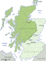
Scotland
Scotland is a country that is part of the United Kingdom. Occupying the northern third of the island of Great Britain, it shares a border with England to the south and is bounded by the North Sea to the east, the Atlantic Ocean to the north and west, and the North Channel and Irish Sea to the...
is organised geographically, taken anti-clockwise, from Berwick-upon-Tweed
Berwick-upon-Tweed
Berwick-upon-Tweed or simply Berwick is a town in the county of Northumberland and is the northernmost town in England, on the east coast at the mouth of the River Tweed. It is situated 2.5 miles south of the Scottish border....
. Tributaries
Tributary
A tributary or affluent is a stream or river that flows into a main stem river or a lake. A tributary does not flow directly into a sea or ocean...
are listed down the page in an upstream direction. (L) indicates a left-bank tributary and (R) indicates a right-bank tributary whilst (Ls) and (Rs) indicate left and right forks where a named river is formed from two differently named rivers.
For simplicity, they are divided here by the coastal section in which the mouth of the river
Estuary
An estuary is a partly enclosed coastal body of water with one or more rivers or streams flowing into it, and with a free connection to the open sea....
can be found. Those on Scottish islands can be found in a section at the end. For Scottish estuaries, please see under firths and sea lochs.
The Scots have many words for watercourses.
- A "Water" (LallansScots languageScots is the Germanic language variety spoken in Lowland Scotland and parts of Ulster . It is sometimes called Lowland Scots to distinguish it from Scottish Gaelic, the Celtic language variety spoken in most of the western Highlands and in the Hebrides.Since there are no universally accepted...
: "Watter", Scots Gaelic, "Uisge") is a smaller river, e.g. Ugie Water, Water of LeithWater of LeithThe Water of Leith is the main river flowing through Edinburgh, Scotland, to the port of Leith where it flows into the sea via the Firth of Forth.It is long and rises in the Colzium Springs at Millstone Rig of the Pentland Hills...
etc. Many Scottish rivers incorporate the name "Water" traditionally. - A "burn", Scots Gaelic: "allt" (anglicised as "Ault/alt"), used for smaller rivers and larger streams, also once widely used in England, now mostly in placenames especially the north, and sometimes spelled "bourne", e.g. BournemouthBournemouthBournemouth is a large coastal resort town in the ceremonial county of Dorset, England. According to the 2001 Census the town has a population of 163,444, making it the largest settlement in Dorset. It is also the largest settlement between Southampton and Plymouth...
and AshbourneAshbourne, DerbyshireAshbourne is a small market town in the Derbyshire Dales, England. It has a population of 10,302.The town advertises itself as 'The Gateway to Dovedale'.- Local customs :...
. In Scotland examples include Coalburn, BannockburnBannockburnBannockburn is a village immediately south of the city of Stirling in Scotland. It is named after the Bannock Burn, a burn running through the village before flowing into the River Forth.-History:...
, AultmoreAultmoreAultmore is a village in Moray, Scotland, near Keith....
. - Abhainn in Gaelic meaning river, which is anglicised as Avon. There is also a similar Brythonic cognate. This sometimes leads to curious 'double' namings of rivers by Anglo-SaxonAnglo-SaxonAnglo-Saxon may refer to:* Anglo-Saxons, a group that invaded Britain** Old English, their language** Anglo-Saxon England, their history, one of various ships* White Anglo-Saxon Protestant, an ethnicity* Anglo-Saxon economy, modern macroeconomic term...
speakers, such as River AvonRiver AvonRiver Avon is the name of many rivers:-England:*River Avon *River Avon *River Avon *River Avon *Avon Water -Scotland:*River Avon *River Avon...
and River AftonRiver AftonThe River Afton is a small river in Ayrshire, Scotland. which flows North from Alwhat Hill in the Carsphairn and Scaur Hills, through Afton Reservoir and then for eight miles down Glen Afton before joining the River Nith at New Cumnock.The river is memorialised in Robert Burns's poem and this led...
(literally "River River"), or Glendale (literally "Valley Valley") which is a combination of Norse/Anglo-Saxon "dale" and Gaelic "glen" or Brittonic "glyn".
South-eastern Scotland
North Sea
In the southwest, beyond the Straits of Dover, the North Sea becomes the English Channel connecting to the Atlantic Ocean. In the east, it connects to the Baltic Sea via the Skagerrak and Kattegat, narrow straits that separate Denmark from Norway and Sweden respectively...
between Berwick-upon-Tweed
Berwick-upon-Tweed
Berwick-upon-Tweed or simply Berwick is a town in the county of Northumberland and is the northernmost town in England, on the east coast at the mouth of the River Tweed. It is situated 2.5 miles south of the Scottish border....
and Kincardine
Kincardine
Kincardine or Kincardine-on-Forth is a small town located on the north shore of the Firth of Forth, in Fife, Scotland. The town was given the status of a Burgh of barony in 1663. It was at one time a reasonably prosperous minor port...
(East Coast)
The right-bank tributary of the Tweed, the River Till together with its tributaries, is almost wholly within England but is included for completeness of the Tweed catchment.
Tweed catchment
- River TweedRiver TweedThe River Tweed, or Tweed Water, is long and flows primarily through the Borders region of Great Britain. It rises on Tweedsmuir at Tweed's Well near where the Clyde, draining northwest, and the Annan draining south also rise. "Annan, Tweed and Clyde rise oot the ae hillside" as the Border saying...
- Whiteadder WaterWhiteadder WaterWhiteadder Water is a river in East Lothian and Berwickshire, Scotland. It also flows for a very short distance through Northumberland before joining the River Tweed...
(L)- Blackadder WaterBlackadder WaterBlackadder Water is a river in Berwickshire in the Scottish Borders area of Scotland, forming part of the River Tweed system.Rising in the Harecleugh Forest plantation just south of the Twin Law cairns, north of the village of Westruther. The headwaters of the Blackadder join with those of the...
(R)- Langton Burn (L)
- Moneynut Water (L)
- Dye WaterDye WaterThe Dye Water is a river in the Lammermuir Hills in the Scottish Borders area of Scotland. It rises in the Hope Hills, continues along the East Lothian boundary, a mile north east of Seenes Law, then east to Longformacus...
(R) - Bothwell WaterBothwell WaterThe Bothwell Water is a river in the Scottish Borders area of Scotland. It rises in the Lammermuir Hills near Caldercleugh and continues past the Upper Monynut Forest, Crichness, Bothwell Hill, and the village of Bothwell, Scottish Borders, when it joins the Whiteadder Water.-External links:******...
(L) - Faseny Water (R)
- Blackadder Water
- River TillRiver TillThe River Till in Northumberland is the only tributary of the River Tweed which flows wholly in England. . The upper part of the Till, which rises on Comb Fell, is known as the River Breamish...
(R) (England only) (is known as River Breamish in upper reaches)- River GlenRiver Glen, NorthumberlandThe River Glen in Northumberland, England is a tributary of the River Till. The College Burn and Bowmont Water, both flowing out of the Cheviot Hills, meet near Kirknewton to form the River Glen...
(L), (England only)- Bowmont WaterBowmont WaterBowmont Water is a river in the Scottish Borders and Northumberland . It rises in the Cheviot Hills and passes by Mowhaugh, Town Yetholm, and Kirk Yetholm...
(Ls) (upper reaches in Scotland) - College Burn (Rs), (England only)
- Bowmont Water
- Wooler WaterWooler WaterWooler Water is a tributary of the River Till in northern England....
(L), (England only)- Carey Burn (Ls) (England only)
- Harthope Burn (Rs) (England only)
- Hetton Burn (R) (England only)
- Lilburn Burn (Ls) (England only)
- River Breamish (Rs) (England only)
- Harelaw Burn (L) (England only)
- Linhope Burn (L) (England only)
- River Glen
- Leet Water (L)
- Eden WaterEden WaterEden Water is a tributary of the River Tweed in the Scottish Borders area of Scotland. "Water" is the Lowland Scots term for a small river.The Eden Burn rises to the east of Lauder at Corsbie Moor. The Eden Water passes Bassendean village and Bassendean House and the hamlets of Fawside and Mack's...
(L) - River TeviotRiver TeviotThe River Teviot, or Teviot Water, is a river of the Scottish Borders area of Scotland, and a tributary of the River Tweed.It rises in the western foothills of Comb Hill on the border of Dumfries and Galloway...
(R)- Kale WaterKale WaterThe Kale Water is a long tributary of the River Teviot in the Scottish Borders area of Scotland. Its feeder burns in the Cheviot Hills are the Long Burn, Hawkwillow Burn and the Grindstone Burn, east of Leithope Forest near the Anglo-Scottish Border....
(R) - Oxnam Water (R)
- Jed WaterJed WaterThe Jed Water is a river and a tributary of the River Teviot in the Borders region of Scotland.In total Jed Water is over 20 miles long, it flows into the Teviot near Jedfoot Bridge from a source in the Cheviot Hills....
(R)- Black Burn (R)
- Ale WaterAle WaterThe Ale Water is a tributary of the River Teviot, in the Scottish Borders area of Scotland. It rises at Henwoodie Hill and flows through Alemoor Loch.It meets the Teviot south of the village of Ancrum, and it runs through Ashkirk and Lilliesleaf....
(L) - Rule WaterRule WaterThe Rule Water is a river in the Scottish Borders area of Scotland, and a tributary of the River Teviot.The Rule Water rises in Wauchope Forest and passes Hobkirk, Bonchester Bridge, Hallrule, Abbotrule, and Bedrule until it joins the River Teviot at Spittal-on-Rule.Other placenames include the...
(R) - Slitrig WaterSlitrig WaterSlitrig Water , also known as the River Slitrig, is a river in the Scottish Borders. It is a tributary of the River Teviot.-References:...
(R) - Borthwick WaterBorthwick WaterThe Borthwick Water is a river in the Scottish Borders area of Scotland, and a tributary of the River Teviot....
(L) - Allan WaterRiver TeviotThe River Teviot, or Teviot Water, is a river of the Scottish Borders area of Scotland, and a tributary of the River Tweed.It rises in the western foothills of Comb Hill on the border of Dumfries and Galloway...
(R)
- Kale Water
- Leader Water (L)
- Boondreigh Water (L)
- Earnscleugh Water (L)
- Gala WaterGala WaterThe Gala Water is a river in the Scottish Borders area of Scotland and a tributary of the River Tweed. It is sometimes known as the "Gala", which nickname is also shared with Galashiels, which it flows through. The "Braw Lads O Gala Watter" is a song about people from Galashiels.-Gallery:...
(L)- Heriot Water (R)
- Ettrick Water (R)
- Yarrow Water (L)
- Megget WaterMegget WaterMegget Water is a river in the Scottish Borders area of Scotland, in the former Selkirkshire. The Water rises at Broad Hill, passes through Megget Reservoir and empties into St Mary's Loch...
(L) (enters St Mary's LochSt Mary's LochSt Mary's Loch is the largest natural loch in the Scottish Borders, and is situated on the A708 road between Selkirk and Moffat, about south of Edinburgh. It is long and wide, and was created by glacial action during the last ice age...
)
- Megget Water
- Rankle Burn (R)
- Tima Water (R)
- Yarrow Water (L)
- Leithen WaterLeithen WaterLeithen Water is a tributary of the River Tweed in Scotland. It joins it near the town of Innerleithen, whose name comes from the Scottish Gaelic inbhir, meaning a confluence, and anglicised as "inner" or "inver". The Brythonic equivalent is "Aber". "Leithen" is a Celtic name meaning grey in...
(L) - Quair WaterQuair WaterThe Quair Water is a tributary of the River Tweed in the Scottish Borders area of Scotland. Its name is related to Traquair.-See also:*List of places in the Scottish Borders*List of places in Scotland*List of rivers of Scotland-External links:**...
(R) - Eddleston WaterEddleston WaterEddleston Water is a small river north of Peebles, in the Scottish Borders area of Scotland which joins the River Tweed at Peebles. It is also known locally as "The Cuddy"....
(L) - Manor WaterManor WaterThe Manor Water is a river in the Scottish Borders area of Scotland. It rises in the Ettrick Forest and flows into the River Tweed one mile south of Peebles.-See also:*List of places in the Scottish Borders*List of places in Scotland...
(R) - Lyne WaterLyne WaterThe Lyne Water is a tributary of the River Tweed which rises in the Pentland Hills of southern Scotland at Baddinsgill Reservoir. It runs through West Linton and Romannobridge, passes Flemington and Lyne Station and enters the Tweed west of Peebles. It floods regularly in winter and occasionally in...
(L) - Holms WaterHolms WaterThe Holms Water is a river and a tributary of the River Tweed, in the Scottish Borders area of Scotland, near Glenkirk, Stanhope, Peeblesshire and Hearthstane.-See also:*List of places in the Scottish Borders*List of places in Scotland...
(L)- Biggar Water (L)
- Kingledoors Burn (L)
- Talla WaterTalla WaterTalla Water is a river in the Scottish Borders area of Scotland, near Tweedsmuir. It feeds the Talla Reservoir.The Talla Railway was constructed to facilitate the building work, especially the Tweed Viaduct.-External links:**...
(R) - Fruid WaterFruid WaterFruid Water is a small reservoir in the Scottish Borders area of Scotland, UK, near Menzion.-See also:*Baddinsgill Reservoir*Megget Reservoir*Talla Reservoir*West Water Reservoir*List of reservoirs and dams in the United Kingdom-External links:*...
(R)
- Whiteadder Water
Simple coastal catchments
- Eye Water
- Ale Water (L)
- Biel WaterBiel WaterThe Biel Water is a river running through the Biel Estate in Biel, East Lothian.It runs for 4.5 kilometres from the Luggate Burn and the Whittinghame Water, via Stenton, Biel House, West Barns, and finally to Belhaven Bay with its rather unusual bridge....
Tyne catchment
- River TyneRiver Tyne, ScotlandThe River Tyne is a river in Scotland, UK. It rises in the Moorfoot Hills in Midlothian near Tynehead to the south of Edinburgh, at the junction of the B6458 and the B6367. It continues for approx...
- Tyne Water (Ls)
- Birns Water (Rs) (Humbie Water)
Firth of Forth
Firth of Forth
The Firth of Forth is the estuary or firth of Scotland's River Forth, where it flows into the North Sea, between Fife to the north, and West Lothian, the City of Edinburgh and East Lothian to the south...
(Estuary)
Esk catchment
- River Esk, LothianRiver Esk, LothianThe River Esk is a river which flows through Midlothian and East Lothian, Scotland.It initially runs as two separate rivers, the North Esk and the South Esk....
- River South EskRiver Esk, LothianThe River Esk is a river which flows through Midlothian and East Lothian, Scotland.It initially runs as two separate rivers, the North Esk and the South Esk....
(Rs)- Gore Water (R)
- River North EskRiver Esk, LothianThe River Esk is a river which flows through Midlothian and East Lothian, Scotland.It initially runs as two separate rivers, the North Esk and the South Esk....
(Ls)
- River South Esk
Water of Leith catchment
- Water of LeithWater of LeithThe Water of Leith is the main river flowing through Edinburgh, Scotland, to the port of Leith where it flows into the sea via the Firth of Forth.It is long and rises in the Colzium Springs at Millstone Rig of the Pentland Hills...
Almond catchment
- River AlmondRiver Almond, LothianThe River Almond is a river in east-central Scotland. It is 28 miles long, rising in North Lanarkshire near Shotts and runs through West Lothian, draining into the Firth of Forth at Cramond near Edinburgh....
- Linhouse Water (R)
- Breich Water (R)
Avon catchment
- River Avon
Carron catchment
- River CarronRiver Carron (Forth)The River Carron is a river in central Scotland. This river has given its name to towns in Falkirk, a variety of regional features, a type of cannon, a line of bathtubs, two warships and an island in the Southern Hemisphere.-River Carron:The river rises in the Campsie Fells before flowing into...
- Bonny Water (R)
- Earl's Burn (L)
Forth to Tay

North Sea
In the southwest, beyond the Straits of Dover, the North Sea becomes the English Channel connecting to the Atlantic Ocean. In the east, it connects to the Baltic Sea via the Skagerrak and Kattegat, narrow straits that separate Denmark from Norway and Sweden respectively...
between Kincardine
Kincardine
Kincardine or Kincardine-on-Forth is a small town located on the north shore of the Firth of Forth, in Fife, Scotland. The town was given the status of a Burgh of barony in 1663. It was at one time a reasonably prosperous minor port...
and Buddon Ness (East Coast)
Forth catchment
- River ForthRiver ForthThe River Forth , long, is the major river draining the eastern part of the central belt of Scotland.The Forth rises in Loch Ard in the Trossachs, a mountainous area some west of Stirling...
- Pow Burn (R)
- River Devon, ClackmannanshireRiver Devon, ClackmannanshireThe River Devon is a tributary of the River Forth in Clackmannanshire, Scotland.-Geography:The source of the river is Blairdenon Hill in the Ochils at an altitude of ....
(L) - Black DevonBlack DevonThe Black Devon is a river in Scotland. It rises in the area west of Knockhill Racing Circuit, around north-west of Dunfermline, Fife, with the gathering of three small streams in branch formation. The river flows westwards through Balgonar, north of Saline, and then merges with the Saline Burn...
(L) - Bannock BurnBannock BurnThe Bannock Burn is a stream which rises in the Touch Hills to the south-west of Stirling in central Scotland. The Bannock flows eastward and enters the River Forth to the east of Stirling, close to the site of the Battle of Bannockburn...
(R) - Allan WaterAllan WaterThe Allan Water is a river in central Scotland, United Kingdom. Rising in the Ochil Hills, it runs through Strathallan to Dunblane and Bridge of Allan before joining the River Forth....
(L) - River TeithRiver TeithThe River Teith in Scotland flows from the north-west into the River Forth near Drip north-west of Stirling.- Etymology :The name comes from the Scottish Gaelic Uisge Theavich, which translates into English as the "pleasant river".- Course :...
(L)- Ardoch Burn (L)
- Keltie Water (L)
- Garbh UisgeGarbh UisgeGarbh Uisge is a short river of approximately 7 km in the Trossachs of Scotland just north-west Callander. It is the outflow of Loch Lubnaig and joins with Eas Gobhain west of Callander to form the River Teith...
(Ls) (drains Loch LubnaigLoch LubnaigLoch Lubnaig is a small loch near Callander in the Stirling council area, Scotland. It lies in the former county of Perthshire....
) - Eas Gobhain (Rs) (drains Loch VenacharLoch VenacharLoch Venachar is a freshwater loch in Stirling district, Scotland, situated between Callander and Brig o' Turk...
)
- Goodie Water (L)
- Kelty Water (R)
- Duchray Water (R)
Simple coastal catchments
- River Leven, FifeRiver Leven, FifeThe River Leven is a river in Fife in Scotland. It flows from Loch Leven into the Firth of Forth at the town of Leven. The river is home to brown trout and hosts a run of sea trout and atlantic salmon...
- River OreRiver OreThe River Ore is the name of the final section of the River Alde in Suffolk, England from just above Orford to the sea. It has one tributary, the River Butley, and Havergate Island is found at their confluence....
(R)
- River Ore
- Kenly Water
Eden catchment
- River Eden, FifeRiver Eden, FifeThe River Eden is a river in Fife in Scotland, and is one of Fife's two principal rivers, along with the Leven. It is nearly 30 miles long and has a fall of around 90 metres...
- Motray Water (L)
- Ceres Burn (R)
Tay catchment
- River TayRiver TayThe River Tay is the longest river in Scotland and the seventh-longest in the United Kingdom. The Tay originates in western Scotland on the slopes of Ben Lui , then flows easterly across the Highlands, through Loch Dochhart, Loch Lubhair and Loch Tay, then continues east through Strathtay , in...
- River EarnRiver EarnThe River Earn in Scotland leaves Loch Earn at St Fillans and runs east through Strathearn, then east and south, joining the River Tay near Abernethy. The Earn is about long. It passes by Comrie, Crieff and Bridge of Earn....
(L)- River FargRiver FargThe River Farg is a small tributary of the River Earn, located in the lieutenancy area of Perth and Kinross, central Scotland. Its source is located in Glen Farg reservoir; it winds round roads and farms, and has been forced in many places to change course due to human interference...
(R) - Water of May (R)
- Ruthven Water (R)
- Machany Water (R)
- Shaggie Burn (L)
- Turret Burn (R)
- River Lednock (L)
- Water of Ruchill (R)
- Burn of Ample (R) (flows into Loch EarnLoch EarnLoch Earn is a freshwater loch in the central highlands of Scotland, in the districts of Perth and Kinross and Stirling...
) - Kendrum Burn (R) (flows into Loch EarnLoch EarnLoch Earn is a freshwater loch in the central highlands of Scotland, in the districts of Perth and Kinross and Stirling...
)- Allt Srath a' Ghlinne (L)
- River Farg
- River Almond, Perthshire (R)
- Shochie Burn (R)
- Ordie Burn (L)
- River Isla, PerthshireRiver Isla, PerthshireThe River Isla is a tributary of the River Tay in Angus and Perthshire, Scotland. It runs for 46 miles through Glen Isla and Strathmore .-External links:*...
(L)- River ErichtRiver ErichtThe River Ericht is a river in Perthshire, Scotland formed from the confluence of the rivers Blackwater and Ardle.It runs south for around 10 miles before discharging into the River Isla, and eventually the River Tay...
(L)- Lunan Burn (R)
- Lornty Burn (R)
- Shee WaterShee WaterThe Shee Water is a river in the highland portion of eastern Perth and Kinross, Scotland. The Allt a' Ghlinne Bhig, Allt Ghlinn Thaitneach and Glen Lochsie Burn drain south out of the Grampian mountains. They converge at the Spittal of Glenshee to form the Shee Water...
(known as Black Water in its lower reaches) (Ls)- Allt a' Ghlinne Bhig (L)
- Glen Lochsie Burn (R)
- River ArdleRiver ArdleThe River Ardle is a tributary of the River Ericht. It runs for through the valley of Strathardle in Perthshire, Scotland. It is a salmon river providing opportunities for angling.-Course:...
(Rs)- Allt Fearnach (Ls)
- Brerachan Water (Rs)
- Shee Water
- Dean Water (R)
- Alyth Burn (R)
- Melgam Water (L)
- River Ericht
- River BraanRiver BraanThe River Braan is a tributary of the River Tay in Scotland.Within the county of Perth and Kinross, it flows 11 miles eastwards from Loch Freuchie, near Amulree, and joins the River Tay near Dunkeld.-References:* - Geo.ed.ac.uk-External links:...
(R)- Ballinloan Burn (L)
- Cochill Burn (L)
- River Quaich (flows into Loch Freuchie)
- River TummelRiver TummelThe River Tummel is a river in Perth and Kinross, Scotland. Discharging from Loch Rannoch, it flows east to a point near the Falls of Tummel, where it bends to the southeast, a direction which it maintains until it falls into the River Tay, just below Logierait, after a course of from its source...
(L)- River GarryRiver Garry, PerthshireThe River Garry is a major tributary of the River Tummel, itself a tributary of the River Tay, in the traditional county of Perthshire in the Scottish Highlands...
(L)- Allt Girnaig (L)
- River Tilt (L)
- Tarf Water (R)
- Errochty Water (R)
- Edendon Water (L)
- Allt Camghouran (R) (enters Loch RannochLoch RannochLoch Rannoch is a large body of fresh water in Perth and Kinross, Scotland.The loch is over long in a west-east direction with an average width of about . The River Tummel begins at its eastern end. The Tay Forest Park lies along its southern shore...
) - River ErichtRiver Ericht, RannochThe River Ericht is a short river which flows generally southwards from the southern end of Loch Ericht for 3 miles / 5 km to enter Loch Rannoch near its western end at Bridge of Ericht....
(L) - River Gaur (enters Loch RannochLoch RannochLoch Rannoch is a large body of fresh water in Perth and Kinross, Scotland.The loch is over long in a west-east direction with an average width of about . The River Tummel begins at its eastern end. The Tay Forest Park lies along its southern shore...
)- Abhainn Duibhe (R)
- Allt Chaldar (L)
- Allt Eigheach (L) (enters Loch Eigheach)
- Garbh Ghaoir (enters Loch Eigheach)
- Abhainn Bà (enters Loch Laidon) (known as River Bà usptream of Loch Bà)
- Bruar Water (L)??
- River Garry
- River Lyon (L)
- Keltney Burn (L) (upper reaches known as Allt Mor)
- Allt Conait (L)
- River Lochay (Ls) (enters Loch TayLoch TayLoch Tay is a freshwater loch in the central highlands of Scotland, in the district of Perthshire.It is a long narrow loch of around 14 miles long, and typically around 1 to 1½ miles wide, following the line of the valley from the south west to north east...
) - River DochartRiver DochartThe River Dochart is in Perthshire, Scotland.Coming from Ben Lui, it flows east out of Loch Dochart and through the glen of the same name. At Killin just before it enters Loch Tay are the Falls of Dochart. The river is sometimes also considered to be a part of the upper reaches of the River...
(Rs) (enters Loch TayLoch TayLoch Tay is a freshwater loch in the central highlands of Scotland, in the district of Perthshire.It is a long narrow loch of around 14 miles long, and typically around 1 to 1½ miles wide, following the line of the valley from the south west to north east...
)
- River Earn
Simple coastal catchments
- Dighty Water
- Buddon Burn
East Coast
Flowing into the North SeaNorth Sea
In the southwest, beyond the Straits of Dover, the North Sea becomes the English Channel connecting to the Atlantic Ocean. In the east, it connects to the Baltic Sea via the Skagerrak and Kattegat, narrow straits that separate Denmark from Norway and Sweden respectively...
between Buddon Ness and Rattray Head
Rattray Head
Rattray Head is a headland in Buchan, Aberdeenshire, on the north east coast Scotland. To north lies Strathbeg Bay and Rattray Bay is to its south...
- Pitairlie Burn
- Monikie Burn
- Elliot WaterElliot WaterThe Elliot Water is a minor river in Angus in eastern Scotland. The Elliot rises near West Hills in Carmyllie and flows through the parish and village of Arbirlot before reaching the North Sea at Elliot, on the west side of Arbroath...
- Rottenraw Burn
- Brothock Burn
- Keilor Burn
- Lunan WaterLunan WaterThe Lunan Water is an easterly flowing river in Angus, Scotland, that discharges to the North Sea north of the town of Arbroath. Draining chiefly agricultural lands, this stream has a moderate level of turbidity and a pH level of approximately 8.7. Other nearby watercourses discharging to the...
River South Esk catchment
- River South EskRiver South EskThe South Esk is a river in Angus, Scotland. It goes past Brechin and enters the North Sea at Montrose Basin. It was noted in the 19th century.-References:...
- Noran Water (L)
- Prosen Water (R)
- Burn of Glenmoye (L)
- White Water (R)
River North Esk catchment
- River North EskRiver North EskThe North Esk is a river in Angus and Aberdeenshire, Scotland. It is formed by the meeting of the Water of Mark and the Water of Lee , and enters the North Sea four miles north of Montrose. It forms the boundary between Angus and Aberdeenshire at certain stages in its course...
- Luther WaterRiver North EskThe North Esk is a river in Angus and Aberdeenshire, Scotland. It is formed by the meeting of the Water of Mark and the Water of Lee , and enters the North Sea four miles north of Montrose. It forms the boundary between Angus and Aberdeenshire at certain stages in its course...
(L) - West WaterRiver North EskThe North Esk is a river in Angus and Aberdeenshire, Scotland. It is formed by the meeting of the Water of Mark and the Water of Lee , and enters the North Sea four miles north of Montrose. It forms the boundary between Angus and Aberdeenshire at certain stages in its course...
(R) (upper reaches known as Water of Saughs) - Water of TarfRiver North EskThe North Esk is a river in Angus and Aberdeenshire, Scotland. It is formed by the meeting of the Water of Mark and the Water of Lee , and enters the North Sea four miles north of Montrose. It forms the boundary between Angus and Aberdeenshire at certain stages in its course...
(L) - Water of MarkRiver North EskThe North Esk is a river in Angus and Aberdeenshire, Scotland. It is formed by the meeting of the Water of Mark and the Water of Lee , and enters the North Sea four miles north of Montrose. It forms the boundary between Angus and Aberdeenshire at certain stages in its course...
(Ls) - Water of LeeRiver North EskThe North Esk is a river in Angus and Aberdeenshire, Scotland. It is formed by the meeting of the Water of Mark and the Water of Lee , and enters the North Sea four miles north of Montrose. It forms the boundary between Angus and Aberdeenshire at certain stages in its course...
(Rs)
- Luther Water
Simple coastal catchments
- Bervie WaterBervie WaterBervie Water is a river in Aberdeenshire, Scotland which rises in the Drumtochty Forest and flows across The Mearns to reach the North Sea at Inverbervie. Approximately two kilometres upstream of the North Sea, the Bervie Water flows through the grounds of Allardice Castle. The Bothenoth Burn ...
- Carron Water, AberdeenshireCarron Water, AberdeenshireCarron Water is a river in Aberdeenshire, Scotland.Carron Water rises in Fetteresso Forest on the eastern edge of the Grampians. It flows past Fetteresso Castle and discharges into the North Sea at Stonehaven Bay. Carron Water separates the Old Town from Stonehaven's new town , laid out in...
- Cowie WaterCowie WaterThe Cowie Water is a river rising in the Grampian Mountains in Aberdeenshire, Scotland that discharges to the North Sea in the northern part of Stonehaven. south of the ruined Cowie Castle...
- Burn of MonboysBurn of MonboysBurn of Monboys is a stream that rises in the Mounth, or eastern range of the Grampian Mountains, northwest of Stonehaven and south of Netherley, Aberdeenshire, Scotland...
- Cowton BurnCowton BurnCowton Burn is a stream that rises in the Mounth, or eastern range of the Grampian Mountains, on some of the northwest slopes of the Durris Forest west of Netherley, Aberdeenshire, Scotland. The Grid Reference for the headwaters is NO 925 823); Cowton Burn is a tributary to the Cowie Water...
- Burn of Monboys
- Burn of MuchallsBurn of MuchallsThe Burn of Muchalls is an easterly flowing stream in Aberdeenshire, Scotland that discharges to the North Sea. Its point of discharge is on a rocky beach set with scenic sea stacks...
- Burn of PheppieBurn of PheppieThe Burn of Pheppie is an easterly flowing coastal stream in Aberdeenshire, Scotland that discharges to the North Sea immediately north of the village of Muchalls. Draining chiefly agricultural lands, this stream has a notable lack of turbidity and a pH level of approximately 8.02...
- Burn of ElsickBurn of ElsickThe Burn of Elsick is a coastal stream in Aberdeenshire, Scotland that discharges to the North Sea. This watercourse drains primarily agricultural lands and enters the North Sea at Newtonhill.-History:...
- Burn of Findon
Dee catchment
- River Dee, AberdeenshireRiver Dee, AberdeenshireThe River Dee is a river in Aberdeenshire, Scotland. It rises in the Cairngorms and flows through Strathdee to reach the North Sea at Aberdeen...
- Crynoch BurnCrynoch BurnCrynoch Burn is a stream in Aberdeenshire that is tributary to the River Dee. This stream rises somewhat above Netherley and flows near Netherley House; and thence into the Red Moss, a significant natural bog habitat; thence near the historic Lairhillock Inn; and finally by the village of...
(R)- Cairnie BurnCairnie BurnCairnie Burn is a stream that rises in the Mounth, or eastern range of the Grampian Mountains, north of Netherley, Aberdeenshire, Scotland. Cairnie Burn is a generally northeast flowing watercourse that is a tributary to the Crynoch Burn...
(L)
- Cairnie Burn
- Gormack Burn (L)
- Leuchar BurnLeuchar BurnLeuchar Burn is a stream that rises in the Loch of Skene, in Aberdeenshire, Scotland Initially near the headwaters Leuchar Burn flows in a southerly course; as it approaches the Royal Deeside, the watercourse rotates to the southeast, ultimately forming a boundary between Aberdeenshire and...
(L)
- Leuchar Burn
- Burn of Sheeoch (R)
- Water of FeughWater of FeughThe Water of Feugh is a stream in Aberdeenshire that is the largest tributary to the River Dee. This stream rises in the Grampian Mountains of Scotland, in an area known as the Forest of Birse, and has a particularly scenic aspect in a series of cascades at the Bridge of Feugh slightly above its...
(R) - Burn of Canny (L)
- Tarland Burn (L)
- Water of Tanar (R)
- Tullich Burn (L)
- River Muick (R)
- River Gairn (L)
- Glenfenzie Burn (L) (minor)
- Girnock Burn (R)
- Clunie Water (R)
- Callater Burn (R)
- Quoich Water (L)
- Ey Burn (R)
- Lui Water (L)
- Derry Burn (Ls)
- Luibeg Burn (Rs)
- Geldie Burn (R)
- Crynoch Burn
Don catchment
- River Don, AberdeenshireRiver Don, AberdeenshireThe River Don is a river in north-east Scotland. It rises in the Grampians and flows eastwards, through Aberdeenshire, to the North Sea at Aberdeen. The Don passes through Alford, Kemnay, Inverurie, Kintore, and Dyce...
- Elrick Burn (L)
- River UrieRiver UrieThe River Ury is a small river in northeastern Scotland situated in the Garioch area of Aberdeenshire. Its origins are close to Bennachie, approximately 25 miles to the northwest of Aberdeen. The river runs for approximately 15 miles before meeting the River Don at the south edge of Inverurie. Its...
(L)- Gadie Burn (minor?)
- Ton Burn (R)
- Birks Burn (minor?)
- Mossat Burn (L)
- Kindie Burn (L)
- Water of Buchat (L)
- Deskry Burn (R)
- Water of Nochty (L)
- Ernan Water (L)
- Water of Carvie (R) (minor)
Simple coastal catchments
- Blackdog Burn
- Potterton Burn
- Millden Burn ??
- Eigie Burn ??
- Blairton Burn ??
- Menie Burn ??
- Sandend Burn ??
Ythan catchment
- River YthanRiver YthanThe Ythan is a river in the north-east of Scotland rising at Wells of Ythan near the village of Ythanwells and flowing south-eastwards through the towns of Fyvie, Methlick and Ellon before flowing into the North Sea near Newburgh, in Formartine...
- Tarty Burn (R)
- Ebrie Burn (L)
- Little Water (L)
- Fordoun Burn (R)
Simple coastal catchments
- Water of Cruden
- River UgieRiver UgieThe River Ugie or Ugie Water is a river in Scotland. Located in the north east, it flows into the North Sea on the east coast at Peterhead, north of Cruden Bay. There is considerable evidence of prehistoric within the Ugie drainage basin, especially in the South Ugie Water catchment basin...
- South Ugie WaterSouth Ugie WaterThe South Ugie Water is a tributary of the Ugie Water in northeastern Aberdeenshire, Scotland. To the south of the Ugie Water are a number of prehistoric monuments, evidencing the habitation of early man in the northeast of Scotland; for example, the Catto Long Barrow and a number of tumuli are...
(Rs)- Burn of Fedderate (L)
- North Ugie Water (Ls)
- South Ugie Water
- Cuttie Burn (?minor)
- Black WaterBlack Water"Black Water" is a song by the American music group The Doobie Brothers from the album What Were Once Vices Are Now Habits. Released in 1974, it features Patrick Simmons on lead vocals....
(?minor)
Moray Firth (south coast)
Flowing into the North SeaNorth Sea
In the southwest, beyond the Straits of Dover, the North Sea becomes the English Channel connecting to the Atlantic Ocean. In the east, it connects to the Baltic Sea via the Skagerrak and Kattegat, narrow straits that separate Denmark from Norway and Sweden respectively...
between Rattray Head
Rattray Head
Rattray Head is a headland in Buchan, Aberdeenshire, on the north east coast Scotland. To north lies Strathbeg Bay and Rattray Bay is to its south...
and Inverness
Inverness
Inverness is a city in the Scottish Highlands. It is the administrative centre for the Highland council area, and is regarded as the capital of the Highlands of Scotland...
- Water of Philorth
- Pouk Burn
- The Dour
- Tore Burn
Deveron catchment
- River DeveronRiver DeveronThe River Deveron , known anciently as the Dovern, is a river in the north east of Scotland. The river has a length of 60 miles, and has a reputation for its salmon, sea trout and brown trout fishing...
- Idoch Water (R)
- Burn of Forgue (R)
- River Isla, MorayRiver Isla, MorayThe River Isla is a tributary of the River Deveron in North-East Scotland. The area surrounding it is known as Strathisla...
(L)- Burn of Cairnie (R)
- Burn of Davidston (R)
- River Bogie (R)
Simple coastal catchments
- Burn of Boyndie
- Burn of Boyne
- Burn of Durn
- Burn of Fordyce
- Cullen Burn
- Burn of Deskford
- Glen Burn
- Burn of Buckie
- Burn of Tynet
Spey catchment
- River SpeyRiver SpeyThe River Spey is a river in the northeast of Scotland, the second longest and the fastest-flowing river in Scotland...
- Burn of Fochabers (R)
- Burn of Rothes (L)
- River FiddichRiver FiddichThe River Fiddich is a right bank tributary of the River Spey in northeast Scotland. It rises on the eastern slopes of Corriehabbie Hill in Glenfiddich Forest and flows northeastwards beneath the A941 road, past Auchindown Castle to a sharp bend adjacent to the A920 road where it turns westwards to...
(R)- Dullan WaterRiver FiddichThe River Fiddich is a right bank tributary of the River Spey in northeast Scotland. It rises on the eastern slopes of Corriehabbie Hill in Glenfiddich Forest and flows northeastwards beneath the A941 road, past Auchindown Castle to a sharp bend adjacent to the A920 road where it turns westwards to...
(L)
- Dullan Water
- Knockando Burn (L)
- Allt Arder (L)
- Allt a' Ghealaidh (L)
- River AvonRiver Avon, StrathspeyThe River Avon is a river in the Strathspey area of the Scottish Highlands, and a tributary of the River Spey. It drains the north-eastern area of the Cairngorm Mountains and is largely contained within the Cairngorms National Park...
- River Livet (R)
- Burn of Lochy (L) ('Burn of Brown' above Bridge of Brown)
- Conglass Water (R)
- Water of Ailnack (L) (known as Water of Caiplich in its upper reaches)
- River Dulnain (L)
- River NethyRiver NethyThe River Nethy is a right bank tributary of the River Spey in northeast Scotland. It rises as the Garbh Allt between Cairn Gorm and A' Chòinneach on the northern slopes of the Cairngorms and flows northwards through Strath Nethy and into Abernethy Forest...
(R)- Dorback BurnRiver NethyThe River Nethy is a right bank tributary of the River Spey in northeast Scotland. It rises as the Garbh Allt between Cairn Gorm and A' Chòinneach on the northern slopes of the Cairngorms and flows northwards through Strath Nethy and into Abernethy Forest...
(R)
- Dorback Burn
- River DruieRiver DruieThe River Druie is a right bank tributary of the River Spey in northeast Scotland. The Druie tributary, the Am Beanaidh emerges from Loch Einich, and flows north through Gleann Einich. To its east, the Allt Druidh flows northeastwards out of the Lairig Ghru. At their confluence in Rothiemurchus...
(R)- River LuineagRiver DruieThe River Druie is a right bank tributary of the River Spey in northeast Scotland. The Druie tributary, the Am Beanaidh emerges from Loch Einich, and flows north through Gleann Einich. To its east, the Allt Druidh flows northeastwards out of the Lairig Ghru. At their confluence in Rothiemurchus...
(R) - Am BeanaidhRiver DruieThe River Druie is a right bank tributary of the River Spey in northeast Scotland. The Druie tributary, the Am Beanaidh emerges from Loch Einich, and flows north through Gleann Einich. To its east, the Allt Druidh flows northeastwards out of the Lairig Ghru. At their confluence in Rothiemurchus...
(L)
- River Luineag
- River FeshieRiver FeshieThe River Feshie is a major right bank tributary of the River Spey in northeast Scotland. It rises in the remote countryside of the Glenfeshie Forest, flowing initially eastwards then northeast before turning sharply to the northwest, gaining the waters of the River Eidart on its right bank and...
(R)- Allt ChomhraigRiver FeshieThe River Feshie is a major right bank tributary of the River Spey in northeast Scotland. It rises in the remote countryside of the Glenfeshie Forest, flowing initially eastwards then northeast before turning sharply to the northwest, gaining the waters of the River Eidart on its right bank and...
(L) - River EidartRiver FeshieThe River Feshie is a major right bank tributary of the River Spey in northeast Scotland. It rises in the remote countryside of the Glenfeshie Forest, flowing initially eastwards then northeast before turning sharply to the northwest, gaining the waters of the River Eidart on its right bank and...
(R)
- Allt Chomhraig
- River TromieRiver TromieThe River Tromie is a right bank tributary of the River Spey in northeast Scotland. It emerges from the northern end of Loch an t-Seilich within the Gaick Forest and flows northwards, then northwestwards down through Glen Tromie to Bhran Cottage where it turns to the northnortheast...
(R) - Allt Mor (L)
- River CalderRiver Calder, HighlandThe River Calder is a left bank tributary of the River Spey in the Scottish Highlands Its headwaters are the Allt Ballach, Allt an Lochain Dubh and Allt Madagain which drain the mountain slopes at the southeastern corner of the Monadhliath. Their waters are added to by those of the Allt Fionndrigh...
(L) - River TruimRiver TruimThe River Truim is a right bank tributary of the River Spey in the Scottish Highlands. Its headwaters meet to the north of the Pass of Drumochter and flow northwards as the Truim past the dam at the northern end of Loch Ericht and through the village of Dalwhinnie, highest village in the Scottish...
(R) - River Mashie (R)
- Markie Burn (L)
Lossie catchment
- River LossieRiver LossieThe River Lossie is a river in north east Scotland. Ptolemy , the Greco / Roman geographer, named it as ost. Loxa Fl. The river originates in the hills above Dallas, in Moray, and has its source 400 meters above sea-level. It enters the sea at Lossiemouth on the Moray Firth...
- Black Burn (L)
- Leanoch Burn (R)
Findhorn catchment
- River FindhornRiver FindhornThe River Findhorn is one of the longest rivers in Scotland. Located in the north east, it flows into the Moray Firth on the north coast. It has one of the largest non-firth estuaries in Scotland....
- Burn of Mosset (R) (drains into Findhorn Bay)
- Muckle Burn (R) (drains into Findhorn Bay)
- Dorback Burn (R)
- River Divie (R)
- Leonach Burn (R)
- Rhilean Burn (L)
- Funtack Burn (L) ('Moy Burn' above Loch MoyLoch MoyLoch M'hoy is a freshwater loch beside the village of M'hoy near Inverness in the Scottish Highlands.-References:...
) - Glen Mazeran (L)??
- Elrick Burn (R)
- River Eskin (L)
Nairn catchment
- River NairnRiver NairnThe River Nairn is a river in the Scottish Highlands which rises in the Monadhliath Mountains and flows northeast through Strathnairn to enter the Moray Firth at Nairn. The headwaters of the Nairn, the Allt Mor and Cròm-allt Beag drop steeply down the western slopes of Carn Ghriogair, their...
- Allt DeargRiver NairnThe River Nairn is a river in the Scottish Highlands which rises in the Monadhliath Mountains and flows northeast through Strathnairn to enter the Moray Firth at Nairn. The headwaters of the Nairn, the Allt Mor and Cròm-allt Beag drop steeply down the western slopes of Carn Ghriogair, their...
(R)- Riereach BurnRiver NairnThe River Nairn is a river in the Scottish Highlands which rises in the Monadhliath Mountains and flows northeast through Strathnairn to enter the Moray Firth at Nairn. The headwaters of the Nairn, the Allt Mor and Cròm-allt Beag drop steeply down the western slopes of Carn Ghriogair, their...
(R)
- Riereach Burn
- River FarnackRiver NairnThe River Nairn is a river in the Scottish Highlands which rises in the Monadhliath Mountains and flows northeast through Strathnairn to enter the Moray Firth at Nairn. The headwaters of the Nairn, the Allt Mor and Cròm-allt Beag drop steeply down the western slopes of Carn Ghriogair, their...
(R)
- Allt Dearg
Ness catchment
- River NessRiver NessThe River Ness is a river flowing from Loch Ness in Scotland, north to Inverness and the Moray Firth. On a hill above the river in Inverness stands Inverness Castle. The river is overlooked by the Eden Court Theatre, one of the largest theatres in Scotland. St. Andrews Cathedral also lies along...
- River Farigaig (R) (flows into Loch NessLoch NessLoch Ness is a large, deep, freshwater loch in the Scottish Highlands extending for approximately southwest of Inverness. Its surface is above sea level. Loch Ness is best known for the alleged sightings of the cryptozoological Loch Ness Monster, also known affectionately as "Nessie"...
) - River Enrick (L) (flows into Loch NessLoch NessLoch Ness is a large, deep, freshwater loch in the Scottish Highlands extending for approximately southwest of Inverness. Its surface is above sea level. Loch Ness is best known for the alleged sightings of the cryptozoological Loch Ness Monster, also known affectionately as "Nessie"...
) - River Coiltie (L) (flows into Loch NessLoch NessLoch Ness is a large, deep, freshwater loch in the Scottish Highlands extending for approximately southwest of Inverness. Its surface is above sea level. Loch Ness is best known for the alleged sightings of the cryptozoological Loch Ness Monster, also known affectionately as "Nessie"...
) - River Foyers (R) (flows into Loch NessLoch NessLoch Ness is a large, deep, freshwater loch in the Scottish Highlands extending for approximately southwest of Inverness. Its surface is above sea level. Loch Ness is best known for the alleged sightings of the cryptozoological Loch Ness Monster, also known affectionately as "Nessie"...
)- River Fechlin (L)
- Allt Breineag (L)
- River ERiver EThe River E is a river in the Highlands of Scotland. It begins in the north-west of the Monadh Liath, to the south-east of Loch Ness. It runs in a north-westerly direction for about 10 km, before flowing into Loch Mhòr....
(L) (flows into Loch MhòrLoch MhòrLoch Mhòr is a loch in the traditional county of Inverness-shire in the Scottish Highlands. It occupies much of the wide floor of Stratherrick which runs roughly parallel to Loch Ness around 3mi / 5km to its southeast. A generally shallow body of water, Loch Mhòr achieves a depth in excess of 20m...
)
- River Fechlin (L)
- River Moriston (L) (flows into Loch NessLoch NessLoch Ness is a large, deep, freshwater loch in the Scottish Highlands extending for approximately southwest of Inverness. Its surface is above sea level. Loch Ness is best known for the alleged sightings of the cryptozoological Loch Ness Monster, also known affectionately as "Nessie"...
)- Allt Bhlaraidh (L)
- River Doe (L)
- River Loyne (R)
- Allt Doe (R) (flows into Loch NessLoch NessLoch Ness is a large, deep, freshwater loch in the Scottish Highlands extending for approximately southwest of Inverness. Its surface is above sea level. Loch Ness is best known for the alleged sightings of the cryptozoological Loch Ness Monster, also known affectionately as "Nessie"...
) - River Oich (L)? (flows into Loch NessLoch NessLoch Ness is a large, deep, freshwater loch in the Scottish Highlands extending for approximately southwest of Inverness. Its surface is above sea level. Loch Ness is best known for the alleged sightings of the cryptozoological Loch Ness Monster, also known affectionately as "Nessie"...
)- River Garry (flows into Loch OichLoch OichLoch Oich is a freshwater loch in the Highlands of Scotland which forms part of the Caledonian Canal, of which it is the highest point. This narrow loch lies between Loch Ness and Loch Lochy in the Great Glen...
)
- River Garry (flows into Loch Oich
- River TarffRiver Tarff, Fort AugustusThe River Tarff is a river in Inverness-shire in the Scottish Highlands. It rises between the hills of Gairbeinn and Geal Charn and flows northwards then southwestwards and finally north-northwestwards into the Great Glen where it enters Loch Ness at Fort Augustus. The middle and lower reaches of...
(R) (flows into Loch NessLoch NessLoch Ness is a large, deep, freshwater loch in the Scottish Highlands extending for approximately southwest of Inverness. Its surface is above sea level. Loch Ness is best known for the alleged sightings of the cryptozoological Loch Ness Monster, also known affectionately as "Nessie"...
)
- River Farigaig (R) (flows into Loch Ness
Moray Firth (north coast)
Flowing into the North SeaNorth Sea
In the southwest, beyond the Straits of Dover, the North Sea becomes the English Channel connecting to the Atlantic Ocean. In the east, it connects to the Baltic Sea via the Skagerrak and Kattegat, narrow straits that separate Denmark from Norway and Sweden respectively...
between Inverness
Inverness
Inverness is a city in the Scottish Highlands. It is the administrative centre for the Highland council area, and is regarded as the capital of the Highlands of Scotland...
and Duncansby Head
Duncansby Head
Duncansby Head is the most north-easterly part of the Scottish mainland, including even the famous John o' Groats, Caithness, Highland...
(East Coast)
Moniack catchment
- Moniack Burn (flows into Beauly FirthBeauly FirthThe Beauly Firth is a firth in northern Scotland. It is effectively a continuation of the Moray Firth westward, and is bounded at one end by Beauly and at the other by Inverness . The Kessock Ferry has crossed at the eastern end since the 15th Century...
)
Beauly catchment
- River BeaulyRiver BeaulyThe River Beauly is a river in the Scottish Highlands, about 15 km west of the city of Inverness.It is about 25 km long, beginning near the village of Struy, at the confluence of the River Farrar and the River Glass...
- Belladrum Burn (R)
- Bruiach Burn (R)
- River FarrarRiver FarrarThe River Farrar is a river in the Highlands of Scotland. It begins at the confluence of the Uisge Misgeach and the Garbh-uisge, which flows out of Loch Monar...
(Ls) - River GlassRiver Glass, StrathglassThe River Glass is a river in the Scottish Highlands which flows northeastwards down Strathglass. It begins at the confluence of the River Affric and the Abhainn Deabhag, near the village of Tomich...
(Rs)- River Cannich (L)
- River Affric (L)
- Abhainn Deabhag (R)
- River Farrar
Conon catchment
- River CononRiver CononThe River Conon is a river in the Highlands of Scotland. It begins at Loch Luichart, and flows in a south-easterly direction to be joined by the River Meig at Scatwell before passing through Loch Achonachie...
- River Orrin (R)
- Allt Goibhre (R)
- Black WaterBlack Water (Conon)The Black Water is a river in the Highlands of Scotland. It begins at the confluence of the Glascarnoch River with the Abhainn Srath a' Bhàthaich, near where it is crossed by the Black Bridge, carrying the A835 road. It flows in a south-easterly direction past the village of Garve, then passing...
(L) - River Meig (R)
- River Orrin (R)
Simple coastal catchments
- River Peffery
- River SgitheachRiver SgitheachRiver Sgitheach also known as Skiach or Skiack, is a river in Ross and Cromarty, Scotland...
- Allt GraadAllt GraadAllt Graad is a river in Easter Ross, Highland, Scotland. It is named on Ordnance Survey maps variously as Allt Graad and River Glass. It has also been known as the "Allt Grande", and the archaic Anglicization, "Aultgraad"....
(or River GlassAllt GraadAllt Graad is a river in Easter Ross, Highland, Scotland. It is named on Ordnance Survey maps variously as Allt Graad and River Glass. It has also been known as the "Allt Grande", and the archaic Anglicization, "Aultgraad"....
, known as Abhainn Beinn nan Eun above Loch Glass)- Allt nan Caorach (R)
- River Averon (also known as River Alness) (known as Abhainn na Glasa above Loch Morie)
- Black WaterBlack Water"Black Water" is a song by the American music group The Doobie Brothers from the album What Were Once Vices Are Now Habits. Released in 1974, it features Patrick Simmons on lead vocals....
(L)
- Black Water
- Balnagown River
- River Tain (flows into Dornoch FirthDornoch FirthThe Dornoch Firth is a firth on the east coast of Highland, in northern Scotland. It forms part of the boundary between Ross and Cromarty, to the south, and Sutherland, to the north....
) - Wester Fearn Burn (flows into Dornoch FirthDornoch FirthThe Dornoch Firth is a firth on the east coast of Highland, in northern Scotland. It forms part of the boundary between Ross and Cromarty, to the south, and Sutherland, to the north....
)
Carron catchment
- River CarronRiver Carron, SutherlandThe River Carron is a river in Sutherland, in the Highlands of Scotland.It begins as the Abhainn a' Ghlinne Mhoir, which joins with the Alladale River to form the River Carron...
(flows into Kyle of SutherlandKyle of SutherlandKyle of Sutherland is a river estuary that separates Sutherland from Ross-shire. It flows into the Dornoch Firth and is fed by the rivers Oykel, Shin, River Cassley and Carron.The downstream extent of the Kyle of Sutherland is the bridge at Bonar Bridge...
/Dornoch FirthDornoch FirthThe Dornoch Firth is a firth on the east coast of Highland, in northern Scotland. It forms part of the boundary between Ross and Cromarty, to the south, and Sutherland, to the north....
)- Black WaterBlack Water"Black Water" is a song by the American music group The Doobie Brothers from the album What Were Once Vices Are Now Habits. Released in 1974, it features Patrick Simmons on lead vocals....
(L) (known in upper reaches as Abhainn an t-Srath Chuileannaidh) - Water of Glencalvie (R) (Diebidale River in its upper reaches)
- Alladale RiverAlladale RiverAlladale River is in Highland Region, Scotland It joins with the Abhainn a' Ghlinne Mhoir to form the River Carron....
(Ls) - Abhainn a' Ghlinne Mhoir (Rs) (known as Abhainn a' Ghlinne Bhig in its upper reaches)
- Alladale River
- Black Water
Oykel catchment
- River OykelRiver OykelThe River Oykel is a major river in northern Scotland that is famous for its salmon fishing. It rises on Ben More Assynt, a few miles from Ullapool on the west coast of Scotland, and drains into the North Sea via the Kyle of Sutherland...
(flows into Kyle of SutherlandKyle of SutherlandKyle of Sutherland is a river estuary that separates Sutherland from Ross-shire. It flows into the Dornoch Firth and is fed by the rivers Oykel, Shin, River Cassley and Carron.The downstream extent of the Kyle of Sutherland is the bridge at Bonar Bridge...
)- River CassleyRiver CassleyThe River Cassley in Sutherland, in northern Scotland, drains into the Kyle of Sutherland at Invercassley , a short distance below where the River Oykel flows into the Kyle. The Kyle is subsequently joined by the River Shin about Inveran, before it becomes the Dornoch Firth at Bonar Bridge, into...
(L) - River Einig (R) (upper reaches are known as Rappach Water)
- Abhainn Dubhag (R) (upper reaches are known as Corriemulzie River)
- River Cassley
Shin catchment
- River ShinRiver ShinThe River Shin is a river in the Scottish North West Highlands.The river flows from Loch Shin into the Dornoch Firth and then into the North Sea. The river is just long....
(flows into Kyle of SutherlandKyle of SutherlandKyle of Sutherland is a river estuary that separates Sutherland from Ross-shire. It flows into the Dornoch Firth and is fed by the rivers Oykel, Shin, River Cassley and Carron.The downstream extent of the Kyle of Sutherland is the bridge at Bonar Bridge...
)- Grudie Burn (R)
- River Tirry (L) (flows into Loch ShinLoch ShinLoch Shin is a loch in the Scottish North West Highlands. To the south is the small town of Lairg. The loch is the largest in Sutherland, runs from the north-west to the south-east and is 17 miles long....
) - River Fiag (L) (flows into Loch ShinLoch ShinLoch Shin is a loch in the Scottish North West Highlands. To the south is the small town of Lairg. The loch is the largest in Sutherland, runs from the north-west to the south-east and is 17 miles long....
) - Merkland River (L) (flows into Loch ShinLoch ShinLoch Shin is a loch in the Scottish North West Highlands. To the south is the small town of Lairg. The loch is the largest in Sutherland, runs from the north-west to the south-east and is 17 miles long....
via Loch a' Ghriama)
Simple coastal catchments
- River EvelixRiver EvelixThe River Evelix is a river in Sutherland, Scotland. It draws water from some of rugged moorland and farmland. To its south is the Kyle of Sutherland and to its west the River Shin. It passes through farmland, the village of Evelix, and the estuary of Loch Evelix...
- River FleetRiver FleetThe River Fleet is the largest of London's subterranean rivers. Its two headwaters are two streams on Hampstead Heath; each is now dammed into a series of ponds made in the 18th century, the Hampstead Ponds and the Highgate Ponds. At the south edge of Hampstead Heath these two streams flow...
- Abhainn an t-Sratha Charnaig (R)
- Lettie River (L) (also known as Abhainn Leataidh)
- Golspie Burn
Brora catchment
- River BroraRiver BroraThe River Brora is an east-flowing river in Sutherland in the Highlands of Scotland which is formed as its headwater streams, the Féith Osdail, Allt Gobhlach and Allt nan Con-uisge meet at Dalnessie before flow southeastwards down Strath Brora to Dalreavoch...
- Black WaterRiver BroraThe River Brora is an east-flowing river in Sutherland in the Highlands of Scotland which is formed as its headwater streams, the Féith Osdail, Allt Gobhlach and Allt nan Con-uisge meet at Dalnessie before flow southeastwards down Strath Brora to Dalreavoch...
(L)- River SkinsdaleRiver BroraThe River Brora is an east-flowing river in Sutherland in the Highlands of Scotland which is formed as its headwater streams, the Féith Osdail, Allt Gobhlach and Allt nan Con-uisge meet at Dalnessie before flow southeastwards down Strath Brora to Dalreavoch...
(L)
- River Skinsdale
- Black Water
Simple coastal catchments
- River Loth ?
- River HelmsdaleRiver HelmsdaleThe River Helmsdale is one of the major east-flowing rivers of Sutherland in the Highlands of Scotland...
(River Ullie)- Abhainn na FritheRiver HelmsdaleThe River Helmsdale is one of the major east-flowing rivers of Sutherland in the Highlands of Scotland...
(R) - Bannock BurnRiver HelmsdaleThe River Helmsdale is one of the major east-flowing rivers of Sutherland in the Highlands of Scotland...
(L)
- Abhainn na Frithe
- Berriedale Water
- Langwell Water (R)
- Dunbeath Water
Wick catchment
- Wick River
- Strath Burn (R)
- Scouthal BurnScouthal BurnScouthal Burn has its source in the Flow Country of Caithness, in the Highland area of Scotland, at a height of around 50 metres, at the confluence of the Burn of Achorole and Alt Feithe Buidhe and about three kilometres south/southwest of the village of Watten.Scouthal Burn meanders generally...
(L)
- Scouthal Burn
- Strath Burn (R)
- Burn of Lyth
North Coast
Flowing into the Atlantic OceanAtlantic Ocean
The Atlantic Ocean is the second-largest of the world's oceanic divisions. With a total area of about , it covers approximately 20% of the Earth's surface and about 26% of its water surface area...
between Dunnet Head
Dunnet Head
Dunnet Head is a peninsula in Caithness, on the north coast of Scotland, that includes the most northerly point of the mainland of Great Britain. The point, known as Easter Head, is at , about westnorthwest of John o' Groats and about from Duncansby Head...
and Cape Wrath
Cape Wrath
Cape Wrath is a cape in Sutherland, Highland, in northern Scotland. It is the most northwesterly point on the island of Great Britain. The land between the Kyle of Durness and the lighthouse that is situated right at the tip, is known as the Parph, two hundred and seven square kilometers of...
Thurso catchment
- River ThursoRiver ThursoThe River Thurso has Loch Rumsdale in Caithness as its source, about 26 kilometres south and 14 kilometres west of the burgh of Thurso, Caithness, and about 2 kilometres south of the railway line linking the burghs of Thurso and Wick with Inverness. At its source and until it reaches Loch More...
- Little River, Highland
- Sleach Water (L) (flows into Loch More
Simple coastal catchments
- Forss WaterForss WaterForss Water, known also as Forss River, has its source at the northern end of Loch Shurrey, at . About 13 kilometres north of its source the river flows into Crosskirk Bay and the Atlantic Ocean at...
(known by several other names upstream of Loch Shurrery) - Achvarasdal Burn
- Sandside Burn
- Halladale River
- River Dyke (L)
- River Strathy
- Armadale Burn
- River Naver
- River Borgie
- Kinloch River
Hope catchment
- River Hope (known as Strathmore River above Loch Hope)
- Glen Golly River (Ls)
- Abhainn Srath Coir' an Easaidh (Rs)
Simple coastal catchments
- Amhainn an t-Sratha Bhig
- River Dionard
- Daill River
- Kearvaig River
North-west Highlands
Atlantic Ocean
The Atlantic Ocean is the second-largest of the world's oceanic divisions. With a total area of about , it covers approximately 20% of the Earth's surface and about 26% of its water surface area...
between Cape Wrath
Cape Wrath
Cape Wrath is a cape in Sutherland, Highland, in northern Scotland. It is the most northwesterly point on the island of Great Britain. The land between the Kyle of Durness and the lighthouse that is situated right at the tip, is known as the Parph, two hundred and seven square kilometers of...
and Corpach
Corpach
Corpach is a large village north of Fort William, in the Scottish Highlands. The canal lock at Corpach Basin on Loch Linnhe, east of the narrows leading to Loch Eil, is the western sea entrance of the Caledonian Canal...
at the head of Loch Linnhe
Loch Linnhe
Loch Linnhe is a sea loch on the west coast of Scotland....
Simple coastal catchments
- Keisgaig River (minor)
- Sandwood River
- Rhiconich River
- River Laxford
- River Inver
- River Traligill (flows into Loch AssyntLoch AssyntLoch Assynt is a freshwater loch in Sutherland, Scotland, 8 km ENE of Lochinver.Situated in a spectacular setting between the heights of Canisp, Quinag and Beinn Uidhe, it receives the outflow from Lochs Awe, Maol a' Choire, and Leitir Easaich. It discharges into the sea at Loch Inver, via the...
) - River Loanan (flows into Loch Assynt)
- River Traligill (flows into Loch Assynt
- Abhainn Bad na h-Achlaise (known as Abhainn na Clach Airigh upstream)
Kirkaig catchment
- River Kirkaig
- Abhainn a' Chrocain (L) (flows into Loch VeyatieLoch VeyatieLoch Veyatie is a large body of water in north-west Scotland. It stretches for 6 km north-westwards from the settlement of Elphin, and lies between Suilven and Cùl Mòr...
) - Abhainn Mor (R) (flows into Loch Veyatie)
- Ledmore River (flows into Cam Loch)
- Ledbeg River (R)
- Ledmore River (flows into Cam Loch)
- Abhainn a' Chrocain (L) (flows into Loch Veyatie
Simple coastal catchments
- River Polly
- River Canaird (or Kanaird)
- River Runie (R)
- Ullapool River (known as Rhidorroch River upstream of Loch Achall and River Douchary further upstream)
- River Lael
- River Broom
- Abhainn Cuileig (Ls)
- Abhainn Droma (Rs)
- Dundonnell River
- Gruinard River (Abhainn Srath na Sealga upstream of Loch na Sealga)
- Allt Loch a Ghiubhsachan (L)
- Inverianvie River
- Little Gruinard River
Ewe catchment
- River Ewe
- River Talladale (L) (flows into Loch MareeLoch MareeLoch Maree is a loch in Wester Ross in the Northwest Highlands of Scotland. At long and with a maximum width of , it is the fourth largest freshwater loch in Scotland; it is the largest north of Loch Ness. Its surface area is ....
) - River Grudie (L) (flows into Loch Maree)
- Abhainn an Fhasaigh (R)(flows into Loch Maree)
- Kinlochewe River (flows into Loch Maree)
- A' Ghairbhe (Ls)
- Abhainn Bruachaig (Rs)
- River Talladale (L) (flows into Loch Maree
Simple coastal catchments
- River Sand
- River Kerry
- Badachro River (known as Abhainn Braigh-horrisdale upstream of Loch Braigh Horrisdale)
- River Erradale
- Craig River
- River Torridon
- River Balgy
- River Applecross
- River Toscaig
- River Kishorn
- River CarronRiver Carron, Wester RossRiver Carron is a river in Wester Ross, in the Highlands of Scotland. The river rises in Ledgowan Forest. It gathers its head-streams through Carron Bog, then enters Loch Scaven and flows out from there....
- Fionn Abhainn (R)
- River Lair (R)
- River Taodail
- River Attadale
- River Ling
- Uisge Dubh (or Black Water)
- River Elchaig
- Allt a' Ghlomaich (L)
- River Glennan (minor)
- River Croe
- Abhainn Chonaig (R)
- River ShielGlen ShielGlen Shiel is a glen in the Northwest Highlands of Scotland.The glen runs approximately 9 miles from north-west to south-east, from sea level at the village of Shiel Bridge and Loch Duich to the Cluanie Inn at the western end of Loch Cluanie and the start of Glenmoriston.W. H...
- Glenmore River
- Abhainn a' Ghlinne Bhig
- River Arnisdale
- River Barrisdale
- Abhainn Inbhir Ghuiserein
- Inverie River
- River Carnach
- River Morar
- River Meoble (L) (flows into Loch MorarLoch MorarLoch Morar is a freshwater loch in Morar, Lochaber, Highland, Scotland. It is the fifth-largest loch in Scotland, with a surface area of and the deepest freshwater body in the British Isles, with a maximum depth of ....
)
- River Meoble (L) (flows into Loch Morar
- River Ailort
- River Moidart
Shiel catchment
- River ShielRiver ShielThe River Shiel is a four kilometre long river in Acharacle, Highland. It flows out of the Loch Shiel into the sea at Dorlin.- Fishing :...
- River Polloch (L) (flows into Loch ShielLoch ShielLoch Shiel is a 19.3 km2 freshwater loch, 120 m deep, situated 20 km west of Fort William in Lochaber, Highland, Scotland...
) - Glenalladale River (R) (flows into Loch Shiel)
- River Finna (R) (flows into head of Loch Shiel)
- Callop River (L) (flows into head of Loch Shiel)
- River Polloch (L) (flows into Loch Shiel
Simple coastal catchments
- Glenmore River
- Strontian River
- Carnoch River
- Glencripesdale Burn
- Kinloch River
- Barr RiverBarr River, MorvernBarr River is a short watercourse in Morvern in the Scottish Highlands. Its principal tributaries are the Allt Ghleann Sleibhtecoire and the Allt na Lice Beithe which rise on open moorland to the south and flow north amongst coniferous plantations. The river enters the tidal Loch Teacus at Poll...
- Savary River
Aline catchment
- River Aline
- Abhainn a' Ghlinne Ghil (Ls)
- Black Water (Rs)
Simple coastal catchments
- Rannoch River
- Glensanda River (minor)
- River Tarbert
- River Gour
- River Scaddle
- Cona River
- Garvan River
- South Garvan River (Rs)
- North Garvan River (Ls)
- Dubh Lighe
- Fionn Lighe
- River Lochy
- River Lundy (L)
- River Loy (R)
- River Spean (L)
- The Cour (L)
- River Roy (R)
- River Treig (L)
- Allt na Lairige (flows into Loch TreigLoch TreigLoch Treig is a 9 km freshwater loch situated in a steep-sided glen 20 km east of Fort William, in Lochaber, Highland, Scotland...
) - Abhainn Rath (flows into Loch Treig)
- Allt na Lairige (flows into Loch Treig
- Abhainn Ghuilbinn (L) (River Ossian upstream of Loch Ghuilbinn)
- River Pattack (flows into Loch lagganLoch LagganLoch Laggan is a freshwater loch situated east of Fort William, in Lochaber, Highland, Scotland. The A86 road from Spean Bridge to Kingussie follows along its north bank...
)
- River Arkaig (R) (flows into Loch LochyLoch LochyLoch Lochy is a large freshwater loch in Lochaber, Highland, Scotland. With a mean depth of , it is the third deepest loch of Scotland.-Geography:...
)- River Mallie (R) (flows into Loch ArkaigLoch ArkaigLoch Arkaig is a body of water in Lochaber, Scotland, to the west of the Great Glen. It is approximately 12 miles in length and lies 140 feet above sea level, the maximum depth is some 300 feet....
)
- River Mallie (R) (flows into Loch Arkaig
- River Gloy (L) (flows into Loch Lochy)
- River Nevis (known as Water of Nevis upstream)
- River Kiachnish
- Abhainn Righ
- River Leven
- Allt na Caim (R) (flows into Blackwater ReservoirBlackwater ReservoirThe Blackwater Reservoir is a reservoir created behind a dam in the mountains above Kinlochleven, Lochaber, Highland, Scotland. At over 914 m long, the dam is the longest in the Highlands....
) - Black WaterBlack Water"Black Water" is a song by the American music group The Doobie Brothers from the album What Were Once Vices Are Now Habits. Released in 1974, it features Patrick Simmons on lead vocals....
(flows into Blackwater Reservoir)
- Allt na Caim (R) (flows into Blackwater Reservoir
- River CoeRiver CoeThe River Coe rises at the north-eastern base of Buachaille Etive Beag and flows west along Glen Coe, Scotland. After dramatic waterfalls at the Pass of Glen Coe. It runs through the small Loch Achtriochtan before it turns north west...
- River Duror
- River Creran
- River Ure (L)
- River Esragan
- River Etive
- River Coupall (R)
- River Kinglass
- River Liver
- River Noe
Awe catchment
- River AweRiver AweThe River Awe is a short river in the Southwest Highlands of Scotland by which the freshwater Loch Awe empties into Loch Etive, a sea loch.The river flows from a barrage which stretches across the end of a deep arm of the loch which protrudes northwestward through the Pass of Brander from the...
- River OrchyRiver OrchyThe River Orchy is located in Dalmally, Argyll, Scotland. It rises in the Black Mount Forest, passes through Loch Tulla and Glen Orchy before reaching Loch Awe. There are falls and islands within the river...
(flows into Loch AweLoch AweLoch Awe is a large body of water in Argyll and Bute, Scotland. It has also given its name to a village on its banks, variously known as Loch Awe, or Lochawe. There are islands within the loch such as Innis Chonnell and Inishail.- The loch :It is the third largest freshwater loch in Scotland with...
)- River Strae (R)
- River Lochy (L)
- Allt Kinglass (R)
- Water of Tulla (L) (flows into Loch TullaLoch TullaLoch Tulla is a small loch at near Bridge of Orchy and Glen Coe in Scotland and in the central highlands. It contains salmon some of which are bred locally....
) - Abhainn Shira (R) (flows into Loch Tulla)
- Water of Tulla (L) (flows into Loch Tulla
- Archan River (R)
- Keppochan River (L)
- River Avich (L) (flows into Loch Awe)
- Kames River (R) (flow into Loch Awe)
- River Liever (L) (flows into Loch Awe)
- River Orchy
Simple coastal catchments
- River Nant
- Feochan
- Feochan Mhor or River Nell (Rs)
- Feochan Bheag (Ls)
- River Euchar
- River Oude
- Barbreck River
- River AddRiver AddThe River Add is a river which runs through Argyll and Bute on the West of Scotland. It passes through the Mòine Mhòr Nature Reserve then ends at Loch Crinan by the hamlet of Bellanoch, where it is crossed by an 1851 cast-iron bridge.-References:*...
- Martin Burn (R)
- Abhainn na Cuile
- Bardaravine River
- Barr WaterBarr WaterBarr Water is a westerly flowing river of the Kintyre peninsula in the southwest Scottish Highlands. Rising at the diminutive Loch Losgainn near the hill of Cruach Mhic-an t-Saoir, it initially flows south-southwestwards amongst conifer plantations before turning west-southwestwards to flow down...
- Machrihanish Water
Firth of Clyde
Firth of Clyde
The Firth of Clyde forms a large area of coastal water, sheltered from the Atlantic Ocean by the Kintyre peninsula which encloses the outer firth in Argyll and Ayrshire, Scotland. The Kilbrannan Sound is a large arm of the Firth of Clyde, separating the Kintyre Peninsula from the Isle of Arran.At...
between the Mull of Kintyre
Mull of Kintyre
The Mull of Kintyre is the southwesternmost tip of the Kintyre Peninsula in southwest Scotland. From here, the Antrim coast is visible and an historic lighthouse, the second commissioned in Scotland, guides shipping in the intervening North Channel...
and Mull of Galloway
Mull of Galloway
The Mull of Galloway is the southernmost point of Scotland. It is situated in Wigtownshire, Dumfries and Galloway.A lighthouse is positioned at the point . Built in 1830 by engineer Robert Stevenson, the white-painted round tower is high...
. Rivers on Arran
Isle of Arran
Arran or the Isle of Arran is the largest island in the Firth of Clyde, Scotland, and with an area of is the seventh largest Scottish island. It is in the unitary council area of North Ayrshire and the 2001 census had a resident population of 5,058...
are found in the islands section.
Simple coastal catchments
- Breackerie Water
- Conie Water
- Glenlussa Water
- Saddell Water
- Carradale Water
- Claonaig Water
- Skipness River
- Leacann Water
- Douglas WaterDouglas Water (Loch Fyne)The Douglas Water is a river in Argyll in the southwest Scottish Highlands. It emerges from the northeastern end of the diminutive Loch Dubh-ghlas and flows northeastwards through Coire Dubh-ghlas before turning east then southeast amongst extensive conifer plantations to the bridge which carries...
- River Aray
- River ShiraRiver ShiraRiver Shira is the river that runs through Glen Shira, originating from a dammed loch to the north. The river includes a few waterfalls and islands, including Eilean an Eagail...
- River Fyne
- Kinglas Water
- Kilfinan Burn
- River Auchalick
- River Ruel
- River Eachaig
- River Massan (R)
- River Cur (flows into Loch EckLoch EckLoch Eck is a loch located on the Cowal peninsula, north of Dunoon, Argyll and Bute, Scotland. It is seven miles long. Apart from Loch Lomond, it is the only naturally occurring habitat of the powan.-External links:*...
)
- River Finart
- River Goil
- Croe Water
- Loin Water
Clyde catchment
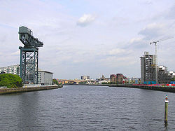
- River ClydeRiver ClydeThe River Clyde is a major river in Scotland. It is the ninth longest river in the United Kingdom, and the third longest in Scotland. Flowing through the major city of Glasgow, it was an important river for shipbuilding and trade in the British Empire....
- River LevenRiver Leven, DunbartonshireThe River Leven is a stretch of water in West Dunbartonshire, Scotland, flowing from Loch Lomond in the North to the River Clyde in the South...
(R)- Fruin Water (R) (flows into Loch LomondLoch LomondLoch Lomond is a freshwater Scottish loch, lying on the Highland Boundary Fault. It is the largest lake in Great Britain by surface area. The lake contains many islands, including Inchmurrin, the largest fresh-water island in the British Isles, although the lake itself is smaller than many Irish...
) - River Endrick (L) (flows into Loch Lomond)
- Blane Water (L)
- Luss Water (R) (flows into Loch Lomond)
- Douglas WaterGlen DouglasGlen Douglas is a glen in the southwest Scottish Highlands. It is drained by the Douglas Water which discharges at the village of Inverbeg at its eastern end into Loch Lomond. The glen is followed by a minor road which links the A82 road alongside Loch Lomond with the A814 road beside Loch Long...
(R) (flows into Loch Lomond) - Inveruglas Water (R) (flows into Loch Lomond)
- River Falloch (flows into head of Loch Lomond)
- Dubh Eas (R)
- Fruin Water (R) (flows into Loch Lomond
- Black Cart WaterRiver CartThe River Cart is a tributary of the River Clyde, Scotland, which it joins from the west roughly midway between the towns of Erskine and Renfrew....
(L)- River GryffeRiver GryfeThe River Gryfe or River Gryffe is a river and tributary of the Black Cart Water, running through the historic county of Renfrewshire and the modern council areas of Renfrewshire and Inverclyde in the west central Lowlands of Scotland, United Kingdom....
(L)- Gryfe Water (Ls)
- Green Water (Rs)
- River Gryffe
- White Cart WaterRiver CartThe River Cart is a tributary of the River Clyde, Scotland, which it joins from the west roughly midway between the towns of Erskine and Renfrew....
(L)- Levern Water (L)
- River KelvinRiver KelvinThe Kelvin rises on watershed of Scotland on the moor south east of the village of Banton, east of Kilsyth - . At almost 22 miles long, it initially flows south to Dullatur Bog where it falls into a man made trench and takes a ninety degree turn flowing west along the northern boundary of the bog...
(R)- Allander WaterAllander WaterThe Allander Water is a river in East Dunbartonshire and West Dunbartonshire, Scotland, and one of the three main tributaries of the River Kelvin, the others being the Glazert Water and the Luggie Water.The Allander Water flows through Milngavie...
(R) - Luggie WaterLuggie WaterAccording to the "Ordnance Gazetteer of Scotland:Luggie Water, a rivulet of Lanarkshire and the detached district of Dumbartonshire, flowing 10 7/8 miles westward and west-north-westward along the boundaries or through the interior of Cumbernauld, New Monkland, Cadder, and Kirkintilloch parishes,...
(L) - Glazert Water (R)
- Allander Water
- Rotten Calder Water (L)
- North Calder WaterNorth Calder WaterThe North Calder Water is a river in North Lanarkshire, Scotland. It flows for 12 miles from the Black Loch to the River Clyde at Daldowie south-east of Glasgow....
(R) - South Calder WaterSouth Calder WaterThe South Calder Water is a river in Scotland. It runs west from the high plateau between Shotts and Fauldhouse, which also produces the River Almond, which flows east into the River Forth.The river is known locally as "The Cawder".-Route:...
(R) - Avon WaterAvon WaterAvon Water, also known locally as the River Avon, is a 24-mile-long river in Scotland, and a tributary of the River Clyde.The Avon Water rises in the hills on the boundary between East Ayrshire and South Lanarkshire, close to the head of the Irvine Water...
(L)- Cander Water (R)
- Glengavel Water (R)
- River Nethan (L)
- Mouse Water (R)
- Douglas WaterDouglas WaterThe Douglas Water is a river in south-central Scotland, and is a tributary of the River Clyde. Its course is entirely within the South Lanarkshire council area. The river's name comes from the Gaelic dubh-glas, meaning black water....
(L) - Medwin Water
- North Medwin (Rs)
- South Medwin (Ls)
- Duneaton Water (L)
- Snar Water (R)
- Camps water (R)
- Glengonnar Water (L)
- Elvan Water (L)
- Daer Water
- Portrail Water (L)
- River Leven
Simple coastal catchments
- Noddsdale Water
- Gogo Water
Garnock catchment
- River GarnockRiver GarnockThe River Garnock, the smallest of Ayrshire's six principal rivers, has its source on the southerly side of the Hill of Stake in the heart of the Clyde Muirshiel Regional Park. About a mile and a half south of this starting point the untested stream tumbles over the Spout of Garnock, the highest...
- Lugton Water (L)
- Rye Water (R)
Irvine catchment
- River IrvineRiver IrvineThe River Irvine is a river flowing through southwest Scotland, with its watershed on the Lanarkshire border of Ayrshire at an altitude of above sea-level, near Drumclog, and SW by W of Strathaven...
- Annick Water (R)
- Fenwick Water (R)
- Craufurdland Water (R)
- Cessnock Water (L)
Ayr catchment
- River AyrRiver AyrThe River Ayr , longest river in what was the old county of Ayrshire of Scotland, is approximately 65 kilometres in length. It originates at Glenbuck Loch in East Ayrshire on the border of Lanarkshire and winds its way through East and South Ayrshire to the town of Ayr, where it empties into the...
- Water of Coyle (L)
- Lugar WaterLugar WaterThe Lugar Water, or River Lugar, is created by the confluence of Bello Water and Guelt Water, both of which flow from the hills of the Southern Uplands in East Ayrshire, Scotland....
(L)- Burnock Water (L)
- Bellow Water (Rs)
- Glenmuir Water (Ls)
- Guelt Water (L)
- Greenock WaterGreenock WaterGreenock Water is a river in East Ayrshire, Scotland.It flows out of the Dippal Burn, about 2 miles south of Dungavel Hill. A tributary of the River Ayr, it joins it about 4 miles west of the small town of Muirkirk....
(R)
Doon catchment
- River DoonRiver DoonThe River Doon is a river in South Ayrshire, Scotland. The river flows 23 miles from Loch Doon, joining the Firth of Clyde just south of Ayr. Its course is generally north-westerly, passing near to the town of Dalmellington, and through the villages of Patna, Dalrymple, and Alloway, birthplace...
- Carrick Lane (L) (flows into Loch DoonLoch DoonLoch Doon is a body of water, in Carrick, Scotland. The River Doon issues from its northern end, while the loch itself receives waters from Loch Enoch via Eglin Lane....
)- Whitespout Lane (Ls)
- Eglin Lane (Rs)
- Gala Lane (flows into head of Loch Doon)
- Carrick Lane (L) (flows into Loch Doon
Simple coastal catchments
- Water of GirvanWater of GirvanThe Water of Girvan is a river in South Ayrshire, which has its source at Loch Braden Reservoir in the Carrick Forest section of Galloway Forest Park. This river passes through the villages of Straiton, Kirkmichael and Dailly en-route to the Firth of Clyde at Girvan Harbour....
- River StincharRiver StincharThe River Stinchar is a river in South Ayrshire, Scotland. It flows south west from the Galloway Forest Park to enter the Firth of Clyde at Ballantrae, about south south east of Ailsa Craig....
- Water of Tig (L)
- Duisk River (L)
Solway Firth

Mull of Galloway
The Mull of Galloway is the southernmost point of Scotland. It is situated in Wigtownshire, Dumfries and Galloway.A lighthouse is positioned at the point . Built in 1830 by engineer Robert Stevenson, the white-painted round tower is high...
to Gretna
Gretna
-Places:In Scotland:*Gretna, Scotland in Dumfries and Galloway*Gretna GreenIn Canada:*Gretna, ManitobaIn the United States:*Gretna, Florida*Gretna, Louisiana*Gretna, Nebraska*Mount Gretna, Pennsylvania*Mount Gretna Heights, Pennsylvania...
; rivers flowing into the Irish Sea
Irish Sea
The Irish Sea separates the islands of Ireland and Great Britain. It is connected to the Celtic Sea in the south by St George's Channel, and to the Atlantic Ocean in the north by the North Channel. Anglesey is the largest island within the Irish Sea, followed by the Isle of Man...
and Solway Firth
Solway Firth
The Solway Firth is a firth that forms part of the border between England and Scotland, between Cumbria and Dumfries and Galloway. It stretches from St Bees Head, just south of Whitehaven in Cumbria, to the Mull of Galloway, on the western end of Dumfries and Galloway. The Isle of Man is also very...
Water of Luce catchment
- Water of LuceWater of LuceThe Water of Luce is a river in Dumfries and Galloway, in south west Scotland.The Main Water of Luce rises in South Ayrshire, flows south to New Luce, where it is joined by the Cross Water of Luce, and flows into the Solway Firth at Luce Bay....
- Main Water of Luce (Rs)
- Cross water of Luce (Ls)
Bladnoch catchment
- River BladnochRiver BladnochThe Bladnoch is a river in the Machars of Galloway in southwest Scotland. One of the earliest descriptions of it is given by Sir Andrew Agnew of Lochnaw and Sir David Dunbar in an appendix to Andrew Symson's work A Large Description of Galloway written in the 17th century...
- Tarf WaterTarf Water, WigtownshireThe Tarf Water is a river in the former county of Wigtownshire in south-west Scotland. It rises on the Ayrshire border and flows in a generally southeastward direction to meet the River Bladnoch near the village of Kirkcowan It has no major tributaries but is fed by numerous burns which drain an...
(R) - Black Burn (R)
- Tarf Water
Cree catchment
- River CreeRiver CreeThe River Cree is a river in Dumfries and Galloway, Scotland which runs through Newton Stewart and into the Solway Firth. It forms part of the boundary between the counties of Wigtownshire and Kirkcudbrightshire....
- Palnure Burn (L)
- Penkiln Burn (L)
- Water of Minnoch (L)
- Water of Trool (L)
- Moneypool Burn
Water of Fleet catchment
- Water of FleetWater of FleetThe Water of Fleet is a river in Scotland flowing into Fleet Bay on the Solway. Its two tributaries are the 'Big Water of Fleet', which begins around Loch Grannoch, and the 'Little Water of Fleet'. The river flows through Gatehouse of Fleet before meeting the sea.The Big Water of Fleet is...
- Skyre Burn (R)
- Little Water of Fleet (Ls)
- Big Water of Fleet (Rs)
Dee catchment
- River DeeRiver Dee, GallowayThe River Dee, in south-west Scotland, flows from its source in Loch Dee amongst the Galloway Hills, firstly to Clatteringshaws Loch, then in to Loch Ken, where it joins the Water of Ken. From there, the Dee flows southwards to Kirkcudbright, and into Kirkcudbright Bay to reach the Solway. The...
(known also as 'Black Water of Dee' above confluence with Water of Ken)- Tarff WaterRiver Dee, GallowayThe River Dee, in south-west Scotland, flows from its source in Loch Dee amongst the Galloway Hills, firstly to Clatteringshaws Loch, then in to Loch Ken, where it joins the Water of Ken. From there, the Dee flows southwards to Kirkcudbright, and into Kirkcudbright Bay to reach the Solway. The...
(R) - Water of KenWater of KenThe Water of Ken is a river in Galloway, south-west Scotland. It rises on Blacklorg Hill, north-east of Cairnsmore of Carsphairn in the Carsphairn hills, and flows south-westward into the Glenkens valley, passing through Carsfad and Earlstoun lochs, both of which are dammed to supply the Galloway...
(L)- Polharrow Burn (R)
- Water of Deugh (R)
- Carsphairn Lane (R)
- Tarff Water
Urr catchment
- Urr WaterUrr WaterUrr Water or River Urr is a river in southwest Scotland.Entirely within Dumfries and Galloway, the Urr Water originates at Glenlair, and flows southwards for thirty miles from Loch Urr to its outflow into the Solway Firth at Rough Firth...
- Kirkgunzeon Lane (L)
Nith catchment
- River NithRiver NithThe River Nith is a river in South West Scotland.-Source, flow and mouth:The Nith rises in the Carsphairn hills of East Ayrshire, more precisely between Prickeny Hill and Enoch Hill, 7 km East of Dalmellington...
- New Abbey Pow (R)
- Cargen Water (R)
- Cluden Water (R)
- Cairn Water (Ls)
- Castlefairn Water (Rs)
- Dalwhat Water (Ls)
- Old Water (Rs)
- Cairn Water (Ls)
- Scaur WaterScaur WaterScaur Water is a river which rises near Polskeoch in the Scaur hills in the region of Dumfries and Galloway, Scotland.It flows from its source near Sanquhar in the Southern Uplands and joins the River Nith two miles southwest of Thornhill. The total length is...
(R) (or Scar Water)- Shinnel WaterShinnel WaterShinnel Water, also spelt Shinnell, is a river in the region of Dumfries and Galloway, Scotland.It rises in the Scaur hills hills of Tynron Parish in the Southern Uplands at an altitude of 460m, and flows 13 miles to join Scaur Water near Penpont, at an altitude of 70m...
(R)
- Shinnel Water
- Cample Water (L)
- Carron WaterCarron Water, DumfriesshireThe Carron Water is a tributary of the River Nith in southwest Scotland. It rises in the Dalveen Pass in the Lowther Hills as its headwater streams, the Dinabid Linn, Dalveen Lane and Lavern Burn join to flow southwards, to the west of the village of Durisdeer, to meet the Nith at Carronbridge....
(L) - Mennock Water (L)
- Cairn Water??
- Euchan Water (R)
- Crawick Water (L)
- Wanlock Water (Ls)
- Spango Water (Rs)
Minor catchment
- Lochar Water
Annan catchment
- River AnnanRiver AnnanThe River Annan is a river in southwest Scotland. It rises at the foot of Hart Fell, five miles north of Moffat. A second fork rises on Annanhead Hill and flows through the Devil's Beef Tub before joining at the Hart Fell fork north of Moffat.From there it flows past the town of Lockerbie, and...
- Mein Water (L)
- Water of Milk (L)
- Corrie Water (R)
- Dryfe Water (L)
- Kinnel Water (R)
- Water of AeWater of AeThe Water of Ae is a tributary of the River Annan which it flows into west of Lockerbie in Dumfries and Galloway, South West Scotland....
(R)- Capel Water (R)
- Broadshaw Water (R)
- Water of Ae
- Wamphray Water (L)
- Moffat Water (L)
- Evan Water (R)
Esk catchment
- River Esk, Dumfries and GallowayRiver Esk, Dumfries and GallowayThe River Esk is a river in Dumfries and Galloway, Scotland, that flows into the Solway Firth. It also flows for a small way through the English county of Cumbria before entering the Solway....
(a.k.a. 'Border' Esk)- Kirtle WaterKirtle WaterThe Kirtle Water is a river in Dumfries and Galloway in southern Scotland. It rises on the southern slopes of Haggy Hill where its headwaters are impounded to form Winterhope Reservoir...
(R) (enters tidal section) - River SarkRiver SarkDisambiguation: for other meanings, please see Sark The River Sark or Sark Water is a river best known for forming part of the western border between Scotland and England...
(R) (straddles the border in its lower reaches, enters tidal section) - River LyneRiver LyneThe River Lyne is a river of Cumbria in England.The river is formed near the hamlet of Stapleton by the confluence of the Black Lyne and the White Lyne ....
(L) - Liddel WaterLiddel WaterLiddel Water is a river running through southern Scotland and northern England, for much of its course forming the border between the two countries, and was formerly one of the boundaries of the Debatable Lands....
(L)- Kershope BurnKershope BurnKershope Burn is a minor river running in its entirety along the border between England and Scotland.The river rises, as Clark's Sike, in a marshy area in Kielder Forest Northumberland known as Hobb's Flow, before becoming Kershope Burn after running by Kershopehead, a farmstead in Cumbria.The...
(L) - Hermitage WaterHermitage WaterThe Hermitage Water is a river in Liddesdale, in the Scottish Borders area of Scotland. Among its many feeder burns are Braidley Burn, Dinley Burn, Gorrenberry Burn and Twislehope Burn. The Water flows through the hamlets of Dinley and Gorrenberry, and through the village of Hermitage, and past...
(R)- Roughley Burn (L)
- Whitrope Burn (L)
- Kershope Burn
- Tarras Water (L)
- Wauchope Water (R)
- Ewes Water (L)
- Meggat Water (L)
- White EskRiver Esk, Dumfries and GallowayThe River Esk is a river in Dumfries and Galloway, Scotland, that flows into the Solway Firth. It also flows for a small way through the English county of Cumbria before entering the Solway....
(Ls) - Garwald Water (R)
- Black EskRiver Esk, Dumfries and GallowayThe River Esk is a river in Dumfries and Galloway, Scotland, that flows into the Solway Firth. It also flows for a small way through the English county of Cumbria before entering the Solway....
(Rs)
- White Esk
- Kirtle Water
Further tributaries of the Esk lie wholly in England - see List of rivers in England.
Rivers on Scottish islands
Most of the Scottish islands are too small to maintain watercourses of any great length or size, and are frequently indented by numerous long bays and inlets which further break up the landscape. However a disproportionate number of their watercourses bear the name 'river', though many are relatively tiny.Arran
- The numerous small watercourses on ArranIsle of ArranArran or the Isle of Arran is the largest island in the Firth of Clyde, Scotland, and with an area of is the seventh largest Scottish island. It is in the unitary council area of North Ayrshire and the 2001 census had a resident population of 5,058...
are listed anticlockwise from Brodick.- Glencloy Water
- Glenrosa Water
- South Sannox Burn
- North Sannox Burn
- Abhainn Mór
- Iorsa Water
- Machrie Water
- Black Water (upper reaches known as Clauchan Water)
- Sliddery Water
- Torrylinn Water (also known as Kilmory Water)
- Benlister Burn
- Glenashdale Burn (a.k.a. Allt Delphin)
Skye and the Inner Hebrides
Islay- There are numerous watercourses on IslayIslay-Prehistory:The earliest settlers on Islay were nomadic hunter-gatherers who arrived during the Mesolithic period after the retreat of the Pleistocene ice caps. In 1993 a flint arrowhead was found in a field near Bridgend dating from 10,800 BC, the earliest evidence of a human presence found so far...
, many of which though short are termed 'rivers'. They are listed anticlockwise from Port AskaigPort AskaigPort Askaig is a port village on the east coast of the island of Islay, in Scotland.-Transport:Port Askaig serves as the main port of Islay, sharing passenger services to the Scottish mainland with Port Ellen...
.- Doodilmore River
- Gortanaoid River
- Saligo River
- River Drolsay
- River SornRiver SornThe River Sorn is a small river on the Scottish island of Islay. Draining Loch Finlaggan and having gathered the waters of the Allt Ruadh and the Ballygrant Burn, it flows southwestwards to enter the sea at the village of Bridgend at the head of Loch Indaal....
- River LagganRiver Laggan, IslayThe River Laggan is a small river on the Scottish island of Islay. Having gathered the waters of the Kilennan River, Barr River and Duich River / Torra River it enters the sea at the north end of Laggan Bay off Loch Indaal.- References :...
- Duich RiverRiver Laggan, IslayThe River Laggan is a small river on the Scottish island of Islay. Having gathered the waters of the Kilennan River, Barr River and Duich River / Torra River it enters the sea at the north end of Laggan Bay off Loch Indaal.- References :...
(L) (upper reaches known as Torra River) - Kilennan RiverRiver Laggan, IslayThe River Laggan is a small river on the Scottish island of Islay. Having gathered the waters of the Kilennan River, Barr River and Duich River / Torra River it enters the sea at the north end of Laggan Bay off Loch Indaal.- References :...
(L) - Barr RiverRiver Laggan, IslayThe River Laggan is a small river on the Scottish island of Islay. Having gathered the waters of the Kilennan River, Barr River and Duich River / Torra River it enters the sea at the north end of Laggan Bay off Loch Indaal.- References :...
- Duich River
- Machrie River
- Glenegedale River (L)
- Kintra River
- Kilbride River
- Ardilistry River
- Kintour River
- Claggain River
Jura
- There are numerous watercourses on JuraJura, ScotlandJura is an island in the Inner Hebrides of Scotland, situated adjacent and to the north-east of Islay. Part of the island is designated as a National Scenic Area. Until the twentieth century Jura was dominated - and most of it was eventually owned - by the Campbell clan of Inveraray Castle on Loch...
, some of which though short are termed 'rivers'. They are listed anticlockwise from Feolin Ferry.- Corran River
- Lussan River
- Shian River
- Glenbatrick River
Mull
- There are numerous watercourses on MullIsle of MullThe Isle of Mull or simply Mull is the second largest island of the Inner Hebrides, off the west coast of Scotland in the council area of Argyll and Bute....
, some of which though short are termed 'rivers'.They are listed anticlockwise from Tobermory.- Tobermory River
- River Bellart
- River Ba (Glencannel River flows into Loch Ba)
- Scarisdale River
- Coladoir River
- Leidle River
- Beach River
- Lussa River
- Scallastle River
- River Forsa
- Aros River
- Ledmore River (Ls)
- Allt an Lon Biolaireich (Rs)
Rùm
- There are a number of watercourses on RùmRùmRùm , a Scottish Gaelic name often anglicised to Rum) is one of the Small Isles of the Inner Hebrides, in the district of Lochaber, Scotland...
, of which are named as 'rivers'. They are listed anticlockwise from KinlochKinloch CastleKinloch Castle is a late Victorian mansion located on the Isle of Rùm, one of the Small Isles off the west coast of Scotland. It was built as a private residence for Sir George Bullough, a textile tycoon from Lancashire whose father bought Rùm as his summer residence and shooting estate....
.- Kinloch River
- Kilmory River
- Abhainn Rangail
- Dibidil River
Isle of Skye
- Listed anticlockwise around the coast from KyleakinKyleakinThe village of Kyleakin is situated on the east coast of the Isle of Skye in the Inner Hebrides, along the strait of Kyle Akin opposite the northwest Scottish mainland town of Kyle of Lochalsh...
. Many small watercourses, which would in other areas be named as 'burn' or 'allt', bear the name 'river' in Skye.- Broadford River
- River Sligachan
- Allt Dearg Mòr
- Varragill River
- River Leasgeary
- River Chracaig
- Lealt River
- Stenscholl River (upper reaches known as Kilmartin River)
- River Brogaig
- Kilmaluag River
- River RhaUig, SkyeThe village of Uig lies at the head of the sheltered inlet of Uig Bay on the west coast of the Trotternish peninsula on the Isle of Skye, Scotland. Uig is situated partly on the raised beach around the head of the bay and partly on the steep slopes behind it...
- River CononUig, SkyeThe village of Uig lies at the head of the sheltered inlet of Uig Bay on the west coast of the Trotternish peninsula on the Isle of Skye, Scotland. Uig is situated partly on the raised beach around the head of the bay and partly on the steep slopes behind it...
- River Hinnisdal
- River Romesdal
- River Haultin
- River Snizort
- Lòn an Eireannaich (R)
- Abhainn an Acha-leathain
- Tungadal River
- River Tora
- Treaslane River
- Bay River
- River Horneval
- Osdale River
- Hamara River
- Lorgill River
- Dibidal River
- Roskhill River
- Caroy River
- River Ose
- Amar River
- Sumardale River
- River Drynoch
- Viskigill Burn
- River Talisker
- Eynort River
- River Brittle
- Scavaig River
- Abhainn Camas Fhionnairigh
- Ord River
- Kylerhea River
Outer Hebrides
Lewis- Abhainn Ghriais
- Abhainn Lacasdail
- Abhainn Ghrioda (Greeta River or River Creed)
- Abhainn Arnoil
- Abhainn Bharabhais
Orkney
Mainland- Burn of AyrelandBurn of AyrelandThe Burn of Ayreland is a northwesterly flowing coastal stream on Mainland Orkney, Scotland that discharges to the Clestrain Sound about two miles south of Stenness. Draining chiefly agricultural lands elevated mosses and moorland. This stream has a notable lack of turbidity and a pH level of...
- Mill Dam Burn, ShapinsayMill Dam, ShapinsayMill Dam, Shapinsay is a wetland in western Shapinsay, in Orkney, Scotland.This water body was not shown on the 1840 survey map of the island, since it is a man-made creation from a damming in the 1880s. Mill Dam is fed by a stream flowing from the north that rises on the western lobe of Shapinsay...
, Orkney IslandsOrkney IslandsOrkney also known as the Orkney Islands , is an archipelago in northern Scotland, situated north of the coast of Caithness...
Listing by length
The eleven major rivers of Scotland, in order of length, are:- River TayRiver TayThe River Tay is the longest river in Scotland and the seventh-longest in the United Kingdom. The Tay originates in western Scotland on the slopes of Ben Lui , then flows easterly across the Highlands, through Loch Dochhart, Loch Lubhair and Loch Tay, then continues east through Strathtay , in...
193 km (119.9 mi) - River SpeyRiver SpeyThe River Spey is a river in the northeast of Scotland, the second longest and the fastest-flowing river in Scotland...
172 km (106.9 mi) - River ClydeRiver ClydeThe River Clyde is a major river in Scotland. It is the ninth longest river in the United Kingdom, and the third longest in Scotland. Flowing through the major city of Glasgow, it was an important river for shipbuilding and trade in the British Empire....
171 km (106.3 mi) - River TweedRiver TweedThe River Tweed, or Tweed Water, is long and flows primarily through the Borders region of Great Britain. It rises on Tweedsmuir at Tweed's Well near where the Clyde, draining northwest, and the Annan draining south also rise. "Annan, Tweed and Clyde rise oot the ae hillside" as the Border saying...
156 km (96.9 mi) - River DeeRiver Dee, AberdeenshireThe River Dee is a river in Aberdeenshire, Scotland. It rises in the Cairngorms and flows through Strathdee to reach the North Sea at Aberdeen...
137 km (85.1 mi) - River DonRiver Don, AberdeenshireThe River Don is a river in north-east Scotland. It rises in the Grampians and flows eastwards, through Aberdeenshire, to the North Sea at Aberdeen. The Don passes through Alford, Kemnay, Inverurie, Kintore, and Dyce...
132 km (82 mi) - River NithRiver NithThe River Nith is a river in South West Scotland.-Source, flow and mouth:The Nith rises in the Carsphairn hills of East Ayrshire, more precisely between Prickeny Hill and Enoch Hill, 7 km East of Dalmellington...
112 km (69.6 mi) - River ForthRiver ForthThe River Forth , long, is the major river draining the eastern part of the central belt of Scotland.The Forth rises in Loch Ard in the Trossachs, a mountainous area some west of Stirling...
105 km (65.2 mi) - River FindhornRiver FindhornThe River Findhorn is one of the longest rivers in Scotland. Located in the north east, it flows into the Moray Firth on the north coast. It has one of the largest non-firth estuaries in Scotland....
101 km (62.8 mi) - River DeveronRiver DeveronThe River Deveron , known anciently as the Dovern, is a river in the north east of Scotland. The river has a length of 60 miles, and has a reputation for its salmon, sea trout and brown trout fishing...
98 km (60.9 mi) - River AnnanRiver AnnanThe River Annan is a river in southwest Scotland. It rises at the foot of Hart Fell, five miles north of Moffat. A second fork rises on Annanhead Hill and flows through the Devil's Beef Tub before joining at the Hart Fell fork north of Moffat.From there it flows past the town of Lockerbie, and...
79 km (49.1 mi)
Listing by area of catchment
The major rivers of Scotland, in order of catchment, are:- River TayRiver TayThe River Tay is the longest river in Scotland and the seventh-longest in the United Kingdom. The Tay originates in western Scotland on the slopes of Ben Lui , then flows easterly across the Highlands, through Loch Dochhart, Loch Lubhair and Loch Tay, then continues east through Strathtay , in...
c. 2000 square miles (5,180 km²) - River TweedRiver TweedThe River Tweed, or Tweed Water, is long and flows primarily through the Borders region of Great Britain. It rises on Tweedsmuir at Tweed's Well near where the Clyde, draining northwest, and the Annan draining south also rise. "Annan, Tweed and Clyde rise oot the ae hillside" as the Border saying...
1500 square miles (3,885 km²) - River SpeyRiver SpeyThe River Spey is a river in the northeast of Scotland, the second longest and the fastest-flowing river in Scotland...
1097 square miles (2,841.2 km²)
Note: Imperial figures from quoted source; and metric figures less certain.
Shared names
A number of Scottish rivers have identical or very similar names which can be a source of confusion. These are some of the main ones. The symbol '>' is used here to signify 'tributary of':Ale
- Ale Water ( > Eye Water, Eyemouth); Ale WaterAle WaterThe Ale Water is a tributary of the River Teviot, in the Scottish Borders area of Scotland. It rises at Henwoodie Hill and flows through Alemoor Loch.It meets the Teviot south of the village of Ancrum, and it runs through Ashkirk and Lilliesleaf....
( > Tweed)
Allan
- Allan WaterAllan WaterThe Allan Water is a river in central Scotland, United Kingdom. Rising in the Ochil Hills, it runs through Strathallan to Dunblane and Bridge of Allan before joining the River Forth....
( > Forth); Allan WaterRiver TeviotThe River Teviot, or Teviot Water, is a river of the Scottish Borders area of Scotland, and a tributary of the River Tweed.It rises in the western foothills of Comb Hill on the border of Dumfries and Galloway...
( > Teviot > Tweed)
Almond
- River AlmondRiver Almond, LothianThe River Almond is a river in east-central Scotland. It is 28 miles long, rising in North Lanarkshire near Shotts and runs through West Lothian, draining into the Firth of Forth at Cramond near Edinburgh....
(Lothian); River Almond ( > Tay)
Avon
- River Avon (Falkirk); River AvonRiver Avon, StrathspeyThe River Avon is a river in the Strathspey area of the Scottish Highlands, and a tributary of the River Spey. It drains the north-eastern area of the Cairngorm Mountains and is largely contained within the Cairngorms National Park...
( > Spey); Avon WaterAvon WaterAvon Water, also known locally as the River Avon, is a 24-mile-long river in Scotland, and a tributary of the River Clyde.The Avon Water rises in the hills on the boundary between East Ayrshire and South Lanarkshire, close to the head of the Irvine Water...
( > Clyde)
Ba
- River Ba (Mull); River Bà (Rannoch Moor)
Bannock Burn
- Bannock BurnRiver HelmsdaleThe River Helmsdale is one of the major east-flowing rivers of Sutherland in the Highlands of Scotland...
( > River Helmsdale); Bannock BurnBannock BurnThe Bannock Burn is a stream which rises in the Touch Hills to the south-west of Stirling in central Scotland. The Bannock flows eastward and enters the River Forth to the east of Stirling, close to the site of the Battle of Bannockburn...
( > Forth)
Barr
- Barr RiverBarr River, MorvernBarr River is a short watercourse in Morvern in the Scottish Highlands. Its principal tributaries are the Allt Ghleann Sleibhtecoire and the Allt na Lice Beithe which rise on open moorland to the south and flow north amongst coniferous plantations. The river enters the tidal Loch Teacus at Poll...
(Morvern); Barr RiverRiver Laggan, IslayThe River Laggan is a small river on the Scottish island of Islay. Having gathered the waters of the Kilennan River, Barr River and Duich River / Torra River it enters the sea at the north end of Laggan Bay off Loch Indaal.- References :...
( > River Laggan, Islay); Barr WaterBarr WaterBarr Water is a westerly flowing river of the Kintyre peninsula in the southwest Scottish Highlands. Rising at the diminutive Loch Losgainn near the hill of Cruach Mhic-an t-Saoir, it initially flows south-southwestwards amongst conifer plantations before turning west-southwestwards to flow down...
(Kintyre)
Black Burn
- Black Burn - commonly occurring including Lossie, Tweed, Water of Luce
Black Water
- Black WaterBlack Water"Black Water" is a song by the American music group The Doobie Brothers from the album What Were Once Vices Are Now Habits. Released in 1974, it features Patrick Simmons on lead vocals....
-very frequent
Calder
- River CalderRiver Calder, HighlandThe River Calder is a left bank tributary of the River Spey in the Scottish Highlands Its headwaters are the Allt Ballach, Allt an Lochain Dubh and Allt Madagain which drain the mountain slopes at the southeastern corner of the Monadhliath. Their waters are added to by those of the Allt Fionndrigh...
( > Spey, Highand); North Calder WaterNorth Calder WaterThe North Calder Water is a river in North Lanarkshire, Scotland. It flows for 12 miles from the Black Loch to the River Clyde at Daldowie south-east of Glasgow....
( > Clyde); South Calder WaterSouth Calder WaterThe South Calder Water is a river in Scotland. It runs west from the high plateau between Shotts and Fauldhouse, which also produces the River Almond, which flows east into the River Forth.The river is known locally as "The Cawder".-Route:...
( > Clyde)
Carron
- River CarronRiver Carron (Forth)The River Carron is a river in central Scotland. This river has given its name to towns in Falkirk, a variety of regional features, a type of cannon, a line of bathtubs, two warships and an island in the Southern Hemisphere.-River Carron:The river rises in the Campsie Fells before flowing into...
(Forth); River CarronRiver Carron, SutherlandThe River Carron is a river in Sutherland, in the Highlands of Scotland.It begins as the Abhainn a' Ghlinne Mhoir, which joins with the Alladale River to form the River Carron...
(Sutherland); River CarronRiver Carron, Wester RossRiver Carron is a river in Wester Ross, in the Highlands of Scotland. The river rises in Ledgowan Forest. It gathers its head-streams through Carron Bog, then enters Loch Scaven and flows out from there....
(Wester Ross); Carron WaterCarron Water, AberdeenshireCarron Water is a river in Aberdeenshire, Scotland.Carron Water rises in Fetteresso Forest on the eastern edge of the Grampians. It flows past Fetteresso Castle and discharges into the North Sea at Stonehaven Bay. Carron Water separates the Old Town from Stonehaven's new town , laid out in...
(Aberdeenshire); Carron WaterCarron Water, DumfriesshireThe Carron Water is a tributary of the River Nith in southwest Scotland. It rises in the Dalveen Pass in the Lowther Hills as its headwater streams, the Dinabid Linn, Dalveen Lane and Lavern Burn join to flow southwards, to the west of the village of Durisdeer, to meet the Nith at Carronbridge....
( > Nith)
Conon
- River CononUig, SkyeThe village of Uig lies at the head of the sheltered inlet of Uig Bay on the west coast of the Trotternish peninsula on the Isle of Skye, Scotland. Uig is situated partly on the raised beach around the head of the bay and partly on the steep slopes behind it...
(Skye); River CononRiver CononThe River Conon is a river in the Highlands of Scotland. It begins at Loch Luichart, and flows in a south-easterly direction to be joined by the River Meig at Scatwell before passing through Loch Achonachie...
( > Cromarty Firth)
Dee
- River Dee, AberdeenshireRiver Dee, AberdeenshireThe River Dee is a river in Aberdeenshire, Scotland. It rises in the Cairngorms and flows through Strathdee to reach the North Sea at Aberdeen...
(Aberdeen); River DeeRiver Dee, GallowayThe River Dee, in south-west Scotland, flows from its source in Loch Dee amongst the Galloway Hills, firstly to Clatteringshaws Loch, then in to Loch Ken, where it joins the Water of Ken. From there, the Dee flows southwards to Kirkcudbright, and into Kirkcudbright Bay to reach the Solway. The...
(Galloway)
Dibidal, Dibidil
- Dibidal River (Skye); Dibidil River (Rùm)
Dorback
- Dorback BurnRiver NethyThe River Nethy is a right bank tributary of the River Spey in northeast Scotland. It rises as the Garbh Allt between Cairn Gorm and A' Chòinneach on the northern slopes of the Cairngorms and flows northwards through Strath Nethy and into Abernethy Forest...
( > Nethy > Spey); Dorback BurnDorback Burn (Findhorn)The Dorback Burn is a right-bank tributary of the River Findhorn in northeast Scotland. It emerges from the northeast end of Lochindorb and flows northeast to a point where the A939 road and A940 road meet, where it is joined on its right by the Anaboard Burn...
( > Findhorn)
Douglas
- Douglas WaterDouglas WaterThe Douglas Water is a river in south-central Scotland, and is a tributary of the River Clyde. Its course is entirely within the South Lanarkshire council area. The river's name comes from the Gaelic dubh-glas, meaning black water....
( > Clyde); Douglas WaterGlen DouglasGlen Douglas is a glen in the southwest Scottish Highlands. It is drained by the Douglas Water which discharges at the village of Inverbeg at its eastern end into Loch Lomond. The glen is followed by a minor road which links the A82 road alongside Loch Lomond with the A814 road beside Loch Long...
(Loch Lomond); Douglas WaterDouglas Water (Loch Fyne)The Douglas Water is a river in Argyll in the southwest Scottish Highlands. It emerges from the northeastern end of the diminutive Loch Dubh-ghlas and flows northeastwards through Coire Dubh-ghlas before turning east then southeast amongst extensive conifer plantations to the bridge which carries...
(Loch Fyne)
Eden
- Eden WaterEden WaterEden Water is a tributary of the River Tweed in the Scottish Borders area of Scotland. "Water" is the Lowland Scots term for a small river.The Eden Burn rises to the east of Lauder at Corsbie Moor. The Eden Water passes Bassendean village and Bassendean House and the hamlets of Fawside and Mack's...
(Tweed); River EdenRiver Eden, FifeThe River Eden is a river in Fife in Scotland, and is one of Fife's two principal rivers, along with the Leven. It is nearly 30 miles long and has a fall of around 90 metres...
(Fife)
Elrick
- Elrick Burn (Don); Elrick Burn (Findhorn)
Enrick, Endrick
- River Endrick (Loch Lomond); River Enrick (Loch Ness)
Esk, North Esk, South Esk
- River Esk, Dumfries and GallowayRiver Esk, Dumfries and GallowayThe River Esk is a river in Dumfries and Galloway, Scotland, that flows into the Solway Firth. It also flows for a small way through the English county of Cumbria before entering the Solway....
('Border Esk'), River Esk, LothianRiver Esk, LothianThe River Esk is a river which flows through Midlothian and East Lothian, Scotland.It initially runs as two separate rivers, the North Esk and the South Esk....
(Lothian); River North EskRiver North EskThe North Esk is a river in Angus and Aberdeenshire, Scotland. It is formed by the meeting of the Water of Mark and the Water of Lee , and enters the North Sea four miles north of Montrose. It forms the boundary between Angus and Aberdeenshire at certain stages in its course...
; River North EskRiver North EskThe North Esk is a river in Angus and Aberdeenshire, Scotland. It is formed by the meeting of the Water of Mark and the Water of Lee , and enters the North Sea four miles north of Montrose. It forms the boundary between Angus and Aberdeenshire at certain stages in its course...
(Lothian); River South EskRiver South EskThe South Esk is a river in Angus, Scotland. It goes past Brechin and enters the North Sea at Montrose Basin. It was noted in the 19th century.-References:...
; River South EskRiver South EskThe South Esk is a river in Angus, Scotland. It goes past Brechin and enters the North Sea at Montrose Basin. It was noted in the 19th century.-References:...
(Lothian)
Gala
- Gala Lane (Loch Doon); Gala WaterGala WaterThe Gala Water is a river in the Scottish Borders area of Scotland and a tributary of the River Tweed. It is sometimes known as the "Gala", which nickname is also shared with Galashiels, which it flows through. The "Braw Lads O Gala Watter" is a song about people from Galashiels.-Gallery:...
( > Tweed)
Garry
- River Garry (Loch Oich); River GarryRiver Garry, PerthshireThe River Garry is a major tributary of the River Tummel, itself a tributary of the River Tay, in the traditional county of Perthshire in the Scottish Highlands...
( > Tummel > Tay)
Glass
- River GlassAllt GraadAllt Graad is a river in Easter Ross, Highland, Scotland. It is named on Ordnance Survey maps variously as Allt Graad and River Glass. It has also been known as the "Allt Grande", and the archaic Anglicization, "Aultgraad"....
(Easter Ross); River Glass, StrathglassRiver Glass, StrathglassThe River Glass is a river in the Scottish Highlands which flows northeastwards down Strathglass. It begins at the confluence of the River Affric and the Abhainn Deabhag, near the village of Tomich...
( > Beauly)
Glenmore
- Glenmore River; Glenmore River
Isla
- River IslaRiver Isla, MorayThe River Isla is a tributary of the River Deveron in North-East Scotland. The area surrounding it is known as Strathisla...
( > Deveron); River IslaRiver Isla, PerthshireThe River Isla is a tributary of the River Tay in Angus and Perthshire, Scotland. It runs for 46 miles through Glen Isla and Strathmore .-External links:*...
( > Tay)
Kilmory
- Kilmory River (Rùm); Kilmory Water
Kinglas, Kinglass
- Kinglas Water; River Kinglass
Kinloch
- Kinloch River (Rùm); Kinloch River; Kinloch River
Ledmore
- Ledmore River (Kirkaig); Ledmore River (Mull)
Leven
- River Leven (Argyll); River LevenRiver Leven, DunbartonshireThe River Leven is a stretch of water in West Dunbartonshire, Scotland, flowing from Loch Lomond in the North to the River Clyde in the South...
( > Clyde); River Leven, FifeRiver Leven, FifeThe River Leven is a river in Fife in Scotland. It flows from Loch Leven into the Firth of Forth at the town of Leven. The river is home to brown trout and hosts a run of sea trout and atlantic salmon...
(Fife)
Lochy, Lochay
- River Lochay (Tay); River Lochy (Great Glen); River Lochy (Awe)
Lunan
- Lunan Burn (Tay); Lunan WaterLunan WaterThe Lunan Water is an easterly flowing river in Angus, Scotland, that discharges to the North Sea north of the town of Arbroath. Draining chiefly agricultural lands, this stream has a moderate level of turbidity and a pH level of approximately 8.7. Other nearby watercourses discharging to the...
Lyne
- River LyneRiver LyneThe River Lyne is a river of Cumbria in England.The river is formed near the hamlet of Stapleton by the confluence of the Black Lyne and the White Lyne ....
(Border Esk); Lyne WaterLyne WaterThe Lyne Water is a tributary of the River Tweed which rises in the Pentland Hills of southern Scotland at Baddinsgill Reservoir. It runs through West Linton and Romannobridge, passes Flemington and Lyne Station and enters the Tweed west of Peebles. It floods regularly in winter and occasionally in...
(Tweed)
Machrie
- Machrie River (Islay); Machrie Water (Arran)
Meggat, Megget
- Meggat Water ( > Border Esk); Megget WaterMegget WaterMegget Water is a river in the Scottish Borders area of Scotland, in the former Selkirkshire. The Water rises at Broad Hill, passes through Megget Reservoir and empties into St Mary's Loch...
( > Tweed)
Mor
- Abhainn Mór (Arran); Abhainn Mor (Kirkaig)
Shiel
- River ShielRiver ShielThe River Shiel is a four kilometre long river in Acharacle, Highland. It flows out of the Loch Shiel into the sea at Dorlin.- Fishing :...
(Loch Shiel); River ShielGlen ShielGlen Shiel is a glen in the Northwest Highlands of Scotland.The glen runs approximately 9 miles from north-west to south-east, from sea level at the village of Shiel Bridge and Loch Duich to the Cluanie Inn at the western end of Loch Cluanie and the start of Glenmoriston.W. H...
( > Loch Duich)
Tarf, Tarff
- Tarf Water ( > Tilt > Garry > Tummel >Tay); Tarf WaterTarf Water, WigtownshireThe Tarf Water is a river in the former county of Wigtownshire in south-west Scotland. It rises on the Ayrshire border and flows in a generally southeastward direction to meet the River Bladnoch near the village of Kirkcowan It has no major tributaries but is fed by numerous burns which drain an...
( > River Bladnoch (Galloway)); Tarff WaterRiver Dee, GallowayThe River Dee, in south-west Scotland, flows from its source in Loch Dee amongst the Galloway Hills, firstly to Clatteringshaws Loch, then in to Loch Ken, where it joins the Water of Ken. From there, the Dee flows southwards to Kirkcudbright, and into Kirkcudbright Bay to reach the Solway. The...
( > River Dee, Galloway); River Tarff, Fort AugustusRiver Tarff, Fort AugustusThe River Tarff is a river in Inverness-shire in the Scottish Highlands. It rises between the hills of Gairbeinn and Geal Charn and flows northwards then southwestwards and finally north-northwestwards into the Great Glen where it enters Loch Ness at Fort Augustus. The middle and lower reaches of...
( > Loch Ness); Water of TarfRiver North EskThe North Esk is a river in Angus and Aberdeenshire, Scotland. It is formed by the meeting of the Water of Mark and the Water of Lee , and enters the North Sea four miles north of Montrose. It forms the boundary between Angus and Aberdeenshire at certain stages in its course...
( > River North Esk,Angus/Aberdeenshire )
See also
- Rivers and Fisheries Trusts of ScotlandRivers and Fisheries Trusts of ScotlandThe Rivers and Fisheries Trusts of Scotland is a waterway society, an unincorporated association, a Scottish charity, and an umbrella organisation for river trusts in Scotland, based in Edinburgh.RAFTS is the representative of all of Scotland's river systems...
(RAFTS) - Association of Rivers TrustsAssociation of Rivers TrustsThe Rivers Trust is the new name for the Association of Rivers Trusts which is a waterway society and registered charity No. 1107144, and an umbrella organisation for trusts concerned with rivers in England and Wales...
(ART) - List of waterway societies in the United Kingdom
- List of rivers
- List of rivers of England
- List of rivers in Ireland
- List of rivers of the Isle of Man
- List of rivers of Wales