
.gif)
List of places in Stirling (district)
Encyclopedia
This List of places in Stirling (district) is a list of links for any town
, village
, hamlet
, castle
, historic house
, nature reserve
. river
, canal
or other place of interest in Stirling
district.


Town
A town is a human settlement larger than a village but smaller than a city. The size a settlement must be in order to be called a "town" varies considerably in different parts of the world, so that, for example, many American "small towns" seem to British people to be no more than villages, while...
, village
Village
A village is a clustered human settlement or community, larger than a hamlet with the population ranging from a few hundred to a few thousand , Though often located in rural areas, the term urban village is also applied to certain urban neighbourhoods, such as the West Village in Manhattan, New...
, hamlet
Hamlet
The Tragical History of Hamlet, Prince of Denmark, or more simply Hamlet, is a tragedy by William Shakespeare, believed to have been written between 1599 and 1601...
, castle
Castle
A castle is a type of fortified structure built in Europe and the Middle East during the Middle Ages by European nobility. Scholars debate the scope of the word castle, but usually consider it to be the private fortified residence of a lord or noble...
, historic house
Historic house
A historic house can be a stately home, the birthplace of a famous person, or a house with an interesting history or architecture.- Background :...
, nature reserve
Nature reserve
A nature reserve is a protected area of importance for wildlife, flora, fauna or features of geological or other special interest, which is reserved and managed for conservation and to provide special opportunities for study or research...
. river
River
A river is a natural watercourse, usually freshwater, flowing towards an ocean, a lake, a sea, or another river. In a few cases, a river simply flows into the ground or dries up completely before reaching another body of water. Small rivers may also be called by several other names, including...
, canal
Canal
Canals are man-made channels for water. There are two types of canal:#Waterways: navigable transportation canals used for carrying ships and boats shipping goods and conveying people, further subdivided into two kinds:...
or other place of interest in Stirling
Stirling
Stirling is a city and former ancient burgh in Scotland, and is at the heart of the wider Stirling council area. The city is clustered around a large fortress and medieval old-town beside the River Forth...
district.
A
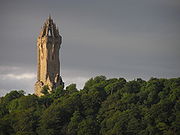
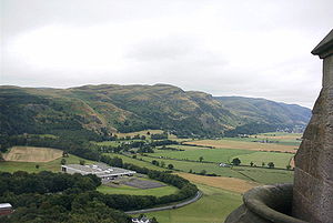
- Abbey CraigAbbey CraigThe Abbey Craig is the hill upon which the Wallace Monument stands, at Causewayhead, just to the north of Stirling, Scotland.The Abbey Craig is part of a complex quartz-dolerite intrusion or sill within carboniferous strata, at the western edge of the Central Coal Field, known as the Stirling Sill...
- Aberfoyle, Stirling
- ArdchyleArdchyleArdchyle is a village in Stirling, Scotland....
- ArdeonaigArdeonaigArdeonaig is a hamlet on the southern shore of Loch Tay in the Stirling Council area of Scotland. It is approximately 7 miles east of Killin and lies at the mouth of the Ardeonaig Burn where it enters Loch Tay....
- Argyll's Lodgings, Stirling
- ArnpriorArnpriorArnprior is a town in Renfrew County, in the eastern portion of Southern Ontario, Canada. It is located at the mouth of the Madawaska River, as it enters the Ottawa River in the Ottawa Valley...
- Ashfield, StirlingAshfield, StirlingAshfield is a hamlet in Stirlingshire, Scotland. It lies between the Allan Water and the Stirling-Perth Railway line. It is two miles north of Dunblane and was designated a conservation village in 1976. It was originally built to house workers at a nearby silk dyeing mill...
B
- BalmahaBalmahaBalmaha is a hamlet on the eastern shore of Loch Lomond in the council area of Stirling, Scotland.The name Balmaha comes from the Gaelic for St Maha's Place which suggests the village may have ancient origins, perhaps as a hermit's residence...
- BannockburnBannockburnBannockburn is a village immediately south of the city of Stirling in Scotland. It is named after the Bannock Burn, a burn running through the village before flowing into the River Forth.-History:...
- Battle of Stirling BridgeBattle of Stirling BridgeThe Battle of Stirling Bridge was a battle of the First War of Scottish Independence. On 11 September 1297, the forces of Andrew Moray and William Wallace defeated the combined English forces of John de Warenne, 6th Earl of Surrey and Hugh de Cressingham near Stirling, on the River Forth.-The main...
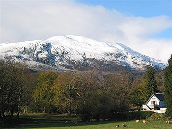
- Ben LediBen LediBen Ledi is a mountain in Perthshire, Scotland. It is 879 m high, and is classified as a Corbett. By road it lies about eight kilometres north-west of Callander, near the village of Kilmahog...
- Blair DrummondBlair DrummondBlair Drummond is a small rural community near Stirling in Scotland, predominantly located along the A84 road.-Description:...
- BorelandBorelandBoreland is the name of two small villages in Scotland, one of them in Dumfries and Galloway, which is located in the Eskdale valley about 7 miles north of Lockerbie on the B723 road to Eskdalemuir, and the other in Perthshire.- References:...
- BraveheartBraveheartBraveheart is a 1995 epic historical drama war film directed by and starring Mel Gibson. The film was written for the screen and then novelized by Randall Wallace...
Rob Roy McGregor - Breadalbane Folklore Centre
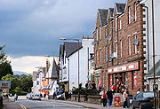
- Bridge of AllanBridge of AllanBridge of Allan is a town in Stirling council area in Scotland, just north of the city of Stirling. It was formerly administered by Stirlingshire and Central Regional Council....
- Brig o'Turk
- BuchlyvieBuchlyvieBuchlyvie is a village in the Stirling council area of Scotland. It is 24 km west of Stirling, south of Flanders Moss in the Carse of Forth. The village lies on the A811, which follows the line of an eighteenth-century military road...
C
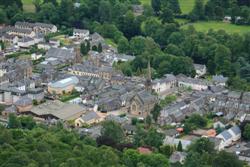
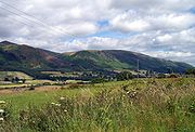
- CallanderCallanderCallander is a burgh in the region of Stirling, Scotland, situated on the River Teith. The town is located in the former county of Perthshire and is a popular tourist stop to and from the Highlands....
- Cambuskenneth AbbeyCambuskenneth AbbeyCambuskenneth Abbey is a ruined Augustinian monastery located on an area of land enclosed by a meander of the River Forth near Stirling in Scotland. The abbey is largely reduced to its foundations. The neighbouring modern village of Cambuskenneth is named after it.Cambuskenneth Abbey was founded...
- CampsieMilton of CampsieMilton of Campsie is a small village situated in East Dunbartonshire, Scotland roughly 10 miles north of Glasgow. Nestling at the foot of the Campsie Fells, it is neighboured by Kirkintilloch and Lennoxtown...
, Campsie FellsCampsie FellsThe Campsie Fells are a range of hills in central Scotland, stretching east to west, from Denny Muir to Dumgoyne, in Stirlingshire. . The highest point in the range is Earl's Seat which is 578 m high... - Carron Valley Reservoir
- Carse of Lecropt
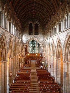
- The Church of the Holy Rude, StirlingThe Church of the Holy Rude, StirlingThe Church of the Holy Rude is the second oldest building in Stirling, Scotland, after Stirling Castle. The church was founded in 1129 during the reign of David I as the parish church of Stirling....
- CowieCowie, StirlingCowie is a village in the Stirling council area of Scotland. It lies on the minor B9124 road approximately 4 miles south-east of Stirling and about a mile north of the A9 road. The United Kingdom Census 2001 recorded the population as 2387....
- Craigdownings
- Craigruie
- CrianlarichCrianlarichCrianlarich is a village in the Stirling district and registration county of Perthshire, Scotland, about six miles north-east of the head of Loch Lomond...
- CroftamieCroftamieCroftamie is a small village near Drymen in Scotland.The village was traditionally part of Dunbartonshire, but a minor change in boundaries means that it is now under Stirling Council....
- Culcreuch CastleCulcreuch CastleCulcreuch Castle is a Scottish castle close to the village of Fintry, near Loch Lomond. It has been the home of the Barons of Culcreuch since 1699, was turned into a hotel, venue and visitor attraction in the 1980s. -History:...
F
- FallinFallin, StirlingFallin is a village in the Stirling council area of Scotland. It lies on the A905 road 3 miles east of Stirling on a bend in the River Forth. The United Kingdom Census 2001 recorded the population as 2710....
- Falls of DochartFalls of DochartThe Falls of Dochart are situated on the River Dochart at Killin in Stirling , Scotland at the western end of Loch Tay. A bridge crosses over the river just as you enter Killin giving a fabulous view of the falls as they cascade down over the rocks and around the island of Inchbuie, which is the...
, Falls of LochayFalls of Lochay-References:... - FintryFintryFintry is a small village in central Scotland, nestled in the strath of the Endrick Water between the Campsie Fells and the Fintry Hills, some 19 miles north of Glasgow. It is within the local government council area of Stirling...
, Fintry HillsFintry HillsThe Fintry Hills form the western end of a range of hills which stretch west from the city of Stirling, Scotland. They culminate in the peak of Stronend, which overlooks the village of Fintry.... - Flanders MossFlanders MossFlanders Moss is an area of bogland in the Carse of Stirling in central Scotland.It lies between the villages of Thornhill to the north and Kippen to the south....
- Forth Valley
L
- Lake of MenteithLake of MenteithThe Lake of Menteith , is a loch in Scotland, located on the Carse of Stirling, the flood plain of the upper reaches of the rivers Forth and Teith, upstream of Stirling. Until the early 19th century, the more usual Scottish name of Loch of Menteith was used...
- LecroptLecroptLecropt is a rural parish lying to the west of Bridge of Allan, Scotland.The population of the parish of Lecropt is estimated to be around 75, consisting entirely of isolated farms and houses, as well as the Keir Estate owned by the landed Stirling family...
, Lecropt Kirk - Loch AchrayLoch AchrayLoch Achray is a small freshwater loch 11 kilometres west of Callander in Stirling district, Scotland.The loch lies between Loch Katrine and Loch Venachar in the heart of the Trossachs and has an average depth of 11 metres. The south side of the loch is wooded and well served by woodland tracks and...
, Loch ArdLoch ArdLoch Ard is a body of fresh water in the Loch Lomond and the Trossachs National Park of the Stirling District in Scotland. -Overview:...
, Loch EarnLoch EarnLoch Earn is a freshwater loch in the central highlands of Scotland, in the districts of Perth and Kinross and Stirling...
, Loch KatrineLoch KatrineLoch Katrine is a freshwater loch in the district of Stirling, Scotland. It is roughly 8 miles long by 2/3 of a mile wide and runs the length of Strath Gartney...
, Loch LubnaigLoch LubnaigLoch Lubnaig is a small loch near Callander in the Stirling council area, Scotland. It lies in the former county of Perthshire....
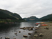
, Loch VenacharLoch VenacharLoch Venachar is a freshwater loch in Stirling district, Scotland, situated between Callander and Brig o' Turk... - Loch LomondLoch LomondLoch Lomond is a freshwater Scottish loch, lying on the Highland Boundary Fault. It is the largest lake in Great Britain by surface area. The lake contains many islands, including Inchmurrin, the largest fresh-water island in the British Isles, although the lake itself is smaller than many Irish...
, Loch Lomond and the Trossachs National ParkLoch Lomond and the Trossachs National ParkLoch Lomond and The Trossachs National Park is a national park in Scotland centred on Loch Lomond, and includes several ranges of hills, the Trossachs being the most famous... - LochearnheadLochearnheadLochearnhead is a village on the A84 Stirling to Crianlarich road at the foot of Glen Ogle, north of the Highland Boundary Fault...
R
- RaplochRaplochThe Raploch is a district of the city of Stirling, which lies to the south of the River Forth in central Scotland. The area is sometimes referred to by people from outside the area as "Raploch"....
- River Balvag, River ForthRiver ForthThe River Forth , long, is the major river draining the eastern part of the central belt of Scotland.The Forth rises in Loch Ard in the Trossachs, a mountainous area some west of Stirling...
, River Leny - Rob Roy McGregor
- RowardennanRowardennanRowardennan is a small hamlet on the eastern shore of Loch Lomond in Scotland.Rowardennan is at the northern end of the public road, but the West Highland Way passes through the village and continues north along the side of the loch. Rowardennan has a hostel and camping for hikers on the West...
S
- Sieges of Stirling CastleSieges of Stirling CastleThere have been at least sixteen sieges of Stirling Castle, a strategically important fortification in Stirling, Scotland. Stirling is located at the crossing of the River Forth, making it a key location for access to the north of Scotland...
- StirlingStirlingStirling is a city and former ancient burgh in Scotland, and is at the heart of the wider Stirling council area. The city is clustered around a large fortress and medieval old-town beside the River Forth...
, Stirling (council area)Stirling (council area)Stirling is one of the 32 unitary local government council areas of Scotland, and has a population of about 87,000 . It was created under the Local Government etc Act 1994 with the boundaries of the Stirling district of the former Central local government region, and it covers most of the former...
, StirlingshireStirlingshireStirlingshire or the County of Stirling is a registration county of Scotland, based around Stirling, the former county town. It borders Perthshire to the north, Clackmannanshire and West Lothian to the east, Lanarkshire to the south, and Dunbartonshire to the south-west.Until 1975 it was a county... - Stirling Bridge
- Stirling CastleStirling CastleStirling Castle, located in Stirling, is one of the largest and most important castles, both historically and architecturally, in Scotland. The castle sits atop Castle Hill, an intrusive crag, which forms part of the Stirling Sill geological formation. It is surrounded on three sides by steep...
(Historic ScotlandHistoric ScotlandHistoric Scotland is an executive agency of the Scottish Government, responsible for historic monuments in Scotland.-Role:As its website states:...
) - Stirling Smith Museum and Art GalleryStirling Smith Museum and Art GalleryStirling Smith Art Gallery and Museum is an institution based in Stirling, Central Scotland, dedicated to the promotion of cultural and historical heritage and the arts, from a local scale to nationally and beyond. It is also known locally by its original name of "The Smith Institute"...
- St Ninians
- StrathblaneStrathblaneStrathblane is a village and parish in the registration county of Stirlingshire, situated in the southwestern part of the Stirling council area, in central Scotland. It lies at the foothills of the Campsie Fells and the Kilpatrick Hills on the Blane Water, north of Glasgow, east-southeast of...
- StrathyreStrathyreStrathyre is a district and settlement in the Stirling local government district of Scotland. It forms the south-eastern part of the parish of Balquhidder and was, prior to the 1973 reorganisation of local government, part of Perthshire...
- Stronachlachar