

List of mountains and hills in Lower Saxony
Encyclopedia
This List of mountains and hills in Lower Saxony shows a selection of high or well-known mountain
s and hill
s in the German state of Lower Saxony
(in order of height). Although there is no universally agreed definition of a 'mountain
', summits at 2,000 feet (610 metres) or higher may generally be referred to as mountains; those below 2,000 feet as 'hill
s', hence the division of this list. By this definition, it can be seen that all the mountains in Lower Saxony occur in the Harz
.
In the "Landscape" column, major hill ranges are shown in bold. Clicking "List" in the rows of the "List" column links to other hills or mountains in that landscape – some of which are outside Lower Saxony. The table is arranged by height, but may be sorted by other criteria by clicking the symbol of the desired column.
Mountain
Image:Himalaya_annotated.jpg|thumb|right|The Himalayan mountain range with Mount Everestrect 58 14 160 49 Chomo Lonzorect 200 28 335 52 Makalurect 378 24 566 45 Mount Everestrect 188 581 920 656 Tibetan Plateaurect 250 406 340 427 Rong River...
s and hill
Hill
A hill is a landform that extends above the surrounding terrain. Hills often have a distinct summit, although in areas with scarp/dip topography a hill may refer to a particular section of flat terrain without a massive summit A hill is a landform that extends above the surrounding terrain. Hills...
s in the German state of Lower Saxony
Lower Saxony
Lower Saxony is a German state situated in north-western Germany and is second in area and fourth in population among the sixteen states of Germany...
(in order of height). Although there is no universally agreed definition of a 'mountain
Mountain
Image:Himalaya_annotated.jpg|thumb|right|The Himalayan mountain range with Mount Everestrect 58 14 160 49 Chomo Lonzorect 200 28 335 52 Makalurect 378 24 566 45 Mount Everestrect 188 581 920 656 Tibetan Plateaurect 250 406 340 427 Rong River...
', summits at 2,000 feet (610 metres) or higher may generally be referred to as mountains; those below 2,000 feet as 'hill
Hill
A hill is a landform that extends above the surrounding terrain. Hills often have a distinct summit, although in areas with scarp/dip topography a hill may refer to a particular section of flat terrain without a massive summit A hill is a landform that extends above the surrounding terrain. Hills...
s', hence the division of this list. By this definition, it can be seen that all the mountains in Lower Saxony occur in the Harz
Harz
The Harz is the highest mountain range in northern Germany and its rugged terrain extends across parts of Lower Saxony, Saxony-Anhalt and Thuringia. The name Harz derives from the Middle High German word Hardt or Hart , latinized as Hercynia. The legendary Brocken is the highest summit in the Harz...
.
Highest points in Lower Saxony's regions
The following table lists the highest points in the various landscapes (hill ranges or regions) of Lower Saxony.In the "Landscape" column, major hill ranges are shown in bold. Clicking "List" in the rows of the "List" column links to other hills or mountains in that landscape – some of which are outside Lower Saxony. The table is arranged by height, but may be sorted by other criteria by clicking the symbol of the desired column.
| Mountain / hill | Height (m) | Landscape | List | District(s) or town(s) |
|---|---|---|---|---|
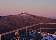
| Wurmberg Wurmberg (Harz) At the Wurmberg is the second highest mountain in the Harz and the highest in Lower Saxony .- Geography :The Wurmberg lies north of Braunlage, in the district of Goslar, and west of Schierke. Its summit is located due south of the Brocken and roughly 400 m south of the state border with... |
971.2 | Harz Harz The Harz is the highest mountain range in northern Germany and its rugged terrain extends across parts of Lower Saxony, Saxony-Anhalt and Thuringia. The name Harz derives from the Middle High German word Hardt or Hart , latinized as Hercynia. The legendary Brocken is the highest summit in the Harz... |
List | Goslar |
| Haferberg Haferberg The Haferberg is a hill, , in the Kaufungen Forest in Hesse and Lower Saxony in Germany.- Geography :The densely wooded Haferberg, which is the highest hill in the Münden Nature Park, is located on the border of north Hesse and south Lower Saxony , 1.25 km northwest of the pass of Umschwang,... |
580.4 | Kaufungen Forest | List | Göttingen |
| Große Blöße Große Blöße At above sea level, the Große Blöße is the highest hill in the Solling-Vogler Nature Park, the Solling and the Weser Uplands .- Geographical location :... |
527.8 | Solling Solling The Solling is a range of hills up to high in the Weser Uplands in the German state of Lower Saxony, whose extreme southerly foothills extend into Hesse and North Rhine-Westphalia.... |
List | Northeim |
| Köterberg Köterberg The Köterberg, at above sea level, is the highest hill in the Lippe Uplands and lies on the state border between North Rhine-Westphalia and Lower Saxony in North Germany... |
495.8 | Lippe Uplands Lippe Uplands The Lippe Uplands is a range of hills in Ostwestfalen-Lippe within the administrative district of Detmold in the German state of North Rhine-Westphalia.-Geography:... |
--- | Holzminden |
| Bloße Zelle Bloße Zelle The Bloße Zelle is, at , the highest elevation on the Hils and in the Alfeld Uplands . It lies on the boundary of the districts of Holzminden and Hildesheim, a good 4 kilometres northeast of Eschershausen.... |
480.4 | Hils Hils For HILS, see Hardware-in-the-loop simulation.The Hils is a range of hills in Germany's Central Uplands that is up to high. It is located in the districts of Holzminden, Hildesheim and Northeim, in the state of Lower Saxony.- Geography :... |
List | Hildesheim, Holzminden |
| Hoher Hagen Hoher Hagen (Dransfeld) The Hoher Hagen is a volcanic hill that is still high today, in the Dransfeld Municipal Forest, in the German district of Göttingen in South Lower Saxony.- Geography :... (Hoher Hagen) |
480 | Dransfeld Municipal Forest Dransfeld Municipal Forest The Dransfeld Municipal Forest is a ridge in Germany's Central Uplands that is up to high. It is located in the district of Göttingen, in South Lower Saxony.... |
List Dransfeld Municipal Forest The Dransfeld Municipal Forest is a ridge in Germany's Central Uplands that is up to high. It is located in the district of Göttingen, in South Lower Saxony.... |
Göttingen |
| Ebersnacken Ebersnacken At above sea level the Ebersnacken is the highest hill in the forested uplands of the Vogler in Lower Saxony, Germany.The hill is situated in the district of Holzminden about half way as the crow flies between Bodenwerder to the northwest and Stadtoldendorf to the southeast.On the summit, which is... |
460.4 | Vogler Vogler The Vogler is a range of hills, up to 460.4 m high, in the Weser Uplands in southern Lower Saxony .Together with the Solling, the Vogler forms the Solling-Vogler Nature Park which lies a couple of kilometres further south.- Geography :... |
List | Holzminden |
| Holzberg | 444.5 | Holzberg | List | Holzminden |
| Kanstein | 441 | Thüster Berg Thüster Berg The Thüster Berg is a ridge, up to , in the Lower Saxon Hills in central Germany. It is situated in the districts of Hameln-Pyrmont and Hildesheim in the federal state of Lower Saxony.- Location :... |
--- | Hameln-Pyrmont |
| Lauensteiner Kopf | 439 | Ith Ith The Ith is a ridge in Germany's Central Uplands which is up to high. It lies about 40 km southwest of Hanover and, at 22 kilometres, is the longest line of crags in North Germany.- Geography :- Location :... |
List | Hameln-Pyrmont |
| Hohe Egge Hohe Egge The Hohe Egge, at a good , is the highest point on the Süntel ridge in the Calenberg Uplands in the German federal state of Lower Saxony. On its summit is the Süntel Tower.... |
437.5 | Süntel Süntel The Süntel is a massif in the German Central Uplands that is up to . It forms part of the Weser Uplands in Lower Saxony southwest of Hanover and north of Hamelin.-Geographical location:... |
List | Hameln-Pyrmont |
| Mackenröder Spitze Mackenröder Spitze The Mackenröder Spitze, at about , is the highest hill in the Göttingen Forest and lies on the boundary of the town and district of Göttingen, in South Lower Saxony in Germany.- Geography :... |
427.5 | Göttingen Forest Göttingen Forest The Göttingen Forest is a ridge in Germany's Central Uplands that is up to 427.5 metres high. It forms part of the Lower Saxon Hills in South Lower Saxony.- Geography :... |
List | Göttingen |
| Fast | 419.2 | Osterwald | List | Hameln-Pyrmont |
| Sackberg | 411.4 | Ahlsburg | List | Northeim |
| Helleberg | 409.6 | Elfas Elfas The Elfas is a range of hills up to in the districts of Holzminden an Northeim in Lower Saxony .- Geographical location :The Elfas is located in the middle of the Leine Uplands between the Hils to the north, the Homburg Forest to the west, the Hube to the east, the Amtsberge to the south-southwest... |
List | Holzminden |
| Totenberg Totenberg The Totenberg, at , is the highest hill in the Bramwald, a forested hill range in the Weser Uplands in South Lower Saxony.The hill is surrounded by the Totenberg nature reserve with an area of about 437 hectares, of which 342 ha is managed as "near-natural forest". The rest is designated... |
408 | Bramwald Bramwald The Bramwald is a range of hills up to in the Weser Uplands in Lower Saxony . It is a unique, natural, wild, hill and forest landscape... |
List | Göttingen |
| Bröhn Bröhn The Bröhn , is the highest hill in the Deister range in the German state of Lower Saxony. It owes its name to the broom growing here... |
405.0 | Deister Deister The Deister is a chain of hills in the German state of Lower Saxony, about 15 mi southwest of the city of Hanover. It runs in a north-westerly direction from Springe in the south to Rodenberg in the north. The next the chain of hills that attaches in the south is called Small Deister... |
List | Hanover Region |
| unnamed summit | 406.1 | Homburg Forest Homburg Forest The Homburg Forest also known as the Homburg Hills is an area of upland up to in the north German state of Lower Saxony.- Geography :... |
List | Holzminden |
| Hohe Egge Hohe Egge The Hohe Egge, at a good , is the highest point on the Süntel ridge in the Calenberg Uplands in the German federal state of Lower Saxony. On its summit is the Süntel Tower.... |
395 | Selter | List | Hildesheim, Holzminden, Northeim |
| Hohe Tafel | 395 | Sieben Berge | List | Hildesheim |
| Belzer Berg | 392.2 | Amtsberge Amtsberge The Amtsberge are a relatively small ridge, up to , near Dassel in southern Lower Saxony in Germany.- Geography :The densely wooded ridge of the Amtsberge is located on the boundary between the districts of Northeim and Holzminden and also on the boundary between the Leine... |
List | Northeim |
| Balos | 379 | Weper Weper The Weper is a long, high ridge of hills up to located in the district of Northeim in the German state of Lower Saxony.Part of the Weper is a nature reserve with the same name which, with an area of , is the large protected region of dry grassland in Lower Saxony.- Geography :The Weper, which lies... |
List | Northeim |
| Grasberg | 378.2 | Nesselberg Nesselberg The Nesselberg is a ridge up to high in the Calenberg Highland which, together with the Kleiner Deister and the Osterwald, forms a group of three contiguous hill regions in the northwestern part of the Leine Uplands... |
List | Hameln-Pyrmont Hanover |
| Ahrensberg Ahrensberg (Sackwald) The Ahrensberg, at 374 metres, is the highest hill in the Sackwald range in the district of Hildesheim, in the north German state of Lower Saxony.- Geography :The densely forested Ahrensberg rises in the Leine Uplands, part of the Lower Saxon Hills... |
374 | Sackwald Sackwald The Sackwald is a ridge, up to high, in the Lower Saxon Hills in the district of Hildesheim in the North German state of Lower Saxony. It is named after the village of Sack in the borough of Alfeld, the name meaning "Sack Forest".... |
List | Hildesheim |
| Diebische Ecke | 367 | Bückeberg Bückeberg The Bückeberg is a ridge in the Calenberg Uplands between the Harrl and the Deister in central Germany, and is often considered part of the Weser Uplands... |
List | Schaumburg |
| Griesberg | 358.9 | Hildesheim Forest Hildesheim Forest The Hildesheim Forest is a range of hills up to in the district of Hildesheim in the German state of Lower Saxony.- Geography :The Hildesheim Forest is located in the Innerste Uplands, part of the Lower Saxon Hills, between the valleys of the Leine to the west, the Innerste to the north and the ... |
List | Hildesheim |
| Burgberg | 355.0 | Burgberg Burgberg (ridge) The Burgberg is a ridge of hills up to high in the German federal state of Lower Saxony.- Geography :The Burgberg, which belongs to the Solling-Vogler Nature Park, is located in the district of Holzminden in the Weser Uplands between the hill ranges of the Vogler to the north, the Homburgwald to... |
List | Holzminden |
| Hainberg | 353 | Vorberge Vorberge The Vorberge are a ridge, up to high, in the Lower Saxon Hills and within the district of Hildesheim in the German state of Lower Saxony.... |
List | Hildesheim |
| Wolfsköpfe | 345.7 | Kleiner Deister Kleiner Deister The Kleiner Deister is a ridge of hills in the Calenberg Uplands which, together with the Nesselberg and the Osterwald, forms a group of three adjacent hill ranges in the northern part of the Leine Uplands... |
List | Hanover Region |
| Fuchshöhlenberg | 346.2 | Hube | List | Northeim |
| Dörenberg Dörenberg The Dörenberg is a hill, , in the Teutoburg Forest in the district of Osnabrück, in the German state of Lower Saxony.- Origin of the name :Dören could be derived, especially in the area of Ostwestfalen-Lippe, from Dör, the Low German word for a hill or mountain pass.- Location :The Dörenberg, the... |
331.2 | Teutoburg Forest Teutoburg Forest The Teutoburg Forest is a range of low, forested mountains in the German states of Lower Saxony and North Rhine-Westphalia which used to be believed to be the scene of a decisive battle in AD 9... |
List | Osnabrück |
| Babenstein | 331 | Duinger Berg Duinger Berg The Duinger Berg is a hill range, up to , in the Lower Saxon Hills and the district of Landkreis in the German state of Lower Saxony.- Location :... |
--- | Hildesheim |
| Möncheberg | 326.1 | Weser Uplands | List | Schaumburg |
| Reuberg | 328.2 | Reuberg Reuberg The Reuberg is a ridge, up to , in the Lower Saxon Hills in the districts of Holzminden and Hildesheim in the German state of Lower Saxony.- Location :The Reuberg lies in the western part of the Leine Uplands, a northern section of the Lower Saxon Hills... |
--- | Hildesheim, Holzminden |
| Eilumer Horn Eilumer Horn The Eilumer Horn, at , is the highest point in the Elm, a ridge in the north German state of Lower Saxony. Although many maps suggest the Drachenberg is the highest hill in the Elm, the latter only reaches a height of 314 metres according to the State Survey Office of Lower Saxony .- History :For a... |
323.3 | Elm | List | Wolfenbüttel |
| Hohe Dehne | 317.6 | Heber | List | Hildesheim |
| Rotenberg | 317.3 | Rotenberg | List | Göttingen, Osterode am Harz |
| Hammersteinshöhe | 317 | Sauberge Sauberge The Sauberge is a mountain range up to in the Innerste Uplands in the district of Hildesheim in eastern Lower Saxony in Germany.- Location :... |
List | Hildesheim |
| Bärenkopf | 307.0 | Salzgitter Ridge | List | Goslar |
| Steinberg | 300.3 | Steinberg | --- | Hildesheim Holzminden |
| Kalter Buschkopf | 299 | Hainberg | List | Wolfenbüttel |
| Riesberg | 290 | Harplage Harplage The Harplage is a hill range, up to 290 metres high, located west-northwest of the Harz in the southeast of the German state of Lower Saxony.- Geography :... |
List | Hildesheim |
| unnamed summit | 260 | Külf Külf The Külf is a ridge, up to , in the Leine Uplands in the district of Hildesheim in the German state of Lower Saxony.- Location :With seven main summits, the Külf stretches for about 9 kilometres, lying in a triangle formed by the settlements of Gronau, Alfeld and Duingen... |
--- | Hildesheim |
| Harlyberg Harlyberg The Harlyberg, at , is the highest hill of the Harly Forest, and rises in the district of Goslar in southeastern Lower Saxony, central Germany.... |
255.9 | Harly Forest Harly Forest The Harly Forest is a hill range up to 256 m above NN in the district of Goslar in southeastern Lower Saxony in Germany.- Geography :It is located in the northern Harz Foreland about 11 kilometres as the crow flies northeast of Goslar and immediately north-northwest of Vienenburg. It is... |
--- | Goslar |
| Buchberg | 255 | Weinberg | --- | Hildesheim |
| Adlershorst | 254.2 | Lichtenberge (part of the Salzgitter Ridge) |
List |
Salzgitter Salzgitter Salzgitter is an independent city in southeast Lower Saxony, Germany, located between Hildesheim and Braunschweig. Together with Wolfsburg and Braunschweig, Salzgitter is one of the seven Oberzentren of Lower Saxony... (independent town) |
| Knebelberg | 243 | Vorholz | List | Hildesheim |
| Hesterbrink | 234.3 | Wiehen Hills | List | Osnabrück |
| Remlinger Herse | 234 | Asse Asse Asse is a municipality located in the Belgian province of Flemish Brabant. The municipality comprises the towns of Asse proper, Bekkerzeel, Kobbegem, Mollem, Relegem and Zellik. On January 1, 2006 Asse had a total population of 29,191... |
List | Wolfenbüttel |
| Hüggel Hüggel The Hüggel is a ridge, up to , about 5 kilometres long and 1 kilometre wide, near Hasbergen in the Lower Saxon district of Osnabrück in central Germany. It is the highest point of the Osnabrück Uplands... |
225.6 | Hüggel Hüggel The Hüggel is a ridge, up to , about 5 kilometres long and 1 kilometre wide, near Hasbergen in the Lower Saxon district of Osnabrück in central Germany. It is the highest point of the Osnabrück Uplands... |
List | Osnabrück |
| Hungerberg | 205 | Oderwald Oderwald Oderwald is a Samtgemeinde in the district of Wolfenbüttel, in Lower Saxony, Germany. It is situated along the river Oker, approx. 10 km south of Wolfenbüttel. It is named after the Oderwald, a small chain of hills in the municipality... |
List | Wolfenbüttel |
| Süllberg | 198.2 | Calenberg Land Calenberg Land The Calenberg Land is a historic landscape southwest of Hanover in Germany, roughly formed by the countryside between the Leine and the Deister hills... |
List | Hanover |
| Kollwesshöh Kollwesshöh The Kollwesshöh is, at , the highest hill in the Stemweder Berg, the smallest and northernmost range of the Central Uplands in Germany, and also the highest point in the North German Plain north of the Bückeberge.... |
181.4 | Stemweder Berg Stemweder Berg The Stemweder Berg is a ridge up to on the border of North Rhine-Westphalia and Lower Saxony in Germany and is the northernmost and smallest of Germany's Central Uplands ranges.... |
List | Minden-Lübbecke |
| unnamed summit | 173.3 | Benther Berg Benther Berg The Benther Berg is a ridge, up to , in the Calenberg Land near Benthe in Hanover Region in the German state of Lower Saxony.- Location :The Benther Berg is about 3.5 kilometres long and 500 m wide... |
--- | Hanover Region |
| Wilseder Berg Wilseder Berg At the Wilseder Berg is the highest point on the Lüneburg Heath in North Germany.- Description :The Wilseder Berg is part of a nature reserve within the Lüneburg Heath and lies near the villages of Wilsede and Bispingen in the Heidekreis. The hill was formed during the penultimate ice age, the... |
169.2 | Lüneburg Heath Lüneburg Heath The Lüneburg Heath is a large area of heath, geest and woodland in northeastern part of the state of Lower Saxony in northern Germany. It forms part of the hinterland for the cities of Hamburg, Hanover, and Bremen and is named after the town of Lüneburg. Most of the area is a nature reserve... |
List | Heidekreis |
| unnamed summit | 162.6 | Giesen Hills Giesen Hills The Giesen Hills are a ridge, up to 162.6 metres high, in the district of Hildesheim in the German state of Lower Saxony.- Geography :The ridge of the Giesen Hills is located in the extreme north of the Innerste Uplands, a northeastern element of the Lower Saxon Hills... |
--- | Hildesheim |
| Brunnenberg | 161.4 | Rehburg Hills Rehburg Hills The Rehburg Hills are a hill range, up to , in the districts of Nienburg and Schaumburg in Lower Saxony, Germany.- Origin of the name :The Rehburg Hills and their foothills give the impression of being several small neighbouring hills. The little village of Bad Rehburg was a well-known spa and... |
List | Nienburg/Weser |
| Burgberg | 155 | Gehrdener Berg Gehrdener Berg The Gehrdener Berg is a forested ridge in the Calenberg Land in Hanover Region in the north German state of Lower Saxony. On its slopes nestles the town of Gehrden that gives the ridge its name. The ridge is about 2.7 kilometres long and is the sister hill range of the Benther Berg in southwest... |
--- | Hanover Region |
| Hülsenberg | 155 | Harburg Hills Harburg Hills The Harburg Hills are a low ridge in the northeastern part of the German state of Lower Saxony and the southern part of the city state of Hamburg... |
List | Harburg |
| Signalberg Signalberg (Damme) The Signalberg is, at , the highest elevation in the Damme Hills and Oldenburg Münsterland. It rises in the district of Vechta in the north German state of Lower Saxony.... |
146 | Damme Hills Damme Hills The Damme Hills are a high, wooded ridge, up to , in the Oldenburg Münsterland in the southern part of the district of Vechta, in western Lower Saxony, Germany.- Location :... |
List | Vechta |
| Hoher Mechtin Hoher Mechtin At a height of the Hoher Mechtin is the highest elevation in the Wendland in the district of Lüchow-Dannenberg in northern Germany, and is at the same time a significant high point on the entire North German Plain. It lies roughly at the centre point of the Drawehn ridge, which is also described... |
142 | Drawehn Drawehn The Drawehn is a partly wooded and partly agricultural region of hills in the northeastern part of the German state of Lower Saxony, lying between the districts of Lüneburg and Uelzen in the west and Lüchow-Dannenberg in the east.- Definition :... |
--- | Lüchow-Dannenberg |
| Trillenberg | 140 | Ankum Heights Ankum Heights The Ankum Heights , also called the Fürstenau Hills , are a ridge of hills up to 140 m high in the western part of the state of Lower Saxony on the North German Plain.- Geography :... |
List | Osnabrück |
| Kiekeberg Kiekeberg The Kiekeberg is, at 127 metres above sea level, one of the more prominent hills in the Harburg Hills in north Germany. It is located in the parish of Ehestorf in the municipality of Rosengarten in the district of Harburg in the southern foothills of the range, which is also known as The Black... |
127 | The Black Hills (part of the Harburg Hills Harburg Hills The Harburg Hills are a low ridge in the northeastern part of the German state of Lower Saxony and the southern part of the city state of Hamburg... ) |
List |
Harburg |
| unnamed summit | 122.8 | Stemmer Berg | List | Hanover Region |
| Kettelsberg | 108.1 | Gehn | List | Osnabrück |
| Flidderberg | 107 | Lohberge (part of the Harburg Hills Harburg Hills The Harburg Hills are a low ridge in the northeastern part of the German state of Lower Saxony and the southern part of the city state of Hamburg... ) |
List |
Harburg |
| Hüttenberg | 101 | Grinderwald Grinderwald The Grinderwald is a mixed forest and a low hill range, up to , in Hanover Region and the Lower Saxon district of Nienburg/Weser in Germany.- Geology :... |
List | Hanover Region Nienburg/Weser |
| Windmühlenberg | 91 | Lingener Höhe | List | Emsland |
| Silberberg Silberberg (Wingst) The Silberberg is a low hill, 74 metres high, in the Wingst ridge in the district of Cuxhaven in the north German state of Lower Saxony.It is the highest natural elevation in the Elbe-Weser Triangle, but is overshadowed by the observation tower of the nearby hill of Deutscher Olymp. It was formed... |
74 | Wingst Wingst (ridge) The Wingst is a ridge, up to 74 metres high, in northern Lower Saxony, Germany.- Geography :The ridge is located in northeast part of the district of Cuxhaven, just a few kilometres south of the mouth of the River Elbe on the North Sea coast, and west of the lower reaches of the Oste between... |
List | Cuxhaven |
| Windberg | 73 | Hümmling Hümmling Hümmling district existed 1815 to 1932 and was a district in nowaday's western Lower Saxony, Germany.It was named after Hümmling hills, a ground moraine landscape in Emsland region- History :... |
List | Emsland |
| Litberg Litberg The Litberg is, at 65 metres above sea level , the highest point in the district of Stade. It lies about 2.5 kilometres south of Beckdorf in the municipality of Sauensiek. The Litberg is small hill covered with birch, pine, willow and alder, which was formed from an Ice Age moraine. It... |
65 | Stade Geest Stade Geest The Stade Geest is a natural region of low, sandy heath in the North German Plain.It includes a large part of the Elbe-Weser Triangle between the cities of Hamburg, Bremen and Cuxhaven and is bordered by the natural regions of the Elbe Marsch, Weser Marsch, Weser-Aller Plain and Lüneburg Heath... |
--- | Stade |
| Gieren- & Kistenberg | 23 | Osenberge Osenberge The Osenberge is a dune region up to high in the district of Oldenburg, Lower Saxony .- Geographical location :The rolling dunes of the Osenberge are located in the northwest of the Wildeshausen Geest Nature Park, on average about 14 km south of Oldenburg, directly south of Sandkrug and... |
--- | Oldenburg |
Mountains (2000 feet or higher)
Name, Height in metres above NN, Location (District/Region); three "???" mean unknown or not yet discovered; please contribute!- WurmbergWurmberg (Harz)At the Wurmberg is the second highest mountain in the Harz and the highest in Lower Saxony .- Geography :The Wurmberg lies north of Braunlage, in the district of Goslar, and west of Schierke. Its summit is located due south of the Brocken and roughly 400 m south of the state border with...
(971.2 metres (3,186.4 ft)), Goslar district, HarzHarzThe Harz is the highest mountain range in northern Germany and its rugged terrain extends across parts of Lower Saxony, Saxony-Anhalt and Thuringia. The name Harz derives from the Middle High German word Hardt or Hart , latinized as Hercynia. The legendary Brocken is the highest summit in the Harz... - BruchbergBruchbergAt the Bruchberg in the Upper Harz is the second highest mountain in Lower Saxony and the third highest in the Harz mountains in North Germany. It lies between Altenau and Torfhaus in the middle of the Harz National Park. The Bruchberg is more like a plateau and has no real summit...
(927 m), Goslar district, Harz - AchtermannshöheAchtermannshöheAt , the Achtermannshöhe in the Harz National Park is the third highest mountain in Lower Saxony and the fourth highest in the Harz mountains....
(926 m), Goslar district, Harz - RehbergRehberg (Harz)At above sea level, the Rehberg in the Harz mountains is the fourth highest mountain in the German state of Lower Saxony, and the fifth highest in the Harz....
(893 m), Goslar district, Harz - Quitschenberg (882 m), Goslar district, Harz
- Auf dem AckerAuf dem AckerAuf dem Acker is a mountain ridge up to 865.1 metres high, which is located in the southwestern part of the Harz mountains in Lower Saxony .- Geography :...
(860 m), Osterode am Harz district, Harz - Großer SonnenbergSonnenberg (Harz)The Sonnenberg is a ski resort in the Upper Harz surrounded by the Harz National Park. The settlement of the same name located there is part of the borough of Sankt Andreasberg.- Topography :...
(853,4 m), Goslar district, Harz - Kleiner SonnenbergSonnenberg (Harz)The Sonnenberg is a ski resort in the Upper Harz surrounded by the Harz National Park. The settlement of the same name located there is part of the borough of Sankt Andreasberg.- Topography :...
(853,0 m), Goslar district, Harz - Großer Breitenberg (811 m), Osterode am Harz district, Harz
- Lärchenkopf (801 m), Goslar district, Harz
- SchalkeSchalke (Harz)The Schalke is a mountain, , in the Upper Harz in the German state of Lower Saxony. It lies in Goslar district north of Clausthal-Zellerfeld and west of Schulenberg....
(762 m), Goslar district, Harz - Abbenstein (756m), Goslar district, Harz
- Haspelkopf (749 m), Goslar district, Harz
- KuppeKuppe (Harz)The Kuppe is a mountain in the Harz that lies north of Sankt Andreasberg in the district of Goslar in the German state of Lower Saxony. It is 729 m high and is connected to the Jordanshöhe in the west....
(729 m), Goslar district, Harz - BocksbergBocksberg (Harz)The Bocksberg is the local mountain for the village of Hahnenklee in the borough of Goslar in the German state of Lower Saxony. It lies southeast of this spa village in the Harz mountains and is ....
(727 m), Goslar district, Harz - Kahler Berg (727 m), Goslar district, Harz
- JordanshöheJordanshöheThe Jordanshöhe is a mountain in the Harz in central Germany. It lies north of the town of Sankt Andreasberg in the district of Goslar in Lower Saxony. To the west is the Kuppe. On the mountain there is the Jordanshöhe youth hostel and the Jordanshöhe nature trail ....
(723 m), Goslar district, Harz - StöberhaiStöberhaiThe Stöberhai is a mountain the Harz highlands in Central Germany, immediately south of the Oder Dam and northwest of Wieda. At a height of it is the highest mountain in the South Harz...
(720 m), Osterode am Harz district, Harz - Kleiner Breitenberg (711 m), Osterode am Harz district, Harz
- Großer KnollenGroßer KnollenThe Großer Knollen is a high mountain in the southwestern part of the Harz in Lower Saxony, Germany.- Geography :The Großer Knollen is located northeast of Herzberg am Harz and Scharzfeld, north of Bad Lauterberg im Harz and south of the hamlet of Sieber...
(688 m), Osterode am Harz district, Harz - Koboltstaler KöpfeKoboltstaler KöpfeThe Koboltstaler Köpfe are a group of three mountains, that rise southwest of Sankt Andreasberg and east of Sieber in the district of Osterode am Harz in Lower Saxony. The highest of the three peaks is 673 metres high. The other two summits lie roughly 350 metres east and south of the...
(673 m), Goslar district, Harz - WolfskopfWolfskopfThe Wolfskopf is a 668.5 metre high mountain in the West Harz in central Germany. It lies in the district of Osterode am Harz roughly 2 km east of Kamschlacken and about 5 km southwest of Altenau....
(669 m), Goslar district, Harz - RavensbergRavensberg (Harz)The Ravensberg is a 659 m high mountain in the South Harz mountains in the German state of Lower Saxony. It is relatively isolated and visible for a long way. It lies in the district of Osterode am Harz, north of Bad Sachsa....
(659 m), Osterode am Harz district, Harz - Beerberg (658 m), Goslar district, Harz
- ÜbelsbergÜbelsbergThe Übelsberg is a 651.3 metre high mountain in the South Harz, which lies southwest of Sieber in the district of Osterode am Harz in Lower Saxony. It sits astride the watershed between the Grade Lutter and the Krumme Lutter rivers. The mountain is linked via a ridge to the Aschentalshalbe in...
(651.3 m), Osterode am Harz district, Harz - BraakbergBraakbergThe Braakberg is a 645.5 metre high mountain in the Harz in central Germany, which lies about 2.4 km north of Lonau in the district of Osterode am Harz in the state of Lower Saxony. To the north the Braakberg transitions into the ridge known as Auf dem Acker...
(646 m), Osterode am Harz district, Harz - Mathias-Schmidt-Berg (645 m), Goslar district, Harz
- Rammelsberg (635 m), Goslar district, Harz
- Kleiner KnollenKleiner KnollenThe Kleiner Knollen is a 631 metre high mountain in the southwestern part of the Harz in the German state of Lower Saxony.- Geography :The Kleiner Knollen is located east of Herzberg am Harz, northeast of Scharzfeld, northwest of Bad Lauterberg im Harz and south of Sieber. It is dominated by...
(631 m), Osterode am Harz district, Harz - Großer WurzelnbergGroßer WurzelnbergThe Großer Wurzelnberg rises to a height of in the Harz mountains of central Germany. It lies 3.7 km northeast of Sieber in the district of Osterode am Harz in Lower Saxony. It is a rounded summit on one of the ridges running southwards from the Acker and which forms the watershed between...
(625.8 m), Osterode am Harz district, Harz - HasselkopfHasselkopfHasselkopf is a mountain on the southern periphery of Braunlage, Germany. It is 612 m high.The hill is mostly covered in grass and undeveloped, but its northern slope has a short ski lift and can be used for downhill skiing in the winter months....
, (612 m), Goslar district, Harz - Kleiner WurzelnbergKleiner WurzelnbergThe Kleiner Wurzelnberg rises to a height of in the Harz mountains of Germany, 3.7 km northeast of Sieber in the district of Osterode am Harz in Lower Saxony. It forms a rounded summit on one of the ridges running south of the Acker which acts as the watershed between the Verlorene Kulmke...
(610 m), Osterode am Harz district, Harz
Hills (under 2000 feet)
- Großer Trogtaler Berg (609 m), Goslar district, Harz
- LangfastLangfastThe Langfast is a ridge in the district of Osterode am Harz in North Germany.This ridge, with a height of , is located in theSouth Harz mountains between Herzberg am Harz and Sieber....
(606 metres (1,988.2 ft)), Goslar district, Harz - SchadenbeeksköpfeSchadenbeeksköpfeThe Schadenbeeksköpfe are two summits on a southeastern outlier of the Aschentalshalbe in the Harz Mountains of Germany, about 3.6 kilometres southeast of Sieber in the district of Osterode am Harz in Lower Saxony. Their highest peak is 605 metres above sea level. In addition they...
(605 m), Osterode am Harz district, Harz - Adlersberg (593,2 m), Osterode am Harz district, Harz
- HöxterbergHöxterbergThe Höxterberg is a hill in the Harz Mountains of central Germany, that lies south of Sieber in the district of Osterode am Harz in Lower Saxony. It is 584 metres high and lie 0.9 kilometres west of the Pagelsburg, 1.5 kilometres south of the Fissenkenkopf, 1.8 km west of the ...
(584 m), Osterode am Harz district, Harz - Gropenbornskopf (581,2 m), Osterode am Harz district, Harz
- HaferbergHaferbergThe Haferberg is a hill, , in the Kaufungen Forest in Hesse and Lower Saxony in Germany.- Geography :The densely wooded Haferberg, which is the highest hill in the Münden Nature Park, is located on the border of north Hesse and south Lower Saxony , 1.25 km northwest of the pass of Umschwang,...
(581 m), Göttingen district, Kaufungen Forest - BreitentalskopfBreitentalskopfThe Breitentalskopf is a hill in the Harz Mountains of central Germany, that rises southeast of Sieber in the district of Osterode am Harz in Lower Saxony. It is 579.1 m high and separates the River Sieber from the Breitental valley , that gave the hill its name. Towards the southeast is the...
(579,1 m), Osterode am Harz district, Harz - IbergIberg (Harz)The Iberg is a hill, 563 m above sea level, in the western Harz mountains in the German state of Lower Saxony.It lies north of Bad Grund, above the Harz High Road. The Iberg is an old coral reef that emerged in the Givetian/Frasnian stages, that was created as an atoll in the middle of...
(563 m), Osterode am Harz district, Harz - Franzosenkopf (562 m), Osterode am Harz district, Harz
- Klappstert (553 m), Osterode am Harz district, Harz
- EichelnkopfEichelnkopfThe Eichelnkopf is a 545.7 m high hill in the southwestern part of the Harz Mountains in the central German state of Lower Saxony.- Geography :...
(545,7 m), Osterode am Harz district, Harz - Pagelsburg (545 m), Osterode am Harz district, Harz
- Großer Steinberg (542 m), Göttingen district, Kaufungen Forest
- Kleiner Steinberg (Kaufungen Forest) (542 m), Göttingen district, Kaufungen Forest
- Großer Mittelberg (531 m), Osterode am Harz district, Harz
- Große BlößeGroße BlößeAt above sea level, the Große Blöße is the highest hill in the Solling-Vogler Nature Park, the Solling and the Weser Uplands .- Geographical location :...
(527.8 m), Northeim district, SollingSollingThe Solling is a range of hills up to high in the Weser Uplands in the German state of Lower Saxony, whose extreme southerly foothills extend into Hesse and North Rhine-Westphalia.... - Fissenkenkopf (527 m), Osterode am Harz district, Harz
- Großer AhrensbergGroßer AhrensbergAt the Großer Ahrensberg is one of the highest hills in the Solling range, which is located in southern Lower Saxony in Germany.This densely wooded hill lies about as the crow flies west-southwest of Dassel between the villages of Hellental and Schießhaus to the north and Silberborn to the south...
(524.9 m), Holzminden district, Solling - Steile Wand (Berg) (518.9 m), Osterode am Harz district, Harz
- MoosbergMoosbergThe Moosberg is a 513.0 m high hill in the Solling range, which is located in southwestern Lower Saxony .- Geography :The hill lies in the "Hochsolling", the central and highest part of the Solling, which is surrounded by the Solling-Vogler Nature Park...
(513.0 m), Holzminden district, Solling - Häringsnase (508 m), Göttingen district, Kaufungen Forest
- Vogelherd (ca. 505 m), Holzminden district, Solling
- KöterbergKöterbergThe Köterberg, at above sea level, is the highest hill in the Lippe Uplands and lies on the state border between North Rhine-Westphalia and Lower Saxony in North Germany...
(496 m), Holzminden district, Weser Uplands - Dreiberg (495,5 m), Northeim district, Solling
- Großer SteinbergGroßer Steinberg (Solling)The Großer Steinberg is a high hill in the south of the Solling range. It lies within the district of Northeim, in the southwestern part of the German state of Lower Saxony.- Geography :...
(493 m), Northeim district, Solling - Großer Teichtalskopf (492 m), Osterode am Harz district, Harz
- Tünnekenbornstrang (490.1 m), Northeim district, Solling
- Großer BurgbergGroßer BurgbergThe Großer Burgberg is a 483 metre high hill on the northern slopes of the Harz mountains in central Germany which lies right on the edge of the town of Bad Harzburg. In front of it is the Kleiner Burgberg. From both peaks there are sweeping views over the town and the Harz Foreland. On the...
(482 m), Goslar district, Harz - Bloße Zelle (480 m), DuingenDuingenDuingen is a village and a municipality in the district of Hildesheim, in Lower Saxony, Germany. It is situated approx. 25 km southwest of Hildesheim, and 40 km south of Hanover....
, Hildesheim district / Grünenplan, Holzminden district, HilsHilsFor HILS, see Hardware-in-the-loop simulation.The Hils is a range of hills in Germany's Central Uplands that is up to high. It is located in the districts of Holzminden, Hildesheim and Northeim, in the state of Lower Saxony.- Geography :... - Brunsberg (480 m), Göttingen district, Dransfeld State Forest (c.f. Hoher HagenHoher Hagen (Dransfeld)The Hoher Hagen is a volcanic hill that is still high today, in the Dransfeld Municipal Forest, in the German district of Göttingen in South Lower Saxony.- Geography :...
) - Bärenkopf (473.0 m), Holzminden district, Solling
- Heuer (472 m), Osterode am Harz district, Harz
- Wolfsstrang (468.7 m), Northeim district,, Solling
- Hengelsberg (463 m), Göttingen district, Dransfeld State Forest
- Brackenberg (461.0 m), Göttingen district, Münden Nature Park
- EbersnackenEbersnackenAt above sea level the Ebersnacken is the highest hill in the forested uplands of the Vogler in Lower Saxony, Germany.The hill is situated in the district of Holzminden about half way as the crow flies between Bodenwerder to the northwest and Stadtoldendorf to the southeast.On the summit, which is...
(460.4 m), Holzminden district, VoglerVoglerThe Vogler is a range of hills, up to 460.4 m high, in the Weser Uplands in southern Lower Saxony .Together with the Solling, the Vogler forms the Solling-Vogler Nature Park which lies a couple of kilometres further south.- Geography :... - Schönenberg (457.1 m), Northeim district, Solling
- Hasselberg (also called Schrodhalbe; 452,5 m), Holzminden district, Solling
- Hahnenbreite (452,0 m), Northeim district, Solling
- Alte Schmacht (447,5 m), Northeim district, Solling
- Eisernstieg (446,3 m), Northeim district, Solling
- Holzberg (444,5 m), Holzminden district, Holzberg
- Strutberg (444 m), Northeim district, Solling
- Großer Lauenberg (442,6 m), Northeim district, Solling
- Klippen (441,3 m), Holzminden district, Holzberg
- Kanstein (441 m), Hameln-Pyrmont district, Thüster BergThüster BergThe Thüster Berg is a ridge, up to , in the Lower Saxon Hills in central Germany. It is situated in the districts of Hameln-Pyrmont and Hildesheim in the federal state of Lower Saxony.- Location :...
- Wildenkiel (ca. 441 m), Holzminden district, Solling
- Kohlhai (440,8 m), Holzminden district, Vogler
- Auerhahnkopf (ca. 440 m), Holzminden district, Solling
- Lauensteiner Kopf (439 m), Hameln-Pyrmont district, IthIthThe Ith is a ridge in Germany's Central Uplands which is up to high. It lies about 40 km southwest of Hanover and, at 22 kilometres, is the longest line of crags in North Germany.- Geography :- Location :...
- Hohe Egge (437 m), Hameln-Pyrmont district, SüntelSüntelThe Süntel is a massif in the German Central Uplands that is up to . It forms part of the Weser Uplands in Lower Saxony southwest of Hanover and north of Hamelin.-Geographical location:...
- Schnippkopf (437,0 m), Holzminden district, Vogler
- Kleiner Burgberg (436 m), Goslar district, Harz
- Hammershüttenkopf (430,5 m; western peak), Holzminden district, Vogler
- Mackenröder SpitzeMackenröder SpitzeThe Mackenröder Spitze, at about , is the highest hill in the Göttingen Forest and lies on the boundary of the town and district of Göttingen, in South Lower Saxony in Germany.- Geography :...
(427,5 m), Göttingen district, Göttingen ForestGöttingen ForestThe Göttingen Forest is a ridge in Germany's Central Uplands that is up to 427.5 metres high. It forms part of the Lower Saxon Hills in South Lower Saxony.- Geography :... - Hengstrücken (424 m), Northeim district, Solling
- Hünstollen (423,7 m), Göttingen district, Göttingen Forest
- Dransberg (422 m), Göttingen district, Dransfeld State Forest
- Buchholz (421,7 m), Holzminden district, Solling
- Schotsberg (419 m), Göttingen district, Dransfeld State Forest
- Fast (419 m), Hameln-Pyrmont district, OsterwaldOsterwaldOsterwald is a community and part of the Joint Community of Neuenhaus in the district of Grafschaft Bentheim in Lower Saxony. The community consists of the centres of Osterwald, Alte Piccardie and Hohenkörben ....
- Sonnenköpfe (414,6 m; western peak), Holzminden district, Solling
- Hammershüttenkopf (412,5 m; eastern peak), Holzminden district, Vogler
- Westlicher Voglerkamm (412 m), Holzminden district, Vogler
- Sackberg (411,4 m), Northeim district, AhlsburgAhlsburgThe Ahlsburg is a range of hills, relatively small in area and up to , in the southern part of Lower Saxony .- Geography :The Ahlsburg hills run in a northwest to southeast direction and are around 10 km long and up to about 3 km wide. They are heavily wooded and belong to the Leine Uplands...
- Helleberg (410 m), Holzminden district, ElfasElfasThe Elfas is a range of hills up to in the districts of Holzminden an Northeim in Lower Saxony .- Geographical location :The Elfas is located in the middle of the Leine Uplands between the Hils to the north, the Homburg Forest to the west, the Hube to the east, the Amtsberge to the south-southwest...
- TotenbergTotenbergThe Totenberg, at , is the highest hill in the Bramwald, a forested hill range in the Weser Uplands in South Lower Saxony.The hill is surrounded by the Totenberg nature reserve with an area of about 437 hectares, of which 342 ha is managed as "near-natural forest". The rest is designated...
(408 m), Göttingen district, BramwaldBramwaldThe Bramwald is a range of hills up to in the Weser Uplands in Lower Saxony . It is a unique, natural, wild, hill and forest landscape... - Sonnenköpfe (407,0 m; Ostgipfel), Holzminden district, Solling
- Ahrensberg (405 m), Holzminden district, Elfas
- Netteberg (406,1 m), Goslar district, Harz
- BröhnBröhnThe Bröhn , is the highest hill in the Deister range in the German state of Lower Saxony. It owes its name to the broom growing here...
(405,0 m), Hanover region, DeisterDeisterThe Deister is a chain of hills in the German state of Lower Saxony, about 15 mi southwest of the city of Hanover. It runs in a north-westerly direction from Springe in the south to Rodenberg in the north. The next the chain of hills that attaches in the south is called Small Deister... - Großer HomburgGroßer HomburgThe Großer Homburg is a hill, , in the Homburgwald, part of the Weser Uplands in the German state of Lower Saxony.The Großer Homburg is located in the district of Holzminden above and north of the town of Stadtoldendorf and a couple of kilometres south of Eschershausen.On the summit of the Großer...
(ca. 403 m), Holzminden district, Homburg ForestHomburg ForestThe Homburg Forest also known as the Homburg Hills is an area of upland up to in the north German state of Lower Saxony.- Geography :... - Butterberg (402,0 m), Holzminden district, Vogler
- Himbeerbrink (400,5 m), Holzminden district, Vogler
- Till (399,2 m), Holzminden district, Homburg Forest
- Kohlenberg (396,7 m), Holzminden district, Homburg Forest
- Hohe Tafel (395 m), Hildesheim district, Sieben BergeSieben BergeThe Sieben Berge are a ridge of hills up to in the Lower Saxon Hills in the district of Hildesheim, Lower Saxony . Together with the Vorberge and the Sackwald the Sieben Berge belong to the geological formation of the Sackmulde....
- Höfeler (395,2 m), Hanover region, Deister
- Belzer Berg (392,2 m), Northeim district, Amtsberge
- Junge Schmacht (388,0 m), Northeim district, Solling
- Kneppelberg (386 m), Holzminden district, Elfas
- Reinekensiekskopf (382,1 m), Hanover region, Deister
- Sandberg (382 m), Göttingen district, Bramwald
- Klagesberg (381 m), Göttingen district, Bramwald
- Vaaker Berg (380 m), Göttingen district, Bramwald
- Platte (379,7 m), ??? district, Solling
- Hohe Warte (378,5 m), Hanover region, Deister
- Grasberg (378,2 m), Hameln-Pyrmont district / Hanover region, NesselbergNesselbergThe Nesselberg is a ridge up to high in the Calenberg Highland which, together with the Kleiner Deister and the Osterwald, forms a group of three contiguous hill regions in the northwestern part of the Leine Uplands...
- Fahrenbrink (375,7 m), Hanover region, Deister
- Belzer Berg (375,6 m), Northeim district, Amtsberge
- Hoher Nacken (375 m), Hameln-Pyrmont district, Süntel
- Mangel (374,9 m), Hanover region
- Bakeder Berg (373 m), Hameln-Pyrmont district, Süntel
- Klingenberg (373 m), Göttingen district, Bramwald
- Schierenbrink (372,3 m), Hanover region / Hameln-Pyrmont district, Nesselberg
- Ochsenberg (371,5 m), Northeim district, Ahlsburg
- Ehrberg (370,5 m), Holzminden district, Vogler
- Hatop (370,4 m), Northeim district, Amtsberge
- Görtsberg (370 m), Holzminden district, Vogler
- Stadtberg (369,2 m), Holzminden district, Homburg Forest
- Diebische Ecke (367 m), Schaumburg district, BückebergBückebergThe Bückeberg is a ridge in the Calenberg Uplands between the Harrl and the Deister in central Germany, and is often considered part of the Weser Uplands...
- Birkenberg (366 m), Holzminden district, Elfas
- Streitberg (366,0 m), Holzminden district, Vogler
- Sommerberg (364,5 m), ??? district, Solling
- Hörzen (364 m), Hildesheim district, Sieben Berge
- Lehmbrink (364,0 m), Holzminden district, Vogler
- Nesselberg (362 m), Hildesheim district, Sieben Berge
- Großer Hals (361 m), Hanover region, Deister
- Ostenberg (360 m), Hildesheim district, Sieben Berge
- Ducksteinberg (360 m), Northeim district, Ahlsburg
- Vorwohler Berg (360 m), Holzminden district, Elfas
- Griesberg (359 m), Hildesheim district, Hildesheim ForestHildesheim ForestThe Hildesheim Forest is a range of hills up to in the district of Hildesheim in the German state of Lower Saxony.- Geography :The Hildesheim Forest is located in the Innerste Uplands, part of the Lower Saxon Hills, between the valleys of the Leine to the west, the Innerste to the north and the ...
- Eichfast (355,7 m), Northeim district, Ahlsburg
- Ebersberg (355,0 m), Hanover region, Deister
- Bützeberg (352,6 m), Holzminden district, Vogler
- Katzennase (352 m), Hameln-Pyrmont district, Süntel
- Hoher Kamp (350 m), Hameln-Pyrmont district, Süntel
- Teichklippe (up to 350 m), Northeim district, Amtsberge
- Großer Schweineberg (349,8 m), Holzminden district, Vogler
- Wolfsberg (347,3 m), Holzminden district, Homburg Forest
- Wolfsköpfe (345,7 m), Hanover region, Kleiner DeisterKleiner DeisterThe Kleiner Deister is a ridge of hills in the Calenberg Uplands which, together with the Nesselberg and the Osterwald, forms a group of three adjacent hill ranges in the northern part of the Leine Uplands...
- HübichensteinHübichensteinThe Hübichenstein is an unusual rock formation in the Harz mountains, 50 meters in height, located on highway B242 about one kilometer northwest of Bad Grund, Lower Saxony, Germany. In 1897 it was crowned with a monument to Kaiser Wilhelm I, in the shape of an eagle with three-meter wingspan.-...
(345 m), Osterode am Harz district, Harz - Piepenberg (344,9 m), Holzminden district, Vogler
- Bielstein (344 m), Hanover region, Deister
- Wendeberg (343,6 m), Northeim district, Amtsberge
- Kellberg (343,1 m; with observation tower), Holzminden district, Homburg Forest
- Bückeberg (342 m), Schaumburg district, Bückeberg
- Hohenstein (341 m), Hameln-Pyrmont district, Süntel
- Bösenberg (339 m), Hildesheim district, Hildesheim Forest
- Egge (339 m), ??? district, Deister
- Lauensberg (333 m), Hildesheim district, Sieben Berge
- Kleperberg (332 m), Göttingen district, Göttingen Forest
- Flintenburg (331,5 m), Holzminden district, Vogler
- DörenbergDörenbergThe Dörenberg is a hill, , in the Teutoburg Forest in the district of Osnabrück, in the German state of Lower Saxony.- Origin of the name :Dören could be derived, especially in the area of Ostwestfalen-Lippe, from Dör, the Low German word for a hill or mountain pass.- Location :The Dörenberg, the...
(331,2 m), Osnabrück district, Teutoburg ForestTeutoburg ForestThe Teutoburg Forest is a range of low, forested mountains in the German states of Lower Saxony and North Rhine-Westphalia which used to be believed to be the scene of a decisive battle in AD 9... - Egge (339 m), Hanover region, Deister
- Südwehe (338 m), Hameln-Pyrmont district, Süntel
- Babenstein (331), Hildesheim district, Duinger BergDuinger BergThe Duinger Berg is a hill range, up to , in the Lower Saxon Hills and the district of Landkreis in the German state of Lower Saxony.- Location :...
- Breitenkamper Berg (326,9 m), Holzminden district, Vogler
- Möncheberg (326 m), Schaumburg district, WesergebirgeWesergebirgeThe Wesergebirge is a low mountain chain up to high in the Weser Uplands in the German states of North Rhine-Westphalia and Lower Saxony....
- Roter Stein (325 m), Hameln-Pyrmont district, Süntel
- Eilumer Horn (323,3 m), Wolfenbüttel district, Elm
- Südlieth (323,2 m), Northeim district, Ahlsburg
- Steinberg "1" (323 m), Hildesheim district, Hildesheim Forest
- Drakenberg (321,0 m), Hanover region, Kleiner Deister
- Heimkenberg (320,4 m), Northeim district, Amtsberge
- Amelungsberg (320 m), Hameln-Pyrmont district, Süntel
- Tosmarberg (320 m), Hildesheim district, Hildesheim Forest
- Heidelberg (319,3 m), Holzminden district, Homburg Forest
- Kikedal (319 m), Hildesheim district, Duinger Berg
- Hohe Dehne (317,6 m), Hildesheim district, HeberHeber (hills)The Heber is a hogback ridge, relatively small in area and up to 313.5 metres high, in the Lower Saxon Hills within the districts of Goslar, Northeim and Hildesheim in the German state of Lower Saxony.- Geography :...
- Hammersteinshöhe (317 m), Hildesheim district, SaubergeSaubergeThe Sauberge is a mountain range up to in the Innerste Uplands in the district of Hildesheim in eastern Lower Saxony in Germany.- Location :...
- Hainberg (Göttingen Forest) (315 m), Göttingen district, Göttingen Forest
- KniebrinkKniebrinkThe Kniebrink, at , is the third highest mountain in the northern German Wiehen Hills. Its immediate summit belongs administratively to the village of Oberbauerschaft in the municipality of Hüllhorst...
(315 m), ??? district, Wiehengebirge - Hirtenberg (314,1 m), Holzminden district, Vogler
- Grafensundern (314 m), Osnabrück district, Teutoburg Forest
- Mechtshäuser Berg (313,5 m), Goslar district, Heber
- Drachenberg (313 m), Wolfenbüttel district, Elm
- Saalberg (313 m), Hildesheim district, Sieben Berge
- Klei (312,9 m), Northeim district, Heber
- Burgberg (312 m), Wolfenbüttel district, Elm
- Kniggenbrink (312 m), Hanover region, Deister
- Lohberg (312 m), Göttingen district, Dransfeld State Forest
- Rosenberg (311 m), Hildesheim district, Hildesheim Forest
- Schiffberg (311,0 m), Holzminden district, Homburg Forest
- Wisselberg (310 m), Holzminden district, Vogler
- Kalenberg (310 m), Hanover region, Deister
- Zimmerberg (309,0 m), Holzminden district, Vogler
- Weidenberg (308,7 m), Northeim district, Ahlsburg
- ButterbergButterberg (Bad Harzburg)The Butterberg near Bad Harzburg is a hill located northeast of the spa town in Goslar district in the German state of Lower Saxony. Its long crest, which is protected as a nature reserve, reaches a height of ....
(308 m), Goslar district, Harz - Himmelberg (308 m), Hildesheim district, Sieben Berge
- Bärenkopf (307 m), Goslar district, Salzgitter HillsSalzgitter HillsThe Salzgitter Hills is an area of upland up to in height, in the Lower Saxon Hills between Salzgitter and Goslar in the districts of Wolfenbüttel and Goslar and in the territory of the independent town of Salzgitter...
- Hankenüll (307 m), Osnabrück district, on the border of Lower Saxony and North Rhine-Westphalia, Teutoburg Forest
- Hammberg (306 m), Hildesheim district, Hildesheim Forest
- Ramsnacken (305 m), Hameln-Pyrmont district, Süntel
- Iberg (303,0 m), Northeim district, Ahlsburg
- Querberg (303 m), Hildesheim district, Hildesheim Forest
- Weinberg (302,4 m; near Holenberg), Holzminden district, Vogler
- Großer Karl (301 m), Schaumburg district, Bückeberg
- Nußberg (301 m), Hildesheim district, Sieben Berge
- Borberg (300 m), Hameln-Pyrmont district, Süntel
- Schrabstein (300 m), Hameln-Pyrmont district, Süntel
- Kalter Buschkopf (299 m), Wolfenbüttel district, HainbergHainberg (hills)The Hainberg is a hill range, up to 299 metres high, northwest of the Harz Mountains in the eastern part of Lower Saxony, Germany.- Hills :...
- Kurzeberg (299 m), Holzminden district, Elfas
- Riesenberg (298 m), Hameln-Pyrmont district, Süntel
- Klagesberg (298,2 m), Northeim district, Ahlsburg
- ???-Berg (298,0 m; with Grubenhagen Castle), Northeim district, Ahlsburg
- Böllenberg (297 m), Northeim district, Ahlsburg
- Iberg (295 m), Hameln-Pyrmont district, Süntel
- Mittelberg (294 m), Hameln-Pyrmont district, Süntel
- Turmberg (293 m), Hildesheim district, Bünte
- Vorberg (289 m), Northeim district, Ahlsburg
- Werderberg (288,1 m), Holzminden district, Vogler
- Langer Kopf (288 m), Hildesheim district, Hildesheim Forest
- Hasselnberg (286 m), Hameln-Pyrmont district, Süntel
- Raher Berg (285,1 m), Hanover region, Kleiner Deister
- Schlahköpfe (285 m), Wolfenbüttel district, Hainberg
- Steinberg (max. 283 m), Wolfenbüttel district, Hainberg
- Welfenhöhe (282 m), Hildesheim district, Hildesheim Forest
- Himckeburg (280,2 m), Holzminden district, Vogler
- Pferdeberg (279 m), Göttingen district, Untereichsfeld
- Eimer Berg (278 m), Holzminden district, Elfas
- Schweineberg (278 m), Hameln-Pyrmont district, Wesergebirge
- Süllberg (277 m), Hildesheim district, Hildesheim Forest
- Sonnenberg (276 m), Hildesheim district, Hildesheim Forest
- Hamberg (275 m), Stadt SalzgitterSalzgitterSalzgitter is an independent city in southeast Lower Saxony, Germany, located between Hildesheim and Braunschweig. Together with Wolfsburg and Braunschweig, Salzgitter is one of the seven Oberzentren of Lower Saxony...
, (Salzgitter Hills) - Wohlberg (273 m), Hildesheim district, Hildesheim Forest
- Rothenberg (270 m), Northeim district, Amtsberge
- Großer Freeden (269 m), Osnabrück district, Teutoburg Forest
- Heisennacken (267 m), Holzminden district, Elfas
- Schierenberg (267 m), Hildesheim district, Hildesheim Forest
- Auf dem Herze (266 m), Hildesheim district, Hildesheim Forest
- Ebersberg (266 m), Hildesheim district, Sauberge
- Feldberg (266 m), Hildesheim district, Bünte
- Eichenberg (263 m), Hildesheim district, Hildesheim Forest
- Hohlenberg (263 m), Wolfenbüttel district, Hainberg
- Triesberg (261 m), Hildesheim district, Hildesheim Forest
- Osterberg (260 m), Hameln-Pyrmont district, Süntel
- Rottberg (259 m), Hildesheim district, Hildesheim Forest
- Wedeberg (258 m), ??? district, Teutoburg Forest
- Salzberg (257 m), Hildesheim district, Sauberge
- Ziegenberg (257 m), Hildesheim district, Sauberge
- HarlybergHarlybergThe Harlyberg, at , is the highest hill of the Harly Forest, and rises in the district of Goslar in southeastern Lower Saxony, central Germany....
(256 m), Goslar district, Harly Forest - Buchberg (255 m), Hildesheim district, WeinbergWeinbergWeinberg may refer to:* Weinberg an der Raab in Styria* Weinberg Center for the Arts- Other Results :* Weinberg angle* Weinberg's Law of Twins* Hardy-Weinberg principle* Weinberg College of Arts and Sciences- See also :...
- Königszinne (255,0 m), Holzminden district, Vogler
- Adlershorst (254 m), town of Salzgitter, Lichtenberge (Salzgitter HillsSalzgitter HillsThe Salzgitter Hills is an area of upland up to in height, in the Lower Saxon Hills between Salzgitter and Goslar in the districts of Wolfenbüttel and Goslar and in the territory of the independent town of Salzgitter...
) - Hülsberg (254 m), ??? district, Teutoburg Forest
- Kliebenkopf (254 m), Wolfenbüttel district, Hainberg
- Timmer Egge (254 m), ??? district, Teutoburg Forest
- Laubberg (253 m), Goslar district, Hainberg
- Dröhnenberg (252 m), Hildesheim district, Hildesheim Forest
- Jägerturmsköpfe (max. 251 m), Wolfenbüttel district, Hainberg
- Hinterberg (249 m), Hildesheim district, Hildesheim Forest
- Westerberg (249 m), Hameln-Pyrmont district, Süntel
- Haiberg (248 m), Hildesheim district, Hildesheim Forest
- Brandberg (247 m), Hildesheim district, Hildesheim Forest
- Westeregge (245 m), Schaumburg district, Süntel
- Klusberg (244 m), Hildesheim district, Hildesheim Forest
- Nördlicher Jägertumskopf (244 m), Wolfenbüttel district, Hainberg
- Spannbrink (244 m), ??? district, Teutoburg Forest
- Weißer Stein (244 m), Hildesheim district, Sauberge
- Heeßer Berg (243 m), Schaumburg district, Bückeberg
- Hohes Rad (243 m), Hameln-Pyrmont district, Süntel
- Knebelberg (243 m), Hildesheim district, VorholzVorholzThe Vorholz is a ridge up to 243 m high in the districts of Hildesheim and Wolfenbüttel in the German state of Lower Saxony.- Geography :The heavily-wooded Vorholz is located in the north of the Innerste Uplands, part of the Lower Saxon Hills...
- Lerchenberg (243 m), Hildesheim district, Hildesheim Forest
- Sieben Köpfe (243 m), town of Salzgitter, Lichtenberge (Salzgitter Hills)
- Hamberg (242 m), Hildesheim district, Hildesheim Forest
- Steinberg "2" (242 m), Hildesheim district, Hildesheim Forest
- Hohnsberg (241,9 m) Osnabrück district, Teutoburg Forest
- Burgberg (241 m), town of Salzgitter, Lichtenberge (Salzgitter Hills)
- Linkkopf (241 m), Hildesheim district, Hildesheim Forest
- Katenstein (240,7 m), Northeim district, Ahlsburg
- Steinberg (239 m), Schaumburg district, Bückeberg
- Herzberg (237 m), town of Salzgitter, Lichtenberge (Salzgitter Hills)
- Kneppelberg (236 m), Hildesheim district, Hildesheim Forest
- Sothenberg (235 m), Hildesheim district, Sauberge
- Osterklippe (235 m), Goslar district, Hainberg
- Remlinger Herse (234 m), Wolfenbüttel district, AsseAsse (Germany)The Asse is a small hill range in the district of Wolfenbüttel in southeastern Lower Saxony with a median height of 200 metres ASL; the highest elevation is the Remlinger Herse with a height of 234 m. There are more than 600 different plants found here; the Asse is mostly covered by trees...
- Kappenberg (233 m), Holzminden district, Vogler
- Langer Berg (230 m), town of Salzgitter, Lichtenberge (Salzgitter Hills)
- Eichenberg (230 m), Hildesheim district, Hainberg
- Barenberg (227 m), Hildesheim district, Vorholz
- Stuckenberg (227 m), Hildesheim district, Hildesheim Forest
- HüggelHüggelThe Hüggel is a ridge, up to , about 5 kilometres long and 1 kilometre wide, near Hasbergen in the Lower Saxon district of Osnabrück in central Germany. It is the highest point of the Osnabrück Uplands...
(226 m), Osnabrück district, Teutoburg Forest - Papenberg (226 m), Hildesheim district, Hainberg
- Röhrberg (225 m), Wolfenbüttel district, Asse
- Borgberg (225 m), ??? district, Teutoburg Forest
- Elber Berg (225 m), Wolfenbüttel district, Lichtenberge (Salzgitter Hills)
- Kahlberg (224,7 m), Northeim district, Solling
- Hillenberg (224 m), Hildesheim district, Hainberg
- Langenberg (224 m), Hildesheim district, Hainberg
- Festberg (223 m), Wolfenbüttel district, Asse
- Hinterer Eichberg (222 m), Wolfenbüttel district, Asse
- Spitzer Hai (222 m), Wolfenbüttel district, Hainberg
- Wendgeberg (222 m), Hameln-Pyrmont district, Süntel
- Rothenberg (221 m), Wolfenbüttel district, Asse
- Heidelbeerenberg (221 m), Hildesheim district, Vorholz
- Weinberg (220,5 m; near Rühle), Holzminden district, Vogler
- Beutling (220 m), Osnabrück district, Teutoburg Forest
- Kalkrosenberg (220 m), town of Salzgitter, Lichtenberge (Salzgitter Hills)
- Lindenberg (219 m), town of Salzgitter, Lichtenberge (Salzgitter Hills)
- Wohldenberg (218 m), ??? district, Hainberg
- Ziegenberg (218 m), Hildesheim district, Hildesheim Forest
- Langer Berg (216 m), Hildesheim district, Vorholz
- Oheberg (215 m), Hildesheim district, Sauberge
- Großer Steinberg (213 m), Hildesheim district, Vorholz
- Urberg (213 m), Osnabrück district, Bad IburgBad IburgBad Iburg is a town in the district of Osnabrück, in Lower Saxony, Germany. It is situated in the Teutoburg Forest, 16 km south of Osnabrück....
, Teutoburg Forest - Mühlberg (212 m), Göttingen district, Bramwald
- Kapitelhai (209 m), Wolfenbüttel district, Hainberg
- Wenser Berg (209 m), Hildesheim district, Vorholz
- Kleiner Berg (208 m), Osnabrück district, Teutoburg Forest
- Kanzelberg (207 m), Hildesheim district, Bünte
- Klingenberg (207 m), Hildesheim district, Hildesheim Forest
- Spitzhut (207 m), Hildesheim district, Vorholz
- Langenberg (206 m), Osnabrück district, Teutoburg Forest
- Hützlah (206 m), ??? district, Hainberg
- Hungerberg (205 m), Wolfenbüttel district, OderwaldOderwaldOderwald is a Samtgemeinde in the district of Wolfenbüttel, in Lower Saxony, Germany. It is situated along the river Oker, approx. 10 km south of Wolfenbüttel. It is named after the Oderwald, a small chain of hills in the municipality...
- Mittlerer Eichberg (201 m), Wolfenbüttel district, Asse
- Emilienhöhe (201 m), Hildesheim district, Hildesheim Forest
- Großer Steinkuhlenberg (201 m), town of Salzgitter, Lichtenberge (Salzgitter Hills)
- Ilsenberg (201 m), Hildesheim district, Vorholz
- Mieckenberg (200 m), Hildesheim district, Vorholz
- Kleiner Freeden (200 m), Osnabrück district, Teutoburg Forest
- Süllberg (198,2 m), Hanover region, Calenberg LandCalenberg LandThe Calenberg Land is a historic landscape southwest of Hanover in Germany, roughly formed by the countryside between the Leine and the Deister hills...
- Strutzberg (198 m), Schaumburg district, Deister
- Kleiner Steinkuhlenberg (195 m), town of Salzgitter, Lichtenberge (Salzgitter Hills)
- Limberg (194,3 m), Osnabrück district, Teutoburg Forest
- Born (192 m), Osnabrück district, Wiehen Hills
- Bockernberg (190 m), town of Salzgitter, Lichtenberge (Salzgitter Hills)
- Silberberg (180 m), Osnabrück district, Hüggel region
- Kleiner Steinberg (175 m), Hildesheim district, Vorholz
- Thieberg (175 m), Hildesheim district, Vorholz
- Benther BergBenther BergThe Benther Berg is a ridge, up to , in the Calenberg Land near Benthe in Hanover Region in the German state of Lower Saxony.- Location :The Benther Berg is about 3.5 kilometres long and 500 m wide...
(173 m), Hanover region, Calenberg Land - Schulenburger Berg (173 m), Hanover region
- Großer Hahnenberg (172 m), Wolfenbüttel district, Asse
- Wilseder BergWilseder BergAt the Wilseder Berg is the highest point on the Lüneburg Heath in North Germany.- Description :The Wilseder Berg is part of a nature reserve within the Lüneburg Heath and lies near the villages of Wilsede and Bispingen in the Heidekreis. The hill was formed during the penultimate ice age, the...
(169 m), Soltau-Fallingbostel district, Lüneburg HeathLüneburg HeathThe Lüneburg Heath is a large area of heath, geest and woodland in northeastern part of the state of Lower Saxony in northern Germany. It forms part of the hinterland for the cities of Hamburg, Hanover, and Bremen and is named after the town of Lüneburg. Most of the area is a nature reserve... - Rehberg (165 m), Hildesheim district, Vorholz
- Brunnenberg (161 m), Nienburg/Weser district, Rehburg HillsRehburg HillsThe Rehburg Hills are a hill range, up to , in the districts of Nienburg and Schaumburg in Lower Saxony, Germany.- Origin of the name :The Rehburg Hills and their foothills give the impression of being several small neighbouring hills. The little village of Bad Rehburg was a well-known spa and...
- Münchhausener Berg (160 m), Schaumburg district, Bückeberg
- Ortsberg (157 m), Hildesheim district, Vorholz
- Öselberg (156 m), Wolfenbüttel district, Ösel
- Burgberg (155 m), Hanover region, Gehrdener BergGehrdener BergThe Gehrdener Berg is a forested ridge in the Calenberg Land in Hanover Region in the north German state of Lower Saxony. On its slopes nestles the town of Gehrden that gives the ridge its name. The ridge is about 2.7 kilometres long and is the sister hill range of the Benther Berg in southwest...
- Hülsenberg (155 m), Harburg district, Harburg HillsHarburg HillsThe Harburg Hills are a low ridge in the northeastern part of the German state of Lower Saxony and the southern part of the city state of Hamburg...
- Heisterberg (153 m), Schaumburg district, Bückeberg
- Wolfsberg (152,1 m), Hanover region, Calenberg Land
- FalkenbergFalkenberg (Lüneburg Heath)The Falkenberg lies in the northwestern part of the district of Celle in northern Germany. It is one of the highest points on the Lüneburg Heath. In good weather Hanover is visible from its summit...
(150 m), Celle district, Lüneburg Heath - Gannaberg (150 m), Harburg district, Harburg Hills
- Vörier Berg (147,6 m), Hanover region, Calenberg Land
- Signalberg (146 m), Vechta district, Damme HillsDamme HillsThe Damme Hills are a high, wooded ridge, up to , in the Oldenburg Münsterland in the southern part of the district of Vechta, in western Lower Saxony, Germany.- Location :...
- Mordkuhlenberg (145 m), Vechta district, Damme Hills
- Süerser Berg (143 m), Hanover region, Gehrdener BergGehrdener BergThe Gehrdener Berg is a forested ridge in the Calenberg Land in Hanover Region in the north German state of Lower Saxony. On its slopes nestles the town of Gehrden that gives the ridge its name. The ridge is about 2.7 kilometres long and is the sister hill range of the Benther Berg in southwest...
- Hoher MechtinHoher MechtinAt a height of the Hoher Mechtin is the highest elevation in the Wendland in the district of Lüchow-Dannenberg in northern Germany, and is at the same time a significant high point on the entire North German Plain. It lies roughly at the centre point of the Drawehn ridge, which is also described...
(142 m), Lüchow-Dannenberg district, Elbufer-Drawehn Nature ParkElbufer-Drawehn Nature ParkThe Elbhöhen-Wendland Nature Park , formerly known as the Elbufer-Drawehn Nature Park is a German nature park east of Lüneburg in Lower Saxony.- Location:...
, DrawehnDrawehnThe Drawehn is a partly wooded and partly agricultural region of hills in the northeastern part of the German state of Lower Saxony, lying between the districts of Lüneburg and Uelzen in the west and Lüchow-Dannenberg in the east.- Definition :... - Lauseberg (141,0 m), Hanover region, Deister
- Pampower Berg (140 m), Lüchow-Dannenberg district, Elbufer-Drawehn Nature Park
- Trillenberg (140 m), Osnabrück district, Ankum HeightsAnkum HeightsThe Ankum Heights , also called the Fürstenau Hills , are a ridge of hills up to 140 m high in the western part of the state of Lower Saxony on the North German Plain.- Geography :...
- Hagenberg (136,2 m), Osnabrück district, Teutoburg Forest
- Köthenerberg (139 m), Hanover region, Gehrdener BergGehrdener BergThe Gehrdener Berg is a forested ridge in the Calenberg Land in Hanover Region in the north German state of Lower Saxony. On its slopes nestles the town of Gehrden that gives the ridge its name. The ridge is about 2.7 kilometres long and is the sister hill range of the Benther Berg in southwest...
- BrunsbergBrunsberg (Harburg)The Brunsberg is a high hill on the northwestern edge of the Lüneburg Heath in northern Germany. It lies in the Brunsberg Nature Reserve, reserve no. LÜ 010 with an area of , near Sprötze between the towns of Buchholz in der Nordheide and Tostedt...
(129 m), Harburg district, Harburg Hills - KiekebergKiekebergThe Kiekeberg is, at 127 metres above sea level, one of the more prominent hills in the Harburg Hills in north Germany. It is located in the parish of Ehestorf in the municipality of Rosengarten in the district of Harburg in the southern foothills of the range, which is also known as The Black...
(127 m), Harburg district, Harburg Hills (The Black Hills) - Blauer Berg (125 m), Uelzen district, Samtgemeinde Suderburg, Lüneburg Heath
- Stemmer Berg (122,8 m), Hanover region
- Müllberg (called Monte Müllo, 121,3 m), city of Hanover
- Lindenberg (121 m), town of Salzgitter
- Spröckelnberg (121 m), Vechta district, Damme Hills
- Loccumer Berg (119 m), Nienburg (Weser) district, Rehburg Hills
- Bökenberg (114 m), Vechta district, Damme Hills
- Geitelder Berg (111 m), city of BrunswickBraunschweigBraunschweig , is a city of 247,400 people, located in the federal-state of Lower Saxony, Germany. It is located north of the Harz mountains at the farthest navigable point of the Oker river, which connects to the North Sea via the rivers Aller and Weser....
- Roter Berg (108 m), Osnabrück district, HüggelHüggelThe Hüggel is a ridge, up to , about 5 kilometres long and 1 kilometre wide, near Hasbergen in the Lower Saxon district of Osnabrück in central Germany. It is the highest point of the Osnabrück Uplands...
- Fistelberge (107 m), Harburg district, Harburg Hills (The Black Hills (Die Schwarzen Berge))
- Flidderberg (107 m), Harburg district, Harburg Hills, Lohberge
- KronsbergKronsbergThe Kronsberg is the second highest peak in the city of Hannover. There is a large hill on the southeastern outskirts of the citys Expo Park in Hanover. With a height of it is only 4 m lower than the trash mountain Monte Müllo on the grounds of the landfill in the northeastern district of Lahe...
(106 m), Hanover region - Wietzer BergWietzer BergThe Wietzer Berg is a low hill, 102 metres above sea level, on the Lüneburg Heath in the north German district of Celle. It lies about 2 kilometres west-southwest of the tourist village of Müden and is a popular destination in the generally flat landscape of the Südheide Nature Park...
(102 m), Celle district, Südheide - Otterberg (101 m), Harburg district, southwest of the Harburg Hills
- Nußberg (93 m), city of Brunswick
- Bentheimer Schlossberg (92 m), Grafschaft Bentheim district, outlier of the Teutoburg Forest
- Windmühlenberg (91 m), Emsland district, Lingen HeightsLingen HeightsThe Lingen Heights is a landscape of low, rolling hills up to 91 metres high in the North German Plain in the western part of the north German state of Lower Saxony.- Geography :...
- Poascheberg (89 m), Grafschaft Bentheim district, Niedergrafschaft, near NeuenhausNeuenhausNeuenhaus is a town in the district of Grafschaft Bentheim in Lower Saxony, and is the seat of a like-named Joint Community . Neuenhaus lies on the river Vechte near the border with the Kingdom of the Netherlands and is roughly 10 km northwest of Nordhorn, and 30 km north of...
- Lindener Berg (87 m), Hanover region
- Giersberg, (83 m), city of Brunswick
- Harzhorn (82 m), Peine district, hill on the eastern perimeter of Duttenstedt
- SilberbergSilberberg (Wingst)The Silberberg is a low hill, 74 metres high, in the Wingst ridge in the district of Cuxhaven in the north German state of Lower Saxony.It is the highest natural elevation in the Elbe-Weser Triangle, but is overshadowed by the observation tower of the nearby hill of Deutscher Olymp. It was formed...
(74 m), Cuxhaven district, WingstWingst (ridge)The Wingst is a ridge, up to 74 metres high, in northern Lower Saxony, Germany.- Geography :The ridge is located in northeast part of the district of Cuxhaven, just a few kilometres south of the mouth of the River Elbe on the North Sea coast, and west of the lower reaches of the Oste between... - Windberg (73 m), Emsland district, HümmlingHümmling (hills)The Hümmling is a ground moraine landscape, up to high, in the Emsland region on the North German Plain in the western part of the German state of Lower Saxony.- Location :...
- Isterberg (68 m), Grafschaft Bentheim district, south of NordhornNordhornNordhorn is the district seat of Grafschaft Bentheim in Lower Saxony's southwesternmost corner near the border with the Netherlands and the boundary with North Rhine-Westphalia.- Name's origin :...
- LitbergLitbergThe Litberg is, at 65 metres above sea level , the highest point in the district of Stade. It lies about 2.5 kilometres south of Beckdorf in the municipality of Sauensiek. The Litberg is small hill covered with birch, pine, willow and alder, which was formed from an Ice Age moraine. It...
(65 m), Stade district, Stade GeestStade GeestThe Stade Geest is a natural region of low, sandy heath in the North German Plain.It includes a large part of the Elbe-Weser Triangle between the cities of Hamburg, Bremen and Cuxhaven and is bordered by the natural regions of the Elbe Marsch, Weser Marsch, Weser-Aller Plain and Lüneburg Heath... - Seilbahnberg (62,7), Peine district, artificial hill on the eastern edge of Lengede
- Deutscher OlympDeutscher OlympThe Deutscher Olymp is a 61 metre high elevation on the Wingst ridge in the district of Cuxhaven in the German state of Lower Saxony.The Deutscher Olymp was formed from an ice age moraine...
(61 m), Cuxhaven district, Wingst - WeyerbergWeyerbergThe Weyerberg is a 54.4 metre high, sandy geest island in the Teufelsmoor in northern Germany. It is located near its main settlement of Worpswede in the district of Osterholz in Lower Saxony. Its name means something like 'wooded hill'...
(51 m), Osterholz district, WorpswedeWorpswedeWorpswede is a municipality in the district of Osterholz, in Lower Saxony, Germany. It is situated in the Teufelsmoor, northeast of Bremen. The small town itself is located near the Weyerberg hill. It has been the home to a lively artistic community since the end of the 19th century, with over 130... - Gierenberg (23 m), Oldenburg district, OsenbergeOsenbergeThe Osenberge is a dune region up to high in the district of Oldenburg, Lower Saxony .- Geographical location :The rolling dunes of the Osenberge are located in the northwest of the Wildeshausen Geest Nature Park, on average about 14 km south of Oldenburg, directly south of Sandkrug and...
- Kistenberg (23 m), Oldenburg district, Osenberge