

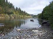
List of longest streams of Oregon
Encyclopedia
Oregon
Oregon is a state in the Pacific Northwest region of the United States. It is located on the Pacific coast, with Washington to the north, California to the south, Nevada on the southeast and Idaho to the east. The Columbia and Snake rivers delineate much of Oregon's northern and eastern...
. All of these streams originate in the United States except the longest, the Columbia
Columbia River
The Columbia River is the largest river in the Pacific Northwest region of North America. The river rises in the Rocky Mountains of British Columbia, Canada, flows northwest and then south into the U.S. state of Washington, then turns west to form most of the border between Washington and the state...
, which begins in the Canadian province of British Columbia
British Columbia
British Columbia is the westernmost of Canada's provinces and is known for its natural beauty, as reflected in its Latin motto, Splendor sine occasu . Its name was chosen by Queen Victoria in 1858...
and flows 1,249 miles (2,010 km) to the sea near Astoria
Astoria, Oregon
Astoria is the county seat of Clatsop County, Oregon, United States. Situated near the mouth of the Columbia River, the city was named after the American investor John Jacob Astor. His American Fur Company founded Fort Astoria at the site in 1811...
. The second-longest, the Snake River
Snake River
The Snake is a major river of the greater Pacific Northwest in the United States. At long, it is the largest tributary of the Columbia River, the largest North American river that empties into the Pacific Ocean...
, which at 1048 miles (1,686.6 km) is the only other stream of more than 1000 miles (1,609.3 km) on the list, begins in Wyoming
Wyoming
Wyoming is a state in the mountain region of the Western United States. The western two thirds of the state is covered mostly with the mountain ranges and rangelands in the foothills of the Eastern Rocky Mountains, while the eastern third of the state is high elevation prairie known as the High...
and flows through parts of Idaho
Idaho
Idaho is a state in the Rocky Mountain area of the United States. The state's largest city and capital is Boise. Residents are called "Idahoans". Idaho was admitted to the Union on July 3, 1890, as the 43rd state....
and Washington, as well as Oregon. Some of the other streams also cross borders between Oregon and California
California
California is a state located on the West Coast of the United States. It is by far the most populous U.S. state, and the third-largest by land area...
, Nevada
Nevada
Nevada is a state in the western, mountain west, and southwestern regions of the United States. With an area of and a population of about 2.7 million, it is the 7th-largest and 35th-most populous state. Over two-thirds of Nevada's people live in the Las Vegas metropolitan area, which contains its...
, Idaho, or Washington, but the majority flow entirely within Oregon.
The Atlas of Oregon ranks 31 rivers in the state by average streamflow
Streamflow
Streamflow, or channel runoff, is the flow of water in streams, rivers, and other channels, and is a major element of the water cycle. It is one component of the runoff of water from the land to waterbodies, the other component being surface runoff...
; the top five are the Columbia, Snake, Willamette
Willamette River
The Willamette River is a major tributary of the Columbia River, accounting for 12 to 15 percent of the Columbia's flow. The Willamette's main stem is long, lying entirely in northwestern Oregon in the United States...
, Santiam
Santiam River
The Santiam River is a tributary of the Willamette River, about long, in western Oregon in the United States. Through its two principal tributaries, the North Santiam and the South Santiam rivers, it drains a large area of the Cascade Range at the eastern side of the Willamette Valley east of...
, and Umpqua
Umpqua River
The Umpqua River on the Pacific coast of Oregon in the United States is approximately long. One of the principal rivers of the Oregon Coast and known for bass and shad, the river drains an expansive network of valleys in the mountains west of the Cascade Range and south of the Willamette Valley,...
. Not all Oregon rivers with high average flows are on this list of longest streams because neither their main stem
Main Stem
"Main Stem" is 1942 instrumental by Duke Ellington and His Famous Orchestra. Although recorded in 1942, the single would not be released until 1944 where it was Duke Ellington's last of four number one's on the Harlem Hit Parade. "Main Stem" would also peak at number twenty on the pop chart"Main...
s nor any of their tributaries
Tributary
A tributary or affluent is a stream or river that flows into a main stem river or a lake. A tributary does not flow directly into a sea or ocean...
(including what are called "forks") are at least 50 miles (80 km) long. High-flow streams mentioned in the Atlas but not included in this long-stream list are the Metolius
Metolius River
The Metolius River is a tributary of the Deschutes River in Central Oregon, United States, near the city of Sisters. The river flows north from springs near Black Butte, then turns sharply east, descending through a series of gorges before ending in the western end of the lake...
, Hood, Youngs
Youngs River
The Youngs River is a tributary of the Columbia River, approximately long, in northwest Oregon in the United States. It drains part of the Northern Oregon Coast Range in the extreme northwest corner of state, entering the Columbia just upstream from its mouth.It rises in a remote section of the...
, and Coos
Coos River
The Coos River flows for about into Coos Bay along the Pacific coast of southwest Oregon in the United States. Formed by the confluence of its major tributaries, the South Fork Coos River and the Millicoma River, it drains an important timber-producing region of the Southern Oregon Coast Range...
rivers. On the other hand, the list includes four low-flow intermittent streams—Dry River
Dry River (Crooked River)
The Dry River is an intermittent tributary, long, of the Crooked River in the U.S. state of Oregon. The stream arises near Hampton Buttes north of Hampton and U.S. Route 20 between Brothers and Riley in the Oregon High Desert...
, Rattlesnake Creek
Rattlesnake Creek (Oregon)
Rattlesnake Creek is a tributary, long, of Crooked Creek in the U.S. state of Oregon. The creek, which is intermittent, begins in the desert north of McDermitt in Malheur County. It joins Crooked Creek southeast of the intersection of U.S. Route 95 and Oregon Route 78 at Burns Junction, about ...
, Rock Creek
Rock Creek (Catlow Valley)
Rock Creek is a intermittent stream flowing in Harney and Lake counties in the U.S. state of Oregon. The source of Rock Creek is at an elevation of on Hart Mountain, while the mouth is at an elevation of in the Catlow Valley. Rock Creek has a watershed....
, and Dry Creek
Dry Creek (Oregon)
Dry Creek is a tributary, long, of Crooked Creek in the U.S. state of Oregon. The creek, which is intermittent, begins in the desert near Five Points in Malheur County. It joins Crooked Creek east of Burns Junction and about south of the larger stream's confluence with the Owyhee River...
—that cross parts of the Oregon High Desert
High Desert (Oregon)
The Oregon High Desert is a region of the U.S. state of Oregon, located east of the Cascade Range and south of the Blue Mountains, in the central and eastern parts of the state. Divided into a southern region and a northern region, the desert covers most of five Oregon counties and averages above...
.
The direction of Oregon stream flow is influenced by four major drainage divides: the Oregon Coast Range
Oregon Coast Range
The Oregon Coast Range, often called simply the Coast Range and sometimes the Pacific Coast Range, is a mountain range, in the Pacific Coast Ranges physiographic region, in the U.S. state of Oregon along the Pacific Ocean...
on the west, the Cascade Range
Cascade Range
The Cascade Range is a major mountain range of western North America, extending from southern British Columbia through Washington and Oregon to Northern California. It includes both non-volcanic mountains, such as the North Cascades, and the notable volcanoes known as the High Cascades...
further inland, the Klamath
Klamath Mountains
The Klamath Mountains, which include the Siskiyou, Marble, Scott, Trinity, Trinity Alps, Salmon, and northern Yolla-Bolly Mountains, are a rugged lightly populated mountain range in northwest California and southwest Oregon in the United States...
–Siskiyou
Siskiyou Mountains
The Siskiyou Mountains are a coastal mountain range in the northern Klamath Mountains in northwestern California and southwestern Oregon in the United States. They extend in an arc for approximately from east of Crescent City, California northeast along the north side of the Klamath River into...
Mountains in the southwest, and the Blue Mountains
Blue Mountains (Oregon)
The Blue Mountains are a mountain range in the western United States, located largely in northeastern Oregon and stretching into southeastern Washington...
in the northeast. One set of streams, including the Nehalem River
Nehalem River
The Nehalem River is a river on the Pacific coast of northwest Oregon in the United States, approximately long. It drains part of the Northern Oregon Coast Range northwest of Portland, originating on the east side of the mountains and flowing in a loop around the north end of the range near the...
, flows directly into the Pacific Ocean or into larger streams flowing directly to the Pacific; other streams, such as the Deschutes River, flow into the Columbia River or its tributaries. A third set, including the Klamath River
Klamath River
The Klamath River is an American river that flows southwest through Oregon and northern California, cutting through the Cascade Range to empty into the Pacific Ocean. The river drains an extensive watershed of almost that stretches from the high desert country of the Great Basin to the temperate...
and its tributaries, originates in Oregon, but its waters eventually flow into northern California before reaching the ocean. Other streams like the Donner und Blitzen River
Donner und Blitzen River
The Donner und Blitzen River is a river on the eastern Oregon high desert which drains a relatively arid basin, the southern portion of Harney Basin, from roughly 20 to 80 miles south-southeast of Burns including Malheur National Wildlife Refuge...
flow into closed basins, such as Malheur Lake
Malheur Lake
Malheur Lake is a lake in an arid region of eastern Oregon, United States near Burns, Oregon. The lake is fed by Donner und Blitzen River from the south and the Silvies River from the north. Malheur Lake has no outlet, though water escapes through ground seepage and by evaporation; widespread...
, that have no outlet to the sea.
Source data for the table below came from topographic map
Topographic map
A topographic map is a type of map characterized by large-scale detail and quantitative representation of relief, usually using contour lines in modern mapping, but historically using a variety of methods. Traditional definitions require a topographic map to show both natural and man-made features...
s created by the United States Geological Survey
United States Geological Survey
The United States Geological Survey is a scientific agency of the United States government. The scientists of the USGS study the landscape of the United States, its natural resources, and the natural hazards that threaten it. The organization has four major science disciplines, concerning biology,...
and published on-line by TopoQuest
TopoQuest
TopoQuest is a free web mapping service built on open source software that provides internet-based topographic maps for most of the United States....
, and from the Atlas of Oregon; the Oregon Atlas and Gazetteer; two federally produced geographic information system
Geographic Information System
A geographic information system, geographical information science, or geospatial information studies is a system designed to capture, store, manipulate, analyze, manage, and present all types of geographically referenced data...
(GIS) datasets—the National Hydrography Dataset and the National Watershed Boundary Dataset—and other sources as noted. In the table, total lengths are given in miles (mi) and kilometers (km), and elevations are in feet (ft) and meters (m).
Rivers and creeks
| Name | Mouth | Total length | Watershed area |
Mouth coordinates |
Mouth elevation | Source coordinates |
Source elevation | Source and mouth locations |
|---|---|---|---|---|---|---|---|---|
| Columbia River Columbia River The Columbia River is the largest river in the Pacific Northwest region of North America. The river rises in the Rocky Mountains of British Columbia, Canada, flows northwest and then south into the U.S. state of Washington, then turns west to form most of the border between Washington and the state... |
Pacific Ocean Pacific Ocean The Pacific Ocean is the largest of the Earth's oceanic divisions. It extends from the Arctic in the north to the Southern Ocean in the south, bounded by Asia and Australia in the west, and the Americas in the east.At 165.2 million square kilometres in area, this largest division of the World... |
1,249 mi 2,010 km |
258,000 mi2 668,000 km2 |
46°14′39"N 124°03′29"W | 0 ft 0 m |
50°13′00"N 115°51′00"W | 2,657 ft 810 m |
Source at Columbia Lake Columbia Lake Columbia Lake is the primary lake at the headwaters of the Columbia River, in British Columbia, Canada. It is fed by several small tributaries. The village of Canal Flats is located at the south end of the lake.... , British Columbia British Columbia British Columbia is the westernmost of Canada's provinces and is known for its natural beauty, as reflected in its Latin motto, Splendor sine occasu . Its name was chosen by Queen Victoria in 1858... , mouth near Astoria Astoria, Oregon Astoria is the county seat of Clatsop County, Oregon, United States. Situated near the mouth of the Columbia River, the city was named after the American investor John Jacob Astor. His American Fur Company founded Fort Astoria at the site in 1811... |
| Snake River Snake River The Snake is a major river of the greater Pacific Northwest in the United States. At long, it is the largest tributary of the Columbia River, the largest North American river that empties into the Pacific Ocean... |
Columbia River Columbia River The Columbia River is the largest river in the Pacific Northwest region of North America. The river rises in the Rocky Mountains of British Columbia, Canada, flows northwest and then south into the U.S. state of Washington, then turns west to form most of the border between Washington and the state... |
1,078 mi 1,674 km |
108,000 mi2 280,000 km2 |
46°11′10"N 119°01′43"W | 358 ft 109 m |
44°07′49"N 110°13′10"W | 9,199 ft 2,804 m |
Source in Absaroka Range Absaroka Range The Absaroka Range is a sub-range of the Rocky Mountains in the United States. The range stretches about 150 mi across the Montana-Wyoming border, forming the eastern boundary of Yellowstone National Park and the western side of the Bighorn Basin. The range borders the Beartooth Mountains... , Wyoming Wyoming Wyoming is a state in the mountain region of the Western United States. The western two thirds of the state is covered mostly with the mountain ranges and rangelands in the foothills of the Eastern Rocky Mountains, while the eastern third of the state is high elevation prairie known as the High... , mouth near Tri-Cities, Washington Tri-Cities, Washington The Tri-Cities is a mid-sized metropolitan area in the southeastern part of the U.S. state of Washington, consisting of three neighboring cities: Kennewick, Pasco, and Richland. The cities are located at the confluence of the Yakima, Snake, and Columbia rivers in the semi-arid region of... |
| Owyhee River Owyhee River The Owyhee River is a tributary of the Snake River located in northern Nevada, southwestern Idaho and southeastern Oregon in the United States. It is long. The river's drainage basin is in area, one of the largest subbasins of the Columbia Basin... |
Snake River Snake River The Snake is a major river of the greater Pacific Northwest in the United States. At long, it is the largest tributary of the Columbia River, the largest North American river that empties into the Pacific Ocean... |
346 mi 557 km |
11,049 mi2 28,617 km2 |
43°48′46"N 117°01′32"W | 3,185 ft 666 ft |
41°30′17"N 115°44′30"W | 6,918 ft 2,109 m |
Source in Independence Mountains Independence Mountains The Independence Mountains are a range of peaks and hills in northern Elko County, in northeastern Nevada in the western United States. The range extends northward approximately from a point near Carlin to the banks of the Owyhee River. To the east is the North Fork of the Humboldt River, and to... of Nevada Nevada Nevada is a state in the western, mountain west, and southwestern regions of the United States. With an area of and a population of about 2.7 million, it is the 7th-largest and 35th-most populous state. Over two-thirds of Nevada's people live in the Las Vegas metropolitan area, which contains its... , mouth near Nyssa Nyssa, Oregon Nyssa is a city in Malheur County, Oregon, United States. The population was 3,163 at the 2000 census. The city is located along the Snake River on the Idaho border, in the region of far eastern Oregon known as the "Treasure Valley"... |
| Klamath River Klamath River The Klamath River is an American river that flows southwest through Oregon and northern California, cutting through the Cascade Range to empty into the Pacific Ocean. The river drains an extensive watershed of almost that stretches from the high desert country of the Great Basin to the temperate... |
Pacific Ocean Pacific Ocean The Pacific Ocean is the largest of the Earth's oceanic divisions. It extends from the Arctic in the north to the Southern Ocean in the south, bounded by Asia and Australia in the west, and the Americas in the east.At 165.2 million square kilometres in area, this largest division of the World... |
287 mi 462 km |
15,700 mi2 40,700 km2 |
41°32′49"N 124°05′00"W | 0 ft 0 m |
42°11′29"N 121°46′58"W | 4,090 ft 1,247 m |
Source at Upper Klamath Lake Upper Klamath Lake Upper Klamath Lake is a large, shallow freshwater lake east of the Cascade Range in south central Oregon in the United States. The largest freshwater body in Oregon, it is approximately 20 mi long and 8 mi wide and extends northwest from the city of Klamath Falls... , mouth near Crescent City, California Crescent City, California Crescent City is the county seat and only incorporated city in Del Norte County, California. Named for the crescent-shaped stretch of sandy beach south of the city, Crescent City had a total population of 7,643 in the 2010 census, up from 4,006 in the 2000 census... |
| John Day River John Day River The John Day River is a tributary of the Columbia River, approximately long, in northeastern Oregon in the United States. Undammed along its entire length, the river is the third longest free-flowing river in the conterminous United States. There is extensive use of its waters for irrigation. Its... |
Columbia River Columbia River The Columbia River is the largest river in the Pacific Northwest region of North America. The river rises in the Rocky Mountains of British Columbia, Canada, flows northwest and then south into the U.S. state of Washington, then turns west to form most of the border between Washington and the state... |
284 mi 457 km |
8,100 mi2 21,000 km2 |
45°43′57"N 120°38′57"W | 269 ft 82 m |
44°14′44"N 118°33′08"W | 6,676 ft 2,035 m |
Source in Strawberry Range, mouth near Rufus Rufus, Oregon Rufus is a city in Sherman County, Oregon, United States. The population was 268 at the 2000 census. The city was named for an early settler, Rufus Carrol Wallis.-Geography:... |
| Deschutes River | Columbia River Columbia River The Columbia River is the largest river in the Pacific Northwest region of North America. The river rises in the Rocky Mountains of British Columbia, Canada, flows northwest and then south into the U.S. state of Washington, then turns west to form most of the border between Washington and the state... |
251 mi 405 km |
10,400 mi2 26,939 km2 |
45°38′07"N 120°54′52"W | 164 ft 50 m |
43°54′33"N 121°45′40"W | 4,747 ft 1,447 m |
Source in Cascade Range Cascade Range The Cascade Range is a major mountain range of western North America, extending from southern British Columbia through Washington and Oregon to Northern California. It includes both non-volcanic mountains, such as the North Cascades, and the notable volcanoes known as the High Cascades... , mouth near Biggs Junction Biggs Junction, Oregon Biggs Junction is an unincorporated community in Sherman County, Oregon, United States. For statistical purposes, the United States Census Bureau has defined Biggs Junction as a census-designated place... |
| Rogue River Rogue River (Oregon) The Rogue River in southwestern Oregon in the United States flows about in a generally westward direction from the Cascade Range to the Pacific Ocean. Known for its salmon runs, whitewater rafting, and rugged scenery, it was one of the original eight rivers named in the Wild and Scenic Rivers Act... |
Pacific Ocean Pacific Ocean The Pacific Ocean is the largest of the Earth's oceanic divisions. It extends from the Arctic in the north to the Southern Ocean in the south, bounded by Asia and Australia in the west, and the Americas in the east.At 165.2 million square kilometres in area, this largest division of the World... |
215 mi 346 km |
5,200 mi2 13,400 km2 |
42°25′21"N 124°25′45"W | 0 ft 0 m |
43°03′57"N 122°13′56"W | 5,320 ft 1,622 m |
Source in Cascade Range Cascade Range The Cascade Range is a major mountain range of western North America, extending from southern British Columbia through Washington and Oregon to Northern California. It includes both non-volcanic mountains, such as the North Cascades, and the notable volcanoes known as the High Cascades... , mouth near Gold Beach Gold Beach, Oregon Gold Beach is a city in and the county seat of Curry County, Oregon, United States, on the Oregon Coast. The population was 1,897 at the 2000 census.-History:... |
| Malheur River Malheur River The Malheur River is a tributary of the Snake River in eastern Oregon in the United States. It drains a high desert area, between the Harney Basin and the Blue Mountains and the Snake.... |
Snake River Snake River The Snake is a major river of the greater Pacific Northwest in the United States. At long, it is the largest tributary of the Columbia River, the largest North American river that empties into the Pacific Ocean... |
190 mi 306 km |
5,000 mi2 11,940 km2 |
44°03′33"N 116°58′31"W | 2,133 ft 650 m |
44°08′05"N 118°37′14"W | 4,958 ft 1,511 m |
Source in Strawberry Range, mouth near Ontario Ontario, Oregon Ontario is the largest city in Malheur County, Oregon, United States. It lies along the Snake River at the Idaho border. The population was 10,985 at the 2000 census, with an estimated population of 11,245 in 2006... |
| Willamette River Willamette River The Willamette River is a major tributary of the Columbia River, accounting for 12 to 15 percent of the Columbia's flow. The Willamette's main stem is long, lying entirely in northwestern Oregon in the United States... |
Columbia River Columbia River The Columbia River is the largest river in the Pacific Northwest region of North America. The river rises in the Rocky Mountains of British Columbia, Canada, flows northwest and then south into the U.S. state of Washington, then turns west to form most of the border between Washington and the state... |
187 mi 301 km |
11,400 mi2 30,000 km2 |
45°39′10"N 122°45′53"W | 10 ft 3 m |
44°01′23"N 123°01′25"W | 438 ft 134 m |
Source near Eugene Eugene, Oregon Eugene is the second largest city in the U.S. state of Oregon and the seat of Lane County. It is located at the south end of the Willamette Valley, at the confluence of the McKenzie and Willamette rivers, about east of the Oregon Coast.As of the 2010 U.S... , mouth near Portland Portland, Oregon Portland is a city located in the Pacific Northwest, near the confluence of the Willamette and Columbia rivers in the U.S. state of Oregon. As of the 2010 Census, it had a population of 583,776, making it the 29th most populous city in the United States... |
| Grande Ronde River Grande Ronde River The Grande Ronde River is a tributary of the Snake River, long, in northeastern Oregon and southeastern Washington in the United States. It drains an area southeast of the Blue Mountains and northwest of the Wallowa Mountains, on the Columbia Plateau... |
Snake River Snake River The Snake is a major river of the greater Pacific Northwest in the United States. At long, it is the largest tributary of the Columbia River, the largest North American river that empties into the Pacific Ocean... |
182 mi 339 km |
4,000 mi2 10,240 km2 |
46°04′49"N 116°58′47"W | 820 ft 250 m |
44°57′34"N 118°15′38"W | 7,446 ft 2,270 m |
Source in Blue Mountains Blue Mountains (Oregon) The Blue Mountains are a mountain range in the western United States, located largely in northeastern Oregon and stretching into southeastern Washington... , mouth on Washington–Idaho Idaho Idaho is a state in the Rocky Mountain area of the United States. The state's largest city and capital is Boise. Residents are called "Idahoans". Idaho was admitted to the Union on July 3, 1890, as the 43rd state.... border |
| Powder River Powder River (Oregon) The Powder River is a tributary of the Snake River, approximately long, in northeast Oregon in the United States. It drains an area of the Columbia Plateau on the eastern side of the Blue Mountains... |
Snake River Snake River The Snake is a major river of the greater Pacific Northwest in the United States. At long, it is the largest tributary of the Columbia River, the largest North American river that empties into the Pacific Ocean... |
153 mi 246 km |
1,720 mi2 4,455 km2 |
44°44′37"N 117°02′56"W | 2,064 ft 629 m |
44°44′30"N 118°12′22"W | 4,402 ft 1,342 m |
Source in Blue Mountains Blue Mountains (Oregon) The Blue Mountains are a mountain range in the western United States, located largely in northeastern Oregon and stretching into southeastern Washington... , mouth near Richland Richland, Oregon Richland is a city in Baker County, Oregon, United States. The population was 147 at the 2000 census.-History:Richland was platted in 1897 due to needs from nearby mining and railroad interests... |
| Crooked River Crooked River (Oregon) The Crooked River is a tributary, long, of the Deschutes River in the U.S. state of Oregon. The river begins at the confluence of South Fork Crooked River and Beaver Creek. Of the two tributaries, the South Fork Crooked River is the larger and is sometimes considered part of the Crooked River proper... |
Deschutes River | 125 mi 201 km |
4,300 mi2 11,137 km2 |
44°34′25"N 121°16′19"W | 1,949 ft 594 m |
44°06′05"N 120°03′04"W | 3,624 ft 1,105 m |
Source near Ochoco Mountains Ochoco Mountains The Ochoco Mountains are a mountain range in central Oregon. The Ochoco Mountains form the western end of the Blue Mountains province. The mountains were formed when Permian, Triassic, and Jurassic rocks were slowly uplifted by volcanic eruptions to form the Clarno Formation. Today, the highest... , mouth near Culver Culver, Oregon Culver is a city in Jefferson County, Oregon, United States. The population was 802 at the 2000 census, with an estimated population of 1,315 in 2007.- History :... |
| Middle Fork Willamette River Middle Fork Willamette River The Middle Fork Willamette River is one of several forks that unite to form the Willamette River in the western part of the U.S. state of Oregon... |
Willamette River Willamette River The Willamette River is a major tributary of the Columbia River, accounting for 12 to 15 percent of the Columbia's flow. The Willamette's main stem is long, lying entirely in northwestern Oregon in the United States... |
122 mi 196 km |
1,355 mi2 3,510 km2 |
44°01′23"N 123°01′25"W | 436 ft 133 m |
43°24′28"N 122°06′20"W | 5,552 ft 1,692 m |
Source in Calapooya Mountains Calapooya Mountains The Calapooya Mountains are a mountain range in Lane and Douglas counties of southwestern Oregon in the United States. The range runs for approximately west from the Cascade Range between Eugene on the north and Roseburg on the south.- Geology :... , mouth near Springfield Springfield, Oregon Springfield is a city in Lane County, Oregon, United States. Located in the Southern Willamette Valley, it is within the Eugene-Springfield Metropolitan Statistical Area. Separated from Eugene to the west, mainly by Interstate 5, Springfield is the second-most populous city in the metropolitan area... |
| Nehalem River Nehalem River The Nehalem River is a river on the Pacific coast of northwest Oregon in the United States, approximately long. It drains part of the Northern Oregon Coast Range northwest of Portland, originating on the east side of the mountains and flowing in a loop around the north end of the range near the... |
Pacific Ocean Pacific Ocean The Pacific Ocean is the largest of the Earth's oceanic divisions. It extends from the Arctic in the north to the Southern Ocean in the south, bounded by Asia and Australia in the west, and the Americas in the east.At 165.2 million square kilometres in area, this largest division of the World... |
119 mi 192 km |
855 mi2 2,214 km2 |
45°39′29"N 123°56′04"W | 0 ft 0 m |
45°43′53"N 123°25′26"W | 2,420 ft 740 m |
Source in Northern Oregon Coast Range Northern Oregon Coast Range The Northern Oregon Coast Range is the northern section of the Oregon Coast Range, in the Pacific Coast Ranges physiographic region, located in the northwest portion of the state of Oregon, United States. This section of the mountain range, part of the Pacific Coast Ranges, contains peaks as high... , mouth near Wheeler Wheeler, Oregon Wheeler is a city in Tillamook County, Oregon, United States. The population was 391 at the 2000 census.-Geography:According to the United States Census Bureau, the city has a total area of , all of it land.-Demographics:... |
| North Fork John Day River North Fork John Day River The North Fork John Day River is a tributary of the John Day River in the U.S. state of Oregon. It begins in Grant County about northwest of Baker City near the crest of the Blue Mountains. It flows generally west to the community of Dale on U.S... |
John Day River John Day River The John Day River is a tributary of the Columbia River, approximately long, in northeastern Oregon in the United States. Undammed along its entire length, the river is the third longest free-flowing river in the conterminous United States. There is extensive use of its waters for irrigation. Its... |
117 mi 188 km |
600 mi2 1,554 km2 |
44°45′22"N 119°38′19"W | 1,834 ft 559 m |
44°51′48"N 118°14′13"W | 7,420 ft 2,260 m |
Source in Elkhorn Mountains Elkhorn Mountains The Elkhorn Mountains are a mountain range in southwestern Montana, part of the Rocky Mountains and are roughly 300,000 acres in size. It is an inactive volcanic mountain range with the highest point being Crow Peak at , right next to Elkhorn Peak,... , mouth near Kimberly Kimberly, Oregon Kimberly is an unincorporated community in Grant County, Oregon, United States. It is located at the intersection of Oregon Route 19 and Oregon Route 402 and the confluence of the John Day and the North Fork John Day rivers.... |
| Umpqua River Umpqua River The Umpqua River on the Pacific coast of Oregon in the United States is approximately long. One of the principal rivers of the Oregon Coast and known for bass and shad, the river drains an expansive network of valleys in the mountains west of the Cascade Range and south of the Willamette Valley,... |
Pacific Ocean Pacific Ocean The Pacific Ocean is the largest of the Earth's oceanic divisions. It extends from the Arctic in the north to the Southern Ocean in the south, bounded by Asia and Australia in the west, and the Americas in the east.At 165.2 million square kilometres in area, this largest division of the World... |
112 mi 180 km |
4,685 mi2 12,133 km2 |
43°40′09"N 124°12′18"W | 0 ft 0 m |
43°16′05"N 123°26′46"W | 362 ft 110 m |
Source near Roseburg Roseburg, Oregon Roseburg is a city in the U.S. state of Oregon. It is the county seat of Douglas County. The population was 21,181 at the 2010 census.-History:... , mouth near Reedsport Reedsport, Oregon Reedsport is a city in Douglas County, Oregon, United States. As of the 2010 census, the population was 4,154.- History :Reedsport was established on the estuary of the Umpqua River on January 7, 1852. It was named for a local settler, Alfred W. Reed, who founded the city in 1912... |
| Siuslaw River Siuslaw River The Siuslaw River is a river, approximately 110 mi long, along the Pacific coast of Oregon in the United States. It drains an area of approximately in the Central Oregon Coast Range southwest of the Willamette Valley and north of the watershed of the Umpqua River.It rises in the mountains... |
Pacific Ocean Pacific Ocean The Pacific Ocean is the largest of the Earth's oceanic divisions. It extends from the Arctic in the north to the Southern Ocean in the south, bounded by Asia and Australia in the west, and the Americas in the east.At 165.2 million square kilometres in area, this largest division of the World... |
110 mi 180 km |
773 mi2 2,000 km2 |
44°01′01"N 124°08′14"W | 0 ft 0 m |
43°49′23"N 123°15′42"W | 632 ft 193 m |
Source in Central Oregon Coast Range Central Oregon Coast Range The Central Oregon Coast Range is the middle section of the Oregon Coast Range, in the Pacific Coast Ranges physiographic region, and located in the west-central portion of the state of Oregon, United States roughly between the Salmon River and the Umpqua River and the Willamette Valley and the... , mouth at Florence Florence, Oregon Florence is a city in Lane County, Oregon, United States. As of the 2010 census, the city had a total population of 8,466.-History:The Florence area was originally inhabited by the Siuslaw tribe of Native Americans. Some state that the city was named for state senator A. B... |
| North Umpqua River North Umpqua River The North Umpqua River is a tributary of the Umpqua River, approximately long, in southwestern Oregon in the United States. It drains a scenic and rugged area of the Cascade Range southwest of Eugene, flowing through steep canyons and surrounded by large Douglas-fir forests... |
Umpqua River Umpqua River The Umpqua River on the Pacific coast of Oregon in the United States is approximately long. One of the principal rivers of the Oregon Coast and known for bass and shad, the river drains an expansive network of valleys in the mountains west of the Cascade Range and south of the Willamette Valley,... |
110 mi 170 km |
1,373 mi2 3,560 km2 |
43°16′05"N 123°26′45"W | 361 ft 110 m |
43°15′24"N 122°00′03"W | 5,985 ft 1,824 m |
Source in Cascade Range Cascade Range The Cascade Range is a major mountain range of western North America, extending from southern British Columbia through Washington and Oregon to Northern California. It includes both non-volcanic mountains, such as the North Cascades, and the notable volcanoes known as the High Cascades... , mouth near Roseburg Roseburg, Oregon Roseburg is a city in the U.S. state of Oregon. It is the county seat of Douglas County. The population was 21,181 at the 2010 census.-History:... |
| South Umpqua River South Umpqua River The South Umpqua River is a tributary of the Umpqua River, approximately long, in southwestern Oregon in the United States. It drains part of the Cascade Range east of Roseburg... |
Umpqua River Umpqua River The Umpqua River on the Pacific coast of Oregon in the United States is approximately long. One of the principal rivers of the Oregon Coast and known for bass and shad, the river drains an expansive network of valleys in the mountains west of the Cascade Range and south of the Willamette Valley,... |
110 mi 170 km |
1,800 mi2 4,700 km2 |
43°16′04"N 123°26′46"W | 361 ft 110 m |
43°06′26"N 122°35′22"W | 2,009 ft 612 m |
Source in Cascade Range Cascade Range The Cascade Range is a major mountain range of western North America, extending from southern British Columbia through Washington and Oregon to Northern California. It includes both non-volcanic mountains, such as the North Cascades, and the notable volcanoes known as the High Cascades... , mouth near Roseburg Roseburg, Oregon Roseburg is a city in the U.S. state of Oregon. It is the county seat of Douglas County. The population was 21,181 at the 2010 census.-History:... |
| Jordan Creek Jordan Creek (Owyhee River) Jordan Creek is a tributary of the Owyhee River in the northwestern United States. It flows generally west from near Silver City, Idaho, in the Owyhee Mountains to near Rome in the Oregon High Desert. Major tributaries are Big Boulder, Soda, Louse, Spring, Rock, Meadow, Combination, and Louisa... |
Owyhee River Owyhee River The Owyhee River is a tributary of the Snake River located in northern Nevada, southwestern Idaho and southeastern Oregon in the United States. It is long. The river's drainage basin is in area, one of the largest subbasins of the Columbia Basin... |
99 mi 159 km |
1,305 mi2 3,380 km2 |
42°51′45"N 117°38′29"W | 3,363 ft 1,025 m |
42°58′21"N 116°44′39"W | 7,551 ft 2,302 m |
Source in Owyhee Mountains Owyhee Mountains The Owyhee Mountains are a mountain range in Owyhee County, Idaho and Malheur County, Oregon.- References :... of Idaho, mouth near Rome Rome, Oregon Rome is an unincorporated community in Malheur County, Oregon, United States, part of the Ontario, OR–ID Micropolitan Statistical Area. In the sparsely populated high desert of southeastern Oregon, Rome is immediately west of the Owyhee River on US-95, approximately 12 miles northeast of... |
| Burnt River Burnt River (Oregon) The Burnt River is a tributary of the Snake River in eastern Oregon, United States. It enters the Snake near Huntington, Oregon, at a point upstream of the Powder River and downstream of the Malheur River, slightly more than from the Snake's confluence with the Columbia River... |
Snake River Snake River The Snake is a major river of the greater Pacific Northwest in the United States. At long, it is the largest tributary of the Columbia River, the largest North American river that empties into the Pacific Ocean... |
98 mi 158 km |
1,090 mi2 2,823 km2 |
44°21′54"N 117°13′34"W | 2,073 ft 632 m |
44°30′15"N 118°10′51"W | 3,824 ft 1,166 m |
Source in Blue Mountains Blue Mountains (Oregon) The Blue Mountains are a mountain range in the western United States, located largely in northeastern Oregon and stretching into southeastern Washington... , mouth near Huntington Huntington, Oregon Huntington is a city in Baker County, on the eastern border of Oregon, United States. It is located on the Snake River and along Interstate 84 and U.S. Route 30. The population was 515 at the 2000 census.- History:... |
| Silvies River Silvies River The Silvies River flows for about through Grant and Harney counties in the U.S. state of Oregon. The river drains of the northern Harney Basin.... |
Malheur Lake Malheur Lake Malheur Lake is a lake in an arid region of eastern Oregon, United States near Burns, Oregon. The lake is fed by Donner und Blitzen River from the south and the Silvies River from the north. Malheur Lake has no outlet, though water escapes through ground seepage and by evaporation; widespread... |
95 mi 153 km |
1,273 mi2 3,300 km2 |
43°34′05"N 119°02′04"W | 4,150 ft 1,265 m |
44°07′19"N 119°13′53"W | 5,649 ft 1,722 m |
Source in Blue Mountains Blue Mountains (Oregon) The Blue Mountains are a mountain range in the western United States, located largely in northeastern Oregon and stretching into southeastern Washington... , mouth near Burns Burns, Oregon Burns is a city in and the county seat of Harney County, Oregon, United States. As of the 2010 census the population was 2,806.-History:Burns was established in the early 1880s and incorporated upon Harney county's creation in 1889... |
| North Santiam River North Santiam River The North Santiam River is a tributary of the Santiam River in western Oregon in the United States. It drains of the Cascade Range on the eastern side of the Willamette Valley east of Salem.... |
Santiam River Santiam River The Santiam River is a tributary of the Willamette River, about long, in western Oregon in the United States. Through its two principal tributaries, the North Santiam and the South Santiam rivers, it drains a large area of the Cascade Range at the eastern side of the Willamette Valley east of... |
92 mi 148 km |
766 mi2 1,984 km2 |
44°41′12"N 123°00′24"W | 217 ft 66 m |
44°28′39"N 121°53′04"W | 5,133 ft 1,565 m |
Source in Cascade Range Cascade Range The Cascade Range is a major mountain range of western North America, extending from southern British Columbia through Washington and Oregon to Northern California. It includes both non-volcanic mountains, such as the North Cascades, and the notable volcanoes known as the High Cascades... , mouth in Willamette Valley Willamette Valley The Willamette Valley is the most populated region in the state of Oregon of the United States. Located in the state's northwest, the region is surrounded by tall mountain ranges to the east, west and south and the valley's floor is broad, flat and fertile because of Ice Age conditions... |
| Little Deschutes River Little Deschutes River The Little Deschutes River is a tributary of the Deschutes River in the central part of the U.S. state of Oregon. It is about long, with a drainage basin of... |
Deschutes River | 92 mi 146 km |
1,020 mi2 2,642 km2 |
43°51′14"N 121°27′14"W | 4,163 ft 1,269 m |
43°18′25"N 121°59′43"W | 6,219 ft 1,896 m |
Source in Cascade Range Cascade Range The Cascade Range is a major mountain range of western North America, extending from southern British Columbia through Washington and Oregon to Northern California. It includes both non-volcanic mountains, such as the North Cascades, and the notable volcanoes known as the High Cascades... , mouth near Sunriver Sunriver, Oregon Sunriver, Oregon is a private planned resort community in Deschutes County, Oregon, United States. It is part of the Bend, Oregon Metropolitan Statistical Area... |
| Smith River | Umpqua River Umpqua River The Umpqua River on the Pacific coast of Oregon in the United States is approximately long. One of the principal rivers of the Oregon Coast and known for bass and shad, the river drains an expansive network of valleys in the mountains west of the Cascade Range and south of the Willamette Valley,... |
90 mi 140 km |
218 mi2 565 km2 |
43°44′13"N 124°04′43"W | 0 mi 0 km |
43°44′25"N 123°20′22"W | 1,406 ft 429 m |
Source in Central Oregon Coast Range Central Oregon Coast Range The Central Oregon Coast Range is the middle section of the Oregon Coast Range, in the Pacific Coast Ranges physiographic region, and located in the west-central portion of the state of Oregon, United States roughly between the Salmon River and the Umpqua River and the Willamette Valley and the... , mouth near Reedsport Reedsport, Oregon Reedsport is a city in Douglas County, Oregon, United States. As of the 2010 census, the population was 4,154.- History :Reedsport was established on the estuary of the Umpqua River on January 7, 1852. It was named for a local settler, Alfred W. Reed, who founded the city in 1912... |
| McKenzie River McKenzie River The McKenzie River is a tributary of the Willamette River in western Oregon in the United States. It drains part of the Cascade Range east of Eugene and flows into the southernmost end of the Willamette Valley. It is named for Donald MacKenzie, a Scottish Canadian fur trader... |
Willamette River Willamette River The Willamette River is a major tributary of the Columbia River, accounting for 12 to 15 percent of the Columbia's flow. The Willamette's main stem is long, lying entirely in northwestern Oregon in the United States... |
90 mi 145 km |
1,300 mi2 3,367 km2 |
44°07′32"N 123°06′20"W | 371 ft 113 m |
44°21′37"N 121°59′39"W | 3,570 ft 1,088 m |
Source in Cascade Range Cascade Range The Cascade Range is a major mountain range of western North America, extending from southern British Columbia through Washington and Oregon to Northern California. It includes both non-volcanic mountains, such as the North Cascades, and the notable volcanoes known as the High Cascades... , mouth near Eugene Eugene, Oregon Eugene is the second largest city in the U.S. state of Oregon and the seat of Lane County. It is located at the south end of the Willamette Valley, at the confluence of the McKenzie and Willamette rivers, about east of the Oregon Coast.As of the 2010 U.S... |
| Umatilla River Umatilla River The Umatilla River is an tributary of the Columbia River in the U.S. state of Oregon. Draining a basin of , it enters the Columbia near the city of Umatilla in the northeastern part of the state... |
Columbia River Columbia River The Columbia River is the largest river in the Pacific Northwest region of North America. The river rises in the Rocky Mountains of British Columbia, Canada, flows northwest and then south into the U.S. state of Washington, then turns west to form most of the border between Washington and the state... |
89 mi 143 km |
2,540 mi2 6,579 km2 |
45°55′09"N 119°21′20"W | 269 ft 82 m |
45°43′32"N 118°11′17"W | 2,332 ft 711 m |
Source in Blue Mountains Blue Mountains (Oregon) The Blue Mountains are a mountain range in the western United States, located largely in northeastern Oregon and stretching into southeastern Washington... , mouth at Umatilla Umatilla, Oregon Umatilla is a city in Umatilla County, Oregon, United States. It is named for the Umatilla River, which enters the Columbia River on the side of the city. The river is named after the Umatilla Tribe. The city is located on the south side of the Columbia River, and is located on U.S... |
| Dry River Dry River (Crooked River) The Dry River is an intermittent tributary, long, of the Crooked River in the U.S. state of Oregon. The stream arises near Hampton Buttes north of Hampton and U.S. Route 20 between Brothers and Riley in the Oregon High Desert... (intermittent) |
Crooked River Crooked River (Oregon) The Crooked River is a tributary, long, of the Deschutes River in the U.S. state of Oregon. The river begins at the confluence of South Fork Crooked River and Beaver Creek. Of the two tributaries, the South Fork Crooked River is the larger and is sometimes considered part of the Crooked River proper... |
88 mi 142 km |
752 mi2 1,948 km2 |
44°20′10"N 121°02′50"W | 2,782 ft 848 m |
43°46′56"N 120°16′44"W | 5,886 ft 1,794 m |
Source in Hampton Buttes near Brothers Brothers, Oregon Brothers is an unincorporated community in Deschutes County, Oregon, United States on U.S. Route 20. It is part of the Bend, Oregon Metropolitan Statistical Area. It lies at an elevation of above sea level.-History:... , mouth upstream of Smith Rock Smith Rock State Park Smith Rock State Park is a state park located in central Oregon's high desert near the towns of Redmond and Terrebonne. Its sheer cliffs of tuff and basalt are ideal for rock climbing of all difficulty levels... |
| Silver Creek Silver Creek (Harney County, Oregon) Silver Creek is an stream of Oregon which drains a portion of the endorheic Harney Basin to Harney Lake. Arising in the Blue Mountains, it flows generally southeast, although much of the stream is intermittent... |
Harney Lake Harney Lake Harney Lake is a shallow alkali lake basin located in southeast Oregon, United States, approximately thirty miles south of the town of Burns. The lake lies within the boundary of the Malheur National Wildlife Refuge and is the lowest point in the Blitzen Valley drainage.- History :The lake has been... |
87 mi 140 km |
1,700 mi2 4,403 km2 |
43°15′47"N 119°11′21"W | 4,101 ft 1,250 m |
43°56′28"N 119°33′25"W | 5,830 ft 1,777 m |
Source in Malheur National Forest Malheur National Forest The Malheur National Forest is a National Forest in the U.S. state of Oregon. It contains 1.7 million acres in the Blue Mountains of eastern Oregon. The forest include high desert grasslands, sage, juniper, pine, fir, and other tree species. Elevations vary from about 4000 feet to the 9038... , mouth at Harney Lake Harney Lake Harney Lake is a shallow alkali lake basin located in southeast Oregon, United States, approximately thirty miles south of the town of Burns. The lake lies within the boundary of the Malheur National Wildlife Refuge and is the lowest point in the Blitzen Valley drainage.- History :The lake has been... |
| Sprague River | Williamson River Williamson River (Oregon) The Williamson River of south-central Oregon in the United States is about long. It drains about east of the Cascade Range. Together with its principal tributary, the Sprague River, it provides over half the inflow to Upper Klamath Lake, the largest freshwater lake in Oregon... |
84 mi 135 km |
1,560 mi2 4,050 km |
42°34′16"N 121°52′28"W | 4,163 ft 1,269 m |
42°26′16"N 121°06′34"W | 4,326 ft 1,319 m |
Source on high plateau of eastern Klamath County Klamath County, Oregon -National protected areas:* Bear Valley National Wildlife Refuge* Crater Lake National Park * Deschutes National Forest * Fremont National Forest * Klamath Marsh National Wildlife Refuge* Lower Klamath National Wildlife Refuge... , mouth near Chiloquin Chiloquin, Oregon Chiloquin is a city in Klamath County, Oregon, United States. Chiloquin was the pioneer version of a Klamath family name Chaloquin, which was the name of a Klamath chief who was alive at the time of the treaty of 1864... |
| Clackamas River Clackamas River The Clackamas River is an approximately tributary of the Willamette River in northwestern Oregon, in the United States. As it drains an area of about , the Clackamas passes through mostly forested and rugged mountainous terrain in its upper reaches, and passes through agricultural and urban areas... |
Willamette River Willamette River The Willamette River is a major tributary of the Columbia River, accounting for 12 to 15 percent of the Columbia's flow. The Willamette's main stem is long, lying entirely in northwestern Oregon in the United States... |
83 mi 134 km |
940 mi2 2,435 km2 |
45°22′21"N 122°36′31"W | 10 ft 3 m |
44°49′17"N 121°47′47"W | 4,904 ft 1,496 m |
Source in Cascade Range Cascade Range The Cascade Range is a major mountain range of western North America, extending from southern British Columbia through Washington and Oregon to Northern California. It includes both non-volcanic mountains, such as the North Cascades, and the notable volcanoes known as the High Cascades... , mouth at Gladstone Gladstone, Oregon Gladstone is a city located in Clackamas County, Oregon, United States. As of the 2000 census, the city had a total population of 11,438. The 2007 estimate is 12,200 residents. Gladstone is a four-square-mile suburban community twelve miles south of Portland at the confluence of the Clackamas and... and Oregon City Oregon City, Oregon Oregon City was the first city in the United States west of the Rocky Mountains to be incorporated. It is the county seat of Clackamas County, Oregon... |
| Tualatin River Tualatin River The Tualatin River is a tributary of the Willamette River located in Oregon in the United States. The river is approximately long, and it drains a fertile farming region called the Tualatin Valley southwest and west of Portland at the northwest corner of the Willamette Valley... |
Willamette River Willamette River The Willamette River is a major tributary of the Columbia River, accounting for 12 to 15 percent of the Columbia's flow. The Willamette's main stem is long, lying entirely in northwestern Oregon in the United States... |
83 mi 134 km |
712 mi2 1,844 km2 |
45°20′17"N 122°39′05"W | 59 ft 18 m |
45°28′55"N 123°24′21"W | 1,978 ft 603 m |
Source in Northern Oregon Coast Range Northern Oregon Coast Range The Northern Oregon Coast Range is the northern section of the Oregon Coast Range, in the Pacific Coast Ranges physiographic region, located in the northwest portion of the state of Oregon, United States. This section of the mountain range, part of the Pacific Coast Ranges, contains peaks as high... , mouth near West Linn West Linn, Oregon West Linn is a city in Clackamas County, Oregon, United States. Now a prosperous southern suburb of Portland, West Linn has a history of early development, prompted by the opportunity to harvest energy from nearby Willamette Falls. It was named after Senator Dr. Lewis Fields Linn of Ste... |
| Rock Creek Rock Creek (John Day River) Rock Creek is an tributary of the John Day River in the U.S. state of Oregon. The source of the creek is at an elevation of in Umatilla National Forest, while the mouth is at an elevation of east of Wasco. Rock Creek has a watershed.... |
John Day River John Day River The John Day River is a tributary of the Columbia River, approximately long, in northeastern Oregon in the United States. Undammed along its entire length, the river is the third longest free-flowing river in the conterminous United States. There is extensive use of its waters for irrigation. Its... |
82 mi 132 km |
507 mi2 1,313 km2 |
45°34′36"N 120°24′17"W | 404 ft 123 m |
45°02′00"N 119°34′35"W | 4,351 ft 1,326 m |
Source in Umatilla National Forest Umatilla National Forest The Umatilla National Forest, in the Blue Mountains of northeast Oregon and southeast Washington, covers an area of 1.4 million acres . In descending order of land area the forest is located in parts of Umatilla, Grant, Columbia, Morrow, Wallowa, Union, Garfield, Asotin, Wheeler, and Walla Walla... , mouth east of Wasco Wasco, Oregon Wasco is a city in Sherman County, Oregon, United States. The population was 381 at the 2000 census.-Geography:According to the United States Census Bureau, the city has a total area of , all land.-Demographics:... |
| Willow Creek Willow Creek (Columbia River) Willow Creek is a long tributary of the Columbia River, located in the U.S. state of Oregon. It drains of Morrow and Gilliam counties. Arising in the Blue Mountains, it flows generally northwest to its confluence with the Columbia River upstream of Arlington.-Course:Willow Creek's headwaters are... |
Columbia River Columbia River The Columbia River is the largest river in the Pacific Northwest region of North America. The river rises in the Rocky Mountains of British Columbia, Canada, flows northwest and then south into the U.S. state of Washington, then turns west to form most of the border between Washington and the state... |
79 mi 127 km |
880 mi2 2,279 km2 |
45°48′21"N 120°00′24"W | 269 ft 82 m |
45°09′56"N 119°20′29"W | 4,918 ft 1,499 m |
Source in Umatilla National Forest Umatilla National Forest The Umatilla National Forest, in the Blue Mountains of northeast Oregon and southeast Washington, covers an area of 1.4 million acres . In descending order of land area the forest is located in parts of Umatilla, Grant, Columbia, Morrow, Wallowa, Union, Garfield, Asotin, Wheeler, and Walla Walla... , mouth upstream of Arlington Arlington, Oregon Arlington is a city in Gilliam County, Oregon, United States. The account of how this city received its name varies: one tradition claims it was named after the lawyer Nathan Arlington Cornish; another tradition claims that the Southern inhabitants of this city had enough clout to rename the city... |
| South Fork Crooked River South Fork Crooked River The South Fork Crooked River is a tributary, long, of the Crooked River in the U.S. state of Oregon. Starting southeast of Hampton in Deschutes County, the South Fork flows east from near Ram Lake . It passes under U.S. Route 20 at Hampton, then continues east and north for about before entering... |
Crooked River Crooked River (Oregon) The Crooked River is a tributary, long, of the Deschutes River in the U.S. state of Oregon. The river begins at the confluence of South Fork Crooked River and Beaver Creek. Of the two tributaries, the South Fork Crooked River is the larger and is sometimes considered part of the Crooked River proper... |
76 mi 123 km |
1,530 mi2 4,000 km2 |
44°06′05"N 120°03′04"W | 3,622 ft 1,104 m |
43°38′55"N 120°23′40"W | 4,779 ft 1,457 m |
Source southeast of Brothers Brothers, Oregon Brothers is an unincorporated community in Deschutes County, Oregon, United States on U.S. Route 20. It is part of the Bend, Oregon Metropolitan Statistical Area. It lies at an elevation of above sea level.-History:... , mouth near Ochoco Mountains Ochoco Mountains The Ochoco Mountains are a mountain range in central Oregon. The Ochoco Mountains form the western end of the Blue Mountains province. The mountains were formed when Permian, Triassic, and Jurassic rocks were slowly uplifted by volcanic eruptions to form the Clarno Formation. Today, the highest... |
| Middle Fork John Day River Middle Fork John Day River The Middle Fork John Day River is a tributary of the North Fork John Day River in the U.S. state of Oregon. It originates in the Blue Mountains of northeast Oregon in the Malheur National Forest near Austin and flows generally west to the North Fork about above Monument... |
North Fork John Day River North Fork John Day River The North Fork John Day River is a tributary of the John Day River in the U.S. state of Oregon. It begins in Grant County about northwest of Baker City near the crest of the Blue Mountains. It flows generally west to the community of Dale on U.S... |
75 mi 121 km |
321 mi2 833 km2 |
44°54′59"N 119°18′08"W | 2,198 ft 670 m |
44°35′05"N 118°25′48"W | 4,253 ft 1,296 m |
Source in Blue Mountains Blue Mountains (Oregon) The Blue Mountains are a mountain range in the western United States, located largely in northeastern Oregon and stretching into southeastern Washington... , mouth near Monument Monument, Oregon Monument is a city in Grant County, Oregon, United States. The population was 151 at the 2000 census. It is located near the confluence of the North Fork and Middle Fork of the John Day River.-Geography:... |
| Cow Creek Cow Creek (South Umpqua River) Cow Creek is a medium-sized river in southwestern Oregon, a tributary of the South Umpqua River. It drains an area of over on the western foothills of the Cascade Range and within the Oregon Coast Range... |
South Umpqua River South Umpqua River The South Umpqua River is a tributary of the Umpqua River, approximately long, in southwestern Oregon in the United States. It drains part of the Cascade Range east of Roseburg... |
75 mi 121 km |
456 mi2 1,181 km2 |
42°56′49"N 123°20′16"W | 636 ft 194 m |
42°48′09"N 122°59′30"W | 2,404 ft 733 m |
Source in Umpqua National Forest Umpqua National Forest Umpqua National Forest, in southern Oregon's Cascade mountains, covers an area of one-million acres in Douglas, Lane, and Jackson Counties, and borders Crater Lake National Park. The four ranger districts that comprise the Forest are Cottage Grove, Diamond Lake, North Umpqua, and Tiller Ranger... , mouth at Canyonville Canyonville, Oregon Canyonville is a city in Douglas County, Oregon, United States. The population was 1,293 at the 2000 census, while the 2007 estimate is 1,640 residents... |
| Sycan River Sycan River The Sycan River is a tributary, about long, of the Sprague River in the U.S. state of Oregon. The headwaters are in highlands in the Fremont National Forest south of Summer Lake. The river runs northwest into the Sycan Marsh in southern Lake County, from which it flows generally southwest to join... |
Sprague River | 75 mi 121 km |
559 mi2 1,450 km2 |
42°27′40"N 121°17′13"W | 4,311 ft 1,314 m |
42°38′50"N 120°44′08"W | 7,075 ft 2,156 m |
Source on high plateau of eastern Klamath County Klamath County, Oregon -National protected areas:* Bear Valley National Wildlife Refuge* Crater Lake National Park * Deschutes National Forest * Fremont National Forest * Klamath Marsh National Wildlife Refuge* Lower Klamath National Wildlife Refuge... , mouth at Beatty Beatty, Oregon Beatty is an unincorporated community in Klamath County, Oregon, United States. Beatty is located on Oregon Route 140 at the confluence of the Sycan and Sprague Rivers and is 30 miles east of Klamath Falls.... |
| Imnaha River Imnaha River The Imnaha River is a tributary of the Snake River in the U.S. state of Oregon. Flowing generally east near the headwaters and then north through Wallowa County, the entire river is designated Wild and Scenic... |
Snake River Snake River The Snake is a major river of the greater Pacific Northwest in the United States. At long, it is the largest tributary of the Columbia River, the largest North American river that empties into the Pacific Ocean... |
73 mi 117 km |
855 mi2 2,214 km2 |
45°49′03"N 116°45′53"W | 945 ft 288 m |
45°06′47"N 117°07′31"W | 6,641 ft 2,024 m |
Source in Wallowa Mountains Wallowa Mountains The Wallowa Mountains are a mountain range located in the Columbia Plateau of northeastern Oregon in the United States. The range runs approximately 40 mi northwest to southeast in southwestern Wallowa County between the Blue Mountains to the west and the Snake River to the east. The range is... , mouth on Idaho Idaho Idaho is a state in the Rocky Mountain area of the United States. The state's largest city and capital is Boise. Residents are called "Idahoans". Idaho was admitted to the Union on July 3, 1890, as the 43rd state.... border |
| Calapooia River Calapooia River The Calapooia River is a tributary of the Willamette River in the U.S. state of Oregon.The Calapooia runs through Crawfordsville and Brownsville in the Willamette Valley. The river converges with the Willamette near Albany. It was named for the Kalapuya , a tribe of Native Americans.-References:... |
Willamette River Willamette River The Willamette River is a major tributary of the Columbia River, accounting for 12 to 15 percent of the Columbia's flow. The Willamette's main stem is long, lying entirely in northwestern Oregon in the United States... |
72 mi 116 km |
365 mi2 945 km2 |
44°38′20"N 123°06′36"W | 180 ft 55 m |
44°15′54"N 122°19′25"W | 4,552 ft 1,387 m |
Source in Cascade Range Cascade Range The Cascade Range is a major mountain range of western North America, extending from southern British Columbia through Washington and Oregon to Northern California. It includes both non-volcanic mountains, such as the North Cascades, and the notable volcanoes known as the High Cascades... , mouth at Albany Albany, Oregon Albany is the eleventh largest city in the U.S. state of Oregon, and is the county seat of Linn County. It is located in the Willamette Valley at the confluence of the Calapooia River and the Willamette River in both Linn and Benton counties, just east of Corvallis and south of Salem. It is... |
| Williamson River Williamson River (Oregon) The Williamson River of south-central Oregon in the United States is about long. It drains about east of the Cascade Range. Together with its principal tributary, the Sprague River, it provides over half the inflow to Upper Klamath Lake, the largest freshwater lake in Oregon... |
Klamath River Klamath River The Klamath River is an American river that flows southwest through Oregon and northern California, cutting through the Cascade Range to empty into the Pacific Ocean. The river drains an extensive watershed of almost that stretches from the high desert country of the Great Basin to the temperate... |
70 mi 110 km |
3,000 mi2 7,800 km2 |
42°27′53"N 121°57′25"W | 4,147 ft 1,264 m |
42°42′15"N 121°20′24"W | 5,100 ft 1,600 m |
Source on high plateau of eastern Klamath County Klamath County, Oregon -National protected areas:* Bear Valley National Wildlife Refuge* Crater Lake National Park * Deschutes National Forest * Fremont National Forest * Klamath Marsh National Wildlife Refuge* Lower Klamath National Wildlife Refuge... , mouth at Upper Klamath Lake Upper Klamath Lake Upper Klamath Lake is a large, shallow freshwater lake east of the Cascade Range in south central Oregon in the United States. The largest freshwater body in Oregon, it is approximately 20 mi long and 8 mi wide and extends northwest from the city of Klamath Falls... |
| Succor Creek Succor Creek Succor Creek is a tributary of the Snake River in the U.S. states of Idaho and Oregon. The creek begins in the Owyhee Mountains in Owyhee County, Idaho. After flowing for about in Idaho, Succor Creek enters Malheur County, Oregon, where it flows for before re-entering Idaho for its final... |
Snake River Snake River The Snake is a major river of the greater Pacific Northwest in the United States. At long, it is the largest tributary of the Columbia River, the largest North American river that empties into the Pacific Ocean... |
67 mi 108 km |
494 mi2 1,279 km2 |
43°37′55"N 116°56′47"W | 2,211 ft 674 m |
43°05′45"N 116°50′18"W | 6,976 ft 2,126 m |
Source in Owyhee Mountains Owyhee Mountains The Owyhee Mountains are a mountain range in Owyhee County, Idaho and Malheur County, Oregon.- References :... , mouth near Homedale Homedale, Idaho Homedale is a city in Owyhee County, Idaho, United States. The population was 2,528 at the 2000 census. The town name was chosen by drawing names from a hat... , both in Idaho Idaho Idaho is a state in the Rocky Mountain area of the United States. The state's largest city and capital is Boise. Residents are called "Idahoans". Idaho was admitted to the Union on July 3, 1890, as the 43rd state.... |
| Siletz River Siletz River The Siletz River flows about to the Pacific Ocean through coastal mountains in the U.S. state of Oregon. Formed by the confluence of its north and south forks near Valsetz in Polk County, it winds through the Central Oregon Coast Range. The river, draining a watershed of , empties into Siletz Bay,... |
Pacific Ocean Pacific Ocean The Pacific Ocean is the largest of the Earth's oceanic divisions. It extends from the Arctic in the north to the Southern Ocean in the south, bounded by Asia and Australia in the west, and the Americas in the east.At 165.2 million square kilometres in area, this largest division of the World... |
67 mi 108 km |
373 mi2 970 km2 |
44°54′12"N 124°00′41"W | 0 ft 0 m |
44°52′48"N 123°42′40"W | 708 ft 216 m |
Source in Central Oregon Coast Range Central Oregon Coast Range The Central Oregon Coast Range is the middle section of the Oregon Coast Range, in the Pacific Coast Ranges physiographic region, and located in the west-central portion of the state of Oregon, United States roughly between the Salmon River and the Umpqua River and the Willamette Valley and the... , mouth near Lincoln City Lincoln City, Oregon Lincoln City is a city in Lincoln County, Oregon, United States. It is named after the county. The population was 7,930 at the 2010 census.- History :... |
| South Santiam River South Santiam River The South Santiam River is a tributary of the Santiam River, about long, in western Oregon in the United States. It drains an area of the Cascade Range into the Willamette Valley east of Corvallis.... |
Santiam River Santiam River The Santiam River is a tributary of the Willamette River, about long, in western Oregon in the United States. Through its two principal tributaries, the North Santiam and the South Santiam rivers, it drains a large area of the Cascade Range at the eastern side of the Willamette Valley east of... |
66 mi 106 km |
1,040 mi2 2,694 km2 |
44°41′12"N 123°00′24"W | 217 ft 66 m |
44°22′27"N 122°13′05"W | 1,932 ft 589 m |
Source in Cascade Range Cascade Range The Cascade Range is a major mountain range of western North America, extending from southern British Columbia through Washington and Oregon to Northern California. It includes both non-volcanic mountains, such as the North Cascades, and the notable volcanoes known as the High Cascades... , mouth in Willamette Valley Willamette Valley The Willamette Valley is the most populated region in the state of Oregon of the United States. Located in the state's northwest, the region is surrounded by tall mountain ranges to the east, west and south and the valley's floor is broad, flat and fertile because of Ice Age conditions... |
| South Fork Coquille River South Fork Coquille River The South Fork Coquille River is the largest tributary of the Coquille River in coastal Oregon in the United States. From its headwaters in the Oregon Coast Range, the river flows northwest to join the North Fork Coquille River at Myrtle Point, forming the main stem Coquille... |
Coquille River Coquille River The Coquille River is a stream long, in southwestern Oregon in the United States. It drains a mountainous area of of the Southern Oregon Coast Range into the Pacific Ocean. Its watershed is located between that of the Coos River to the north and the Rogue River to the south.-Geography:The river,... |
63 mi 101 km |
288 mi2 746 km2 |
43°04′49"N 124°08′29"W | 13 ft 4 m |
42°50′24"N 123°52′30"W | 3,472 ft 1,058 m |
Source in Siskiyou National Forest, mouth near Myrtle Point Myrtle Point, Oregon -2000 Census data:As of the census of 2000, there were 2,451 people, 988 households, and 674 families residing in the city. The population density was 1,529.5 people per square mile . There were 1,110 housing units at an average density of 692.7 per square mile... |
| West Little Owyhee River West Little Owyhee River West Little Owyhee River is a tributary of the Owyhee River in the U.S. state of Oregon. The source of the river is at an elevation of near McDermitt, while the mouth is at an elevation of in the Owyhee Desert. West Little Owyhee River has a watershed.... |
Owyhee River Owyhee River The Owyhee River is a tributary of the Snake River located in northern Nevada, southwestern Idaho and southeastern Oregon in the United States. It is long. The river's drainage basin is in area, one of the largest subbasins of the Columbia Basin... |
63 mi 101 km |
310 mi2 803 km2 |
42°27′10"N 117°12′34"W | 4,373 ft 1,333 m |
42°06′30"N 117°35′03"W | 6,508 ft 1,984 m |
Source near McDermitt McDermitt, Nevada-Oregon McDermitt is an unincorporated community straddling the Nevada–Oregon border, in Humboldt County, Nevada, and Malheur County, Oregon in the United States. For statistical purposes, the census bureau has allocated McDermitt two census-designated places , McDermitt NV and Fort McDermitt NV... , mouth in Owyhee Desert Owyhee Desert The Owyhee Desert ecoregion, within the Deserts and xeric shrublands Biome, is in the Northwestern United States. The Owyhee Uplands Bypass passes through the desert.-Geography:... |
| Pudding River Pudding River The Pudding River is a tributary of the Molalla River in the U.S. state of Oregon. Its drainage basin covers . Among its tributaries is the Little Pudding River... |
Molalla River Molalla River The Molalla River is a tributary of the Willamette River in the U.S. state of Oregon.-Geography:Its headwaters are in Clackamas County, in the Table Rock Wilderness, near Table Rock, in the Cascade Range... |
62 mi 100 km |
531 mi2 1,375 km2 |
45°17′54"N 122°43′07"W | 62 ft 19 m |
44°53′51"N 122°44′42"W | 950 ft 290 m |
Source in Waldo Hills, mouth near Canby Canby, Oregon Canby is a city in Clackamas County, Oregon, United States. The population was 15,829 at the 2010 census. It is located on Oregon Route 99E, two miles northeast of Barlow.-History:... |
| Luckiamute River Luckiamute River The Luckiamute River is a tributary of the Willamette River, about long, in western Oregon in the United States. It drains an area of Central Oregon Coast Range and the western Willamette Valley northwest of Corvallis.... |
Willamette River Willamette River The Willamette River is a major tributary of the Columbia River, accounting for 12 to 15 percent of the Columbia's flow. The Willamette's main stem is long, lying entirely in northwestern Oregon in the United States... |
62 mi 100 km |
315 mi2 816 km2 |
44°45′15"N 123°08′54"W | 164 ft 50 m |
44°47′28"N 123°32′45"W | 2,684 ft 818 m |
Source in Central Oregon Coast Range Central Oregon Coast Range The Central Oregon Coast Range is the middle section of the Oregon Coast Range, in the Pacific Coast Ranges physiographic region, and located in the west-central portion of the state of Oregon, United States roughly between the Salmon River and the Umpqua River and the Willamette Valley and the... , mouth near Buena Vista Buena Vista, Oregon Buena Vista is an unincorporated community in Polk County, Oregon, United States. It is located on the Willamette River, and is the western landing for the Buena Vista Ferry. It is approximately 6 miles south-southeast of Independence.-History:... |
| Bully Creek Bully Creek (Malheur River) Bully Creek is a long tributary of the Malheur River, located in the U.S. state of Oregon. It drains of Malheur County. Arising in the Blue Mountains, it flows generally southeast to its confluence with the Malheur River near Vale.-Course:... |
Malheur River Malheur River The Malheur River is a tributary of the Snake River in eastern Oregon in the United States. It drains a high desert area, between the Harney Basin and the Blue Mountains and the Snake.... |
62 mi 99 km |
601 mi2 1,560 km2 |
43°58′30"N 117°14′24"W | 2,244 ft 684 m |
44°05′25"N 118°05′55"W | 4,278 ft 1,304 m |
Source in Malheur County Malheur County, Oregon Malheur County is a county located in the southeast corner of the U.S. state of Oregon. It is included in the eight-county definition of Eastern Oregon. Most of the county observes the Mountain Time Zone, although the southern quarter of the county observes the Pacific Time Zone along with the... , mouth near Vale Vale, Oregon Vale is a city in Malheur County, Oregon, United States, about west of the Idaho border. It is at the intersection of U.S. Routes 20 and 26, on the Malheur River.Vale was selected as Malheur's county seat in 1955, 68 years after the county was founded... |
| South Fork John Day River South Fork John Day River The South Fork John Day River is a tributary of the John Day River in the U.S. state of Oregon. It begins in the Malheur National Forest in Harney County about north-northwest of Burns and flows generally north to Dayville, where it meets the main stem of the John Day River. Along the way, the... |
John Day River John Day River The John Day River is a tributary of the Columbia River, approximately long, in northeastern Oregon in the United States. Undammed along its entire length, the river is the third longest free-flowing river in the conterminous United States. There is extensive use of its waters for irrigation. Its... |
60 mi 97 km |
607 mi2 1,570 km2 |
44°28′26"N 119°32′10"W | 2,329 ft 710 m |
43°55′09"N 119°19′17"W | 5,400 ft 1,600 m |
Source in Ochoco Mountains Ochoco Mountains The Ochoco Mountains are a mountain range in central Oregon. The Ochoco Mountains form the western end of the Blue Mountains province. The mountains were formed when Permian, Triassic, and Jurassic rocks were slowly uplifted by volcanic eruptions to form the Clarno Formation. Today, the highest... , mouth near Dayville Dayville, Oregon Dayville is a city in Grant County, Oregon, United States. It was incorporated in 1913. The population was 138 at the 2000 census.-Geography:According to the United States Census Bureau, the city has a total area of , all land.... |
| Lost River Lost River (California) Lost River begins and ends in a closed basin in northern California and southwestern Oregon in the United States. The river, long, flows in an arc from Clear Lake Reservoir in Modoc County, California, through Klamath County, Oregon to Tule Lake in Siskiyou County... |
Tule Lake Tule Lake Tule Lake is an intermittent lake covering an area of , long and across, in northeastern Siskiyou County and northwestern Modoc County in California, along the border with Oregon.-Geography:Tule Lake is fed by the Lost River... |
60 mi 97 km |
2,998 mi2 7,760 km2 |
41°56′24"N 121°30′19"W | 4,035 ft 1,230 m |
41°55′34"N 121°04′33"W | 4,479 ft 1,365 m |
Source at Clear Lake Reservoir Clear Lake Reservoir Clear Lake Reservoir is a reservoir in northwestern Modoc County, California in the Modoc National Forest about northwest of Alturas. It is formed by Clear Lake Dam on the Lost River and has a capacity of... , mouth at Tule Lake Tule Lake Tule Lake is an intermittent lake covering an area of , long and across, in northeastern Siskiyou County and northwestern Modoc County in California, along the border with Oregon.-Geography:Tule Lake is fed by the Lost River... , both in California California California is a state located on the West Coast of the United States. It is by far the most populous U.S. state, and the third-largest by land area... |
| Donner und Blitzen River Donner und Blitzen River The Donner und Blitzen River is a river on the eastern Oregon high desert which drains a relatively arid basin, the southern portion of Harney Basin, from roughly 20 to 80 miles south-southeast of Burns including Malheur National Wildlife Refuge... |
Malheur Lake Malheur Lake Malheur Lake is a lake in an arid region of eastern Oregon, United States near Burns, Oregon. The lake is fed by Donner und Blitzen River from the south and the Silvies River from the north. Malheur Lake has no outlet, though water escapes through ground seepage and by evaporation; widespread... |
60 mi 97 km |
791 mi2 2,050 km2 |
43°17′30"N 118°49′12"W | 4,101 ft 1,250 m |
42°32′02"N 118°43′52"W | 6,526 ft 1989 m |
Source near Steens Mountain Steens Mountain Steens Mountain is a large fault-block mountain in the southeastern part of the U.S. state of Oregon. Located in Harney County, it stretches some and rises from an elevation of about above the Alvord Desert to its peak at... , mouth at Malheur Lake Malheur Lake Malheur Lake is a lake in an arid region of eastern Oregon, United States near Burns, Oregon. The lake is fed by Donner und Blitzen River from the south and the Silvies River from the north. Malheur Lake has no outlet, though water escapes through ground seepage and by evaporation; widespread... |
| South Yamhill River South Yamhill River The South Yamhill River is a tributary of the Yamhill River, approximately long, in northwest Oregon in the United States. It drains an area of the Northern Oregon Coast Range, as well as part of the Willamette Valley west of the Willamette River.-Course:... |
Yamhill River Yamhill River The Yamhill River is an tributary of the Willamette River, in the U.S. state of Oregon. Formed by the confluence of the South Yamhill River and the North Yamhill River about east of McMinnville, it drains part of the Northern Oregon Coast Range... |
60 mi 97 km |
492 mi2 1,274 km2 |
45°13′33"N 123°08′41"W | 75 ft 23 m |
45°06′38"N 123°43′40"W | 551 ft 168 m |
Source in Northern Oregon Coast Range Northern Oregon Coast Range The Northern Oregon Coast Range is the northern section of the Oregon Coast Range, in the Pacific Coast Ranges physiographic region, located in the northwest portion of the state of Oregon, United States. This section of the mountain range, part of the Pacific Coast Ranges, contains peaks as high... , mouth near McMinnville McMinnville, Oregon McMinnville is the county seat and largest city of Yamhill County, Oregon, United States. According to Oregon Geographic Names, it was named by its founder, William T. Newby , an early immigrant on the Oregon Trail, for his hometown of McMinnville, Tennessee... |
| North Fork Malheur River North Fork Malheur River The North Fork Malheur River is a tributary of the Malheur River in eastern Oregon in the United States. Rising in Big Cow Burn in the Blue Mountains, it flows generally south to join the larger river at Juntura. The upper of the river have been designated Wild and Scenic. This part of the river... |
Malheur River Malheur River The Malheur River is a tributary of the Snake River in eastern Oregon in the United States. It drains a high desert area, between the Harney Basin and the Blue Mountains and the Snake.... |
59 mi 95 km |
550 mi2 1,424 km2 |
43°45′25"N 118°03′40"W | 2,923 ft 891 m |
44°21′58"N 118°24′16"W | 6,884 ft 2,098 m |
Source in Strawberry Range, mouth near Juntura Juntura, Oregon Juntura is an unincorporated community in Malheur County, Oregon, United States on U.S. Route 20. The word juntura is Spanish for "juncture", and the community was named for its proximity to the confluence of the Malheur River with its north fork. The name was probably selected by local settler B. L... |
| Yaquina River Yaquina River The Yaquina River is a river, approximately 50 mi long, on the Pacific coast of Oregon in the United States. It drains an area of the Central Oregon Coast Range west of the Willamette Valley near Newport.... |
Pacific Ocean Pacific Ocean The Pacific Ocean is the largest of the Earth's oceanic divisions. It extends from the Arctic in the north to the Southern Ocean in the south, bounded by Asia and Australia in the west, and the Americas in the east.At 165.2 million square kilometres in area, this largest division of the World... |
59 mi 95 km |
253 mi2 660 km2 |
44°36′44"N 124°01′04"W | 0 ft 0 m |
44°44′57"N 123°36′06"W | 2,137 ft 651 m |
Source in Central Oregon Coast Range Central Oregon Coast Range The Central Oregon Coast Range is the middle section of the Oregon Coast Range, in the Pacific Coast Ranges physiographic region, and located in the west-central portion of the state of Oregon, United States roughly between the Salmon River and the Umpqua River and the Willamette Valley and the... , mouth at Newport Newport, Oregon Newport is a city in Lincoln County, Oregon, United States. It was incorporated in 1882, though the name dates back to the establishment of a post office in 1868... |
| Butter Creek Butter Creek (Oregon) Butter Creek is a long creek in the U.S. state of Oregon. The source of the creek is at an elevation of in Umatilla National Forest, while the mouth is at an elevation of upstream of Hermiston, Oregon. Butter Creek has a watershed, and is a tributary of the Umatilla River.... |
Umatilla River Umatilla River The Umatilla River is an tributary of the Columbia River in the U.S. state of Oregon. Draining a basin of , it enters the Columbia near the city of Umatilla in the northeastern part of the state... |
57 mi 92 km |
465 mi2 1,204 km2 |
45°47′41"N 119°19′44"W | 535 ft 163 m |
45°12′24"N 119°10′25"W | 5,034 ft 1,534 m |
Source in Umatilla National Forest Umatilla National Forest The Umatilla National Forest, in the Blue Mountains of northeast Oregon and southeast Washington, covers an area of 1.4 million acres . In descending order of land area the forest is located in parts of Umatilla, Grant, Columbia, Morrow, Wallowa, Union, Garfield, Asotin, Wheeler, and Walla Walla... , mouth upstream of Hermiston Hermiston, Oregon As of the census of 2010, there were 16,745 people, 4,964 households, and 3,360 families residing in the city. The population density was 2,035.4 people per square mile . There were 5,383 housing units at an average density of 832.9 per square mile... |
| Rattlesnake Creek Rattlesnake Creek (Oregon) Rattlesnake Creek is a tributary, long, of Crooked Creek in the U.S. state of Oregon. The creek, which is intermittent, begins in the desert north of McDermitt in Malheur County. It joins Crooked Creek southeast of the intersection of U.S. Route 95 and Oregon Route 78 at Burns Junction, about ... (intermittent) |
Crooked Creek Crooked Creek (Oregon) Crooked Creek is a tributary of the Owyhee River in the U.S. state of Oregon. The source of Crooked Creek is at an elevation of at Crooked Creek Spring, while the mouth is at an elevation of near Rome. Crooked Creek has a watershed.... |
57 mi 92 km |
298 mi2 772 km2 |
42°43′24"N 117°47′42"W | 3,770 ft 1,149 m |
42°16′55"N 117°40′10"W | 6,439 ft 1,963 m |
Source in desert north of McDermitt McDermitt, Nevada-Oregon McDermitt is an unincorporated community straddling the Nevada–Oregon border, in Humboldt County, Nevada, and Malheur County, Oregon in the United States. For statistical purposes, the census bureau has allocated McDermitt two census-designated places , McDermitt NV and Fort McDermitt NV... , mouth near Burns Junction Burns Junction, Oregon Burns Junction is a highway junction and unincorporated locale in Malheur County, Oregon, United States. Burns Junction lies at the intersection of U.S. Route 95 and Oregon Route 78, about southeast of the Harney County city of Burns.... |
| Willow Creek Willow Creek (Malheur River) Willow Creek is a tributary of the Malheur River in Malheur County in the U.S. state of Oregon. The creek, which forms at above sea level and ends at , flows generally southeast between Ironside and Vale. Willow Creek's watershed covers of relatively arid land.Willow Creek begins at the... |
Malheur River Malheur River The Malheur River is a tributary of the Snake River in eastern Oregon in the United States. It drains a high desert area, between the Harney Basin and the Blue Mountains and the Snake.... |
57 mi 92 km |
787 mi2 2,038 km2 |
43°59′14"N 117°13′51"W | 2,234 ft 681 m |
44°20′08"N 117°56′15"W | 3,724 ft 1,135 m |
Source near Ironside Ironside, Oregon Ironside is an unincorporated community in Malheur County, Oregon, United States. Ironside is located on U.S. Route 26 northwest of Vale. Ironside has a post office with ZIP code 97908.... , mouth near Vale Vale, Oregon Vale is a city in Malheur County, Oregon, United States, about west of the Idaho border. It is at the intersection of U.S. Routes 20 and 26, on the Malheur River.Vale was selected as Malheur's county seat in 1955, 68 years after the county was founded... |
| Chetco River Chetco River The Chetco River is a stream located in the southwestern portion of the U.S. state of Oregon. It drains approximately of Curry County. Flowing through a rugged and isolated coastal region, it descends rapidly from about to sea level at the Pacific Ocean. Except for the lowermost , the river is... |
Pacific Ocean Pacific Ocean The Pacific Ocean is the largest of the Earth's oceanic divisions. It extends from the Arctic in the north to the Southern Ocean in the south, bounded by Asia and Australia in the west, and the Americas in the east.At 165.2 million square kilometres in area, this largest division of the World... |
56 mi 90 km |
352 mi2 912 km2 |
42°02′43"N 124°16′14"W | 0 ft 0 m |
42°07′47"N 123°52′39"W | 3,201 ft 976 m |
Source in Klamath Mountains Klamath Mountains The Klamath Mountains, which include the Siskiyou, Marble, Scott, Trinity, Trinity Alps, Salmon, and northern Yolla-Bolly Mountains, are a rugged lightly populated mountain range in northwest California and southwest Oregon in the United States... , mouth near Brookings Brookings, Oregon Brookings is a city in Curry County, Oregon, United States. It was named after John E. Brookings, president of the Brookings Lumber and Box Company, which founded the city in 1908. As of the 2010 census the population was 6,336. The total population of the Brookings area is over 13,000, which... |
| Illinois River Illinois River (Oregon) The Illinois River is a tributary, about long, of the Rogue River in the U.S. state of Oregon. It drains part of the Klamath Mountains in northern California and southwestern Oregon. The river's main stem begins at the confluence of its east and west forks near Cave Junction in southern Josephine... |
Rogue River Rogue River (Oregon) The Rogue River in southwestern Oregon in the United States flows about in a generally westward direction from the Cascade Range to the Pacific Ocean. Known for its salmon runs, whitewater rafting, and rugged scenery, it was one of the original eight rivers named in the Wild and Scenic Rivers Act... |
56 mi 97 km |
983 mi2 2,546 km2 |
42°33′00"N 124°03′58"W | 102 ft 31 m |
42°09′35"N 123°39′33"W | 1,275 ft 389 m |
Source near Cave Junction Cave Junction, Oregon Cave Junction, incorporated in 1948, is a city in Josephine County, Oregon, United States. As of the 2010 census, the city population was 1,883. Its motto is the "Gateway to the Oregon Caves," and the city got its name by virtue of its location at the junction of Redwood Highway and Caves Highway... (between Klamath Mountains Klamath Mountains The Klamath Mountains, which include the Siskiyou, Marble, Scott, Trinity, Trinity Alps, Salmon, and northern Yolla-Bolly Mountains, are a rugged lightly populated mountain range in northwest California and southwest Oregon in the United States... and Siskiyou Mountains Siskiyou Mountains The Siskiyou Mountains are a coastal mountain range in the northern Klamath Mountains in northwestern California and southwestern Oregon in the United States. They extend in an arc for approximately from east of Crescent City, California northeast along the north side of the Klamath River into... ), mouth near Agness Agness, Oregon Agness is an unincorporated community in Curry County, Oregon, United States. It is located near the confluence of two Wild and Scenic rivers—the Lower Rogue and the Illinois. Agness post office was established October 16, 1897. It was named after Agnes, the daughter of the first postmaster, and... |
| Rock Creek Rock Creek (Catlow Valley) Rock Creek is a intermittent stream flowing in Harney and Lake counties in the U.S. state of Oregon. The source of Rock Creek is at an elevation of on Hart Mountain, while the mouth is at an elevation of in the Catlow Valley. Rock Creek has a watershed.... (intermittent) |
Catlow Valley | 56 mi 90 km |
269 mi2 697 km2 |
42°39′41"N 119°10′08"W | 4,557 ft 1,389 m |
42°26′57"N 119°41′33"W | 6,896 ft 2,102 m |
Source on Hart Mountain Hart Mountain Hart Mountain is a fault-block mountain, in Lake County, Oregon, USA. It lies about to the east of Lakeview.It is sometimes confused with a mountain range, but is more properly described as one mountain. The two highest peaks are Warner Peak and Hart Peak.The top of the mountain is part of the... , mouth in Catlow Valley |
| Wallowa River Wallowa River The Wallowa River is a tributary of the Grande Ronde River, approximately long, in northeastern Oregon in the United States. It drains a valley on the Columbia Plateau in the northeast corner of the state north of Wallowa Mountains. It rises in southern Wallowa County, in the Wallowa Mountains in... |
Grande Ronde River Grande Ronde River The Grande Ronde River is a tributary of the Snake River, long, in northeastern Oregon and southeastern Washington in the United States. It drains an area southeast of the Blue Mountains and northwest of the Wallowa Mountains, on the Columbia Plateau... |
55 mi 89 km |
956 mi2 2,480 km2 |
45°43′31"N 117°47′09"W | 2,316 ft 706 m |
45°16′28"N 117°12′42"W | 4,498 ft 1,371 m |
Source in Wallowa Mountains Wallowa Mountains The Wallowa Mountains are a mountain range located in the Columbia Plateau of northeastern Oregon in the United States. The range runs approximately 40 mi northwest to southeast in southwestern Wallowa County between the Blue Mountains to the west and the Snake River to the east. The range is... , mouth downstream of Wallowa Wallowa, Oregon Wallowa is a city in Wallowa County, Oregon, United States. The population was 869 at the 2000 census.-History:Wallowa was platted in 1889. Wallowa is a Nez Perce word describing a triangular structure of stakes that in turn supported a network of sticks called lacallas to form a fish trap. The Nez... |
| Sandy River Sandy River (Oregon) The Sandy River is a tributary of the Columbia River in northwestern Oregon in the United States. Measured by a United States Geological Survey gauge downstream of the Sandy's confluence with the Bull Run River, from the mouth, the river's average discharge is . The maximum daily recorded flow... |
Columbia River Columbia River The Columbia River is the largest river in the Pacific Northwest region of North America. The river rises in the Rocky Mountains of British Columbia, Canada, flows northwest and then south into the U.S. state of Washington, then turns west to form most of the border between Washington and the state... |
55 mi 89 km |
508 mi2 1,316 km2 |
45°34′05"N 122°24′03"W | 10 ft 3 m |
45°22′32"N 121°43′45"W | 5,225 ft 1,593 m |
Source in Cascade Range Cascade Range The Cascade Range is a major mountain range of western North America, extending from southern British Columbia through Washington and Oregon to Northern California. It includes both non-volcanic mountains, such as the North Cascades, and the notable volcanoes known as the High Cascades... , mouth near Troutdale Troutdale, Oregon Troutdale is a city in Multnomah County, Oregon, north of Gresham and east of Wood Village. As of the 2010 census, the city population was 15,962.... |
| Long Tom River Long Tom River The Long Tom River is a tributary of the Willamette River in western Oregon in the United States. It drains an area at the south end of the Willamette Valley between Eugene and Corvallis.... |
Willamette River Willamette River The Willamette River is a major tributary of the Columbia River, accounting for 12 to 15 percent of the Columbia's flow. The Willamette's main stem is long, lying entirely in northwestern Oregon in the United States... |
55 mi 89 km |
410 mi2 1,062 km2 |
44°22′48"N 123°14′54"W | 256 ft 78 m |
44°13′12"N 123°26′39"W | 1,400 ft 427 m |
Source near Low Pass Low Pass, Oregon Low Pass is an unincorporated community in Lane County, Oregon, United States, on the Long Tom River, five miles east of Blachly and eleven miles west of Cheshire.... , mouth north of Monroe Monroe, Oregon Monroe is a city in Benton County, Oregon, United States. The population was 607 at the 2000 census. It is part of the "Corvallis, Oregon Metropolitan Statistical Area"... |
| Fifteenmile Creek Fifteenmile Creek (Columbia River) Fifteenmile Creek is a long tributary of the Columbia River, located in the U.S. state of Oregon. It drains of Hood River and Wasco counties... |
Columbia River Columbia River The Columbia River is the largest river in the Pacific Northwest region of North America. The river rises in the Rocky Mountains of British Columbia, Canada, flows northwest and then south into the U.S. state of Washington, then turns west to form most of the border between Washington and the state... |
54 mi 87 km |
373 mi2 966 km2 |
45°36′50"N 121°07′22"W | 95 ft 29 m |
45°20′35"N 121°31′18"W | 6,178 ft 1,883 m |
Source in Mount Hood National Forest Mount Hood National Forest The Mount Hood National Forest is located east of the city of Portland, Oregon, and the northern Willamette River valley. The Forest extends south from the Columbia River Gorge across more than of forested mountains, lakes and streams to the Olallie Scenic Area, a high lake basin under the slopes... , mouth near The Dalles The Dalles, Oregon The Dalles is the largest city and county seat of Wasco County, Oregon, United States. The name of the city comes from the French word dalle The Dalles is the largest city and county seat of Wasco County, Oregon, United States. The name of the city comes from the French word dalle The Dalles is... |
| Dry Creek (intermittent) | Crooked Creek Crooked Creek (Oregon) Crooked Creek is a tributary of the Owyhee River in the U.S. state of Oregon. The source of Crooked Creek is at an elevation of at Crooked Creek Spring, while the mouth is at an elevation of near Rome. Crooked Creek has a watershed.... |
54 mi 86 km |
499 mi2 1,184 km2 |
42°47′42"N 117°44′47"W | 3,570 ft 1,088 m |
42°30′31"N 117°17′44"W | 5,000 ft 1,524 m |
Source near Five Points, mouth near Burns Junction Burns Junction, Oregon Burns Junction is a highway junction and unincorporated locale in Malheur County, Oregon, United States. Burns Junction lies at the intersection of U.S. Route 95 and Oregon Route 78, about southeast of the Harney County city of Burns.... |
| Nestucca River Nestucca River The Nestucca River flows for about through forests near the Pacific coast of northwest Oregon in the United States. It drains a timber-producing area of the Northern Oregon Coast Range west of Portland.... |
Pacific Ocean Pacific Ocean The Pacific Ocean is the largest of the Earth's oceanic divisions. It extends from the Arctic in the north to the Southern Ocean in the south, bounded by Asia and Australia in the west, and the Americas in the east.At 165.2 million square kilometres in area, this largest division of the World... |
53 mi 85 km |
370 mi2 960 km2 |
45°11′03"N 123°57′26"W | 0 ft 0 m |
45°16′23"N 123°23′33"W | 2,246 ft 685 m |
Source in Northern Oregon Coast Range Northern Oregon Coast Range The Northern Oregon Coast Range is the northern section of the Oregon Coast Range, in the Pacific Coast Ranges physiographic region, located in the northwest portion of the state of Oregon, United States. This section of the mountain range, part of the Pacific Coast Ranges, contains peaks as high... , mouth near Pacific City Pacific City, Oregon Pacific City is a census-designated place and unincorporated community in Tillamook County, Oregon, United States. The population was 1,027 at the 2000 census... |
| Warm Springs River Warm Springs River The Warm Springs River is a river in northern Central Oregon, United States, which drains the east side of the Cascade Range and is a tributary to the Deschutes River. The watershed is approximately between Mount Jefferson and Timothy Lake and appears the northwestern and southwestern boundaries... |
Deschutes River | 53 mi 85 km |
541 mi2 1,401 km2 |
44°51′28"N 121°04′09"W | 1,240 ft 378 m |
44°57′39"N 121°47′21"W | 4,023 ft 1,226 m |
Source in Cascade Range Cascade Range The Cascade Range is a major mountain range of western North America, extending from southern British Columbia through Washington and Oregon to Northern California. It includes both non-volcanic mountains, such as the North Cascades, and the notable volcanoes known as the High Cascades... , mouth near Kahneeta |
| North Fork Coquille River North Fork Coquille River The North Fork Coquille River is a tributary of the Coquille River in the southern Oregon Coast Range in the U.S. State of Oregon.About long, it starts as the confluence of several gulches on the east slope of Coos Mountain. The river first flows north, but then turns west and south... |
Coquille River Coquille River The Coquille River is a stream long, in southwestern Oregon in the United States. It drains a mountainous area of of the Southern Oregon Coast Range into the Pacific Ocean. Its watershed is located between that of the Coos River to the north and the Rogue River to the south.-Geography:The river,... |
53 mi 85 km |
154 mi2 399 km2 |
43°04′49"N 124°08′29"W | 13 ft 4 m |
43°16′54"N 123°51′14"W | 1,647 ft 502 m |
Source in central Coast Range Oregon Coast Range The Oregon Coast Range, often called simply the Coast Range and sometimes the Pacific Coast Range, is a mountain range, in the Pacific Coast Ranges physiographic region, in the U.S. state of Oregon along the Pacific Ocean... , mouth near Myrtle Point Myrtle Point, Oregon -2000 Census data:As of the census of 2000, there were 2,451 people, 988 households, and 674 families residing in the city. The population density was 1,529.5 people per square mile . There were 1,110 housing units at an average density of 692.7 per square mile... |
| Chewaucan River Chewaucan River The Chewaucan River is part of the Great Basin drainage. It flows through the Fremont–Winema National Forests, Bureau of Land Management land, and private property in southern Oregon. Its watershed consists of of conifer forest, marsh, and rural pasture land... |
Abert Lake | 53 mi 86 km |
651 mi2 1,686 km2 |
42°31′21"N 120°14′59"W | 4,258 ft 1,298 m |
42°27′49"N 120°36′38"W | 5,151 ft 1,570 m |
Source in Fremont National Forest Fremont National Forest The Fremont National Forest is a United States National Forest named after John C. Frémont, who explored the area for the United States Army Corps of Engineers in 1843. It is located in western Lake and eastern Klamath counties in Oregon, and has a land area of . There are local ranger district... , mouth at Abert Lake |
| Applegate River Applegate River The Applegate River is a long tributary of the Rogue River in the U.S. state of Oregon. It drains approximately . Rising in northern California, it soon crosses the border and flows northeast then northwest to meet the Rogue about west of Grants Pass... |
Rogue River Rogue River (Oregon) The Rogue River in southwestern Oregon in the United States flows about in a generally westward direction from the Cascade Range to the Pacific Ocean. Known for its salmon runs, whitewater rafting, and rugged scenery, it was one of the original eight rivers named in the Wild and Scenic Rivers Act... |
51 mi 82 km |
767 mi2 1,990 km2 |
42°25′44"N 123°26′59"W | 850 ft 259 m |
41°58′23"N 123°11′08"W | 2,534 ft 772 m |
Source in Siskiyou Mountains Siskiyou Mountains The Siskiyou Mountains are a coastal mountain range in the northern Klamath Mountains in northwestern California and southwestern Oregon in the United States. They extend in an arc for approximately from east of Crescent City, California northeast along the north side of the Klamath River into... in California, mouth near Grants Pass Grants Pass, Oregon -Rogue River:The Rogue River runs through Grants Pass.-Demographics:As of the census of 2000, there were 23,003 people, 9,376 households, and 5,925 families residing in the city. The population density was . There were 9,885 housing units at an average density of 1,303.3 per square mile . By 2008,... |
| Trout Creek Trout Creek (Deschutes River) Trout Creek is a long tributary of the Deschutes River in the U.S. state of Oregon. It drains approximately of Crook, Jefferson, and Wasco counties. Arising in the Ochoco Mountains, it flows north and then west to its confluence with the Deschutes River.... |
Deschutes River | 51 mi 82 km |
692 mi2 1,792 km2 |
44°49′17"N 121°05′19"W | 1,283 ft 391 m |
44°30′42"N 120°33′20"W | 5,593 ft 1,705 m |
Source in Ochoco Mountains Ochoco Mountains The Ochoco Mountains are a mountain range in central Oregon. The Ochoco Mountains form the western end of the Blue Mountains province. The mountains were formed when Permian, Triassic, and Jurassic rocks were slowly uplifted by volcanic eruptions to form the Clarno Formation. Today, the highest... , mouth at Jefferson Jefferson County, Oregon Jefferson County is a county located in the U.S. state of Oregon. In 2010, its population was 21,720. It is named after Mount Jefferson. The seat of the county is Madras.-History:... –Wasco Wasco County, Oregon Wasco County is a county located in the U.S. state of Oregon. The county is named for a local tribe of Native Americans, the Wasco, a Chinook tribe who lived on the south side of the Columbia River. In 2010, its population was 25,213... county line |
| Cow Creek Cow Creek (Jordan Creek) Cow Creek is a tributary of Jordan Creek in the U.S. state of Oregon. The source of Cow Creek is at an elevation of near De Lamar, Idaho, while the mouth is at an elevation of at Danner. Cow Creek has a watershed.... |
Jordan Creek Jordan Creek (Owyhee River) Jordan Creek is a tributary of the Owyhee River in the northwestern United States. It flows generally west from near Silver City, Idaho, in the Owyhee Mountains to near Rome in the Oregon High Desert. Major tributaries are Big Boulder, Soda, Louse, Spring, Rock, Meadow, Combination, and Louisa... |
51 mi 82 km |
330 mi2 855 km2 |
42°56′51"N 117°20′38"W | 4,216 ft 1,285 m |
43°04′23"N 116°50′23"W | 7,048 ft 2,148 m |
Source near De Lamar, Idaho De Lamar, Idaho De Lamar is a ghost town in Owyhee County, Idaho, United States. Its elevation is 5,463 feet , and it is located at , approximately six miles west of Silver City. The community lies within an area governed by the Bureau of Land Management.The community formed around the De Lamar Mine,... , mouth at Danner Danner, Oregon Danner is an unincorporated community located in Malheur County, Oregon, United States, near Jordan Valley.-History:The old Idaho-Oregon-Nevada highway ran through Danner, following the route of the Skinner Toll Road which opened the area for settlement in 1863.Danner is the location of the grave... |
| Crooked Creek Crooked Creek (Oregon) Crooked Creek is a tributary of the Owyhee River in the U.S. state of Oregon. The source of Crooked Creek is at an elevation of at Crooked Creek Spring, while the mouth is at an elevation of near Rome. Crooked Creek has a watershed.... |
Owyhee River Owyhee River The Owyhee River is a tributary of the Snake River located in northern Nevada, southwestern Idaho and southeastern Oregon in the United States. It is long. The river's drainage basin is in area, one of the largest subbasins of the Columbia Basin... |
51 mi 82 km |
1,340 mi2 3,500 km2 |
42°52′57"N 117°41′52"W | 3,343 ft 1,019 M |
42°40′32"N 117°54′33"W | 3,921 ft 1,195 m |
Source at Crooked Creek Spring, mouth near Rome Rome, Oregon Rome is an unincorporated community in Malheur County, Oregon, United States, part of the Ontario, OR–ID Micropolitan Statistical Area. In the sparsely populated high desert of southeastern Oregon, Rome is immediately west of the Owyhee River on US-95, approximately 12 miles northeast of... |
| Minam River Minam River The Minam River is a tributary of the Wallowa River, long, in northeastern Oregon in the United States. It drains a rugged wilderness area of the Wallowa Mountains west of La Grande.... |
Wallowa River Wallowa River The Wallowa River is a tributary of the Grande Ronde River, approximately long, in northeastern Oregon in the United States. It drains a valley on the Columbia Plateau in the northeast corner of the state north of Wallowa Mountains. It rises in southern Wallowa County, in the Wallowa Mountains in... |
51 mi 82 km |
239 mi2 618 km2 |
45°37′17"N 117°43′14"W | 2,536 ft 773 m |
45°10′07"N 117°21′28"W | 7,684 ft 2,342 m |
Source in the Eagle Cap Wilderness Eagle Cap Wilderness Eagle Cap Wilderness is a wilderness area located in the Wallowa Mountains of northeastern Oregon , within the Wallowa–Whitman National Forest. The Wilderness was established in 1940. In 1964, it was included in the National Wilderness Preservation System... , mouth at Minam Minam, Oregon Minam is an unincorporated community in northwestern Wallowa County, Oregon, United States. It is located at the confluence of the Minam and Wallowa rivers, north of the Wallowa Mountains on Oregon Route 82... |
| Molalla River Molalla River The Molalla River is a tributary of the Willamette River in the U.S. state of Oregon.-Geography:Its headwaters are in Clackamas County, in the Table Rock Wilderness, near Table Rock, in the Cascade Range... |
Willamette River Willamette River The Willamette River is a major tributary of the Columbia River, accounting for 12 to 15 percent of the Columbia's flow. The Willamette's main stem is long, lying entirely in northwestern Oregon in the United States... |
50 mi 80 km |
877 mi2 2,270 km2 |
45°17′23"N 122°43′18"W | 69 ft 21 m |
44°54′12"N 122°16′01"W | 3,304 ft 1,007 m |
Source in Cascade Range Cascade Range The Cascade Range is a major mountain range of western North America, extending from southern British Columbia through Washington and Oregon to Northern California. It includes both non-volcanic mountains, such as the North Cascades, and the notable volcanoes known as the High Cascades... , mouth near Canby Canby, Oregon Canby is a city in Clackamas County, Oregon, United States. The population was 15,829 at the 2010 census. It is located on Oregon Route 99E, two miles northeast of Barlow.-History:... |
| Walla Walla River Walla Walla River The Walla Walla River is a tributary of the Columbia River, joining the Columbia just above Wallula Gap in southeastern Washington in the United States. The river flows through Umatilla County, Oregon and Walla Walla County, Washington. Its drainage basin is in area.-Course:The headwaters of the... |
Columbia River Columbia River The Columbia River is the largest river in the Pacific Northwest region of North America. The river rises in the Rocky Mountains of British Columbia, Canada, flows northwest and then south into the U.S. state of Washington, then turns west to form most of the border between Washington and the state... |
50 mi 80 km |
1,758 mi2 4,453 km2 |
46°03′27"N 118°54′40"W | 404 ft 123 m |
45°53′54"N 118°18′28"W | 1,360 ft 410 m |
Source near Milton-Freewater Milton-Freewater, Oregon Milton-Freewater is a city in Umatilla County, Oregon, United States. The city received its current name in 1951 when the neighboring rival cities of Milton and Freewater voted to merge. The population was 6,470 at the 2000 census... , mouth near Wallula, Washington Wallula, Washington Wallula is a census-designated place in Walla Walla County, Washington, United States. The population was 179 at the 2010 census.-History:Lewis and Clark reached the area April 27, 1806, on their return journey from the Pacific... |
Works cited
- Benke, Arthur C., ed., and Cushing, Colbert E., ed.; Carter, James L.; Resh, Vincent H. (2005). "Chapter 12: Pacific Coast Rivers of the Coterminous United States" in Rivers of North America. Burlington, Massachusetts: Elsevier Academic Press. ISBN 978-0-12-088253-3.
- Benke, Arthur C., ed., and Cushing, Colbert E., ed.; Stanford, Jack A.; Gregory, Stanley V.; Hauer, F. Richard; Snyder, Eric B. (2005). "Chapter 13: Columbia River Basin" in Rivers of North America. Burlington, Massachusetts: Elsevier Academic Press. ISBN 978-0-12-088253-3.
- Loy, William G., ed.; Allan, Stuart; Buckley, Aileen R.; Meacham, James E. (2001) [1976]. Atlas of Oregon, 2nd edition. Eugene, Oregon: University of Oregon Press. ISBN 978-0-87114-101-9.
- Sheehan, Madelynne Diness (2005). Fishing in Oregon: The Complete Oregon Fishing Guide, 10th edition. Scappoose, Oregon: Flying Pencil Publications. ISBN 978-0-916473-15-0.
External links
- Map of Oregon drainage basins published by State of Oregon Water Resources Department