

List of islands of North America
Encyclopedia
The following is a list of the major island groups of North America
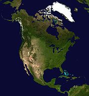
North America
North America is a continent wholly within the Northern Hemisphere and almost wholly within the Western Hemisphere. It is also considered a northern subcontinent of the Americas...
.
West Indies
- West Indies
- Lucayan ArchipelagoLucayan archipelagoThe Lucayan Archipelago, as defined by Julian Granberry, consists of the islands of the Commonwealth of the Bahamas and of the Turks and Caicos Islands...
- Bahama Islands
- AbacoAbaco IslandsThe Abaco Islands lie in the northern Bahamas and comprise the main islands of Great Abaco and Little Abaco, together with the smaller Wood Cay, Elbow Cay, Lubbers Quarters Cay, Green Turtle Cay, Great Guana Cay, Castaway Cay, Man-o-War Cay, Stranger's Cay, Umbrella Cay, Walker's Cay, Little Grand...
- AcklinsAcklinsAcklins is an island and district of the Bahamas.It is one of a group of islands arranged along a large, shallow lagoon called the Bight of Acklins, of which the largest are Crooked Island in the north and Acklins in the southeast, and the smaller are Long Cay [ 8sq mi] in the northwest, and...
- Andros Island, largest island of the Bahamas
- Berry IslandsBerry IslandsThe Berry Islands are a chain of islands and a district of the Bahamas, covering about thirty square miles of the north western part of the Out Islands...
- BiminiBiminiBimini is the westernmost district of the Bahamas composed of a chain of islands located about 53 miles due east of Miami, Florida. Bimini is the closest point in the Bahamas to the mainland United States and approximately 137 miles west-northwest of Nassau...
- Cat IslandCat Island (Bahamas)Cat Island is in the central Bahamas, and one of its districts, and has the nation's highest point. Its Mount Alvernia rises to 206 ft and is topped by a monastery called The Hermitage. This assembly of buildings was erected by the Franciscan "Brother Jerome" .The first European settlers were...
- Conception Island
- Crooked IslandCrooked Island (Bahamas)Crooked Island is an island and district, part of a group of Bahamian islands defining a large, shallow lagoon called the Bight of Acklins, of which the largest are Crooked Island in the north and Acklins in the south-east, and the smaller are Long Cay in the north-west, and Castle Island in the...
- Dolly's CayDolly's CayDolly's Cay is a remote rock on the Great Bahama Bank in the series of cays running southeast from Andros Island, and is around 20 km east south east of the southeast tip of Andros. It is part of South Andros District....
- Egg Island
- Elbow CayElbow CayElbow Cay is a six-mile long cay in the Abaco Islands of the Bahamas. Originally populated by British loyalists fleeing the newly independent United States of America in 1785, it has survived on fishing, boat building, and salvage...
- EleutheraEleutheraEleuthera is an island in The Bahamas, lying 50 miles east of Nassau. It is very long and thin—110 miles long and in places little more than a mile wide. According to the 2000 Census, the population of Eleuthera is approximately 8,000...
- Ellis IslandEllis IslandEllis Island in New York Harbor was the gateway for millions of immigrants to the United States. It was the nation's busiest immigrant inspection station from 1892 until 1954. The island was greatly expanded with landfill between 1892 and 1934. Before that, the much smaller original island was the...
- ExumaExumaExuma is a district of the Bahamas, consisting of over 360 islands . The largest of the cays is Great Exuma, which is 37 mi in length and joined to another island, Little Exuma by a small bridge. The capital and largest city in the district is George Town , founded 1793 and located on Great...
- Long CayLong CayLong Cay is an island in the Bahamas in an atoll that includes Acklins Island and Crooked Island. It is 8 square miles and is in the Acklins and Crooked Islands District...
- Grand BahamaGrand BahamaGrand Bahama is one of the northernmost of the islands of the Bahamas, and the closest major island to the United States, lying off the state of Florida. Grand Bahama is the fifth largest island in the Bahamas island chain of approximately 700 islands and 2,400 cays...
- Great Guana CayGreat Guana CayGreat Guana Cay is an islet located in The Bahamas. It is a long but narrow islet which is 9 miles in length. It is located in the centre of the Abaco Islands...
- Great Harbour Cay
- Great Isaac Cay
- Green Turtle CayGreen Turtle CayGreen Turtle Cay is an island in The Bahamas. It is located in the "Abaco Out Islands" and is long and 1/2 mile wide. It was named after the abundance of green turtles that inhabited the area. The population of the island is about 450 and its main settlement is New Plymouth which was founded in...
- Harbour Island
- InaguaInaguaInagua is the southernmost district of the Bahamas comprising the islands of Great Inagua and Little Inagua.Great Inagua is the third largest island in The Bahamas at 596 sq mi and lies about 55 miles from the eastern tip of Cuba. The island is about 55 x 19 miles in extent, the highest point...
- Little Stirrup CayLittle Stirrup CayLittle Stirrup Cay, Bahamas, is one of the Berry Islands, a collection of cays and small islands and is located approximately 55 miles north of Nassau. The island is less than a mile wide from east to west and less than a 200 yards from north to south...
- Long IslandLong IslandLong Island is an island located in the southeast part of the U.S. state of New York, just east of Manhattan. Stretching northeast into the Atlantic Ocean, Long Island contains four counties, two of which are boroughs of New York City , and two of which are mainly suburban...
- Man-O-War CayMan-O-War CayMan-O-War Cay is a small island in the Abaco region of the Bahamas.It has a population of about 300 Bahamian residents and about 135 foreign resident families. During the summer some local houses are rented by vacationing families that have a reputation as good house guests...
- MayaguanaMayaguanaMayaguana is the most easterly island and district of the Bahamas. It is one of only a few Bahamian islands which retain their Lucayan names. The population of Mayaguana in the 2000 census was 259, amounting to an estimate 312 in 2010...
- Moore's IslandMoore's IslandMoore's Island is one of the districts of the Bahamas, on the Abaco Islands.Moore's Island is one of the little cays off the main land of Abaco. It is approximately long and wide and approximately from Abaco...
- Musha CayMusha CayMusha Cay is a 150 acre , privately owned island in the Exuma Chain, in the southern Bahamas. It is located 85 miles southeast of Nassau. It is owned by illusionist David Copperfield....
- New ProvidenceNew ProvidenceNew Providence is the most populous island in the Bahamas, containing more than 70% of the total population. It also houses the national capital city, Nassau.The island was originally under Spanish control following Christopher Columbus' discovery of the New World, but the Spanish government showed...
- Norman's CayNorman's CayNorman's Cay is a small Bahamian island in the Exumas, a chain of islands south and east of Nassau, that served as the headquarters for Carlos Lehder's drug-smuggling operation from 1978 to around 1982.-Drug smuggling history:...
- Paradise IslandParadise IslandParadise Island is an island in the Bahamas formerly known as Hog Island. The island is located just off the shore of the city of Nassau, which is itself located on the northern edge of the island of New Providence. It is best known for the sprawling 'Vegas-by-the-sea resort' Atlantis.Paradise...
- Plana CaysPlana CaysThe Plana Cays are a group of two small islands in the southern Bahama Islands located east of Acklins Island and west of Mayaguana Island. The islands are today uninhabited....
- Ragged Island
- Rum CayRum CayRum Cay is an island and district of the Bahamas. Lat.: N23 42' 30" - Long.: W 74 50' 00" - Size: 30 Sq. mlsRum Cay is 20 miles southwest of San Salvador Island, has many rolling hills that rises to about 120 feet . Christopher Columbus called it Santa Maria de la Concepción. The island is...
- Samana CaySamana CaySamana Cay is the largest now uninhabited island in the Bahamas, believed by some researchers to have been the location of Columbus's first landfall in the Americas, on October 12, 1492....
- San Salvador IslandSan Salvador IslandSan Salvador Island, also known as Watlings Island, is an island and district of the Bahamas. Until 1986, when the National Geographic Society suggested Samana Cay, it was widely believed that during his first expedition to the New World, San Salvador Island was the first land sighted and visited...
- Abaco
- Turks Islands
- Caicos Islands
- Middle CaicosMiddle CaicosMiddle Caicos, also Grand Caicos, is the largest island in the Turks and Caicos Islands. To the west, it is separated from North Caicos by Juniper Hole, and to the east, from East Caicos by Lorimer Creek, both narrow passages that can accommodate only small boats.Middle Caicos has an area of 144.2...
, largest island of the Turks and Caicos Islands
- Middle Caicos
- Bahama Islands
- AntillesAntillesThe Antilles islands form the greater part of the West Indies in the Caribbean Sea. The Antilles are divided into two major groups: the "Greater Antilles" to the north and west, including the larger islands of Cuba, Jamaica, Hispaniola , and Puerto Rico; and the smaller "Lesser Antilles" on the...
- Greater AntillesGreater AntillesThe Greater Antilles are one of three island groups in the Caribbean. Comprising Cuba, Jamaica, Hispaniola , and Puerto Rico, the Greater Antilles constitute almost 90% of the land mass of the entire West Indies.-Greater Antilles in context :The islands of the Caribbean Sea, collectively known as...
- CubaCubaThe Republic of Cuba is an island nation in the Caribbean. The nation of Cuba consists of the main island of Cuba, the Isla de la Juventud, and several archipelagos. Havana is the largest city in Cuba and the country's capital. Santiago de Cuba is the second largest city...
, world's 17th largest and 15th most populous island - HispaniolaHispaniolaHispaniola is a major island in the Caribbean, containing the two sovereign states of the Dominican Republic and Haiti. The island is located between the islands of Cuba to the west and Puerto Rico to the east, within the hurricane belt...
, world's 22nd largest, 16th tallest, and 10th most populous island - JamaicaJamaicaJamaica is an island nation of the Greater Antilles, in length, up to in width and 10,990 square kilometres in area. It is situated in the Caribbean Sea, about south of Cuba, and west of Hispaniola, the island harbouring the nation-states Haiti and the Dominican Republic...
, world's 71st largest and 31st most populous island - Puerto RicoPuerto RicoPuerto Rico , officially the Commonwealth of Puerto Rico , is an unincorporated territory of the United States, located in the northeastern Caribbean, east of the Dominican Republic and west of both the United States Virgin Islands and the British Virgin Islands.Puerto Rico comprises an...
, world's 82nd largest and 25th most populous island
- Cuba
- Lesser AntillesLesser AntillesThe Lesser Antilles are a long, partly volcanic island arc in the Western Hemisphere. Most of its islands form the eastern boundary of the Caribbean Sea with the Atlantic Ocean, with the remainder located in the southern Caribbean just north of South America...
(Caribbees)- Leeward IslandsLeeward IslandsThe Leeward Islands are a group of islands in the West Indies. They are the northern islands of the Lesser Antilles chain. As a group they start east of Puerto Rico and reach southward to Dominica. They are situated where the northeastern Caribbean Sea meets the western Atlantic Ocean...
- AnguillaAnguillaAnguilla is a British overseas territory and overseas territory of the European Union in the Caribbean. It is one of the most northerly of the Leeward Islands in the Lesser Antilles, lying east of Puerto Rico and the Virgin Islands and directly north of Saint Martin...
- AntiguaAntiguaAntigua , also known as Waladli, is an island in the West Indies, in the Leeward Islands in the Caribbean region, the main island of the country of Antigua and Barbuda. Antigua means "ancient" in Spanish and was named by Christopher Columbus after an icon in Seville Cathedral, Santa Maria de la...
- BarbudaBarbudaBarbuda is an island in the Eastern Caribbean, and forms part of the state of Antigua and Barbuda. It has a population of about 1,500, most of whom live in the town of Codrington.-Location:...
- DominicaDominicaDominica , officially the Commonwealth of Dominica, is an island nation in the Lesser Antilles region of the Caribbean Sea, south-southeast of Guadeloupe and northwest of Martinique. Its size is and the highest point in the country is Morne Diablotins, which has an elevation of . The Commonwealth...
- Guadeloupe Archipelago
- Basse-TerreBasse-TerreBasse-Terre is the prefecture of Guadeloupe, an overseas region and department of France located in the Lesser Antilles...
, largest island of Guadeloupe
- Basse-Terre
- La DésiradeLa DésiradeLa Désirade is a French West Indies island located at the eastern of Guadeloupe, in the Lesser Antilles.It has a land area of 20.64 km² and a population of 1,595 in 2006 , with a population density of 77 inh. per km² in 2006...
- Les Saintes
- Marie-GalanteMarie-GalanteMarie-Galante is an island of the Caribbean Sea located at the south of Guadeloupe and at north of Dominica. Marie-Galante is a dependence of Guadeloupe which is a french overseas department....
- MontserratMontserratMontserrat is a British overseas territory located in the Leeward Islands, part of the chain of islands called the Lesser Antilles in the West Indies. This island measures approximately long and wide, giving of coastline...
- NevisNevisNevis is an island in the Caribbean Sea, located near the northern end of the Lesser Antilles archipelago, about 350 km east-southeast of Puerto Rico and 80 km west of Antigua. The 93 km² island is part of the inner arc of the Leeward Islands chain of the West Indies...
- RedondaRedondaRedonda is a very small, uninhabited Caribbean island which is part of Antigua and Barbuda, in the Leeward Islands, West Indies.This small island lies southwest of Antigua, in the waters between the islands of Nevis and Montserrat...
- Saba
- Saint KittsSaint KittsSaint Kitts Saint Kitts Saint Kitts (also known more formally as Saint Christopher Island (Saint-Christophe in French) is an island in the West Indies. The west side of the island borders the Caribbean Sea, and the eastern coast faces the Atlantic Ocean...
(Saint Christopher Island), largest island of Saint Kitts and Nevis - Saint MartinSaint MartinSaint Martin is an island in the northeast Caribbean, approximately east of Puerto Rico. The 87 km2 island is divided roughly 60/40 between France and the Kingdom of the Netherlands ; however, the Dutch side has the larger population. It is one of the smallest sea islands divided between...
- Saint-Barthélemy (Saint Barts)
- Sint Eustatius
- Virgin IslandsVirgin IslandsThe Virgin Islands are the western island group of the Leeward Islands, which are the northern part of the Lesser Antilles, which form the border between the Caribbean Sea and the Atlantic Ocean...
- AnegadaAnegadaAnegada is the northernmost of the British Virgin Islands, a group of islands which form part of the archipelago of the Virgin Islands. It lies approximately north of Virgin Gorda. Anegada is the only inhabited British Virgin Island formed from coral and limestone, rather than being of volcanic...
- Jost Van DykeJost Van DykeAt roughly 8 square kilometers, and about 3 square miles Jost Van Dyke is the smallest of the four main islands of the British Virgin Islands, the northern portion of the archipelago of the Virgin Islands, located in the Atlantic Ocean and Caribbean Sea. Jost Van Dyke lies about 8 km to the...
- Saint Croix, largest island of the United States Virgin Islands
- Saint JohnSaint John, U.S. Virgin IslandsSaint John is an island in the Caribbean Sea and a constituent district of the United States Virgin Islands , an unincorporated territory of the United States. St...
- Saint ThomasSaint Thomas, U.S. Virgin IslandsSaint Thomas is an island in the Caribbean Sea and with the islands of Saint John, Saint Croix, and Water Island a county and constituent district of the United States Virgin Islands , an unincorporated territory of the United States. Located on the island is the territorial capital and port of...
- TortolaTortolaTortola is the largest and most populated of the British Virgin Islands, a group of islands that form part of the archipelago of the Virgin Islands. Local tradition recounts that Christopher Columbus named it Tortola, meaning "land of the Turtle Dove". Columbus named the island Santa Ana...
, largest island of the British Virgin Islands - Virgin GordaVirgin GordaVirgin Gorda is the third-largest and second most populous of the British Virgin Islands . Located at approximately 18 degrees, 48 minutes North, and 64 degrees, 30 minutes West, it covers an area of about...
- Anegada
- Anguilla
- Windward IslandsWindward IslandsThe Windward Islands are the southern islands of the Lesser Antilles, within the West Indies.-Name and geography:The Windward Islands are called such because they were more windward to sailing ships arriving in the New World than the Leeward Islands, given that the prevailing trade winds in the...
- MartiniqueMartiniqueMartinique is an island in the eastern Caribbean Sea, with a land area of . Like Guadeloupe, it is an overseas region of France, consisting of a single overseas department. To the northwest lies Dominica, to the south St Lucia, and to the southeast Barbados...
- Saint LuciaSaint LuciaSaint Lucia is an island country in the eastern Caribbean Sea on the boundary with the Atlantic Ocean. Part of the Lesser Antilles, it is located north/northeast of the island of Saint Vincent, northwest of Barbados and south of Martinique. It covers a land area of 620 km2 and has an...
- Saint VincentSaint Vincent (island)Saint Vincent is a volcanic island in the Caribbean. It is the largest island of the chain called Saint Vincent and the Grenadines. It is located in the Caribbean Sea, between Saint Lucia and Grenada. It is composed of partially submerged volcanic mountains...
, largest island of Saint Vincent and the Grenadines - GrenadinesGrenadinesThe Grenadines is a Caribbean island chain of over 600 islands in the Windward Islands.-Geographic boundaries:They are divided between the island nations of Saint Vincent and the Grenadines and Grenada. They lie between the islands of Saint Vincent in the north and Grenada in the south. Neither...
- GrenadaGrenadaGrenada is an island country and Commonwealth Realm consisting of the island of Grenada and six smaller islands at the southern end of the Grenadines in the southeastern Caribbean Sea...
- Martinique
- BarbadosBarbadosBarbados is an island country in the Lesser Antilles. It is in length and as much as in width, amounting to . It is situated in the western area of the North Atlantic and 100 kilometres east of the Windward Islands and the Caribbean Sea; therein, it is about east of the islands of Saint...
- TobagoTobagoTobago is the smaller of the two main islands that make up the Republic of Trinidad and Tobago. It is located in the southern Caribbean, northeast of the island of Trinidad and southeast of Grenada. The island lies outside the hurricane belt...
- TrinidadTrinidadTrinidad is the larger and more populous of the two major islands and numerous landforms which make up the island nation of Trinidad and Tobago. It is the southernmost island in the Caribbean and lies just off the northeastern coast of Venezuela. With an area of it is also the fifth largest in...
, largest island of Trinidad and Tobago and world's 116th largest island - Leeward AntillesLeeward AntillesThe Leeward Antilles are a chain of islands in the Caribbean – specifically, the southerly islands of the Lesser Antilles along the southeastern fringe of the Caribbean Sea, just north of the Venezuelan coast of the South American mainland...
- ArubaArubaAruba is a 33 km-long island of the Lesser Antilles in the southern Caribbean Sea, located 27 km north of the coast of Venezuela and 130 km east of Guajira Peninsula...
- Bonaire
- CuraçaoCuraçaoCuraçao is an island in the southern Caribbean Sea, off the Venezuelan coast. The Country of Curaçao , which includes the main island plus the small, uninhabited island of Klein Curaçao , is a constituent country of the Kingdom of the Netherlands...
, largest island of the Netherlands Antilles - Isla de Coche
- Isla de Cubagua
- Isla La Tortuga
- Isla MargaritaIsla MargaritaMargarita Island is the largest island of the state of Nueva Esparta in Venezuela, situated in the Caribbean Sea, off the northeastern coast of the country. The state also contains two other smaller islands: Coche and Cubagua. The capital city of Nueva Esparta is La Asunción, located in a river...
, largest island of Venezuela - Venezuelan ArchipelagoFederal dependencies of VenezuelaThe Federal Dependencies of Venezuela encompass all of Venezuela's off shore islands in the Caribbean Sea and the Gulf of Venezuela...
- Aruba
- Leeward Islands
- Greater Antilles
- Lucayan Archipelago
- Islands of the Western Caribbean SeaCaribbean SeaThe Caribbean Sea is a sea of the Atlantic Ocean located in the tropics of the Western hemisphere. It is bounded by Mexico and Central America to the west and southwest, to the north by the Greater Antilles, and to the east by the Lesser Antilles....
- Cayman IslandsCayman IslandsThe Cayman Islands is a British Overseas Territory and overseas territory of the European Union located in the western Caribbean Sea. The territory comprises the three islands of Grand Cayman, Cayman Brac, and Little Cayman, located south of Cuba and northwest of Jamaica...
- Grand CaymanGrand CaymanGrand Cayman is the largest of the three Cayman Islands and the location of the nation's capital, George Town. In relation to the other two Cayman Islands, it is approximately 75 miles southwest of Little Cayman and 90 miles southwest of Cayman Brac.-Geography:Grand Cayman encompasses 76% of...
, largest island of the Cayman Islands
- Grand Cayman
- Islas de la Bahia
- RoatánRoatánRoatán, located between the islands of Útila and Guanaja, is the largest of Honduras' Bay Islands. The island was formerly known as Ruatan and Rattan...
, largest island of Honduras
- Roatán
- Saint George's Caye
- Caye CaulkerCaye CaulkerCaye Caulker is a small limestone coral island off the coast of Belize in the Caribbean Sea measuring about by less than . The town on the island is known by the name Caye Caulker Village...
- Ambergris CayeAmbergris CayeAmbergris Caye, pronounced "am-BER-gris", is the largest island of Belize located northeast of the country in the Caribbean Sea. Though administered as part of the Belize District, the closest point on the mainland is part of the Corozal District....
, largest island of Belize - CozumelCozumelCozumel is an island in the Caribbean Sea off the eastern coast of Mexico's Yucatan Peninsula, opposite Playa del Carmen, and close to the Yucatan Channel. Cozumel is one of the ten municipalities of the state of Quintana Roo...
- Isla MujeresIsla MujeresIsla Mujeres is one of the ten municipalities of the Mexican state of Quintana Roo. The municipality, located in the northeastern corner of the state is mostly on the mainland and has a municipal seat of the same name; Isla Mujeres...
- Isla ContoyIsla ContoyIsla Contoy is a small island in the Mexican state of Quintana Roo, approximately 30 kilometers north of Isla Mujeres. The island is only 8.5 km in length and has an area of 3.17 square kilometres....
- Cayman Islands
- Islands of the Gulf of MexicoGulf of MexicoThe Gulf of Mexico is a partially landlocked ocean basin largely surrounded by the North American continent and the island of Cuba. It is bounded on the northeast, north and northwest by the Gulf Coast of the United States, on the southwest and south by Mexico, and on the southeast by Cuba. In...
- Isla del Carmen
- Padre IslandPadre IslandPadre Island is part of the U.S. state of Texas. The island is located on Texas' southern coast of the Gulf of Mexico and is famous for its white sandy beaches at the south end...
, world's longest barrier islandBarrier islandBarrier islands, a coastal landform and a type of barrier system, are relatively narrow strips of sand that parallel the mainland coast. They usually occur in chains, consisting of anything from a few islands to more than a dozen... - Matagorda IslandMatagorda IslandMatagorda Island, Spanish for "thick brush," is a 38 mile long barrier island on the Texas Gulf coast, about seven miles south of Port O'Connor, in the southernmost part of Calhoun County. The island is oriented generally northeast-southwest, with the Gulf of Mexico on the east and south, and...
- Galveston IslandGalveston IslandGalveston Island is a barrier island on the Texas Gulf coast in the United States, about 50 miles southeast of Houston. The entire island, with the exception of Jamaica Beach, is within the city limits of the City of Galveston....
- Marsh IslandMarsh Island (Louisiana)Marsh Island is an island off the coast of southern Louisiana in the United States.Marsh Island is an uninhabited low-lying marshy island in Iberia Parish, south coastal Louisiana, lying between Vermilion Bay and the Gulf of Mexico...
- Point au Fer Island
- Saint James Island
North Atlantic Ocean
- Islands of the Western North Atlantic Ocean
- Bermuda Islands
- BermudaBermudaBermuda is a British overseas territory in the North Atlantic Ocean. Located off the east coast of the United States, its nearest landmass is Cape Hatteras, North Carolina, about to the west-northwest. It is about south of Halifax, Nova Scotia, Canada, and northeast of Miami, Florida...
- Bermuda
- Atlantic Costal Islands
- Florida KeysFlorida KeysThe Florida Keys are a coral archipelago in southeast United States. They begin at the southeastern tip of the Florida peninsula, about south of Miami, and extend in a gentle arc south-southwest and then westward to Key West, the westernmost of the inhabited islands, and on to the uninhabited Dry...
- Key WestKey WestKey West is an island in the Straits of Florida on the North American continent at the southernmost tip of the Florida Keys. Key West is home to the southernmost point in the Continental United States; the island is about from Cuba....
- Key LargoKey LargoKey Largo is an island in the upper Florida Keys archipelago and, at long, the largest of the Keys. It is also the northernmost of the Florida Keys in Monroe County, and the northernmost of the Keys connected by U.S. Highway 1...
- Key West
- Merritt Island
- Sea IslandsSea IslandsThe Sea Islands are a chain of tidal and barrier islands on the Atlantic Ocean coast of the United States. They number over 100, and are located between the mouths of the Santee and St. Johns Rivers along the coast of the U.S...
- Hilton Head Island
- Port Royal IslandPort Royal, South CarolinaPort Royal is a town in Beaufort County, South Carolina, United States. Largely because of annexation of surrounding areas , the population of Port Royal rose from 3,950 in 2000 to 10,678 in 2010, a 170% increase. As defined by the U.S...
- Johns IslandJohns Island, South CarolinaJohns Island, also spelled John's Island, is the largest island in the U.S. State of South Carolina. It is one of the many Sea Islands along the coast of South Carolina.-Background:...
- Saint Helena Island
- Edisto Island
- Outer BanksOuter BanksThe Outer Banks is a 200-mile long string of narrow barrier islands off the coast of North Carolina, beginning in the southeastern corner of Virginia Beach on the east coast of the United States....
- Staten IslandStaten IslandStaten Island is a borough of New York City, New York, United States, located in the southwest part of the city. Staten Island is separated from New Jersey by the Arthur Kill and the Kill Van Kull, and from the rest of New York by New York Bay...
- Manhattan Island, most densely populated island of the Americas
- Long IslandLong IslandLong Island is an island located in the southeast part of the U.S. state of New York, just east of Manhattan. Stretching northeast into the Atlantic Ocean, Long Island contains four counties, two of which are boroughs of New York City , and two of which are mainly suburban...
, largest Atlantic island of the United States, most populous island of the United States, and the world's 17th most populous island- New York Barrier Islands
- Block IslandBlock IslandBlock Island is part of the U.S. state of Rhode Island and is located in the Atlantic Ocean approximately south of the coast of Rhode Island, east of Montauk Point on Long Island, and is separated from the Rhode Island mainland by Block Island Sound. The United States Census Bureau defines Block...
- Conanicut IslandConanicut IslandConanicut Island is the second largest island in Narragansett Bay, in the state of Rhode Island. It is connected on the east to Newport, Rhode Island, on Aquidneck Island by the Claiborne Pell Bridge, commonly known as the Newport Bridge, and on the west to North Kingstown, Rhode Island, on the...
- Aquidneck IslandAquidneck IslandAquidneck Island, located in the state of Rhode Island, is the largest island in Narragansett Bay. The island's official name is Rhode Island, and the common use of name "Aquidneck Island" helps distinguish the island from the state. The total land area is 97.9 km²...
(Rhode IslandAquidneck IslandAquidneck Island, located in the state of Rhode Island, is the largest island in Narragansett Bay. The island's official name is Rhode Island, and the common use of name "Aquidneck Island" helps distinguish the island from the state. The total land area is 97.9 km²...
) - Elizabeth IslandsElizabeth IslandsThe Elizabeth Islands are a chain of small islands extending southwest from the southern coast of Cape Cod, Massachusetts in the United States. They are located at the outer edge of Buzzards Bay, north of Martha's Vineyard from which they are separated by Vineyard Sound, and constitute the town of...
- Marthas Vineyard
- Nantucket Island
- Monomoy IslandMonomoy IslandMonomoy Island is an 8 mile long spit of sand extending southwest from Chatham, Cape Cod off the Massachusetts mainland.- History :It was taken over by the US government just before World War II...
- Florida Keys
- Bermuda Islands
the thousand islands
-
-
- Mount Desert IslandMount Desert IslandMount Desert Island , in Hancock County, Maine, is the largest island off the coast of Maine. With an area of it is the 6th largest island in the contiguous United States. Though it is often claimed to be the third largest island on the eastern seaboard of the United States, it is actually second...
, largest island of Maine - Cape Breton IslandCape Breton IslandCape Breton Island is an island on the Atlantic coast of North America. It likely corresponds to the word Breton, the French demonym for Brittany....
, world's 77th largest island - Prince Edward IslandPrince Edward IslandPrince Edward Island is a Canadian province consisting of an island of the same name, as well as other islands. The maritime province is the smallest in the nation in both land area and population...
, world's 104th largest island - Anticosti IslandAnticosti IslandAnticosti Island is an island at the outlet of the Saint Lawrence River into the Gulf of Saint Lawrence, in Quebec, Canada, between 49° and 50° N., and between 61° 40' and 64° 30' W. At in size, it is the 90th largest island in the world and 20th largest island in Canada...
, world's 90th largest island
- Mount Desert Island
- Newfoundland, largest Atlantic island of Canada and the world's 16th largest island
- Ile de Saint-PierreSaint Pierre IslandSaint Pierre Island is one of the three main islands of Saint Pierre and Miquelon. It contains the town of Saint-Pierre, which lies on the island's east coast and is the main population centre of the island group....
- Ile de MiquelonMiquelon IslandMiquelon Island is one of the three main islands of Saint Pierre and Miquelon. It is connected to the similarly-sized Langlade Island by a thin tombolo sandspit known as La Dune, which in turn forms a part of the boundary of the Grand Barachois.Miquelon and Langlade form the commune of...
, largest island of Saint Pierre and Miquelon
- Ile de Saint-Pierre
-
Greenland
- GreenlandGreenlandGreenland is an autonomous country within the Kingdom of Denmark, located between the Arctic and Atlantic Oceans, east of the Canadian Arctic Archipelago. Though physiographically a part of the continent of North America, Greenland has been politically and culturally associated with Europe for...
, world's largest and 11th tallest island- Qeqertarsuaq (Disko Island), world's 85th largest island
- Milne LandMilne LandMilne Land is a large island in eastern Greenland. It is the third largest island of Greenland, after the main island of Greenland and Disko Island. It is named after British admiral David Milne. It is 113 km long from Moræne Pynt in the southwest to Bregnepynt in the northeast, and up to 45 km...
- Traill IslandTraill IslandTraill Island is a large island in eastern Greenland. It is named after zoologist Thomas Stewart Traill. The highest point of the island is 1884 m. Traill Island is a part of the Northeast Greenland National Park....
- Ymer IslandYmer IslandYmer Island is an island in northeastern Greenland. Its area is 2,437 km². It is mountainous . The island is a part of Northeast Greenland National Park, the largest national park in the world. It is named for the giant Ymir, the forefather of the Jotuns....
- Geographical Society IslandGeographical Society IslandGeographical Society Island is an island in northeastern Greenland with area 1,717 km². To the north lies Ymer Island, and to the south lies Traill Ø...
- Clavering IslandClavering IslandClavering Island is a large island in eastern Greenland, to the west of Wollaston Foreland. It was named by the second German North Polar Expedition 1869–70 as Clavering Insel to commemorate Douglas Charles Clavering , commander of the Griper on the 1823 voyage, which explored the area and, at the...
- Nares LandNares LandNares Land is an island in northern Greenland. Its area is 1466 km²....
- Shannon IslandShannon IslandShannon is a large island in the Sermersooq municipality, in eastern Greenland, to the east of Hochstetter Foreland, with an area of . It was named by Douglas Charles Clavering on his 1823 expedition for the Royal Navy frigate HMS Shannon, a 38 gun frigate on which he served as midshipman under Sir...
- The following islands are usually associated with EuropeEuropeEurope is, by convention, one of the world's seven continents. Comprising the westernmost peninsula of Eurasia, Europe is generally 'divided' from Asia to its east by the watershed divides of the Ural and Caucasus Mountains, the Ural River, the Caspian and Black Seas, and the waterways connecting...
rather than North AmericaNorth AmericaNorth America is a continent wholly within the Northern Hemisphere and almost wholly within the Western Hemisphere. It is also considered a northern subcontinent of the Americas...
, despite lying closer to GreenlandGreenlandGreenland is an autonomous country within the Kingdom of Denmark, located between the Arctic and Atlantic Oceans, east of the Canadian Arctic Archipelago. Though physiographically a part of the continent of North America, Greenland has been politically and culturally associated with Europe for...
that to ScandinaviaScandinaviaScandinavia is a cultural, historical and ethno-linguistic region in northern Europe that includes the three kingdoms of Denmark, Norway and Sweden, characterized by their common ethno-cultural heritage and language. Modern Norway and Sweden proper are situated on the Scandinavian Peninsula,...
:- IcelandIcelandIceland , described as the Republic of Iceland, is a Nordic and European island country in the North Atlantic Ocean, on the Mid-Atlantic Ridge. Iceland also refers to the main island of the country, which contains almost all the population and almost all the land area. The country has a population...
, world's 18th largest island - Jan MayenJan MayenJan Mayen Island is a volcanic island in the Arctic Ocean and part of the Kingdom of Norway. It is long and 373 km2 in area, partly covered by glaciers . It has two parts: larger northeast Nord-Jan and smaller Sør-Jan, linked by an isthmus wide...
- Svalbard Archipelago
- SpitsbergenSpitsbergenSpitsbergen is the largest and only permanently populated island of the Svalbard archipelago in Norway. Constituting the western-most bulk of the archipelago, it borders the Arctic Ocean, the Norwegian Sea and the Greenland Sea...
, world's 35th largest island - NordaustlandetNordaustlandetNordaustlandet is the second-largest island in the archipelago of Svalbard, Norway, with an area of . It lies north east of Spitsbergen, separated by Hinlopenstretet. Much of Nordaustlandet lies under large ice caps, mainly Austfonna and Vestfonna, the remaining parts of the north being tundra...
, world's 58th largest island - Edgeoya
- Barentsoya
- Spitsbergen
- Iceland
Arctic Ocean
- Islands of the Western Arctic OceanArctic OceanThe Arctic Ocean, located in the Northern Hemisphere and mostly in the Arctic north polar region, is the smallest and shallowest of the world's five major oceanic divisions...
:- Canadian Arctic ArchipelagoCanadian Arctic ArchipelagoThe Canadian Arctic Archipelago, also known as the Arctic Archipelago, is a Canadian archipelago north of the Canadian mainland in the Arctic...
- Baffin IslandBaffin IslandBaffin Island in the Canadian territory of Nunavut is the largest island in the Canadian Arctic Archipelago, the largest island in Canada and the fifth largest island in the world. Its area is and its population is about 11,000...
, largest island of Canada and the world's 5th largest island - Victoria Island, world's 8th largest island
- Banks IslandBanks IslandOne of the larger members of the Canadian Arctic Archipelago, Banks Island is situated in the Inuvik Region of the Northwest Territories, Canada. It is separated from Victoria Island to its east by the Prince of Wales Strait and from the mainland by Amundsen Gulf to its south. The Beaufort Sea lies...
, world's 24th largest island - Southampton IslandSouthampton IslandSouthampton Island is a large island at the entrance to Hudson Bay at Foxe Basin. One of the larger members of the Canadian Arctic Archipelago, Southampton Island is part of the Kivalliq Region in Nunavut, Canada. The area of the island is stated as by Statistics Canada . It is the 34th largest...
, world's 34th largest island - Prince of Wales Island, world's 40th largest island
- Somerset Island, world's 46th largest island
- King William IslandKing William IslandKing William Island is an island in the Kitikmeot Region of Nunavut and forms part of the Canadian Arctic Archipelago. In area it is between and making it the 61st largest island in the world and Canada's 15th largest island...
, world's 61st largest island - Bylot IslandBylot IslandBylot Island lies off the northern end of Baffin Island in Nunavut Territory, Canada. At it is ranked 71st largest island in the world and Canada's 17th largest island. It is also one of the largest uninhabited islands in the world. While there are no permanent settlements on this Canadian Arctic...
, world's 72nd largest island - Prince Charles IslandPrince Charles IslandPrince Charles Island is a large, low-lying island with an area of , making it the world's 78th largest island and the 19th largest island in Canada. It is located in Foxe Basin, off the west coast of Baffin Island, in the Qikiqtaaluk Region of Nunavut, Canada. Despite the island's size, it wasn't...
, world's 78th largest island - Queen Elizabeth IslandsQueen Elizabeth IslandsThe Queen Elizabeth Islands are the northernmost cluster of islands in the Canadian Arctic Archipelago, split between Nunavut and Northwest Territories in Northern Canada.-Geography:...
- Ellesmere IslandEllesmere IslandEllesmere Island is part of the Qikiqtaaluk Region of the Canadian territory of Nunavut. Lying within the Canadian Arctic Archipelago, it is considered part of the Queen Elizabeth Islands, with Cape Columbia being the most northerly point of land in Canada...
, world's 10th largest and 37th tallest island - Devon IslandDevon IslandDevon Island , claimed to be the largest uninhabited island on Earth, is located in Baffin Bay, Qikiqtaaluk Region, Nunavut, Canada. It is one of the larger members of the Canadian Arctic Archipelago, the second-largest of the Queen Elizabeth Islands, Canada's sixth largest island, and the 27th...
, world's largest uninhabited landmass and 27th largest island - Melville Island, world's 33rd largest island
- Bathurst IslandBathurst IslandA member of the Canadian Arctic Archipelago, Bathurst Island is one of the Queen Elizabeth Islands in Nunavut Territory, Canada. The area of the island is estimated at , making it the 54th largest island in the world and Canada's 13th largest island. It is uninhabited.The island is low-lying with...
, world's 54th largest island - Prince Patrick IslandPrince Patrick IslandA member of the Canadian Arctic Archipelago, Prince Patrick Island is the westernmost of the Queen Elizabeth Islands in the Northwest Territories of Canada. The area of the island is , making it the 55th largest island in the world and Canada's 14th largest island...
, world's 55th largest island - Cornwallis Island, world's 96th largest island
- Mackenzie King IslandMackenzie King IslandMackenzie King Island is one of the Queen Elizabeth Islands in northern Canada. It lies north of Melville Island and south of Borden Island, and like them is divided. Most of the island is in Northwest Territories, while its easternmost portion lies in Nunavut...
, world's 115th largest island
- Ellesmere Island
- Sverdrup IslandsSverdrup IslandsThe Sverdrup Islands is an archipelago of the northern Queen Elizabeth Islands, in Nunavut, Canada. The islands are situated in the Arctic Ocean, west of Ellesmere Island from 77° to 81° North and 85° to 106° West.- History :...
- Axel Heiberg IslandAxel Heiberg IslandAxel Heiberg Island is an island in the Qikiqtaaluk Region, Nunavut, Canada. Located in the Arctic Ocean, it is the 31st largest island in the world and Canada's seventh largest island. According to Statistics Canada, it has an area of ....
, world's 32nd largest island - Ellef Ringnes IslandEllef Ringnes IslandEllef Ringnes Island is one of the Sverdrup Islands in Qikiqtaaluk Region, Nunavut, Canada. Also a member of the Queen Elizabeth Islands and Canadian Arctic Archipelago, it is located in the Arctic Ocean, east of Borden Island, and west of Amund Ringnes Island...
, world's 69th largest island - Amund Ringnes IslandAmund Ringnes IslandAmund Ringnes Island is one of the Sverdrup Islands in the Qikiqtaaluk Region, Nunavut, Canada. It is located in the Arctic Ocean, between 78 and 79 degrees of latitude. It lies east of Ellef Ringnes Island, west of Axel Heiberg Island. Hassel Sound separates Amund Ringnes Island from Ellef Ringnes...
, world's 111th largest island
- Axel Heiberg Island
- Baffin Island
- Islands of Hudson BayHudson BayHudson Bay , sometimes called Hudson's Bay, is a large body of saltwater in northeastern Canada. It drains a very large area, about , that includes parts of Ontario, Quebec, Saskatchewan, Alberta, most of Manitoba, southeastern Nunavut, as well as parts of North Dakota, South Dakota, Minnesota,...
- Coats IslandCoats IslandCoats Island lies at the northern end of Hudson Bay in the Kivalliq Region of Nunavut. At in size, it is the 107th largest island in the world, and Canada's 24th largest island....
, world's 107th largest island - Belcher IslandsBelcher IslandsThe Belcher Islands are an archipelago in Qikiqtaaluk Region, Nunavut, Canada. Located in Hudson Bay, the Belcher Islands are spread out over almost . The hamlet of Sanikiluaq is on the north coast of Flaherty Island and is the southernmost in Nunavut. Along with Flaherty Island, the other large...
- Islands of James BayJames BayJames Bay is a large body of water on the southern end of Hudson Bay in Canada. Both bodies of water extend from the Arctic Ocean. James Bay borders the provinces of Quebec and Ontario; islands within the bay are part of Nunavut...
- Coats Island
- Islands of the Alaskan Arctic Coast
- Canadian Arctic Archipelago
North Pacific Ocean
- Islands of the Eastern North Pacific Ocean:
- Islands of the Bering SeaBering SeaThe Bering Sea is a marginal sea of the Pacific Ocean. It comprises a deep water basin, which then rises through a narrow slope into the shallower water above the continental shelves....
- Pribilof IslandsPribilof IslandsThe Pribilof Islands are a group of four volcanic islands off the coast of mainland Alaska, in the Bering Sea, about north of Unalaska and 200 miles southwest of Cape Newenham. The Siberia coast is roughly northwest...
- Saint Lawrence Island, world's 113th largest island
- Diomede IslandsDiomede IslandsThe Diomede Islands , also known in Russia as Gvozdev Islands , consist of two rocky, tuya-like islands:* The U.S. island of Little Diomede or, in its native language, Ignaluk , and* The Russian island of Big Diomede , also known as Imaqliq,...
- King IslandKing Island, AlaskaKing Island is an island in the Bering Sea, west of Alaska. It is about west of Cape Douglas and is south of Wales, Alaska....
- Saint Matthew Island
- Karaginsky IslandKaraginsky IslandKaraginsky Island or Karaginskiy Island is an island in the Karaginsky Gulf of the Bering Sea. The 40 km wide strait between the Kamchatka Peninsula and this island is called Litke Strait....
- Pribilof Islands
- Aleutian Islands
- Fox IslandsFox Islands (Alaska)The Fox Islands are a group of islands in the eastern Aleutian Islands of the U.S. state of Alaska. The Fox Islands are the closest to mainland North America in the Aleutian chain, and just east of Samalga Pass and the Islands of Four Mountains group....
- Unimak IslandUnimak IslandUnimak Island is the largest island in the Aleutian Islands chain of the U.S. state of Alaska. It is the easternmost island in the Aleutians and, with an area of 1,571.41 mi² , the ninth largest island in the United States and the 134th largest island in the world. It is home to Mount...
, world's 28th tallest island
- Unimak Island
- Islands of Four MountainsIslands of Four MountainsIslands of Four Mountains is an island grouping of the Aleutian Islands in Alaska, United States. The chain includes, from west to east, Amukta, Chagulak, Yunaska, Herbert, Carlisle, Chuginadak, Uliaga, and Kagamil Islands. This island chain is located between Amukta Pass and the Andreanof Islands...
- Andreanof IslandsAndreanof IslandsThe Andreanof Islands are a group of islands in the Aleutian Islands in southwest Alaska. They are located between Amchitka Pass and the Rat Islands group to the west, and Amukta Pass and the Islands of Four Mountains group to the east, at about 52° North and 172°57' to 179°09' West. The islands...
- Rat IslandsRat IslandsThe Rat Islands are a volcanic group of islands in the Aleutian Islands in southwest Alaska, between Buldir Island and the Near Islands group to its west, and Amchitka Pass and the Andreanof Islands group to its east, at about ....
- Buldir Island
- Near IslandsNear IslandsThe Near Islands or Sasignan Islands are the smallest and westernmost group of the Aleutian Islands in southwestern Alaska.-Geography:The largest of the Near Islands are Attu and Agattu...
- Commander Islands
- Fox Islands
- Kodiak ArchipelagoKodiak ArchipelagoThe Kodiak Archipelago is an archipelago, or group of islands, south of main land mass of the state of Alaska , about by air south of Anchorage in the Gulf of Alaska. The largest island in the archipelago is Kodiak Island, the second largest island in the United States...
- Kodiak IslandKodiak IslandKodiak Island is a large island on the south coast of the U.S. state of Alaska, separated from the Alaska mainland by the Shelikof Strait. The largest island in the Kodiak Archipelago, Kodiak Island is the second largest island in the United States and the 80th largest island in the world, with an...
, largest island of Alaska and the world's 80th largest island
- Kodiak Island
- Islands of the Gulf of AlaskaGulf of AlaskaThe Gulf of Alaska is an arm of the Pacific Ocean defined by the curve of the southern coast of Alaska, stretching from the Alaska Peninsula and Kodiak Island in the west to the Alexander Archipelago in the east, where Glacier Bay and the Inside Passage are found.The entire shoreline of the Gulf is...
- Montague IslandMontague Island (Alaska)Montague Island is an island in the Gulf of Alaska lying at the entrance to Prince William Sound in the state of Alaska, USA. The island has a land area of 790.88 km² , making it the 26th largest island in the United States. As of the 2000 census, Montague did not have a permanent resident...
- Montague Island
- Alexander ArchipelagoAlexander ArchipelagoThe Alexander Archipelago is a long archipelago, or group of islands, of North America off the southeastern coast of Alaska. It contains about 1,100 islands, which are the tops of the submerged coastal mountains that rise steeply from the Pacific Ocean. Deep channels and fjords separate the...
- Chichagof IslandChichagof IslandChichagof Island, or Shee Kaax, is an island in the Alexander Archipelago of the Alaska Panhandle. At long and wide, it has a land area of , making it the fifth largest island in the United States and the 109th largest island in the world. It's coastline measures 742 miles. There was a 2000...
, world's 109th largest island - Admiralty IslandAdmiralty IslandAdmiralty Island is an island in the Alexander Archipelago in Southeast Alaska, at . It is 145 km long and 56 km wide with an area of 4,264.1 km² , making it the seventh largest island in the United States and the 132nd largest island in the world. It is one of the...
- Baranof IslandBaranof IslandBaranof Island, also sometimes called Baranov Island, Shee or Sitka Island, is an island in the northern Alexander Archipelago in the Alaska Panhandle, in Alaska. The name Baranof was given in 1805 by Imperial Russian Navy captain U. F. Lisianski to honor Alexander Andreyevich Baranov...
- Wrangell IslandWrangell IslandWrangell Island is in the Alexander Archipelago in the Alaska Panhandle of southeastern Alaska. It is long and 8–23 km wide. It has a land area of , making it the 29th largest island in the United States...
- Revillagigedo IslandRevillagigedo IslandRevillagigedo Island is an island in the Alexander Archipelago in Ketchikan Gateway Borough of the southeastern region of the U.S. state of Alaska. Running about 89 km north-south and 48 km east-west, it is 2,754.835 km² in area, making it the 12th largest island in the United...
- Kupreanof IslandKupreanof IslandKupreanof Island is an island in the Alexander Archipelago in southeastern Alaska. The island is long and wide with a total land area is , making it the 13th largest island in the United States and the 170th largest island in the world. The Lindenberg Peninsula, on the southeast side of the...
- Dall IslandDall IslandDall Island is an island in the Alexander Archipelago off the southeast coast of Alaska, just west of Prince of Wales Island and north of Canadian waters. Its peak elevation is 2,443 feet above sea level. Its land area is 254.02 square miles , making it the 28th largest island in the United States...
- Prince of Wales Island, world's 97th largest island
- Chichagof Island
- Queen Charlotte IslandsQueen Charlotte IslandsHaida Gwaii , formerly the Queen Charlotte Islands, is an archipelago on the North Coast of British Columbia, Canada. Haida Gwaii consists of two main islands: Graham Island in the north, and Moresby Island in the south, along with approximately 150 smaller islands with a total landmass of...
- Graham IslandGraham IslandGraham Island is the largest island in the Haida Gwaii archipelago , lying off the coast of British Columbia, Canada. It is separated only by a narrow channel from the other principal island of the group, Moresby Island Graham Island is the largest island in the Haida Gwaii archipelago (formerly...
, world's 101st largest island - Moresby IslandMoresby IslandMoresby Island is a large island that forms part of the Haida Gwaii archipelago in British Columbia, Canada, located at . Gwaii Haanas National Park Reserve and Haida Heritage Site includes Moresby and other islands...
- Graham Island
- Vancouver IslandVancouver IslandVancouver Island is a large island in British Columbia, Canada. It is one of several North American locations named after George Vancouver, the British Royal Navy officer who explored the Pacific Northwest coast of North America between 1791 and 1794...
, largest Pacific island of Canada and the world's 43rd largest island - San Juan Archipelago
- Gulf IslandsGulf IslandsThe Gulf Islands are the islands in the Strait of Georgia , between Vancouver Island and the mainland of British Columbia, Canada....
- San Juan IslandsSan Juan IslandsThe San Juan Islands are an archipelago in the northwest corner of the contiguous United States between the US mainland and Vancouver Island, British Columbia, Canada. The San Juan Islands are part of the U.S...
- Orcas IslandOrcas IslandOrcas Island is the largest of the San Juan Islands, which are located in the northwestern corner of Washington state in San Juan County, Washington.-History:...
, second largest island of Washington
- Orcas Island
- Gulf Islands
- Channel Islands of CaliforniaChannel Islands of CaliforniaThe Channel Islands of California are a chain of eight islands located in the Pacific Ocean off the coast of Southern California along the Santa Barbara Channel in the United States of America...
- Santa Cruz IslandSanta Cruz IslandSanta Cruz Island was the largest privately owned island off the continental United States, but is currently part-owned by the National Park service . The island, located off the coast of California, is long and from wide...
, largest island of California
- Santa Cruz Island
- Isla de Cedros
- Islands of the Gulf of CaliforniaGulf of CaliforniaThe Gulf of California is a body of water that separates the Baja California Peninsula from the Mexican mainland...
- Isla Ángel de la GuardaIsla Ángel de la GuardaIsla Ángel de la Guarda, also called Archangel Island, and called Xazl Iimt east of Bahía de los Ángeles, and separated from the Baja California Peninsula by the Canal de Ballenas . It is the second largest of the eleven Midriff Islands or Islas Grandes. It is part of the state of Baja California,...
- Isla Tiburón, largest island of Mexico
- Isla Ángel de la Guarda
- Isla Guadalupe
- Revillagigedo IslandsRevillagigedo IslandsThe Revillagigedo Islands or Revillagigedo Archipelago are a group of four volcanic islands in the Pacific Ocean, known for their unique ecosystem...
- Isla Socorro
- Islas MaríasIslas MaríasThe Islas Marías are an archipelago of four islands that belong to Mexico. They are located in the Pacific Ocean, some off the coast of the state of Nayarit. They are part of the municipality of San Blas, Nayarit...
- Clipperton IslandClipperton IslandClipperton Island is an uninhabited nine-square-kilometre coral atoll in the eastern Pacific Ocean, southwest of Mexico and west of Central America, at...
- Isla Espiritu Santo (El Salvador), largest island of El Salvador
- Isla del Coco, largest island of Costa Rica
- Isla de Coiba, largest island of Panama
- Archipelago de las Perlas
- Isla del Rey
- Islands of the Bering Sea
Inland islands
- Lake islandsIslandAn island or isle is any piece of sub-continental land that is surrounded by water. Very small islands such as emergent land features on atolls can be called islets, cays or keys. An island in a river or lake may be called an eyot , or holm...
of North AmericaNorth AmericaNorth America is a continent wholly within the Northern Hemisphere and almost wholly within the Western Hemisphere. It is also considered a northern subcontinent of the Americas...
- Atlin LakeAtlin LakeAtlin Lake is a lake in northwestern British Columbia and is that province's largest natural lake. The northern tip of the lake is in the Yukon, as is Little Atlin Lake. However, most of the lake lies within the Atlin District of British Columbia...
,- Theresa Island, highest elevation inside a freshwater lake in North America at 2059m
- Lake HuronLake HuronLake Huron is one of the five Great Lakes of North America. Hydrologically, it comprises the larger portion of Lake Michigan-Huron. It is bounded on the east by the Canadian province of Ontario and on the west by the state of Michigan in the United States...
- Manitoulin IslandManitoulin IslandManitoulin Island is a Canadian island in Lake Huron, in the province of Ontario. It is the largest island in a freshwater lake in the world. In addition to the historic Anishinaabe and European settlement of the island, archeological discoveries at Sheguiandah have demonstrated Paleo-Indian and...
, world's largest inland island - Saint Joseph IslandSt. Joseph IslandSt. Joseph Island is a Canadian island in Lake Huron, near the mouth of the St. Marys River which connects Lake Huron with Lake Superior. It is the second largest island in Lake Huron and the third largest in the Great Lakes overall, trailing Manitoulin and Lake Superior's Isle Royale.St...
, world's 8th largest inland island - Drummond Island, world's 9th largest inland island
- Thirty Thousand Islands
- Manitoulin Island
- Lake SuperiorLake SuperiorLake Superior is the largest of the five traditionally-demarcated Great Lakes of North America. It is bounded to the north by the Canadian province of Ontario and the U.S. state of Minnesota, and to the south by the U.S. states of Wisconsin and Michigan. It is the largest freshwater lake in the...
- Isle RoyaleIsle RoyaleIsle Royale is an island of the Great Lakes, located in the northwest of Lake Superior, and part of the state of Michigan. The island and the 450 surrounding smaller islands and waters make up Isle Royale National Park....
, world's 6th largest inland island - Saint Ignace Island, world's 12th largest inland island
- Michipicoten IslandMichipicoten IslandMichipicoten Island is an island in Ontario, Canada, in the northeastern part of Lake Superior, approximately 175 km northwest of Sault Ste. Marie and 65 km southwest of Wawa, Ontario...
, world's 19th largest inland island - Madeline IslandMadeline IslandMadeline Island is an island of the U.S. state of Wisconsin located in Lake Superior approximately two miles northeast of Bayfield, Wisconsin, and connected to that town seasonally by a 20 minute ferry ride or an ice road. It is the largest of the Apostle Islands, although it is not included...
- Isle Royale
- Lake OntarioLake OntarioLake Ontario is one of the five Great Lakes of North America. It is bounded on the north and southwest by the Canadian province of Ontario, and on the south by the American state of New York. Ontario, Canada's most populous province, was named for the lake. In the Wyandot language, ontarío means...
- Thousand IslandsThousand IslandsThe Thousand Islands is the name of an archipelago of islands that straddle the Canada-U.S. border in the Saint Lawrence River as it emerges from the northeast corner of Lake Ontario. They stretch for about downstream from Kingston, Ontario. The Canadian islands are in the province of Ontario, the...
- Thousand Islands
- Lake NicaraguaLake NicaraguaLake Nicaragua or Cocibolca or Granada or is a vast freshwater lake in Nicaragua of tectonic origin. With an area of , it is the largest lake in Central America, the 19th largest lake in the world and the 9th largest in the Americas. It is slightly smaller than Lake Titicaca. With an elevation...
- OmetepeOmetepeOmetepe is an island formed by two volcanoes rising from Lake Nicaragua in the Republic of Nicaragua. Its name derives from the Nahuatl words ome and tepetl , meaning two mountains...
, 11th largest inland island - Isla Zapatera
- Solentiname IslandsSolentiname IslandsThe Solentiname Islands are an archipelago towards the southern end of Lake Nicaragua in the Nicaraguan department of Río San Juan...
- Ometepe
- Great Slave LakeGreat Slave LakeGreat Slave Lake is the second-largest lake in the Northwest Territories of Canada , the deepest lake in North America at , and the ninth-largest lake in the world. It is long and wide. It covers an area of in the southern part of the territory. Its given volume ranges from to and up to ...
- Simpson Islands
- Big Simpson Island, world's 13th largest inland island
- Blanchet Island, world's 14th largest inland island
- Preble Island, world's 20th largest inland island
- Simpson Islands
- Manicouagan ReservoirManicouagan ReservoirManicouagan Reservoir is an annular lake in central Quebec, Canada. The lake covers an area of 1,942 km², and its eastern shore is accessible via Route 389. The island in the centre of the lake is known as René-Levasseur Island, and its highest point is Mount Babel...
- René-Levasseur IslandRené-Levasseur IslandRené-Levasseur Island is a large island in the center of Lake Manicouagan in Quebec, Canada. Its highest peak is Mount Babel, at 952 m . With a total area of 2,020 km² , the island is larger in terms of area than the lake in which it is situated...
, world's largest artificial island and 2nd largest inland island
- René-Levasseur Island
- Grand LakeGrand Lake (Newfoundland)Grand Lake is a large lake in the interior of the island of Newfoundland of the Canadian province of Newfoundland and Labrador. It has an area of 534 km², making it the largest lake on the island of Newfoundland. Consequently it is one of, if not the deepest...
on the Island of Newfoundland- Glover IslandGlover IslandGlover Island is a large lake island in the interior of the Island of Newfoundland in the province of Newfoundland and Labrador, Canada. It is the 18th largest lake island in the world by area...
, world's 18th largest inland island
- Glover Island
- Atlin Lake
- River islandsIslandAn island or isle is any piece of sub-continental land that is surrounded by water. Very small islands such as emergent land features on atolls can be called islets, cays or keys. An island in a river or lake may be called an eyot , or holm...
of North AmericaNorth AmericaNorth America is a continent wholly within the Northern Hemisphere and almost wholly within the Western Hemisphere. It is also considered a northern subcontinent of the Americas...
- Saint Lawrence RiverSaint Lawrence RiverThe Saint Lawrence is a large river flowing approximately from southwest to northeast in the middle latitudes of North America, connecting the Great Lakes with the Atlantic Ocean. It is the primary drainage conveyor of the Great Lakes Basin...
- Île de Montréal, most populous island of Canada
- Niagara RiverNiagara RiverThe Niagara River flows north from Lake Erie to Lake Ontario. It forms part of the border between the Province of Ontario in Canada and New York State in the United States. There are differing theories as to the origin of the name of the river...
- Grand IslandGrand Island, New YorkGrand Island is a town and an island in Erie County, New York, USA. As of the 2010 census, the town population is 20,374. This represents an increase of 9.41% from the 2000 census figure . The current town name derives from the French name La Grande Île, as Grand Island is the largest island in...
- Navy IslandNavy IslandNavy Island is a small island in the Niagara River in the province of Ontario, managed by Parks Canada as a National Historic Site of Canada. It is located about upstream from Horseshoe Falls, and has an area of roughly...
- Goat IslandGoat Island (New York)Goat Island is a small island in the Niagara River, located in the middle of Niagara Falls between the Bridal Veil Falls and the Horseshoe Falls...
- Dufferin IslandsDufferin IslandsDufferin Islands are a group of scenic man-made islands located in Niagara Falls, Ontario, approximately 1/2 mile south of the Horseshoe Falls...
- Grand Island
- Hudson RiverHudson RiverThe Hudson is a river that flows from north to south through eastern New York. The highest official source is at Lake Tear of the Clouds, on the slopes of Mount Marcy in the Adirondack Mountains. The river itself officially begins in Henderson Lake in Newcomb, New York...
- Schodack IslandSchodack Island State ParkSchodack Island State Park is a state park located in Rensselaer County, New York in the USA. The park is at the Hudson River in the southwest part of the Town of Schodack....
- Westerlo (Castle) IslandCastle Island (New York)Castle Island is in the city of Albany, Albany County, New York and has over the past 400 years been referred to as Martin Gerritse's Island, Patroon's Island, Van Rensselaer Island, and since the late 19th century has been referred to as Westerlo Island...
- Schodack Island
- Susquehanna RiverSusquehanna RiverThe Susquehanna River is a river located in the northeastern United States. At long, it is the longest river on the American east coast that drains into the Atlantic Ocean, and with its watershed it is the 16th largest river in the United States, and the longest river in the continental United...
- McCormick IslandMcCormick IslandMcCormick Island is a island, located in the city of Harrisburg, Pennsylvania. It's one of the larger islands that makes up the Sheets Island Archipelago in the Susquehanna River. Other islands surrounding are Sheets Island, and Governor’s Mansion Island. It is directly south of the I-81 bridge,...
- Wade IslandWade IslandWade Island is located in the Susquehanna River in Harrisburg, Pennsylvania. Itself a part of Sheets Island Archipelago, the small island is home to Pennsylvania's large nesting colony of herons and egrets....
- McCormick Island
- Saint Lawrence River
See also
- List of islands by area
- List of islands by highest point
- List of islands by population
- List of islands in lakes
- List of islands of Central America
- Clipperton IslandClipperton IslandClipperton Island is an uninhabited nine-square-kilometre coral atoll in the eastern Pacific Ocean, southwest of Mexico and west of Central America, at...
- Navassa IslandNavassa IslandNavassa Island is a small, uninhabited island in the Caribbean Sea, claimed as an unorganized unincorporated territory of the United States, which administers it through the U.S. Fish and Wildlife Service. Haiti, which claims to have had sovereignty over Navassa since 1801, also claims the island...
- Topic outline of North America
- List of islands of South America