

List of intrastate Interstate Highways
Encyclopedia
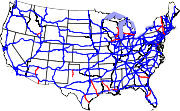
Interstate Highway System
The Dwight D. Eisenhower National System of Interstate and Defense Highways, , is a network of limited-access roads including freeways, highways, and expressways forming part of the National Highway System of the United States of America...
that are located entirely within one state. The concept seems contradictory at first; the word "Interstate" refers to the way the entire group of highways is funded (as a national system of interconnected highways), not to the route each given highway travels.
Within the contiguous 48 states
This list includes only primary Interstate highways (those with route numbers less than 100). Most (but not all) three digit Interstates are intrastate.| Interstate Highway | State | Route | Length (mi) | Length (km) | Notes |
|---|---|---|---|---|---|
| Florida Florida Florida is a state in the southeastern United States, located on the nation's Atlantic and Gulf coasts. It is bordered to the west by the Gulf of Mexico, to the north by Alabama and Georgia and to the east by the Atlantic Ocean. With a population of 18,801,310 as measured by the 2010 census, it... |
Tampa Tampa, Florida Tampa is a city in the U.S. state of Florida. It serves as the county seat for Hillsborough County. Tampa is located on the west coast of Florida. The population of Tampa in 2010 was 335,709.... (I-275) to Daytona Beach Daytona Beach, Florida Daytona Beach is a city in Volusia County, Florida, USA. According to 2008 U.S. Census Bureau estimates, the city has a population of 64,211. Daytona Beach is a principal city of the Deltona – Daytona Beach – Ormond Beach, Florida Metropolitan Statistical Area, which the census bureau estimated had... (I-95 Interstate 95 in Florida Interstate 95 is the main Interstate Highway on the east coast of the United States; it serves the Atlantic coast of Florida. It begins at a partial interchange with U.S. Highway 1 just south of downtown Miami, and heads north past Daytona Beach and Jacksonville to the Georgia state line at the St... ) |
132.3 | 212.9 | ||
| Louisiana Louisiana Louisiana is a state located in the southern region of the United States of America. Its capital is Baton Rouge and largest city is New Orleans. Louisiana is the only state in the U.S. with political subdivisions termed parishes, which are local governments equivalent to counties... |
Baton Rouge Baton Rouge, Louisiana Baton Rouge is the capital of the U.S. state of Louisiana. It is located in East Baton Rouge Parish and is the second-largest city in the state.Baton Rouge is a major industrial, petrochemical, medical, and research center of the American South... (I-10 Interstate 10 Interstate 10 is the fourth-longest Interstate Highway in the United States, after I-90, I-80, and I-40. It is the southernmost east–west, coast-to-coast Interstate Highway, although I-4 and I-8 are further south. It stretches from the Pacific Ocean at State Route 1 in Santa Monica,... ) to Slidell Slidell, Louisiana Slidell is a city situated on the northeast shore of Lake Pontchartrain in St. Tammany Parish, Louisiana, United States. The population was 25,695 at the 2000 census. The Greater Slidell Community has a population of about 90,000... (I-10 Interstate 10 Interstate 10 is the fourth-longest Interstate Highway in the United States, after I-90, I-80, and I-40. It is the southernmost east–west, coast-to-coast Interstate Highway, although I-4 and I-8 are further south. It stretches from the Pacific Ocean at State Route 1 in Santa Monica,... /I-59 Interstate 59 Interstate 59 is an Interstate Highway in the southern United States. Its southern terminus is near Slidell, Louisiana, a suburb of New Orleans, at an intersection with Interstate 10 and Interstate 12, its northern terminus is at Wildwood, Georgia, at an intersection with Interstate 24.The road's... ) |
85.6 | 137.8 | ||
| Georgia Georgia (U.S. state) Georgia is a state located in the southeastern United States. It was established in 1732, the last of the original Thirteen Colonies. The state is named after King George II of Great Britain. Georgia was the fourth state to ratify the United States Constitution, on January 2, 1788... |
Macon Macon, Georgia Macon is a city located in central Georgia, US. Founded at the fall line of the Ocmulgee River, it is part of the Macon metropolitan area, and the county seat of Bibb County. A small portion of the city extends into Jones County. Macon is the biggest city in central Georgia... (I-75 Interstate 75 Interstate 75 is a major north–south Interstate Highway in the Great Lakes and Southeastern regions of the United States. It travels from State Road 826 and State Road 924 in Hialeah, Florida to Sault Ste. Marie, Michigan, at the Ontario, Canada, border... ) to Savannah Savannah, Georgia Savannah is the largest city and the county seat of Chatham County, in the U.S. state of Georgia. Established in 1733, the city of Savannah was the colonial capital of the Province of Georgia and later the first state capital of Georgia. Today Savannah is an industrial center and an important... (US-17 U.S. Route 17 in Georgia U.S. Route 17 in Georgia runs north–south near the Atlantic Ocean, serving Brunswick and Savannah on its path from Florida at the St. Marys River to South Carolina at the Savannah River... ) |
166.8 | 268.4 | ||
| Arizona Arizona Arizona ; is a state located in the southwestern region of the United States. It is also part of the western United States and the mountain west. The capital and largest city is Phoenix... |
Phoenix Phoenix, Arizona Phoenix is the capital, and largest city, of the U.S. state of Arizona, as well as the sixth most populated city in the United States. Phoenix is home to 1,445,632 people according to the official 2010 U.S. Census Bureau data... (I-10 Interstate 10 Interstate 10 is the fourth-longest Interstate Highway in the United States, after I-90, I-80, and I-40. It is the southernmost east–west, coast-to-coast Interstate Highway, although I-4 and I-8 are further south. It stretches from the Pacific Ocean at State Route 1 in Santa Monica,... ) to Flagstaff Flagstaff, Arizona Flagstaff is a city located in northern Arizona, in the southwestern United States. In 2010, the city's population was 65,870. The population of the Metropolitan Statistical Area was at 134,421 in 2010. It is the county seat of Coconino County... (I-40 Interstate 40 Interstate 40 is the third-longest major east–west Interstate Highway in the United States, after I-90 and I-80. Its western end is at Interstate 15 in Barstow, California; its eastern end is at a concurrency of U.S. Route 117 and North Carolina Highway 132 in Wilmington, North Carolina... ) |
145.8 | 234.6 | ||
| Arizona Arizona Arizona ; is a state located in the southwestern region of the United States. It is also part of the western United States and the mountain west. The capital and largest city is Phoenix... |
Nogales Nogales, Arizona Nogales is a city in Santa Cruz County, Arizona, United States. The population was 21,017 at the 2010 census. According to 2005 Census Bureau estimates, the population of the city is 20,833. The city is the county seat of Santa Cruz County.... (Mexican border) to Tucson Tucson, Arizona Tucson is a city in and the county seat of Pima County, Arizona, United States. The city is located 118 miles southeast of Phoenix and 60 miles north of the U.S.-Mexico border. The 2010 United States Census puts the city's population at 520,116 with a metropolitan area population at 1,020,200... (I-10 Interstate 10 Interstate 10 is the fourth-longest Interstate Highway in the United States, after I-90, I-80, and I-40. It is the southernmost east–west, coast-to-coast Interstate Highway, although I-4 and I-8 are further south. It stretches from the Pacific Ocean at State Route 1 in Santa Monica,... ) |
63.4 | 102 | Interstate 19 reaches the Mexican Mexico The United Mexican States , commonly known as Mexico , is a federal constitutional republic in North America. It is bordered on the north by the United States; on the south and west by the Pacific Ocean; on the southeast by Guatemala, Belize, and the Caribbean Sea; and on the east by the Gulf of... border but does not cross any state lines. |
|
| Texas Texas Texas is the second largest U.S. state by both area and population, and the largest state by area in the contiguous United States.The name, based on the Caddo word "Tejas" meaning "friends" or "allies", was applied by the Spanish to the Caddo themselves and to the region of their settlement in... |
Lubbock Lubbock, Texas Lubbock is a city in and the county seat of Lubbock County, Texas, United States. The city is located in the northwestern part of the state, a region known historically as the Llano Estacado, and the home of Texas Tech University and Lubbock Christian University... (US-87) to Amarillo Amarillo, Texas Amarillo is the 14th-largest city, by population, in the state of Texas, the largest in the Texas Panhandle, and the seat of Potter County. A portion of the city extends into Randall County. The population was 190,695 at the 2010 census... (I-40 Interstate 40 Interstate 40 is the third-longest major east–west Interstate Highway in the United States, after I-90 and I-80. Its western end is at Interstate 15 in Barstow, California; its eastern end is at a concurrency of U.S. Route 117 and North Carolina Highway 132 in Wilmington, North Carolina... ) |
124.1 | 199.7 | ||
| Texas Texas Texas is the second largest U.S. state by both area and population, and the largest state by area in the contiguous United States.The name, based on the Caddo word "Tejas" meaning "friends" or "allies", was applied by the Spanish to the Caddo themselves and to the region of their settlement in... |
Corpus Christi Corpus Christi, Texas Corpus Christi is a coastal city in the South Texas region of the U.S. state of Texas. The county seat of Nueces County, it also extends into Aransas, Kleberg, and San Patricio counties. The MSA population in 2008 was 416,376. The population was 305,215 at the 2010 census making it the... (US-181) to San Antonio San Antonio, Texas San Antonio is the seventh-largest city in the United States of America and the second-largest city within the state of Texas, with a population of 1.33 million. Located in the American Southwest and the south–central part of Texas, the city serves as the seat of Bexar County. In 2011,... (I-35 Interstate 35 Interstate 35 is a north–south Interstate Highway in the central United States. I-35 stretches from Laredo, Texas, on the U.S.-Mexico border to Duluth, Minnesota, at Minnesota Highway 61 and 26th Avenue East. Many interstates used to have splits or spurs indicated with suffixed letters , but I-35... ) |
143 | 230.1 | ||
| Wisconsin Wisconsin Wisconsin is a U.S. state located in the north-central United States and is part of the Midwest. It is bordered by Minnesota to the west, Iowa to the southwest, Illinois to the south, Lake Michigan to the east, Michigan to the northeast, and Lake Superior to the north. Wisconsin's capital is... |
Beloit Beloit, Wisconsin Beloit is a city in Rock County, Wisconsin, United States. As of the 2010 census, Beloit had a population of 36,966. The greater Beloit area is home to more than 91,000 residents.-Claim to fame:... (I-39 Interstate 39 Interstate 39 is a highway in the midwestern United States. I-39 runs from Normal, Illinois at Interstate 55 to Highway 29 in Rothschild, Wisconsin, approximately six miles south of Wausau. I-39 was designed to replace US Highway 51, which in the early 1980s was one of the busiest two-lane... & I-90 Interstate 90 Interstate 90 is the longest Interstate Highway in the United States at . It is the northernmost coast-to-coast interstate, and parallels US 20 for the most part. Its western terminus is in Seattle, at Edgar Martinez Drive S. near Safeco Field and CenturyLink Field, and its eastern terminus is in... ) to Green Bay Green Bay, Wisconsin Green Bay is a city in and the county seat of Brown County in the U.S. state of Wisconsin, located at the head of Green Bay, a sub-basin of Lake Michigan, at the mouth of the Fox River. It has an elevation of above sea level and is located north of Milwaukee. As of the 2010 United States Census,... (US-41) |
191.6 | 308.3 | ||
| Texas Texas Texas is the second largest U.S. state by both area and population, and the largest state by area in the contiguous United States.The name, based on the Caddo word "Tejas" meaning "friends" or "allies", was applied by the Spanish to the Caddo themselves and to the region of their settlement in... |
Galveston Galveston, Texas Galveston is a coastal city located on Galveston Island in the U.S. state of Texas. , the city had a total population of 47,743 within an area of... (TX-124 State Highway 124 (Texas) State Highway 124 or SH 124 is a state highway in the U.S. state of Texas maintained by the Texas Department of Transportation . The highway begins along the Gulf Coast near the northeast end of the Bolivar Peninsula at and extends to the northeast ending at and . In between, the highway has... ) to Dallas Dallas, Texas Dallas is the third-largest city in Texas and the ninth-largest in the United States. The Dallas-Fort Worth Metroplex is the largest metropolitan area in the South and fourth-largest metropolitan area in the United States... (I-30 Interstate 30 Interstate 30 is an Interstate Highway in the southern United States. I-30 runs from Interstate 20 west of Fort Worth, Texas, northeast via Dallas, Texas, and Texarkana, Texas, to Interstate 40 in North Little Rock, Arkansas. The route parallels U.S. Route 67 except for the portion west of... ) |
284.9 | 458.5 | The only two-digit Interstate ending in 5 or 0 to be an intrastate Highway. Such numbers are supposed to be signed to major interstates, which is why it is unusual that this one is intrastate. | |
| Louisiana Louisiana Louisiana is a state located in the southern region of the United States of America. Its capital is Baton Rouge and largest city is New Orleans. Louisiana is the only state in the U.S. with political subdivisions termed parishes, which are local governments equivalent to counties... |
Lafayette Lafayette, Louisiana Lafayette is a city in and the parish seat of Lafayette Parish, Louisiana, United States, on the Vermilion River. The population was 120,623 at the 2010 census... (I-10 Interstate 10 Interstate 10 is the fourth-longest Interstate Highway in the United States, after I-90, I-80, and I-40. It is the southernmost east–west, coast-to-coast Interstate Highway, although I-4 and I-8 are further south. It stretches from the Pacific Ocean at State Route 1 in Santa Monica,... ) to Shreveport Shreveport, Louisiana Shreveport is the third largest city in Louisiana. It is the principal city of the fourth largest metropolitan area in the state of Louisiana and is the 109th-largest city in the United States.... (I-20 Interstate 20 Interstate 20 is a major east–west Interstate Highway in the Southern United States. I‑20 runs 1,535 miles from near Kent, Texas, at Interstate 10 to Florence, South Carolina, at Interstate 95... ) |
208.3 | 335.2 | Planned to reach Kansas City, Missouri Kansas City, Missouri Kansas City, Missouri is the largest city in the U.S. state of Missouri and is the anchor city of the Kansas City Metropolitan Area, the second largest metropolitan area in Missouri. It encompasses in parts of Jackson, Clay, Cass, and Platte counties... |
|
| North Carolina North Carolina North Carolina is a state located in the southeastern United States. The state borders South Carolina and Georgia to the south, Tennessee to the west and Virginia to the north. North Carolina contains 100 counties. Its capital is Raleigh, and its largest city is Charlotte... |
Ellerbe Ellerbe, North Carolina Ellerbe is a town in Richmond County, North Carolina, United States. The population was 1,021 at the 2000 census. It is perhaps best known as the one-time home of professional wrestler André the Giant, who operated a nearby ranch/farm in his spare time and retirement. His ashes were scattered on... (US-220) to Greensboro Greensboro, North Carolina Greensboro is a city in the U.S. state of North Carolina. It is the third-largest city by population in North Carolina and the largest city in Guilford County and the surrounding Piedmont Triad metropolitan region. According to the 2010 U.S... (I-40 Interstate 40 Interstate 40 is the third-longest major east–west Interstate Highway in the United States, after I-90 and I-80. Its western end is at Interstate 15 in Barstow, California; its eastern end is at a concurrency of U.S. Route 117 and North Carolina Highway 132 in Wilmington, North Carolina... & I-85 Interstate 85 Interstate 85 is a major interstate highway in the Southeastern United States. Its current southern terminus is at an interchange with Interstate 65 in Montgomery, Alabama; its northern terminus interchanges with Interstate 95 in Petersburg, Virginia, near Richmond... ) |
56.7 | 91.2 | Planned to reach Michigan Michigan Michigan is a U.S. state located in the Great Lakes Region of the United States of America. The name Michigan is the French form of the Ojibwa word mishigamaa, meaning "large water" or "large lake".... and South Carolina South Carolina South Carolina is a state in the Deep South of the United States that borders Georgia to the south, North Carolina to the north, and the Atlantic Ocean to the east. Originally part of the Province of Carolina, the Province of South Carolina was one of the 13 colonies that declared independence... |
|
| Idaho Idaho Idaho is a state in the Rocky Mountain area of the United States. The state's largest city and capital is Boise. Residents are called "Idahoans". Idaho was admitted to the Union on July 3, 1890, as the 43rd state.... |
Heyburn Heyburn, Idaho Heyburn is a city in Minidoka County, Idaho, United States. The population was 2,899 at the 2000 census. It is part of the Burley, Idaho Micropolitan Statistical Area.The city was named after Weldon Heyburn, a U.S. Senator from Idaho from 1903-12.... (I-84 Interstate 84 in Idaho In the U.S. state of Idaho, Interstate 84 heads southeast from the Oregon state line, it spurs to Interstate 184 in Boise. Eventually I-84 spurs Interstate 86 and mainline I-84 heads southeast towards Utah and I-86 is continues due east and heads to Pocatello, meeting with Interstate 15.-Future:... ) to Pocatello Pocatello, Idaho Pocatello is the county seat and largest city of Bannock County, with a small portion on the Fort Hall Indian Reservation in neighboring Power County, in the southeastern part of the U.S. state of Idaho. It is the principal city of the Pocatello metropolitan area, which encompasses all of Bannock... (I-15) |
62.9 | 101.2 | ||
| New York New York New York is a state in the Northeastern region of the United States. It is the nation's third most populous state. New York is bordered by New Jersey and Pennsylvania to the south, and by Connecticut, Massachusetts and Vermont to the east... |
New York City (I-278 Interstate 278 Interstate 278 is an auxiliary Interstate Highway in New Jersey and New York, United States. The road runs from U.S. Route 1/9 in Linden, New Jersey to the Bruckner Interchange in the New York City borough of the Bronx... ) to Champlain Champlain (village), New York Champlain is a village in Clinton County, New York, USA. The population was 1,101 at the 2010 census. The village is named after nearby Lake Champlain.The Village of Champlain in located in the Town of Champlain and is north of Plattsburgh.-History:... (Canadian border) |
333.5 | 536.7 | The longest intrastate Interstate highway, Interstate 87 reaches the Canadian Canada Canada is a North American country consisting of ten provinces and three territories. Located in the northern part of the continent, it extends from the Atlantic Ocean in the east to the Pacific Ocean in the west, and northward into the Arctic Ocean... border, but it does not cross any state lines. |
|
| Illinois Illinois Illinois is the fifth-most populous state of the United States of America, and is often noted for being a microcosm of the entire country. With Chicago in the northeast, small industrial cities and great agricultural productivity in central and northern Illinois, and natural resources like coal,... |
Silvis Silvis, Illinois Silvis is a city in Rock Island County, Illinois, United States. The population as of 2010 had broken the 10,000 marker to 10,021.-Geography:Silvis is located at .... (I-80 Interstate 80 Interstate 80 is the second-longest Interstate Highway in the United States, following Interstate 90. It is a transcontinental artery running from downtown San Francisco, California to Teaneck, New Jersey in the New York City Metropolitan Area... ) to Hillside Hillside, Illinois Hillside is a village in Cook County, Illinois, United States. The population was 8,155 at the 2000 census.One notable landmark in Hillside is the Mount Carmel Cemetery. On the grounds of the cemetery are the graves of a number of organized crime figures, such as Al Capone and Dion O'Bannion... (I-290 Interstate 290 (Illinois) Interstate 290 is a main Interstate freeway that runs westwards from the Chicago Loop. A portion of I-290 is officially called the Dwight D. Eisenhower Expressway. In short form, it is known as "the Ike" or the Eisenhower... ) |
140.6 | 226.3 | ||
| New York New York New York is a state in the Northeastern region of the United States. It is the nation's third most populous state. New York is bordered by New Jersey and Pennsylvania to the south, and by Connecticut, Massachusetts and Vermont to the east... |
Binghamton Binghamton, New York Binghamton is a city in the Southern Tier of New York in the United States. It is near the Pennsylvania border, in a bowl-shaped valley at the confluence of the Susquehanna and Chenango Rivers... (I-81 Interstate 81 Interstate 81 is an Interstate Highway in the eastern part of the United States. Its southern terminus is at Interstate 40 in Dandridge, Tennessee; its northern terminus is on Wellesley Island at the Canadian border, where the Thousand Islands Bridge connects it to Highway 401, the main freeway... ) to Schenectady Schenectady, New York Schenectady is a city in Schenectady County, New York, United States, of which it is the county seat. As of the 2010 census, the city had a population of 66,135... (I-90 Interstate 90 Interstate 90 is the longest Interstate Highway in the United States at . It is the northernmost coast-to-coast interstate, and parallels US 20 for the most part. Its western terminus is in Seattle, at Edgar Martinez Drive S. near Safeco Field and CenturyLink Field, and its eastern terminus is in... ) |
117.8 | 189.6 | ||
| Michigan Michigan Michigan is a U.S. state located in the Great Lakes Region of the United States of America. The name Michigan is the French form of the Ojibwa word mishigamaa, meaning "large water" or "large lake".... |
Muskegon Muskegon, Michigan Muskegon is a city in the U.S. state of Michigan. As of the 2010 census, the city population was 38,401. The city is the county seat of Muskegon County... (US 31 U.S. Route 31 in Michigan US Highway 31 is a part of the United States Numbered Highway System that runs from Alabama, to the Upper Peninsula of the US state of Michigan. In Michigan, it is a state trunkline highway that runs from the Indiana–Michigan state line at Bertrand Township to its terminus at Interstate 75 south... ) to Detroit Detroit, Michigan Detroit is the major city among the primary cultural, financial, and transportation centers in the Metro Detroit area, a region of 5.2 million people. As the seat of Wayne County, the city of Detroit is the largest city in the U.S. state of Michigan and serves as a major port on the Detroit River... (I-75 Interstate 75 Interstate 75 is a major north–south Interstate Highway in the Great Lakes and Southeastern regions of the United States. It travels from State Road 826 and State Road 924 in Hialeah, Florida to Sault Ste. Marie, Michigan, at the Ontario, Canada, border... ) |
192.1 | 309.2 | ||
| Maryland Maryland Maryland is a U.S. state located in the Mid Atlantic region of the United States, bordering Virginia, West Virginia, and the District of Columbia to its south and west; Pennsylvania to its north; and Delaware to its east... |
Annapolis Annapolis, Maryland Annapolis is the capital of the U.S. state of Maryland, as well as the county seat of Anne Arundel County. It had a population of 38,394 at the 2010 census and is situated on the Chesapeake Bay at the mouth of the Severn River, south of Baltimore and about east of Washington, D.C. Annapolis is... (US-50) to Baltimore (I-695) |
17.6 | 28.3 | Currently the shortest two-digit interstate highway in the country, the only two-digit interstate highway on the U.S. mainland located entirely within one county, and the only two-digit interstate highway on the U.S. mainland that does not connect to any other two-digit interstate highways. | |
| Pennsylvania Pennsylvania The Commonwealth of Pennsylvania is a U.S. state that is located in the Northeastern and Mid-Atlantic regions of the United States. The state borders Delaware and Maryland to the south, West Virginia to the southwest, Ohio to the west, New York and Ontario, Canada, to the north, and New Jersey to... |
Bedford Bedford, Pennsylvania Bedford is a borough in Bedford County, Pennsylvania, west of the State Capital, Harrisburg. It is the county seat of Bedford County. Bedford was established in the mid-18th century. Population counts follow: 1890, 2,242; 1900, 2,167; 1910, 2,385. The population was 3,141 at the 2000... (I-70 Interstate 70 Interstate 70 is an Interstate Highway in the United States that runs from Interstate 15 near Cove Fort, Utah, to a Park and Ride near Baltimore, Maryland. It was the first Interstate Highway project in the United States. I-70 approximately traces the path of U.S. Route 40 east of the Rocky... /I-76 Interstate 76 (east) Interstate 76 is an Interstate Highway in the United States, running 435 miles from an interchange with Interstate 71 west of Akron, Ohio, east to Interstate 295 near Camden, New Jersey.... ) to Bellefonte Bellefonte, Pennsylvania Bellefonte is a borough in Centre County, Pennsylvania, United States. It lies about twelve miles northeast of State College and is part of the State College, Pennsylvania Metropolitan Statistical Area... (I-80 Interstate 80 Interstate 80 is the second-longest Interstate Highway in the United States, following Interstate 90. It is a transcontinental artery running from downtown San Francisco, California to Teaneck, New Jersey in the New York City Metropolitan Area... ) |
85 | 136.8 | Interstate 99 may eventually extend through New York New York New York is a state in the Northeastern region of the United States. It is the nation's third most populous state. New York is bordered by New Jersey and Pennsylvania to the south, and by Connecticut, Massachusetts and Vermont to the east... via US 15 U.S. Route 15 U.S. Route 15 is a -long United States highway, designated along South Carolina, North Carolina, Virginia, Maryland, Pennsylvania, and New York. The route is signed north–south, from U.S. Route 17 Alternate in Walterboro, South Carolina to Interstate 86 and NY 17 in Painted Post, New York.US... and Maryland Maryland Maryland is a U.S. state located in the Mid Atlantic region of the United States, bordering Virginia, West Virginia, and the District of Columbia to its south and west; Pennsylvania to its north; and Delaware to its east... to Interstate 68 Interstate 68 Interstate 68 is a Interstate highway in the U.S. states of West Virginia and Maryland, connecting in Morgantown to in Hancock. is also Corridor E of the Appalachian Development Highway System. From 1965 until the freeway's construction was completed in 1991, it was designated as... . Surface roads connect it with the Pennsylvania Turnpike Pennsylvania Turnpike The Pennsylvania Turnpike is a toll highway system operated by the Pennsylvania Turnpike Commission in the Commonwealth of Pennsylvania, United States. The three sections of the turnpike system total . The main section extends from Ohio to New Jersey and is long... at its current signed south end. |
Additionally, there are four Interstate highways that are almost entirely intrastate:
-
 Interstate 66Interstate 66Interstate 66 is an Interstate Highway in the eastern United States. As indicated by its even route number, it runs in an east–west direction. Its western terminus is at Middletown, Virginia, at an intersection with Interstate 81; its eastern terminus is in Washington, D.C., at an...
is located almost entirely in VirginiaVirginiaThe Commonwealth of Virginia , is a U.S. state on the Atlantic Coast of the Southern United States. Virginia is nicknamed the "Old Dominion" and sometimes the "Mother of Presidents" after the eight U.S. presidents born there...
, but it has a very short section in the District of Columbia. I-66 is 75 miles in length, with one-half mile in D.C. -
 Interstate 72Interstate 72Interstate 72 is an Interstate Highway in the midwestern United States. Its western terminus is in Hannibal, Missouri, at an intersection with U.S. Route 61; its eastern terminus is at Country Fair Drive in Champaign, Illinois. In 2006, the Illinois General Assembly dedicated all of Interstate 72...
is located almost entirely in IllinoisIllinoisIllinois is the fifth-most populous state of the United States of America, and is often noted for being a microcosm of the entire country. With Chicago in the northeast, small industrial cities and great agricultural productivity in central and northern Illinois, and natural resources like coal,...
, but it has a very short section in MissouriMissouriMissouri is a US state located in the Midwestern United States, bordered by Iowa, Illinois, Kentucky, Tennessee, Arkansas, Oklahoma, Kansas and Nebraska. With a 2010 population of 5,988,927, Missouri is the 18th most populous state in the nation and the fifth most populous in the Midwest. It...
. I-72 is 184 miles in length, with 2 miles in Missouri. -
 Interstate 76 (western section) is located almost entirely in ColoradoColoradoColorado is a U.S. state that encompasses much of the Rocky Mountains as well as the northeastern portion of the Colorado Plateau and the western edge of the Great Plains...
, but it has a very short section in NebraskaNebraskaNebraska is a state on the Great Plains of the Midwestern United States. The state's capital is Lincoln and its largest city is Omaha, on the Missouri River....
that connects Interstate 80Interstate 80Interstate 80 is the second-longest Interstate Highway in the United States, following Interstate 90. It is a transcontinental artery running from downtown San Francisco, California to Teaneck, New Jersey in the New York City Metropolitan Area...
. I-76 is 186 miles in length, with less than 3 miles in Nebraska. -
 Interstate 86Interstate 86 (east)Interstate 86 is an Interstate Highway that extends for through northwestern Pennsylvania and southern New York in the United States...
(eastern section) is located almost entirely in New YorkNew YorkNew York is a state in the Northeastern region of the United States. It is the nation's third most populous state. New York is bordered by New Jersey and Pennsylvania to the south, and by Connecticut, Massachusetts and Vermont to the east...
, but it has a short section in PennsylvaniaPennsylvaniaThe Commonwealth of Pennsylvania is a U.S. state that is located in the Northeastern and Mid-Atlantic regions of the United States. The state borders Delaware and Maryland to the south, West Virginia to the southwest, Ohio to the west, New York and Ontario, Canada, to the north, and New Jersey to...
that connects Interstate 90Interstate 90Interstate 90 is the longest Interstate Highway in the United States at . It is the northernmost coast-to-coast interstate, and parallels US 20 for the most part. Its western terminus is in Seattle, at Edgar Martinez Drive S. near Safeco Field and CenturyLink Field, and its eastern terminus is in...
. I-86 is 177 miles in length (in the process of being expanded to 380 miles), with less than 7 miles in Pennsylvania.
Outside of the contiguous 48 states
As AlaskaAlaska
Alaska is the largest state in the United States by area. It is situated in the northwest extremity of the North American continent, with Canada to the east, the Arctic Ocean to the north, and the Pacific Ocean to the west and south, with Russia further west across the Bering Strait...
and Hawaii
Hawaii
Hawaii is the newest of the 50 U.S. states , and is the only U.S. state made up entirely of islands. It is the northernmost island group in Polynesia, occupying most of an archipelago in the central Pacific Ocean, southwest of the continental United States, southeast of Japan, and northeast of...
do not share land borders with any other U.S. state, their Interstate highways are all located fully within their respective state's boundaries. Puerto Rico
Puerto Rico
Puerto Rico , officially the Commonwealth of Puerto Rico , is an unincorporated territory of the United States, located in the northeastern Caribbean, east of the Dominican Republic and west of both the United States Virgin Islands and the British Virgin Islands.Puerto Rico comprises an...
is not a state; however, it also has highways funded by the Federal Government as Interstate highways.
Signed Interstates
H-1, H-2, and H-3 stand for Hawaii-1, Hawaii-2, and Hawaii-3, respectively. These freeways are part of the Interstate Highway SystemInterstate Highway System
The Dwight D. Eisenhower National System of Interstate and Defense Highways, , is a network of limited-access roads including freeways, highways, and expressways forming part of the National Highway System of the United States of America...
and are thus called Interstate highways. These are all located on the heavily-populated island of Oahu
Oahu
Oahu or Oahu , known as "The Gathering Place", is the third largest of the Hawaiian Islands and most populous of the islands in the U.S. state of Hawaii. The state capital Honolulu is located on the southeast coast...
, and there are none on the other islands.
| Interstate Highway | Route | Length (mi) | Length (km) |
|---|---|---|---|
| Kapolei, HI (HI-93 Hawaii Route 93 Route 93 is a major east–west highway on the island of Oahu which begins as Interstate H-1 terminates in Kapolei and ends at Kaena Point on the extreme northwest end of Oahu, just past Makaha.-Route description:... ) to Honolulu, HI (HI-72) |
27.2 | 43.8 | |
| Pearl City, HI (H-1 Interstate H-1 Interstate H-1 is the busiest Interstate Highway in Hawaii, United States, located on the island of O‘ahu. Despite the number, this is an east–west highway—the 'H'-series numbering reflects the order in which routes were funded and built. H-1 goes from Route 93 in Kapolei to Route 72 in... ) to Wahiawā, HI (HI-99) |
8.3 | 13.4 | |
| Hālawa, HI Halawa, Hawaii Halawa is a census-designated place in the ‘Ewa District of Honolulu County, Hawaii, United States. Halawa Stream branches into two valleys: North and South Halawa; North Halawa is the larger stream and fluvial feature. Their confluence is within the H-3/H-201 highways exchange. Most of Halawa... (H-1 Interstate H-1 Interstate H-1 is the busiest Interstate Highway in Hawaii, United States, located on the island of O‘ahu. Despite the number, this is an east–west highway—the 'H'-series numbering reflects the order in which routes were funded and built. H-1 goes from Route 93 in Kapolei to Route 72 in... ) to Marine Corps Base Hawaii Marine Corps Base Hawaii Marine Corps Base Hawaii , formerly Marine Corps Air Station, Kaneohe Bay and originally Naval Air Station Kaneohe Bay, is a U.S. Marine Corps base facility and air station located on the Mokapu Peninsula of windward O'ahu in the City & County of Honolulu. As of the 2000 Census, the base had a... |
15.3 | 24.6 |
Unsigned Interstates
Interstate highways in Alaska and Puerto Rico are not signed as Interstate highways, and are designated as such primarily for purposes of Federal funding. Interstates A-1 through A-4 are located in Alaska, and Interstates PRI-1 through PRI-3 are located in Puerto Rico. These highways are not required to meet interstate standards, and as a result, most portions of these interstate highways are not grade-separate freeways. Freeways in Puerto Rico are primarily toll roadToll road
A toll road is a privately or publicly built road for which a driver pays a toll for use. Structures for which tolls are charged include toll bridges and toll tunnels. Non-toll roads are financed using other sources of revenue, most typically fuel tax or general tax funds...
s that are not funded through the Eisenhower Interstate System. Very few freeways exist in Alaska; they are located primarily near Anchorage, Fairbanks, and Wasilla.
| Interstate Highway | Route | Length (mi) | Length (km) |
|---|---|---|---|
| Anchorage, AK (A-3) to Canadian border | 408.2 | 656.9 | |
| Tok, AK (A-1) to Fairbanks, AK (A-4) | 202.2 | 325.4 | |
| Anchorage, AK (A-1) to Soldotna, AK | 148.1 | 238.3 | |
| Palmer, AK (A-1) to Fairbanks, AK (A-2) | 323.7 | 520.9 | |
| Ponce, PR (PRI-2) to San Juan, PR (PRI-2) | 71.1 | 114.4 | |
| Ponce, PR (PRI-1) to San Juan, PR (PRI-3) | 138.1 | 222.2 | |
| San Juan, PR (PRI-2) to Ceiba, PR Ceiba, Puerto Rico Ceiba is a small town in northeast Puerto Rico. It is named after the famous Ceiba tree. Ceiba is located in the east coast of the island, bordering the Atlantic Ocean, north of Naguabo, south of Fajardo, and east of Río Grande. It is located about one hour's driving distance from San Juan... |
40.6 | 65.3 |