

List of floods
Encyclopedia
Prior to 1950
- The Ohio River flood of 1937Ohio River flood of 1937The Ohio River flood of 1937 took place in late January and February 1937. With damage stretching from Pittsburgh to Cairo, Illinois, one million persons were left homeless, with 385 dead and property losses reaching $500 million...
occurred in late January and February 1937, causing damage along the Ohio River and several smaller tributaries from Pittsburgh, Illinois to Cairo, Illinois. This flood left close to 1 million people homeless, 385 dead, and $50,000,000 worth of damage. - The 1931 Huang He flood caused between 800,000 and 4,000,000 deaths in ChinaChinaChinese civilization may refer to:* China for more general discussion of the country.* Chinese culture* Greater China, the transnational community of ethnic Chinese.* History of China* Sinosphere, the area historically affected by Chinese culture...
, one of a series of disastrous floods on the Huang He river. It was one of the worst floods in history. - The Great Mississippi Flood of 1927Great Mississippi Flood of 1927The Great Mississippi Flood of 1927 was the most destructive river flood in the history of the United States.-Events:The flood began when heavy rains pounded the central basin of the Mississippi in the summer of 1926. By September, the Mississippi's tributaries in Kansas and Iowa were swollen to...
was one of the most destructive floods in United States history and the impetus for many later Flood Control ActFlood Control ActThere are multiple laws known as the Flood Control Act. Typically, they are administered by the United States Army Corps of Engineers:-List of Flood Control Acts:*Flood Control Act of 1917...
s. - The Hatfield Flood of San Diego, United States, of 1916 destroyed the Sweetwater and Lower Otay Dams, and caused 22 deaths and $4.5 million in damages.
- The 1916 Clermont, QueenslandClermont, QueenslandClermont is an agricultural town in the Isaac Region, Queensland, Australia. It is 274 km south-west of Mackay on the junction of the Gregory and Peak Downs highways...
flood was the worst flood in Clermont history. - The Great Dayton FloodGreat Dayton FloodThe Great Dayton Flood of 1913 flooded Dayton, Ohio, and the surrounding area with water from the Great Miami River, causing the greatest natural disaster in Ohio history...
of 1913 killed 360 people and destroyed 20,000 homes in the United States. It also damaged historic photographic plates belonging to Wilbur and Orville Wright. It ended canal transportation in Ohio. - In 1910, large areas of Paris were flooded1910 Great Flood of ParisThe 1910 Great Flood of Paris was a catastrophe in which the Seine River, carrying winter rains from its tributaries, flooded Paris, France, and several nearby communities....
when the River Seine burst its banks.

1950s
- The LynmouthLynmouthLynmouth is a village in Devon, England, on the north edge of Exmoor.The village straddles the confluence of the West Lyn and East Lyn rivers, in a gorge below Lynton, to which it is connected by the Lynton and Lynmouth Cliff Railway....
flood of 1952 killed 34 people, more than any other British flood, it was also very destructive and destroyed over 80 buildings in the town of LynmouthLynmouthLynmouth is a village in Devon, England, on the north edge of Exmoor.The village straddles the confluence of the West Lyn and East Lyn rivers, in a gorge below Lynton, to which it is connected by the Lynton and Lynmouth Cliff Railway....
, DevonDevonDevon is a large county in southwestern England. The county is sometimes referred to as Devonshire, although the term is rarely used inside the county itself as the county has never been officially "shired", it often indicates a traditional or historical context.The county shares borders with...
, United KingdomUnited KingdomThe United Kingdom of Great Britain and Northern IrelandIn the United Kingdom and Dependencies, other languages have been officially recognised as legitimate autochthonous languages under the European Charter for Regional or Minority Languages...
. - The North Sea Flood of 1953North Sea flood of 1953The 1953 North Sea flood was a major flood caused by a heavy storm, that occurred on the night of Saturday 31 January 1953 and morning of 1 February 1953. The floods struck the Netherlands, Belgium, England and Scotland.A combination of a high spring tide and a severe European windstorm caused a...
caused over 2,000 deaths in the DutchNetherlandsThe Netherlands is a constituent country of the Kingdom of the Netherlands, located mainly in North-West Europe and with several islands in the Caribbean. Mainland Netherlands borders the North Sea to the north and west, Belgium to the south, and Germany to the east, and shares maritime borders...
province of Zeeland and the about 50 in the United KingdomUnited KingdomThe United Kingdom of Great Britain and Northern IrelandIn the United Kingdom and Dependencies, other languages have been officially recognised as legitimate autochthonous languages under the European Charter for Regional or Minority Languages...
(the coastlines of East Anglia and Lincolnshire were worst hit) and led to the construction of the Delta WorksDelta WorksThe Delta Works is a series of construction projects in the southwest of the Netherlands to protect a large area of land around the Rhine-Meuse-Scheldt delta from the sea. The works consist of dams, sluices, locks, dikes, levees, and storm surge barriers...
in Holland and the Thames BarrierThames BarrierThe Thames Barrier is the world's second-largest movable flood barrier and is located downstream of central London. Its purpose is to prevent London from being flooded by exceptionally high tides and storm surges moving up from the sea...
in London. - 1953 North Kyushu Flood1953 North Kyushu FloodThe 1953 North Kyushu Flood was the flood which hit the Northern Kyushu, Japan Fukuoka Prefecture, Saga Prefecture, Kumamoto Prefecture and Ooita Prefecture in June 1953...
killed at least 759 and the killed and missing amounted to 1,001 in the northern KyushuKyushuis the third largest island of Japan and most southwesterly of its four main islands. Its alternate ancient names include , , and . The historical regional name is referred to Kyushu and its surrounding islands....
area of Japan. - On October 15, 1954, Hurricane HazelHurricane HazelHurricane Hazel was the deadliest and costliest hurricane of the 1954 Atlantic hurricane season. The storm killed as many as 1,000 people in Haiti before striking the United States near the border between North and South Carolina, as a Category 4 hurricane...
struck TorontoTorontoToronto is the provincial capital of Ontario and the largest city in Canada. It is located in Southern Ontario on the northwestern shore of Lake Ontario. A relatively modern city, Toronto's history dates back to the late-18th century, when its land was first purchased by the British monarchy from...
in CanadaCanadaCanada is a North American country consisting of ten provinces and three territories. Located in the northern part of the continent, it extends from the Atlantic Ocean in the east to the Pacific Ocean in the west, and northward into the Arctic Ocean...
. The resulting rainfall flooded the city, killing 81 people, destroying 20 bridges, and leaving over 2000 people homeless. - The Hunter Valley floods of 1955Hunter Valley floods of 1955The Hunter Valley Floods of February 1955 was a major flood on the Hunter River in New South Wales, Australia...
in New South WalesNew South WalesNew South Wales is a state of :Australia, located in the east of the country. It is bordered by Queensland, Victoria and South Australia to the north, south and west respectively. To the east, the state is bordered by the Tasman Sea, which forms part of the Pacific Ocean. New South Wales...
(Australia) destroyed over 100 homes and caused 45,000 to be evacuated. - In 1957, the storm surge from Hurricane AudreyHurricane AudreyHurricane Audrey was the first major hurricane of the 1957 Atlantic hurricane season. Audrey was the only storm to reach Category 4 status in June. A powerful hurricane, Audrey caused catastrophic damage across eastern Texas and western Louisiana. It then affected the South Central United States as...
flooded southwest Louisiana, killing about 400 people.
1960s
- In 1966, the flood of the Arno River killed dozens of people and damaged or destroyed millions of masterpieces of art and rare books in Florence, Italy.
- In 1965 Hurricane BetsyHurricane BetsyHurricane Betsy was a Category 4 hurricane of the 1965 Atlantic hurricane season which caused enormous damage in the Bahamas, Florida, and Louisiana. Betsy made its most intense landfall near the mouth of the Mississippi River, causing significant flooding of the waters of Lake Pontchartrain into...
flooded large areas of New OrleansNew Orleans, LouisianaNew Orleans is a major United States port and the largest city and metropolitan area in the state of Louisiana. The New Orleans metropolitan area has a population of 1,235,650 as of 2009, the 46th largest in the USA. The New Orleans – Metairie – Bogalusa combined statistical area has a population...
, USA, for up to 10 days, drowning around 40 people. - The North Sea flood of 1962North Sea flood of 1962The North Sea flood of 1962 was a natural disaster affecting mainly the coastal regions of Germany and in particular the city of Hamburg in the night from 16 February to 17 February 1962...
kills almost 330 people along the coasts of southeastern England, Germany, and southern Denmark. 318 of the deaths occurred in HamburgHamburg-History:The first historic name for the city was, according to Claudius Ptolemy's reports, Treva.But the city takes its modern name, Hamburg, from the first permanent building on the site, a castle whose construction was ordered by the Emperor Charlemagne in AD 808...
, GermanyGermanyGermany , officially the Federal Republic of Germany , is a federal parliamentary republic in Europe. The country consists of 16 states while the capital and largest city is Berlin. Germany covers an area of 357,021 km2 and has a largely temperate seasonal climate...
and many millions of pounds worth of damage was done. - In 1960, flooding from a tsunami (caused by the Great Chilean EarthquakeGreat Chilean EarthquakeThe 1960 Valdivia earthquake or Great Chilean Earthquake of Sunday, 22 May 1960 is to date the most powerful earthquake ever recorded on Earth, rating 9.5 on the moment magnitude scale...
) affected the towns of RiñihueRiñihue, ChileRiñihue is a hamlet in Los Lagos, Chile. It is located south of the Tralcán Mount in the west side of Riñihue Lake. In early 20th century Riñihue grew out as a settlement due to the exploitation of wood in Riñihue Lake. Riñihue was the first Chilean lakeshore settlement to be reached by the...
, RiñihuazoRiñihuazoThe Riñihuazo is the name given to the damming of Riñihue Lake on 22 May 1960, after a landslide caused by the Great Chilean Earthquake blocked its outflow. According to the chronicler Mariño de Lobera a similar event occurred after the 1575 Valdivia earthquake.During the Great Chilean Earthquake,...
, Los LagosLos Lagos, ChileLos Lagos is a Chilean city and commune in Valdivia Province, Los Ríos Region.-Demographics:According to the 2002 census of the National Statistics Institute, Los Lagos spans an area of and has 20,168 inhabitants . Of these, 9,479 lived in urban areas and 10,689 in rural areas...
, AntilhueAntilhueAntilhue is a village in Chile, South America. It is located in the commune of Los Lagos on the shores of Calle-Calle River just east of Valdivia. Two petroleum-fueled power plants, Antilhue I and Antilhue II, with a combined pruduction capacity of 101.3 MW, are located near the village....
, PishuincoPishuincoPishuinco is a hamlet in the commune of Valdivia, Chile. It lies at the northern end of the Calle-Calle River between the city of Valdivia and Antilhue....
, and ValdiviaValdivia, ChileValdivia is a city and commune in southern Chile administered by the Municipality of Valdivia. The city is named after its founder Pedro de Valdivia and is located at the confluence of the Calle-Calle, Valdivia and Cau-Cau Rivers, approximately east of the coastal towns of Corral and Niebla...
(all in ChileChileChile ,officially the Republic of Chile , is a country in South America occupying a long, narrow coastal strip between the Andes mountains to the east and the Pacific Ocean to the west. It borders Peru to the north, Bolivia to the northeast, Argentina to the east, and the Drake Passage in the far...
).
1970s
- In 1974, the dying Cyclone Wanda triggered major flooding in BrisbaneBrisbaneBrisbane is the capital and most populous city in the Australian state of Queensland and the third most populous city in Australia. Brisbane's metropolitan area has a population of over 2 million, and the South East Queensland urban conurbation, centred around Brisbane, encompasses a population of...
, AustraliaAustraliaAustralia , officially the Commonwealth of Australia, is a country in the Southern Hemisphere comprising the mainland of the Australian continent, the island of Tasmania, and numerous smaller islands in the Indian and Pacific Oceans. It is the world's sixth-largest country by total area...
killing 6 people and leaving hundreds homeless. - In 2 July 1975, many areas of RomaniaRomaniaRomania is a country located at the crossroads of Central and Southeastern Europe, on the Lower Danube, within and outside the Carpathian arch, bordering on the Black Sea...
n Cuverture Charpatinas (e.g. BuzauBuzau CountyBuzău is a county of Romania, in the historical region Muntenia, with the capital city at Buzău.-Demographics:In 2002, it had a population of 496,214 and the population density was 81/km².*Romanians – 97%*Roma – under 3% declared, and others....
, PrahovaPrahova CountyPrahova is a county of Romania, in the historical region Muntenia, with the capital city at Ploieşti.-Demographics:In 2002, it had a population of 829,945 and the population density was 176/km². It is Romania's most populated county, having a population density double than the country's mean...
County), were struck by major flooding.
- In August 1975, the Banqiao DamBanqiao DamThe Banqiao Reservoir Dam is a dam on the River Ru in Zhumadian Prefecture, Henan province, China. It infamously failed in 1975, causing more casualties than any other dam failure in history, and was subsequently rebuilt....
in China breaks apart under excess rainfall and damage from Typhoon NinaTyphoon Nina (1975)Super Typhoon Nina was a short-lived but intense super typhoon that caused catastrophic damage and loss of life in China after causing the Banqiao Dam to collapse...
, drowning about 26,000 and caused the lives of another 140,000 in resulting epidemics.
1980s
- In the winter of 1983, the Pacific NorthwestPacific NorthwestThe Pacific Northwest is a region in northwestern North America, bounded by the Pacific Ocean to the west and, loosely, by the Rocky Mountains on the east. Definitions of the region vary and there is no commonly agreed upon boundary, even among Pacific Northwesterners. A common concept of the...
of the United StatesUnited StatesThe United States of America is a federal constitutional republic comprising fifty states and a federal district...
saw one of the worst floods on record for that region, and some states recorded their wettest winter ever. Damage estimates are as high as $1.1 billion. - In 1982, the river JucarJúcarThe Júcar or Xúquer is a river on the Iberian Peninsula of Spain. The river runs for approximately 509 km from its source at Ojuelos de Valdeminguete, on the eastern flank of the Montes Universales, Sistema Ibérico...
in SpainSpainSpain , officially the Kingdom of Spain languages]] under the European Charter for Regional or Minority Languages. In each of these, Spain's official name is as follows:;;;;;;), is a country and member state of the European Union located in southwestern Europe on the Iberian Peninsula...
breaks the Tous Reservoir, flooding the surrounding land in a deluge of 16,000 m3/s of water, and killing 30 people. - During the 1980s, the Great Salt LakeGreat Salt LakeThe Great Salt Lake, located in the northern part of the U.S. state of Utah, is the largest salt water lake in the western hemisphere, the fourth-largest terminal lake in the world. In an average year the lake covers an area of around , but the lake's size fluctuates substantially due to its...
reached record high water levels due to a large amount of rain and its lack of an outlet. Places such as SaltairSaltair, UtahSaltair, also The SaltAir or Saltair Pavilion, is the name which has been given to several resorts located on the southern shore of the Great Salt Lake in Utah, United States, about fifteen miles from Salt Lake City.-Saltair I:...
were inundated. - The South African town of LaingsburgLaingsburg- South Africa :* Laingsburg Local Municipality, in the Western Cape province* Laingsburg, Western Cape, a town in the Laingsburg Local Municipality, Western Cape...
was basically destroyed on January 25, 1981, when 104 of its 900 inhabitants died during a flood that swept threw the town and left only about 25 houses standing
1990s
- The 1998 Yangtze River Floods1998 Yangtze River FloodsThe 1998 Yangtze River floods was a major flood that lasted from middle of June to the beginning of September 1998 in the People's Republic of China at the Yangtze River.-Tolls:The event was considered the worst Northern China flood in 40 years...
left 14 million people homeless, killed hundreds, and left billions of pounds worth of damage. - Bangladesh was flooded in 1998, with millions of people affected and hundreds killed.
- The Red River Flood of 1997 (also called the Red River of the North Flood of 1997 in the United States) occurred in April and May 1997 along the Red River of the NorthRed River of the NorthThe Red River is a North American river. Originating at the confluence of the Bois de Sioux and Otter Tail rivers in the United States, it flows northward through the Red River Valley and forms the border between the U.S. states of Minnesota and North Dakota before continuing into Manitoba, Canada...
in North DakotaNorth DakotaNorth Dakota is a state located in the Midwestern region of the United States of America, along the Canadian border. The state is bordered by Canada to the north, Minnesota to the east, South Dakota to the south and Montana to the west. North Dakota is the 19th-largest state by area in the U.S....
, MinnesotaMinnesotaMinnesota is a U.S. state located in the Midwestern United States. The twelfth largest state of the U.S., it is the twenty-first most populous, with 5.3 million residents. Minnesota was carved out of the eastern half of the Minnesota Territory and admitted to the Union as the thirty-second state...
, (USA) and ManitobaManitobaManitoba is a Canadian prairie province with an area of . The province has over 110,000 lakes and has a largely continental climate because of its flat topography. Agriculture, mostly concentrated in the fertile southern and western parts of the province, is vital to the province's economy; other...
(Canada). It was the most severe flooding of the river since 1826. - The worst flood in Polish history hits the country in July 1997, killing 65 and causing extensive damage to WroclawWroclawWrocław , situated on the River Oder , is the main city of southwestern Poland.Wrocław was the historical capital of Silesia and is today the capital of the Lower Silesian Voivodeship. Over the centuries, the city has been part of either Poland, Bohemia, Austria, Prussia, or Germany, but since 1945...
and OpoleOpoleOpole is a city in southern Poland on the Oder River . It has a population of 125,992 and is the capital of the Upper Silesia, Opole Voivodeship and, also the seat of Opole County...
. - July 1996 saw severe floods in Central Honshū, Japan.
- A dying typhoon hits Kyushu, Japan, in September 1996, causing severe floods in that region.
- On May 8, 1995, severe floods cause extensive damage in Louisiana, USA.
- The summer of 1993 was unusually wet for the USA, causing flooding in the southwest.
- March 1993 the "No Name" storm, silently brought major flooding to Citrus County, FL
- The Great Flood of 1993Great Flood of 1993The Great Mississippi and Missouri Rivers Flood of 1993 occurred in the American Midwest, along the Mississippi and Missouri rivers and their tributaries, from April to October 1993. The flood was among the most costly and devastating to ever occur in the United States, with $15 billion in damages...
was one of the most destructive floods in United StatesUnited StatesThe United States of America is a federal constitutional republic comprising fifty states and a federal district...
history. - In AlaskaAlaskaAlaska is the largest state in the United States by area. It is situated in the northwest extremity of the North American continent, with Canada to the east, the Arctic Ocean to the north, and the Pacific Ocean to the west and south, with Russia further west across the Bering Strait...
, USA, from May to September 1992 it was unusually wet, causing the 100 year flood. Snow melt only made the floods worse. - January 1992 saw severe floods in South America, most notably Brazil.
2000s
- In November 2009, record-breaking amounts of rain were dumped on CumbriaCumbriaCumbria , is a non-metropolitan county in North West England. The county and Cumbria County Council, its local authority, came into existence in 1974 after the passage of the Local Government Act 1972. Cumbria's largest settlement and county town is Carlisle. It consists of six districts, and in...
, EnglandEnglandEngland is a country that is part of the United Kingdom. It shares land borders with Scotland to the north and Wales to the west; the Irish Sea is to the north west, the Celtic Sea to the south west, with the North Sea to the east and the English Channel to the south separating it from continental...
and CorkCork (city)Cork is the second largest city in the Republic of Ireland and the island of Ireland's third most populous city. It is the principal city and administrative centre of County Cork and the largest city in the province of Munster. Cork has a population of 119,418, while the addition of the suburban...
, IrelandIrelandIreland is an island to the northwest of continental Europe. It is the third-largest island in Europe and the twentieth-largest island on Earth...
, causing minor floods in Cork and major floods in Cumbria. During the floods, waters reached a UK record 8 ft deep in CockermouthCockermouth-History:The Romans created a fort at Derventio, now the adjoining village of Papcastle, to protect the river crossing, which had become located on a major route for troops heading towards Hadrian's Wall....
, CumbriaCumbriaCumbria , is a non-metropolitan county in North West England. The county and Cumbria County Council, its local authority, came into existence in 1974 after the passage of the Local Government Act 1972. Cumbria's largest settlement and county town is Carlisle. It consists of six districts, and in...
. - In June 2009, minor flooding hit parts of Sheffield City Centre in SheffieldSheffieldSheffield is a city and metropolitan borough of South Yorkshire, England. Its name derives from the River Sheaf, which runs through the city. Historically a part of the West Riding of Yorkshire, and with some of its southern suburbs annexed from Derbyshire, the city has grown from its largely...
, EnglandEnglandEngland is a country that is part of the United Kingdom. It shares land borders with Scotland to the north and Wales to the west; the Irish Sea is to the north west, the Celtic Sea to the south west, with the North Sea to the east and the English Channel to the south separating it from continental...
. Waters reached only about half a foot deep as the River Don broke its banks, but considerable damage was still caused. - The 2008 Indian floods2008 Indian floodsThe 2008 Indian floods were a series of floods in various states of India during the 2008 monsoon season. The floods mostly affected the western regions of Maharashtra state and Andhra Pradesh as well as northern Bihar...
affected several states in India between July 2008 and September 2008 during an unusually wet monsoon season. The floods caused severe damage, and killed an estimated 2404 people. - The 2007 Africa Floods was one of the worst and most destructive floods in recorded history on the continent of Africa with 14 countries affected.
- Between late May 2007 and early August 2007, severe 2007 United Kingdom floods hit most of the United KingdomUnited KingdomThe United Kingdom of Great Britain and Northern IrelandIn the United Kingdom and Dependencies, other languages have been officially recognised as legitimate autochthonous languages under the European Charter for Regional or Minority Languages...
, with the most affected area in the country being YorkshireYorkshireYorkshire is a historic county of northern England and the largest in the United Kingdom. Because of its great size in comparison to other English counties, functions have been increasingly undertaken over time by its subdivisions, which have also been subject to periodic reform...
. The city of SheffieldSheffieldSheffield is a city and metropolitan borough of South Yorkshire, England. Its name derives from the River Sheaf, which runs through the city. Historically a part of the West Riding of Yorkshire, and with some of its southern suburbs annexed from Derbyshire, the city has grown from its largely...
(in Yorkshire) was the worst affected city in the country, a months worth of rain fell on the city in just 18 hours on 25 June 2007, bursting the banks of the River Don in that city. There were also fears that the Ulley ReservoirUlley ReservoirUlley Reservoir is a reservoir located a few hundred metres to the west and downhill of the village of Ulley, south of Rotherham, South Yorkshire, England...
in SheffieldSheffieldSheffield is a city and metropolitan borough of South Yorkshire, England. Its name derives from the River Sheaf, which runs through the city. Historically a part of the West Riding of Yorkshire, and with some of its southern suburbs annexed from Derbyshire, the city has grown from its largely...
would fail, if it did it would have killed hundreds. 6 people were killed across the country. - The 2007 Hunter Floods inundated large areas of the cities of MaitlandMaitlandMaitland is an English and Scottish surname. It arrived in Britain after the Norman conquest of 1066. There are two theories about its source. It is either a nickname reference to "bad temper/disposition" , or it may be a locational reference to Mautalant, a place in Pontorson, France...
and NewcastleNewcastle, New South WalesThe Newcastle metropolitan area is the second most populated area in the Australian state of New South Wales and includes most of the Newcastle and Lake Macquarie Local Government Areas...
in AustraliaAustraliaAustralia , officially the Commonwealth of Australia, is a country in the Southern Hemisphere comprising the mainland of the Australian continent, the island of Tasmania, and numerous smaller islands in the Indian and Pacific Oceans. It is the world's sixth-largest country by total area...
in June 2007, claimed 11 lives and forced the evacuation of 4,000 people in Central Maitland. - Peninsular Malaysia, SumatraSumatraSumatra is an island in western Indonesia, westernmost of the Sunda Islands. It is the largest island entirely in Indonesia , and the sixth largest island in the world at 473,481 km2 with a population of 50,365,538...
, and SabahSabahSabah is one of 13 member states of Malaysia. It is located on the northern portion of the island of Borneo. It is the second largest state in the country after Sarawak, which it borders on its southwest. It also shares a border with the province of East Kalimantan of Indonesia in the south...
suffered floods between December 2006 and January 2007. It killed hundreds and forced 100,000 people to be evacuated in Johor alone. Floods hit the country's capital JakartaJakartaJakarta is the capital and largest city of Indonesia. Officially known as the Special Capital Territory of Jakarta, it is located on the northwest coast of Java, has an area of , and a population of 9,580,000. Jakarta is the country's economic, cultural and political centre...
in January 2007, killing 80. It was the worst flood in Malaysia for over 100 years. - EthiopiaEthiopiaEthiopia , officially known as the Federal Democratic Republic of Ethiopia, is a country located in the Horn of Africa. It is the second-most populous nation in Africa, with over 82 million inhabitants, and the tenth-largest by area, occupying 1,100,000 km2...
saw one of its worst floods ever in August 2006. - The Mid-Atlantic States flood of 2006 in the eastern United StatesUnited StatesThe United States of America is a federal constitutional republic comprising fifty states and a federal district...
is considered to be the worst in that region since the flooding caused by Hurricane DavidHurricane DavidHurricane David was the fourth named tropical cyclone, second hurricane, and first major hurricane of the 1979 Atlantic hurricane season. A Category 5 hurricane on the Saffir-Simpson Hurricane Scale, David was among the deadliest hurricanes in the latter half of the 20th century, killing...
in 1979. - KoreaKoreaKorea ) is an East Asian geographic region that is currently divided into two separate sovereign states — North Korea and South Korea. Located on the Korean Peninsula, Korea is bordered by the People's Republic of China to the northwest, Russia to the northeast, and is separated from Japan to the...
(both North KoreaNorthNorth is a noun, adjective, or adverb indicating direction or geography.North is one of the four cardinal directions or compass points. It is the opposite of south and is perpendicular to east and west.By convention, the top side of a map is north....
and South KoreaSouthSouth is a noun, adjective, or adverb indicating direction or geography.South is one of the four cardinal directions or compass points. It is the opposite of north and is perpendicular to east and west.By convention, the bottom side of a map is south....
) saw one of its worst floods ever in May 2006. - In November 2005, in the IndiaIndiaIndia , officially the Republic of India , is a country in South Asia. It is the seventh-largest country by geographical area, the second-most populous country with over 1.2 billion people, and the most populous democracy in the world...
n states of Tamil NaduTamil NaduTamil Nadu is one of the 28 states of India. Its capital and largest city is Chennai. Tamil Nadu lies in the southernmost part of the Indian Peninsula and is bordered by the union territory of Pondicherry, and the states of Kerala, Karnataka, and Andhra Pradesh...
and Andhra PradeshAndhra PradeshAndhra Pradesh , is one of the 28 states of India, situated on the southeastern coast of India. It is India's fourth largest state by area and fifth largest by population. Its capital and largest city by population is Hyderabad.The total GDP of Andhra Pradesh is $100 billion and is ranked third...
, many villages were isolated due to heavy rains caused by low-pressure areas in the Bay of BengalBay of BengalThe Bay of Bengal , the largest bay in the world, forms the northeastern part of the Indian Ocean. It resembles a triangle in shape, and is bordered mostly by the Eastern Coast of India, southern coast of Bangladesh and Sri Lanka to the west and Burma and the Andaman and Nicobar Islands to the...
. - Record rain across eastern Europe in August 2005 caused very severe flooding2005 European floodsThe 2005 European floods hit mainly Romania, Switzerland, Austria and Germany, as well as several other countries in Central Europe and Eastern Europe during August 2005...
. - 80% of New OrleansNew Orleans, LouisianaNew Orleans is a major United States port and the largest city and metropolitan area in the state of Louisiana. The New Orleans metropolitan area has a population of 1,235,650 as of 2009, the 46th largest in the USA. The New Orleans – Metairie – Bogalusa combined statistical area has a population...
, LouisianaLouisianaLouisiana is a state located in the southern region of the United States of America. Its capital is Baton Rouge and largest city is New Orleans. Louisiana is the only state in the U.S. with political subdivisions termed parishes, which are local governments equivalent to counties...
, USAUnited StatesThe United States of America is a federal constitutional republic comprising fifty states and a federal district...
was flooded due to the failure of several levees in August 2005 during Hurricane KatrinaHurricane KatrinaHurricane Katrina of the 2005 Atlantic hurricane season was a powerful Atlantic hurricane. It is the costliest natural disaster, as well as one of the five deadliest hurricanes, in the history of the United States. Among recorded Atlantic hurricanes, it was the sixth strongest overall...
. 1,076 people also died because of the hurricane. - Flooding in Mumbai2005 Maharashtra floodsThe 2005 Maharashtra floods refers to the flooding of many parts of the Indian state of Maharashtra including large areas of the metropolis Mumbai, a city located on the coast of the Arabian Sea, on the western coast of India, in which at least 5,000 people died. It occurred just one month after...
, IndiaIndiaIndia , officially the Republic of India , is a country in South Asia. It is the seventh-largest country by geographical area, the second-most populous country with over 1.2 billion people, and the most populous democracy in the world...
, in July 2005 left over 700 dead. Some areas went under 5 m of water. - One of CanadaCanadaCanada is a North American country consisting of ten provinces and three territories. Located in the northern part of the continent, it extends from the Atlantic Ocean in the east to the Pacific Ocean in the west, and northward into the Arctic Ocean...
's most devastating floods occurred in southern AlbertaAlbertaAlberta is a province of Canada. It had an estimated population of 3.7 million in 2010 making it the most populous of Canada's three prairie provinces...
in June 2005. The flooding affected many majorMajorMajor is a rank of commissioned officer, with corresponding ranks existing in almost every military in the world.When used unhyphenated, in conjunction with no other indicator of rank, the term refers to the rank just senior to that of an Army captain and just below the rank of lieutenant colonel. ...
metropolitan areaMetropolitan areaThe term metropolitan area refers to a region consisting of a densely populated urban core and its less-populated surrounding territories, sharing industry, infrastructure, and housing. A metropolitan area usually encompasses multiple jurisdictions and municipalities: neighborhoods, townships,...
s including CalgaryCalgaryCalgary is a city in the Province of Alberta, Canada. It is located in the south of the province, in an area of foothills and prairie, approximately east of the front ranges of the Canadian Rockies...
. 4 deaths resulted from the three-week flood. - In January 2005, flooding on the rivers EdenRiver Eden, CumbriaThe River Eden is a river that flows through Cumbria, England on its way to the Solway Firth.-Course of river:The Eden rises in Black Fell Moss, Mallerstang, on the high ground between High Seat, Yorkshire Dales and Hugh Seat. Here it forms the boundary between the counties of Cumbria and North...
, KentRiver KentThe River Kent is a short river in the county of Cumbria in England. The river originates in hills surrounding Kentmere, and flows for around 20 miles into the north of Morecambe Bay. The Lake District National Park includes the upper reaches of the river within its boundaries.The river passes...
, DerwentRiver Derwent, CumbriaThe Derwent is a river in the Lake District of the county of Cumbria in the north of England. The name Derwent is derived from a Celtic word for "oak trees"....
, Greta and Cocker as well as others in CumbriaCumbriaCumbria , is a non-metropolitan county in North West England. The county and Cumbria County Council, its local authority, came into existence in 1974 after the passage of the Local Government Act 1972. Cumbria's largest settlement and county town is Carlisle. It consists of six districts, and in...
, EnglandEnglandEngland is a country that is part of the United Kingdom. It shares land borders with Scotland to the north and Wales to the west; the Irish Sea is to the north west, the Celtic Sea to the south west, with the North Sea to the east and the English Channel to the south separating it from continental...
, flooded about 2,000 properties and caused in excess of £250 million of damage. It was the worst flood in the history of the region of Cumbria (but it was beaten by the Cumbria flooding of November 2009). - The Boscastle flood, 2004 on the 16 August in the village of BoscastleBoscastleBoscastle is a village and fishing port on the north coast of Cornwall, England, in the civil parish of Forrabury and Minster. It is situated 14 miles south of Bude and 5 miles north-east of Tintagel....
, CornwallCornwallCornwall is a unitary authority and ceremonial county of England, within the United Kingdom. It is bordered to the north and west by the Celtic Sea, to the south by the English Channel, and to the east by the county of Devon, over the River Tamar. Cornwall has a population of , and covers an area of...
, United KingdomUnited KingdomThe United Kingdom of Great Britain and Northern IrelandIn the United Kingdom and Dependencies, other languages have been officially recognised as legitimate autochthonous languages under the European Charter for Regional or Minority Languages...
, caused much damage to buildings in the Valency river valley. Further flooding took place in surrounding valleys, and in the town of CamelfordCamelfordCamelford is a town and civil parish in north Cornwall, United Kingdom, situated in the River Camel valley northwest of Bodmin Moor. The town is approximately ten miles north of Bodmin and is governed by Camelford Town Council....
. - In 2002, the 2002 Glasgow floods2002 Glasgow floodsThe 2002 Glasgow floods were a series of Flash floods that occurred after Thunderstorms in the Scottish Lowlands in late July and early August 2002. The heaviest rainfall fell on the night of Tuesday 30 July 2002....
hit GlasgowGlasgowGlasgow is the largest city in Scotland and third most populous in the United Kingdom. The city is situated on the River Clyde in the country's west central lowlands...
, ScotlandScotlandScotland is a country that is part of the United Kingdom. Occupying the northern third of the island of Great Britain, it shares a border with England to the south and is bounded by the North Sea to the east, the Atlantic Ocean to the north and west, and the North Channel and Irish Sea to the...
, causing severe damage. - In 2002, the 2002 European floods2002 European floodsIn August 2002 a 100-year flood caused by over a week of continuous heavy rains ravaged Europe, killing dozens, dispossessing thousands, and causing damage of billions of euros in the Czech Republic, Austria, Germany, Slovakia, Poland, Hungary, Romania and Croatia....
hit Central Europe, causing major damage. - In June 2001, floods from Tropical Storm AllisonTropical Storm AllisonTropical Storm Allison was a tropical storm that devastated southeast Texas in June of the 2001 Atlantic hurricane season. The first storm of the season, Allison lasted an unusually long period of time for a June storm, remaining tropical or subtropical for 15 days...
killed over 30 people in the HoustonHouston, TexasHouston is the fourth-largest city in the United States, and the largest city in the state of Texas. According to the 2010 U.S. Census, the city had a population of 2.1 million people within an area of . Houston is the seat of Harris County and the economic center of , which is the ...
, TexasTexasTexas is the second largest U.S. state by both area and population, and the largest state by area in the contiguous United States.The name, based on the Caddo word "Tejas" meaning "friends" or "allies", was applied by the Spanish to the Caddo themselves and to the region of their settlement in...
, area. - The 2000 Mozambique flood2000 Mozambique floodThe 2000 Mozambique flood was a natural disaster that occurred in February and March 2000. The catastrophic flooding was caused by heavy rainfall that lasted for five weeks and made many homeless. Approximately 800 people were killed. 1,400 km² of arable land was affected and 20,000 head of...
, caused by heavy rains followed by a cycloneCycloneIn meteorology, a cyclone is an area of closed, circular fluid motion rotating in the same direction as the Earth. This is usually characterized by inward spiraling winds that rotate anticlockwise in the Northern Hemisphere and clockwise in the Southern Hemisphere of the Earth. Most large-scale...
, covered much of the country for three weeks, killing thousands, leaving the country devastated for years afterwards.
2010s
- in June 2011 flooding in China2011 China floodsThe 2011 China floods are a series of floods from June to September of 2011 that occurred in central and southern parts of the People's Republic of China...
affected more than 4.8 million people, with 100,000 evacuated and 54 reported dead. - 2011 Brazil floods of January are consider the worst in the country's history. As of Jan. 18, the floods have taken about 700 lives and 14,000 people are homeless mainly due to landslides.
- The 2010-2011 Queensland floods are some of the worst the country of AustraliaAustraliaAustralia , officially the Commonwealth of Australia, is a country in the Southern Hemisphere comprising the mainland of the Australian continent, the island of Tasmania, and numerous smaller islands in the Indian and Pacific Oceans. It is the world's sixth-largest country by total area...
has ever seen. - The November 2010 Colombia floods and associated landslides killed 138 persons. 1.3 million were left homeless.
- In November 2010, many areas of CornwallCornwallCornwall is a unitary authority and ceremonial county of England, within the United Kingdom. It is bordered to the north and west by the Celtic Sea, to the south by the English Channel, and to the east by the county of Devon, over the River Tamar. Cornwall has a population of , and covers an area of...
, UK, were struck by floods. The worst hit area was the town of ParPar, CornwallPar is a town and fishing port with a harbour on the south coast of Cornwall, England, United Kingdom. The town is situated in the civil parish of Tywardreath and Par and is approximately east of St Austell. Par has a population of around 1,400.....
. - On August 4, 2010 at 9:25 am EST a major thunderstorm producing large hail and winds in excess of 60 mph (97 km/h) advanced at the leading edge of a cold front moving across the American Midwest, causing a flash flood that struck LouisvilleLouisville, KentuckyLouisville is the largest city in the U.S. state of Kentucky, and the county seat of Jefferson County. Since 2003, the city's borders have been coterminous with those of the county because of a city-county merger. The city's population at the 2010 census was 741,096...
, KentuckyKentuckyThe Commonwealth of Kentucky is a state located in the East Central United States of America. As classified by the United States Census Bureau, Kentucky is a Southern state, more specifically in the East South Central region. Kentucky is one of four U.S. states constituted as a commonwealth...
and portions of the surrounding Kentuckiana region. - On July 26, 2010, heavy monsoon rains flooded most of PakistanPakistanPakistan , officially the Islamic Republic of Pakistan is a sovereign state in South Asia. It has a coastline along the Arabian Sea and the Gulf of Oman in the south and is bordered by Afghanistan and Iran in the west, India in the east and China in the far northeast. In the north, Tajikistan...
in the 2010 Pakistan floods2010 Pakistan floodsThe 2010 Pakistan floods began in late July 2010, resulting from heavy monsoon rains in the Khyber Pakhtunkhwa, Sindh, Punjab and Balochistan regions of Pakistan and affected the Indus River basin. Approximately one-fifth of Pakistan's total land area was underwater, approximately...
. - In May 2010 until August 2010 flooding in China affected more than 230 million people - with 15.2 million people evacuated and thousands dead.
- In May 2010, PolandPolandPoland , officially the Republic of Poland , is a country in Central Europe bordered by Germany to the west; the Czech Republic and Slovakia to the south; Ukraine, Belarus and Lithuania to the east; and the Baltic Sea and Kaliningrad Oblast, a Russian exclave, to the north...
's Prime Minister Donald TuskDonald TuskDonald Franciszek Tusk is a Polish politician who has been Prime Minister of Poland since 2007. He was a co-founder and is chairman of the Civic Platform party....
informs the Sejm that ongoing flooding is "the worst natural disaster in the nation's history". (thenews.pl)
Africa
- The 2009 West Africa floods2009 West Africa floodsThe 2009 West Africa floods are a natural disaster that began in June 2009 as a consequence of exceptionally heavy seasonal rainfall in large areas of West Africa....
affected close to 1 million people across 12 countries, and caused the deaths of at least 193 people. - The 2009 Angola, Namibia and Zambia floods2009 Angola, Namibia and Zambia floodsThe 2009 Angola, Namibia and Zambia floods are a continuing natural disaster which began in early March 2009 and have resulted in the deaths of at least 131 people and have otherwise affected around 445,000 people. The floods have affected seven regions of Namibia, three provinces of Zambia, two...
affected some 445,000 people across 3 countries and resulted in the deaths of at least 131 people. - The 2008 Benin floods2008 Benin floodsThe 2008 Benin floods struck the nation of Benin between July and October 2008, and affected the other West African nations of Burkina Faso, Mali, Mauritania, Niger and Togo. According to the Red Cross of Benin, the flooding in Benin initially affected almost 7,000 people, including the...
affected 150,000 people in Benin. - The 2008 Namibia floods2008 Namibia floodsThe 2008 Namibia floods began in early February 2008 and killed 42 people by early March. An estimated 250,000 people, primarily in the former Ovamboland regions of Oshana, Ohangwena, Omusati and Oshikoto, were left stranded without outside access except by helicopter, with another 65,000 facing...
affected 250,000 people, killing 42. - The 2007 Mozambican flood2007 Mozambican floodThe 2007 Mozambican flood began in late December 2006 when the Cahora Bassa Dam overflowed from heavy rains on Southern Africa. It worsened in February 2007 when the Zambezi River broke its banks, flooding the surrounding areas in Mozambique...
affected 121,000 people and resulted in 29-40 deaths. - The 2007 African floods2007 African floodsThe 2007 floods of Africa was reported by the UN to be one of the worst floodings in recorded history. The flooding started with rains on September 14, 2007 local time. Over 14 countries had been affected in the continent of Africa, 250 people were reported to have been killed by the flooding and...
hit over 14 countries in Africa, affecting 2.5 million people and 250 deaths. - EthiopiaEthiopiaEthiopia , officially known as the Federal Democratic Republic of Ethiopia, is a country located in the Horn of Africa. It is the second-most populous nation in Africa, with over 82 million inhabitants, and the tenth-largest by area, occupying 1,100,000 km2...
saw one of its worst floods in August 2006. - The 2000 Mozambique flood2000 Mozambique floodThe 2000 Mozambique flood was a natural disaster that occurred in February and March 2000. The catastrophic flooding was caused by heavy rainfall that lasted for five weeks and made many homeless. Approximately 800 people were killed. 1,400 km² of arable land was affected and 20,000 head of...
, caused by heavy rains followed by a cycloneCycloneIn meteorology, a cyclone is an area of closed, circular fluid motion rotating in the same direction as the Earth. This is usually characterized by inward spiraling winds that rotate anticlockwise in the Northern Hemisphere and clockwise in the Southern Hemisphere of the Earth. Most large-scale...
, covered much of the country for three weeks, killing thousands, leaving the country devastated for years afterwards.
China
- The 1998 Yangtze River Floods1998 Yangtze River FloodsThe 1998 Yangtze River floods was a major flood that lasted from middle of June to the beginning of September 1998 in the People's Republic of China at the Yangtze River.-Tolls:The event was considered the worst Northern China flood in 40 years...
left 14 million people homeless. - The 1954 Yangtze River Floods1954 Yangtze River FloodsFrom June to September of 1954, the Yangtze River Floods were a series of catastrophic floodings that occurred mostly in Hubei Province. Due to unusually high volume of precipitation as well as an extraordinarily long rainy season in the middle stretch of the Yangtze River late in the spring of...
- The 1931 Huang He flood caused between 800,000 and 4,000,000 deaths in ChinaChinaChinese civilization may refer to:* China for more general discussion of the country.* Chinese culture* Greater China, the transnational community of ethnic Chinese.* History of China* Sinosphere, the area historically affected by Chinese culture...
, one of a series of disastrous floods on the Huang He.
Japan
- In July 1996 a flood hit Central Honshū and 48 people died.
- On 21 September 1996, a typhoon hit Kyushu causing flooding along the coasts as huge waves crashed onshore and flooding onshore when the typhoon dumped lots of rain on the area.
- In 1953, the 1953 North Kyushu Flood1953 North Kyushu FloodThe 1953 North Kyushu Flood was the flood which hit the Northern Kyushu, Japan Fukuoka Prefecture, Saga Prefecture, Kumamoto Prefecture and Ooita Prefecture in June 1953...
killed 759 people and the killed and missing amounted to 1,001 in the northern area of KyushuKyushuis the third largest island of Japan and most southwesterly of its four main islands. Its alternate ancient names include , , and . The historical regional name is referred to Kyushu and its surrounding islands....
of JapanJapanJapan is an island nation in East Asia. Located in the Pacific Ocean, it lies to the east of the Sea of Japan, China, North Korea, South Korea and Russia, stretching from the Sea of Okhotsk in the north to the East China Sea and Taiwan in the south...
.
South Korea
- South KoreaSouth KoreaThe Republic of Korea , , is a sovereign state in East Asia, located on the southern portion of the Korean Peninsula. It is neighbored by the People's Republic of China to the west, Japan to the east, North Korea to the north, and the East China Sea and Republic of China to the south...
was also flooded at the same time but its floods continued through to the end of June 2006.
Bangladesh
- Bangladesh has been victim of numerous floods throughout the years, the major ones being in 1954, 1955, 1970, 1985, 1988, 1998, 2007
India
- In October 2009, flooding occurred across South India, it was one of the worst flood in the area in the last 100 years, killing 250 people and making 500,000 homeless.
- The 2008 Indian floods2008 Indian floodsThe 2008 Indian floods were a series of floods in various states of India during the 2008 monsoon season. The floods mostly affected the western regions of Maharashtra state and Andhra Pradesh as well as northern Bihar...
affected most of India throughout 2008. - Flooding in Mumbai in July 2005 left over 700 dead. Some areas went under 5 m of water.
- Assam has been suffering floods regularly since 1998.
Pakistan
- In 2003, SindhSindhSindh historically referred to as Ba'ab-ul-Islam , is one of the four provinces of Pakistan and historically is home to the Sindhi people. It is also locally known as the "Mehran". Though Muslims form the largest religious group in Sindh, a good number of Christians, Zoroastrians and Hindus can...
province was bading affected due to monsoon rains causing damages in billions. - In 2007, Cyclone YemyinCyclone YemyinCyclone Yemyin was a deadly tropical cyclone that made landfalls on India and Pakistan. The Pakistan Meteorological Department referred to Tropical Cyclone 03B as "Tropical Cyclone Yemyin"...
submerged lower part of Balochistan Province in sea water killing 380 people. Before that it killed 213 people in KarachiKarachiKarachi is the largest city, main seaport and the main financial centre of Pakistan, as well as the capital of the province of Sindh. The city has an estimated population of 13 to 15 million, while the total metropolitan area has a population of over 18 million...
on its way to Balochistan. - In 2009, KarachiKarachiKarachi is the largest city, main seaport and the main financial centre of Pakistan, as well as the capital of the province of Sindh. The city has an estimated population of 13 to 15 million, while the total metropolitan area has a population of over 18 million...
was flooded. (see 2009 Karachi floods2009 Karachi floodsThe 2009 Karachi floods in Pakistan's financial centre, Karachi, have killed at least 26 people. The death toll is expected to rise, and more than 150 people have been injured in a series of related incidents. The floods are the result of the worst rains in the region in thirty years. Further...
) - In 2010, from Mid-July till Mid-August - PakistanPakistanPakistan , officially the Islamic Republic of Pakistan is a sovereign state in South Asia. It has a coastline along the Arabian Sea and the Gulf of Oman in the south and is bordered by Afghanistan and Iran in the west, India in the east and China in the far northeast. In the north, Tajikistan...
's four provinces (Balochistan, Khyber Pakhtunkhwa and Southern Punjab and Sindh) were badly affected during the monsoon rains when dams, rivers and lakes overflowed, killing at least 1,750 people, injuring 2,500 and affecting 23 million people. The flood is considered the worst in Pakistan's history, affecting people of all four provinces and Azad Jamu and Kashmir Region of Pakistan. (see 2010 Pakistan floods2010 Pakistan floodsThe 2010 Pakistan floods began in late July 2010, resulting from heavy monsoon rains in the Khyber Pakhtunkhwa, Sindh, Punjab and Balochistan regions of Pakistan and affected the Indus River basin. Approximately one-fifth of Pakistan's total land area was underwater, approximately...
)
Malaysia
- Floods in Peninsular MalaysiaPeninsular MalaysiaPeninsular Malaysia , also known as West Malaysia , is the part of Malaysia which lies on the Malay Peninsula. Its area is . It shares a land border with Thailand in the north. To the south is the island of Singapore. Across the Strait of Malacca to the west lies the island of Sumatra...
, SabahSabahSabah is one of 13 member states of Malaysia. It is located on the northern portion of the island of Borneo. It is the second largest state in the country after Sarawak, which it borders on its southwest. It also shares a border with the province of East Kalimantan of Indonesia in the south...
and SumatraSumatraSumatra is an island in western Indonesia, westernmost of the Sunda Islands. It is the largest island entirely in Indonesia , and the sixth largest island in the world at 473,481 km2 with a population of 50,365,538...
in December 2006 and January 2007 were considered to be the worst in the area for 100 years, resulting in evacuation of over 100,000 people in the worst-hit state of JohorJohorJohor is a Malaysian state, located in the southern portion of Peninsular Malaysia. It is one of the most developed states in Malaysia. The state capital city and royal city of Johor is Johor Bahru, formerly known as Tanjung Puteri...
at its peak. Jakarta in Indonesia and some other isolated parts of Indonesia were also flooded at the same time.
Western Europe
- The North Sea Flood of 1953North Sea flood of 1953The 1953 North Sea flood was a major flood caused by a heavy storm, that occurred on the night of Saturday 31 January 1953 and morning of 1 February 1953. The floods struck the Netherlands, Belgium, England and Scotland.A combination of a high spring tide and a severe European windstorm caused a...
caused over 2,000 deaths in the DutchNetherlandsThe Netherlands is a constituent country of the Kingdom of the Netherlands, located mainly in North-West Europe and with several islands in the Caribbean. Mainland Netherlands borders the North Sea to the north and west, Belgium to the south, and Germany to the east, and shares maritime borders...
province of Zeeland and the United KingdomUnited KingdomThe United Kingdom of Great Britain and Northern IrelandIn the United Kingdom and Dependencies, other languages have been officially recognised as legitimate autochthonous languages under the European Charter for Regional or Minority Languages...
and led to the construction of the Delta WorksDelta WorksThe Delta Works is a series of construction projects in the southwest of the Netherlands to protect a large area of land around the Rhine-Meuse-Scheldt delta from the sea. The works consist of dams, sluices, locks, dikes, levees, and storm surge barriers...
and the Thames BarrierThames BarrierThe Thames Barrier is the world's second-largest movable flood barrier and is located downstream of central London. Its purpose is to prevent London from being flooded by exceptionally high tides and storm surges moving up from the sea...
. - The North Sea flood of 1962North Sea flood of 1962The North Sea flood of 1962 was a natural disaster affecting mainly the coastal regions of Germany and in particular the city of Hamburg in the night from 16 February to 17 February 1962...
killed 318 people and damaged parts of the NetherlandsNetherlandsThe Netherlands is a constituent country of the Kingdom of the Netherlands, located mainly in North-West Europe and with several islands in the Caribbean. Mainland Netherlands borders the North Sea to the north and west, Belgium to the south, and Germany to the east, and shares maritime borders...
, United KingdomUnited KingdomThe United Kingdom of Great Britain and Northern IrelandIn the United Kingdom and Dependencies, other languages have been officially recognised as legitimate autochthonous languages under the European Charter for Regional or Minority Languages...
and GermanyGermanyGermany , officially the Federal Republic of Germany , is a federal parliamentary republic in Europe. The country consists of 16 states while the capital and largest city is Berlin. Germany covers an area of 357,021 km2 and has a largely temperate seasonal climate...
, but mainly HamburgHamburg-History:The first historic name for the city was, according to Claudius Ptolemy's reports, Treva.But the city takes its modern name, Hamburg, from the first permanent building on the site, a castle whose construction was ordered by the Emperor Charlemagne in AD 808...
, Germany. - A series of floods in Ireland, Italy and France2011 European floodsThe 2011 floods in Europe, caused by low-pressure area, occurred in late October–early November in France, Italy and Ireland. In Italy the river Po rose 4 m in Turin and a number of people died in Genoa. A state of emergency in the Italian regions of Liguria and Tuscany was declared after floods...
in 2011 causes several deaths across all three countries.
FranceFranceThe French Republic , The French Republic , The French Republic , (commonly known as France , is a unitary semi-presidential republic in Western Europe with several overseas territories and islands located on other continents and in the Indian, Pacific, and Atlantic oceans. Metropolitan France...
- One of France's worst floods of the 20th century occurred in 1910. The end of 1909 and early 1910 saw a period of heavy rain and snow fall over a period of 3 months. The level of the SeineSeineThe Seine is a -long river and an important commercial waterway within the Paris Basin in the north of France. It rises at Saint-Seine near Dijon in northeastern France in the Langres plateau, flowing through Paris and into the English Channel at Le Havre . It is navigable by ocean-going vessels...
began to rise rapidly from January 18 to 20, rising to a maximum of 8.62 meters above normal on the 28th. Some 4 billion cubic meters of river water, contaminated with river sediment and municipal sewage, flooded over 5 square kilometers of Paris. There were over 150,000 casualties and over 20,000 buildings flooded.
ItalyItalyItaly , officially the Italian Republic languages]] under the European Charter for Regional or Minority Languages. In each of these, Italy's official name is as follows:;;;;;;;;), is a unitary parliamentary republic in South-Central Europe. To the north it borders France, Switzerland, Austria and...
- 3 November 1844, the ArnoArnoThe Arno is a river in the Tuscany region of Italy. It is the most important river of central Italy after the Tiber.- Source and route :The river originates on Mount Falterona in the Casentino area of the Apennines, and initially takes a southward curve...
flooded FlorenceFlorenceFlorence is the capital city of the Italian region of Tuscany and of the province of Florence. It is the most populous city in Tuscany, with approximately 370,000 inhabitants, expanding to over 1.5 million in the metropolitan area....
and the Mugello. - 22 October 1951, numerous casualties due to floods in the neighbourhoods of BeneventoBeneventoBenevento is a town and comune of Campania, Italy, capital of the province of Benevento, 50 km northeast of Naples. It is situated on a hill 130 m above sea-level at the confluence of the Calore Irpino and Sabato...
. - 14 November 1951, the PoPo RiverThe Po |Ligurian]]: Bodincus or Bodencus) is a river that flows either or – considering the length of the Maira, a right bank tributary – eastward across northern Italy, from a spring seeping from a stony hillside at Pian del Re, a flat place at the head of the Val Po under the northwest face...
delta was hit by floods; 84 casualties, 180,000 people lost their homes. - 9 October 1963, Vajont disasterVajont DamThe Vajont Dam is a disused dam, completed in 1959 in the valley of the Vajont river under Monte Toc, 100 km north of Venice, Italy...
(a landslideLandslideA landslide or landslip is a geological phenomenon which includes a wide range of ground movement, such as rockfalls, deep failure of slopes and shallow debris flows, which can occur in offshore, coastal and onshore environments...
falling into an artificial lake, triggering a seicheSeicheA seiche is a standing wave in an enclosed or partially enclosed body of water. Seiches and seiche-related phenomena have been observed on lakes, reservoirs, swimming pools, bays, harbors and seas...
wave and a megatsunamiMegatsunamiMegatsunami is an informal term to describe a tsunami that has initial wave heights that are much larger than normal tsunamis...
); 1.917 people killed and many towns in the PiavePiavePiave can refer to:* Francesco Maria Piave, Italian librettist and composer* Piave * Piave * Battle of the Piave River* 10 Motorised Division Piave An Italian division of World War II...
valley obliterated. - 4 November 1966, the flood of the Arno River killed 34 people and damaged or destroyed millions of masterpieces of art and rare books in Florence.
- 18 July 1985, Val di Stava disasterVal di Stava Dam CollapseThe Val di Stava Dam collapse occurred on 19 July 1985, when two tailings dams above the village of Stava, near Tesero, Northern Italy, failed. It resulted in one of Italy's worst disasters, killing 268 people, destroying 63 buildings and demolishing eight bridges.The upper dam broke first, leading...
; an artificial reservoir breached the dam, killing 286 people. - Summer 1987, heavy precipitation caused the Valtellina disasterValtellina disasterThe Valtellina disaster happened in Valtellina, Northern Italian Alps, in July-August 1987. The calamity affected the provinces of Sondrio, Brescia, Bergamo, Lecco, and Como....
, killing 53 people and inflicting serious damage to infrastructures, landscape, towns and economy. - 6 November 1994, southern part of PiedmontPiedmontPiedmont is one of the 20 regions of Italy. It has an area of 25,402 square kilometres and a population of about 4.4 million. The capital of Piedmont is Turin. The main local language is Piedmontese. Occitan is also spoken by a minority in the Occitan Valleys situated in the Provinces of...
hit by floods from PoPo RiverThe Po |Ligurian]]: Bodincus or Bodencus) is a river that flows either or – considering the length of the Maira, a right bank tributary – eastward across northern Italy, from a spring seeping from a stony hillside at Pian del Re, a flat place at the head of the Val Po under the northwest face...
and Tanaro; 70 casualties, 2.226 people lost their homes. - 19 June 1996, VersiliaVersiliaThe Versilia is a part of Tuscany in the north-western province of Lucca, and is named after the Versilia river.Known for fashionable Riviera resorts, it consists of numerous clubs that are frequented by local celebrities....
and GarfagnanaGarfagnanaGarfagnana is an historical region of Italy, today part of the province of Lucca in the Apennines, in northwest Tuscany, but before the unification of Italy it belonged to the Duchy of Modena and Reggio, ruled by the Este family. For a short time, in the 16th century, it was governed by the poet...
in TuscanyTuscanyTuscany is a region in Italy. It has an area of about 23,000 square kilometres and a population of about 3.75 million inhabitants. The regional capital is Florence ....
hit by flash floods; 14 casualties. - 5 May 1998, SarnoSarnoSarno is a town and comune of Campania, Italy, in the province of Salerno, 20 km northeast from the city of Salerno and 60 km east of Naples by the main railway.-Overview:...
in CampaniaCampaniaCampania is a region in southern Italy. The region has a population of around 5.8 million people, making it the second-most-populous region of Italy; its total area of 13,590 km² makes it the most densely populated region in the country...
hit by a flash flood that triggered a mudslide; 160 casualties. - 9 September 2000, a camping place near Soverato, CalabriaCalabriaCalabria , in antiquity known as Bruttium, is a region in southern Italy, south of Naples, located at the "toe" of the Italian Peninsula. The capital city of Calabria is Catanzaro....
wiped by a flash flood; 12 casualties, 1 missing person. - 13 to 16 September 2001, floods in most of the PoPo RiverThe Po |Ligurian]]: Bodincus or Bodencus) is a river that flows either or – considering the length of the Maira, a right bank tributary – eastward across northern Italy, from a spring seeping from a stony hillside at Pian del Re, a flat place at the head of the Val Po under the northwest face...
basin; 23 casualties, 11 missing people, 40.000 evacuees.
SpainSpainSpain , officially the Kingdom of Spain languages]] under the European Charter for Regional or Minority Languages. In each of these, Spain's official name is as follows:;;;;;;), is a country and member state of the European Union located in southwestern Europe on the Iberian Peninsula...
- In 1982 the river JucarJúcarThe Júcar or Xúquer is a river on the Iberian Peninsula of Spain. The river runs for approximately 509 km from its source at Ojuelos de Valdeminguete, on the eastern flank of the Montes Universales, Sistema Ibérico...
(ValenciaValencia (province)Valencia or València is a province of Spain, in the central part of the Valencian Community.It is bordered by the provinces of Alicante, Albacete, Cuenca, Teruel, Castellón, and the Mediterranean Sea...
, SpainSpainSpain , officially the Kingdom of Spain languages]] under the European Charter for Regional or Minority Languages. In each of these, Spain's official name is as follows:;;;;;;), is a country and member state of the European Union located in southwestern Europe on the Iberian Peninsula...
) broke the Tous Reservoir causing a flood that killed 30 people.
PortugalPortugalPortugal , officially the Portuguese Republic is a country situated in southwestern Europe on the Iberian Peninsula. Portugal is the westernmost country of Europe, and is bordered by the Atlantic Ocean to the West and South and by Spain to the North and East. The Atlantic archipelagos of the...
- In February 2010, severe floods and mudslides hit the Portuguese island of Madeira, killing at least 50.
United KingdomUnited KingdomThe United Kingdom of Great Britain and Northern IrelandIn the United Kingdom and Dependencies, other languages have been officially recognised as legitimate autochthonous languages under the European Charter for Regional or Minority Languages...
- Great Sheffield FloodGreat Sheffield FloodNot to be confused with the floods in Sheffield in 2007.The Great Sheffield Flood was a flood that devastated parts of Sheffield, England, on 11 March 1864, when the Dale Dyke Dam broke.- Collapse of Dale Dyke Dam :...
- Deadliest flood in the history of the UK, caused by the failure of the Dale Dike ReservoirDale Dike ReservoirDale Dike Reservoir or Dale Dyke Reservoir , famous for causing the Great Sheffield Flood, is in the north-east Peak District, in the City of Sheffield South Yorkshire, England, a mile west of Bradfield, eight miles from the centre of Sheffield, on the Dale Dike, a tributary of the River...
. Affected SheffieldSheffieldSheffield is a city and metropolitan borough of South Yorkshire, England. Its name derives from the River Sheaf, which runs through the city. Historically a part of the West Riding of Yorkshire, and with some of its southern suburbs annexed from Derbyshire, the city has grown from its largely...
in 1864, 270 dead - Lynmouth flood of 1952 — 34 people were killed, with a further 420 made homeless. Over 100 buildings were destroyed.
- Canvey Island floods of 1953 - 58 people were killed and many properties damaged, with 13,000 islanders evacuated. Survivors were temporarily housed in the newly built and as yet unused King John comprehensive school in nearby Hadleigh.
- 2002 Glasgow floods2002 Glasgow floodsThe 2002 Glasgow floods were a series of Flash floods that occurred after Thunderstorms in the Scottish Lowlands in late July and early August 2002. The heaviest rainfall fell on the night of Tuesday 30 July 2002....
— 200 people immediately evacuated, but the water supply of 140 thousand people was affected. - Boscastle flood of 2004Boscastle flood of 2004The Boscastle flood of 2004 occurred on Monday, 16 August 2004 in the two villages of Boscastle and Crackington Haven in Cornwall, England, United Kingdom. The villages suffered extensive damage after flash floods caused by an exceptional amount of rain that fell over eight hours that afternoon...
— Boscastle in Cornwall was heavily damaged due to flash floods. - EdenRiver Eden, CumbriaThe River Eden is a river that flows through Cumbria, England on its way to the Solway Firth.-Course of river:The Eden rises in Black Fell Moss, Mallerstang, on the high ground between High Seat, Yorkshire Dales and Hugh Seat. Here it forms the boundary between the counties of Cumbria and North...
, KentRiver KentThe River Kent is a short river in the county of Cumbria in England. The river originates in hills surrounding Kentmere, and flows for around 20 miles into the north of Morecambe Bay. The Lake District National Park includes the upper reaches of the river within its boundaries.The river passes...
, DerwentRiver Derwent, CumbriaThe Derwent is a river in the Lake District of the county of Cumbria in the north of England. The name Derwent is derived from a Celtic word for "oak trees"....
, Greta and Cocker as well as other CumbriaCumbriaCumbria , is a non-metropolitan county in North West England. The county and Cumbria County Council, its local authority, came into existence in 1974 after the passage of the Local Government Act 1972. Cumbria's largest settlement and county town is Carlisle. It consists of six districts, and in...
n Rivers flooded in January 2005 damaging around 2000 properties and causing over £250 million of damage. - 2007 United Kingdom floods2007 United Kingdom floodsThe 2007 United Kingdom floods were a series of destructive floods that occurred in various areas across the country during the summer of 2007. The most severe floods occurred across Northern Ireland on 12 June; East Yorkshire and The Midlands on 15 June; Yorkshire, The Midlands, Gloucestershire,...
- 6 people killed. Whole country affected, with Yorkshire the worst hit county. Yorkshire suffers many road and rail closures, power cuts and evacuations with SheffieldSheffieldSheffield is a city and metropolitan borough of South Yorkshire, England. Its name derives from the River Sheaf, which runs through the city. Historically a part of the West Riding of Yorkshire, and with some of its southern suburbs annexed from Derbyshire, the city has grown from its largely...
the worst hit place in the country. - November 2009 Great Britain and Ireland floods — heavy rain falls on much of the British Isles, but Cumbria worst affected. 2 people killed.
Eastern Europe
- Record rain across eastern Europe in August 2005 caused very severe flooding2005 European floodsThe 2005 European floods hit mainly Romania, Switzerland, Austria and Germany, as well as several other countries in Central Europe and Eastern Europe during August 2005...
.
PolandPolandPoland , officially the Republic of Poland , is a country in Central Europe bordered by Germany to the west; the Czech Republic and Slovakia to the south; Ukraine, Belarus and Lithuania to the east; and the Baltic Sea and Kaliningrad Oblast, a Russian exclave, to the north...
- 1934 flood in Poland1934 flood in Poland1934 flood in Poland was the biggest flood in the Second Polish Republic. It began with heavy rains in the Dunajec river basin, which took place between 13 and 17 July 1934. In the following days, the flood spread to the basins of the Raba, Wisłoka, and Skawa, all of which are tributaries to the...
was the biggest flood in history in Poland (then the Second Polish RepublicSecond Polish RepublicThe Second Polish Republic, Second Commonwealth of Poland or interwar Poland refers to Poland between the two world wars; a period in Polish history in which Poland was restored as an independent state. Officially known as the Republic of Poland or the Commonwealth of Poland , the Polish state was...
) with 55 people killed.
Canada
- In May 1950 the Red River, also known as Red River of the NorthRed River of the NorthThe Red River is a North American river. Originating at the confluence of the Bois de Sioux and Otter Tail rivers in the United States, it flows northward through the Red River Valley and forms the border between the U.S. states of Minnesota and North Dakota before continuing into Manitoba, Canada...
, reached its highest level since 1861 and flooded most of the Red River Valley. Winnipeg, Manitoba was inundated on May 5, also known as Black Friday to some residents, and had to be partially evacuated. - On October 15, 1954, Hurricane HazelHurricane HazelHurricane Hazel was the deadliest and costliest hurricane of the 1954 Atlantic hurricane season. The storm killed as many as 1,000 people in Haiti before striking the United States near the border between North and South Carolina, as a Category 4 hurricane...
struck TorontoTorontoToronto is the provincial capital of Ontario and the largest city in Canada. It is located in Southern Ontario on the northwestern shore of Lake Ontario. A relatively modern city, Toronto's history dates back to the late-18th century, when its land was first purchased by the British monarchy from...
in CanadaCanadaCanada is a North American country consisting of ten provinces and three territories. Located in the northern part of the continent, it extends from the Atlantic Ocean in the east to the Pacific Ocean in the west, and northward into the Arctic Ocean...
killing 81 people, destroying 20 bridges, and leaving over 2000 people homeless. - One of CanadaCanadaCanada is a North American country consisting of ten provinces and three territories. Located in the northern part of the continent, it extends from the Atlantic Ocean in the east to the Pacific Ocean in the west, and northward into the Arctic Ocean...
's most devastating floods occurred in southern AlbertaAlbertaAlberta is a province of Canada. It had an estimated population of 3.7 million in 2010 making it the most populous of Canada's three prairie provinces...
in June 2005. The flooding affected many majorMajorMajor is a rank of commissioned officer, with corresponding ranks existing in almost every military in the world.When used unhyphenated, in conjunction with no other indicator of rank, the term refers to the rank just senior to that of an Army captain and just below the rank of lieutenant colonel. ...
metropolitan areaMetropolitan areaThe term metropolitan area refers to a region consisting of a densely populated urban core and its less-populated surrounding territories, sharing industry, infrastructure, and housing. A metropolitan area usually encompasses multiple jurisdictions and municipalities: neighborhoods, townships,...
s including CalgaryCalgaryCalgary is a city in the Province of Alberta, Canada. It is located in the south of the province, in an area of foothills and prairie, approximately east of the front ranges of the Canadian Rockies...
. 4 deaths resulted from the three-week flood.
United States
- The May 2010 Tennessee floods were 1000-year floodFloodA flood is an overflow of an expanse of water that submerges land. The EU Floods directive defines a flood as a temporary covering by water of land not normally covered by water...
s in Middle TennesseeMiddle TennesseeMiddle Tennessee is a distinct portion of the state of Tennessee, delineated according to state law as the 41 counties in the Middle Grand Division of Tennessee....
, West TennesseeWest TennesseeWest Tennessee is one of the three Grand Divisions of the State of Tennessee. Of the three, it is the one that is most sharply defined geographically. Its boundaries are the Mississippi River on the west and the Tennessee River on the east...
, South Central and Western KentuckyKentuckyThe Commonwealth of Kentucky is a state located in the East Central United States of America. As classified by the United States Census Bureau, Kentucky is a Southern state, more specifically in the East South Central region. Kentucky is one of four U.S. states constituted as a commonwealth...
and northern MississippiMississippiMississippi is a U.S. state located in the Southern United States. Jackson is the state capital and largest city. The name of the state derives from the Mississippi River, which flows along its western boundary, whose name comes from the Ojibwe word misi-ziibi...
as the result of torrential rains on May 1 and 2, 2010. The Cumberland RiverCumberland RiverThe Cumberland River is a waterway in the Southern United States. It is long. It starts in Harlan County in far southeastern Kentucky between Pine and Cumberland mountains, flows through southern Kentucky, crosses into northern Tennessee, and then curves back up into western Kentucky before...
crested at 51.86 feet in NashvilleNashville, TennesseeNashville is the capital of the U.S. state of Tennessee and the county seat of Davidson County. It is located on the Cumberland River in Davidson County, in the north-central part of the state. The city is a center for the health care, publishing, banking and transportation industries, and is home...
, a level not seen since 1937. - The Mid-Atlantic States flood of 2006 in the eastern United StatesUnited StatesThe United States of America is a federal constitutional republic comprising fifty states and a federal district...
is considered to be the worst in that region since the flooding caused by Hurricane DavidHurricane DavidHurricane David was the fourth named tropical cyclone, second hurricane, and first major hurricane of the 1979 Atlantic hurricane season. A Category 5 hurricane on the Saffir-Simpson Hurricane Scale, David was among the deadliest hurricanes in the latter half of the 20th century, killing...
in 1979. - 80% of New OrleansNew Orleans, LouisianaNew Orleans is a major United States port and the largest city and metropolitan area in the state of Louisiana. The New Orleans metropolitan area has a population of 1,235,650 as of 2009, the 46th largest in the USA. The New Orleans – Metairie – Bogalusa combined statistical area has a population...
, LouisianaLouisianaLouisiana is a state located in the southern region of the United States of America. Its capital is Baton Rouge and largest city is New Orleans. Louisiana is the only state in the U.S. with political subdivisions termed parishes, which are local governments equivalent to counties...
, U.S.United StatesThe United States of America is a federal constitutional republic comprising fifty states and a federal district...
was flooded due to the failure of several floodwalls in August 2005 in the aftermath of Hurricane KatrinaHurricane KatrinaHurricane Katrina of the 2005 Atlantic hurricane season was a powerful Atlantic hurricane. It is the costliest natural disaster, as well as one of the five deadliest hurricanes, in the history of the United States. Among recorded Atlantic hurricanes, it was the sixth strongest overall...
. 1,076 people also died because of the hurricane. - In June 2001, floods from Tropical Storm AllisonTropical Storm AllisonTropical Storm Allison was a tropical storm that devastated southeast Texas in June of the 2001 Atlantic hurricane season. The first storm of the season, Allison lasted an unusually long period of time for a June storm, remaining tropical or subtropical for 15 days...
killed over 30 people in the Houston, TexasTexasTexas is the second largest U.S. state by both area and population, and the largest state by area in the contiguous United States.The name, based on the Caddo word "Tejas" meaning "friends" or "allies", was applied by the Spanish to the Caddo themselves and to the region of their settlement in...
, area. - In October 1998, San MarcosSan Marcos, TexasSan Marcos is a city in the U.S. state of Texas, and is the seat of Hays County. Located within the metropolitan area, the city is located on the Interstate 35 corridor—between Austin and San Antonio....
, TexasTexasTexas is the second largest U.S. state by both area and population, and the largest state by area in the contiguous United States.The name, based on the Caddo word "Tejas" meaning "friends" or "allies", was applied by the Spanish to the Caddo themselves and to the region of their settlement in...
experienced flooding that had rain totals of 15" to 30" in a short period of time. - The Red River Flood of 1997 occurred in April and May 1997 along the Red River of the NorthRed River of the NorthThe Red River is a North American river. Originating at the confluence of the Bois de Sioux and Otter Tail rivers in the United States, it flows northward through the Red River Valley and forms the border between the U.S. states of Minnesota and North Dakota before continuing into Manitoba, Canada...
in North DakotaNorth DakotaNorth Dakota is a state located in the Midwestern region of the United States of America, along the Canadian border. The state is bordered by Canada to the north, Minnesota to the east, South Dakota to the south and Montana to the west. North Dakota is the 19th-largest state by area in the U.S....
, MinnesotaMinnesotaMinnesota is a U.S. state located in the Midwestern United States. The twelfth largest state of the U.S., it is the twenty-first most populous, with 5.3 million residents. Minnesota was carved out of the eastern half of the Minnesota Territory and admitted to the Union as the thirty-second state...
, and ManitobaManitobaManitoba is a Canadian prairie province with an area of . The province has over 110,000 lakes and has a largely continental climate because of its flat topography. Agriculture, mostly concentrated in the fertile southern and western parts of the province, is vital to the province's economy; other...
(Canada). It was the most severe flooding of the river since 1826. - On 8 May 1995, a flood hit Louisiana and caused extensive damage.
- The Great Flood of 1993Great Flood of 1993The Great Mississippi and Missouri Rivers Flood of 1993 occurred in the American Midwest, along the Mississippi and Missouri rivers and their tributaries, from April to October 1993. The flood was among the most costly and devastating to ever occur in the United States, with $15 billion in damages...
was one of the most destructive floods in United StatesUnited StatesThe United States of America is a federal constitutional republic comprising fifty states and a federal district...
history. - In AlaskaAlaskaAlaska is the largest state in the United States by area. It is situated in the northwest extremity of the North American continent, with Canada to the east, the Arctic Ocean to the north, and the Pacific Ocean to the west and south, with Russia further west across the Bering Strait...
from May to September 1992 unusually wet conditions, plus snow melt, caused the 100 year flood in areas of Alaska. - In 1983 the Pacific NorthwestPacific NorthwestThe Pacific Northwest is a region in northwestern North America, bounded by the Pacific Ocean to the west and, loosely, by the Rocky Mountains on the east. Definitions of the region vary and there is no commonly agreed upon boundary, even among Pacific Northwesterners. A common concept of the...
saw one of their worst winter floods, And some of the Northwest states saw their wettest winter yet. The damage was estimated at 1.1 billion dollars. - In 1972 the Black Hills floodBlack Hills floodThe Black Hills Flood of 1972, in the Black Hills of Western South Dakota, USA, occurred on June 9, 1972. The extreme rainfall of around of rain in 6 hours sent Rapid Creek and other creeks overflowing and flooded many residential and commercial properties around the Black Hills...
killed 238 people and caused $160 million of damage in western South DakotaSouth DakotaSouth Dakota is a state located in the Midwestern region of the United States. It is named after the Lakota and Dakota Sioux American Indian tribes. Once a part of Dakota Territory, South Dakota became a state on November 2, 1889. The state has an area of and an estimated population of just over...
. - In 1965 Hurricane BetsyHurricane BetsyHurricane Betsy was a Category 4 hurricane of the 1965 Atlantic hurricane season which caused enormous damage in the Bahamas, Florida, and Louisiana. Betsy made its most intense landfall near the mouth of the Mississippi River, causing significant flooding of the waters of Lake Pontchartrain into...
flooded large areas of New OrleansNew Orleans, LouisianaNew Orleans is a major United States port and the largest city and metropolitan area in the state of Louisiana. The New Orleans metropolitan area has a population of 1,235,650 as of 2009, the 46th largest in the USA. The New Orleans – Metairie – Bogalusa combined statistical area has a population...
(USA) for up to 10 days, drowning around 40 people. - In 1957, storm surge flooding from Hurricane AudreyHurricane AudreyHurricane Audrey was the first major hurricane of the 1957 Atlantic hurricane season. Audrey was the only storm to reach Category 4 status in June. A powerful hurricane, Audrey caused catastrophic damage across eastern Texas and western Louisiana. It then affected the South Central United States as...
killed about 400 people in southwest Louisiana. - The Ohio River flood of 1937Ohio River flood of 1937The Ohio River flood of 1937 took place in late January and February 1937. With damage stretching from Pittsburgh to Cairo, Illinois, one million persons were left homeless, with 385 dead and property losses reaching $500 million...
took place in late January and February 1937. With damage stretching from Pittsburgh to Cairo, Illinois, 1 million were left homeless, with 385 dead and property losses reaching $500 million - The Great Mississippi Flood of 1927Great Mississippi Flood of 1927The Great Mississippi Flood of 1927 was the most destructive river flood in the history of the United States.-Events:The flood began when heavy rains pounded the central basin of the Mississippi in the summer of 1926. By September, the Mississippi's tributaries in Kansas and Iowa were swollen to...
was one of the most destructive floods in United States history. - The Vermont flood of 1927 is probably the worst flood in Vermont history doing $30 million in damages, which would be $270 million today, killed 84 people, and left 9,000 homeless.
- The Hatfield Flood of San Diego, United States, of 1916 destroyed the Sweetwater and Lower Otay Dams, and caused 22 deaths and $4.5 million in damages.
- The Great Dayton FloodGreat Dayton FloodThe Great Dayton Flood of 1913 flooded Dayton, Ohio, and the surrounding area with water from the Great Miami River, causing the greatest natural disaster in Ohio history...
of 1913 killed 360 people and destroyed 20,000 homes in the United States. It also damaged historic photographic plates belonging to Wilbur and Orville Wright. It caused the end of canal transportation in Ohio. - A list and description of all known major storms and floods in Texas is at USGS
Australia
- 2010/2011 Considerable flooding in much of the state of QueenslandQueenslandQueensland is a state of Australia, occupying the north-eastern section of the mainland continent. It is bordered by the Northern Territory, South Australia and New South Wales to the west, south-west and south respectively. To the east, Queensland is bordered by the Coral Sea and Pacific Ocean...
results in significant damage, evacuations and loss of at least 10 lives during the December and January periods. - The 2007 Hunter Floods inundated large areas of the cities of MaitlandCity of MaitlandThe City of Maitland is a Local Government Area in the Lower Hunter Region of New South Wales, Australia. It is on the New England Highway and CityRail's Hunter line.-Demographics:...
and NewcastleCity of NewcastleNewcastle City Council is a Local Government Area in the Hunter Region of New South Wales, Australia.-Demographics:According to the Australian Bureau Statistics the City of Newcastle had an estimated resident population of 154,777 as of 30 June 2008...
, in June 2007 claimed 11 lives and forced the evacuation of 4,000 people in Central Maitland alone. - Floods hit Victoria in 1998 causing considerable damage and flooding in the capital of AustraliaAustraliaAustralia , officially the Commonwealth of Australia, is a country in the Southern Hemisphere comprising the mainland of the Australian continent, the island of Tasmania, and numerous smaller islands in the Indian and Pacific Oceans. It is the world's sixth-largest country by total area...
, CanberraCanberraCanberra is the capital city of Australia. With a population of over 345,000, it is Australia's largest inland city and the eighth-largest city overall. The city is located at the northern end of the Australian Capital Territory , south-west of Sydney, and north-east of Melbourne...
.
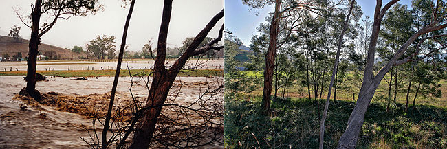
- The Hunter Valley floods of 1955Hunter Valley floods of 1955The Hunter Valley Floods of February 1955 was a major flood on the Hunter River in New South Wales, Australia...
in New South WalesNew South WalesNew South Wales is a state of :Australia, located in the east of the country. It is bordered by Queensland, Victoria and South Australia to the north, south and west respectively. To the east, the state is bordered by the Tasman Sea, which forms part of the Pacific Ocean. New South Wales...
(Australia) destroyed over 100 homes and caused 45,000 to be evacuated. - 1940 saw severe floods in QueenslandQueenslandQueensland is a state of Australia, occupying the north-eastern section of the mainland continent. It is bordered by the Northern Territory, South Australia and New South Wales to the west, south-west and south respectively. To the east, Queensland is bordered by the Coral Sea and Pacific Ocean...
, AustraliaAustraliaAustralia , officially the Commonwealth of Australia, is a country in the Southern Hemisphere comprising the mainland of the Australian continent, the island of Tasmania, and numerous smaller islands in the Indian and Pacific Oceans. It is the world's sixth-largest country by total area...
. - 1893 Brisbane flood1893 Brisbane floodThe 1893 Brisbane flood, occasionally referred to as the Great Flood of 1893 or the Black February flood, occurred when the Brisbane River burst its banks on three occasions in February 1893. It is the occurrence of three major floods in the same month that saw the period named "Black February"....
Fiji
- The 2009 Fiji floods are responsible for at least 16 deaths in the islands
lol
kaitlin s was here
New Zealand
- The 1858 Hutt RiverHutt River, New Zealandthumb|300px|The Hutt River looking downstream.The Hutt River flows through the southern North Island of New Zealand...
flood kills 14 - The 1878 of the Clutha RiverClutha RiverThe Clutha River / Mata-Au is the second longest river in New Zealand flowing south-southeast through Central and South Otago from Lake Wanaka in the Southern Alps to the Pacific Ocean, south west of Dunedin. It is the highest volume river in New Zealand, and the swiftest, with a catchment of ,...
- 1897 flooding at Clive in Hawke's Bay kills 12
- Severe flooding badly affected the city of DunedinDunedinDunedin is the second-largest city in the South Island of New Zealand, and the principal city of the Otago Region. It is considered to be one of the four main urban centres of New Zealand for historic, cultural, and geographic reasons. Dunedin was the largest city by territorial land area until...
in 1929 - In 1938 a flash-flood at a railway workers' camp at Kopuawhara kills 21
- The 1978 of the Clutha RiverClutha RiverThe Clutha River / Mata-Au is the second longest river in New Zealand flowing south-southeast through Central and South Otago from Lake Wanaka in the Southern Alps to the Pacific Ocean, south west of Dunedin. It is the highest volume river in New Zealand, and the swiftest, with a catchment of ,...
, known as the "Hundred years flood" hits one day before the 100th anniversary of the great flood of 1878 - The 1984 Southland flood
- In 1988, extensive flooding is caused in several parts of the North Island by Cyclone BolaCyclone BolaCyclone Bola was one of the costliest cyclones in the history of New Zealand, causing severe damage as an extratropical cyclone when it passed near the country in March 1988. It formed on February 24 to the north of Fiji, and tracking generally southwestward it reached hurricane-force winds near...
- The 2004 Manawatu flood inundated the town of Feilding
South America
- 2011 Brazil floods of January are consider the worst in the country's history. As of Jan. 18, the floods have taken about 700 lives and 14,000 people are homeless mainly due to landslides.
- In January 1992 Brazil saw severe floods. Rio de JaneiroRio de JaneiroRio de Janeiro , commonly referred to simply as Rio, is the capital city of the State of Rio de Janeiro, the second largest city of Brazil, and the third largest metropolitan area and agglomeration in South America, boasting approximately 6.3 million people within the city proper, making it the 6th...
had its worst ever flood that killed over 250 people in April 2010. - The Great Chilean EarthquakeGreat Chilean EarthquakeThe 1960 Valdivia earthquake or Great Chilean Earthquake of Sunday, 22 May 1960 is to date the most powerful earthquake ever recorded on Earth, rating 9.5 on the moment magnitude scale...
was followed by a tsunami that flooded the settlements of RiñihueRiñihue, ChileRiñihue is a hamlet in Los Lagos, Chile. It is located south of the Tralcán Mount in the west side of Riñihue Lake. In early 20th century Riñihue grew out as a settlement due to the exploitation of wood in Riñihue Lake. Riñihue was the first Chilean lakeshore settlement to be reached by the...
, Los LagosLos Lagos, ChileLos Lagos is a Chilean city and commune in Valdivia Province, Los Ríos Region.-Demographics:According to the 2002 census of the National Statistics Institute, Los Lagos spans an area of and has 20,168 inhabitants . Of these, 9,479 lived in urban areas and 10,689 in rural areas...
, AntilhueAntilhueAntilhue is a village in Chile, South America. It is located in the commune of Los Lagos on the shores of Calle-Calle River just east of Valdivia. Two petroleum-fueled power plants, Antilhue I and Antilhue II, with a combined pruduction capacity of 101.3 MW, are located near the village....
, PishuincoPishuincoPishuinco is a hamlet in the commune of Valdivia, Chile. It lies at the northern end of the Calle-Calle River between the city of Valdivia and Antilhue....
and ValdiviaValdivia, ChileValdivia is a city and commune in southern Chile administered by the Municipality of Valdivia. The city is named after its founder Pedro de Valdivia and is located at the confluence of the Calle-Calle, Valdivia and Cau-Cau Rivers, approximately east of the coastal towns of Corral and Niebla...
See also
- 1900 Galveston hurricane
Floods by country
- Floods in the United States: 1901–2000
- Floods in the United States until 1900Floods in the United States until 1900Floods in the United States until 1900 is a list of significant floods which have struck the United States up to 1900. Floods are generally caused by excessive rainfall, excessive snowmelt, and dam failure...
- List of cyclones
- List of flash floods
- List of hurricanes