
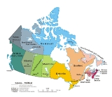
List of cities in Canada
Encyclopedia
This is a list of incorporated cities of Canada
in alphabetical order categorized by province. More thorough lists of communities are available for each province.
, a sufficient population size (10,000 people or more) must be present and a majority of the buildings must be on parcels of land smaller than 1,850 square metres. A community is not always incorporated
as a city even if it meets these requirements. The urban service areas of Fort McMurray
and Sherwood Park
are hamlets
recognized as equivalents of cities, but remain unincorporated. Nine towns are also eligible for city status but remain incorporated as towns.
, a community can be incorporated as a city if its population exceeds 5,000. Once so incorporated, a city does not lose this status even if its population later declines; the once-thriving city of Greenwood
, for example, now has a population of just 625 people.

is its capital, Yellowknife.
 Nova Scotia no longer has any incorporated cities, as they were amalgamated into Regional Municipalities
in the 1990s.
is its capital, Iqaluit.
, city status is conferred by the provincial government, generally upon the request of the incorporated municipality. A municipality may apply for city status anytime after its population surpasses 10,000. This status is not automatically conferred on a community that reaches this population target, but must be requested by the municipality and granted by the provincial Ministry of Municipal Affairs and Housing
. Not all municipalities which reach this population target have pursued city designation (as, for example, Markham
, Ajax
and Oakville
, which in 2006 had census populations of ca. 262,000, 93,000, and 166,000 respectively, but are still designated as towns.) Once designated a city, however, a municipality does not lose this status even if its population later falls back below 10,000 (as, for example, Dryden
.)
City status may also be conferred on some rural counties
which have been amalgamated such that all municipal governance takes place at the county level with no further municipal subdivisions. Thus, city status in Ontario does not always connote a primarily urbanized community.
, provincial law does not currently distinguish between towns and cities — one designation, ville
, covers both types of communities regardless of size, as the French language lacks a widely-used term to distinguish town and cities in general. A ville might be informally referred to as a town or a city in English
, but this is an arbitrary and subjective distinction. Quebec does, however, distinguish between villes and other types of incorporated municipalities, such as municipalités
and villages autochthones
. Quebec did at one time distinguish between villes and cités, but no longer does.
All municipalities in Quebec which have ville status are listed here, regardless of whether they are considered towns or cities in unofficial usage.
, towns must have a population of 5,000 or more and meet other criteria in order to incorporate as a city, although in the early 20th century several centres such as Saskatoon
and Regina
were granted city status despite having a smaller population. The City of Melville
retains its city status despite dropping below 5,000 people in the 1990s. Kindersley
, with a population that fluctuates around the 5,000 mark, has applied for city status in recent years.
is its capital, Whitehorse
. Dawson
was also previously incorporated as a city, but when the criteria were changed in the 1980s, its status was reduced to that of a town due to population. Through special provision, however, it is officially the town of the city of Dawson.
Canada
Canada is a North American country consisting of ten provinces and three territories. Located in the northern part of the continent, it extends from the Atlantic Ocean in the east to the Pacific Ocean in the west, and northward into the Arctic Ocean...
in alphabetical order categorized by province. More thorough lists of communities are available for each province.
Federal, provincial and territorial capitals
- CanadaCanadaCanada is a North American country consisting of ten provinces and three territories. Located in the northern part of the continent, it extends from the Atlantic Ocean in the east to the Pacific Ocean in the west, and northward into the Arctic Ocean...
: OttawaOttawaOttawa is the capital of Canada, the second largest city in the Province of Ontario, and the fourth largest city in the country. The city is located on the south bank of the Ottawa River in the eastern portion of Southern Ontario... - AlbertaAlbertaAlberta is a province of Canada. It had an estimated population of 3.7 million in 2010 making it the most populous of Canada's three prairie provinces...
: EdmontonEdmontonEdmonton is the capital of the Canadian province of Alberta and is the province's second-largest city. Edmonton is located on the North Saskatchewan River and is the centre of the Edmonton Capital Region, which is surrounded by the central region of the province.The city and its census... - British ColumbiaBritish ColumbiaBritish Columbia is the westernmost of Canada's provinces and is known for its natural beauty, as reflected in its Latin motto, Splendor sine occasu . Its name was chosen by Queen Victoria in 1858...
: VictoriaVictoria, British ColumbiaVictoria is the capital city of British Columbia, Canada and is located on the southern tip of Vancouver Island off Canada's Pacific coast. The city has a population of about 78,000 within the metropolitan area of Greater Victoria, which has a population of 360,063, the 15th most populous Canadian... - ManitobaManitobaManitoba is a Canadian prairie province with an area of . The province has over 110,000 lakes and has a largely continental climate because of its flat topography. Agriculture, mostly concentrated in the fertile southern and western parts of the province, is vital to the province's economy; other...
: WinnipegWinnipegWinnipeg is the capital and largest city of Manitoba, Canada, and is the primary municipality of the Winnipeg Capital Region, with more than half of Manitoba's population. It is located near the longitudinal centre of North America, at the confluence of the Red and Assiniboine Rivers .The name... - New BrunswickNew BrunswickNew Brunswick is one of Canada's three Maritime provinces and is the only province in the federation that is constitutionally bilingual . The provincial capital is Fredericton and Saint John is the most populous city. Greater Moncton is the largest Census Metropolitan Area...
: Fredericton - Newfoundland and LabradorNewfoundland and LabradorNewfoundland and Labrador is the easternmost province of Canada. Situated in the country's Atlantic region, it incorporates the island of Newfoundland and mainland Labrador with a combined area of . As of April 2011, the province's estimated population is 508,400...
: St. John'sSt. John's, Newfoundland and LabradorSt. John's is the capital and largest city in Newfoundland and Labrador, and is the oldest English-founded city in North America. It is located on the eastern tip of the Avalon Peninsula on the island of Newfoundland. With a population of 192,326 as of July 1, 2010, the St... - Nova ScotiaNova ScotiaNova Scotia is one of Canada's three Maritime provinces and is the most populous province in Atlantic Canada. The name of the province is Latin for "New Scotland," but "Nova Scotia" is the recognized, English-language name of the province. The provincial capital is Halifax. Nova Scotia is the...
: Halifax - OntarioOntarioOntario is a province of Canada, located in east-central Canada. It is Canada's most populous province and second largest in total area. It is home to the nation's most populous city, Toronto, and the nation's capital, Ottawa....
: TorontoTorontoToronto is the provincial capital of Ontario and the largest city in Canada. It is located in Southern Ontario on the northwestern shore of Lake Ontario. A relatively modern city, Toronto's history dates back to the late-18th century, when its land was first purchased by the British monarchy from... - Prince Edward IslandPrince Edward IslandPrince Edward Island is a Canadian province consisting of an island of the same name, as well as other islands. The maritime province is the smallest in the nation in both land area and population...
: CharlottetownCharlottetownCharlottetown is a Canadian city. It is both the largest city on and the provincial capital of Prince Edward Island, and the county seat of Queens County. Named after Queen Charlotte, the wife of George III, Charlottetown was first incorporated as a town in 1855 and designated as a city in 1885... - QuebecQuebecQuebec or is a province in east-central Canada. It is the only Canadian province with a predominantly French-speaking population and the only one whose sole official language is French at the provincial level....
: Quebec CityQuebec CityQuebec , also Québec, Quebec City or Québec City is the capital of the Canadian province of Quebec and is located within the Capitale-Nationale region. It is the second most populous city in Quebec after Montreal, which is about to the southwest... - SaskatchewanSaskatchewanSaskatchewan is a prairie province in Canada, which has an area of . Saskatchewan is bordered on the west by Alberta, on the north by the Northwest Territories, on the east by Manitoba, and on the south by the U.S. states of Montana and North Dakota....
: ReginaRegina, SaskatchewanRegina is the capital city of the Canadian province of Saskatchewan. The city is the second-largest in the province and a cultural and commercial centre for southern Saskatchewan. It is governed by Regina City Council. Regina is the cathedral city of the Roman Catholic and Romanian Orthodox... - Northwest TerritoriesNorthwest TerritoriesThe Northwest Territories is a federal territory of Canada.Located in northern Canada, the territory borders Canada's two other territories, Yukon to the west and Nunavut to the east, and three provinces: British Columbia to the southwest, and Alberta and Saskatchewan to the south...
: Yellowknife - NunavutNunavutNunavut is the largest and newest federal territory of Canada; it was separated officially from the Northwest Territories on April 1, 1999, via the Nunavut Act and the Nunavut Land Claims Agreement Act, though the actual boundaries had been established in 1993...
: Iqaluit - YukonYukonYukon is the westernmost and smallest of Canada's three federal territories. It was named after the Yukon River. The word Yukon means "Great River" in Gwich’in....
: WhitehorseWhitehorse, YukonWhitehorse is Yukon's capital and largest city . It was incorporated in 1950 and is located at kilometre 1476 on the Alaska Highway in southern Yukon. Whitehorse's downtown and Riverdale areas occupy both shores of the Yukon River, which originates in British Columbia and meets the Bering Sea in...
Alberta
To qualify as a city in AlbertaAlberta
Alberta is a province of Canada. It had an estimated population of 3.7 million in 2010 making it the most populous of Canada's three prairie provinces...
, a sufficient population size (10,000 people or more) must be present and a majority of the buildings must be on parcels of land smaller than 1,850 square metres. A community is not always incorporated
Municipal corporation
A municipal corporation is the legal term for a local governing body, including cities, counties, towns, townships, charter townships, villages, and boroughs. Municipal incorporation occurs when such municipalities become self-governing entities under the laws of the state or province in which...
as a city even if it meets these requirements. The urban service areas of Fort McMurray
Fort McMurray, Alberta
Fort McMurray is an urban service area in the Regional Municipality of Wood Buffalo in Alberta, Canada. It was previously incorporated as a city on September 1, 1980. It became an urban service area when it amalgamated with Improvement District No. 143 on April 1, 1995 to create the Municipality...
and Sherwood Park
Sherwood Park, Alberta
Sherwood Park is a large hamlet in Alberta, Canada within Strathcona County that is recognized as an urban service area. It is located adjacent to the City of Edmonton's eastern boundary, generally south of Highway 16 , west of Highway 21 and north of Highway 630...
are hamlets
Hamlet (place)
A hamlet is usually a rural settlement which is too small to be considered a village, though sometimes the word is used for a different sort of community. Historically, when a hamlet became large enough to justify building a church, it was then classified as a village...
recognized as equivalents of cities, but remain unincorporated. Nine towns are also eligible for city status but remain incorporated as towns.
| City | Area (km²) |
Population (2006) |
Density (/km²) |
Location | Remarks |
|---|---|---|---|---|---|
| Airdrie Airdrie, Alberta Airdrie is a city in Alberta, Canada, located just north of Calgary within the Calgary–Edmonton Corridor. The City of Airdrie is part of Calgary's Census Metropolitan Area and a member community of the Calgary Regional Partnership . Due to its proximity to Calgary, Airdrie's population has been... |
33.10 | 28,927 | 874 | 51.29173°N 114.0143°W | Part of Calgary Region Calgary Region The Calgary Region is an area centred around Calgary, Alberta, Canada. It consists of the City of Calgary, Rocky View County and the municipalities it encloses, and the Municipal District of Foothills No. 31 and the municipalities it encloses. The Calgary Census Metropolitan Area and Calgary... |
| Brooks Brooks, Alberta Brooks is a city in southeast Alberta, Canada surrounded by the County of Newell. It is located on Highway 1 and the Canadian Pacific Railway, approximately southeast of Calgary, and northwest of Medicine Hat. The city has an elevation of .- History :The area that is now Brooks was originally... |
17.70 | 12,498 | 706 | 50.56402°N 111.8988°W | |
| Calgary Calgary Calgary is a city in the Province of Alberta, Canada. It is located in the south of the province, in an area of foothills and prairie, approximately east of the front ranges of the Canadian Rockies... |
726.50 | 988,193 | 1,360 | 51.04510°N 114.0571°W | Largest city in Alberta Part of Calgary Region |
| Camrose Camrose, Alberta Camrose is a city in central Alberta, Canada, amid some of the richest farmland in the prairies. It is a relatively small city which originally grew up along a railroad and now grows along Highway 13. Camrose is a scenic community with many parks, leading to its moniker "The Rose City"... |
31.14 | 15,620 | 502 | 53.02285°N 112.8282°W | |
| Cold Lake Cold Lake, Alberta Cold Lake is a city in northeastern Alberta, Canada, named after the lake it is situated near.-Geography:The city is situated in Alberta's "Lakeland" district, 300 km northeast of Edmonton, near the Alberta-Saskatchewan provincial border. The area surrounding the city is sparsely populated,... |
59.30 | 11,595 | 202 | 54.46417°N 110.1825°W | |
| Edmonton Edmonton Edmonton is the capital of the Canadian province of Alberta and is the province's second-largest city. Edmonton is located on the North Saskatchewan River and is the centre of the Edmonton Capital Region, which is surrounded by the central region of the province.The city and its census... |
684.37 | 730,372 | 1,067 | 53.54543°N 113.4901°W | Capital of Alberta Part of Edmonton Capital Region Edmonton Capital Region The Edmonton Capital Region , also commonly referred to as the Alberta Capital Region, Greater Edmonton or Metro Edmonton, is a conglomeration of municipalities centred around Edmonton – Alberta's provincial capital.... |
| Fort Saskatchewan | 48.12 | 14,957 | 311 | 53.71276°N 113.2131°W | Part of Edmonton Capital Region |
| Grande Prairie | 61.08 | 47,076 | 771 | 55.16995°N 118.7979°W | |
| Lacombe Lacombe, Alberta Lacombe is a city in Alberta, Canada. It is located north of Red Deer, the nearest major city, and south of Edmonton, the nearest metropolitan area... |
18.24 | 10,742 | 643 | 52.46833°N 113.7369°W | Smallest city in Alberta |
| Leduc Leduc, Alberta - Demographics :The population of the City of Leduc according to its 2011 municipal census is 24,139, a 3.6% increase over its 2010 municipal census population of 23,293.... |
36.97 | 16,967 | 459 | 53.25944°N 113.5490°W | Part of Edmonton Capital Region |
| Lethbridge Lethbridge Lethbridge is a city in the province of Alberta, Canada, and the largest city in southern Alberta. It is Alberta's fourth-largest city by population after Calgary, Edmonton and Red Deer, and the third-largest by area after Calgary and Edmonton. The nearby Canadian Rockies contribute to the city's... |
121.97 | 74,637 | 612 | 49.69417°N 112.8328°W | |
| Lloydminster Lloydminster Lloydminster is a Canadian city which has the unusual geographic distinction of straddling the provincial border between Alberta and Saskatchewan... |
24.19 | 15,910 | 658 | 53.28425°N 110.0123°W | Portion of city also located in Saskatchewan Saskatchewan Saskatchewan is a prairie province in Canada, which has an area of . Saskatchewan is bordered on the west by Alberta, on the north by the Northwest Territories, on the east by Manitoba, and on the south by the U.S. states of Montana and North Dakota.... (numbers for Alberta portion only) |
| Medicine Hat | 112.01 | 56,997 | 509 | 50.04157°N 110.6776°W | |
| Red Deer Red Deer, Alberta Red Deer is a city in Central Alberta, Canada. It is located near the midpoint of the Calgary-Edmonton Corridor and is surrounded by Red Deer County. It is Alberta's third-most-populous city – after Calgary and Edmonton. The city is located in aspen parkland, a region of rolling hills... |
69.23 | 82,772 | 1,196 | 52.26819°N 113.8111°W | |
| Spruce Grove Spruce Grove, Alberta Spruce Grove is a city in the vicinity of Edmonton, Alberta. Like nearby Stony Plain it is surrounded by Parkland County.With a population of 24,646, Spruce Grove is the 11th largest city in Alberta. The Horizon Stage Performing Arts Centre is the local theatre, and its TransAlta Tri Leisure Centre... |
26.40 | 19,496 | 738 | 53.54492°N 113.9008°W | Part of Edmonton Capital Region |
| St. Albert St. Albert, Alberta St. Albert is a suburban city in Alberta, located northwest of Edmonton, on the Sturgeon River. It was originally settled as a Métis community, and is now the second largest city in the Edmonton area. St... |
35.04 | 57,719 | 1,647 | 53.63023°N 113.6257°W | Part of Edmonton Capital Region |
| Wetaskiwin | 16.74 | 11,673 | 698 | 52.96947°N 113.3769°W | |
- Source: Areas, populations and densities from Statistics Canada, 2006 Census of Canada
British Columbia
In British ColumbiaBritish Columbia
British Columbia is the westernmost of Canada's provinces and is known for its natural beauty, as reflected in its Latin motto, Splendor sine occasu . Its name was chosen by Queen Victoria in 1858...
, a community can be incorporated as a city if its population exceeds 5,000. Once so incorporated, a city does not lose this status even if its population later declines; the once-thriving city of Greenwood
Greenwood, British Columbia
Greenwood is a small city in south central British Columbia.It was incorporated in 1897 and was formerly one of the principal cities of the Boundary Country smelting and mining district. It earned "city" status and has retained that stature despite the population implosion following the closure of...
, for example, now has a population of just 625 people.
| City | Population (2006) | Area (km²) | Location | Remarks |
|---|---|---|---|---|
| Abbotsford Abbotsford, British Columbia Abbotsford is a Canadian city located in the Lower Mainland of British Columbia, adjacent to Greater Vancouver. It is the fifth largest municipality in British Columbia, home to 123,864 people . Its Census Metropolitan Area, which includes the District of Mission, is the 23rd largest in Canada,... |
359.36 | 49°3′17"N 122°19′41"W | ||
| Armstrong Armstrong, British Columbia The City of Armstrong is located in the North Okanagan of the Canadian province of British Columbia, between Vernon and Enderby. It overlooks the Spallumcheen Valley, which forms a broad pass between the Okanagan Valley to the south and the Shuswap Country to the north, and is about from each of... |
5.24 | 50°26′30"N 119°11′0"W | ||
| Burnaby | 89.12 | 49°14′34"N 122°57′58"W | Part of Metro Vancouver | |
| Campbell River Campbell River, British Columbia Campbell River is a coastal city in British Columbia on the east coast of Vancouver Island at the south end of Discovery Passage, which lies along the important coastal Inside Passage shipping route... |
143.48 | 50°1′28"N 125°14′51"W | ||
| Castlegar Castlegar, British Columbia Castlegar is the second largest city in the West Kootenay region of British Columbia, Canada. It is located within the Selkirk Mountains at the confluence of the Kootenay and Columbia Rivers. It is a regional trade and transportation centre, with a local economy fueled by forestry, mining and tourism... |
19.8 | 49°19′30"N 117°39′53"W | ||
| Chilliwack Chilliwack, British Columbia Chilliwack is a Canadian city in the Province of British Columbia. It is a predominantly agricultural community with an estimated population of 80,000 people. Chilliwack is the second largest city in the Fraser Valley Regional District after Abbotsford. The city is surrounded by mountains and... |
260.19 | 49°9′28"N 121°57′3"W | ||
| Colwood Colwood, British Columbia Colwood is a city located on Vancouver Island to the southwest of Victoria, capital of British Columbia. Colwood was incorporated in 1985 and has a population of approximately 15,000 people. Colwood lies within the boundaries of the Victoria Census Metropolitan area or Capital Regional District,... |
17.76 | 48°25′25"N 123°29′29"W | Part of Greater Victoria | |
| Coquitlam | 121.69 | 49°17′0"N 122°47′30"W | Part of Metro Vancouver | |
| Courtenay Courtenay, British Columbia Courtenay is a city on the east coast of Vancouver Island, in the Canadian province of British Columbia. It is the largest city in the area commonly known as the Comox Valley, and it is the seat of the Comox Valley Regional District which replaced the Comox-Strathcona Regional District... |
26.68 | 49°41′16"N 124°59′40"W | ||
| Cranbrook Cranbrook, British Columbia Cranbrook, British Columbia is a city in southeast British Columbia, located on the west side of the Kootenay River at its confluence with the St. Mary's River, It is the largest urban centre in the region known as the East Kootenay. As of 2006, Cranbrook's population is 18,267, and the... |
25.14 | 49°30′40"N 115°46′2"W | ||
| Dawson Creek | 22.32 | 55°45′38"N 120°14′8"W | ||
| Duncan Duncan, British Columbia Duncan is a city on southern Vancouver Island in British Columbia, Canada.-History:The community is named after William Chalmers Duncan . He arrived in Victoria in May 1862, then in August of that year he was one of the party of a hundred settlers which Governor Douglas took to Cowichan Bay... |
2.05 | 48°46′43"N 123°42′28"W | ||
| Enderby Enderby, British Columbia The City of Enderby is in the North Okanagan of the Canadian province of British Columbia, between Armstrong and Salmon Arm. It is approximately 80 km north of Kelowna and 130 km east of Kamloops... |
4.23 | 50°33′3"N 119°8′23"W | ||
| Fernie Fernie, British Columbia Fernie is a city in the Elk Valley area of the East Kootenay region of southeastern British Columbia, Canada, located on BC Highway 3 on the eastern approaches to the Crowsnest Pass through the Rocky Mountains... |
16.05 | 49°30′30"N 115°5′20"W | ||
| Fort St. John Fort St. John, British Columbia The City of Fort St. John is a city in northeastern British Columbia, Canada. A member municipality of the Peace River Regional District, the city covers an area of about 22 km² with 22,000 residents . Located at Mile 47, it is one of the largest cities along the Alaska Highway. Originally... |
22.74 | 56°15′9"N 120°50′47"W | ||
| Grand Forks Grand Forks, British Columbia -Schools:Schools in the region are operated by School District 51 Boundary which has its main office in Grand Forks but also serves Midway, Greenwood, Beaverdell, and Rock Creek.... |
10.44 | 49°2′0"N 118°26′24"W | ||
| Greenwood Greenwood, British Columbia Greenwood is a small city in south central British Columbia.It was incorporated in 1897 and was formerly one of the principal cities of the Boundary Country smelting and mining district. It earned "city" status and has retained that stature despite the population implosion following the closure of... |
2.52 | 49°5′28"N 118°40′37"W | Smallest city in British Columbia and Canada |
|
| Kamloops | 297.3 | 50°40′34"N 120°20′26"W | ||
| Kelowna Kelowna Kelowna is a city on Okanagan Lake in the Okanagan Valley, in the southern interior of British Columbia, Canada. Its name derives from a Okanagan language term for "grizzly bear"... |
211.69 | 49°53′17"N 119°29′43"W | ||
| Kimberley Kimberley, British Columbia Kimberley is a small city in southeast British Columbia, Canada along Highway 95A between the Purcell and Rocky Mountains. Kimberley was named in 1896 after the Kimberley mine in South Africa. From 1917 to 2001, it was the home to the world's largest lead-zinc mine, the Sullivan Mine... |
58.31 | 49°40′11"N 115°58′39"W | ||
| Kitimat Kitimat, British Columbia Kitimat is a coastal city in northwestern British Columbia, in the Regional District of Kitimat-Stikine. The Kitimat Valley, which includes the adjacent community of Terrace, is the most populous urban district in Northwest British Columbia... |
242.63 | 54°2′30"N 128°40′30"W | ||
| Langford Langford, British Columbia Langford is a city of 22,459 residents on southern Vancouver Island, within the province of British Columbia, Canada. It is considered one of Greater Victoria's Western Communities... |
39.55 | 48°26′55"N 123°30′47"W | Part of Greater Victoria | |
| Langley Langley, British Columbia (city) The City of Langley is a municipality in Metro Vancouver. It lies directly east of the City of Surrey, adjacent to Cloverdale, and surrounded on the north, east and south by Township of Langley.-History:... |
10.22 | 49°6′15"N 122°39′27"W | Part of Metro Vancouver | |
| Merritt Merritt, British Columbia Merritt is a city in the Nicola Valley of the south-central Interior of British Columbia, Canada. Situated at the confluence of the Nicola and Coldwater rivers, it is the first major community encountered after travelling along Phase One of the Coquihalla Highway and acts as the gateway to all... |
24.94 | 50°6′43"N 120°47′12"W | ||
| Nanaimo | 89.3 | 49°9′53"N 123°56′0"W | ||
| Nelson Nelson, British Columbia Nelson is a city located in the Selkirk Mountains on the extreme West Arm of Kootenay Lake in the Southern Interior of British Columbia, Canada. Known as "The Queen City", and acknowledged for its impressive collection of restored heritage buildings from its glory days in a regional silver rush,... |
11.72 | 49°30′0"N 117°17′0"W | ||
| New Westminster | 15.41 | 49°12′25"N 122°54′40"W | Part of Metro Vancouver | |
| North Vancouver North Vancouver, British Columbia (city) The City of North Vancouver is a waterfront municipality on the north shore of Burrard Inlet, directly across from Vancouver, British Columbia. It is the smallest of the three North Shore municipalities, and the most urbanized as well... |
11.85 | 49°19′0"N 123°4′0"W | Part of Metro Vancouver | |
| Parksville Parksville, British Columbia -Demographics:Parksville had a population of 10,993 people in 2006, which was an increase of 6.5% from the 2001 census count. The median household income in 2006 for Parksville was $55,524, which is below the British Columbia provincial average of $62,346.... |
14.6 | 49°18′45"N 124°19′0"W | ||
| Penticton | 42.02 | 49°29′28"N 119°35′19"W | ||
| Pitt Meadows | 85.38 | 49°13′15"N 122°41′0"W | ||
| Port Alberni | 19.92 | 49°14′2"N 124°48′18"W | ||
| Port Coquitlam | 28.85 | 49°15′44"N 122°46′56"W | Part of Metro Vancouver | |
| Port Moody | 25.62 | 49°16′30"N 122°51′0"W | Part of Metro Vancouver | |
| Powell River Powell River, British Columbia Powell River is a city on the northern Sunshine Coast of southwestern British Columbia, Canada. Most of its population lives near the eastern shores of Malaspina Strait, that part of the larger Georgia Strait between Texada Island and the Mainland... |
29.77 | 49°50′7"N 124°31′29"W | ||
| Prince George Prince George, British Columbia Prince George, with a population of 71,030 , is the largest city in northern British Columbia, Canada, and is known as "BC's Northern Capital"... |
316 | 53°54′48"N 122°45′1"W | ||
| Prince Rupert Prince Rupert, British Columbia Prince Rupert is a port city in the province of British Columbia, Canada. It is the land, air, and water transportation hub of British Columbia's North Coast, and home to some 12,815 people .-History:... |
54.9 | 54°18′44"N 130°19′37"W | ||
| Quesnel Quesnel, British Columbia -Demographics:Quesnel had a population of 9,326 people in 2006, which was a decrease of 7.1% from the 2001 census count. The median household income in 2005 for Quesnel was $54,044, which is slightly above the British Columbia provincial average of $52,709.... |
35.34 | 52°58′42"N 122°29′33"W | ||
| Revelstoke Revelstoke, British Columbia Revelstoke is a city in southeastern British Columbia, Canada. It is located east of Vancouver, and west of Calgary, Alberta. The city is situated on the banks of the Columbia River just south of the Revelstoke Dam and near its confluence with the Illecillewaet River... |
31.9 | 51°0′36"N 118°12′51"W | ||
| Richmond Richmond, British Columbia Richmond is a coastal city, incorporated in the Canadian province of British Columbia. Part of Metro Vancouver, its neighbouring communities are Vancouver and Burnaby to the north, New Westminster to the east, and Delta to the south, while the Strait of Georgia forms its western border... |
128.76 | 49°10′0"N 123°8′0"W | Part of Metro Vancouver | |
| Rossland Rossland, British Columbia Rossland is a city in the West Kootenay region of British Columbia.Tucked high in the Monashee Mountains, Rossland is at an elevation of 1023 metres . Population today is approximately 3500; a number that fluctuates from season to season. The population is at its peak during the winter... |
57.97 | 49°4′36"N 117°47′55"W | ||
| Salmon Arm Salmon Arm, British Columbia -Climate:- Education :Public schools in Salmon Arm are part of School District 83 North Okanagan-Shuswap; within the city limits, there are currently five elementary schools , one middle school , and a secondary school with two campuses... |
155.36 | 50°42′8"N 119°16′20"W | ||
| Surrey Surrey, British Columbia Surrey is a city in the province of British Columbia, Canada. It is a member municipality of Metro Vancouver, the governing body of the Greater Vancouver Regional District... |
317.19 | 49°11′15"N 122°51′0"W | Part of Metro Vancouver | |
| Terrace Terrace, British Columbia Terrace is a city on the Skeena River in British Columbia, Canada. The Kitselas people, a tribe of the Tsimshian Nation, have lived in the Terrace area for thousands of years. The community population fell between 2001 and 2006 from 12,109 with a regional population of 19,980 to 11,320 and... |
41.52 | 54°30′59"N 128°35′59"W | ||
| Trail Trail, British Columbia Trail is a city in the West Kootenay region of the Interior of British Columbia, Canada.-Geography:Trail has an area of . The city is located on both banks of the Columbia River, approximately 10 km north of the United States border. This section of the Columbia River valley is located between the... |
34.78 | 49°5′42"N 117°42′36"W | ||
| Vancouver Vancouver Vancouver is a coastal seaport city on the mainland of British Columbia, Canada. It is the hub of Greater Vancouver, which, with over 2.3 million residents, is the third most populous metropolitan area in the country,... |
114.71 | 49°15′0"N 123°6′0"W | Largest city in British Columbia Part of Metro Vancouver |
|
| Vernon Vernon, British Columbia Vernon is a city in the south-central region of British Columbia, Canada. Named after Forbes George Vernon, a former MLA of British Columbia who helped found the famed Coldstream Ranch, the City of Vernon was incorporated on December 30, 1892. The City of Vernon has a population of 35,944 , while... |
94.2 | 50°16′1"N 119°16′19"W | ||
| Victoria Victoria, British Columbia Victoria is the capital city of British Columbia, Canada and is located on the southern tip of Vancouver Island off Canada's Pacific coast. The city has a population of about 78,000 within the metropolitan area of Greater Victoria, which has a population of 360,063, the 15th most populous Canadian... |
19.68 | 48°25′20"N 123°21′56"W | Capital of British Columbia Part of Greater Victoria |
|
| White Rock White Rock, British Columbia White Rock is a city in British Columbia, Canada, that lies within the Metro Vancouver regional district. It borders Semiahmoo Bay and is surrounded on three sides by the City of Surrey, British Columbia. To the south lies the Semiahmoo First Nation, which is within the city limits of Surrey... |
5.16 | 49°2′0"N 122°49′0"W | Part of Metro Vancouver | |
| Williams Lake Williams Lake, British Columbia Williams Lake, is a city in the Central Interior of British Columbia, Canada. Located in the central part of a region known as the Cariboo, it is the largest urban centre between Kamloops and Prince George, with a population of 11,150 in city limits.... |
33.11 | 52°8′30"N 122°8′30"W |
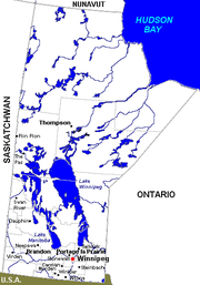
Manitoba
| City | Population (2006) | Area (km²) | Location | Remarks |
|---|---|---|---|---|
| Brandon Brandon, Manitoba Brandon is the second largest city in Manitoba, Canada, and is located in the southwestern area of the province. Brandon is the largest city in the Westman region of Manitoba. The city is located along the Assiniboine River. Spruce Woods Provincial Park and CFB Shilo are a relatively short distance... |
41,511 | 465.16 | 49.84334°N 99.95044°W | |
| Dauphin Dauphin, Manitoba Dauphin is a small city in Manitoba, Canada, with a population of 7,906 as of 2006. The nearby lake was given the name "Dauphin" by the explorer Pierre Gaultier de Varennes, sieur de La Vérendrye in 1741 in honour of the heir to the French throne... |
7,906 | 12.65 | 51.15007°N 100.0497°W | |
| Flin Flon Flin Flon Flin Flon is a Canadian mining city located on the border of Manitoba and Saskatchewan, with the majority of the city located within Manitoba.- Founding :... |
5,594 | 11.55 | 54.76848°N 101.8772°W | Smallest city in Manitoba Portion of city also located in Saskatchewan Saskatchewan Saskatchewan is a prairie province in Canada, which has an area of . Saskatchewan is bordered on the west by Alberta, on the north by the Northwest Territories, on the east by Manitoba, and on the south by the U.S. states of Montana and North Dakota.... (numbers for Manitoba portion only) |
| Portage la Prairie | 12,728 | 24.67 | 49.97277°N 98.29043°W | |
| Selkirk Selkirk, Manitoba Selkirk is a city in the western Canadian province of Manitoba, located about 22 km northeast of the provincial capital Winnipeg on the Red River, near . As of the 2006 census, Selkirk had a population of 9,515.... |
9,515 | 24.87 | 50.14250°N 96.87070°W | |
| Steinbach Steinbach, Manitoba Steinbach is a city of approx. 13,500 people in the southeast corner of the province of Manitoba, Canada, a short distance from the capital Winnipeg. Steinbach is the largest community in the Eastman region of Manitoba. The city is located in the R.M. of Hanover and bordered to the east by the R.M... |
11,066 | 25.57 | 49.52564°N 96.68467°W | |
| Thompson Thompson, Manitoba Thompson is a city in northern Manitoba. As the "Hub of the North" it serves as the regional trade and service centre of northern Manitoba. Thompson is located north of the Canada – United States border, north of the provincial capital of Winnipeg, and is northeast of Flin Flon... |
13,446 | 17.18 | 55.74630°N 97.85012°W | |
| Winkler Winkler, Manitoba Winkler is a small city with a population of about 9,900 located in southern Manitoba, Canada in the Rural Municipality of Stanley... |
9,106 | 17.02 | 49.17991°N 97.93844°W | |
| Winnipeg Winnipeg Winnipeg is the capital and largest city of Manitoba, Canada, and is the primary municipality of the Winnipeg Capital Region, with more than half of Manitoba's population. It is located near the longitudinal centre of North America, at the confluence of the Red and Assiniboine Rivers .The name... |
633,451 | 464.01 | 49.89990°N 97.13888°W | Capital of Manitoba Largest city in Manitoba |
New Brunswick
| City | Population (2006) | Area (km²) | Location | Remarks |
|---|---|---|---|---|
| Bathurst Bathurst, New Brunswick Bathurst is a Canadian city in Gloucester County, New Brunswick.Bathurst is situated on Bathurst Harbour, an estuary at the mouth of the Nepisiguit River at the southernmost part of Chaleur Bay.... |
12,714 | 47.61814°N 65.65112°W | ||
| Campbellton Campbellton, New Brunswick Campbellton is a Canadian city in Restigouche County, New Brunswick.Situated on the south bank of the Restigouche River opposite Pointe-à-la-Croix, Quebec, Campbellton was officially incorporated in 1889 and achieved city status in 1958.Forestry and tourism are major industries in the regional... |
7,384 | 48.00751°N 66.67272°W | Smallest city in New Brunswick | |
| Dieppe Dieppe, New Brunswick Dieppe is a Canadian city in Westmorland County, New Brunswick.-Geography:Dieppe is located on the Petitcodiac River east of the adjacent city of Moncton... |
18,565 | 46.09443°N 64.74844°W | Part of the Moncton Census Metropolitan Area | |
| Edmundston | 16,643 | 47.36292°N 68.32603°W | ||
| Fredericton | 50,535 | 45.96354°N 66.64307°W | Capital of New Brunswick | |
| Miramichi Miramichi, New Brunswick Miramichi is the largest city in northern New Brunswick, Canada. It is situated at the mouth of the Miramichi River where it enters Miramichi Bay... |
18,129 | 47.03127°N 65.46817°W | ||
| Moncton | 64,128 | 46.08799°N 64.77711°W | Part of the Moncton Census Metropolitan Area | |
| Saint John Saint John, New Brunswick City of Saint John , or commonly Saint John, is the largest city in the province of New Brunswick, and the first incorporated city in Canada. The city is situated along the north shore of the Bay of Fundy at the mouth of the Saint John River. In 2006 the city proper had a population of 74,043... |
68,043 | 45.27320°N 66.06478°W | Largest city in New Brunswick Part of the Saint John Census Metropolitan Area |
|
Newfoundland and Labrador
| City | Population (2006) | Area (km²) | Location | Remarks |
|---|---|---|---|---|
| Corner Brook | 20,083 | 48.95083°N 57.94966°W | Smallest city in Newfoundland and Labrador | |
| Mount Pearl Mount Pearl Mount Pearl is the second largest city in Newfoundland and Labrador, Canada. The city is located southwest of St. John's, on the eastern tip of the Avalon Peninsula on the island of Newfoundland. Mount Pearl is part of the St... |
24,671 | 47.51866°N 52.80579°W | Part of the St. John's Metropolitan Area St. John's Metropolitan Area The St. John's Metropolitan Area is the most populous census metropolitan area in the Canadian province of Newfoundland and Labrador. With a population of 181,113 in the 2006 Canadian Census, the CMA is the second largest in Atlantic Canada and the 20th largest CMA in Canada.The St. John’s CMA had... |
|
| St. John's St. John's, Newfoundland and Labrador St. John's is the capital and largest city in Newfoundland and Labrador, and is the oldest English-founded city in North America. It is located on the eastern tip of the Avalon Peninsula on the island of Newfoundland. With a population of 192,326 as of July 1, 2010, the St... |
100,646 | 47.56149°N 52.71266°W | Capital of Newfoundland and Labrador Largest city in Newfoundland and Labrador Part of the St. John's Metropolitan Area |
Northwest Territories
As in the other two Canadian territories, the only incorporated city in the Northwest TerritoriesNorthwest Territories
The Northwest Territories is a federal territory of Canada.Located in northern Canada, the territory borders Canada's two other territories, Yukon to the west and Nunavut to the east, and three provinces: British Columbia to the southwest, and Alberta and Saskatchewan to the south...
is its capital, Yellowknife.
- Yellowknife - territorial capital 62.45466°N 114.3764°W
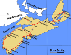
Nova Scotia
Regional municipality
A regional municipality is a type of Canadian municipal government similar to and at the same municipal government level as a county, although the specific structure and servicing responsibilities may vary from place to place...
in the 1990s.
- HalifaxCity of HalifaxHalifax is a city in Canada, which was the capital of the province of Nova Scotia and shire town of Halifax County. It was the largest city in Atlantic Canada until it was amalgamated into Halifax Regional Municipality in 1996...
- provincial capital and Metropolitan AreaMetropolitan areaThe term metropolitan area refers to a region consisting of a densely populated urban core and its less-populated surrounding territories, sharing industry, infrastructure, and housing. A metropolitan area usually encompasses multiple jurisdictions and municipalities: neighborhoods, townships,...
, now part of the Halifax Regional Municipality 44.64887°N 63.57531°W - SydneySydney, Nova ScotiaSydney is a Canadian urban community in the province of Nova Scotia. It is situated on the east coast of Cape Breton Island and is administratively part of the Cape Breton Regional Municipality....
- former city, now part of the Cape Breton Regional MunicipalityCape Breton Regional Municipality, Nova ScotiaCape Breton Regional Municipality often shortened to simply CBRM, is a regional municipality in Nova Scotia's Cape Breton County.According to the 2006 Census of Canada, the population within the Cape Breton Regional Municipality is 102,250...
46.13631°N 60.19551°W - DartmouthDartmouth, Nova ScotiaDartmouth founded in 1750, is a community and planning area of the Halifax Regional Municipality, Nova Scotia. Located on the eastern shore of Halifax Harbour, Dartmouth has been nicknamed the City of Lakes after the large number of lakes located in the city.On April 1, 1996, the provincial...
- formerly the second largest city in Nova Scotia, now a Metropolitan Area and part of the Halifax Regional Municipality. 44.66389°N 63.56818°W
Nunavut
As in the other two Canadian territories, the only incorporated city in NunavutNunavut
Nunavut is the largest and newest federal territory of Canada; it was separated officially from the Northwest Territories on April 1, 1999, via the Nunavut Act and the Nunavut Land Claims Agreement Act, though the actual boundaries had been established in 1993...
is its capital, Iqaluit.
- Iqaluit - territorial capital 63.71105°N 68.32749°W
Ontario
In OntarioOntario
Ontario is a province of Canada, located in east-central Canada. It is Canada's most populous province and second largest in total area. It is home to the nation's most populous city, Toronto, and the nation's capital, Ottawa....
, city status is conferred by the provincial government, generally upon the request of the incorporated municipality. A municipality may apply for city status anytime after its population surpasses 10,000. This status is not automatically conferred on a community that reaches this population target, but must be requested by the municipality and granted by the provincial Ministry of Municipal Affairs and Housing
Ministry of Municipal Affairs and Housing (Ontario)
The Ministry of Municipal Affairs and Housing is responsible for municipal affairs and housing in the Canadian province of Ontario.The current Minister of Municipal Affairs and Housing in the Ontario cabinet is Kathleen Wynne.-Former Ministers:...
. Not all municipalities which reach this population target have pursued city designation (as, for example, Markham
Markham, Ontario
Markham is a town in the Regional Municipality of York, located within the Greater Toronto Area of Southern Ontario, Canada. The population was 261,573 at the 2006 Canadian census...
, Ajax
Ajax, Ontario
Ajax is a town in the Durham Region in the Greater Toronto Area.The town is named for the HMS Ajax a Royal Navy cruiser that served in World War II. Ajax is a part of the Greater Toronto Area and the...
and Oakville
Oakville, Ontario
Oakville is a town in Halton Region, on Lake Ontario in Southern Ontario, Canada, and is part of the Greater Toronto Area. As of the 2006 census the population was 165,613.-History:In 1793, Dundas Street was surveyed for a military road...
, which in 2006 had census populations of ca. 262,000, 93,000, and 166,000 respectively, but are still designated as towns.) Once designated a city, however, a municipality does not lose this status even if its population later falls back below 10,000 (as, for example, Dryden
Dryden, Ontario
Dryden is the second-largest city in the Kenora District of Northwestern Ontario, Canada, located on Wabigoon Lake. It is the smallest community in the province of Ontario designated as a city...
.)
City status may also be conferred on some rural counties
County
A county is a jurisdiction of local government in certain modern nations. Historically in mainland Europe, the original French term, comté, and its equivalents in other languages denoted a jurisdiction under the sovereignty of a count A county is a jurisdiction of local government in certain...
which have been amalgamated such that all municipal governance takes place at the county level with no further municipal subdivisions. Thus, city status in Ontario does not always connote a primarily urbanized community.
| City | Census division | Population (2006) |
Location | Remarks |
|---|---|---|---|---|
| Barrie Barrie Barrie may refer to:* Barrie, city in Ontario, Canada* Barrie , Canadian federal electoral district* Barrie , provincial electoral district* Barrie—Simcoe—Bradford, former Canadian electoral district... |
Simcoe County Simcoe County, Ontario Simcoe County is located in central portion of Southern Ontario. The County is situated just north of the Greater Toronto Area stretching from the shores of Lake Simcoe in the east to Georgian Bay in the west... |
128,430 | 44.39047°N 79.68564°W | |
| Belleville Belleville, Ontario Belleville is a city located at the mouth of the Moira River on the Bay of Quinte in Southern Ontario, Canada, in the Quebec City-Windsor Corridor. It is the seat of Hastings County, but is politically independent of it. and the centre of the Bay of Quinte Region... |
Hastings County Hastings County, Ontario Hastings County is located in the province of Ontario, Canada. It is The Cheese Capital of Canada. Geographically, it is located on the border of Eastern Ontario and Central Ontario. The population was 125,915 in 2001 and grew to 130,474 in the 2006 Canada Census... |
48,821 | 44.16276°N 77.38319°W | |
| Brampton Brampton Brampton is the third-largest city in the Greater Toronto Area of Ontario, Canada.Brampton may also refer to:- Canada :* Brampton, a city in Ontario** Brampton GO Station, a station in the GO Transit network located in the city- United Kingdom :... |
Peel Region | 433,806 | 43.68529°N 79.75988°W | Part of the Greater Toronto Area Greater Toronto Area The Greater Toronto Area is the largest metropolitan area in Canada, with a 2006 census population of 5.5 million. The Greater Toronto Area is usually defined as the central city of Toronto, along with four regional municipalities surrounding it: Durham, Halton, Peel, and York... |
| Brant Brant, Ontario The County of Brant is a single-tier municipality and a census division in the Canadian province of Ontario. Despite its name, it is not a county by the standard definition, as all municipal services are handled by a single level of government. The county has service offices in Burford, Paris... |
Brant Brant, Ontario The County of Brant is a single-tier municipality and a census division in the Canadian province of Ontario. Despite its name, it is not a county by the standard definition, as all municipal services are handled by a single level of government. The county has service offices in Burford, Paris... |
34,415 | 43.15267°N 80.17157°W | |
| Brantford | Brant Brant, Ontario The County of Brant is a single-tier municipality and a census division in the Canadian province of Ontario. Despite its name, it is not a county by the standard definition, as all municipal services are handled by a single level of government. The county has service offices in Burford, Paris... |
90,192 | 43.14194°N 80.26221°W | |
| Brockville | Leeds and Grenville Leeds and Grenville United Counties, Ontario The United Counties of Leeds and Grenville are located Ontario, Canada. The population, as of the 2006 census, was 99,206. The United Counties have a land area of . Leeds and Grenville are located in the subregion of Southern Ontario named Eastern Ontario, and front on the St. Lawrence River and... |
21,957 | 44.59024°N 75.68258°W | |
| Burlington Burlington, Ontario Burlington , is a city located in Halton Region at the western end of Lake Ontario. Burlington is part of the Greater Toronto Area, and is also included in the Hamilton Census Metropolitan Area. Physically, Burlington lies between the north shore of Lake Ontario and the Niagara Escarpment... |
Halton Region | 164,415 | 43.32570°N 79.79885°W | Part of the Greater Toronto Area |
| Cambridge Cambridge, Ontario Cambridge is a city located in Southern Ontario at the confluence of the Grand and Speed rivers in the Regional Municipality of Waterloo, Ontario, Canada. It is an amalgamation of the City of Galt, the towns of Preston and Hespeler, and the hamlet of Blair.Galt covers the largest portion of... |
Waterloo Region Regional Municipality of Waterloo, Ontario The Regional Municipality of Waterloo is a regional municipality located in Southern Ontario, Canada. It consists of the cities of Kitchener, Cambridge, and Waterloo, and the townships of Wellesley, Woolwich, Wilmot, and North Dumfries. It is often referred to as the Region of Waterloo or just... |
120,371 | 43.36145°N 80.31461°W | |
| Chatham-Kent Chatham-Kent, Ontario Chatham–Kent is a unitary authority in Southwestern Ontario, Canada. Mostly rural, its centres of population are Blenheim, Chatham, Dresden, Ridgetown, Tilbury and Wallaceburg. Modern Chatham–Kent was created in 1998 by the merger of Kent County and its municipalities.- History :The former city of... |
single-tier | 108,177 | ||
| Clarence-Rockland Clarence-Rockland, Ontario Clarence-Rockland is a city in Eastern Ontario, Canada, in the United Counties of Prescott and Russell on the Ottawa River. Clarence-Rockland is located immediately to the east of Ottawa and is considered part of Canada's National Capital Region in the census.... |
Prescott and Russell Prescott and Russell United Counties, Ontario The United Counties of Prescott and Russell are consolidated counties located in the Canadian province of Ontario. As of 2006, the population is 80,184. Its county seat is L'Orignal, Ontario. It was created as a result of a merger between Russell County and Prescott County in 1820... |
20,790 | 45.55125°N 75.28913°W | Part of the National Capital Region National Capital Region (Canada) The National Capital Region, also referred to as Canada's Capital Region, is an official federal designation for the Canadian capital of Ottawa, Ontario, the neighbouring city of Gatineau, Quebec, and surrounding urban and rural communities.... |
| Cornwall Cornwall, Ontario Cornwall is a city in Eastern Ontario, Canada and the seat of the United Counties of Stormont, Dundas and Glengarry, Ontario. Cornwall is Ontario's easternmost city, located on the St... |
Stormont, Dundas and Glengarry Stormont, Dundas and Glengarry United Counties, Ontario The United Counties of Stormont, Dundas and Glengarry is an upper tier county and census division in the Canadian province of Ontario. The county seat is Cornwall... |
45,965 | 45.02094°N 74.73068°W | |
| Dryden Dryden, Ontario Dryden is the second-largest city in the Kenora District of Northwestern Ontario, Canada, located on Wabigoon Lake. It is the smallest community in the province of Ontario designated as a city... |
Kenora District Kenora District, Ontario Kenora District is a district and census division in Northwestern Ontario, Canada. It was created in 1907 from parts of Rainy River District. It is, geographically, the largest division in that province; at 407,192.66 km2 it comprises almost 38 percent of the province's land area... |
8,195 | 49.78008°N 92.83670°W | Smallest city in Ontario |
| Elliot Lake | Algoma District Algoma District, Ontario Algoma District is a district and census division in Northeastern Ontario in the Canadian province of Ontario. It was created in 1858 comprising territory as far west as Minnesota... |
11,549 | 46.38599°N 82.65100°W | |
| Greater Sudbury | single-tier | 157,857 | 46.48989°N 80.98979°W | |
| Guelph Guelph Guelph is a city in Ontario, Canada.Guelph may also refer to:* Guelph , consisting of the City of Guelph, Ontario* Guelph , as the above* University of Guelph, in the same city... |
Wellington County Wellington County, Ontario Wellington County is a county located in Southwestern Ontario, Canada. The county seat is Guelph, a city which is politically independent, but Guelph's status as the seat means it houses the county's administrative offices... |
114,943 | 43.54350°N 80.24826°W | |
| Haldimand County Haldimand County, Ontario Haldimand is a rural city-status single-tier municipality on the Niagara Peninsula in Southern Ontario, Canada, on the north shore of Lake Erie, and on the Grand River. Municipal offices are located in Cayuga.... |
single-tier | 45,212 | ||
| Hamilton Hamilton, Ontario Hamilton is a port city in the Canadian province of Ontario. Conceived by George Hamilton when he purchased the Durand farm shortly after the War of 1812, Hamilton has become the centre of a densely populated and industrialized region at the west end of Lake Ontario known as the Golden Horseshoe... |
single-tier | 504,559 | 43.25515°N 79.87327°W | Part of the Golden Horseshoe Golden Horseshoe The Golden Horseshoe is a densely populated and industrialized region centred around the Greater Toronto Area at the western end of Lake Ontario in Southern Ontario, Canada, with outer boundaries stretching south to Lake Erie and north to Georgian Bay. Most of it is also part of the Quebec City... |
| Kawartha Lakes Kawartha Lakes, Ontario The city of Kawartha Lakes is a unitary municipality in Central Ontario, Canada. Although called a city, Kawartha Lakes is the size of a typical Ontarian county and is mostly rural.... |
single-tier | 74,561 | ||
| Kenora | Kenora District Kenora District, Ontario Kenora District is a district and census division in Northwestern Ontario, Canada. It was created in 1907 from parts of Rainy River District. It is, geographically, the largest division in that province; at 407,192.66 km2 it comprises almost 38 percent of the province's land area... |
15,177 | 49.76747°N 94.49049°W | |
| Kingston Kingston, Ontario Kingston, Ontario is a Canadian city located in Eastern Ontario where the St. Lawrence River flows out of Lake Ontario. Originally a First Nations settlement called "Katarowki," , growing European exploration in the 17th Century made it an important trading post... |
Frontenac County Frontenac County, Ontario Frontenac County, as defined by Statistics Canada, is a census division of the Canadian province of Ontario. It is located in the eastern portion of Southern Ontario. The City of Kingston is included in the census division, but is politically separated from the County of Frontenac. It has a land... |
117,207 | 44.22993°N 76.48042°W | |
| Kitchener Kitchener, Ontario The City of Kitchener is a city in Southern Ontario, Canada. It was the Town of Berlin from 1854 until 1912 and the City of Berlin from 1912 until 1916. The city had a population of 204,668 in the Canada 2006 Census... |
Waterloo Region | 204,668 | 43.45179°N 80.49249°W | |
| London London, Ontario London is a city in Southwestern Ontario, Canada, situated along the Quebec City – Windsor Corridor. The city has a population of 352,395, and the metropolitan area has a population of 457,720, according to the 2006 Canadian census; the metro population in 2009 was estimated at 489,274. The city... |
Middlesex County Middlesex County, Ontario Middlesex County is a primarily rural county in Southwestern Ontario. Landlocked, the county is bordered by Huron and Perth counties on the north, Oxford County on the east, Elgin County on the south, and Chatham-Kent and Lambton County on the west.The seat is the city of London, although the city... |
352,395 | 42.98809°N 81.24609°W | |
| Mississauga | Peel Region | 668,549 | 43.58881°N 79.64436°W | Part of the Greater Toronto Area |
| Niagara Falls Niagara Falls, Ontario Niagara Falls is a Canadian city on the Niagara River in the Golden Horseshoe region of Southern Ontario. The municipality was incorporated on June 12, 1903... |
Niagara Region | 82,184 | 43.10602°N 79.06384°W | Part of the Golden Horseshoe |
| Norfolk County Norfolk County, Ontario Norfolk County is a rural city-status single-tier municipality on the north shore of Lake Erie in Southwestern Ontario, Canada. Bloomsburg is a small town located in Norfolk County and is the hometown of David Slater. The county seat and largest community is Simcoe... |
single-tier | 60,847 | ||
| North Bay North Bay, Ontario North Bay is a city in Northeastern Ontario, Canada. It is the seat of Nipissing District, and takes its name from its position on the shore of Lake Nipissing.-History:... |
Nipissing District Nipissing District, Ontario Nipissing District, Ontario is a district in Northeastern Ontario in the Canadian province of Ontario. It was created in 1858. The district seat is North Bay.In 2006, the population was 84,688... |
53,966 | 46.30913°N 79.46072°W | |
| Orillia | Simcoe County Simcoe County, Ontario Simcoe County is located in central portion of Southern Ontario. The County is situated just north of the Greater Toronto Area stretching from the shores of Lake Simcoe in the east to Georgian Bay in the west... |
30,259 | 44.60917°N 79.42111°W | |
| Oshawa Oshawa Oshawa is a city in Ontario, Canada, on the Lake Ontario shoreline. It lies in Southern Ontario approximately 60 kilometres east of downtown Toronto. It is commonly viewed as the eastern anchor of both the Greater Toronto Area and the Golden Horseshoe. It is now commonly referred to as the most... |
Durham Region | 141,590 | 43.89622°N 78.86561°W | Part of the Greater Toronto Area |
| Ottawa Ottawa Ottawa is the capital of Canada, the second largest city in the Province of Ontario, and the fourth largest city in the country. The city is located on the south bank of the Ottawa River in the eastern portion of Southern Ontario... |
single-tier | 812,129 | 45.44001°N 75.69460°W | Capital of Canada Part of the National Capital Region |
| Owen Sound | Grey County Grey County, Ontario Grey County is a county and census division of the Canadian province of Ontario. The county seat is in Owen Sound. The population was 92,411 in 2006. It is located in the subregion of Southern Ontario named Southwestern Ontario... |
21,753 | 44.56424°N 80.94280°W | |
| Pembroke Pembroke, Ontario Pembroke is a city in the province of Ontario, Canada, at the confluence of the Muskrat River and the Ottawa River in the Ottawa Valley... |
Renfrew County Renfrew County, Ontario Renfrew is a county in the Canadian province of Ontario. In 2006, the population was 97,545 and county covered , giving a population density of . There are 17 official municipalities.-Government:... |
13,930 | 45.82702°N 77.11162°W | |
| Peterborough Peterborough, Ontario Peterborough is a city on the Otonabee River in southern Ontario, Canada, 125 kilometres northeast of Toronto. The population of the City of Peterborough was 74,898 as of the 2006 census, while the census metropolitan area has a population of 121,428 as of a 2009 estimate. It presently ranks... |
Peterborough County Peterborough County, Ontario Peterborough County is located in Southern Ontario, Canada. It is projected to reach a population of 159,840 by 2031, according to the Ontario Ministry of Finance's Ontario Population Projections Update... |
74,898 | 44.30898°N 78.31982°W | |
| Pickering Pickering, Ontario Pickering is a city located in Southern Ontario, Canada immediately east of Toronto in Durham Region. It is part of the Greater Toronto Area, the largest metropolitan area in Canada.- Early Period :... |
Durham Region | 87,838 | 43.83798°N 79.08371°W | Part of the Greater Toronto Area |
| Prince Edward County Prince Edward County, Ontario Prince Edward County is a single-tier municipality and a census division of the Canadian province of Ontario.-Geography:Prince Edward County is located in Southern Ontario on a large irregular headland or littoral at the eastern end of Lake Ontario, just west of the head of the St. Lawrence River... |
single-tier | 25,496 | ||
| Port Colborne Port Colborne, Ontario Port Colborne is a city on Lake Erie, at the southern end of the Welland Canal, in the Niagara Region of southern Ontario, Canada... |
Niagara Region | 18,599 | 42.88646°N 79.25104°W | Part of the Golden Horseshoe |
| Quinte West Quinte West, Ontario Quinte West is a city, formerly part of Hastings County, but now a Separated municipality in Southern Ontario, Canada, . It is located on the western end of the Bay of Quinte on Lake Ontario... |
Hastings County Hastings County, Ontario Hastings County is located in the province of Ontario, Canada. It is The Cheese Capital of Canada. Geographically, it is located on the border of Eastern Ontario and Central Ontario. The population was 125,915 in 2001 and grew to 130,474 in the 2006 Canada Census... |
42,697 | ||
| Sarnia Sarnia, Ontario Sarnia is a city in Southern Ontario, Canada . It is the largest city on Lake Huron and is located where the upper Great Lakes empty into the St. Clair River.... |
Lambton County Lambton County, Ontario Lambton County is a census division of the Canadian province of Ontario. The county is located in Southwestern Ontario. It is bordered on the north by Lake Huron, which flows into the St. Clair River, the county's western border and part of the Canada-United States border. To the south is Lake... |
71,419 | 42.97500°N 82.40682°W | |
| Sault Ste. Marie Sault Ste. Marie, Ontario Sault Ste. Marie is a city on the St. Marys River in Algoma District, Ontario, Canada. It is the third largest city in Northern Ontario, after Sudbury and Thunder Bay, with a population of 74,948. The community was founded as a French religious mission: Sault either means "jump" or "rapids" in... |
Algoma District Algoma District, Ontario Algoma District is a district and census division in Northeastern Ontario in the Canadian province of Ontario. It was created in 1858 comprising territory as far west as Minnesota... |
74,948 | 46.50663°N 84.33337°W | |
| St. Catharines | Niagara Region | 131,989 | 43.15928°N 79.24696°W | Part of the Golden Horseshoe |
| St. Thomas St. Thomas, Ontario St. Thomas is a city in southern , Ontario, Canada. It is the seat for Elgin County and gained its city charter on March 4, 1881.-History:... |
Elgin County Elgin County, Ontario Elgin County is a county and census division of the Canadian province of Ontario with a current population of approximately 46,000. The county seat is St. Thomas.It consists of:*Town of Aylmer*Municipality of Bayham*Municipality of Central Elgin... |
36,110 | 42.77922°N 81.19270°W | |
| Stratford Stratford, Ontario Stratford is a city on the Avon River in Perth County in southwestern Ontario, Canada with a population of 32,000.When the area was first settled by Europeans in 1832, the townsite and the river were named after Stratford-upon-Avon, England. It is the seat of Perth County. Stratford was... |
Perth County Perth County, Ontario Perth County is a census division of the Canadian province of Ontario. The county seat is Stratford and is located in Southwestern Ontario, west of Toronto. It encompasses , 90% of which is classified as prime agricultural land... |
30,461 | 43.36999°N 80.98220°W | |
| Temiskaming Shores | Timiskaming District Timiskaming District, Ontario Timiskaming is a district and census division in Northeastern Ontario in the Canadian province of Ontario. The district was created in 1912 from parts of Algoma, Nipissing, and Sudbury districts. In 1921, Cochrane District was created from parts of this district and parts of Thunder Bay... |
10,442 | ||
| Thorold Thorold, Ontario Thorold is a city in Ontario, Canada, located on the Niagara Escarpment. It is also the seat of the Regional Municipality of Niagara.... |
Niagara Region | 18,224 | 43.10808°N 79.21494°W | Part of the Golden Horseshoe |
| Thunder Bay Thunder Bay -In Canada:Thunder Bay is the name of three places in the province of Ontario, Canada along Lake Superior:*Thunder Bay District, Ontario, a district in Northwestern Ontario*Thunder Bay, a city in Thunder Bay District*Thunder Bay, Unorganized, Ontario... |
Thunder Bay Thunder Bay District, Ontario Thunder Bay District is a district and census division in Northwestern Ontario in the Canadian province of Ontario. The district seat is Thunder Bay.... |
109,140 | 48.38177°N 89.24602°W | |
| Timmins Timmins Timmins is a city in northeastern Ontario, Canada on the Mattagami River. At the time of the Canada 2006 Census, Timmins' population was 42,997... |
Cochrane District Cochrane District, Ontario Cochrane District, Ontario is a district and census division in Northeastern Ontario in the Canadian province of Ontario. It was created in 1921 from parts of Timiskaming and Thunder Bay districts.... |
42,997 | 48.47640°N 81.32891°W | |
| Toronto Toronto Toronto is the provincial capital of Ontario and the largest city in Canada. It is located in Southern Ontario on the northwestern shore of Lake Ontario. A relatively modern city, Toronto's history dates back to the late-18th century, when its land was first purchased by the British monarchy from... |
single-tier | 2,503,281 | 43.65353°N 79.38390°W | Capital of Ontario Largest city in Ontario and Canada Part of the Greater Toronto Area |
| Vaughan Vaughan Vaughan is a city in York Region north of Toronto, Ontario, Canada. Vaughan is the fastest growing municipality in Canada achieving a population growth rate of 80.2% between 1996–2006, according to Statistics Canada having nearly doubled in population since 1991. Vaughan is located in Southern... |
York Region | 238,866 | 43.81099°N 79.45012°W | Part of the Greater Toronto Area |
| Waterloo Waterloo, Ontario Waterloo is a city in Southern Ontario, Canada. It is the smallest of the three cities in the Regional Municipality of Waterloo, and is adjacent to the city of Kitchener.... |
Waterloo Region | 97,475 | 43.46342°N 80.52009°W | |
| Welland Welland, Ontario Welland is a city in the Regional Municipality of Niagara in Southern Ontario, Canada.The city has been traditionally known as the place where rails and water meet, referring to the railways from Buffalo to Toronto and Southwestern Ontario, and the waterways of Welland Canal and Welland River,... |
Niagara Region | 50,331 | 42.99328°N 79.23915°W | Part of the Golden Horseshoe |
| Windsor Windsor, Ontario Windsor is the southernmost city in Canada and is located in Southwestern Ontario at the western end of the heavily populated Quebec City – Windsor Corridor. It is within Essex County, Ontario, although administratively separated from the county government. Separated by the Detroit River, Windsor... |
Essex County Essex County, Ontario Essex County is a county and census division located in Southwestern Ontario and covers an area at the southernmost tip of Canada. The administrative seat is Essex... |
216,473 | 42.31745°N 83.03518°W | |
| Woodstock Woodstock, Ontario Woodstock is a city and the county seat of Oxford County in Southern Ontario, Canada. Woodstock is located 128 km southwest of Toronto, north of Highway 401 along the historic Thames River... |
Oxford County Oxford County, Ontario Oxford County is a regional municipality and census division of the Canadian province of Ontario, located in the Southern portion of the province. The regional seat is in Woodstock... |
35,480 | 43.12979°N 80.75668°W |
Prince Edward Island
- CharlottetownCharlottetownCharlottetown is a Canadian city. It is both the largest city on and the provincial capital of Prince Edward Island, and the county seat of Queens County. Named after Queen Charlotte, the wife of George III, Charlottetown was first incorporated as a town in 1855 and designated as a city in 1885...
- provincial capital/largest city 46.24785°N 63.12019°W - SummersideSummerside, Prince Edward IslandSummerside is a Canadian city in Prince County, Prince Edward Island. It is the second largest city in the province and the principal municipality for the western part of the island.- History :...
46.39316°N 63.79023°W
Quebec
In QuebecQuebec
Quebec or is a province in east-central Canada. It is the only Canadian province with a predominantly French-speaking population and the only one whose sole official language is French at the provincial level....
, provincial law does not currently distinguish between towns and cities — one designation, ville
Ville
Ville is the modern French word of Latin origin now meaning city or town, but the first meaning in the middle-ages was farm and then village...
, covers both types of communities regardless of size, as the French language lacks a widely-used term to distinguish town and cities in general. A ville might be informally referred to as a town or a city in English
English language
English is a West Germanic language that arose in the Anglo-Saxon kingdoms of England and spread into what was to become south-east Scotland under the influence of the Anglian medieval kingdom of Northumbria...
, but this is an arbitrary and subjective distinction. Quebec does, however, distinguish between villes and other types of incorporated municipalities, such as municipalités
Municipality
A municipality is essentially an urban administrative division having corporate status and usually powers of self-government. It can also be used to mean the governing body of a municipality. A municipality is a general-purpose administrative subdivision, as opposed to a special-purpose district...
and villages autochthones
Indian reserve
In Canada, an Indian reserve is specified by the Indian Act as a "tract of land, the legal title to which is vested in Her Majesty, that has been set apart by Her Majesty for the use and benefit of a band." The Act also specifies that land reserved for the use and benefit of a band which is not...
. Quebec did at one time distinguish between villes and cités, but no longer does.
All municipalities in Quebec which have ville status are listed here, regardless of whether they are considered towns or cities in unofficial usage.
| City | Census division | Population 2006 |
Location |
| Acton Vale Acton Vale, Quebec Acton Vale is an industrial town in south-central Quebec, Canada. It is the seat of the Regional County Municipality of Acton and is in the Montérégie administrative region. The population as of the Canada 2006 Census was 7,797... |
Acton Acton Regional County Municipality, Quebec Acton Regional County Municipality is located in Central Quebec. The Regional County Municipality Seat is Acton Vale.Founded in 1982, the Acton Regional County Municipality is made up of eight smaller municipalities containing a little fewer than 16,000 people. The average population density is... |
7,797 | Montérégie Montérégie Montérégie is an administrative region in southwest Québec. It includes the cities of Boucherville, Brossard, Granby, Longueuil, Salaberry-de-Valleyfield, Saint-Jean-sur-Richelieu, Saint-Hyacinthe, Sorel-Tracy, and Vaudreuil-Dorion.... |
| Alma Alma, Quebec Alma is a town in the Canadian province of Quebec.-Geography:Alma is located on the southeast coast of Lac Saint-Jean where it flows into the Saguenay River, in the Saguenay–Lac-Saint-Jean region of Quebec, Canada, approximately 175 km north of Quebec City... |
Lac-Saint-Jean-Est Lac-Saint-Jean-Est Regional County Municipality, Quebec Lac-Saint-Jean-Est is a regional county municipality in northeastern Quebec, Canada. The county seat is in Alma. In 2006 it was 99.5% French-speaking.-Communities:* Cities & Towns** Alma** Desbiens** Métabetchouan–Lac-à-la-Croix... |
29,998 | Saguenay–Lac-Saint-Jean |
| Amos Amos, Quebec Amos is a ville in northwestern Quebec, Canada, on the Harricana River. It is the seat of Abitibi Regional County Municipality.Amos is the main city on the Harricana River, and the smallest of the three primary cities — after Rouyn-Noranda and Val-d'Or — in the Abitibi-Témiscamingue region of Quebec... |
Abitibi Abitibi Regional County Municipality, Quebec Abitibi Regional County Municipality is located in Northwestern Quebec. The Regional County Municipality seat is Amos.-Municipalities:*Barraute*Berry*Champneuf*La Corne*La Morandière*La Motte*Preissac*Rochebaucourt*Saint-Dominique-du-Rosaire... |
12,584 | Abitibi-Témiscamingue Abitibi-Témiscamingue Abitibi-Témiscamingue is a region located in western Quebec, Canada, along the border with Ontario. It became part of the province in 1898. It has a land area of 57,674.26 km2 . As of the 2006 census, the population of the region was 143,872 inhabitants.-History:The land was first occupied... |
| Amqui | La Matapédia La Matapédia Regional County Municipality, Quebec 300px|rightLa Matapédia is a Regional County Municipality in eastern Quebec, Canada at the base of the Gaspé peninsula.It is located in the Bas-Saint-Laurent region of Quebec. The seat is in Amqui. It is named for the Matapédia River which runs through the western part of the RCM. La Matapedia was... |
6,261 | Bas-Saint-Laurent Bas-Saint-Laurent The Bas-Saint-Laurent region is located along the south shore of the lower Saint Lawrence River in Quebec.It has a population of 200,653 and a land area of 22,232.11 km² .-Subdivisions:... |
| L'Ancienne-Lorette L'Ancienne-Lorette, Quebec L'Ancienne-Lorette is a city in central Quebec, Canada. It is a suburb of and an enclave within Quebec City. It was merged with Quebec City from January 1, 2002, to December 31, 2005, but was re-established as a separate city on January 1, 2006.... |
Quebec City CMA | 16,516 | Capitale-Nationale Capitale-Nationale Capitale-Nationale is one of 17 administrative regions of Quebec, Canada. Quebec City, Quebec's centre of government, is located in this region. It has a land area of 18,638.7 km2... |
| Asbestos Asbestos, Quebec -Communities:*Asbestos*Trois-Lacs-External links:***... |
Les Sources Les Sources Regional County Municipality, Quebec -External links:***-References:... |
6,819 | Centre-du-Québec Centre-du-Québec Centre-du-Québec is a region of Quebec, Canada. The main centres are Drummondville, Victoriaville and Bécancour. It has a land area of 6,928.78 km² and a 2006 census population of 224,200 inhabitants.-Description:... |
| L'Assomption L'Assomption, Quebec L'Assomption is an off-island suburb of Montreal, in southwestern Quebec, Canada on the L'Assomption River. It is the seat of the Regional County Municipality of L'Assomption. It is located on the outer fringes of the Montreal urban area.... |
L'Assomption L'Assomption Regional County Municipality, Quebec 260px|rightL'Assomption is a regional county municipality in southwestern Quebec, Canada. The seat is in L'Assomption. The region is named for the L'Assomption River which flows through the region from the north before emptying into the Saint Lawrence River in the south of the region at... |
16,738 | Laurentides |
| Baie-Comeau | Manicouagan Manicouagan Regional County Municipality, Quebec Manicouagan is a Regional County Municipality in the Côte-Nord region of Quebec, Canada. It is located on the north shore of the Saint Lawrence River with its seat in Baie-Comeau... |
22,554 | Côte-Nord Côte-Nord Côte-Nord is the second largest administrative region by land area in Quebec, Canada, after Nord-du-Québec... |
| Baie-d'Urfé Baie-d'Urfé, Quebec Baie-D'Urfé is a suburb located near to the western tip of the Island of Montreal, in Quebec, Canada. After the amalgamation of the Island's 27 distinct municipalities, it was merged on January 1, 2002 with neighbouring Beaconsfield to create the borough of Beaconsfield–Baie-D'Urfé, in the new... |
Montreal CMA Island of Montreal The Island of Montreal , in extreme southwestern Quebec, Canada, is located at the confluence of the Saint Lawrence and Ottawa Rivers. It is separated from Île Jésus by the Rivière des Prairies.... |
3,902 | Montréal Montréal (region) Montréal is one of the administrative regions of Quebec, Canada.It is also a territory equivalent to a regional county municipality and a census division , for both of which its geographical code is 66.... |
| Baie-Saint-Paul Baie-Saint-Paul, Quebec Baie-Saint-Paul is a city in the Province of Quebec, Canada, on the northern shore of the Saint Lawrence River. Baie-Saint-Paul is the seat of Charlevoix Regional County Municipality. The city is situated at the mouth of the Gouffre River... |
Charlevoix Charlevoix Regional County Municipality, Quebec Charlevoix is a regional county municipality in northeastern Quebec, Canada. The regional county municipality seat is Baie-Saint-Paul.According to the 2001 Statistics Canada Census:*Population: 13,166*% Change : -2.0*Dwellings: 5,924... |
7,288 | Capitale-Nationale Capitale-Nationale Capitale-Nationale is one of 17 administrative regions of Quebec, Canada. Quebec City, Quebec's centre of government, is located in this region. It has a land area of 18,638.7 km2... |
| Barkmere Barkmere, Quebec Barkmere is a ville in the Canadian province of Quebec, located in Les Laurentides Regional County Municipality.It is one of the smallest incorporated municipalities in Quebec, with a population of just 87 in the Canada 2006 Census.-Demographics:... |
Les Laurentides Les Laurentides Regional County Municipality, Quebec Les Laurentides is a Regional County Municipality in southwestern Quebec, Canada, in the Laurentides region. The seat is in Saint-Faustin-Lac-Carré and it is named after the Laurentian Mountains... |
87 | Laurentides |
| Beaconsfield Beaconsfield, Quebec Beaconsfield , 2006 Population 19,194) is a municipality on the Island of Montreal in Quebec, Canada. It is located on the north shore of Lake Saint-Louis and is bordered on the west by Baie-D'Urfé, on the north by Kirkland and on the east by Pointe-Claire... |
Montreal CMA Island of Montreal The Island of Montreal , in extreme southwestern Quebec, Canada, is located at the confluence of the Saint Lawrence and Ottawa Rivers. It is separated from Île Jésus by the Rivière des Prairies.... |
19,194 | Montréal Montréal (region) Montréal is one of the administrative regions of Quebec, Canada.It is also a territory equivalent to a regional county municipality and a census division , for both of which its geographical code is 66.... |
| Beauceville Beauceville, Quebec Beauceville is a city in and the seat of the Municipalité régionale de comté Robert-Cliche in Quebec, Canada. It is part of the Chaudière-Appalaches region and the population was 6,226 as of the Canada 2006 Census.... |
Robert-Cliche Robert-Cliche Regional County Municipality, Quebec Robert-Cliche is a regional county municipality in southeastern Quebec, Canada, on the Chaudière River, in Chaudière-Appalaches, between La Nouvelle-Beauce and Beauce-Sartigan.... |
6,226 | Chaudière-Appalaches Chaudière-Appalaches Chaudière-Appalaches is an administrative region in Quebec, Canada. It comprises most of what is historically known as the "Beauce" |the electoral district of Beauce]]). It is named for the Chaudière River and the Appalachian Mountains.... |
| Beauharnois Beauharnois, Quebec Beauharnois is a city located in the Beauharnois-Salaberry Regional County Municipality of southwestern Quebec, Canada and is part of Greater Montreal Area. The city's population as of the Canada 2006 Census was 11,918... |
Beauharnois-Salaberry Beauharnois-Salaberry Regional County Municipality, Quebec Beauharnois-Salaberry Regional County Municipality is a regional county municipality in southwestern Quebec. The regional county municipality seat is Beauharnois.-Communities:*Cities and Towns**Beauharnois**Salaberry-de-Valleyfield... |
11,918 | Montérégie Montérégie Montérégie is an administrative region in southwest Québec. It includes the cities of Boucherville, Brossard, Granby, Longueuil, Salaberry-de-Valleyfield, Saint-Jean-sur-Richelieu, Saint-Hyacinthe, Sorel-Tracy, and Vaudreuil-Dorion.... |
| Beaupré Beaupré, Quebec Beaupré is a ville in the Canadian province of Quebec, located in La Côte-de-Beaupré Regional County Municipality. The town is along the Saint Lawrence River and Route 138 at the mouth of the Sainte-Anne-du-Nord River.... |
La Côte-de-Beaupré La Côte-de-Beaupré Regional County Municipality, Quebec 300px|rightLa Côte-de-Beaupré is a regional county municipality in northeastern Quebec, Canada. Regional County municipality seat is Château-Richer, Quebec. The municipality has a land area of 4,864.67 km² and a 2006 census population of 23,015 inhabitants. Its largest community is the... |
3,006 | Capitale-Nationale Capitale-Nationale Capitale-Nationale is one of 17 administrative regions of Quebec, Canada. Quebec City, Quebec's centre of government, is located in this region. It has a land area of 18,638.7 km2... |
| Bécancour Bécancour, Quebec Bécancour is a town in the Centre-du-Québec region of Québec, Canada; it is the seat of the Bécancour Regional County Municipality. It is located on the south shore of the Saint Lawrence River at the confluence of the Bécancour River, opposite Trois-Rivières.Wôlinak, an Abenaki Indian reserve, is... |
Bécancour Bécancour Regional County Municipality, Quebec Bécancour is a regional county municipality in central Quebec, Canada. The regional county municipality seat is Bécancour.-Communities:*Cities & Towns**Bécancour*Municipalities**Deschaillons-sur-Saint-Laurent**Fortierville**Lemieux**Manseau... |
11,134 | Montérégie Montérégie Montérégie is an administrative region in southwest Québec. It includes the cities of Boucherville, Brossard, Granby, Longueuil, Salaberry-de-Valleyfield, Saint-Jean-sur-Richelieu, Saint-Hyacinthe, Sorel-Tracy, and Vaudreuil-Dorion.... |
| Bedford | Brome-Missisquoi Brome-Missisquoi Regional County Municipality, Quebec - External links :* * *... |
2,612 | Estrie Estrie The Estrie is an administrative region of Quebec that overlaps mostly the Eastern Townships. Estrie, a French neologism, was coined as a derivative of est, "east."... |
| Belleterre Belleterre, Quebec Belleterre is a ville in northwestern Quebec, Canada, in the MRC de Témiscamingue.-History:In 1930, prospector William Logan discovered gold near Mud Lake . This led to the establishment of the Belleterre Gold Mines Company in 1935, and the formation of the Belleterre community at nearby Sables... |
Témiscamingue Témiscamingue Regional County Municipality, Quebec Témiscamingue is a county regional municipality in the Abitibi-Témiscamingue region of western Quebec, Canada. The county seat is Ville-Marie.... |
350 | Abitibi-Témiscamingue Abitibi-Témiscamingue Abitibi-Témiscamingue is a region located in western Quebec, Canada, along the border with Ontario. It became part of the province in 1898. It has a land area of 57,674.26 km2 . As of the 2006 census, the population of the region was 143,872 inhabitants.-History:The land was first occupied... |
| Belœil | La Vallée-du-Richelieu La Vallée-du-Richelieu Regional County Municipality, Quebec La Vallée-du-Richelieu is a Regional County Municipality in southwestern Quebec, Canada. It surrounds the Richelieu River as the river makes its way from Lake Champlain in the United States north to the Saint Lawrence River northeast of Montreal at Sorel-Tracy, Quebec... |
18,927 | Montérégie Montérégie Montérégie is an administrative region in southwest Québec. It includes the cities of Boucherville, Brossard, Granby, Longueuil, Salaberry-de-Valleyfield, Saint-Jean-sur-Richelieu, Saint-Hyacinthe, Sorel-Tracy, and Vaudreuil-Dorion.... |
| Berthierville Berthierville, Quebec Berthierville is a Canadian town located between Montreal and Trois-Rivières on the north shore of the Saint Lawrence River in the province of Quebec. Berthierville is the seat of D'Autray Regional County Municipality, and is served by Autoroute 40, and is the junction of Routes 138 and 158... |
D'Autray D'Autray Regional County Municipality, Quebec 300px|rightD'Autray is a regional county municipality in central Quebec, Canada. The regional county municipality seat is Berthierville. The municipality has a land area of 1,246.68 km² and a 2006 census population of 40,321 inhabitants. Its largest community is the city of Lavaltrie.-Cities... |
4,007 | Lanaudière Lanaudière Lanaudière is one of the seventeen administrative regions of Quebec, Canada, situated immediately to the northeast of Montreal. It has a total population of 429,053 inhabitants.-Geography:... |
| Blainville Blainville, Quebec Blainville is an off-island suburb of Montreal, in southwestern Quebec and is located northwest of downtown Montreal.The idyllic setting and small town environment makes for a sharp contrast with the booming urban centre next door. Blainville sits right at the foot of the Laurentians, an ancient... |
Thérèse-de-Blainville | 46,493 | Montérégie Montérégie Montérégie is an administrative region in southwest Québec. It includes the cities of Boucherville, Brossard, Granby, Longueuil, Salaberry-de-Valleyfield, Saint-Jean-sur-Richelieu, Saint-Hyacinthe, Sorel-Tracy, and Vaudreuil-Dorion.... |
| Bois-des-Filion Bois-des-Filion, Quebec Bois-des-Filion is an off-island suburb of Montreal, located in Quebec, Canada, to the north of Montreal.Historically, hundreds of families annually traveled to this region seasonally to experience the magnificent maple forests; however the tourist industry is currently a minor source of income for... |
Thérèse-de-Blainville | 8,383 | Lanaudière Lanaudière Lanaudière is one of the seventeen administrative regions of Quebec, Canada, situated immediately to the northeast of Montreal. It has a total population of 429,053 inhabitants.-Geography:... |
| Boisbriand Boisbriand, Quebec Boisbriand is an off-island suburb of Montreal, in southwestern Quebec, Canada on the north shore of the Rivière des Mille-Îles in the Regional County Municipality of Thérèse-de-Blainville.The Hasidic community of Kiryas Tosh is located within the city limits... |
Thérèse-de-Blainville | 26,483 | Lanaudière Lanaudière Lanaudière is one of the seventeen administrative regions of Quebec, Canada, situated immediately to the northeast of Montreal. It has a total population of 429,053 inhabitants.-Geography:... |
| Bonaventure Bonaventure, Quebec Bonaventure is a town on the Gaspé Peninsula in the Bonaventure Regional County Municipality of Quebec. It is located on Baie des Chaleurs near the mouth of the Bonaventure River... |
Bonaventure Bonaventure Regional County Municipality, Quebec Bonaventure Regional County Municipality is a regional county municipality in eastern Quebec, on the Gaspé Peninsula. The regional county municipality seat is New Carlisle.-Communities:Cities*Bonaventure*New Richmond*Paspébiac... |
2,673 | Gaspésie |
| Boucherville | Longueuil CMA Urban agglomeration of Longueuil The urban agglomeration of Longueuil was created on January 1, 2006 as a result of the de-amalgamation process brought upon by the Charest government... |
39,062 | Montérégie Montérégie Montérégie is an administrative region in southwest Québec. It includes the cities of Boucherville, Brossard, Granby, Longueuil, Salaberry-de-Valleyfield, Saint-Jean-sur-Richelieu, Saint-Hyacinthe, Sorel-Tracy, and Vaudreuil-Dorion.... |
| Brome Lake (Lac-Brome) | Brome-Missisquoi Brome-Missisquoi Regional County Municipality, Quebec - External links :* * *... |
5,629 | Montérégie Montérégie Montérégie is an administrative region in southwest Québec. It includes the cities of Boucherville, Brossard, Granby, Longueuil, Salaberry-de-Valleyfield, Saint-Jean-sur-Richelieu, Saint-Hyacinthe, Sorel-Tracy, and Vaudreuil-Dorion.... |
| Bromont Bromont, Quebec Bromont is a city in southwestern Quebec in Canada, 75 kilometres east of Montreal on Autoroute 10, bordering the Eastern Townships at the base of Mount Brome . The population as of the Canada 2006 Census was 6,049.... |
La Haute-Yamaska La Haute-Yamaska Regional County Municipality, Quebec La Haute-Yamaska is a regional county municipality in southcentral Quebec, Canada. It is named for its position at the height of the Yamaska River which cuts through the south part of the Regional County Municipality, and rises at Brome Lake located in neighbouring Brome-Missisquoi Regional County... |
6,049 | Estrie Estrie The Estrie is an administrative region of Quebec that overlaps mostly the Eastern Townships. Estrie, a French neologism, was coined as a derivative of est, "east."... |
| Brossard Brossard Brossard is a suburban area, located on the south shore of the Saint Lawrence River, opposite the island and city of Montreal.Brossard is subdivided into many smaller sections. These sections are characterized by having street names that all begin with the same letter of the alphabet... |
Longueuil CMA Urban agglomeration of Longueuil The urban agglomeration of Longueuil was created on January 1, 2006 as a result of the de-amalgamation process brought upon by the Charest government... |
71,154 | Montérégie Montérégie Montérégie is an administrative region in southwest Québec. It includes the cities of Boucherville, Brossard, Granby, Longueuil, Salaberry-de-Valleyfield, Saint-Jean-sur-Richelieu, Saint-Hyacinthe, Sorel-Tracy, and Vaudreuil-Dorion.... |
| Brownsburg-Chatham | Argenteuil Argenteuil Regional County Municipality, Quebec Argenteuil Regional County Municipality is located in southern Quebec, Canada, part of the Laurentides region. The Regional County Municipality seat is Lachute.-History:... |
6,664 | Laurentides |
| Cabano Cabano, Quebec Cabano is a city in Témiscouata Regional County Municipality within the Bas-Saint-Laurent region of Quebec, Canada. It is situated on Lake Témiscouata on Route 185.On May 9, 1950, a fire destroyed a large part of the city.... |
Témiscouata Témiscouata Regional County Municipality, Quebec Témiscouata is a county regional municipality of Quebec in Canada. It is located southeast of Rivière-du-Loup, bordering New Brunswick, and is centred around Lake Témiscouata.Major industries include forestry, agriculture and maple syrup products.... |
3,199 | Bas-Saint-Laurent Bas-Saint-Laurent The Bas-Saint-Laurent region is located along the south shore of the lower Saint Lawrence River in Quebec.It has a population of 200,653 and a land area of 22,232.11 km² .-Subdivisions:... |
| Candiac Candiac, Quebec Candiac is an off-island suburb of Montreal, in the Canadian province of Quebec; it is located on the south shore of the Saint Lawrence River opposite Montreal near La Prairie... |
Roussillon Roussillon Regional County Municipality, Quebec Roussillon is a regional county municipality of Quebec in Canada. The seat is in Saint-Constant, Quebec. The region's population was 149,996 in 2006.-Communities:*Cities and Towns**Candiac**Châteauguay**Delson**La Prairie**Léry**Mercier... |
15,947 | Montérégie Montérégie Montérégie is an administrative region in southwest Québec. It includes the cities of Boucherville, Brossard, Granby, Longueuil, Salaberry-de-Valleyfield, Saint-Jean-sur-Richelieu, Saint-Hyacinthe, Sorel-Tracy, and Vaudreuil-Dorion.... |
| Cap-Chat Cap-Chat, Quebec Cap-Chat is a town in the Canadian province of Québec, in the Regional County Municipality of Haute-Gaspésie, and in the administrative region of Gaspésie-Îles-de-la-Madeleine. Its geographical co-ordinates are lat. 49°6′ N; long. 66°41′ W. Cap-Chat is found 16 km west of... |
La Haute-Gaspésie La Haute-Gaspésie Regional County Municipality, Quebec La Haute-Gaspésie is a regional county municipality in eastern Quebec, Canada on the Gaspé peninsula. The regional county municipality seat is in Sainte-Anne-des-Monts.-Cities:* Cap-Chat* Sainte-Anne-des-Monts-Municipalities:* La Martre... |
2,777 | Gaspésie–Îles-de-la-Madeleine |
| Cap-Santé | Portneuf Portneuf Regional County Municipality, Quebec Portneuf is a Regional County Municipality in the Canadian province of Quebec. The county administrative seat is Cap-Santé.- History :The Regional County Municipality of Portneuf was constituted as a regional administrative entity on November 25th 1981 by a Provincial decree creating the supralocal... |
2,666 | Capitale-Nationale Capitale-Nationale Capitale-Nationale is one of 17 administrative regions of Quebec, Canada. Quebec City, Quebec's centre of government, is located in this region. It has a land area of 18,638.7 km2... |
| Carignan Carignan, Quebec Carignan is a town in southwestern Quebec, Canada on the Richelieu River in the Regional County Municipality of La-Vallée-du-Richelieu. The population as of the Canada 2006 Census was 7,426.... |
La Vallée-du-Richelieu La Vallée-du-Richelieu Regional County Municipality, Quebec La Vallée-du-Richelieu is a Regional County Municipality in southwestern Quebec, Canada. It surrounds the Richelieu River as the river makes its way from Lake Champlain in the United States north to the Saint Lawrence River northeast of Montreal at Sorel-Tracy, Quebec... |
7,426 | Montérégie Montérégie Montérégie is an administrative region in southwest Québec. It includes the cities of Boucherville, Brossard, Granby, Longueuil, Salaberry-de-Valleyfield, Saint-Jean-sur-Richelieu, Saint-Hyacinthe, Sorel-Tracy, and Vaudreuil-Dorion.... |
| Carleton-sur-Mer | Avignon Avignon Regional County Municipality, Quebec Avignon Regional County Municipality is located in eastern Quebec, on the Gaspé peninsula, along Baie des Chaleurs. The regional county municipality seat is Nouvelle... |
4,077 | Gaspésie–Îles-de-la-Madeleine |
| Causapscal Causapscal, Quebec Causapscal is a city in the Canadian province of Quebec, located in La Matapédia Regional County Municipality. The city's name derives from the Mi'kmaq word Goesôpsiag, meaning "rocky point".... |
La Matapédia La Matapédia Regional County Municipality, Quebec 300px|rightLa Matapédia is a Regional County Municipality in eastern Quebec, Canada at the base of the Gaspé peninsula.It is located in the Bas-Saint-Laurent region of Quebec. The seat is in Amqui. It is named for the Matapédia River which runs through the western part of the RCM. La Matapedia was... |
2,556 | Bas-Saint-Laurent Bas-Saint-Laurent The Bas-Saint-Laurent region is located along the south shore of the lower Saint Lawrence River in Quebec.It has a population of 200,653 and a land area of 22,232.11 km² .-Subdivisions:... |
| Chambly Chambly, Quebec Chambly is a city in southwestern Quebec, Canada, about to the south east of Montreal.- Geography :It sits on the Richelieu River in the Regional County Municipality of La-Vallée-du-Richelieu, at .-History:... |
La Vallée-du-Richelieu La Vallée-du-Richelieu Regional County Municipality, Quebec La Vallée-du-Richelieu is a Regional County Municipality in southwestern Quebec, Canada. It surrounds the Richelieu River as the river makes its way from Lake Champlain in the United States north to the Saint Lawrence River northeast of Montreal at Sorel-Tracy, Quebec... |
22,608 | Montérégie Montérégie Montérégie is an administrative region in southwest Québec. It includes the cities of Boucherville, Brossard, Granby, Longueuil, Salaberry-de-Valleyfield, Saint-Jean-sur-Richelieu, Saint-Hyacinthe, Sorel-Tracy, and Vaudreuil-Dorion.... |
| Chandler Chandler, Quebec The port of Chandler was founded in 1912 when Percy Milton Chandler, a Philadelphia manufacturer, built the first pulp and paper mill in the Gaspésie at the site. This city of 7914 is the birthplace of NHL player Mathieu Garon. It is located at 48°21′N latitude, 64°41′ longitude. Its elevation is... |
Le Rocher-Percé Le Rocher-Percé Regional County Municipality, Quebec Rocher-Percé is a county regional municipality of Quebec in Canada. It is named after Percé Rock , a massive arched sandstone rock rising from the Atlantic just off the tip of the Gaspé peninsula. The region includes the towns of Percé, Grande-Rivière, Port-Daniel-Gascons and Chandler... |
7,914 | Gaspésie–Îles-de-la-Madeleine |
| Chapais Chapais, Quebec Chapais is a community in the Canadian province of Quebec, located on Route 113 near Chibougamau in the Jamésie region. It is surrounded by, but not a part of, the municipality of Baie-James. The community was first settled in 1929, when prospector Léo Springer discovered deposits of copper, silver... |
Nord-du-Québec Nord-du-Québec Nord-du-Québec is the largest of the seventeen administrative regions of Quebec, Canada. With , of which are lakes and rivers, it covers much of the Labrador Peninsula and about 55% of the total land surface area of Quebec.... |
1,630 | Nord-du-Québec Nord-du-Québec Nord-du-Québec is the largest of the seventeen administrative regions of Quebec, Canada. With , of which are lakes and rivers, it covers much of the Labrador Peninsula and about 55% of the total land surface area of Quebec.... |
| Charlemagne Charlemagne, Quebec Charlemagne is an off-island suburb of Montreal, Quebec, Canada. It is located on the north shore of the Rivière des Prairies, northeast of Montreal's downtown core. As of 2006, the population was 5,594.... |
L'Assomption L'Assomption Regional County Municipality, Quebec 260px|rightL'Assomption is a regional county municipality in southwestern Quebec, Canada. The seat is in L'Assomption. The region is named for the L'Assomption River which flows through the region from the north before emptying into the Saint Lawrence River in the south of the region at... |
5,594 | Lanaudière Lanaudière Lanaudière is one of the seventeen administrative regions of Quebec, Canada, situated immediately to the northeast of Montreal. It has a total population of 429,053 inhabitants.-Geography:... |
| Châteauguay | Roussillon Roussillon Regional County Municipality, Quebec Roussillon is a regional county municipality of Quebec in Canada. The seat is in Saint-Constant, Quebec. The region's population was 149,996 in 2006.-Communities:*Cities and Towns**Candiac**Châteauguay**Delson**La Prairie**Léry**Mercier... |
42,786 | Montérégie Montérégie Montérégie is an administrative region in southwest Québec. It includes the cities of Boucherville, Brossard, Granby, Longueuil, Salaberry-de-Valleyfield, Saint-Jean-sur-Richelieu, Saint-Hyacinthe, Sorel-Tracy, and Vaudreuil-Dorion.... |
| Château-Richer Château-Richer, Quebec Château-Richer is a small town situated in the Capitale-Nationale region of Quebec, Canada. Located on the north shore of the Saint Lawrence River east of Quebec City, Château-Richer is the seat for the Côte-de-Beaupré Regional County Municipality.... |
La Côte-de-Beaupré La Côte-de-Beaupré Regional County Municipality, Quebec 300px|rightLa Côte-de-Beaupré is a regional county municipality in northeastern Quebec, Canada. Regional County municipality seat is Château-Richer, Quebec. The municipality has a land area of 4,864.67 km² and a 2006 census population of 23,015 inhabitants. Its largest community is the... |
3,563 | Capitale-Nationale Capitale-Nationale Capitale-Nationale is one of 17 administrative regions of Quebec, Canada. Quebec City, Quebec's centre of government, is located in this region. It has a land area of 18,638.7 km2... |
| Chibougamau | Nord-du-Québec Nord-du-Québec Nord-du-Québec is the largest of the seventeen administrative regions of Quebec, Canada. With , of which are lakes and rivers, it covers much of the Labrador Peninsula and about 55% of the total land surface area of Quebec.... |
7,563 | Nord-du-Québec Nord-du-Québec Nord-du-Québec is the largest of the seventeen administrative regions of Quebec, Canada. With , of which are lakes and rivers, it covers much of the Labrador Peninsula and about 55% of the total land surface area of Quebec.... |
| Clermont Clermont, Capitale-Nationale, Quebec Clermont is a ville in the Canadian province of Quebec, and the seat of government for the Charlevoix-Est Regional County Municipality. It is located on the southern banks of the Malbaie River.-History:... |
Charlevoix-Est Charlevoix-Est Regional County Municipality, Quebec Charlevoix-Est is a regional county municipality in northeastern Quebec, Canada. The regional county municipality seat is Clermont.According to the 2001 Statistics Canada Census:*Population: 16,624*% Change : -1.9*Dwellings: 6,893... |
3,041 | Capitale-Nationale Capitale-Nationale Capitale-Nationale is one of 17 administrative regions of Quebec, Canada. Quebec City, Quebec's centre of government, is located in this region. It has a land area of 18,638.7 km2... |
| Coaticook Coaticook, Quebec Coaticook is a town in southeastern Quebec, Canada on the Coaticook River; it is the seat of the Coaticook Regional County Municipality. Its southern border is also the border with the United States-Communities:... |
Coaticook Coaticook Regional County Municipality, Quebec Coaticook is a regional county municipality in southeastern Quebec, Canada. The regional county municipality seat is Coaticook.-History:On September 3, 1783, as a result of the signing of the Treaty of Paris the American Revolutionary War ended with Great Britain... |
9,204 | Estrie Estrie The Estrie is an administrative region of Quebec that overlaps mostly the Eastern Townships. Estrie, a French neologism, was coined as a derivative of est, "east."... |
| Contrecoeur Contrecoeur, Quebec Contrecœur is a city in southwestern Quebec, Canada on the south shore of the St. Lawrence River. The population as of the Canada 2006 Census was 5,678... |
Lajemmerais Lajemmerais Regional County Municipality, Quebec Marguerite-d'Youville is a regional county municipality located in the Montérégie region of southwestern Quebec, Canada. The seat is in Verchères.... |
5,678 | Centre-du-Québec Centre-du-Québec Centre-du-Québec is a region of Quebec, Canada. The main centres are Drummondville, Victoriaville and Bécancour. It has a land area of 6,928.78 km² and a 2006 census population of 224,200 inhabitants.-Description:... |
| Cookshire-Eaton Cookshire-Eaton, Quebec Cookshire-Eaton is a ville in the Estrie region in Quebec. It was formed in 2002 by the amalgamation of the villages of Cookshire and Sawyerville, and the township of Eaton. It is the seat of Le Haut-Saint-François Regional County Municipality.... |
Le Haut-Saint-François Le Haut-Saint-François Regional County Municipality, Quebec -References:... |
5,004 | Estrie Estrie The Estrie is an administrative region of Quebec that overlaps mostly the Eastern Townships. Estrie, a French neologism, was coined as a derivative of est, "east."... |
| Côte-Saint-Luc | Montreal CMA Island of Montreal The Island of Montreal , in extreme southwestern Quebec, Canada, is located at the confluence of the Saint Lawrence and Ottawa Rivers. It is separated from Île Jésus by the Rivière des Prairies.... |
31,395 | Montréal Montréal (region) Montréal is one of the administrative regions of Quebec, Canada.It is also a territory equivalent to a regional county municipality and a census division , for both of which its geographical code is 66.... |
| Cowansville Cowansville, Quebec Cowansville is a town in south-central Quebec, Canada, located on Lac Davignon north of the U.S. border. It is the seat of Brome-Missisquoi, a regional county municipality... |
Brome-Missisquoi Brome-Missisquoi Regional County Municipality, Quebec - External links :* * *... |
12,182 | Montérégie Montérégie Montérégie is an administrative region in southwest Québec. It includes the cities of Boucherville, Brossard, Granby, Longueuil, Salaberry-de-Valleyfield, Saint-Jean-sur-Richelieu, Saint-Hyacinthe, Sorel-Tracy, and Vaudreuil-Dorion.... |
| Danville Danville, Quebec Danville is a town in the administrative region of Estrie, in the Canadian province of Quebec. As of the 2006 Canadian Census, the population was 4,041.... |
Les Sources Les Sources Regional County Municipality, Quebec -External links:***-References:... |
4,041 | Centre-du-Québec Centre-du-Québec Centre-du-Québec is a region of Quebec, Canada. The main centres are Drummondville, Victoriaville and Bécancour. It has a land area of 6,928.78 km² and a 2006 census population of 224,200 inhabitants.-Description:... |
| Daveluyville Daveluyville, Quebec Daveluyville is a town in the Centre-du-Québec region of the Canadian province of Quebec. It was founded by Adolphe Daveluy, the grandfather of organist Raymond Daveluy and soprano Marie Daveluy. It is north of Autoroute 20. Its population was 1,005 in the Canada 2006 Census.-External links:*... |
Arthabaska Arthabaska Regional County Municipality, Quebec Arthabaska Regional County Municipality is located in Central Quebec. The regional county municipality seat is Victoriaville. A report released in early 2006 by Maclean's magazine listed Arthabaska as the worst place in Canada for murder per capita but, by 2008, it had fallen to 21st... |
1,005 | Centre-du-Québec Centre-du-Québec Centre-du-Québec is a region of Quebec, Canada. The main centres are Drummondville, Victoriaville and Bécancour. It has a land area of 6,928.78 km² and a 2006 census population of 224,200 inhabitants.-Description:... |
| Dégelis Dégelis, Quebec Dégelis is a city in Témiscouata Regional County Municipality within the Bas-Saint-Laurent region of Quebec. It is situated on Route 185, close to the Quebec / New Brunswick Border.* Population: 3,209* % Change : -3.3* Dwellings: 1,630... |
Témiscouata Témiscouata Regional County Municipality, Quebec Témiscouata is a county regional municipality of Quebec in Canada. It is located southeast of Rivière-du-Loup, bordering New Brunswick, and is centred around Lake Témiscouata.Major industries include forestry, agriculture and maple syrup products.... |
3,209 | Bas-Saint-Laurent Bas-Saint-Laurent The Bas-Saint-Laurent region is located along the south shore of the lower Saint Lawrence River in Quebec.It has a population of 200,653 and a land area of 22,232.11 km² .-Subdivisions:... |
| Delson Delson, Quebec Delson is an off-island suburb of Montreal, Quebec, Canada. It is situated 8 mi/13 km SSE of Montreal within the regional county municipality of Roussillion in the administrative region of Montérégie. The population as of the Canada 2006 Census was 7,322.On its small territory, Delson is crossed... |
Roussillon Roussillon Regional County Municipality, Quebec Roussillon is a regional county municipality of Quebec in Canada. The seat is in Saint-Constant, Quebec. The region's population was 149,996 in 2006.-Communities:*Cities and Towns**Candiac**Châteauguay**Delson**La Prairie**Léry**Mercier... |
7,322 | Estrie Estrie The Estrie is an administrative region of Quebec that overlaps mostly the Eastern Townships. Estrie, a French neologism, was coined as a derivative of est, "east."... |
| Desbiens Desbiens, Quebec Desbiens is a ville in the Canadian province of Quebec, located in Lac-Saint-Jean-Est Regional County Municipality. It is on the shores of Lac Saint-Jean at the mouth of the Métabetchouane River.-Demographics:Population trend:... |
Lac-Saint-Jean-Est Lac-Saint-Jean-Est Regional County Municipality, Quebec Lac-Saint-Jean-Est is a regional county municipality in northeastern Quebec, Canada. The county seat is in Alma. In 2006 it was 99.5% French-speaking.-Communities:* Cities & Towns** Alma** Desbiens** Métabetchouan–Lac-à-la-Croix... |
1,074 | Saguenay–Lac-Saint-Jean |
| Deux-Montagnes Deux-Montagnes, Quebec Deux-Montagnes is a municipality in southwestern Quebec, Canada on the north shore of the Rivière des Mille Îles where it flows out of Lake of Two Mountains... |
Deux-Montagnes Deux-Montagnes Regional County Municipality, Quebec Deux-Montagnes is a regional county municipality in southwestern Quebec, Canada. It is located immediately north of Laval on the north shore of the Rivière des Mille-Îles and on the north shore of the Lake of Two Mountains. The Regional County Municipality seat is Deux-Montagnes... |
17,402 | Laurentides |
| Disraeli Disraeli, Quebec (city) The city of Disraeli is located in the Municipalité régionale de comté des Appalaches in Quebec, Canada. It is part of the Chaudière-Appalaches region and the population is 2,570 as of 2009... |
Les Appalaches | 2,570 | Chaudière-Appalaches Chaudière-Appalaches Chaudière-Appalaches is an administrative region in Quebec, Canada. It comprises most of what is historically known as the "Beauce" |the electoral district of Beauce]]). It is named for the Chaudière River and the Appalachian Mountains.... |
| Dolbeau-Mistassini | Maria-Chapdelaine Maria-Chapdelaine Regional County Municipality, Quebec Maria-Chapdelaine is a Regional County Municipality in northeastern Quebec, Canada. Its seat is in Dolbeau-Mistassini. The RCM runs from Lac Saint-Jean in the south to the deep interior of northern Quebec in the north... |
14,546 | Lac-Saint-Jean Lac-Saint-Jean This article is about the former federal electoral district. For the lake, see Lac Saint-Jean. For the current provincial electoral district, see Lac-Saint-Jean ... |
| Dollard-des-Ormeaux | Montreal CMA Island of Montreal The Island of Montreal , in extreme southwestern Quebec, Canada, is located at the confluence of the Saint Lawrence and Ottawa Rivers. It is separated from Île Jésus by the Rivière des Prairies.... |
48,930 | Montréal Montréal (region) Montréal is one of the administrative regions of Quebec, Canada.It is also a territory equivalent to a regional county municipality and a census division , for both of which its geographical code is 66.... |
| Donnacona Donnacona, Quebec Donnacona is an industrial town located about west of Quebec City in Portneuf County, Quebec, Canada.Some people believe the city was named after Donnacona, a 16th century Wendat chief who was taken to France... |
Portneuf Portneuf Regional County Municipality, Quebec Portneuf is a Regional County Municipality in the Canadian province of Quebec. The county administrative seat is Cap-Santé.- History :The Regional County Municipality of Portneuf was constituted as a regional administrative entity on November 25th 1981 by a Provincial decree creating the supralocal... |
5,564 | Capitale-Nationale Capitale-Nationale Capitale-Nationale is one of 17 administrative regions of Quebec, Canada. Quebec City, Quebec's centre of government, is located in this region. It has a land area of 18,638.7 km2... |
| Dorval | Montreal CMA Island of Montreal The Island of Montreal , in extreme southwestern Quebec, Canada, is located at the confluence of the Saint Lawrence and Ottawa Rivers. It is separated from Île Jésus by the Rivière des Prairies.... |
18,088 | Montréal Montréal (region) Montréal is one of the administrative regions of Quebec, Canada.It is also a territory equivalent to a regional county municipality and a census division , for both of which its geographical code is 66.... |
| Drummondville | Drummond Drummond Regional County Municipality, Quebec Drummond is a regional county municipality in central Quebec, Canada. The regional county municipality seat is Drummondville.-Communities:*Cities & Towns**Drummondville*Municipalities**Durham-Sud**L'Avenir**Lefebvre**Saint-Bonaventure... |
67,392 | Centre-du-Québec Centre-du-Québec Centre-du-Québec is a region of Quebec, Canada. The main centres are Drummondville, Victoriaville and Bécancour. It has a land area of 6,928.78 km² and a 2006 census population of 224,200 inhabitants.-Description:... |
| Dunham Dunham, Quebec Dunham is a city in the Canadian province of Quebec, located in Brome-Missisquoi Regional County Municipality. The population as of the Canada 2006 Census was 3,396.-Population:Population trend-Language:Mother tongue language ... |
Brome-Missisquoi Brome-Missisquoi Regional County Municipality, Quebec - External links :* * *... |
3,396 | Montérégie Montérégie Montérégie is an administrative region in southwest Québec. It includes the cities of Boucherville, Brossard, Granby, Longueuil, Salaberry-de-Valleyfield, Saint-Jean-sur-Richelieu, Saint-Hyacinthe, Sorel-Tracy, and Vaudreuil-Dorion.... |
| Duparquet Duparquet, Quebec Duparquet is a ville in northwestern Quebec, Canada in the MRC d'Abitibi-Ouest. It covers 157.4 km² and had a population of 650 in the Canada 2006 Census.-History:... |
Abitibi-Ouest Abitibi-Ouest Regional County Municipality, Quebec Abitibi-Ouest Regional County Municipality is located in Northwestern Quebec. The Regional County Municipality seat is La Sarre.-Communities:*Cities and Towns**Duparquet**La Sarre**Macamic*Municipalities**Authier... |
650 | Abitibi-Témiscamingue Abitibi-Témiscamingue Abitibi-Témiscamingue is a region located in western Quebec, Canada, along the border with Ontario. It became part of the province in 1898. It has a land area of 57,674.26 km2 . As of the 2006 census, the population of the region was 143,872 inhabitants.-History:The land was first occupied... |
| East Angus East Angus, Quebec East Angus is a city in Le Haut-Saint-François Regional County Municipality, in Quebec, Canada. The city had a population of 3,357 in the Canada 2006 Census.... |
Le Haut-Saint-François Le Haut-Saint-François Regional County Municipality, Quebec -References:... |
3,357 | Estrie Estrie The Estrie is an administrative region of Quebec that overlaps mostly the Eastern Townships. Estrie, a French neologism, was coined as a derivative of est, "east."... |
| L'Épiphanie | L'Assomption L'Assomption Regional County Municipality, Quebec 260px|rightL'Assomption is a regional county municipality in southwestern Quebec, Canada. The seat is in L'Assomption. The region is named for the L'Assomption River which flows through the region from the north before emptying into the Saint Lawrence River in the south of the region at... |
4,606 | Lanaudière Lanaudière Lanaudière is one of the seventeen administrative regions of Quebec, Canada, situated immediately to the northeast of Montreal. It has a total population of 429,053 inhabitants.-Geography:... |
| Estérel Estérel, Quebec Estérel is a village and municipality in the Laurentides region of Quebec, Canada, part of the Les Pays-d'en-Haut Regional County Municipality. The municipal territory almost entirely extends around Lake Masson, whereas the village itself is situated on the eastern shore of this lake.-History:The... |
Les Pays-d'en-Haut Les Pays-d'en-Haut Regional County Municipality, Quebec Les Pays-d'En-Haut is a county regional municipality of Quebec in Canada. The population of the MRC according to the 2006 Census is 36,573-Towns:* Estérel* Sainte-Adèle* Sainte-Marguerite-du-Lac-Masson* Saint-Sauveur-Municipalities:* Lac-des-Seize-Îles... |
256 | Capitale-Nationale Capitale-Nationale Capitale-Nationale is one of 17 administrative regions of Quebec, Canada. Quebec City, Quebec's centre of government, is located in this region. It has a land area of 18,638.7 km2... |
| Farnham Farnham, Quebec Farnham is a town located in the province of Quebec, Canada. It is part of the Brome-Missisquoi regional county municipality, in the administrative region of Montérégie. The population as of the Canada 2006 Census was 7,809, making it the second most populated community in the RCM.- History :The... |
Brome-Missisquoi Brome-Missisquoi Regional County Municipality, Quebec - External links :* * *... |
7,809 | Montérégie Montérégie Montérégie is an administrative region in southwest Québec. It includes the cities of Boucherville, Brossard, Granby, Longueuil, Salaberry-de-Valleyfield, Saint-Jean-sur-Richelieu, Saint-Hyacinthe, Sorel-Tracy, and Vaudreuil-Dorion.... |
| Fermont Fermont, Quebec Fermont is a town in northeastern Quebec, Canada, near the Quebec-Labrador border about from Labrador City on Route 389, which connects to the Trans-Labrador Highway... |
Caniapiscau Caniapiscau Regional County Municipality, Quebec Caniapiscau is a regional county municipality in northeastern Quebec, Canada. The regional county municipality seat is Fermont. It is located in the northwest corner of the Côte-Nord region of Quebec. It has a land area of and a 2006 census population of 3,948 inhabitants, two-thirds of whom lived... |
2,633 | Côte-Nord Côte-Nord Côte-Nord is the second largest administrative region by land area in Quebec, Canada, after Nord-du-Québec... |
| Forestville Forestville, Quebec Forestville is a town in the Côte-Nord region of Quebec, Canada. It is located on the north shore of the Saint Lawrence River along Route 138, approximately southwest of Baie-Comeau. There is a vehicle and passenger ferry service from Forestville to Rimouski, on the south shore of the St. Lawrence... |
La Haute-Côte-Nord La Haute-Côte-Nord Regional County Municipality, Quebec La Haute-Côte-Nord is a Regional County Municipality in northeastern Quebec, Canada. It is located on the Gulf of Saint Lawrence where the Saguenay River flows into it. The Regional County Municipality seat is at Les Escoumins. The municipality has a land area of and a 2006 census population... |
3,543 | Côte-Nord Côte-Nord Côte-Nord is the second largest administrative region by land area in Quebec, Canada, after Nord-du-Québec... |
| Fossambault-sur-le-Lac Fossambault-sur-le-Lac, Quebec Fossambault-sur-le-Lac is a French-speaking town in the south part of Quebec, Canada, in the regional county municipality of La Jacques-Cartier, just north of Quebec City. It has a population of 1,532... |
La Jacques-Cartier La Jacques-Cartier Regional County Municipality, Quebec La Jacques-Cartier is a regional county municipality in northeastern Quebec, Canada. It is located in the Capitale-Nationale region of Quebec. The seat is in Shannon... |
1,532 | Capitale-Nationale Capitale-Nationale Capitale-Nationale is one of 17 administrative regions of Quebec, Canada. Quebec City, Quebec's centre of government, is located in this region. It has a land area of 18,638.7 km2... |
| Gaspé Gaspé, Quebec Gaspé is a city at the tip of the Gaspé Peninsula in the Gaspésie–Îles-de-la-Madeleine region of eastern Quebec, Canada. As of the 2006 census, the city had a total population of 14,819.... |
La Côte-de-Gaspé La Côte-de-Gaspé Regional County Municipality, Quebec La Côte-de-Gaspé is a regional county municipality on the Gaspé peninsula in eastern Quebec, Canada. The regional county municipality seat is Gaspé. The municipality has a land area of 4,097.13 km² and a 2006 census population of 17,888 inhabitants... |
14,819 | Gaspésie |
| Gatineau Gatineau Gatineau is a city in western Quebec, Canada. It is the fourth largest city in the province. It is located on the northern banks of the Ottawa River, immediately across from Ottawa, Ontario, and together they form Canada's National Capital Region. Ottawa and Gatineau comprise a single Census... |
Gatineau Gatineau Gatineau is a city in western Quebec, Canada. It is the fourth largest city in the province. It is located on the northern banks of the Ottawa River, immediately across from Ottawa, Ontario, and together they form Canada's National Capital Region. Ottawa and Gatineau comprise a single Census... |
242,124 | Outaouais |
| Gracefield | La Vallée-de-la-Gatineau La Vallée-de-la-Gatineau Regional County Municipality, Quebec La Vallée-de-la-Gatineau is a Regional County Municipality in the Outaouais region of western Quebec, Canada. The seat is in Gracefield. It is named for its location straddling the Gatineau River north of Low. It was incorporated on January 1, 1983.It consists of two cities, fifteen... |
2,439 | Outaouais |
| Granby Granby, Quebec Granby is a city in southwestern Quebec, located east of Montreal. The population as of the Canada 2006 Census was 47,637. Granby is the seat of La Haute-Yamaska Regional County Municipality. It is the fifth most populated city in Montérégie after Longueuil, Saint-Jean-sur-Richelieu, Brossard and... |
La Haute-Yamaska La Haute-Yamaska Regional County Municipality, Quebec La Haute-Yamaska is a regional county municipality in southcentral Quebec, Canada. It is named for its position at the height of the Yamaska River which cuts through the south part of the Regional County Municipality, and rises at Brome Lake located in neighbouring Brome-Missisquoi Regional County... |
47,637 | Montérégie Montérégie Montérégie is an administrative region in southwest Québec. It includes the cities of Boucherville, Brossard, Granby, Longueuil, Salaberry-de-Valleyfield, Saint-Jean-sur-Richelieu, Saint-Hyacinthe, Sorel-Tracy, and Vaudreuil-Dorion.... |
| Grande-Rivière Grande-Rivière, Quebec Grande-Rivière is a city in the Gaspésie-Îles-de-la-Madeleine region of the province of Québec in Canada.... |
Le Rocher-Percé Le Rocher-Percé Regional County Municipality, Quebec Rocher-Percé is a county regional municipality of Quebec in Canada. It is named after Percé Rock , a massive arched sandstone rock rising from the Atlantic just off the tip of the Gaspé peninsula. The region includes the towns of Percé, Grande-Rivière, Port-Daniel-Gascons and Chandler... |
3,409 | Gaspésie–Îles-de-la-Madeleine |
| Hampstead Hampstead, Quebec -History:The Town of Hampstead was founded in 1914. It was designed to be an exclusive garden city. There are no retail shops within municipal boundaries. Houses were assigned relatively large lots to allow space for trees and shrubbery. The town's roads were designed with curves in order to slow... |
Montreal CMA Island of Montreal The Island of Montreal , in extreme southwestern Quebec, Canada, is located at the confluence of the Saint Lawrence and Ottawa Rivers. It is separated from Île Jésus by the Rivière des Prairies.... |
6,996 | Montréal Montréal (region) Montréal is one of the administrative regions of Quebec, Canada.It is also a territory equivalent to a regional county municipality and a census division , for both of which its geographical code is 66.... |
| Hudson Hudson, Quebec Hudson, Quebec, Canada, is a town with a population of 5,088 on the south-west bank of the lower Ottawa River, in the Vaudreuil-Soulanges Regional County Municipality. Situated about west of downtown Montreal, many residents commute to work on the Island of Montreal.- Location and... |
Vaudreuil-Soulanges Vaudreuil-Soulanges Regional County Municipality, Quebec -References:... |
5,088 | Montérégie Montérégie Montérégie is an administrative region in southwest Québec. It includes the cities of Boucherville, Brossard, Granby, Longueuil, Salaberry-de-Valleyfield, Saint-Jean-sur-Richelieu, Saint-Hyacinthe, Sorel-Tracy, and Vaudreuil-Dorion.... |
| Huntingdon Huntingdon, Quebec Huntingdon is a small town in Huntingdon County in the Haut-Saint-Laurent Regional County Municipality and the Montérégie region of the province of Quebec, Canada. The population as of the Canada 2006 Census was 2,587... |
Le Haut-Saint-Laurent Le Haut-Saint-Laurent Regional County Municipality, Quebec Le Haut-Saint-Laurent is a regional county municipality in southwestern Quebec, Canada in the Montérégie region. Its seat is in Huntingdon and it is named for the Saint Lawrence River which forms its western and northwestern boundary.... |
2,587 | Montérégie Montérégie Montérégie is an administrative region in southwest Québec. It includes the cities of Boucherville, Brossard, Granby, Longueuil, Salaberry-de-Valleyfield, Saint-Jean-sur-Richelieu, Saint-Hyacinthe, Sorel-Tracy, and Vaudreuil-Dorion.... |
| L'Île-Cadieux L'Île-Cadieux, Quebec L'Île-Cadieux is a village and municipality in the Montérégie region of Quebec, Canada, part of the Vaudreuil-Soulanges Regional County Municipality. It is located on and contiguous with Cadieux Island, which projects into Lake of Two Mountains just north off Vaudreuil-sur-le-Lac... |
Vaudreuil-Soulanges Vaudreuil-Soulanges Regional County Municipality, Quebec -References:... |
128 | Montérégie Montérégie Montérégie is an administrative region in southwest Québec. It includes the cities of Boucherville, Brossard, Granby, Longueuil, Salaberry-de-Valleyfield, Saint-Jean-sur-Richelieu, Saint-Hyacinthe, Sorel-Tracy, and Vaudreuil-Dorion.... |
| L'Île-Dorval L'Île-Dorval, Quebec L'Île-Dorval is a municipality and an island in southwestern Quebec, Canada, in Lac Saint-Louis off the Island of Montreal.A cottaging spot, it had only two permanent residents as of the 1996 census, making it the smallest municipality in Canada both in area and population. By the 2001 census the... |
Montreal CMA Island of Montreal The Island of Montreal , in extreme southwestern Quebec, Canada, is located at the confluence of the Saint Lawrence and Ottawa Rivers. It is separated from Île Jésus by the Rivière des Prairies.... |
59 | Montréal Montréal (region) Montréal is one of the administrative regions of Quebec, Canada.It is also a territory equivalent to a regional county municipality and a census division , for both of which its geographical code is 66.... |
| L'Île-Perrot L'Île-Perrot, Quebec Town of Île-Perrot is a town and municipality on Île Perrot in southwestern Quebec, Canada. The population as of the Canada 2006 Census was 9,927. The town is at the western end of Lake Saint-Louis, and borders the local island communities of Terrasse-Vaudreuil, Pincourt and... |
Vaudreuil-Soulanges Vaudreuil-Soulanges Regional County Municipality, Quebec -References:... |
9,927 | Montréal Montréal (region) Montréal is one of the administrative regions of Quebec, Canada.It is also a territory equivalent to a regional county municipality and a census division , for both of which its geographical code is 66.... |
| Joliette | Joliette Joliette Regional County Municipality, Quebec 300px|rightJoliette is a regional county municipality in southwest-central Quebec, Canada. The regional county seat is Joliette. The municipality has a land area of 416.285 km² and a 2006 census population of 58,354 inhabitants.... |
19,045 | Lanaudière Lanaudière Lanaudière is one of the seventeen administrative regions of Quebec, Canada, situated immediately to the northeast of Montreal. It has a total population of 429,053 inhabitants.-Geography:... |
| Kingsey Falls Kingsey Falls, Quebec Kingsey Falls, Quebec is a town in Centre-du-Québec, Quebec, Canada. It is 30 Km east of Drummondville and west of Route 116.-Sources:*... |
Arthabaska Arthabaska Regional County Municipality, Quebec Arthabaska Regional County Municipality is located in Central Quebec. The regional county municipality seat is Victoriaville. A report released in early 2006 by Maclean's magazine listed Arthabaska as the worst place in Canada for murder per capita but, by 2008, it had fallen to 21st... |
2,086 | Estrie Estrie The Estrie is an administrative region of Quebec that overlaps mostly the Eastern Townships. Estrie, a French neologism, was coined as a derivative of est, "east."... |
| Kirkland Kirkland, Quebec Kirkland is a town on the Island of Montreal in southwestern Quebec, Canada. As of 2006, the population was 20,491. It is named after Charles-Aimé Kirkland, a Quebec provincial politician.... |
Montreal CMA Island of Montreal The Island of Montreal , in extreme southwestern Quebec, Canada, is located at the confluence of the Saint Lawrence and Ottawa Rivers. It is separated from Île Jésus by the Rivière des Prairies.... |
20,491 | Montréal Montréal (region) Montréal is one of the administrative regions of Quebec, Canada.It is also a territory equivalent to a regional county municipality and a census division , for both of which its geographical code is 66.... |
| Lac-Delage Lac-Delage, Quebec Lac-Delage is a town in the Capitale-Nationale region of Quebec, Canada, located on the eponymous Lake Delage.-Demographics:Population trend:* Population in 2006: 530 * Population in 2001: 447... |
La Jacques-Cartier La Jacques-Cartier Regional County Municipality, Quebec La Jacques-Cartier is a regional county municipality in northeastern Quebec, Canada. It is located in the Capitale-Nationale region of Quebec. The seat is in Shannon... |
530 | Capitale-Nationale Capitale-Nationale Capitale-Nationale is one of 17 administrative regions of Quebec, Canada. Quebec City, Quebec's centre of government, is located in this region. It has a land area of 18,638.7 km2... |
| Lac-Mégantic Lac-Mégantic, Quebec Lac-Mégantic is a town in Estrie on Lac Mégantic, a freshwater lake for which the town was named. Situated in the former Frontenac County in the historic Eastern Townships, Lac-Mégantic is the seat of Le Granit Regional County Municipality and of the judicial district of... |
Le Granit Le Granit Regional County Municipality, Quebec -References:... |
5,967 | Estrie Estrie The Estrie is an administrative region of Quebec that overlaps mostly the Eastern Townships. Estrie, a French neologism, was coined as a derivative of est, "east."... |
| Lac-Saint-Joseph Lac-Saint-Joseph, Quebec Lac-Saint-Joseph is a town in Quebec, Canada, located on the eponymous Lake Saint-Joseph.-Demographics:Population trend:* Population in 2006: 266 * Population in 2001: 184* Population in 1996: 83... |
La Jacques-Cartier La Jacques-Cartier Regional County Municipality, Quebec La Jacques-Cartier is a regional county municipality in northeastern Quebec, Canada. It is located in the Capitale-Nationale region of Quebec. The seat is in Shannon... |
266 | Capitale-Nationale Capitale-Nationale Capitale-Nationale is one of 17 administrative regions of Quebec, Canada. Quebec City, Quebec's centre of government, is located in this region. It has a land area of 18,638.7 km2... |
| Lac-Sergent | Portneuf Portneuf Regional County Municipality, Quebec Portneuf is a Regional County Municipality in the Canadian province of Quebec. The county administrative seat is Cap-Santé.- History :The Regional County Municipality of Portneuf was constituted as a regional administrative entity on November 25th 1981 by a Provincial decree creating the supralocal... |
423 | Capitale-Nationale Capitale-Nationale Capitale-Nationale is one of 17 administrative regions of Quebec, Canada. Quebec City, Quebec's centre of government, is located in this region. It has a land area of 18,638.7 km2... |
| Lachute | Argenteuil Argenteuil Regional County Municipality, Quebec Argenteuil Regional County Municipality is located in southern Quebec, Canada, part of the Laurentides region. The Regional County Municipality seat is Lachute.-History:... |
11,832 | Laurentides |
| Laval Laval, Quebec Laval is a Canadian city and a region in southwestern Quebec. It is the largest suburb of Montreal, the third largest municipality in the province of Quebec, and the 14th largest city in Canada with a population of 368,709 in 2006... |
Laval Laval, Quebec Laval is a Canadian city and a region in southwestern Quebec. It is the largest suburb of Montreal, the third largest municipality in the province of Quebec, and the 14th largest city in Canada with a population of 368,709 in 2006... |
376,845 | Montréal Montreal Montreal is a city in Canada. It is the largest city in the province of Quebec, the second-largest city in Canada and the seventh largest in North America... |
| Lavaltrie Lavaltrie, Quebec Lavaltrie is a city located within the D'Autray Regional County Municipality in the southern part of the region of Lanaudière, Quebec, Canada, northeast of Montreal outside of the suburban sprawl of the northern crown... |
D'Autray D'Autray Regional County Municipality, Quebec 300px|rightD'Autray is a regional county municipality in central Quebec, Canada. The regional county municipality seat is Berthierville. The municipality has a land area of 1,246.68 km² and a 2006 census population of 40,321 inhabitants. Its largest community is the city of Lavaltrie.-Cities... |
12,112 | Lanaudière Lanaudière Lanaudière is one of the seventeen administrative regions of Quebec, Canada, situated immediately to the northeast of Montreal. It has a total population of 429,053 inhabitants.-Geography:... |
| Lebel-sur-Quévillon Lebel-sur-Quévillon, Quebec Lebel-sur-Quévillon is a town in the Canadian province of Quebec, located on Route 113 in the Jamésie region. It is located approximately 88 kilometres north of Senneterre and approximately 200 kilometres southwest of Chibougamau... |
Nord-du-Québec Nord-du-Québec Nord-du-Québec is the largest of the seventeen administrative regions of Quebec, Canada. With , of which are lakes and rivers, it covers much of the Labrador Peninsula and about 55% of the total land surface area of Quebec.... |
2,729 | Nord-du-Québec Nord-du-Québec Nord-du-Québec is the largest of the seventeen administrative regions of Quebec, Canada. With , of which are lakes and rivers, it covers much of the Labrador Peninsula and about 55% of the total land surface area of Quebec.... |
| Léry Léry, Quebec Léry is a small town situated along the south shore of Lake Saint-Louis in Quebec, Canada. The population as of the Canada 2006 Census was 2,385... |
Roussillon Roussillon Regional County Municipality, Quebec Roussillon is a regional county municipality of Quebec in Canada. The seat is in Saint-Constant, Quebec. The region's population was 149,996 in 2006.-Communities:*Cities and Towns**Candiac**Châteauguay**Delson**La Prairie**Léry**Mercier... |
2,385 | Montérégie Montérégie Montérégie is an administrative region in southwest Québec. It includes the cities of Boucherville, Brossard, Granby, Longueuil, Salaberry-de-Valleyfield, Saint-Jean-sur-Richelieu, Saint-Hyacinthe, Sorel-Tracy, and Vaudreuil-Dorion.... |
| Lévis Lévis, Quebec Lévis is a city in eastern Quebec, Canada. It is located on the south shore of the St. Lawrence River, opposite Quebec City. A ferry links Old Quebec with Old Lévis, and two bridges, the Quebec Bridge and the Pierre Laporte Bridge, connect western Lévis with Quebec City. The Société de transport de... |
Lévis Lévis, Quebec Lévis is a city in eastern Quebec, Canada. It is located on the south shore of the St. Lawrence River, opposite Quebec City. A ferry links Old Quebec with Old Lévis, and two bridges, the Quebec Bridge and the Pierre Laporte Bridge, connect western Lévis with Quebec City. The Société de transport de... |
130,006 | Chaudière-Appalaches Chaudière-Appalaches Chaudière-Appalaches is an administrative region in Quebec, Canada. It comprises most of what is historically known as the "Beauce" |the electoral district of Beauce]]). It is named for the Chaudière River and the Appalachian Mountains.... |
| Longueuil Longueuil Longueuil is a city in the province of Quebec, Canada. It is the seat of the Montérégie administrative region and sits on the south shore of the Saint Lawrence River directly across from Montreal. The population as of the Canada 2006 Census totaled 229,330, making it the third largest city in... |
Longueuil CMA Urban agglomeration of Longueuil The urban agglomeration of Longueuil was created on January 1, 2006 as a result of the de-amalgamation process brought upon by the Charest government... |
229,330 | Montérégie Montérégie Montérégie is an administrative region in southwest Québec. It includes the cities of Boucherville, Brossard, Granby, Longueuil, Salaberry-de-Valleyfield, Saint-Jean-sur-Richelieu, Saint-Hyacinthe, Sorel-Tracy, and Vaudreuil-Dorion.... |
| Lorraine Lorraine, Quebec Lorraine is an off-island suburb of Montreal, in southwestern Quebec, Canada on the north shore of the Rivière des Mille-Îles in the Regional County Municipality of Thérèse-de-Blainville. There are no industries and only a very limited commercial district ; almost all houses are of the detached type... |
Thérèse-de-Blainville | 9,613 | Laurentides |
| Louiseville Louiseville, Quebec Louiseville is a town in the Mauricie region of the province of Quebec in Canada. It is located near the mouth of the Wolf River on the north shore of Lac Saint-Pierre.... |
Maskinongé Maskinongé Regional County Municipality, Quebec Maskinongé is a county regional municipality of Quebec in central Quebec, Canada in the Mauricie region. The seat is in Louiseville. It is located adjacent on the west of Trois-Rivières on the Saint Lawrence River.... |
7,433 | Lanaudière Lanaudière Lanaudière is one of the seventeen administrative regions of Quebec, Canada, situated immediately to the northeast of Montreal. It has a total population of 429,053 inhabitants.-Geography:... |
| Macamic Macamic, Quebec Macamic is a ville in northwestern Quebec, Canada, in the Abitibi-Ouest Regional County Municipality. It covers 191.95 km² and had a population of 2,838 in the Canada 2006 Census.... |
Abitibi-Ouest Abitibi-Ouest Regional County Municipality, Quebec Abitibi-Ouest Regional County Municipality is located in Northwestern Quebec. The Regional County Municipality seat is La Sarre.-Communities:*Cities and Towns**Duparquet**La Sarre**Macamic*Municipalities**Authier... |
2,726 | Abitibi-Témiscamingue Abitibi-Témiscamingue Abitibi-Témiscamingue is a region located in western Quebec, Canada, along the border with Ontario. It became part of the province in 1898. It has a land area of 57,674.26 km2 . As of the 2006 census, the population of the region was 143,872 inhabitants.-History:The land was first occupied... |
| Magog Magog, Quebec Magog is a city in southeastern Quebec, Canada, about east of Montreal at the confluence of Lake Memphremagog--after which the city was named—with the Rivière aux Cerises and the Magog River... |
Memphrémagog Memphrémagog Regional County Municipality, Quebec Memphrémagog is a Quebec Regional County Municipality in Canada.-History:After the signing of the Treaty of Paris on September 3, 1783, the American Revolutionary War ended with the establishment of the state of Vermont. The border of Upper Canada was then defined at approximately 45 degrees north... |
23,880 | Estrie Estrie The Estrie is an administrative region of Quebec that overlaps mostly the Eastern Townships. Estrie, a French neologism, was coined as a derivative of est, "east."... |
| Malartic Malartic, Quebec Malartic is a town on the Malartic River in northwestern Quebec, Canada, in the La Vallée-de-l'Or Regional County Municipality. It is located about east of the centre of Rouyn-Noranda along Quebec Route 117 and the Canadian National Railway.... |
La Vallée-de-l'Or La Vallée-de-l'Or Regional County Municipality, Quebec Vallée-de-l'Or is a Regional County Municipality in northwestern Quebec, Canada. The seat is in Val-d'Or. It is named for its Gold deposits in the Harricana River and Bell River valleys... |
3,640 | Abitibi-Témiscamingue Abitibi-Témiscamingue Abitibi-Témiscamingue is a region located in western Quebec, Canada, along the border with Ontario. It became part of the province in 1898. It has a land area of 57,674.26 km2 . As of the 2006 census, the population of the region was 143,872 inhabitants.-History:The land was first occupied... |
| La Malbaie La Malbaie, Quebec La Malbaie is a municipality in the Charlevoix-Est Regional County Municipality in the province of Quebec, Canada, situated on the north shore of the Saint Lawrence River, at the mouth of the Malbaie River... |
Charlevoix-Est Charlevoix-Est Regional County Municipality, Quebec Charlevoix-Est is a regional county municipality in northeastern Quebec, Canada. The regional county municipality seat is Clermont.According to the 2001 Statistics Canada Census:*Population: 16,624*% Change : -1.9*Dwellings: 6,893... |
8,959 | Capitale-Nationale Capitale-Nationale Capitale-Nationale is one of 17 administrative regions of Quebec, Canada. Quebec City, Quebec's centre of government, is located in this region. It has a land area of 18,638.7 km2... |
| Maniwaki Maniwaki, Quebec Maniwaki is a town north of Gatineau and located north-west of Montreal, in the province of Quebec, Canada. The town is situated on the Gatineau River, at the crossroads of Route 105 and Route 107, not far south of Route 117... |
La Vallée-de-la-Gatineau La Vallée-de-la-Gatineau Regional County Municipality, Quebec La Vallée-de-la-Gatineau is a Regional County Municipality in the Outaouais region of western Quebec, Canada. The seat is in Gracefield. It is named for its location straddling the Gatineau River north of Low. It was incorporated on January 1, 1983.It consists of two cities, fifteen... |
4,102 | Outaouais |
| Marieville Marieville, Quebec Marieville is a city in the Canadian province of Quebec. It is located within the Rouville Regional County Municipality in the Montérégie region about 30 kilometers east of Montreal. The population as of the Canada 2006 Census was 7,904.-History:... |
Rouville Rouville Regional County Municipality, Quebec Rouville is a regional county municipality of Quebec in Canada.-Communities:*Cities and Towns**Marieville**Richelieu**Saint-Césaire*Municipalities**Ange-Gardien**Rougemont**Sainte-Angèle-de-Monnoir**Saint-Mathias-sur-Richelieu... |
7,904 | Montérégie Montérégie Montérégie is an administrative region in southwest Québec. It includes the cities of Boucherville, Brossard, Granby, Longueuil, Salaberry-de-Valleyfield, Saint-Jean-sur-Richelieu, Saint-Hyacinthe, Sorel-Tracy, and Vaudreuil-Dorion.... |
| Mascouche Mascouche, Quebec Mascouche is a suburban city north of Montreal in southern Quebec, Canada. The city is located on the Mascouche River and has a population of 33,764, ranking 30th among Quebec municipalities.The current mayor is Richard Marcotte.- Infrastructure :... |
Les Moulins Les Moulins Regional County Municipality, Quebec Les Moulins is a regional county municipality in the Canadian province of Quebec.The census division, immediately north of Laval on the north shore of the Rivière des Mille-Îles, comprises the municipalities of Terrebonne and Mascouche... |
34,626 | Lanaudière Lanaudière Lanaudière is one of the seventeen administrative regions of Quebec, Canada, situated immediately to the northeast of Montreal. It has a total population of 429,053 inhabitants.-Geography:... |
| Matagami Matagami, Quebec Matagami is a small town in Quebec, Canada. It is located north of Amos, on Matagami Lake, at the northern terminus of Route 109 and the start of the James Bay Road . The town had a population of 1,555 in the Canada 2006 Census.-History:Matagami was founded in 1963 with the development of mining... |
Nord-du-Québec Nord-du-Québec Nord-du-Québec is the largest of the seventeen administrative regions of Quebec, Canada. With , of which are lakes and rivers, it covers much of the Labrador Peninsula and about 55% of the total land surface area of Quebec.... |
1,555 | Nord-du-Québec Nord-du-Québec Nord-du-Québec is the largest of the seventeen administrative regions of Quebec, Canada. With , of which are lakes and rivers, it covers much of the Labrador Peninsula and about 55% of the total land surface area of Quebec.... |
| Matane Matane Matane is a city in Quebec, Canada.Matane may also refer to:*Matane , Quebec*Matane Regional County Municipality, Quebec*Matane River, Quebec*Paulias Matane, Governor-General of Papua New Guinea... |
Matane Matane Regional County Municipality, Quebec Matane is a county regional municipality, located in the Bas-Saint-Laurent region of Quebec, in Canada. The seat is Matane.According to the 2001 Statistics Canada Census:*Population: 22,507*% Change : -5.1*Dwellings: 11,025... |
14,742 | Gaspésie–Îles-de-la-Madeleine |
| Mercier Mercier, Quebec Mercier is a town in southwestern Quebec, Canada in the Regional County Municipality Roussillon. It is located on the Châteauguay River, southwest of Montreal. The population as of the Canada 2006 Census was 10,121.-Population:Population trend... |
Roussillon Roussillon Regional County Municipality, Quebec Roussillon is a regional county municipality of Quebec in Canada. The seat is in Saint-Constant, Quebec. The region's population was 149,996 in 2006.-Communities:*Cities and Towns**Candiac**Châteauguay**Delson**La Prairie**Léry**Mercier... |
10,121 | Montérégie Montérégie Montérégie is an administrative region in southwest Québec. It includes the cities of Boucherville, Brossard, Granby, Longueuil, Salaberry-de-Valleyfield, Saint-Jean-sur-Richelieu, Saint-Hyacinthe, Sorel-Tracy, and Vaudreuil-Dorion.... |
| Métabetchouan–Lac-à-la-Croix Métabetchouan–Lac-à-la-Croix, Quebec Métabetchouan–Lac-à-la-Croix is a city in Quebec, Canada, in the Saguenay–Lac-Saint-Jean region.The city consists of the population centres of Métabetchouan, on the shores of Lac Saint-Jean at the mouth of the small Couchepaganiche River, and Lac-à-la-Croix, a few kilometres to the east on Cross... |
Lac-Saint-Jean-Est Lac-Saint-Jean-Est Regional County Municipality, Quebec Lac-Saint-Jean-Est is a regional county municipality in northeastern Quebec, Canada. The county seat is in Alma. In 2006 it was 99.5% French-speaking.-Communities:* Cities & Towns** Alma** Desbiens** Métabetchouan–Lac-à-la-Croix... |
4,084 | Saguenay–Lac-Saint-Jean |
| Métis-sur-Mer Métis-sur-Mer, Quebec Métis-sur-Mer is a village in the La Mitis Regional County Municipality within the Bas-Saint-Laurent region of Quebec.This area was first settled by Scottish immigrants during the early 19th century.... |
La Mitis La Mitis Regional County Municipality, Quebec La Mitis is a regional county municipality in eastern Quebec, Canada on the Gaspé peninsula. Its seat is in Mont-Joli which is on the Saint Lawrence River. La Mitis is named for the Mitis River which has its source in the region and flows through the central part of the region before emptying... |
604 | Gaspésie–Îles-de-la-Madeleine |
| Mirabel Mirabel, Quebec Mirabel is a city in Quebec, Canada. It is an off-island suburb north-west of Montreal.Mirabel is also the name of a territory equivalent to a regional county municipality and census division of Quebec, coextensive with the city of Mirabel. Its geographical code is 74.Mirabel's population was... |
Mirabel Mirabel, Quebec Mirabel is a city in Quebec, Canada. It is an off-island suburb north-west of Montreal.Mirabel is also the name of a territory equivalent to a regional county municipality and census division of Quebec, coextensive with the city of Mirabel. Its geographical code is 74.Mirabel's population was... |
34,626 | Laurentides |
| Mont-Joli | La Mitis La Mitis Regional County Municipality, Quebec La Mitis is a regional county municipality in eastern Quebec, Canada on the Gaspé peninsula. Its seat is in Mont-Joli which is on the Saint Lawrence River. La Mitis is named for the Mitis River which has its source in the region and flows through the central part of the region before emptying... |
6,568 | Bas-Saint-Laurent Bas-Saint-Laurent The Bas-Saint-Laurent region is located along the south shore of the lower Saint Lawrence River in Quebec.It has a population of 200,653 and a land area of 22,232.11 km² .-Subdivisions:... |
| Mont-Laurier Mont-Laurier, Quebec Mont-Laurier is a town and incorporated municipality in northwest Quebec, Canada, located on the banks of the Rivière du Lièvre, a tributary of the Ottawa River. Known as the “Capital of the Haute-Laurentides”, the motto of the town is Laurus elationis praemium, which translates to “Lift the... |
Antoine-Labelle Antoine-Labelle Regional County Municipality, Quebec Antoine-Labelle Regional County Municipality is located in central Quebec, Canada, in the Laurentides region. The Regional County Municipality seat is Mont-Laurier.-Municipalities:* Chute-Saint-Philippe* Ferme-Neuve* Kiamika* La Macaza* Lac-des-Écorces... |
13,405 | Outaouais |
| Mont-Saint-Hilaire Mont-Saint-Hilaire, Quebec Mont-Saint-Hilaire is an off-island suburb of Montréal in southeastern Québec, Canada on the Richelieu River in the Regional County Municipality of La Vallée-du-Richelieu... |
La Vallée-du-Richelieu La Vallée-du-Richelieu Regional County Municipality, Quebec La Vallée-du-Richelieu is a Regional County Municipality in southwestern Quebec, Canada. It surrounds the Richelieu River as the river makes its way from Lake Champlain in the United States north to the Saint Lawrence River northeast of Montreal at Sorel-Tracy, Quebec... |
15,720 | Montérégie Montérégie Montérégie is an administrative region in southwest Québec. It includes the cities of Boucherville, Brossard, Granby, Longueuil, Salaberry-de-Valleyfield, Saint-Jean-sur-Richelieu, Saint-Hyacinthe, Sorel-Tracy, and Vaudreuil-Dorion.... |
| Mont-Tremblant | Les Laurentides Les Laurentides Regional County Municipality, Quebec Les Laurentides is a Regional County Municipality in southwestern Quebec, Canada, in the Laurentides region. The seat is in Saint-Faustin-Lac-Carré and it is named after the Laurentian Mountains... |
8,892 | Laurentides |
| Montmagny Montmagny, Quebec -External links:*... |
Montmagny Montmagny Regional County Municipality, Quebec Montmagny is a county regional municipality of Quebec in Canada. Montmagny is the seat.This area was named after Charles de Montmagny, the second governor of New France.According to the 2001 Statistics Canada Census:*Population: 23,438... |
11,724 | Bas-Saint-Laurent Bas-Saint-Laurent The Bas-Saint-Laurent region is located along the south shore of the lower Saint Lawrence River in Quebec.It has a population of 200,653 and a land area of 22,232.11 km² .-Subdivisions:... |
| Montreal Montreal Montreal is a city in Canada. It is the largest city in the province of Quebec, the second-largest city in Canada and the seventh largest in North America... |
Montreal CMA Island of Montreal The Island of Montreal , in extreme southwestern Quebec, Canada, is located at the confluence of the Saint Lawrence and Ottawa Rivers. It is separated from Île Jésus by the Rivière des Prairies.... |
1,620,693 | Montréal Montréal (region) Montréal is one of the administrative regions of Quebec, Canada.It is also a territory equivalent to a regional county municipality and a census division , for both of which its geographical code is 66.... |
| Montréal-Est Montréal-Est, Quebec Montreal East , is a town in southwestern Quebec, Canada on the island of Montreal, formerly part of the borough of Rivière-des-Prairies–Pointe-aux-Trembles–Montréal-Est. Montreal-Est has consistently been the home to many large oil refineries since 1915.Montreal-Est was originally founded in 1910... |
Montreal CMA Island of Montreal The Island of Montreal , in extreme southwestern Quebec, Canada, is located at the confluence of the Saint Lawrence and Ottawa Rivers. It is separated from Île Jésus by the Rivière des Prairies.... |
3,822 | Montréal Montréal (region) Montréal is one of the administrative regions of Quebec, Canada.It is also a territory equivalent to a regional county municipality and a census division , for both of which its geographical code is 66.... |
| Montreal West Montreal West, Quebec Montreal West is a town in southwestern Quebec, Canada on the Island of Montreal. On January 1, 2002 it, along with its neighboring suburbs of Côte Saint-Luc and Hampstead, was merged into a borough of the City of Montreal to be known as Côte-Saint-Luc—Hampstead—Montréal-Ouest, though 97% of the... |
Montreal CMA Island of Montreal The Island of Montreal , in extreme southwestern Quebec, Canada, is located at the confluence of the Saint Lawrence and Ottawa Rivers. It is separated from Île Jésus by the Rivière des Prairies.... |
5,184 | Montréal Montréal (region) Montréal is one of the administrative regions of Quebec, Canada.It is also a territory equivalent to a regional county municipality and a census division , for both of which its geographical code is 66.... |
| Mount Royal Mount Royal, Quebec Mount Royal is a town located on the northwest side of Mount Royal, north of downtown Montreal, on the Island of Montreal in southwestern Quebec, Canada. The town is completely surrounded by Montreal. The population was 18,933 at the 2006 census... |
Montreal CMA Island of Montreal The Island of Montreal , in extreme southwestern Quebec, Canada, is located at the confluence of the Saint Lawrence and Ottawa Rivers. It is separated from Île Jésus by the Rivière des Prairies.... |
18,933 | Montréal Montréal (region) Montréal is one of the administrative regions of Quebec, Canada.It is also a territory equivalent to a regional county municipality and a census division , for both of which its geographical code is 66.... |
| Murdochville Murdochville, Quebec Murdochville is a small mining community located in Quebec, Canada. Its population is 812.The mining operation in the town was comparatively large, starting with mining the raw ore and finishing with an end product of pure copper anode. In the 1970s, the mining operation in Murdochville was large... |
La Côte-de-Gaspé La Côte-de-Gaspé Regional County Municipality, Quebec La Côte-de-Gaspé is a regional county municipality on the Gaspé peninsula in eastern Quebec, Canada. The regional county municipality seat is Gaspé. The municipality has a land area of 4,097.13 km² and a 2006 census population of 17,888 inhabitants... |
812 | Gaspésie–Îles-de-la-Madeleine |
| Neuville Neuville, Quebec Neuville is a village on the north shore of the Saint Laurence River, just west of Quebec City, part of the Portneuf Regional County Municipality, Quebec, Canada. It was founded in 1684, and has remained quite picturesque throughout these years.... |
Portneuf Portneuf Regional County Municipality, Quebec Portneuf is a Regional County Municipality in the Canadian province of Quebec. The county administrative seat is Cap-Santé.- History :The Regional County Municipality of Portneuf was constituted as a regional administrative entity on November 25th 1981 by a Provincial decree creating the supralocal... |
3,638 | Capitale-Nationale Capitale-Nationale Capitale-Nationale is one of 17 administrative regions of Quebec, Canada. Quebec City, Quebec's centre of government, is located in this region. It has a land area of 18,638.7 km2... |
| New Richmond New Richmond, Quebec New Richmond is an incorporated municipality in Quebec, Canada situated on the southern coast of the Gaspé Peninsula between the municipalities of Maria and Caplan. The first European settlers arrived from Scotland in 1755. The first arrivals were the Duthie brothers, George and John Duthie and... |
Bonaventure Bonaventure Regional County Municipality, Quebec Bonaventure Regional County Municipality is a regional county municipality in eastern Quebec, on the Gaspé Peninsula. The regional county municipality seat is New Carlisle.-Communities:Cities*Bonaventure*New Richmond*Paspébiac... |
3,748 | Gaspésie–Îles-de-la-Madeleine |
| Nicolet Nicolet, Quebec Nicolet, Quebec is the county seat of Nicolet-Yamaska Regional County Municipality, Quebec, Canada. The population as of the Canada 2006 Census was 7,827... |
Nicolet-Yamaska Nicolet-Yamaska Regional County Municipality, Quebec Nicolet-Yamaska is a Regional County Municipality in the Centre-du-Québec region of Quebec in Canada.The county seat is Nicolet.-Communities:*Cities and Towns** Nicolet*Municipalities** Aston-Jonction** Baie-du-Febvre** Grand-Saint-Esprit... |
7,827 | Centre-du-Québec Centre-du-Québec Centre-du-Québec is a region of Quebec, Canada. The main centres are Drummondville, Victoriaville and Bécancour. It has a land area of 6,928.78 km² and a 2006 census population of 224,200 inhabitants.-Description:... |
| Normandin Normandin, Quebec Normandin is a city located on the west side of Lac Saint-Jean in the Canadian province of Quebec.Normandin is name after the surveyor Joseph-Laurent Normandin. Its history of European-Canadian settlement began in 1878 when the first pioneers arrived. Alphonse Laliberté was elected as Normandin's... |
Maria-Chapdelaine Maria-Chapdelaine Regional County Municipality, Quebec Maria-Chapdelaine is a Regional County Municipality in northeastern Quebec, Canada. Its seat is in Dolbeau-Mistassini. The RCM runs from Lac Saint-Jean in the south to the deep interior of northern Quebec in the north... |
3,220 | Saguenay–Lac-Saint-Jean |
| Notre-Dame-de-l'Île-Perrot Notre-Dame-de-l'Île-Perrot, Quebec Notre-Dame-de-l'Île-Perrot is the largest of four municipalities located on Île Perrot, west of the island of Montreal, Quebec. The population as of the Canada 2006 Census was 9,885.-Population:Population trend-Language:... |
Vaudreuil-Soulanges Vaudreuil-Soulanges Regional County Municipality, Quebec -References:... |
9,885 | Montérégie Montérégie Montérégie is an administrative region in southwest Québec. It includes the cities of Boucherville, Brossard, Granby, Longueuil, Salaberry-de-Valleyfield, Saint-Jean-sur-Richelieu, Saint-Hyacinthe, Sorel-Tracy, and Vaudreuil-Dorion.... |
| Notre-Dame-des-Prairies Notre-Dame-des-Prairies, Quebec Notre-Dame-des-Prairies is a town in the Lanaudière region of Quebec, Canada, part of the Joliette Regional County Municipality. It is a suburb of Joliette, located along the eastern shores of the L'Assomption River.-History:... |
Joliette Joliette Regional County Municipality, Quebec 300px|rightJoliette is a regional county municipality in southwest-central Quebec, Canada. The regional county seat is Joliette. The municipality has a land area of 416.285 km² and a 2006 census population of 58,354 inhabitants.... |
8,230 | Lanaudière Lanaudière Lanaudière is one of the seventeen administrative regions of Quebec, Canada, situated immediately to the northeast of Montreal. It has a total population of 429,053 inhabitants.-Geography:... |
| Notre-Dame-du-Lac Notre-Dame-du-Lac, Quebec Notre-Dame-du-Lac is a former city in the regional county municipality of Témiscouata in the province of Québec, Canada, located in the administrative region du Bas-Saint-Laurent. On 5 May 2010, the cities of Cabano and Notre-Dame-du-Lac combined to form a new city named Témiscouata-sur-le-Lac... |
Témiscouata Témiscouata Regional County Municipality, Quebec Témiscouata is a county regional municipality of Quebec in Canada. It is located southeast of Rivière-du-Loup, bordering New Brunswick, and is centred around Lake Témiscouata.Major industries include forestry, agriculture and maple syrup products.... |
2,060 | Abitibi-Témiscamingue Abitibi-Témiscamingue Abitibi-Témiscamingue is a region located in western Quebec, Canada, along the border with Ontario. It became part of the province in 1898. It has a land area of 57,674.26 km2 . As of the 2006 census, the population of the region was 143,872 inhabitants.-History:The land was first occupied... |
| Otterburn Park Otterburn Park, Quebec Otterburn Park is a small town located 40km east of Montreal, Quebec, Canada. The population as of the Canada 2006 Census was 8,464. The town lies south of Mont-Saint-Hilaire, on the Richelieu River, and is one of the few officially bilingual towns in Québec.... |
La Vallée-du-Richelieu La Vallée-du-Richelieu Regional County Municipality, Quebec La Vallée-du-Richelieu is a Regional County Municipality in southwestern Quebec, Canada. It surrounds the Richelieu River as the river makes its way from Lake Champlain in the United States north to the Saint Lawrence River northeast of Montreal at Sorel-Tracy, Quebec... |
8,464 | Montérégie Montérégie Montérégie is an administrative region in southwest Québec. It includes the cities of Boucherville, Brossard, Granby, Longueuil, Salaberry-de-Valleyfield, Saint-Jean-sur-Richelieu, Saint-Hyacinthe, Sorel-Tracy, and Vaudreuil-Dorion.... |
| Paspébiac Paspébiac, Quebec Paspébiac is a town on Baie des Chaleurs in the Gaspésie region of eastern Quebec, Canada. As of 2006, the population was 3,159. The town is noted for the Banc de Paspébiac, a large sandbar jutting out into the bay... |
Bonaventure Bonaventure Regional County Municipality, Quebec Bonaventure Regional County Municipality is a regional county municipality in eastern Quebec, on the Gaspé Peninsula. The regional county municipality seat is New Carlisle.-Communities:Cities*Bonaventure*New Richmond*Paspébiac... |
3,159 | Gaspésie–Îles-de-la-Madeleine |
| Percé Percé, Quebec Percé is a small village near the tip of the Gaspé Peninsula in Québec. As a municipality, it is 432.39 square km in area. It has a long history of being an important seasonal fishing centre under the French... |
Le Rocher-Percé Le Rocher-Percé Regional County Municipality, Quebec Rocher-Percé is a county regional municipality of Quebec in Canada. It is named after Percé Rock , a massive arched sandstone rock rising from the Atlantic just off the tip of the Gaspé peninsula. The region includes the towns of Percé, Grande-Rivière, Port-Daniel-Gascons and Chandler... |
3,419 | Gaspésie–Îles-de-la-Madeleine |
| Pincourt Pincourt, Quebec Pincourt is a municipality on the island of Île Perrot, off the western tip of the island of Montreal, Quebec. The population as of the Canada 2006 Census was 11,197. The town shares the island with the three other municipalities of Notre-Dame-de-l'Île-Perrot, Terrasse Vaudreuil and L'Île-Perrot,... |
Vaudreuil-Soulanges Vaudreuil-Soulanges Regional County Municipality, Quebec -References:... |
11,197 | Montérégie Montérégie Montérégie is an administrative region in southwest Québec. It includes the cities of Boucherville, Brossard, Granby, Longueuil, Salaberry-de-Valleyfield, Saint-Jean-sur-Richelieu, Saint-Hyacinthe, Sorel-Tracy, and Vaudreuil-Dorion.... |
| Plessisville Plessisville, Quebec Plessisville, Quebec is a county seat of L'Érable Regional County Municipality, Quebec, Canada. Routes 116 and 165 go through it. The city is 185 km from Montreal and 95 km from Quebec City... |
L'Érable L'Érable Regional County Municipality, Quebec L'Érable is a Regional County Municipality in the Centre-du-Québec region of Quebec, Canada. Named for its maple trees, the region is rural in nature and is located 50km southwest of Quebec City... |
6,677 | Centre-du-Québec Centre-du-Québec Centre-du-Québec is a region of Quebec, Canada. The main centres are Drummondville, Victoriaville and Bécancour. It has a land area of 6,928.78 km² and a 2006 census population of 224,200 inhabitants.-Description:... |
| La Pocatière La Pocatière, Quebec La Pocatière is a town in the Kamouraska Regional County Municipality within the Bas-Saint-Laurent region of Quebec.A Bombardier plant which manufactures subway and railway cars is located there. Educational institutions include the Collège de Sainte-Anne-de-la-Pocatière and the Cégep de La Pocatière... |
Kamouraska Kamouraska Regional County Municipality, Quebec Kamouraska is a regional county municipality in eastern Quebec, Canada. Regional County municipality seat is Saint-Pascal. The other main town is La Pocatière, Quebec.... |
4,575 | Bas-Saint-Laurent Bas-Saint-Laurent The Bas-Saint-Laurent region is located along the south shore of the lower Saint Lawrence River in Quebec.It has a population of 200,653 and a land area of 22,232.11 km² .-Subdivisions:... |
| Pohénégamook Pohenegamook, Quebec Pohénégamook, Quebec is a Canadian town on the International Boundary in Quebec's Témiscouata Regional County Municipality.The town shares the border with Estcourt Station, Maine, the northernmost point in New England.... |
Témiscouata Témiscouata Regional County Municipality, Quebec Témiscouata is a county regional municipality of Quebec in Canada. It is located southeast of Rivière-du-Loup, bordering New Brunswick, and is centred around Lake Témiscouata.Major industries include forestry, agriculture and maple syrup products.... |
2,940 | Bas-Saint-Laurent Bas-Saint-Laurent The Bas-Saint-Laurent region is located along the south shore of the lower Saint Lawrence River in Quebec.It has a population of 200,653 and a land area of 22,232.11 km² .-Subdivisions:... |
| Pointe-Claire | Montreal CMA Island of Montreal The Island of Montreal , in extreme southwestern Quebec, Canada, is located at the confluence of the Saint Lawrence and Ottawa Rivers. It is separated from Île Jésus by the Rivière des Prairies.... |
30,161 | Montréal Montreal Montreal is a city in Canada. It is the largest city in the province of Quebec, the second-largest city in Canada and the seventh largest in North America... |
| Pont-Rouge | Portneuf Portneuf Regional County Municipality, Quebec Portneuf is a Regional County Municipality in the Canadian province of Quebec. The county administrative seat is Cap-Santé.- History :The Regional County Municipality of Portneuf was constituted as a regional administrative entity on November 25th 1981 by a Provincial decree creating the supralocal... |
7,518 | Capitale-Nationale Capitale-Nationale Capitale-Nationale is one of 17 administrative regions of Quebec, Canada. Quebec City, Quebec's centre of government, is located in this region. It has a land area of 18,638.7 km2... |
| Port-Cartier Port-Cartier, Quebec Port-Cartier is a town in the Côte-Nord region of Quebec, Canada. It is located on the north shore of the Saint Lawrence River at the mouth of the Rochers River, exactly southwest of Sept-Îles, Quebec.... |
Sept-Rivières Sept-Rivières Regional County Municipality, Quebec Sept-Rivières is a regional county municipality of Quebec, Canada, in the Côte-Nord region. Its county seat is Sept-Îles.-Geography:Sept-Rivières is located in the central part of Côte-Nord... |
6,758 | Côte-Nord Côte-Nord Côte-Nord is the second largest administrative region by land area in Quebec, Canada, after Nord-du-Québec... |
| Portneuf Portneuf, Quebec Southern main part... |
Portneuf Portneuf Regional County Municipality, Quebec Portneuf is a Regional County Municipality in the Canadian province of Quebec. The county administrative seat is Cap-Santé.- History :The Regional County Municipality of Portneuf was constituted as a regional administrative entity on November 25th 1981 by a Provincial decree creating the supralocal... |
3,086 | Capitale-Nationale Capitale-Nationale Capitale-Nationale is one of 17 administrative regions of Quebec, Canada. Quebec City, Quebec's centre of government, is located in this region. It has a land area of 18,638.7 km2... |
| La Prairie La Prairie, Quebec La Prairie is an off-island suburb of Montreal, in southwestern Quebec, Canada at the confluence of the Saint-Jacques River and the Saint Lawrence River in the Regional County Municipality of Roussillon... |
Roussillon Roussillon Regional County Municipality, Quebec Roussillon is a regional county municipality of Quebec in Canada. The seat is in Saint-Constant, Quebec. The region's population was 149,996 in 2006.-Communities:*Cities and Towns**Candiac**Châteauguay**Delson**La Prairie**Léry**Mercier... |
21,763 | Montérégie Montérégie Montérégie is an administrative region in southwest Québec. It includes the cities of Boucherville, Brossard, Granby, Longueuil, Salaberry-de-Valleyfield, Saint-Jean-sur-Richelieu, Saint-Hyacinthe, Sorel-Tracy, and Vaudreuil-Dorion.... |
| Princeville Princeville, Québec Princeville is a city in the Canadian province of Quebec, located in L'Érable Regional County Municipality.The population was 5571 in 2006.-External links:*... |
L'Érable L'Érable Regional County Municipality, Quebec L'Érable is a Regional County Municipality in the Centre-du-Québec region of Quebec, Canada. Named for its maple trees, the region is rural in nature and is located 50km southwest of Quebec City... |
5,571 | Centre-du-Québec Centre-du-Québec Centre-du-Québec is a region of Quebec, Canada. The main centres are Drummondville, Victoriaville and Bécancour. It has a land area of 6,928.78 km² and a 2006 census population of 224,200 inhabitants.-Description:... |
| Prévost Prévost, Quebec Prévost is a town within the La Rivière-du-Nord Regional County Municipality, Quebec, Canada, and the administrative region of Laurentides in the Laurentian Mountains, north of Montreal. It was created in 1973 from the amalgamation of the former villages of Shawbridge and Lesage with old Prévost... |
La Rivière-du-Nord La Rivière-du-Nord Regional County Municipality, Quebec La Rivière-du-Nord is a regional county municipality in southwestern Quebec, Canada. The seat is in Saint-Jérôme. The region is named for the river that runs through it, the Rivière du Nord. La Rivière-du-Nord is located in the Laurentides region of Quebec... |
10,132 | Laurentides |
| Quebec City Quebec City Quebec , also Québec, Quebec City or Québec City is the capital of the Canadian province of Quebec and is located within the Capitale-Nationale region. It is the second most populous city in Quebec after Montreal, which is about to the southwest... |
Quebec City CMA | 659,545 | Capitale-Nationale Capitale-Nationale Capitale-Nationale is one of 17 administrative regions of Quebec, Canada. Quebec City, Quebec's centre of government, is located in this region. It has a land area of 18,638.7 km2... |
| Repentigny Repentigny, Quebec Repentigny is an off-island suburb of Montreal, in the province of Quebec, located north of Montreal, on the lower end of the L'Assomption River and on the Saint Lawrence River. Repentigny and Charlemagne are the first towns off the island of Montreal.-History:... |
L'Assomption L'Assomption Regional County Municipality, Quebec 260px|rightL'Assomption is a regional county municipality in southwestern Quebec, Canada. The seat is in L'Assomption. The region is named for the L'Assomption River which flows through the region from the north before emptying into the Saint Lawrence River in the south of the region at... |
76,237 | Lanaudière Lanaudière Lanaudière is one of the seventeen administrative regions of Quebec, Canada, situated immediately to the northeast of Montreal. It has a total population of 429,053 inhabitants.-Geography:... |
| Richelieu Richelieu, Quebec Richelieu is a city in Rouville Regional County Municipality, in the province of Quebec, Canada. The population as of the Canada 2006 Census was 5,208... |
Rouville Rouville Regional County Municipality, Quebec Rouville is a regional county municipality of Quebec in Canada.-Communities:*Cities and Towns**Marieville**Richelieu**Saint-Césaire*Municipalities**Ange-Gardien**Rougemont**Sainte-Angèle-de-Monnoir**Saint-Mathias-sur-Richelieu... |
5,208 | Montérégie Montérégie Montérégie is an administrative region in southwest Québec. It includes the cities of Boucherville, Brossard, Granby, Longueuil, Salaberry-de-Valleyfield, Saint-Jean-sur-Richelieu, Saint-Hyacinthe, Sorel-Tracy, and Vaudreuil-Dorion.... |
| Richmond Richmond, Quebec Richmond, population 3,336 , is a town nestled amidst rolling farmlands on the Saint-François River between Sherbrooke and Drummondville, in the heart of Estrie in Quebec, Canada.-Richmond today:... |
Le Val-Saint-François Le Val-Saint-François Regional County Municipality, Quebec -References:... |
3,336 | Estrie Estrie The Estrie is an administrative region of Quebec that overlaps mostly the Eastern Townships. Estrie, a French neologism, was coined as a derivative of est, "east."... |
| Rimouski | Rimouski-Neigette Rimouski-Neigette Regional County Municipality, Quebec Rimouski-Neigette is a county regional municipality of Quebec in Canada. Its seat is the city of Rimouski.According to the 2001 Statistics Canada Census:*Population: 52,289*% Change : -0.7*Dwellings: 24,991*Area : 2,716.48 km²... |
42,240 | Bas-Saint-Laurent Bas-Saint-Laurent The Bas-Saint-Laurent region is located along the south shore of the lower Saint Lawrence River in Quebec.It has a population of 200,653 and a land area of 22,232.11 km² .-Subdivisions:... |
| Rivière-du-Loup | Rivière-du-Loup Rivière-du-Loup Regional County Municipality, Quebec Rivière-du-Loup is a county regional municipality of Quebec in Canada. Its most important city is Rivière-du-Loup, which contains more than half of the population of the region.... |
18,586 | Bas-Saint-Laurent Bas-Saint-Laurent The Bas-Saint-Laurent region is located along the south shore of the lower Saint Lawrence River in Quebec.It has a population of 200,653 and a land area of 22,232.11 km² .-Subdivisions:... |
| Rivière-Rouge Rivière-Rouge, Quebec Small eastern section... |
Antoine-Labelle Antoine-Labelle Regional County Municipality, Quebec Antoine-Labelle Regional County Municipality is located in central Quebec, Canada, in the Laurentides region. The Regional County Municipality seat is Mont-Laurier.-Municipalities:* Chute-Saint-Philippe* Ferme-Neuve* Kiamika* La Macaza* Lac-des-Écorces... |
4,152 | Laurentides |
| Roberval Roberval, Quebec Roberval is a city on the south-western shore of Lac Saint-Jean in the Le Domaine-du-Roy Regional County Municipality of Quebec, Canada. With a population of 10,544 in the Canada 2006 Census, it is the third largest city on this lake after Alma and Dolbeau-Mistassini.It is the seat of the... |
Le Domaine-du-Roy Le Domaine-du-Roy Regional County Municipality, Quebec right|300pxLe Domaine-du-Roy is a Regional County Municipality in northeastern Quebec, Canada. Its seat is in Roberval, Quebec. It is named for the King of France, who at the time of the colonization of Quebec owned this land... |
10,544 | Saguenay–Lac-Saint-Jean |
| Rosemère Rosemère, Quebec Rosemère is an off-island suburb of Montreal, in southwestern Quebec, Canada on the north shore of the Rivière des Mille-Îles in the Regional County Municipality of Thérèse-de-Blainville. The town is noted for its green look, due to the high density of trees. Some wooded areas in the town have... |
Thérèse-de-Blainville | 14,173 | Laurentides |
| Rouyn-Noranda | Rouyn-Noranda | 39,924 | Abitibi-Témiscamingue Abitibi-Témiscamingue Abitibi-Témiscamingue is a region located in western Quebec, Canada, along the border with Ontario. It became part of the province in 1898. It has a land area of 57,674.26 km2 . As of the 2006 census, the population of the region was 143,872 inhabitants.-History:The land was first occupied... |
| Saguenay Saguenay, Quebec Saguenay is a city in the Saguenay-Lac-Saint-Jean region of Quebec, Canada, on the Saguenay River, about north of Quebec City.... |
Le Saguenay-et-son-Fjord Le Saguenay-et-son-Fjord Le Saguenay-et-son-Fjord is a census division of Quebec, with geographical code 94.It consists of the regional county municipality of Le Fjord-du-Saguenay and the territory equivalent to a regional county municipality of Saguenay... |
143,692 | Saguenay–Lac-Saint-Jean |
| Sainte-Adèle Sainte-Adèle, Quebec Sainte-Adèle is a municipality in Quebec, Canada, and is part of the Les Pays-d'en-Haut Regional County Municipality. It lies on the Route 117 about north-west of Montreal. Its tourism-based economy centres on its skiing and hotel industry... |
Les Pays-d'en-Haut Les Pays-d'en-Haut Regional County Municipality, Quebec Les Pays-d'En-Haut is a county regional municipality of Quebec in Canada. The population of the MRC according to the 2006 Census is 36,573-Towns:* Estérel* Sainte-Adèle* Sainte-Marguerite-du-Lac-Masson* Saint-Sauveur-Municipalities:* Lac-des-Seize-Îles... |
10,634 | Laurentides |
| Sainte-Agathe-des-Monts Sainte-Agathe-des-Monts, Quebec Sainte-Agathe-des-Monts is a town in the province of Quebec in the regional county municipality of Les Laurentides, in the administrative region of Laurentides, also known as the "Laurentians" or the Laurentian Mountains... |
Les Laurentides Les Laurentides Regional County Municipality, Quebec Les Laurentides is a Regional County Municipality in southwestern Quebec, Canada, in the Laurentides region. The seat is in Saint-Faustin-Lac-Carré and it is named after the Laurentian Mountains... |
9,679 | Laurentides |
| Sainte-Anne-de-Beaupré Sainte-Anne-de-Beaupré, Quebec Sainte-Anne-de-Beaupré is a town in La Côte-de-Beaupré Regional County Municipality, Quebec, Canada, along the Saint Lawrence River, north-east of the Quebec City. The population was 2,803 according to the Canada 2006 Census... |
La Côte-de-Beaupré La Côte-de-Beaupré Regional County Municipality, Quebec 300px|rightLa Côte-de-Beaupré is a regional county municipality in northeastern Quebec, Canada. Regional County municipality seat is Château-Richer, Quebec. The municipality has a land area of 4,864.67 km² and a 2006 census population of 23,015 inhabitants. Its largest community is the... |
2,803 | Capitale-Nationale Capitale-Nationale Capitale-Nationale is one of 17 administrative regions of Quebec, Canada. Quebec City, Quebec's centre of government, is located in this region. It has a land area of 18,638.7 km2... |
| Sainte-Anne-de-Bellevue Sainte-Anne-de-Bellevue, Quebec Sainte-Anne-de-Bellevue is a town located at the western tip of the Island of Montreal in southwestern Quebec, Canada. It is the second oldest community in Montreal's West Island, having been founded as a parish in 1703... |
Montreal CMA Island of Montreal The Island of Montreal , in extreme southwestern Quebec, Canada, is located at the confluence of the Saint Lawrence and Ottawa Rivers. It is separated from Île Jésus by the Rivière des Prairies.... |
5,197 | Montréal Montréal (region) Montréal is one of the administrative regions of Quebec, Canada.It is also a territory equivalent to a regional county municipality and a census division , for both of which its geographical code is 66.... |
| Sainte-Anne-des-Monts Sainte-Anne-des-Monts, Quebec Sainte-Anne-des-Monts is a city in the Gaspésie-Îles-de-la-Madeleine region of the province of Quebec in Canada.Sainte-Anne-des-Monts, a small city between mountains and sea, it is on the south shore of the St-Lawrence river estuary.-History:... |
La Haute-Gaspésie La Haute-Gaspésie Regional County Municipality, Quebec La Haute-Gaspésie is a regional county municipality in eastern Quebec, Canada on the Gaspé peninsula. The regional county municipality seat is in Sainte-Anne-des-Monts.-Cities:* Cap-Chat* Sainte-Anne-des-Monts-Municipalities:* La Martre... |
6,772 | Gaspésie–Îles-de-la-Madeleine |
| Sainte-Anne-des-Plaines Sainte-Anne-des-Plaines, Quebec Sainte-Anne-des-Plaines is a city in southwestern Quebec, Canada, northwest of Montreal in the Regional County Municipality of Thérèse-de-Blainville. The population estimate for the city in 2011 was 13,700, up from 13,001 in the 2006 census... |
Thérèse-de-Blainville | 13,001 | Laurentides |
| Saint-Augustin-de-Desmaures Saint-Augustin-de-Desmaures, Quebec Saint-Augustin-de-Desmaures is a city in central Quebec, Canada, on the Saint Lawrence River, adjacent to Quebec City.The town was founded in 1691 by three families... |
Quebec City CMA | 17,281 | Capitale-Nationale Capitale-Nationale Capitale-Nationale is one of 17 administrative regions of Quebec, Canada. Quebec City, Quebec's centre of government, is located in this region. It has a land area of 18,638.7 km2... |
| Saint-Basile | Portneuf Portneuf Regional County Municipality, Quebec Portneuf is a Regional County Municipality in the Canadian province of Quebec. The county administrative seat is Cap-Santé.- History :The Regional County Municipality of Portneuf was constituted as a regional administrative entity on November 25th 1981 by a Provincial decree creating the supralocal... |
2,560 | Capitale-Nationale Capitale-Nationale Capitale-Nationale is one of 17 administrative regions of Quebec, Canada. Quebec City, Quebec's centre of government, is located in this region. It has a land area of 18,638.7 km2... |
| Saint-Basile-le-Grand Saint-Basile-le-Grand, Quebec Saint-Basile-le-Grand is a city located in La Vallée-du-Richelieu Regional County Municipality in southwestern Quebec, Canada. The population as of the Canada 2006 Census was 15,605.-Population:Population trend-Language:... |
La Vallée-du-Richelieu La Vallée-du-Richelieu Regional County Municipality, Quebec La Vallée-du-Richelieu is a Regional County Municipality in southwestern Quebec, Canada. It surrounds the Richelieu River as the river makes its way from Lake Champlain in the United States north to the Saint Lawrence River northeast of Montreal at Sorel-Tracy, Quebec... |
15,605 | Montérégie Montérégie Montérégie is an administrative region in southwest Québec. It includes the cities of Boucherville, Brossard, Granby, Longueuil, Salaberry-de-Valleyfield, Saint-Jean-sur-Richelieu, Saint-Hyacinthe, Sorel-Tracy, and Vaudreuil-Dorion.... |
| Saint-Bruno-de-Montarville | Longueuil CMA Urban agglomeration of Longueuil The urban agglomeration of Longueuil was created on January 1, 2006 as a result of the de-amalgamation process brought upon by the Charest government... |
24,388 | Montérégie Montérégie Montérégie is an administrative region in southwest Québec. It includes the cities of Boucherville, Brossard, Granby, Longueuil, Salaberry-de-Valleyfield, Saint-Jean-sur-Richelieu, Saint-Hyacinthe, Sorel-Tracy, and Vaudreuil-Dorion.... |
| Sainte-Catherine Sainte-Catherine, Quebec Sainte-Catherine is an off-island suburb of Montreal, in southwestern Quebec, Canada on the St. Lawrence River in the Regional County Municipality of Roussillon... |
Roussillon Roussillon Regional County Municipality, Quebec Roussillon is a regional county municipality of Quebec in Canada. The seat is in Saint-Constant, Quebec. The region's population was 149,996 in 2006.-Communities:*Cities and Towns**Candiac**Châteauguay**Delson**La Prairie**Léry**Mercier... |
16,211 | Montérégie Montérégie Montérégie is an administrative region in southwest Québec. It includes the cities of Boucherville, Brossard, Granby, Longueuil, Salaberry-de-Valleyfield, Saint-Jean-sur-Richelieu, Saint-Hyacinthe, Sorel-Tracy, and Vaudreuil-Dorion.... |
| Sainte-Catherine-de-la-Jacques-Cartier Sainte-Catherine-de-la-Jacques-Cartier, Quebec Sainte-Catherine-de-la-Jacques-Cartier is a town in Quebec, Canada, located in the regional county municipality of La Jacques-Cartier, in the administrative region of Capitale-Nationale. The Jacques-Cartier River passes through the city.... |
La Jacques-Cartier La Jacques-Cartier Regional County Municipality, Quebec La Jacques-Cartier is a regional county municipality in northeastern Quebec, Canada. It is located in the Capitale-Nationale region of Quebec. The seat is in Shannon... |
5,021 | Capitale-Nationale Capitale-Nationale Capitale-Nationale is one of 17 administrative regions of Quebec, Canada. Quebec City, Quebec's centre of government, is located in this region. It has a land area of 18,638.7 km2... |
| Saint-Césaire Saint-Césaire, Quebec Saint-Césaire is a city in the Canadian province of Quebec, located within the Rouville Regional County Municipality in the province's Montérégie region... |
Rouville Rouville Regional County Municipality, Quebec Rouville is a regional county municipality of Quebec in Canada.-Communities:*Cities and Towns**Marieville**Richelieu**Saint-Césaire*Municipalities**Ange-Gardien**Rougemont**Sainte-Angèle-de-Monnoir**Saint-Mathias-sur-Richelieu... |
5,151 | Montérégie Montérégie Montérégie is an administrative region in southwest Québec. It includes the cities of Boucherville, Brossard, Granby, Longueuil, Salaberry-de-Valleyfield, Saint-Jean-sur-Richelieu, Saint-Hyacinthe, Sorel-Tracy, and Vaudreuil-Dorion.... |
| Saint-Constant Saint-Constant, Quebec Saint-Constant is an off-island suburb of Montreal in the Roussillon Regional County Municipality of southwestern Quebec, Canada. The population as of the Canada 2006 Census was 23,957.-Population:Population trend-Language:... |
Roussillon Roussillon Regional County Municipality, Quebec Roussillon is a regional county municipality of Quebec in Canada. The seat is in Saint-Constant, Quebec. The region's population was 149,996 in 2006.-Communities:*Cities and Towns**Candiac**Châteauguay**Delson**La Prairie**Léry**Mercier... |
23,957 | Montérégie Montérégie Montérégie is an administrative region in southwest Québec. It includes the cities of Boucherville, Brossard, Granby, Longueuil, Salaberry-de-Valleyfield, Saint-Jean-sur-Richelieu, Saint-Hyacinthe, Sorel-Tracy, and Vaudreuil-Dorion.... |
| Saint-Eustache Saint-Eustache, Quebec Saint-Eustache is an off-island suburb of Montreal, in western Quebec, Canada, west of Montreal on the north shore of the Rivière des Mille-Îles.... |
Deux-Montagnes Deux-Montagnes Regional County Municipality, Quebec Deux-Montagnes is a regional county municipality in southwestern Quebec, Canada. It is located immediately north of Laval on the north shore of the Rivière des Mille-Îles and on the north shore of the Lake of Two Mountains. The Regional County Municipality seat is Deux-Montagnes... |
42,062 | Laurentides |
| Saint-Félicien Saint-Félicien, Quebec Saint-Félicien is a city in the Canadian province of Quebec. The town is located within the Le Domaine-du-Roy Regional County Municipality in the Saguenay-Lac-Saint-Jean region. Its population as of 2006 is 10,477.-Geography:... |
Le Domaine-du-Roy Le Domaine-du-Roy Regional County Municipality, Quebec right|300pxLe Domaine-du-Roy is a Regional County Municipality in northeastern Quebec, Canada. Its seat is in Roberval, Quebec. It is named for the King of France, who at the time of the colonization of Quebec owned this land... |
10,477 | Saguenay–Lac-Saint-Jean |
| Saint-Gabriel Saint-Gabriel, Quebec Saint-Gabriel is a town in the Lanaudière region of Quebec, Canada, part of the D'Autray Regional County Municipality. It is located on the shores of Lake Maskinongé, in the shadows of the Laurentian Mountains.-History:... |
D'Autray D'Autray Regional County Municipality, Quebec 300px|rightD'Autray is a regional county municipality in central Quebec, Canada. The regional county municipality seat is Berthierville. The municipality has a land area of 1,246.68 km² and a 2006 census population of 40,321 inhabitants. Its largest community is the city of Lavaltrie.-Cities... |
2,828 | Lanaudière Lanaudière Lanaudière is one of the seventeen administrative regions of Quebec, Canada, situated immediately to the northeast of Montreal. It has a total population of 429,053 inhabitants.-Geography:... |
| Saint-Georges Saint-Georges, Quebec Saint-Georges is a city in the province of Quebec. It is the seat of Beauce-Sartigan Regional County Municipality, part of the Chaudière-Appalaches region. The population was 30,113 as of 2009. Route 173 runs through Saint-Georges Est and heads south to the border with Maine, USA... |
Beauce-Sartigan Beauce-Sartigan Regional County Municipality, Quebec Beauce-Sartigan is a regional county municipality in southeastern Quebec, Canada, on the Chaudière River, in Chaudière-Appalaches. It shares its eastern border with Maine, United States. The county seat is Saint-Georges.... |
30,113 | Chaudière-Appalaches Chaudière-Appalaches Chaudière-Appalaches is an administrative region in Quebec, Canada. It comprises most of what is historically known as the "Beauce" |the electoral district of Beauce]]). It is named for the Chaudière River and the Appalachian Mountains.... |
| Saint-Hyacinthe Saint-Hyacinthe, Quebec Saint-Hyacinthe is a city in southwestern Quebec east of Montreal on the Yamaska River. The population as of the Canada 2006 Census was 55,823. The city is located in Les Maskoutains Regional County Municipality of the Montérégie region, and is traversed by the Yamaska River which flows... |
Les Maskoutains Les Maskoutains Regional County Municipality, Quebec -References:... |
55,823 | Montérégie Montérégie Montérégie is an administrative region in southwest Québec. It includes the cities of Boucherville, Brossard, Granby, Longueuil, Salaberry-de-Valleyfield, Saint-Jean-sur-Richelieu, Saint-Hyacinthe, Sorel-Tracy, and Vaudreuil-Dorion.... |
| Saint-Jean-sur-Richelieu | Le Haut-Richelieu Le Haut-Richelieu Regional County Municipality, Quebec Le Haut-Richelieu is a Regional County Municipality in southwestern Quebec, Canada in the Montérégie region. Its seat is in Saint-Jean-sur-Richelieu. It is named for the Richelieu River which runs south-north through the RCM.-Communities:... |
87,492 | Montérégie Montérégie Montérégie is an administrative region in southwest Québec. It includes the cities of Boucherville, Brossard, Granby, Longueuil, Salaberry-de-Valleyfield, Saint-Jean-sur-Richelieu, Saint-Hyacinthe, Sorel-Tracy, and Vaudreuil-Dorion.... |
| Saint-Jérôme Saint-Jérôme, Quebec Saint-Jérôme is a town in Quebec, Canada, near Mirabel, about northwest of Montreal along Autoroute des Laurentides. The town is a gateway to the Laurentian Mountains and its resorts.... |
La Rivière-du-Nord La Rivière-du-Nord Regional County Municipality, Quebec La Rivière-du-Nord is a regional county municipality in southwestern Quebec, Canada. The seat is in Saint-Jérôme. The region is named for the river that runs through it, the Rivière du Nord. La Rivière-du-Nord is located in the Laurentides region of Quebec... |
63,729 | Laurentides |
| Saint-Joseph-de-Beauce Saint-Joseph-de-Beauce, Quebec Saint-Joseph-de-Beauce is a city in the Municipalité régionale de comté Robert-Cliche in Quebec, Canada. It is part of the Chaudière-Appalaches region and the population is 4,490 as of 2009.... |
Robert-Cliche Robert-Cliche Regional County Municipality, Quebec Robert-Cliche is a regional county municipality in southeastern Quebec, Canada, on the Chaudière River, in Chaudière-Appalaches, between La Nouvelle-Beauce and Beauce-Sartigan.... |
4,454 | Chaudière-Appalaches Chaudière-Appalaches Chaudière-Appalaches is an administrative region in Quebec, Canada. It comprises most of what is historically known as the "Beauce" |the electoral district of Beauce]]). It is named for the Chaudière River and the Appalachian Mountains.... |
| Saint-Joseph-de-Sorel Saint-Joseph-de-Sorel, Quebec Saint-Joseph-de-Sorel is a town in the Regional county municipality of Pierre-De Saurel, in Montérégie, Quebec. It is located north of the Tracy section of Sorel-Tracy... |
Pierre-De Saurel | 1,686 | Montérégie Montérégie Montérégie is an administrative region in southwest Québec. It includes the cities of Boucherville, Brossard, Granby, Longueuil, Salaberry-de-Valleyfield, Saint-Jean-sur-Richelieu, Saint-Hyacinthe, Sorel-Tracy, and Vaudreuil-Dorion.... |
| Sainte-Julie Sainte-Julie, Quebec Sainte-Julie , is an off-island suburb of Montreal, in southwestern Quebec, Canada, east of Montreal in the Regional County Municipality of Lajemmerais. The population as of the Canada 2006 Census was 29,079. Ste. Julie was named the best town to live in, in Québec for 2009... |
Lajemmerais Lajemmerais Regional County Municipality, Quebec Marguerite-d'Youville is a regional county municipality located in the Montérégie region of southwestern Quebec, Canada. The seat is in Verchères.... |
29,019 | Montérégie Montérégie Montérégie is an administrative region in southwest Québec. It includes the cities of Boucherville, Brossard, Granby, Longueuil, Salaberry-de-Valleyfield, Saint-Jean-sur-Richelieu, Saint-Hyacinthe, Sorel-Tracy, and Vaudreuil-Dorion.... |
| Saint-Lambert Saint-Lambert, Quebec Saint-Lambert is a Canadian city in the province of Quebec located opposite Montreal on the south shore of the St. Lawrence River. Saint-Lambert was named for either the early French Canadian hunter Lambert Closse or for Roman Catholic Bishop Lambert of Maastricht... |
Longueuil CMA Urban agglomeration of Longueuil The urban agglomeration of Longueuil was created on January 1, 2006 as a result of the de-amalgamation process brought upon by the Charest government... |
21,599 | Montérégie Montérégie Montérégie is an administrative region in southwest Québec. It includes the cities of Boucherville, Brossard, Granby, Longueuil, Salaberry-de-Valleyfield, Saint-Jean-sur-Richelieu, Saint-Hyacinthe, Sorel-Tracy, and Vaudreuil-Dorion.... |
| Saint-Lazare Saint-Lazare, Quebec Saint-Lazare, also known as Saint-Lazare-de-Vaudreuil, is an off-island suburb of Montreal, in southwestern Quebec, Canada in the Regional County Municipality of Vaudreuil-Soulanges.... |
Vaudreuil-Soulanges Vaudreuil-Soulanges Regional County Municipality, Quebec -References:... |
17,016 | Montérégie Montérégie Montérégie is an administrative region in southwest Québec. It includes the cities of Boucherville, Brossard, Granby, Longueuil, Salaberry-de-Valleyfield, Saint-Jean-sur-Richelieu, Saint-Hyacinthe, Sorel-Tracy, and Vaudreuil-Dorion.... |
| Saint-Lin-Laurentides Saint-Lin-Laurentides, Quebec Saint-Lin-Laurentides is a small town in Quebec, Canada, in the Regional County Municipality of Montcalm. In the 2001 Canadian census, the town had a population of 12,384.... |
Montcalm Montcalm Regional County Municipality, Quebec 300px|rightMontcalm is a regional county municipality in the Canadian province of Quebec. Its seat is Sainte-Julienne. The population of the MRC according to the 2006 Census is 42,558-Municipalities:* Saint-Calixte* Saint-Esprit* Saint-Jacques... |
14,159 | Laurentides |
| Saint-Marc-des-Carrières Saint-Marc-des-Carrières, Quebec Saint-Marc-des-Carrières is a town in Quebec, Canada, part of Portneuf Regional County Municipality in the Capitale-Nationale region.The place has earned the title of Rock Capital of Portneuf County because of its rock quarries that have played a significant role in the local economy... |
Portneuf Portneuf Regional County Municipality, Quebec Portneuf is a Regional County Municipality in the Canadian province of Quebec. The county administrative seat is Cap-Santé.- History :The Regional County Municipality of Portneuf was constituted as a regional administrative entity on November 25th 1981 by a Provincial decree creating the supralocal... |
2,774 | Capitale-Nationale Capitale-Nationale Capitale-Nationale is one of 17 administrative regions of Quebec, Canada. Quebec City, Quebec's centre of government, is located in this region. It has a land area of 18,638.7 km2... |
| Sainte-Marguerite-du-Lac-Masson Sainte-Marguerite-du-Lac-Masson, Quebec Sainte-Marguerite-du-Lac-Masson is a village and municipality in the Laurentides region of Quebec, Canada, part of the Les Pays-d'en-Haut Regional County Municipality... |
Les Pays-d'en-Haut Les Pays-d'en-Haut Regional County Municipality, Quebec Les Pays-d'En-Haut is a county regional municipality of Quebec in Canada. The population of the MRC according to the 2006 Census is 36,573-Towns:* Estérel* Sainte-Adèle* Sainte-Marguerite-du-Lac-Masson* Saint-Sauveur-Municipalities:* Lac-des-Seize-Îles... |
2,498 | Laurentides |
| Sainte-Marie Sainte-Marie, Quebec -References:**- External links :*... |
La Nouvelle-Beauce La Nouvelle-Beauce Regional County Municipality, Quebec La Nouvelle-Beauce is a regional county municipality in southeastern Quebec, Canada, south of the Saint Lawrence River. It is located south of Lévis, in Chaudière-Appalaches, along the Chaudière River.... |
11,584 | Chaudière-Appalaches Chaudière-Appalaches Chaudière-Appalaches is an administrative region in Quebec, Canada. It comprises most of what is historically known as the "Beauce" |the electoral district of Beauce]]). It is named for the Chaudière River and the Appalachian Mountains.... |
| Sainte-Marthe-sur-le-Lac Sainte-Marthe-sur-le-Lac, Quebec Sainte-Marthe-sur-le-Lac is a town in the Canadian province of Quebec, located in Deux-Montagnes Regional County Municipality. It is crossed from east to west by road 344, commonly known as Oka road... |
Deux-Montagnes Deux-Montagnes Regional County Municipality, Quebec Deux-Montagnes is a regional county municipality in southwestern Quebec, Canada. It is located immediately north of Laval on the north shore of the Rivière des Mille-Îles and on the north shore of the Lake of Two Mountains. The Regional County Municipality seat is Deux-Montagnes... |
11,311 | Laurentides |
| Saint-Ours Saint-Ours, Quebec Saint-Ours is a town located in the Pierre-De Saurel Regional County Municipality of Québec , in the administrative region of Montérégie. The population as of the Canada 2006 Census was 1,700.-Population:Population trend-Language:... |
Pierre-De Saurel | 1,700 | Montérégie Montérégie Montérégie is an administrative region in southwest Québec. It includes the cities of Boucherville, Brossard, Granby, Longueuil, Salaberry-de-Valleyfield, Saint-Jean-sur-Richelieu, Saint-Hyacinthe, Sorel-Tracy, and Vaudreuil-Dorion.... |
| Saint-Pamphile Saint-Pamphile, Quebec Saint-Pamphile is a ville in the Canadian province of Quebec, located in L'Islet Regional County Municipality, in the Chaudière-Appalaches administrative district. While the official municipal territory ends at the US-Canada border located at the eastern end of town, there is a tiny hamlet located... |
L'Islet L'Islet Regional County Municipality, Quebec L'Islet is a Regional County Municipality in the Chaudière-Appalaches region of Quebec in Canada.The county seat is Saint-Jean-Port-Joli.According to the 2001 Statistics Canada Census:*Population: 19,368*% Change : −2.3*Dwellings: 8,944... |
2,704 | Bas-Saint-Laurent Bas-Saint-Laurent The Bas-Saint-Laurent region is located along the south shore of the lower Saint Lawrence River in Quebec.It has a population of 200,653 and a land area of 22,232.11 km² .-Subdivisions:... |
| Saint-Pascal Saint-Pascal, Quebec Saint-Pascal is a ville in the Canadian province of Quebec, located in the Kamouraska Regional County Municipality. It is in the Bas-Saint-Laurent Region.-Municipal council:* Mayor: Cécile Joseph... |
Kamouraska Kamouraska Regional County Municipality, Quebec Kamouraska is a regional county municipality in eastern Quebec, Canada. Regional County municipality seat is Saint-Pascal. The other main town is La Pocatière, Quebec.... |
3,504 | Bas-Saint-Laurent Bas-Saint-Laurent The Bas-Saint-Laurent region is located along the south shore of the lower Saint Lawrence River in Quebec.It has a population of 200,653 and a land area of 22,232.11 km² .-Subdivisions:... |
| Saint-Pie Saint-Pie, Quebec Saint-Pie is a city in the Montérégie region of southwest Quebec. The population as of the Canada 2006 Census was 5,109. The Parish of Saint-Pie was amalgamated into the City of Saint-Pie on February 28, 2003.-Population:Population trend... |
Les Maskoutains Les Maskoutains Regional County Municipality, Quebec -References:... |
5,109 | Montérégie Montérégie Montérégie is an administrative region in southwest Québec. It includes the cities of Boucherville, Brossard, Granby, Longueuil, Salaberry-de-Valleyfield, Saint-Jean-sur-Richelieu, Saint-Hyacinthe, Sorel-Tracy, and Vaudreuil-Dorion.... |
| Saint-Raymond Saint-Raymond, Quebec Saint-Raymond, also called Saint-Raymond de Portneuf, is a city in Quebec, Canada, located about north-west of Quebec City. It is the largest city in population and area of the Portneuf Regional County Municipality.- Economy :... |
Portneuf Portneuf Regional County Municipality, Quebec Portneuf is a Regional County Municipality in the Canadian province of Quebec. The county administrative seat is Cap-Santé.- History :The Regional County Municipality of Portneuf was constituted as a regional administrative entity on November 25th 1981 by a Provincial decree creating the supralocal... |
9,273 | Capitale-Nationale Capitale-Nationale Capitale-Nationale is one of 17 administrative regions of Quebec, Canada. Quebec City, Quebec's centre of government, is located in this region. It has a land area of 18,638.7 km2... |
| Saint-Rémi Saint-Rémi, Quebec Saint-Remi is a city in the municipality of Les Jardins-de-Napierville in Quebec, Canada, situated in the Montérégie administrative region. The population as of the Canada 2011 Census was around 7000.-Population:Population trend -Population:... |
Les Jardins-de-Napierville Les Jardins-de-Napierville Regional County Municipality, Quebec Les Jardins-de-Napierville is a Regional County Municipality in southwestern Quebec, Canada in the Montérégie region. Founded on January 1, 1982... |
6,136 | Montérégie Montérégie Montérégie is an administrative region in southwest Québec. It includes the cities of Boucherville, Brossard, Granby, Longueuil, Salaberry-de-Valleyfield, Saint-Jean-sur-Richelieu, Saint-Hyacinthe, Sorel-Tracy, and Vaudreuil-Dorion.... |
| Saint-Sauveur | Les Pays-d'en-Haut Les Pays-d'en-Haut Regional County Municipality, Quebec Les Pays-d'En-Haut is a county regional municipality of Quebec in Canada. The population of the MRC according to the 2006 Census is 36,573-Towns:* Estérel* Sainte-Adèle* Sainte-Marguerite-du-Lac-Masson* Saint-Sauveur-Municipalities:* Lac-des-Seize-Îles... |
9,191 | Laurentides |
| Sainte-Thérèse Sainte-Thérèse, Quebec Sainte-Thérèse is an off-island suburb northwest of Montreal, in southwestern Quebec, Canada, in the Regional County Municipality of Thérèse-de-Blainville.... |
Thérèse-de-Blainville | 25,224 | Laurentides |
| Saint-Tite Saint-Tite, Quebec Saint-Tite is a town in Quebec province, Canada, north of Trois-Rivières; its name is the French name for Saint Titus. Its chief industries are forestry and leather production. It is best known, though, for the Festival Western de Saint-Tite, which developed from a rodeo inaugurated in 1967 to... |
Mékinac Mékinac Regional County Municipality, Quebec Mékinac is a Regional County Municipality in central Quebec, Canada. Its seat is Saint-Tite.-Communities:City*Saint-TiteMunicipalities*Notre-Dame-de-Montauban*Sainte-Thècle*Trois-RivesVillage Municipality*Grandes-Piles... |
3,826 | Mauricie Mauricie Mauricie is a traditional and current administrative region of Quebec. La Mauricie National Park is contained within the region, making it a prime tourist location. The region has a land area of 35,855.22 km² and a 2006 census population of 258,928 residents... |
| Salaberry-de-Valleyfield | Beauharnois-Salaberry Beauharnois-Salaberry Regional County Municipality, Quebec Beauharnois-Salaberry Regional County Municipality is a regional county municipality in southwestern Quebec. The regional county municipality seat is Beauharnois.-Communities:*Cities and Towns**Beauharnois**Salaberry-de-Valleyfield... |
39,672 | Montérégie Montérégie Montérégie is an administrative region in southwest Québec. It includes the cities of Boucherville, Brossard, Granby, Longueuil, Salaberry-de-Valleyfield, Saint-Jean-sur-Richelieu, Saint-Hyacinthe, Sorel-Tracy, and Vaudreuil-Dorion.... |
| La Sarre La Sarre, Quebec La Sarre is a town in northwestern Quebec, Canada, and is the most populous town and seat of the Abitibi-Ouest Regional County Municipality. It is located at the intersection of Routes 111 and 393, on the La Sarre River, a tributary of Lake Abitibi.... |
Abitibi-Ouest Abitibi-Ouest Regional County Municipality, Quebec Abitibi-Ouest Regional County Municipality is located in Northwestern Quebec. The Regional County Municipality seat is La Sarre.-Communities:*Cities and Towns**Duparquet**La Sarre**Macamic*Municipalities**Authier... |
7,336 | Abitibi-Témiscamingue Abitibi-Témiscamingue Abitibi-Témiscamingue is a region located in western Quebec, Canada, along the border with Ontario. It became part of the province in 1898. It has a land area of 57,674.26 km2 . As of the 2006 census, the population of the region was 143,872 inhabitants.-History:The land was first occupied... |
| Schefferville Schefferville, Quebec Schefferville is a town in the Canadian province of Quebec. Schefferville is in the heart of the Naskapi and Innu territory in northern Quebec, less than 2 km from the border with Labrador on the north shore of Knob Lake. The town has an incorporated area of . It is located within the... |
Caniapiscau Caniapiscau Regional County Municipality, Quebec Caniapiscau is a regional county municipality in northeastern Quebec, Canada. The regional county municipality seat is Fermont. It is located in the northwest corner of the Côte-Nord region of Quebec. It has a land area of and a 2006 census population of 3,948 inhabitants, two-thirds of whom lived... |
202 | Nord-du-Québec Nord-du-Québec Nord-du-Québec is the largest of the seventeen administrative regions of Quebec, Canada. With , of which are lakes and rivers, it covers much of the Labrador Peninsula and about 55% of the total land surface area of Quebec.... |
| Scotstown Scotstown, Quebec Scotstown is a city of 617 people in Le Haut-Saint-François Regional County Municipality, in Quebec, Canada.... |
Le Haut-Saint-François Le Haut-Saint-François Regional County Municipality, Quebec -References:... |
588 | Estrie Estrie The Estrie is an administrative region of Quebec that overlaps mostly the Eastern Townships. Estrie, a French neologism, was coined as a derivative of est, "east."... |
| Senneterre Senneterre, Quebec Senneterre is a town in the Abitibi-Témiscamingue region of northwestern Quebec, Canada. It is in the Vallée-de-l'Or Regional County Municipality. The town's territory includes a vast undeveloped area stretching from the Bell River to the Mauricie region... |
La Vallée-de-l'Or La Vallée-de-l'Or Regional County Municipality, Quebec Vallée-de-l'Or is a Regional County Municipality in northwestern Quebec, Canada. The seat is in Val-d'Or. It is named for its Gold deposits in the Harricana River and Bell River valleys... |
2,993 | Abitibi-Témiscamingue Abitibi-Témiscamingue Abitibi-Témiscamingue is a region located in western Quebec, Canada, along the border with Ontario. It became part of the province in 1898. It has a land area of 57,674.26 km2 . As of the 2006 census, the population of the region was 143,872 inhabitants.-History:The land was first occupied... |
| Sept-Îles Sept-Îles, Quebec For the islands in north of Brittany, see JentilezSept-Îles is a city in the Côte-Nord region of eastern Quebec, Canada. It is the northernmost town in Quebec with any significant population... |
Sept-Rivières Sept-Rivières Regional County Municipality, Quebec Sept-Rivières is a regional county municipality of Quebec, Canada, in the Côte-Nord region. Its county seat is Sept-Îles.-Geography:Sept-Rivières is located in the central part of Côte-Nord... |
27,827 | Côte-Nord Côte-Nord Côte-Nord is the second largest administrative region by land area in Quebec, Canada, after Nord-du-Québec... |
| Shawinigan | Shawinigan | 51,904 | Mauricie Mauricie Mauricie is a traditional and current administrative region of Quebec. La Mauricie National Park is contained within the region, making it a prime tourist location. The region has a land area of 35,855.22 km² and a 2006 census population of 258,928 residents... |
| Sherbrooke | Sherbrooke | 186,952 | Estrie Estrie The Estrie is an administrative region of Quebec that overlaps mostly the Eastern Townships. Estrie, a French neologism, was coined as a derivative of est, "east."... |
| Sorel-Tracy Sorel-Tracy, Quebec Sorel-Tracy is a city in southwestern Quebec, Canada and the geographical end point of the Lake Champlain Valley at the confluence of the Richelieu River and the St. Lawrence River, on the western edge of Lac Saint-Pierre downstream and east of nearby Montreal. The population as of the Canada 2006... |
Pierre-De Saurel | 34,076 | Montérégie Montérégie Montérégie is an administrative region in southwest Québec. It includes the cities of Boucherville, Brossard, Granby, Longueuil, Salaberry-de-Valleyfield, Saint-Jean-sur-Richelieu, Saint-Hyacinthe, Sorel-Tracy, and Vaudreuil-Dorion.... |
| Stanstead | Memphrémagog Memphrémagog Regional County Municipality, Quebec Memphrémagog is a Quebec Regional County Municipality in Canada.-History:After the signing of the Treaty of Paris on September 3, 1783, the American Revolutionary War ended with the establishment of the state of Vermont. The border of Upper Canada was then defined at approximately 45 degrees north... |
2,957 | Estrie Estrie The Estrie is an administrative region of Quebec that overlaps mostly the Eastern Townships. Estrie, a French neologism, was coined as a derivative of est, "east."... |
| Sutton Sutton, Quebec Sutton is a town situated in southwestern Quebec. It is part of the Brome-Missisquoi Regional County Municipality in the administrative region of the Montérégie. The population as of the Canada 2006 Census was 3,805... |
Brome-Missisquoi Brome-Missisquoi Regional County Municipality, Quebec - External links :* * *... |
3,805 | Montérégie Montérégie Montérégie is an administrative region in southwest Québec. It includes the cities of Boucherville, Brossard, Granby, Longueuil, Salaberry-de-Valleyfield, Saint-Jean-sur-Richelieu, Saint-Hyacinthe, Sorel-Tracy, and Vaudreuil-Dorion.... |
| Témiscaming Témiscaming, Quebec Témiscaming is a town located at the south end of Lac Témiscamingue on the upper Ottawa River in the Témiscamingue Regional County Municipality of western Quebec, Canada. Also nearby is Lake Kipawa.-History:... |
Témiscamingue Témiscamingue Regional County Municipality, Quebec Témiscamingue is a county regional municipality in the Abitibi-Témiscamingue region of western Quebec, Canada. The county seat is Ville-Marie.... |
2,697 | Abitibi-Témiscamingue Abitibi-Témiscamingue Abitibi-Témiscamingue is a region located in western Quebec, Canada, along the border with Ontario. It became part of the province in 1898. It has a land area of 57,674.26 km2 . As of the 2006 census, the population of the region was 143,872 inhabitants.-History:The land was first occupied... |
| Terrebonne Terrebonne, Quebec Terrebonne is an off-island suburb of Montreal, in western Quebec, Canada. It is located on the north shores of the Rivière des Mille-Îles and of the Rivière des Prairies, North of Montreal and Laval.... |
Les Moulins Les Moulins Regional County Municipality, Quebec Les Moulins is a regional county municipality in the Canadian province of Quebec.The census division, immediately north of Laval on the north shore of the Rivière des Mille-Îles, comprises the municipalities of Terrebonne and Mascouche... |
94,703 | Lanaudière Lanaudière Lanaudière is one of the seventeen administrative regions of Quebec, Canada, situated immediately to the northeast of Montreal. It has a total population of 429,053 inhabitants.-Geography:... |
| Thetford Mines | Les Appalaches | 25,704 | Chaudière-Appalaches Chaudière-Appalaches Chaudière-Appalaches is an administrative region in Quebec, Canada. It comprises most of what is historically known as the "Beauce" |the electoral district of Beauce]]). It is named for the Chaudière River and the Appalachian Mountains.... |
| Thurso Thurso, Quebec Thurso is a city in the Papineau Regional County Municipality in the Outaouais region of western Quebec. It is located on the Ottawa River, and is within Canada's National Capital Region... |
Papineau Papineau Regional County Municipality, Quebec Papineau is a county regional municipality of Quebec in Canada located in the Outaouais region. The regional seat is Papineauville.-Communities:*Cities and Towns**Thurso*Municipalities** Boileau** Bowman** Chénéville** Duhamel** Fassett... |
2,299 | Outaouais |
| Trois-Pistoles Trois-Pistoles, Quebec Trois-Pistoles is a town in and the seat of the Les Basques Regional County Municipality within the Bas-Saint-Laurent region of Quebec. It is also the county seat. The town is located on the south shore of the Saint Lawrence River.... |
Les Basques Les Basques Regional County Municipality, Quebec 250px|rightLes Basques is a Regional County Municipality in eastern Quebec, Canada. It is located on the south bank of the Saint Lawrence River halfway between Rimouski and Rivière-du-Loup... |
3,500 | Bas-Saint-Laurent Bas-Saint-Laurent The Bas-Saint-Laurent region is located along the south shore of the lower Saint Lawrence River in Quebec.It has a population of 200,653 and a land area of 22,232.11 km² .-Subdivisions:... |
| Trois-Rivières Trois-Rivières Trois-Rivières means three rivers in French and may refer to:in Canada*Trois-Rivières, the largest city in the Mauricie region of Quebec, Canada*Circuit Trois-Rivières, a racetrack in Trois-Rivières, Quebec... |
Francheville Francheville (census division) Francheville is a census division of Quebec, with geographical code 37. It consists of the regional county municipality of Les Chenaux and the territory equivalent to a regional county municipality of Trois-Rivières.... |
129,100 | Mauricie Mauricie Mauricie is a traditional and current administrative region of Quebec. La Mauricie National Park is contained within the region, making it a prime tourist location. The region has a land area of 35,855.22 km² and a 2006 census population of 258,928 residents... |
| La Tuque La Tuque, Quebec La Tuque is a city in south central Quebec, Canada, on the Saint-Maurice River, between Trois-Rivières and Chambord. In 2006, it had a population of 11,821 Latuquois.... |
La Tuque La Tuque (census division) La Tuque is a territory equivalent to a regional county municipality and census division of Quebec. Its geographical code is 90.The TE of La Tuque consists of:*the municipalities of the urban agglomeration of La Tuque, namely*the city of La Tuque... |
11,821 | Mauricie Mauricie Mauricie is a traditional and current administrative region of Quebec. La Mauricie National Park is contained within the region, making it a prime tourist location. The region has a land area of 35,855.22 km² and a 2006 census population of 258,928 residents... |
| Val-d'Or | La Vallée-de-l'Or La Vallée-de-l'Or Regional County Municipality, Quebec Vallée-de-l'Or is a Regional County Municipality in northwestern Quebec, Canada. The seat is in Val-d'Or. It is named for its Gold deposits in the Harricana River and Bell River valleys... |
31,123 | Abitibi-Témiscamingue Abitibi-Témiscamingue Abitibi-Témiscamingue is a region located in western Quebec, Canada, along the border with Ontario. It became part of the province in 1898. It has a land area of 57,674.26 km2 . As of the 2006 census, the population of the region was 143,872 inhabitants.-History:The land was first occupied... |
| Valcourt | Le Val-Saint-François Le Val-Saint-François Regional County Municipality, Quebec -References:... |
2,349 | Estrie Estrie The Estrie is an administrative region of Quebec that overlaps mostly the Eastern Townships. Estrie, a French neologism, was coined as a derivative of est, "east."... |
| Varennes Varennes, Quebec Varennes is an off-island suburb of Montreal, in southwestern Quebec, Canada on the Saint Lawrence River in the Regional County Municipality of Lajemmerais. The city is approximately 15 miles from Downtown Montreal. The population as of the Canada 2006 Census was 20,950... |
Lajemmerais Lajemmerais Regional County Municipality, Quebec Marguerite-d'Youville is a regional county municipality located in the Montérégie region of southwestern Quebec, Canada. The seat is in Verchères.... |
20,950 | Montérégie Montérégie Montérégie is an administrative region in southwest Québec. It includes the cities of Boucherville, Brossard, Granby, Longueuil, Salaberry-de-Valleyfield, Saint-Jean-sur-Richelieu, Saint-Hyacinthe, Sorel-Tracy, and Vaudreuil-Dorion.... |
| Vaudreuil-Dorion | Vaudreuil-Soulanges Vaudreuil-Soulanges Regional County Municipality, Quebec -References:... |
25,789 | Montérégie Montérégie Montérégie is an administrative region in southwest Québec. It includes the cities of Boucherville, Brossard, Granby, Longueuil, Salaberry-de-Valleyfield, Saint-Jean-sur-Richelieu, Saint-Hyacinthe, Sorel-Tracy, and Vaudreuil-Dorion.... |
| Victoriaville | Arthabaska Arthabaska Regional County Municipality, Quebec Arthabaska Regional County Municipality is located in Central Quebec. The regional county municipality seat is Victoriaville. A report released in early 2006 by Maclean's magazine listed Arthabaska as the worst place in Canada for murder per capita but, by 2008, it had fallen to 21st... |
40,486 | Centre-du-Québec Centre-du-Québec Centre-du-Québec is a region of Quebec, Canada. The main centres are Drummondville, Victoriaville and Bécancour. It has a land area of 6,928.78 km² and a 2006 census population of 224,200 inhabitants.-Description:... |
| Ville-Marie Ville-Marie, Quebec Ville-Marie is a town on Lake Temiscaming in western Quebec, Canada. It is the largest city and seat of the Témiscamingue Regional County Municipality, Quebec. As one of the oldest towns in the Abitibi-Témiscamingue region, it is considered the cradle of north-western Quebec and nicknamed "Pearl of... |
Témiscamingue Témiscamingue Regional County Municipality, Quebec Témiscamingue is a county regional municipality in the Abitibi-Témiscamingue region of western Quebec, Canada. The county seat is Ville-Marie.... |
2,696 | Abitibi-Témiscamingue Abitibi-Témiscamingue Abitibi-Témiscamingue is a region located in western Quebec, Canada, along the border with Ontario. It became part of the province in 1898. It has a land area of 57,674.26 km2 . As of the 2006 census, the population of the region was 143,872 inhabitants.-History:The land was first occupied... |
| Warwick Warwick, Quebec Warwick is a small town north east of Montreal, located in Arthabaska county, Quebec, Canada. The town was incorporated in 1861 and named after a city of the same name in England.... |
Arthabaska Arthabaska Regional County Municipality, Quebec Arthabaska Regional County Municipality is located in Central Quebec. The regional county municipality seat is Victoriaville. A report released in early 2006 by Maclean's magazine listed Arthabaska as the worst place in Canada for murder per capita but, by 2008, it had fallen to 21st... |
4,804 | Centre-du-Québec Centre-du-Québec Centre-du-Québec is a region of Quebec, Canada. The main centres are Drummondville, Victoriaville and Bécancour. It has a land area of 6,928.78 km² and a 2006 census population of 224,200 inhabitants.-Description:... |
| Waterloo Waterloo, Quebec Waterloo is a city in Quebec, included in La Haute-Yamaska Regional County Municipality, in the administrative area of Montérégie. The population as of the Canada 2006 Census was 4,054... |
La Haute-Yamaska La Haute-Yamaska Regional County Municipality, Quebec La Haute-Yamaska is a regional county municipality in southcentral Quebec, Canada. It is named for its position at the height of the Yamaska River which cuts through the south part of the Regional County Municipality, and rises at Brome Lake located in neighbouring Brome-Missisquoi Regional County... |
4,054 | Estrie Estrie The Estrie is an administrative region of Quebec that overlaps mostly the Eastern Townships. Estrie, a French neologism, was coined as a derivative of est, "east."... |
| Waterville Waterville, Quebec Waterville is a city of 1,800 people in southeastern Quebec, Canada, in the Coaticook Regional County Municipality. Waterville owes its existence to water-power, harnessed first by a sawmill and subsequently by several other industries, which attracted its initial British, Loyalist and American... |
Coaticook Coaticook Regional County Municipality, Quebec Coaticook is a regional county municipality in southeastern Quebec, Canada. The regional county municipality seat is Coaticook.-History:On September 3, 1783, as a result of the signing of the Treaty of Paris the American Revolutionary War ended with Great Britain... |
1,926 | Estrie Estrie The Estrie is an administrative region of Quebec that overlaps mostly the Eastern Townships. Estrie, a French neologism, was coined as a derivative of est, "east."... |
| Westmount Westmount, Quebec Westmount is a city on the Island of Montreal, an enclave of the city of Montreal, in southwestern Quebec, Canada; pop. 20,494; area 4.02 km²; population density of 5,092.56 inhabitants/km².... |
Montreal CMA Island of Montreal The Island of Montreal , in extreme southwestern Quebec, Canada, is located at the confluence of the Saint Lawrence and Ottawa Rivers. It is separated from Île Jésus by the Rivière des Prairies.... |
20,494 | Montréal Montréal (region) Montréal is one of the administrative regions of Quebec, Canada.It is also a territory equivalent to a regional county municipality and a census division , for both of which its geographical code is 66.... |
| Windsor Windsor, Quebec Windsor is a town of 5,300 people, part of the Le Val-Saint-François Regional County Municipality in the Estrie region of Quebec, Canada, for which it is the seat.... |
Le Val-Saint-François Le Val-Saint-François Regional County Municipality, Quebec -References:... |
5,239 | Estrie Estrie The Estrie is an administrative region of Quebec that overlaps mostly the Eastern Townships. Estrie, a French neologism, was coined as a derivative of est, "east."... |
Saskatchewan
In SaskatchewanSaskatchewan
Saskatchewan is a prairie province in Canada, which has an area of . Saskatchewan is bordered on the west by Alberta, on the north by the Northwest Territories, on the east by Manitoba, and on the south by the U.S. states of Montana and North Dakota....
, towns must have a population of 5,000 or more and meet other criteria in order to incorporate as a city, although in the early 20th century several centres such as Saskatoon
Saskatoon
Saskatoon is a city in central Saskatchewan, Canada, on the South Saskatchewan River. Residents of the city of Saskatoon are called Saskatonians. The city is surrounded by the Rural Municipality of Corman Park No. 344....
and Regina
Regina, Saskatchewan
Regina is the capital city of the Canadian province of Saskatchewan. The city is the second-largest in the province and a cultural and commercial centre for southern Saskatchewan. It is governed by Regina City Council. Regina is the cathedral city of the Roman Catholic and Romanian Orthodox...
were granted city status despite having a smaller population. The City of Melville
Melville, Saskatchewan
Melville is a small Canadian city located in the east-central portion of Saskatchewan. It was declared a city by the province in 1960. The city is north east of the provincial capital of Regina and south west of Yorkton. According to The World Gazetteer, it has a 2004 population of approximately...
retains its city status despite dropping below 5,000 people in the 1990s. Kindersley
Kindersley, Saskatchewan
Kindersley is a town in west central Saskatchewan, Canada, located at Section 10, Township 29, Range 23, West of the 3rd Meridian, along highway 7, a primary highway linking Calgary, Alberta and Saskatoon, Saskatchewan...
, with a population that fluctuates around the 5,000 mark, has applied for city status in recent years.
| City | Census division | Population 2006 |
Location | Notes |
| Estevan | 10,084 | 49.13949°N 102.9934°W | ||
| Flin Flon Flin Flon Flin Flon is a Canadian mining city located on the border of Manitoba and Saskatchewan, with the majority of the city located within Manitoba.- Founding :... |
242 | 54.75783°N 101.8708°W | Portion of city also located in Manitoba Manitoba Manitoba is a Canadian prairie province with an area of . The province has over 110,000 lakes and has a largely continental climate because of its flat topography. Agriculture, mostly concentrated in the fertile southern and western parts of the province, is vital to the province's economy; other... (numbers for Saskatchewan portion only) |
|
| Humboldt Humboldt, Saskatchewan Humboldt is a Canadian city located in the province of Saskatchewan, 113 km east of Saskatoon at the junction of Highway 5 and Highway 20. The city is surrounded by the Rural Municipality of Humboldt No... |
4,998 | 52.20115°N 105.1233°W | ||
| Lloydminster Lloydminster Lloydminster is a Canadian city which has the unusual geographic distinction of straddling the provincial border between Alberta and Saskatchewan... |
9,100 | 53.28412°N 110.0030°W | Portion of city also located in Alberta Alberta Alberta is a province of Canada. It had an estimated population of 3.7 million in 2010 making it the most populous of Canada's three prairie provinces... (numbers for Saskatchewan portion only) |
|
| Martensville Martensville, Saskatchewan Martensville is a city located in Saskatchewan, Canada, just north of Saskatoon, and south west of Clarkboro Ferry which crosses the South Saskatchewan River. Martensville is one of the fastest growing communities in Saskatchewan, with the population growing 25% between 1996 and 2001. It is... |
4,968 | 52.289722°N 106.666667°W | ||
| Meadow Lake Meadow Lake, Saskatchewan Meadow Lake is a city located in north west Saskatchewan, Canada about north east of Lloydminster and north of North Battleford. On November 9, 2009, it officially became Saskatchewan's 14th city.... |
4,771 | 54.133333°N 108.516667°W | ||
| Melfort Melfort, Saskatchewan Melfort is a small Canadian city in Saskatchewan, approximately southeast of Prince Albert, northwest of Saskatoon and north of Regina.According to The World Gazetteer, its population as of 2004 was 5,400... |
5,192 | 52.86080°N 104.6142°W | ||
| Melville Melville, Saskatchewan Melville is a small Canadian city located in the east-central portion of Saskatchewan. It was declared a city by the province in 1960. The city is north east of the provincial capital of Regina and south west of Yorkton. According to The World Gazetteer, it has a 2004 population of approximately... |
4,149 | 50.92944°N 102.8046°W | Smallest city in Saskatchewan | |
| Moose Jaw | 35,689 | 50.39231°N 105.5350°W | ||
| North Battleford | 13,190 | 52.77622°N 108.2978°W | ||
| Prince Albert Prince Albert, Saskatchewan Prince Albert is the third-largest city in Saskatchewan, Canada. It is situated in the centre of the province on the banks of the North Saskatchewan River. The city is known as the "Gateway to the North" because it is the last major centre along the route to the resources of northern Saskatchewan... |
34,138 | 53.20335°N 105.7530°W | ||
| Regina Regina, Saskatchewan Regina is the capital city of the Canadian province of Saskatchewan. The city is the second-largest in the province and a cultural and commercial centre for southern Saskatchewan. It is governed by Regina City Council. Regina is the cathedral city of the Roman Catholic and Romanian Orthodox... |
179,246 | 50.44810°N 104.6158°W | Capital of Saskatchewan Part of the Regina Metropolitan Area |
|
| Saskatoon Saskatoon Saskatoon is a city in central Saskatchewan, Canada, on the South Saskatchewan River. Residents of the city of Saskatoon are called Saskatonians. The city is surrounded by the Rural Municipality of Corman Park No. 344.... |
202,340 | 52.13073°N 106.6601°W | Largest city in Saskatchewan Part of the Saskatoon Metropolitan Area Saskatoon Metropolitan Area The Saskatoon Region is the metropolitan area based around Saskatoon, Saskatchewan. The region has a population in excess of 265,000 as of 2010The area is served by the Saskatoon John G... |
|
| Swift Current | 14,946 | 50.28485°N 107.7993°W | ||
| Weyburn | 9,433 | 49.66297°N 103.8530°W | ||
| Yorkton | 15,038 | 51.21122°N 102.4597°W | ||
Yukon
As in the other two Canadian territories, the only incorporated city in the YukonYukon
Yukon is the westernmost and smallest of Canada's three federal territories. It was named after the Yukon River. The word Yukon means "Great River" in Gwich’in....
is its capital, Whitehorse
Whitehorse, Yukon
Whitehorse is Yukon's capital and largest city . It was incorporated in 1950 and is located at kilometre 1476 on the Alaska Highway in southern Yukon. Whitehorse's downtown and Riverdale areas occupy both shores of the Yukon River, which originates in British Columbia and meets the Bering Sea in...
. Dawson
Dawson City, Yukon
The Town of the City of Dawson or Dawson City is a town in the Yukon, Canada.The population was 1,327 at the 2006 census. The area draws some 60,000 visitors each year...
was also previously incorporated as a city, but when the criteria were changed in the 1980s, its status was reduced to that of a town due to population. Through special provision, however, it is officially the town of the city of Dawson.
- WhitehorseWhitehorse, YukonWhitehorse is Yukon's capital and largest city . It was incorporated in 1950 and is located at kilometre 1476 on the Alaska Highway in southern Yukon. Whitehorse's downtown and Riverdale areas occupy both shores of the Yukon River, which originates in British Columbia and meets the Bering Sea in...
- territorial capital 60.72092°N 135.0524°W
See also
- History of cities in CanadaHistory of cities in CanadaOver the last 14,000 years, the territory that is now called Canada has evolved from a place without human habitation, to one characterized by a relatively small number of medium- to large-sized cities...
- List of the 100 largest municipalities in Canada by population
- List of the 100 largest metropolitan areas in Canada
- List of the 100 largest cities and towns in Canada by area
- List of towns in Canada
- List of cities and towns of Upper Canada
- List of cities in North America
- List of city nicknames in Canada
- Origins of names of cities in CanadaOrigins of names of cities in CanadaOrigins of the names of cities in Canada lists the names and origins of names of cities across Canada:-See also:*Canadian provincial and territorial name etymologies*List of Canadian place names of Ukrainian origin...