

List of World Heritage Sites in the Americas
Encyclopedia
This is a list of UNESCO
World Heritage Site
s in the Americas (North America
, Central America
, South America
, and the Caribbean
). Hawaii
and Easter Island
are included here given their political ties to the Americas despite being geographically located in Oceania
. On the other hand, Greenland
has been included here as part of North America despite of its cultural and political associations with Europe. Mexico
leads the Americas hosting 31 sites, and is ranked the fourth in the world.
UNESCO
The United Nations Educational, Scientific and Cultural Organization is a specialized agency of the United Nations...
World Heritage Site
World Heritage Site
A UNESCO World Heritage Site is a place that is listed by the UNESCO as of special cultural or physical significance...
s in the Americas (North America
North America
North America is a continent wholly within the Northern Hemisphere and almost wholly within the Western Hemisphere. It is also considered a northern subcontinent of the Americas...
, Central America
Central America
Central America is the central geographic region of the Americas. It is the southernmost, isthmian portion of the North American continent, which connects with South America on the southeast. When considered part of the unified continental model, it is considered a subcontinent...
, South America
South America
South America is a continent situated in the Western Hemisphere, mostly in the Southern Hemisphere, with a relatively small portion in the Northern Hemisphere. The continent is also considered a subcontinent of the Americas. It is bordered on the west by the Pacific Ocean and on the north and east...
, and the Caribbean
Caribbean
The Caribbean is a crescent-shaped group of islands more than 2,000 miles long separating the Gulf of Mexico and the Caribbean Sea, to the west and south, from the Atlantic Ocean, to the east and north...
). Hawaii
Hawaii
Hawaii is the newest of the 50 U.S. states , and is the only U.S. state made up entirely of islands. It is the northernmost island group in Polynesia, occupying most of an archipelago in the central Pacific Ocean, southwest of the continental United States, southeast of Japan, and northeast of...
and Easter Island
Easter Island
Easter Island is a Polynesian island in the southeastern Pacific Ocean, at the southeasternmost point of the Polynesian triangle. A special territory of Chile that was annexed in 1888, Easter Island is famous for its 887 extant monumental statues, called moai, created by the early Rapanui people...
are included here given their political ties to the Americas despite being geographically located in Oceania
Oceania
Oceania is a region centered on the islands of the tropical Pacific Ocean. Conceptions of what constitutes Oceania range from the coral atolls and volcanic islands of the South Pacific to the entire insular region between Asia and the Americas, including Australasia and the Malay Archipelago...
. On the other hand, Greenland
Greenland
Greenland is an autonomous country within the Kingdom of Denmark, located between the Arctic and Atlantic Oceans, east of the Canadian Arctic Archipelago. Though physiographically a part of the continent of North America, Greenland has been politically and culturally associated with Europe for...
has been included here as part of North America despite of its cultural and political associations with Europe. Mexico
Mexico
The United Mexican States , commonly known as Mexico , is a federal constitutional republic in North America. It is bordered on the north by the United States; on the south and west by the Pacific Ocean; on the southeast by Guatemala, Belize, and the Caribbean Sea; and on the east by the Gulf of...
leads the Americas hosting 31 sites, and is ranked the fourth in the world.
Legend
- Site; named after the World Heritage Committee's official designation
- Location; at city, regional, or provincial level and geocoordinates
- Criteria; as defined by the World Heritage Committee
- Area; in hectareHectareThe hectare is a metric unit of area defined as 10,000 square metres , and primarily used in the measurement of land. In 1795, when the metric system was introduced, the are was defined as being 100 square metres and the hectare was thus 100 ares or 1/100 km2...
s and acreAcreThe acre is a unit of area in a number of different systems, including the imperial and U.S. customary systems. The most commonly used acres today are the international acre and, in the United States, the survey acre. The most common use of the acre is to measure tracts of land.The acre is related...
s. If available, the size of the buffer zone has been noted as well. A value of zero implies that no data has been published by UNESCO - Year; during which the site was inscribed to the World Heritage List
- Description; brief information about the site, including reasons for qualifying as an endangered site, if applicable
World Heritage Sites
| Site | Image | Location | Criteria | Area ha (acre) |
Year | Description | Refs |
|---|---|---|---|---|---|---|---|
| Agave Agave Agave is a genus of monocots. The plants are perennial, but each rosette flowers once and then dies ; they are commonly known as the century plant.... Landscape and Ancient Industrial Facilities of Tequila Tequila, Jalisco Santiago de Tequila is a town and municipality located in the state of Jalisco about 60 km from the city of Guadalajara. Tequila is best known as being the birthplace of the drink that bears its name, “tequila,” which is made from the blue agave plant, native to this area. The heart of the... |
Cultural: (ii), (iv), (v), (vi) |
34019 (84,062.7 acre); buffer zone 51261 (126,668.6 acre) | 2006 | The site consists of a living, working landscape of blue agave fields and distilleries in Tequila, El Arenal El Arenal, Jalisco El Arenal is a town and municipality, in Jalisco in central-western Mexico. The municipality covers an area of 181.81 km².As of 2005, the municipality had a total population of 13,574.... and Amatitán Amatitan Amatitán is the head of a municipality in the Mexican state of Jalisco, and is home to one of the world's largest tequila distilleries.... where tequila Tequila Tequila is a spirit made from the blue agave plant, primarily in the area surrounding the city of Tequila, northwest of Guadalajara, and in the highlands of the western Mexican state of Jalisco.... is produced. It reflects more than 2,000 years of commercial use of the agave plant. |
|||
| Alejandro de Humboldt National Park Alejandro de Humboldt National Park Parque Nacional Alejandro de Humboldt is a national park in the Cuban provinces of Holguín and Guantánamo. It is named after the German scientist Alexander von Humboldt who visited the island in 1800 and 1801... |
 |
Holguín Holguín Province Holguín is one of the provinces of Cuba, the third most populous after Ciudad de la Habana and Santiago de Cuba. It lies in the northeast of the country. Its major cities include Holguín , Banes, Antilla, Mayarí, and Moa.... and Guantánamo Guantánamo Province Guantánamo is the easternmost province of Cuba. Its capital is also called Guantánamo. Other towns include Baracoa. The province surrounds the U.S. Navy base at Guantánamo Bay.-History:... ,  Cuba Cuba20°27′N 75°0′W |
Natural: (ix), (x) |
69341 (171,345.2 acre); buffer zone 34330 (84,831.2 acre) | 2001 | The park exhibits a wide array of geology types. It contains many biological species, including 16 of Cuba's 28 endemic Endemic (ecology) Endemism is the ecological state of being unique to a defined geographic location, such as an island, nation or other defined zone, or habitat type; organisms that are indigenous to a place are not endemic to it if they are also found elsewhere. For example, all species of lemur are endemic to the... plant species, as well as animal species such as the endangered Cuban Solenodon Cuban Solenodon The Cuban Solenodon or Almiqui , is a species of soricomorph that is endemic to Cuba. It belongs to the family Solenodontidae along with a similar species, the Hispaniolan Solenodon... . |
|
| Ancient Maya City of Calakmul, Campeche | Cultural: (i), (ii), (iii), (iv) |
3000 (7,413.2 acre); buffer zone 147195 (363,726.4 acre) | 2002 | Calakmul is an important Maya Maya civilization The Maya is a Mesoamerican civilization, noted for the only known fully developed written language of the pre-Columbian Americas, as well as for its art, architecture, and mathematical and astronomical systems. Initially established during the Pre-Classic period The Maya is a Mesoamerican... site with a number of well preserved monuments that bear testimony to twelve centuries of Maya cultural and political development. |
|||
| Antigua Guatemala Antigua Guatemala Antigua Guatemala is a city in the central highlands of Guatemala famous for its well-preserved Spanish Mudéjar-influenced Baroque architecture as well as a number of spectacular ruins of colonial churches... |
Sacatepéquez Department, Guatemala Guatemala14°34′N 90°40′W |
Cultural: (ii), (iii), (iv) |
49 (121.1 acre) | 1979 | Founded in the early 16th century, Antigua was the capital of the Kingdom of Guatemala and its cultural, economic, religious, political and educational centre until a devastating earthquake in 1773. Its principal monuments have been preserved largely as ruins and are an excellent example of Spanish colonial architecture. | ||
| Archaeological Landscape of the First Coffee Plantations in the South-East of Cuba | — | Santiago de Cuba Santiago de Cuba Province Santiago de Cuba Province is the second most populated province in the island of Cuba. The largest city Santiago de Cuba is the main administrative center... and Guantánamo Guantánamo Province Guantánamo is the easternmost province of Cuba. Its capital is also called Guantánamo. Other towns include Baracoa. The province surrounds the U.S. Navy base at Guantánamo Bay.-History:... , Cuba22°37′N 83°43′W |
Cultural: (iii), (iv) |
81475 (201,328.9 acre) | 2000 | During the 19th and early 20th centuries, eastern Cuba was primarily involved with coffea Coffea Coffea is a genus of flowering plants in the Rubiaceae family. They are shrubs or small trees native to tropical and southern Africa and tropical Asia. Seeds of several species are the source of the popular beverage coffee. Coffee ranks as one of the world's most valuable and widely traded... cultivation. The remnants of the plantations display the techniques used in the difficult terrain, as well as the economic and social significance of the plantation system in Cuba and the Caribbean. |
|
| Archaeological Monuments Zone of Xochicalco | Cultural: (iii), (iv) |
0— | 1999 | Xochicalco is a well preserved example of a fortified settlement from the epiclassical period (650–900), the time at which earlier powers such as Teotihuacan Teotihuacan Teotihuacan – also written Teotihuacán, with a Spanish orthographic accent on the last syllable – is an enormous archaeological site in the Basin of Mexico, just 30 miles northeast of Mexico City, containing some of the largest pyramidal structures built in the pre-Columbian Americas... ceased to exist and cultural re-grouping took place. |
|||
| Archaeological Park and Ruins of Quirigua | Izabal Department, Guatemala 15°16′14"N 89°2′25"W |
Cultural: (i), (ii), (iv) |
0— | 1981 | Quiriguá is an ancient Maya Maya civilization The Maya is a Mesoamerican civilization, noted for the only known fully developed written language of the pre-Columbian Americas, as well as for its art, architecture, and mathematical and astronomical systems. Initially established during the Pre-Classic period The Maya is a Mesoamerican... archaeological site that flourished during the Late Classic. The ruins of the site contain outstanding carved stelae and sculpted calendars. |
||
| Archaeological Site of Panamá Viejo Panama Viejo Panamá Viejo is the remaining part of the old Panama City and former capital of the country. It is located in the suburbs of the modern city. Together with the historical district of Panamá, it forms a World Heritage Site.-History:... and Historic District of Panama City Panama City Panama is the capital and largest city of the Republic of Panama. It has a population of 880,691, with a total metro population of 1,272,672, and it is located at the Pacific entrance of the Panama Canal, in the province of the same name. The city is the political and administrative center of the... |
Panamá District Panamá District Panamá District is a district of Panamá Province in Panama. The population according to the 2000 census was 708,438.The district covers a total area of 2561 km²... , Panamá Province Panamá Province Panamá is a major province of the country of Panama, containing the capital city, Panama City. The governor of the province is Mayin Correa, a former mayor of Panama City and elected by President Martinelli after being sworn in on July 1, 2009.-Districts:... ,  Panama Panama8°57′4"N 79°32′26"W |
Cultural: (ii), (iv), (vi) |
57 (140.8 acre) | 1997Extended in 2003 to include the archaeological site of Panamá Viejo and name change from Historic District of Panamá, with the Salón Bolivar, Panama to the present name. | Founded in 1519, Panamá Viejo was the first European settlement on the Pacific coast of the Americas. The Historic District is a 17th century replacement of the original town and preserves its street plan, architecture and blend of Spanish, French and early American styles. | |
|
| Archaeological Zone of Paquimé, Casas Grandes | Cultural: (iii), (iv) |
0— | 1998 | The adobe architecture of Paquimé Casas Grandes bear testimony to a pre-Hispanic culture in northern Mexico located between the Pueblo culture and more advanced Mesoamerican civilizations. | |||
| Area de Conservación Guanacaste |  |
Guanacaste Guanacaste Province Guanacaste is a province of Costa Rica located in the northwestern part of the country, along the coast of the Pacific Ocean. To the north it borders Nicaragua. To the east is the Alajuela Province, and to the southeast is the Puntarenas Province. It is the most sparsely populated of all the... and Alajuela Alajuela Province Alajuela is a province of Costa Rica. It is located in the north-central part of the country, bordering Nicaragua to the north, and clockwise the provinces Heredia, San José, Puntarenas and Guanacaste... Provinces,  Costa Rica Costa Rica10°51′N 85°37′W |
Natural: (ix), (x) |
147000 (363,244.6 acre) | 1999Extended in 2004 to include the sector Santa Elena. | Stretching from the Pacific across the Cordillera de Guanacaste Cordillera de Guanacaste The Cordillera de Guanacaste, also called Guanacaste Cordillera, are a volcanic mountain range in northern Costa Rica near the border with Nicaragua. The mountain range stretches 110 km from northwest to the southeast and contains mostly complex stratovolcanoes... to the Atlantic, the site contains a range of habitats, including some of the most pristine wetland forests worldwide and the best dry forest habitats in Central America; that provide space for several threatened plant and animal species such as the Saltwater crocodile Saltwater Crocodile The saltwater crocodile, also known as estuarine or Indo-Pacific crocodile, is the largest of all living reptiles... , Leatherback sea turtle Leatherback Sea Turtle The leatherback sea turtle is the largest of all living sea turtles and the fourth largest modern reptile behind three crocodilians. It is the only living species in the genus Dermochelys. It can easily be differentiated from other modern sea turtles by its lack of a bony shell. Instead, its... , Jaguar Jaguar The jaguar is a big cat, a feline in the Panthera genus, and is the only Panthera species found in the Americas. The jaguar is the third-largest feline after the tiger and the lion, and the largest in the Western Hemisphere. The jaguar's present range extends from Southern United States and Mexico... , Jabiru Jabiru The Jabiru is a large stork found in the Americas from Mexico to Argentina, except west of the Andes. It is most common in the Pantanal region of Brazil and the Eastern Chaco region of Paraguay. It is the only member of the genus Jabiru... , Mahogany Mahogany The name mahogany is used when referring to numerous varieties of dark-colored hardwood. It is a native American word originally used for the wood of the species Swietenia mahagoni, known as West Indian or Cuban mahogany.... or Guyacan Lignum vitae Lignum vitae is a trade wood, also called guayacan or guaiacum, and in parts of Europe known as pockenholz, from trees of the genus Guaiacum. This wood was once very important for applications requiring a material with its extraordinary combination of strength, toughness and density... . |
|
| Atlantic Forest South-East Reserves | Paraná Paraná (state) Paraná is one of the states of Brazil, located in the South of the country, bordered on the north by São Paulo state, on the east by the Atlantic Ocean, on the south by Santa Catarina state and the Misiones Province of Argentina, and on the west by Mato Grosso do Sul and the republic of Paraguay,... and São Paulo states São Paulo (state) São Paulo is a state in Brazil. It is the major industrial and economic powerhouse of the Brazilian economy. Named after Saint Paul, São Paulo has the largest population, industrial complex, and economic production in the country. It is the richest state in Brazil... ,  Brazil Brazil24°10′S 48°0′W |
Natural: (vii), (ix), (x) |
468193 (1,156,929.1 acre); buffer zone 1223557 (3,023,472.5 acre) | 1999 | The site comprises some of the last remaining Atlantic Forests and shows a very high diversity with many rare and endemic species. As such it is of high interest both for scientists and for conservation. | ||
| Belize Barrier Reef Reserve System† |  |
Belize Belize District The Belize District is a district of the nation of Belize, with its district capital being the nation's largest city, Belize City.- Settlements :... , Stann Creek Stann Creek District Stann Creek District is a district in the south east region of Belize. According to the 2010 census, the district had a population of 32,166 people... and Toledo District Toledo District Toledo District is the southernmost district in Belize, and Punta Gorda the District capital. Although the least developed region in the country, it features some of the most pristine rainforests, extensive cave networks, coastal lowland plains, and offshore cays... s,  Belize Belize17°19′N 87°32′W |
Natural: (vii), (ix), (x) |
96300 (237,962.3 acre) | 1996 | The Belize Barrier Reef Reserve System is the largest reef system on the northern hemisphere and harbors several threatened species including Sea turtle Sea turtle Sea turtles are marine reptiles that inhabit all of the world's oceans except the Arctic.-Distribution:... s, Manatee Manatee Manatees are large, fully aquatic, mostly herbivorous marine mammals sometimes known as sea cows... s and the American crocodile American Crocodile The American crocodile is a species of crocodilian found in the Neotropics. It is the most widespread of the four extant species of crocodiles from the Americas. Populations occur from the Atlantic and Pacific coasts of southern Mexico to South America as far as Peru and Venezuela. It also lives... . The site has been listed as endangered since 2009 due to mangrove cutting and over-development. |
|
| Brasília Brasília Brasília is the capital city of Brazil. The name is commonly spelled Brasilia in English. The city and its District are located in the Central-West region of the country, along a plateau known as Planalto Central. It has a population of about 2,557,000 as of the 2008 IBGE estimate, making it the... |
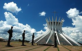 |
Federal District Brazilian Federal District The Federal District is set apart for Brasília, the capital of Brazil. Located in a region called Planalto Central, or Central Plateau, the Federal District is divided in 29 administrative regions. Brasilia - place where the three branches of the Federal Government are located - is the main... , Brazil15°47′S 47°54′W |
Cultural: (i), (iv) |
0— | 1987 | Planned and developed by Lúcio Costa Lúcio Costa Lucio Costa was a Brazilian architect and urban planner.-Career:Costa was born in Toulon, France.Educated at the Royal Grammar School, Newcastle upon Tyne, England and in Montreux until 1916, he graduated as an architect in 1924 from the School of Fine Art in Rio de Janeiro... and Oscar Niemeyer Oscar Niemeyer Oscar Ribeiro de Almeida Niemeyer Soares Filho is a Brazilian architect specializing in international modern architecture... in 1956, Brasília was created ex nihilo Ex nihilo Ex nihilo is a Latin phrase meaning "out of nothing". It often appears in conjunction with the concept of creation, as in creatio ex nihilo, meaning "creation out of nothing"—chiefly in philosophical or theological contexts, but also occurs in other fields.In theology, the common phrase creatio ex... in order to move the capital from Rio de Janeiro to a more central position. Together with Chandigarh Chandigarh Chandigarh is a union territory of India that serves as the capital of two states, Haryana and Punjab. The name Chandigarh translates as "The Fort of Chandi". The name is from an ancient temple called Chandi Mandir, devoted to the Hindu goddess Chandi, in the city... in India it is the only place where Corbusier's design principles of urbanism have been applied on large scale. |
|
| Brazilian Atlantic Islands: Fernando de Noronha Fernando de Noronha Fernando de Noronha is an archipelago of 21 islands and islets in the Atlantic Ocean, offshore from the Brazilian coast. The main island has an area of and had a population of 3,012 in the year 2010... and Atol das Rocas Reserves |
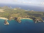 |
Pernambuco Pernambuco Pernambuco is a state of Brazil, located in the Northeast region of the country. To the north are the states of Paraíba and Ceará, to the west is Piauí, to the south are Alagoas and Bahia, and to the east is the Atlantic Ocean. There are about of beaches, some of the most beautiful in the... and Rio Grande do Norte Rio Grande do Norte Rio Grande do Norte is one of the states of Brazil, located in the northeastern region of the country, occupying the northeasternmost tip of the South American continent. Because of its geographic position, Rio Grande do Norte has a strategic importance. The capital and largest city is Natal... , Brazil3°51′29"S 32°25′30"W |
Natural: (vii), (ix), (x) |
42270 (104,451.4 acre); buffer zone 140713 (347,709.1 acre) | 2001 | As one of the few insular habitats in the South Atlantic, the site is essential as feeding ground and reproduction space for marine organisms including endangered and threatened species, most notably the Hawksbill sea turtle. | |
| Brimstone Hill Fortress National Park Brimstone Hill Fortress National Park Brimstone Hill Fortress National Park is a UNESCO World Heritage Site on the island of St. Kitts in the Federation of St. Christopher and Nevis in the Eastern Caribbean.... |
 |
Saint Kitts Saint Kitts Saint Kitts Saint Kitts Saint Kitts (also known more formally as Saint Christopher Island (Saint-Christophe in French) is an island in the West Indies. The west side of the island borders the Caribbean Sea, and the eastern coast faces the Atlantic Ocean... ,  Saint Kitts and Nevis Saint Kitts and Nevis17°20′49"N 62°50′14"W |
Cultural: (iii), (iv) |
0— | 1999 | Built during the 17th and 18th centuries by African slaves in a period of European colonial expansion, the fortress is an exceptionally well preserved example of British military architecture in the Caribbean. | |
| Cahokia Mounds State Historic Site |  |
Illinois Illinois Illinois is the fifth-most populous state of the United States of America, and is often noted for being a microcosm of the entire country. With Chicago in the northeast, small industrial cities and great agricultural productivity in central and northern Illinois, and natural resources like coal,... ,  United States United States38°39′31"N 90°3′41"W |
Cultural: (iii), (iv) |
0— | 1982 | The ancient city of Cahokia was the cultural, religious, and economic centre of the Mississippian culture Mississippian culture The Mississippian culture was a mound-building Native American culture that flourished in what is now the Midwestern, Eastern, and Southeastern United States from approximately 800 CE to 1500 CE, varying regionally.... . It was the earliest and largest pre-Columbian settlement north of Mexico. |
|
| Camino Real de Tierra Adentro | Cultural: (ii), (iv) |
3102 (7,665.2 acre); buffer zone 268057 (662,382.7 acre) | 2010 | The site consists of a 1400 km (869.9 mi) long section of a 2600 km (1,615.6 mi) long trade route ("Silver Road") that was used from the mid-16th to 19th century to transport mainly silver from mines in northern Mexico and mercury imported from Europe. In addition to the road, associated properties such as five urban centresThe five sites are: Historic Centre of Mexico City Mexico City Mexico City is the Federal District , capital of Mexico and seat of the federal powers of the Mexican Union. It is a federal entity within Mexico which is not part of any one of the 31 Mexican states but belongs to the federation as a whole... and Xochimilco Xochimilco Xochimilco is one of the sixteen delegaciones or boroughs within Mexican Federal District. The borough is centered on the formerly independent city of Xochimilco, which was established on what was the southern shore of Lake Xochimilco in the pre-Hispanic period... , Historic Monuments Zone of Querétaro, Historic Town of Guanajuato and Adjacent Mines, Protective town of San Miguel San Miguel de Allende San Miguel de Allende is a city and municipality located in the far eastern part of the state of Guanajuato in central Mexico. It is 274 km from Mexico City and 97 km from the state capital of Guanajuato... and the Sanctuary of Jesús Nazareno de Atotonilco, Historic Centre of Zacatecas. that have been designated separately as World Heritage Sites, religious and other buildings are included in the nomination. |
|||
| Canadian Rocky Mountain Parks Canadian Rocky Mountain Parks The Canadian Rocky Mountain Parks World Heritage Site is located in the Canadian Rockies. It consists of four national parks:*Banff*Jasper*Kootenay*Yohoand three British Columbia provincial parks:*Hamber Provincial Park... |
Alberta Alberta Alberta is a province of Canada. It had an estimated population of 3.7 million in 2010 making it the most populous of Canada's three prairie provinces... and British Columbia British Columbia British Columbia is the westernmost of Canada's provinces and is known for its natural beauty, as reflected in its Latin motto, Splendor sine occasu . Its name was chosen by Queen Victoria in 1858... ,  Canada Canada51°25′N 116°29′W |
Natural: (vii), (viii) |
2306884 (5,700,429.5 acre) | 1984Extended in 1990 to include Mount Robson Mount Robson Provincial Park Mount Robson Provincial Park is a large provincial park in the Canadian Rockies with an area of 2,249 km². The park is located entirely within British Columbia, bordering Jasper National Park in Alberta. The B.C. legislature created the park in 1913, the same year as the first ascent of Mount... , Hamber Hamber Provincial Park Hamber Provincial Park is a provincial park in British Columbia, Canada, located at the provincial border with Alberta, surrounded on three sides by Jasper National Park.-History:The park was named in honour of Eric W... and Mount Assiniboine Provincial Park Mount Assiniboine Provincial Park Mount Assiniboine Provincial Park is a provincial park in British Columbia, Canada, located around Mount Assiniboine.-History:The park was established 1922... s. |
With high peaks, glaciers, lakes, waterfalls, canyons and limestone caves, the National Parks that make up this site exemplify the exceptional features of the Rocky Mountains Rocky Mountains The Rocky Mountains are a major mountain range in western North America. The Rocky Mountains stretch more than from the northernmost part of British Columbia, in western Canada, to New Mexico, in the southwestern United States... . Furthermore, one of the world's most celebrated fossil fields, the Burgess Shale Burgess Shale The Burgess Shale Formation, located in the Canadian Rockies of British Columbia, is one of the world's most celebrated fossil fields, and the best of its kind. It is famous for the exceptional preservation of the soft parts of its fossils... Formation is located within the inscribed property. |
|
|
| Canaima National Park Canaima National Park Canaima National Park is a 30,000 km² park in south-eastern Venezuela that borders Brazil and Guyana. It is located in Bolívar State, and roughly occupies the same area as the Gran Sabana region.... |
Bolívar Bolívar (state) Bolívar State , is one of the 23 states into which Venezuela is divided. The state capital city is Ciudad Bolívar. Bolívar State covers a total surface area of 238,000 km² and in June 30, 2010 had an estimated population of 1,620,359.... ,  Venezuela Venezuela5°20′N 61°30′W |
Natural: (vii), (viii), (ix), (x) |
3000000 (7,413,154.9 acre) | 1994 | The park is characterized by table-top mountains (tepui Tepui A tepui , or tepuy, is a table-top mountain or mesa found in the Guiana Highlands of South America, especially in Venezuela. The word tepui means "house of the gods" in the native tongue of the Pemon, the indigenous people who inhabit the Gran Sabana.... ) that cover 65% of the area and are of both geological and biological interest, providing habitat to a large number of endemic species. Angel Falls, the world's highest waterfall is included in the property. |
||
| Carlsbad Caverns National Park Carlsbad Caverns National Park Carlsbad Caverns National Park is a United States National Park in the Guadalupe Mountains in southeastern New Mexico. The primary attraction of the park for most visitors is the show cave, Carlsbad Caverns... |
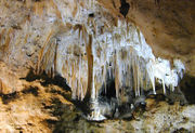 |
New Mexico New Mexico New Mexico is a state located in the southwest and western regions of the United States. New Mexico is also usually considered one of the Mountain States. With a population density of 16 per square mile, New Mexico is the sixth-most sparsely inhabited U.S... , United States32°10′0"N 104°23′0"W |
Natural: (vii), (viii) |
18926 (46,767.1 acre) | 1995 | More than 80 limestone caves notable for their size and decorative rock formations (speleothem Speleothem A speleothem , commonly known as a cave formation, is a secondary mineral deposit formed in a cave. Speleothems are typically formed in limestone or dolostone solutional caves.-Origin and composition:... s), some of which are assisted by bacteria, are included in the property. Their ease of access facilitates scientific research. |
|
| Central Amazon Conservation Complex |  |
State of Amazonas, Brazil 2°20′0"S 62°0′30"W |
Natural: (ix), (x) |
5323018 (13,153,452.3 acre) | 2000Extended in 2003 to include the Amana Sustainable Development Reserve, the Demonstration area of the Mamirauá Sustainable Development Reserve and the Anavilhanas Ecological Station Anavilhanas Ecological Station Anavilhanas Ecological Station is an ecological station in Brazil in the state of Amazonas. The Anavilhanas archipelago includes hundreds of islands in the Rio Negro. An area of 350,000 hectares with a perimeter of 380 km has been put forward by the Brazilian government as a tentative World... ; and name change from Jaú National Park, Brazil to the present name. |
As the largest protected area in the Amazon Basin Amazon Basin The Amazon Basin is the part of South America drained by the Amazon River and its tributaries that drains an area of about , or roughly 40 percent of South America. The basin is located in the countries of Bolivia, Brazil, Colombia, Ecuador, Guyana, Peru, and Venezuela... , the site is notable for its high biodiversity, range of habitats such as várzea and igapó forests and number of endangered species. It has been recognized by various conservation agencies as a high priority region.It is a Centre of Plant Diversity, an Endemic Bird Area of the World and a Global 200 Global 200 The Global 200 is the list of ecoregions identified by the World Wildlife Fund as priorities for conservation. According to the WWF, an ecoregion is defined as a "relatively large unit of land or water containing a characteristic set of natural communities that share a large majority of their... ecoregion. |
|
| Central Suriname Nature Reserve Central Suriname Nature Reserve The Central Suriname Nature Reserve was created in 1998 by Conservation International and the government of Suriname. It was designated a UNESCO World Heritage Site in 2000 for its pristine tropical rainforest ecosystem, and contains 16,000 square kilometres of both montane and lowland primary... |
Sipaliwini District Sipaliwini District Sipaliwini is the largest district of Suriname, located in the south. Sipaliwini does not have a regional capital as it is directly administered by the national government in Paramaribo... ,  Suriname Suriname4°0′N 56°30′W |
Natural: (ix), (x) |
1600000 (3,953,682.6 acre) | 2000 | The site comprises a large undisturbed tract of tropical forst with high biodiversity, many endemic and threatened species. Due to topography and the range of soil conditions, it has various ecoregions. | ||
| Central University City Campus Ciudad Universitaria Ciudad Universitaria , Mexico, is UNAM's main campus, located in Coyoacán borough in the southern part of Mexico City. Designed by architects Mario Pani and Enrique del Moral, it encloses the Olympic Stadium, about 40 faculties and institutes, the Cultural Center, an ecological reserve, the Central... of the Universidad Nacional Autónoma de México National Autonomous University of Mexico The Universidad Nacional Autónoma de México is a university in Mexico. UNAM was founded on 22 September 1910 by Justo Sierra as a liberal alternative to the Roman Catholic-sponsored Royal and Pontifical University of Mexico The Universidad Nacional Autónoma de México (UNAM) (National Autonomous... (UNAM) |
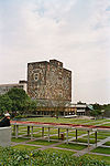 |
Cultural: (i), (ii), (iv) |
177 (437.4 acre); buffer zone 1102 (2,723.1 acre) | 2007 | Built from 1949 and 1952 by more than 60 architects, the buildings, open spaces and sports facilities combine modern architecture with references to local pre-Hispanic traditions. They showcase universal ideals such as access to education and improvement in the quality of life that were prevalent in post-revolutionary Mexican Revolution The Mexican Revolution was a major armed struggle that started in 1910, with an uprising led by Francisco I. Madero against longtime autocrat Porfirio Díaz. The Revolution was characterized by several socialist, liberal, anarchist, populist, and agrarianist movements. Over time the Revolution... Mexico. |
||
| Cerrado Cerrado The Cerrado, is a vast tropical savanna ecoregion of Brazil, particularly in the states of Gioas and Minas Gerais... Protected Areas: Chapada dos Veadeiros Chapada dos Veadeiros National Park Brazil's Chapada dos Veadeiros National Park is located in the Chapada dos Veadeiros, an ancient plateau with an estimated age of 1.8 billion years. Based in the Brazilian state of Goias, the Park was created on January 11, 1961 by President Juscelino Kubitscheck, and listed as a World Heritage... and Emas National Park Emas National Park The Emas National Park |Rhea]] National Park") is a national park and a UNESCO World Heritage Sitein the states of Goiás and Mato Grosso do Sul in Brazil.-Description:... s |
 |
Central Brazil Plateau, State of Goiás Goiás Goiás is a state of Brazil, located in the central part of the country. The name Goiás comes from the name of an indigenous community... , Brazil14°0′20"S 47°41′5"W |
Natural: (ix), (x) |
367356 (907,755.6 acre) | 2001 | The two parks are characteristic of the cerrado, one of the world's oldest tropical ecosystems and an important refuge for species in times of climate change. | |
| Chaco Culture | New Mexico New Mexico New Mexico is a state located in the southwest and western regions of the United States. New Mexico is also usually considered one of the Mountain States. With a population density of 16 per square mile, New Mexico is the sixth-most sparsely inhabited U.S... , United States36°3′50"N 107°58′15"W |
Cultural: (iii) |
0— | 1987 | Notable for its monumental buildings, the site bears testimony to a Pueblo Pueblo Pueblo is a term used to describe modern communities of Native Americans in the Southwestern United States of America. The first Spanish explorers of the Southwest used this term to describe the communities housed in apartment-like structures built of stone, adobe mud, and other local material... culture that dominated large parts of present day south-western United States from the mid-9th to early 13th centuries. |
||
| Chan Chan Archaeological Zone Chan Chan The largest Pre-Columbian city in South America, Chan Chan is an archaeological site located in the Peruvian region of La Libertad, five km west of Trujillo. Chan Chan covers an area of approximately 20 km² and had a dense urban center of about 6km²... † |
 |
La Libertad La Libertad Region La Libertad is a region in northwestern Peru. Formerly it was known as the 'Department of La Libertad" , a political division that generally corresponds to a state in the United States of America... ,  Peru Peru8°6′S 79°5′W |
Cultural: (i), (iii) |
600 (1,482.6 acre) | 1986 | The city of Chan Chan served as the capital of the Chimú culture Chimú Culture The Chimú were the residents of Chimor, with its capital at the city of Chan Chan, a large adobe city in the Moche Valley of present-day Trujillo, Peru. The culture arose about 900 AD. The Inca ruler Tupac Inca Yupanqui led a campaign which conquered the Chimú around 1470 AD,.This was just fifty... . The Chimú kingdom developed along the coast of northern Peru. Chan Chan is divided into nine walled units indicating political and social division. The Chimú were conquered by the Inca Inca Empire The Inca Empire, or Inka Empire , was the largest empire in pre-Columbian America. The administrative, political and military center of the empire was located in Cusco in modern-day Peru. The Inca civilization arose from the highlands of Peru sometime in the early 13th century... in 1470. The site was listed to the List of World Heritage in Danger when it was first inscribed, as the adobe Adobe Adobe is a natural building material made from sand, clay, water, and some kind of fibrous or organic material , which the builders shape into bricks using frames and dry in the sun. Adobe buildings are similar to cob and mudbrick buildings. Adobe structures are extremely durable, and account for... constructions are easily damaged by heavy rain and erosion. |
|
| Chavín Chavín de Huantar Chavín de Huántar is an archaeological site containing ruins and artifacts constructed beginning at least by 1200 BCE and occupied by later cultures until around 400-500 BCE by the Chavín, a major pre-Inca culture. The site is located north of Lima, Peru, at an elevation of , east of the... (Archaeological Site) |
 |
Huari Province Huari Province The Huari Province is one of twenty provinces of the Ancash Region in Peru. The famous Chavín de Huantar archaeological site is located in this province.-Political division:Huari is divided into sixteen districts, which are:-External links:... , Ancash Ancash Region Ancash is a region in northern Peru. It is bordered by the La Libertad region on the north, the Huánuco and Pasco regions on the east, the Lima region on the south, and the Pacific Ocean on the west. Its capital is the city of Huaraz, and its largest city and port is Chimbote... , Peru9°35′34"S 77°10′42"W |
Cultural: (iii) |
0— | 1985 | The Chavín culture Chavín culture The Chavín were a civilization that developed in the northern Andean highlands of Peru from 900 BC to 200 BC. They extended their influence to other civilizations along the coast. The Chavín were located in the Mosna Valley where the Mosna and Huachecsa rivers merge... developed in the Andean Andes The Andes is the world's longest continental mountain range. It is a continual range of highlands along the western coast of South America. This range is about long, about to wide , and of an average height of about .Along its length, the Andes is split into several ranges, which are separated... highlands between 1500 and 300 BC, and the site now known as Chavín de Huantar served as the center. The site consists of a complex of terraces and squares cut from rock. It is believed the Chavín were primarily a religious-based society whose influence resulted from their culture, rather than aggressive expansion. |
|
| Churches of Chiloé Churches of Chiloé The Churches of Chiloé in Chile's Chiloé Archipelago are a unique architectural phenomenon in the Americas and one of the most prominent buildings of Chilota architecture. Unlike classical Spanish colonial architecture the churches of Chiloé are made entirely in native timber with extensive use of... |
 |
Chiloé Province Chiloé Province Chiloé Province is one of the four provinces in the southern Chilean region of Los Lagos . It encompasses all of Chiloé Archipelago with the exception of the Desertores Islands. The province spans a surface area of... , Los Lagos Region Los Lagos Region Los Lagos Region is one of Chile's 15 regions, which are first order administrative divisions, and comprises four provinces: Chiloé, Llanquihue, Osorno and Palena. The region contains the country's second largest island, Chiloé, and the second largest lake, Llanquihue.Its capital is Puerto Montt;... ,  Chile Chile42°30′0"S 73°46′0"W |
Cultural: (ii), (iii) |
0— | 2000 | The churches are the most prominent example of Chilota wooden architecture fusing European and indigeneous traditions. They are a result of 17th and 18th century Jesuit missions. | |
| City of Cuzco Cusco Cusco , often spelled Cuzco , is a city in southeastern Peru, near the Urubamba Valley of the Andes mountain range. It is the capital of the Cusco Region as well as the Cuzco Province. In 2007, the city had a population of 358,935 which was triple the figure of 20 years ago... |
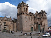 |
Cuzco, Peru 13°31′20"S 71°59′0"W |
Cultural: (iii), (iv) |
0— | 1983 | Cuzco was developed by the Inca king Pachacutec, who ruled the Kingdom of Cuzco Kingdom of Cusco The Kingdom of Cusco was a small kingdom in the Andes that began as a small city-state founded by the Incas around the 12th century... as it expanded to become the Inca Empire Inca Empire The Inca Empire, or Inka Empire , was the largest empire in pre-Columbian America. The administrative, political and military center of the empire was located in Cusco in modern-day Peru. The Inca civilization arose from the highlands of Peru sometime in the early 13th century... in the 15th century. It became the most important city of the Inca Empire, divided into distinct areas for religious and administrative use, and surrounded by an organized system of agriculture, artisan, and industrial uses. After the Spanish conquered the empire Spanish conquest of the Inca Empire The Spanish conquest of the Inca Empire was one of the most important campaigns in the Spanish colonization of the Americas. This historic process of military conquest was made by Spanish conquistadores and their native allies.... in the 16th century, they built Baroque Baroque architecture Baroque architecture is a term used to describe the building style of the Baroque era, begun in late sixteenth century Italy, that took the Roman vocabulary of Renaissance architecture and used it in a new rhetorical and theatrical fashion, often to express the triumph of the Catholic Church and... churches and buildings over the Inca ruins. |
|
| City of Potosí Potosí Potosí is a city and the capital of the department of Potosí in Bolivia. It is one of the highest cities in the world by elevation at a nominal . and it was the location of the Spanish colonial mint, now the National Mint of Bolivia... |
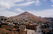 |
Potosí, Potosí Department Potosí Department Potosí Department is a department in southwestern Bolivia. It comprises 118,218 km² with 709,013 inhabitants . The capital is the city of Potosí.... ,  Bolivia Bolivia19°35′1"S 65°45′11"W |
Cultural: (ii), (iv), (vi) |
130 (321.2 acre) | 1987 | Following the discovery of the New World's largest silver reserves in the mid-16th century, Potosí was regarded as the world's largest industrial complex of the time. The site contains industrial facilities of the Cerro Rico, colonial public and residential architecture. | |
| City of Quito Quito San Francisco de Quito, most often called Quito , is the capital city of Ecuador in northwestern South America. It is located in north-central Ecuador in the Guayllabamba river basin, on the eastern slopes of Pichincha, an active stratovolcano in the Andes mountains... |
Quito, Quito Canton, Pichincha Province Pichincha Province Pichincha is a province of Ecuador located in the northern sierra region; its capital and largest city is Quito. It is bordered by Imbabura & Esmeraldas to the north, Cotopaxi & Santo Domingo de los Tsáchilas to the south, Napo & Sucumbíos to the east, and Esmeraldas & Santo Domingo de los... ,  Ecuador Ecuador0°0′14"N 78°30′0"W |
Cultural: (ii), (iv) |
320 (790.7 acre) | 1978 | Built in Spanish colonial style, the former capital of the Royal Audiencia of Quito has the most original and best preserved historic centre of its kind in Latin America. | ||
| Ciudad Universitaria de Caracas Ciudad Universitaria de Caracas The University City of Caracas is the main Campus of the Central University of Venezuela. It was designed by the Venezuelan architect Carlos Raúl Villanueva and was declared a World Heritage Site by UNESCO in 2000... |
 |
Municipality of Libertador, Caracas Caracas Caracas , officially Santiago de León de Caracas, is the capital and largest city of Venezuela; natives or residents are known as Caraquenians in English . It is located in the northern part of the country, following the contours of the narrow Caracas Valley on the Venezuelan coastal mountain range... , Venezuela10°29′27"N 66°53′26"W |
Cultural: (i), (iv) |
0— | 2000 | Designed by Carlos Raúl Villanueva Carlos Raúl Villanueva Carlos Raúl Villanueva was the most prominent Venezuelan architect of the 20th century and one of the great Modernists. He played a major role in the development and modernization of Caracas, Maracay and other cities across the country... , the university campus is considered a masterpiece of early 20th century architecture and urban planning. It derives from colonial traditions, providing an airy solution well suited to the tropical climate. |
|
| Cocos Island Cocos Island Cocos Island is an uninhabited island located off the shore of Costa Rica . It constitutes the 11th district of Puntarenas Canton of the province of Puntarenas. It is one of the National Parks of Costa Rica... National Park |
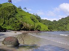 |
Puntarenas Province Puntarenas Province Puntarenas is a province of Costa Rica. It is located in the western part of the country, covering most of Costa Rica's Pacific Ocean coast, and it is the largest province in Costa Rica. Clockwise from the northwest it borders on the provinces Guanacaste, Alajuela, San José and Limón, and the... , Costa Rica5°32′N 87°4′W |
Natural: (ix), (x) |
199790 (493,691.4 acre) | 1997Extension of the park's marine zone in 2002. | As the only island in the tropical eastern Pacific, Cocos Island provides unique marine habitats for large pelagic fish Pelagic fish Pelagic fish live near the surface or in the water column of coastal, ocean and lake waters, but not on the bottom of the sea or the lake. They can be contrasted with demersal fish, which do live on or near the bottom, and reef fish which are associated with coral reefs.The marine pelagic... such as sharks, tuna, dolphins or rays. |
|
| Coffee Cultural Landscape of Colombia Colombian Coffee-Growers Axis Colombian Coffee-Growers Axis , also known as Coffee Triangle is a part of the Colombian Paisa region which is famous for growing and production of a majority of the Colombian coffee, considered by some as the best coffee in the world. There are three departments in the area: Caldas, Quindío and... |
 Colombia Colombia5°28′N 75°41′W |
Cultural: (v), (vi) |
141120 (348,714.8 acre); buffer zone 207000 (511,507.7 acre) | 2011 | The 100 year old coffee cultivation in is emblematic of Colombian culture and has impacted cultural and social traditions in music, architecture, cuisine, education and others. | ||
| Coiba National Park and its Special Zone of Marine Protection | Veraguas Veraguas Province Veraguas is a province of Panama, located in the centre-west of the country. The capital is the city of Santiago de Veraguas. The province covers 10,677.2 km² and is divided into twelve districts.-History:... and Chiriquí Chiriquí Province Chiriquí is a province of Panama, it is located on the western coast of Panama, and it is also the second most developed province in the country, after the Panamá Province. Its capital is the city of David. It has a total area of 6,490.9 km², with a population of 416,873 as of the year 2010... Provinces, Panama7°26′N 81°46′W |
Natural: (ix), (x) |
270125 (667,492.8 acre) | 2005 | The park protects islands and marine areas in the Gulf of Chiriquí Gulf of Chiriqui The Gulf of Chiriquí is a part of Panama that encompasses Coiba National Park and Golfo de Chiriquí National Park. There are dozens of islands in this Gulf. Along with the islands of Coiba National Park there is also Islas Secas, Los Ladrones, Parilla, Isla Boca Brava, Isla Palenque and... and is home to an exceptionally large number of endemic mammals, birds and plants as well as to a several threatened species. The marine ecosystem is characterized by a very large biodiversity with 760 species of marine fishes, 33 species of sharks and 20 species of cetaceans. |
||
| Colonial City of Santo Domingo Ciudad Colonial (Santo Domingo) Ciudad Colonial is the first settlement made by Christopher Columbus and the Spanish explorers in the New World. It has been declared a World Heritage Site by UNESCO. Colloquially known as "Zona Colonial" , Ciudad Colonial is part of the original Santo Domingo, Dominican Republic, and the origin... |
Distrito Nacional Distrito Nacional The Distrito Nacional is a subdivision of the Dominican Republic enclosing the capital Santo Domingo. It is not within any of the provinces, but is itself counted as a province. Before October 16, 2001, the Distrito Nacional was much larger, including what is now known as Santo Domingo Province.... ,  Dominican Republic Dominican Republic18°29′0"N 69°55′0"W |
Cultural: (ii), (iv), (vi) |
93 (229.8 acre) | 1990 | Santo Domingo was founded in 1498 shortly after the arrival of Christopher Columbus Christopher Columbus Christopher Columbus was an explorer, colonizer, and navigator, born in the Republic of Genoa, in northwestern Italy. Under the auspices of the Catholic Monarchs of Spain, he completed four voyages across the Atlantic Ocean that led to general European awareness of the American continents in the... on the island and had the first cathedral, hospital, customs house and university built in the New World. Its grid patterned town plan became the model for other colonial towns in the Americas. |
||
| Coro and its Port | Falcón Falcón Falcón State is one of the 23 states into which Venezuela is divided. The state capital is Coro.-Demographics and geography:Falcón State covers a total surface area of 24,800 km² and, in 2010, had an estimated population of 950,057. The Paraguaná Peninsula is connected to the rest of the... , Venezuela11°24′N 69°41′W |
Cultural: (iv), (v) |
107 (264.4 acre); buffer zone 107 (264.4 acre) | 1993 | Founded in 1527, Coro was one of the earliest colonial towns in the Americas. Its earthen constructions are the only extant example of fusion of Caribean with Spanish Mudéjar Mudéjar Mudéjar is the name given to individual Moors or Muslims of Al-Andalus who remained in Iberia after the Christian Reconquista but were not converted to Christianity... and Dutch architecture. The site has been listed as endangered since 2005 following damage due to heavy rain and the construction of various structures in the buffer zone. |
|
|
| Cueva de las Manos Cueva de las Manos Cueva de las Manos is a cave or a series of caves located in the province of Santa Cruz, Argentina, 163 km south of the town of Perito Moreno. It is famous for the paintings of hands, made by the indigenous inhabitants some 9,000 years ago... , Río Pinturas |
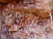 |
Santa Cruz Province, Argentina Argentina47°9′0"S 70°40′0"W |
Cultural: (iii) |
0— | 1999 | Named for the paintings of hands, the cave contains rock art from between 13,000 and 9,500 years ago that bear witness to the earliest human inhabitants in South America. | |
| Darien National Park Darién National Park Darién National Park is a world heritage site in Panama. It is about 325 kilometers from Panama City, and is the most extensive of all national parks of Panama and is one of the most important world heritage sites in Central America.... |
Darién Province Darién Province Darién is a province in eastern Panama. It is also the largest province in Panama. It is hot, humid, heavily forested, and sparsely populated, having 48,378 habitants... , Panama7°44′N 77°33′W |
Natural: (vii), (ix), (x) |
597000 (1,475,217.8 acre) | 1981 | Situated on the border between South and Central America, the park consists of a wide range of habitats including sandy and rocky coastlines, mangroves, swamps, upland and lowland tropical forests. Two Indian tribes, the Chocó and the Kuna live in the property. | ||
| Desembarco del Granma National Park Desembarco del Granma National Park Desembarco del Granma National Park is a national park in south-eastern Cuba, in what is now Granma Province. The park is named after the yacht in which Fidel Castro, Che Guevara, Raúl Castro, and 79 of their supporters sailed from Mexico to Cuba in 1956 and incited the Cuban Revolution.In 1999 it... |
— | Granma Granma Province Granma is one of the provinces of Cuba. Its capital is Bayamo. Other towns include Manzanillo and Pilón.-History:... , Cuba19°53′N 77°38′W |
Natural: (vii), (viii) |
32576 (80,497 acre) | 1999 | The park features a unique karst topography Karst topography Karst topography is a geologic formation shaped by the dissolution of a layer or layers of soluble bedrock, usually carbonate rock such as limestone or dolomite, but has also been documented for weathering resistant rocks like quartzite given the right conditions.Due to subterranean drainage, there... with features such as terraces, cliffs, and waterfalls. |
|
| Dinosaur Provincial Park Dinosaur Provincial Park Dinosaur Provincial Park is a UNESCO World Heritage Site located about two and a half hours drive southeast of Calgary, Alberta, Canada or , about a half hour drive, northeast of Brooks.... |
Alberta Alberta Alberta is a province of Canada. It had an estimated population of 3.7 million in 2010 making it the most populous of Canada's three prairie provinces... , Canada50°46′4"N 111°29′32"W |
Natural: (vii), (viii) |
7493 (18,515.6 acre) | 1979 | The park is noted for the beauty of its badland landscape and as a major fossil site. Specimens of every group of cretaceous Cretaceous The Cretaceous , derived from the Latin "creta" , usually abbreviated K for its German translation Kreide , is a geologic period and system from circa to million years ago. In the geologic timescale, the Cretaceous follows the Jurassic period and is followed by the Paleogene period of the... dinosaurs have been found here including those of 35 species dating more than 75 Million years ago. |
||
| Discovery Coast Atlantic Forest Reserves | Atlantic Coast, Bahia Bahia Bahia is one of the 26 states of Brazil, and is located in the northeastern part of the country on the Atlantic coast. It is the fourth most populous Brazilian state after São Paulo, Minas Gerais and Rio de Janeiro, and the fifth-largest in size... and Espírito Santo Espírito Santo Espírito Santo is one of the states of southeastern Brazil, often referred to by the abbreviation "ES". Its capital is Vitória and the largest city is Vila Velha. The name of the state means literally "holy spirit" after the Holy Ghost of Christianity... states, Brazil16°30′S 39°15′W |
Natural: (ix), (x) |
111930 (276,584.8 acre) | 1999 | The site comprises some of the last remaining Atlantic Forests and shows a very high diversity with many rare and endemic species. As such it is of high interest both for scientists and for conservation. | ||
| Earliest 16th-Century Monasteries on the Slopes of Popocatepetl | Cultural: (ii), (iv) |
0— | 1994 | The site comprises 14 monasteries built by Augustinians, Franciscans and Dominicans near Popocatépetl Popocatépetl Popocatépetl also known as "Popochowa" by the local population is an active volcano and, at , the second highest peak in Mexico after the Pico de Orizaba... volcano. Stylistically they are characterized by an emphasize on open spaces, a concept that influenced architecture in Mexico and beyond. |
|||
| El Tajin El Tajín El Tajín is a pre-Columbian archeological site and was the site of one of the largest and most important cities of the Classic era of Mesoamerica. The city flourished from 600 to 1200 C.E. and during this time numerous temples, palaces, Mesoamerican ballcourts and pyramids were built... , Pre-Hispanic City |
 |
Cultural: (iii), (iv) |
0— | 1992 | Flourishing from the early 9th to early 13th century, El Tajin is the prime site of the period between the Teotihuacan Teotihuacan Teotihuacan – also written Teotihuacán, with a Spanish orthographic accent on the last syllable – is an enormous archaeological site in the Basin of Mexico, just 30 miles northeast of Mexico City, containing some of the largest pyramidal structures built in the pre-Columbian Americas... and Tenochtitlan empires. |
||
| Everglades National Park Everglades National Park Everglades National Park is a national park in the U.S. state of Florida that protects the southern 25 percent of the original Everglades. It is the largest subtropical wilderness in the United States, and is visited on average by one million people each year. It is the third-largest... † |
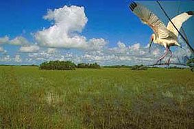 |
Florida Florida Florida is a state in the southeastern United States, located on the nation's Atlantic and Gulf coasts. It is bordered to the west by the Gulf of Mexico, to the north by Alabama and Georgia and to the east by the Atlantic Ocean. With a population of 18,801,310 as measured by the 2010 census, it... , United States25°19′N 80°56′W |
Natural: (viii), (ix), (x) |
592920 (1,465,135.9 acre) | 1979 | The vast wetlands and coastal/marine habitats of the park have made it a sanctuary for many animals including 20 rare, endangered and threatened species such as the Florida panther Florida Panther The Florida panther is an endangered subspecies of cougar that lives in forests and swamps of southern Florida in the United States. Its current taxonomic status is unresolved, but recent genetic research alone does not alter the legal conservation status... and the manatee Manatee Manatees are large, fully aquatic, mostly herbivorous marine mammals sometimes known as sea cows... . The site has been endangered from 1993–2007 following damage due to Hurricane Andrew Hurricane Andrew Hurricane Andrew was the third Category 5 hurricane to make landfall in the United States, after the Labor Day Hurricane of 1935 and Hurricane Camille in 1969. Andrew was the first named storm and only major hurricane of the otherwise inactive 1992 Atlantic hurricane season... and since 2010 due to continued degradation and a loss of marine habitat. |
|
| Fortifications on the Caribbean Side of Panama: Portobelo-San Lorenzo Fort San Lorenzo The Fort of San Lorenzo is located at the entrance to the Chagres River in the province of Colón, Panama. It was declared by UNESCO as a World Heritage Site in the year 1980 under the name of the Fortifications on the Caribbean coast of Panama, of the town of Portobelo . They formed the defensive... |
 |
Colón Province Colón Province Colón is a province of Panama. The capital is the city of Colón.This province has traditionally been focused in commerce , but also has natural resources that are being developed as tourist attraction, such as coral reefs and rainforests... , Panama9°33′14"N 79°39′21"W |
Cultural: (i), (iv) |
0— | 1980 | As outstanding examples of Spanish military architecture, the forts were constructed in the 17th and 18th centuries to protect the Isthmus of Panama Isthmus of Panama The Isthmus of Panama, also historically known as the Isthmus of Darien, is the narrow strip of land that lies between the Caribbean Sea and the Pacific Ocean, linking North and South America. It contains the country of Panama and the Panama Canal... which had been of great importance to European colonial trade. |
|
| Franciscan Missions in the Sierra Gorda of Querétaro | Cultural: (ii), (iii) |
104 (257 acre) | 2003 | These five missions were built jointly with the indios towards the final phase of Christianization of Mexico in the mid-18th century. They played an important role in the further evangalization of California, Arizona and Texas. | |||
| Fuerte de Samaipata | Florida Province Florida Province Florida is a province in the Santa Cruz Department, Bolivia. Its capital is Samaipata. The province was created by law on December 15, 1924.-Division:The province is divided into four municipalities which are further subdivided into cantons.... , Santa Cruz Department, Bolivia18°10′S 63°49′W |
Cultural: (ii), (iii) |
0— | 1998 | Samaipata consists of remains of a town, and more prominently a large sculpted rock (14th–16th centuries) thought to have been the ceremonial centre of a pre-hispanic culture. | ||
| Galápagos Islands Galápagos Islands The Galápagos Islands are an archipelago of volcanic islands distributed around the equator in the Pacific Ocean, west of continental Ecuador, of which they are a part.The Galápagos Islands and its surrounding waters form an Ecuadorian province, a national park, and a... |
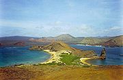 |
Natural: (vii), (viii), (ix), (x) |
14066514 (34,759,082.4 acre) | 1978 | This remote archipelago of volcanic islands is famed for the high degree of endemism and is associated with Charles Darwin Charles Darwin Charles Robert Darwin FRS was an English naturalist. He established that all species of life have descended over time from common ancestry, and proposed the scientific theory that this branching pattern of evolution resulted from a process that he called natural selection.He published his theory... whose observations here contributed to the inception of Darwin's theory Inception of Darwin's theory The inception of Darwin's theory occurred during an intensively busy period which began when Charles Darwin returned from the survey voyage of the Beagle, with his reputation as a fossil collector and geologist already established... of evolution Evolution Evolution is any change across successive generations in the heritable characteristics of biological populations. Evolutionary processes give rise to diversity at every level of biological organisation, including species, individual organisms and molecules such as DNA and proteins.Life on Earth... by natural selection Natural selection Natural selection is the nonrandom process by which biologic traits become either more or less common in a population as a function of differential reproduction of their bearers. It is a key mechanism of evolution.... . The site had been listed as endangered for various reasonsReasons include insufficient prevention of possibilities for the introduction of alien species, insufficient resource allocation for conservation agencies and park management, presence of a large number of illegal immigrants, rapid uncontrolled growth of tourism, fishing over-capacity and sports fishing. 2007–2010. |
||
| Grand Canyon National Park Grand Canyon National Park Grand Canyon National Park is the United States' 15th oldest national park and is located in Arizona. Within the park lies the Grand Canyon, a gorge of the Colorado River, considered to be one of the Wonders of the World. The park covers of unincorporated area in Coconino and Mohave counties.Most... |
Arizona Arizona Arizona ; is a state located in the southwestern region of the United States. It is also part of the western United States and the mountain west. The capital and largest city is Phoenix... , United States36°6′3"N 112°5′26"W |
Natural: (vii), (viii), (ix), (x) |
493077 (1,218,418.7 acre) | 1979 | Plunging down 1500 m (4,921.3 ft) to the Colorado River, it is one of the world's most spectacular gorges. In addition the varying elevations of the canyon walls have created diverse ecosystems for numerous endemic, rare and endangered species. The river's erosion has exposed soils from the Precambrian Precambrian The Precambrian is the name which describes the large span of time in Earth's history before the current Phanerozoic Eon, and is a Supereon divided into several eons of the geologic time scale... to the Cenozoic Cenozoic The Cenozoic era is the current and most recent of the three Phanerozoic geological eras and covers the period from 65.5 mya to the present. The era began in the wake of the Cretaceous–Tertiary extinction event at the end of the Cretaceous that saw the demise of the last non-avian dinosaurs and... often including a rich fossil assembly. |
||
| Great Smoky Mountains National Park Great Smoky Mountains National Park Great Smoky Mountains National Park is a United States National Park and UNESCO World Heritage Site that straddles the ridgeline of the Great Smoky Mountains, part of the Blue Ridge Mountains, which are a division of the larger Appalachian Mountain chain. The border between Tennessee and North... |
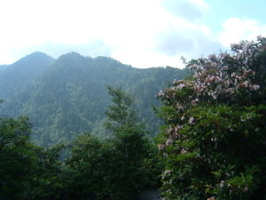 |
Tennessee Tennessee Tennessee is a U.S. state located in the Southeastern United States. It has a population of 6,346,105, making it the nation's 17th-largest state by population, and covers , making it the 36th-largest by total land area... and North Carolina North Carolina North Carolina is a state located in the southeastern United States. The state borders South Carolina and Georgia to the south, Tennessee to the west and Virginia to the north. North Carolina contains 100 counties. Its capital is Raleigh, and its largest city is Charlotte... , United States35°36′N 83°26′W |
Cultural: (vii), (viii), (ix), (x) |
209000 (516,449.8 acre) | 1983 | With more than 3,500 plant species, the park is among the largest remnants of Arcto-Tertiary Geoflora Arcto-Tertiary Geoflora The Arcto-Tertiary Geoflora is a hypothesized floral assemblage that once covered the Northern Hemisphere, from roughly the late Mesozoic to mid Cenozoic Eras.-Origins:First proposed by the paleobotanists J.S. Gardner and C... . It is also home to the world's largest number of salamander species and famous for its mist-shrouded virgin forests. |
|
| Gros Morne National Park Gros Morne National Park Gros Morne National Park is a world heritage site located on the west coast of Newfoundland. At , it is the second largest national park in Atlantic Canada .... |
Newfoundland and Labrador Newfoundland and Labrador Newfoundland and Labrador is the easternmost province of Canada. Situated in the country's Atlantic region, it incorporates the island of Newfoundland and mainland Labrador with a combined area of . As of April 2011, the province's estimated population is 508,400... , Canada49°37′N 57°32′W |
Natural: (vii), (viii) |
180500 (446,024.8 acre) | 1987 | With deep ocean crust and rocks of the earth's mantle lying exposed, the park illustrates continental drift. Landlocked freshwater fjords, glacier-scoured headlands in an ocean setting contribute to the natural beauty of this wilderness area. | ||
| Hawaii Volcanoes National Park Hawaii Volcanoes National Park Hawaii Volcanoes National Park, established in 1916, is a United States National Park located in the U.S. State of Hawaii on the island of Hawaii. It encompasses two active volcanoes: Kīlauea, one of the world's most active volcanoes, and Mauna Loa, the world's most massive volcano... |
Hawaii Hawaii Hawaii is the newest of the 50 U.S. states , and is the only U.S. state made up entirely of islands. It is the northernmost island group in Polynesia, occupying most of an archipelago in the central Pacific Ocean, southwest of the continental United States, southeast of Japan, and northeast of... , United States19°24′3"N 155°7′25"W |
Natural: (viii) |
92934 (229,644.7 acre) | 1987 | With two of the most active volcanoes in the world (Kilauea Kilauea Kīlauea is a volcano in the Hawaiian Islands, and one of five shield volcanoes that together form the island of Hawaii. Kīlauea means "spewing" or "much spreading" in the Hawaiian language, referring to its frequent outpouring of lava. The Puu Ōō cone has been continuously erupting in the eastern... and Mauna Loa Mauna Loa Mauna Loa is one of five volcanoes that form the Island of Hawaii in the U.S. state of Hawaii in the Pacific Ocean, and the largest on Earth in terms of volume and area covered. It is an active shield volcano, with a volume estimated at approximately , although its peak is about lower than that... ), the property showcases constant island building through volcanism. |
||
| Head-Smashed-In Buffalo Jump Head-Smashed-In Buffalo Jump Head-Smashed-In Buffalo Jump is a buffalo jump located where the foothills of the Rocky Mountains begin to rise from the prairie 18 km northwest of Fort Macleod, Alberta, Canada on highway 785... |
 |
Alberta Alberta Alberta is a province of Canada. It had an estimated population of 3.7 million in 2010 making it the most populous of Canada's three prairie provinces... Canada49°44′58"N 113°37′26"W |
Cultural: (vi) |
0— | 1981 | The property consists of remains of a camp, of trails and a tumulus of bones of the American bison American Bison The American bison , also commonly known as the American buffalo, is a North American species of bison that once roamed the grasslands of North America in massive herds... bearing testimony to nearly 6000 years of communal hunting in which the bisons were driven over a cliff, a practice known as buffalo jump Buffalo jump A buffalo jump is a cliff formation which North American Indians historically used in mass killings of plains bison. Hunters herded the bison and drove them over the cliff, breaking their legs and rendering them immobile. Tribe members waiting below closed in with spears and bows to finish the kills... . |
|
| Historical Centre of the City of Arequipa Historic centre of Arequipa In December 2000, UNESCO declared the historical center of Arequipa a World Heritage Site, stating the following:"The historical center of Arequipa is an example of ornamented architecture, represents a masterpiece of the creative coalition of European and native characteristics... |
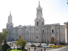 |
Arequipa Arequipa Region Arequipa is a region in southwestern Peru. It is bordered by the Ica, Ayacucho, Apurímac and Cusco regions on the north; the Puno Region on the east; the Moquegua Region on the south; and the Pacific Ocean on the west... , Peru16°24′0"S 71°32′0"W |
Cultural: (i), (iv) |
167 (412.7 acre); buffer zone 165 (407.7 acre) | 2000 | Arequipa is built primarily on top of sillar Sillar Sillar is a whitish volcanic stone from which many colonial buildings in the city of Arequipa, Peru, are made. A fine example are the Arcs of the "Mirador of Yanahuara" in Arequipa, from which the entire city can be appreciated.... , a white volcanic rock Volcanic rock Volcanic rock is a rock formed from magma erupted from a volcano. In other words, it is an igneous rock of volcanic origin... , the product of nearby El Misti El Misti El Misti, also known as Guagua-Putinais a stratovolcano located in southern Peru near the city of Arequipa. With its seasonally snow-capped, symmetrical cone, El Misti stands at above sea level and lies between the mountain Chachani and the volcano Pichu-Pichu . Its last eruption was in... volcano. The architecture of the city is known for its combination of traditional indigenous styles with the new techniques of the European colonial settlers. |
|
| Historic Area of Willemstad Willemstad Willemstad can refer to:*Willemstad, the capital of Curaçao*Willemstad , a town in Moerdijk, the Netherlands*Willemstad , a hamlet near Marum, the Netherlands*Willemstad , a hamlet in the Netherlands... , Inner City and Harbour, Curaçao |
 |
Willemstad, Curaçao Curaçao Curaçao is an island in the southern Caribbean Sea, off the Venezuelan coast. The Country of Curaçao , which includes the main island plus the small, uninhabited island of Klein Curaçao , is a constituent country of the Kingdom of the Netherlands... , Netherlands Antilles Netherlands Antilles The Netherlands Antilles , also referred to informally as the Dutch Antilles, was an autonomous Caribbean country within the Kingdom of the Netherlands, consisting of two groups of islands in the Lesser Antilles: Aruba, Bonaire and Curaçao , in Leeward Antilles just off the Venezuelan coast; and Sint...  Netherlands Netherlands12°6′7"N 68°54′8"W |
Cultural: (ii), (iv), (v) |
86 (212.5 acre); buffer zone 87 (215 acre) | 1997 | The architecture of the 17th century Dutch trading settlement Willemstad combines styles from the Netherlands with Spanish and Portuguese colonial towns. | |
| Historic Bridgetown Bridgetown The city of Bridgetown , metropolitan pop 96,578 , is the capital and largest city of the nation of Barbados. Formerly, the Town of Saint Michael, the Greater Bridgetown area is located within the parish of Saint Michael... and its Garrison Garrison Historic Area St. Ann's Garrison, or more commonly known as "The Garrison", is a small district located in the country of Barbados. This Garrison Historic Area is situated about 2-miles south of Heroes Square in the capital-city Bridgetown, and just west of the village of Hastings in the neighbouring parish of... |
Bridgetown Barbados Barbados13°5′48"N 59°36′50"W |
Cultural: (ii), (iii), (iv) |
187 (462.1 acre); buffer zone 321 (793.2 acre) | 2011 | Bridgetown is an excellent example of a British colonial settlement built from the 17th to 19th century. Unlike Dutch and Spanish settlements of the area, the town is not layed out on a grid plan but follows a serpentine urban design. | ||
| Historic Centre of Camagüey Camagüey Camagüey is a city and municipality in central Cuba and is the nation's third largest city. It is the capital of the Camagüey Province.After almost continuous attacks from pirates the original city was moved inland in 1528.The new city was built with a confusing lay-out of winding alleys that made... |
 |
Camagüey Camagüey Province Camagüey is the largest of the provinces of Cuba. Its capital is Camagüey. Other towns include Florida and Nuevitas.-Geography:Camagüey is mostly low lying, with no major hills or mountain ranges passing through the province... , Cuba21°22′43"N 77°55′7"W |
Cultural: (iv), (v) |
54 (133.4 acre); buffer zone 276 (682 acre) | 2008 | Camagüey is among the first seven villages founded by the Spanish in Cuba, first settled in 1528. The irregular organization of the city is distinct from the typical, orderly construction of most other Spanish settlements. This maze-like style was influenced by medieval European ideas and traditional construction methods of early immigrant masons and construction workers. | |
| Historic Centre of Salvador de Bahia | Bahia Bahia Bahia is one of the 26 states of Brazil, and is located in the northeastern part of the country on the Atlantic coast. It is the fourth most populous Brazilian state after São Paulo, Minas Gerais and Rio de Janeiro, and the fifth-largest in size... state, Brazil12°58′0"S 38°30′0"W |
Cultural: (iv), (vi) |
0— | 1985 | The colonial old town of the first Brazilian capital and town of the first slave market in the New World, has preserved a large number of brightly colored Renaissance houses decorated with stucco work from the 16th to 18th centuries. | ||
| Historic Centre of Santa Ana de los Ríos de Cuenca Cuenca, Ecuador Cuenca is the capital of the Azuay Province. It is located in the highlands of Ecuador at about 2500 m above sea level... |
Azuay Province Azuay Province Azuay is a province of Ecuador, created 25 June 1824. It encompasses an area of . Its capital is Cuenca. It is located in the south center of Ecuador in the highlands. Its mountains reach above sea level in the national park of El Cajas.... , Ecuador2°53′0"S 78°59′0"W |
Cultural: (ii), (iv), (v) |
200 (494.2 acre) | 1999 | Founded in 1557 on an orthogonal town plan, the townscape of Cuenca is an expression of the fusion of different societies and cultures and a showcase of Renaissance urban design in Latin America. | ||
| Historic Centre of Lima Historic Centre of Lima Located principally in the city centre or Cercado de Lima and Rímac areas, the Historic Centre of Lima is among the most important tourist destinations in Peru.-Foundation:... |
 |
Lima Province Lima Province Lima Province is located in the central coast of Peru and is the only province in the country not belonging to any of the twenty-five regions. Its capital is Lima, which is also the nation's capital.... , Peru12°3′5"S 77°2′35"W |
Cultural: (iv) |
200 (494.2 acre) | 1988Extended in 1991 to include "the area protected by national legislation." | Lima was founded by Francisco Pizarro Francisco Pizarro Francisco Pizarro González, Marquess was a Spanish conquistador, conqueror of the Incan Empire, and founder of Lima, the modern-day capital of the Republic of Peru.-Early life:... in 1535 as La Ciudad de los Reyes (City of the Kings). Until the middle of the 18th century, it was the most important city in Spanish South America Spanish colonization of the Americas Colonial expansion under the Spanish Empire was initiated by the Spanish conquistadores and developed by the Monarchy of Spain through its administrators and missionaries. The motivations for colonial expansion were trade and the spread of the Christian faith through indigenous conversions... . The architecture and decoration combine the style of both the local population and Europe, such as in the Monastery of San Francisco, which was the site's original listing in 1988, before it was extended in 1991. |
|
| Historic Centre of Mexico City Mexico City Mexico City is the Federal District , capital of Mexico and seat of the federal powers of the Mexican Union. It is a federal entity within Mexico which is not part of any one of the 31 Mexican states but belongs to the federation as a whole... and Xochimilco Xochimilco Xochimilco is one of the sixteen delegaciones or boroughs within Mexican Federal District. The borough is centered on the formerly independent city of Xochimilco, which was established on what was the southern shore of Lake Xochimilco in the pre-Hispanic period... |
Cultural: (ii), (iii), (iv), (v) |
0— | 1987 | Mexico City, built in the 16th century on the ruins of Tenochtitlan preserves Aztec ruins, the largest cathedral in the Americas Mexico City Metropolitan Cathedral The Metropolitan Cathedral of the Assumption of Mary of Mexico City is the largest and oldest cathedral in the Americas and seat of the Roman Catholic Archdiocese of Mexico. It is situated atop the former Aztec sacred precinct near the Templo Mayor on the northern side of the Plaza de la... and 19th/20th century public architecture. Xochimilco is characterized by a network of canals and artificial islands (chinampa Chinampa Chinampa is a method of ancient Mesoamerican agriculture which used small, rectangle-shaped areas of fertile arable land to grow crops on the shallow lake beds in the Valley of Mexico.-Description:... s) built in pre-Hispanic times. |
|||
| Historic Centre of Morelia | Cultural: (ii), (iv), (vi) |
390 (963.7 acre) | 1991 | Built in the 16th century, Morelia still shows the original street layout and has more than 200 historic buildings constructed of locally available pink stone in a style fusing elements of renaissance, baroque and neo-classicism. | |||
| Historic Centre of Oaxaca Oaxaca, Oaxaca The city and municipality of Oaxaca de Juárez, or simply Oaxaca, is the capital and largest city of the Mexican state of the same name . It is located in the Centro District in the Central Valleys region of the state, in the foothills of the Sierra Madre at the base of the Cerro del Fortín... and Archaeological Site of Monte Albán Monte Albán Monte Albán is a large pre-Columbian archaeological site in the Santa Cruz Xoxocotlán Municipality in the southern Mexican state of Oaxaca... |
Cultural: (i), (ii), (iii), (iv) |
375 (926.6 acre); buffer zone 121 (299 acre) | 1987 | The site includes the pre-Columbian ceremonial site Monte Albán Monte Albán Monte Albán is a large pre-Columbian archaeological site in the Santa Cruz Xoxocotlán Municipality in the southern Mexican state of Oaxaca... occupied during a 1500 year period by Olmecs, Zapotecs and Mixtecs]], the colonial town Oaxaca Oaxaca, Oaxaca The city and municipality of Oaxaca de Juárez, or simply Oaxaca, is the capital and largest city of the Mexican state of the same name . It is located in the Centro District in the Central Valleys region of the state, in the foothills of the Sierra Madre at the base of the Cerro del Fortín... founded in 1529 and the originally Mixtec settlement Cuilapan where Dominicans established a major monastery in the mid-16th century. |
|||
| Historic Centre of Puebla | Cultural: (ii), (iv) |
597 (1,475.2 acre); buffer zone 102 (252 acre) | 1987 | Founded in 1531, Puebla is notable for its 16th/17th century cathedral and colonial houses some of which are covered in blue tiles (azulejos). Stylistically the Baroque district of Puebla shows the fusion of European and American elements. | |||
| Historic Centre of Santa Cruz de Mompox Santa Cruz de Mompox Mompox or Mompós, officially Santa Cruz de Mompox, is a town and municipality in northern Colombia, in the Bolívar Department, which has preserved its colonial character. Located on an island in the Magdalena River where it joins the Cauca River, 249 kilometers from Cartagena. Mompox depends upon... |
Bolívar Department Bolívar Department Bolívar is a department of Colombia. It was named after one of the original nine states of the United States of Colombia. It is located to the north of the country, extending from the coast at Cartagena near the mouth of the Magdalena River, then south along the river to a border with Antioquia.Its... , Colombia9°14′0"N 74°26′0"W |
Cultural: (iv), (v) |
458 (1,131.7 acre); buffer zone 632 (1,561.7 acre) | 1995 | Mompox, founded in 1540 on a major river has preserved in its historic centre the colonial past with many buildings still serving their original function. | ||
| Historic Centre of São Luís São Luís, Maranhão São Luís is the capital and largest city of the Brazilian state of Maranhão. The city is located on Ilha de São Luís in the Baía de São Marcos , an extension of the Atlantic Ocean which forms the estuary of Pindaré, Mearim, Itapecuru and other rivers. Its coordinates are 2.53° south, 44.30° west... |
 |
Maranhão Maranhão Maranhão is a northeastern state of Brazil. To the north lies the Atlantic Ocean. Maranhão is neighbored by the states of Piauí, Tocantins and Pará. The people of Maranhão have a distinctive accent... state, Brazil2°30′51"S 44°18′9"W |
Cultural: (iii), (iv), (v) |
0— | 1997 | São Luís has preserved the complete rectangular town plan and a large number of historical buildings making it a prime example of a Portuguese colonial town. | |
| Historic Centre of the Town of Diamantina | Minas Gerais Minas Gerais Minas Gerais is one of the 26 states of Brazil, of which it is the second most populous, the third richest, and the fourth largest in area. Minas Gerais is the Brazilian state with the largest number of Presidents of Brazil, the current one, Dilma Rousseff, being one of them. The capital is the... , Brazil18°40′0"S 43°36′0"W |
Cultural: (ii), (iv) |
29 (71.7 acre) | 1999 | A well-preserved example of Baroque architecture, this 18th century colonial town was founded in an inhospitable environment of rocky mountains and became a center of diamond mining in the 18th and 19th centuries. | ||
| Historic Centre of the Town of Goiás Goiás, Goiás Goiás is a small city and municipality in the state of Goiás in Brazil. The population was 24,072 in a total area of 3,108 km² . It is the former capital of the state and preserves much of its colonial heritage... |
 |
Goiás Goiás Goiás is a state of Brazil, located in the central part of the country. The name Goiás comes from the name of an indigenous community... , Brazil15°56′0"S 50°8′0"W |
Cultural: (ii), (iv) |
40 (98.8 acre); buffer zone 44 (108.7 acre) | 2001 | Founded in 1727 by the bandeirante explorer Bartolomeu Bueno da Silva, Goiás has preserved much of its colonial heritage and is an example of a European settlement in the interior of South America. | |
| Historic Centre of the Town of Olinda Olinda Olinda is a historic city in the Brazilian state of Pernambuco, located on the country's northeastern Atlantic Ocean coast, just north of Recife and south of Paulista... |
 |
Pernambuco Pernambuco Pernambuco is a state of Brazil, located in the Northeast region of the country. To the north are the states of Paraíba and Ceará, to the west is Piauí, to the south are Alagoas and Bahia, and to the east is the Atlantic Ocean. There are about of beaches, some of the most beautiful in the... , Brazil8°0′48"S 34°50′42"W |
Cultural: (ii), (iv) |
120 (296.5 acre); buffer zone 920 (2,273.4 acre) | 1982 | Founded in 1537 the town prospered as a centre of sugar-cane production. Following looting by the Dutch in the 17th century, the historic centre dates largely to the 18th century with a harmonious combination of buildings, gardens, churches, convents and chapels. | |
| Historic Centre of Zacatecas | Cultural: (ii), (iv) |
110 (271.8 acre) | 1993 | Zacatecas prospered as a center of silver production in the 16th and 17th centuries. The designated property comprises religious and secular buildings with most of them dating to the 17th and 18th centuries. | |||
| Historic City of Sucre Sucre Sucre, also known historically as Charcas, La Plata and Chuquisaca is the constitutional capital of Bolivia and the capital of the department of Chuquisaca. Located in the south-central part of the country, Sucre lies at an elevation of 2750m... |
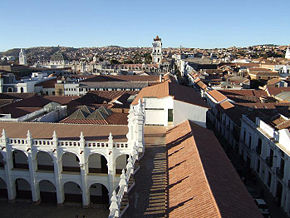 |
Oropeza Province Oropeza Province Oropeza is a province in the Chuquisaca Department, Bolivia. Its seat is Sucre which is also the constitutional capital of Bolivia and the capital of the Chuquisaca Department.- Subdivision :... , Chuquisaca Department Chuquisaca Department Chuquisaca is a department of Bolivia located in the center south. It borders on the departments of Cochabamba, Tarija, Potosí, and Santa Cruz. The departmental capital is Sucre, which is also the constitutional capital of Bolivia.-Geography:... , Bolivia19°2′35"S 65°15′33"W |
Cultural: (iv) |
114 (281.7 acre) | 1991 | Founded by the Spanish in 1538, Sucre has retained many of its 16th century religious buildings showing the fusion of local and European architectural styles. | |
| Historic District of Old Québec Old Quebec Old Quebec is a historic neighbourhood of Quebec City, the capital of the province of Quebec in Canada. Comprising the Upper Town and Lower Town , the area is a UNESCO World Heritage Site... |
 |
Quebec City Quebec City Quebec , also Québec, Quebec City or Québec City is the capital of the Canadian province of Quebec and is located within the Capitale-Nationale region. It is the second most populous city in Quebec after Montreal, which is about to the southwest... , Quebec Quebec Quebec or is a province in east-central Canada. It is the only Canadian province with a predominantly French-speaking population and the only one whose sole official language is French at the provincial level.... Canada46°48′34"N 71°12′38"W |
Cultural: (iv), (vi) |
0— | 1985 | Founded by the French in the 17th century, the urban ensemble of Old Québec is the most complete example of a European fortified town north of Mexico. | |
| Historic Fortified Town of Campeche | Cultural: (ii), (iv) |
181 (447.3 acre) | 1999 | Campeche is a typical example of a Baroque Spanish colonial town with a grid layout. Its fortifications built in the 17th and 18th centuries as defense against pirates are an excellent example of military architecture of the time. | |||
| Historic Inner City of Paramaribo Paramaribo Paramaribo is the capital and largest city of Suriname, located on banks of the Suriname River in the Paramaribo District. Paramaribo has a population of roughly 250,000 people, more than half of Suriname's population... |
Paramaribo District Paramaribo District Paramaribo is a district of Suriname, encompassing the city of Paramaribo and the surrounding area.Paramaribo district has a population of 213,840 and an area 183 km².... , Suriname5°49′34"N 55°9′0"W |
Cultural: (ii), (iv) |
30 (74.1 acre); buffer zone 60 (148.3 acre) | 2002 | Founded as a Dutch colonial town in the 17th century, Paramaribo has preserved its unique street plan with buildings showing the gradual influence of Dutch architectural traditions. | ||
| Historic Monuments Zone of Querétaro | Cultural: (ii), (iv) |
0— | 1996 | Querétaro has preserved many of its buildings from the 17th and 18th century and is exceptional for its street plan which has both, the grid plan typical of Spanish colonial towns and twisting alleys in the Indian quarters. | |||
| Historic Monuments Zone of Tlacotalpan |  |
Cultural: (ii), (iv) |
0— | 1998 | The layout and architecture of the property is an exceptionally well-preserved example of Spanish-Caribbean fusion and is characterised by wide streets, low houses in a variety of styles and colors, and many trees. | ||
| Historic Quarter of the City of Colonia del Sacramento Colonia del Sacramento Colonia del Sacramento is a city in southwestern Uruguay, by the Río de la Plata, facing Buenos Aires, Argentina. It is the oldest town in Uruguay and capital of the departamento of Colonia. It has a population of around 22,000.It is renowned for its historic quarter, a World Heritage Site... |
 |
Colonia Department Colonia Department Colonia is a departamento in southwestern Uruguay. Its capital is Colonia del Sacramento, the country's second oldest city.-Economy:The region is the main producer of dairy products in Uruguay... ,  Uruguay Uruguay34°28′4"S 57°51′12"W |
Cultural: (iv) |
16 (39.5 acre) | 1995 | Founded in 1680 by the Portuguese, the town changed hands between Spanish and Portuguese multiple times during the 17th and 18th centuries and was finally lost to the Spanish. Its well preserved townscape bears testimony to the fusion of Spanish and Portuguese colonial styles. | |
| Historic Quarter of the Seaport City of Valparaíso Valparaíso Valparaíso is a city and commune of Chile, center of its third largest conurbation and one of the country's most important seaports and an increasing cultural center in the Southwest Pacific hemisphere. The city is the capital of the Valparaíso Province and the Valparaíso Region... |
 |
Valparaíso Province Valparaíso Province Valparaíso Province is one of eight provinces of the central Chilean region of Valparaíso . Its capital is the coastal city of Valparaíso Valparaíso Province is one of eight provinces of the central Chilean region of Valparaíso (V). Its capital is the coastal city of Valparaíso Valparaíso... , Chile33°2′26"S 71°37′41"W |
Cultural: (iii) |
23 (56.8 acre); buffer zone 45 (111.2 acre) | 2003 | In the late 19th century Valparaíso prospered as a stopover point for ships travelling between the Atlantic and Pacific via the Straits of Magellan. Its historic quarter set on steep hillsides has bears testimony to this early phase of globalization. | |
| Historic Sanctuary of Machu Picchu Machu Picchu Machu Picchu is a pre-Columbian 15th-century Inca site located above sea level. It is situated on a mountain ridge above the Urubamba Valley in Peru, which is northwest of Cusco and through which the Urubamba River flows. Most archaeologists believe that Machu Picchu was built as an estate for... |
Cuzco, Peru 13°7′0"S 72°35′0"W |
Mixed: (i) (iii), (vii), (ix) |
32592 (80,536.5 acre) | 1983 | At 2340 metres (7,677.2 ft) above sea level, the site of Machu Picchu was constructed as an expansive mountain estate around the middle of the 15th century, and abandoned approximately 100 years later. It includes walls, terraces, and buildings constructed from rock. The city was home to about 1,200 people, mostly priests, women, and children. It was left abandoned prior to the Spanish arrival in Cuzco most likely due to smallpox Smallpox Smallpox was an infectious disease unique to humans, caused by either of two virus variants, Variola major and Variola minor. The disease is also known by the Latin names Variola or Variola vera, which is a derivative of the Latin varius, meaning "spotted", or varus, meaning "pimple"... . |
||
| Historic Town of Guanajuato and Adjacent Mines |  |
Cultural: (i), (ii), (iv), (vi) |
190 (469.5 acre) | 1988 | The prosperity of the town as the largest silver producer in the 18th century is reflected in beautiful Baroque and neo-classical buildings. | ||
| Historic Town of Ouro Preto Ouro Preto -History:Founded at the end of the 17th century, Ouro Preto was originally called Vila Rica, or "rich village," the focal point of the gold rush and Brazil's golden age in the 18th century under Portuguese rule.... |
Minas Gerais Minas Gerais Minas Gerais is one of the 26 states of Brazil, of which it is the second most populous, the third richest, and the fourth largest in area. Minas Gerais is the Brazilian state with the largest number of Presidents of Brazil, the current one, Dilma Rousseff, being one of them. The capital is the... , Brazil20°23′20"S 43°30′20"W |
Cultural: (i), (iii) |
0— | 1980 | The prosperity of the town as the center of the Brazilian gold rush in the 18th century is reflected in a large number of preserved churches, bridges and fountains many of them designed by the Baroque sculptor Aleijadinho Aleijadinho Aleijadinho was a Colonial Brazil-born sculptor and architect, noted for his works on and in various churches of Brazil.... . |
||
| Historic Town of St George St. George's, Bermuda St. George's , located on the island and within the parish of the same names, was the first permanent settlement on the islands of Bermuda, and is often described as the third successful English settlement in the Americas, after St. John's, Newfoundland, and Jamestown, Virginia. However, St... and Related Fortifications, Bermuda |
 |
St. George United Kingdom United Kingdom32°22′46"N 64°40′40"W |
Cultural: (iv) |
258 (637.5 acre) | 2000 | The oldest English town in the New World, St George's fortifications bear testimony to the development of English military architecture from the 17th to 20th centuries. | |
| Hospicio Cabañas, Guadalajara | Cultural: (i), (ii), (iii), (iv) |
0— | 1997 | The early 19th century Hospicio is one of the earliest hospital complexes in Spanish America. Its architecture, designed with this purpose in mind, contains several unique features and is notable for the size, simplicity and relationship between open and built spaces. A series of murals by José Clemente Orozco José Clemente Orozco José Clemente Orozco was a Mexican social realist painter, who specialized in bold murals that established the Mexican Mural Renaissance together with murals by Diego Rivera, David Alfaro Siqueiros, and others... is located within the complex. |
|||
| Huascarán National Park Huascarán National Park Huascarán National Park is a national park in the Cordillera Blanca, a range of the Andes, in Ancash of central Peru. It was also pronounced as Natural Heritage of Humanity and recognized as Reserve of Biosphere Core. The highest mountain in Peru is located in the park... |
 |
Ancash Ancash Region Ancash is a region in northern Peru. It is bordered by the La Libertad region on the north, the Huánuco and Pasco regions on the east, the Lima region on the south, and the Pacific Ocean on the west. Its capital is the city of Huaraz, and its largest city and port is Chimbote... , Peru9°20′S 77°24′W |
Natural: (vii), (viii) |
340000 (840,157.6 acre) | 1985 | Huascarán National Park is located in the Cordillera Blanca Cordillera Blanca The Cordillera Blanca is a mountain range in the Ancash Region of Peru. Part of the larger Andes range, it includes 33 major peaks over high in an area wide and long.-Overview:... mountain range of the Andes Andes The Andes is the world's longest continental mountain range. It is a continual range of highlands along the western coast of South America. This range is about long, about to wide , and of an average height of about .Along its length, the Andes is split into several ranges, which are separated... . It surrounds Huascarán Huascarán Huascarán or Nevado Huascarán is a mountain in the Peruvian province of Yungay, situated in the Cordillera Blanca range of the Western Andes. The highest southern summit of Huascarán is the highest point in Peru, and all the Earth's Tropics... , the tallest peak in Peru. The physical environment includes glaciers, ravines, and lakes, while the park is home to several regional animal species. |
|
| Humberstone and Santa Laura Saltpeter Works Humberstone and Santa Laura Saltpeter Works Humberstone and Santa Laura Saltpeter Works are two former saltpeter refineries located in northern Chile. They were declared a UNESCO World Heritage Site in 2005.-Geography:... † |
 |
Tarapacá Tarapacá Region The I Tarapacá Region is one of Chile's 15 first order administrative divisions. It borders the Chilean Arica and Parinacota Region to the north, Bolivia's Oruro Department on the east, the Antofagasta Region on the south and the Pacific Ocean on the west. The port city of Iquique The I Tarapacá... , Chile20°12′30"S 69°47′40"W |
Cultural: (ii), (iii), (iv) |
0— | 2005 | Situated in the Atacama Desert Atacama Desert The Atacama Desert is a plateau in South America, covering a strip of land on the Pacific coast, west of the Andes mountains. It is, according to NASA, National Geographic and many other publications, the driest desert in the world... , the two saltpeter works are representative of the saltpeter industry that florished in northern Chile in the 19th and early 20th century and brought together people from different parts of South America and Europe creating a unique culture with its own language and customs. The site has been listed as endangered since 2005 due to damage, vandalism, looting and the general fragile nature of the structures as a result of a 40 years lack of maintenance. |
|
| Iguaçu National Park Iguaçu National Park Iguaçu National Park is a national park in Paraná State, Brazil.Created by federal decree nr. 1035 of January 10, 1939, the Park comprises a total area of 185,262.5 hectares and a length of about 420km, 300km of which are natural borders by bodies of water and the Brazilian and Argentinean sides... |
 |
Paraná Paraná (state) Paraná is one of the states of Brazil, located in the South of the country, bordered on the north by São Paulo state, on the east by the Atlantic Ocean, on the south by Santa Catarina state and the Misiones Province of Argentina, and on the west by Mato Grosso do Sul and the republic of Paraguay,... , Brazil25°41′S 54°26′W |
Natural: (vii), (x) |
170086 (420,291.3 acre) | 1986 | Together with Iguazú National Park on the Argentinian side, the park protects Iguazu Falls Iguazu Falls Iguazu Falls, Iguassu Falls, or Iguaçu Falls are waterfalls of the Iguazu River located on the border of the Brazilian State of Paraná and the Argentine Province of Misiones. The falls divide the river into the upper and lower Iguazu. The Iguazu River originates near the city of Curitiba. It flows... , one of the world's largest waterfalls, and is home to many rare and endangered species such as Giant Anteater Giant Anteater The Giant Anteater, Myrmecophaga tridactyla, is the largest species of anteater. It is the only species in the genus Myrmecophaga. It is found in Central and South America from Honduras to northern Argentina... or the Giant Otter Giant Otter The giant otter is a South American carnivorous mammal. It is the longest member of the Mustelidae, or weasel family, a globally successful group of predators. Unusually for a mustelid, the giant otter is a social species, with family groups typically supporting three to eight members... . The site had been listed as endangered 1999–2001 due to an illegally opened road through the park, dams on the Iguazu River Iguazu River The Iguazu River is a river in Brazil and Argentina. It is an important tributary of the Paraná River. The Iguazu River is long, with a drainage basin of .-Course:... and helicopter flights. |
|
| Iguazú National Park Iguazú National Park The Iguazú National Park is a national park of Argentina, located in the Iguazú Department, in the north of the province of Misiones, Argentine Mesopotamia. It has an area of . -History:... |
 |
Misiones Province Misiones Province Misiones is one of the 23 provinces of Argentina, located in the northeastern corner of the country in the Mesopotamiсa region. It is surrounded by Paraguay to the northwest, Brazil to the north, east and south, and Corrientes Province of Argentina to the southwest.- History :The province was... , Mesopotamia Mesopotamia, Argentina La Mesopotamia, Región Mesopotámica is the humid and verdant area of north-east Argentina, comprising the provinces of Misiones, Entre Ríos and Corrientes. The region called Litoral consists of the Mesopotamia and the provinces of Chaco, Formosa and Santa Fe... Argentina25°31′5"S 54°8′0"W |
Natural: (vii), (x) |
55000 (135,907.8 acre) | 1984 | Together with Iguaçu National Park on the Brazilian side, the park protects Iguazu Falls Iguazu Falls Iguazu Falls, Iguassu Falls, or Iguaçu Falls are waterfalls of the Iguazu River located on the border of the Brazilian State of Paraná and the Argentine Province of Misiones. The falls divide the river into the upper and lower Iguazu. The Iguazu River originates near the city of Curitiba. It flows... , one of the world's largest waterfalls. Its subtropical rainforest is home to more than 2000 species of vascular plants and large mammals such as tapir Tapir A Tapir is a large browsing mammal, similar in shape to a pig, with a short, prehensile snout. Tapirs inhabit jungle and forest regions of South America, Central America, and Southeast Asia. There are four species of Tapirs: the Brazilian Tapir, the Malayan Tapir, Baird's Tapir and the Mountain... s, Giant Anteater Giant Anteater The Giant Anteater, Myrmecophaga tridactyla, is the largest species of anteater. It is the only species in the genus Myrmecophaga. It is found in Central and South America from Honduras to northern Argentina... s, Howler monkey Howler monkey Howler monkeys are among the largest of the New World monkeys. Fifteen species are currently recognised. Previously classified in the family Cebidae, they are now placed in the family Atelidae. These monkeys are native to South and Central American forests... s, ocelot Ocelot The ocelot , pronounced /ˈɒsəˌlɒt/, also known as the dwarf leopard or McKenney's wildcat is a wild cat distributed over South and Central America and Mexico, but has been reported as far north as Texas and in Trinidad, in the Caribbean... s and jaguar Jaguar The jaguar is a big cat, a feline in the Panthera genus, and is the only Panthera species found in the Americas. The jaguar is the third-largest feline after the tiger and the lion, and the largest in the Western Hemisphere. The jaguar's present range extends from Southern United States and Mexico... s. |
|
| Ilulissat Icefjord Ilulissat Icefjord Ilulissat Icefjord is a fjord in western Greenland. Ilulissat Icefjord was declared a UNESCO World Heritage Site in 2004.- Geography :It runs west from the Greenland ice sheet to Disko Bay just south of Ilulissat town. At its eastern end is the Jakobshavn Isbræ glacier , the most productive... |
Ilulissat Ilulissat Ilulissat is a town in the Qaasuitsup municipality in western Greenland, located approximately north of the Arctic Circle. With the population of 4,546 as of 2010, it is the third-largest settlement in Greenland, after Nuuk and Sisimiut.... , western Greenland Greenland Greenland is an autonomous country within the Kingdom of Denmark, located between the Arctic and Atlantic Oceans, east of the Canadian Arctic Archipelago. Though physiographically a part of the continent of North America, Greenland has been politically and culturally associated with Europe for... ,  Denmark Denmark69°8′N 49°30′W |
Natural: (vii), (viii) |
402400 (994,351.2 acre) | 2004 | The Jakobshavn Glacier, calves Ice calving Ice calving, also known as glacier calving or iceberg calving, is a form of ice ablation or ice disruption. It is the sudden release and breaking away of a mass of ice from a glacier, iceberg, ice front, ice shelf, or crevasse... into the Ilulissat fjord is one of the most active glaciers moving at 19 metres/day and accounting for 10% of the Greenlandish calf ice. Similar phenomena exist in Antarctica, however its relative ease of access for scientists and visitors makes it unique in the world. |
||
| Independence Hall Independence Hall Independence Hall is the centerpiece of Independence National Historical Park located in Philadelphia, Pennsylvania, United States, on Chestnut Street between 5th and 6th Streets... |
 |
Philadelphia, Pennsylvania Pennsylvania The Commonwealth of Pennsylvania is a U.S. state that is located in the Northeastern and Mid-Atlantic regions of the United States. The state borders Delaware and Maryland to the south, West Virginia to the southwest, Ohio to the west, New York and Ontario, Canada, to the north, and New Jersey to... , United States39°56′55"N 75°9′0"W |
Cultural: (vi) |
0— | 1979 | Both the Declaration of Independence United States Declaration of Independence The Declaration of Independence was a statement adopted by the Continental Congress on July 4, 1776, which announced that the thirteen American colonies then at war with Great Britain regarded themselves as independent states, and no longer a part of the British Empire. John Adams put forth a... and the United States Constitution United States Constitution The Constitution of the United States is the supreme law of the United States of America. It is the framework for the organization of the United States government and for the relationship of the federal government with the states, citizens, and all people within the United States.The first three... were signed in this building. Concepts of freedom and democracy set forth in these documents have influenced charters of many countries and the UN charter. |
|
| Ischigualasto Ischigualasto Ischigualasto is a geological formation and a natural park associated with it in the province of San Juan, north-western Argentina, near the border with Chile... / Talampaya Talampaya National Park Talampaya National Park is a national park located in the east/centre of La Rioja Province, Argentina. It was designated a provincial reserve in 1975, a national park in 1997, and a UNESCO World Heritage Site in 2000.... Natural Parks |
San Juan and La Rioja Province Argentina 30°0′S 68°0′W |
Natural: (viii) |
275369 (680,451 acre) | 2000 | As the most complete continental fossil site of the Triassic Triassic The Triassic is a geologic period and system that extends from about 250 to 200 Mya . As the first period of the Mesozoic Era, the Triassic follows the Permian and is followed by the Jurassic. Both the start and end of the Triassic are marked by major extinction events... period (245–208 million years ago) , the propertie's remains of mammals, dinosaurs and plants reveal the evolution of vertebrates. |
||
| Islands and Protected Areas of the Gulf of California | Natural: (vii), (ix), (x) |
0— | 2005Minor modification of boundaries in 2007 to include the Islas Marietas National Park and the San Lorenzo Marine Archipelago National Park San Lorenzo Marine Archipelago National Park San Lorenzo Marine Archipelago National Park is a national park of Mexico located on San Lorenzo Island part of an archipelago in the Gulf of California off the eastern coast of Baja California. The San Lorenzo Archipelago is considered one of the most important ecological areas of the Gulf of... . |
The property has marine and insular habitats including bridge islandsIslands populated by land in times of ocean level decline. and oceanic islands.Islands populated by sea and air It constitutes a unique ecoregion of exceptional biodiversity with 695 species of plant, 891 species of fish (90 of which are endemic), 39% of the world's marine mammal species, and a large number of bird species. | |||
| Jesuit Block and Estancias of Córdoba Jesuit Block and Estancias of Córdoba The Jesuit Block and Estancias of Córdoba are a former Jesuit reduction built by missionaries in the province of Córdoba, Argentina, named a World Heritage Site in 2000.... |
 |
Córdoba Córdoba, Argentina Córdoba is a city located near the geographical center of Argentina, in the foothills of the Sierras Chicas on the Suquía River, about northwest of Buenos Aires. It is the capital of Córdoba Province. Córdoba is the second-largest city in Argentina after the federal capital Buenos Aires, with... Argentina31°25′14"S 64°11′28"W |
Cultural: (ii), (iv) |
0— | 2000 | Founded in the early 17th century, this Jesuit reduction has preserved the university, church, residences and five farming estates (estancia Estância Estância is a municipality located in the Brazilian state of Sergipe. Its population was 62,218 and its area is 642 km². The city is the seat of the Roman Catholic Diocese of Estância.... s), illustrating the missionary and economic activities carried out by the Jesuits over a period of 150 years in the New World. |
|
| Jesuit Missions of La Santísima Trinidad de Paraná La Santisima Trinidad de Paraná La Santisima Trinidad de Paraná, or the Holy Trinity of Paraná is the name of a former Jesuit mission in Paraguay. It is an example of one of the many Jesuit Reductions, small colonies established by the missionaries in various locations in South America throughout the 17th and 18th century... and Jesús de Tavarangue |
 Paraguay Paraguay27°8′S 55°42′W |
Cultural: (iv) |
0— | 1993 | The ruins of these Jesuit reductions bear testimony to the missionary, social and economical activities of the Jesuits in the Rio de la Plata Basin in the 17th and 18th centuries. | ||
| Jesuit Missions of the Chiquitos Jesuit Missions of the Chiquitos The Jesuit Missions of the Chiquitos are in the Santa Cruz department of eastern Bolivia. Six of the missions have been designated a UNESCO World Heritage Site. The missions are distinguished by the fusion of European and American Indian cultural influences... |
Santa Cruz Department, Bolivia 16°0′S 60°30′W |
Cultural: (iv), (v) |
0— | 1990 | Six settlements in the Chiquitanía have been preserved as living heritage of their past as Jesuit reductions in the 17th and 18th centuries. Their churches largely restored in the late 20th century are a fusion of indigineous and European architectural traditions. | ||
| Jesuit Missions of the Guaranis: San Ignacio Miní San Ignacio Miní San Ignacio Miní was one of the many missions founded in 1632 by the Jesuits in the Americas during the Spanish colonial period near present-day San Ignacio valley, some 60km north of Posadas, Misiones Province, Argentina.... , Santa Ana Nuestra Señora de Santa Ana Reducción de Nuestra Señora de Santa Ana was one of the many missions or reductions founded in the 17th century by the Jesuits in the Americas during the Spanish colonial period.... , Nuestra Señora de Loreto Nuestra Señora de Loreto Reducción de Nuestra Señora de Loreto was one of the many missions or reductions founded in the 17th century by the Jesuits in the Americas during the Spanish colonial period.... and Santa María Mayor Santa María la Mayor Reducción de Santa María la Mayor , located in the Santa María Department of the Misiones Province, Argentina, at approximate coordinates , was one of the missions or reductions founded in the 17th century by the Jesuits in the Americas during the Spanish colonial period.-Jesuit Reductions:The... (Argentina), Ruins of São Miguel das Missões São Miguel das Missões São Miguel das Missões is a Unesco World Heritage site located in the small town of São Miguel das Missões in the northwestern region of Rio Grande do Sul, a state in southern Brazil. It is also known as São Miguel Arcanjo and by its Spanish language name San Miguel... (Brazil Brazil Brazil , officially the Federative Republic of Brazil , is the largest country in South America. It is the world's fifth largest country, both by geographical area and by population with over 192 million people... ) |
 |
Misiones Province Misiones Province Misiones is one of the 23 provinces of Argentina, located in the northeastern corner of the country in the Mesopotamiсa region. It is surrounded by Paraguay to the northwest, Brazil to the north, east and south, and Corrientes Province of Argentina to the southwest.- History :The province was... , Argentina* and Rio Grande do SulRio Grande do Sul Rio Grande do Sul is the southernmost state in Brazil, and the state with the fifth highest Human Development Index in the country. In this state is located the southernmost city in the country, Chuí, on the border with Uruguay. In the region of Bento Gonçalves and Caxias do Sul, the largest wine... , Brazil*28°32′36"S 54°15′57"W |
Cultural: (iv) |
0— | 1983Extended in 1984 to include the four Argentinian missions making it a trans-border site; and name change from The Ruins of São Miguel das Missões to the present name. | Each of the five ruined Jesuit missions founded amidst a tropical forest in the land of the Guaraní people in the 17th and 18th centuries is characterized by a specific design. | |
| Joggins Fossil Cliffs | Nova Scotia Nova Scotia Nova Scotia is one of Canada's three Maritime provinces and is the most populous province in Atlantic Canada. The name of the province is Latin for "New Scotland," but "Nova Scotia" is the recognized, English-language name of the province. The provincial capital is Halifax. Nova Scotia is the... Canada45°42′35"N 64°26′9"W |
Natural: (viii) |
689 (1,702.6 acre); buffer zone 29 (71.7 acre) | 2008 | This paleontological site contains the most complete terrestrial fossil record of the Carboniferous Carboniferous The Carboniferous is a geologic period and system that extends from the end of the Devonian Period, about 359.2 ± 2.5 Mya , to the beginning of the Permian Period, about 299.0 ± 0.8 Mya . The name is derived from the Latin word for coal, carbo. Carboniferous means "coal-bearing"... period including tracks of early animals and of the rainforest they lived in. |
||
| Joya de Cerén Joya de Cerén Joya de Cerén is an archaeological site in La Libertad Department, El Salvador featuring a pre-Columbian Maya farming village preserved remarkably intact under layers of volcanic ash... Archaeological Site |
Opico Opico Opico is a municipality in the La Libertad department of El Salvador.It is located 42 kilometers from San Salvador, capital of the republic. The municipality has an area of 218 km² and a population of 74,280 inhabitants; according to the 2007 census it is ranked No. 13 in population... , La Libertad Department,  El Salvador El Salvador13°49′39"N 89°22′9"W |
Cultural: (iii), (iv) |
0— | 1993 | Joya de Cerén are the remains of a pre-Hispanic farming community that has been preserved largely intact buried under a volcanic eruption around 590 AD. It provides valuable archaeological for everyday life in the 6th century. | ||
| Kluane / Wrangell-St Elias / Glacier Bay / Tatshenshini-Alsek | 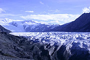 |
British Columbia British Columbia British Columbia is the westernmost of Canada's provinces and is known for its natural beauty, as reflected in its Latin motto, Splendor sine occasu . Its name was chosen by Queen Victoria in 1858... and Yukon Yukon Yukon is the westernmost and smallest of Canada's three federal territories. It was named after the Yukon River. The word Yukon means "Great River" in Gwich’in.... , Canada*;Alaska Alaska Alaska is the largest state in the United States by area. It is situated in the northwest extremity of the North American continent, with Canada to the east, the Arctic Ocean to the north, and the Pacific Ocean to the west and south, with Russia further west across the Bering Strait... , United States*61°12′N 141°0′W |
Natural: (vii), (viii), (ix), (x) |
9839121 (24,312,976 acre) | 1979Extended in 1992 to include the Glacier Bay National Park and in 1994 to include the Tatshenshini-Alsek Provincial Park. The name of the site was changed accordingly from Wrangell/St. Elias/Kluane at the time of inscription to Glacier Bay/Wrangell/St. Elias/Kluane in 1992 to the present name in 1994. | These parks comprise the world's largest non-polar icefield, some of the largest glaciers and a tectonically active mountain landscape. They are home to a number of species endangered elsewhere such as bears, wolves, caribou and Dall sheep Dall Sheep The Dall sheep , Ovis dalli, is a species of sheep native to northwestern North America, ranging from white to slate brown in color and having curved yellowish brown horns... . |
|
| La Fortaleza La Fortaleza La Fortaleza is the current official residence of the Governor of Puerto Rico. It was built between 1533 and 1540 to defend the harbor of San Juan. The structure is also known as Palacio de Santa Catalina . It is the oldest executive mansion in the New World... and San Juan National Historic Site San Juan National Historic Site San Juan National Historic Site in San Juan, Puerto Rico, includes colonial-era forts, bastions, powder houses, and three fourths of the old city wall.-Features:The site includes four features:* Fort San Felipe del Morro* Fort San Cristóbal* El Cañuelo... in Puerto Rico |
San Juan San Juan, Puerto Rico San Juan , officially Municipio de la Ciudad Capital San Juan Bautista , is the capital and most populous municipality in Puerto Rico, an unincorporated territory of the United States. As of the 2010 census, it had a population of 395,326 making it the 46th-largest city under the jurisdiction of... , Puerto Rico Puerto Rico Puerto Rico , officially the Commonwealth of Puerto Rico , is an unincorporated territory of the United States, located in the northeastern Caribbean, east of the Dominican Republic and west of both the United States Virgin Islands and the British Virgin Islands.Puerto Rico comprises an... , United States18°28′0"N 66°7′30"W |
Cultural: (vi) |
0— | 1983 | Puerto Rico was of prime strategic importance during the American colonial period illustrated by the fortifications built between the 15th and 19th century to protect the harbour of San Juan. | ||
| L’Anse aux Meadows National Historic Site | Newfoundland and Labrador Newfoundland and Labrador Newfoundland and Labrador is the easternmost province of Canada. Situated in the country's Atlantic region, it incorporates the island of Newfoundland and mainland Labrador with a combined area of . As of April 2011, the province's estimated population is 508,400... Canada51°28′0"N 55°37′0"W |
Cultural: (vi) |
0— | 1978 | These remains of an 11th century Viking settlement are the first and only known site of Norse Norsemen Norsemen is used to refer to the group of people as a whole who spoke what is now called the Old Norse language belonging to the North Germanic branch of Indo-European languages, especially Norwegian, Icelandic, Faroese, Swedish and Danish in their earlier forms.The meaning of Norseman was "people... presence and the earliest known European settlement in America outside of Greenland. |
||
| León Cathedral León Cathedral (Nicaragua) The Cathedral of León, also known as the Real e Insigne Basilica Catedral de León Nicaragua, is a significantly important and historic landmark in Nicaragua. The Cathedral was awarded World Heritage Site status with the United Nations Educational, Scientific and Cultural Organization... |
León Nicaragua Nicaragua12°26′06"N 86°52′41"W |
Cultural: (ii), (iv) |
0.77 (1.9 acre); buffer zone 13 (32.1 acre) | 2011 | Built over more than 150 years starting in the mid 18th century, the cathedral's architecture is a fusion of different styles from Baroque to Neoclassicism and an expression of a new Latin American society that developed around the 18th century. | ||
| Lines and Geoglyphs of Nazca and Pampas de Jumana Nazca Lines The Nazca Lines are a series of ancient geoglyphs located in the Nazca Desert in southern Peru. They were designated a UNESCO World Heritage Site in 1994. The high, arid plateau stretches more than between the towns of Nazca and Palpa on the Pampas de Jumana about 400 km south of Lima... |
 |
Nazca Ica Region Ica is a region in Peru. It borders the Pacific Ocean on the west; the Lima Region on the north; the Huancavelica and Ayacucho regions on the east; and the Arequipa Region on the south. Its capital is the city of Ica.- Geography :... , Peru14°43′33"S 75°8′55"W |
Cultural: (i), (iii), (iv) |
0— | 1994 | The large designs in the Nazca Desert Sechura Desert The Sechura Desert is located south of the Piura Region of Peru along the Pacific Ocean coast and inland to the foothills of the Andes Mountains... are believed to have been created by the Nazca culture Nazca culture The Nazca culture was the archaeological culture that flourished from 100 to 800 CE beside the dry southern coast of Peru in the river valleys of the Rio Grande de Nazca drainage and the Ica Valley... between 400 and 650 AD. They were created by scratching lines into the ground surface. Designs include animals such as a monkey and hummingbird, plants, and geographic shapes on a large scale. It is believed that they served a ritualistic purpose. |
|
| Los Glaciares Los Glaciares National Park Parque Nacional Los Glaciares is a national park in the Santa Cruz Province, in Argentine Patagonia. It comprises an area of 4459 km². In 1981 it was declared a World Heritage Site by UNESCO.... |
Santa Cruz Province Argentina 50°0′0"S 73°14′58"W |
Natural: (vii), (viii) |
445900 (1,101,841.9 acre) | 1981 | This National Ppark is of exceptional beauty comprising high peaks, glacial lakes and glaciers, some of which are advancing. | ||
| Los Katíos National Park Los Katíos National Park Los Katíos National Park is a national park located in northwest Colombia which covers 278 square miles . It is a part of the Darién Gap, shared by Panama and Colombia and is contiguous to Darién National Park in Panama. The Pan-American Highway when completed as proposed will pass near or through... † |
Antioquia Antioquia Department Antioquia is one of the 32 departments of Colombia, located in the central northwestern part of Colombia with a narrow section that borders the Caribbean Sea. Most of its territory is mountainous with some valleys, much of which is part of the Andes mountain range... and Chocó Chocó Department Chocó is a department of Colombia known for its large Afro-Colombian population. It is in the west of the country, and is the only Colombian department to have coastlines on both the Pacific Ocean and the Atlantic Ocean. It also has all of Colombia's border with Panama. Its capital is... Departments, Colombia7°40′N 77°0′W |
Natural: (ix), (x) |
72000 (177,915.7 acre) | 1994 | Situated at the Darién Gap Darién Gap The Darién Gap is a large swath of undeveloped swampland and forest separating Panama's Darién Province in Central America from Colombia in South America. It measures just over long and about wide. Roadbuilding through this area is expensive, and the environmental toll is steep. Political... , Los Katíos comprizes hills, forests and humid plains that are notable for their exceptional bio-diversity including many endangered animal species and endemic plants. The site has been listed as endangered since 2009 due to deforestation, illegal fishing and hunting. |
||
| Luis Barragán House and Studio Luis Barragán House and Studio The Luis Barragán House and Studio, located in the Tacubaya suburb of Mexico City, was the residence of architect Luis Barragán in the years following the Second World War. Built in 1947, the 1162 square meter three-story concrete house and garden reflect Barragán's design style during this period... |
Cultural: (i), (ii) |
0.12 (0.296526195618331 acre); buffer zone 23 (56.8 acre) | 2004 | Built in 1948, the house and studio of Mexican architect Luis Barragán Luis Barragán Luis Barragán Morfin was a Mexican architect. He was self-trained.-Early life:Educated as an engineer, he graduated from the Escuela Libre de Ingenieros in Guadalajara in 1923 and was self-trained as an architect.After graduation, he travelled through Spain, France , and... combines traditional and modern influences and is considered a masterpiece of the Modern Movement. |
|||
| Malpelo Malpelo Island Malpelo Island is an island located from Colombia's Pacific coast, and approximately from Panama's coast. It has a land area of . It is uninhabited except for a small military post manned by the Colombian Army, which was established in 1986. Visitors need a written permit from the Colombian... Fauna and Flora Sanctuary |
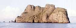 |
Cauca Department Cauca Department Cauca is a Department of Colombia. Located in the south-western part of the country, facing the Pacific Ocean to the west, the Valle del Cauca Department to the north, Tolima Department to the northeast, Huila Department to the east and the Nariño Department to the south, covering a total area of... , Colombia3°58′N 81°37′W |
Natural: (vii), (ix) |
857500 (2,118,926.8 acre) | 2006 | ||
| Mammoth Cave National Park Mammoth Cave National Park Mammoth Cave National Park is a U.S. National Park in central Kentucky, encompassing portions of Mammoth Cave, the longest cave system known in the world. The official name of the system is the Mammoth-Flint Ridge Cave System for the ridge under which the cave has formed. The park was established... |
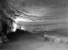 |
Kentucky Kentucky The Commonwealth of Kentucky is a state located in the East Central United States of America. As classified by the United States Census Bureau, Kentucky is a Southern state, more specifically in the East South Central region. Kentucky is one of four U.S. states constituted as a commonwealth... , United States37°11′14"N 86°6′11"W |
Natural: (vii), (viii), (x) |
21191 (52,364.1 acre) | 1981 | ||
| Manú National Park Manú National Park Manú National Park is a biosphere reserve located in Madre de Dios and Paucartambo, Cusco. Before becoming an area protected by the Peruvian government, the Manú National Park was conserved thanks to its inaccessibility. The park remains fairly inaccessible by road to this day. In 1977, UNESCO... |
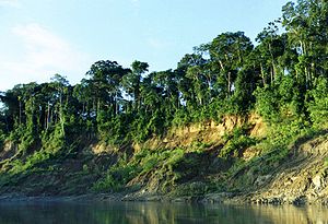 |
Cuzco, Peru 12°15′S 71°45′W |
Natural: (ix), (x) |
1716295 (4,241,053.6 acre) | 1987Minor modification of boundaries in 2009 to include all of the National Park in the World Heritage Site. | The park spreads from 150 metres (492.1 ft) to 4200 metres (13,779.5 ft) above sea-level. Manú is home to 1,000 bird species, over 200 species of mammals (100 of which are bat Bat Bats are mammals of the order Chiroptera "hand" and pteron "wing") whose forelimbs form webbed wings, making them the only mammals naturally capable of true and sustained flight. By contrast, other mammals said to fly, such as flying squirrels, gliding possums, and colugos, glide rather than fly,... s), and over 15,000 species of flowering plants. Prior to being recognized as a World Heritage site, it was designated as a biosphere reserve World Network of Biosphere Reserves The UNESCO World Network of Biosphere Reserves covers internationally-designated protected areas, known as biosphere reserves, that are meant to demonstrate a balanced relationship between man and nature The UNESCO World Network of Biosphere Reserves covers internationally-designated protected... in 1977. |
|
| Maya Site of Copan Copán Copán is an archaeological site of the Maya civilization located in the Copán Department of western Honduras, not far from the border with Guatemala. It was the capital city of a major Classic period kingdom from the 5th to 9th centuries AD... |
Copán Department, Honduras Honduras14°51′0"N 89°8′0"W |
Cultural: (iv), (vi) |
0— | 1980 | |||
| Mesa Verde National Park Mesa Verde National Park Mesa Verde National Park is a U.S. National Park and UNESCO World Heritage Site located in Montezuma County, Colorado, United States. It was created in 1906 to protect some of the best-preserved cliff dwellings in the world... |
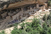 |
Colorado Colorado Colorado is a U.S. state that encompasses much of the Rocky Mountains as well as the northeastern portion of the Colorado Plateau and the western edge of the Great Plains... , United States37°15′42"N 108°29′8"W |
Cultural: (iii) |
0— | 1978 | ||
| Miguasha National Park Miguasha National Park Miguasha National Park is a protected area near Carleton-sur-Mer on the Gaspé Peninsula of Quebec in Canada. Created in 1985 by the Government of Quebec, Miguasha was designated a World Heritage Site in 1999 in recognition of its wealth of fossils, which display a crucial time during the evolution... |
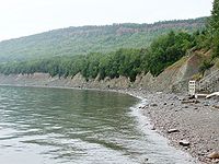 |
Gaspé Peninsula Gaspé Peninsula The Gaspésie , or Gaspé Peninsula or the Gaspé, is a peninsula along the south shore of the Saint Lawrence River in Quebec, Canada, extending into the Gulf of Saint Lawrence... , Quebec Quebec Quebec or is a province in east-central Canada. It is the only Canadian province with a predominantly French-speaking population and the only one whose sole official language is French at the provincial level.... Canada48°6′18"N 66°21′11"W |
Cultural: (vi) |
87 (215 acre) | 1999 | ||
| Monarch Butterfly Biosphere Reserve | Natural: (vii) |
13552 (33,487.7 acre); buffer zone 42707 (105,531.2 acre) | 2008 | ||||
| Monticello Monticello Monticello is a National Historic Landmark just outside Charlottesville, Virginia, United States. It was the estate of Thomas Jefferson, the principal author of the United States Declaration of Independence, third President of the United States, and founder of the University of Virginia; it is... and the University of Virginia University of Virginia The University of Virginia is a public research university located in Charlottesville, Virginia, United States, founded by Thomas Jefferson... in Charlottesville Charlottesville, Virginia Charlottesville is an independent city geographically surrounded by but separate from Albemarle County in the Commonwealth of Virginia, United States, and named after Charlotte of Mecklenburg-Strelitz, the queen consort of King George III of the United Kingdom.The official population estimate for... |
Virginia Virginia The Commonwealth of Virginia , is a U.S. state on the Atlantic Coast of the Southern United States. Virginia is nicknamed the "Old Dominion" and sometimes the "Mother of Presidents" after the eight U.S. presidents born there... , United States38°1′58"N 78°30′14"W |
Cultural: (i), (iv), (vi) |
0— | 1987 | |||
| Morne Trois Pitons National Park Morne Trois Pitons National Park Morne Trois Pitons National Park is a World Heritage Site located in the Caribbean island of Dominica. This area was established as a national park by the Dominican government in July 1975, the first to be legally established in the country... |
south central part of the island, Dominica Dominica15°16′N 61°17′W |
Natural: (viii), (x) |
6857 (16,944 acre) | 1997 | |||
| Nahanni National Park | Northwest Territories Northwest Territories The Northwest Territories is a federal territory of Canada.Located in northern Canada, the territory borders Canada's two other territories, Yukon to the west and Nunavut to the east, and three provinces: British Columbia to the southwest, and Alberta and Saskatchewan to the south... Canada61°33′N 125°35′W |
Natural: (vii), (viii) |
476560 (1,177,604.4 acre) | 1978 | |||
| National Archeological Park of Tierradentro Tierradentro Tierradentro is a National archeological park in the jurisdiction of the municipality of Inza, Department of Cauca, Colombia. The park is located 100 km away from the capital of the Department, Popayán.... |
 |
Inza Inza, Cauca Inza is a town and municipality in the Cauca Department, Colombia.... , Cauca Department Cauca Department Cauca is a Department of Colombia. Located in the south-western part of the country, facing the Pacific Ocean to the west, the Valle del Cauca Department to the north, Tolima Department to the northeast, Huila Department to the east and the Nariño Department to the south, covering a total area of... , Colombia2°35′0"N 76°2′0"W |
Cultural: (iii) |
0— | 1995 | ||
| National History Park – Citadel Citadelle Laferrière The Citadelle Laferrière or, Citadelle Henry Christophe, or simply the Citadelle , is a large mountaintop fortress in northern Haiti, approximately south of the city of Cap-Haïtien and five miles uphill from the town of Milot... , Sans Souci Sans-Souci Palace The Sans-Souci Palace was the royal residence of King Henri I of Haiti, Queen Marie-Louise and their two daughters. It was the most important of nine palaces built by the king, as well as fifteen châteaux, numerous forts, and sprawling summer homes on his twenty plantations. Construction of the... , Ramiers |
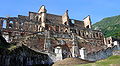 |
Nord Department, Haiti Haiti19°34′25"N 72°14′39"W |
Cultural: (iv), (vi) |
0— | 1982 | ||
| Noel Kempff Mercado National Park Noel Kempff Mercado National Park Noel Kempff Mercado National Park is a national park in northeast Santa Cruz Department, Province of José Miguel de Velasco, Bolivia, on the border with Brazil.-Description:... |
 |
Santa Cruz Department, Bolivia 14°16′S 60°52′W |
Natural: (ix), (x) |
1523446 (3,764,513.7 acre) | 2000 | ||
| Old Havana and its Fortifications Old Havana Old Havana contains the core of the original city of Havana. The positions of the original Havana city walls are the modern boundaries of Old Havana.... |
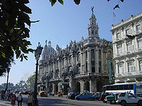 |
La Habana Havana Havana is the capital city, province, major port, and leading commercial centre of Cuba. The city proper has a population of 2.1 million inhabitants, and it spans a total of — making it the largest city in the Caribbean region, and the most populous... , Cuba23°8′0"N 82°21′0"W |
Cultural: (iv), (v) |
143 (353.4 acre) | 1982 | Havana was founded in 1519 by Spanish colonists, growing to become one of the Caribbean's primary ship-building centers by the 17th century. The old city was built in the Baroque Baroque architecture Baroque architecture is a term used to describe the building style of the Baroque era, begun in late sixteenth century Italy, that took the Roman vocabulary of Renaissance architecture and used it in a new rhetorical and theatrical fashion, often to express the triumph of the Catholic Church and... and Neoclassical Neoclassical architecture Neoclassical architecture was an architectural style produced by the neoclassical movement that began in the mid-18th century, manifested both in its details as a reaction against the Rococo style of naturalistic ornament, and in its architectural formulas as an outgrowth of some classicizing... styles. Historical landmarks in Old Havana include La Cabaña La Cabaña The Fortaleza de San Carlos de la Cabaña, known as La Cabaña , is an 18th-century fortress complex, the biggest in the Americas, located on the elevated eastern side of the harbor entrance in Havana, Cuba... , the Cathedral of Havana and the Great Theatre of Havana Great Theatre of Havana The Great Theatre of Havana is located in the Paseo del Prado in Havana, Cuba. It is located in a building known as the Palace of the Galician Centre which served as a place of social reunion for the Galician immigrants in Havana... . |
|
| Old Town Lunenburg | Nova Scotia Nova Scotia Nova Scotia is one of Canada's three Maritime provinces and is the most populous province in Atlantic Canada. The name of the province is Latin for "New Scotland," but "Nova Scotia" is the recognized, English-language name of the province. The provincial capital is Halifax. Nova Scotia is the... Canada44°22′34"N 64°18′33"W |
Cultural: (iv), (v) |
0— | 1995 | |||
| Olympic National Park Olympic National Park Olympic National Park is located in the U.S. state of Washington, in the Olympic Peninsula. The park can be divided into four basic regions: the Pacific coastline, alpine areas, the west side temperate rainforest and the forests of the drier east side. U.S... |
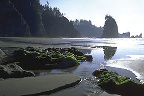 |
Washington, United States 47°45′N 123°27′W |
Cultural: (vii), (ix) |
369660 (913,448.9 acre) | 1981 | ||
| Pantanal Pantanal The Pantanal is a tropical wetland and one of the world's largest wetland of any kind. Most of it lies within the Brazilian state of Mato Grosso do Sul, but it extends into Mato Grosso and portions of Bolivia and Paraguay, sprawling over an area estimated at between and... Conservation Area |
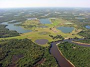 |
Mato Grosso do Sul Mato Grosso do Sul Mato Grosso do Sul is one of the states of Brazil.Neighboring Brazilian states are Mato Grosso, Goiás, Minas Gerais, São Paulo and Paraná. It also borders the countries of Paraguay and Bolivia to the west. The economy of the state is largely based on agriculture and cattle-raising... and Mato Grosso Mato Grosso Mato Grosso is one of the states of Brazil, the third largest in area, located in the western part of the country.Neighboring states are Rondônia, Amazonas, Pará, Tocantins, Goiás and Mato Grosso do Sul. It also borders Bolivia to the southwest... , Brazil17°43′S 57°23′W |
Natural: (vii), (ix), (x) |
187818 (464,108 acre) | 2000 | ||
| Papahānaumokuākea | Hawaii Hawaii Hawaii is the newest of the 50 U.S. states , and is the only U.S. state made up entirely of islands. It is the northernmost island group in Polynesia, occupying most of an archipelago in the central Pacific Ocean, southwest of the continental United States, southeast of Japan, and northeast of... , United States25°21′N 170°9′W |
Mixed: (iii), (vi) (viii), (ix), (x) |
36207499 (89,470,599.4 acre) | 2010 | |||
| Península Valdés | 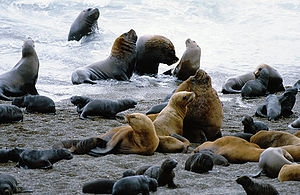 |
Viedma Department Viedma Department Viedma is a department located in the north east of Chubut Province, on the Atlantic coast of Argentina.The provincial subdivision has a population of about 59,000 inhabitants in an area of 12,940km², and its capital city is Puerto Madryn, which is located around 1,334km from Buenos... Argentina42°30′S 64°0′W |
Natural: (x) |
360000 (889,578.6 acre) | 1999 | ||
| Pitons Pitons The Pitons are two volcanic plugs in a World Heritage Site in Saint Lucia. The Gros Piton is 771 m, and the Petit Piton is 743 m high; they are linked by the Piton Mitan ridge.- Geography :... Management Area |
near Soufrière Soufrière, Saint Lucia Soufrière is a quarter on the Southwest coast of Saint Lucia in the West Indies. Soufrière was the former capital of Saint Lucia during times of French rule. It is now a small sleepy fishing port with an emerging tourism industry... ,  Saint Lucia Saint Lucia13°48′25.5"N 61°4′13.3"W |
Natural: (vii), (viii) |
2909 (7,188.3 acre) | 2004 | |||
| Port, Fortresses and Group of Monuments, Cartagena Cartagena, Colombia Cartagena de Indias , is a large Caribbean beach resort city on the northern coast of Colombia in the Caribbean Coast Region and capital of Bolívar Department... |
Bolívar Department Bolívar Department Bolívar is a department of Colombia. It was named after one of the original nine states of the United States of Colombia. It is located to the north of the country, extending from the coast at Cartagena near the mouth of the Magdalena River, then south along the river to a border with Antioquia.Its... , Colombia10°25′0"N 75°32′0"W |
Cultural: (iv), (vi) |
0— | 1984 | |||
| Pre-Hispanic City and National Park of Palenque | 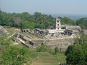 |
Cultural: (i), (ii), (iii), (iv) |
0— | 1987 | |||
| Pre-Hispanic City of Chichen-Itza | 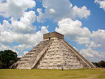 |
Cultural: (i), (ii), (iii) |
0— | 1988 | |||
| Pre-Hispanic City of Teotihuacan | 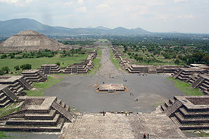 |
Cultural: (i), (ii), (iii), (iv), (vi) |
0— | 1987 | |||
| Pre-Hispanic Town of Uxmal |  |
Cultural: (i), (ii), (iii) |
0— | 1996 | |||
| Prehistoric Caves of Yagul Yagul Yagul is an archaeological site and former city-state associated with the Zapotec civilization of pre-Columbian Mesoamerica, located in the Mexican state of Oaxaca. The site was declared one of the country's four Natural Monuments on 13 October 1998. The site is also known locally as Pueblo Viejo ... and Mitla Mitla Mitla is the second most important archeological site in the state of Oaxaca in Mexico, and the most important of the Zapotec culture. The site is located 44 km from the city of Oaxaca. in the upper end of the Tlacolula Valley, one of the three that form the Central Valleys Region of the... in the Central Valley of Oaxaca Valley of Oaxaca The Valley of Oaxaca is a geographic region located within the modern day State of Oaxaca in southern Mexico. The valley, which is located within the Sierra Madre Mountains, is shaped like a distorted and almost upside-down “Y,” with each of its arms bearing specific names: the northwestern Etla... |
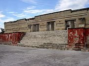 |
Cultural: (iii) |
1515 (3,743.6 acre); buffer zone 3860 (9,538.3 acre) | 2010 | |||
| Protective town of San Miguel San Miguel de Allende San Miguel de Allende is a city and municipality located in the far eastern part of the state of Guanajuato in central Mexico. It is 274 km from Mexico City and 97 km from the state capital of Guanajuato... and the Sanctuary of Jesús Nazareno de Atotonilco |
Cultural: (ii), (iv) |
47 (116.1 acre); buffer zone 47 (116.1 acre) | 2008 | ||||
| Pueblo de Taos | New Mexico New Mexico New Mexico is a state located in the southwest and western regions of the United States. New Mexico is also usually considered one of the Mountain States. With a population density of 16 per square mile, New Mexico is the sixth-most sparsely inhabited U.S... , United States36°26′20"N 105°32′30"W |
Cultural: (iv) |
0— | 1992 | |||
| Quebrada de Humahuaca Quebrada de Humahuaca The Quebrada de Humahuaca is a narrow mountain valley located in the province of Jujuy in northwest Argentina, north of Buenos Aires . It is about long, oriented north-south, bordered by the Altiplano in the west and north, by the Sub-Andean hills in the east, and by the warm valleys in the... |
Jujuy Province Jujuy Province Jujuy is a province of Argentina, located in the extreme northwest of the country, at the borders with Chile and Bolivia. The only neighboring Argentine province is Salta to the east and south.-History:... Argentina23°12′0"S 65°20′56"W |
Cultural: (ii), (iv), (v) |
172116 (425,307.5 acre); buffer zone 369649 (913,421.8 acre) | 2003 | |||
| Rapa Nui National Park Rapa Nui National Park Rapa Nui National Park is a World Heritage Site located on Easter Island, Chile. The park is divided into seven sections:*Rano Kau *Puna Pau .... |
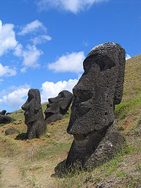 |
Easter Island Easter Island Easter Island is a Polynesian island in the southeastern Pacific Ocean, at the southeasternmost point of the Polynesian triangle. A special territory of Chile that was annexed in 1888, Easter Island is famous for its 887 extant monumental statues, called moai, created by the early Rapanui people... , Valparaíso Region Valparaíso Region The V Valparaíso Region is one of Chile's 15 first order administrative divisions.Valparaíso Region, 2006 With the country's third highest population of 1,539,852 million in 2002 and third smallest area of , the region is Chile's second most densely populated after the Santiago Metropolitan Region... , Chile27°9′S 109°27′W |
Cultural: (i), (iii), (v) |
0— | 1995 | ||
| Redwood National and State Parks Redwood National and State Parks The Redwood National and State Parks are located in the United States, along the coast of northern California. Comprising Redwood National Park and California's Del Norte Coast, Jedediah Smith, and Prairie Creek Redwoods State Parks , the combined RNSP contain... |
California California California is a state located on the West Coast of the United States. It is by far the most populous U.S. state, and the third-largest by land area... , United States41°22′N 124°0′W |
Natural: (vii), (ix) |
56883 (140,560.8 acre) | 1980 | |||
| Rideau Canal Rideau Canal The Rideau Canal , also known as the Rideau Waterway, connects the city of Ottawa, Ontario, Canada on the Ottawa River to the city of Kingston, Ontario on Lake Ontario. The canal was opened in 1832 as a precaution in case of war with the United States and is still in use today, with most of its... |
 |
Ontario Ontario Ontario is a province of Canada, located in east-central Canada. It is Canada's most populous province and second largest in total area. It is home to the nation's most populous city, Toronto, and the nation's capital, Ottawa.... Canada45°0′N 75°46′W |
Cultural: (i), (iv) |
21455 (53,016.4 acre); buffer zone 2363 (5,839.1 acre) | 2007 | ||
| Rio Abiseo National Park Rio Abiseo National Park The Rio Abiseo National Park is located in the San Martín department of Peru. UNESCO pronounced it as Natural and Cultural Heritage of Humanity in 1990. The park is home to a large number of species of flora and fauna, as well as the location of over 30 pre-Columbian archaeological sites... |
— | San Martín San Martín Region San Martín is a region in northern Peru. Most of the region is located in the upper part of the Peruvian Amazon rainforest. Its capital is Moyobamba and the largest city in the region is Tarapoto.-Boundaries:* North and East: Loreto Region... , Peru7°45′S 77°15′W |
Mixed: (iii), (vii), (ix), (x) |
274520 (678,353.1 acre) | 1990In 1992 inscription under cultural criteria (iii) in addition to original inscription as natural site based on criteria (vii), (ix), (x). | The park was created in 1983 in order to protect the region's rainforest habitat. The park is home to many endemic species such as the Yellow-tailed Woolly Monkey Yellow-tailed Woolly Monkey The yellow-tailed woolly monkey is a New World monkey endemic to Peru. It is a rare primate species found only in the Peruvian Andes, in the departments of Amazonas and San Martin as well as bordering areas of La Libertad, Huanuco and Loreto... , which was thought to be extinct. The site is also listed under cultural criteria, as over 30 Pre-Columbian Pre-Columbian era The pre-Columbian era incorporates all period subdivisions in the history and prehistory of the Americas before the appearance of significant European influences on the American continents, spanning the time of the original settlement in the Upper Paleolithic period to European colonization during... sites have been discovered since 1985. |
|
| Río Plátano Biosphere Reserve Río Plátano Biosphere Reserve The Río Plátano Biosphere Reserve is 5,250 km² of preserved land in the La Mosquitia region on the Caribbean coast of Honduras. Most of the land runs along the Río Plátano. The reserve has a number of endangered species and some of Honduras largest sections of forest. It has been a World... † |
La Mosquitia La Mosquitia La Mosquitia refers to the northeastern part of Honduras along the Mosquito Coast. It is an underdeveloped region of tropical rainforest accessible primarily by water and air. Its population include indigenous groups such as the Miskito, the Pech, Rama, Sumo, and Tawakha. The Río Plátano Biosphere... , Honduras15°44′40"N 84°40′30"W |
Natural: (vii), (viii), (ix), (x) |
500000 (1,235,525.8 acre) | 1982 | Endangered since 2011 | ||
| Rock Paintings of the Sierra de San Francisco | Cultural: (i), (iii) |
0— | 1993 | ||||
| Ruins of León Viejo León Viejo León Viejo, is the place where the city of León was originally founded in what is now the town of Puerto Momotombo in the Municipality of La Paz Centro of the Department of León, Nicaragua. This city, after a popular consultation, was abandoned to be settled in another location... |
 |
Puerto Momotombo, Municipality La Paz Centro, Department of León, Nicaragua 12°23′50"N 86°36′37"W |
Cultural: (iii), (iv) |
0— | 2000 | ||
| Sacred City of Caral-Supe Caral Caral was a large settlement in the Supe Valley, near Supe, Barranca province, Peru, some 200 km north of Lima. Caral is the most ancient city of the Americas, and is a well-studied site of the Caral civilization or Norte Chico civilization.- History :... |
 |
Lima Lima Region Lima Region, also known as Lima Provincias, is one of twenty-five regions of Peru. Located in the central coast of the country, its regional seat is Huacho.... , Peru10°53′30"S 77°31′17"W |
Cultural: (ii), (iii), (iv) |
626 (1,546.9 acre); buffer zone 14620 (36,126.8 acre) | 2009 | The archaeological site belonged to the Norte Chico civilization Norte Chico civilization The Norte Chico civilization was a complex pre-Columbian society that included as many as 30 major population centers in what is now the Norte Chico region of north-central coastal Peru... that inhabited the area during the Late Archaic period. Caral is one of 18 complex urban settlements in the region and features many monuments and pyramids. Caral is the earliest known American settlement. A quipu Quipu Quipus or khipus were recording devices used in the Inca Empire and its predecessor societies in the Andean region. A quipu usually consisted of colored, spun, and plied thread or strings from llama or alpaca hair. It could also be made of cotton cords... recovered from the site demonstrates its influence on later Andean cultures. |
|
| San Agustín Archaeological Park | San Augustin and San José de Isnos, Huila Department Huila Department Huila is one of the departments of Colombia. It is located in the southwest of the country, and its capital is Neiva.-Geography:The south of the department is located in the Colombian Massif... , Colombia1°55′0"N 76°14′0"W |
Cultural: (iii) |
0— | 1995 | |||
| Sanctuary of Bom Jesus do Congonhas |  |
Congonhas Congonhas Congonhas is a historical Brazilian city located in the state of Minas Gerais. It is situated south from Belo Horizonte, the capital of state of Minas Gerais, by the highway BR-040... , Minas Gerais Minas Gerais Minas Gerais is one of the 26 states of Brazil, of which it is the second most populous, the third richest, and the fourth largest in area. Minas Gerais is the Brazilian state with the largest number of Presidents of Brazil, the current one, Dilma Rousseff, being one of them. The capital is the... , Brazil20°29′59"S 43°51′28"W |
Cultural: (i), (iv) |
0— | 1985 | ||
| Sangay National Park Sangay National Park Sangay National Park is a national park located in the Morona Santiago, Chimborazo and Tungurahua provinces of Ecuador. The park contains two active volcanoes and ecosystems ranging from tropical rainforests to glaciers.... |
Morona Santiago, Chimborazo Chimborazo Province Chimborazo is a province in Ecuador, located in the central Ecuadorian Andes, containing a section of Sangay National Park. The capital is Riobamba. The province contains Chimborazo , Ecuador's highest mountain.- Cantons :... and Tungurahua Tungurahua Province Tungurahua is one of the twenty-four provinces of Ecuador. Its capital is Ambato. The province takes its name from the Tungurahua volcano, which is located within the boundaries of the provinces.-Population:... Provinces, Ecuador1°50′S 78°20′W |
Natural: (vii), (viii), (ix), (x) |
271925 (671,940.7 acre) | 1983 | Endangered 1992–2005 | ||
| San Pedro de la Roca Castle Castillo de San Pedro de la Roca The Castillo de San Pedro de la Roca is a fortress on the coast of the Cuban city of Santiago de Cuba... , Santiago de Cuba Santiago de Cuba Santiago de Cuba is the second largest city of Cuba and capital city of Santiago de Cuba Province in the south-eastern area of the island, some south-east of the Cuban capital of Havana.... |
Santiago de Cuba Province Santiago de Cuba Province Santiago de Cuba Province is the second most populated province in the island of Cuba. The largest city Santiago de Cuba is the main administrative center... , Cuba19°58′0"N 75°52′15"W |
Cultural: (iv), (v) |
0— | 1997 | The large fort was built to defend the important port of Santiago de Cuba Santiago de Cuba Santiago de Cuba is the second largest city of Cuba and capital city of Santiago de Cuba Province in the south-eastern area of the island, some south-east of the Cuban capital of Havana.... . The design of the fortification was based on Italian and Renaissance architecture Renaissance architecture Renaissance architecture is the architecture of the period between the early 15th and early 17th centuries in different regions of Europe, demonstrating a conscious revival and development of certain elements of ancient Greek and Roman thought and material culture. Stylistically, Renaissance... . The complex of magazines Magazine (artillery) Magazine is the name for an item or place within which ammunition is stored. It is taken from the Arabic word "makahazin" meaning "warehouse".-Ammunition storage areas:... , bastion Bastion A bastion, or a bulwark, is a structure projecting outward from the main enclosure of a fortification, situated in both corners of a straight wall , facilitating active defence against assaulting troops... s, and batteries Artillery battery In military organizations, an artillery battery is a unit of guns, mortars, rockets or missiles so grouped in order to facilitate better battlefield communication and command and control, as well as to provide dispersion for its constituent gunnery crews and their systems... is one of the most complete and well-preserved Spanish-American defense fortifications. |
||
| São Francisco Square in the Town of São Cristóvão São Cristóvão São Cristóvão is a Brazilian city in the Northeastern state of Sergipe. Its population was 75,353 and its area is 437 km². It is the third largest settlement in the state, behind Aracaju and Nossa Senhora do Socorro.-History:... |
São Cristóvão, Sergipe Sergipe Sergipe , is the smallest state of the Brazilian Federation, located on the northeastern Atlantic coast of the country. It borders on two other states, Bahia to the south and west and Alagoas to the north, and to the east is the Atlantic Ocean... , Brazil11°0′58"S 37°12′36"W |
Cultural: (ii), (iv) |
3 (7.4 acre); buffer zone 2500 (6,177.6 acre) | 2010 | |||
| Serra da Capivara National Park Serra da Capivara National Park Serra da Capivara National Park is a national park in the north east of Brazil. It has many prehistoric paintings. The park was created to protect the prehistoric artifacts and paintings found there. It became a World Heritage Site in 1991. Its head archaeologist is Niède Guidon... |
 |
Piauí Piauí Piauí is one of the states of Brazil, located in the northeastern part of the country.Piauí has the shortest coastline of any of the non-landlocked Brazilian states at 66 km , and the capital, Teresina, is the only state capital in the north east to be located inland... , Brazil8°25′0"S 42°20′0"W |
Cultural: (iii) |
0— | 1991 | ||
| Sewell Sewell, Chile Sewell is an uninhabited Chilean mining town located in the commune of Machalí in Cachapoal Province, O'Higgins Region, on the slopes of the Andes, at an altitude between 2,000 and 2,250 metres. The town was founded in 1904 by the Braden Copper Co. to extract the copper in the El Teniente mine,... Mining Town |
Machalí Machalí Machalí is a Chilean commune and city in Cachapoal Province, O'Higgins Region.-Demographics:According to the 2002 census of the National Statistics Institute, Machalí spans an area of and has 28,628 inhabitants . Of these, 26,852 lived in urban areas and 1,776 in rural areas... , Cachapoal Province Cachapoal Province Cachapoal Province is one of three provinces of the central Chilean region of O'Higgins . Its capital is the city of Rancagua .-Geography and demography:... , O'Higgins Region O'Higgins Region The VI O'Higgins Region is one of Chile's 15 first order administrative divisions. It is subdivided into three provinces. It is named in honour of Bernardo O'Higgins Riquelme, one of Chile's founding fathers.... Chile34°5′4"S 70°22′58"W |
Cultural: (ii) |
17 (42 acre); buffer zone 33 (81.5 acre) | 2006 | |||
| SGang Gwaay Ninstints Ninstints is the usual name in English for SGang Gwaay Llanagaay , a village site of the Haida people and part of the Gwaii Haanas National Park Reserve and Haida Heritage Site in Haida Gwaii on the North Coast of British Columbia, Canada... |
 |
British Columbia British Columbia British Columbia is the westernmost of Canada's provinces and is known for its natural beauty, as reflected in its Latin motto, Splendor sine occasu . Its name was chosen by Queen Victoria in 1858... , Canada52°5′42"N 131°13′13"W |
Cultural: (iii) |
0— | 1981 | ||
| Sian Ka'an Sian Ka'an Sian Ka'an is a non profit and non governmental organization biosphere reserve formed by a group of conservationists in the municipality of Tulum in the Mexican state of Quintana Roo, whose mission is the conservation of the biodiversity... |
 |
Natural: (vii), (x) |
528000 (1,304,715.3 acre) | 1987 | |||
| Statue of Liberty Statue of Liberty The Statue of Liberty is a colossal neoclassical sculpture on Liberty Island in New York Harbor, designed by Frédéric Bartholdi and dedicated on October 28, 1886... |
New York City New York City New York is the most populous city in the United States and the center of the New York Metropolitan Area, one of the most populous metropolitan areas in the world. New York exerts a significant impact upon global commerce, finance, media, art, fashion, research, technology, education, and... , New York New York New York is a state in the Northeastern region of the United States. It is the nation's third most populous state. New York is bordered by New Jersey and Pennsylvania to the south, and by Connecticut, Massachusetts and Vermont to the east... , United States40°41′22"N 74°2′41"W |
Cultural: (i), (vi) |
0— | 1984 | |||
| Talamanca Range Cordillera de Talamanca The Cordillera de Talamanca is a mountain range that lies on the border between Costa Rica and Panama. Much of the range and the area around it is included in the La Amistad International Park, which also is shared between the two countries.... -La Amistad Reserves / La Amistad National Park La Amistad International Park The La Amistad International Park, or in Spanish , formerly the La Amistad National Park, is an Transboundary Protected Area in Latin America, management of which is shared between Costa Rica and Panama, following a recommendation by UNESCO after the park's inclusion in the World Heritage Site... |
 |
San José San José Province San José is a province of Costa Rica. It is located in the central part of the country, and borders the provinces of Alajuela, Heredia, Cartago, Limón and Puntarenas. The provincial capital is San José. The province covers an area of 4,965.9 km²... , Cartago Cartago Province Cartago is a province of Costa Rica. It is located in the central part of the country. Bordering provinces are Limón to the east and San José to the west. The capital is Cartago and it was formerly the capital city of Costa Rica until 1823 when the capital was changed to San Jose... , Limón Limón Province Limón is one of seven provinces in Costa Rica. The majority of its territory is situated in the country's Caribbean lowlands, though the southwestern portion houses part of an extensive mountain range known as the Cordillera de Talamanca... and Puntarenas Puntarenas Province Puntarenas is a province of Costa Rica. It is located in the western part of the country, covering most of Costa Rica's Pacific Ocean coast, and it is the largest province in Costa Rica. Clockwise from the northwest it borders on the provinces Guanacaste, Alajuela, San José and Limón, and the... Provinces, Costa Rica*; Bocas del ToroBocas del Toro Province Bocas del Toro is a province of Panama. Its extension is 4,643.9 square kilometers comprising the mainland and nine main islands. The province consists of the Bocas del Toro Archipelago, Bahía Almirante , Laguna de Chiriquí , and adjacent mainland. The capital is the city of Bocas del Toro on Isla... and Chiriquí Chiriquí Province Chiriquí is a province of Panama, it is located on the western coast of Panama, and it is also the second most developed province in the country, after the Panamá Province. Its capital is the city of David. It has a total area of 6,490.9 km², with a population of 416,873 as of the year 2010... Provinces, Panama*9°24′26"N 82°56′20"W |
Natural: (vii), (viii), (ix), (x) |
567845 (1,403,174.3 acre) | 1983Modification of boundaries in 1990 to exclude areas that are not of outstanding universal value and to include the extended Chirripó Chirripó National Park Chirripó National Park is located in the middle portion of the Talamanca Range of Costa Rica, approximately 30 km northeast from the city of San Isidro del General. It protects a number of important ecosystems on the Costa Rican Pacific slope and is notable for including the largest extension... and Talamanca National Parks. |
|
|
| Tikal Tikal Tikal is one of the largest archaeological sites and urban centres of the pre-Columbian Maya civilization. It is located in the archaeological region of the Petén Basin in what is now northern Guatemala... National Park |
Petén Department, Guatemala 17°13′N 89°37′W |
Mixed: (i), (iii), (iv), (ix), (x) |
57600 (142,332.6 acre) | 1979 | |||
| Tiwanaku Tiwanaku Tiwanaku, is an important Pre-Columbian archaeological site in western Bolivia, South America. Tiwanaku is recognized by Andean scholars as one of the most important precursors to the Inca Empire, flourishing as the ritual and administrative capital of a major state power for approximately five... : Spiritual and Political Centre of the Tiwanaku Culture |
 |
Ingavi Province Ingavi Province Ingavi is a province in the La Paz Department, Bolivia. Its capital is Viacha.- Subdivision :Ingavi Province is divided into seven municipalities which are partly further subdivided into cantons.- Population :... , La Paz Department, Bolivia16°33′30"S 68°40′40"W |
Cultural: (iii), (iv) |
0— | 2000 | ||
| Trinidad Trinidad, Cuba -External links:* , Online travel guide to Trinidad* , Selected photos of Trinidad* , Photos of Trinidad... and the Valley de los Ingenios Valley de los Ingenios Valle de los Ingenios, Valley de los Ingenios or Valley of the Sugar Mills is a series of three interconnected valleys about outside of Trinidad, Cuba. The three valleys, San Luis, Santa Rosa and Meyer, were a centre for sugar production from the late 18th century until the late 19th century... |
_02.jpg) |
Sancti Spíritus Province Sancti Spíritus Province Sancti Spíritus is one of the provinces of Cuba. Its capital is the identically named Sancti Spíritus. Another major city is Trinidad.The southern coast of the province is flat, but the western portion of Sancti Spíritus province is mountainous. The southeast has numerous mangroves and swamps... , Cuba21°48′11"N 79°59′4"W |
Cultural: (iv), (v) |
0— | 1988 | The city of Trinidad was founded in the early 16th century. In 1518, Hernán Cortés Hernán Cortés Hernán Cortés de Monroy y Pizarro, 1st Marquis of the Valley of Oaxaca was a Spanish Conquistador who led an expedition that caused the fall of the Aztec Empire and brought large portions of mainland Mexico under the rule of the King of Castile in the early 16th century... began his expedition to conquer Mexico from the port at Trinidad. The city prospered throughout the colonial period in large part due to the success of the local sugar industry. The adjacent Valley de los Ingenios was the origin of the Cuban sugar industry, which emerged in the 18th century. It is home to numerous cane sugar mill Cane sugar mill A cane sugar mill is a factory that processes sugar cane to produce raw or white sugar.- Processing :Traditionally, sugarcane processing requires two stages. Mills extract raw sugar from freshly harvested cane, and sometimes bleach it to make "mill white" sugar for local consumption... s, as well as cattle ranches and tobacco plantations. |
|
| Urban Historic Centre of Cienfuegos Cienfuegos Cienfuegos is a city on the southern coast of Cuba, capital of Cienfuegos Province. It is located about from Havana, and has a population of 150,000. The city is dubbed La Perla del Sur... |
 |
Cienfuegos Cienfuegos Province Cienfuegos is one of the provinces of Cuba. The capital city of the province is also called Cienfuegos and was founded by French settlers in 1819.... , Cuba22°8′50"N 80°27′10"W |
Cultural: (ii), (v) |
0— | 2005 | Cienfuegos was founded in 1819 as a Spanish colony, though its first inhabitants were French immigrants. It became a trade center in the sugar cane, tobacco, and coffee trade because of its location on the Bay of Cienfuegos. Because of its establishment in the later colonial period, the architecture has more modern influences: including modern ideas of urban planning. | |
| Viñales Valley Viñales Valley Viñales Valley is a karstic depression in Cuba. The valley has an area of and is located in the Sierra de los Organos, just north of Viñales in the Pinar del Río Province.... |
 |
Pinar del Río Province Pinar del Río Province Pinar del Río is one of the provinces of Cuba. It is at the western end of the island of Cuba.-Geography:The Pinar del Río province is Cuba's westernmost province and contains one of Cuba's three main mountain ranges, the Cordillera de Guaniguanico, divided into the easterly Sierra del Rosario and... , Cuba22°37′N 83°43′W |
Cultural: (iv) |
0— | 1999 | The village of Viñales Viñales This article is about the town. For the adjacent UNESCO world heritage site, see Viñales Valley. Viñales is a small town and municipality in the north-central Pinar del Rio Province of Cuba.... was founded in 1875 after the expansion of tobacco cultivation in the surrounding valley. The Valley features a karst topography Karst topography Karst topography is a geologic formation shaped by the dissolution of a layer or layers of soluble bedrock, usually carbonate rock such as limestone or dolomite, but has also been documented for weathering resistant rocks like quartzite given the right conditions.Due to subterranean drainage, there... , vernacular architecture Vernacular architecture Vernacular architecture is a term used to categorize methods of construction which use locally available resources and traditions to address local needs and circumstances. Vernacular architecture tends to evolve over time to reflect the environmental, cultural and historical context in which it... , and traditional cultivation methods. The Valley was also the site of various military engagements in the Cuban War of Independence Cuban War of Independence Cuban War of Independence was the last of three liberation wars that Cuba fought against Spain, the other two being the Ten Years' War and the Little War... and Cuban Revolution Cuban Revolution The Cuban Revolution was an armed revolt by Fidel Castro's 26th of July Movement against the regime of Cuban dictator Fulgencio Batista between 1953 and 1959. Batista was finally ousted on 1 January 1959, and was replaced by a revolutionary government led by Castro... . |
|
| Waterton Glacier International Peace Park | Alberta Alberta Alberta is a province of Canada. It had an estimated population of 3.7 million in 2010 making it the most populous of Canada's three prairie provinces... , Canada*;Montana Montana Montana is a state in the Western United States. The western third of Montana contains numerous mountain ranges. Smaller, "island ranges" are found in the central third of the state, for a total of 77 named ranges of the Rocky Mountains. This geographical fact is reflected in the state's name,... , United States*49°0′N 113°54′W |
Natural: (vii), (ix) |
457614 (1,130,787.8 acre) | 1995 | |||
| Whale Sanctuary of El Vizcaino | Natural: (x) |
370950 (916,636.6 acre) | 1993 | ||||
| Wood Buffalo National Park Wood Buffalo National Park Wood Buffalo National Park, located in northeastern Alberta and southern Northwest Territories, is the largest national park in Canada at . The park was established in 1922 to protect the world's largest herd of free roaming Wood Bison, currently estimated at more than 5,000... |
 |
Alberta Alberta Alberta is a province of Canada. It had an estimated population of 3.7 million in 2010 making it the most populous of Canada's three prairie provinces... and Northwest Territories Northwest Territories The Northwest Territories is a federal territory of Canada.Located in northern Canada, the territory borders Canada's two other territories, Yukon to the west and Nunavut to the east, and three provinces: British Columbia to the southwest, and Alberta and Saskatchewan to the south... , Canada59°22′N 112°18′W |
Natural: (vii), (ix), (x) |
4480000 (11,070,311.3 acre) | 1983 | ||
| Yellowstone National Park Yellowstone National Park Yellowstone National Park, established by the U.S. Congress and signed into law by President Ulysses S. Grant on March 1, 1872, is a national park located primarily in the U.S. state of Wyoming, although it also extends into Montana and Idaho... |
Natural: (vii), (viii), (ix), (x) |
898349 (2,219,866.8 acre) | 1978 | Endangered 1995–2003 | |||
| Yosemite National Park Yosemite National Park Yosemite National Park is a United States National Park spanning eastern portions of Tuolumne, Mariposa and Madera counties in east central California, United States. The park covers an area of and reaches across the western slopes of the Sierra Nevada mountain chain... |
Natural: (vii), (viii) |
308283 (761,783.2 acre) | 1984 |
External links
- UNESCO World Heritage Centre official website
- List of UNESCO World Heritage Sites official website
- VRheritage.org - documentation of World Heritage Sites
- Worldheritage-Forum - Information and Weblog on World Heritage Issues