
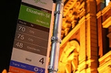
List of Melbourne tram routes
Encyclopedia

Yarra Trams
Yarra Trams is the trading name of the Melbourne tram network, which is fully owned and registered by the Victorian State Government. The current franchise is operated by a consortium named KDR Melbourne which consists of a partnership between French company Keolis and Australian company Downer EDI...
in the city of Melbourne
Melbourne
Melbourne is the capital and most populous city in the state of Victoria, and the second most populous city in Australia. The Melbourne City Centre is the hub of the greater metropolitan area and the Census statistical division—of which "Melbourne" is the common name. As of June 2009, the greater...
, Australia
Australia
Australia , officially the Commonwealth of Australia, is a country in the Southern Hemisphere comprising the mainland of the Australian continent, the island of Tasmania, and numerous smaller islands in the Indian and Pacific Oceans. It is the world's sixth-largest country by total area...
.
For detailed travel information, do not rely solely on this page; please refer to the Metlink website.
Main routes
| Route | Map | Destinations | Comments |
|---|---|---|---|
| 1 Melbourne tram route 1 Tram route 1 is a public transport service in Melbourne, Victoria, Australia. It runs from the terminus at Nicholson Street and Bell Street in East Coburg to the corner of Victoria Avenue and Beaconsfield Parade in Albert Park.... |
East Coburg Coburg, Victoria Coburg is a suburb in Melbourne, Victoria, Australia, 8 km north from Melbourne's central business district. Its Local Government Area is the City of Moreland, although a handful of properties on Coburg's Eastern boundary are located in the City of Darebin... South Melbourne Beach South Melbourne, Victoria South Melbourne is an inner city suburb in Melbourne, Victoria, Australia, 2 km south from Melbourne's central business district. Its Local Government Area are the Cities of Port Phillip and Melbourne... |
via Lygon Street Lygon Street, Melbourne Lygon Street is a street in inner northern Melbourne, Australia running through the suburbs of Carlton, Carlton North, Princes Hill and Brunswick East. Lygon Street's name has become synonymous with Italian restaurants and cafés located in the Carlton part of the street... & City Melbourne city centre Melbourne City Centre is an area of Melbourne in Victoria, Australia. It is not to be confused with the larger local government area of the City of Melbourne... |
|
| 3 Melbourne tram route 3 Tram route 3 is a public transport service in Melbourne, Victoria, Australia. It runs from the University of Melbourne north of the city centre to Malvern East in the eastern suburbs.... |
Melbourne University University of Melbourne The University of Melbourne is a public university located in Melbourne, Victoria. Founded in 1853, it is the second oldest university in Australia and the oldest in Victoria... East Malvern Malvern East, Victoria Malvern East is a suburb in Melbourne, Victoria, Australia, 11 km south-east from Melbourne's central business district. Its Local Government Area is the City of Stonnington... |
Weekdays only | |
| 3a | Melbourne University University of Melbourne The University of Melbourne is a public university located in Melbourne, Victoria. Founded in 1853, it is the second oldest university in Australia and the oldest in Victoria... East Malvern Malvern East, Victoria Malvern East is a suburb in Melbourne, Victoria, Australia, 11 km south-east from Melbourne's central business district. Its Local Government Area is the City of Stonnington... |
via St Kilda St Kilda, Victoria St Kilda is an inner city suburb of Melbourne, Victoria, Australia, 6 km south from Melbourne's central business district. Its Local Government Area is the City of Port Phillip... (Weekends and Public Holidays only) |
|
| 5 Melbourne tram route 5 Tram route 5 is a public transport service in Melbourne, Victoria, Australia. It runs from the University of Melbourne north of the city centre to Malvern East in the eastern suburbs. The destination is, however, displayed as Malvern, although the route technically ends within Malvern East... |
Melbourne University University of Melbourne The University of Melbourne is a public university located in Melbourne, Victoria. Founded in 1853, it is the second oldest university in Australia and the oldest in Victoria... Malvern Malvern, Victoria Malvern is a suburb in Melbourne, Victoria, Australia, 8 km south-east from Melbourne's central business district. Its Local Government Area is the City of Stonnington. At the 2006 Census, Malvern had a population of 9,422.-History:... |
||
| 6 Melbourne tram route 6 Tram route 6 is a public transport service in Melbourne, Victoria, Australia. It runs from the University of Melbourne in the city centre to Glen Iris in the eastern suburbs.... |
Melbourne University University of Melbourne The University of Melbourne is a public university located in Melbourne, Victoria. Founded in 1853, it is the second oldest university in Australia and the oldest in Victoria... Glen Iris Glen Iris, Victoria Glen Iris is a suburb in Melbourne, Victoria, Australia, 10 km south-east from Melbourne's central business district. Its Local Government Area are the Cities of Boroondara and Stonnington... |
||
| 8 Melbourne tram route 8 Tram route 8 is a public transport service in Melbourne, Victoria, Australia. It runs from Toorak to Moreland through the suburbs of Carlton and South Yarra... |
MorelandToorak Toorak, Victoria Toorak is a suburb of Melbourne, Victoria, Australia, 5 km south-east from Melbourne's central business district located on a rise on the south side of a bend in the Yarra River. Its Local Government Area is the City of Stonnington... |
via Lygon Street Lygon Street, Melbourne Lygon Street is a street in inner northern Melbourne, Australia running through the suburbs of Carlton, Carlton North, Princes Hill and Brunswick East. Lygon Street's name has become synonymous with Italian restaurants and cafés located in the Carlton part of the street... & City Melbourne city centre Melbourne City Centre is an area of Melbourne in Victoria, Australia. It is not to be confused with the larger local government area of the City of Melbourne... |
|
| 11 | West Preston Preston, Victoria Preston is a suburb in Melbourne, Victoria, Australia, 9 km north from Melbourne's central business district. Its Local Government Area is the City of Darebin. At the 2006 Census, Preston had a population of 27,892.-Settlement:... Victoria Harbour Docklands |
via Collins Street Collins Street, Melbourne Collins Street is a major street in the Melbourne central business district and runs approximately east to west.It is notable as Melbourne's traditional main street and best known street, is often regarded as Australia's premier street, with some of the country's finest Victorian era buildings.The... |
|
| 16 Melbourne tram route 16 Tram route 16 is a public transport service in Melbourne, Victoria, Australia. It runs from the University of Melbourne in the city centre to Kew in the eastern suburbs. It runs through the suburbs of Melbourne, St Kilda, Balaclava, Malvern, and Kew... |
Melbourne University University of Melbourne The University of Melbourne is a public university located in Melbourne, Victoria. Founded in 1853, it is the second oldest university in Australia and the oldest in Victoria... Kew Kew, Victoria Kew is a suburb in Melbourne, Victoria, Australia, 6 km east from Melbourne's central business district. Its Local Government Area is the City of Boroondara. At the 2006 Census, Kew had a population of 22,516.... |
via St Kilda St Kilda, Victoria St Kilda is an inner city suburb of Melbourne, Victoria, Australia, 6 km south from Melbourne's central business district. Its Local Government Area is the City of Port Phillip... |
|
| 19 Melbourne tram route 19 Tram route 19 is a public transport service in Melbourne, Victoria, Australia. It runs from Flinders Street in the city centre to North Coburg in the northern suburbs. It runs through the suburbs of Melbourne, Parkville, Brunswick, Coburg, and Coburg North... |
North Coburg Coburg North, Victoria Coburg North is a suburb in Melbourne, Victoria, Australia, 10 km north from Melbourne's central business district. Its Local Government Area is the City of Moreland. At the 2006 Census, Coburg North had a population of 6064.... City Melbourne city centre Melbourne City Centre is an area of Melbourne in Victoria, Australia. It is not to be confused with the larger local government area of the City of Melbourne... (Elizabeth Street Elizabeth Street, Melbourne Elizabeth Street is one of the main north-south streets in the central business district of Melbourne, Australia, part of the Hoddle Grid laid out in 1837.- Geography :... ) |
||
| 24 Melbourne tram route 24 Tram route 24 is a public transport service in Melbourne, Victoria, Australia, which runs from La Trobe Street in the city centre, to North Balwyn. Like most tram routes in Melbourne, it falls within Metcard ticketing Zone 1.... |
North Balwyn Balwyn North, Victoria Balwyn North is a suburb in Melbourne, Victoria, Australia, 11 km east from Melbourne's central business district. Its Local Government Area is the City of Boroondara... La Trobe Street West End La Trobe Street, Melbourne La Trobe Street is a major street in the central business district of Melbourne, Victoria, Australia. It runs roughly from east to west and forms the northern boundary of the CBD .... |
via La Trobe Street La Trobe Street, Melbourne La Trobe Street is a major street in the central business district of Melbourne, Victoria, Australia. It runs roughly from east to west and forms the northern boundary of the CBD .... |
|
| 30 Melbourne tram route 30 Tram route 30 is a public transport service in Melbourne, Victoria, Australia. It runs from St Vincents Plaza to Etihad Stadium. It only runs on weekdays, during daylight hours and is one of three fare paying routes to use heritage W class trams.... |
St Vincents Plaza East Melbourne, Victoria East Melbourne is a suburb in Melbourne, Victoria, Australia, adjacent to Melbourne's central business district. Its Local Government Area is the City of Melbourne. At the 2006 Census, East Melbourne had a population of 4,330.... Etihad Stadium Docklands |
via La Trobe Street La Trobe Street, Melbourne La Trobe Street is a major street in the central business district of Melbourne, Victoria, Australia. It runs roughly from east to west and forms the northern boundary of the CBD .... |
|
| 31 Melbourne tram route 31 Tram route 31 is a public transport service in Melbourne, Victoria, Australia. It currently runs from Victoria Harbour via Collins Street through the city to St Vincents Plaza, then down Victoria Parade to Hoddle Street. The route has previously run from the old Collins Street West End terminus via... |
Victoria Harbour DocklandsHoddle Street | via Collins Street Collins Street, Melbourne Collins Street is a major street in the Melbourne central business district and runs approximately east to west.It is notable as Melbourne's traditional main street and best known street, is often regarded as Australia's premier street, with some of the country's finest Victorian era buildings.The... |
|
| 35 | City Circle City Circle (tram route) The City Circle is a zero-fare tram running around the central business district of Melbourne, Australia. Aimed towards tourists the route passes many Melbourne attractions while running along the CBD's outermost thoroughfares, as well as the developing Docklands waterfront precinct.- History :The... |
Zero-fare service encircling the central business district Melbourne city centre Melbourne City Centre is an area of Melbourne in Victoria, Australia. It is not to be confused with the larger local government area of the City of Melbourne... |
|
| 48 Melbourne tram route 48 Tram route 48 is a public transport service in Melbourne, Victoria, Australia. It runs from Victoria Harbour, Docklands to North Balwyn via Collins Street, Spring Street, Wellington Parade and Bridge Road... |
Victoria Harbour DocklandsNorth Balwyn Balwyn North, Victoria Balwyn North is a suburb in Melbourne, Victoria, Australia, 11 km east from Melbourne's central business district. Its Local Government Area is the City of Boroondara... |
via Collins Street Collins Street, Melbourne Collins Street is a major street in the Melbourne central business district and runs approximately east to west.It is notable as Melbourne's traditional main street and best known street, is often regarded as Australia's premier street, with some of the country's finest Victorian era buildings.The... |
|
| 55 Melbourne tram route 55 Tram route 55 is a public transport service in Melbourne, Victoria, Australia. It runs from the corner of Bell Street and Melville Road in West Coburg to the Domain Road Interchange - Domain Road and St Kilda Road east of the city.... |
West Coburg Coburg, Victoria Coburg is a suburb in Melbourne, Victoria, Australia, 8 km north from Melbourne's central business district. Its Local Government Area is the City of Moreland, although a handful of properties on Coburg's Eastern boundary are located in the City of Darebin... Domain Interchange |
via William Street William Street, Melbourne William Street is a major street in the central business district of Melbourne, Victoria, Australia. It runs roughly north-south from Flinders Street to Victoria Street, and is located in the western half of the Hoddle Grid.... & City Melbourne city centre Melbourne City Centre is an area of Melbourne in Victoria, Australia. It is not to be confused with the larger local government area of the City of Melbourne... |
|
| 57 Melbourne tram route 57 Tram route 57 is a public transport service in Melbourne, Victoria, Australia. It runs from the corner of Flinders Street and Elizabeth Street in the city centre to West Maribyrnong in the inner Western suburbs.... |
West Maribyrnong Maribyrnong, Victoria Maribyrnong is a suburb 8 km north-west of Melbourne, Victoria, Australia. Its Local Government Area is the City of Maribyrnong, part of River Ward. At the 2006 Census, Maribyrnong had a population of 8242.... City Melbourne city centre Melbourne City Centre is an area of Melbourne in Victoria, Australia. It is not to be confused with the larger local government area of the City of Melbourne... (Elizabeth Street Elizabeth Street, Melbourne Elizabeth Street is one of the main north-south streets in the central business district of Melbourne, Australia, part of the Hoddle Grid laid out in 1837.- Geography :... ) |
via North Melbourne North Melbourne, Victoria North Melbourne is a large inner city suburb of Melbourne, Victoria, Australia, 2 km north-west from Melbourne's central business district. It is bounded by the CityLink freeway to the west, Victoria Street to the south, O'Connell and Peel Streets to the east and Flemington Road to the north. Its... |
|
| 59 Melbourne tram route 59 Tram route 59 is a public transport service in Melbourne, Victoria, Australia. It runs from the intersection of Flinders Street and Elizabeth Street in the city centre to Airport West in the north western suburbs.... |
Airport West Airport West, Victoria Airport West is a suburb 14 km north-west of Melbourne, Victoria, Australia. Its Local Government Area is the City of Moonee Valley. At the 2006 Census, Airport West had a population of 6660.... City Melbourne city centre Melbourne City Centre is an area of Melbourne in Victoria, Australia. It is not to be confused with the larger local government area of the City of Melbourne... (Elizabeth Street Elizabeth Street, Melbourne Elizabeth Street is one of the main north-south streets in the central business district of Melbourne, Australia, part of the Hoddle Grid laid out in 1837.- Geography :... ) |
||
| 64 Melbourne tram route 64 Tram route 64 is a public transport service in Melbourne, Victoria, Australia. It runs from the University of Melbourne in the city centre to East Brighton in the southern suburbs. It runs through the suburbs of Melbourne, Windsor, Caulfield, and Brighton East... |
Melbourne University University of Melbourne The University of Melbourne is a public university located in Melbourne, Victoria. Founded in 1853, it is the second oldest university in Australia and the oldest in Victoria... East Brighton Brighton East, Victoria Brighton East is a suburb in Melbourne, Victoria, Australia, 11 km south-east from Melbourne's central business district. Its Local Government Area is the City of Bayside. At the 2006 Census, Brighton East had a population of 15,167.... |
||
| 67 Melbourne tram route 67 The Melbourne Tram Route 67 is an Australian tram route which runs back and forth from Carnegie to the University of Melbourne.The route starts at the Carnegie terminus, located in Trugininni Road at the corner of Koornang Road, and travels via Glen Huntly Road, Brighton Road, St Kilda Road and... |
Melbourne University University of Melbourne The University of Melbourne is a public university located in Melbourne, Victoria. Founded in 1853, it is the second oldest university in Australia and the oldest in Victoria... Carnegie Carnegie, Victoria Carnegie is a suburb in Melbourne, Victoria, Australia, 12 km south-east from Melbourne's central business district. Its Local Government Area is the City of Glen Eira. At the 2006 Census, Carnegie had a population of 15,084... |
||
| 70 Melbourne tram route 70 Tram route 70 is a public transport service in Melbourne, Victoria, Australia. It is operated by Camberwell Depot and runs from the Waterfront City Docklands to Wattle Park in Box Hill South... |
Waterfront City DocklandsWattle Park Wattle Park, Melbourne Wattle Park is a public park in Melbourne, Australia, located in the suburb of Burwood. It is known for its plantation of 12,000 wattle trees. It is currently maintained by Parks Victoria.... |
||
| 72 Melbourne tram route 72 Tram route 72 is a public transport service in Melbourne, Victoria, Australia. It runs from the University of Melbourne in the city centre to Camberwell in the eastern suburbs. It runs through the suburbs of Melbourne, South Yarra, Toorak, Malvern, Glen Iris, and Camberwell... |
Melbourne University University of Melbourne The University of Melbourne is a public university located in Melbourne, Victoria. Founded in 1853, it is the second oldest university in Australia and the oldest in Victoria... Camberwell Camberwell, Victoria Camberwell is a suburb in Melbourne, Victoria, Australia, 9 km east from Melbourne's central business district. Its Local Government Area is the City of Boroondara. At the 2006 Census, Camberwell had a population of 19,637.... |
||
| 75 Melbourne tram route 75 Tram route 75 is a public transport service in Melbourne, Victoria, Australia. It runs from the corner of Spencer Street and La Trobe Street in the city centre to Vermont South in the eastern suburbs.... |
City Melbourne city centre Melbourne City Centre is an area of Melbourne in Victoria, Australia. It is not to be confused with the larger local government area of the City of Melbourne... (Spencer Street Spencer Street, Melbourne Spencer Street is a major street in the central business district of Melbourne, Victoria, Australia. It is named for John Spencer, 3rd Earl Spencer, Chancellor of the Exchequer under Lord Melbourne, the Prime Minister of the United Kingdom.... )Vermont South Vermont South, Victoria Vermont South is a suburb in Melbourne, Victoria, Australia, 20 km east from Melbourne's central business district. Its Local Government Area is the City of Whitehorse. At the 2006 Census, Vermont South had a population of 11,485.... |
||
| 78 Melbourne tram route 78 Tram route 78 is a public transport service in Melbourne, Victoria, Australia. The route starts at the Victoria St terminus , then runs along Church St, Richmond, crossing Bridge Rd and Swan St . It continues over the Yarra River along Chapel St, crossing Toorak Rd at stop 49... |
North Richmond Richmond, Victoria Richmond is a suburb in Melbourne, Victoria, Australia, 3 km south-east from Melbourne's central business district. Its Local Government Area is the City of Yarra... Prahran Prahran, Victoria Prahran , also known colloquially as "Pran", is a suburb in Melbourne, Victoria, Australia, 5 km south-east from Melbourne's central business district. Its Local Government Area is the City of Stonnington. At the 2006 Census, Prahran had a population of 10,651. It is a part of Melbourne with... |
||
| 79 Melbourne tram route 79 Tram route 79 is a public transport service in Melbourne, Victoria, Australia. It runs from North Richmond to St Kilda Beach through the suburbs of South Yarra, Prahran, Windsor, Balaclava, and St, Kilda. Like most tram routes in Melbourne, it is entirely within Metcard ticketing Zone 1... |
North Richmond Richmond, Victoria Richmond is a suburb in Melbourne, Victoria, Australia, 3 km south-east from Melbourne's central business district. Its Local Government Area is the City of Yarra... St Kilda Beach St Kilda, Victoria St Kilda is an inner city suburb of Melbourne, Victoria, Australia, 6 km south from Melbourne's central business district. Its Local Government Area is the City of Port Phillip... |
||
| 82 Melbourne tram route 82 Tram route 82 is a public transport service in Melbourne, Victoria, Australia. It runs from the corner of Leeds and Irving Streets near Footscray railway station in Footscray to the corner of Ascot Vale Road and Puckle Street in Moonee Ponds. It is one of Melbourne's very few tram routes which... |
Moonee Ponds Moonee Ponds, Victoria Moonee Ponds is a suburb in Melbourne, Victoria, Australia, 7 km north-west from Melbourne's central business district. Its Local Government Area is the City of Moonee Valley.It is home to Queens Park and the Moonee Valley Racecourse... Footscray Footscray, Victoria Footscray is a suburb 5 km west of Melbourne, Victoria, Australia. Its Local Government Area is the City of Maribyrnong. At the 2006 Census, Footscray had a population of 11,401.... |
||
| 86 Melbourne tram route 86 Tram route 86 is a public transport service in Melbourne, Victoria, Australia. It runs from Bundoora in the northern suburbs to Waterfront City Docklands in the city. It is one of Melbourne's busiest tram routes carrying 44,200 passengers a day... |
Bundoora Bundoora, Victoria Bundoora is a suburb in Melbourne, Victoria, Australia, 16 km north from the Melbourne central business district. Its Local Government Area are the cities of Banyule, Darebin and Whittlesea. At the 2006 Census, Bundoora had a population of 24,018.... RMITWaterfront City Docklands |
via Smith Street Smith Street, Melbourne Smith Street is a street in inner northern Melbourne.-Geography:Smith Street runs north-south from Victoria Parade at its southernmost end to Queens Parade. Between Victoria Parade and Alexandra Parade, it forms the boundary between Fitzroy and Collingwood; the short segment north of Alexandra... & Bourke Street Bourke Street, Melbourne Bourke Street is one of Melbourne's best known streets. Historically been regarded as Melbourne's "second street", with the main street being Collins Street and "busier than Bourke Street" is a popular catchphrase. Bourke Street has traditionally been Melbourne's entertainment hub... |
|
| 96 Melbourne tram route 96 Melbourne tram route 96 is a public transport tram and light rail route in Melbourne, Victoria, Australia.It is one of Melbourne's busiest tram route carrying 39,700 passengers a day with a frequency of every 10 minutes or less during peak... |
East Brunswick Brunswick East, Victoria Brunswick East is a suburb in Melbourne, Victoria, Australia, 6 km north from Melbourne's central business district. Its Local Government Area is the City of Moreland. At the 2006 Census, Brunswick East had a population of 7,410.... St Kilda Beach |
via Bourke Street Bourke Street, Melbourne Bourke Street is one of Melbourne's best known streets. Historically been regarded as Melbourne's "second street", with the main street being Collins Street and "busier than Bourke Street" is a popular catchphrase. Bourke Street has traditionally been Melbourne's entertainment hub... , City Melbourne city centre Melbourne City Centre is an area of Melbourne in Victoria, Australia. It is not to be confused with the larger local government area of the City of Melbourne... & St Kilda light rail Light rail Light rail or light rail transit is a form of urban rail public transportation that generally has a lower capacity and lower speed than heavy rail and metro systems, but higher capacity and higher speed than traditional street-running tram systems... |
|
| 109 Melbourne tram route 109 Tram route 109 or simply The 109 is a public transport service in Melbourne, Victoria, Australia. It runs between a terminus in Box Hill and a terminus near Station Pier in Port Melbourne... |
Box Hill Box Hill, Victoria Box Hill is a suburb in Melbourne, Victoria, Australia, 14 km east from Melbourne's central business district. Its Local Government Area is the City of Whitehorse. At the 2006 Census, Box Hill had a population of 8,616.... Port Melbourne Port Melbourne, Victoria Port Melbourne is a suburb of Melbourne, Victoria, Australia, 5 km southwest of Melbourne's central business district. Its Local Government areas are the cities of Port Phillip and Melbourne. At the 2006 Census, Port Melbourne had a population of 13,293.... |
via Collins Street Collins Street, Melbourne Collins Street is a major street in the Melbourne central business district and runs approximately east to west.It is notable as Melbourne's traditional main street and best known street, is often regarded as Australia's premier street, with some of the country's finest Victorian era buildings.The... , City Melbourne city centre Melbourne City Centre is an area of Melbourne in Victoria, Australia. It is not to be confused with the larger local government area of the City of Melbourne... & Port Melbourne light rail Light rail Light rail or light rail transit is a form of urban rail public transportation that generally has a lower capacity and lower speed than heavy rail and metro systems, but higher capacity and higher speed than traditional street-running tram systems... |
|
| 112 Melbourne tram route 112 Tram route 112 is a public transport service in Melbourne, Victoria, Australia. It runs from West Preston, in the northern suburbs to St Kilda.Like most tram routes in Melbourne, it falls within Metcard/myki ticketing Zone 1.... |
West Preston Preston, Victoria Preston is a suburb in Melbourne, Victoria, Australia, 9 km north from Melbourne's central business district. Its Local Government Area is the City of Darebin. At the 2006 Census, Preston had a population of 27,892.-Settlement:... Fitzroy Street, St Kilda St Kilda, Victoria St Kilda is an inner city suburb of Melbourne, Victoria, Australia, 6 km south from Melbourne's central business district. Its Local Government Area is the City of Port Phillip... |
via Collins Street Collins Street, Melbourne Collins Street is a major street in the Melbourne central business district and runs approximately east to west.It is notable as Melbourne's traditional main street and best known street, is often regarded as Australia's premier street, with some of the country's finest Victorian era buildings.The... & City Melbourne city centre Melbourne City Centre is an area of Melbourne in Victoria, Australia. It is not to be confused with the larger local government area of the City of Melbourne... |
Subsidiary routes
These are off-peak and special event services that run along part of a major route above.- 7 - Melbourne UniversityUniversity of MelbourneThe University of Melbourne is a public university located in Melbourne, Victoria. Founded in 1853, it is the second oldest university in Australia and the oldest in Victoria...
to Malvern Town HallMalvern Town HallStonnington City Centre is the former town hall of the municipality of Malvern in the state of Victoria, Australia. It is the seat of the Local Government Area of the City of Stonnington....
(shortened 6) - 9 - Fitzroy Street, St Kilda|City (West End Collins Street) to Thornbury/Preston tram depot (variant 112)
- 12 - Kew to Malvern tram depot (shortened 16)
- 14 - Melbourne UniversityUniversity of MelbourneThe University of Melbourne is a public university located in Melbourne, Victoria. Founded in 1853, it is the second oldest university in Australia and the oldest in Victoria...
to Malvern tram depot (shortened 16) - 18 - City to Brunswick tram depot (shortened 19)
- 27 - City (Waterfront City Docklands) to Kew tram depot (shortened 24)
- 21 - Arts Centre to East CoburgCoburg, VictoriaCoburg is a suburb in Melbourne, Victoria, Australia, 8 km north from Melbourne's central business district. Its Local Government Area is the City of Moreland, although a handful of properties on Coburg's Eastern boundary are located in the City of Darebin...
- 22 - Arts Centre to Moreland
- 28 - City (Waterfront City Docklands)|La Trobe and Spencer Streets to Richmond (shortened 48/75)
- 29 - City (Waterfront City Docklands) to Kew tram depot (shortened 48)
- 42 - Box HillBox Hill, VictoriaBox Hill is a suburb in Melbourne, Victoria, Australia, 14 km east from Melbourne's central business district. Its Local Government Area is the City of Whitehorse. At the 2006 Census, Box Hill had a population of 8,616....
to Victoria Harbour Docklands - 47 - Port Melbourne|City (West End Collins Street) to Kew tram depot (shortened 109)
- 51 - City to Essendon railway station (shortened 59)
- 56 - City to Melbourne Showgrounds|Moonee Valley (shortened 57/59) - racecourse events only
- 61 - Melbourne UniversityUniversity of MelbourneThe University of Melbourne is a public university located in Melbourne, Victoria. Founded in 1853, it is the second oldest university in Australia and the oldest in Victoria...
to South Caulfield Junction (shortened 64) - 66 - Melbourne UniversityUniversity of MelbourneThe University of Melbourne is a public university located in Melbourne, Victoria. Founded in 1853, it is the second oldest university in Australia and the oldest in Victoria...
to Glenhuntly tram depotGlenhuntly Tram DepotGlenhuntly Tram Depot is located in South Caulfield, a suburb of Melbourne in Victoria, Australia.It is one of 8 depots operated in the Yarra Trams network. The depot was opened in 1923.- Yard layout :...
(shortened 67)
and - North Richmond to Glenhuntly tram depot (lengthened 78)
- 69 - Kew to St Kilda Beach (shortened 16), formerly its own route, discontinued 17 October 2004 and amalgamated into route 16.
- 71 - Bourke Street, DocklandsMelbourne DocklandsDocklands is an inner city suburb in Melbourne, Victoria, Australia occupying an area extending up to 2 km west of and adjacent to Melbourne's Central Business District . Its Local Government Area is the City of Melbourne...
to East Melbourne via Flinders Street - 73 - Melbourne UniversityUniversity of MelbourneThe University of Melbourne is a public university located in Melbourne, Victoria. Founded in 1853, it is the second oldest university in Australia and the oldest in Victoria...
to Glenferrie and Malvern Roads (shortened 72) - 76 - City (Bourke Street and Harbour Esplanade) to Camberwell tram depot (shortened 70)
- 77 - City (Remand Centre) to Camberwell tram depot (shortened 75)
- 81 - City to Essendon tram depot] (shortened 59)
- 85 - Moonee Ponds to West Maribyrnong (shortened 82)
- 87 - City (Waterfront City Docklands) to La Trobe UniversityLa Trobe UniversityLa Trobe University is a multi-campus university in Victoria, Australia. It was established in 1964 by an Act of Parliament to become the third oldest university in the state of Victoria. The main campus of La Trobe is located in the Melbourne suburb of Bundoora; two other major campuses are...
(shortened 86) - 89 - City (Waterfront City Docklands) to Preston tram depot (shortened 86)
- 91 - St Kilda Beach to Bourke and William Streets (shortened 96) (Runs via St Kilda light railLight railLight rail or light rail transit is a form of urban rail public transportation that generally has a lower capacity and lower speed than heavy rail and metro systems, but higher capacity and higher speed than traditional street-running tram systems...
line) - 94 - Brunswick East to Southbank tram depotSouthbank Tram DepotSouthbank Tram Depot is located in Southbank, a suburb of Melbourne in Victoria, Australia. It is one of 8 depots operated in the Yarra Trams network. The depot was opened in March 1997 on the site of the former Montague shipping shed, and replaced the now-demolished South Melbourne tram depot.-...
(shortened 96) - 95 - Melbourne MuseumMelbourne MuseumMelbourne Museum is located in the Carlton Gardens in Melbourne, Australia, adjacent the Royal Exhibition Building.It is the largest museum in the Southern Hemisphere, and is a venue of Museum Victoria, which also operates the Immigration Museum and Scienceworks Museum.The museum has seven main...
to CityMelbourne city centreMelbourne City Centre is an area of Melbourne in Victoria, Australia. It is not to be confused with the larger local government area of the City of Melbourne...
(Spencer StreetSpencer Street, MelbourneSpencer Street is a major street in the central business district of Melbourne, Victoria, Australia. It is named for John Spencer, 3rd Earl Spencer, Chancellor of the Exchequer under Lord Melbourne, the Prime Minister of the United Kingdom....
) via Bourke StreetBourke Street, MelbourneBourke Street is one of Melbourne's best known streets. Historically been regarded as Melbourne's "second street", with the main street being Collins Street and "busier than Bourke Street" is a popular catchphrase. Bourke Street has traditionally been Melbourne's entertainment hub... - 108 - Box Hill to Montague
- 121 - City to Melbourne Cricket GroundMelbourne Cricket GroundThe Melbourne Cricket Ground is an Australian sports stadium located in Yarra Park, Melbourne and is home to the Melbourne Cricket Club. It is the tenth largest stadium in the world, the largest in Australia, the largest stadium for playing cricket, and holds the world record for the highest light...
- special events only - 125 - City to East Melbourne (Simpson Street) - special events only
- 127 - City to Richmond (Hawthorn Bridge) - special events only
- 129 - Return working of routes 121, 125 & 127 to City - special events only
Discontinued and unallocated routes
- 2 South Melbourne Beach to Melbourne UniversityUniversity of MelbourneThe University of Melbourne is a public university located in Melbourne, Victoria. Founded in 1853, it is the second oldest university in Australia and the oldest in Victoria...
- 10 West Preston to St. KildaSt Kilda, VictoriaSt Kilda is an inner city suburb of Melbourne, Victoria, Australia, 6 km south from Melbourne's central business district. Its Local Government Area is the City of Port Phillip...
discontinued in 1992 but was reincarnated as route 112Melbourne tram route 112Tram route 112 is a public transport service in Melbourne, Victoria, Australia. It runs from West Preston, in the northern suburbs to St Kilda.Like most tram routes in Melbourne, it falls within Metcard/myki ticketing Zone 1....
in 2002 - 13 - Melbourne DocklandsMelbourne DocklandsDocklands is an inner city suburb in Melbourne, Victoria, Australia occupying an area extending up to 2 km west of and adjacent to Melbourne's Central Business District . Its Local Government Area is the City of Melbourne...
to Market and FlindersFlinders StreetFlinders Street, named after explorer Matthew Flinders, may refer to:*Flinders Street, Adelaide*Flinders Street, Melbourne*Flinders Street Station, a railway station in Melbourne*Flinders Street Viaduct, a railway bridge in Melbourne...
Streets via Bourke StreetBourke Street, MelbourneBourke Street is one of Melbourne's best known streets. Historically been regarded as Melbourne's "second street", with the main street being Collins Street and "busier than Bourke Street" is a popular catchphrase. Bourke Street has traditionally been Melbourne's entertainment hub...
ran until November 2005. Previously had been used for the peak period service from La Trobe and Spencer Streets to West Preston (additional peak period service of route 11) - 15 - Moreland to St Kilda Beach - Was to resume (albeit redesignated as Route 16) 7 June 2004 (15 used to be the through-routing of routes 16 and 22) but this plan got killed off by management bungling and resulting union pressure
- 22 - Moreland to City Arts Centre (St Kilda Road and Nolan Street) Discontinued 17 October 2004 and amalgamated into route 8
- 23 - Mont Albert to City via La Trobe Street (additional peak period service of route 42 - entered the City via La Trobe Street instead of Collins Street) Discontinued ???
- 25 - 'Up' Flinders Street trams terminating at Swanston Street Discontinued 2000
- 26 - 'Up' Flinders Street trams terminating at Market Street Discontinued 2000
- 27 - 'Up' Flinders Street trams terminating at Flinders and Spencer Streets corner Discontinued 2000
- 31 - Collins Street West End to St Vincents Plaza. Discontinued 19 September 2009
- 32 - Camberwell to City via William Street (additional peak period service of route 72 - entered the City via William Street instead of Swanston Street) Discontinued 21 March 1999
- 34 - La Trobe Street West End to Hoddle Street and Victoria Parade, East Melbourne. Discontinued 19 September 2003
- 36 - Glen Iris to City via Williams Street (additional peak period service of route 6) Discontinued 14 November 1986
- 37 - Carnegie to City via Williams Street (additional peak period service of route 67) Discontinued 14 November 1986
- 38 - Toorak to City via William Street (additional peak period service of route 8) Discontinued 14 November 1986
- 39 - City (Collins and Spencer Streets) to Thornbury (shortened 9 and 11)
- 40 - La Trobe and Spencer Streets to Bulleen and Doncaster Roads, East Kew (shortened 48). Discontinued 28 August 2004 due to the removal of the crossover.
- 44 - Spencer and Collins Streets to Iramoo Street and Whitehorse Road, Balwyn (shortened 42 - later 109). Discontinued ??? due to the removal of the crossover.
- 46 - Spencer and Collins Streets to Kew Post Office (High Street and Cotham Road, Kew) (shortened 42 - later 109) Discontinued ??? due to the removal of the crossover.
- 50 - City (Elizabeth and Flinders StreetFlinders Street, MelbourneFlinders Street is a notable street in Melbourne, Victoria, Australia. Running roughly parallel to the Yarra River, Flinders Street forms the southern edge of the Hoddle Grid. It is exactly one mile in length and one and half chains in width...
s) to North Melbourne (shortened 57) Discontinued 7 August 2005
- 60 - City (Elizabeth and Flinders StreetFlinders Street, MelbourneFlinders Street is a notable street in Melbourne, Victoria, Australia. Running roughly parallel to the Yarra River, Flinders Street forms the southern edge of the Hoddle Grid. It is exactly one mile in length and one and half chains in width...
s) to Ascot Vale (shortened 57) Discontinued ??? - 65 - East Brighton to City via Williams Street (additional combined peak period service of routes 3 and 64, which followed route 64 to Balaclava JunctionBalaclava JunctionBalaclava Junction is the only extant grand union in the Southern Hemisphere, a junction where trams can go in all directions from all directions...
, then route 3 to Domain Road, then the William Street route) Discontinued 14 November 1986 - 68Melbourne tram route 68Tram route 68 was a public transport service in Melbourne, Victoria, Australia. It was decommissioned on Sunday, 7 August 2005. The route was replaced by route 55....
- City (Elizabeth and Flinders StreetFlinders Street, MelbourneFlinders Street is a notable street in Melbourne, Victoria, Australia. Running roughly parallel to the Yarra River, Flinders Street forms the southern edge of the Hoddle Grid. It is exactly one mile in length and one and half chains in width...
s) to West Coburg (Sundays only) to provide service to Royal Park station on the Upfiled rail line and for the Melbourne ZooMelbourne ZooThe Royal Melbourne Zoological Gardens, commonly known as the Melbourne Zoo, contains more than 320 animal species from Australia and around the world. The zoo is north of the centre of Melbourne. It is accessible via Royal Park station on the Upfield railway line, and is also accessible via tram...
. Discontinued 7 August 2005 - 83 - Moonee Ponds to Ordnance Factory (shortened 82) Discontinued ???
- 84 - Unallocated
- 93 - Discontinued 23 June 1989
- 99 - 24 hour service, Melbourne University to Richmond, Prahran, St Kilda before terminating at Fergie Street, North Fitzroy Discontinued 1998-9
- 100 - Unallocated
- 101 - Unallocated
- 103 - Discontinued 11 February 1996
- 105 - Unallocated
- 106 - Unallocated
- 110 - Discontinued 18 December 1993
- 111 - Exhibition Building to Port Melbourne. Discontinued 18 December 1993
See also
- List of Melbourne suburbs
- Transportation in Australia
- List of light-rail transit systems