

List of Arizona State Routes
Encyclopedia

U.S. state
A U.S. state is any one of the 50 federated states of the United States of America that share sovereignty with the federal government. Because of this shared sovereignty, an American is a citizen both of the federal entity and of his or her state of domicile. Four states use the official title of...
of Arizona
Arizona
Arizona ; is a state located in the southwestern region of the United States. It is also part of the western United States and the mountain west. The capital and largest city is Phoenix...
's State Routes are usually abbreviated as SR.
History
The Arizona State Highway system was introduced on September 9, 1927, by the State Highway Commission (formed on August 11 of the same year). It incorporated the new federal aid system and also the U.S. Highway system. The 1927 plan included 27 state routes, most of which were simply dirt roads. Until 1942, the state route marker signs contained a Native American swastika, but were removed after the U.S.'s entry into World War IIWorld War II
World War II, or the Second World War , was a global conflict lasting from 1939 to 1945, involving most of the world's nations—including all of the great powers—eventually forming two opposing military alliances: the Allies and the Axis...
against Nazi Germany
Nazi Germany
Nazi Germany , also known as the Third Reich , but officially called German Reich from 1933 to 1943 and Greater German Reich from 26 June 1943 onward, is the name commonly used to refer to the state of Germany from 1933 to 1945, when it was a totalitarian dictatorship ruled by...
which had a reversed swastika as its emblem.
The modern system was introduced and adopted in the 1950s.
Current
-
 State Route 51
 -
 State Route 61
 -
 State Route 64
 -
 State Route 66
 -
 State Route 67
 -
 State Route 68
 -
 State Route 69
 -
 State Route 71
 -
 State Route 72
 -
 State Route 73
 -
 State Route 74
 -
 State Route 75
 -
 State Route 77
 -
 State Route 78
 -
 State Route 79
 -
 State Route 79B
 -
 State Route 80
 -
 State Route 82
 -
 State Route 83
 -
 State Route 84
 -
 State Route 85
 -
 State Route 86
 -
 State Route 87
 -
 State Route 88
 - State Route 89
-
 State Route 89A
 -
 State Route 90
 -
 State Route 92
 -
 State Route 95
 -
 State Route 96
 -
 State Route 97Arizona State Route 97State Route 97 is a long state highway in the U.S. state of Arizona. It runs from U.S. Route 93 northwest of Congress northeast to SR 96 southeast of Bagdad. The road was built by the late 1930s and improved during the late 1940s...
 -
 State Route 98Arizona State Route 98State Route 98 is a state highway in Coconino County in the U.S. state of Arizona.-Route description:It runs from its junction with US 89 just south of Page to its junction with US 160 to the southeast...
 -
 State Route 99Arizona State Route 99State Route 99 or SR 99 is a state highway in the U.S. state of Arizona.-Route description:SR 99 starts in Leupp, Arizona in the Navajo Indian Reservation and heads south to Interstate 40 west of Winslow. Heading into Winslow, State Route 99 runs on a shared insight with I-40, then exiting I-40...
 -
 Loop 101
 -
 State Route 143
 -
 State Route 169
 -
 State Route 177Arizona State Route 177State Route 177 or SR 177 runs in a north–south direction from Superior, Arizona to Winkelman, Arizona.It ends at two junctions, US 60 to the north and State Route 77 to the south. The southern half of this road runs alongside the Gila River and the Copper Basin Railroad.The road passes...
 -
 State Route 179
 -
 State Route 180AArizona State Route 180AState Route 180A is a highway in Apache County, Arizona, that runs from its junction with US 180 to SR 61 west of St Johns. It is a north–south route for the entirety of its length.-Route description:...
 -
 State Route 181Arizona State Route 181State Route 181 is a highway in Cochise County, Arizona that runs from its junction with US 191 east of Pearce to the Chiricahua National Monument...
 -
 State Route 186Arizona State Route 186State Route 186 is a highway in Cochise County, Arizona that runs from its junction with Interstate 10 in Willcox to its junction with SR 181 west of the Chiricahua National Monument. It is a northwest-southeast diagonal route....
 -
 State Route 187Arizona State Route 187State Route 187, also known as SR 187, is a state highway in south-central Arizona traveling from State Route 387 north of Casa Grande north to its junction with State Route 87 near Sacaton. The entire stretch of road runs in the Gila River Indian Reservation and is approximately long...
 -
 State Route 188Arizona State Route 188State Route 188 is state highway located in Gila County in the U.S. state of Arizona.-Route description:The route starts at U.S. Route 60 in Claypool, just west of Globe, and runs generally northwest to a junction with State Route 288, then continues alongside Lake Roosevelt. The route junctions...
 -
 State Route 189Arizona State Route 189State Route 189 is a highway in Santa Cruz County, Arizona that runs from its junction with Interstate 19 to the US-Mexico Border...
 -
 State Route 195Arizona State Route 195State Route 195 is a planned state highway servicing the Yuma area...
, Robert A. Vaughan Expressway, bypass route around YumaYuma, ArizonaYuma is a city in and the county seat of Yuma County, Arizona, United States. It is located in the southwestern corner of the state, and the population of the city was 77,515 at the 2000 census, with a 2008 Census Bureau estimated population of 90,041.... -
 Loop 202Arizona State Route 202State Route 202, or Loop 202, is the beltway encompassing the eastern Phoenix, Arizona, United States Metropolitan area. It navigates and surrounds the cities of Tempe, Mesa, Chandler, and Gilbert, making it very vital to the area freeway system...
 -
 State Route 210
 -
 State Route 238
 -
 State Route 260
 -
 State Route 261Arizona State Route 261State Route 261 is a highway in Apache County, Arizona that runs from its junction with SR 260 west of Eagar to its junction with SR 273 north of Big Lake. It winds through the forest but is overall a north–south route.-Route description:...
 -
 State Route 264Arizona State Route 264State Route 264 is a highway in northeastern Arizona that runs from its junction with US 160 in Tuba City to the border with New Mexico. The roadway is still numbered 264 into New Mexico to its junction with US 491.-Route description:...
 -
 State Route 266Arizona State Route 266State Route 266 is a highway in Graham County, Arizona that runs from its junction with US 191 south of Safford to Fort Grant. It is an east–west route.-Route description:...
 -
 State Route 273Arizona State Route 273State Route 273 is a state highway in Apache County, Arizona that runs from its junction with SR 260 west of Eagar to its junction with SR 261 north of Big Lake. It winds through the forest but is overall a north–south route....
 -
 State Route 277Arizona State Route 277State Route 277 is a highway in Navajo County, Arizona that runs from its junction with SR 260 in Heber to its junction with SR 377 in Snowflake. It is an east–west route.-Route description:...
 -
 State Route 286Arizona State Route 286State Route 286 is a highway in southern Arizona that runs from its junction with State Route 86 west of Tucson to the US-Mexico border at Sasabe. It is largely a north–south route.-Route description:...
 -
 State Route 287
 -
 State Route 288Arizona State Route 288State Route 288 heads north from State Route 188 near Roosevelt Lake. SR 288 ends at Young south of State Route 260. Currently, most of SR 288 is unpaved.-Route description:...
 -
 State Route 289Arizona State Route 289State Route 289 is a highway in Santa Cruz County, Arizona that runs from its junction with Interstate 19, old U.S. Route 89 to the north of Nogales to Peña Blanca Lake. It is an east–west route.-Route description:...
 -
 Loop 303
 -
 State Route 347
 -
 State Route 366Arizona State Route 366State Route 366 is a highway in Graham County, Arizona that runs from its junction with US 191 south of Safford to near the summit of Mount Graham...
 -
 State Route 373
 -
 State Route 377
 -
 State Route 386
 -
 State Route 387
 -
 State Route 389
 -
 State Route 473
 -
 State Route 564
 -
 State Route 587
Proposed
- State Route 24, connecting State Route 202Arizona State Route 202State Route 202, or Loop 202, is the beltway encompassing the eastern Phoenix, Arizona, United States Metropolitan area. It navigates and surrounds the cities of Tempe, Mesa, Chandler, and Gilbert, making it very vital to the area freeway system...
in MesaMesa, ArizonaAccording to the 2010 Census, the racial composition of Mesa was as follows:* White: 77.1% * Hispanic or Latino : 26.54%* Black or African American: 3.5%* Two or more races: 3.4%* Native American: 2.4%...
to Florence Junction at the connection with U.S. Route 60U.S. Route 60U.S. Route 60 is an east–west United States highway, running from the Atlantic Ocean on the east coast in Virginia to western Arizona. Despite the final "0" in its number, indicating a transcontinental designation, the 1926 route formerly ended in Springfield, Missouri, at its intersection...
and State Route 79.
- State Route 30 - Interstate 10Interstate 10Interstate 10 is the fourth-longest Interstate Highway in the United States, after I-90, I-80, and I-40. It is the southernmost east–west, coast-to-coast Interstate Highway, although I-4 and I-8 are further south. It stretches from the Pacific Ocean at State Route 1 in Santa Monica,...
reliever connecting State Route 202Arizona State Route 202State Route 202, or Loop 202, is the beltway encompassing the eastern Phoenix, Arizona, United States Metropolitan area. It navigates and surrounds the cities of Tempe, Mesa, Chandler, and Gilbert, making it very vital to the area freeway system...
to State Route 303, with an extension to State Route 85.
-
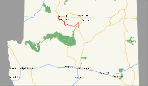
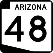 State Route 48
-
 State Route 989
Former
-
 State Route 50, proposed, never built
 -
 State Route 62
 -
 State Route 63
 -
 State Route 65
 -
 State Route 76
 -
 State Route 81
 -
 State Route 84A
 -
 State Route 89L
 -
 State Route 93
 -
 State Route 153
 -
 State Route 160
 -
 State Route 164
 -
 State Route 166
 -
 State Route 170
 -
 State Route 172
 -
 State Route 173
 -
 State Route 176
 -
 State Route 217
 -
 State Route 279
 -
 State Route 280
 -
 State Route 360
 -
 State Route 364
 -
 State Route 380
 -
 State Route 464
 -
 State Route 487
 -
 State Route 504
 -
 State Route 789
 - State Route 989 portion of proposed route was constructed but not marked. ROW was transferred to the town of Oro Valley during the July 18, 2008, State Transportation Board meeting.
Current
| Route number | Length | Western / southern terminus | Eastern / northern terminus | Counties | Description | Map | Refs. |
|---|---|---|---|---|---|---|---|
| at the California California California is a state located on the West Coast of the United States. It is by far the most populous U.S. state, and the third-largest by land area... state line |
|||||||
| at the California California California is a state located on the West Coast of the United States. It is by far the most populous U.S. state, and the third-largest by land area... state line |
at the New Mexico New Mexico New Mexico is a state located in the southwest and western regions of the United States. New Mexico is also usually considered one of the Mountain States. With a population density of 16 per square mile, New Mexico is the sixth-most sparsely inhabited U.S... state line |
||||||
| at the Nevada Nevada Nevada is a state in the western, mountain west, and southwestern regions of the United States. With an area of and a population of about 2.7 million, it is the 7th-largest and 35th-most populous state. Over two-thirds of Nevada's people live in the Las Vegas metropolitan area, which contains its... state line |
at the Utah Utah Utah is a state in the Western United States. It was the 45th state to join the Union, on January 4, 1896. Approximately 80% of Utah's 2,763,885 people live along the Wasatch Front, centering on Salt Lake City. This leaves vast expanses of the state nearly uninhabited, making the population the... state line |
_map.svg.png) |
|||||
| in Phoenix | in Flagstaff | ||||||
| Mexico Federal Highway 15 at the US/Mexico border at Nogales | at Tucson | ||||||
| at the California California California is a state located on the West Coast of the United States. It is by far the most populous U.S. state, and the third-largest by land area... state line |
at the New Mexico New Mexico New Mexico is a state located in the southwest and western regions of the United States. New Mexico is also usually considered one of the Mountain States. With a population density of 16 per square mile, New Mexico is the sixth-most sparsely inhabited U.S... state line |
Former or proposed
-
.svg.png) Interstate 410
Interstate 410 -
.svg.png) Interstate 510
Interstate 510 -
.svg.png) Interstate 710
Interstate 710
Current
| Route number | Length | Western / southern terminus | Eastern / northern terminus | Counties | Description | Map | Refs. |
|---|---|---|---|---|---|---|---|
| at New Mexico New Mexico New Mexico is a state located in the southwest and western regions of the United States. New Mexico is also usually considered one of the Mountain States. With a population density of 16 per square mile, New Mexico is the sixth-most sparsely inhabited U.S... state line |
|||||||
| at Flagstaff | at Utah Utah Utah is a state in the Western United States. It was the 45th state to join the Union, on January 4, 1896. Approximately 80% of Utah's 2,763,885 people live along the Wasatch Front, centering on Salt Lake City. This leaves vast expanses of the state nearly uninhabited, making the population the... state line |
||||||
| at Utah Utah Utah is a state in the Western United States. It was the 45th state to join the Union, on January 4, 1896. Approximately 80% of Utah's 2,763,885 people live along the Wasatch Front, centering on Salt Lake City. This leaves vast expanses of the state nearly uninhabited, making the population the... state line |
 |
||||||
| at Wickenburg | at Nevada Nevada Nevada is a state in the western, mountain west, and southwestern regions of the United States. With an area of and a population of about 2.7 million, it is the 7th-largest and 35th-most populous state. Over two-thirds of Nevada's people live in the Las Vegas metropolitan area, which contains its... state line |
||||||
 San Luis, Arizona San Luis is a city in Yuma County, Arizona, United States. The population was 15,322 at the 2000 census. It is part of the Yuma Metropolitan Statistical Area. San Luis was the second fastest-growing place among all cities and towns in Arizona of any size from 1990 and 2000... |
at California California California is a state located on the West Coast of the United States. It is by far the most populous U.S. state, and the third-largest by land area... state line |
||||||
| at New Mexico New Mexico New Mexico is a state located in the southwest and western regions of the United States. New Mexico is also usually considered one of the Mountain States. With a population density of 16 per square mile, New Mexico is the sixth-most sparsely inhabited U.S... state line |
|||||||
| at Utah Utah Utah is a state in the Western United States. It was the 45th state to join the Union, on January 4, 1896. Approximately 80% of Utah's 2,763,885 people live along the Wasatch Front, centering on Salt Lake City. This leaves vast expanses of the state nearly uninhabited, making the population the... state line |
|||||||
| Grand Canyon National Park Grand Canyon National Park Grand Canyon National Park is the United States' 15th oldest national park and is located in Arizona. Within the park lies the Grand Canyon, a gorge of the Colorado River, considered to be one of the Wonders of the World. The park covers of unincorporated area in Coconino and Mohave counties.Most... |
at New Mexico New Mexico New Mexico is a state located in the southwest and western regions of the United States. New Mexico is also usually considered one of the Mountain States. With a population density of 16 per square mile, New Mexico is the sixth-most sparsely inhabited U.S... state line |
||||||
| at Douglas | at Utah Utah Utah is a state in the Western United States. It was the 45th state to join the Union, on January 4, 1896. Approximately 80% of Utah's 2,763,885 people live along the Wasatch Front, centering on Salt Lake City. This leaves vast expanses of the state nearly uninhabited, making the population the... state line |
Former
-
 U.S. Route 66
 -
 U.S. Route 80
 -
 U.S. Route 91
 -
 U.S. Route 164
 - U.S. Route 260
-
 U.S. Route 466
 -
 U.S. Route 666, U.S. Route 191.
 -
 U.S. Route 789, proposed, never commissioned.