

Lincoln Heights, Los Angeles, California
Encyclopedia
Geography and transportation
Lincoln Heights is bounded by the Los Angeles RiverLos Angeles River
The Los Angeles River is a river that starts in the San Fernando Valley, in the Simi Hills and Santa Susana Mountains, and flows through Los Angeles County, California, from Canoga Park in the western end of the San Fernando Valley, nearly southeast to its mouth in Long Beach...
on the west, the San Bernardino Freeway
San Bernardino Freeway
The San Bernardino Freeway, formerly known as the Ramona Freeway is a freeway in Los Angeles and Orange Counties in the southern part of the U.S. state of California. It refers to the following two segments:...
(I-10
Interstate 10
Interstate 10 is the fourth-longest Interstate Highway in the United States, after I-90, I-80, and I-40. It is the southernmost east–west, coast-to-coast Interstate Highway, although I-4 and I-8 are further south. It stretches from the Pacific Ocean at State Route 1 in Santa Monica,...
) on the south, and Indiana Street on the east; the district's Eastern border is unclear due to the area's uneven terrain. Adjacent communities include El Sereno on the east, City Terrace
City Terrace, California
City Terrace is an unincorporated community in Los Angeles County, California. It is considered part of the East Los Angeles region. The U.S. census numbers are included with East Los Angeles.-Geography and transportation:...
on the southeast, Boyle Heights on the south, Chinatown
Chinatown, Los Angeles
Chinatown in Los Angeles, California is located in the city's downtown area. Built in 1938, it is the second Chinatown to be constructed in Los Angeles. The original historic Chinatown was founded in the late 19th century, but was demolished to make room for Union Station, the city's major rail...
and Solano Canyon on the west, Cypress Park on the northwest, Mt. Washington on the north, and Montecito Heights on the northeast. Major thoroughfares include Valley Boulevard
Valley Boulevard
Valley Boulevard is a street in Southern California, running east from Los Angeles to Pomona, where it becomes Holt Boulevard, and a continuation from Fontana to Colton. It generally parallels Interstate 10 and State Route 60, and is the original alignment of U.S. Route 60...
; Mission Road; Pasadena Avenue; North Main, Marengo, Daly, and Figueroa
Figueroa Street
Figueroa Street is a street in Los Angeles County, California named for General José Figueroa , governor of Alta California from 1833 to 1835, who oversaw the secularization of the missions of California...
Streets; and North Broadway
Broadway (Los Angeles)
Broadway is a major thoroughfare in Los Angeles, California, that runs from Lincoln Heights on the Eastside, through Chinatown, passing through Central Plaza and the Dragon Gate, the Los Angeles Civic Center, passing the Los Angeles Times building at First Street, and Broadway's historic commercial...
. The Golden State Freeway
Interstate 5 in California
Interstate 5 is a major north–south route of the Interstate Highway System in the U.S. state of California. It begins at the Mexico – United States border at the San Ysidro crossing, goes north across the length of California and crosses into Oregon south of the Medford-Ashland metropolitan...
(I-5
Interstate 5
Interstate 5 is the main Interstate Highway on the West Coast of the United States, running largely parallel to the Pacific Ocean coastline from Canada to Mexico . It serves some of the largest cities on the U.S...
) runs through the district, and the Metro Gold Line has a stop
Lincoln/Cypress (LACMTA Station)
Lincoln/Cypress Station is an elevated light rail station in the Los Angeles County Metro Rail system. It is located at the intersection of Lacy Street and Avenue 26, in the Cypress Park and Lincoln Heights neighborhoods of Los Angeles, California. The station is served by the Gold Line...
in the far northwestern portion of the district. Lincoln Heights' ZIP code
ZIP Code
ZIP codes are a system of postal codes used by the United States Postal Service since 1963. The term ZIP, an acronym for Zone Improvement Plan, is properly written in capital letters and was chosen to suggest that the mail travels more efficiently, and therefore more quickly, when senders use the...
is 90031.
History
Encompassing the land east of the Los Angeles River, East Los Angeles is a central historical area of the City that has for many years has been anchored by communities such as Boyle Heights and Lincoln Heights. This area was home to the Gabrielino Indians since the 1st Century, but the area fell to the hands of the Spanish in the late eighteenth century, with Mexican and American ranchers taking control of the land for much of the nineteenth century.Lincoln Heights is considered to be the oldest neighborhood in Los Angeles, dating to the 1830s. Perched on bluffs above the Los Angeles River, it was originally home to some of the city's wealthiest residents, who built a large number of Victorian
Victorian architecture
The term Victorian architecture refers collectively to several architectural styles employed predominantly during the middle and late 19th century. The period that it indicates may slightly overlap the actual reign, 20 June 1837 – 22 January 1901, of Queen Victoria. This represents the British and...
mansions in the district (many of which have been preserved under the city's historic preservation
Historic preservation
Historic preservation is an endeavor that seeks to preserve, conserve and protect buildings, objects, landscapes or other artifacts of historical significance...
program). North Broadway became a busy commercial strip, which it remains today. By the turn of the 20th century, however, the rapid industrial development along the riverbanks made it less appealing for wealthy Angelenos, who moved on first to the Arroyo Seco
Arroyo Seco (Los Angeles County)
The Arroyo Seco, meaning "dry stream" in Spanish, is a seasonal river, canyon, watershed, and cultural area in Los Angeles County, California, United States. The Arroyo Seco has been called the most celebrated canyon in Southern California.-River course:...
area and Hollywood, then (from the 1920s onward) to rapidly developing Mid-Wilshire
Mid-Wilshire
Mid-Wilshire is a district in the City of Los Angeles, California. It is part of the Wilshire region.It mostly encompasses the area bounded by La Cienega Boulevard to the west, Melrose Avenue to the north, Hoover Street to the east and the Santa Monica Freeway to the south, although some...
. As wealthy residents departed, Lincoln Heights became home to a large Italian American
Italian American
An Italian American , is an American of Italian ancestry. The designation may also refer to someone possessing Italian and American dual citizenship...
population, as well as an increasingly large Mexican American
Mexican American
Mexican Americans are Americans of Mexican descent. As of July 2009, Mexican Americans make up 10.3% of the United States' population with over 31,689,000 Americans listed as of Mexican ancestry. Mexican Americans comprise 66% of all Hispanics and Latinos in the United States...
population. It and its cross-river neighbor "Little Italy" (what is now Chinatown) formed the heart of southern California's Italian-American community. One of the major landmarks from this period, the San Antonio Winery
San Antonio Winery
The San Antonio Winery is a winery in the city of Los Angeles, and has operated since 1917. It is located in the Lincoln Heights district just eastside of downtown, on Lamar Street just south of North Main Street. The winery also operates a wine shop, restaurant, and banquet hall.Its former...
, continues to operate today, albeit with non-local grapes.
The neighborhood's original name was East Los Angeles, but in 1917 residents voted to change the name to Lincoln Heights.
Beginning just after World War II
World War II
World War II, or the Second World War , was a global conflict lasting from 1939 to 1945, involving most of the world's nations—including all of the great powers—eventually forming two opposing military alliances: the Allies and the Axis...
, Italians and some Mexicans began migrating out of Lincoln Heights and into working-class and middle-class suburbs in the San Gabriel Valley
San Gabriel Valley
The San Gabriel Valley is one of the principal valleys of Southern California, United States. It lies to the east of Los Angeles, to the north of the Puente Hills, to the south of the San Gabriel Mountains, and west of the Inland Empire. It derives its name from the San Gabriel River that flows...
, including Alhambra
Alhambra, California
Alhambra is a city located in the western San Gabriel Valley region of Los Angeles County, California, United States, which is approximately eight miles from the Downtown Los Angeles civic center. As of the 2010 census, the population was 83,089, down from 85,804 at the 2000 census. The city's...
, San Gabriel
San Gabriel, California
San Gabriel is a city in Los Angeles County, California, United States. It is named after the Mission San Gabriel Arcángel, founded by Junipero Serra. The city grew outward from the mission and in 1852 became the original township of Los Angeles County. San Gabriel was incorporated in 1913...
, Rosemead
Rosemead, California
Rosemead is a city in Los Angeles County, California, United States. As of the 2010 census, it had a population of 53,764. Rosemead is part of a cluster of cities, along with Arcadia, Temple City, Monterey Park, San Marino, and San Gabriel, in the west San Gabriel Valley with a growing Asian...
, Montebello, California
Montebello, California
Montebello is a city in Los Angeles County, California, United States, in the southwestern part of the San Gabriel Valley. It is located on of land just east of downtown Los Angeles. It is considered part of the Gateway Cities, and the city is a member of the Gateway Cities Council of...
, and Temple City, California
Temple City, California
Temple City is a city in Los Angeles County, California. Temple City is part of a cluster of cities, along with Arcadia, Rosemead, Monterey Park, San Marino, and San Gabriel, in the west San Gabriel Valley with a rapidly growing Asian population. Temple City also has a Cuban and Puerto Rican...
. This process accelerated during the 1950s with the construction of the Golden State Freeway, which split the district right down the middle and devastated the neighborhoods through which it passed. Ever since, Lincoln Heights has been a poor-to-working class Chicano and Latin American immigrant barrio
Barrio
Barrio is a Spanish word meaning district or neighborhood.-Usage:In its formal usage in English, barrios are generally considered cohesive places, sharing, for example, a church and traditions such as feast days...
. Many Chinese immigrants, mainly from Southeast China and Vietnam, and their US-born children also reside in Lincoln Heights, due to its proximity to Chinatown
Chinatown, Los Angeles
Chinatown in Los Angeles, California is located in the city's downtown area. Built in 1938, it is the second Chinatown to be constructed in Los Angeles. The original historic Chinatown was founded in the late 19th century, but was demolished to make room for Union Station, the city's major rail...
.
The 1928 case of the missing child Walter Collins, who was kidnapped from his home in Lincoln Heights, influenced the Clint Eastwood film Changeling
Changeling (film)
Changeling is a 2008 American drama film directed by Clint Eastwood and written by J. Michael Straczynski. Based on real-life events in 1928 Los Angeles, the film stars Angelina Jolie as a woman who is reunited with her missing son—only to realize he is an impostor. She confronts the city...
.
Demographics
As of the 2005 census Lincoln Heights had an estimated population of 80,000, one of the largest of any Los Angeles neighborhood. Lincoln Heights is known for its Hispanic population as well as its growing Asian population, but many Italians still reside in the area.Today
North BroadwayBroadway (Los Angeles)
Broadway is a major thoroughfare in Los Angeles, California, that runs from Lincoln Heights on the Eastside, through Chinatown, passing through Central Plaza and the Dragon Gate, the Los Angeles Civic Center, passing the Los Angeles Times building at First Street, and Broadway's historic commercial...
is Lincoln Heights' focal point with its various restaurants and grocery stores. Councilman Ed Reyes's office is in the North Broadway area nearer to Downtown Los Angeles
Downtown Los Angeles
Downtown Los Angeles is the central business district of Los Angeles, California, United States, located close to the geographic center of the metropolitan area...
.
Government and infrastructure
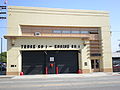
Los Angeles Fire Department
The Los Angeles Fire Department is the agency that provides fire protection and emergency medical services for the city of Los Angeles....
Fire Station 1 is located in the Lincoln Heights area. The station is in the Battalion 7 district.
The Los Angeles County Department of Health Services
Los Angeles County Department of Health Services
Health services to over 10 million residents in the Los Angeles County are provided by the Los Angeles County Department of Health Services and the Los Angeles County Department of Public Health. Mental health services are provided by the County Department of Mental Health...
operates the Central Health Center in Downtown Los Angeles
Downtown Los Angeles
Downtown Los Angeles is the central business district of Los Angeles, California, United States, located close to the geographic center of the metropolitan area...
, serving Lincoln Heights.
Public schools
The district is within the Los Angeles Unified School DistrictLos Angeles Unified School District
Los Angeles Unified School District is the largest public school system in California. It is the 2nd largest public school district in the United States. Only the New York City Department of Education has a larger student population...
and is served with over a dozen schools in the area.
LAUSD high schools:
- Abraham Lincoln High SchoolAbraham Lincoln High School (Los Angeles, California)Abraham Lincoln High School, usually referred to simply as Lincoln High School, is a secondary school located in the Lincoln Heights district of Los Angeles, California, United States. It is located in the East Los Angeles-area community, surrounded by El Sereno, Chinatown, Boyle Heights and...
Middle schools:
- Florence Nightingale Middle School
Elementary schools:
- Hillside Elementary School
- Gates Street Elementary School
- Griffin Elementary School
- Latona Elementary School
- Glen Alta Elementary School
- Albion Elementary School
The Knowledge Is Power Program operates the KIPP Los Angeles Preparatory School, a 5-8 charter
Charter school
Charter schools are primary or secondary schools that receive public money but are not subject to some of the rules, regulations, and statutes that apply to other public schools in exchange for some type of accountability for producing certain results, which are set forth in each school's charter...
middle school, in Lincoln Heights. PUC Schools
PUC Schools
PUC Schools is a charter school operator in Greater Los Angeles. It has its headquarters in Burbank. The charter school systems operates schools in northeast Los Angeles and the northeast San Fernando Valley.-Schools:High schools:...
operates the Milagro Charter School (K-5) and the Excel Charter Academy (6-8) in Lincoln Heights.
Other charter schools:
- Marc and Eva Stern Math And Science School -
- Los Angeles Leadership Academy- (open Fall 2010; currently located in Koreatown)
Private schools
- Sacred Heart High SchoolSacred Heart High School (California)Sacred Heart High School is a Roman Catholic high school for girls in the Lincoln Heights neighborhood of Los Angeles, California. Located in the Roman Catholic Archdiocese of Los Angeles, the school has been administered by the Dominican Sisters of Mission San Jose since 1907.-External links:* *...
(all-girls') - Our Lady Help of Christians (K-8 grade)
- Sacred Heart Elementary School - (K-8 grade)
- Cathedral High SchoolCathedral High School (Los Angeles, California)Cathedral High School is a private, college preparatory Catholic all-boys school in Los Angeles, California.-History and background:Cathedral High School was founded by Archbishop John Joseph Cantwell as the first Los Angeles Archdiocesan high school for boys in Fall 1925. The Christian Brothers...
(all boys)
Public libraries
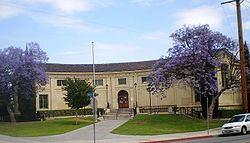
Los Angeles Public Library
The Los Angeles Public Library system serves the residents of Los Angeles, California, United States. With over 6 million volumes, LAPL is one of the largest publicly funded library systems in the world. The system is overseen by a Board of Library Commissioners with five members appointed by the...
is located on Workman Street.
Landmarks (present and former)
- Lincoln ParkLincoln Park (Los Angeles)Lincoln Park in Los Angeles, California was originally created by the City of Los Angeles in 1881, from land donated by Griffith J. Griffith. It was one of Los Angeles' first parks. It was originally called East Los Angeles Park, then Eastlake Park in 1901...
- Los Angeles Alligator FarmLos Angeles Alligator FarmThe Los Angeles Alligator Farm, located next door to the Los Angeles Ostrich Farm in the Lincoln Heights neighborhood of Los Angeles, California, United States, was an alligator farm and a major city tourist attraction from 1907 until 1953....
- San Antonio WinerySan Antonio WineryThe San Antonio Winery is a winery in the city of Los Angeles, and has operated since 1917. It is located in the Lincoln Heights district just eastside of downtown, on Lamar Street just south of North Main Street. The winery also operates a wine shop, restaurant, and banquet hall.Its former...
- Selig Polyscope CompanySelig Polyscope CompanyThe Selig Polyscope Company was an American motion picture company founded in 1896 by William Selig in Chicago, Illinois. Selig Polyscope is noted for establishing Southern California's first permanent movie studio, in the historic Edendale district of Los Angeles...
- The Brewery Art ColonyThe Brewery Art ColonyThe Brewery Art Colony, located in Los Angeles, has been called the largest live-and-work artists' colony in the world. The compound sits on twenty-one former warehouses — with an old Edison power plant chimney dating to 1903 — house work studios, living lofts, restaurants and galleries...
Notable residents
- Arthur K. SnyderArthur K. SnyderArthur K. Snyder, also known as Art Snyder, was a Los Angeles, California, City Council member between 1967 and 1985 and later engaged in a private law practice.-Biography:...
, Los Angeles City Council member, 1967–85, born in Lincoln Heights, 1932
See also
- Lincoln Heights (TV series)Lincoln Heights (TV series)Lincoln Heights is an American drama television series about Eddie Sutton, a Mission Vista police officer who moves his family back to his old neighborhood, Lincoln Heights, to start a new life and to help out his old neighborhood...
- Los Angeles Historic-Cultural Monuments on the East and Northeast Sides
External links
- Official website for the Lincoln Heights Neighborhood Council
- The History of Lincoln Heights, CA 90031 through old photos and memories
- Location: 34.073597°N 118.209627°W