

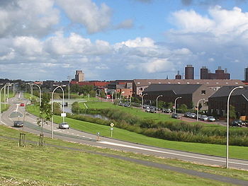
Leidschenveen-Ypenburg
Encyclopedia

The Hague
The Hague is the capital city of the province of South Holland in the Netherlands. With a population of 500,000 inhabitants , it is the third largest city of the Netherlands, after Amsterdam and Rotterdam...
, in the southeast (Former municipality of Rijswijk
Rijswijk
Rijswijk is a town and municipality in the western Netherlands, in the province of South Holland. It is a suburb of The Hague and covers an area of 14.48 km² ....
). It is geographically connected to the main body of The Hague by only a narrow corridor. It is a Vinex-location
Vinex-location
Vinex , is a policy briefing note of the Dutch Ministry of Housing, Spatial Planning and the Environment released in 1988...
.
It consists of four quarters: Hoornwijk and on the southwest of the highway A12
A12 motorway (Netherlands)
The A12 motorway is a motorway in the Netherlands. The road connects the city of The Hague, with the German border, near Zevenaar, and the German Autobahn BAB 3...
and parallel railway to Utrecht
Utrecht (city)
Utrecht city and municipality is the capital and most populous city of the Dutch province of Utrecht. It is located in the eastern corner of the Randstad conurbation, and is the fourth largest city of the Netherlands with a population of 312,634 on 1 Jan 2011.Utrecht's ancient city centre features...
, and Forepark and on the northeast.
In 2005 the new railway station Den Haag Ypenburg was opened, next to the highway.
Two highway nodes are located in the Stadsdeel : and .
History
Until 1992 Ypenburg was a military airfieldYpenburg Airport
Ypenburg Airport , which later became Ypenburg Air Base was an airport in the Netherlands near the city of The Hague.-History:...
. It was the site of a battle on 10 May 1940. Germany managed to capture the airfield but not nearby The Hague on that date. The air traffic control tower still stands today.