
Laporte, Colorado
Encyclopedia
Laporte is a census-designated place
(CDP) in Larimer County
, Colorado
, United States
. The population was 2,691 at the 2000 census
. The Laporte Post Office
has the ZIP Code
80535.
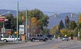
The community is located on the Cache La Poudre River
northwest of Fort Collins
, near the place where the river emerges from the foothills of the Rocky Mountains
.
, the town was first settled by French-Canadian Fur Trappers and mountain men. It is the gateway to all that mountainous region lying north of the South Platte River
and extending from the Plains to the Continental Divide. The trappers built cabins here along the Cache la Poudre River as early as 1828, making it the first white settlement in Larimer County, Colorado
. It became the home of Antoine Janis
in 1844, who is often noted as the first permanent white settler north of the Arkansas River. A band of intrepid mountaineers, hunters and trappers made LaPorte their headquarters for fur catching and trading operations. The settlement increased in numbers, including one hundred fifty lodges of Arapahoe Indians who settled peacefully along the river, and in the valley. The town was named by the fur trappers, many with Native American
wives, who settled in the area in the mid-19th century. According to legend, a group of fur traders had earlier stashed supplies (including gunpowder
) in a cache along the river near Laporte, and that is how the river got its name.
The winter of 1849 brought Kit Carson
and his company of trappers to the headwaters of the Cache la Poudre where they set up camp. In 1860 a town company was organized. It was originally called Colona. Between fifty and sixty log dwellings were erected that year along the banks of the Cache la Poudre River in the valley and in November 1861, the territorial legislature
designated Laporte as the county seat
. In 1862, the town of Colona changed its name to LaPorte, and was named the headquarters of the Mountain Division of the Overland Trail Stage Route. The first post office opened, and a stage stop was built on the Overland Trail
. A station was erected right along the river, very near where the present Overland Trail now crosses the river. Mrs Taylor, wife of the first stationmaster, was a "good cook" and "gracious hostess", and as described by one diarist, knowing "what to do with beans and dried apples." The stage fare from Denver to LaPorte was $20.00. The first bridge over the Cache la Poudre River was built as a toll bridge, and during the rush to California, numerous wagons and stage coaches crossed it every day. The toll charged was anywhere from $.50 to $8.00, depending on what source of information is used. In 1864, the bridge was washed away by a flood, and a ferry was rigged up and used for several years until the county built another bridge.
LaPorte soon became a bustling business and supply center for emigrants, with wagon trains and stage coaches constantly passing through. There were four saloons, a brewery, a butcher shop, two blacksmith shops, a general store and a hotel. The store was a thriving business, sometimes making as much as $1000 per day. LaPorte was the most important settlement north of Denver, housing the Stage Station, the County Court House, the military, Indians, and trappers. In 1862, Camp Collins
was established by the U.S. Army along the river to protect the stage line from attack by Native American
. Also that same year, the Laporte Townsite Company claimed 1280 acres (5.2 km²) of land for the town. In 1863 the 13th Kansas volunteer infantry was stationed to Laporte, acting as escort for the Overland Stage on the trail to Virginia Dale. During the flood of 1864, the army camp was covered with water, and the soldiers had to suddenly flee to higher ground. In August of that year, Col. Collins came down from Laramie on an inspection tour, and decided to move the army camp to Fort Collins, down river about 6 miles.
According to the United States Census Bureau
, the CDP has a total area of 6.1 square miles (15.8 km²), of which, 6.1 square miles (15.8 km²) of it is land and 0.04 square mile (0.1035995244 km²) of it (0.49%) is water.
of 2000, there were 2,691 people, 1,074 households, and 718 families residing in the CDP. The population density
was 440.6 people per square mile (170.0/km²). There were 1,108 housing units at an average density of 181.4 per square mile (70.0/km²). The racial makeup of the CDP was 92.49% White, 0.22% African American, 1.08% Native American, 0.45% Asian, 2.34% from other races
, and 3.42% from two or more races. Hispanic or Latino of any race were 8.06% of the population.
There were 1,074 households out of which 33.4% had children under the age of 18 living with them, 51.6% were married couples
living together, 10.1% had a female householder with no husband present, and 33.1% were non-families. 24.7% of all households were made up of individuals and 5.8% had someone living alone who was 65 years of age or older. The average household size was 2.51 and the average family size was 3.01.
In the CDP the population was spread out with 25.8% under the age of 18, 8.5% from 18 to 24, 32.0% from 25 to 44, 25.4% from 45 to 64, and 8.4% who were 65 years of age or older. The median age was 37 years. For every 100 females there were 102.9 males. For every 100 females age 18 and over, there were 100.6 males.
The median income for a household in the CDP was $46,630, and the median income for a family was $52,500. Males had a median income of $30,602 versus $25,571 for females. The per capita income
for the CDP was $19,870. About 4.9% of families and 5.6% of the population were below the poverty line, including 9.6% of those under age 18 and none of those age 65 or over.
's North American Confederacy series of novels, beginning with The Probability Broach, an alternate-history LaPorte is one of the major cities of North America, occupying roughly half the area of Larimer County, and with a population of over two million people; whereas the city of Denver
does not exist: In its place are the two small historic settlements of Saint Charles Town and Auraria
.
Census-designated place
A census-designated place is a concentration of population identified by the United States Census Bureau for statistical purposes. CDPs are delineated for each decennial census as the statistical counterparts of incorporated places such as cities, towns and villages...
(CDP) in Larimer County
Larimer County, Colorado
Larimer County is the seventh most populous and the ninth most extensive of the 64 counties of the State of Colorado of the United States. The county is located at the northern end of the Front Range, at the edge of the Colorado Eastern Plains along the border with Wyoming...
, Colorado
Colorado
Colorado is a U.S. state that encompasses much of the Rocky Mountains as well as the northeastern portion of the Colorado Plateau and the western edge of the Great Plains...
, United States
United States
The United States of America is a federal constitutional republic comprising fifty states and a federal district...
. The population was 2,691 at the 2000 census
United States Census, 2000
The Twenty-second United States Census, known as Census 2000 and conducted by the Census Bureau, determined the resident population of the United States on April 1, 2000, to be 281,421,906, an increase of 13.2% over the 248,709,873 persons enumerated during the 1990 Census...
. The Laporte Post Office
United States Postal Service
The United States Postal Service is an independent agency of the United States government responsible for providing postal service in the United States...
has the ZIP Code
ZIP Code
ZIP codes are a system of postal codes used by the United States Postal Service since 1963. The term ZIP, an acronym for Zone Improvement Plan, is properly written in capital letters and was chosen to suggest that the mail travels more efficiently, and therefore more quickly, when senders use the...
80535.
The community is located on the Cache La Poudre River
Cache La Poudre River
The Cache la Poudre River is in the state of Colorado in the United States.Its headwaters are in the Front Range in Larimer County, in the northern part of Rocky Mountain National Park. The river descends eastward in the mountains through the Roosevelt National Forest in Poudre Canyon...
northwest of Fort Collins
Fort Collins, Colorado
Fort Collins is a Home Rule Municipality situated on the Cache La Poudre River along the Colorado Front Range, and is the county seat and most populous city of Larimer County, Colorado, United States. Fort Collins is located north of the Colorado State Capitol in Denver. With a 2010 census...
, near the place where the river emerges from the foothills of the Rocky Mountains
Rocky Mountains
The Rocky Mountains are a major mountain range in western North America. The Rocky Mountains stretch more than from the northernmost part of British Columbia, in western Canada, to New Mexico, in the southwestern United States...
.
History
The name la porte means "the door" in FrenchFrench language
French is a Romance language spoken as a first language in France, the Romandy region in Switzerland, Wallonia and Brussels in Belgium, Monaco, the regions of Quebec and Acadia in Canada, and by various communities elsewhere. Second-language speakers of French are distributed throughout many parts...
, the town was first settled by French-Canadian Fur Trappers and mountain men. It is the gateway to all that mountainous region lying north of the South Platte River
South Platte River
The South Platte River is one of the two principal tributaries of the Platte River and itself a major river of the American Midwest and the American Southwest/Mountain West, located in the U.S. states of Colorado and Nebraska...
and extending from the Plains to the Continental Divide. The trappers built cabins here along the Cache la Poudre River as early as 1828, making it the first white settlement in Larimer County, Colorado
Larimer County, Colorado
Larimer County is the seventh most populous and the ninth most extensive of the 64 counties of the State of Colorado of the United States. The county is located at the northern end of the Front Range, at the edge of the Colorado Eastern Plains along the border with Wyoming...
. It became the home of Antoine Janis
Antoine Janis
Antoine Janis was a 19th-century French-American fur trader and an early white homesteader in Larimer County, Colorado, in the United States. The first recorded permanent white settler in northern Colorado, he founded the town of Laporte in 1858.-Biography:Janis was born inMissouri to a French...
in 1844, who is often noted as the first permanent white settler north of the Arkansas River. A band of intrepid mountaineers, hunters and trappers made LaPorte their headquarters for fur catching and trading operations. The settlement increased in numbers, including one hundred fifty lodges of Arapahoe Indians who settled peacefully along the river, and in the valley. The town was named by the fur trappers, many with Native American
Native Americans in the United States
Native Americans in the United States are the indigenous peoples in North America within the boundaries of the present-day continental United States, parts of Alaska, and the island state of Hawaii. They are composed of numerous, distinct tribes, states, and ethnic groups, many of which survive as...
wives, who settled in the area in the mid-19th century. According to legend, a group of fur traders had earlier stashed supplies (including gunpowder
Gunpowder
Gunpowder, also known since in the late 19th century as black powder, was the first chemical explosive and the only one known until the mid 1800s. It is a mixture of sulfur, charcoal, and potassium nitrate - with the sulfur and charcoal acting as fuels, while the saltpeter works as an oxidizer...
) in a cache along the river near Laporte, and that is how the river got its name.
The winter of 1849 brought Kit Carson
Kit Carson
Christopher Houston "Kit" Carson was an American frontiersman and Indian fighter. Carson left home in rural present-day Missouri at age 16 and became a Mountain man and trapper in the West. Carson explored the west to California, and north through the Rocky Mountains. He lived among and married...
and his company of trappers to the headwaters of the Cache la Poudre where they set up camp. In 1860 a town company was organized. It was originally called Colona. Between fifty and sixty log dwellings were erected that year along the banks of the Cache la Poudre River in the valley and in November 1861, the territorial legislature
Colorado Territory
The Territory of Colorado was an organized incorporated territory of the United States that existed from February 28, 1861, until August 1, 1876, when it was admitted to the Union as the State of Colorado....
designated Laporte as the county seat
County seat
A county seat is an administrative center, or seat of government, for a county or civil parish. The term is primarily used in the United States....
. In 1862, the town of Colona changed its name to LaPorte, and was named the headquarters of the Mountain Division of the Overland Trail Stage Route. The first post office opened, and a stage stop was built on the Overland Trail
Overland Trail
The Overland Trail was a stagecoach and wagon trail in the American West during the 19th century. While portions of the route had been used by explorers and trappers since the 1820s, the Overland Trail was most heavily used in the 1860s as an alternative route to the Oregon, California and Mormon...
. A station was erected right along the river, very near where the present Overland Trail now crosses the river. Mrs Taylor, wife of the first stationmaster, was a "good cook" and "gracious hostess", and as described by one diarist, knowing "what to do with beans and dried apples." The stage fare from Denver to LaPorte was $20.00. The first bridge over the Cache la Poudre River was built as a toll bridge, and during the rush to California, numerous wagons and stage coaches crossed it every day. The toll charged was anywhere from $.50 to $8.00, depending on what source of information is used. In 1864, the bridge was washed away by a flood, and a ferry was rigged up and used for several years until the county built another bridge.
LaPorte soon became a bustling business and supply center for emigrants, with wagon trains and stage coaches constantly passing through. There were four saloons, a brewery, a butcher shop, two blacksmith shops, a general store and a hotel. The store was a thriving business, sometimes making as much as $1000 per day. LaPorte was the most important settlement north of Denver, housing the Stage Station, the County Court House, the military, Indians, and trappers. In 1862, Camp Collins
Camp Collins
Camp Collins was a 19th century outpost of the United States Army in the Colorado Territory. The fort was commissioned in the summer of 1862 to protect the Overland Trail from attacks by Native Americans in a conflict that later became known as the Colorado War...
was established by the U.S. Army along the river to protect the stage line from attack by Native American
Native Americans in the United States
Native Americans in the United States are the indigenous peoples in North America within the boundaries of the present-day continental United States, parts of Alaska, and the island state of Hawaii. They are composed of numerous, distinct tribes, states, and ethnic groups, many of which survive as...
. Also that same year, the Laporte Townsite Company claimed 1280 acres (5.2 km²) of land for the town. In 1863 the 13th Kansas volunteer infantry was stationed to Laporte, acting as escort for the Overland Stage on the trail to Virginia Dale. During the flood of 1864, the army camp was covered with water, and the soldiers had to suddenly flee to higher ground. In August of that year, Col. Collins came down from Laramie on an inspection tour, and decided to move the army camp to Fort Collins, down river about 6 miles.
Geography
Laporte is located at 40°38′2"N 105°8′56"W (40.633808, -105.148819).According to the United States Census Bureau
United States Census Bureau
The United States Census Bureau is the government agency that is responsible for the United States Census. It also gathers other national demographic and economic data...
, the CDP has a total area of 6.1 square miles (15.8 km²), of which, 6.1 square miles (15.8 km²) of it is land and 0.04 square mile (0.1035995244 km²) of it (0.49%) is water.
Demographics
As of the censusCensus
A census is the procedure of systematically acquiring and recording information about the members of a given population. It is a regularly occurring and official count of a particular population. The term is used mostly in connection with national population and housing censuses; other common...
of 2000, there were 2,691 people, 1,074 households, and 718 families residing in the CDP. The population density
Population density
Population density is a measurement of population per unit area or unit volume. It is frequently applied to living organisms, and particularly to humans...
was 440.6 people per square mile (170.0/km²). There were 1,108 housing units at an average density of 181.4 per square mile (70.0/km²). The racial makeup of the CDP was 92.49% White, 0.22% African American, 1.08% Native American, 0.45% Asian, 2.34% from other races
Race (United States Census)
Race and ethnicity in the United States Census, as defined by the Federal Office of Management and Budget and the United States Census Bureau, are self-identification data items in which residents choose the race or races with which they most closely identify, and indicate whether or not they are...
, and 3.42% from two or more races. Hispanic or Latino of any race were 8.06% of the population.
There were 1,074 households out of which 33.4% had children under the age of 18 living with them, 51.6% were married couples
Marriage
Marriage is a social union or legal contract between people that creates kinship. It is an institution in which interpersonal relationships, usually intimate and sexual, are acknowledged in a variety of ways, depending on the culture or subculture in which it is found...
living together, 10.1% had a female householder with no husband present, and 33.1% were non-families. 24.7% of all households were made up of individuals and 5.8% had someone living alone who was 65 years of age or older. The average household size was 2.51 and the average family size was 3.01.
In the CDP the population was spread out with 25.8% under the age of 18, 8.5% from 18 to 24, 32.0% from 25 to 44, 25.4% from 45 to 64, and 8.4% who were 65 years of age or older. The median age was 37 years. For every 100 females there were 102.9 males. For every 100 females age 18 and over, there were 100.6 males.
The median income for a household in the CDP was $46,630, and the median income for a family was $52,500. Males had a median income of $30,602 versus $25,571 for females. The per capita income
Per capita income
Per capita income or income per person is a measure of mean income within an economic aggregate, such as a country or city. It is calculated by taking a measure of all sources of income in the aggregate and dividing it by the total population...
for the CDP was $19,870. About 4.9% of families and 5.6% of the population were below the poverty line, including 9.6% of those under age 18 and none of those age 65 or over.
Fiction
In L. Neil SmithL. Neil Smith
L. Neil Smith , also known to readers and fans as El Neil, is a libertarian science fiction author and political activist. He was born on May 12, 1946 in Denver...
's North American Confederacy series of novels, beginning with The Probability Broach, an alternate-history LaPorte is one of the major cities of North America, occupying roughly half the area of Larimer County, and with a population of over two million people; whereas the city of Denver
Denver, Colorado
The City and County of Denver is the capital and the most populous city of the U.S. state of Colorado. Denver is a consolidated city-county, located in the South Platte River Valley on the western edge of the High Plains just east of the Front Range of the Rocky Mountains...
does not exist: In its place are the two small historic settlements of Saint Charles Town and Auraria
Auraria, Denver, Colorado
Auraria was a small mining settlement in the Kansas Territory in the United States. Today it survives in its original location as a neighborhood of Denver, Colorado, south of the confluence of Cherry Creek and the South Platte River.- History :...
.