
Lakki Marwat District
Encyclopedia
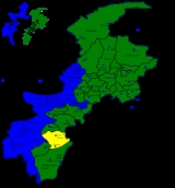
Lakki Marwat is one of the Southern Districts
of Khyber Pakhtunkhwa in Pakistan
. It was created as an administrative district
on July 1, 1992, prior to which it was a Tehsil
of Bannu District
.
Another story links this name to one Lakki Ram or Lukko Ram, a Hindu trader who is considered to be the original founder of this town. Yet another source claims that the town was initially known as Ihsan Pur.
The second part of the District’s name comes from the warrior tribe of Marwat
who has inhabited the entire area for several centuries.
" Lakki derives from Pali language, which is equivalent of Laksmi, goddess of beauty and fortune. The last part of its name is emarta'watta means source of elixir. By the revages of time it changed to Marwat
. It is a metaphor for the river Gambeela."
(0.7%).
Names of villages usually end with Khel, e.g.Aba Khel, Dallo khel, Ghazni Khel, Shahbaz Khel, Titar Khel, Kaka khel, Zangi khel, Nawar khel etc. Out of those villages a total of thirty had a population over 5000, forty-six had a population between 2000-5000, thirty-one had between 1000-2000, forty-nine had under one thousand inhabitants, while one village was uninhabited.
according to the following constituencies:
 The district is a combination of hills and sandy plains. The hilly areas are along the boundaries of the district especially in the east, southeast, southwest and northwest. In the southeast, the Marwat range separates Lakki Marwat from Dera Ismail Khan District
while in the east the Karak Niazi range separates it from Mianwali District
. It is surrounded by Baittani range on the west and southwest, which separates it from Tank District
and the tribal Area adjoining Tank District and South Waziristan
Agency. The Marwat range culminates and Baittani ranges starts near Sheikh Badin. The general elevation of these hills ranges from 500 to 1000 meters above sea level. The land beyond these hills gradually slopes to the central part, which looks like a basin. A large number of streams flow from the surrounding hills, the Kurram river flows through the district from North West to the south east and joins the Indus River south of Isa Khel town. One of its important tributary is Gambila River. The major part of this basin is an alluvial plain. The northern portion of this plain is situated chiefly in the Kurram Gambila Doaba and irrigated by Kurram River. It is a flat sandy area. The southern part is made up of undulating dunes of sand, furrowed at regular intervals by deep torrent beds which carry the drainage of the Marwat and Baittani ranges to the Gambila. It is good for cultivation, water table is quite deep below the soil surface. In the western portion of the district, the soil is fairly stiff clay covered by a layer of stones at the foot of the hills. The whole district is intersected by numerous hill torrents and deep ravines. The general elevation of the plain area is about 200 to 300 meters above sea level.
Districts of Pakistan
The Districts of Pakistan are the second order administrative divisions of Pakistan. Districts were the third order of administrative divisions, below provinces and "divisions", until the reforms of August 2000, when "divisions" were abolished...
of Khyber Pakhtunkhwa in Pakistan
Pakistan
Pakistan , officially the Islamic Republic of Pakistan is a sovereign state in South Asia. It has a coastline along the Arabian Sea and the Gulf of Oman in the south and is bordered by Afghanistan and Iran in the west, India in the east and China in the far northeast. In the north, Tajikistan...
. It was created as an administrative district
Districts of Pakistan
The Districts of Pakistan are the second order administrative divisions of Pakistan. Districts were the third order of administrative divisions, below provinces and "divisions", until the reforms of August 2000, when "divisions" were abolished...
on July 1, 1992, prior to which it was a Tehsil
Tehsil
A Tehsil or Tahsil/Tahasil , also known as Taluk and Mandal, is an administrative division of some country/countries of South Asia....
of Bannu District
Bannu District
Bannu District is one of the twenty four districts of the Khyber Pakhtunkhwa province of Pakistan, it is represented in the provincial assembly by four MPAs. The chief city of the district is Bannu. The major industries are cloth weaving and the manufacture of cotton fabrics, machinery, and...
.
Etymology
There are two different stories about the "Lakki" part of the District's name. One story says that long ago a battel was fought between the Marwat tribe and Wazir and Marwat tribe started to unite an army. The army was huge enough that people say almost 1 Lac Marwat. Then the word "Lac" become Lakki therefore, it is called Lakki Marwat.Another story links this name to one Lakki Ram or Lukko Ram, a Hindu trader who is considered to be the original founder of this town. Yet another source claims that the town was initially known as Ihsan Pur.
The second part of the District’s name comes from the warrior tribe of Marwat
Marwat
Marwat مروت, refers to a Pashtun tribe, located primarily in Lakki Marwat District in the south of Khyber Pakhtunkhwa province in Pakistan as well the districts of Tank and Dera Ismail Khan...
who has inhabited the entire area for several centuries.
" Lakki derives from Pali language, which is equivalent of Laksmi, goddess of beauty and fortune. The last part of its name is emarta'watta means source of elixir. By the revages of time it changed to Marwat
Marwat
Marwat مروت, refers to a Pashtun tribe, located primarily in Lakki Marwat District in the south of Khyber Pakhtunkhwa province in Pakistan as well the districts of Tank and Dera Ismail Khan...
. It is a metaphor for the river Gambeela."
Population
According to the census of 1998, the district had a population of 490,025. Out of this only a total of 46,878 people or 9.6% of the population was recorded as urban inhabitants., while 443,147 people or 90.4% of the population was recorded as rural dwellers.Density
The district covers 3,164 km², with population density of 155 people per km², compared to the population density of 233 people per km² in the North-West Frontier Province as a whole. The population density at the 1981 census was 91 people per km², which indicates a high rate of population growth in the intervening 17 years.Languages
But for a very small minority, the entire district speaks Pashto (99.3%). The other languages include HindkoHindko language
Hindko , also Hindku, or Hinko, is the sixth main regional language of Pakistan. It forms a subgroup of Indo-Aryan languages spoken by Hindkowans in Pakistan and northern India, some Pashtun tribes in Pakistan, as well as by the Hindki people of Afghanistan...
(0.7%).
Household Composition
The average household size of the district is 9.2 people per household compared to 8 at the provincial level.The whole tahsil is one large sandy plain.Names of villages usually end with Khel, e.g.Aba Khel, Dallo khel, Ghazni Khel, Shahbaz Khel, Titar Khel, Kaka khel, Zangi khel, Nawar khel etc. Out of those villages a total of thirty had a population over 5000, forty-six had a population between 2000-5000, thirty-one had between 1000-2000, forty-nine had under one thousand inhabitants, while one village was uninhabited.
Administration
The district has one municipal committee and one town committee. There are 157 mauzas (the smallest revenue unit).Political Representation
At the provincial level, the district is represented by three elected members to the provincial assemblyProvincial Assembly of the North-West Frontier Province
The Provincial Assembly of Khyber Pakhtunkhwa is the unicameral legislative body of the Khyber Pakhtunkhwa province in Pakistan. It was established under Article 106 of the Constitution of the Pakistan...
according to the following constituencies:
- PF-74 (Lakki Marwat-1)
- PF-75 (Lakki Marwat-2)
- PF-76 (Lakki Marwat-3)
Climate
The region has all the characteristics of a desert due to its sand dunes, scorching heat and dry weather. Summers are very hot, while winters are moderately cool. The summer season begins from early April and continues till late October. June is the hottest month with a maximum temperature range of 42 to 45 Degree Celsius and a minimum temperature range of about 30 to 35 Degree Celsius. Periodic sand storms rage through the area during May and June due to the Prevalent low humidity. The hot wind, locally known as "Lu" blows across the district in these months. The cool wave starts from somewhere in early November. December, January and February are the winter months. Though the daytime temperature in winter is not that low, however there is always a sharp decrease in nights. The mean maximum and minimum temperatures during this period are 20 and 4 Degree Celsius respectively. Rainfall is very rare and sporadic and generally occurs in July and August.Topography
Dera Ismail Khan District
Dera Ismail Khan is one of the 24 districts in the Khyber Pakhtunkhwa province of Pakistan. The capital of the district is the town of Dera Ismail Khan...
while in the east the Karak Niazi range separates it from Mianwali District
Mianwali District
Mianwali is a district in the northwest of Punjab province, Pakistan. It borders eight districts: Attock District in the north, Chakwal District in the northeast, Khushab District in the east, and Bhakkar District in the south, while Lakki Marwat lies to the west, Kohat and Karak districts to the...
. It is surrounded by Baittani range on the west and southwest, which separates it from Tank District
Tank District
Tank , is the southern district in the Khyber Pakhtunkhwa province of Pakistan, the city of Tank is the capital of the district, which consists Union Council City I and Union Council City II. There are totally sixteen Union councils of district Tank. Tank was formerly part of district Dera Ismail...
and the tribal Area adjoining Tank District and South Waziristan
South Waziristan
South Waziristan is the southern part of Waziristan, a mountainous region of northwest Pakistan, bordering Afghanistan and covering some 11,585 km² . Waziristan comprises the area west and southwest of Peshawar between the Tochi River to the north and the Gomal River to the south, forming...
Agency. The Marwat range culminates and Baittani ranges starts near Sheikh Badin. The general elevation of these hills ranges from 500 to 1000 meters above sea level. The land beyond these hills gradually slopes to the central part, which looks like a basin. A large number of streams flow from the surrounding hills, the Kurram river flows through the district from North West to the south east and joins the Indus River south of Isa Khel town. One of its important tributary is Gambila River. The major part of this basin is an alluvial plain. The northern portion of this plain is situated chiefly in the Kurram Gambila Doaba and irrigated by Kurram River. It is a flat sandy area. The southern part is made up of undulating dunes of sand, furrowed at regular intervals by deep torrent beds which carry the drainage of the Marwat and Baittani ranges to the Gambila. It is good for cultivation, water table is quite deep below the soil surface. In the western portion of the district, the soil is fairly stiff clay covered by a layer of stones at the foot of the hills. The whole district is intersected by numerous hill torrents and deep ravines. The general elevation of the plain area is about 200 to 300 meters above sea level.
Transport
Lakki Marwat was connected with Mari Indus through a narrow gauge railway line during the Raj. The city, a tehsil of Bannu then, was a railway junction. One line went to Bannu, its district, and the other to Tank. The extent of railways network has ever since defined the limits of the settled area bordering the tribal area to its west. The railway track has since been uprooted and the area now is connected through a network of roads.Neighboring areas
- Tank DistrictTank DistrictTank , is the southern district in the Khyber Pakhtunkhwa province of Pakistan, the city of Tank is the capital of the district, which consists Union Council City I and Union Council City II. There are totally sixteen Union councils of district Tank. Tank was formerly part of district Dera Ismail...
- KarakKarak DistrictKarak is a district of the Khyber Pakhtunkhwa province of Pakistan. It is situated to the south of Kohat District and on the north side of Bannu and Lakki Marwat districts on the main Indus Highway between Peshawar and Karachi - it is 123 km from the provincial capital Peshawar...
- Dera Ismail KhanDera Ismail KhanDera Ismail Khan is a city in Khyber-Pakhtunkhwa Province, Pakistan. It is situated on the west bank of the Indus River, west of Lahore and northwest of Multan. The city is the capital of the district and tehsil of the same name. In Pakistan, its name is often abbreviated to D. I...
- BannuBannuBannu is the principal city of the Bannu District in the Khyber Pakhtunkhwa Province of Pakistan. It is an important road junction and market city. Bannu is a very old city, founded in ancient times; however, the present location of the downtown Bannu was founded by Sir Herbert Edwardes in 1848,...
- MianwaliMianwaliMianwali is the capital city of Mianwali District and situated in the north-west of Punjab province, Pakistan. The city is located on the eastern bank of the Indus River...