
Ku-ring-gai Chase National Park
Encyclopedia
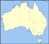
Ku-ring-gai Chase is a national park in New South Wales
, Australia
, 25 km north of Sydney
located largely within the Ku-ring-gai
, Hornsby
, Warringah
and Pittwater
municipal areas. Ku-ring-gai Chase is also officially classed as a suburb
by the Geographical Names Board of New South Wales. The villages of Cottage Point, Appletree Bay, and Bobbin Head are located within park boundaries. An isolated portion of the park; Barrenjoey Headland, is located to the north of Palm Beach east of the primary park body and is home to Barrenjoey Lighthouse.
Ku-ring-gai is generally regarded as a popular tourist destination, known for its scenic setting on the edge of a southern branch of the Hawkesbury River
as well as rock engravings and other art
of Aboriginal origin. Picnic, boating, and fishing facilities can be found throughout the park. There are many great walking tracks in Ku-ring-gai, especially through the Duffys Forest and Terrey Hills area.
Ku-Ring-Gai Chase National Park was added to the Australian National Heritage List
in December 2006.
 The first inhabitants of the area were the Garigal tribe. The rugged landscape provided abundant food and adequate shelter for the aboriginals. More than 800 Aboriginal sites have been found in the park. These include rock engravings, cave drawings, paintings and stencils, axe grinding grooves and middens.
The park was first declared in 1894. The television series, Skippy the Bush Kangaroo
was shot in northern Sydney at the Ku-ring-gai Chase National Park and the adjacent Waratah Park, which is now known as Waratah Park Earth Sanctuary. Bushfires ravaged the park in January 1994.
making it a good place to explore by boat.
Rail access is provided at Mount Colah, Mount Kuring-gai, Berowra and Cowan railway stations. All roads in the area are sealed and all have collection gates where a daily fee is payable.
and facilities include a marina, picnic areas, a small store, and a lunch-time restaurant in what used to be the Bobbin Head Inn, which also contains an information centre. The area contains many fire trails and a walk through mangroves. Aboriginal
engravings can be seen in the area.
and Broken Bay
, has been built on West Head.
is a locality of Palm Beach
. It is a headland and unusual amongst the National Park's features as it is not joined to the rest of the Park by land but separated by 1 kilometer of water, the Pittwater
.
.
New South Wales
New South Wales is a state of :Australia, located in the east of the country. It is bordered by Queensland, Victoria and South Australia to the north, south and west respectively. To the east, the state is bordered by the Tasman Sea, which forms part of the Pacific Ocean. New South Wales...
, Australia
Australia
Australia , officially the Commonwealth of Australia, is a country in the Southern Hemisphere comprising the mainland of the Australian continent, the island of Tasmania, and numerous smaller islands in the Indian and Pacific Oceans. It is the world's sixth-largest country by total area...
, 25 km north of Sydney
Sydney
Sydney is the most populous city in Australia and the state capital of New South Wales. Sydney is located on Australia's south-east coast of the Tasman Sea. As of June 2010, the greater metropolitan area had an approximate population of 4.6 million people...
located largely within the Ku-ring-gai
Ku-ring-gai Council
Ku-ring-gai Council is a Local Government Area in the North Shore region of Sydney. It includes the suburbs of Lindfield, Killara, Gordon, Pymble, St Ives, Turramurra, Warrawee, and parts of Roseville, and Wahroonga. The region is named after the Kuringgai tribe who once inhabited the area...
, Hornsby
Hornsby Shire
Hornsby Shire is a Local Government Area in the Northern region of Sydney, Australia. The Shire stretches from the suburb of Eastwood in the south to the Hawkesbury River town of Wisemans Ferry, some to the north...
, Warringah
Warringah Council
Warringah is a local council area in the Northern Beaches region of Sydney, Australia. Warringah Council overlaps with a number of suburbs from the Manly Council area to the south and the Pittwater Council area to the north...
and Pittwater
Pittwater Council
Pittwater Council is a Local Government Area on the Northern Beaches of Sydney, in the state of New South Wales, Australia. The suburbs which comprise the Pittwater LGA were detached from the Warringah local government area in 1993...
municipal areas. Ku-ring-gai Chase is also officially classed as a suburb
Suburb
The word suburb mostly refers to a residential area, either existing as part of a city or as a separate residential community within commuting distance of a city . Some suburbs have a degree of administrative autonomy, and most have lower population density than inner city neighborhoods...
by the Geographical Names Board of New South Wales. The villages of Cottage Point, Appletree Bay, and Bobbin Head are located within park boundaries. An isolated portion of the park; Barrenjoey Headland, is located to the north of Palm Beach east of the primary park body and is home to Barrenjoey Lighthouse.
Ku-ring-gai is generally regarded as a popular tourist destination, known for its scenic setting on the edge of a southern branch of the Hawkesbury River
Hawkesbury River
The Hawkesbury River, also known as Deerubbun, is one of the major rivers of the coastal region of New South Wales, Australia. The Hawkesbury River and its tributaries virtually encircle the metropolitan region of Sydney.-Geography:-Course:...
as well as rock engravings and other art
Sydney rock engravings
Sydney rock engravings are a form of Australian Aboriginal Rock Art consisting of carefully drawn images of people, animals, or symbols, in the sandstone around Sydney, New South Wales, Australia...
of Aboriginal origin. Picnic, boating, and fishing facilities can be found throughout the park. There are many great walking tracks in Ku-ring-gai, especially through the Duffys Forest and Terrey Hills area.
Ku-Ring-Gai Chase National Park was added to the Australian National Heritage List
Australian National Heritage List
The Australian National Heritage List is a list of places deemed to be of outstanding heritage significance to Australia. The list includes natural, historic and indigenous places...
in December 2006.
History
The park was first declared in 1894. The television series, Skippy the Bush Kangaroo
Skippy the Bush Kangaroo
Skippy the Bush Kangaroo is an Australian television series for children created by John McCallum, produced from 1966–1968, telling the adventures of a young boy and his intelligent pet kangaroo, in the Waratah National Park in Duffys Forest, near Sydney, New South Wales.Ninety-one 30-minute...
was shot in northern Sydney at the Ku-ring-gai Chase National Park and the adjacent Waratah Park, which is now known as Waratah Park Earth Sanctuary. Bushfires ravaged the park in January 1994.
Access
Many of the park's attraction are accessible only be walking track. Many kilometres of park front the southern shoreline of Broken BayBroken Bay
Broken Bay is a large inlet of the Pacific Ocean located about 50 km north of Sydney on the coast of New South Wales, Australia, and is the first major bay north of Sydney's Port Jackson.- Geography :...
making it a good place to explore by boat.
Rail access is provided at Mount Colah, Mount Kuring-gai, Berowra and Cowan railway stations. All roads in the area are sealed and all have collection gates where a daily fee is payable.
Bobbin Head
Bobbin Head is located on Cowan CreekCowan Creek
Cowan Creek is located in New South Wales, Australia. It is a tidal subcatchment of the Hawkesbury River. Almost all of the catchment lies within Ku-ring-gai Chase National Park. Tributaries include Coal and Candle Creek, which branches off from Cowan Creek at Cottage Point and Smiths Creek....
and facilities include a marina, picnic areas, a small store, and a lunch-time restaurant in what used to be the Bobbin Head Inn, which also contains an information centre. The area contains many fire trails and a walk through mangroves. Aboriginal
Indigenous Australians
Indigenous Australians are the original inhabitants of the Australian continent and nearby islands. The Aboriginal Indigenous Australians migrated from the Indian continent around 75,000 to 100,000 years ago....
engravings can be seen in the area.
Appletree Bay
- Paved parking area, including trailer parking
- Boat launch ramp and jetty
- Flush Toilets
- Picnic Tables
- Barbecues
The Basin
A popular camping and picnic site with a small beach is located at the Basin on Pittwater. This is the only place in the entire national park where camping is allowed. Access is either by West Head Road via The Basin Track or on a ferry from Palm Beach Wharf.West Head
West Head is a headland at the north eastern tip of the National Park. A lookout, with views of Barrenjoey, Palm BeachPalm Beach, New South Wales
Palm Beach is a northern beachside suburb of Sydney, in the state of New South Wales, Australia. Palm Beach is located 41 kilometres north of the Sydney central business district, in the local government area of Pittwater Council, in the Northern Beaches region. Palm Beach sits on a peninsula at...
and Broken Bay
Broken Bay
Broken Bay is a large inlet of the Pacific Ocean located about 50 km north of Sydney on the coast of New South Wales, Australia, and is the first major bay north of Sydney's Port Jackson.- Geography :...
, has been built on West Head.
Barrenjoey
BarrenjoeyBarrenjoey, New South Wales
Barrenjoey is a locality in the suburb of Palm Beach, at the farthest northern tip of Pittwater. The headland is mostly made up of Hawkesbury sandstone which overlays Narrabeen shale. Around 10,000 years ago the headland was cutoff from the mainland due to the rising sea level; subsequent buildup...
is a locality of Palm Beach
Palm Beach, New South Wales
Palm Beach is a northern beachside suburb of Sydney, in the state of New South Wales, Australia. Palm Beach is located 41 kilometres north of the Sydney central business district, in the local government area of Pittwater Council, in the Northern Beaches region. Palm Beach sits on a peninsula at...
. It is a headland and unusual amongst the National Park's features as it is not joined to the rest of the Park by land but separated by 1 kilometer of water, the Pittwater
Pittwater
Pittwater is a body of water extending south from Broken Bay, New South Wales, Australia parallel to the coast.The waterway was surveyed by crew members of HMS Sirius in 1788, and named Pitt Water after British Prime Minister William Pitt the Younger...
.
The Sphinx
This is a walk going by the Sphinx Memorial commemorating the fallen A.I.F comrades of Pte. W. T. Shirley during World War IWorld War I
World War I , which was predominantly called the World War or the Great War from its occurrence until 1939, and the First World War or World War I thereafter, was a major war centred in Europe that began on 28 July 1914 and lasted until 11 November 1918...
.
Cottage Point
Cottage Point Kiosk and Boat Hire, built around 1918, is situated at Cottage Point at the entrance to Coal and Candle Creek.See also
- Church Point FerryChurch Point FerryChurch Point Ferry provides ferry services from Church Point, situated on Pittwater in the northern suburbs of Sydney, New South Wales, Australia. The ferry provides an hourly service to Scotland Island and Ku-ring-gai Chase, where it stops at Halls Wharf, Lovett Bay and Elvina Bay.-External links:*...
- Protected areas of New South WalesProtected areas of New South WalesThe Protected areas of New South Wales include both terrestrial and aquatic protected areas. At 30 June 2010 there were 776 separate terrestrial protected areas with a total land area of . 189 of these are national parks, totalling...
- Pittwater RoadPittwater RoadPittwater Road is an urban Main Road within the Sydney suburbs of Manly, North Manly, Brookvale, Dee Why, Collaroy, Collaroy, Narrabeen, North Narrabeen, Warriewood, Mona Vale, Bayview and Church Point...
- Sydney Rock EngravingsSydney rock engravingsSydney rock engravings are a form of Australian Aboriginal Rock Art consisting of carefully drawn images of people, animals, or symbols, in the sandstone around Sydney, New South Wales, Australia...