

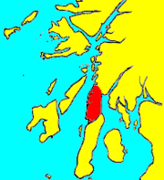
Knapdale
Encyclopedia
Argyll and Bute
Argyll and Bute is both one of 32 unitary council areas; and a Lieutenancy area in Scotland. The administrative centre for the council area is located in Lochgilphead.Argyll and Bute covers the second largest administrative area of any Scottish council...
in the Scottish Highlands
Scottish Highlands
The Highlands is an historic region of Scotland. The area is sometimes referred to as the "Scottish Highlands". It was culturally distinguishable from the Lowlands from the later Middle Ages into the modern period, when Lowland Scots replaced Scottish Gaelic throughout most of the Lowlands...
, adjoining Kintyre
Kintyre
Kintyre is a peninsula in western Scotland, in the southwest of Argyll and Bute. The region stretches approximately 30 miles , from the Mull of Kintyre in the south, to East Loch Tarbert in the north...
to the south, and divided from the rest of Argyll
Argyll
Argyll , archaically Argyle , is a region of western Scotland corresponding with most of the part of ancient Dál Riata that was located on the island of Great Britain, and in a historical context can be used to mean the entire western coast between the Mull of Kintyre and Cape Wrath...
to the north by the Crinan Canal
Crinan Canal
The Crinan canal is a canal in the west of Scotland. It takes its name from the village of Crinan at its westerly end. Nine miles long, it connects the village of Ardrishaig on Loch Gilp with the Sound of Jura, providing a navigable route between the Clyde and the Inner Hebrides, without the need...
. It includes two parish
Parish
A parish is a territorial unit historically under the pastoral care and clerical jurisdiction of one parish priest, who might be assisted in his pastoral duties by a curate or curates - also priests but not the parish priest - from a more or less central parish church with its associated organization...
es, North Knapdale and South Knapdale.
Knapdale Forest, planted in the 1930s, covers much of the region. During the 1930s, the Ministry of Labour
Ministry of Labour
The Ministry of Labour was a British civil service department established by the New Ministries and Secretaries Act 1916. It was renamed the Employment Department in 1988, and finally abolished in 1995...
supplied the men from among the unemployed, many coming from the crisis-hit mining and heavy industry communities of the Central Belt
Central Belt
The Central Belt of Scotland is a common term used to describe the area of highest population density within Scotland. Despite the name, it is not geographically central but is nevertheless situated at the 'waist' of Scotland on a conventional map and the term 'central' is used in many local...
. They were housed in one of a number of Instructional Centres created by the Ministry, most of them on Forestry Commission
Forestry Commission
The Forestry Commission is a non-ministerial government department responsible for forestry in Great Britain. Its mission is to protect and expand Britain's forests and woodlands and increase their value to society and the environment....
property; by 1938, the Ministry had 38 Instructional Centres across Britain
United Kingdom
The United Kingdom of Great Britain and Northern IrelandIn the United Kingdom and Dependencies, other languages have been officially recognised as legitimate autochthonous languages under the European Charter for Regional or Minority Languages...
. The camp was used to hold enemy prisoners during the Second World War. The hutted camp in Knapdale was located at Cairnbaan
Cairnbaan
Cairnbaan is a village situated on the Crinan Canal, in Argyll and Bute, western Scotland. Cairnbaan is around halfway between the two ends of the canal, Ardrishaig and Crinan The name, from Scottish Gaelic, literally means "white hill"...
, just south of the Crinan Canal, and a surviving building remains in use as a Forestry Commission
Forestry Commission
The Forestry Commission is a non-ministerial government department responsible for forestry in Great Britain. Its mission is to protect and expand Britain's forests and woodlands and increase their value to society and the environment....
workshop.
Local attractions include the Chapel of Keills, A grave-slab in the chapel has a carving of a clarsach
Clàrsach
Clàrsach or Cláirseach , is the generic Gaelic word for 'a harp', as derived from Middle Irish...
similar to the Queen Mary Harp currently at the Museum of Scotland in Edinburgh
Edinburgh
Edinburgh is the capital city of Scotland, the second largest city in Scotland, and the eighth most populous in the United Kingdom. The City of Edinburgh Council governs one of Scotland's 32 local government council areas. The council area includes urban Edinburgh and a rural area...
, one of only the three surviving medieval gaelic harps. West Highland grave slabs from the Argyll area, suggesting that Knapdale is where this harp originated. The village also has a thirteenth century Kilmory Chapel and the eleventh century Castle Sween
Castle Sween
Castle Sween is located on the eastern shore of Loch Sween, in Knapdale, on the west coast of Argyll, Scotland. Castle Sween is thought to be one of the earliest stone castles built in Scotland, having been built sometime in the late twelfth century...
.
In 2005, the Scottish Government turned down a licence application for unfenced reintroduction of the European Beaver
European Beaver
The Eurasian beaver or European beaver is a species of beaver, which was once widespread in Eurasia, where it was hunted to near extinction both for fur and for castoreum, a secretion of its scent gland believed to have medicinal properties...
in Knapdale. However, in late 2007 a successful application was made for a release project, and the first beavers were released on the 29 May 2009. This initial release into the wild of 11 animals received a setback during the first year with the disappearance of two animals and the unproven allegation of the illegal shooting of a third. However, the remaining population was increased in 2010 by further releases.
Knapdale has a designation as a National Scenic Area
National Scenic Area (Scotland)
National Scenic Area is a conservation designation used in Scotland, and currently administered by Scottish Natural Heritage. NSAs are defined as having outstanding scenic interest or unsurpassed attractiveness.-Overview:...
.
Places in Knapdale include:
- AchnamaraAchnamaraAchnamara is a village in the Scottish council area of Argyll and Bute. Its location is approximately 56°1' N 5°34' W....
, ArdrishaigArdrishaigArdrishaig is a lochside village at the southern entrance to the Crinan Canal in west Scotland, in Argyll. Ardrishaig had 1,283 inhabitants in 2001.... - CrinanCrinan (village)Crinan is a small village located on the west coast of Scotland in the region known as Knapdale, which is part of Argyll.The Crinan Canal starts at Ardrishaig on Loch Fyne, and ends nine miles away at Crinan on the Sound of Jura...
- KilberryKilberryKilberry is a village in Argyll and Bute, Scotland. It is on the western coast of the district of Knapdale. Close by the small village is the popular Port Ban Caravan Park which provides both caravans for rent during holiday seasons and plots for privately owned caravans along with a large...
, Kilmory - TayvallichTayvallichTayvallich, pronounced "Tay-vee-al-ich", is a small village in Knapdale, Argyll and Bute, Scotland. The village name has origins in gaelic: Taigh a' Bhealaich . The village is built around a sheltered harbour on Loch Sween. It has a primary school, small caravan park, pub and village store. The...
The United Kingdom Census 2001
United Kingdom Census 2001
A nationwide census, known as Census 2001, was conducted in the United Kingdom on Sunday, 29 April 2001. This was the 20th UK Census and recorded a resident population of 58,789,194....
reported a population of 2325, down from 2641 in the United Kingdom Census 1991
United Kingdom Census 1991
A nationwide census, commonly known as Census 1991, was conducted in the United Kingdom on Sunday 21 April 1991. This was the 19th UK census....
, a change from 312 to 527 in North Knapdale, and from 2641 to 2325 in South Knapdale. Census figures for the 19th and 20th centuries show a continuing and steady decline of population in North Knapdale, from a peak of around 2700 in 1825 to under 500 in 1950. Possible boundary changes make historic comparisons for South Knapdale less certain, but this part of the region appears not to have suffered the same depopulation as the north, and even modest growth, a rise from around 1750 in 1801 to around 2700 in 1901.
External links
- Knapdale People, the history of modern Knapdale using historic documents.