
Kilmacud
Encyclopedia
Kilmacud is a suburban area in Dublin in the local authority area of Dún Laoghaire-Rathdown
.
Kilmacud is the area west of Stillorgan
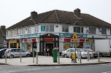
. In essence, it is a collection of middle-class housing estates built in the 1950s by a range of small private construction companies to cater for the growing market of those able to raise mortgages of £3,000 approx to buy their own homes. Its focus is the 'Redesdale Garden Estate', drawing its name from the local mansion—now St. Anne's former girls' reform school—of the British right-wing politician Lord Redesdale, whose daughters the Mitford sisters had achieved celebrity and notoriety in British society. Many other houses and apartments have been built in the area since the 1950s.
Kilmacud is north of Sandyford
, east of Dundrum
and south of Goatstown
. The west end of the Lower Kilmacud Road starts in Goatstown, heading in a southerly direction. It then goes southeast through what appears to be a narrow shortcut and on out to the end of Drummartin Road and turns east. From there it continues eastwards through to the Stillorgan dual carriageway or N11. In total, it is about 2.6 kilometres or 1.6 miles long. The Upper Kilmacud Road starts in Dundrum and going uphill initially it continues eastward, levels off, and continues until a sharp corner brings it northward and downhill. It joins the Lower Kilmacud Road close to St. Laurence's Boys School. It is about 2.9 kilometres or 1.8 miles long.
The difference between Kilmacud and Stillorgan is somewhat ambiguous. For example Kilmacud Crokes GAA club is located in Stillorgan and Stillorgan's Roman Catholic parish is called Kilmacud. Kilmacud can be described as the area between and immediately around the Upper and Lower Kilmacud Roads
. A now gone placename sign for Stillorgan stood up until the 1970s near Beaufield Park, which is on the section of the Lower Kilmacud Road running between the shops near St. Laurence's Church, and the Stillorgan Shopping Centre. This would have been on the western edge of the Stillorgan, and many of the existing housing estates mentioned earlier would not have been in place prior to the 1950s, so it would have marked the beginnings of a built-up area. The area now referred to as Kilmacud would have been on the western side of the sign, with the Chapel of SS Laurence and Cuthbert close by. This was long before the current church dedicated just to St. Laurence O'Toole, which opened in 1969.
Kilmacud Crokes is a major G.A.A. club whose clubhouse, Glenalbyn
is located directly opposite the Stillorgan shopping centre.
Kilmacud's primary schools are Scoil Lorcán Naofa (St. Laurence's, named for the one time archbishop of Dublin Laurence O'Toole), St Raphaela's Primary School and Mount Anville National School, the secondary schools are St. Benildus College, Mount Anville Secondary School
and St. Raphaela's.
The LUAS
light-rail system runs south of Kilmacud and has two stations in the area, Stillorgan and Kilmacud, the former being on the edge of the Sandyford Industrial Estate and beside the main reservoir. The Kilmacud stop is south of the grounds of St. Benildus College.
Dun Laoghaire-Rathdown
Dún Laoghaire–Rathdown is a county in Ireland. It is one of three smaller counties into which County Dublin was divided in 1994. Located to the south-east of Dublin city, its county seat is the town of Dún Laoghaire. It is one of the four constituent parts of the Dublin Region...
.
Kilmacud is the area west of Stillorgan
Stillorgan
Stillorgan , formerly a village in its own right, is now a suburban area of Dublin in Ireland. Stillorgan is located in Dun Laoghaire-Rathdown County, and contains many housing estates, shops and other facilities, with the old village centre still present...
. In essence, it is a collection of middle-class housing estates built in the 1950s by a range of small private construction companies to cater for the growing market of those able to raise mortgages of £3,000 approx to buy their own homes. Its focus is the 'Redesdale Garden Estate', drawing its name from the local mansion—now St. Anne's former girls' reform school—of the British right-wing politician Lord Redesdale, whose daughters the Mitford sisters had achieved celebrity and notoriety in British society. Many other houses and apartments have been built in the area since the 1950s.
Kilmacud is north of Sandyford
Sandyford
Sandyford is a suburb of Dublin, located in Dún Laoghaire-Rathdown County, Ireland. A major part of Sandyford today is composed of the Sandyford Industrial Estate and related developments.- Location and access :...
, east of Dundrum
Dundrum, Dublin
Dundrum , originally a town in its own right, is now a suburb of Dublin in Dún Laoghaire-Rathdown, Ireland.The area is located in the postal districts of Dublin 14 and Dublin 16.-History:...
and south of Goatstown
Goatstown
Goatstown is a suburb of Dublin located in Dún Laoghaire-Rathdown County, Ireland. To the west is Dundrum, to the east is Mount Merrion and Stillorgan, to the south is Sandyford, and to the north is Roebuck and Clonskeagh....
. The west end of the Lower Kilmacud Road starts in Goatstown, heading in a southerly direction. It then goes southeast through what appears to be a narrow shortcut and on out to the end of Drummartin Road and turns east. From there it continues eastwards through to the Stillorgan dual carriageway or N11. In total, it is about 2.6 kilometres or 1.6 miles long. The Upper Kilmacud Road starts in Dundrum and going uphill initially it continues eastward, levels off, and continues until a sharp corner brings it northward and downhill. It joins the Lower Kilmacud Road close to St. Laurence's Boys School. It is about 2.9 kilometres or 1.8 miles long.
The difference between Kilmacud and Stillorgan is somewhat ambiguous. For example Kilmacud Crokes GAA club is located in Stillorgan and Stillorgan's Roman Catholic parish is called Kilmacud. Kilmacud can be described as the area between and immediately around the Upper and Lower Kilmacud Roads
R825 road
The R825 road is a regional road in south Dublin, Ireland. The road starts in Clonskeagh at the junction with the R117 and passes through Goatstown, Kilmacud and Stillorgan before ending at a junction with the N31 in Blackrock, County Dublin...
. A now gone placename sign for Stillorgan stood up until the 1970s near Beaufield Park, which is on the section of the Lower Kilmacud Road running between the shops near St. Laurence's Church, and the Stillorgan Shopping Centre. This would have been on the western edge of the Stillorgan, and many of the existing housing estates mentioned earlier would not have been in place prior to the 1950s, so it would have marked the beginnings of a built-up area. The area now referred to as Kilmacud would have been on the western side of the sign, with the Chapel of SS Laurence and Cuthbert close by. This was long before the current church dedicated just to St. Laurence O'Toole, which opened in 1969.
Kilmacud Crokes is a major G.A.A. club whose clubhouse, Glenalbyn
Glenalbyn
Glenalbyn -Glenalbyn House:The grounds called Linden Lea pitch measuring was purchased by Kilmacud Crokes in 1963, taking ownership on May 4, 1964 and was named Pairc De Burca. Glenalbyn House was owned by the Wilkinson family and was then purchased in 1965 and opened in 1966. On July 7, 1996 the...
is located directly opposite the Stillorgan shopping centre.
Kilmacud's primary schools are Scoil Lorcán Naofa (St. Laurence's, named for the one time archbishop of Dublin Laurence O'Toole), St Raphaela's Primary School and Mount Anville National School, the secondary schools are St. Benildus College, Mount Anville Secondary School
Mount Anville Secondary School
Mount Anville Secondary School is a Roman Catholic, private all-girls post-primary school in Goatstown in Ireland. It was originally an all-boarding school, but in recent years due to decreased demand for such schools it has become a day-school...
and St. Raphaela's.
The LUAS
Luas
Luas , also promoted in the development stage as the Dublin Light Rail System, is a tram or light rail system serving Dublin, the first such system in the decades since the closure of the last of the Dublin tramways. In 2007, the system carried 28.4 million passengers, a growth of 10% since...
light-rail system runs south of Kilmacud and has two stations in the area, Stillorgan and Kilmacud, the former being on the edge of the Sandyford Industrial Estate and beside the main reservoir. The Kilmacud stop is south of the grounds of St. Benildus College.