Kavaratti
Encyclopedia
Kavaratti is a census town
in the India
n Union Territory
and the capital of Lakshadweep
. Kavaratti is also the name of the island upon which the town stands.
at 10.57°N 72.62°E. It has an average elevation of 0 metres (0 feet). The closest island is uninhabited Pitti
islet, located 24 km north of Kavaratti. The inhabited island of Agatti
lies 54 km to the NW and the uninhabited Suheli Par
53 km to the SW.
, Kavaratti had a population of 10,113. Males constitute 55% of the population and females 45%. Kavaratti has an average literacy rate of 78%, higher than the national average of 59.5%: male literacy is 83%, and female literacy is 72%. In Kavaratti, 12% of the population is under 6 years of age.
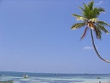
 The lagoon in Kavaratti island is ideal for water sports, swimming and there are sandy beaches for sun basking. Tourists can enjoy the marine life exhibits at the Marine Aquarium, and a vast collection of specimens at the Museum.
Census town
In India, a census town is one which has:# A minimum population of 5,000# At least 75% of male working population engaged in non-agricultural pursuits# A density of population of at least 400 persons per km2.In Ireland, a census town is;...
in the India
India
India , officially the Republic of India , is a country in South Asia. It is the seventh-largest country by geographical area, the second-most populous country with over 1.2 billion people, and the most populous democracy in the world...
n Union Territory
Union Territory
A Union Territory is a sub-national administrative division of India, in the federal framework of governance. Unlike the states of India, which have their own elected governments, union territories are ruled directly by the federal government; the President of India appoints an Administrator or...
and the capital of Lakshadweep
Lakshadweep
Lakshadweep , formerly known as the Laccadive, Minicoy, and Amindivi Islands, is a group of islands in the Laccadive Sea, 200 to 440 km off the coast of the South West Indian state of Kerala...
. Kavaratti is also the name of the island upon which the town stands.
Geography
The island of Kavaratti lies 360 km off the coast of the state of KeralaKerala
or Keralam is an Indian state located on the Malabar coast of south-west India. It was created on 1 November 1956 by the States Reorganisation Act by combining various Malayalam speaking regions....
at 10.57°N 72.62°E. It has an average elevation of 0 metres (0 feet). The closest island is uninhabited Pitti
Pitti
Pitti is an uninhabited coral islet in the Union Territory of Lakshadweep, India. It is located at about 24 km to the north of Kavaratti, 37 km to the east of Agatti and 42.5 km to the SSW of Amini Island. The island is low and arid and, lacking adequate anchorage points, of difficult accessibility...
islet, located 24 km north of Kavaratti. The inhabited island of Agatti
Agatti
Agatti Island , also known as Agathy, is a 5.6 km long island, situated on a coral atoll in the Union Territory of Lakshadweep, India. It is located about 459 km off Kochi in the mainland and 7 km to the southwest of Bangaram, the nearest island...
lies 54 km to the NW and the uninhabited Suheli Par
Suheli Par
Suheli Par is a coral atoll in the Union Territory of Lakshadweep, India. It is located at , 52 km to the SW of Kavaratti, 76 km to the south of Agatti, 139 km to the west of Kalpeni and 205 km to the NNW of Minicoy, with the broad Nine Degree Channel between them. There are two uninhabited islands...
53 km to the SW.
Demographics
India censusCensus
A census is the procedure of systematically acquiring and recording information about the members of a given population. It is a regularly occurring and official count of a particular population. The term is used mostly in connection with national population and housing censuses; other common...
, Kavaratti had a population of 10,113. Males constitute 55% of the population and females 45%. Kavaratti has an average literacy rate of 78%, higher than the national average of 59.5%: male literacy is 83%, and female literacy is 72%. In Kavaratti, 12% of the population is under 6 years of age.
Climate
Tourist attractions


