
Kadirli
Encyclopedia
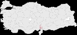
Kadirli is a town and district of Osmaniye Province
in the Mediterranean
region of Turkey
. It is located in the Çukurova
plain, 90 km (56 mi) from the large city of Osmaniye
. Population is 81,016(urban) and 116,951 (including rural areas) (2010 census).
, Kahramanmaraş
and Hatay
for two centuries. They were routed when the land was brought under Ottoman
control by Yavuz Sultan Selim I in 1517.
Kadirli was occupied by French forces at the end of the First World War under the terms of the armistice signed by the Ottoman Empire. The French forces were resisted by local elements and eventually withdrew from the town in March 1920. Kadirli was a district (ilçe) in Kozan
province between 1923-1926 and in Adana Province
between 1926-1995.
In the summertime, families move to the uplands of Taurus Mountains
, mainly Plateau Maksutolugu, adjacent to Kahramanmaraş
because of hot weather in a general manner, also working people staying in town join their families in the weekends.
In recent times, inhabitants also prefer to spend their summertime at the sea side in Yumurtalık
and Mersin
during hot season as an alternative of moving to plateau.
In Kadirli, there is a vocational college connected with the Korkut Ata University, Osmaniye
. The college offers two educational programs: Computer Programming and Industrial Electronics since 1997.
Osmaniye Province
Osmaniye Province is a Turkish province located in southern Turkey. It became a province in 1996. The province was part of Adana Province. It covers an area of 3,767 km² and has a population of 479,221 . The province is situated in Çukurova, a geographical, economical and cultural region.The...
in the Mediterranean
Mediterranean Region, Turkey
The Mediterranean Region is one of Turkey's seven census-defined geographical regions . It is bordered by the Aegean Region to the west, the Central Anatolia Region to the north, the Eastern Anatolia Region to the northeast, the Southeastern Anatolia Region to the east, Syria to the southeast, and...
region of Turkey
Turkey
Turkey , known officially as the Republic of Turkey , is a Eurasian country located in Western Asia and in East Thrace in Southeastern Europe...
. It is located in the Çukurova
Çukurova
Çukurova , historically known as Cilicia, is a geographic, economic and cultural region in south-central Turkey, covering the provinces of Mersin, Adana, Osmaniye and Hatay...
plain, 90 km (56 mi) from the large city of Osmaniye
Osmaniye
-External links:...
. Population is 81,016(urban) and 116,951 (including rural areas) (2010 census).
History
The Cilicia/Çukurova plain is rich farmland and is also a place of strategic importance on an important trade route between the Middle East and Anatolia. It has therefore been settled since the time of the Hittites and many civilisations have owned the land since: Assyrians, Romans (he Roman city of Flavius may have been located here), Byzantines, Armenians and finally Turks. The most prominent group of Turks to settle here were the Dulkadir lords, semi-autonomous barons during the Ottoman era, who ruled GaziantepGaziantep
Gaziantep , Ottoman Turkish: Ayintab) previously and still informally called Antep; ʻayn tāb is a city in southeast Turkey and amongst the oldest continually inhabited cities in the world. The city is located 185 kilometres northeast of Adana and 127 kilometres by road north of Aleppo, Syria...
, Kahramanmaraş
Kahramanmaras
-Industry:Kahramanmaraş's industry is mainly based on textile and ice cream. Kahramanmaraş is one of the biggest textile industry cities of Turkey. Companies like Kipaş, İskur, Arsan and Bozkurt are one of the richest companies in the city...
and Hatay
Hatay Province
Hatay Province is a province in southern Turkey, on the Mediterranean coast. It is bordered by Syria to the south and east and the Turkish provinces of Adana and Osmaniye to the north. The province is part of Çukurova, a geographical, economical and cultural region that covers the provinces of...
for two centuries. They were routed when the land was brought under Ottoman
Ottoman Empire
The Ottoman EmpireIt was usually referred to as the "Ottoman Empire", the "Turkish Empire", the "Ottoman Caliphate" or more commonly "Turkey" by its contemporaries...
control by Yavuz Sultan Selim I in 1517.
Kadirli was occupied by French forces at the end of the First World War under the terms of the armistice signed by the Ottoman Empire. The French forces were resisted by local elements and eventually withdrew from the town in March 1920. Kadirli was a district (ilçe) in Kozan
Kozan
Kozan may refer to:*Kozan, Hiroshima in Japan*Kozan, Adana in Turkey*Kozan, Shaft in Iran*Kozan, a village in Northern Cyprus...
province between 1923-1926 and in Adana Province
Adana Province
Adana Province is a province of Turkey located in south-central Anatolia. With a population of 2,085,225, it is the fifth most populous province in Turkey. The administrative seat of the province is the city of Adana, home to 78% of the residents of the province...
between 1926-1995.
Kadirli today
Kadirli is a small town providing the basic infrastructure, such as shops and schools, to an area of rich farmland, which produces grain and 70% of Turkey's radishes. There are two reservoirs for irrigating the area. There is small scale industry.In the summertime, families move to the uplands of Taurus Mountains
Taurus Mountains
Taurus Mountains are a mountain complex in southern Turkey, dividing the Mediterranean coastal region of southern Turkey from the central Anatolian Plateau. The system extends along a curve from Lake Eğirdir in the west to the upper reaches of the Euphrates and Tigris rivers in the east...
, mainly Plateau Maksutolugu, adjacent to Kahramanmaraş
Kahramanmaras
-Industry:Kahramanmaraş's industry is mainly based on textile and ice cream. Kahramanmaraş is one of the biggest textile industry cities of Turkey. Companies like Kipaş, İskur, Arsan and Bozkurt are one of the richest companies in the city...
because of hot weather in a general manner, also working people staying in town join their families in the weekends.
In recent times, inhabitants also prefer to spend their summertime at the sea side in Yumurtalık
Yumurtalik
Yumurtalık is a small city and a district in Adana Province of Turkey. It is a Mediterranean port at a distance of about from Adana center. Yumurtalık's population does not exceed 5,000 in winter, but in summer, it rises to 30 to 40,000 people since many inhabitants of Adana have holiday homes here...
and Mersin
Mersin
-Mersin today:Today, Mersin is a large city spreading out along the coast, with Turkey's second tallest skyscraper , huge hotels, an opera house, expensive real estate near the sea or up in the hills, and many other modern urban...
during hot season as an alternative of moving to plateau.
In Kadirli, there is a vocational college connected with the Korkut Ata University, Osmaniye
Osmaniye
-External links:...
. The college offers two educational programs: Computer Programming and Industrial Electronics since 1997.
Places of interest
There are many archaeological and touristic sites nearby such as:- KaratepeKaratepeKaratepe is a late Hittite fortress and open air museum in Osmaniye Province in southern Turkey lying at a distance of about 23 km from the district center of Kadirli. It is sited in the Taurus Mountains, on the right bank of the Ceyhan River...
National Park - 23 km from Kadirli. The ruins of a walled city of the time of the HittitesHittitesThe Hittites were a Bronze Age people of Anatolia.They established a kingdom centered at Hattusa in north-central Anatolia c. the 18th century BC. The Hittite empire reached its height c...
. Discovered by archaeologists Halet CambelHalet ÇambelHalet Çambel was a Turkish fencer and renowned archaeologist.Çambel was born in Berlin. Her father, Hasan Cemil Çambel, was closely associated with Mustafa Kemal Ataturk, founder of the Turkish republic. Her mother, Remziye Hanim, was the daughter of the Turkish ambassador to Germany...
and Helmut Bossert. Relics found here date from a late Hittite kingdom (8th century BC) and include vast historic tablets, statues and ruins, even a monumental gate and pillars of lions and sphinxs. The ruins even gave us inscriptions in Hittite and Phoenician, which have been used to decipher the Hittite language. - The Alacami is the oldest surviving monument in Kadirli. Its remains display over a millennium and a half of local history in several building phases. In the late 5th / early 6th century the site was artificially terraced for the construction of a large basilical church, built in at least two stages from a variety of reused architectural elements and incorporating the hypogeum as a crypt. It later seems to have fallen into disuse until the medieval period when it was converted into an Armenian church. This involved some modification to the original structure and the addition of a small church that sits inside the former nave of the church and reuses the original apse. This small church was converted into a mosque in the late 15th century, and a minaret was attached to the original Byzantine structure.