

Josipdol
Encyclopedia
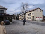
Josipdol is a village and municipality in Karlovac County
, Croatia
. The municipality is part of Lika
.
 Josipdol is situated in the Ogulin
-Plaški
valley which together with Lika
and Gorski Kotar
forms Mountainous Croatia. The town is located at the crossroads of state roads D-23, which connects Karlovac and Senj
(Jozefin road), and D-42, which connects Vrbovsko
and Plitvice. Josipdol is located 10 km southeast from Ogulin, 14 km northwest from Plaški and 45 km southwest from Karlovac.
and 10.5% were Serbs
. Serbs form the majority in the village of Trojvrh.
village show that the area was settled in the Neolithic
. Remains from the Copper Age
show that the area was the southernmost part of Lasinja
culture. The first known inhabitants of the area were the Illyrian tribe of Japods, which lived here from the late Bronze Age. In this area the Japods had two strongholds, Tetrapones, east of today's town Josipdol and Metulum, north of the town. On the north the Japods bordered with Celts and random remains of Celtic coins were found in the area.
In the period 35-33 B.C. future Roman Emperor Octavian
conquered the Japod areas and incorporated them into the Roman Empire
. Although no physical remains of any Roman road has been found it is believed that through this area passed the Yantar road, which connected the Baltic with the Adriatic. During this period Metulum had municipality status which is proved by a script from Diocletian's time.
In the 7th century Slavs came to colonize the Balkan area and founded a settlement Modruš in the Josipdol area. In the 9th century, Modruš is mentioned as the site of the Borna
and Ljudevit Posavski
confrontation. In 1102 Croatia joined personal union with Hungary
and the Hungarians formed new territorial units called Župa
s; Modruš
became the seat of one of these Župas and soon became the seat of the Krbava-Modruš episcopacy.
After a 12th century king's rule became in vain and possession of Župas fell into the hands of the nobility, Modruš became a possession of the Frankopan
family. Because it was on a road that connected the interior with the coast, Modruš became an important traffic and trade center. This was the golden age for Modruš, which lasted until wars with the Ottoman
s in the 15th century, when it was raided several times.
As Croatia became part of the Habsburg empire Modruš became part of the Military Frontier
and a new population settled the area. In 1776, Austrian authorities began to build the road that would connect Karlovac with Senj and Josipdol was founded as a traffic and trade center on the road. The road was named Josephina
and it is still in use today.
During the Kingdom of Yugoslavia
, a railway from Ogulin to Split was built which passed Josipdol. The railway accelerated the industrial growth of the town and a wood industry was founded. In the 21st century it was one of the centers where the Zagreb-Split motorway was built and many locals found jobs in constructing it. In 2003 the first part of the road was opened on the Bosiljevo-Josipdol part.
s. In 2003 municipality experienced economic boom because of building motorway Zagreb-Split nearby. Josipdol was one of the construction centers and many locals found job in construction of motorway.
Karlovac County
Karlovac County is a county in central Croatia, with the administrative center in Karlovac.The city of Karlovac is another fort from the times of the Military Frontier...
, Croatia
Croatia
Croatia , officially the Republic of Croatia , is a unitary democratic parliamentary republic in Europe at the crossroads of the Mitteleuropa, the Balkans, and the Mediterranean. Its capital and largest city is Zagreb. The country is divided into 20 counties and the city of Zagreb. Croatia covers ...
. The municipality is part of Lika
Lika
Lika is a mountainous region in central Croatia, roughly bound by the Velebit mountain from the southwest and the Plješevica mountain from the northeast. On the north-west end Lika is bounded by Ogulin-Plaški basin, and on the south-east by the Malovan pass...
.
Geography
Ogulin
Ogulin is a town in north-western Croatia, in Karlovac County. It has a population of 8,712 , and a total municipal population of 15,054...
-Plaški
Plaški
Plaški is a village and a municipality in Karlovac County, Croatia. It is part of Lika.- Geography :Plaški is situated in the lower part of the Ogulin-Plaški valley. Together with Gorski kotar and Lika, the Ogulin-Plaški valley forms Mountainous Croatia...
valley which together with Lika
Lika
Lika is a mountainous region in central Croatia, roughly bound by the Velebit mountain from the southwest and the Plješevica mountain from the northeast. On the north-west end Lika is bounded by Ogulin-Plaški basin, and on the south-east by the Malovan pass...
and Gorski Kotar
Gorski kotar
Gorski kotar is the mountainous region in Croatia between Karlovac and Rijeka. Together with Lika and the Ogulin-Plaški valley it forms Mountainous Croatia. Because 63% of its surface is forested it is popularly called the green lungs of Croatia or Croatian Switzerland...
forms Mountainous Croatia. The town is located at the crossroads of state roads D-23, which connects Karlovac and Senj
Senj
Senj , German Zengg, Hungarian Zeng and Italian Segna) is the oldest town on the upper Adriatic, and it was founded in the time before the Romans some 3000 years ago on the hill Kuk. It was the center of the Illyrian tribe Iapydes. The current settlement is situated at the foot of the slopes Mala...
(Jozefin road), and D-42, which connects Vrbovsko
Vrbovsko
Vrbovsko is a town in western Croatia, situated at the far east of the mountainous region of Gorski kotar in the Primorje-Gorski Kotar county; on its 280 square kilometers area, Vrbovsko features 60 settlements and a total of 5,019 inhabitants...
and Plitvice. Josipdol is located 10 km southeast from Ogulin, 14 km northwest from Plaški and 45 km southwest from Karlovac.
Demographics
According to the 2001 census, the town had a population of 993 with a total municipality population of 3,987, of which 87.5% were CroatsCroats
Croats are a South Slavic ethnic group mostly living in Croatia, Bosnia and Herzegovina and nearby countries. There are around 4 million Croats living inside Croatia and up to 4.5 million throughout the rest of the world. Responding to political, social and economic pressure, many Croats have...
and 10.5% were Serbs
Serbs
The Serbs are a South Slavic ethnic group of the Balkans and southern Central Europe. Serbs are located mainly in Serbia, Montenegro and Bosnia and Herzegovina, and form a sizable minority in Croatia, the Republic of Macedonia and Slovenia. Likewise, Serbs are an officially recognized minority in...
. Serbs form the majority in the village of Trojvrh.
History
Scarce archaeological remains near OštarijeOštarije
Oštarije is a village in Croatia. It is connected by the D42 highway....
village show that the area was settled in the Neolithic
Neolithic
The Neolithic Age, Era, or Period, or New Stone Age, was a period in the development of human technology, beginning about 9500 BC in some parts of the Middle East, and later in other parts of the world. It is traditionally considered as the last part of the Stone Age...
. Remains from the Copper Age
Copper Age
The Chalcolithic |stone]]") period or Copper Age, also known as the Eneolithic/Æneolithic , is a phase of the Bronze Age in which the addition of tin to copper to form bronze during smelting remained yet unknown by the metallurgists of the times...
show that the area was the southernmost part of Lasinja
Lasinja
Lasinja is a municipality in Karlovac County, Croatia. There are 1,938 inhabitants, 88% of whom are Croats and 10.27% who are Serbs....
culture. The first known inhabitants of the area were the Illyrian tribe of Japods, which lived here from the late Bronze Age. In this area the Japods had two strongholds, Tetrapones, east of today's town Josipdol and Metulum, north of the town. On the north the Japods bordered with Celts and random remains of Celtic coins were found in the area.
In the period 35-33 B.C. future Roman Emperor Octavian
Augustus
Augustus ;23 September 63 BC – 19 August AD 14) is considered the first emperor of the Roman Empire, which he ruled alone from 27 BC until his death in 14 AD.The dates of his rule are contemporary dates; Augustus lived under two calendars, the Roman Republican until 45 BC, and the Julian...
conquered the Japod areas and incorporated them into the Roman Empire
Roman Empire
The Roman Empire was the post-Republican period of the ancient Roman civilization, characterised by an autocratic form of government and large territorial holdings in Europe and around the Mediterranean....
. Although no physical remains of any Roman road has been found it is believed that through this area passed the Yantar road, which connected the Baltic with the Adriatic. During this period Metulum had municipality status which is proved by a script from Diocletian's time.
In the 7th century Slavs came to colonize the Balkan area and founded a settlement Modruš in the Josipdol area. In the 9th century, Modruš is mentioned as the site of the Borna
Borna
Borna is a town in the Free State of Saxony, Germany, capital of the Leipzig district. It is situated approx. 30 km southeast of Leipzig. It has approx. 21,000 inhabitants.-History:Borna as a town is more than 750 years old....
and Ljudevit Posavski
Ljudevit Posavski
Ljudevit Posavski was a Croatian Duke of Pannonian Croatia from 810 to 823. The capital of his realm was in Sisak. As the ruler of the Pannonian Slavs, he led an unsuccessful resistance to Frankish domination. He held close ties with the Carantanian and Carniolan tribes and with the Serbian tribe...
confrontation. In 1102 Croatia joined personal union with Hungary
Hungary
Hungary , officially the Republic of Hungary , is a landlocked country in Central Europe. It is situated in the Carpathian Basin and is bordered by Slovakia to the north, Ukraine and Romania to the east, Serbia and Croatia to the south, Slovenia to the southwest and Austria to the west. The...
and the Hungarians formed new territorial units called Župa
Župa
A Župa is a Slavic term, used historically among the Southern and Western branches of the Slavs, originally denoting various territorial and other sub-units, usually a small administrative division, especially a gathering of several villages...
s; Modruš
Modruš
Modruš is a village in the mountainous part of Croatia, located south of Josipdol. The population is 197 .This now small village is historically noted as the seat of one of the medieval Catholic bishoprics, established in 1185 in Krbava and moved to Modruš in the 1460s. It later became the Roman...
became the seat of one of these Župas and soon became the seat of the Krbava-Modruš episcopacy.
After a 12th century king's rule became in vain and possession of Župas fell into the hands of the nobility, Modruš became a possession of the Frankopan
Frankopan
The Frankopans are a Croatian noble family. Also called Frankapan, Frangepán in Hungarian, and Frangipani in Italian.The Frankopan family is the leading princely Croatian aristocratic family which dates back to the 12th Century and even earlier to Roman times...
family. Because it was on a road that connected the interior with the coast, Modruš became an important traffic and trade center. This was the golden age for Modruš, which lasted until wars with the Ottoman
Ottoman Empire
The Ottoman EmpireIt was usually referred to as the "Ottoman Empire", the "Turkish Empire", the "Ottoman Caliphate" or more commonly "Turkey" by its contemporaries...
s in the 15th century, when it was raided several times.
As Croatia became part of the Habsburg empire Modruš became part of the Military Frontier
Military Frontier
The Military Frontier was a borderland of Habsburg Austria and later the Austro-Hungarian Monarchy, which acted as the cordon sanitaire against incursions from the Ottoman Empire...
and a new population settled the area. In 1776, Austrian authorities began to build the road that would connect Karlovac with Senj and Josipdol was founded as a traffic and trade center on the road. The road was named Josephina
Josephina (road)
The Josephina is a historic road in Croatia that connects Senj and thus the Adriatic coast and Karlovac and the Pannonian plain...
and it is still in use today.
During the Kingdom of Yugoslavia
Kingdom of Yugoslavia
The Kingdom of Yugoslavia was a state stretching from the Western Balkans to Central Europe which existed during the often-tumultuous interwar era of 1918–1941...
, a railway from Ogulin to Split was built which passed Josipdol. The railway accelerated the industrial growth of the town and a wood industry was founded. In the 21st century it was one of the centers where the Zagreb-Split motorway was built and many locals found jobs in constructing it. In 2003 the first part of the road was opened on the Bosiljevo-Josipdol part.
Economy
Economy is mostly based on agriculture, harvesting potatoes, mushrooms and fruit. There also couple of smaller sawmillSawmill
A sawmill is a facility where logs are cut into boards.-Sawmill process:A sawmill's basic operation is much like those of hundreds of years ago; a log enters on one end and dimensional lumber exits on the other end....
s. In 2003 municipality experienced economic boom because of building motorway Zagreb-Split nearby. Josipdol was one of the construction centers and many locals found job in construction of motorway.
Towns and Villages in Municipality
|
|
|
|
|
|
|