

John McDouall Stuart
Encyclopedia
South Australia
South Australia is a state of Australia in the southern central part of the country. It covers some of the most arid parts of the continent; with a total land area of , it is the fourth largest of Australia's six states and two territories.South Australia shares borders with all of the mainland...
, achieving this despite poor backing from the Government of South Australia
Government of South Australia
The form of the Government of South Australia is prescribed in its constitution, which dates from 1856, although it has been amended many times since then...
. His experience and the care he showed for his team ensured he never lost a man, despite the harshness of the country he encountered. The explorations of Stuart eventually resulted in the Adelaide-Darwin telegraph being built and the main route from Port Augusta
Port Augusta, South Australia
-Electricity generation:Electricity is generated at the Playford B and Northern power stations from brown coal mined at Leigh Creek, 250 km to the north...
to Darwin
Darwin, Northern Territory
Darwin is the capital city of the Northern Territory, Australia. Situated on the Timor Sea, Darwin has a population of 127,500, making it by far the largest and most populated city in the sparsely populated Northern Territory, but the least populous of all Australia's capital cities...
being established, which is now known as the Stuart Highway
Stuart Highway
The Stuart Highway is one of Australia's major highways. It is a segment of Australia's Highway 1 extending from Darwin, Northern Territory, in the north, via Tennant Creek and Alice Springs, to Port Augusta, South Australia, in the south—a distance of...
in his honour.
Early life
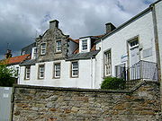
Born in Dysart, Fife, ScotlandScotland
Scotland is a country that is part of the United Kingdom. Occupying the northern third of the island of Great Britain, it shares a border with England to the south and is bounded by the North Sea to the east, the Atlantic Ocean to the north and west, and the North Channel and Irish Sea to the...
, Stuart was the youngest of nine children. His father was a retired army captain serving as a customs officer. Stuart's parents died when he was in his early teens and he came under the care of relatives. He graduated from the Scottish Naval and Military Academy as a civil engineer
Civil engineer
A civil engineer is a person who practices civil engineering; the application of planning, designing, constructing, maintaining, and operating infrastructures while protecting the public and environmental health, as well as improving existing infrastructures that have been neglected.Originally, a...
before emigrating to Australia
Australia
Australia , officially the Commonwealth of Australia, is a country in the Southern Hemisphere comprising the mainland of the Australian continent, the island of Tasmania, and numerous smaller islands in the Indian and Pacific Oceans. It is the world's sixth-largest country by total area...
in 1838 at the age of 23. Stuart was a slight, delicately built young man, standing about 5' 6" tall (168 cm) and weighing less than 9 stone (about 55 kg). In 1839 he arrived in the three-year-old frontier colony of South Australia
South Australia
South Australia is a state of Australia in the southern central part of the country. It covers some of the most arid parts of the continent; with a total land area of , it is the fourth largest of Australia's six states and two territories.South Australia shares borders with all of the mainland...
, at that time little more than a single crowded outpost of tents and dirt floored wooden huts. Stuart soon found employment as a public surveyor, working in the semi-arid scrub of the newly settled districts marking out blocks for settlers and miners. In 1842 the committee he was working for reduced the number of employees and Stuart lost his job. This didn't bother Stuart greatly as he became a private surveyor and kept working in the remote areas he loved. Life in the surveying camps was harsh but Stuart rapidly earned a reputation for extraordinary accuracy. He was a Freemason
Freemasonry
Freemasonry is a fraternal organisation that arose from obscure origins in the late 16th to early 17th century. Freemasonry now exists in various forms all over the world, with a membership estimated at around six million, including approximately 150,000 under the jurisdictions of the Grand Lodge...
Charles Sturt's protégé
The South Australian Surveyor-General, Stuart's superior officer, was the famous explorer Captain Charles SturtCharles Sturt
Captain Charles Napier Sturt was an English explorer of Australia, and part of the European Exploration of Australia. He led several expeditions into the interior of the continent, starting from both Sydney and later from Adelaide. His expeditions traced several of the westward-flowing rivers,...
, who had already solved the mystery of the inland-flowing rivers of New South Wales
New South Wales
New South Wales is a state of :Australia, located in the east of the country. It is bordered by Queensland, Victoria and South Australia to the north, south and west respectively. To the east, the state is bordered by the Tasman Sea, which forms part of the Pacific Ocean. New South Wales...
, in the process discovering the Darling River
Darling River
The Darling River is the third longest river in Australia, measuring from its source in northern New South Wales to its confluence with the Murray River at Wentworth, New South Wales. Including its longest contiguous tributaries it is long, making it the longest river system in Australia.The...
, travelling the full length of the Murrumbidgee
Murrumbidgee River
The Murrumbidgee River is a major river in the state of New South Wales, Australia, and the Australian Capital Territory . A major tributary of the Murray River, the Murrumbidgee flows in a west-northwesterly direction from the foot of Peppercorn Hill in the Fiery Range of the Snowy Mountains,...
, and tracing the Murray
Murray River
The Murray River is Australia's longest river. At in length, the Murray rises in the Australian Alps, draining the western side of Australia's highest mountains and, for most of its length, meanders across Australia's inland plains, forming the border between New South Wales and Victoria as it...
to the sea. Stuart remained with the Survey Department until 1842 and then worked in the Mount Lofty Ranges
Mount Lofty Ranges
The Mount Lofty Ranges are the range of mountains just to the east of Adelaide in South Australia.-Location and description:The Mount Lofty Ranges stretch from the southernmost point of the Fleurieu Peninsula at Cape Jervis northwards for over before petering out north of Peterborough...
as a private surveyor and grazier.
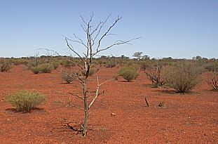
In 1844 Captain Sturt embarked on an expedition into the arid interior, and engaged Stuart as a draughtsman. Sturt's expedition penetrated further north than any previous attempt, at the cost of great hardship. Instead of the hoped-for inland sea, the explorers found two of the most fearsome arid areas anywhere in Australia: Sturt Stony Desert and the Simpson Desert
Simpson Desert
The Simpson Desert is a large area of dry, red sandy plain and dunes in Northern Territory, South Australia and Queensland in central Australia. It is the fourth largest Australian desert, with an area of 176,500 km² ....
. After second-in-command James Poole died of scurvy
Scurvy
Scurvy is a disease resulting from a deficiency of vitamin C, which is required for the synthesis of collagen in humans. The chemical name for vitamin C, ascorbic acid, is derived from the Latin name of scurvy, scorbutus, which also provides the adjective scorbutic...
, Sturt appointed Stuart in his place. Both men survived to return to Adelaide, but suffered greatly from scurvy. Sturt never really recovered and soon returned to England; the younger Stuart was unable to work or travel for a year.
Stuart returned to his trade as a private surveyor, spending more and more time in the remote areas he loved, and moving to Port Lincoln for several years before moving again to the northern Flinders Ranges
Flinders Ranges
Flinders Ranges is the largest mountain range in South Australia, which starts approximately north west of Adelaide. The discontinuous ranges stretch for over from Port Pirie to Lake Callabonna...
where he worked for the wealthy pastoralists William Finke, James Chambers, and John Chambers, exploring, prospecting for minerals, and surveying pastoral leases.
He was a member of Stephen Hack's expedition of May and June 1857 looking for grazing country north and west of Streaky Bay
Streaky Bay, South Australia
Streaky Bay is a coastal town on the western side of the Eyre Peninsula, in South Australia just off the Flinders Highway 303 km north west of Port Lincoln and 727 km by road from Adelaide...
and a private expedition to Lake Gairdner
Lake Gairdner
Lake Gairdner is a large endorheic lake in central South Australia, and is considered the fourth largest salt lake in Australia when it is flooded....
with Anthony Forster (later to become editor of The Register
South Australian Register
The Register, originally the South Australian Gazette and Colonial Register, was the first South Australian newspaper. It was first published in London in June 1836 and folded almost a century later in February 1931....
) in 1858.
The first expedition
On 14 May 1858, with financial backing from William Finke, Stuart set off on the first of his six major expeditions. His aim was to find minerals, a land which the aborigines called Wingillpinin, and new grazing land in the north-west of South Australia. Stuart took two companions (another white man named Forster and a young Aboriginal man), a pocket compass, a watch, half a dozen horses, and rations for six weeks. From the Flinders Ranges, Stuart travelled west, passing to the south of Lake TorrensLake Torrens
Lake Torrens is a salt lake in central South Australia. It is located in the Lake Torrens National Park....
, then north along the western edge of Lake Torrens. He found an isolated chain of semi-permanent waterholes which he named Chamber's Creek (now called Stuart Creek). It later became crucially important as a staging post for expeditions to the arid centre of the continent.
Opal
Opal is an amorphous form of silica related to quartz, a mineraloid form, not a mineral. 3% to 21% of the total weight is water, but the content is usually between 6% to 10%. It is deposited at a relatively low temperature and may occur in the fissures of almost any kind of rock, being most...
field underfoot) before shortage of provisions and lack of feed for the horses forced him to turn towards the sea 500 kilometres to the south. A difficult journey along the edge of the Great Victoria Desert
Great Victoria Desert
The Great Victoria Desert is a barren and sparsely populated desert area of southern Australia.-Location and description:The Great Victoria is the biggest desert in Australia and consists of many small sandhills, grassland plains, areas with a closely packed surface of pebbles and salt lakes...
brought Stuart to Miller's Water (near present-day Ceduna) and from there back to civilisation after four months and 2,400 kilometres. This expedition made Stuart's reputation and brought him the award of a gold watch from the Royal Geographical Society
Royal Geographical Society
The Royal Geographical Society is a British learned society founded in 1830 for the advancement of geographical sciences...
.
The second expedition
Shortly after returning from his first expedition, Stuart applied for a pastoral lease at Chambers Creek. As the discoverer he was already entitled to a lease, but wanted rights to a larger area. As a bargaining chip in the negotiation process, Stuart offered to do the surveying himself and in April 1859 he set off with a party of three men and 15 horses. The Chambers Creek survey complete, Stuart explored to the north again, aiming to reach the border between South Australia and what is now the Northern TerritoryNorthern Territory
The Northern Territory is a federal territory of Australia, occupying much of the centre of the mainland continent, as well as the central northern regions...
(at that time still a part of New South Wales
New South Wales
New South Wales is a state of :Australia, located in the east of the country. It is bordered by Queensland, Victoria and South Australia to the north, south and west respectively. To the east, the state is bordered by the Tasman Sea, which forms part of the Pacific Ocean. New South Wales...
). Although still well supplied with rations and not short of water, the expedition turned back about 100 kilometres short of the border because they had no more horse shoes (an essential item in that arid, stony region). Importantly, however, Stuart had found another reliable water supply for future attempts: a "beautiful spring" fed by the then-unknown Great Artesian Basin
Great Artesian Basin
The Great Artesian Basin provides the only reliable source of freshwater through much of inland Australia. The basin is the largest and deepest artesian basin in the world, stretching over a total of , with temperatures measured ranging from 30°C to 100°C...
. He wrote: I have named this "The Spring of Hope". It is a little brackish, not from salt, but soda, and runs a good stream of water. I have lived upon far worse water than this: to me it is of the utmost importance, and keeps my retreat open. I can go from here to Adelaide any time of the year and in any sort of season. He returned in July with reports of "wonderful country"; an extraordinary description of territory that is now barely able to support a few cattle.
(The history of Australia generally, and of South Australia in particular, has many similar examples of initial optimism that proved unjustified. Explorers and early settlers often chanced to see an area during a rare good season and consequently assumed that it could be used for sheep, cattle, or even wheat. The inevitable return to normal weather patterns resulted in heartbreak and bankruptcy for the farmer, and destruction of the thin and fragile topsoil layer. Farmers who advanced into the Flinders Ranges in the good seasons of the 1870s were forced to abandon their new lands en masse during the drought of the early 1880s.)
The third expedition
At around this time in Australia, exploration fever was reaching a peak. Several factors contributed. At "home" (as Australians still called Britain), public attention was focussed on the search for the source of the NileNile
The Nile is a major north-flowing river in North Africa, generally regarded as the longest river in the world. It is long. It runs through the ten countries of Sudan, South Sudan, Burundi, Rwanda, Democratic Republic of the Congo, Tanzania, Kenya, Ethiopia, Uganda and Egypt.The Nile has two major...
, with the competing expeditions of Speke
John Hanning Speke
John Hanning Speke was an officer in the British Indian Army who made three exploratory expeditions to Africa and who is most associated with the search for the source of the Nile.-Life:...
, Burton
Richard Francis Burton
Captain Sir Richard Francis Burton KCMG FRGS was a British geographer, explorer, translator, writer, soldier, orientalist, cartographer, ethnologist, spy, linguist, poet, fencer and diplomat. He was known for his travels and explorations within Asia, Africa and the Americas as well as his...
and Baker
Samuel Baker
Sir Samuel White Baker, KCB, FRS, FRGS was a British explorer, officer, naturalist, big game hunter, engineer, writer and abolitionist. He also held the titles of Pasha and Major-General in the Ottoman Empire and Egypt. He served as the Governor-General of the Equatorial Nile Basin between Apr....
all contending for the honour of discovery. Like the interior of Africa, inland Australia remained an embarrassing blank area on the map and although the long-held dreams of a fertile inland sea had faded, there was an intense desire to see the continent crossed. This was the apex of the age of heroic exploration.
Additionally, there was the factor of the telegraph. Invented only a few decades earlier, the technology had matured rapidly and a global network of undersea and overland cables was taking shape. The line from England had already reached India
India
India , officially the Republic of India , is a country in South Asia. It is the seventh-largest country by geographical area, the second-most populous country with over 1.2 billion people, and the most populous democracy in the world...
and plans were being made to extend it to the major population centres of Australia in Victoria and New South Wales. Several of the mainland colonies were competing to host the Australian terminus of the telegraph: Western Australia and New South Wales proposed long undersea cables; South Australia proposed employing the shortest possible undersea cable and bringing the telegraph ashore in Australia's Top End
Top End
The Top End of northern Australia is the second northernmost point on the continent. It covers a rather vaguely-defined area of perhaps 400,000 square kilometres behind the northern coast from the Northern Territory capital of Darwin across to Arnhem Land with the Indian Ocean on the west, the...
. From there it would run overland for 3,000 kilometres south to Adelaide. The difficulty was obvious: the proposed route was not only remote and (so far as European settlers were concerned) uninhabited, it was simply a vast blank space on the map.
At much the same time, the wealthy rival colony Victoria was preparing the biggest and most lavishly equipped expedition in Australia's history. The South Australian government offered a reward of £2,000 to any person able to cross the continent and discover a suitable route for the telegraph from Adelaide to the north coast. Stuart's friends and sponsors, James & John Chambers and Finke, asked the government to put up £1,000 to equip an expedition to be led by Stuart. The South Australian government, however, ignored Stuart and instead sponsored an expedition led by Alexander Tolmer
Alexander Tolmer
Alexander Tolmer was a South Australian police officer and Police Commissioner. He migrated to the new colony in 1840 and was made sub-inspector by Governor George Gawler....
, which failed miserably, failing to travel beyond the settled districts.
Meanwhile, Stuart was entangled with other problems. Some of the land he had claimed and surveyed in the Chambers Creek district on his second trip had in fact already been explored and claimed by people attracted to the area by reports of Stuart's first trip. Stuart needed to return to Chambers Creek to re-survey his claims. He left Adelaide with a small party in August 1859. Having surveyed his own claim and several new claims on behalf of his sponsors, Stuart spent the spring and summer exploring the area west of Lake Eyre, finding several more artesian springs. Working through the severe heat of summer, Stuart experienced trouble with his eyes because of the glare, and after some time enduring half rations, all but one of his men refused to leave camp. Contemptuously, Stuart sent them home.
William Kekwick, his remaining companion, was reputed for his steadfastness and would stay with Stuart for the remainder of his career, usually organising the supply bases while Stuart scouted ahead. Kekwick went south for provisions and more men, returning with 13 horses, rations for three months, however only a single man; Benjamin Head.
The fourth expedition
On 2 March 1860 the three men left Chambers Creek, aiming to find the centre of Australia. As always, Stuart travelled light, taking only as much as could be carried on a few pack horses. The secret to successful exploration, in Stuart's view, was to travel fast and avoid the delays and complications that always attend a large supply train.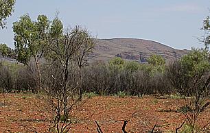
Scurvy
Scurvy is a disease resulting from a deficiency of vitamin C, which is required for the synthesis of collagen in humans. The chemical name for vitamin C, ascorbic acid, is derived from the Latin name of scurvy, scorbutus, which also provides the adjective scorbutic...
began to set in. Stuart's right eye was failing. Nevertheless, they found a major watercourse in early April which Stuart named the Finke River
Finke River
The Finke River is one of the largest rivers in central Australia. Its source is in the Northern Territory's MacDonnell Ranges, and the name Finke River is first applied at the confluence of the Davenport and Ormiston Creeks, just north of Glen Helen. From here the river meanders for approximately...
, and followed it north-west over the South Australian border to the MacDonnell Ranges
MacDonnell Ranges
The MacDonnell Ranges of the Northern Territory, are a long series of mountain ranges located in the centre of Australia , and consist of parallel ridges running to the east and west of Alice Springs...
, which he named after Sir Richard Graves MacDonnell
Richard Graves MacDonnell
Sir Richard Graves MacDonnell KCMG CB was an Anglo-Irish lawyer, judge and colonial governor...
, Governor of South Australia, on 12 April 1860.
On 22 April 1860, according to Stuart's calculations, the party reached the centre of the continent. Stuart wrote: There is a high mount about two miles to the NNE which I hoped would be in the centre but on it tomorrow I will raise a cone of stones and plant the Flag there and will name it Mount Sturt after my excellent and esteemed commander of the expedition in 1844 and 45, Captain Sturt, as a mark of gratitude for the great kindness I received from him during that journey. (In fact the mountain became known as Central Mount Stuart
Central Mount Stuart
Central Mount Stuart is a mountain peak situated in the southern Northern Territory, Australia. It is a prominent landmark easily seen from the nearby Stuart Highway, which at closest approach lies about 6 km to the southeast...
after Stuart himself, not his mentor Sturt, and geographers no longer regard it as the true centre of Australia. Nevertheless, it retains its symbolic value.)
The explorers were unable to progress much further north. Lack of water forced them back again and again. Stuart's scurvy was growing worse, Head was now half his original weight, and only Kekwick remained capable of heavy work. Then, on 22 May, it rained. With water now available nearly every day, they made good mileage and by mid June were able to reach a riverbed which Stuart named Tennant's Creek (now the site of the township Tennant Creek
Tennant Creek, Northern Territory
Tennant Creek is a town located in the Northern Territory of Australia. It is the fifth largest town in the Northern Territory and it is located on the Stuart Highway, just south of the intersection with the western terminus of the Barkly Highway....
). The worst of the country was now behind them and they were only about 800 km from the coast.
From here, however, progress seemed impossible. A four day excursion to the north-west found no water at all and they had to retreat. After giving the horses a week to recover, they tried heading due north. They found another creek (later named Attack Creek) but were blocked by heavy scrub. Unlike those further south, the Warramunga Aboriginal people were hostile. On 26 June they raided the explorers' camp. One stole the shoeing rasp (which Stuart was able to recover); others threw boomerangs at the horses and set fire to the grass around the camp. Like Sturt (and unlike some of the other Australian explorers) Stuart generally got on well with the Aboriginal people he encountered but he was unable to negotiate with this group and considered it unsafe to continue. That night, with even the indefatigable Kekwick complaining of weakness, the explorers abandoned their attempt to reach the north coast and reluctantly turned south.
It was 2,400 kilometres to Adelaide, all three men had scurvy, supplies were very short, the horses were in poor condition, and the country was drying out. Nevertheless, the party pressed on at Stuart's customary rapid pace. They reached the safety of Chambers Creek in August. A few days earlier, on 20 August 1860, the larger Burke and Wills expedition had finally left Melbourne
Melbourne
Melbourne is the capital and most populous city in the state of Victoria, and the second most populous city in Australia. The Melbourne City Centre is the hub of the greater metropolitan area and the Census statistical division—of which "Melbourne" is the common name. As of June 2009, the greater...
.
Stuart reached Adelaide in October 1860. Although he had narrowly failed to cross the continent, his achievement in crossing the centre was immense, ranked with Speke's discovery of the source of the Nile. He was awarded the Royal Geographical Society's Patron's Medal — only the second person (after Dr Livingstone
David Livingstone
David Livingstone was a Scottish Congregationalist pioneer medical missionary with the London Missionary Society and an explorer in Africa. His meeting with H. M. Stanley gave rise to the popular quotation, "Dr...
) to be given double honours by that august body. Belatedly, even the South Australian government started to recognise Stuart's abilities.
The fifth expedition
James Chambers put forward a plan for Stuart and Kekwick to return north with a government-provided armed guard to see them past the difficulties at Attack Creek. The government prevaricated and quibbled about cost, personnel, and ultimate control of the expedition, but eventually agreed to contribute ten armed men and £2,500; and put Stuart in operational command. (In contrast, the Burke and Wills expedition had cost £9,000 to establish. That expedition had already reached the Darling RiverDarling River
The Darling River is the third longest river in Australia, measuring from its source in northern New South Wales to its confluence with the Murray River at Wentworth, New South Wales. Including its longest contiguous tributaries it is long, making it the longest river system in Australia.The...
in northern New South Wales.)
Stuart left Chambers Creek with a dozen men, 49 horses and rations for 30 weeks on 1 January 1861. It was high summer in South Australia and the worst possible time for travelling. Stuart was soon forced to send two men and the five weakest horses back. The heat was extreme and the party often delayed while Stuart searched for fodder and water. They were still in northern South Australia on 11 February, the day that Burke and Wills reached the Gulf of Carpentaria
Gulf of Carpentaria
The Gulf of Carpentaria is a large, shallow sea enclosed on three sides by northern Australia and bounded on the north by the Arafura Sea...
. With difficulty, Stuart's party had reached the MacDonnell Ranges when heavy rains came, allowing them to press on northwards at a much better pace. They reached Attack Creek on 24 April 1861, this time finding no sign of the hostile tribesmen that had blocked the last attempt. At about the same time — and unknown to Stuart's party, of course — Burke, Wills and King reached their base camp at Cooper Creek
Cooper Creek
Cooper Creek is one of the most famous and yet least visited rivers in Australia. It is sometimes known as the Barcoo River from one of its tributaries and is one of three major Queensland river systems that flow into the Lake Eyre Basin...
only to find it deserted. The fourth member of their party, Charles Gray, was already dead; Wills and then Burke perished within a few more days, leaving only King to be sustained by the kindness of the local Aborigines.
Stuart still planned to march north-west towards the known region of Victoria River, which had been mapped by A.C. Gregory in 1845. Leaving the main expedition to rest, he led a series of small parties in that direction, but was blocked by thick scrub and a complete lack of water. After a great deal of effort, the scouting parties managed to find another watering point 80 kilometres further north and Stuart moved the main body up. Over the next two weeks Stuart made three more attempts to find a practicable route over the plains to the north-west, but without success. Finally, he decided to try heading due north. He was rewarded with the discovery of "a splendid sheet of water" 150 metres wide and 7 kilometres long which he named Glandfield Lagoon. (It was later renamed Newcastle Waters
Newcastle Waters, Northern Territory
Newcastle Waters is a small settlement off the Stuart Highway in the Northern Territory. Newcastle is virtually uninhabited. The nearest petrol station and accommodation is found south at Elliott. It is inside Newcastle Waters station, a large cattle station with over 40,000 head of...
after a scandal involving the then Mayor of Adelaide, Edward Glandfield.)
For five more weeks the party camped at Newcastle Waters while Stuart tried to find a north-westward route to take them to Victoria River and thus the sea. The local Aboriginal people were unfriendly, lighting fires around the camp and spooking the horses, and Kekwick had to mount an armed sentry with instructions to fire warning shots whenever they came near. Provisions were running short and both men and horses were in poor condition. Finally, on 1 July 1861, exactly six months after they had left Chambers Creek, Stuart ordered a return. In the relative cool of the southern winter, they travelled fast, reaching the settled regions of South Australia in September.
When Stuart learned that Burke and Wills were missing he immediately offered to join the search for them. The first rescue teams had left some time earlier, however, and soon returned with the news that no less than 7 members of the largest and best-equipped expedition in Australia's history had died.
Public exploration mania had cooled considerably. Although Stuart had now led five expeditions into the arid centre of Australia and crossed all but the last few hundred miles of the continent without losing a man, the South Australian government was initially reluctant to back a sixth effort. However, the prospect of establishing a route for an overland telegraph line became a significant factor. The government finally provided £2,000 at the last minute on condition that Stuart took a scientist with him. James & John Chambers along with William Finke remained the principal private backers.
The sixth expedition
The main body of Stuart's sixth expedition left Adelaide in late October 1861, leaving Stuart behind for a time to recover from an accidental injury to his hand. However they did not leave Chambers Creek until 8 January 1862, numbering 10 men and 71 horses. Benjamin Head, veteran of the fourth and fifth expeditions was still too ill to accompany them. The party made good time to Newcastle Waters, reaching that point on 5 April, and experiencing conflict with the local Aborigines once again. Here they rested for a week before Stuart led a scouting party north, finding good water for the main body to move up to. The next stage, however, proved more difficult. Five times Stuart and his scouts tried to find a route towards Victoria River without success. Finally he headed north rather than north-west and was rewarded with a series of small waterholes leading to Daly Waters, about 150 kilometres north of Newcastle Waters.Stuart made one last attempt to reach Victoria River before continuing north into the Top End
Top End
The Top End of northern Australia is the second northernmost point on the continent. It covers a rather vaguely-defined area of perhaps 400,000 square kilometres behind the northern coast from the Northern Territory capital of Darwin across to Arnhem Land with the Indian Ocean on the west, the...
. On 9 June he reached a territory that had already been mapped and 1 July the Mary River
Mary River (Northern Territory)
The Mary River flows in the Northern Territory of Australia and is a site of the Mary River National Park. Its lower reaches form part of the Adelaide and Mary River Floodplains Important Bird Area.-External links:**...
. Finally, on 24 July 1862 Stuart reached the beach at Chambers Bay (east of present day Darwin
Darwin, Northern Territory
Darwin is the capital city of the Northern Territory, Australia. Situated on the Timor Sea, Darwin has a population of 127,500, making it by far the largest and most populated city in the sparsely populated Northern Territory, but the least populous of all Australia's capital cities...
).
Members of John McDouall Stuart's 1861-1862 Expedition Party
The ten successful members of the party are listed here with their age on the day of the expedition's departure form North Adelaide.
| Born | Died | Grave | Notes | |||
| John William Billiatt | 19 years, 1 month | 1842 | Devon | Cousin of King. | ||
| Stephen King jr Stephen King jr Stephen King was a sketcher, surveyor and explorer. He was part of the last John McDouall Stuart expedition , successfully crossing Australia from south to north.... |
19 years, 10 months | 1841 | Nailsworth | |||
| James Frew jr | 21 years, 4 days | 1840 | West Tce West Terrace Cemetery The West Terrace Cemetery is South Australia’s oldest cemetery, first appearing on Colonel William Light’s 1837 plan of Adelaide. The 27.6 hectare site is located in the south-west corner of the Adelaide central business district, between West Terrace, Anzac Highway, Sir Donald Bradman Drive and... |
|||
| William Patrick Auld | Assistant | 21 years, 5 months | 1840 | West Tce | ||
| John McGorrery | Shoeing Smith | 21 years, 9 months | 1840 | West Tce | ||
| Heath Nash | 23 years, 1 month | 1838 | Payneham | |||
| Francis William Thring | Third Officer | 24 years, 5 months | 1837 | West Tce | ||
| William Darton Kekwick | Second in Command | 38 years, 10 months | 1822 | Blinman | ||
| John McDouall Stuart | Commander | 46 years, 1 month | 1815 | London | ||
| Frederick George Waterhouse Frederick George Waterhouse Frederick George Waterhouse was an English naturalist, zoologist and entomologist who made significant contributions to the study of the natural history of Australia.... |
Naturalist | 46 years, 2 months | 1815 | Magill |
Places named after John McDouall Stuart
Places named after John McDouall Stuart include:- Stuart Street, an arterial road in the CanberraCanberraCanberra is the capital city of Australia. With a population of over 345,000, it is Australia's largest inland city and the eighth-largest city overall. The city is located at the northern end of the Australian Capital Territory , south-west of Sydney, and north-east of Melbourne...
suburb of GriffithGriffith, Australian Capital TerritoryGriffith is an early inner-south suburb of Canberra, Australian Capital Territory, Australia. Griffith is named after Sir Samuel Griffith, who was chosen in 1903 as the first Chief Justice of the High Court of Australia and retained his position until retirement in 1919... - the Stuart HighwayStuart HighwayThe Stuart Highway is one of Australia's major highways. It is a segment of Australia's Highway 1 extending from Darwin, Northern Territory, in the north, via Tennant Creek and Alice Springs, to Port Augusta, South Australia, in the south—a distance of...
, - Stuart ParkStuart Park, Northern TerritoryStuart Park is an inner suburb of the city of Darwin, Northern Territory, Australia.-History:This area derived its name as part of Parap after the Army had left in 1946 and a number of Sidney William hutments remained. The Parap Parish Hall between Westralia Street and Charles Street existed in...
, an inner DarwinDarwin, Northern TerritoryDarwin is the capital city of the Northern Territory, Australia. Situated on the Timor Sea, Darwin has a population of 127,500, making it by far the largest and most populated city in the sparsely populated Northern Territory, but the least populous of all Australia's capital cities...
suburb, - Central Mount StuartCentral Mount StuartCentral Mount Stuart is a mountain peak situated in the southern Northern Territory, Australia. It is a prominent landmark easily seen from the nearby Stuart Highway, which at closest approach lies about 6 km to the southeast...
, - the Electoral division of StuartElectoral division of StuartStuart is an electoral division of the Legislative Assembly in Australia's Northern Territory. Named after explorer John McDouall Stuart, it was initially created in 1947 as one of the five inaugural electoral divisions of the Northern Territory Legislative Council...
in the Northern Territory, - an electoral division in South AustraliaSouth AustraliaSouth Australia is a state of Australia in the southern central part of the country. It covers some of the most arid parts of the continent; with a total land area of , it is the fourth largest of Australia's six states and two territories.South Australia shares borders with all of the mainland...
, and - the town of Stuart, which was changed to Alice Springs in 1933.
A statue honouring Stuart can be found in Victoria Square, Adelaide
Victoria Square, Adelaide
Victoria Square is a public square in the South Australian capital of Adelaide. The square is in the centre of the city's grid of one square mile, and was named by the Street Naming Committee on 23 May 1837 after Princess Victoria, heir presumptive of the British throne. Less than a month later the...
, while in Darwin
Darwin, Northern Territory
Darwin is the capital city of the Northern Territory, Australia. Situated on the Timor Sea, Darwin has a population of 127,500, making it by far the largest and most populated city in the sparsely populated Northern Territory, but the least populous of all Australia's capital cities...
, both a statue and a monument celebrate his achievements.
In March 2010, the Alice Springs Freemasons commissioned a 4 metre high ferro-concrete statue of Stuart for donation to the Alice Springs Town Council to commemorate the 150th anniversary of Stuart's fourth expedition, during which he had reached what later became the town of Alice Springs. The Town Council approved the project in breach of its own public art policy, sparking widespread public controversy; many locals objected to a memorial featuring a white man carrying a gun in a town where race relations between indigenous and non-indigenous communities remains a sensitive issue.
External links
- The Journals of John McDouall Stuart at the University of AdelaideUniversity of AdelaideThe University of Adelaide is a public university located in Adelaide, South Australia. Established in 1874, it is the third oldest university in Australia...
- Official Web Site of the John McDouall Stuart Society Inc.
- Searchable Journals of John McDouall Stuart