

Joaíma
Encyclopedia
Minas Gerais
Minas Gerais is one of the 26 states of Brazil, of which it is the second most populous, the third richest, and the fourth largest in area. Minas Gerais is the Brazilian state with the largest number of Presidents of Brazil, the current one, Dilma Rousseff, being one of them. The capital is the...
.
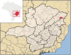
The population as of 2007 was estimated to be 14,881 people living in a total area of 1,668 km². The city belongs to the mesoregion of Jequitinhonha and to the microregion of Almenara
Almenara, Minas Gerais
Almenara is a city in the northeast of the Brazilian state of Minas Gerais. Situated on the Jequitinhonha River it is the largest town in that river valley. Its 2007 population was estimated at 36,907 and the municipal area was 2,301 km²....
.
Joaíma is located 27 km. south of the Jequitinhonha River. BR-116 is 58 km. to the west. The elevation is 293 meters. It became a municipality in 1948.
Neighboring municipalities are: Jequitinhonha
Jequitinhonha
Jequitinhonha is a Brazilian municipality located in the northeast of the state of Minas Gerais.The population as of 2007 was estimated to be 23,982 people living in a total area of 3,518 km². The city belongs to the mesoregion of Jequitinhonha and to the microregion of Almenara. ...
, Felisburgo
Felisburgo
Felisburgo is a Brazilian municipality located in the northeast of the state of Minas Gerais.The population as of 2007 was estimated to be 6,687 people living in a total area of 594 km². The city belongs to the mesoregion of Jequitinhonha and to the microregion of Almenara. Divisópolis is located...
, Monte Formoso
Monte Formoso
Monte Formoso is a Brazilian municipality located in the northeast of the state of Minas Gerais. The city belongs to the IBGE statistical mesoregion of Jequitinhonha and to the microregion of Almenara. As of 2007 the population was 4,709 in an area of 384 km²...
, and Santana do Araçuai.
The main economic activities are cattle raising and the cultivation of coffee, sugarcane and corn. The GDP in 2006 was R$43,727,000. There were 02 banking agencies as of 2007. In the same year there were 392 automobiles, which was a ratio of one automobile for every 50 people. In the rural area there were 970 farms of which only 21 had tractors. Most of the farming practiced is on the subsistence level. There were 62,000 head of cattle in 2006.
This municipality is isolated from major population centers and suffers from drought and poor soils.
- Municipal Human Development IndexHuman Development IndexThe Human Development Index is a composite statistic used to rank countries by level of "human development" and separate "very high human development", "high human development", "medium human development", and "low human development" countries...
: .646 (2000) - State ranking: 756 out of 853 municipalities as of 2000
- National ranking: 3,832 out of 5,138 municipalities as of 2000
- Degree of urbanization: 70.48% (2000)--the rate for Minas Gerais was 82.0%
- Illiteracy rate: 35.51% (15 years old or older) The rate for Minas Gerais was 11.96%; the rate for Brazil was 13.63%
- Urban area covered by sewage system: 64.10%--the rate for Minas Gerais was 81.39%
- Health centers and hospitals: 07 health centers and 01 hospital with 59 beds
See also
- List of municipalities in Minas Gerais