
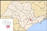
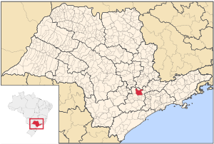
Itu
Encyclopedia
| Map | |
|---|---|
 |
|
| Coat of Arms | Flag |
 |
|
| Statistics | |
| State: | São Paulo São Paulo (state) São Paulo is a state in Brazil. It is the major industrial and economic powerhouse of the Brazilian economy. Named after Saint Paul, São Paulo has the largest population, industrial complex, and economic production in the country. It is the richest state in Brazil... |
| Meso-region: | Metropolitana Paulista |
| Microrregions: | Sorocaba Sorocaba (micro-region) The Microregion of Sorocaba is a microregion in the central part of São Paulo State, Brazil.- Municipalities:* Alumínio* Araçariguama* Araçoiaba da Serra* Cabreúva* Capela do Alto* Iperó* Itu* Mairinque* Porto Feliz* Salto* Salto de Pirapora... |
| Anniversary: | February 2 |
| Location Location (geography) The terms location and place in geography are used to identify a point or an area on the Earth's surface or elsewhere. The term 'location' generally implies a higher degree of can certainty than "place" which often has an ambiguous boundary relying more on human/social attributes of place identity... : |
23° 15' 50" S 47° 17' 56" W |
| Area Area Area is a quantity that expresses the extent of a two-dimensional surface or shape in the plane. Area can be understood as the amount of material with a given thickness that would be necessary to fashion a model of the shape, or the amount of paint necessary to cover the surface with a single coat... : |
641.68 km² |
| Population Population A population is all the organisms that both belong to the same group or species and live in the same geographical area. The area that is used to define a sexual population is such that inter-breeding is possible between any pair within the area and more probable than cross-breeding with individuals... : |
157.384 (2009) |
| Population density Population density Population density is a measurement of population per unit area or unit volume. It is frequently applied to living organisms, and particularly to humans... : |
243.9/km² |
| Elevation Elevation The elevation of a geographic location is its height above a fixed reference point, most commonly a reference geoid, a mathematical model of the Earth's sea level as an equipotential gravitational surface .... : |
583 m |
| Postal code: | 13300-xxx |
| Area/distance code: | (00)55-11 |
| Climate Climate Climate encompasses the statistics of temperature, humidity, atmospheric pressure, wind, rainfall, atmospheric particle count and other meteorological elemental measurements in a given region over long periods... : |
Subtropical |
| Name of inhabitants or denomym: | Ituano |
| Website: | www.itu.sp.gov.br |
| Population Statistics | |
| Urban: | 123,942 |
| Rural: | 11,424 |
| Other | |
| Literacy rate: | 92.53% |
| Distance from the state capital: | 88 km |
Itu is an old and historic municipality in the state of São Paulo
São Paulo (state)
São Paulo is a state in Brazil. It is the major industrial and economic powerhouse of the Brazilian economy. Named after Saint Paul, São Paulo has the largest population, industrial complex, and economic production in the country. It is the richest state in Brazil...
in Brazil
Brazil
Brazil , officially the Federative Republic of Brazil , is the largest country in South America. It is the world's fifth largest country, both by geographical area and by population with over 192 million people...
. The population in 2009 was 157,384 and the area is 641.68 km². The elevation is 583 m. This place name comes from the Tupi language, meaning big waterfall. Itu is linked with the highway numbered the SP-75
SP-75
The Rodovia Sen. José Ermírio de Moraes or SP-75 is a highway in the southeastern part of the state of São Paulo in Brazil. It begins in Sorocaba and ends at the SP-308 near Salto.-Highway names:...
and are flowed with two rivers, Tietê
Tietê River
The Tietê River is a Brazilian river in the state of São Paulo.The source is in Salesópolis in the Serra do Mar, at 1,120 m altitude...
and Jundiaí. Itu has five hospitals, eleven bank agencies and one shopping center, the Plaza Shopping Itu.
Itu was founded by the Portuguese
Portugal
Portugal , officially the Portuguese Republic is a country situated in southwestern Europe on the Iberian Peninsula. Portugal is the westernmost country of Europe, and is bordered by the Atlantic Ocean to the West and South and by Spain to the North and East. The Atlantic archipelagos of the...
in 1610 by Domingos Fernandes. It became a parish in 1653. In 1657, it was elevated to a town and municipality. It became a part of Brazil
Brazil
Brazil , officially the Federative Republic of Brazil , is the largest country in South America. It is the world's fifth largest country, both by geographical area and by population with over 192 million people...
in 1822. It became a city in 1843.
Itu was the birth place of the Brazilian Republic and has a renowned museum.
Itu became a famous town after "Simplicio" a well known Brazilian comedian, born in Itu, was made Tourism Secretary and to increase tourism promoted it as the "capital of large things". For example, the town square holds a giant 4mt high yellow phone-booth "orelhão". The Itu popsicle is about 30 cm (1 feet) tall. And a giant Christmas tree.
With the increase in domestic tourism the infrastructure soon developed to attract foreign visitors as well as international meetings, seminars and congress events. In 1999 and 2003 the Seventh Day Adventist Reform Movement
Seventh Day Adventist Reform Movement
The Seventh Day Adventist Reform Movement is a Protestant Christian denomination, part of the Sabbatarian adventist movement, and formed as the result of a schism within the Seventh-day Adventist Church in Europe during World War I over the position its leadership took on proper Sabbath observance...
held their international delegation session in Itu bringing people from over 80 countries to the city at each event.
Geography
Its climate is subtropical, temperatures varies from 16° and 22°. The summer is warm and dry, and the winters are moderately cold and dry.It is located between the crystalline plateau and sedimentary areas.
Population history
| Year | Population | Change | Density |
|---|---|---|---|
| 2001 | 135,366 | - | 211.51/km² |
| 2004 | 149,758 | 14,392 / 10.63% | 234.0/km² |
| 2009 | 157,384 | 7,626 / 0.51% | 245.9/km² |
Demographics
According to the 2000 IBGEIBGE
The Brazilian Institute of Geography and Statistics or IBGE , is the agency responsible for statistical, geographic, cartographic, geodetic and environmental information in Brazil...
Census, the population was 136,366, of which 123,942 are urban and 11,424 are rural. Its life expectancy for the city was 71.53 years. The literacy rate was at 92.53%.